Bikepacking Death Valley – Valle de la Muerte
Valle de la Muerte – a Bikepacking route through Death Valley by Janet and Brian.
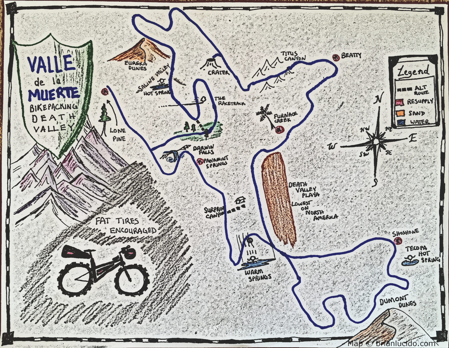
This is the map for the entire route discussed in this post. To Export GPX files, click on the three horizontal bars in the upper right hand corner of the map and select Export selected map data... To see full screen, click here (opens in new window)
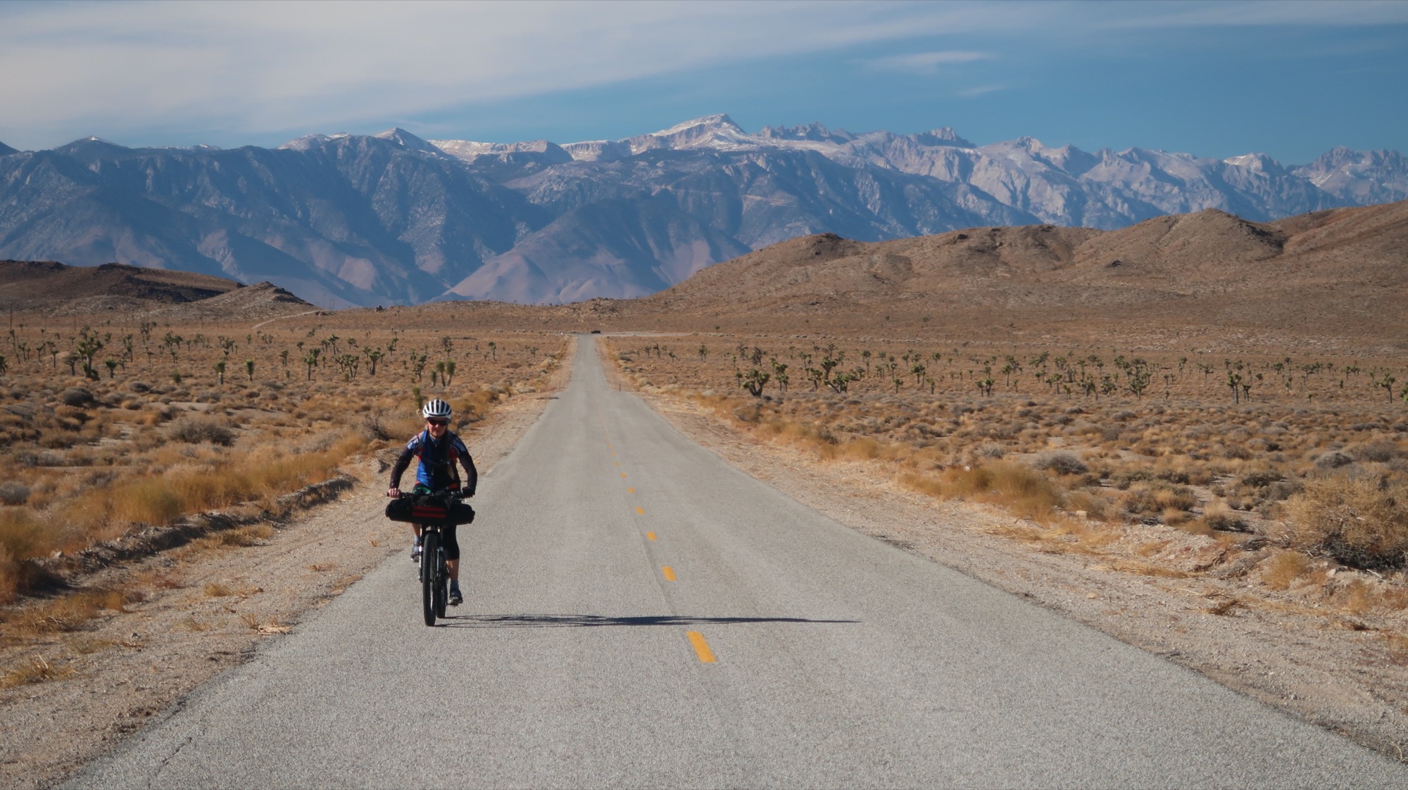
Janet and I have been envisioning a bikepacking route through Death Valley for a while. We wanted to try and see “everything” in the entire park – so we sculpted a route that linked together as much dirt as possible and went to as many attractions as possible. There were a couple limitations: First, we knew we couldn’t go to really high altitudes because it was January. This eliminated attractions such as Telescope Peak. In spite of our planning, a surprise snow storm came through during our trip forcing us to push through snow anyway. The second limitation was that we would be traveling during the Pandemic, so certain resources wouldn’t be available. There were also some advantages of riding during this time – there were far fewer people in the park, and being that this is such an isolated location, we were able to avoid contact with people just as well as we would if we stayed home.
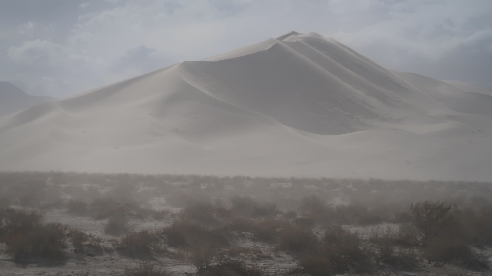
This route has a number of features that make it one of my favorite routes ever. We were able to visit 2 hot springs (and once the Pandemic is over, there are actually more that you can visit, which I have indicated on the map). The route also has something to look forward to every day: Spectacular scenery in Echo and Titus Canyon, The dramatic hole at Ubehebe Crater, the (now solved) mystery of The Racetrack, a chance to visit the lowest location in North America, and the amazing Eureka Sand dunes. I have created a downloadable map at the bottom of this page with all of the GPX waypoints to help you plan your resupplies. Each waypoint has detailed information in the description, including information about when to stock up on water and shortcut options if you need to shrink the route. If you are looking for a shorter version bikepacking Death Valley, check out the route that Emily Bei Cheng created making a more “compact” route that utilizes the route we scouted from Echo Canyon to HWY 95.
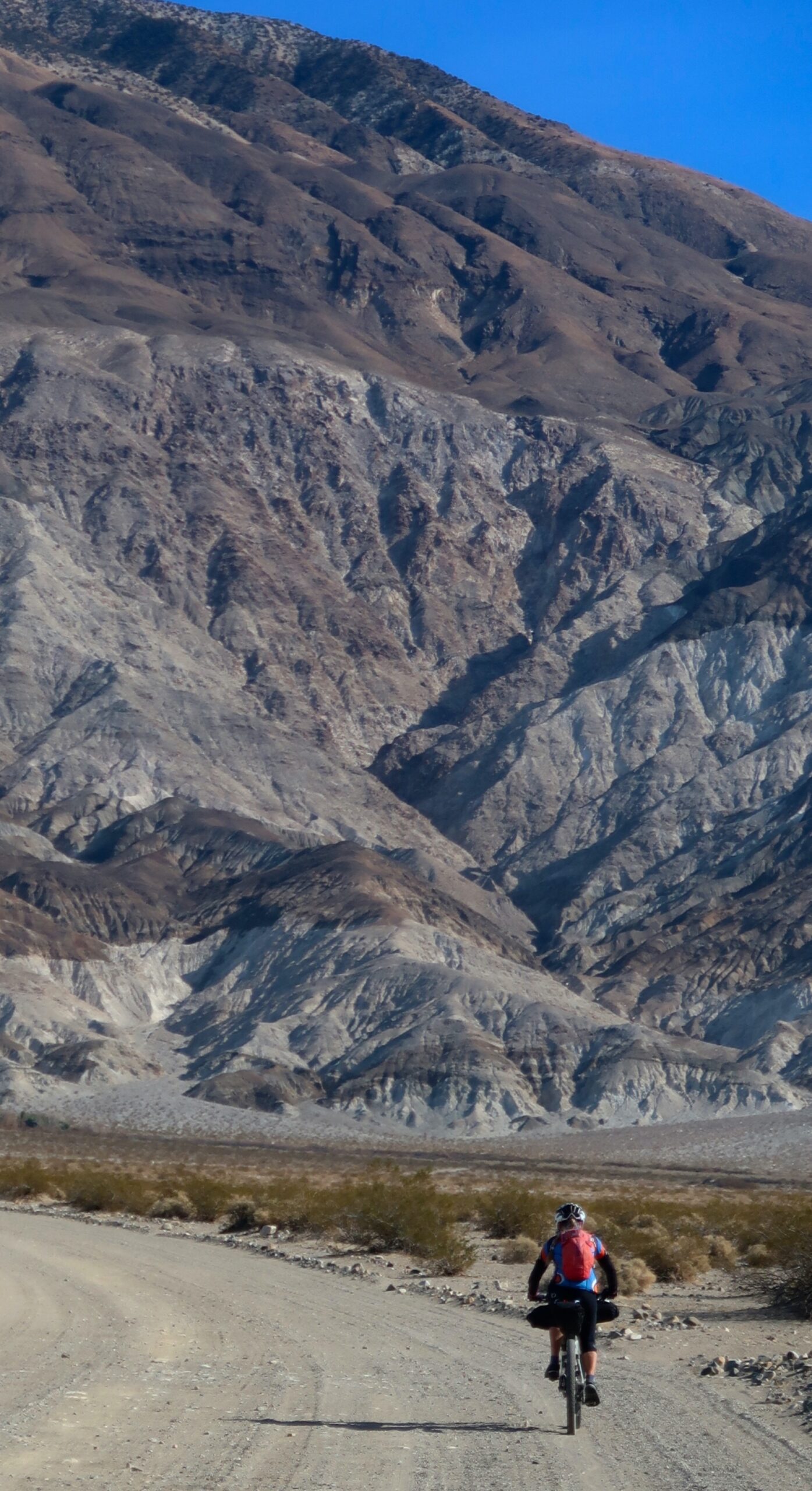
Death Valley has a permit system for backcountry camping. There is also a park entrance fee, which is waived if you are a pass holder. This route enters and leaves the park several times – and we never had to show our passes. This is a superb route if you’re trying to go somewhere remote. It is challenging in that you need to carry quite a bit of water. Plus size or fat tires are encouraged – for both sand and possible snow if you expect to encounter that. We managed pretty well on 2.2″ tires. We are accustomed to doing a lot of pushing.
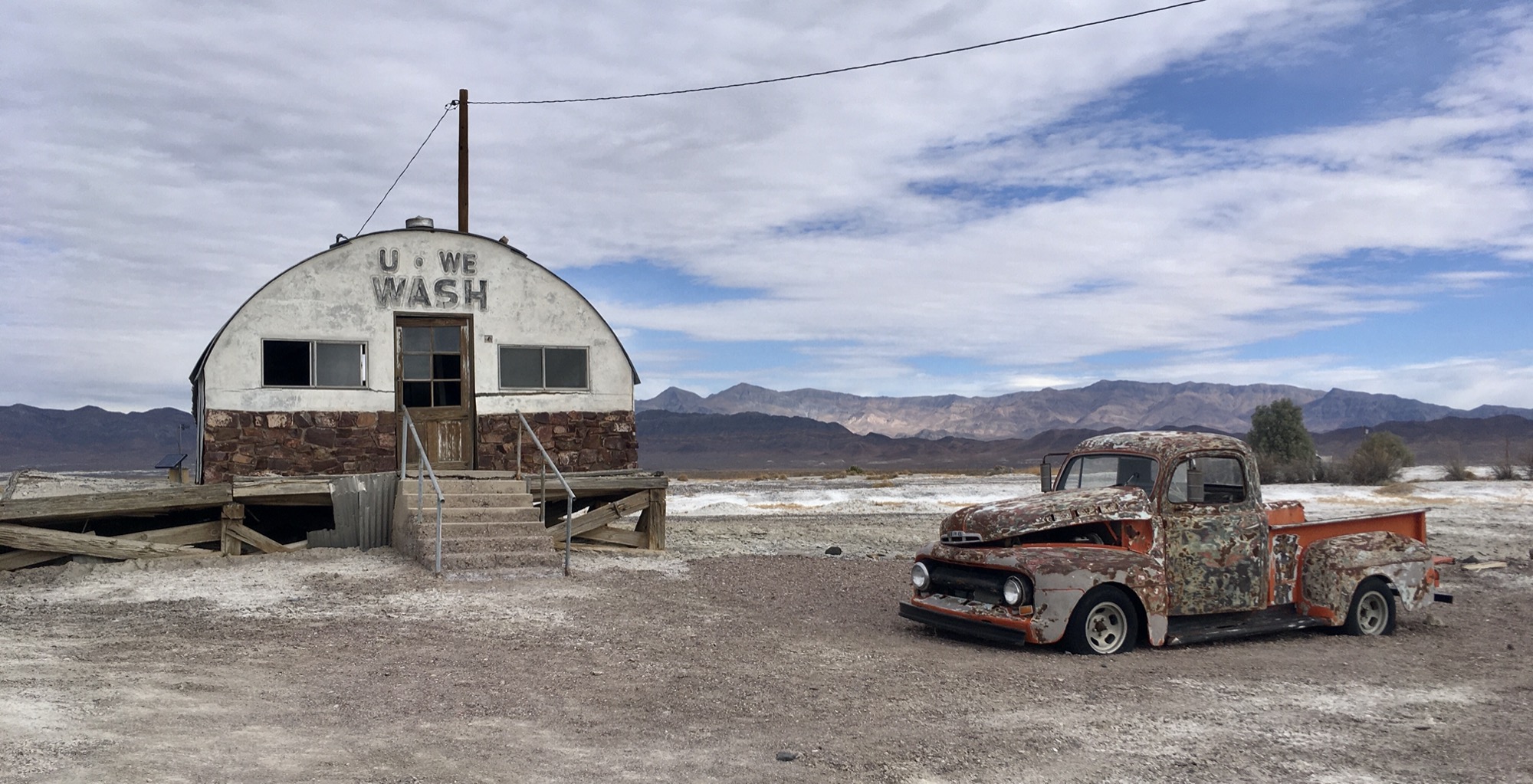
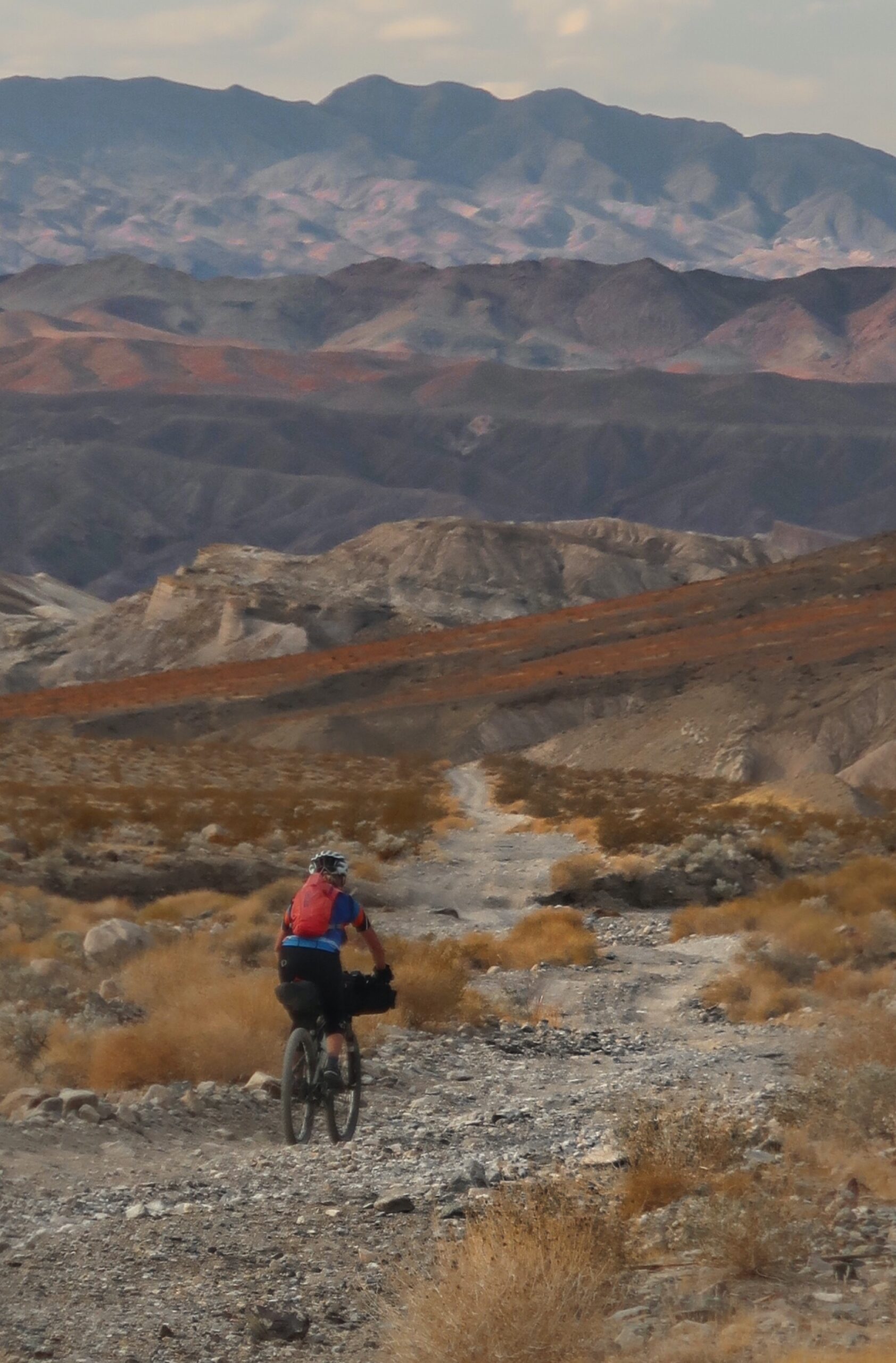
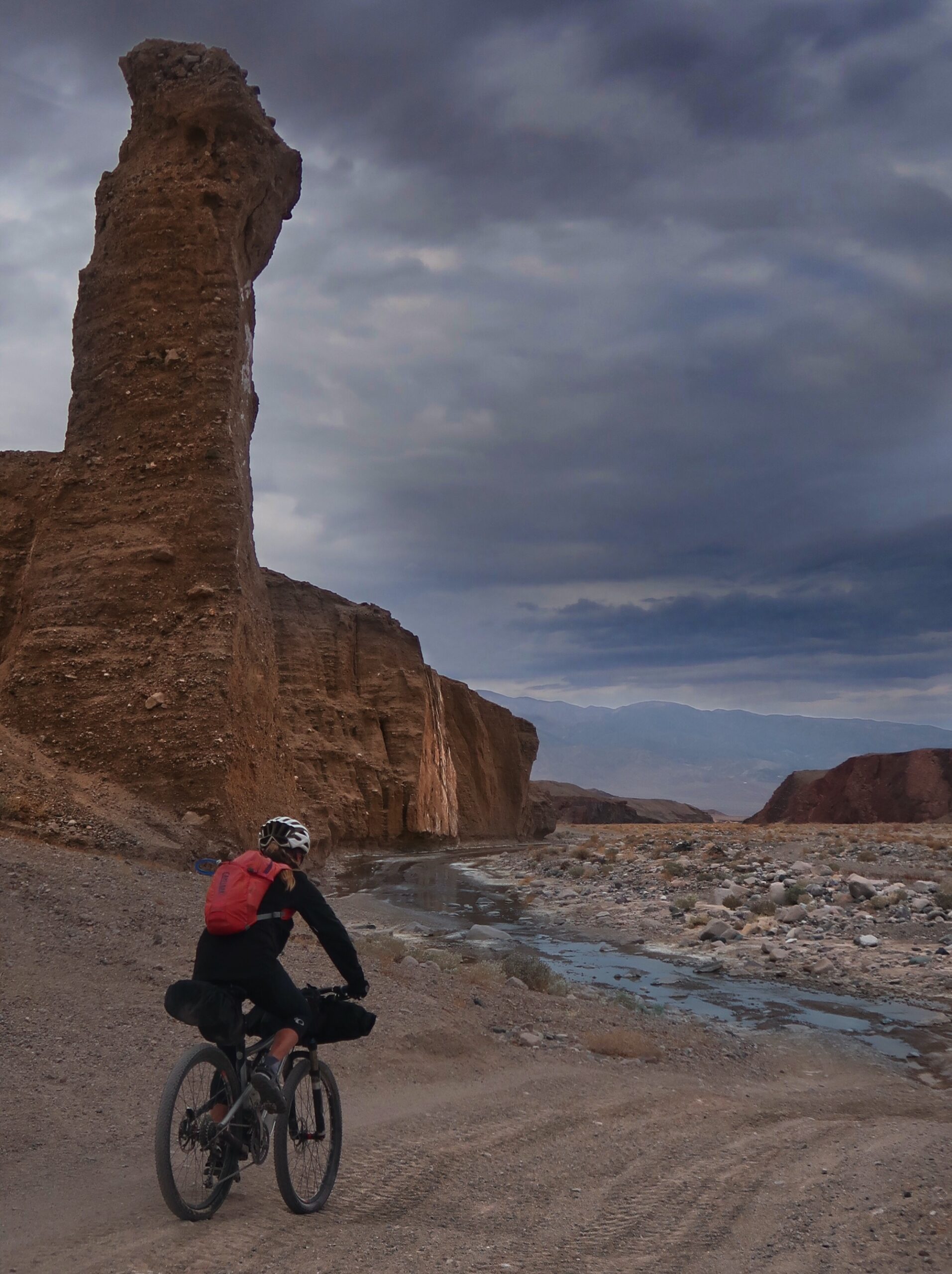
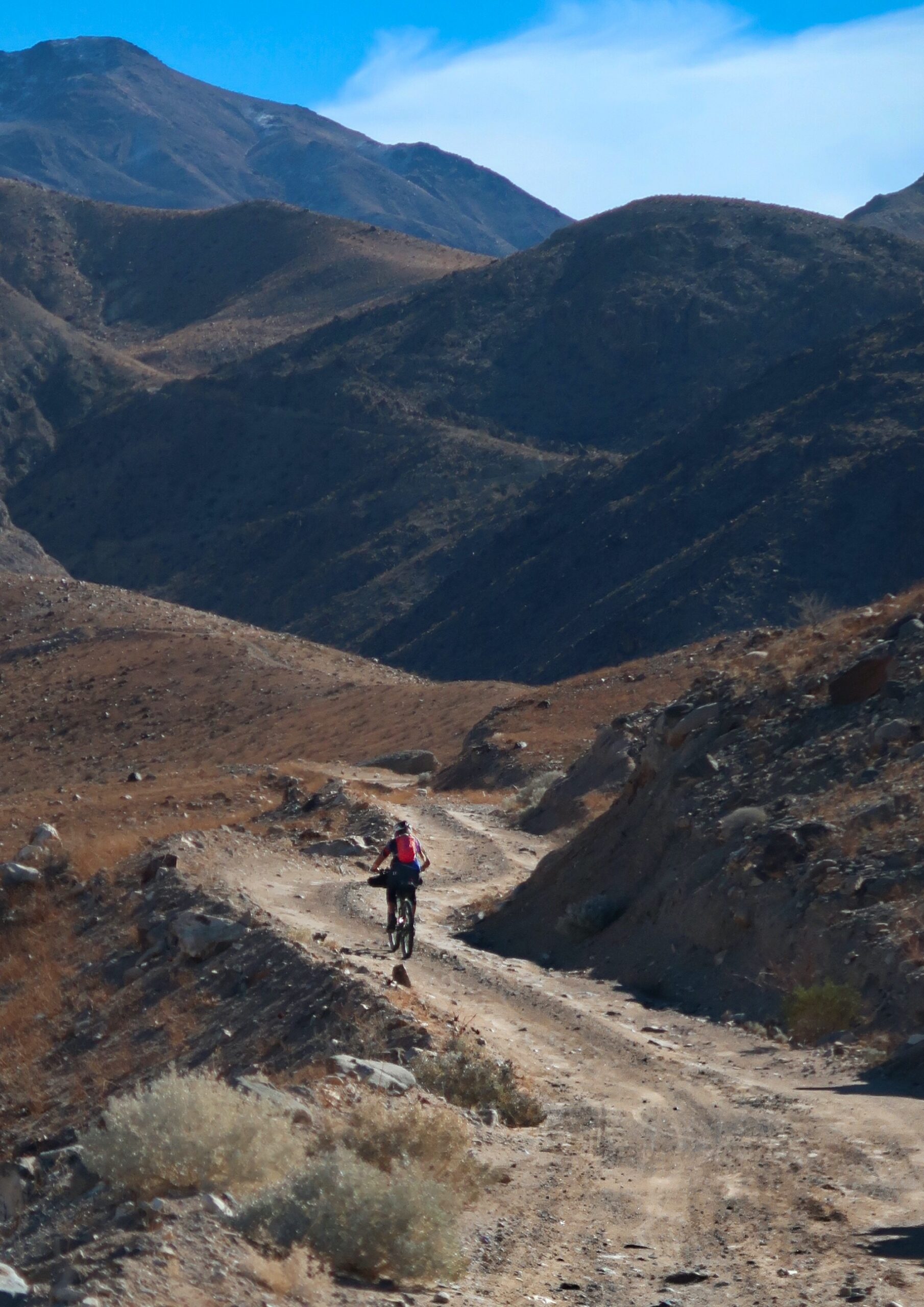
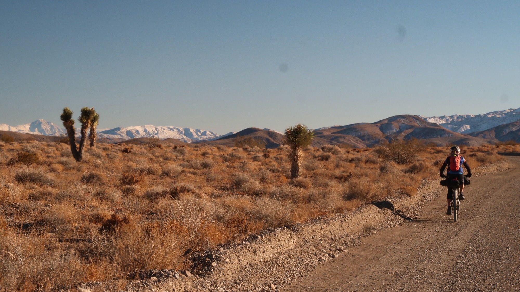
The pictures below tell the story of our journey. Jump to the map if you just want to download the route files. Leave a comment if you end up doing this route!
Not much was going on in Panamint Springs. Some weathered looking guys sat on the patio smoking their cigarettes. They batted back and forth witticisms and jocular insults. As we eavesdroppped, we learned that more than one of them had had skin cancer or a relative die of the affliction. We also learned that they are probably closing the store soon. Janet had read before we left that their creditors had been giving them more time due to COVID. I doubted our small purchase of two “Ice Sodas” would help much.
Lots of times on these trips, I think about how I could do this “forever”. There are enough places on this planet to explore for a very long time. It is at these times when I wish I could live forever. I started wondering: Maybe you appreciate it more because you know these are fugacious moments? There is no time to be depressed when there is so much to do.
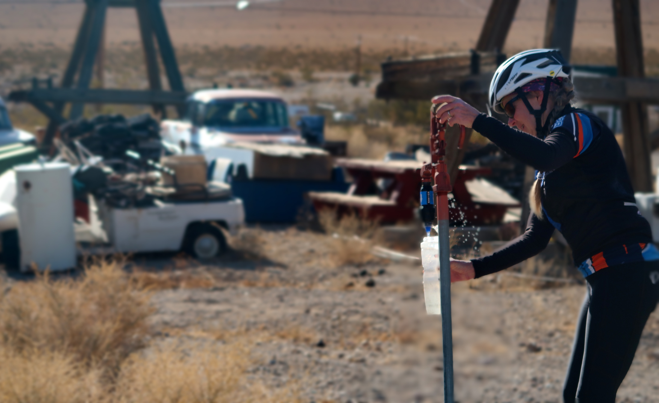
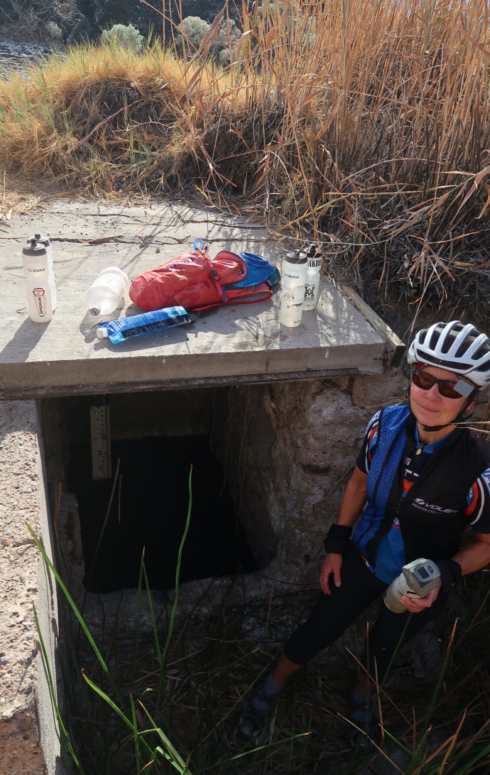
We had not expected water in Darwin. If anything, I thought this would be a ghost town. Well, maybe it is a ghost town? We didn’t see anyone. Hopefully this water is safe!
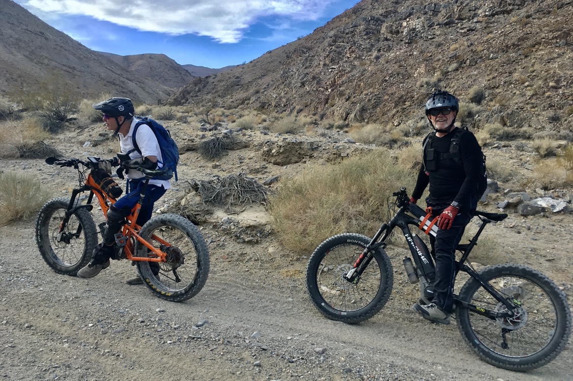
The only people we saw today. Paul Sylvester and Rod Perry. They were motor fat biking up the beautiful canyon that we were descending. Right away I hit it off with Paul when he mentioned that he watches Ali and Iohan G on YouTube. You could tell he was passionate about Iohan’s bike packing videos; he said he loves every part of them. Paul was 73 and he said that after he started getting fat bikes, he sold all his other bikes because none of them were as fun. This got me thinking fat again because I had gotten stymied by snow last week. I’m always so happy to see upbeat people still riding through their 70s and beyond, especially on this kind of terrain!
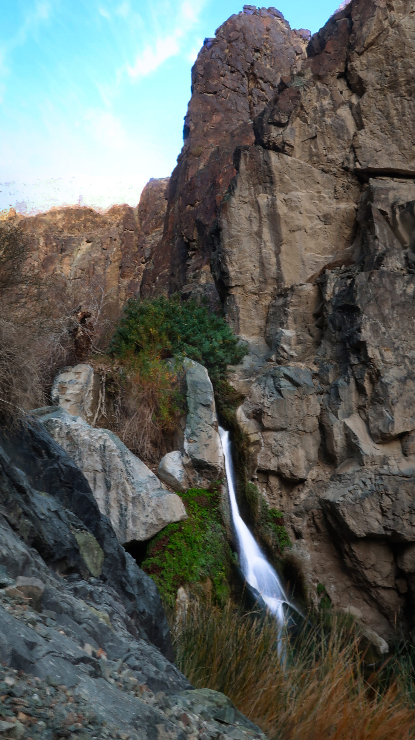
First thing in the morning we hiked to Darwin Falls. I cannot resist visiting waterfalls! The water doesn’t make it very far; a system of pipes that looks like a child’s erector set takes the water down to Panamint Springs for use by the few people who make a living there. The plumbing is a patchwork quilt of fittings, and the 5” pipe is draped over rocks or flimsy looking A’s hacked together from 2 x 4’s. Last night this worked to our advantage because we camped near one of the sloppy junction pieces that sprayed a veritable shower down upon us. Not bad, a free shower in the desert!
Another 2 days until we see pavement again. A guy who lived here said he had lived in Santa María, but he didn’t like it because there are too many people and it is “too expensive for my tastes.” He kept mentioning places in California and how they were too expensive. He sold us our $5 sodas (ahem, where is it expensive?) and encouraged us not to drink the water from the bathroom because the “burros poop in the source”. I had gulped a liter from the faucet a few minutes before encountering him, so I just kept quiet. With him, it was easy to keep quiet because he rattled off all the places that were too hard to ride a bike – pretty much everywhere we are going.
On the prowl for another hot spring. I found where it may have been in the past; but the area is now dry.
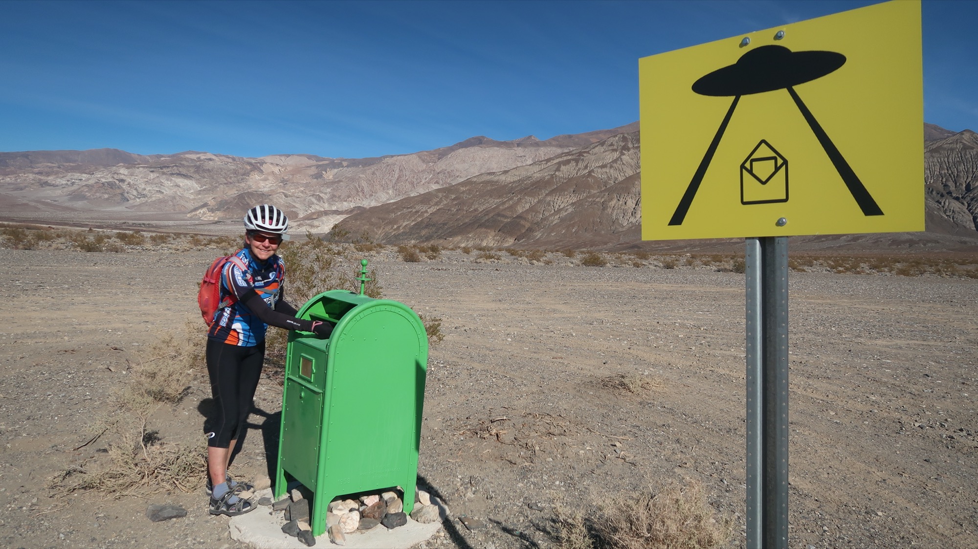
The mailbox was made in 1958. I guess it was a blue box that had been repainted. I’m very curious what is in there. It is well locked, so if you put something in, only a person (or perhaps alien) with a key can get it out. If I had known, we would have brought something to send. We once put a postcard addressed to my niece with no postage in a magic mailbox on a deserted island off the coast of Ecuador… and it was delivered by a stranger to her less than 6 months later!
Up here we were surprised to meet someone, a cyclist named Bill. He told us of his mother in law who is 99 years old and living with him and his wife and avoiding COVID. She is “as sharp as a tack” he commented. His wife, who leads bike tours had already received her vaccination because as a tour leader, she is a First Responder. They have no idea when Ruth will become elegible. He asked for some water and I kept on pouring from my 2 liter jug – even after he said that was enough – to try and lighten the load on my bike. I wanted to tell him that I had not drank from that bottle – just so he wouldn’t worry about COVID, but then that seemed weird.
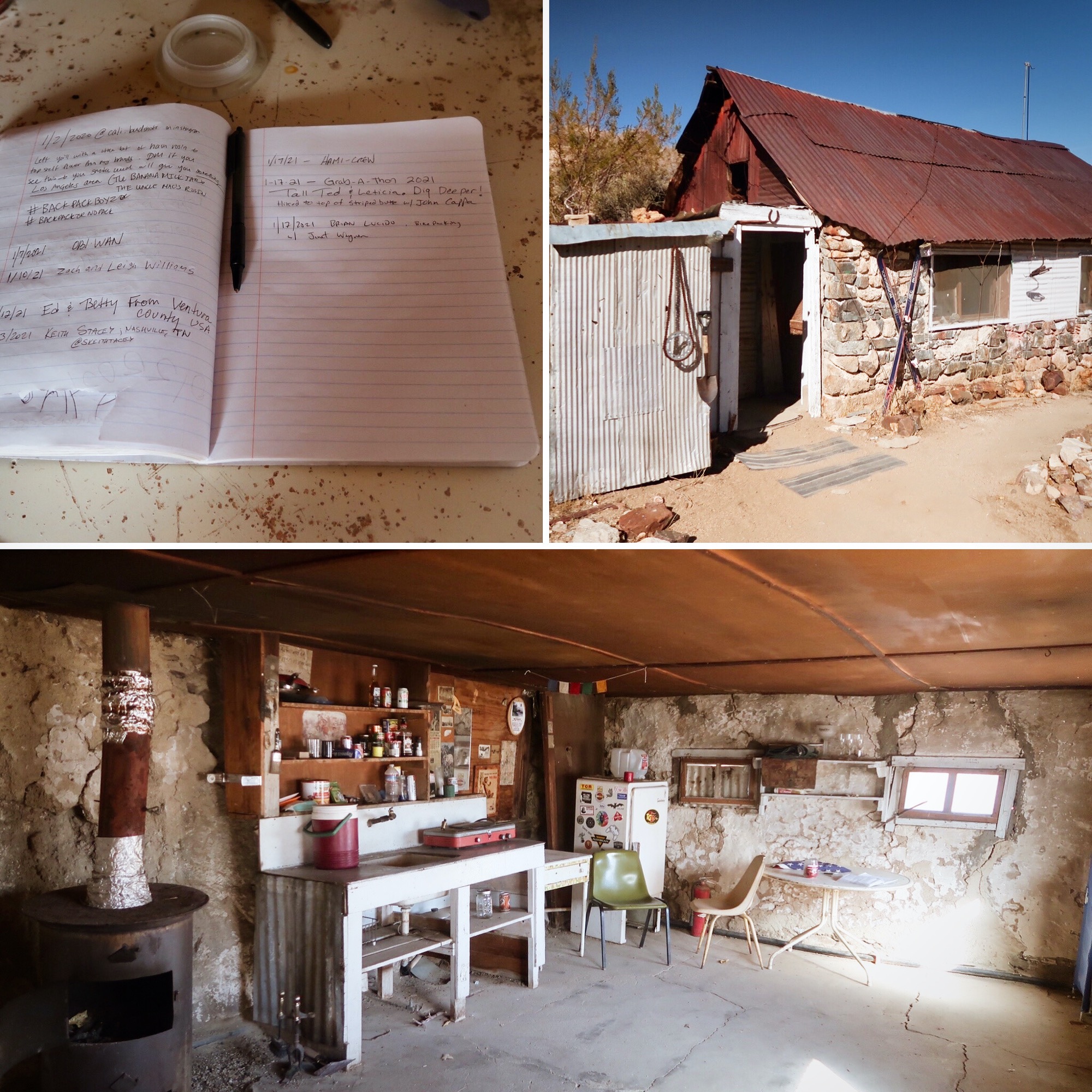
I saw “Stella’s cabin” on the map and took the slight detour to check it out. It seems as if these cabins in Death Valley are open to the public and you can sleep in them if you don’t mind mice. There is even piped running water in here!? Inside I found a Sugar Free Canada Dry and hid it in my bag saving it for later to surprise Janet. Seems like Death Valley is a good place to wait out the vaccine and avoid people, but surprisingly two people had signed the logbook today already!
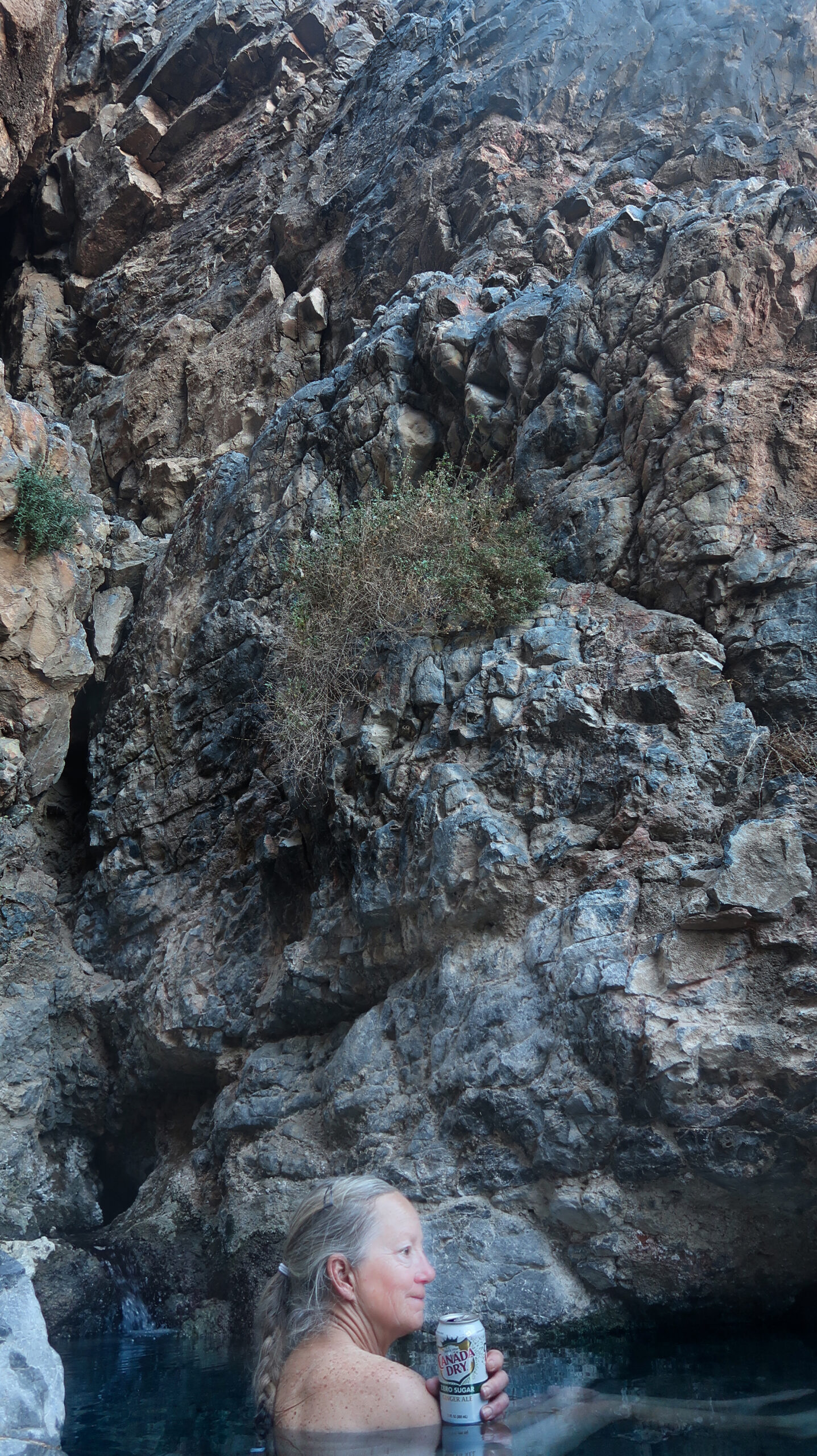
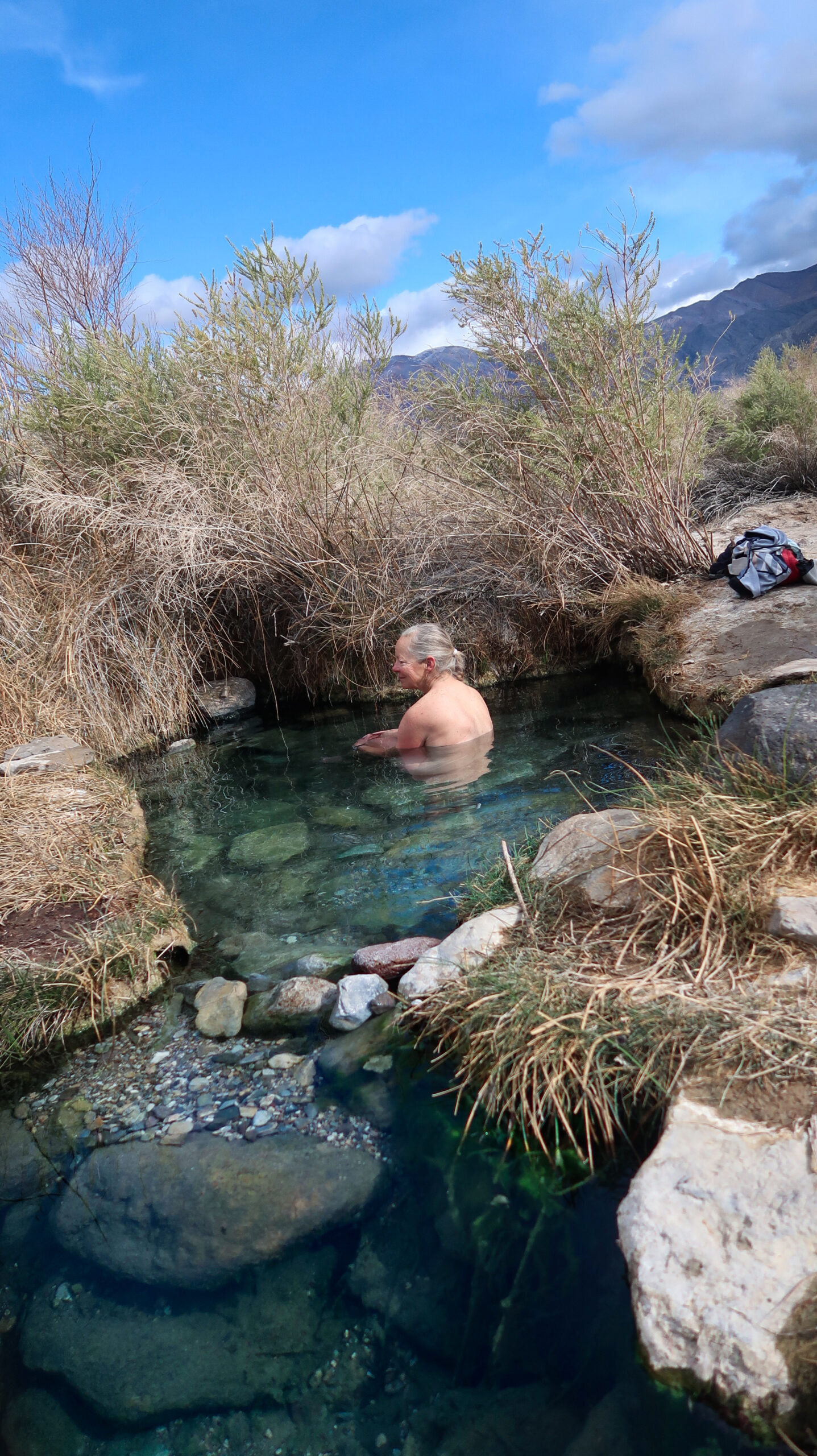
Our quest to find a soakable hot spring was fruitful! We arrived at a place on the map shown as “Warm Spring”. Finding a hot river, I followed it up to a notch in the cliff where there was a divine little pool. Usually it is hard to coerce Janet into soaking, but today she went for it with alacrity. Notice the “Canada Dry” – I found it in the cabin and picked it up, keeping it secret until we got here. May sound simple, but we don’t often have beverages like this 2 days from the store!
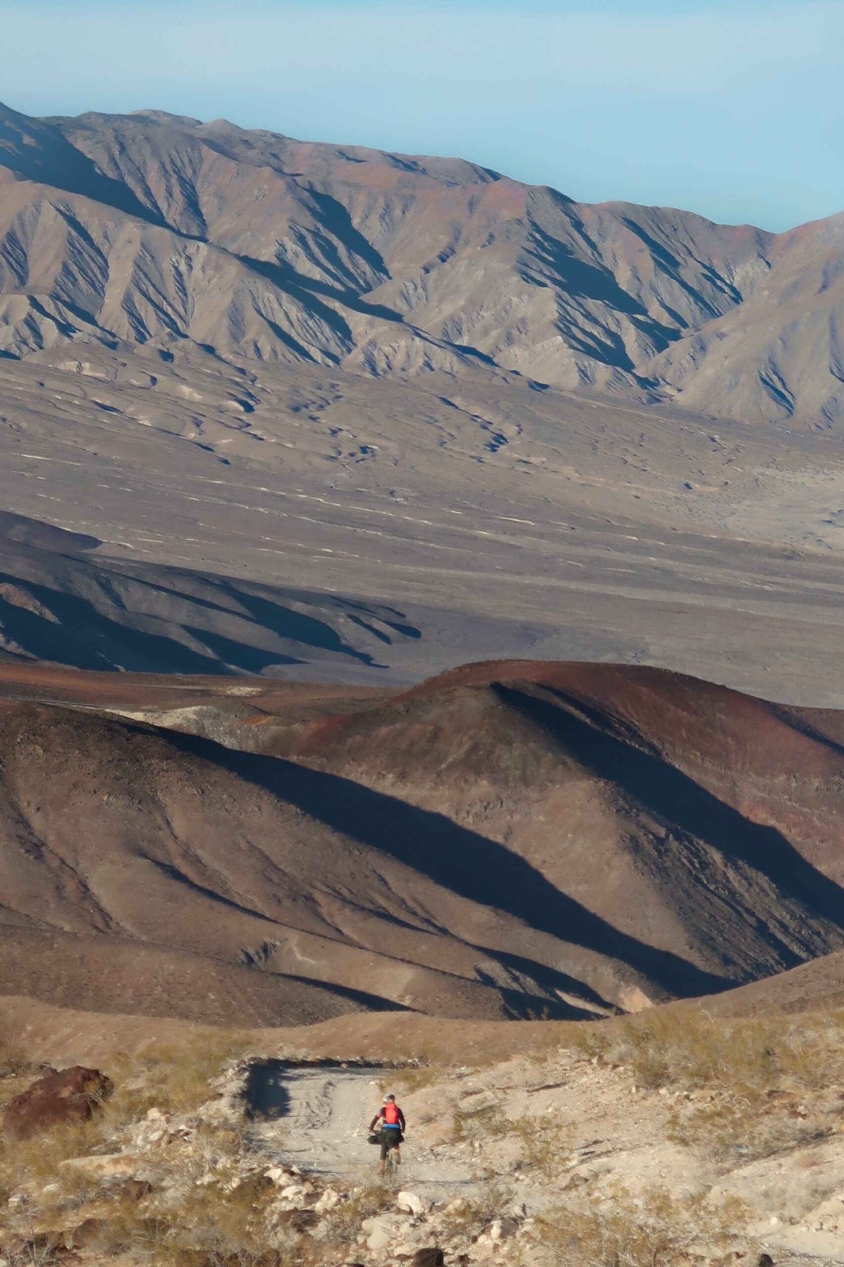
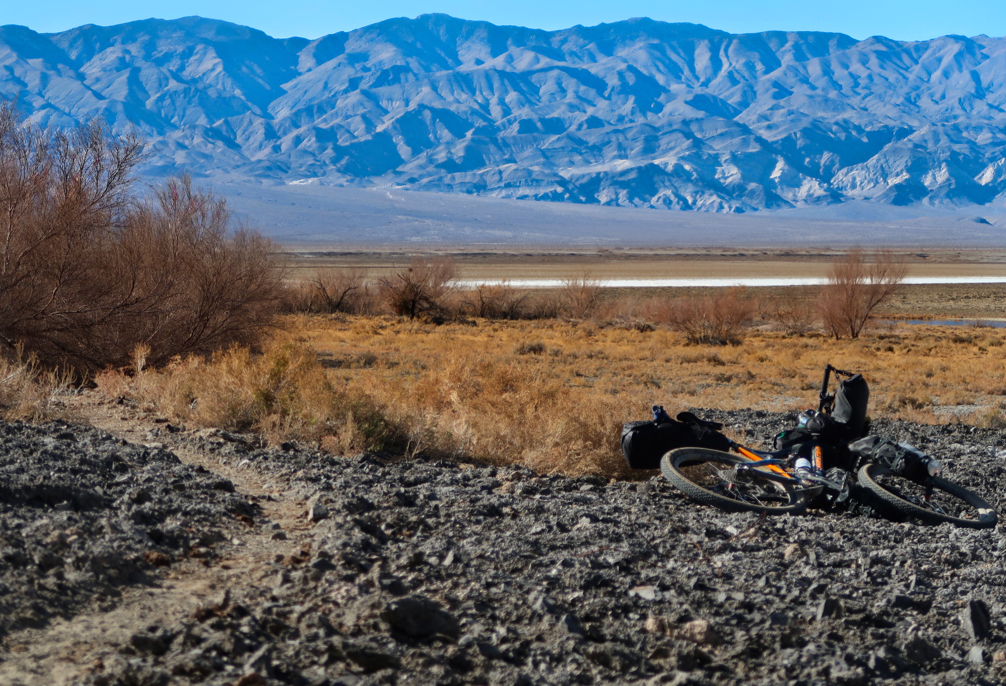
Below sea level – but not the lowest point yet. Our route will figure – 8 through the park with the hope of doing a thorough off road tour. Hopefully our gear will allow us to complete the trip, as some important water carriers broke the other day.
Janet and I decided to split up so I could investigate some potential hot springs. The wind was blowing something ferocious, and she didn’t want to backtrack into it. Here are the first springs, though they were not very warm. I then ventured to the 2nd springs which were more known. Unfortunately, there were signs at the start of the trail saying it was closed due to Covid. Now I was presented with a moral dilemma: Should i cross the line just to see the spring and not soak? That would have filled part of the satisfaction of finding the spring, but probably wouldn’t have violated the principle of the rules… after much inner turmoil, I decided to skip the trail and go find Janet.
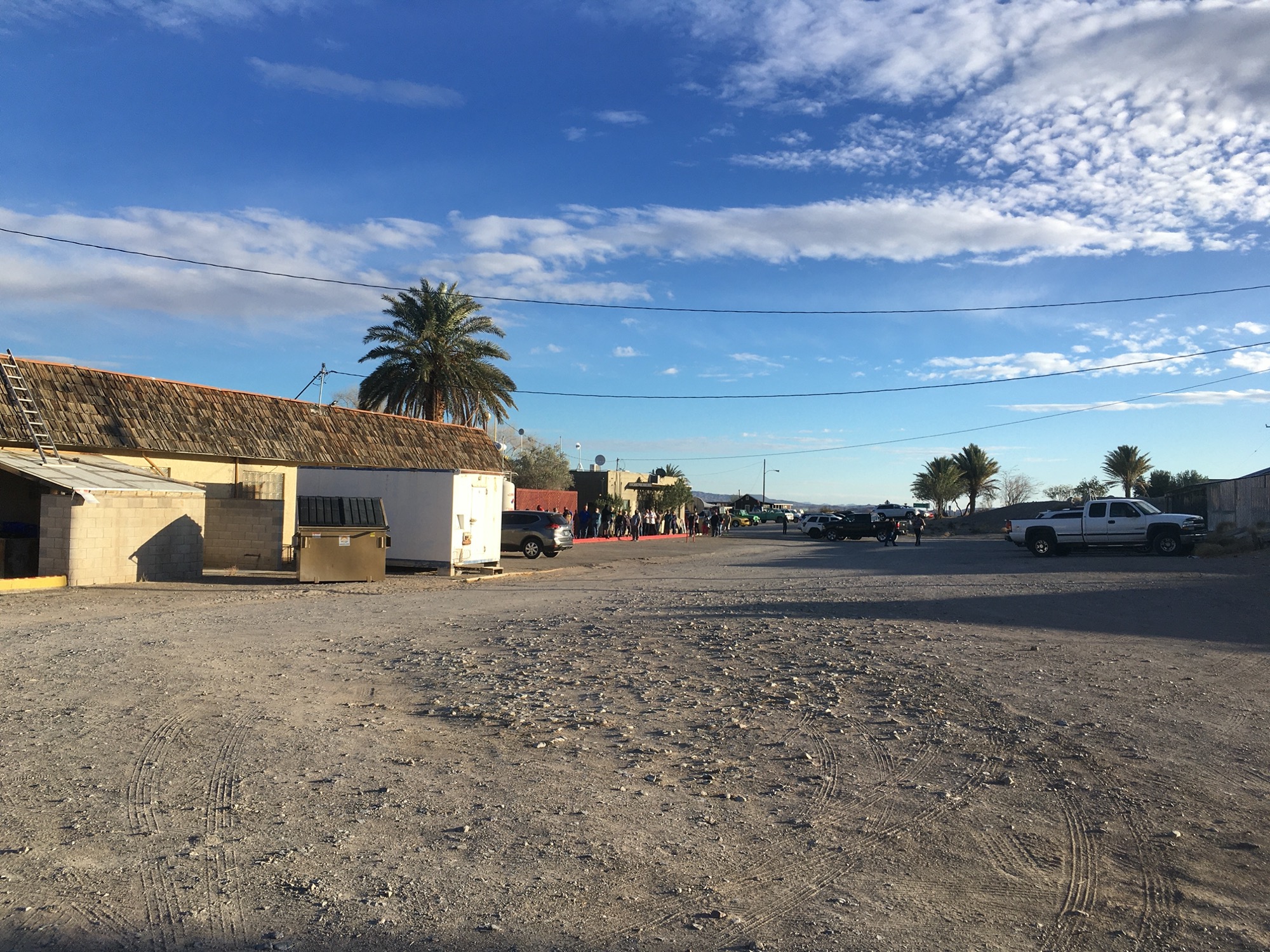
Janet and i saw this long line (this is 1/3 of the line, as it wraps around the other side of the gas station). My first thought is always, “look, they are doing vaccinations here!” I also thought this when we saw a long line 4 days ago at a remote fire station, but later discovered it was for free food pickup). I found a bearded fellow to query about the situation. At first I thought he was cross eyed, but he turned out to be one of those people who cannot make eye contact. His eyes wandered every which direction, except towards me. He paused lengthily between my questions.. not for effect, but because he would periodically review the stack of tickets in his hands, as if to reassure himself that they were still there. Apparently, this is the closest place to Parhumph, NV for buying lottery tickets. Of course, NV is known for gambling, but I never considered until today that they don’t have the California lottery. He checked his watch and after 30 seconds, reported that he spent 1 hour and 30 minutes in line to get his tickets. We wished him good luck.
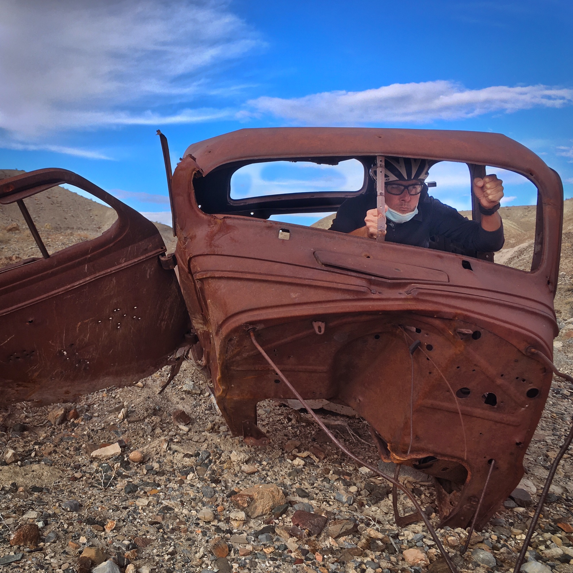
As I climbed into the car to perform this photo shoot, it started to tip over! It would have been an unusual rescue to recover my body from a wrecked roll over out here.
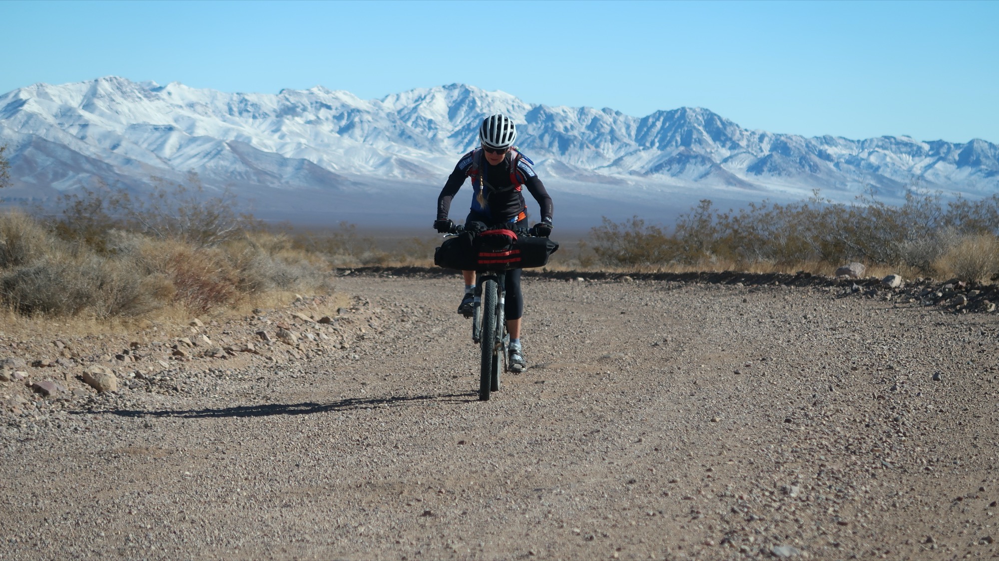
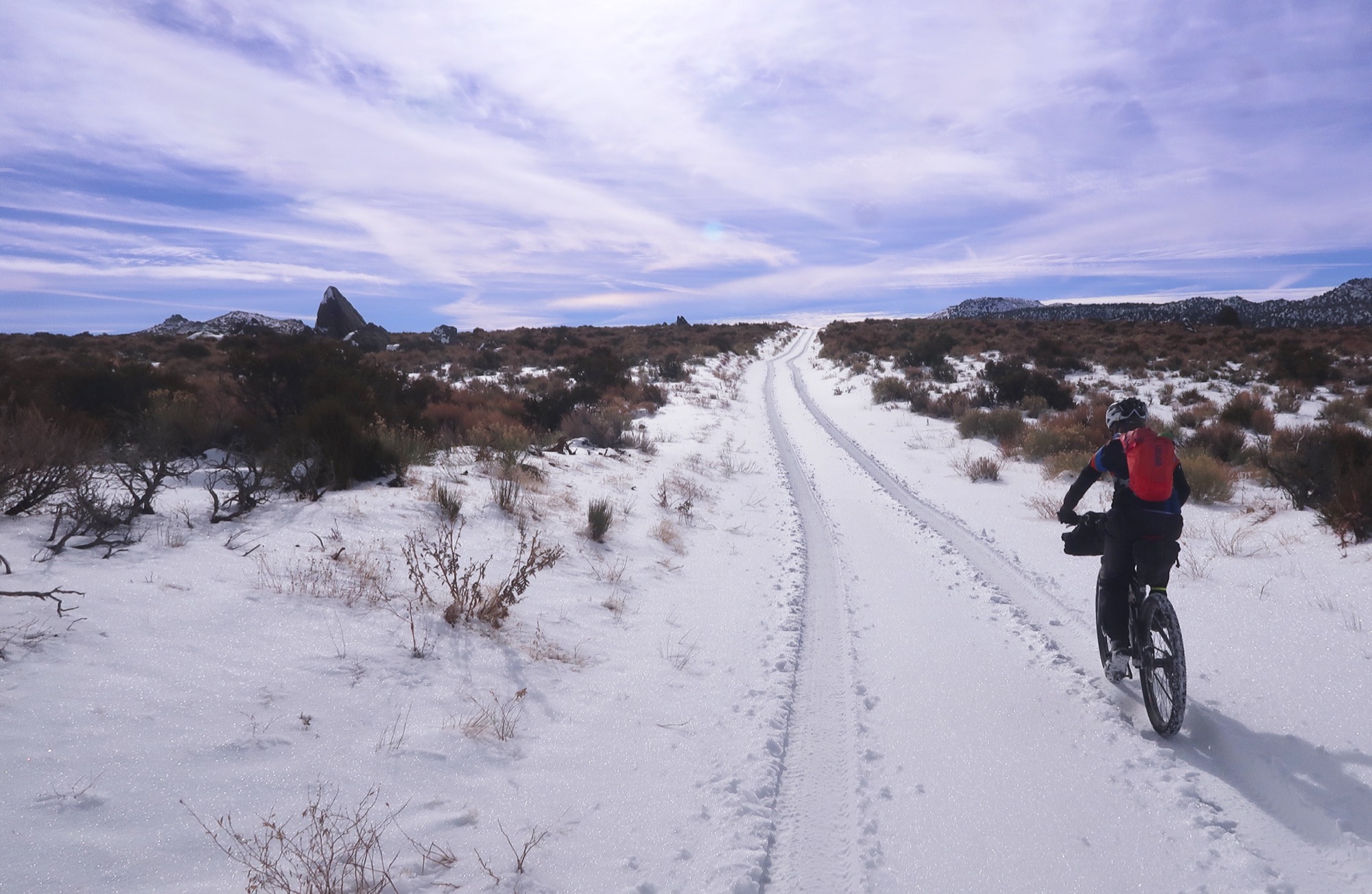
Janet had been doing well in the deep gravel (with some sand). I had been struggling a little. So we lowered my tire pressure as well as Janet’s. We put them at about 10psi, and now Janet was riding like a pro! She didn’t have to push at all, and she was riding straight as an arrow where my lumbering machine was going squirrely.
Our last water for 1.5 to 2 days; depending on our pace. This is the source for Saratoga Springs. We purified the water and it tastes as if you got regular tap water and stirred in a teaspoon of baking soda. Nevermind the taste. The pupfish has adapted to it, and so will we. Our next water is called “Eagle Borax Spring” and it looks like a red colored pond on the satellite.
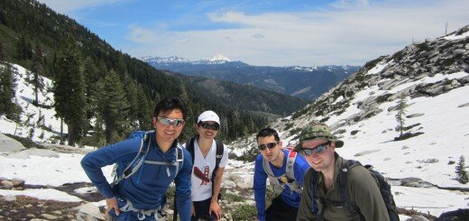
We met Adam and Leutian who were backpacking across Death Valley (North to South). They had wisely placed water caches along the way, and when they told us that, Janet quipped, “You’re lucky we didn’t find them!” Actually, that isn’t totally a joke… These guys were college age and on seeing me with my mask, they said, “oh yeah, we kind of forgot about Covid”. Well, I guess that makes sense since they are last in line for vaccines, those poor forgotten young people.
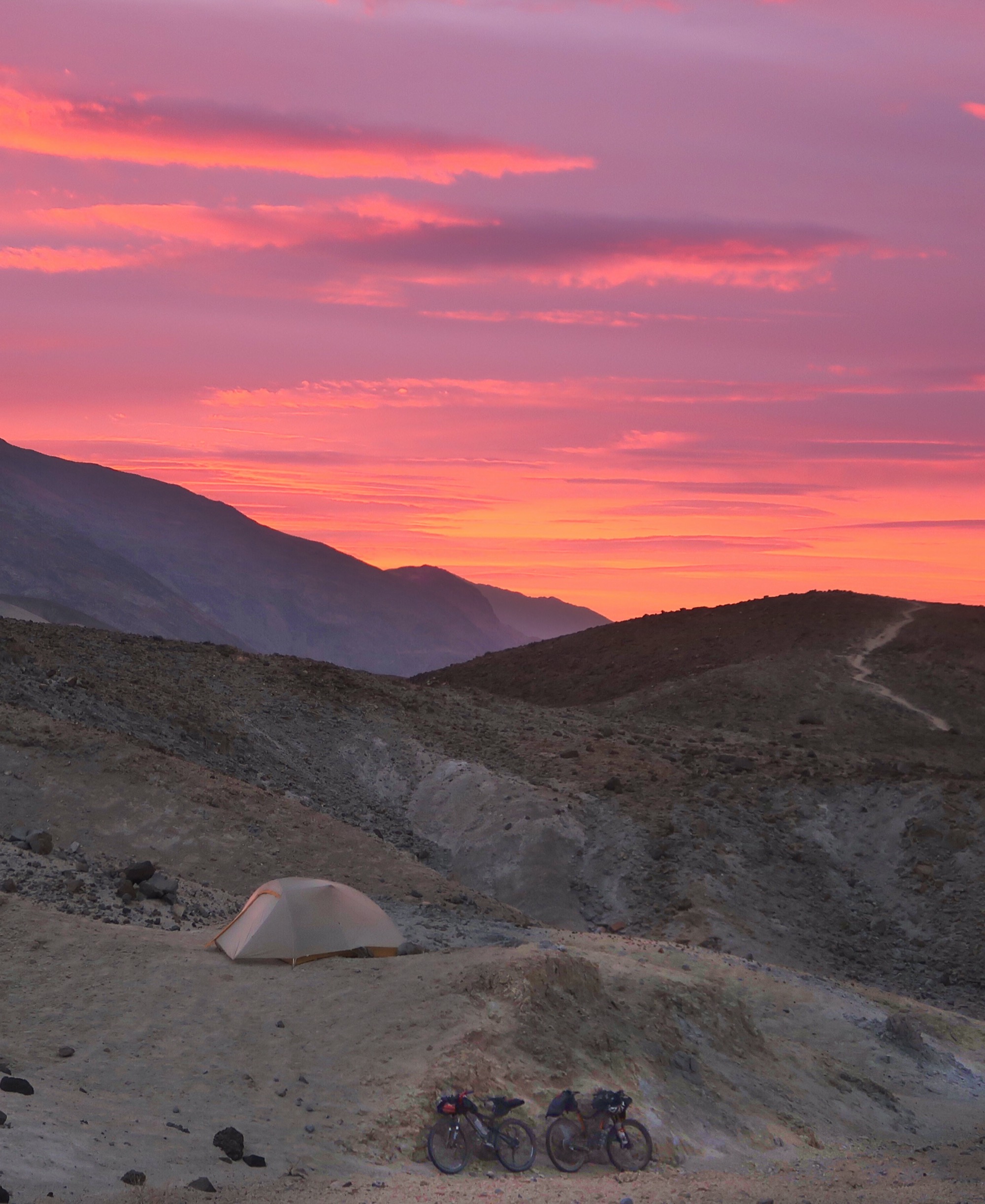
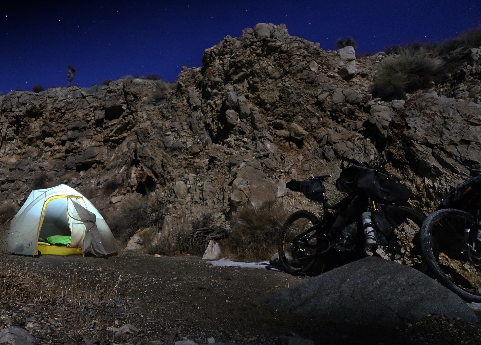
From our clandestine camp on sharp rock. Janet’s sleeping pad got a large puncture as we lay down to listen to the “Great Railway Bazaar” by Paul Theroux. Luckily, glueless tube patches work well to heal this type of pad! The sunrise crescendoed over a period of 15 minutes making it hard to choose which photo to share with you!
Besides the hikers, the other person we met was a friendly guy from Santa Maria. He parked by one of the (dry) springs and took the 100’ walk to a pile of crunchy salt crusted soil, his belly protruding poignantly from beneath his maroon shirt. A bulldog lazed in the passenger seat of his pickup, indolently flicking his eyes between us and the man. Mr. Santa Maria didn’t look much the athlete, but then began to tell us of his 5 day backpacking trip on El Camino Santiago. He obviously loved it: he plans to go do more of it next year. After a long and enjoyable talk, just before we parted ways he mentioned a movie. “It kind of gets into a Christian thing, but it is called, ‘I’ll push you’.” I sensed he might be tearing up behind his aviator sunglasses as he explained the plot of a guy who had developed a “muscular problem” but wanted to do the Camino – so his friend agreed to push him in his wheelchair. We plan to look for it when we get home.
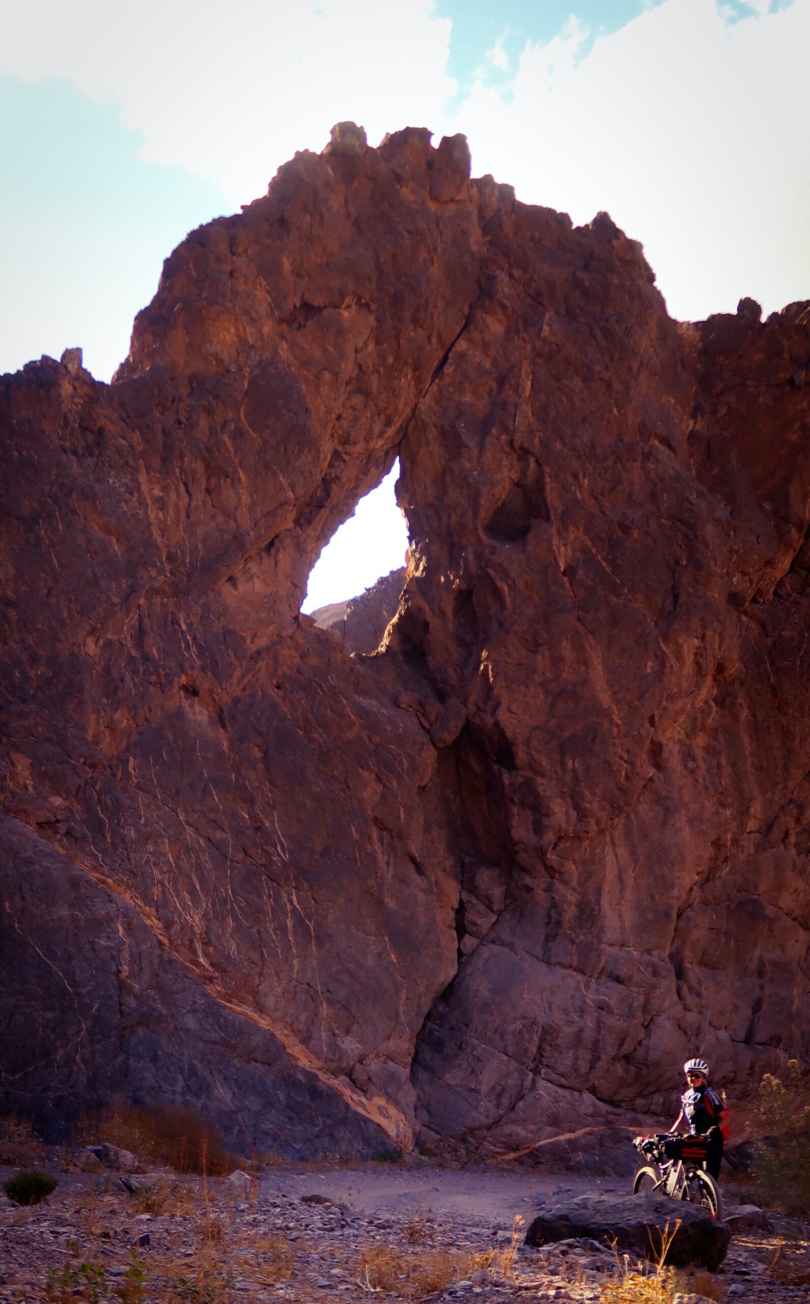
The real eye of the needle. We had come across a crude map that mentioned we would see “the eye of the needle” along our canyon voyage. Several times, Janet exclaimed that we had found the eye of the needle – because she found a new hole in the rocks. This one, though, was the Papa Bear of the rock holes, so we assumed that it was the real eye.
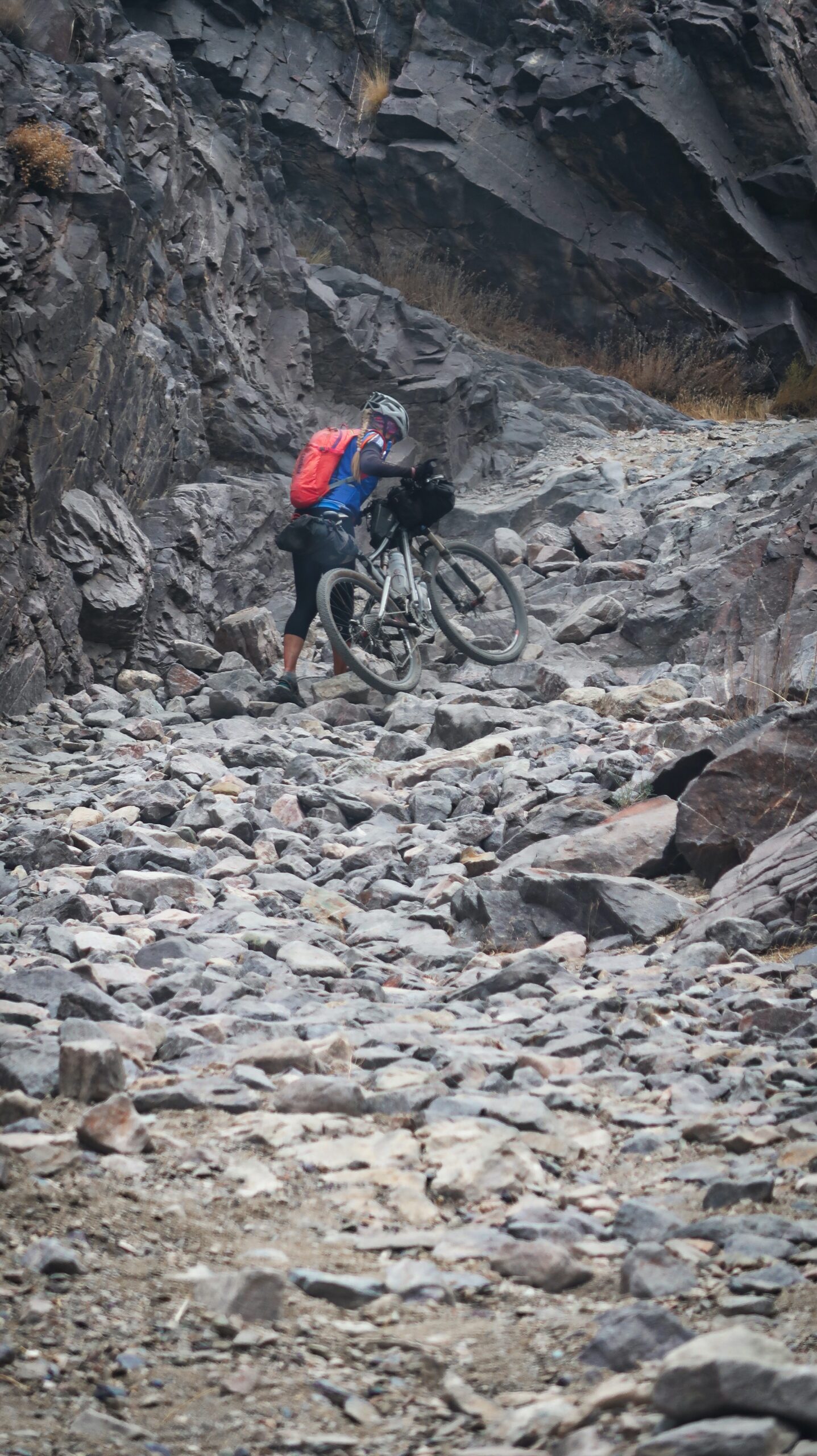
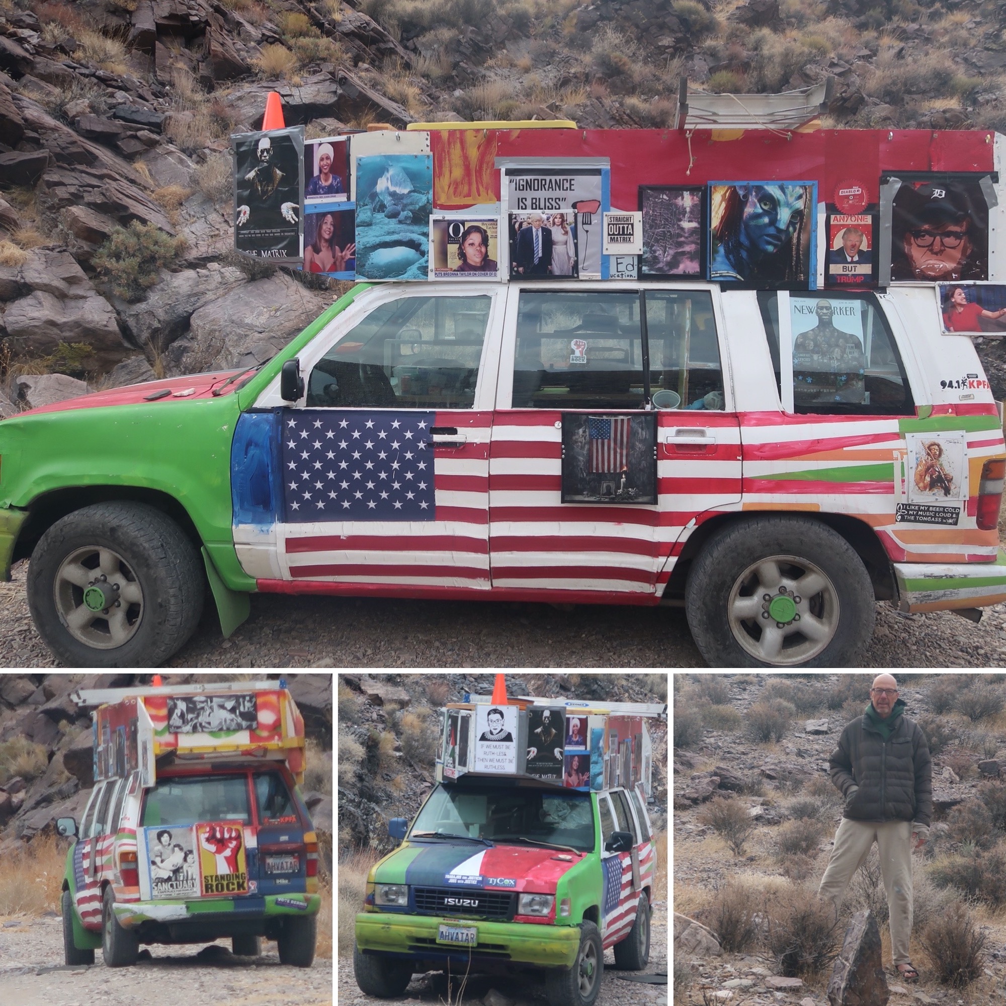
Just when we thought we were in the depths of remoteness, we came across this painted van. Janet commented, “they could be sleeping in there” as I was taking photos. I commented that anyone with a van that loud wants you to be looking at it. Right after a particularly rocky section (other pic of Janet pushing), we met Ko (he claimed it was his real name until later he said his given name was Brian). Immediately he launched into a chiding monologue of Standing Rock (remember, South Dakota, 2016?). It took me a minute to remember and he was sorely disappointed that this event was not at the forefront of our minds. He scurried at us with his phone to show a picture. I had my mask ready and Janet and I clumsily straddle-walked our bikes to get away. “Well happy COVID season to you too!” He announced. I explained to him that we were just being careful and he said, “I’m 71, so I guess I should be careful too”. But from a distance we managed to have a good conversation with him about his art and His participation at Standing Rock. He had the strange mannerism of covering his bald head with his hoodie, only to pull it off seconds later, and then repeat the process. . Then he dropped the bomb: His girlfriend just died a couple weeks ago. He was here to mourn. I felt sorry for him, choosing to be alone, but clearly lonely and needing attention. I think we gave him enough attention to get him through the day; he was “so happy with the people he has met”, and I let him have my email. The one I don’t use much.
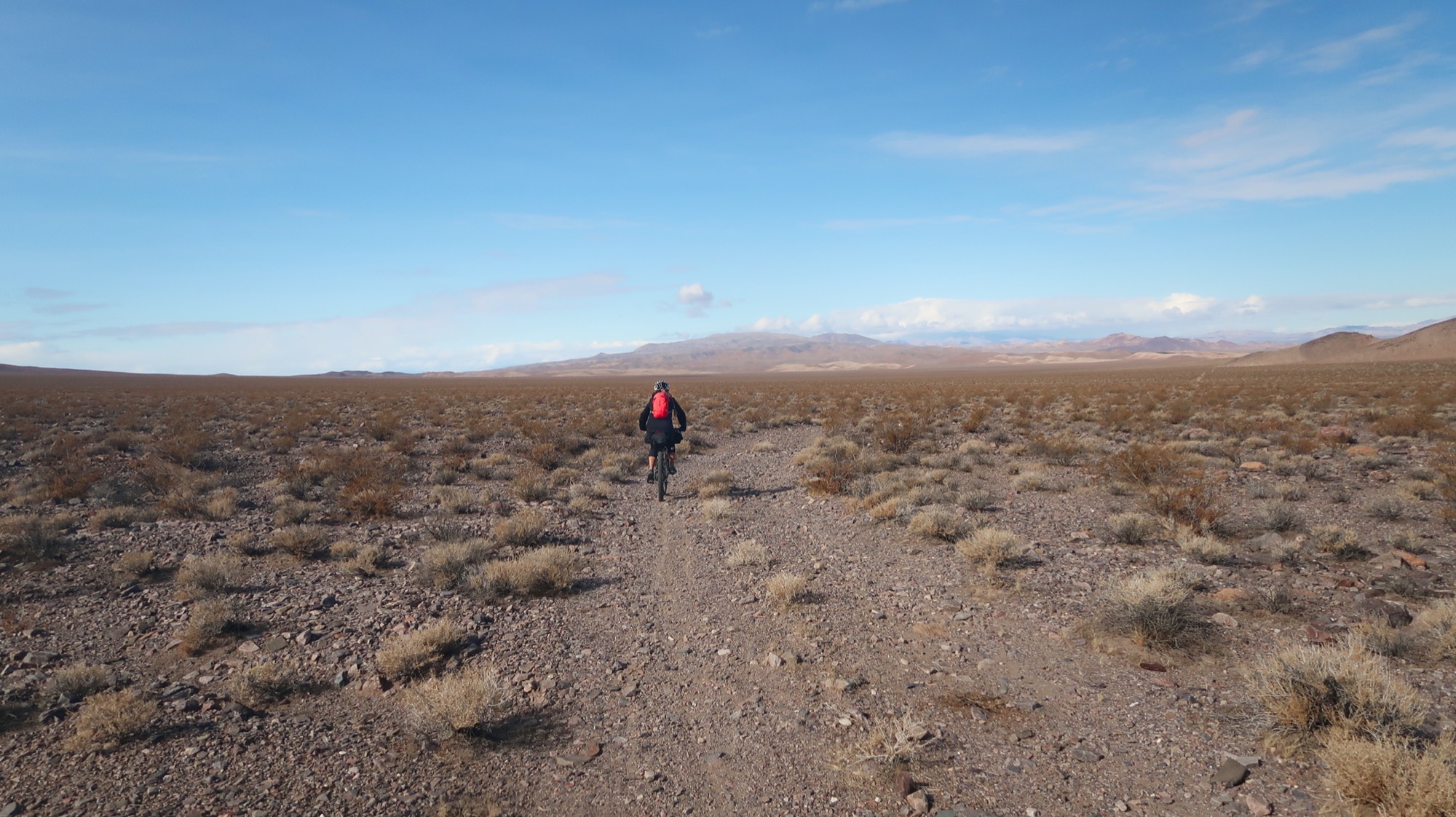
This route looked pretty sparse on the satellite, but I was expecting it to be pure sand. We were relieved to find it rocky. Once again, Janet did really well here. She has been impressing me a lot on this trip!
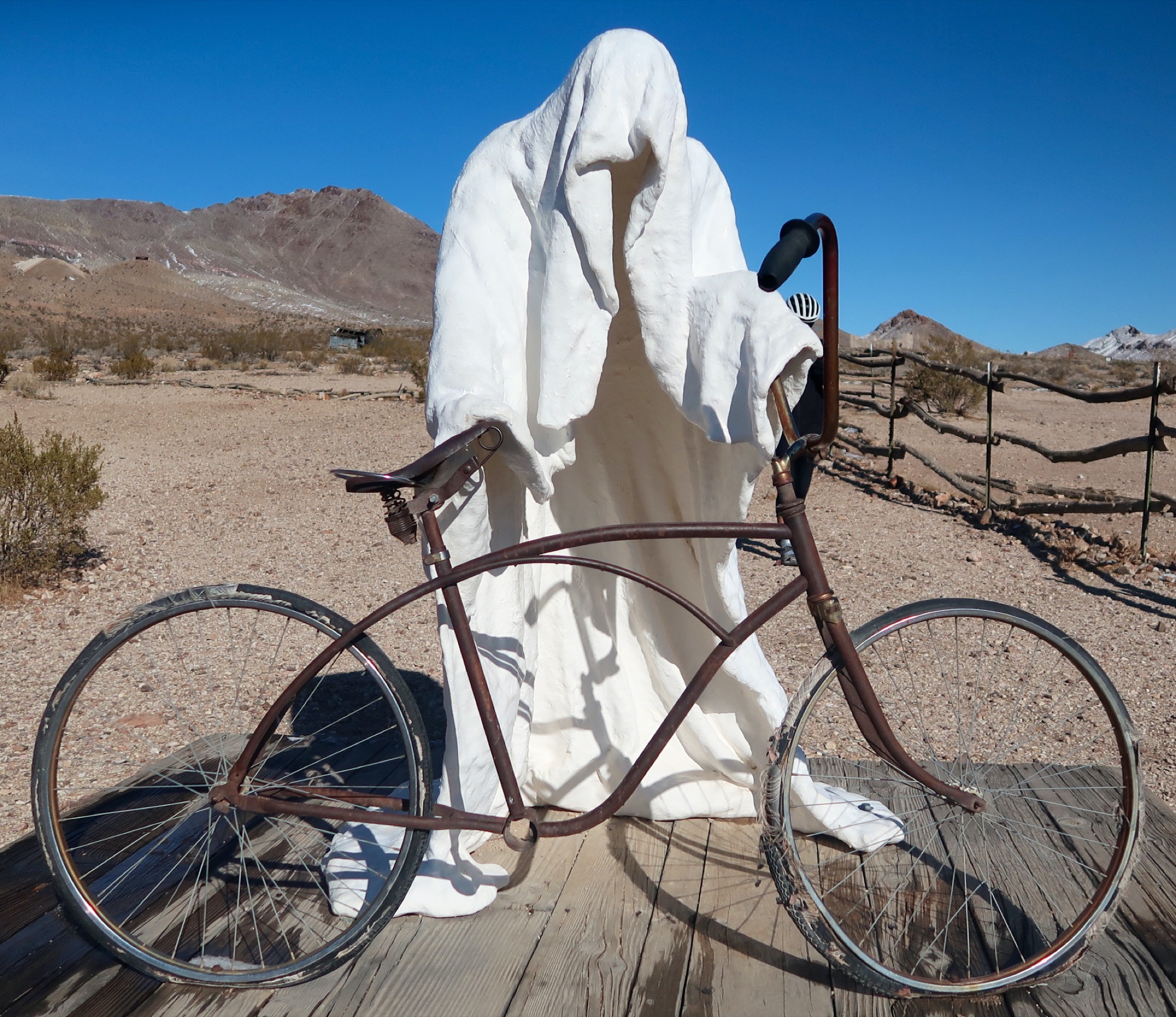
Well, it was bike related so I had to take a picture!
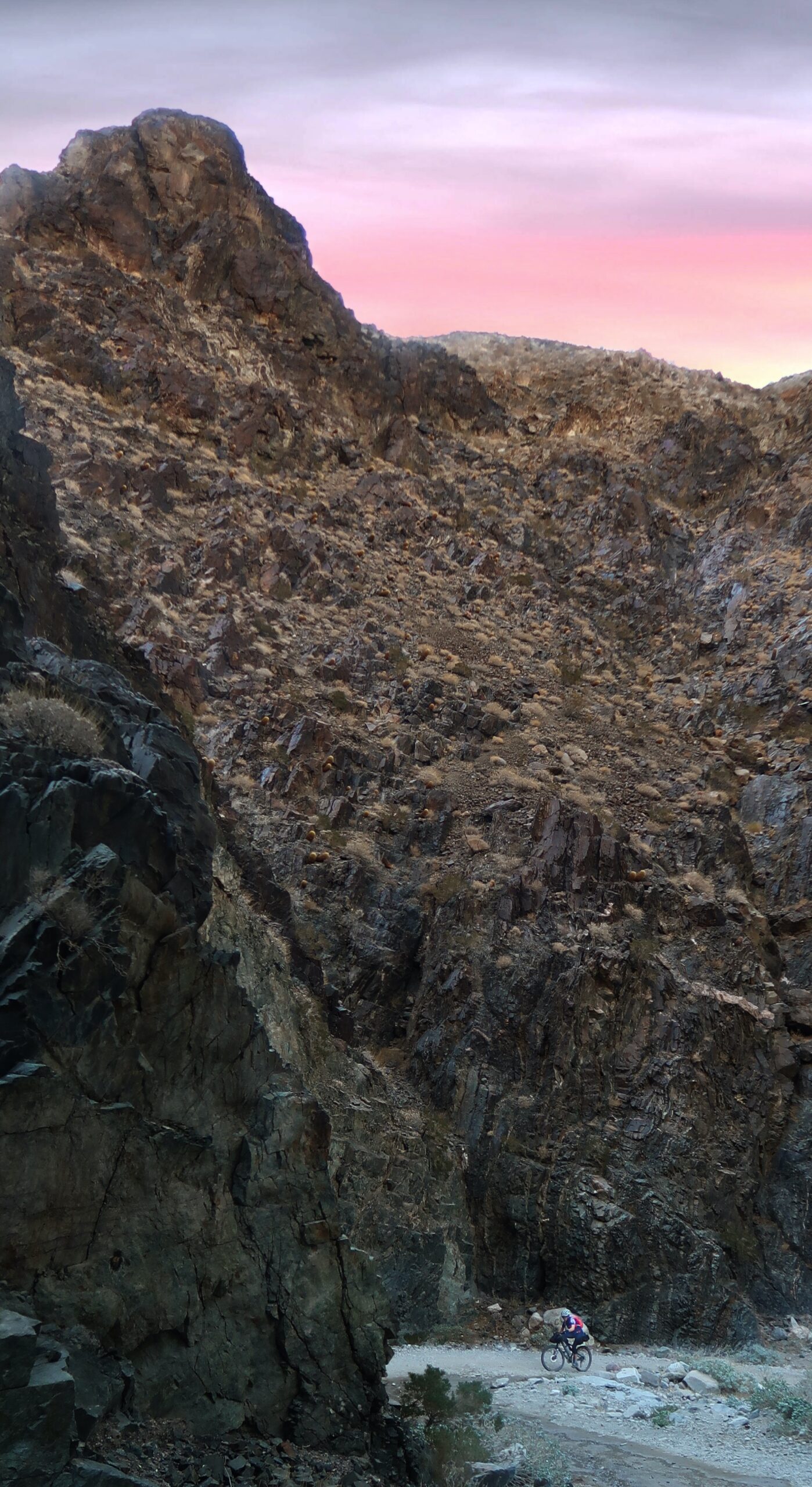
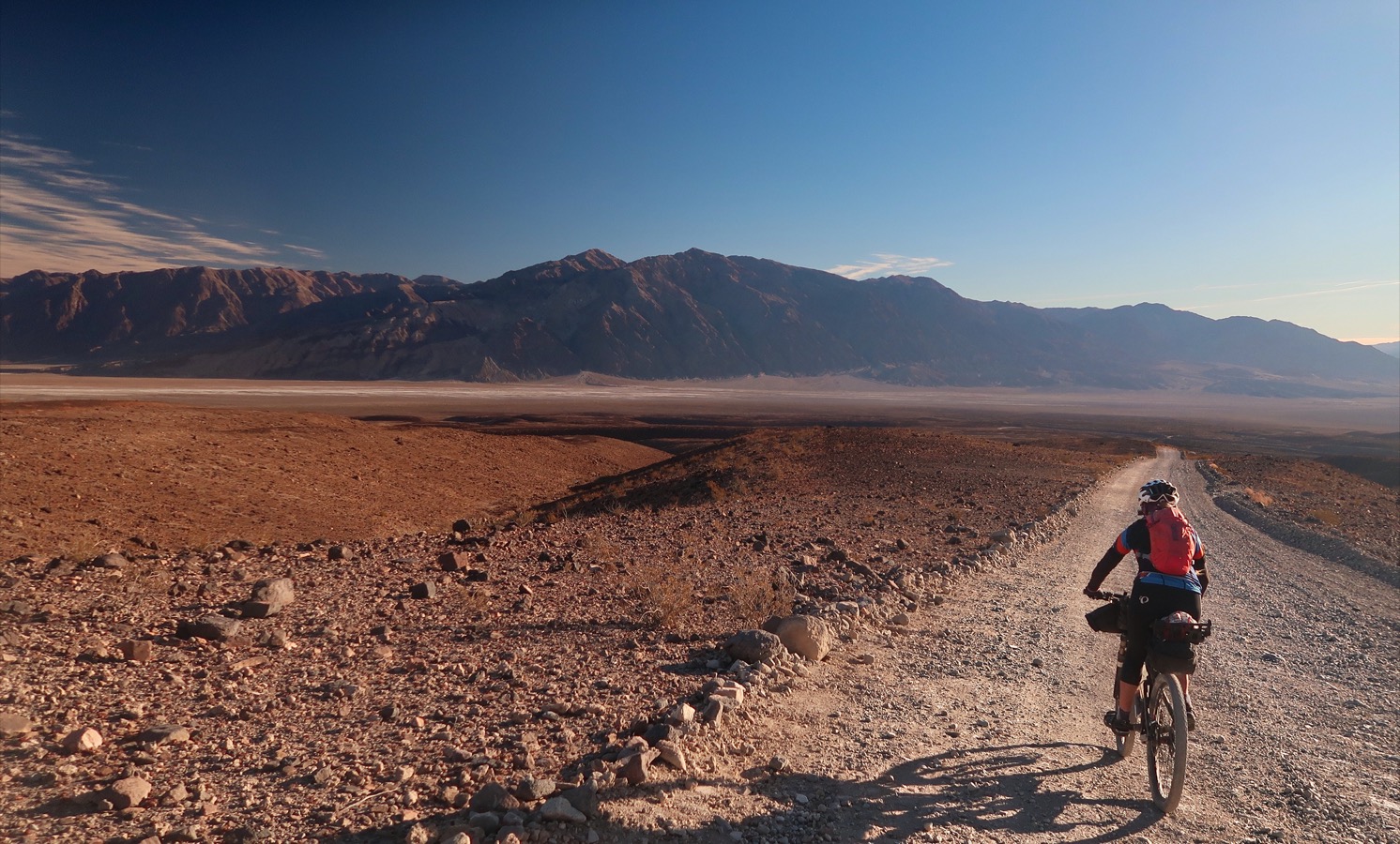
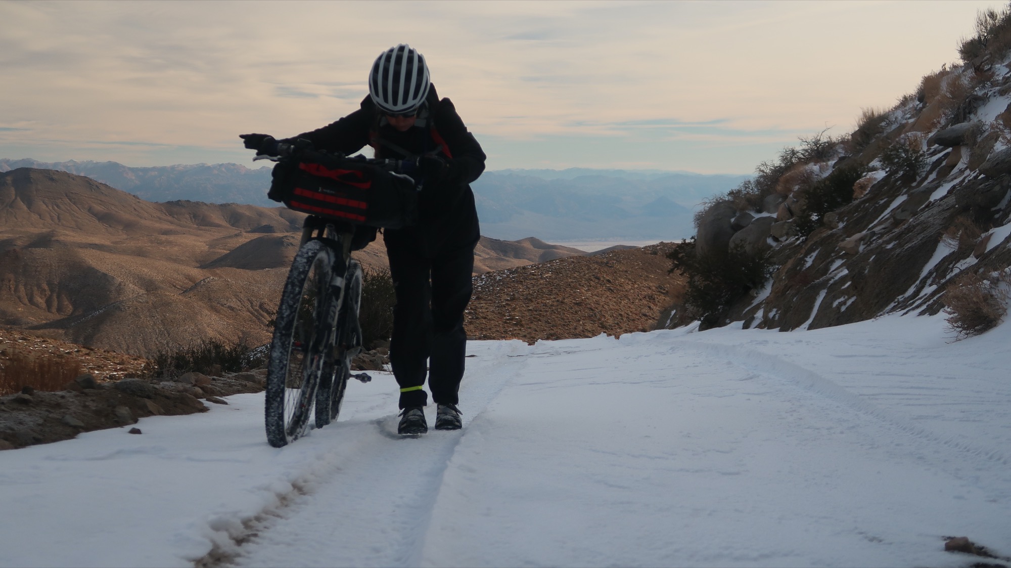
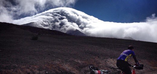
The climb before descending into Titus Canyon. We thought long and hard (and looked at wunderground an inordinate number of times). We even almost quit in Beatty after looking at the forecast. Today was the clear day, and then we have 3 days of precipitation- rain and snow predicted. A bit worried because there aren’t any “escape routes” once we get another day or two into it.
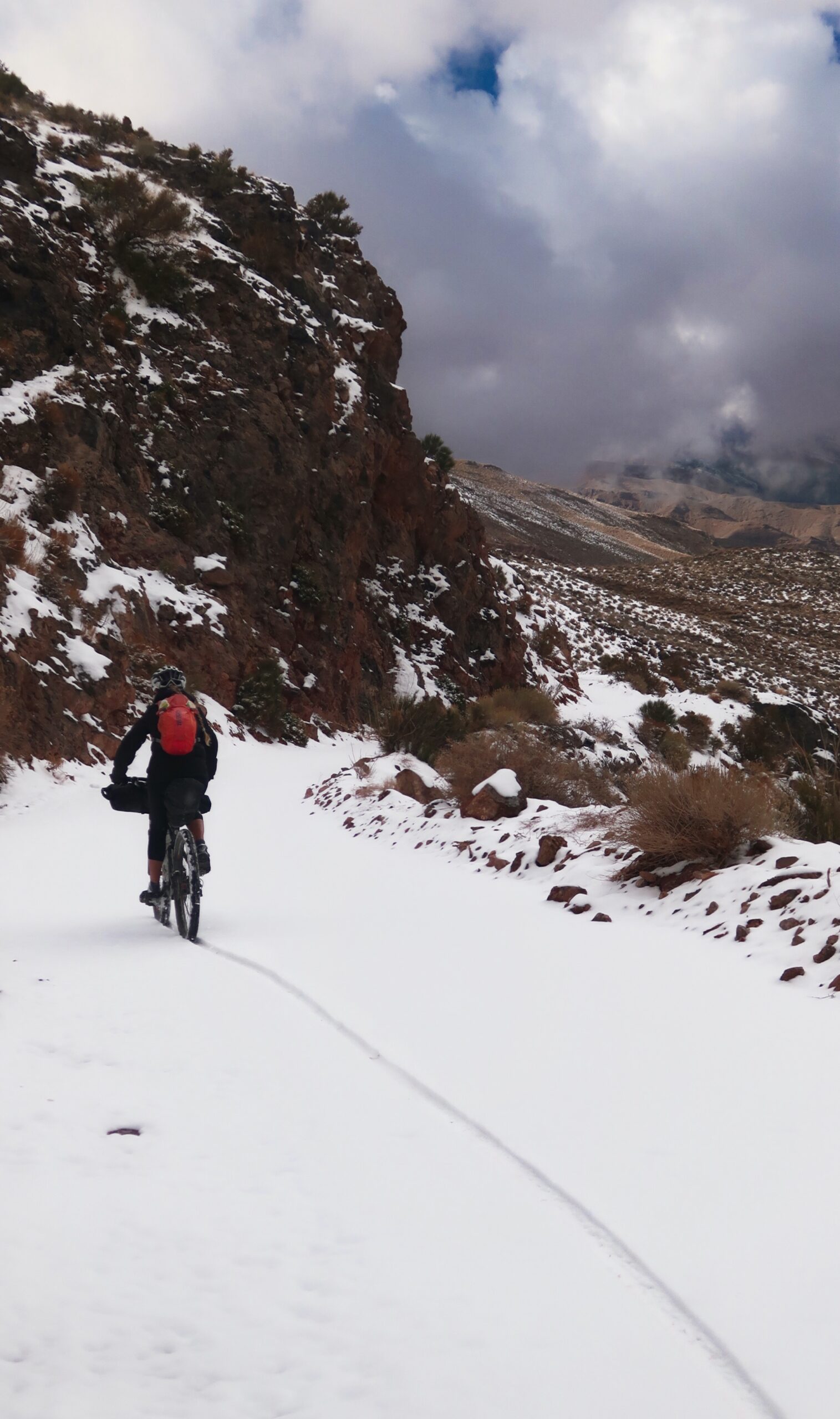
2” of snow at the top of 5,100’ pass. Not problematic for 2.2” tires. We have a 7,200’ pass later in the week, though…
Bitterly cold, we knew we had two things to look forward to. One was the raging 20+ mile per hour tail wind that blew us uphill to climb over 2000’ before noon. The other was a desolate ranger station that might have bathrooms. Sure enough, bathrooms with cold water. I tried the hand dryer in the men’s room but blew nothing but cold air. So, I met with Janet in the women’s room and formed a circle around the anemic hand dryer in there. All was well until suddenly someone knocked on the door. We thought we were alone out here, but it was park maintenance and they were wondering why the dryer was running. He didn’t see me around the door frame, fortunately, and Janet explained we were cold. Later on, though, he came around when we were outside and said “Are y’all outa there?” Of course – we weren’t in there anymore; we were talking outside, so I’m guessing he wanted to rub it in that he caught us!
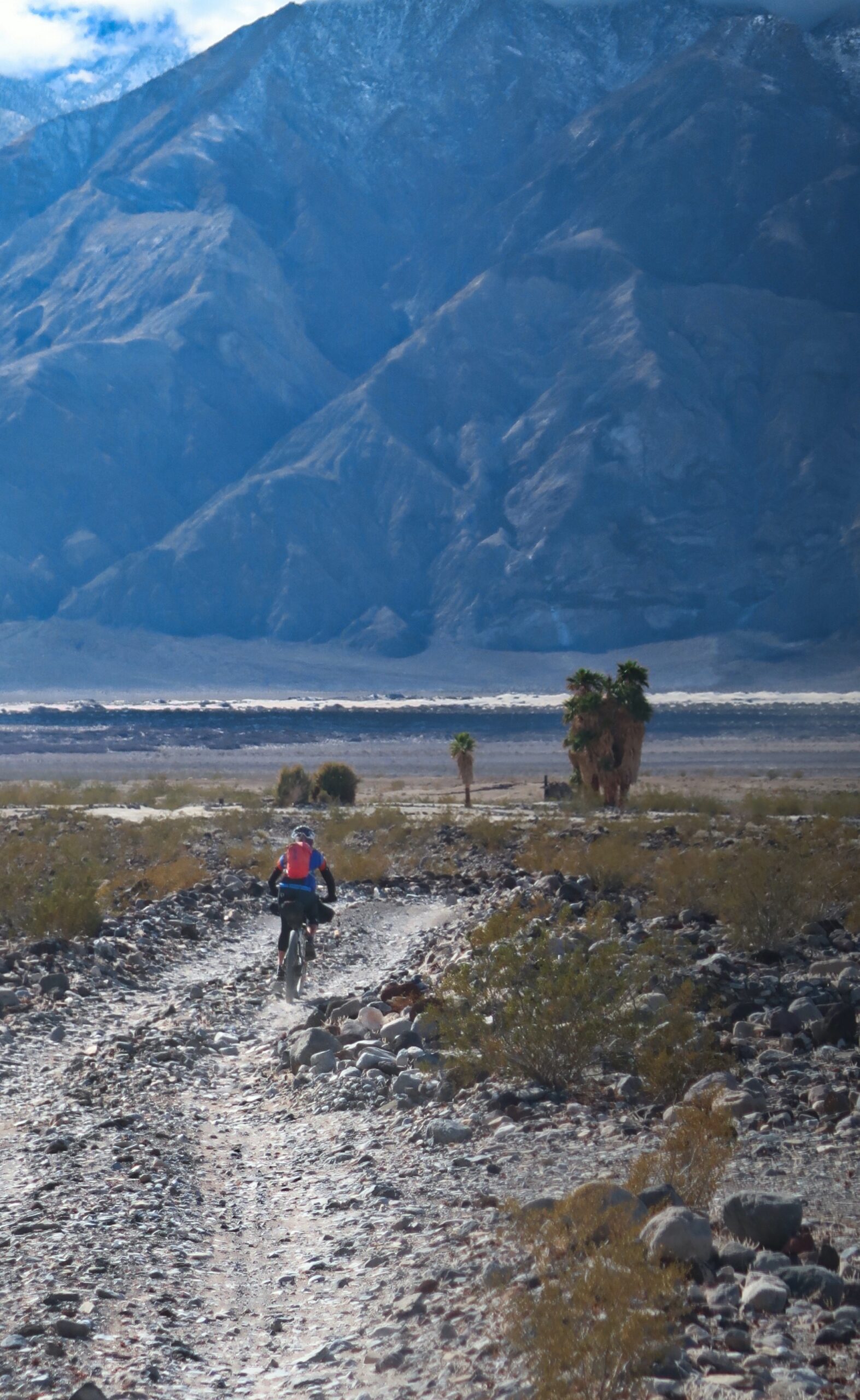
Due to us changing direction, yesterday’s tailwind became today’s headwind. We inched our way to the dunes and upon arriving, we parked by the bathroom. A Sprinter type van was parked; we were separated from it by 200’ of dust and pebble laden air. I saw movement inside and secretly wished that they would offer us water – Sand Spring yesterday only offered an 8’ deep well fortresses by barb wire – so we left the water at the bottom of that pit. Our expectations of reaching a spring today were dashed by the mass of air in a serious rush to go the opposite direction as us. A man stepped out of the van and bravely began walking towards us. The man approaching from the van worked his way towards us and came pretty close. I could see his scalp where it seemed as if maybe he had a surgery, the sparse hairs for some reason made me think he was the survivor of a war; someone who had aged but was still getting on well. Maybe it was his benevolence that had made him seem spry for his age. “You want some water or a warm meal?” He asked. I had been secretly hoping he would offer water as we only had 4 liters left, and said, “yes, please!” We walked toward the van. He had just told us that he came here for his anniversary, so we were momentarily surprised when another man opened the door and produced 4 x 500ml bottles. They were from Ohio – Amish country. He began to tell us how the Ohio Amish are now intentionally “interbreeding” with the Pennsylvania Amish to help mitigate the number of birth defects such as hemophilia. Next his wife appeared and said that when she first saw our tire tracks, she thought it was a snake. There were two couples in the van, however we mostly saw the kind man, Philip, as the others refuged from the wind in the van.
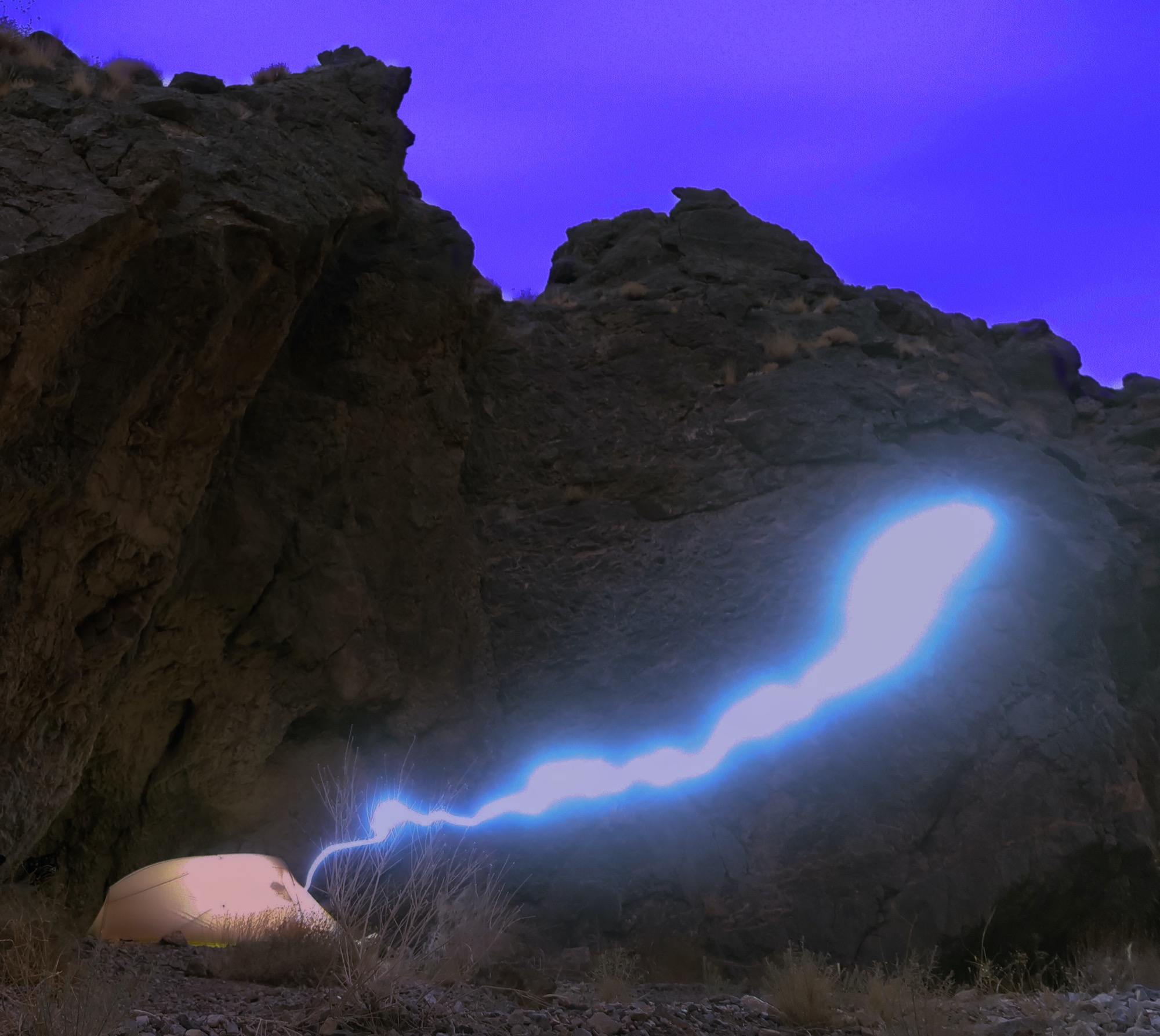
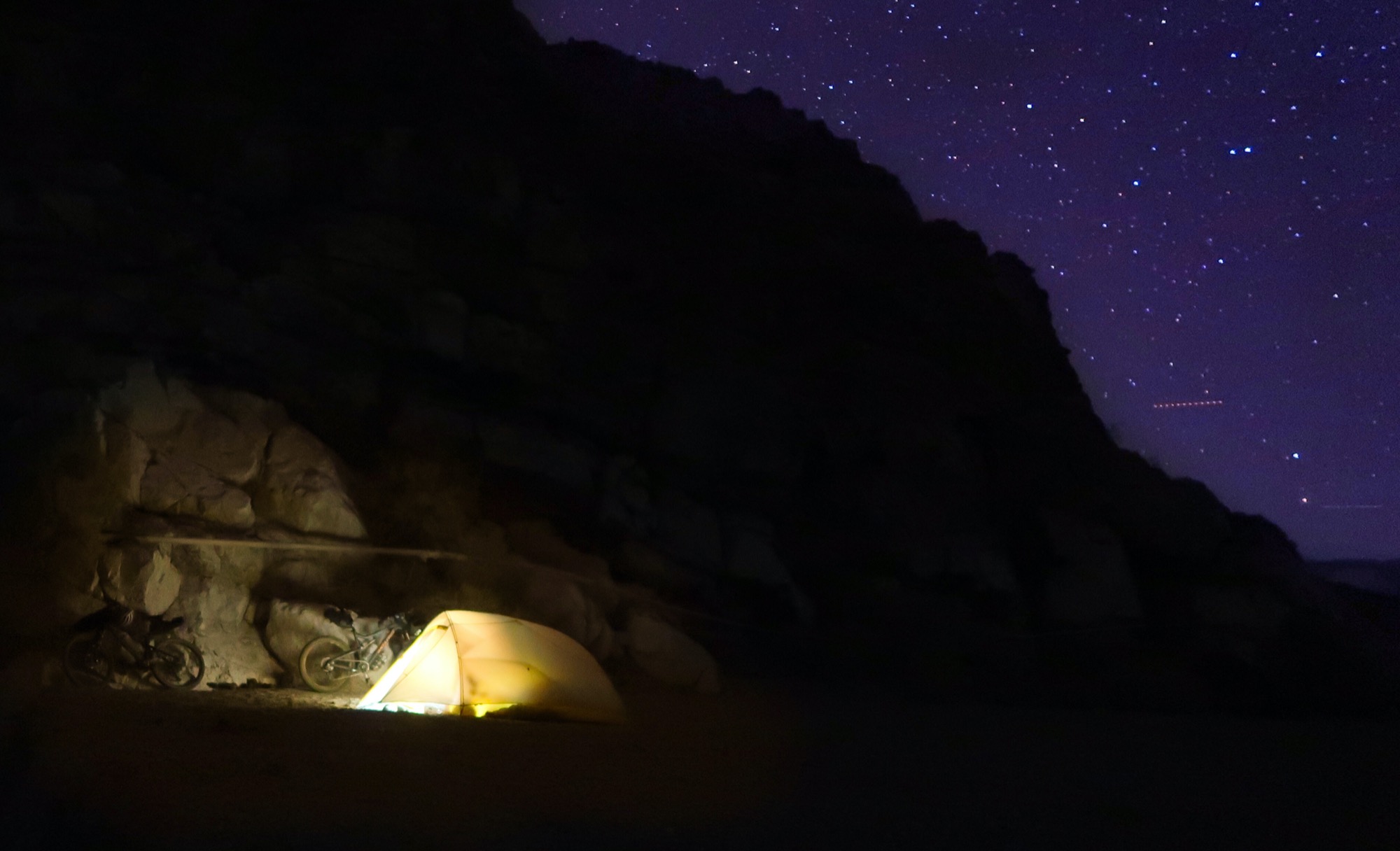
We found a spot that was sheltered from the wind. You can’t see too well, but this is a cave. It was the perfect spot with wind whipping all around – but practically still in this semi cave. The only problem is that I was very scared about the conglomerate rock above us. To demonstrate to Janet, I grabbed a rock from the ceiling and easily yanked it out. There were fissures all the way up the rock and I was sure that the whole slab could slide off the cliff whenever it wanted. I took this long exposure, and when I saw it, I thought the light (from my headlamp) was a premonition of our souls escaping from the tent. I decided not to jinx anything and waited until we were safely out of the cave to write this caption. Oh, and yes, we did wake once in the night to a rock sliding down the cliff and then thudding besides us. Video: https://instagram.com/p/CKro_hWFM06/
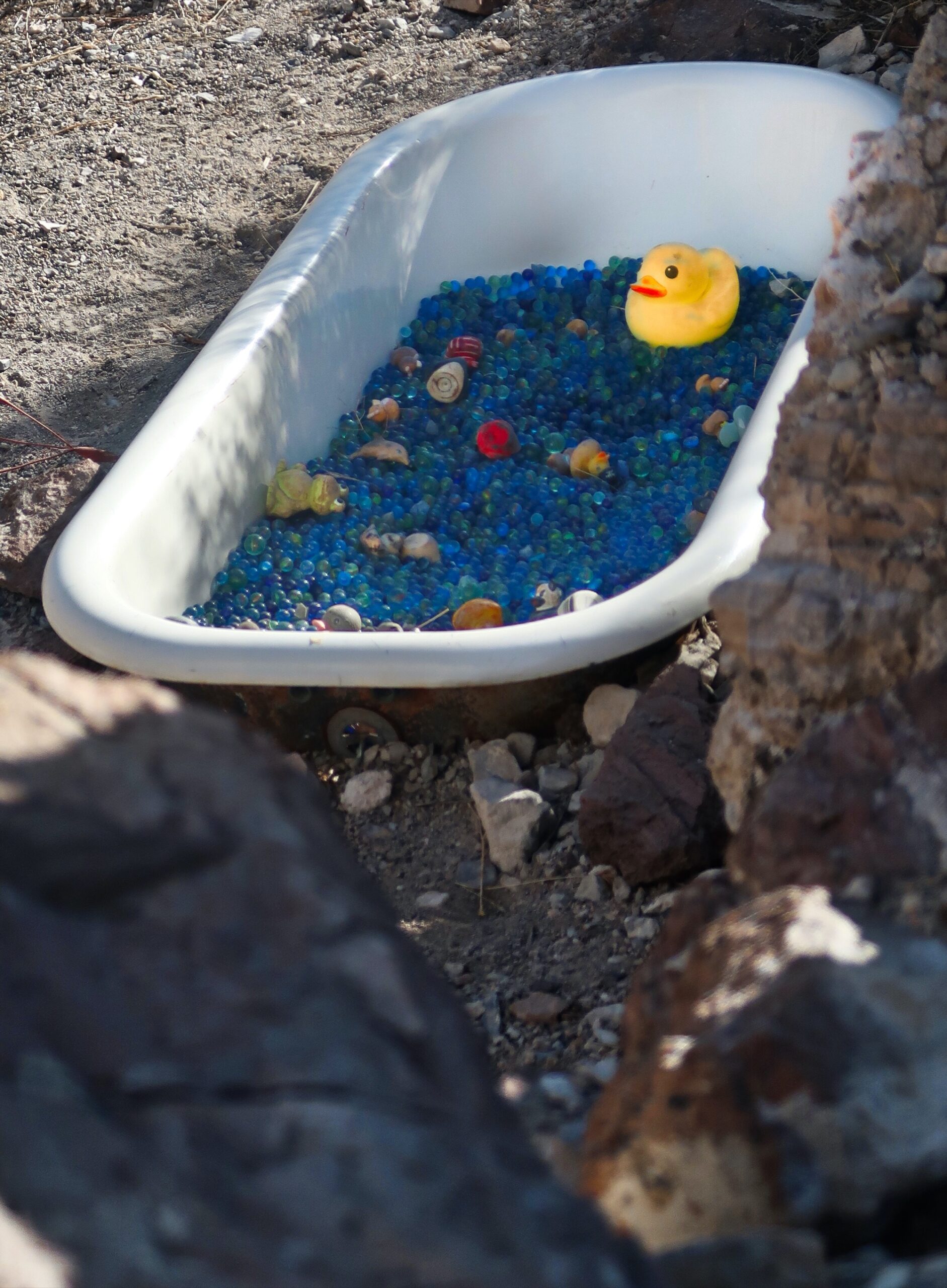
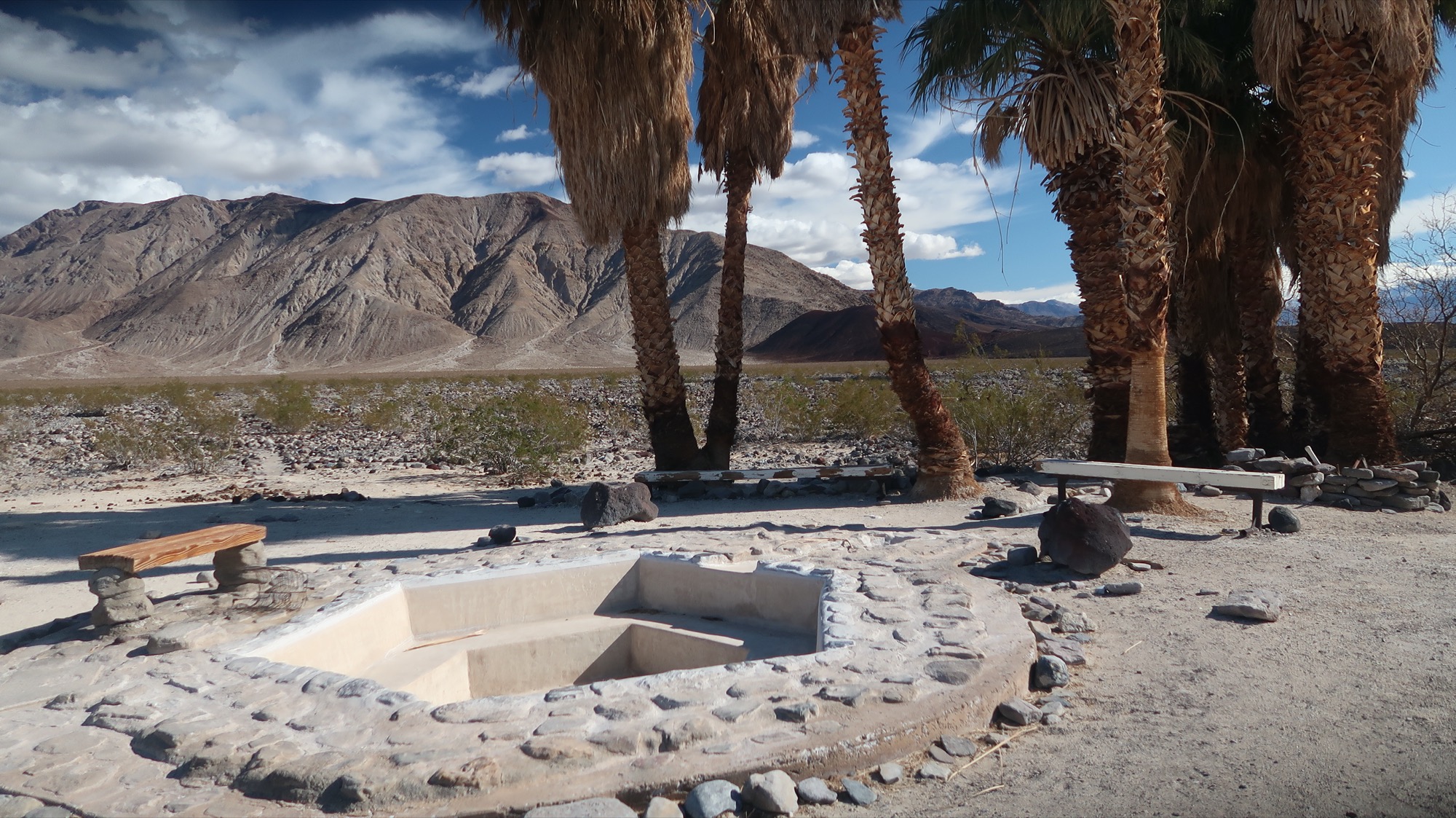
So, on the old USGS maps, there was a spot called -Marble Baths- The reference was to a geological feature, and it was in the wrong spot. So, this guy as a joke put this marble bath in. People come and leave marbles now. He passed away several years ago, but the legend lives on.
Ahhhh! Upper Saline Valley Hot Springs. We needed something warm and wet after not seeing surface water or being warm for a couple days. This was Purrrrrfect. The two lower pools are a mile and two miles down the road – and they are closed due to COVID. They are made of concrete and more like hot tubs; empty now. This is the “natural” one and it is still open for some reason. Perfect for us!! Washing away the hardship of the last few days – and preparing for our last (and highest) pass crossing.
Dropping down to two lower hot springs after a long soak. This land used to be BLM land and these springs had some long term residents; one named “Wizard”. The park got the land and then they let Wizard stay as a sort of camp host. This area can get cut off to vehicles by big snow storms, so it can be pretty isolated. Anyway, Wizard died, but then Lee (Lizard) took his place as camp host. He has been living here for years, but it is unlikely that the park will let another person fill this job in the future. By the way, in the news, someone died in the (closed) source pool for the lower springs a few weeks ago. Not sure of any more than that.
The conventional hot spring tubs at the lower hot springs; these were closed due to COVID.
After we set up camp, I went on foot to see if I could find another hot spring I had seen on an old map. I found the spring, but it wasn’t the soaking type – and it wasn’t really hot. When I got to the area, I was dreaming of an Eagle’s nest like spring. Photo is just b-roll quality. I did replenish our water. This Picture is from my hike.
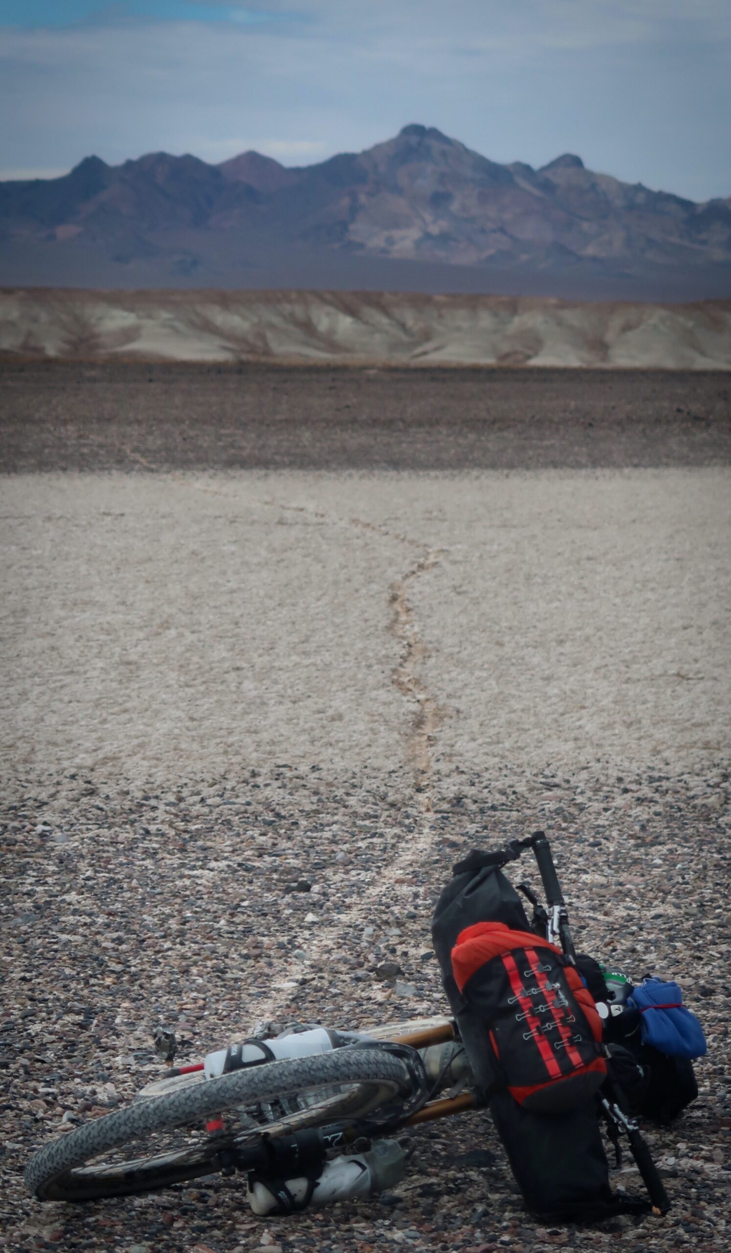
It is pretty cool to be in a place like this. After several days of nearly complete solitude, we saw several cars parked when we go to the “racetrack”. It felt so strange – we had ridden so far in remote territory. It makes you wonder how these people got here.. even for them, via the Crater, it is a really long drive. One of the SUVs with tinted windows rolled down its window. “It’s a good thing you guys are wearing those masks,” exclaimed the woman wearing Bvlgari Sunglasses, leaning her elbow lithely on the door frame. We nodded in acknowledgement. She continued, “Yeah, with all the dust, you don’t want to get valley fever.” We may as well have been talking to a person from a different planet, as she seemed to be on such a different wavelength than us. We did the nod and smile, and continued away from the parking lot.
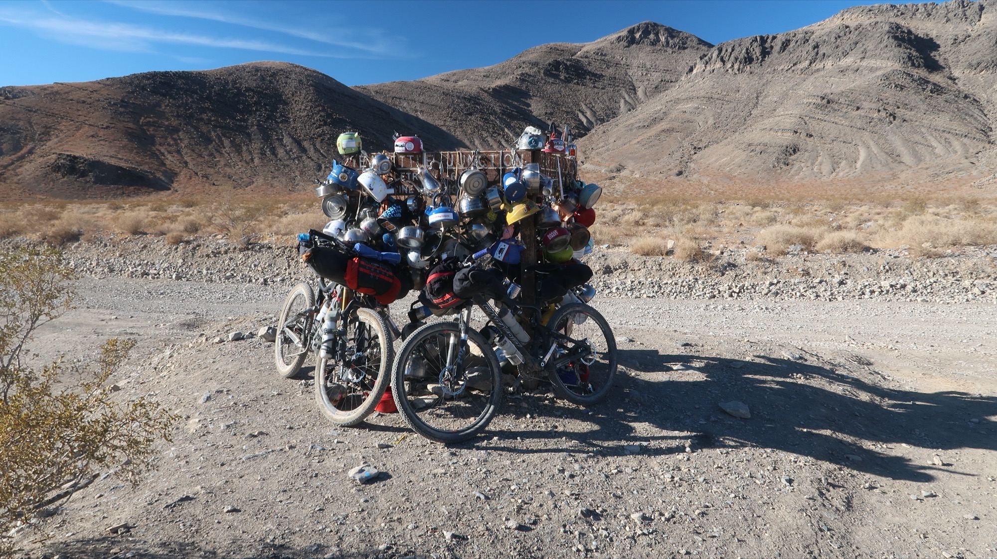
Teakettle Junction, a very remote place – except for all the people who came here to leave kettles! I wanted to take one, but then Janet saw the sign that said, “Take only photos; leave only Teakettles”. Janet offered to get me one from Goodwill, but I insisted it just wasn’t the same. Anyway, most of these were dated 2018 to 2021, so not sure where the old ones go. Janet suggested maybe a teakettle museum.
We are pretty much loving this.
Last night was a cold one. 29F in the tent, and it is usually 6F colder outside. I took this shot by moonlight at 5:30am. We woke because we were cold with just 32F bags. We used the little propane stove to warm the tent (I love that thing!) it makes sense to do that because there was only a little fuel left, and who is going to bring a canister with just a tiny bit of fuel on the next trip?
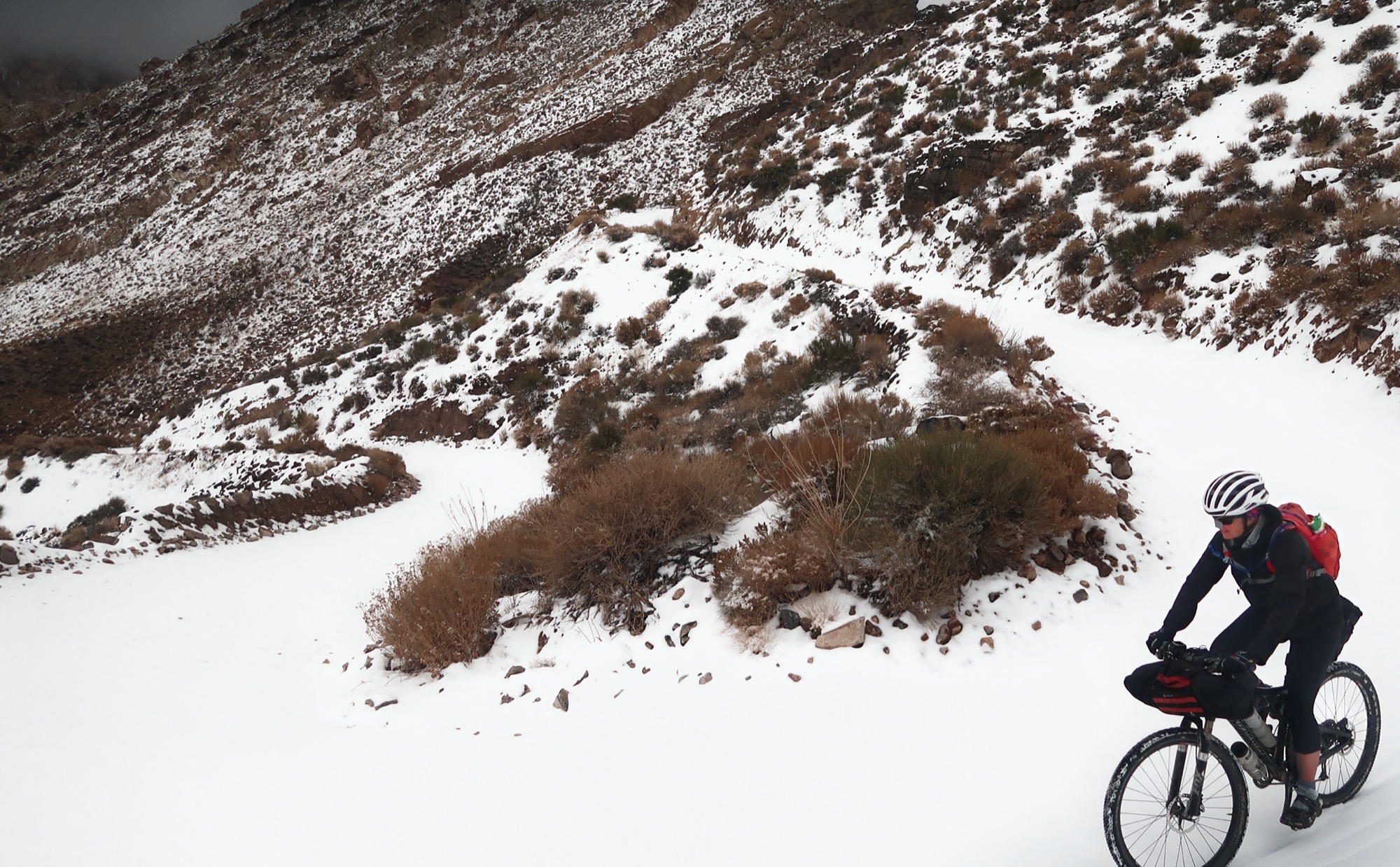
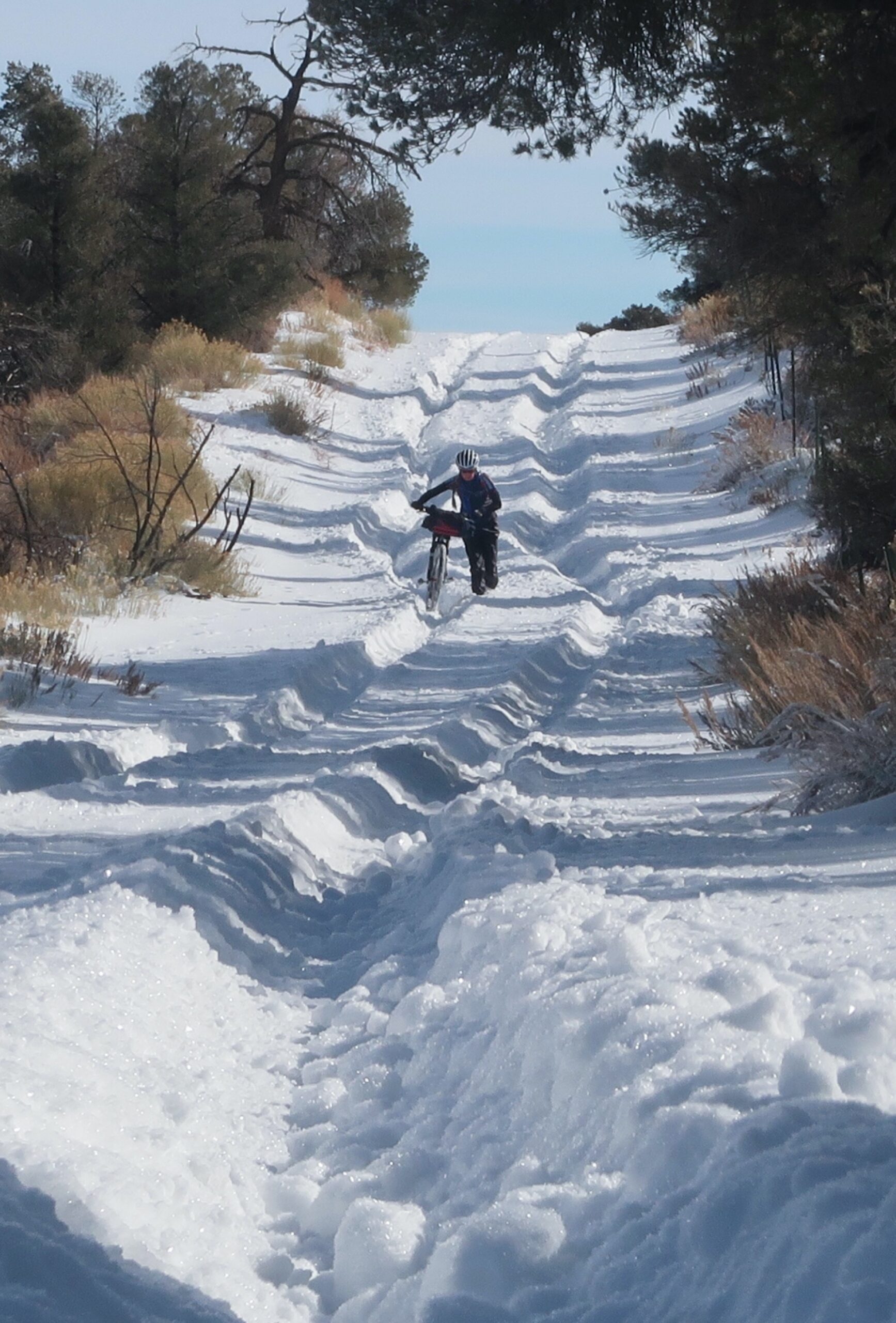
When we hit the 5,200’ level, snow began. We later learned that the other 7,000’ pass (North Pass to Big Pone) that I had planned as a “bailout” was much much deeper in snow than this one. Only 30 or 40 miles away as the crow flies, but that is the direction that the storm took. How lucky we were!
Janet rode very well on some slippery descents, sometimes with one leg extended for balance. We both crashed a bunch of times. I told Janet that now we know she can ride the “skinnies” at the Eucs because she is able to stay within a 7” tire track.
Near the bottom of our descent, we finally saw a vehicle. The man wearing a grease stained neon green T-shirt emerged to ask us if we had seen a break in the pipe up the mountain.. his 4×4 was incapable of going much further. We reported details of water sources and pipes because I investigate every water source – even if we don’t need any. I asked if this was his land or if we were still on the park. He lowered his head, his graying curly locks bouncing about. Detecting his reticence, I said, ‘We are interested- but only if you want to tell us.’ He explained that his grandfather had claims on the land on Hunter mountain in the late 1800s. They had cattle and horses up there. The NPS took his father to court and fought him over all his claims, and they lost everything except water rights, which this man now uses for his stock (he was up there because the water stopped flowing; we told him which pipe burst). He said that the NPS came and shot his father’s horses. I was taken aback; a court battle made sense, but killing someone’s horses seemed way out of line. Maybe things were different back in the late 30s? He seemed a bit relieved to have unloaded this emotional bit of history, and feeling like a friend, he gave us a tip on a shortcut that would save us 4 miles and 500′ of climbing. I wish I could learn more about this story.


I am very impressed with both your route and blog presentation!
I just did a smaller 200 mile portion of this route last week. It was fascinating to do it after the big hurricane storm that hit in August, 2023. My shorter version is here: https://caltopo.com/m/30TQH
Great write up. How many days did this take you?
Tom –
Thanks for your question. Here is how you download the waypoints:
1) On the map, click the three horizontal lines (we call this the “hamburger”).
2) Click on “Export Selected Map Data”
3) Uncheck the stuff you don’t want (the top one is the waypoints). Click Export.
hope that helps and you have a great trip!!
Brian
Awesome tour! In March I did a much shorter tour through Saline Valley via Eureka Dunes, Steel Pass and North Pass. Beautiful remote area!