Utah Bikepacking – All The Routes
Earlier in 2021, I bought a Fat Bike. Initially, I was inspired to do this because I had ridden up to the Sierra Nevada around New Years – and all of my routes were thwarted by snow. It became apparent that if I wanted to ride in snow, I’d need some big tires. The snow had melted by the time I got the bike, so I decided to look for a summer route that would utilize its capabilities. My search led me to Utah… and it became apparent that I had just enough time to do “all the routes.” Basically, this trip was a linking of all the Utah routes I could find on bikepacking.com.
This is the map for the entire route discussed in this post. To Export GPX files, click on the three horizontal bars in the upper right hand corner of the map and select Export selected map data... To see full screen, click here (opens in new window)
Here are all of the 2-4 day trips I used to make one huge route:
Hey Joe Safari
The White Rim Trail
Plateau Passage
Cedar Mesa Loop
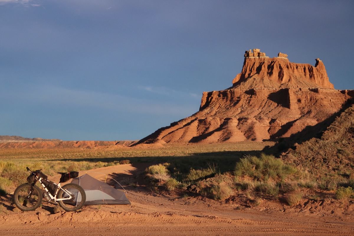
Stone House Lands (my favorite)
Grand Staircase Loop
As you can see, these routes are already pretty well established; so the purpose of this blog is mostly to share my pictures and give you an idea of my experience on the route. Overall, I was really glad to have the fat bike on “Hey Joe Safari” as well as the “Cedar Mesa Loop”. The fat bike was the wrong bike for the White Rim (a full suspension would have been better).. and probably the same for the section of Plateau Passage that I did. Stone House Lands benefited from a fat bike in certain sections, and same with the Grand Staircase Loop.
Hope you Enjoy the photos!
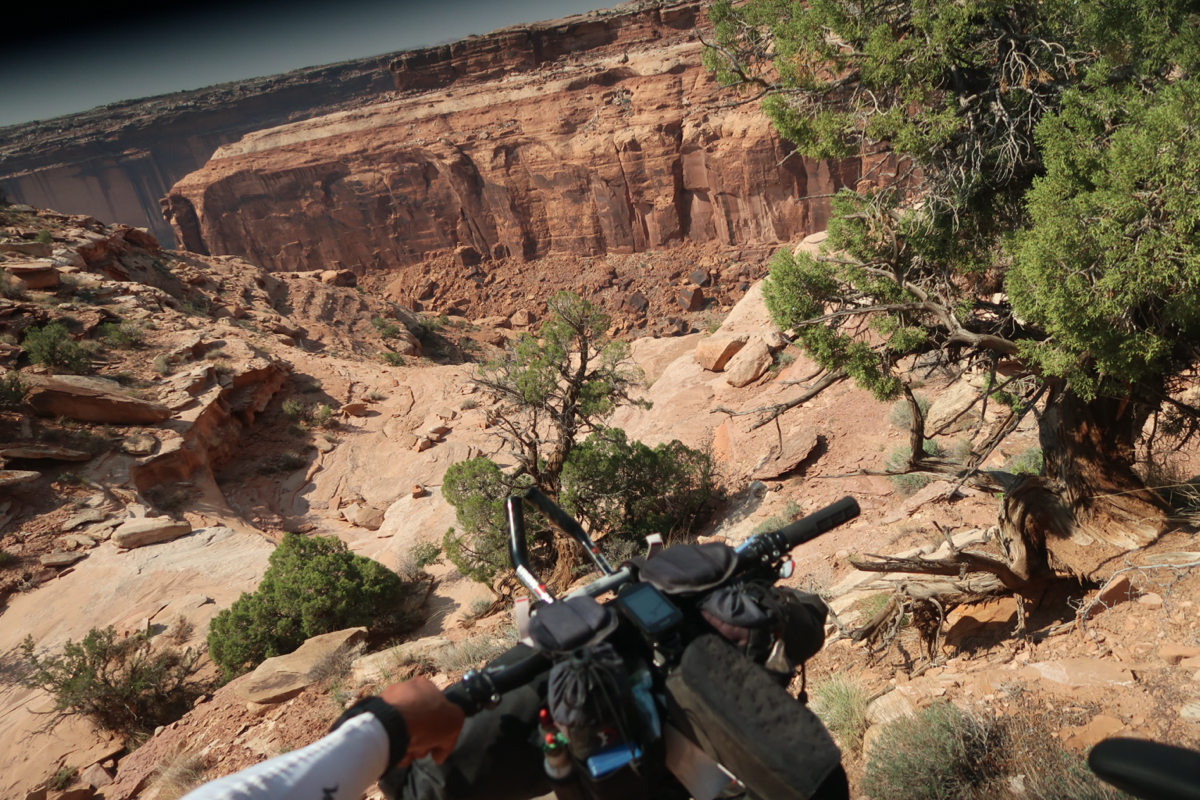
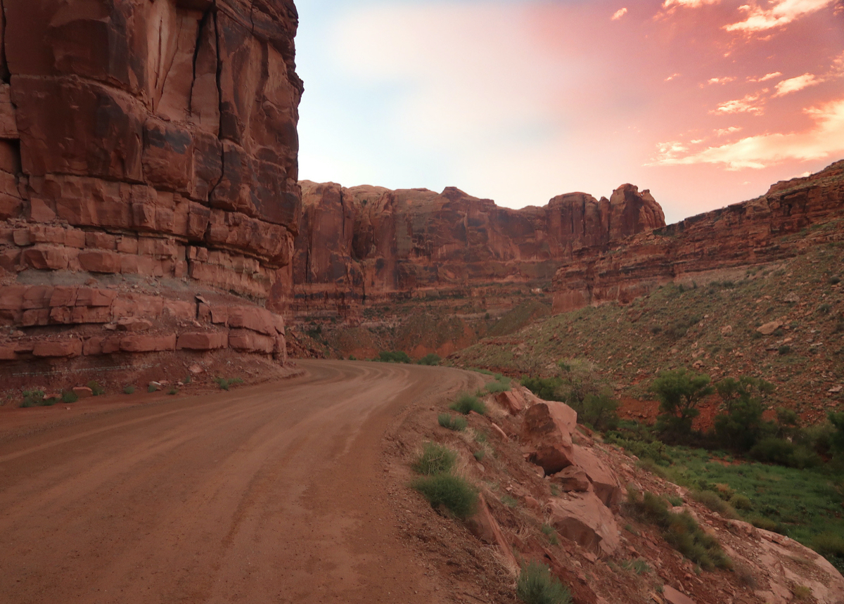
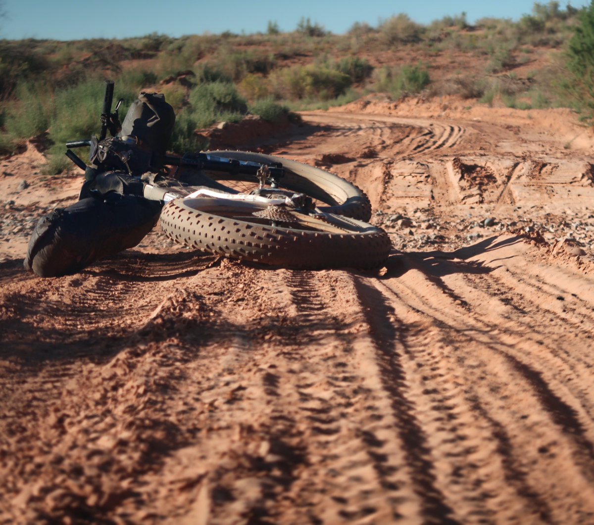
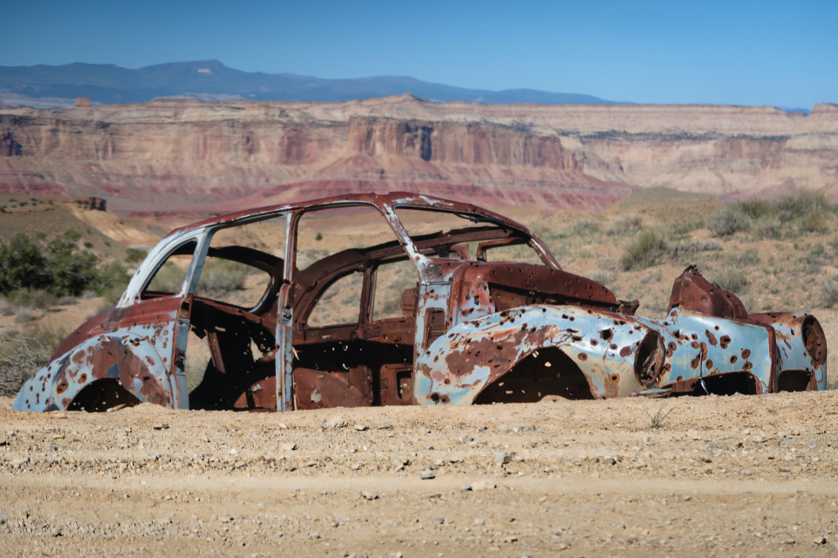
A scary part of this route is the descent into Hey Joe canyon. If you saw me going down this, you would think I was a fool. It took what felt like 2 hours to inch the bike down a series of “small” cliffs. It was a tad dangerous and hell on the bike. The bike got scratched in several places… and it also fell on me once so I have already had to use my first aid kit. I never used to do first aid – just let things bleed – but now with my low red and white blood cells, I treated it with topical antibiotics. Honestly, I’m not too fond of some of the bikepacking.com routes where you have to hike a bunch – there is already a sport for that called BACKpacking.
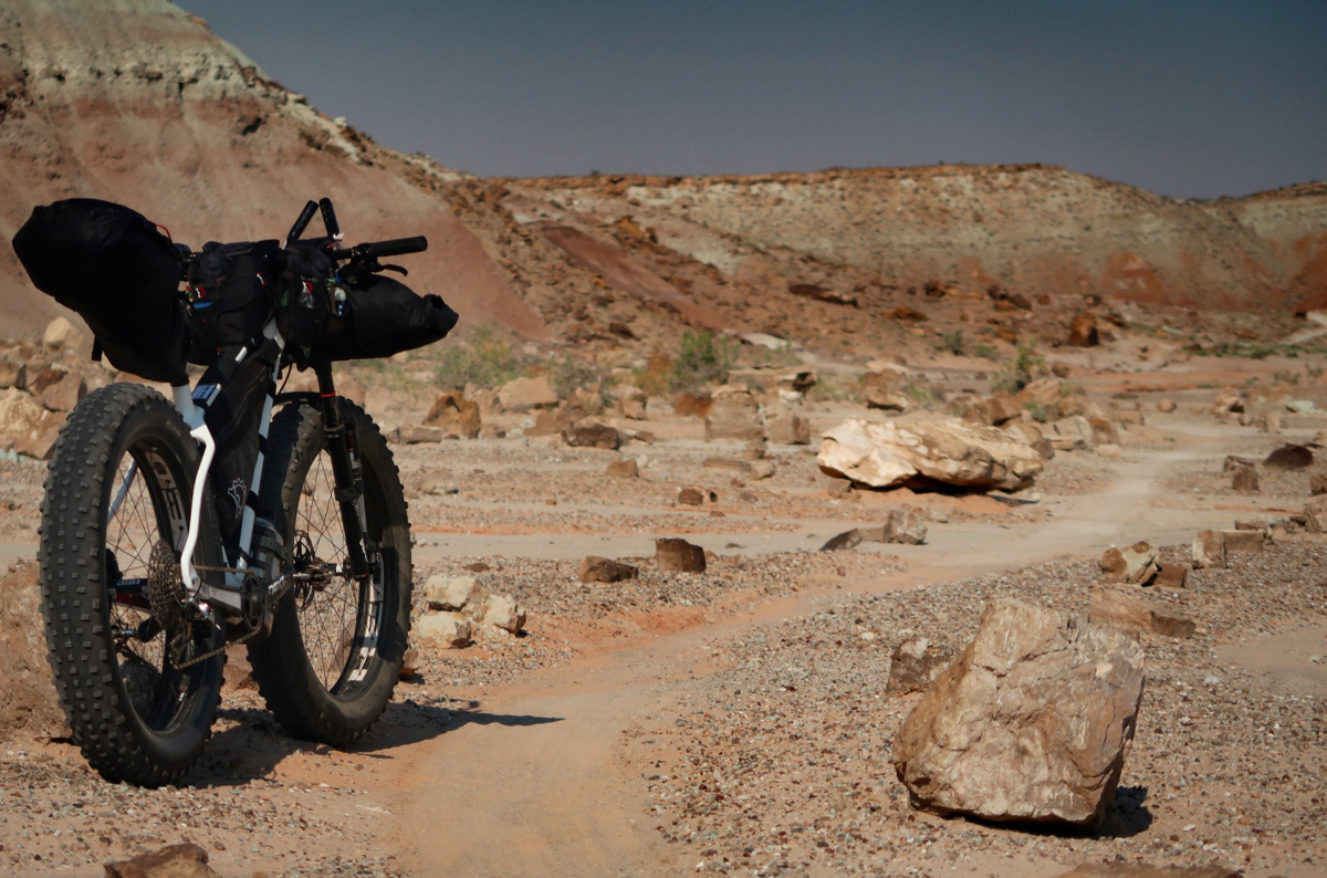
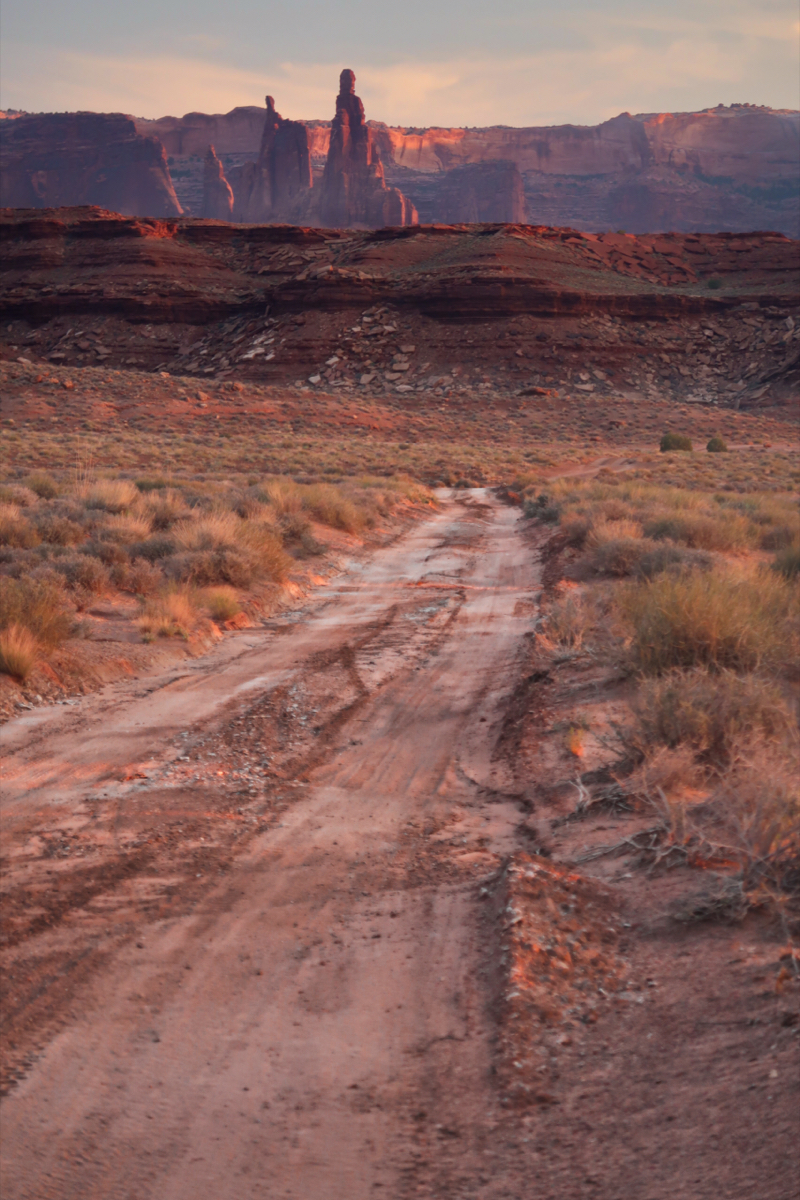
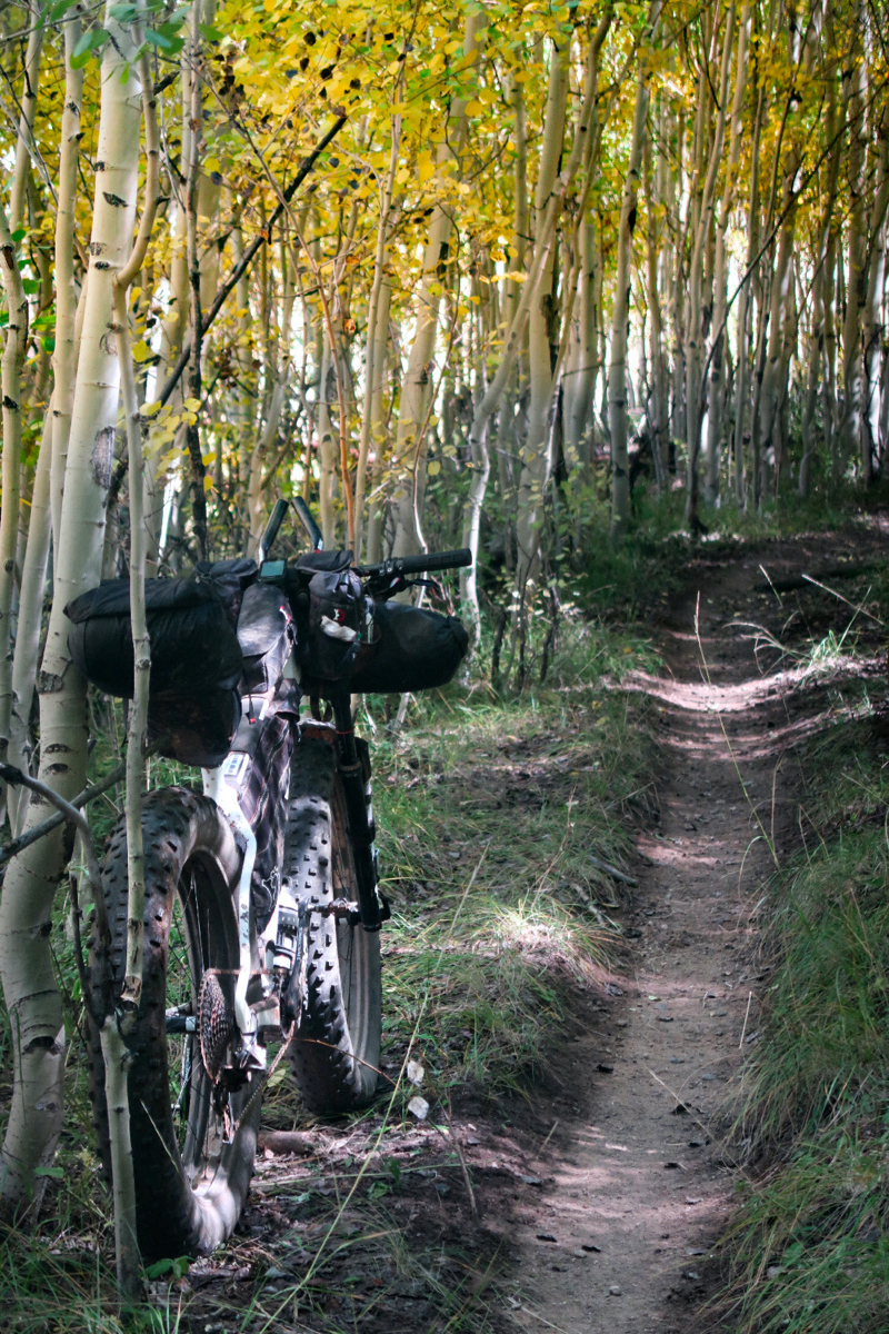
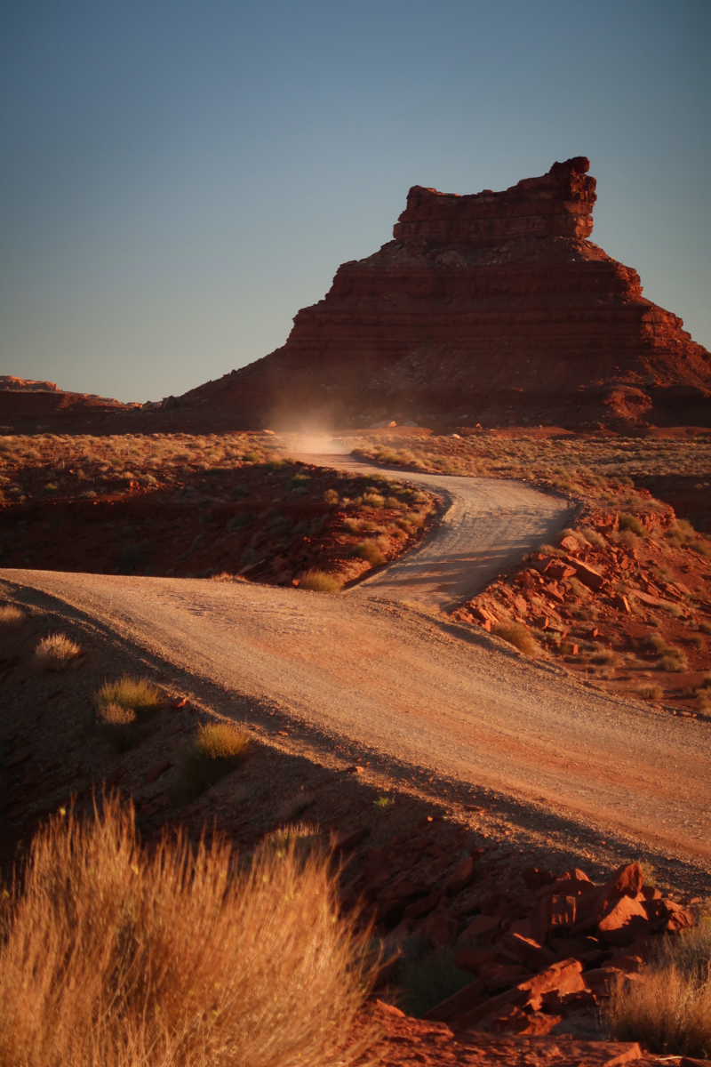
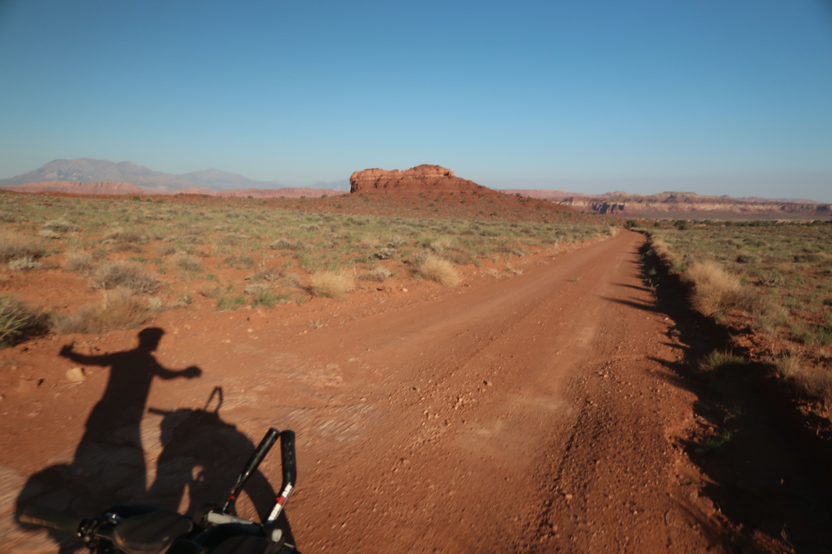
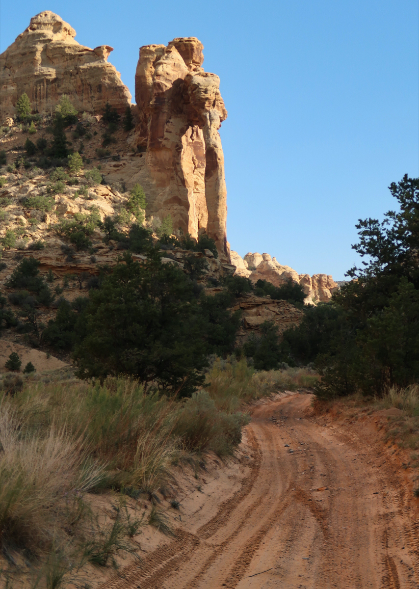
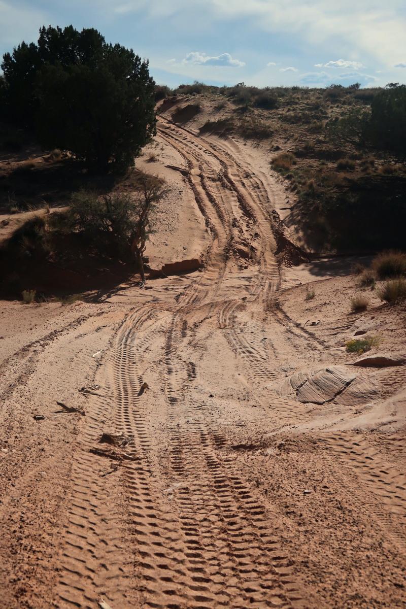
The beginning of the Hey Joe Safari route.
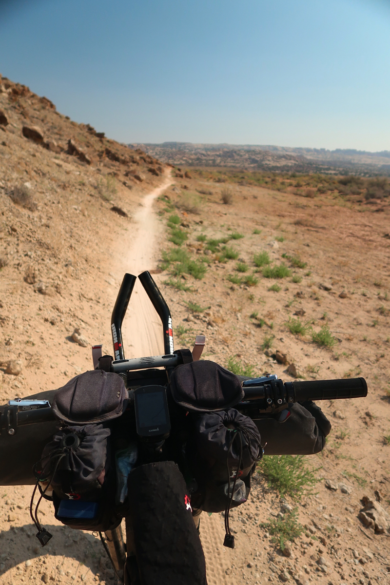
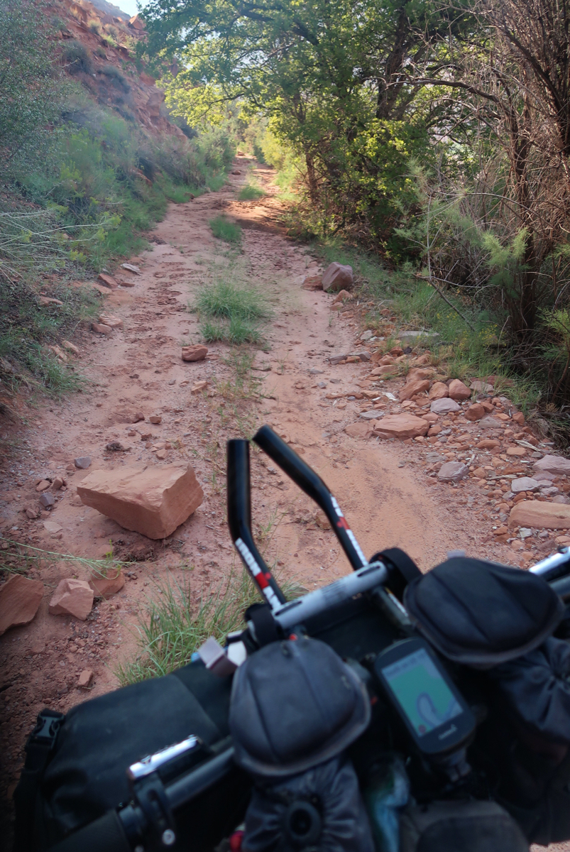
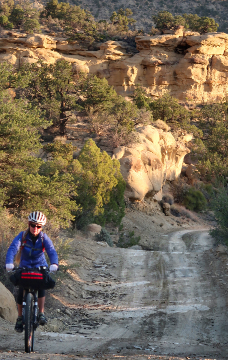
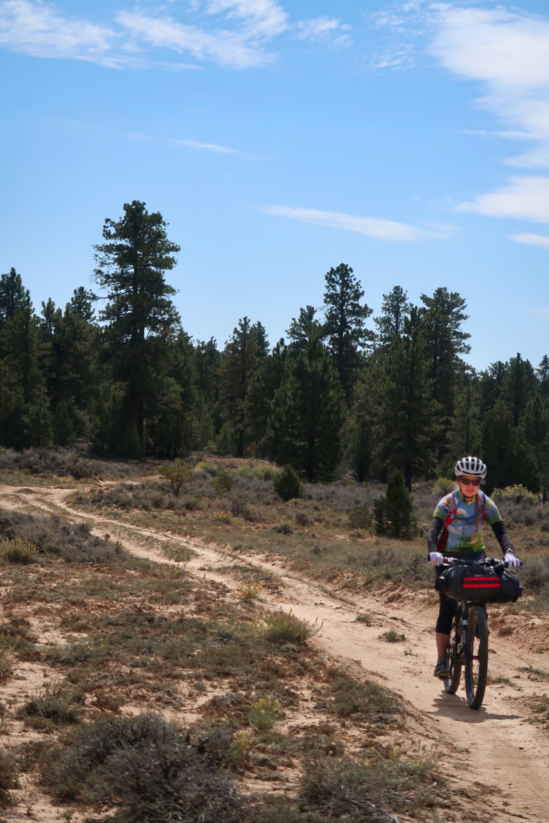
Some nice single track in the morning to start the day!
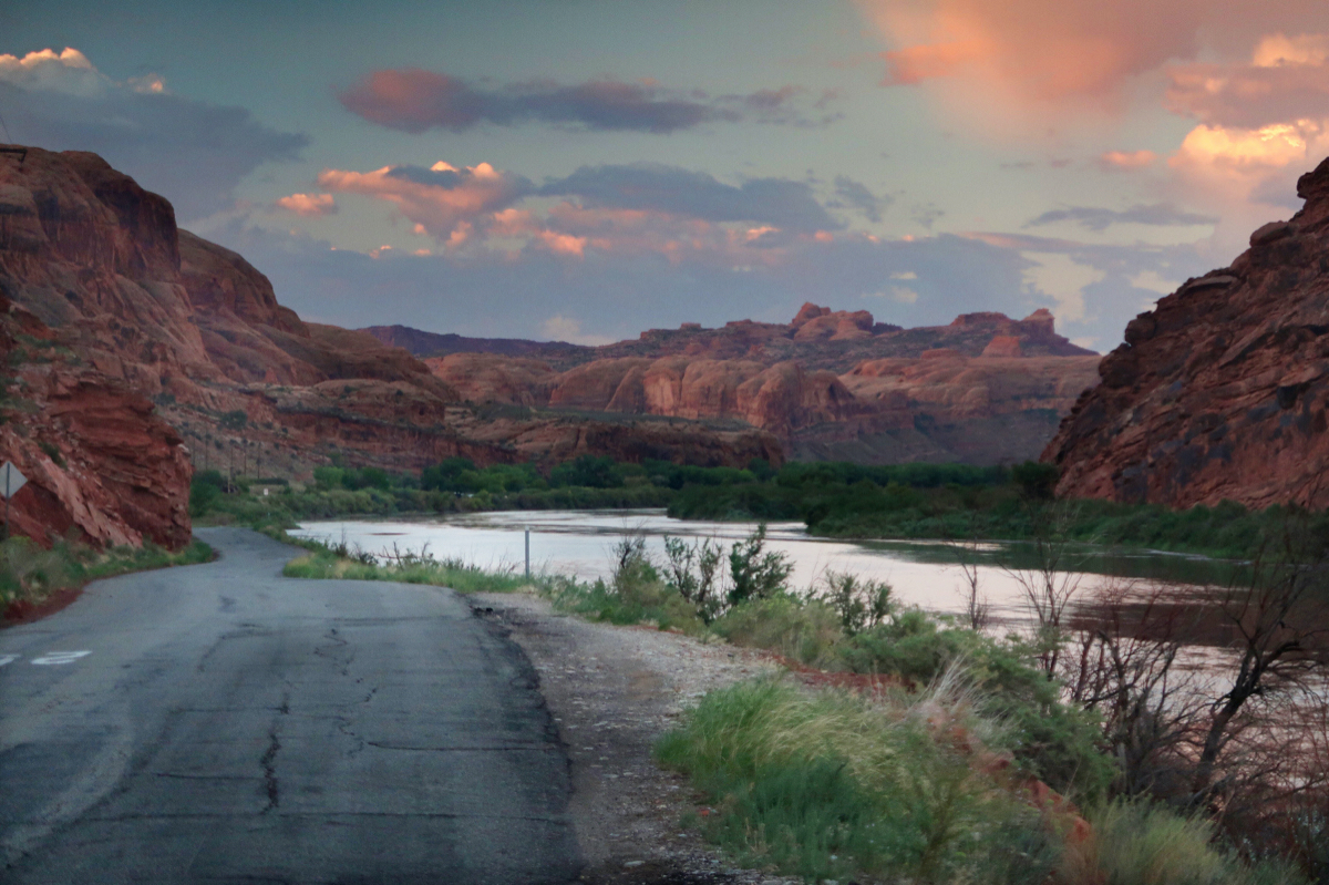
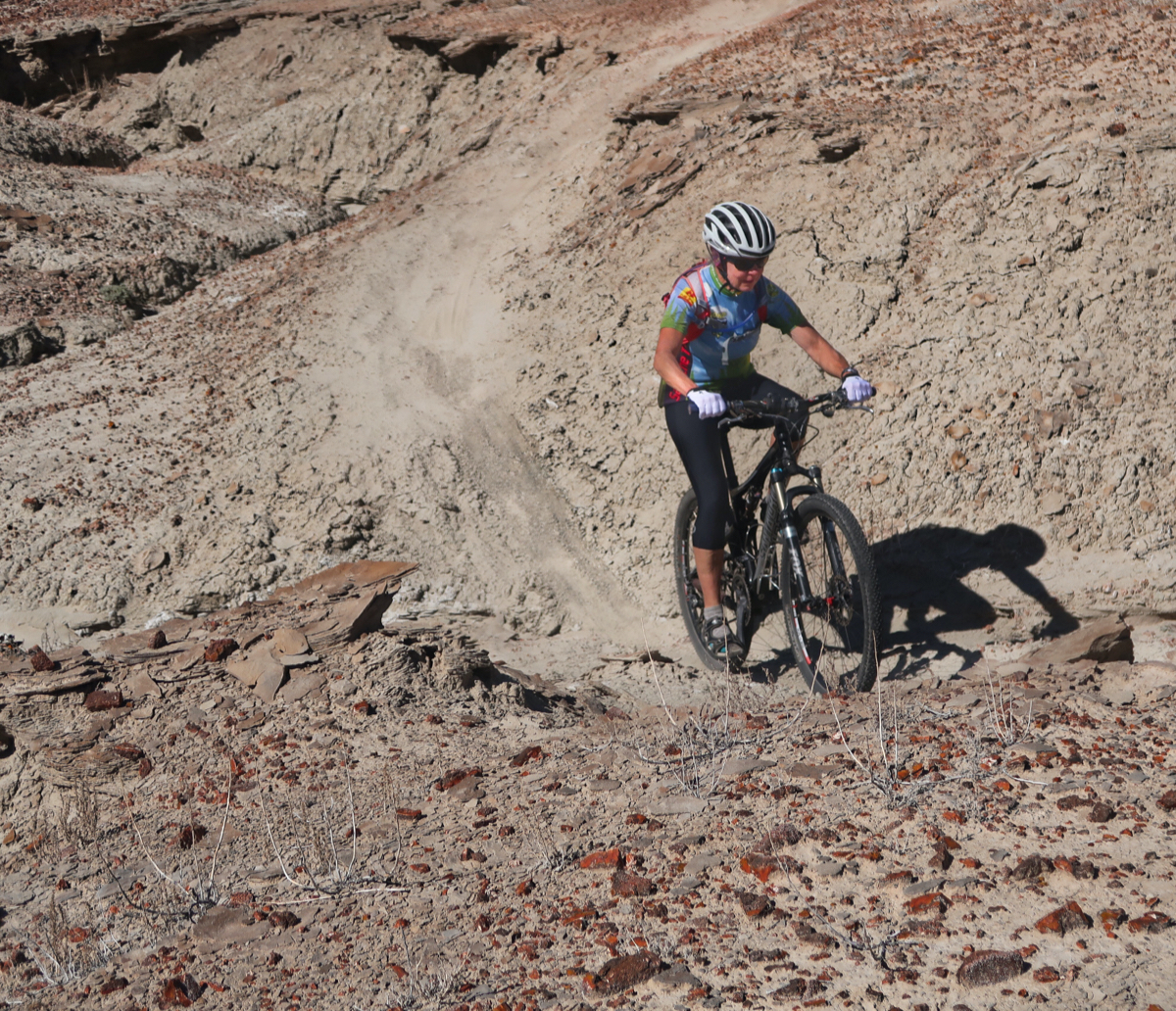
Riding along the river was tedious and slow. Very happy I had the fat bike, as the first 2/3 of this route were mostly sand. The river isn’t very accessible due to thick tamarisk – even though it is only a few feet away. I found ONE place to access it to filter 5 liters of water. I went through 10 liters today! A woman who was canoeing the river came over for the purpose of offering water. She was very nice to offer! She told me not to drink the green river water. She gave me half a water bottle (about 400mL). So I filtered the rest. Later, in Spring canyon, I found a cleaner puddle and filtered the crap out of it. I’ve been so thirsty!
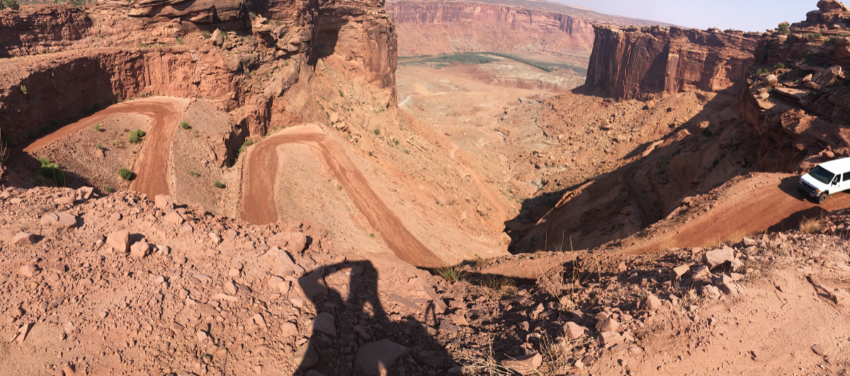
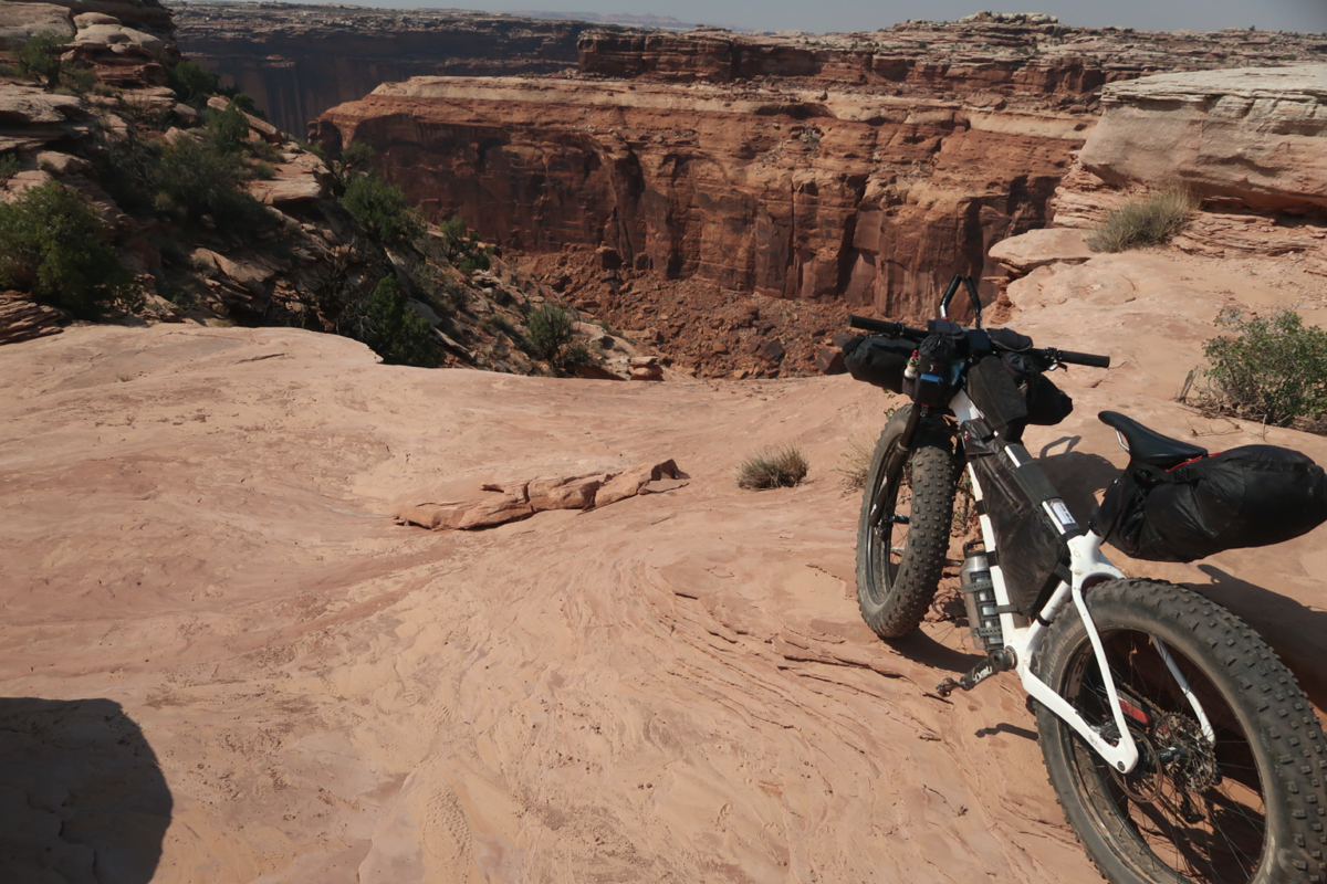
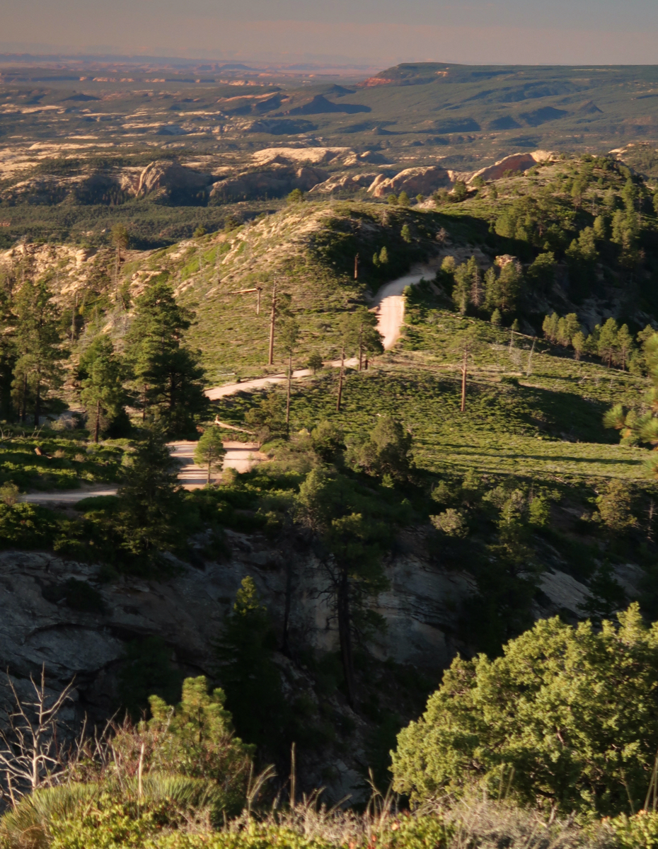
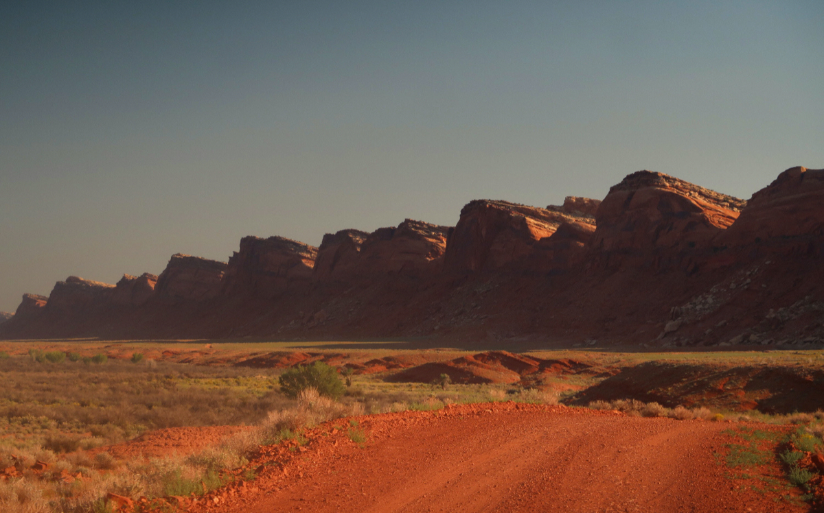
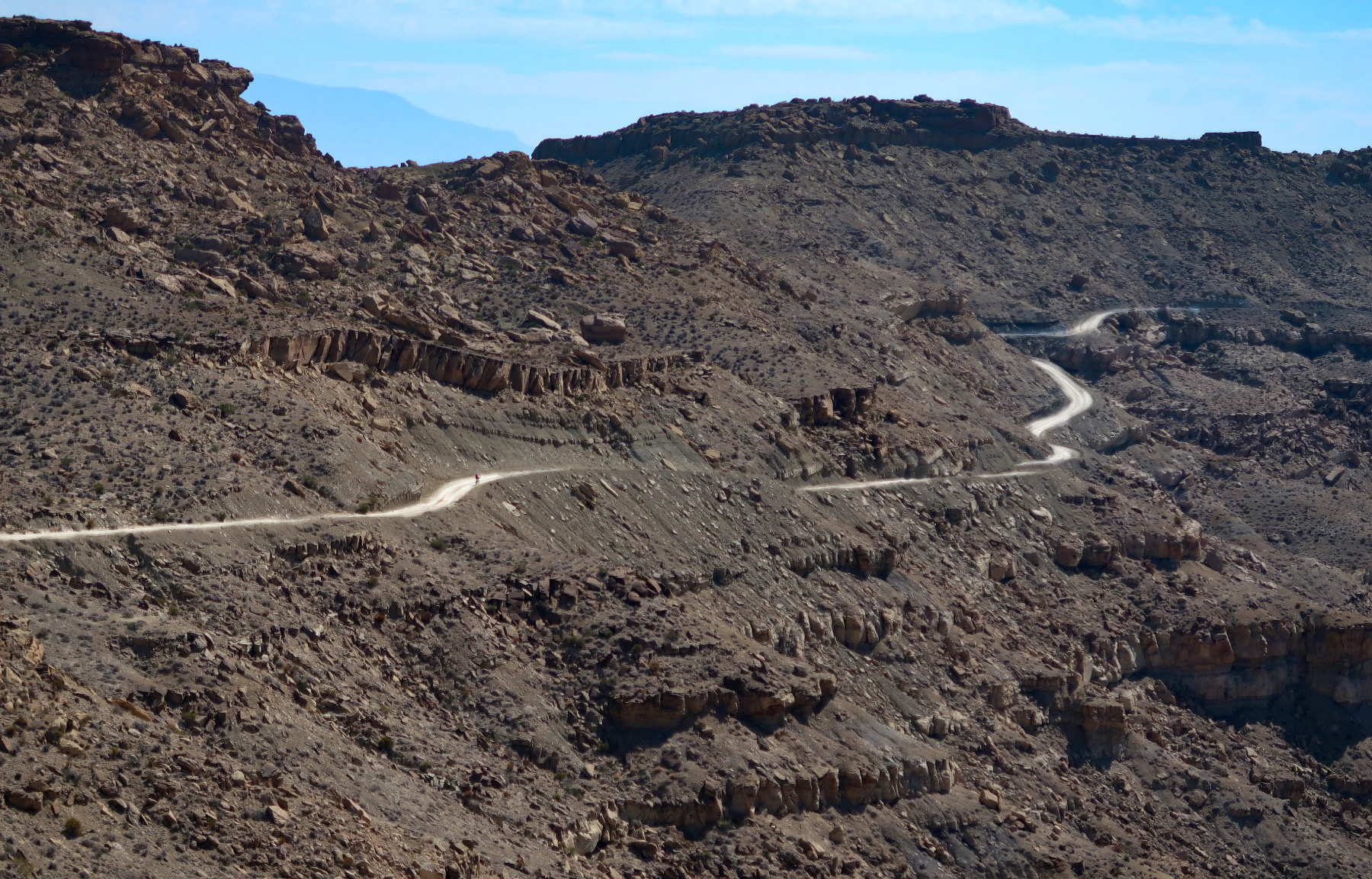
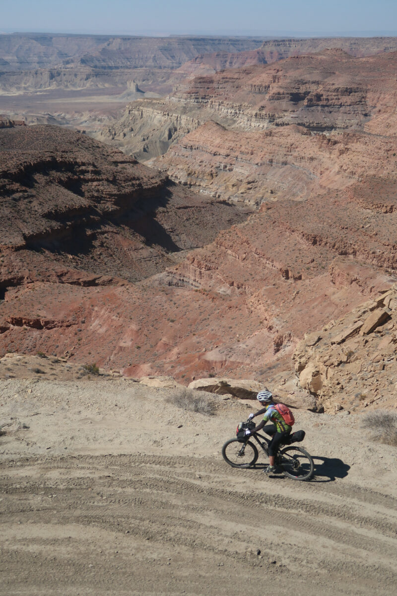
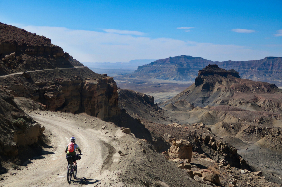
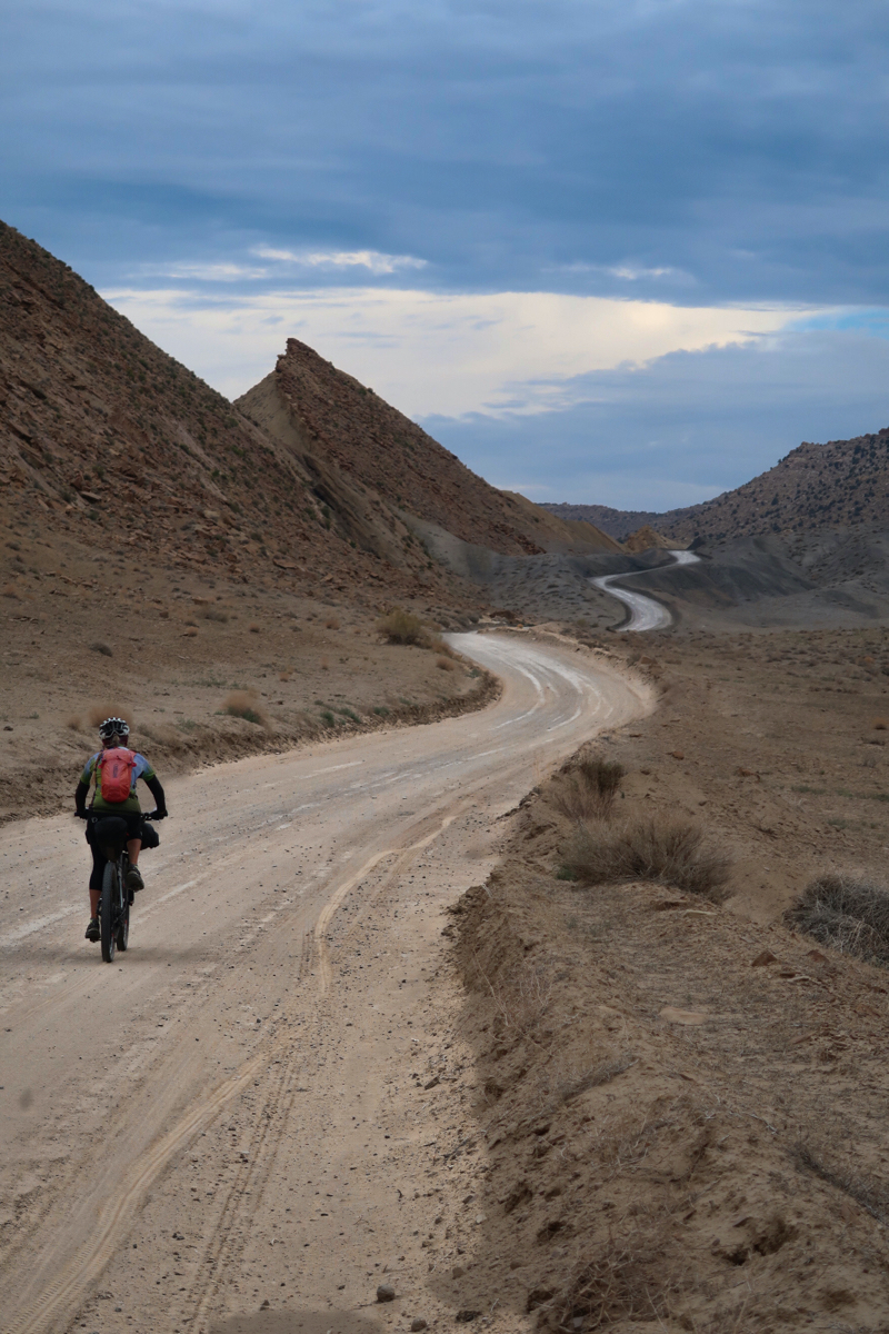
Looking down the big descent back to the green river. You can see a van that was pulling a trailer with 5 kayaks. I didn’t see any organized bike groups except for one small one near here. The cyclists looked like beginners with helmets on backwards (or not wearing any). Not sure where their van was. Those were the only cyclists o saw all day. I hardly saw anyone, which kind of surprised me. I guess it is still too hot.
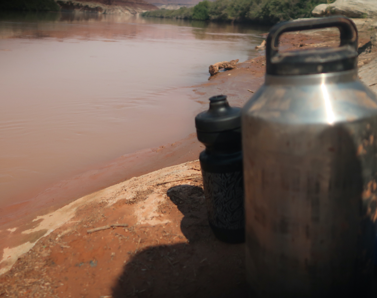
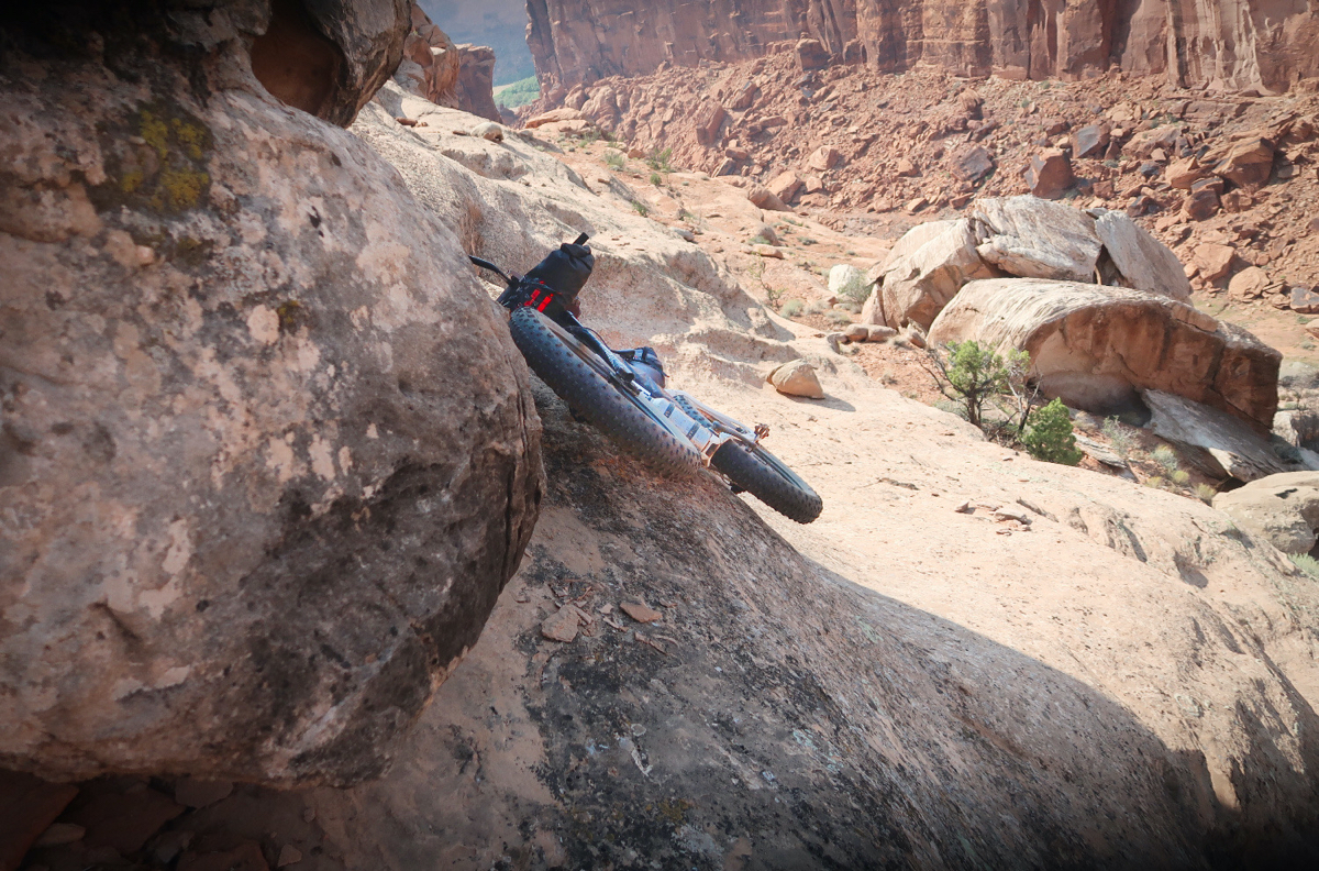
My first attempt at getting to the river failed – I was just a few feet away, but blocked by tamarisk. Finally I climbed back up to the trail, a bit worried. Then I found a series of cliffs that I thought I could descend – and the river was not choked with tamarisk at that point. I made it! Filtering muddy water is tricky – you filter a little then you have to use some of the filtered water and clean your filter. It is very time consuming but absolutely necessary! Late in the day (too dark for a picture) I filtered out of a very muddy puddle. That is what you have to do!
Today I saw about 5 parties on vehicles. Most made fun of me saying, “that looks hard” (or kept their air conditioned windows closed). But a man and his two sons stopped and asked me if I needed anything at Candlestick campground. I was embarrassed to need anything, but did ask for water, so they filled my 500ml bottle. I had just filtered that muddy river water, so the coffers were kind of full so to speak. But tomorrow is a 70 mile day with no water known. I can only make about 5 or 6 mph on this terrain, so it promises to be another long one. They also gave me 4 snack things like granola bars. Normally I eat low carb, but I can make this work! Thanks to them I got some motivation too. They were very generous!
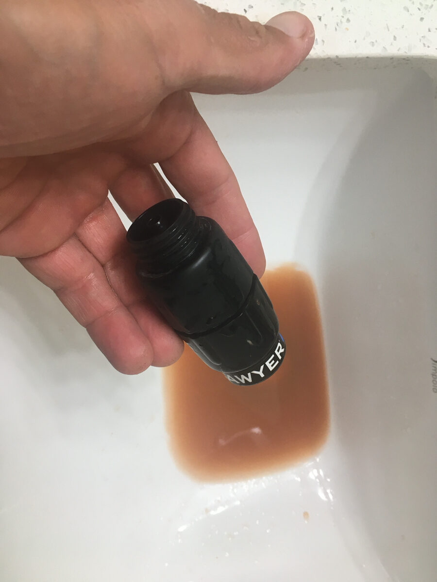
By the way, I’m pretty amazed that the Sawyer filter is still working after the mud I have pushed through it. Sure, I have to clean it every 500-1000mL, but it is WORKING, which is extremely important! Here is a photo of the third backwash once I got to the hotel. I didn’t think to photo the first, more gruesome backwash. I’ve long been fond of the sawyer products, but after this, I like them even more. It amazes me to see crystal clear water emerge after putting mud puddle water in on the other end. Sawyer Micro Water Filter Highly Recommended, and if you use the link, I may get a commission.
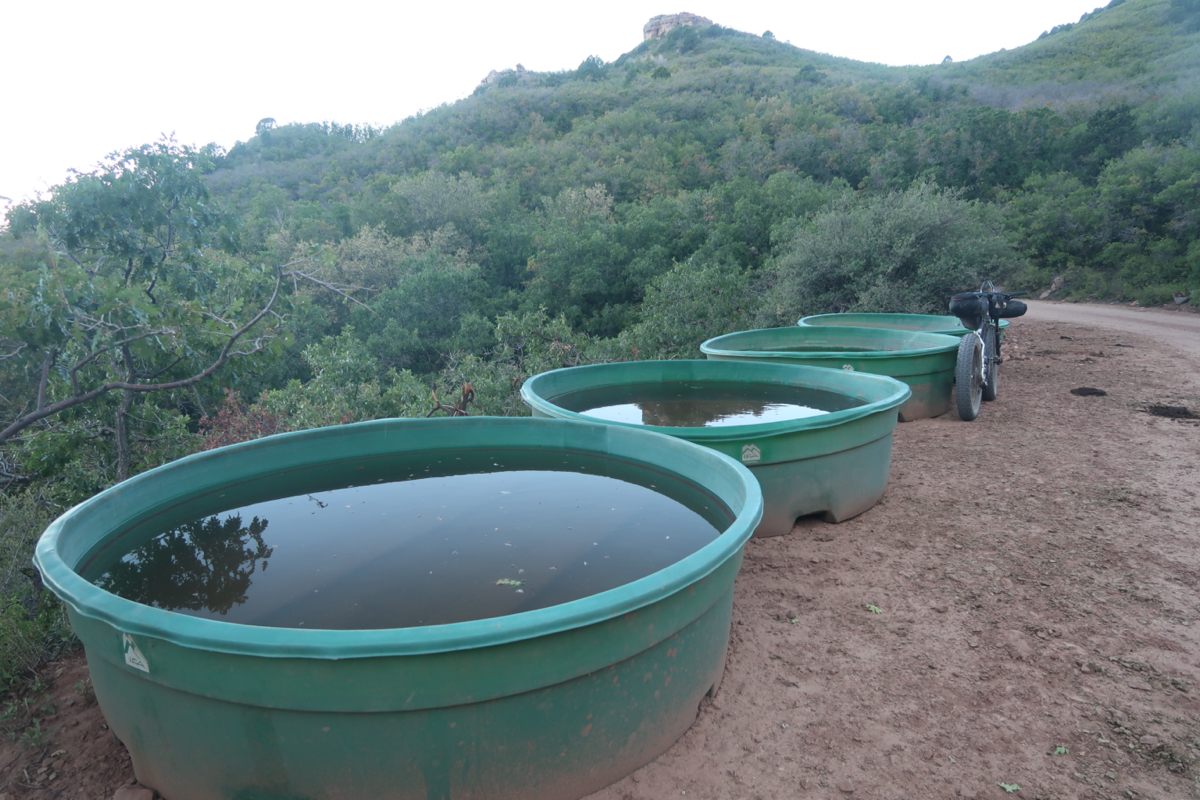
I only stopped when I could find shade – usually the shade of rocks. While resting in one of the few rock Umbrellas, a group of 3 bikepackers rolled up. Since I only saw 1 truck and 4 motorcycles on the entire route, this was kind of novel! Sue, Vince, and Brigette were doing a 2 day ride out here and had stashed some water at the pass. They were from Anchorage, AK and struggling with both the heat and the elevation. They plan to do the “San Juan Huts” tour which is Durango to Moab in just a few days – they reserved it in January. They won’t have to carry tents on that route because you sleep in a hut. Also, the huts are stocked with all sorts of food, and I guess you just eat what you want. Sue, in particular, was super friendly and had lots of stories. She told me “when you cross the water, there will be a cow trough”. Normally, this would be good information, but I wielded it incorrectly. When I crossed some water, I looked and did not see a cow trough. So, I assumed there must be another water crossing with a cow trough (a trough means non muddy water usually). Anyway, neither the water nor trough ever came. I kicked myself for not filtering the water I had seen – but later in the day, filtered from the muddiest puddle yet – found in Indian Creek.
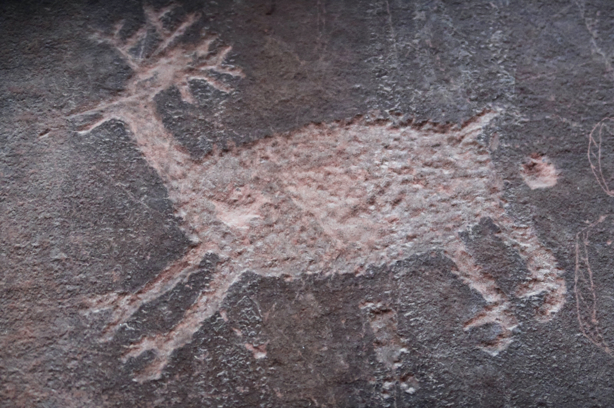
I wonder if the people who did this rock are drew in the deer poo flying out. Did they giggle after they drew it? Or maybe a vandal came along and added it after the fact. Or maybe the entire drawing was done by some kid in the early 1900s. Would we revere it on the same way of that were true? These are some of the musings you may have while playing desert solitaire.
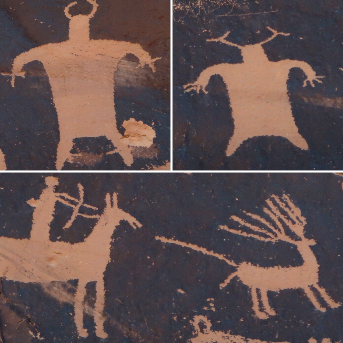
I took a quick stop at Newspaper Rock. I tried to discern what the two guys up top were. Did the artists see someone/something that looked like that, or was it from their imagination? The picture below looked more like something they might see in everyday life.
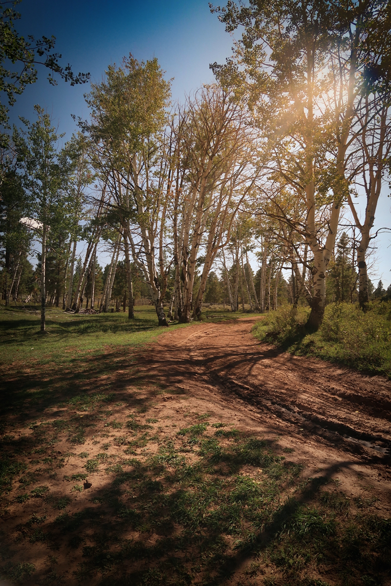
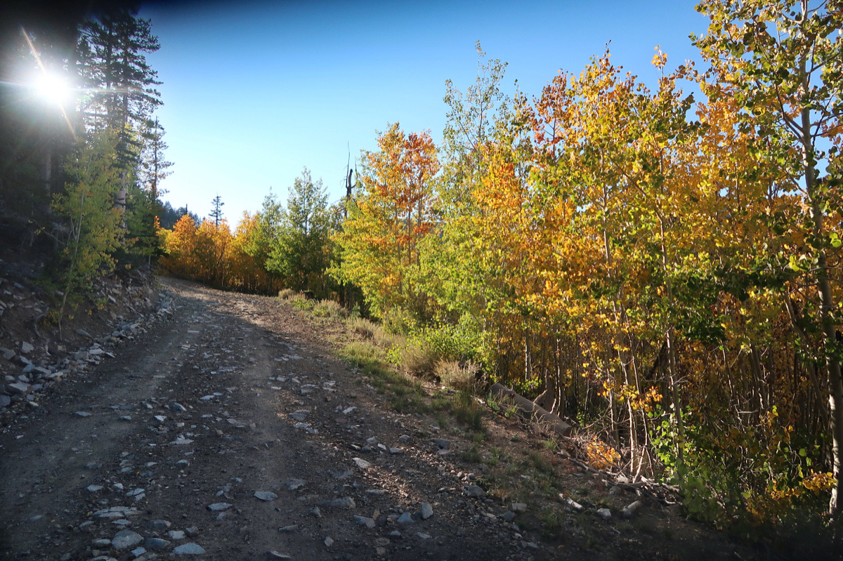
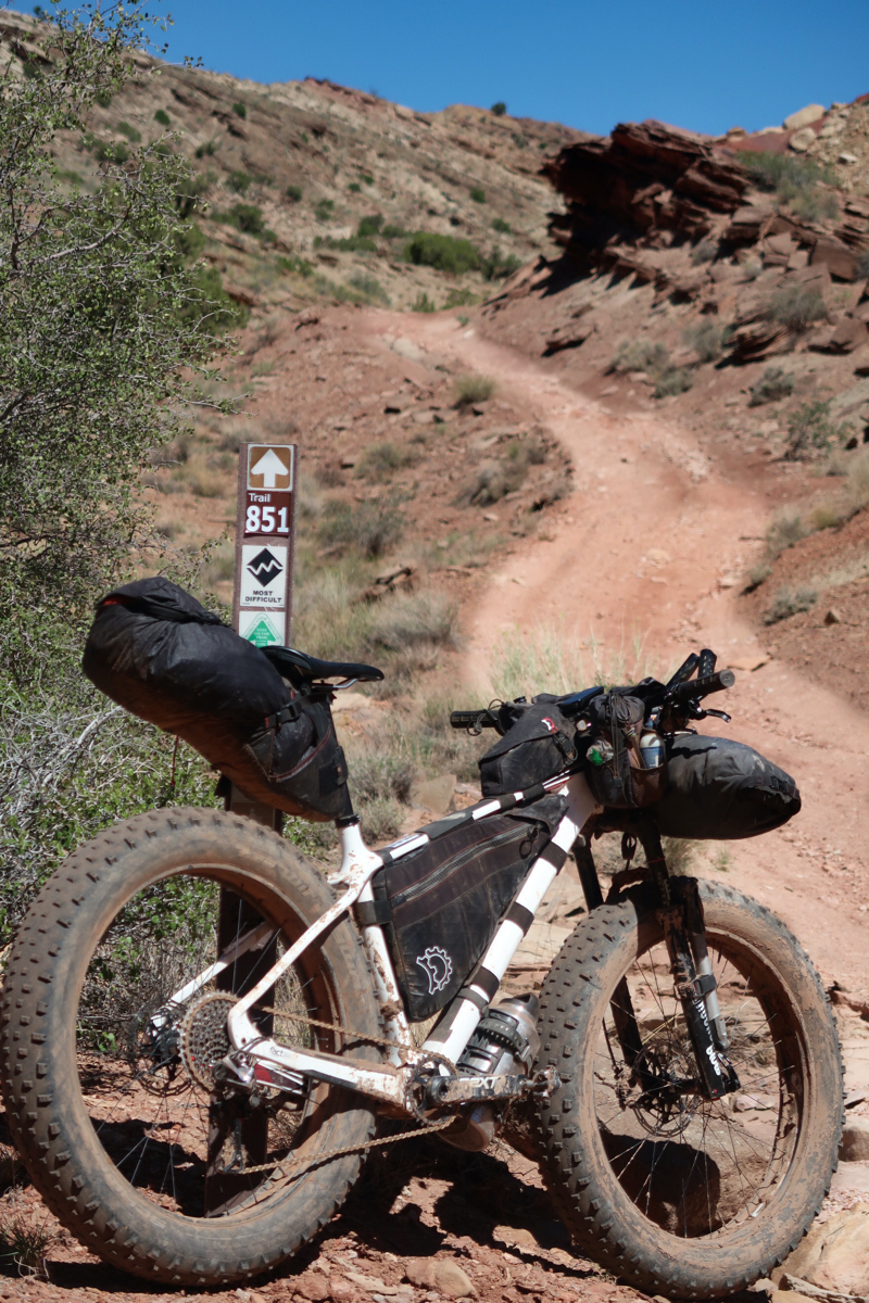
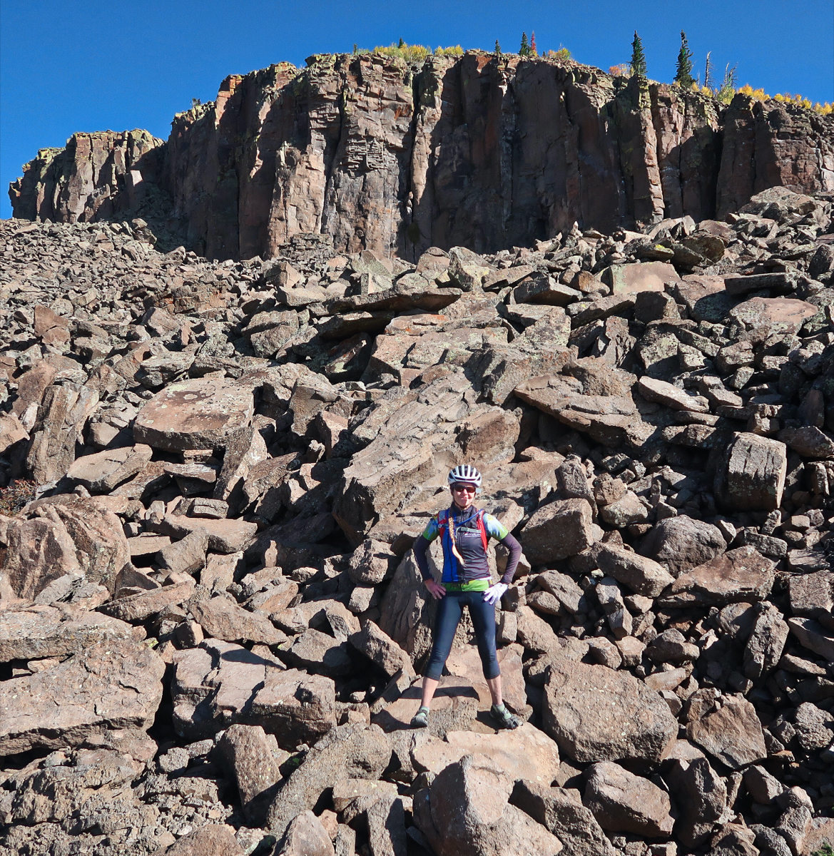
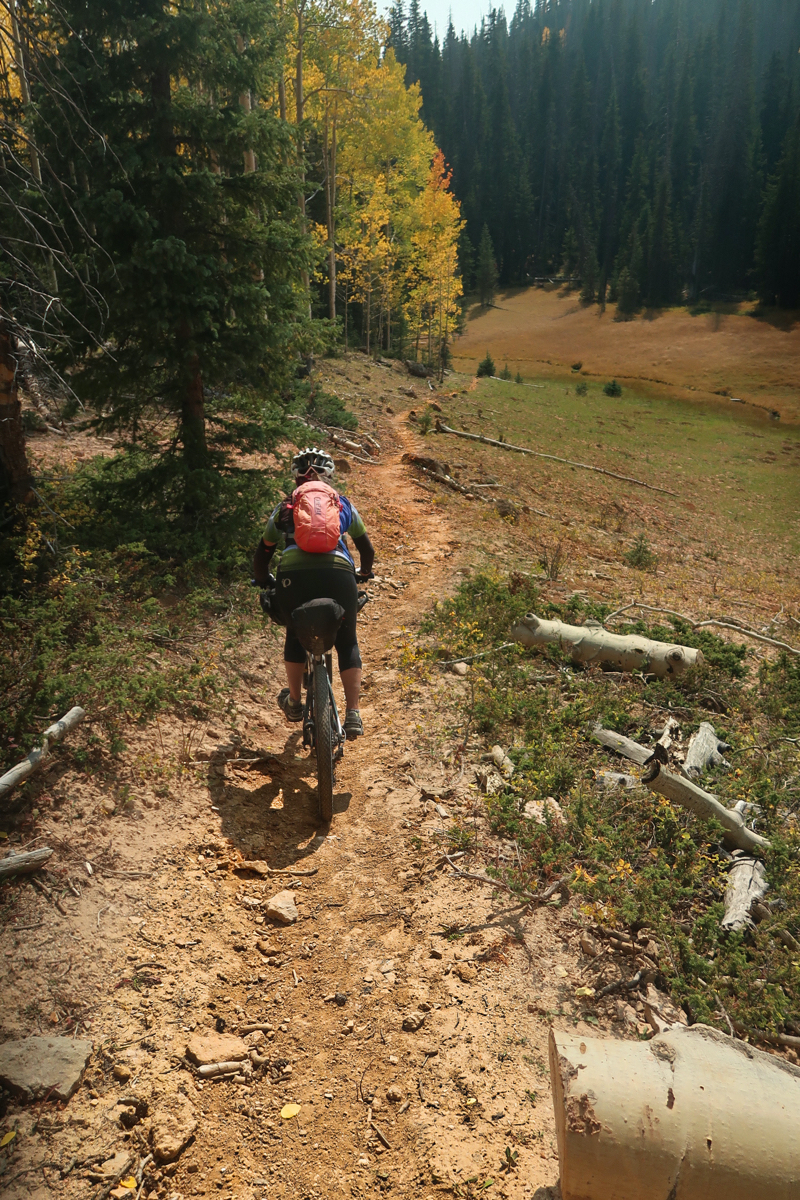
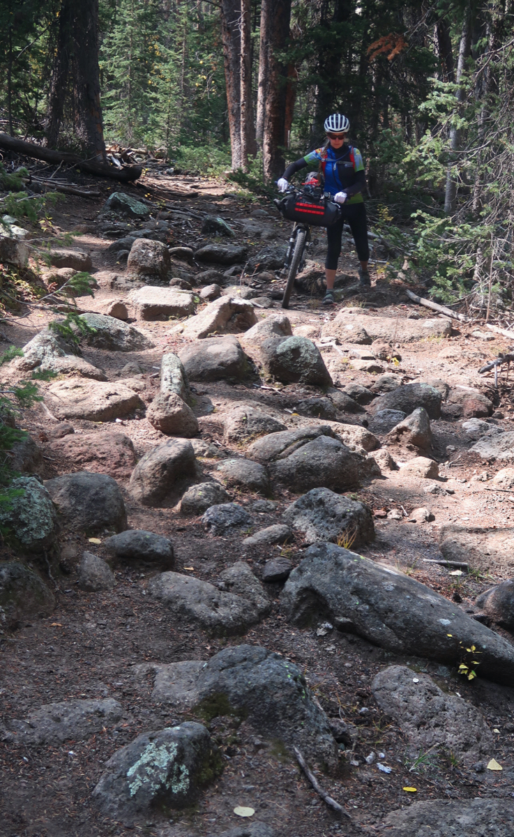
Intersection of Robinson Pasture trail and “Red Ledges Trail”. Red Ledges was not even on my map, and I did have a bit of temptation to take it (because I was getting tired of hike-a-biking). The issues with Robinson Pasture trail were: 1) it is very steep 2) there were rocks too large to ride in many of the aspen sections 3) when the trail became less steep, it was so narrow and sunken in that the pedals hit either side. I did see 3 motorcycles coming down (only people I saw) and it seemed to be fine for them.
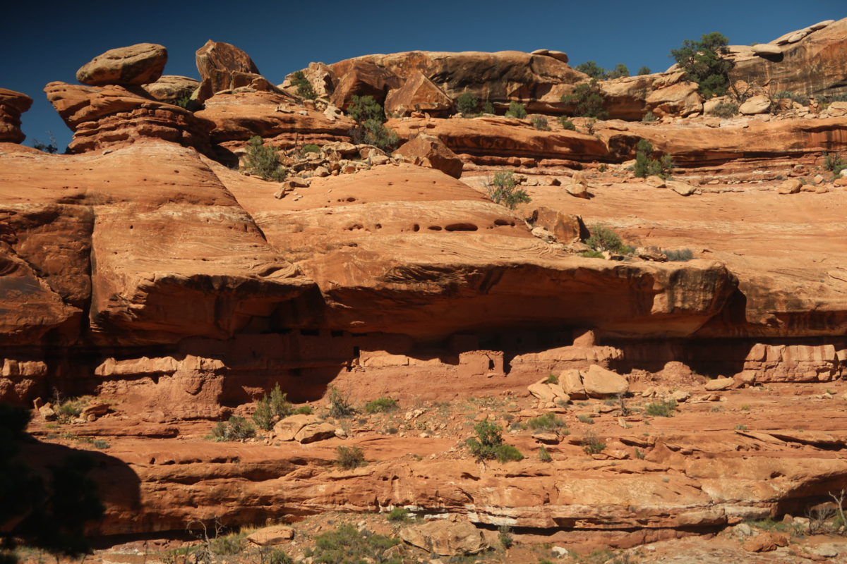
The MoonHouse from across the canyon
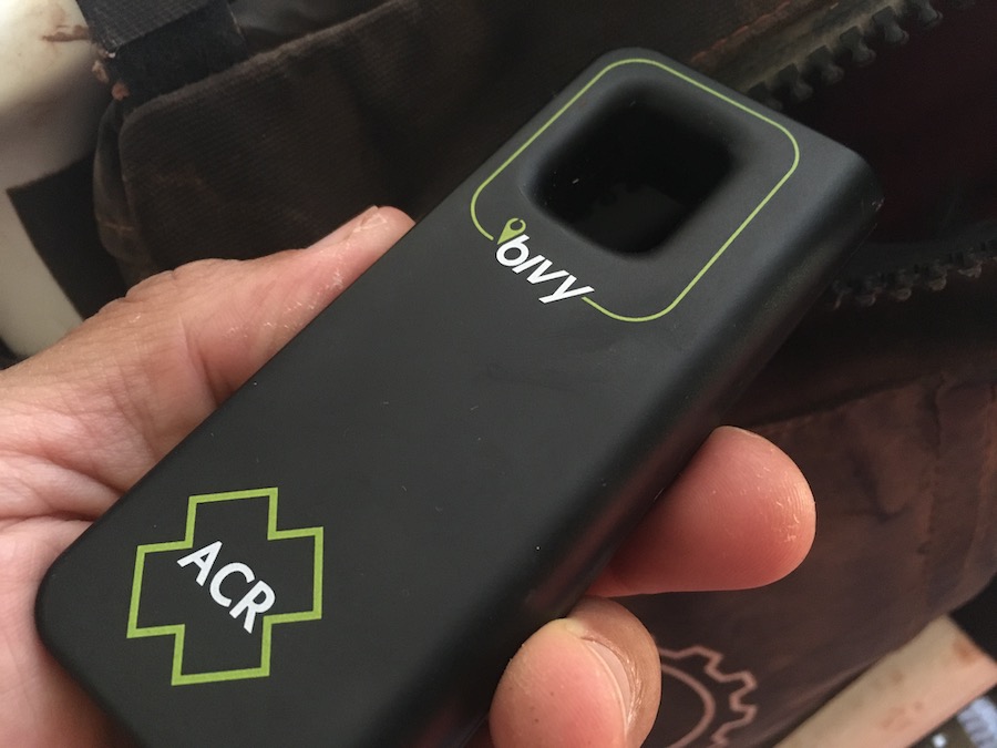
I got a Bivy stick satellite communicator which I have been using on this trip. So far, though, it appears that Utah is blanketed with cell coverage. The reason I selected this device instead of the very comparably sized in-reach mini is because there is not an annual subscription fee. By the time you pay Garmin’s $35 annual fee, that makes up the $3 per month difference between Garmin and Bivy. Plus, Bivy let’s you send 20 messages instead of Garmin’s 10 on the most basic plan. So far, it has been working – I send an “ok” message each night. It also has an 🆘 button. I highly recommend it; here it is on Amazon
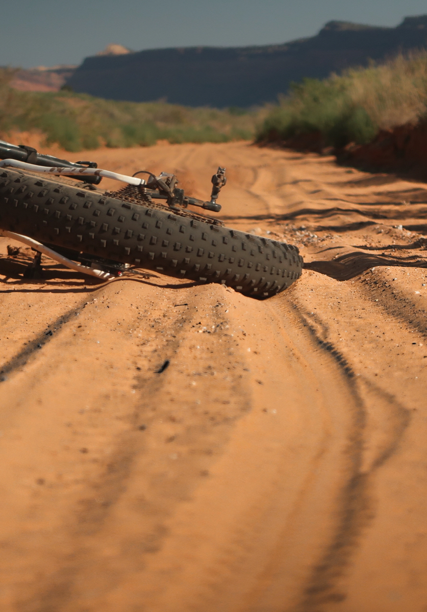
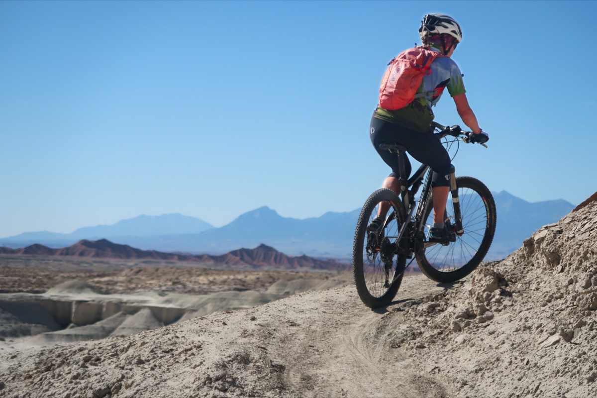
The last 20 or so miles of today’s ride were sandy like this. The fatbike brought a smile to my face because I knew that any of my other bikes, I would have had to do A LOT of pushing. This was the perfect day for the fat tires. Yes, on the White Rim trail, a 29×2.2 full suspension would have been optimal – but today (and along the “Hey Joe Safari” (day 1), fat was the optimal bike.
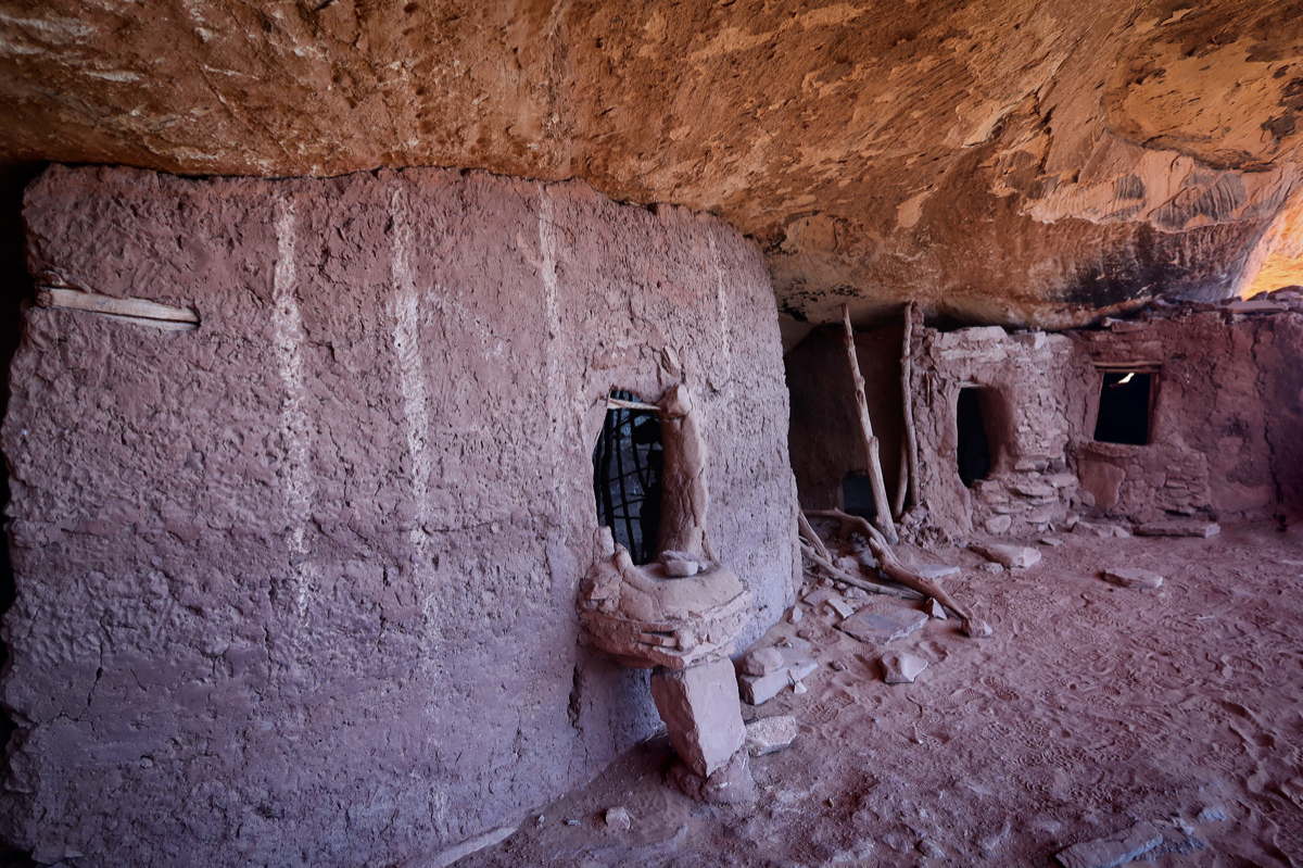
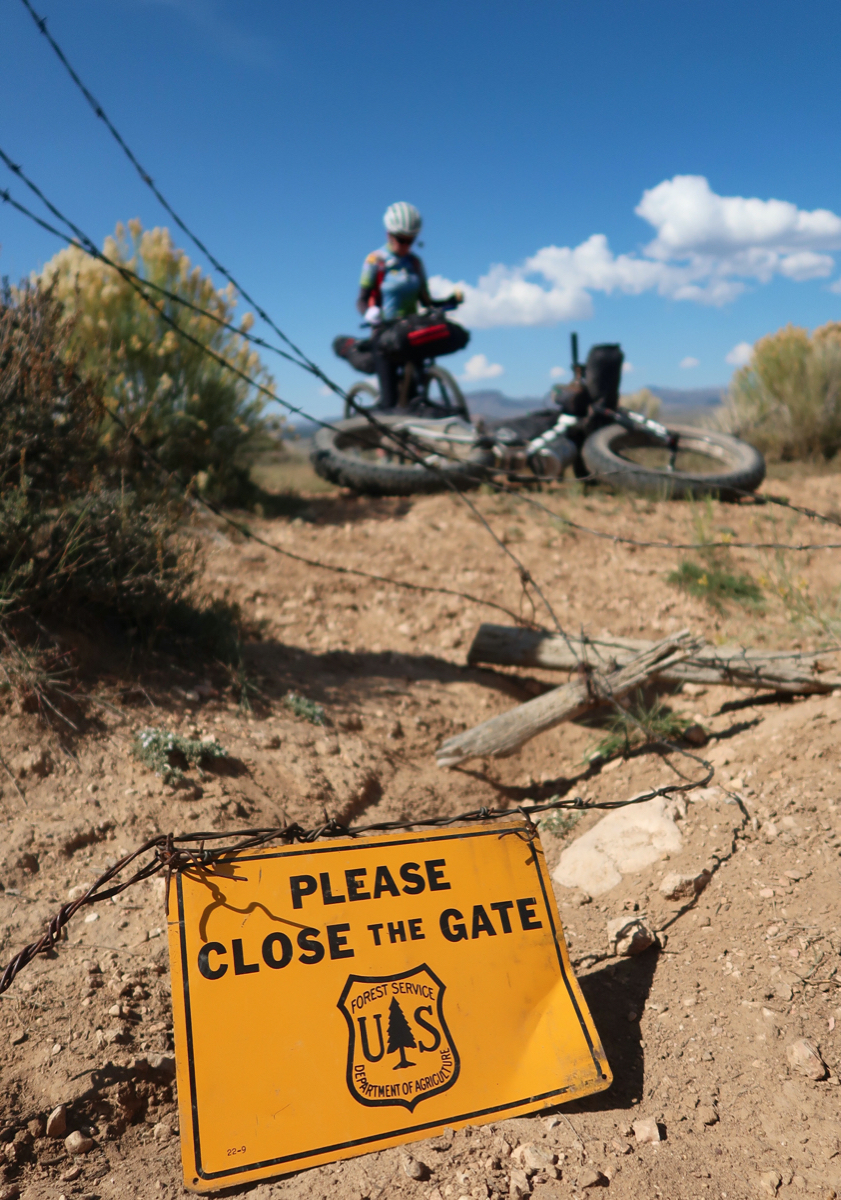
I took a side trip to the moon house. You need to ride to the end of the road and then hike across a canyon. It seems like they are trying to keep it a little secret – it’s not on any maps! It made me extra happy today to have a cool “destination” – much of the ride so far has been just following the route. Heading here made the day feel more adventuresome. You’re supposed to get a permit to hike here – but the office was closed (see below) when I arrived. Along a long sandy road, there was a register – and the last signature was two days ago – the previous signatures commented that “there are no fee envelopes in the box”. The signature from 2 days ago was signed BLM Patrol and their comment was “make your reservation on recreation.gov. I checked and I had no cell service (nor had there been any 20 sandy miles ago). So I went without a permit – making sure to respect the site, leave no trace, and not climb on the structures.
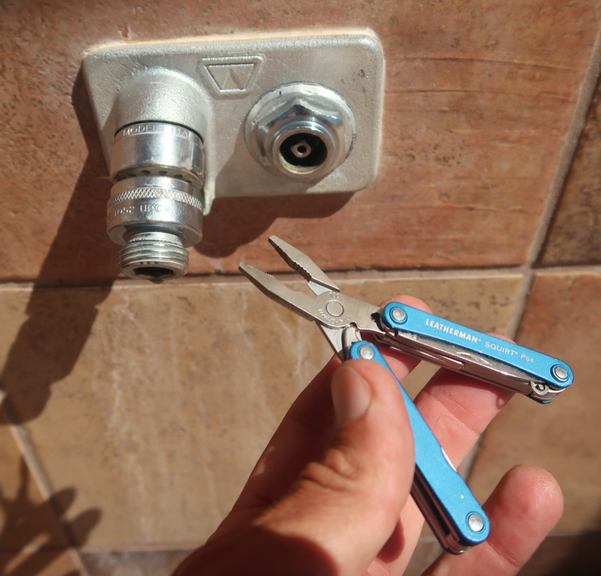
My only known water stop for 36 hours: a ranger station. I got here and you could see where they had unbolted the drinking fountain. Plus, the office was closed due to COVID. The sign in the window said someone would be there from 9a to 12p… and to knock and they would give you info in the parking lot. Of course no one was there – so I was extremely happy to find I could open the recessed square valve with my pliers. I would have been in big trouble without this water! I filled up 7 liters, but later noticed a lot of sediment at the bottom of my bottles. Apparently this water was not filtered like comes out of my filter. I sure hope it is safe to drink.
I’ve already consumed lots of Audiobooks on this ride: “The Unbearable Lightness of Being,” (M. Kundera) “Teacher Man,” (F. McCormick) “Dawn Light,” (D. Ackerman), and “All the Pretty Horses,” (C. McCarthy). My favorite of the four has been “All the Pretty Horses,” because I feel a bit like the main character as he rides his horse through Langtree, Bracketville, Del Rio – all places Janet and I rode (bikes) in Texas. He then crosses into Mexico – and that is where the adventure begins! I won’t tell more in case you want to read it. I’ve also been listening to all sorts of podcasts – and one I didn’t expect to like so much was Lance Armstrong’s “The Forward.” I think he is a great interviewer and really seems to bring out the best in people. I liked his interview with Ryan Hall (and how Ryan and his wife Sara adopted 4 sisters from Kenya; the oldest was 13 when they adopted)… and another good episode was when Lance went to San Quentin Prison and met with some former inmates – definitely a show of redemption!
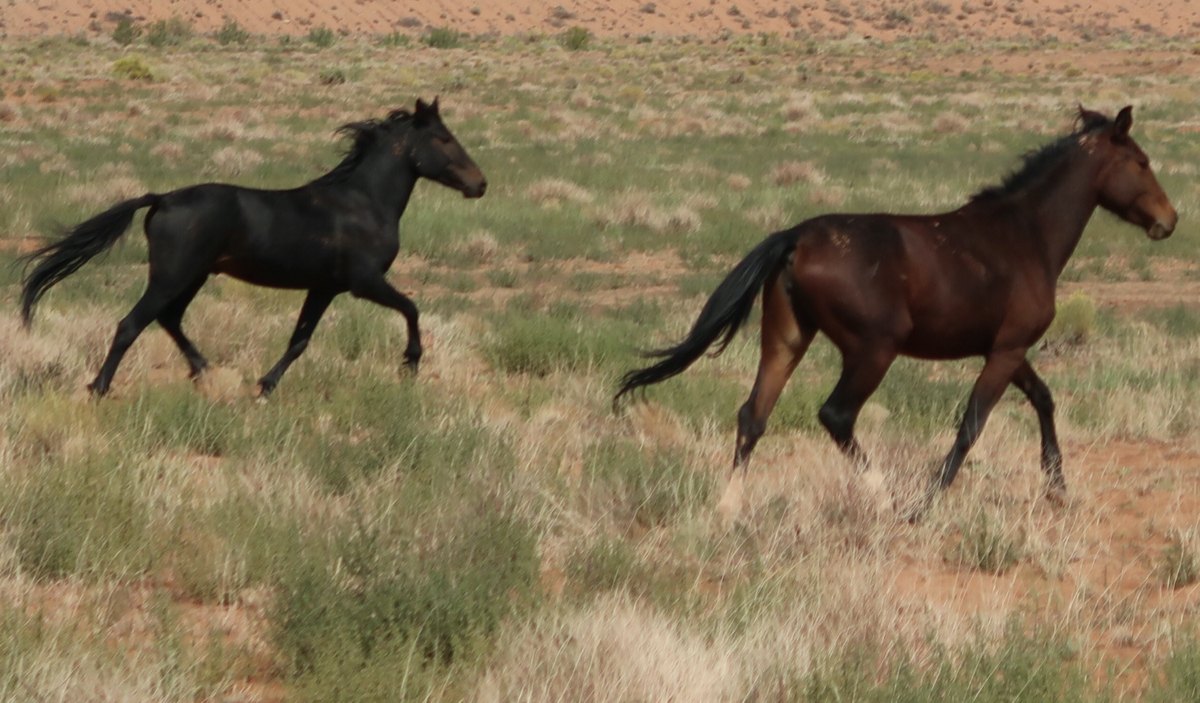
At the end of the day I got to my hotel and got intercepted by a guy who was on a trip to photograph wild horses. We chatted amicably for a long time, but maybe he was a little too much because then at dinner he wanted to tell me the same stories over again. He is 72, takes 32 pills a day, is very overweight, and he pays to go on guided wild horse trips for photography. He knew many of the places where Janet and I had seen wild horses. We agreed a lot on various conservation topics – but we did disagree on vaccinations. He had been in the Army, so therefore he doesn’t trust the government. He rides a class 3 eBike, and his brother holds the world record for speed while water skiing (though he split his pelvis 13 inches from parachute cords while trying to slow down). He survived.
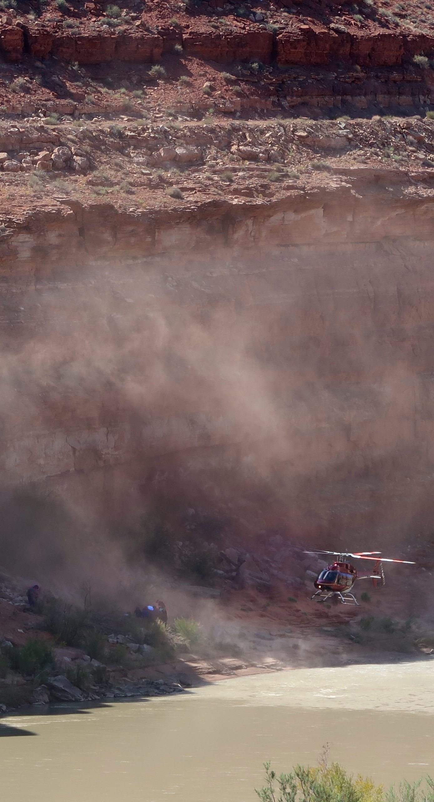
Big excitement at the hotel. All these cop cars were swarming the hotel and people were looking around with binoculars. I was busy doing my laundry, so I missed seeing this fugitive who the cops were chasing. Apparently he was running away and finally got tired and FELL OFF THE CLIFF. People said he survived because he got up afterwards (briefly) but people figured he had broken bones because he went back down after that. You can see the paramedics down there.
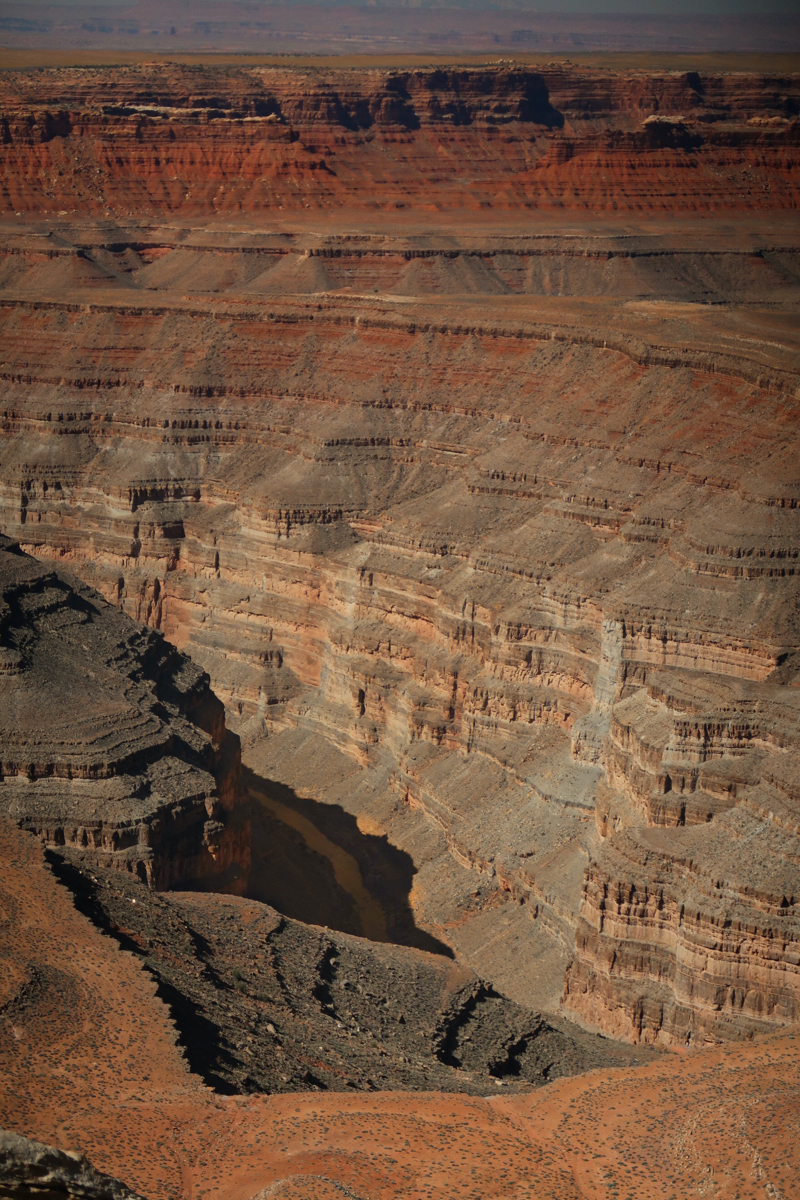
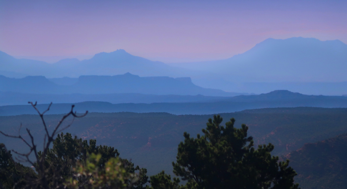
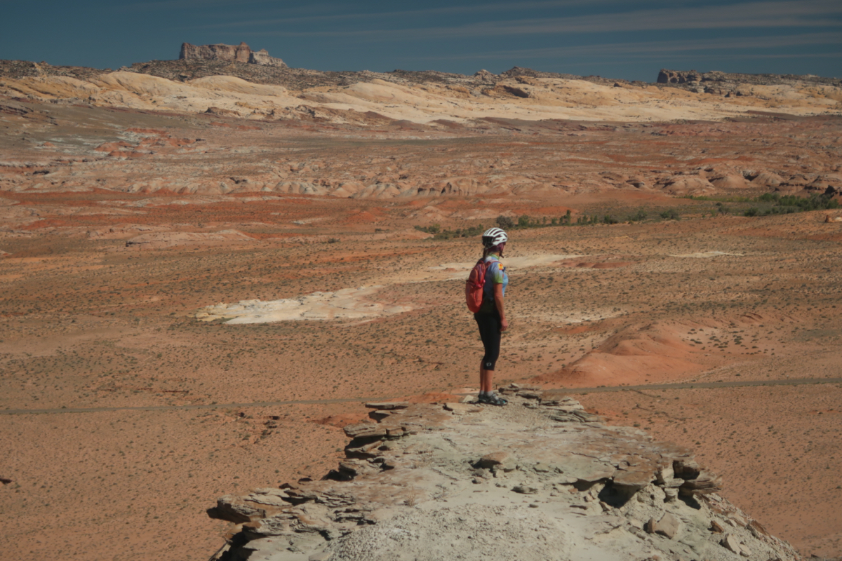
One of the views from Muley point. I don’t want to inundate you with photos, so only posting one. It was super scenic, but somewhat detracted by the two guys having an argument. One wanted to leave, and the other wanted to keep looking at the scenery and taking photos.
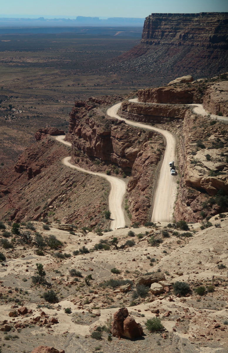
Climbing the Moki Dugway to get to Muley Point. Very scenic and easier terrain than what I am used to (graded road; those trucks down there are removing rocks from the road).
I’m briefly back up to high elevation again today. It took longer for the air to get hot today, so I avoided the major heat. That made me feel better. Also, I’ve been eating more fat and protein (I’d been experimenting with carbs (fruit) and pescatarian over the summer). Whatever the change is, I’ve been feeling back to my old self the last 3 days.
Riding up Comb Wash was a delight. This kind of sand normally means pushing on a regular mountain bike – but was actually quite easy (even as a climb) on the fat bike!
The Comb Range. I have a guess as to how it got its name.
Excited to be heading to Hite for my last resupply. The next place to get food is my hidden box. I’m entering the most remote part of the trip now.
Near the nadir of my route, there is a hotel on hwy24. Last time I passed it in 2018, it looked closed – but it was only 0.5 miles out of the way today, so I went over seeking food. It looked closed again; mud from the recent floods in the driveway. I peered in the window and saw a fridge with sodas and the wifi password “visit2021”. A young woman came out the door of a hotel room. I asked if she could sell me any food. “No”, she replied tersely. “I have cash,” I insisted. “No”. Then I asked if I could buy two Diet Pepsi’s. She obliged, and returned with two cans and asked for $2. I drank the sodas and used their (fast) WiFi to download podcasts. The sodas tasted like carbonated water! I looked at the bottom: Exp Sept 2020. I didn’t know aspartame could lose its sweetness, but it was gone. Luckily, the 35mg of caffeine (each) hadn’t broken down, so I had an enjoyable ride into the dusty desert after that. Caffeine Content According to Memory: Diet Pepsi: 35 Diet Dr Pepper: 42 Diet Coke: 55
Near the end of the day, I came to a spring named “Birch Spring”. Many of the springs that I had researched have been dry, but this one was dripping! Unfortunately, it was down a steep cliff overgrown with thorny plants. I had only consumed 2.5 liters today – thanks to the cloudy skies, so didn’t really need water. This compares to the whopping 13 liters I drank yesterday in the heat! Temperature makes a huge difference in your water needs and performance.
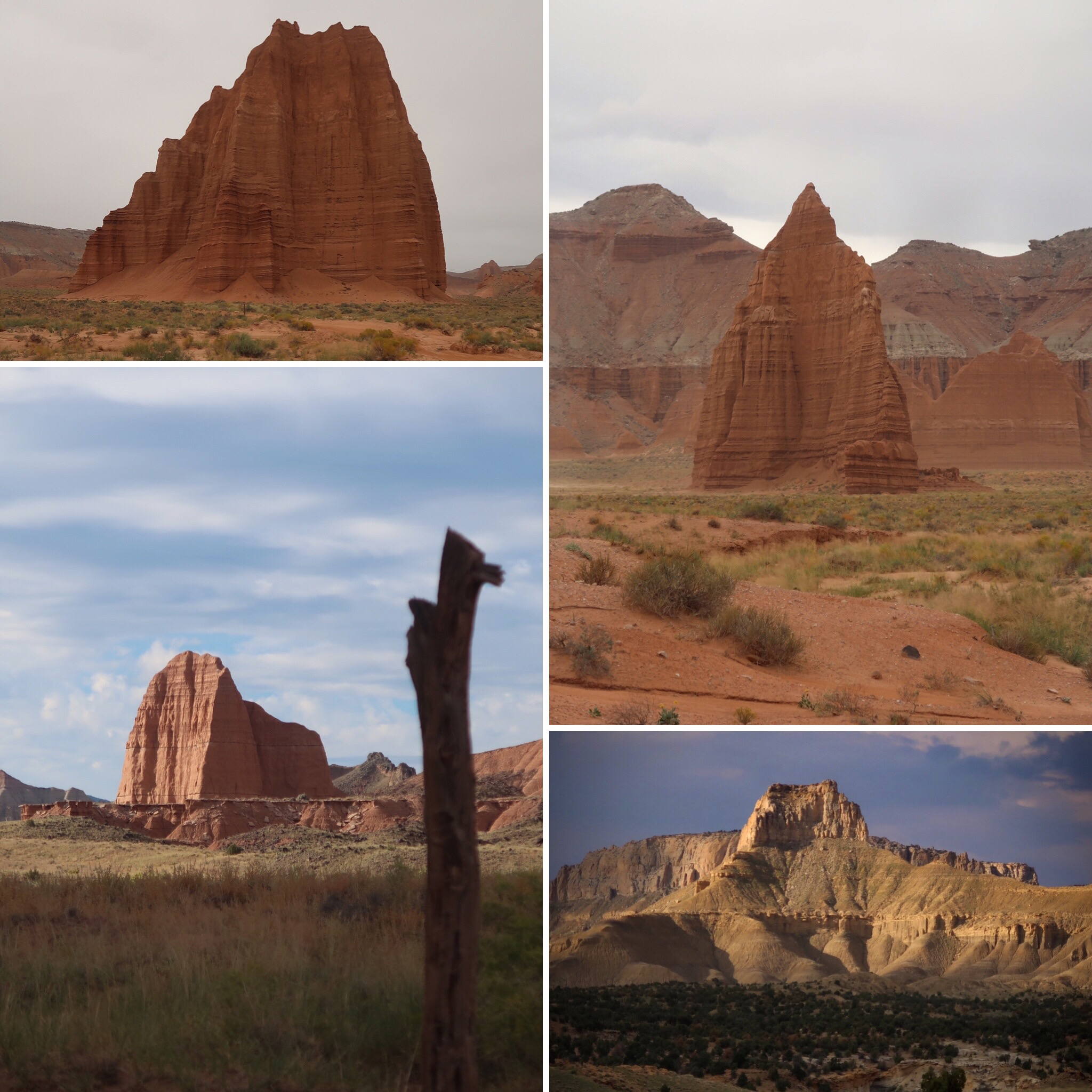
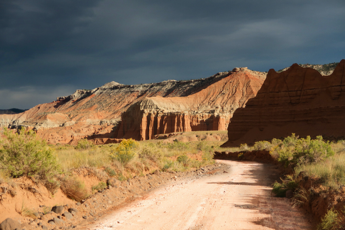
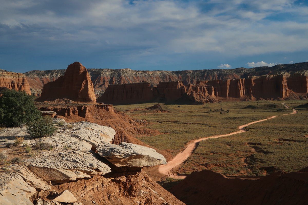
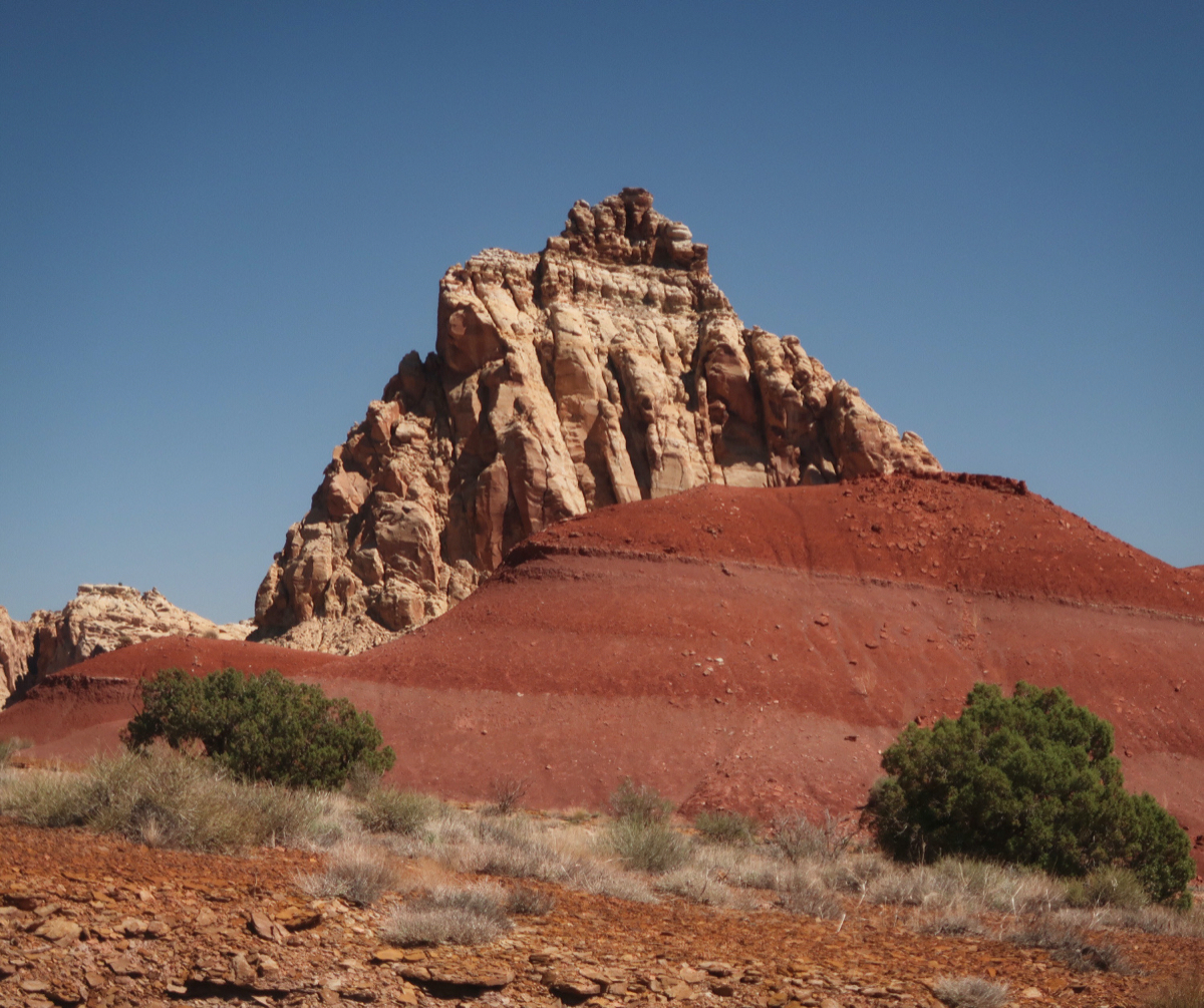
Some of the land formations I visited today were Temple of the Sun and Temple of the moon. As well as several unnamed precipices.
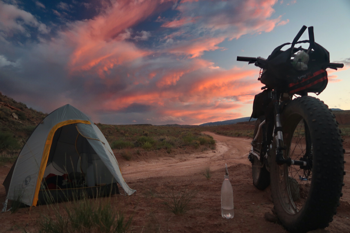
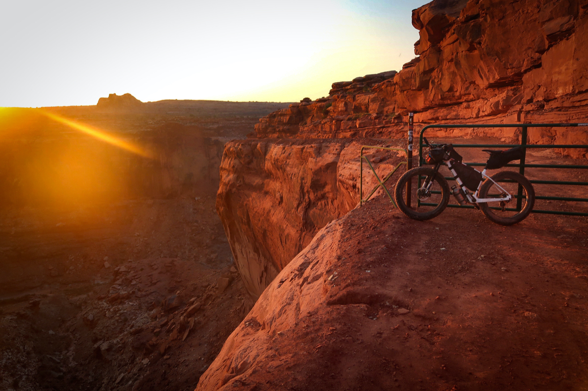
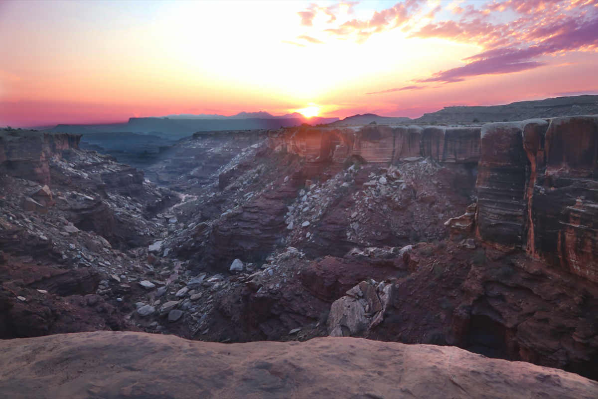
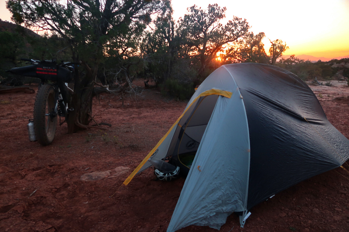
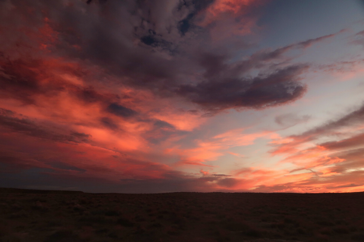
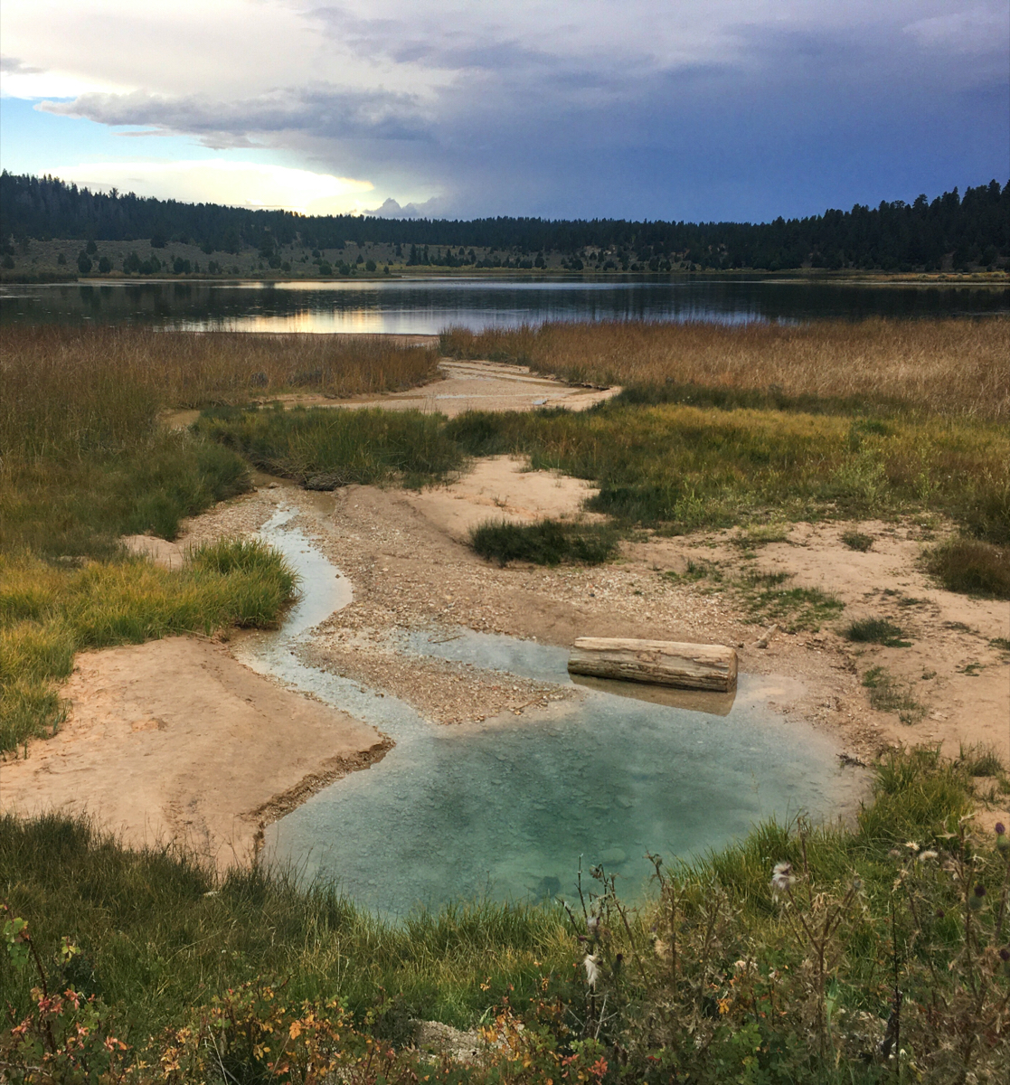
For a few minutes, I enjoyed this amazing sunset while eating the dregs of my food for dinner (2 cans of tuna and a small piece of cheese). I took this photo using the polarizing filter on my camera, which brought out the variegated colors in the sky.
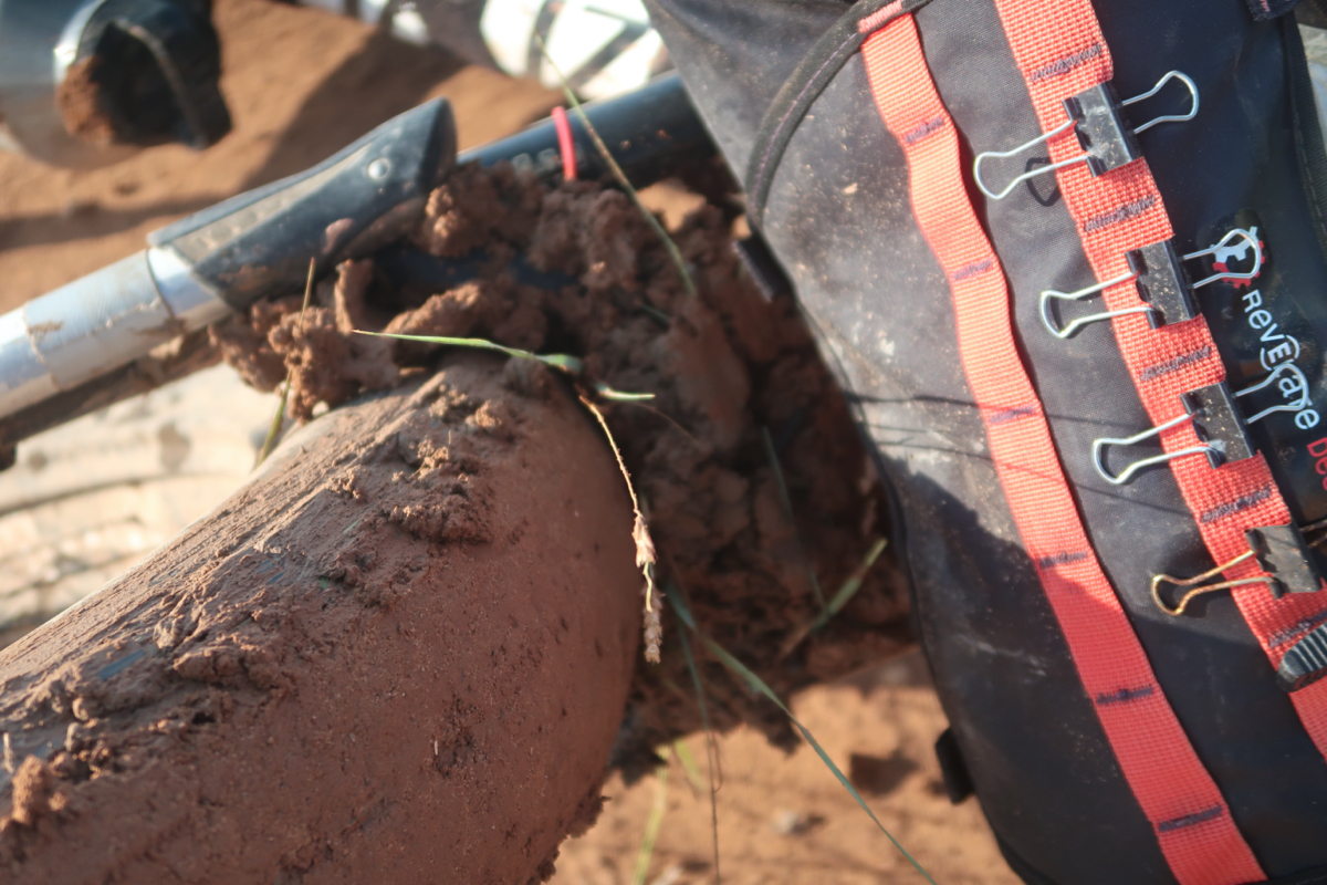
Well, on the bright side, I did not encounter any significant mud yesterday- in spite of riding in rain for 3 hours. I feel lucky because had I known about this mud, I would not have slept as well last night – dreading this apocalypse. Also on the bright side: I refrained from shouting the “f” word all morning. (Fun).
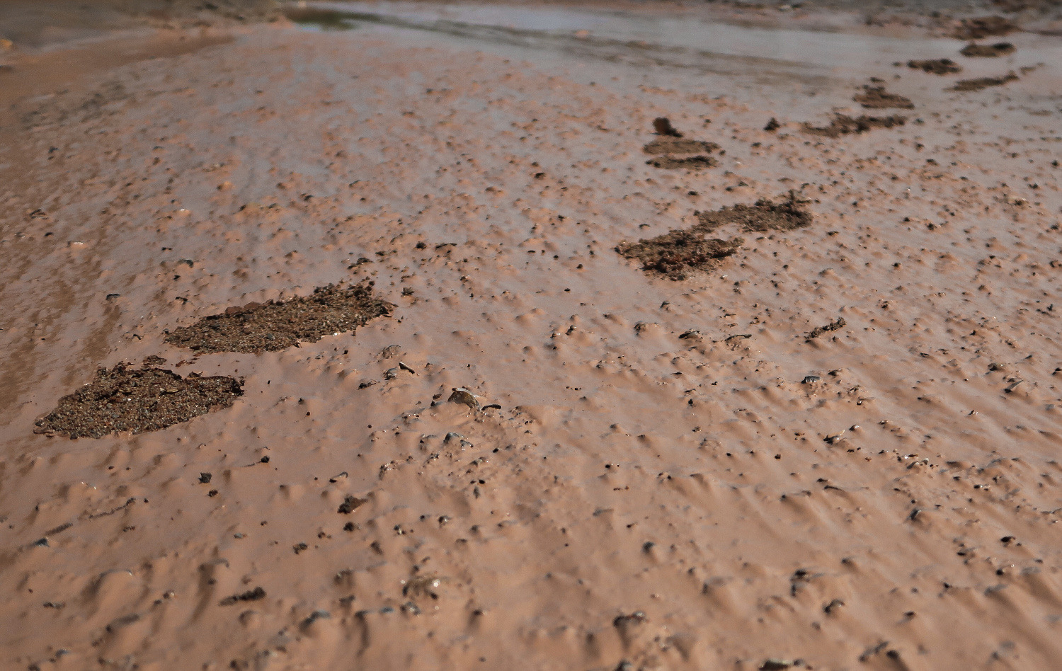
Do you remember the parable where Jesus and the man are walking together, and the man looks back and queries: “but if you were walking with me, why is there only one set of footprints?” Jesus replied, “That was when I carried you”. I wish that Jesus had carried me over some of this mud, but instead I assumed Jesus’ role and carried ‘ol fattie. Hope he appreciates it.
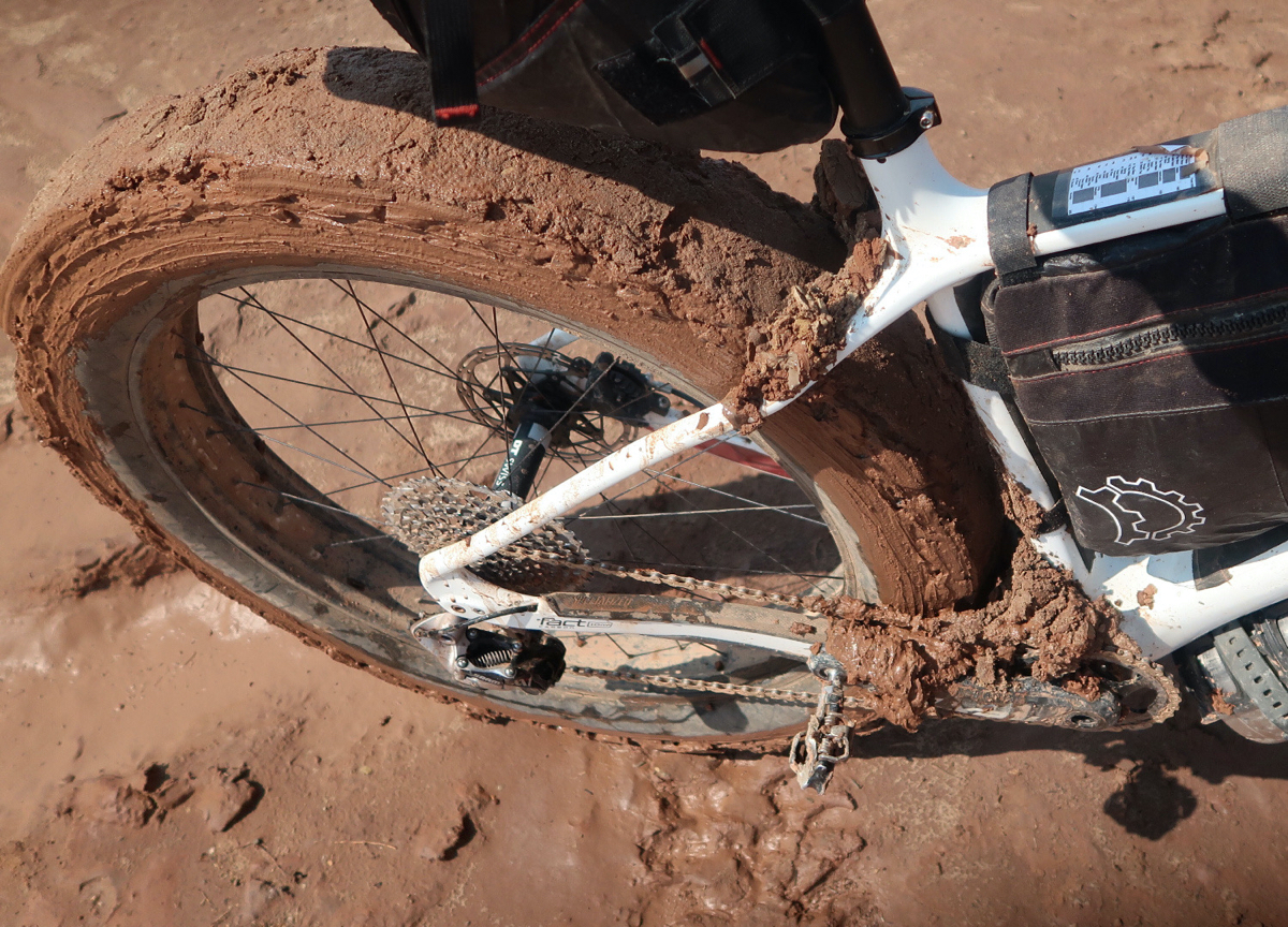
Because of the constant mud, I began to realize that my planned route was going to be miserable. I was only able to manage 4 miles every hour – often carrying my once heavy – now MUCH heavier bike. Clipping in was no longer an option, with 2” heels of mud glued to my sandals.
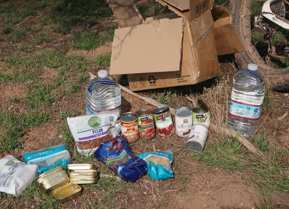
Dear Past Self, well I’m disappointed in how well you know Future Self. Good move on the canned veggies- Future Self was craving the crap out of those. But why didn’t you put in a can of Diet Coke, you goodie-two-shoes, you! *For the litter enthusiasts amongst you, Janet will be coming by in an elaborate plan to remove the partially emptied food cache box!
The “Stone House Lands” route still looks to be my favorite of the 5 bikepacking.com routes I have linked together on this trip (one more to go)! I’m not done with it yet, but the scenery and stuff to see has been outstanding. The difficulty is high with all the remoteness, sand (and mud today). I’d consider doing it again because I missed ~20 miles due to me bailing out to HWY70 today. Still more to do tomorrow, though, so maybe premature granting this award. I also liked the “Cedar Mesa loop” which has stuff to see – and is the easiest of the 5 routes. I didn’t really like “Hey Joe Safari” because I think it could be changed to be better fun and less dangerous.
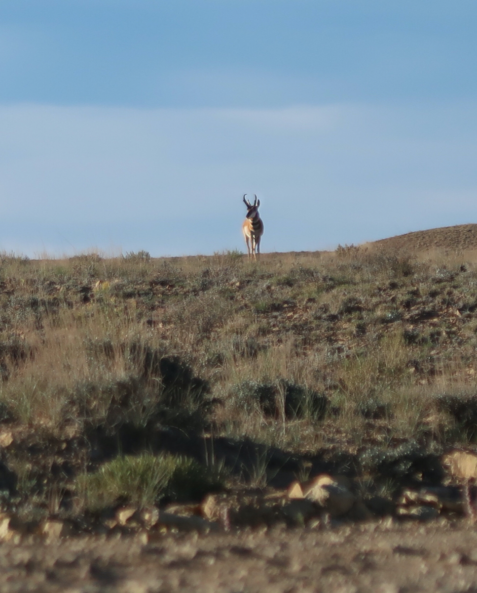
Lone Pronghorn. Usually these guys run away, but this one was fairly complacent.
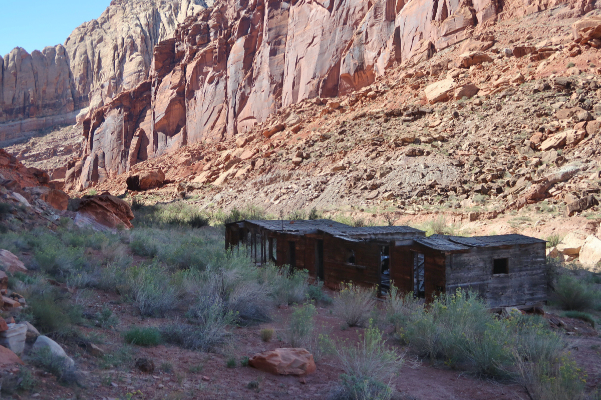
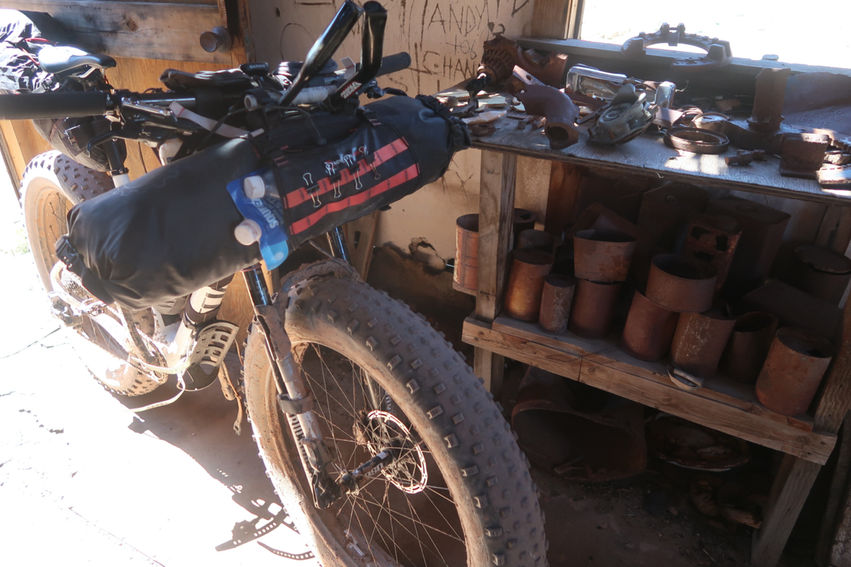
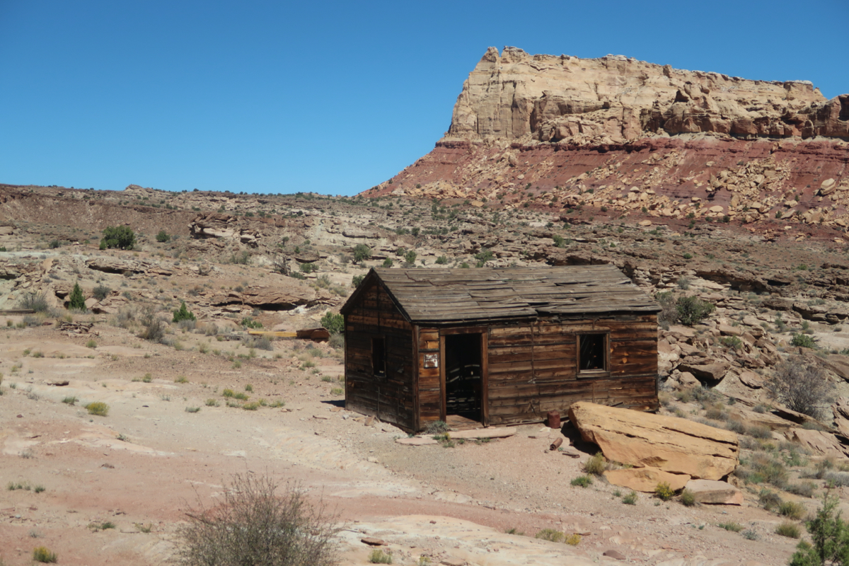
I’m kind of a sucker for Names. This place was called “The Bunkhouse at Hidden Splendor”. With a name like that, I had to take the side trip to visit. If it were called “The Bunkhouse at Thorny Muddy Windy Pass” I probably would have skipped it. Janet later told me she thinks it was a Uranium mining camp.
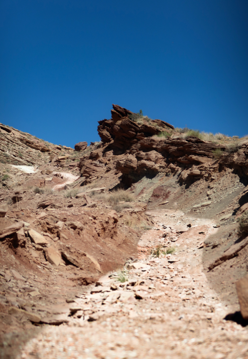
I had to hike-a-bike a lot on the “Behind the Reef” trail. It was really pretty back there – but very challenging for a loaded bike.
It is so pretty out here. I took tons of pictures, but after you look at the photos, and try to pick a few, you realize that none of them really capture the beauty of the scene. So, I guess you’ll just have to come out here. By the way, I encountered two bikepackers today: Nathan? And Mary. They were going the opposite direction and had placed two food/water caches. If I were to do this route again, I’d do that too. I’m open to repeating it because I missed some sections due to time crunch (had to meet Janet to begin the 6th and final loop starting in 3 days).
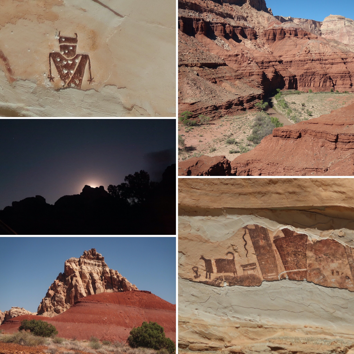
Too many pictures today, so I made a collage. Petroglyphs, Muddy Creek, moon rise, layers of color, and more petroglyphs.
My intended route was to finish off the “Stone House Lands” route… but Janet was getting a little bit of FOMO back home and the weather suddenly got better. She came out to meet me 2 days early. This also had the advantage for me that I wouldn’t need to retrace my steps on the Notom road. I wouldn’t have minded that… but it was great to see Janet a little earlier than expected!
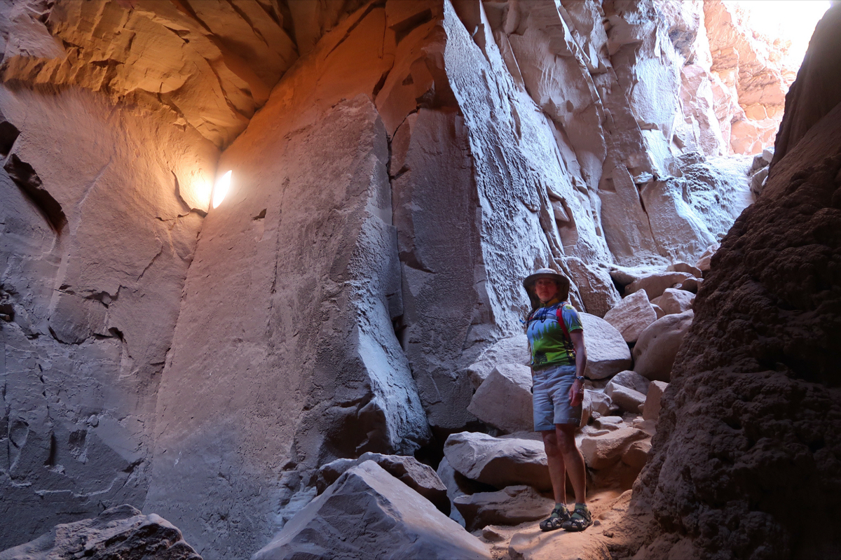
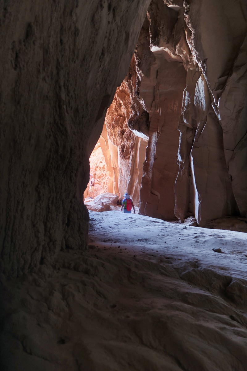
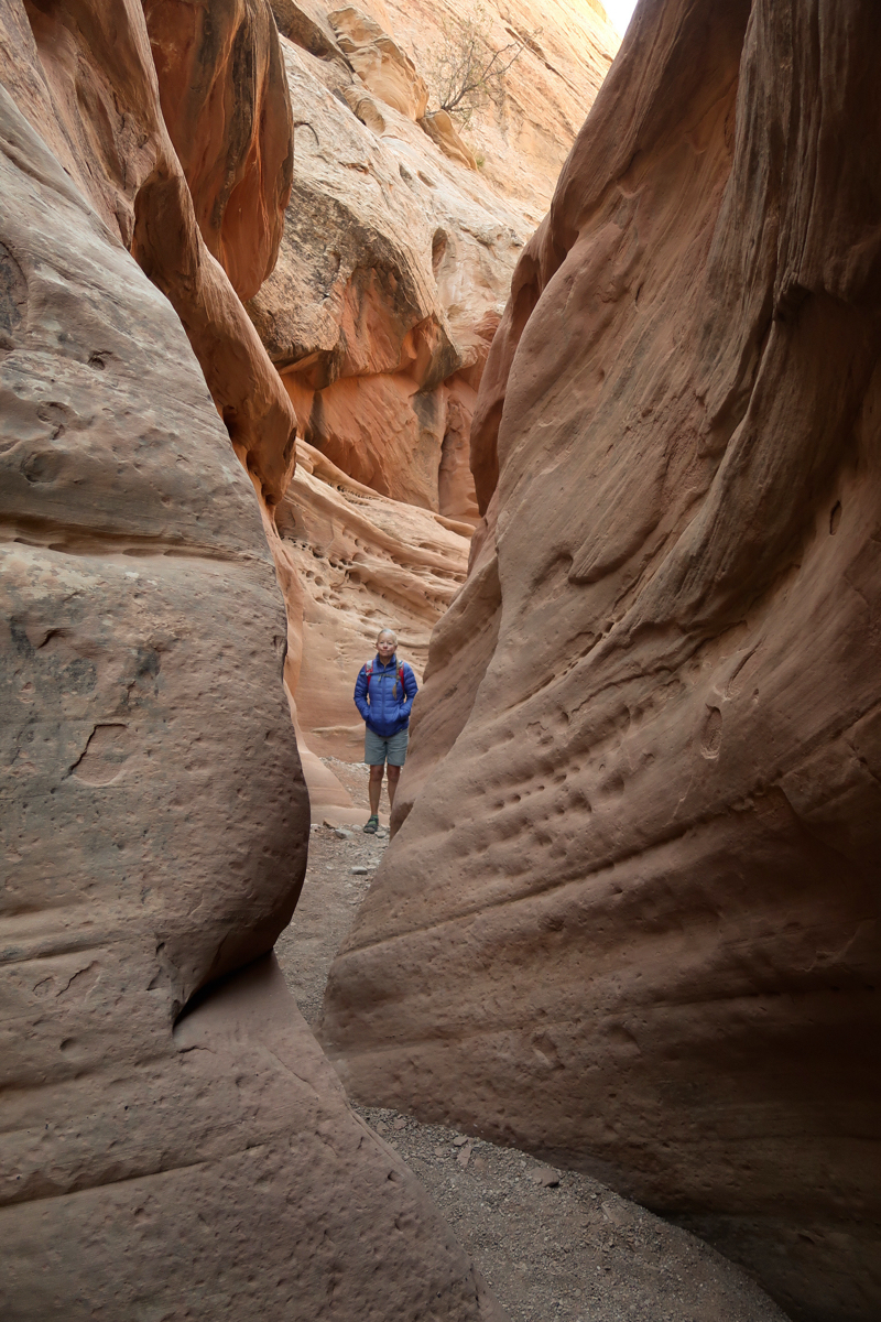
This is from inside “The Goblin’s Lair” a hike I did with Janet.
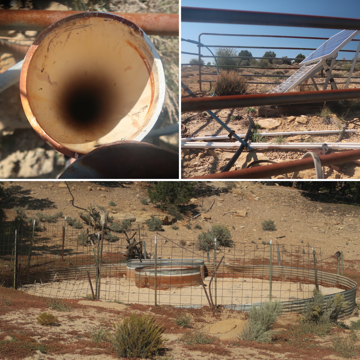
I had a spring marked on on old map I found. We went to check it out. In the bottom, you see what we found at the spring location. This was dry. I followed a black pipe up a small hill and found the solar pump and the big pipe shown. You could see water down there, but it would be tricky to get at it unless you had a pump or a bottle on a string. Since it isn’t so hot, we just carried on with the water we had from Escalante.
When Janet and I got down lower, I saw a Van/SUV buried to its rear axle in the sand. A man and woman were waving for help so I went over. I started thinking how the heck we were going to get them out, but the man immediately launched into this story about how his daughter yelled and they turned around and that was why they were off the road. I said “Ok” and started lowering their tire pressure- but how were we going to get it out of the hole? Meanwhile the two curious kids poked their heads out the window and the guy started telling this frenetic story a second and THIRD time. His wife just stood there. Surely he had done some sort of drug or something. Why was he stuck like this and not helping me – just telling a nonsense story? Lucky for him, on a road where we had seen almost ZERO cars, and Aussie pulls up with a fully equipped 4×4. The stuck driver lunches his yelling kid story to the Aussie, but Mr. Aussie doesn’t care – He announces “I don’t have any experience, but I have a winch” in a great Aussie accent. If he had left out the experience part, I would have thought these guys had just been saved by God. But later it came clear that the Aussie had boards to put under the tires, an air compressor, and an understanding of what to do. I asked him if I could leave before it was finished and he patted me on the back and smiled and said, “Sure. You’re a hero.” It was nice of him to say – but in reality, he was the true hero sure to get them out of this fix. This family was pretty lucky this man happened to stop and save them!
Today Janet and I rode to Big Water to get food resupply. Oops! When we got to the town, there isn’t actually any food. I asked a firefighter and he said it was going to be miles away. I asked about the 1 mile away gas station, but he said they would be closed for the season. We rode there anyway. On the door, a paper sign said “Will Close Oct 1”. YES! We were saved! Well, kind of. They had very little food – enough calories for sure – but none of my low-carb gas station staples like nuts, butter, cheese, canned fish, etc. luckily, Janet brought me a second insulin, so I have enough insulin to eat carbs – but it is tricky business balancing high doses of insulin with exercise – followed by resting in the tent. It’s going to be a wild ride (already I think my insulin outran my meal and my hands are shaking as I type and retype this). 😑.
At Big Water, we met a couple named David Wasch and ?? (https://skimum.com). They have been on the road with their motos for 4 weeks – taking almost all dirt like us. In fact, I think they looked dirtier than we did – if you can believe it. They had been to burning man, and I asked how they liked it. Their response was more in line with how I’d expect myself to react. They are glad they went, but it was “tough”. Most people I tell about my reservations say, “you just have to go; it’s not like you think .” Anyway, we chatted with them for a long time as the store proprietor patiently waited outside… listening to our conversation with his pack of cigarettes resting on the table.
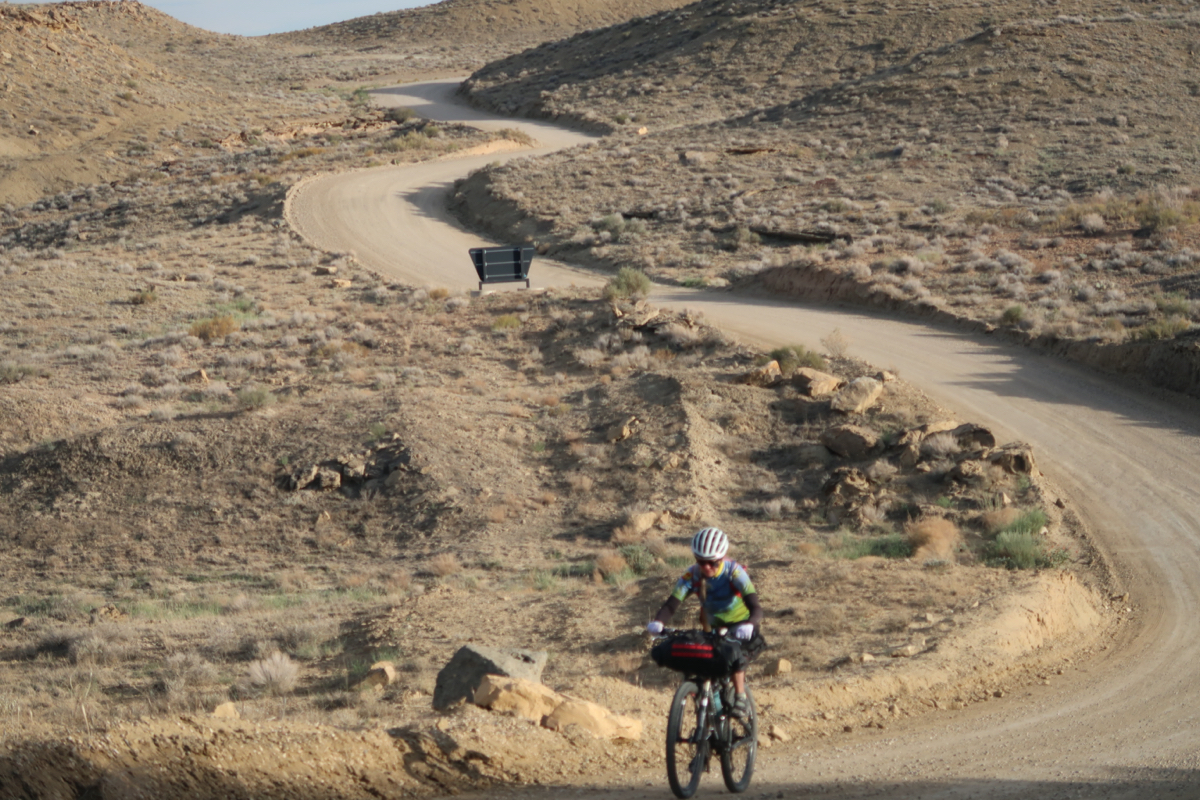
Janet and I parted ways briefly after Big Water. She took the road while I decided to remain true to the route. The first 5 miles after town were pure beach sand! And I loved it! Normally I would have detested this type of terrain, but being able to ride (almost) all of it put a grin on my face – especially because I saw prints of a normal MTB tire accompanied by footprints 👣 – Someone had to push a looong way shortly before me. Also, I’m glad Janet took the road – she had a chance to catch up on Strava and also her tires were too skinny for this stuff.
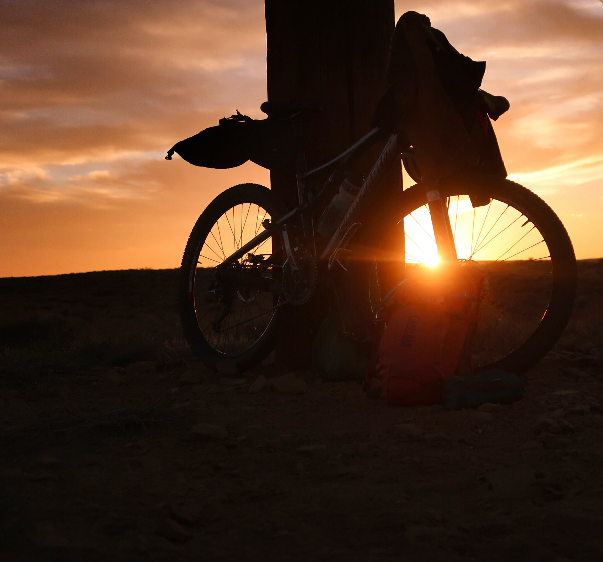
One thing I gotta say about desert places: they produce great sunsets.
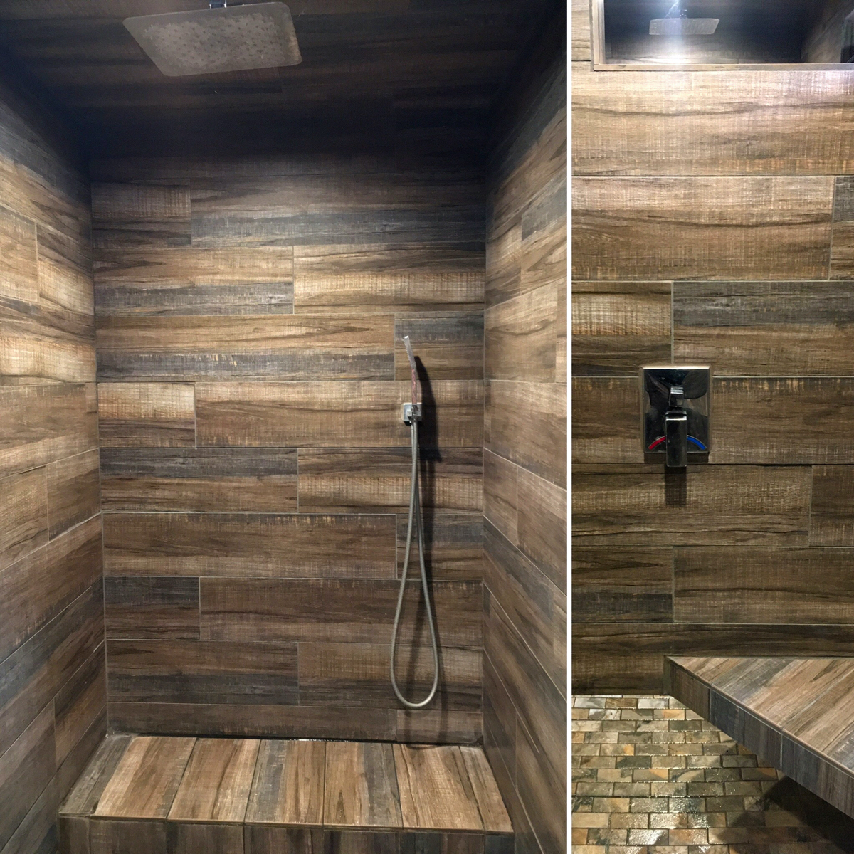
You may think we stayed at a fancy hotel… Nope! We showed up at Kodachrome State Park and asked for a site. As the woman was helping us, she said, “oh, we just had a cancellation in site 17. Do you want that? It is near the showers.” YES! “Ok, good. You will like the showers. They are RainPick”. That meant nothing to me… until we got to these luxurious showers. I don’t know where they are getting all that water from, but I’ll admit I indulged in more than one liter of shower water tonight!
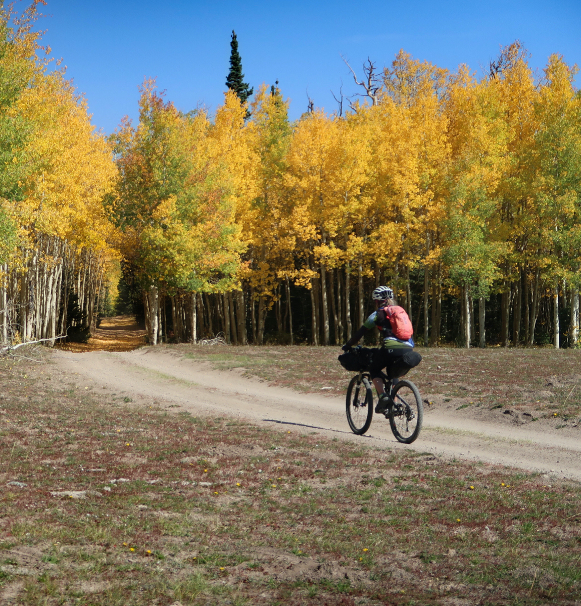
I took Janet on a little woodland adventure, trying to skip a bit of Hwy. today was mostly road riding, so we wanted some dirt. Dark clouds rolled in as we got to a campground, so it was the perfect excuse to stop. I’ve been enjoying the shorter days. Riding 11 hour days back-to-back and being in the sun so much was taking a toll on my body.
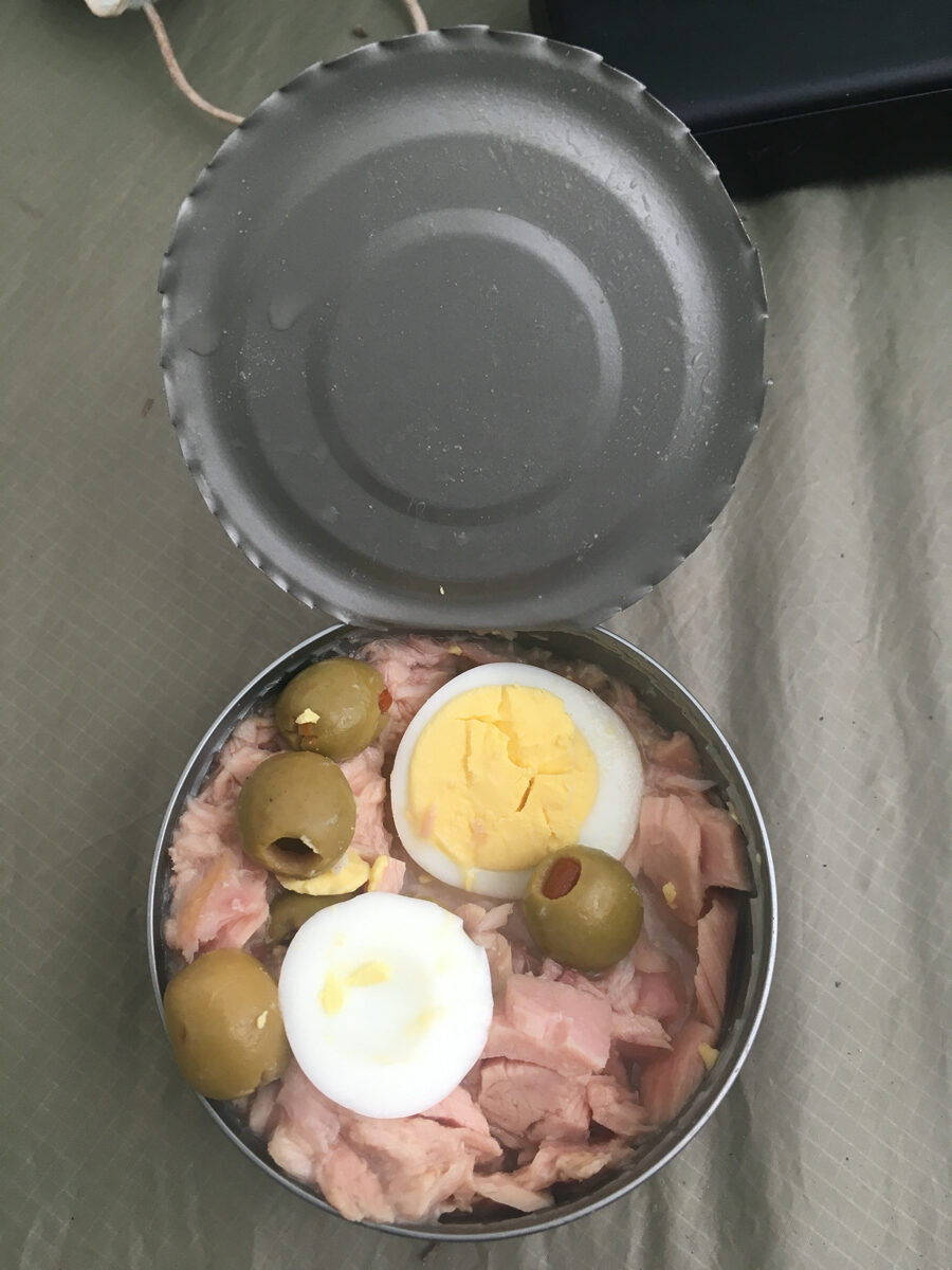
Being wrong: When I was a kid, my grandma used to make tuna salad with these ingredients (plus Mayo, and not in a can). I used to love that salad until the 80’s when they said eggs and mayonnaise caused heart disease. She used to love that I always ate all her food… until I started refusing the eggs and mayonnaise. Full circle: now I think this is a super healthy meal. Sorry grandma!
right after a small thunderstorm passed us by. We managed to miss it, but some other cyclists who came through the same camp on just a slightly different route got soaked. We were really lucky!!
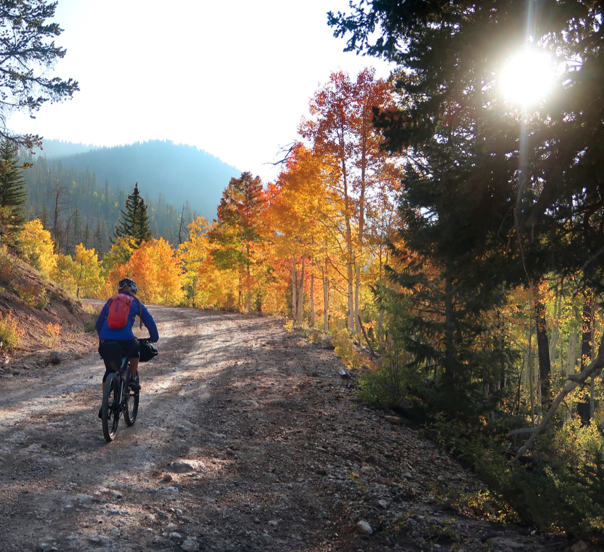
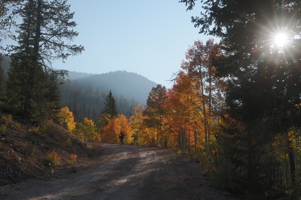
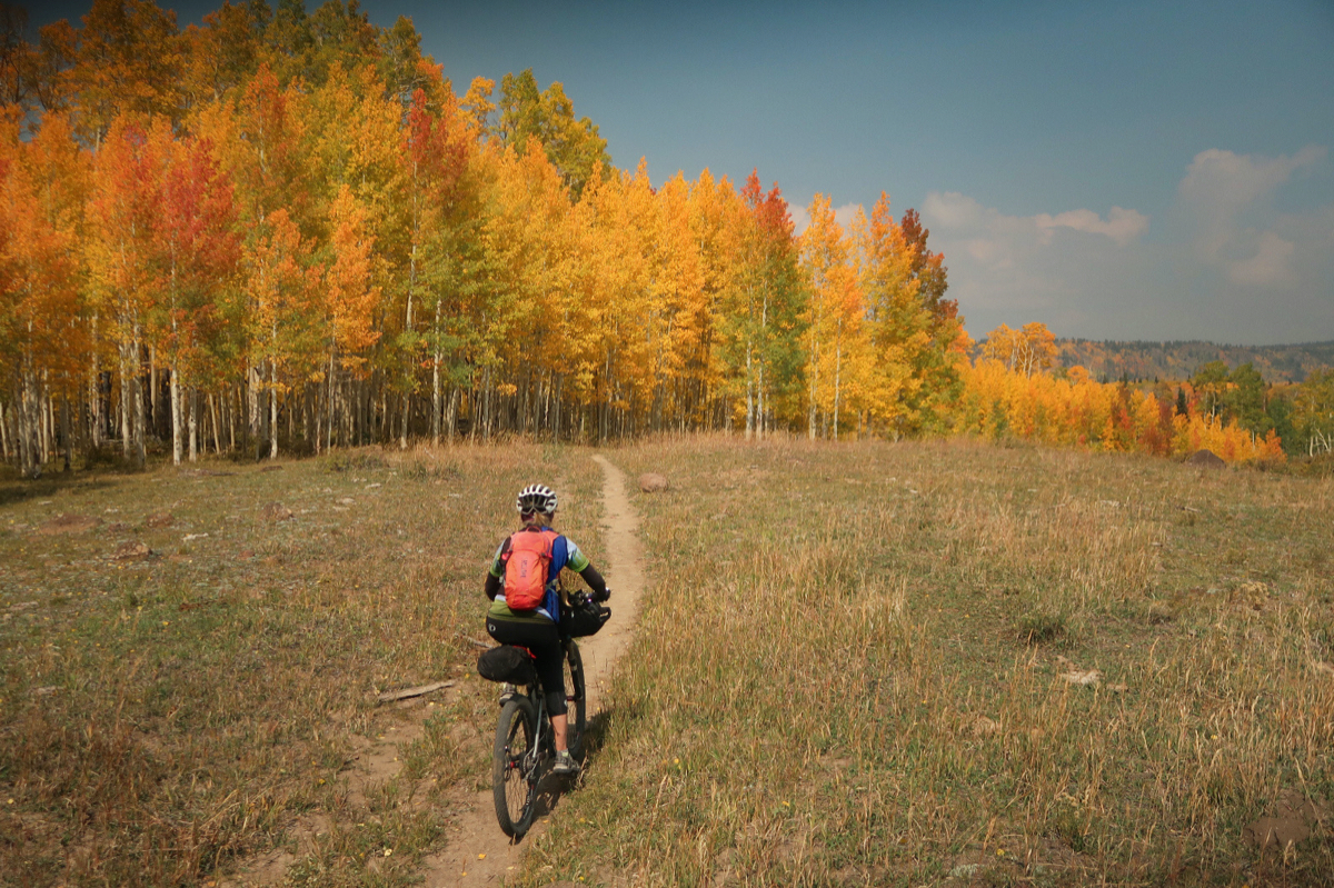
We were on this general region a week ago, and the colors had not turned yet. It was brilliant today. The wind changed too, bringing in the acrid smell of wildfire smoke… and a bit of haze in certain directions. That smoke helped cull the photo list, as I didn’t bother getting out the camera for what would have been some great views in places.
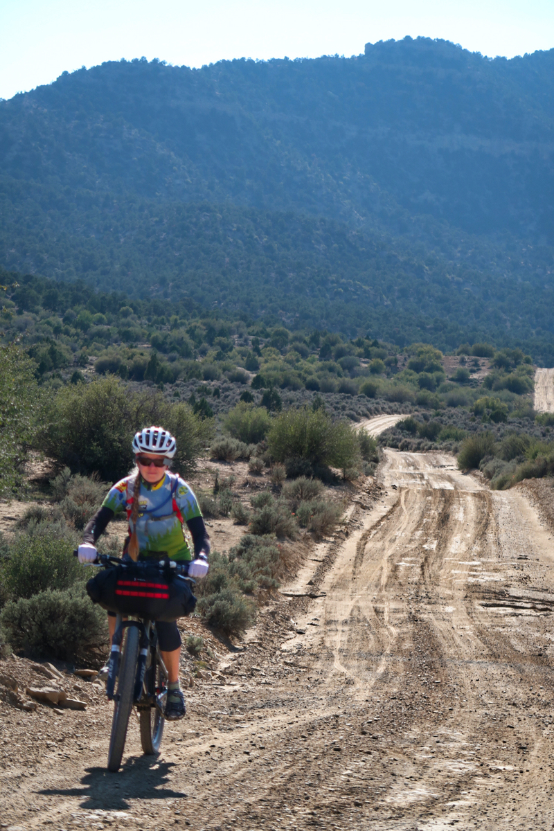
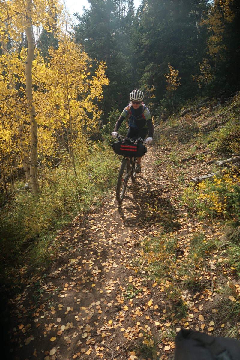
Super Janet! Today while descending some particularly rocky trails, Janet was on my tail! I almost asked her if she wanted to pass and go first. She is so great!
So, about a third (time wise) of our single track route involved pushing. Admittedly, I got frustrated saying to Janet: maybe we should bail from the trail to a dirt road. She said, “well maybe we should give the trail more of a chance.” At points, we said, “this is fun!” At other points, we just trudged through. At one point, I clocked 1 hour – and we had progressed 2 miles. I predicted a finish after sunset. Then the trail got better and we finished just before dark. After it was over, though, we were glad we did it and had a high five at camp.


Loved going through this entry and trip notes. Great photos and super helpful to anybody doing all are parts of the route. I am thinking the cache was SUPER fun to get to and open. Next time perhaps a buddy can add some secret surprises that you weren’t expecting. • My grandma spooned the bacon grease over the eggs to make them “over easy” without ever turning them over. Loved and love ’em. Great “Super Janet” photo. As always, Thanks for sharing.