Idaho Hot Springs Loop
The Idaho Hot Springs Loop is another route envisioned by the Adventure Cycling Company. Having done two of their mountain bike routes this year, I can say that I am VERY pleased with their work, and would recommend both to anyone wishing to conduct their own self supported mountain bike tour. You can get your maps here for the Idaho Hot Springs Loop. If you are on a budget and already have a GPS, you can just purchase their digital data file for a very reasonable price. This is what I did – however, we also had the benefit of our riding companions having the paper map, which was very nice.
This is the map for the entire route discussed in this post. To Export GPX files, click on the three horizontal bars in the upper right hand corner of the map and select Export selected map data…
To see full screen, click here (opens in new window)
All of the original route was rideable, however, there was a big landslide on National Forest 227 (the road between Ketchum and Featherville) two years ago. Last winter, there was another land slide, and it is expected that this road will remain abandoned. The section of difficulty is fairly short, but also quite time consuming – especially with a loaded touring bike. I have included pictures of the two obstructions below. The landslide / damaged areas are West of the Bowns Campground. One time consuming portion begins here: 43.58360° N 114.99210° W and ends here: 43.58430° N 114.98632° W – it took us about 20 minutes to cover this 0.25 mile section. The next time consuming portion begins here: 43.58605° N 114.97092° W and ends here: 43.58464° N 114.96949° W – it took us 12 minutes to cover this 0.1 mile section. The third and final slow section begins here: 43.60550° N 114.90475° W and ends here: 43.60654° N 114.88174° W – it took us about 15 minutes to travel this 0.35 mile segment. It is worth noting that someone had recently chopped a path in the willows (and that the water was low enough in the river) to make this feasible. If the water is high, you may find yourself spending a lot more time bushwhacking above the river.
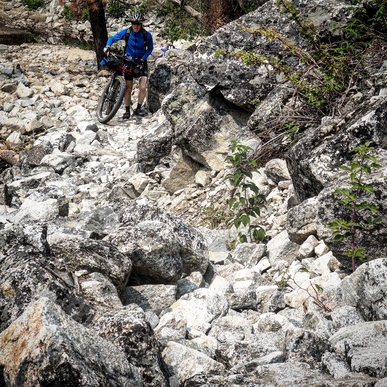
This photo gives you an idea of what the two landslides look like. Both pretty much look like this, and are to the West of the 3rd difficult section I mention.
Before venturing into this section, we found a GPS track on Strava that would take us around the obstructions. That track was for the Skeleton Creek trail. After studying the track, it appeared that there was a lot of elevation change, and single track (which may be a good thing, depending on your style). Looking at the time it took people to get across either route, I became convinced that we would be much faster taking the original route as opposed to the skeleton creek – even if the water were high. You can contact me directly if you’d like a GPS track of the Skeleton Creek reroute.
This picture shows you what it was like near the washout section near the Bowns campground (the third difficult section I mention). It’s not that bad if the water is low.
Besides that one difficult section, the remainder of the route was fantastic. The maps promise 41 hot springs, however they are not all soakable. Many are just places where hot water comes out of the rocks, with no discernible pool to sit in. Others are at the river, and may or may not be useable, depending on the flow. Here is my list of top 10 springs that I would return to, going counter-clockwise along the route from Boise:
1) 43.724384° N 115.604432° W – Loftus (Great quality pool with waterfall effect. Somewhat shallow)
2) 43.575811° N 114.830968° W – Pries (if you’re just one person)
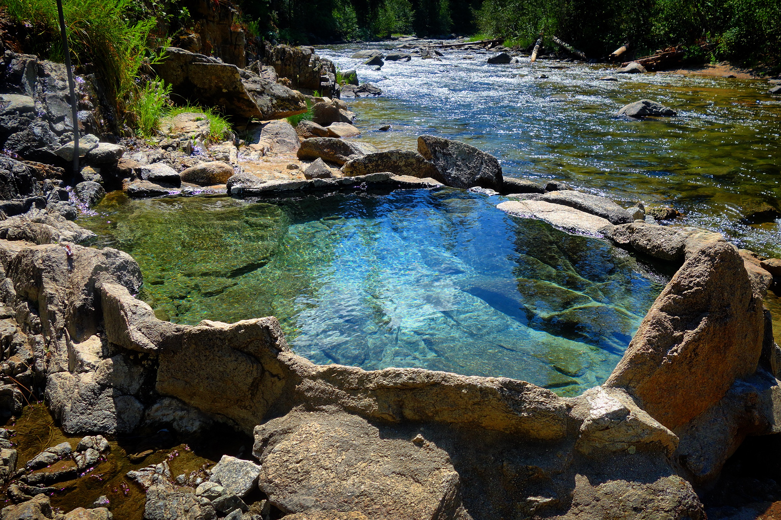
3) 43.562422° N 114.795027° W – Worswick (shallow in places, but many options of where to go. Pretty setting).
4) 43.641214° N 114.490757° W – Frenchman’s Bend/Warfield (looked nice, but we did not investigate because there were a lot of people there).
5) 44.216957° N 114.931456° W – Mountain Village Resort (only applies if you are staying at the hotel).
6) 44.710405° N 115.700320° W – Penny/New Penny (New Penny is easy to get to, and shallow). Penny is down a big cliff. We did not investigate.
7) 44.846406° N 115.697279° W – Mile 16 (Probably the best spring on the route. A little too hot for me (measured 110F with my GPS)).
8) 44.675088° N 115.941339° W – Gold Fork (Looked nice; you have to pay to enter).
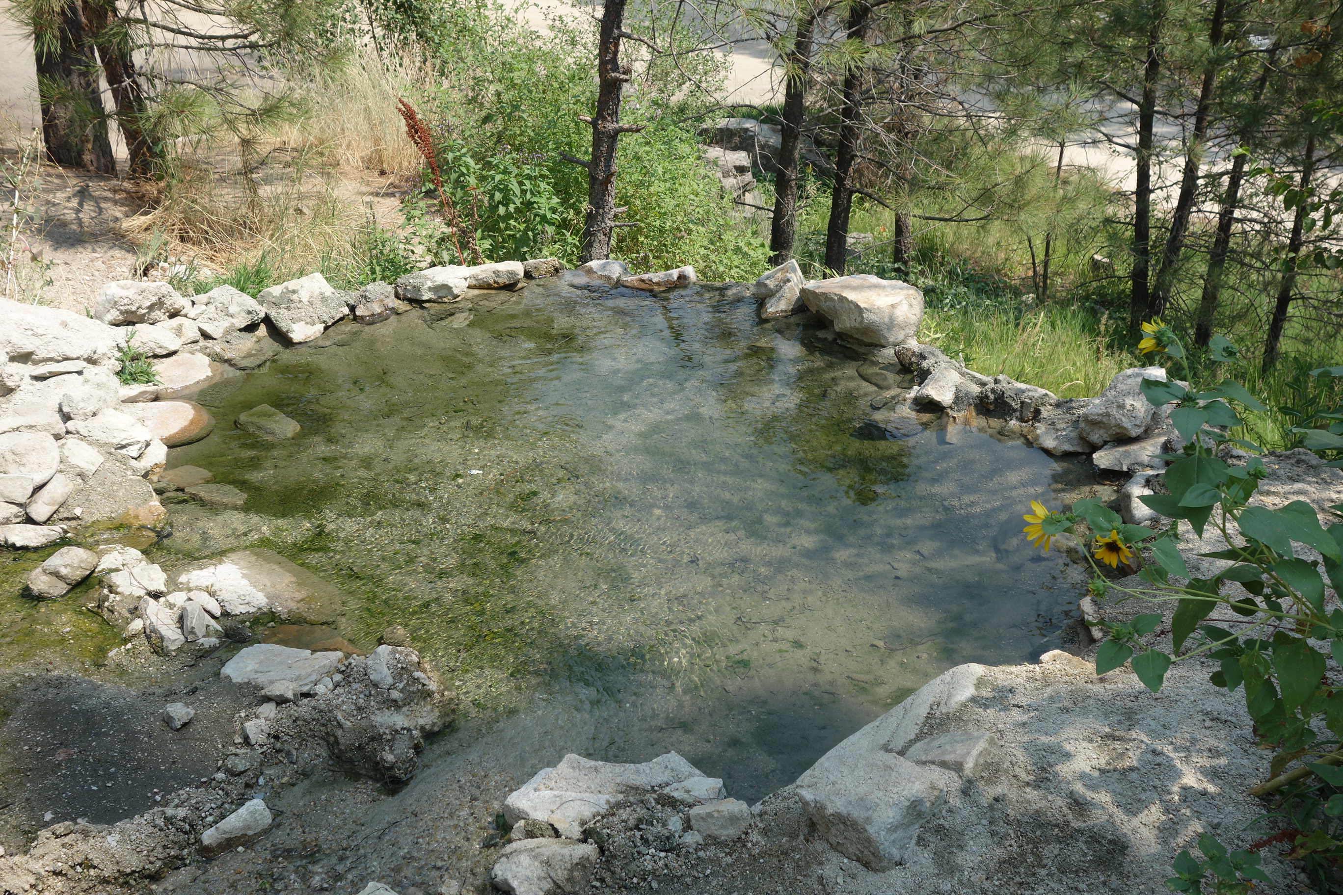
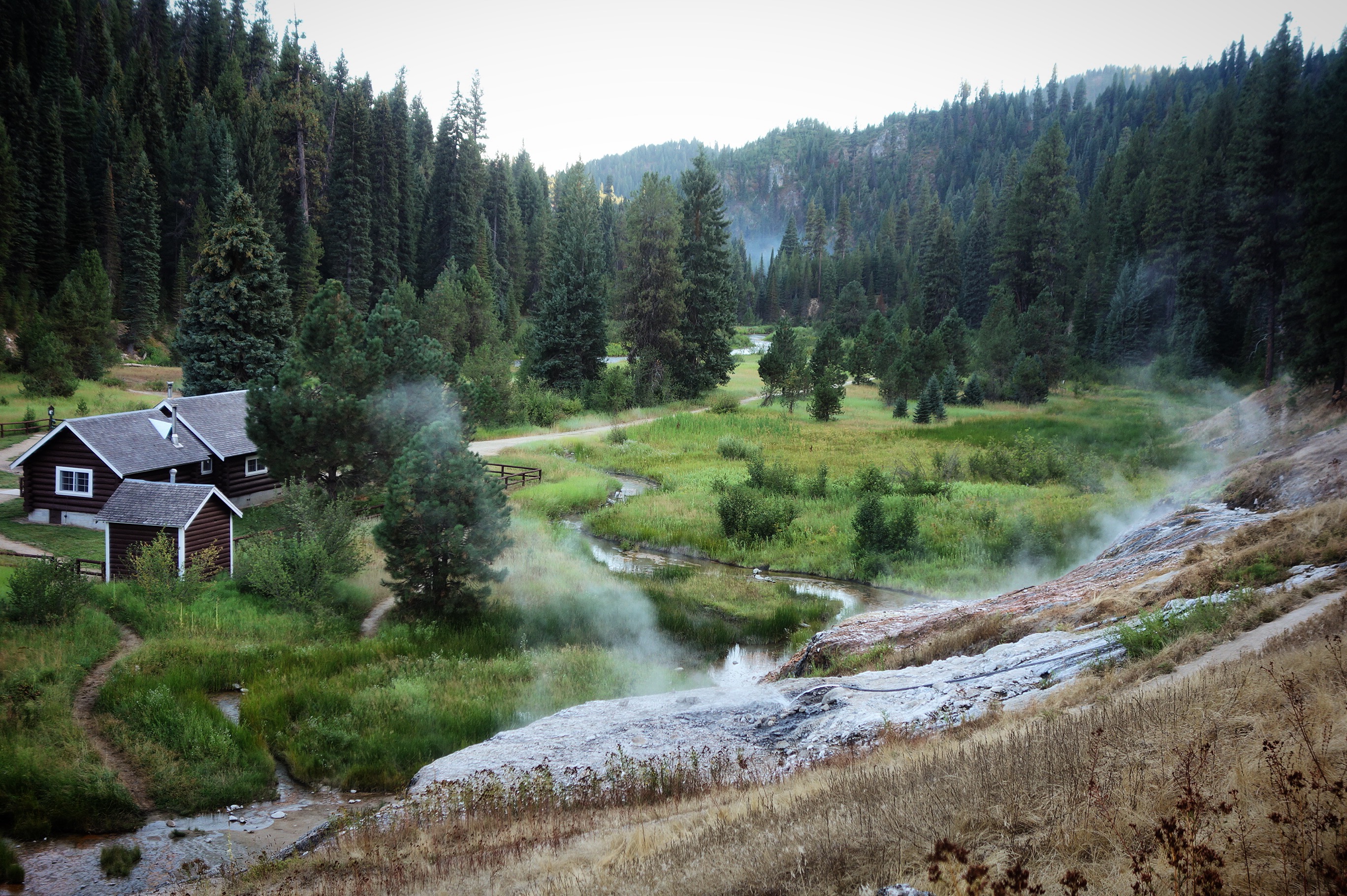
9) 44.364015° N 115.856616° W – Boiling Springs (One of the prettiest settings. Good Springs. You can even rent a cabin right next to the springs!)
0) 44.252243° N 115.891879° W – Rocky Canyon (looked interesting; we did not soak – it’s across the river, and has terraced pools).
We did not visit any of the springs that were off route (except for Molly Springs, which we would not recommend). Also, we did not do the full route in it’s entirety: we rode pavement between Idaho City and North Fork Boise River Road. Other than that, we remained true to the route designed by adventure cycling.
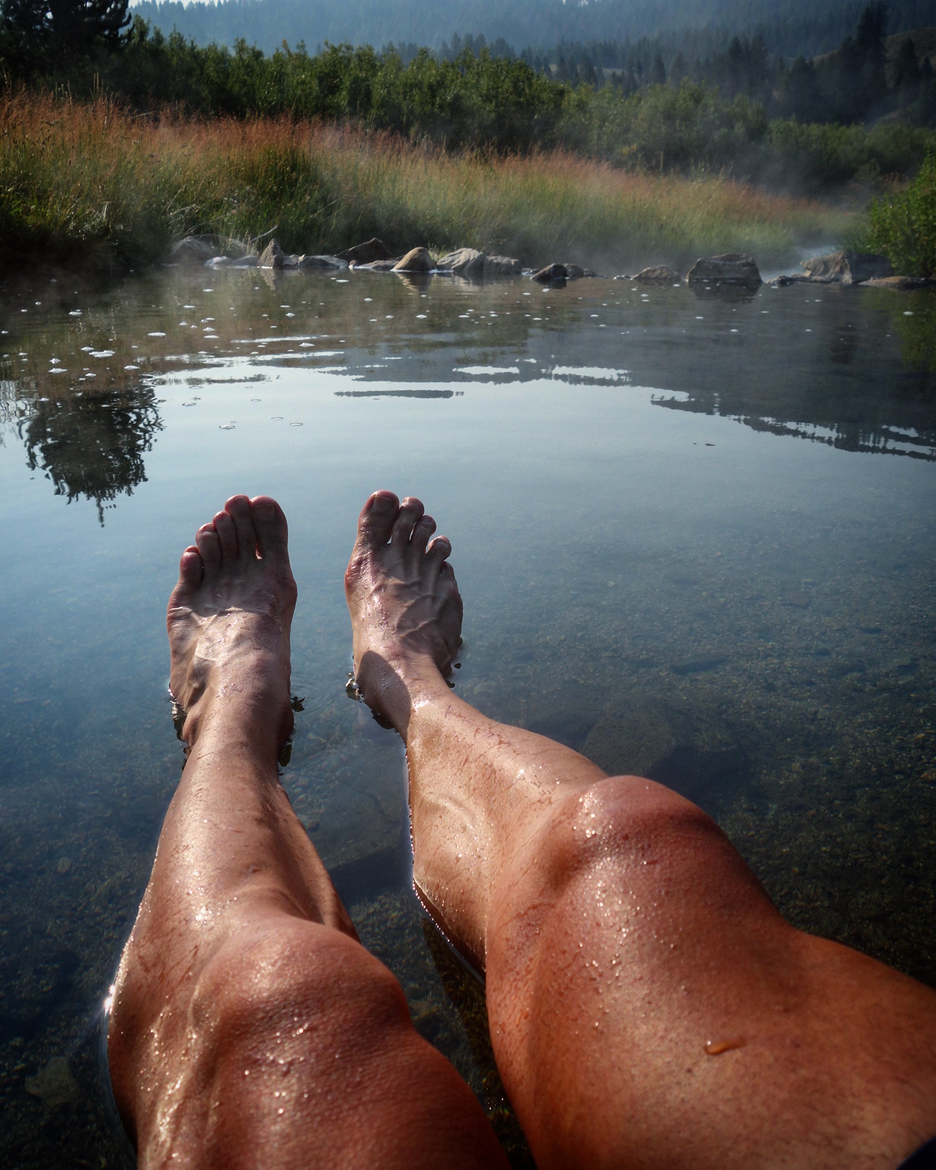
Hot Springs
Loftus Hot Spring 43.72438° N 115.60443° W
Me soaking in Worswick hot springs. I really liked these – and there are more soaking areas up the creek. 43.56242° N 114.79503° W
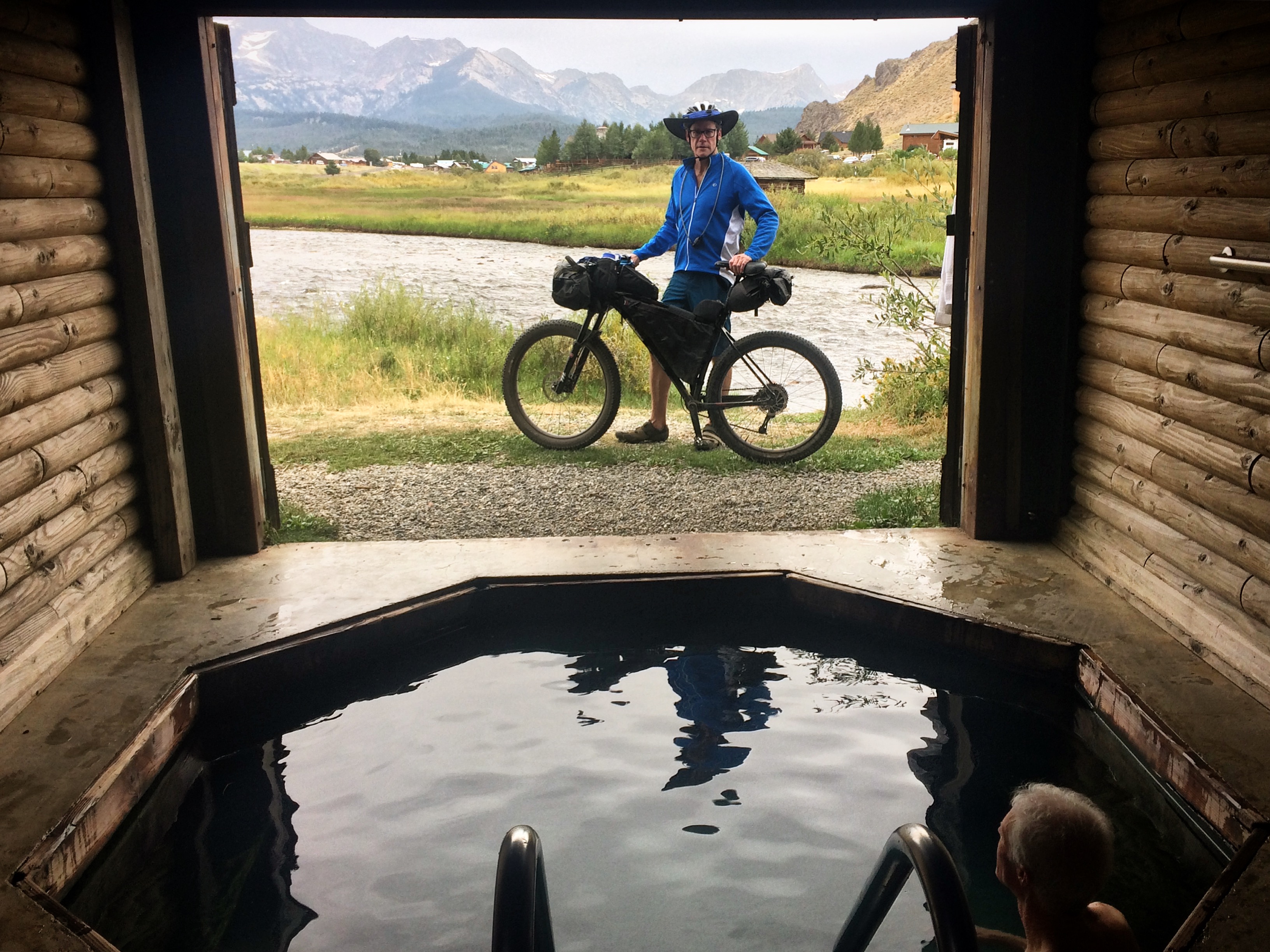
This hot spring is not open to the public. It is inside a locked building: 44.22093° N 114.93135° W If you stay at the Mountain Village Resort, you can use it for 1 hour. You need to schedule your 1 hour time slot so it does not over fill.
Mile 16 hot spring. A real winner! 44.84641° N 115.69728° W
The view from Boiling Springs Hot Springs. 44.36402° N 115.85662° W
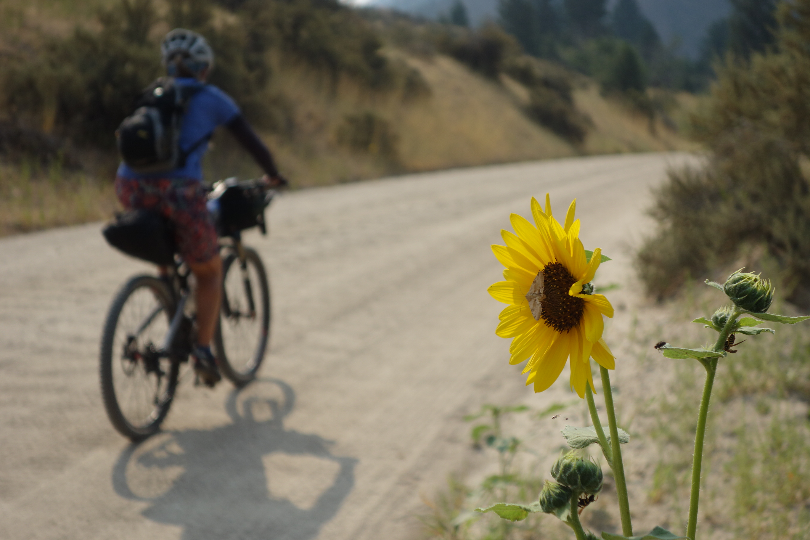
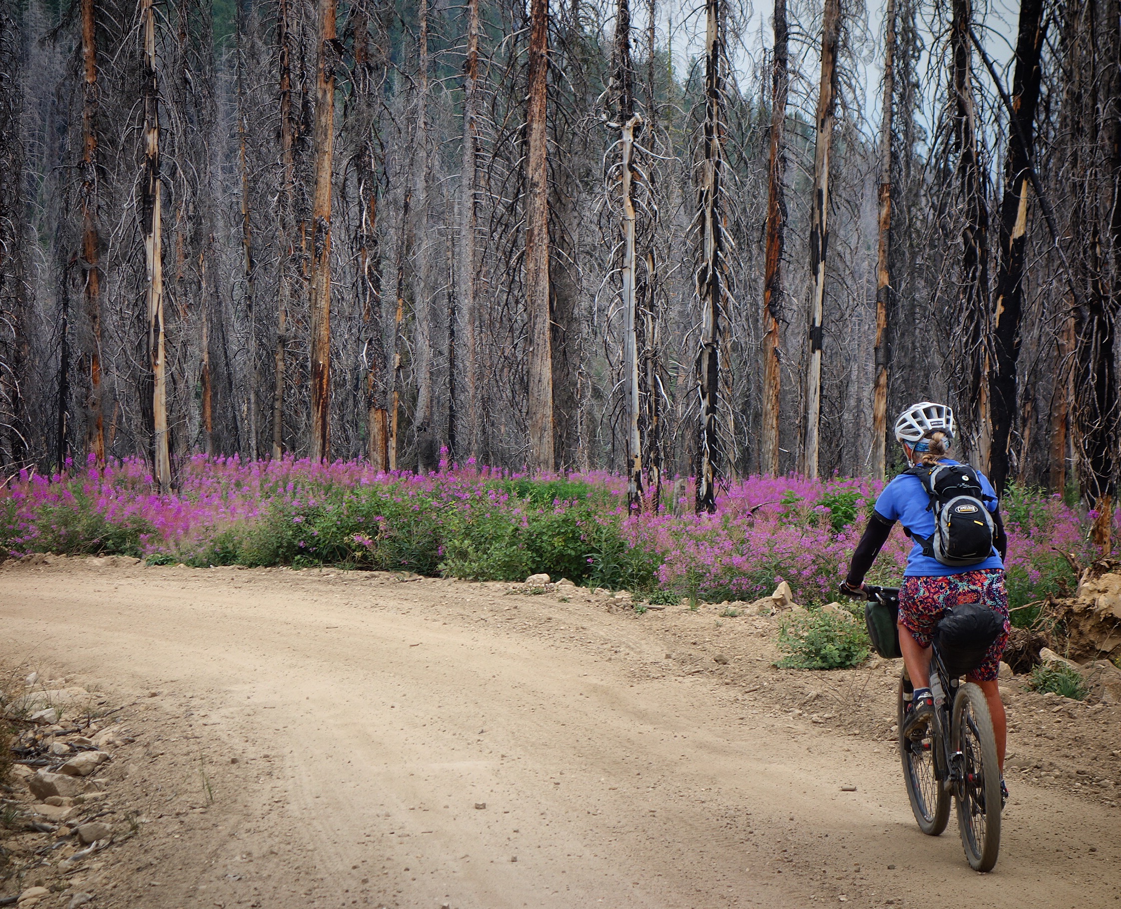
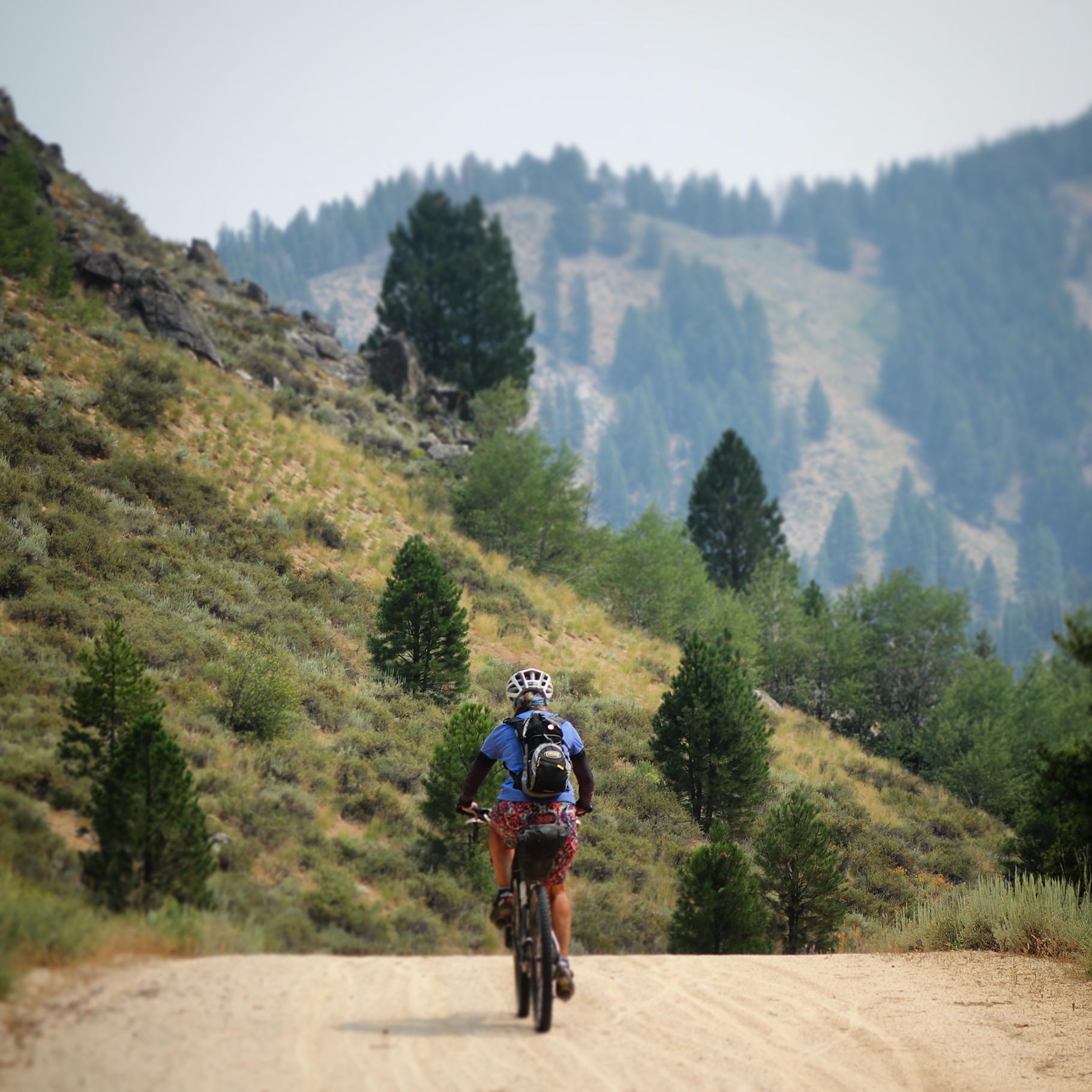
Other Pictures
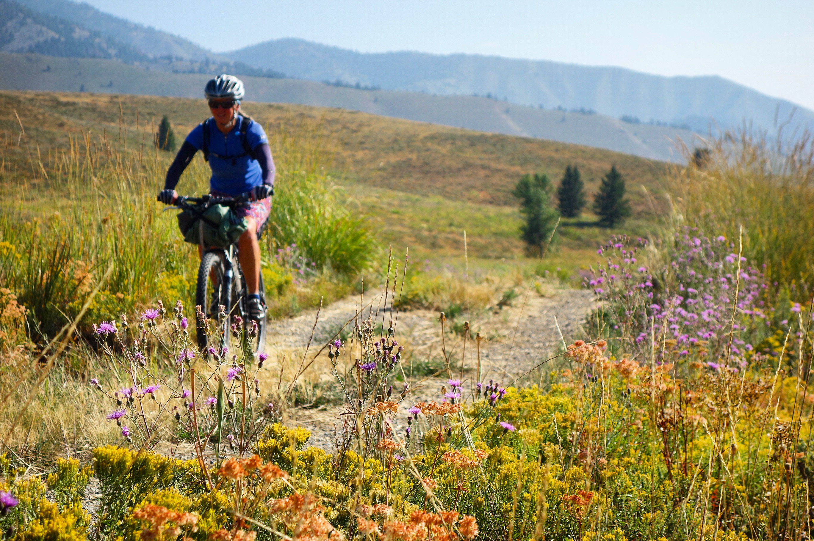
Janet on the way from Lucky Peak Reservoir. We made arrangements with the Parks service to leave our car there for $40. You need to buy an annual pass to the park in order to do this. We bought the pass here: 43.59401° N 115.97391° W and they let us camp in the parking lot.
Dropping down Trinity Ridge Road.
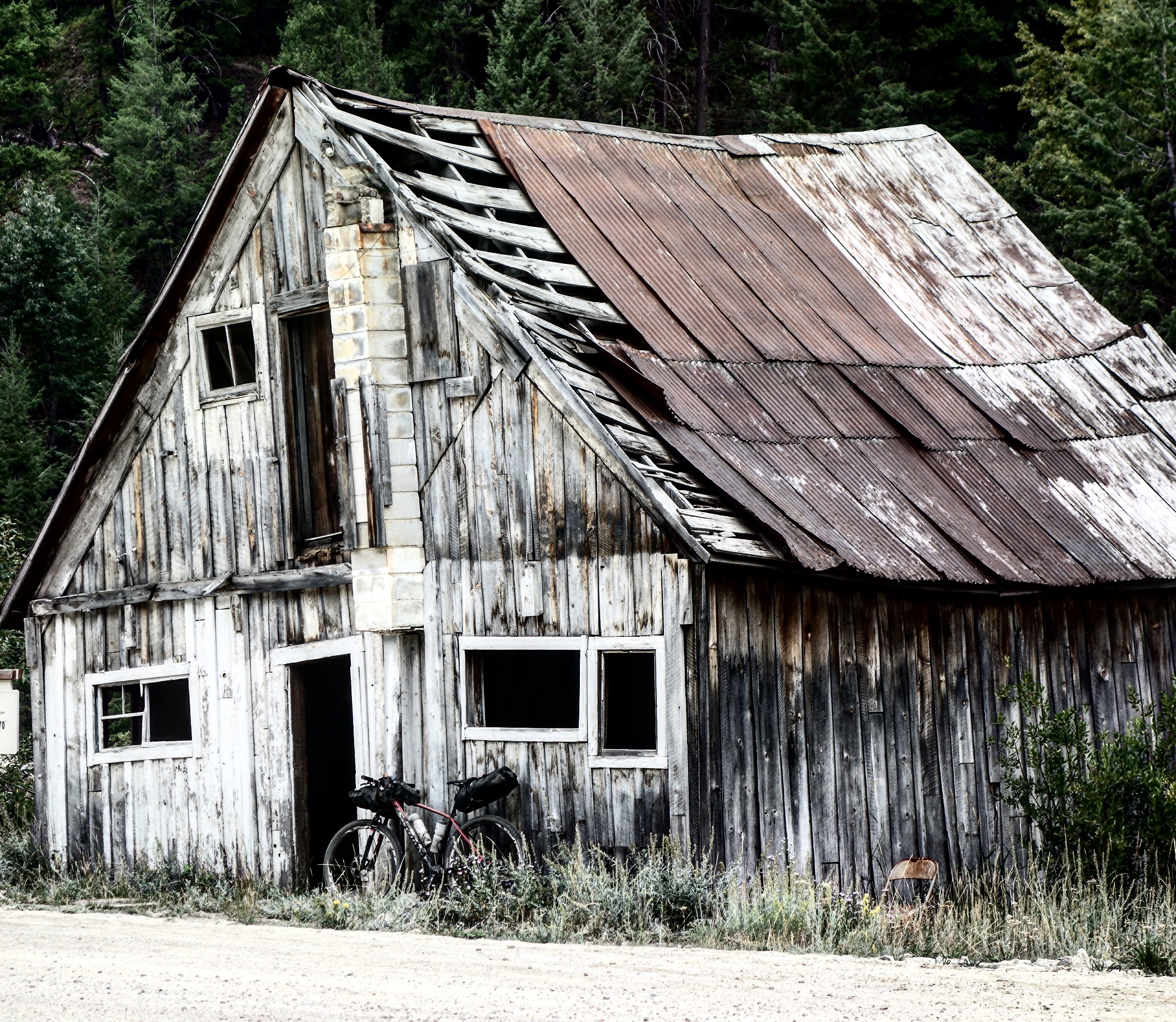
Don’t plan on getting any supplies in the town of Rocky Bar… We did stay in Featherville, which we really enjoyed. The rooms at the Feather River Motel were big and comfortable. Also, Pat at the restaurant next door was a HUGE bike packing supporter. He was a hub of information sent back from other people who were riding the route. In fact, if you’re looking for up-to-date information on the route, he may be the best to ask! (208)-654-2410.
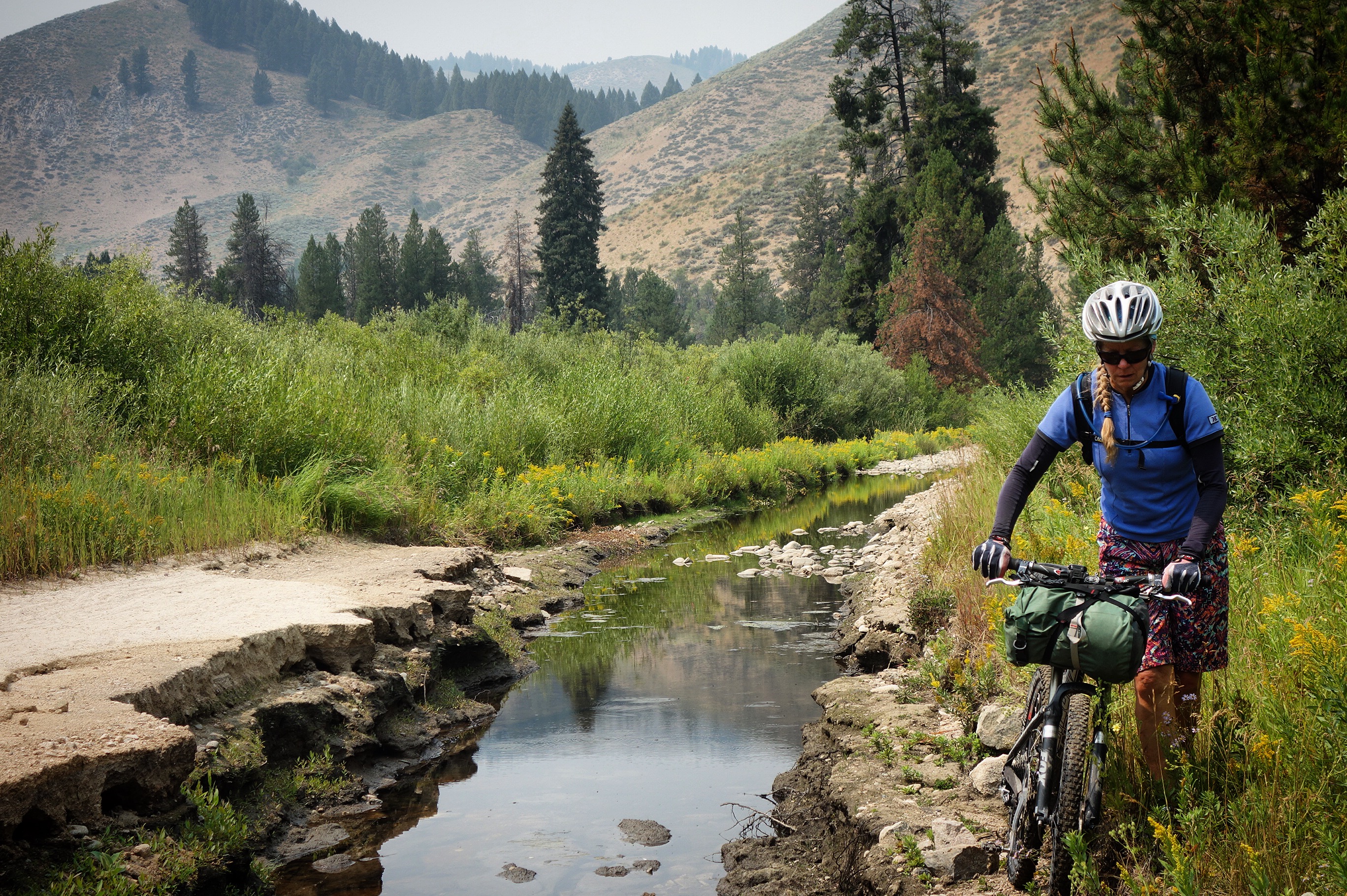
Riding along the North Fork Boise River Road. The scenery kept getting better and better!
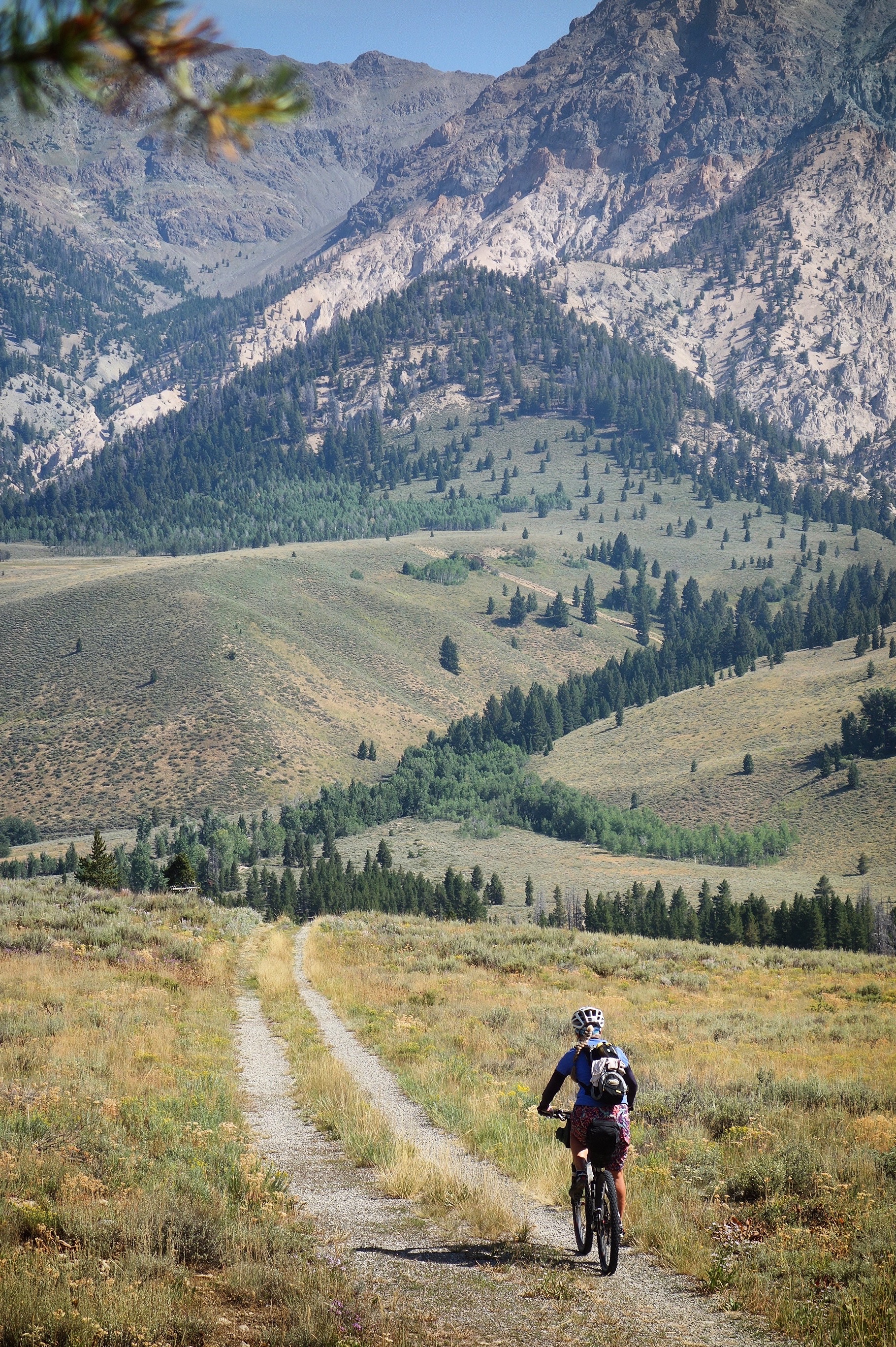
Janet and I had traveled by road from Ketchum to Stanley earlier this summer. I wasn’t too excited about traveling this corridor again. That was a mistake: This turned out to be an awesome section!
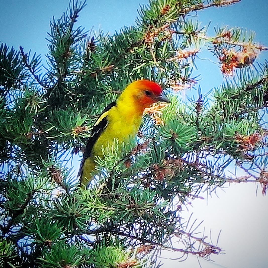
I was delighted to see these colorful birds. Stan easily identified it as a Western Tanager.
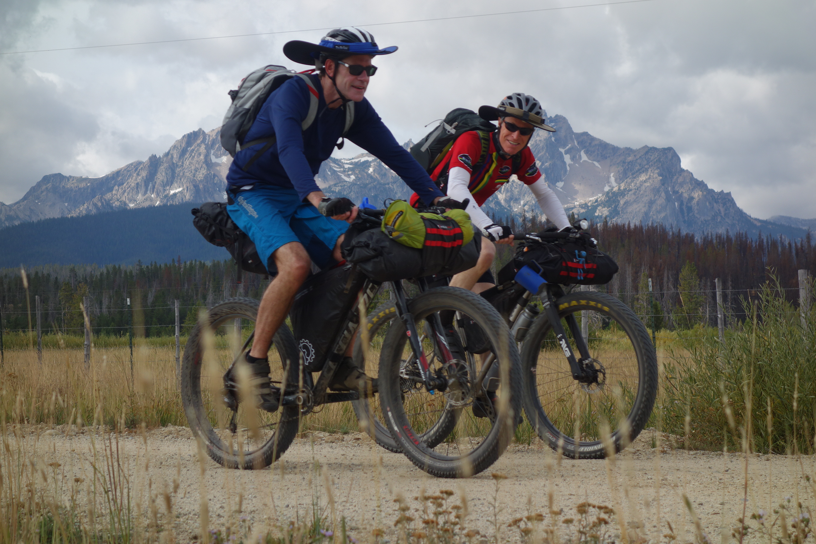
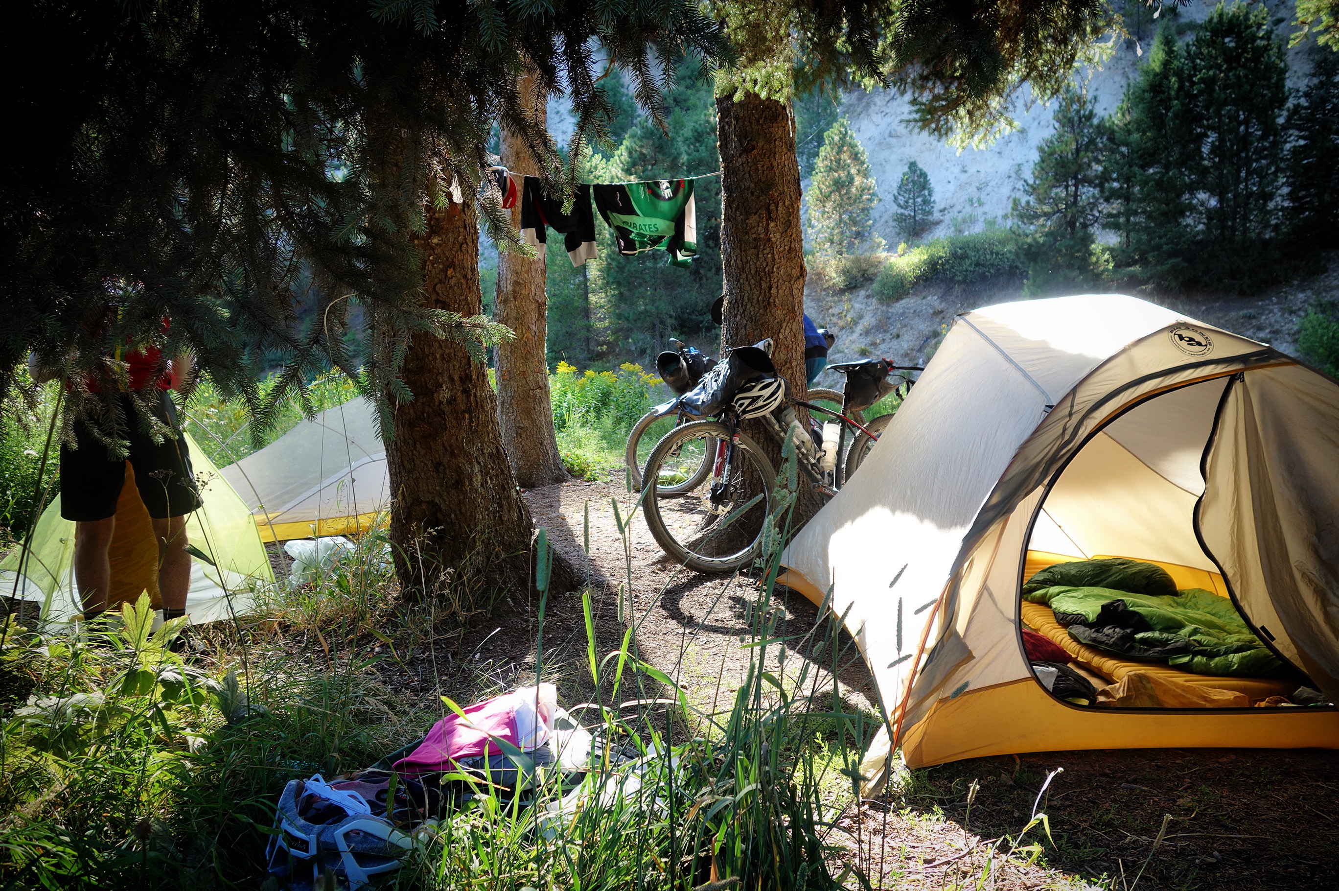
Tom and Stan.
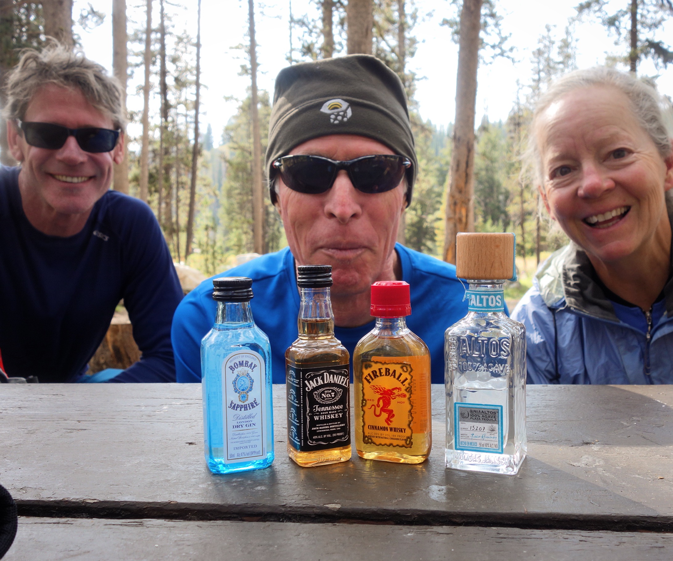
When we stayed at the Mountain Village Resort in Stanley, they included these beverages.
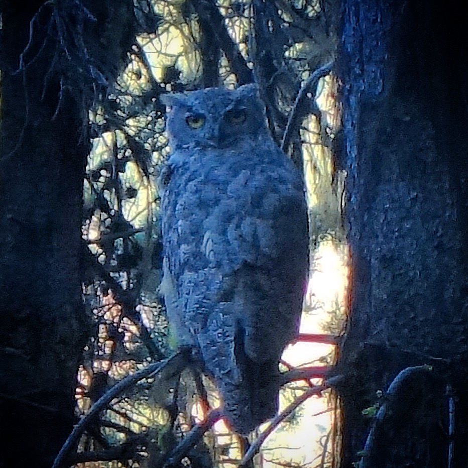
We went a little off-route to spend the night at Horsetheif reservoir. Camping at the reservoir is now paid. At the time of our visit, the only facilities were bathrooms, but the host said that they are using the fees to bring in amenities like picnic tables and fire rings. They are all paid for, and will arrive soon. Meanwhile, in spite of the lack of amenities, we enjoyed seeing this great horned owl, and having our tents circled by wolves. In fact, Stan and Tom were so frightened by the wolves that they moved into the bathroom for the night!
Our campsite near Boiling Springs. We didn’t camp at the campground proper, but in an overflow area. Actually, this site was a lot nicer than the campground!
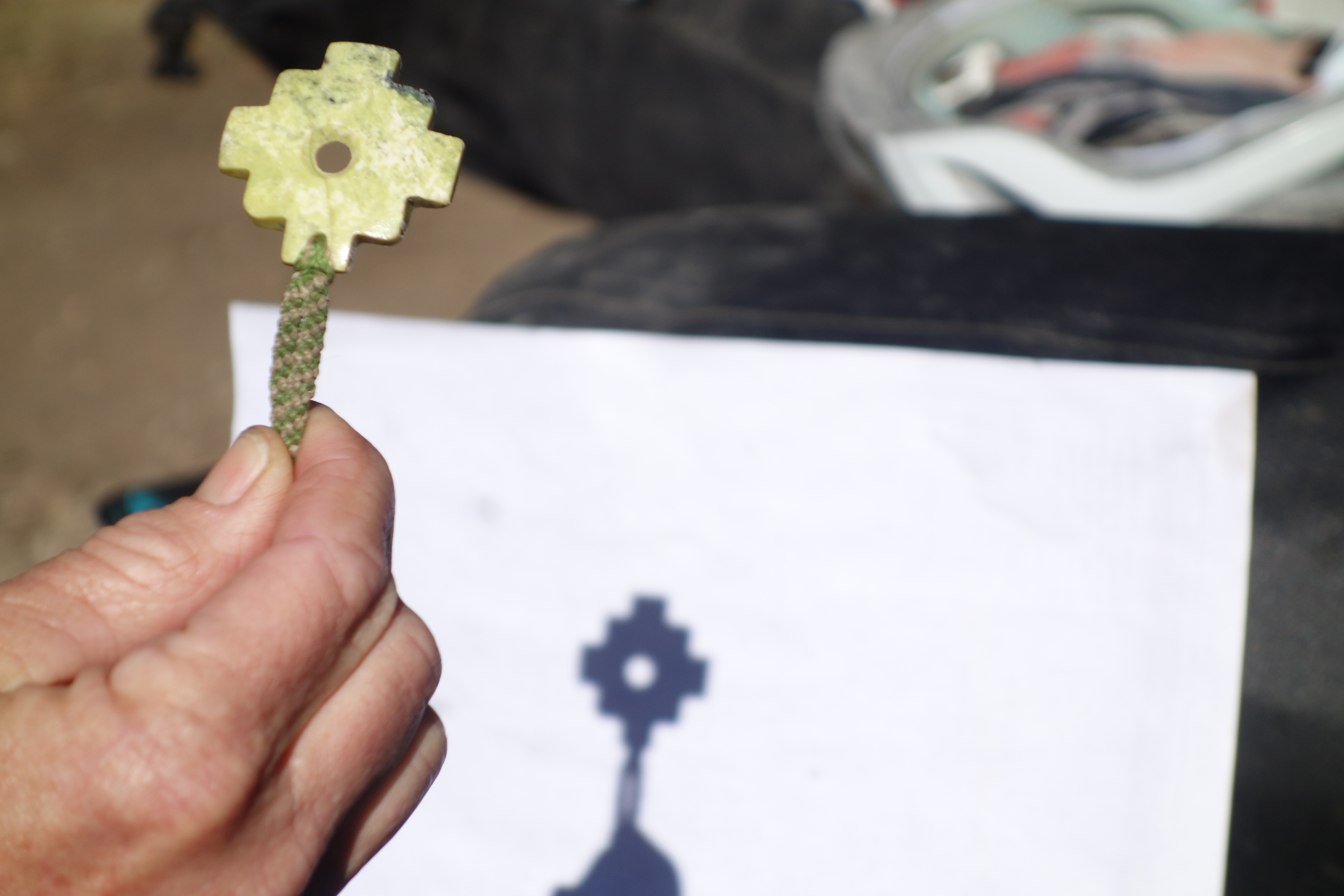
Tom brought this eclipse viewing device that he had purchased in Peru. It didn’t work very well with the large aperture, but once we started poking pin-holes in paper, we could visualize the shadow the moon was making on the sun.
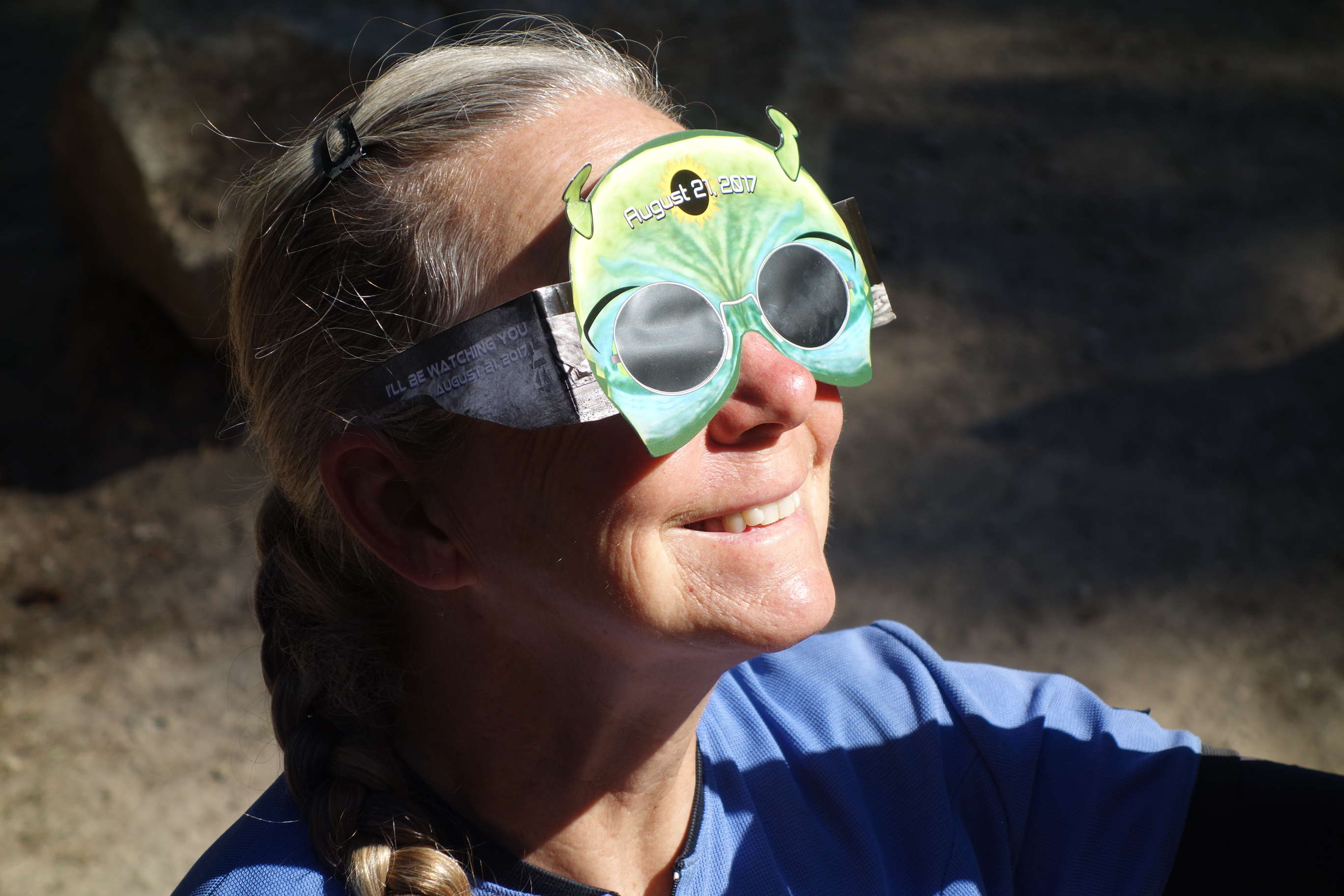
Janet wearing the eclipse glasses that Stan got for our group. I didn’t realize it beforehand, but this type of lens was crucial for our enjoyment of the eclipse.
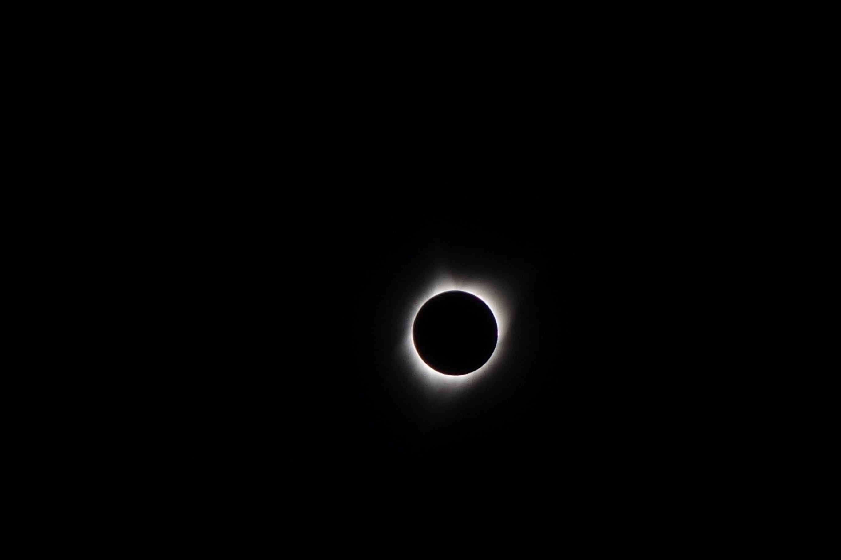
Part of Stan’s idea had been to time our ride in Idaho with the “epicenter” of the eclipse. He got it just right.


Would love to incorporate some fly fishing while either doing the whole route or just the Northern route. Is there opportunities to fish streams along the way or is it not worth it ?
Dave – I’m not an expert in fly fishing – I have only fished with lures.. but I’d definitely say “go for it”. I think it is worth it to come prepared – especially if you have one of those packable fly rods.
Hi Brian. Thanks for the great write up. My son and I could start this trip on gravel bike Sept 12 or so(couple of weeks from now) I understand it will likely freeze at night but what is your gestalt on 50-60 miles a day for the route that time of year? Appreciate it! Joel
Hello! On the map, it looks like there are stretches of paved roads. Can you talk about how safe these felt?! Thank you!
Krista – Thanks for your question. None of these roads concerned me for safety. In fact, we were there during the eclipse, meaning that there was A LOT more traffic than usual. In spite of this, traffic was still pretty light in most areas. During normal times, I think it would be even better. Of course, everyone has a different tolerance for vehicles, but I would say this is safer traffic-wise than the many of paved roads I have ridden.
Looking to do this ride in late July /early August this year on a Gravel Tandem. Any recommendations?
Go for it! It will be a little on the warm side at that time of year, but the route we took was smooth enough for a gravel tandem (and I usually try and encourage people to “overbike” a little)… but this route is quite tame. I think it would be OK on a tandem with tires 42c or bigger.
Hi Brian – thank you for your helpful blog! Did you do the loop counterclockwise or clockwise? And may I ask how many days you spent on the loop? Also did you ship yourself packages of resupply food to post offices along the way? I do this while backpacking, just curious how you resupplies food along the route. Thanks! -Carrie
Hi Carrie – We did the loop counterclockwise. It took us 15 days (you can see each day on the map). We did not ship food – and it shouldn’t be necessary; The longest we had to carry food was maybe 2 days. I figure that we may have been going slower than most people too… so with a faster pace, you could theoretically resupply almost every night if that were your style. **UPDATE** I see that you used the word “backpacking” when I originally thought you meant “bike packing”. I’m pretty sure you could still do it without shipping food ahead, though.. but you might have to carry food for more than 2 days like I said above!
Thanks for the trip report! What kind of bikes did you use? I heard “gravel” bike are the best, but do you think a regular mountain bik?e would be ok? Do we need to get less aggressive tires? We are going to do it with a sag truck, so won’t be doing the singletrack…. any other advice would be great! Thanks!
Hi Mary – A regular mountain bike would be really good for this ride. You could get away with a gravel bike, though. Hope you have a great trip!
Thanks for the info. Looking to do this loop September 2022. What type of bike do you suggest – mt bike or lighter gravel bike (we likely wont do the single track sections)? Coming down from Alaska and trying to decide if we haul full suspension mt bikes or rent bikes in Boise (know of any rentals?) Thanks.
Hi Joe – This route could be done on rigid mountain bikes, so you don’t need suspension (as long as you skip the single track sections). You could probably use a gravel bike too if you didn’t mind the jostling. For us, hard tails (front suspension) bikes were the best.
There was quite a bit of washboard. I found my full suspension really helped.
Thank you for this hugely informative report! I leave in a week for a 10 day ride around the hot spring loop. My buddy Tom and I are pretty strong riders but living in Austin, we just train the 100+ heat, not the climbing. The northern loop…is that what is in the map you posted above with GPS points?
Also, how many mile did you ride in total?
Thanks again! So excited to see this part of country up close and intimate.
Spencer – the map we show is the whole ride – but look for the Lowman cutoff. It is road, but it could form the Southern portion of your loop. We rode about 500 miles in all. You could probably do the whole thing, or if you want to be more relaxed, try looping as I suggest skipping the South. Enjoy!
Howdy!
Looking to do a 7 day trip (really 9 with two travel days from Boise in a car) of the Idaho Hot Springs Loop.
What stretch would you recommend?
Claire –
I would recommend doing the Northern Loop. This is for 2 reasons:
1) The big reason is the unrideable section on National Forest 227 (the road between Ketchum and Featherville). Although beautiful, this section would be less enjoyable due to the difficult hike-a-bike.
2) With 7 days, you’d be hard-pressed to do the entire thing (though it is not impossible, I think it would be more fun to take time and enjoy the hot springs.
When I bought the GPS maps from Adventure Cycling, it came with 4 GPS tracks. One of the GPS tracks was called “2014cut_low” which referred to the “Lowman Cutoff.” Basically, to do this, you’d ride the route from Boise up to the so-called Lowman Cutoff. The Lowman Cutoff goes from Crouch to Grimes Pass to Lowman, and then rejoins the main route on 21 near Stanley. From here, you could stay on 21 to Stanley, resupply, and then ride the route (which roughly parallels 21) back to continue on the Northern loop of the ride.
There are a lot of great hot springs in this section – probably a higher concentration of our favorites – so highly recommended.