Circumnavigation of the Palisade Crest
This is the map for the entire route discussed in this post. To Export GPX files, click on the three horizontal bars in the upper right hand corner of the map and select Export selected map data... To see full screen, click here (opens in new window)
For a long time, I have wanted to visit the Palisade Glacier. Everyone knows that glaciers are shrinking and vanishing, so I figured it would be a good idea to check out this noteworthy glacier sooner than later. I always prefer loops as opposed to out-and-backs, so I set out to design an aesthetic route that visited popular sites and lakes – but also went by some less visited regions. In addition to the route design, this trip also focused on fishing – a sport that I have taken to very quickly. I felt confident that I would catch fish easily, so I brought far fewer calories than normal in the pack. This was to offset the additional weight of a pot and stove – both of which I don’t normally carry on backpacking trips.
The route ended up being kind of a “dream route” for me – connecting a lot of places that I had seen on the map and wondered what they looked like in real life. There were several short out-and-backs to visit various lakes as well. In terms of difficulty, I wanted to keep everything class-2 or easier… but I decided to follow a class 3 route down the North side of Cloudripper. It was scary, so if you decide to follow this route and don’t want to do class 3, there is a class 2 route down the north side of Cloudripper that goes via Vagabond Peak. You can still visit Chocolate Lakes if you want; my motivation was to make the more aesthetic straight-shot to these lakes from the peak. The descent I took required a lot of slow movements and care not to disturb loose rock. Often rocks would fall in the narrow chute; having a helmet would have been preferable, though cumbersome considering that this was the only section where it would have been really required. Scimitar pass and Haeckel Col were the two other difficult passes – but if you follow my route (except for the small mistake on Scimitar), they are quite do-able.
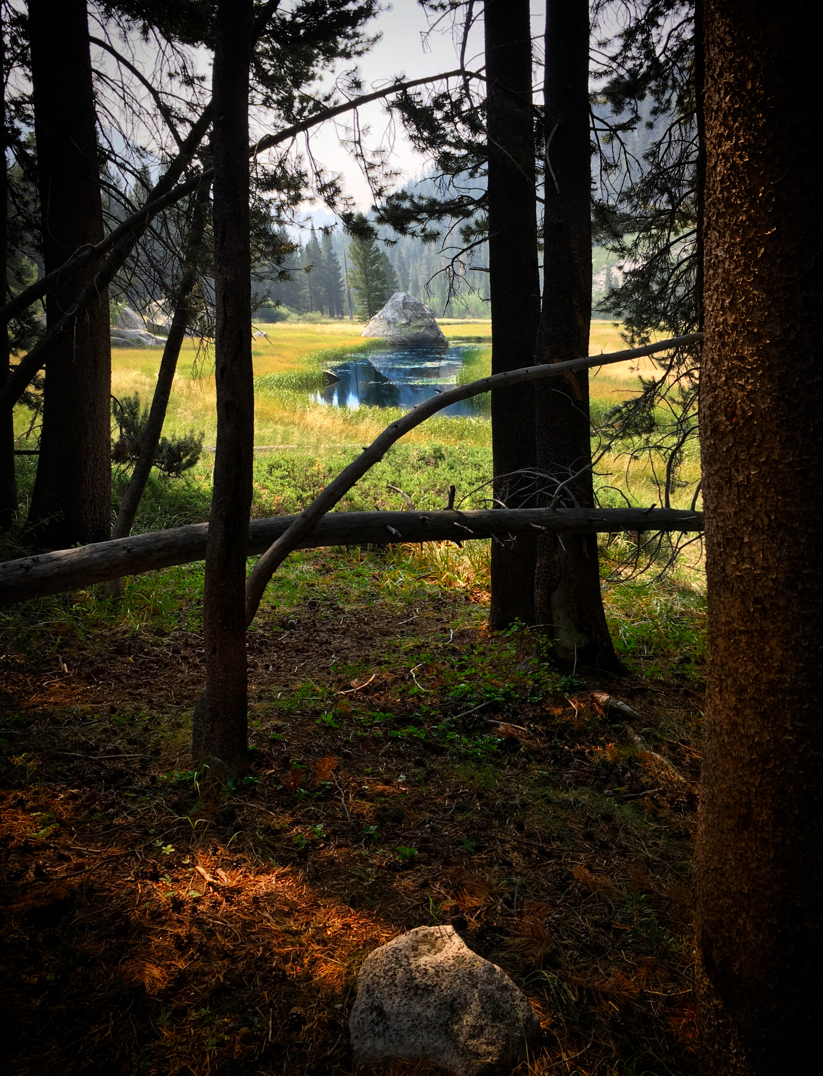
Please enjoy the photos and captions below…
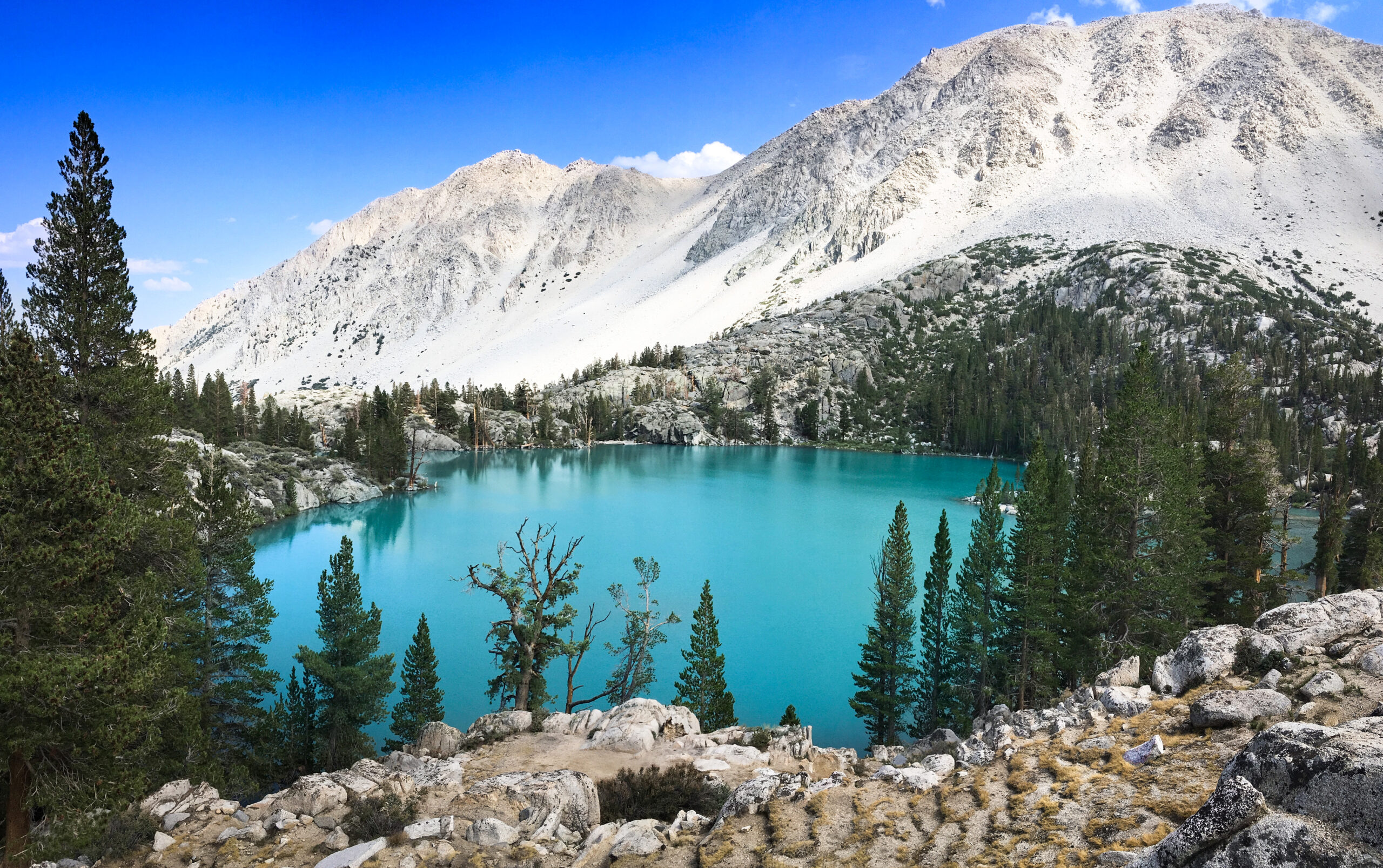
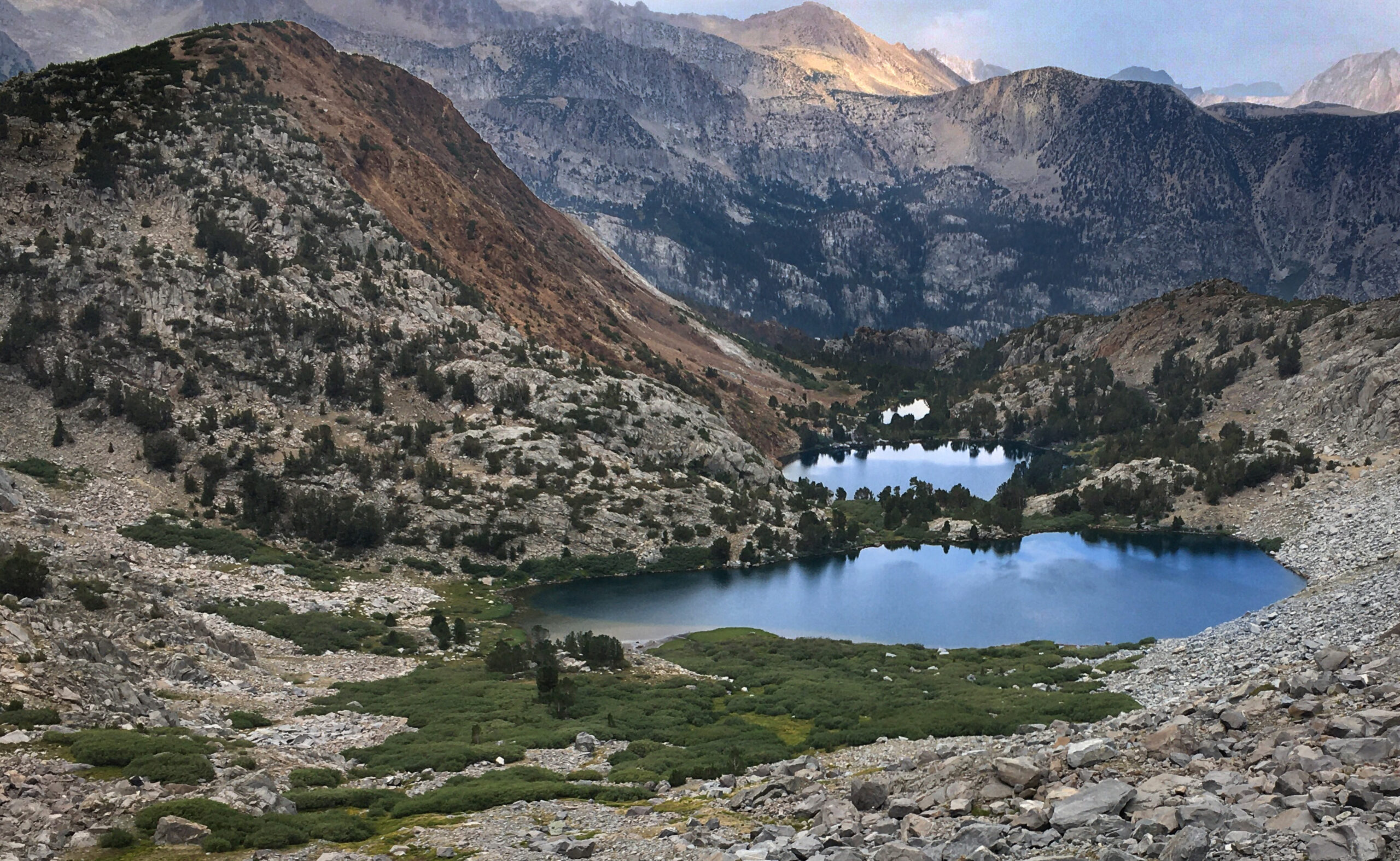
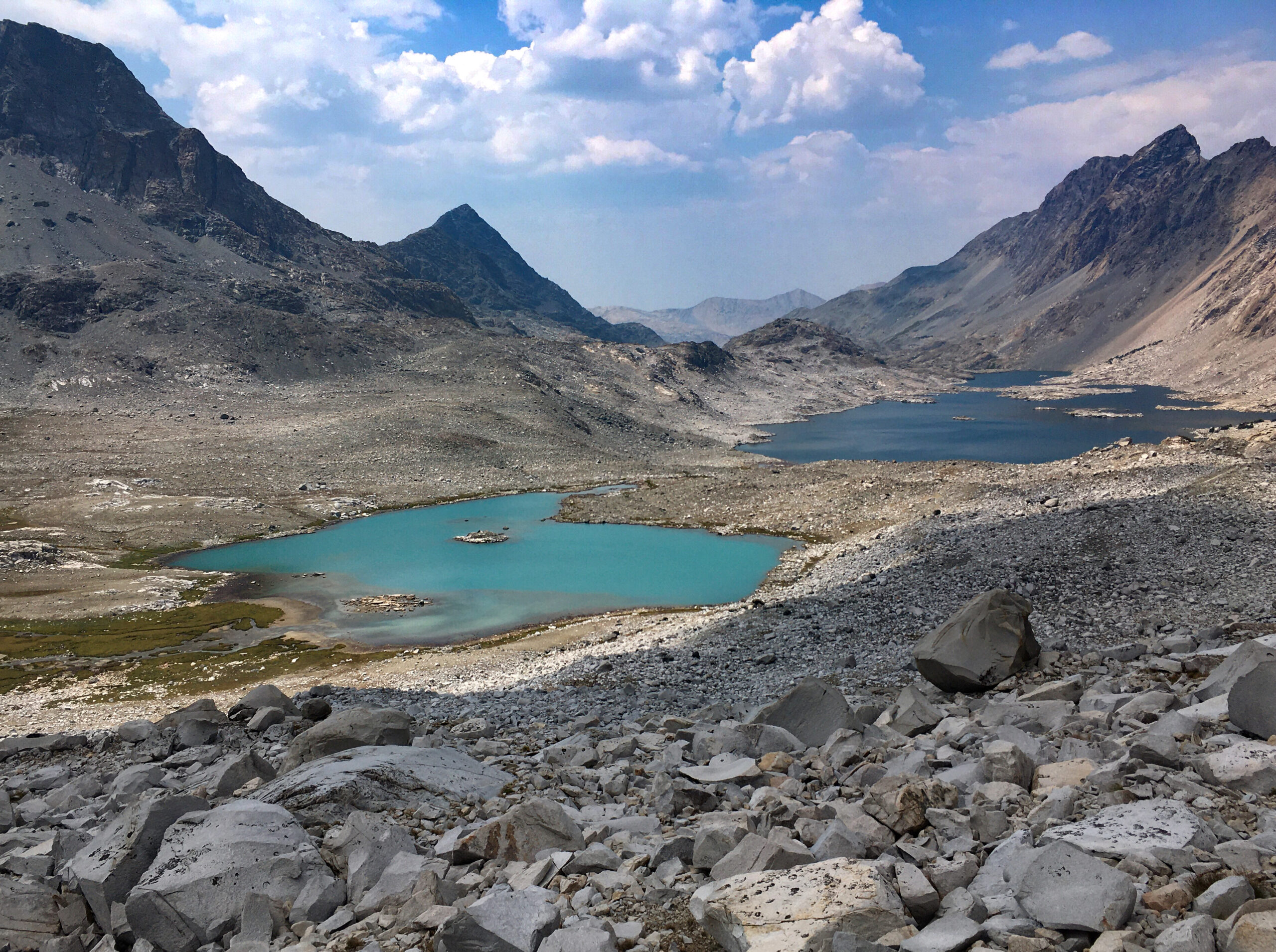
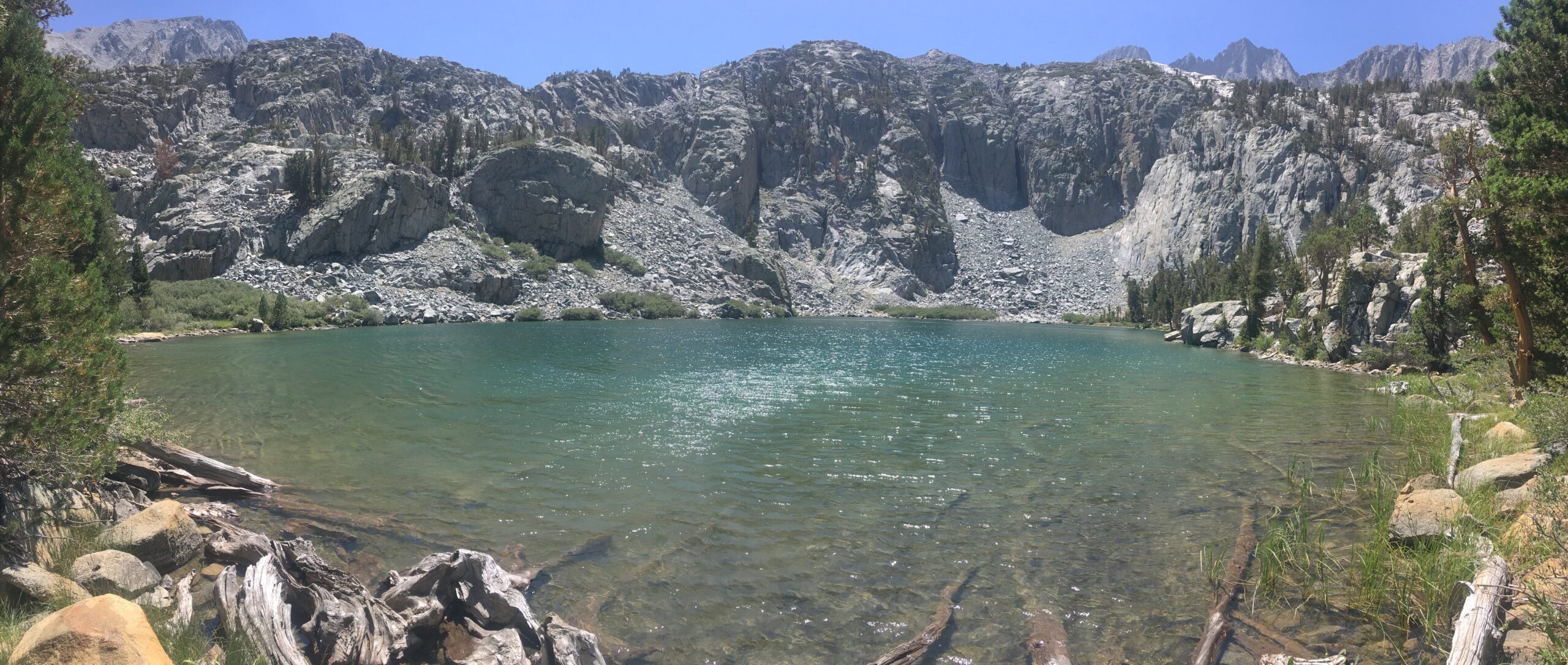
Lake 3. They were not very creative in naming these lakes.
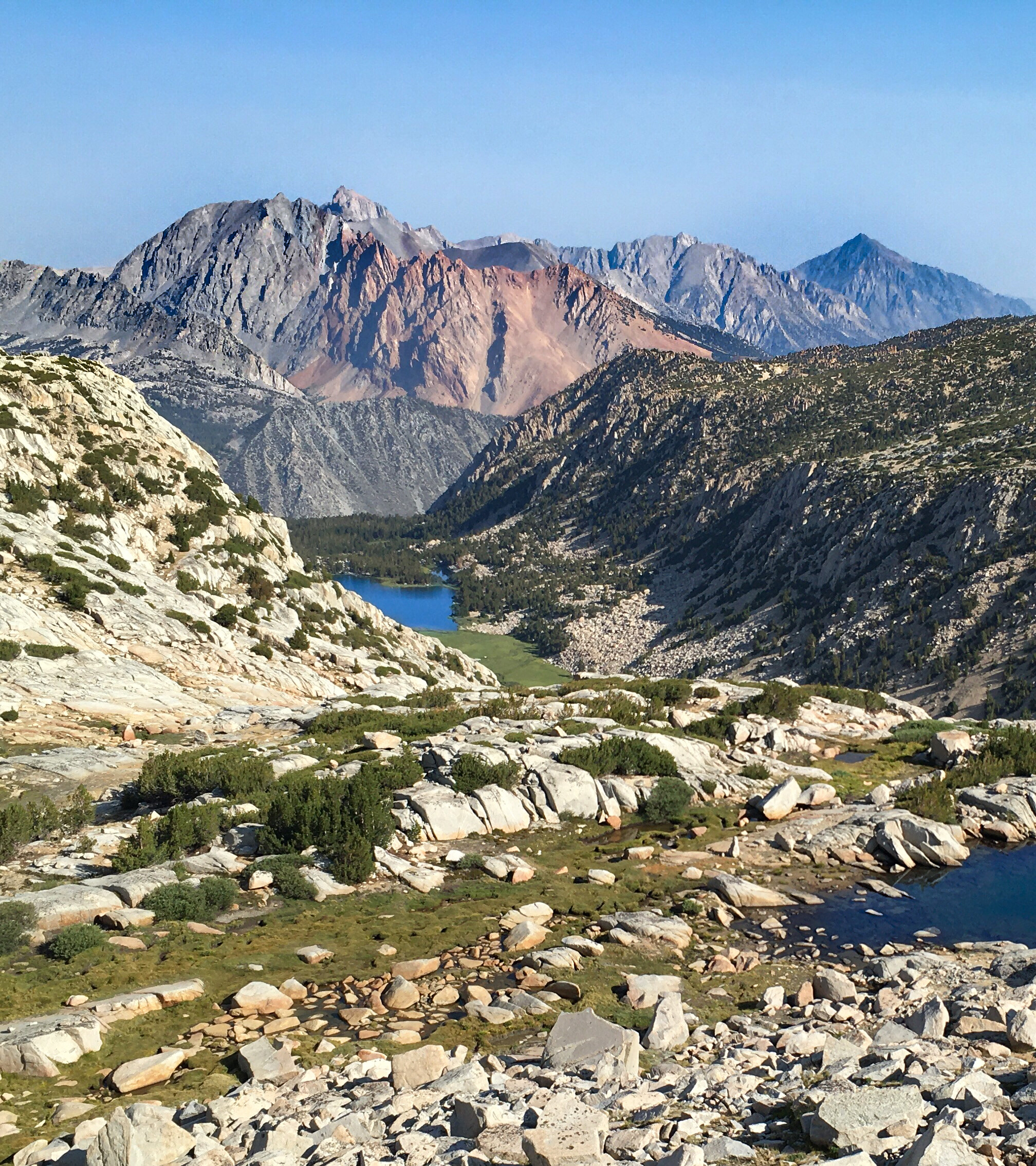
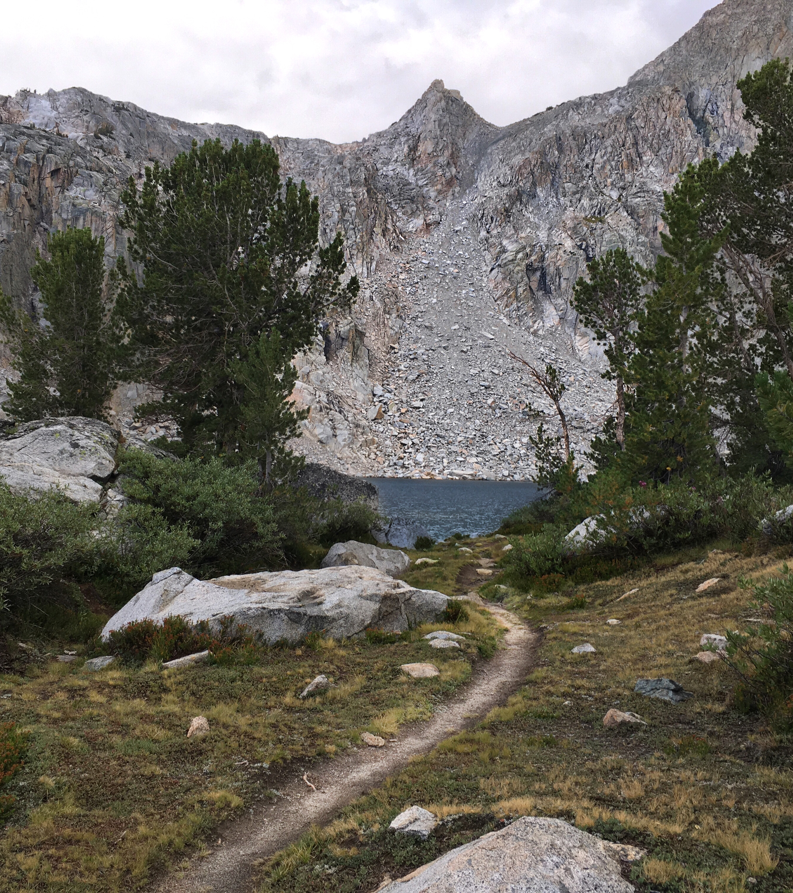
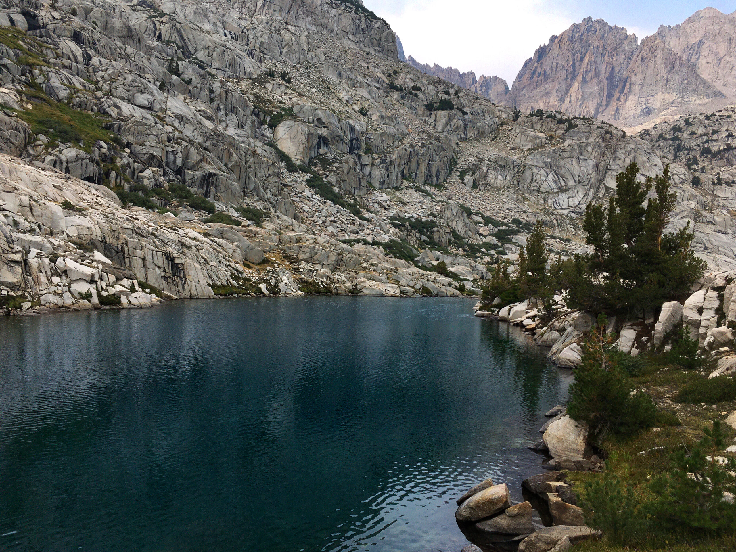
You can see Lakes 1,2, and 3. They are below the Palisade glacier; the glacial melt gives them this color.
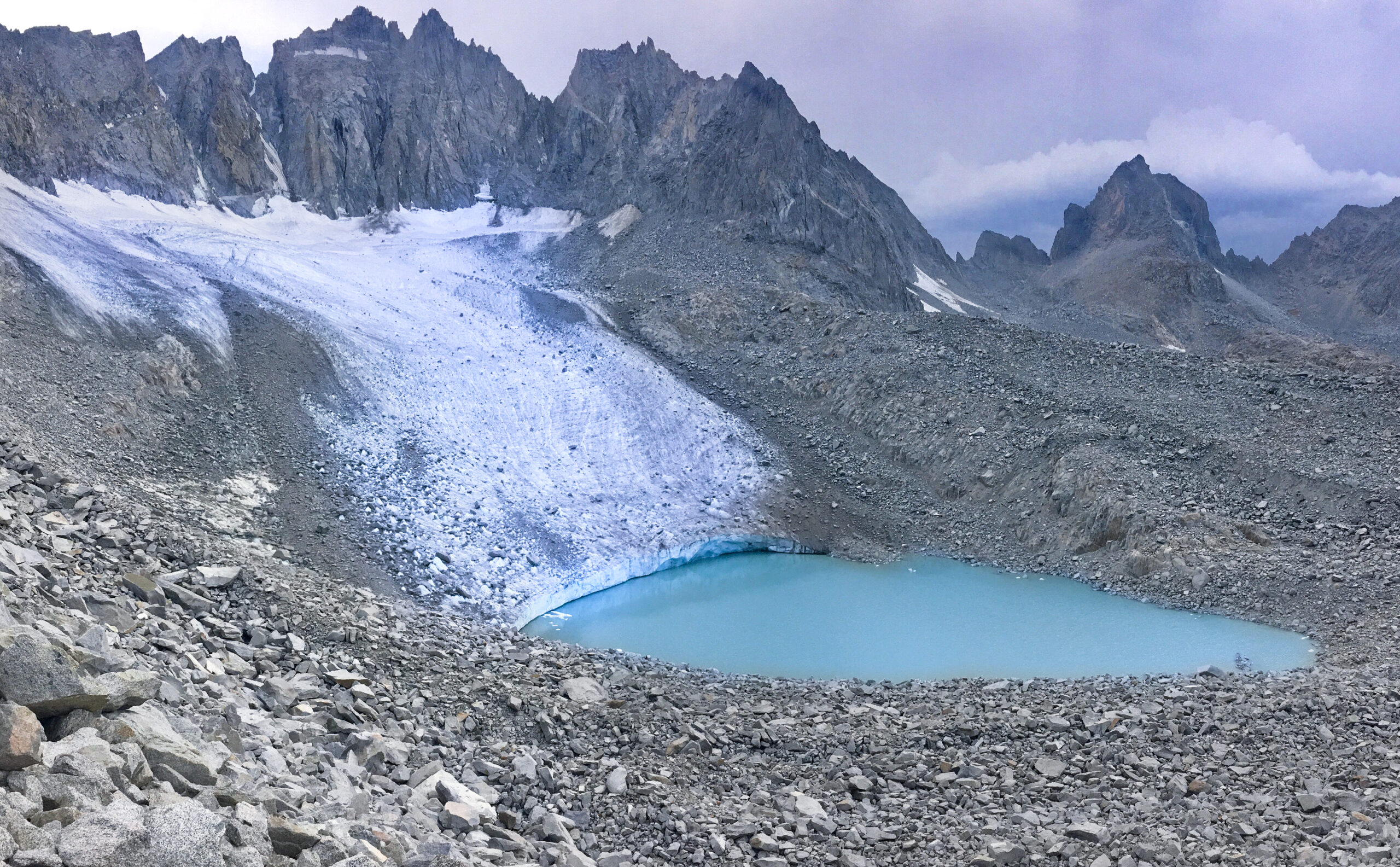
I have long wanted to visit the Palisade glacier – so here it is! Very happy to be here. Felt extremely weak due to my anemia – much much weaker than Sierras only about 2 weeks ago. But the good news is that my peripheral smear came back normal. This means I’m not as worried about leukemia. Still have to figure out what is going on, but took the good result as a green light to do this trip.

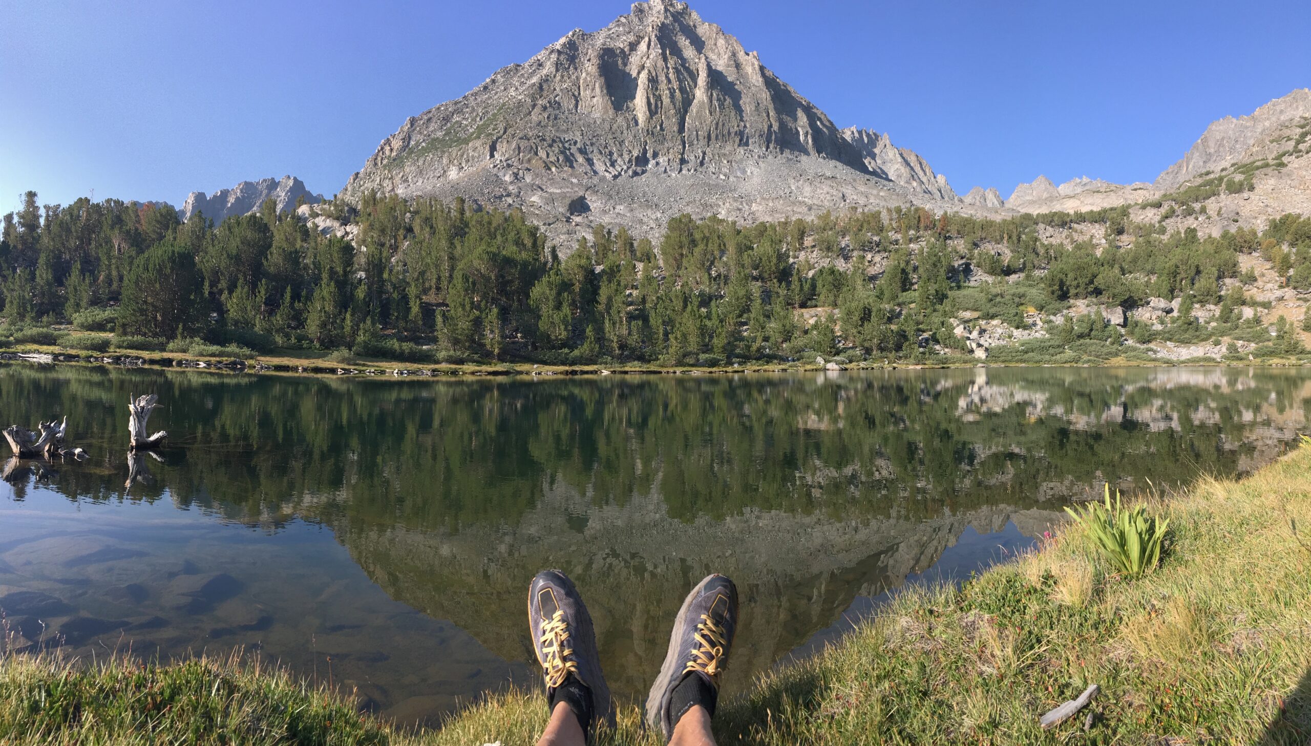
I Stopped at Seventh Lake to fish and relax and get mentally prepared for Cloudripper. Took a quick swim too. That is “Two Eagle Peak” in the background.
Thunder and Lightning lake viewed from the shoulder of Cloudripper. You can see a theme in the names of this region?
This is the top of Cloudripper- I had two possible routes down – and easier class 2 descent which was less aesthetically appealing (but would go over Vagabond peak)… or the more aesthetic, but scary class 3 descent to Chocolate lakes. It was tedious and slow, but I carefully made my way down the class 3 chute!
Chocolate lakes from above. The closest lake in the photo happens to be the furthest lake from a more major trail – so when I cast my line, I caught 3 fish in just a few minutes. I was starting to get an idea of what works (and what doesn’t) in terms of fishing.

Ruwau lake. I was going to skirt the String of chocolate lakes, but upon seeing this beauty from above, decided to change my route slightly to walk it’s shore.
I was briefly on the highly trafficked “Bishop Pass trail”, just a quick connector to some more interesting routes… but this popular trail is quite pretty on the East side of the pass!
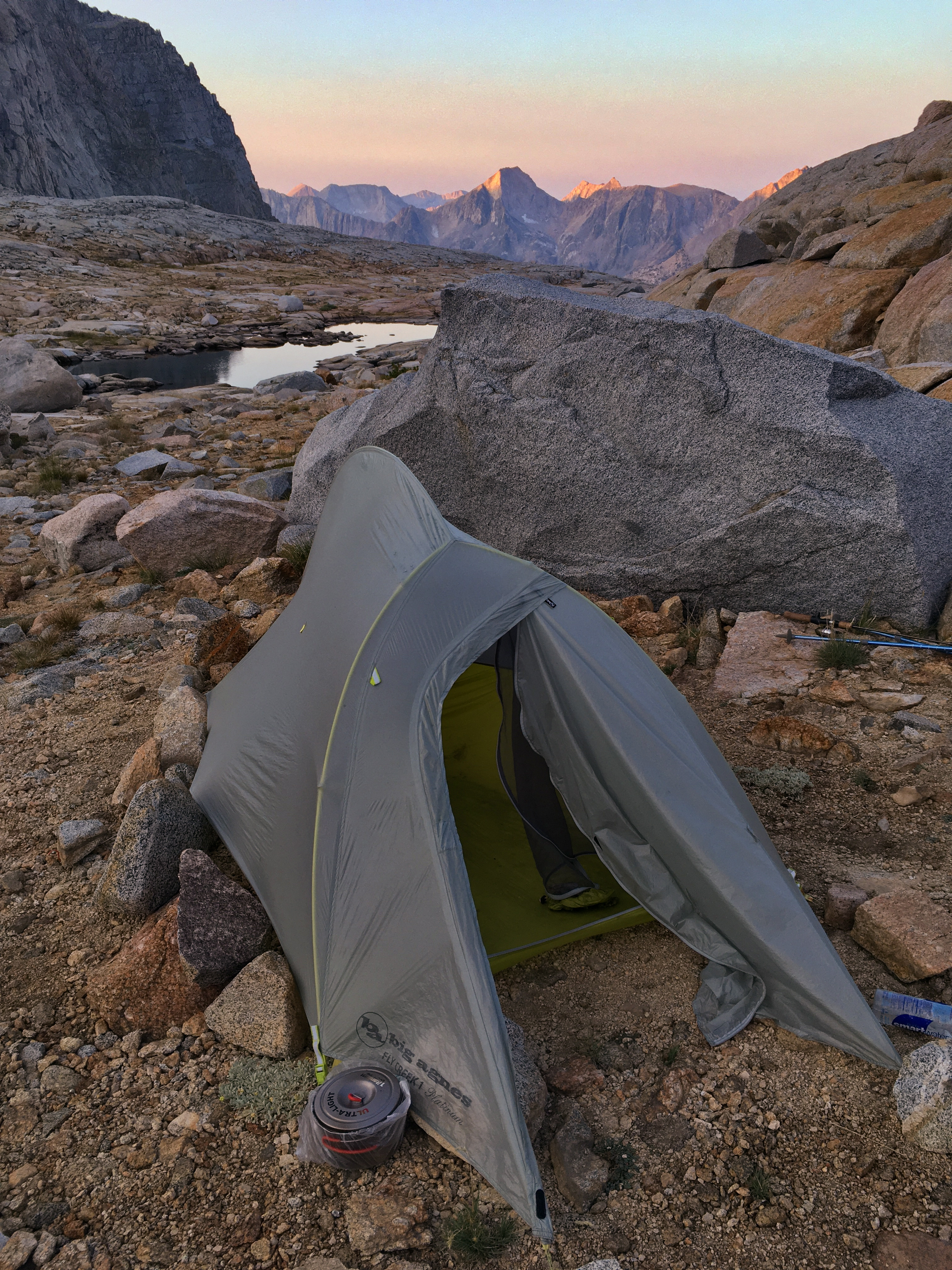
My tent for the night at Treasure Lakes. Again, I was learning what works for fishing – Treasure lakes are accessible on most sides. It took me several hours to catch just one medium sized fish. I fished through a thunderstorm wearing my plastic bag poncho and boxers! After the storm was over, it became apparent what was going on : two other people were fishing the lake – I could see fish all over, but they weren’t interested in the lures. It seems that if you fish where everyone else does, those fish become disinterested in the lures… the other people were not catching fish either (I watched them because I didn’t want to have FOMO!!).
Along the South Lake/Sabrina crossing.
I made an off trail connection between the South Lake and Sabrina lake basins. I had scouted it out on satellite beforehand and it ended up being not too scary. Mainly, I look for cliffs on the topo/satellite images. Today, the biggest impediment were the willows, which cut my legs as I was bushwhacking. The terrain going up was complicated at first (navigating around waterfalls and cliffs), but got much easier and prettier at the top as seen in this picture. Really loving this route and continue to be excited for each upcoming leg!
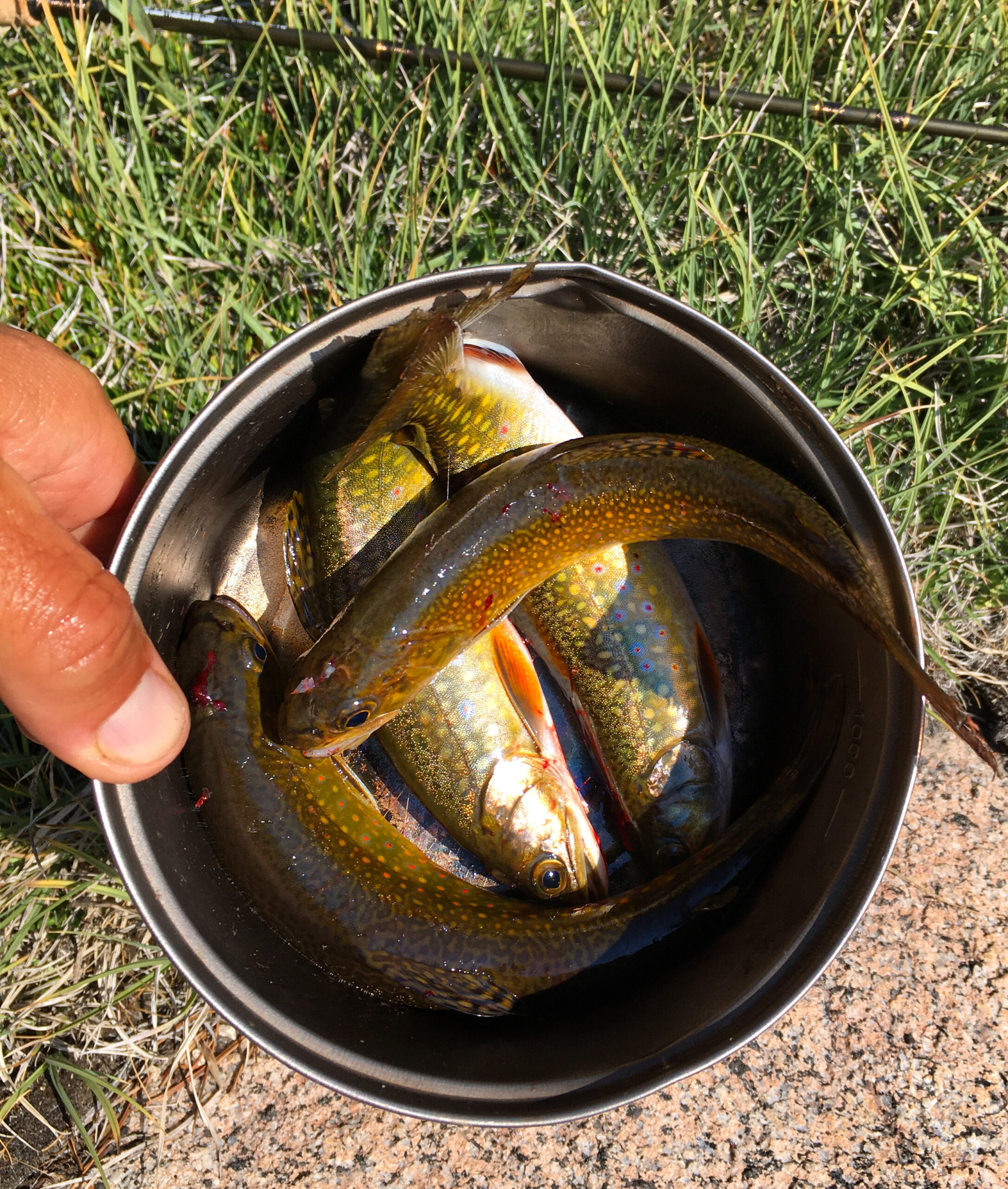
I want to tell you more about fishing. Before the trip, my friend Mike B. loaned me a beautiful rod and reel that packed down small. I was a bit worried about taking this uber expensive setup to the mountains. I had seen this even-lighter $21 spincast reel at Big 5, and since it was 7.7 ounces, I decided to bring it instead – wouldn’t have to worry about damaging or losing Mike’s nice gear. What you see in the photo is everything I brought for fishing – lures worth about $7 and the rod/reel. Also, I had a $53 fishing license. I love simple sports like running (all you need are shoes), and this type of fishing has an aesthetic beauty to it. Plus I learned a lot about fish behavior in just 6 days. Ironically, you end up paying more attention to your natural surroundings – even though there is that one bad part… I loved almost every bit of fishing – the feeling of a tug on the line, watching the movements of the fish, and then perhaps my favorite part was the revelation of the beautifully colored and patterned creature as it emerged from the water. These were all Golden Trout, and mid-day light would make them gleam more beautiful than gold itself. Then came the one part I didn’t like: my part in transitioning them from live fish to dead fish. I tried to do this as humanely as possible – even spent hours reading online “do fish feel pain,” and “how to kill fish.” I was pleased to see that most fishermen online were respectful of this task. I gave my own thanks to each fish. It’s a dilemma – we all must eat something. In the modern world, we even have the option of eating no living creatures – which I experimented with for several years in and after college. I still ponder this ethical dilemma every day, but capturing food this way seems to me a way to be a part of the full human experience that has existed for 200,000 years. I feel that if I’m going to eat the flesh of another animal, I should take ownership of of the full process.
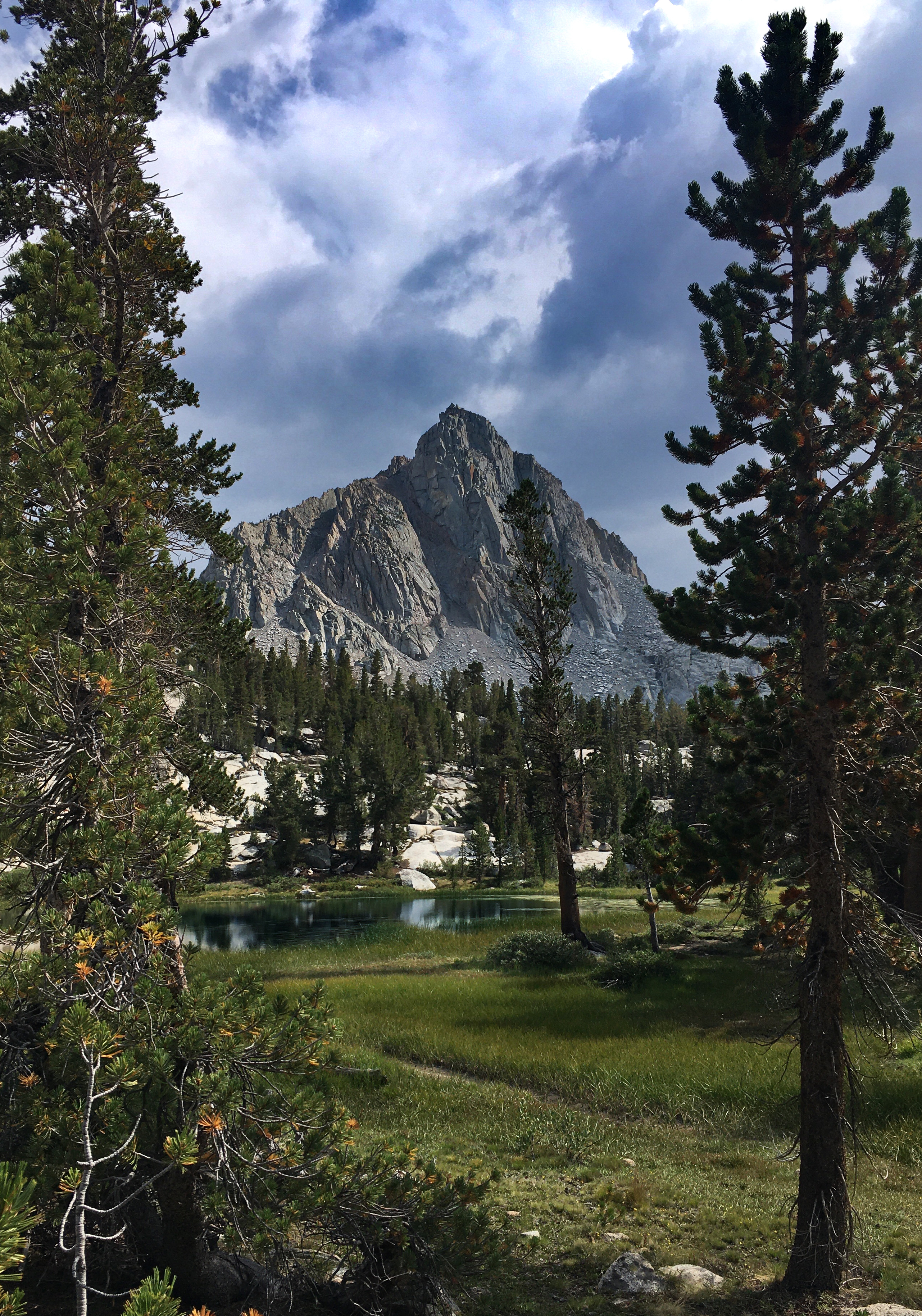
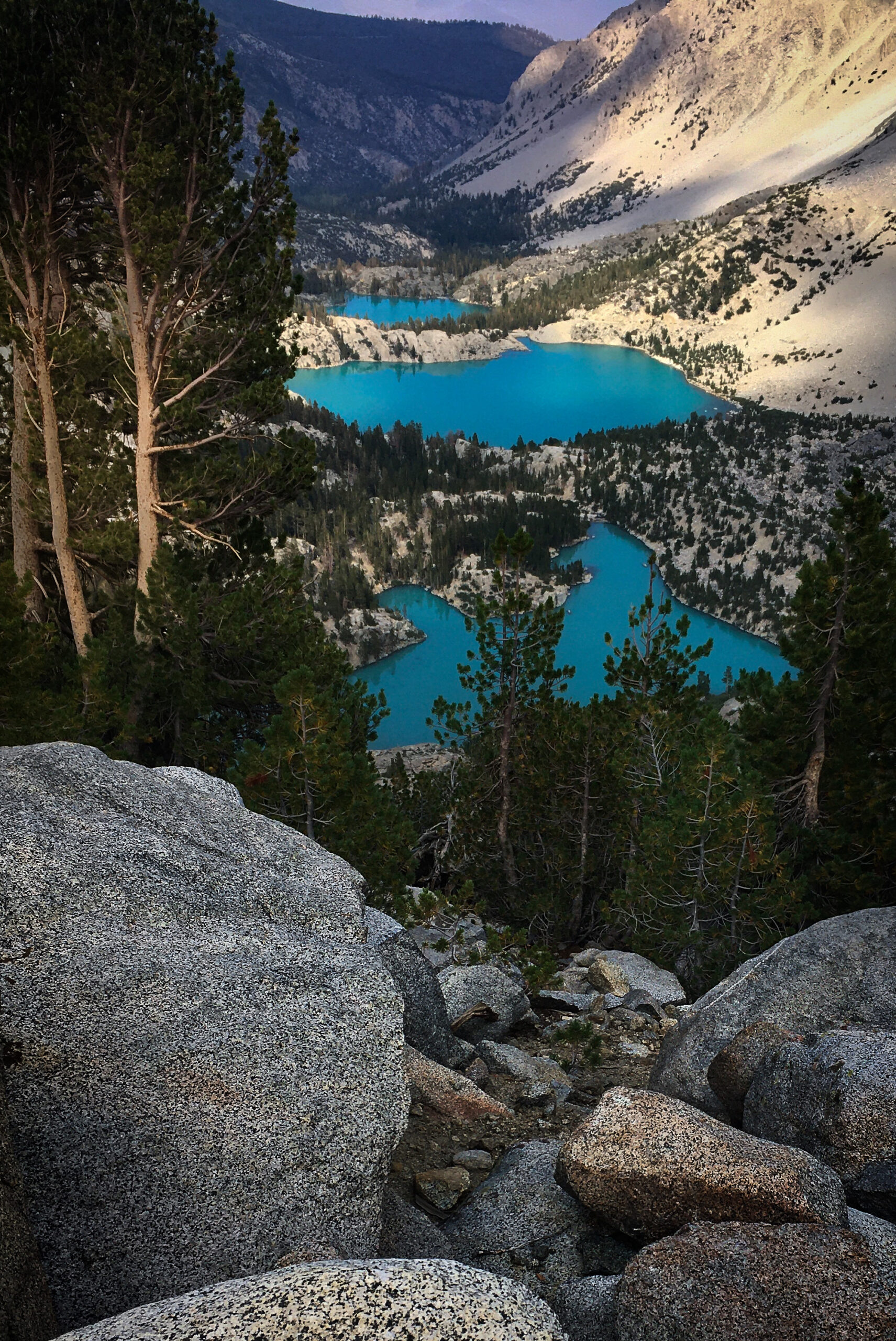
The lowest of the Emerald Lakes, with an unnamed peak in the background.
This is Midnight Lake. I was excited to get here as it was the end of the trail (tomorrow over trail-less Haeckel Col). A bit nervous but also excited. There were only two other small parties camped at the lake. When I fished the easy places (where you could see everyone else had also fished), no bites. I finally made the effort to climb over rocks and try some new spots. Had my limit in 10 minutes! It is amazing how different the same lake could be.
Here is Hungry Packer lake from the shoulder leading to the pass. I had wanted to visit this lake too, but thunderstorms yesterday deterred me from doing this one extra out and back.
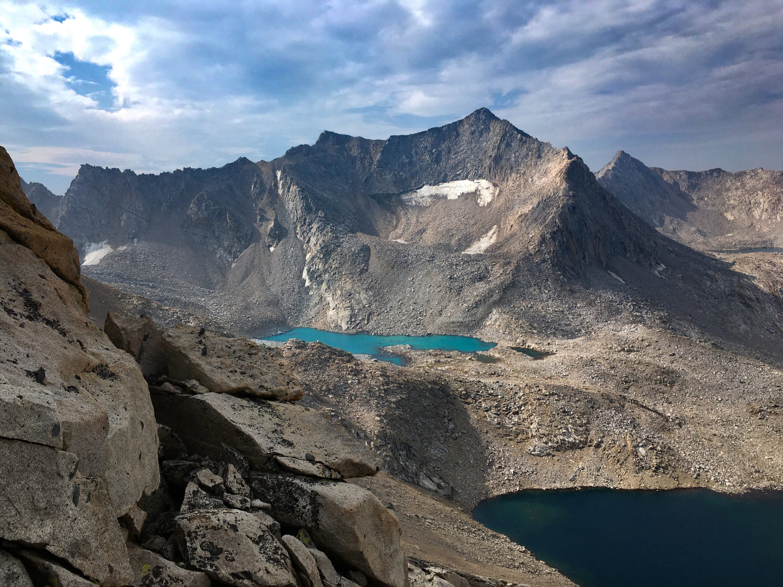
From the top of Haeckel Col, I could see these gorgeous unnamed lakes and a sweet view of Mt Fiske. Fiske I think is “fish” in Norwegian😊. Just out of view to the right is Mt. Huxley.
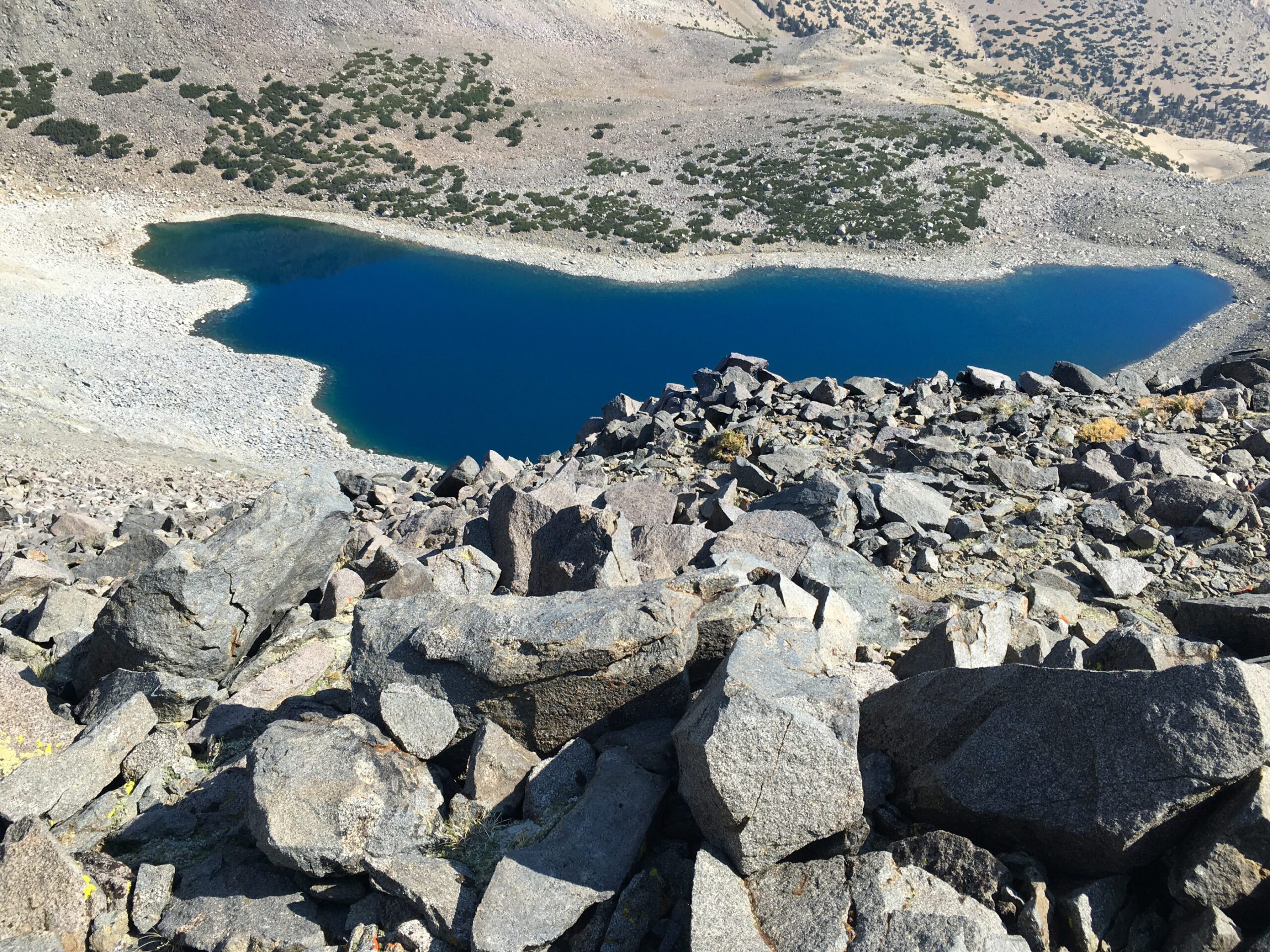
After crossing Davis Lakes pass, I worked my way down to both of these lakes – hoping to fish somewhere that other people don’t fish (these are off any trail)… but zero signs of any fish in either lake! So, another thing I learned is that you need to fish in lakes that are stocked – and they don’t seem to stock lakes that are off trails. A bit disappointed, because I like the “purity” of catching a wild animal… but now it seems as if Fish and Game might just be doing “food drops” with our license fees. I guess you get to pretend like you’re “living off the land”, but really you’re just gathering up food dropped out of a helicopter in the wilderness. Maybe?
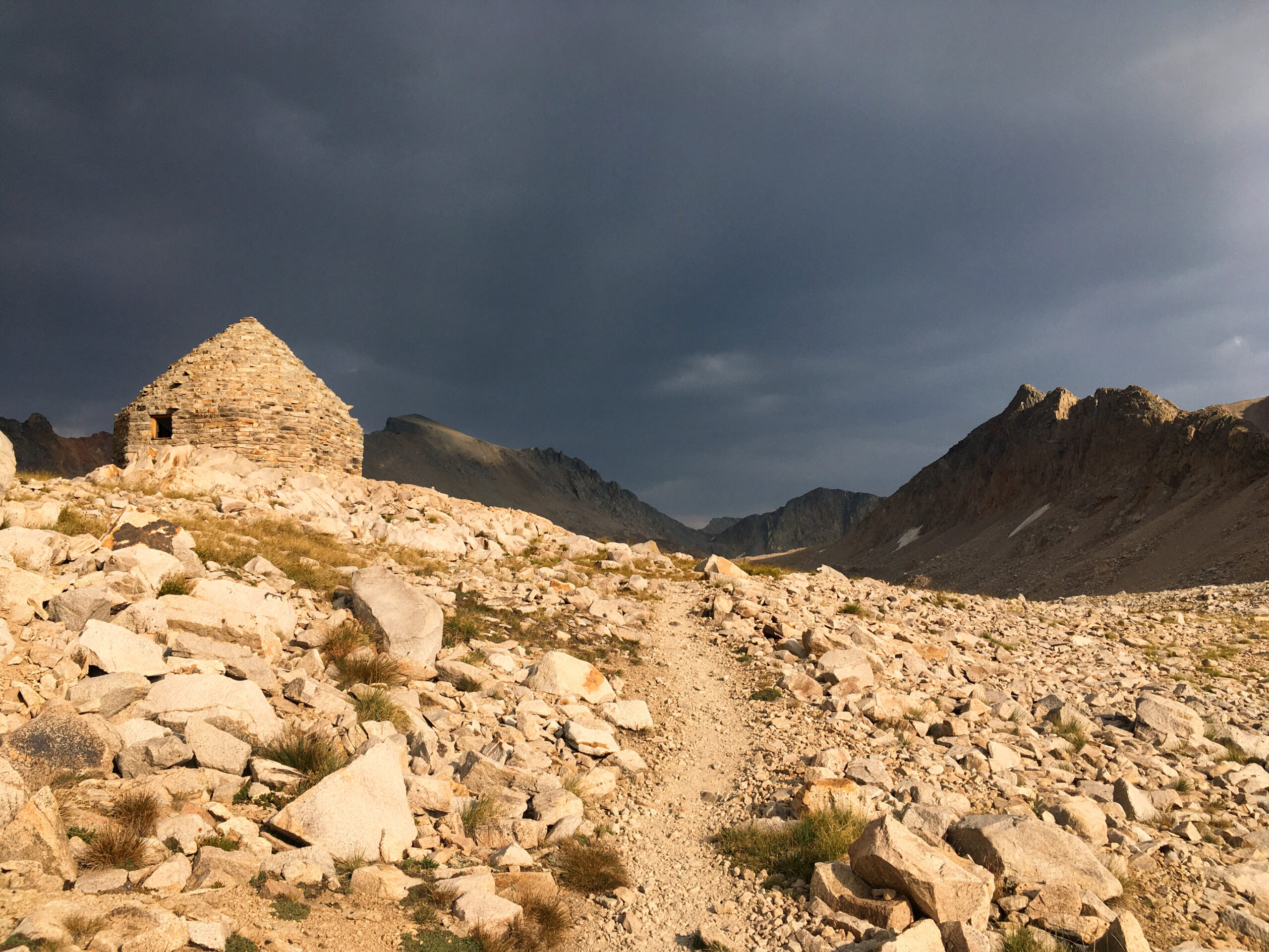
The Muir hut – scenic as the 3rd thunderstorm of the trip approached. Glad I brought that Poncho!
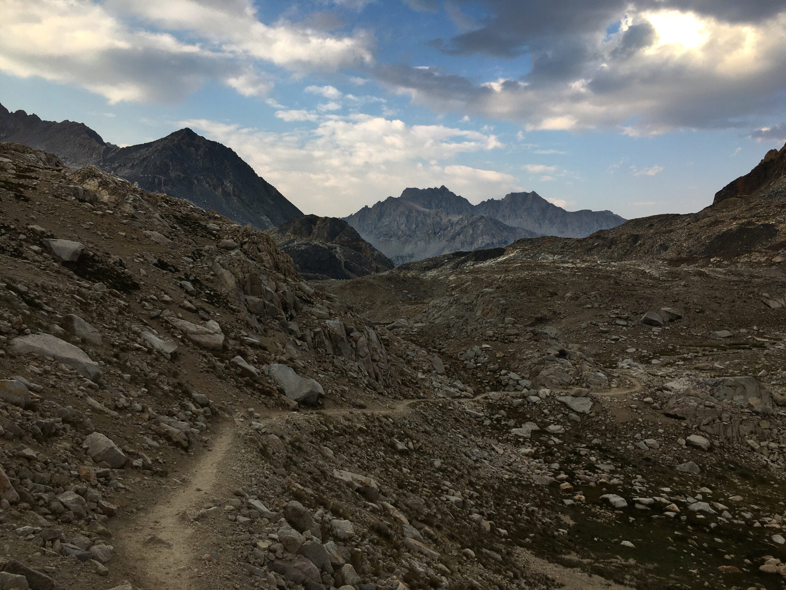
Ahh, some easy trail. Miles go by so much faster on trails. The off trail keeps my mind fully engaged at all times. On trails, the mind can wander… ironic because something always needs to be wandering. If you’re off trail, it is you who is wandering. If you’re on trail, it is your mind that is doing the wandering.
This is “Big Pete” who lives in “Big Pete Meadow” in the Le Conte Canyon. This section of the John Muir Trail isn’t my favorite scenery, but you meet lots of interesting people. For example, I say a “fast looking guy” running with just a Salomon Running vest – with a similarly equipped woman running behind. Was he trying to set a supported running record on the JMT? Another thing I saw a lot of were hikers with headphones. As I was climbing the Golden Staircase, I was stuck behind a group of 3 and finally asked, “Could I pass, please?” The guy in front of me was so startled that he fell over backwards like a turtle on his back! I apologized, feeling bad; luckily his fall was padded by his pack.
In Le Conte Canyon. As mentioned in previous posts, this is a “dream route” for me because it links together many places I’ve wanted to visit… but it also was the first trip in a tentative experiment where I wanted to see if I could “live off the land”. I say tentative because I did bring 4.5 pounds of food for a 6 day trip. That is definitely less than the typical 1.5 pounds of food per day that people bring. The aim way to see if it was feasible to live on caught fish. I think it is possible, however there is limit to 5 fish a day. Even with the food I brought, I lost 9 pounds of body weight on this trip (first time being 155 lbs since high school (except for being super dehydrated after hot bike rides now and then)). Also, there is a bit of a hiccup in the purist “live off the land” aspiration: I still need to bring insulin, which is kind of like brining food. With the reduced caloric intake, though, my daily dosages dropped to about 6 units per day on the 4th and 5th day of the trip.
This beautiful lake is just above Palisade lake on the way to Cirque pass. I had done this section in 2015 on the Sierra High Route. Today I met two guys doing the Sierra High Route – one of them was on his FOURTH trip doing the 200 mile route. He knew the route well, and we both delighted in discussing all the parts we loved the most.
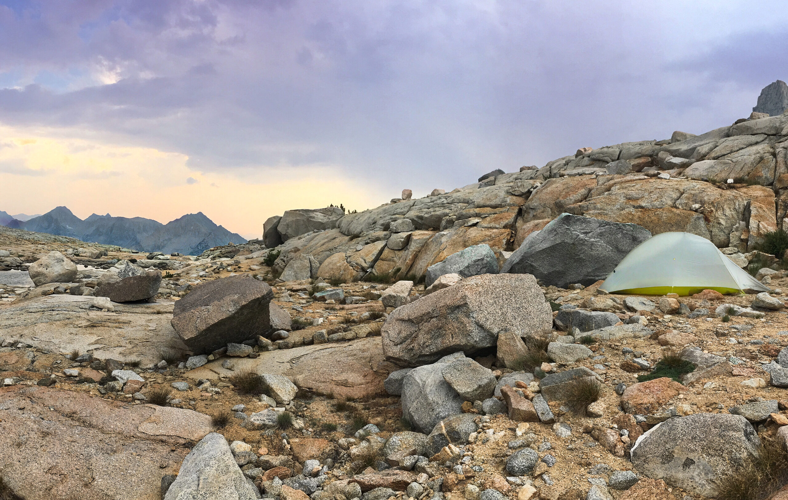
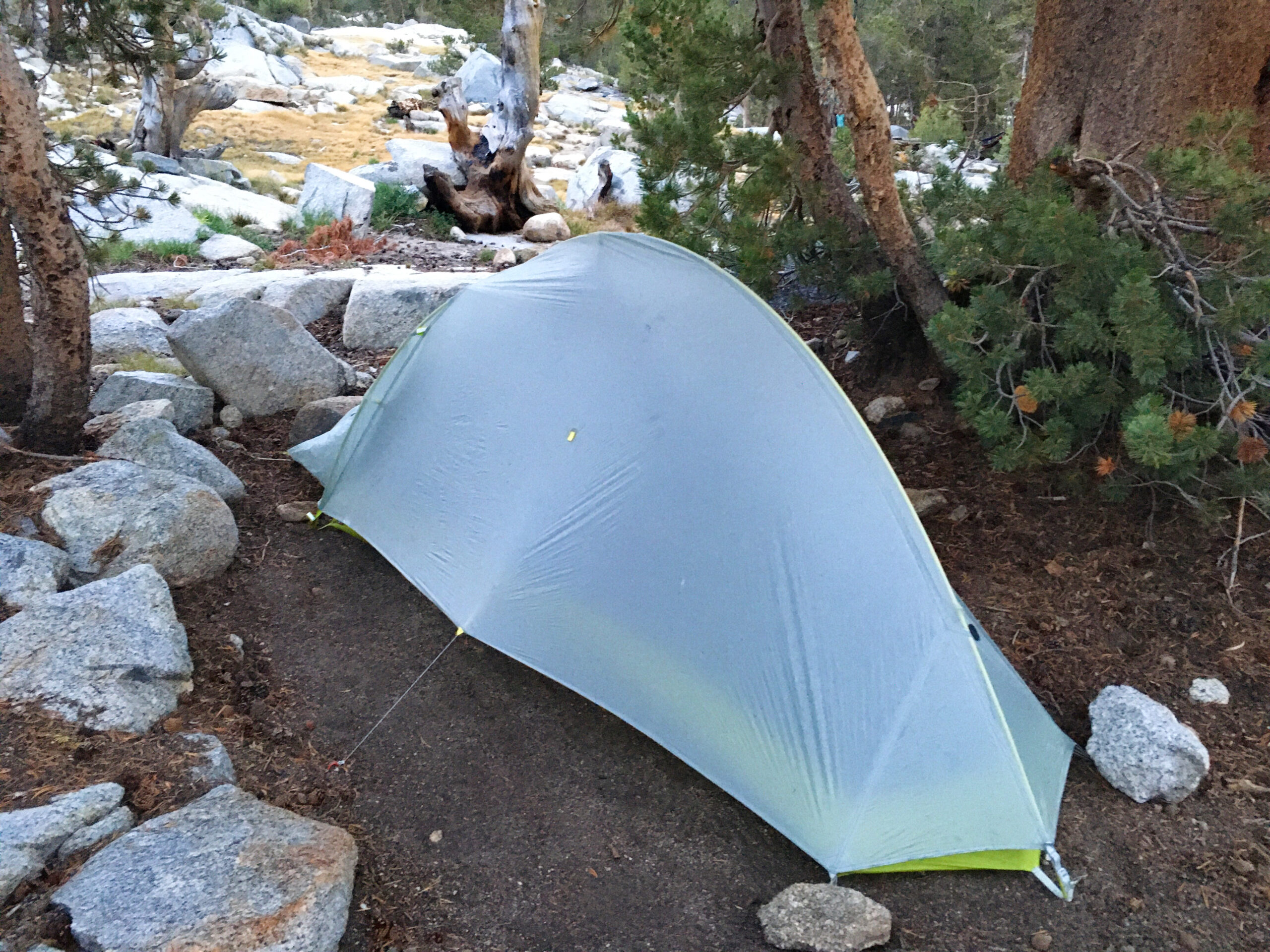
Here is my camp which I set up shortly before the 4th thunderstorm of the trip moved in. I did not fish tonight – as I noticed that off-trail lakes do not have fish in them! I did, however practice mid-day fishing in both the Middle Fork Kings as well as Palisade creek. There I discovered that fish in moving water are much stronger and wriggly than the complacent lake fish.
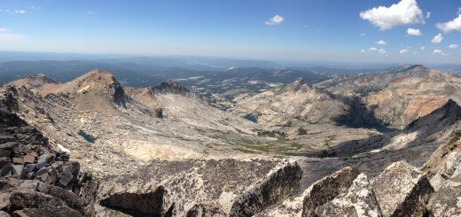
Morning time getting ready for 2 miles to the top of Scimitar. From here, it looks like an unscalable wall, but once you get up there, you find ledges and ramps that you fit together like a puzzle, and eventually work your way to the top.
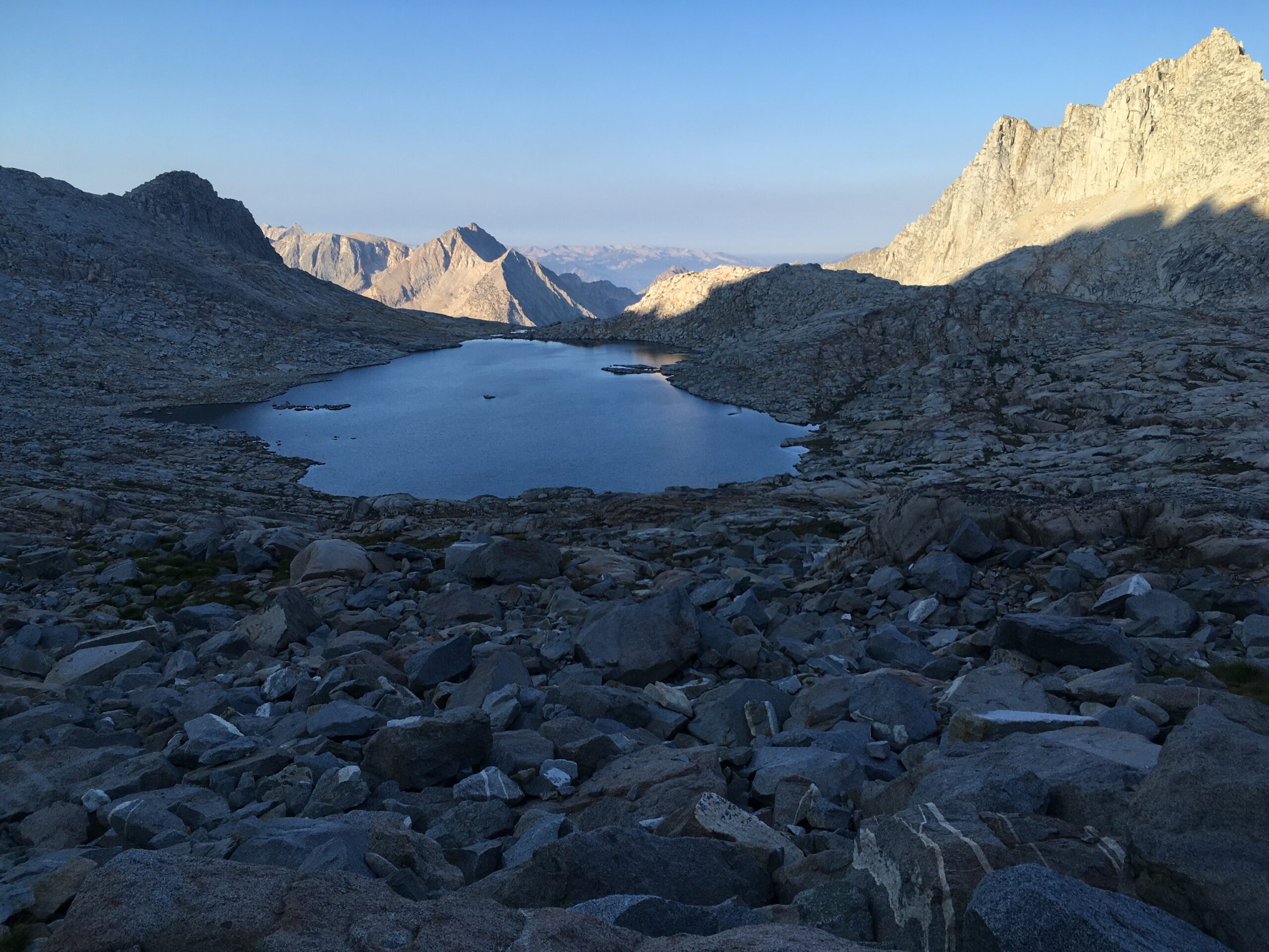

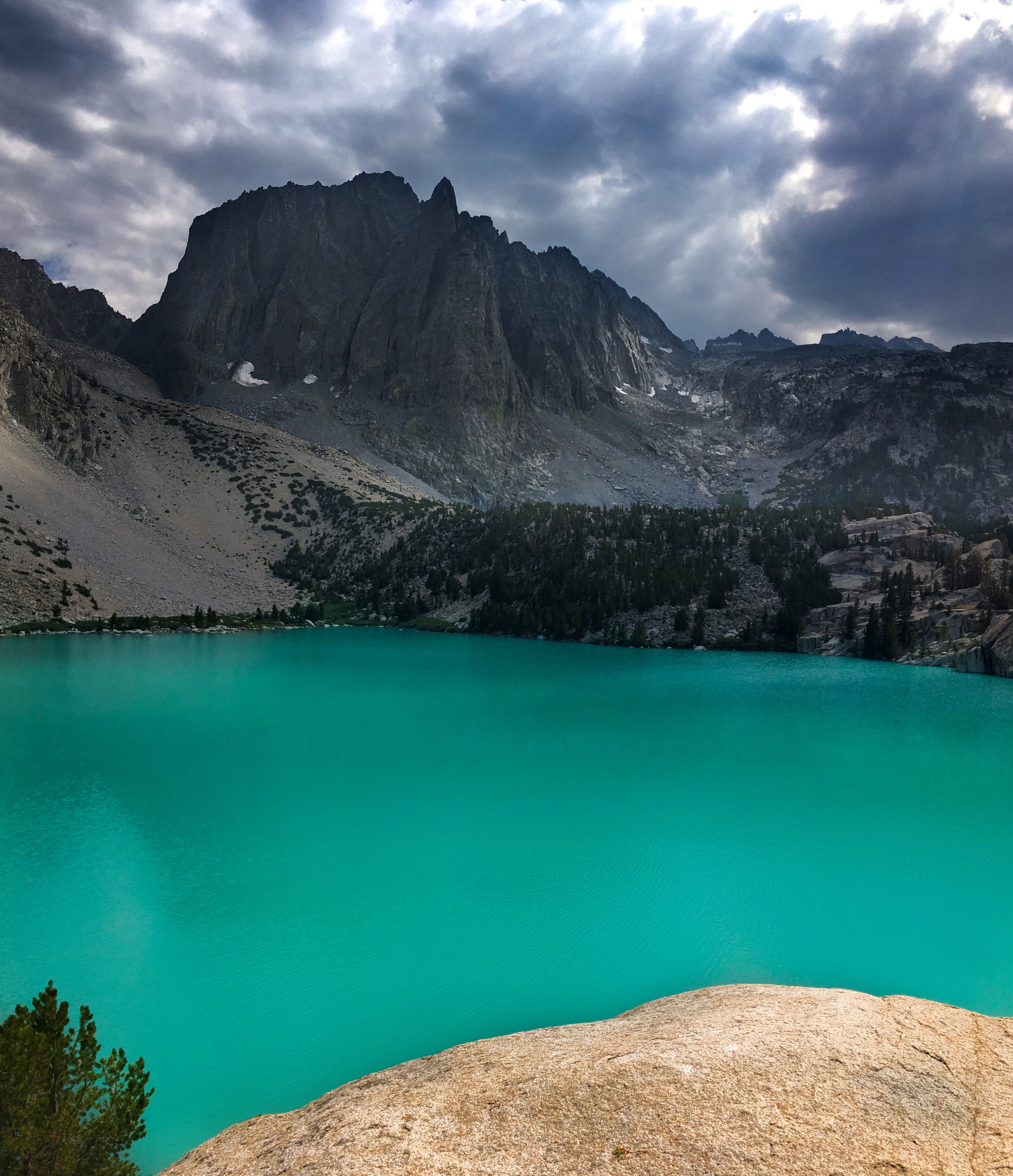
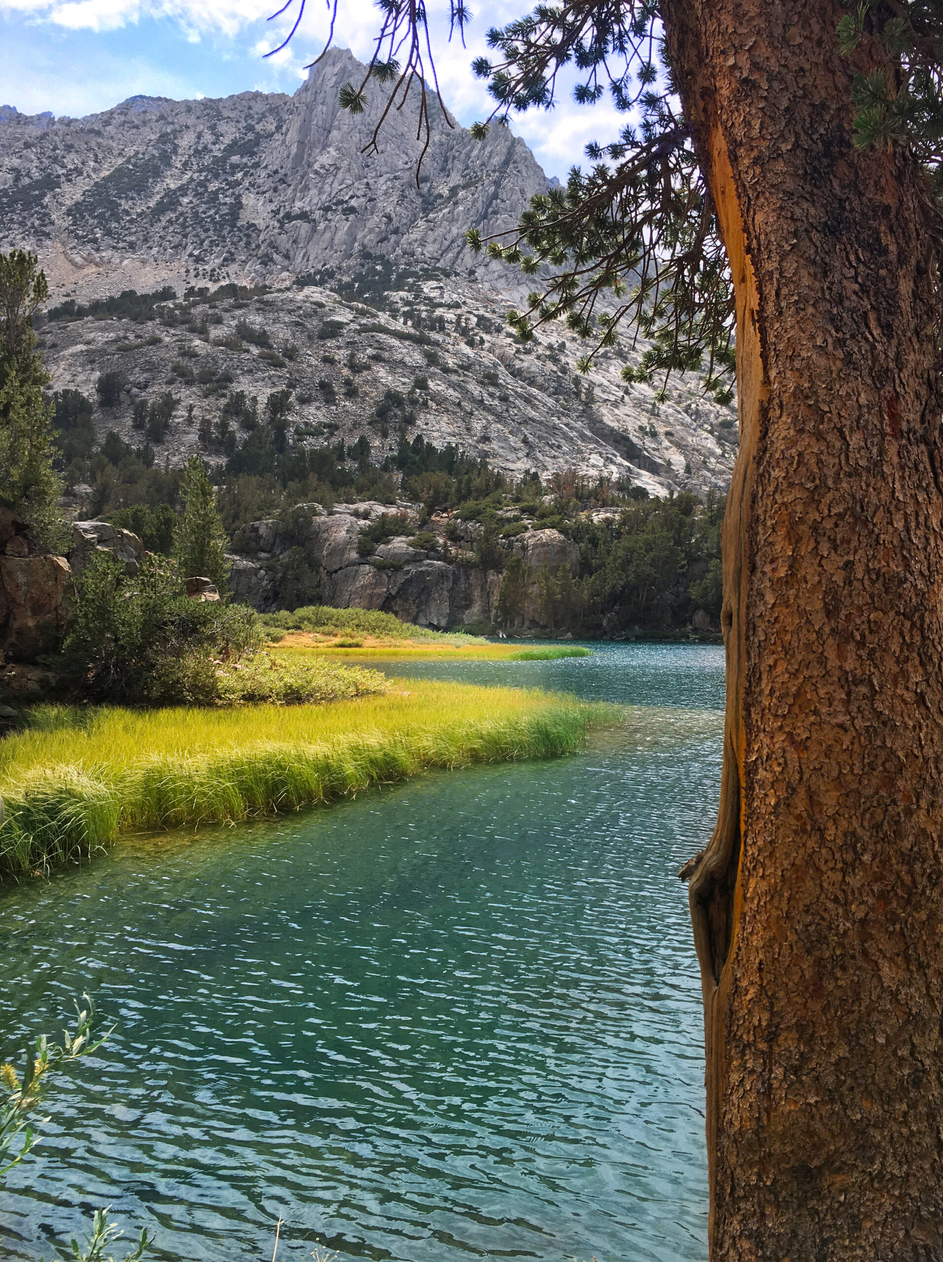
Cradled in the cirque formed by Mt Jepson and the Palisade Crest, you can see “Glacier Creek” – an unnamed lake simply listed as lake “3559” on the USGS Map. The far peak left of center is North Palisade. In the back, the highest peak is Mount Sill (a popular climb with gear). To the right and out of frame is Mount Jepson… and Scimitar pass which I will cross tomorrow. Tonight’s camp is on the shore of this lake
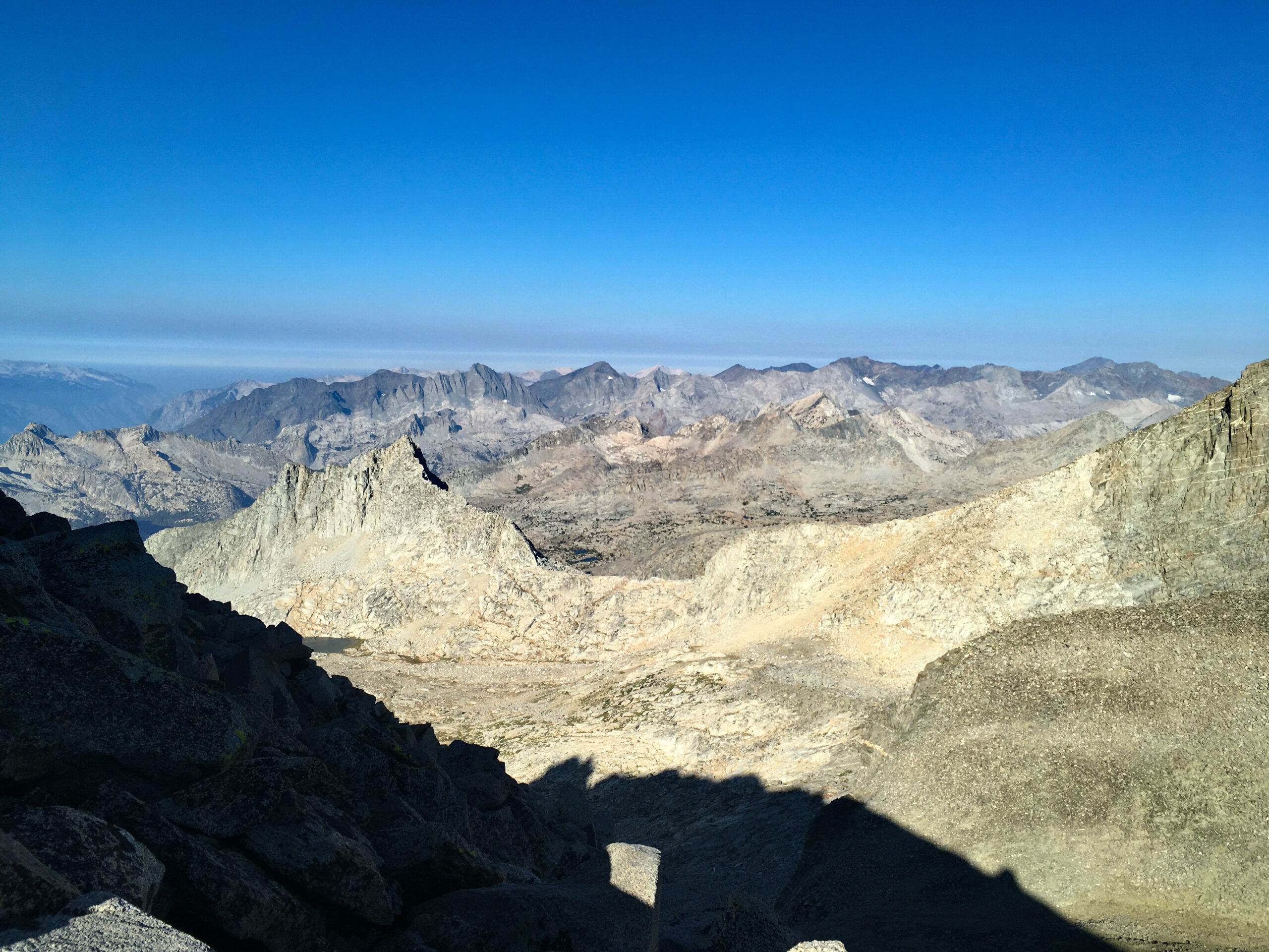
The view looking back West from the top of Scimitar. Today was more clear – less smoke from the fires.
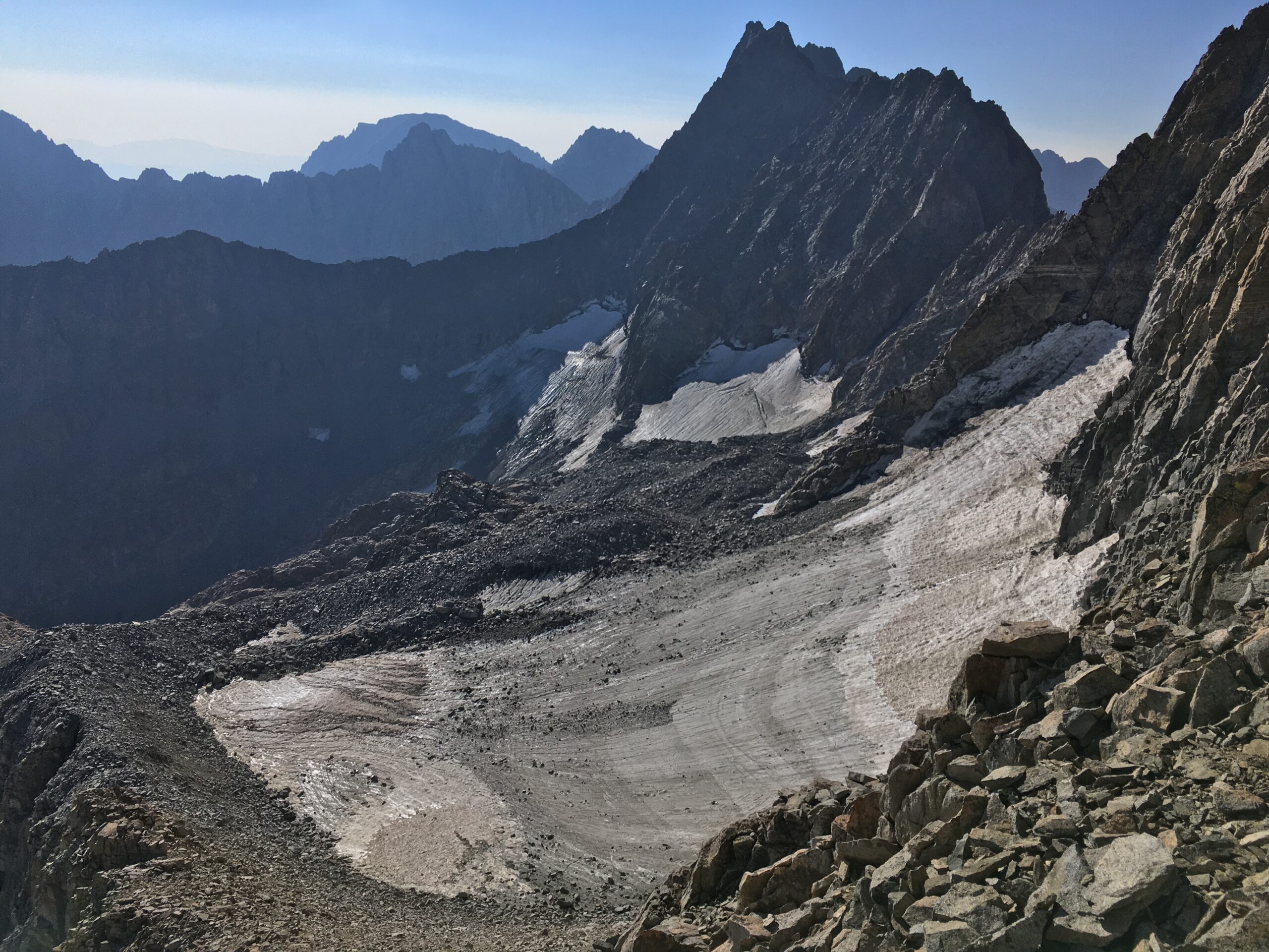
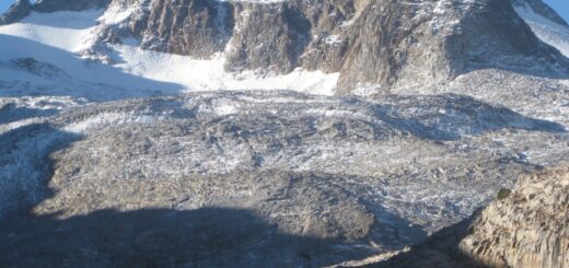
Norman Clyde peak and Glacier from the pass. Really cool to be here! I texted Janet to let her know I was OK.
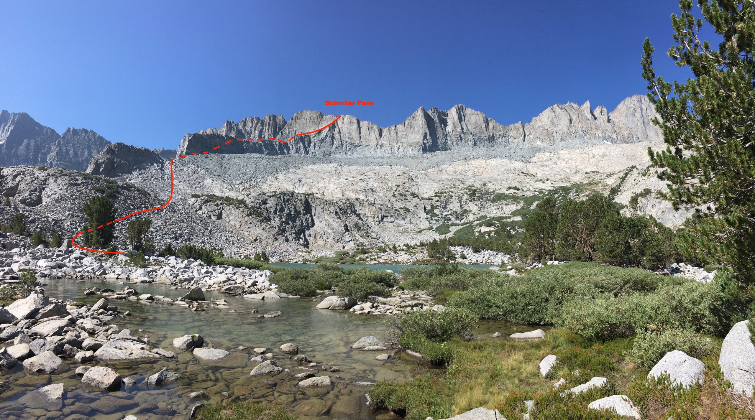
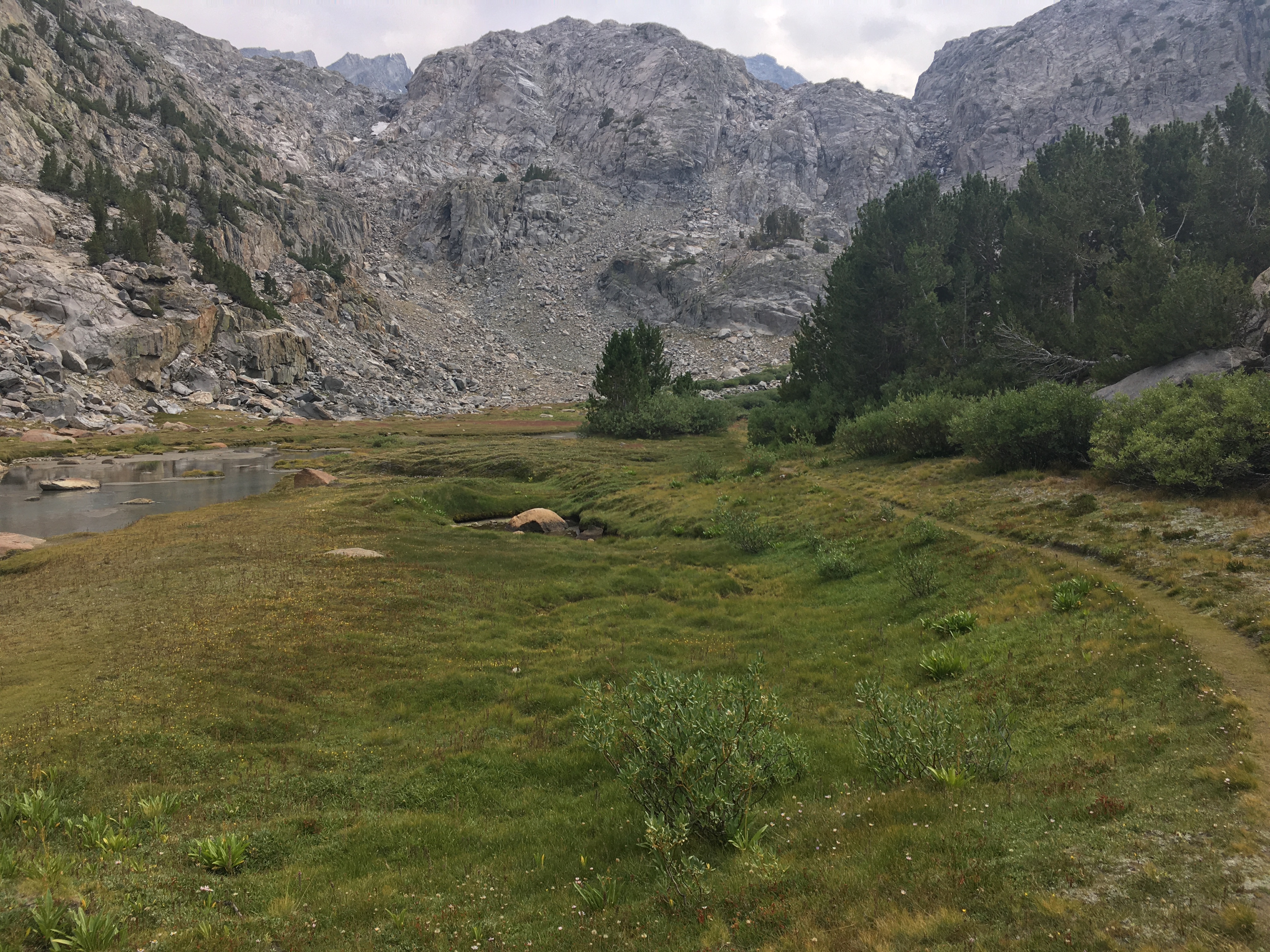
Here is a 3D of my route down Scimitar Pass. It was tedious and time consuming – but really good for mental focus: and only Class 2 if you believe it from the picture. I don’t get bored traversing this kind of terrain. The slowest part was actually below this because there was a lot of bushwhacking through willows. There is actually a very well cairned route, but it is still pretty slow.
I took one last side trip up the steep climb to Brainerd lake. The plan was to swim and just look to see if there were fish. No fish seen. While here, I met a guy named Mark who had been soaking in the view for an hour. He asked if he could walk with me and I said sure. He ended up being a really interesting guy who is getting interested in Triathlon, and he had 2 brothers who got COVID before the vaccine was available and they were both seriously ill (but survived). He wants to get into backpacking more but has been more of a day hiker historically. He told me about a couple cool places to visit too, including Fern Canyon. We walked all the way back to the car, which was perfect because the last part of the hike was kind of a commute anyway.


Beautiful photos Brian and I really enjoyed the commentary.