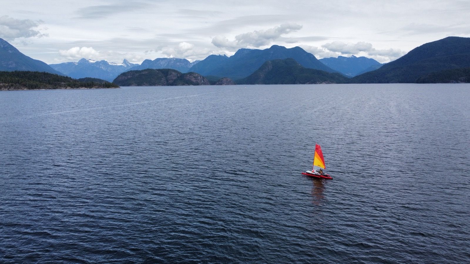
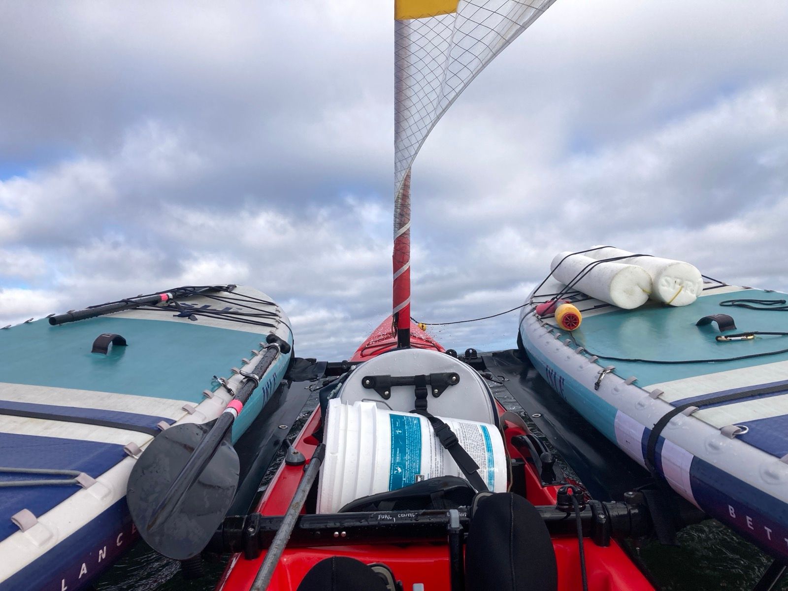
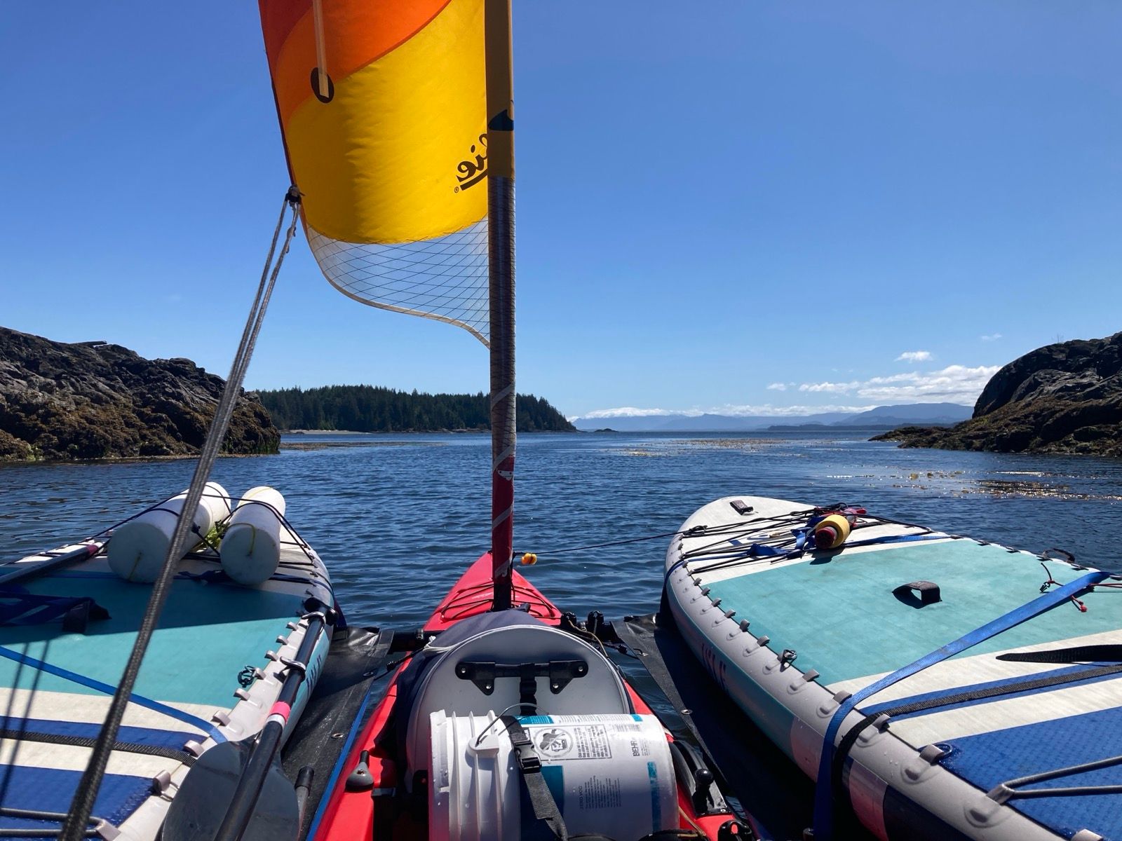
Kayak Sailing the Inside Passage on a Hobie Tandem Island
In July 2025 I sailed my Hobie Tandem Island along the Inside Passage from Bellingham, WA to Ketchikan, AK. I took several diversions from the traditional Inland Passage Route to see Hot Springs and Glacial Melt. Those diversions were and out-and-back on the Bute Inlet, Around King Island (Burke Channel, Labeuchere Channel, Fisher Channel), and up the Ursula Channel (down the Douglas Channel via the Sue Channel / Stewart Narrows).
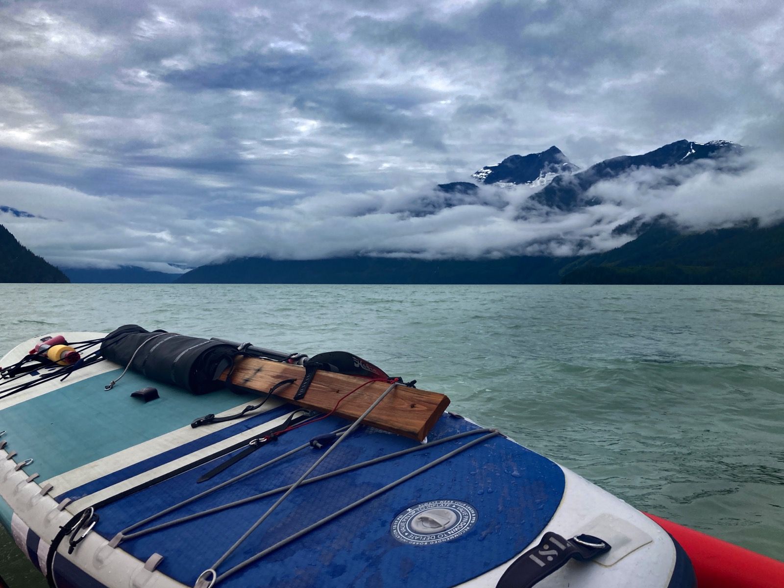
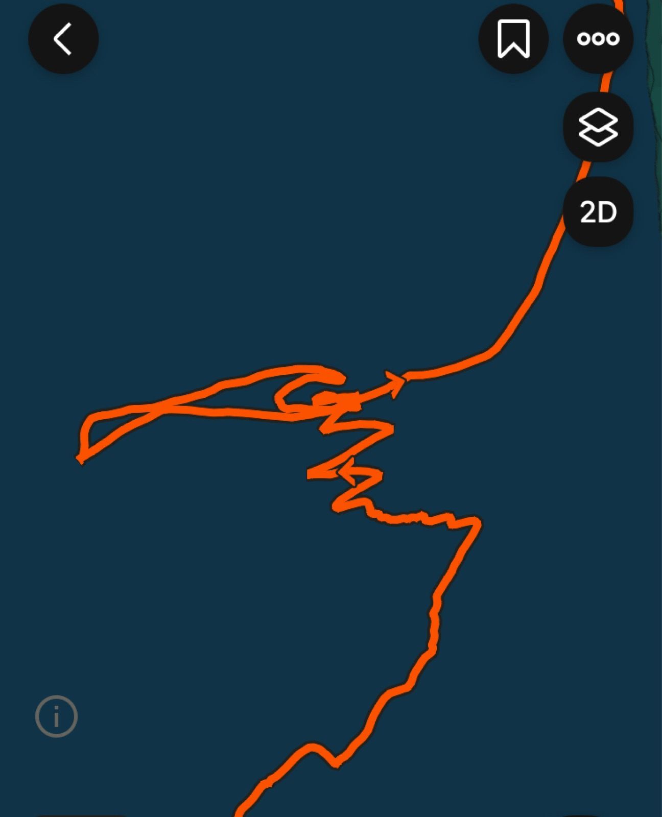
MAP:
This is the map for the entire route discussed in this post. To Export GPX files, click on the three horizontal bars in the upper right hand corner of the map and select Export selected map data... To see full screen, click here (opens in new window)
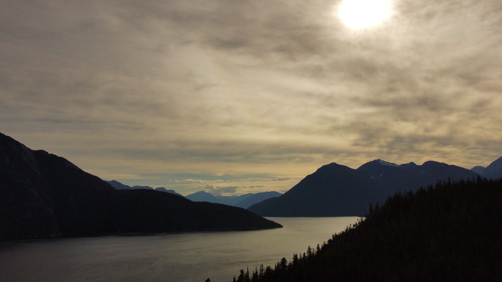
– Day 1 : Kayak Sailing the Salish Sea [top]

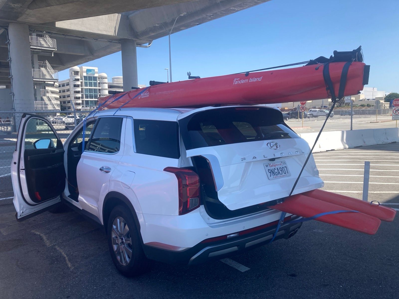
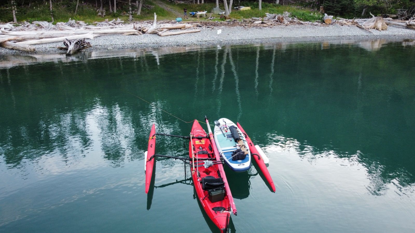
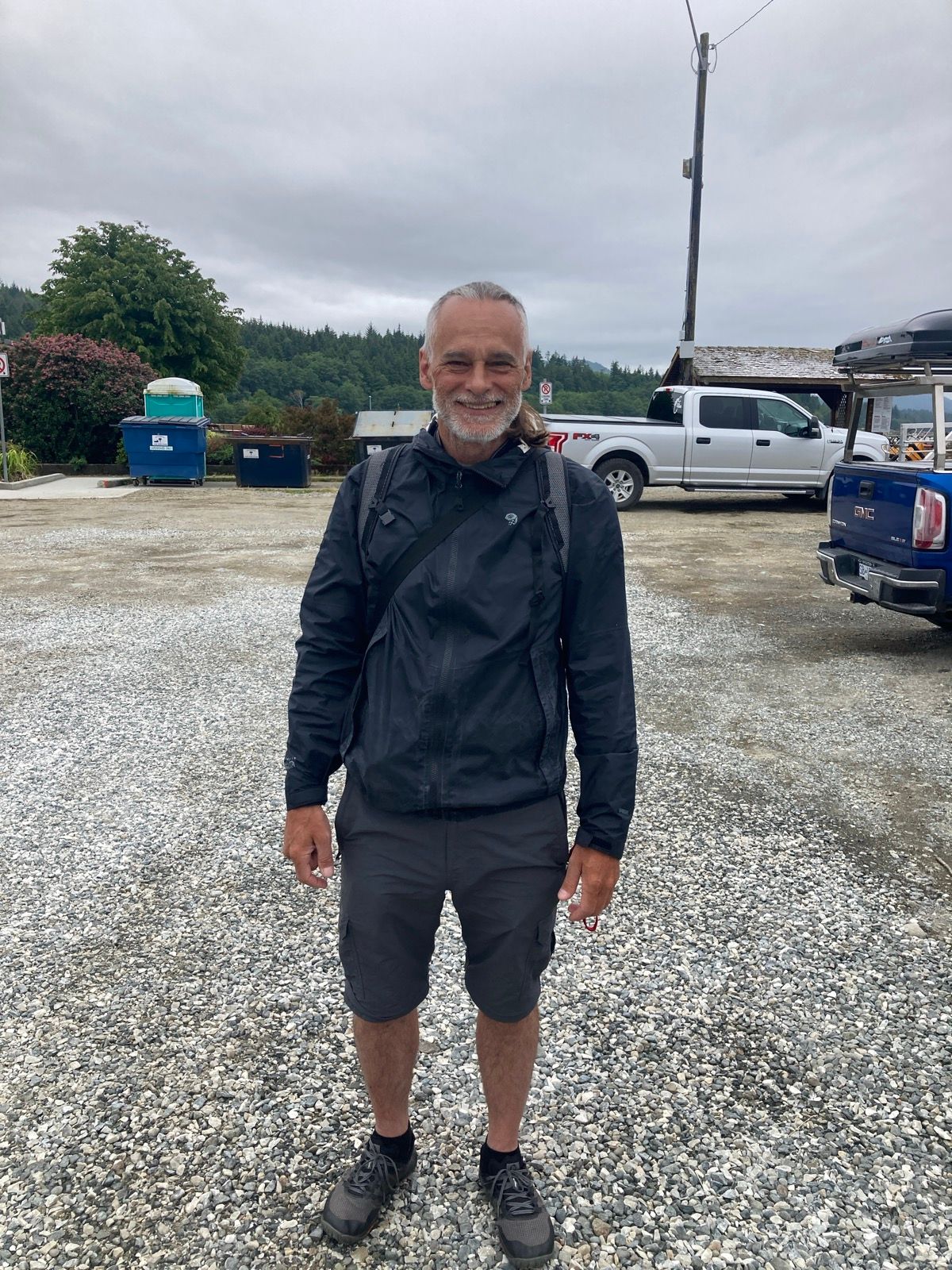
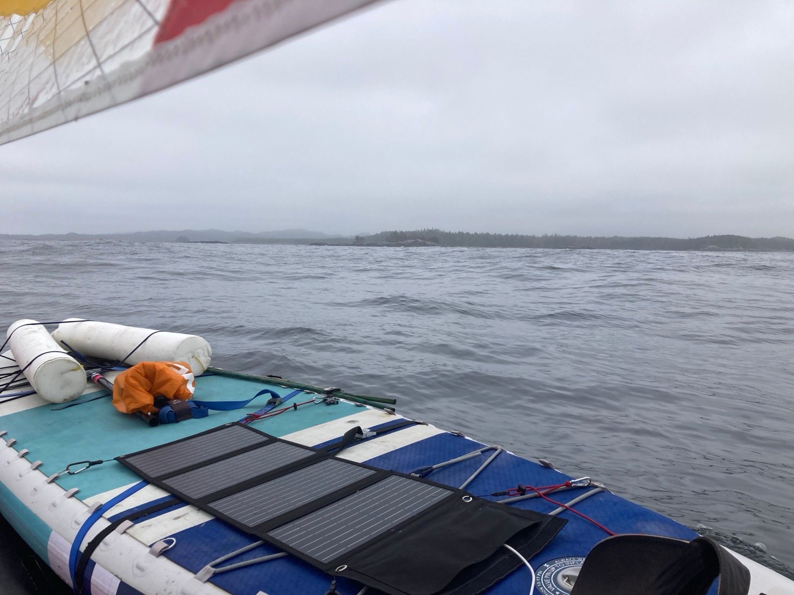
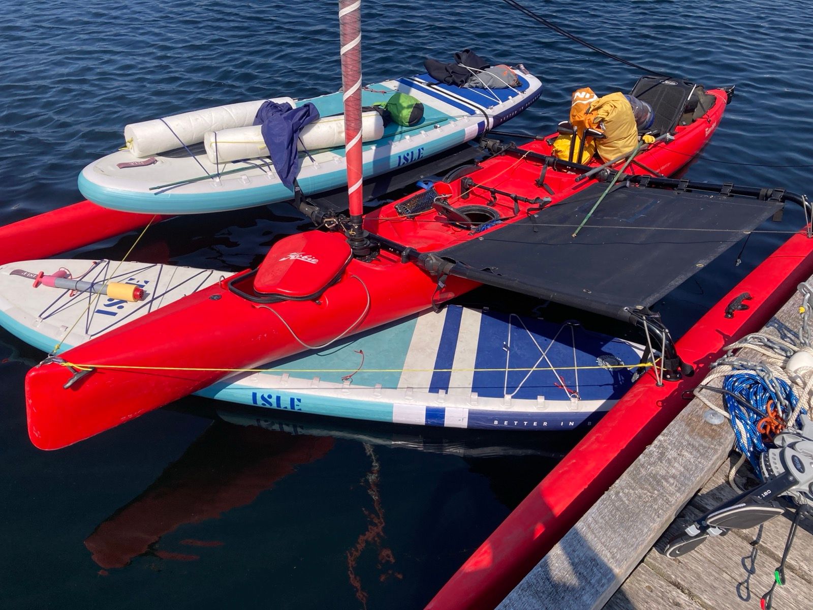
My stomach churned with nervousness as I drove 2 days to the boat ramp. I worried that I’d struggle to unload and assemble the Hobie Tandem Island by myself; there is a lot to overcome when you’re responsible for moving about 500 pounds of unwieldy “stuff” around by yourself. It took 3 hours to get everything into the water. This included me trying to transport the boat on foam rollers (the kind you use for an injured knee) – which didn’t work as well as I hoped. The boat canted left and right; it was hard to get the boat on a proper trajectory. It’s a reminder that everything needs to be tested thoroughly before departure. I have already sold our wheeled cart from the ICW; that too was inadequate for this vessel – but it moved faster.
The kind folks at the rental car place drove me back to the dock, where the boat was still waiting. It had already attracted a lot of people and questions. I reported to the inquisitors that I was going for an ordinary sail in the hopes being able to get on the water as quickly as possible. According to my charts, à perfect flood tide was setting up to push the Red Lobster in a desirable direction.
Once on the water, I began to finally relax. It is a bit torturous, being dependent on a bike, a boat – some form of human powered conveyance to feel “relaxed” and in one’s element.
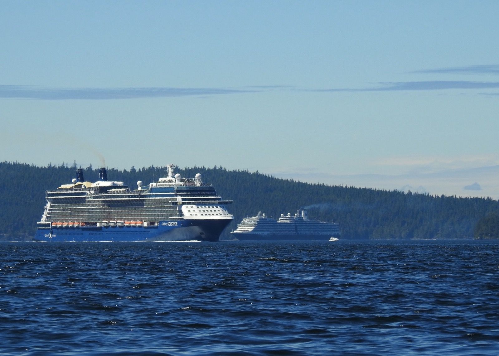
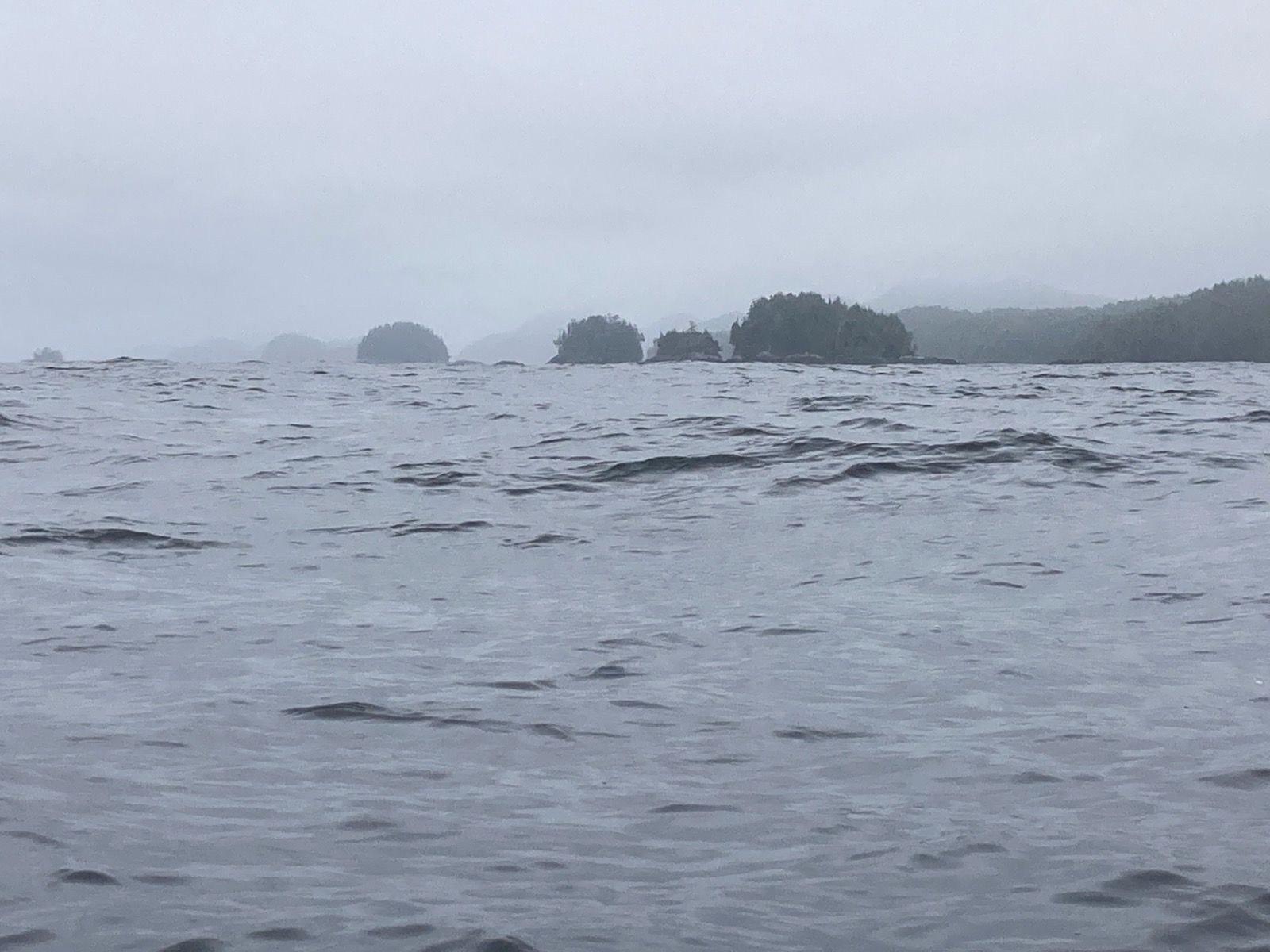
The water pushed me between Lummi and Portage Islands without too much effort of my own, but once out in the Strait of Georgia, the current predictions were obviously wrong. Humans can predict the gyrations of distant celestial bodies with atomic precision, but we still lack the ability to untangle the chaos that is the movement of water on our own planet. Toiling through the standing waves still felt good after having been stationary inside the rental car for two days straight.
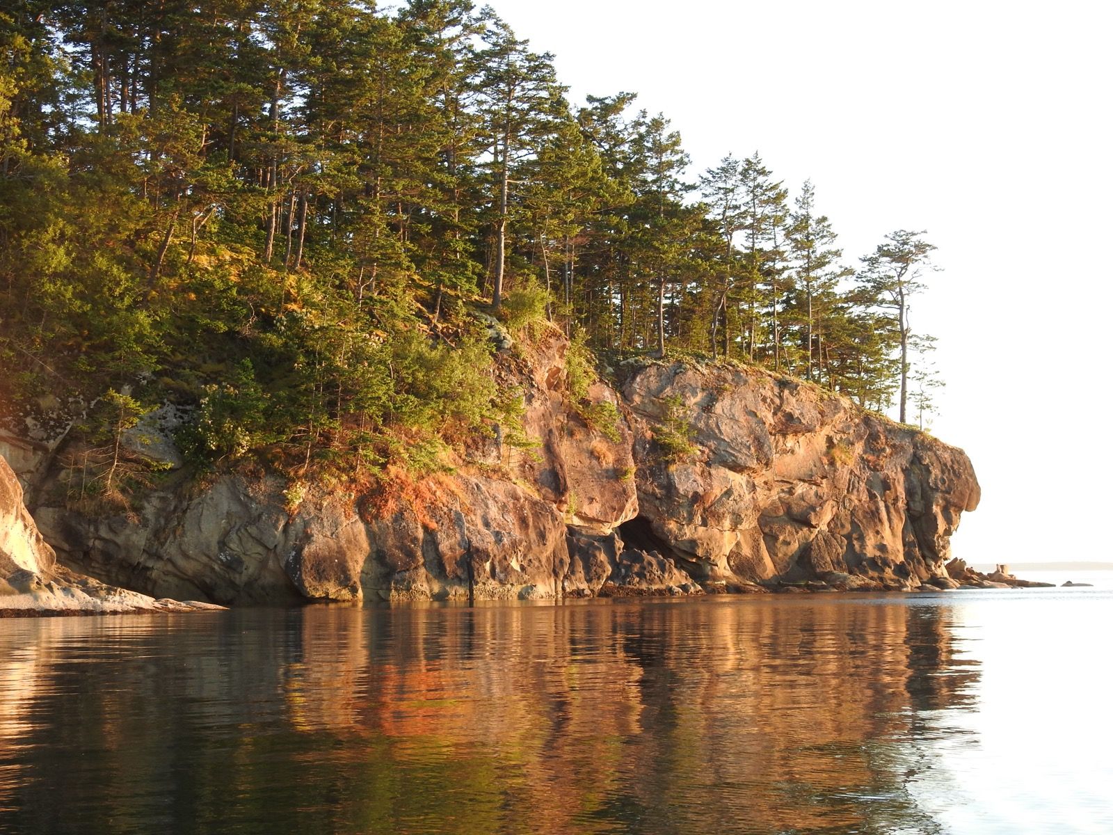
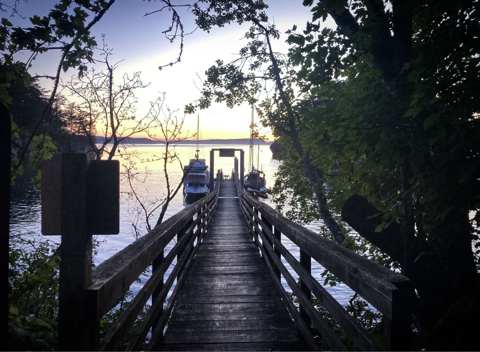
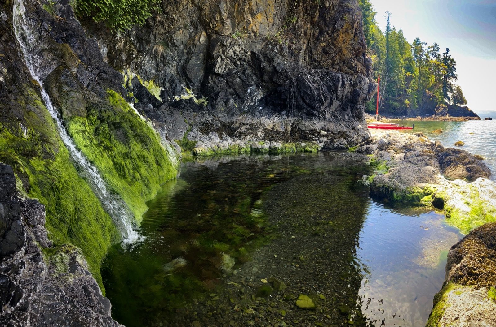
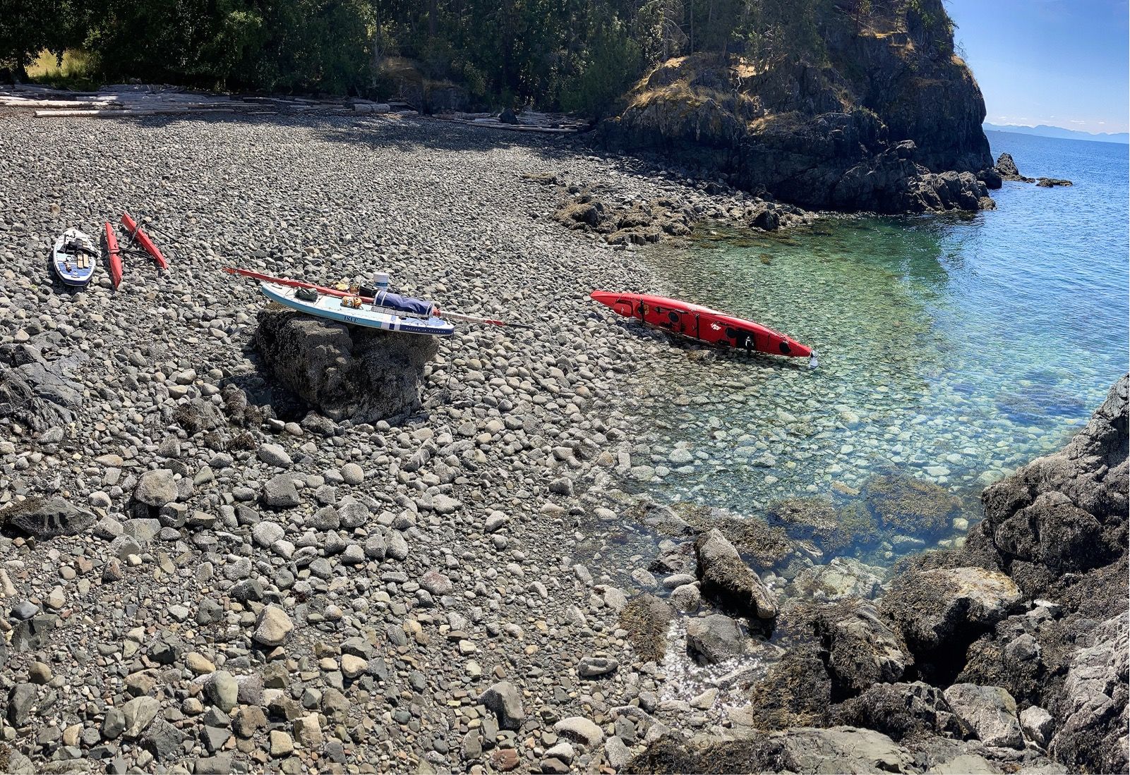
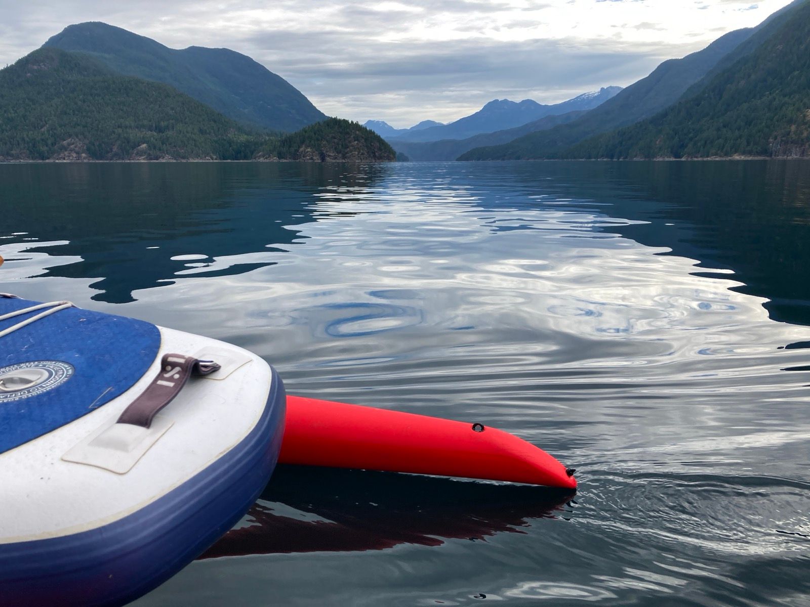
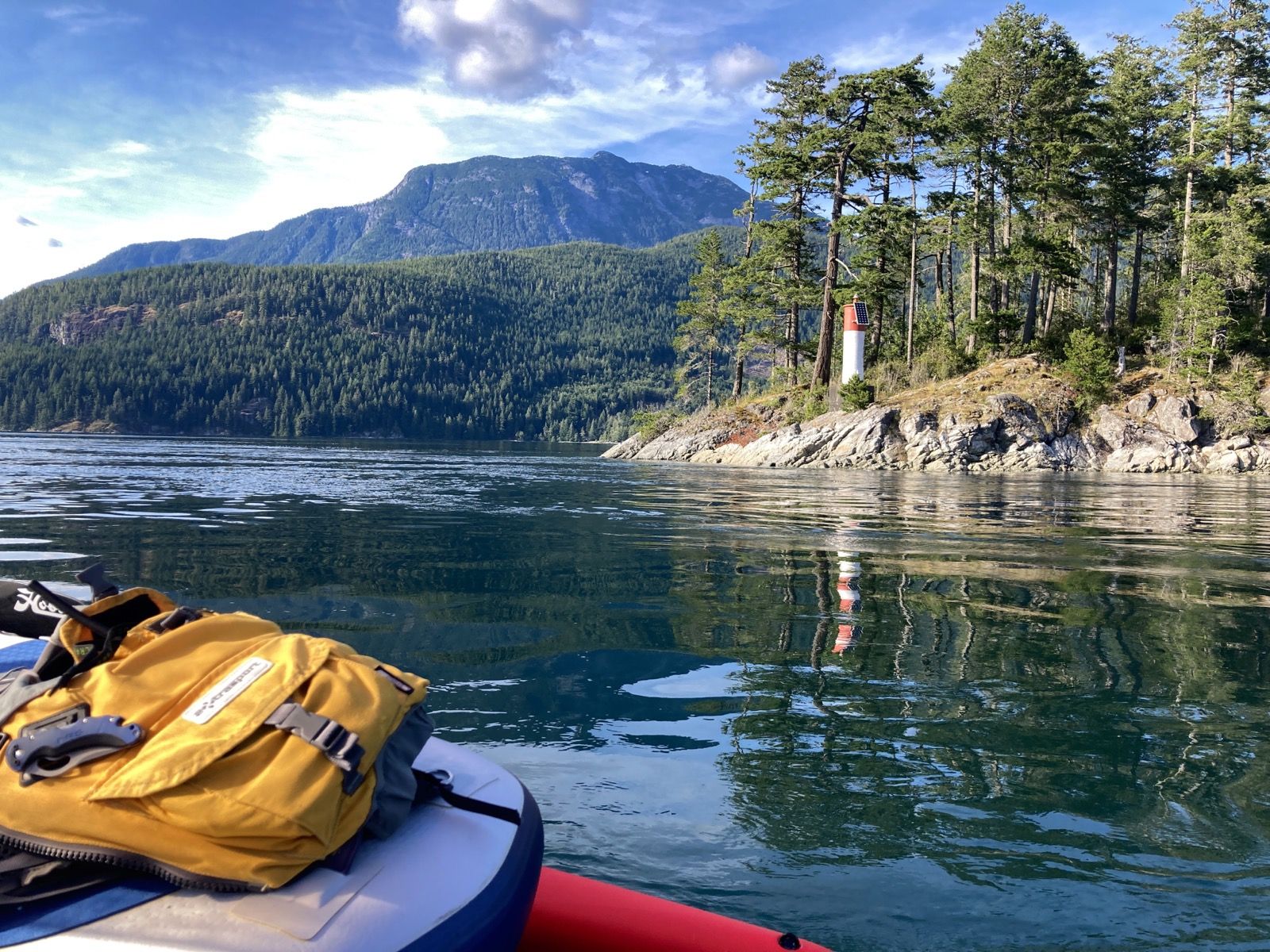
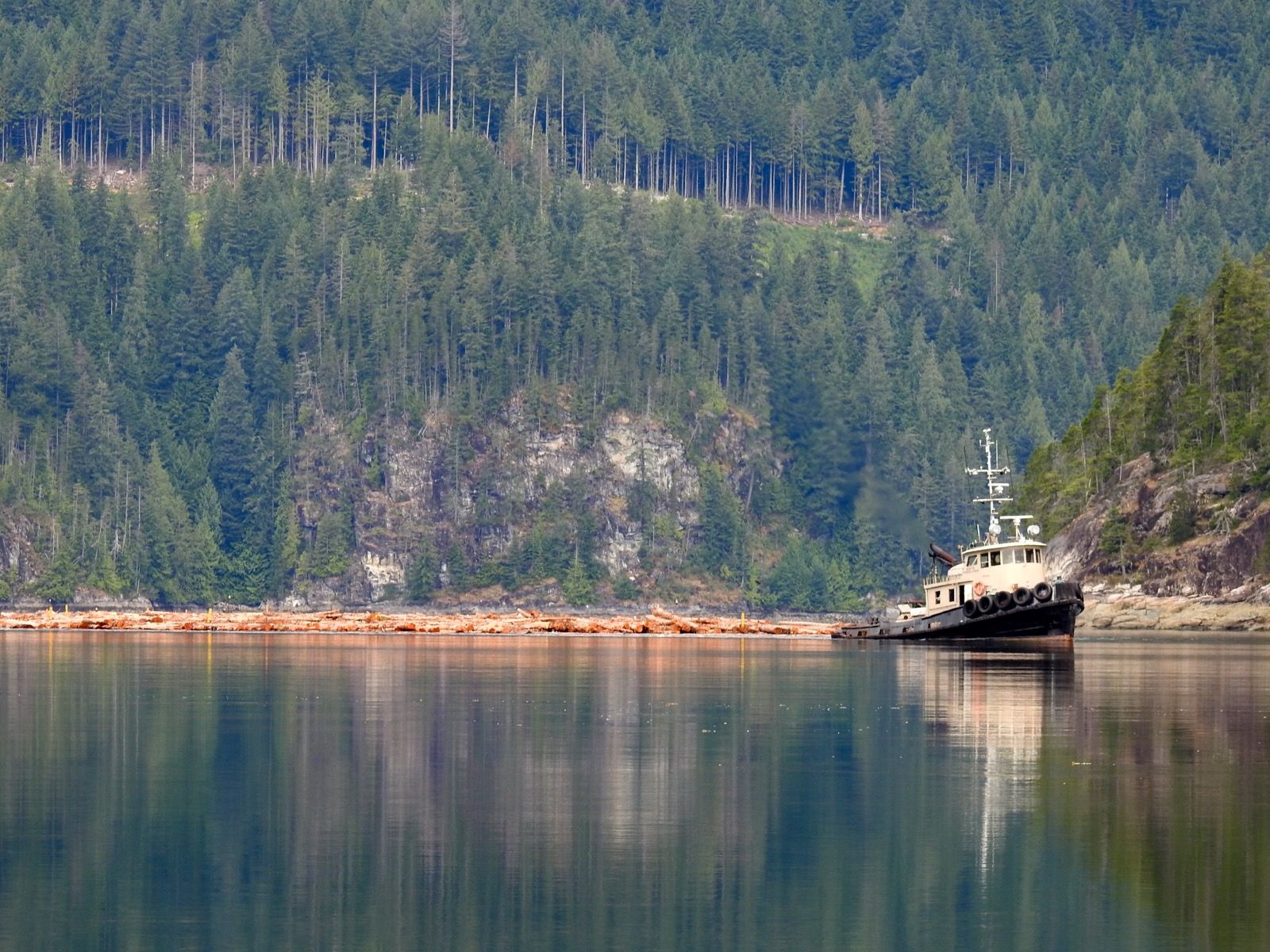
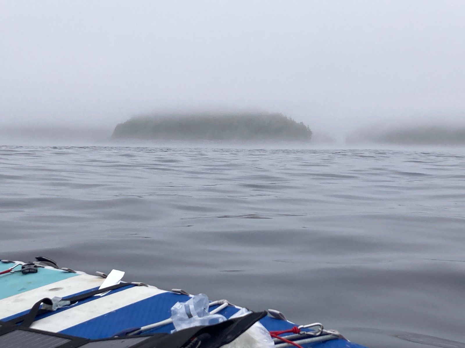
En Route, I discovered that Rolfe cove had a dock and campsite on Matia island. After passing Lummi island, I had a rough plan to try to get to Sucia Island (meaning “dirty island” in Spanish due to the foul terrain beneath the surface). I tucked into the cove and found a beautiful landing alread inhabited by two sailors who had come from different places. They asked me if I was doing the Wa360, and I told them no. Ironically, though, it was the WA360’s big brother (R2AK) that inspired me to do this exact trip… except they aren’t running it this year. They shared tips, and already my route is changing based on places to see recommended by them and my driver.
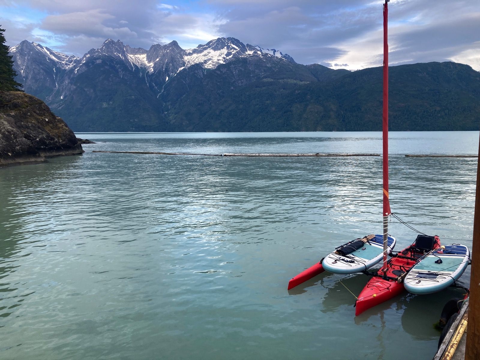
As I unloaded the boat in the nautical twilight, à sudden downpour of heavy rain hit the sea surface near my boat – except no water was falling from the clear skies. I have no idea what made this strange apparition on the surface… a massive school of fish? I don’t expect every day to be as great as today, but if all the days were only 75% as good as today, it would still be a perfect trip.
Sunrise 5:19 Sunset 9:11
Moon 40% waxing
Photos:


Strava Comments:
Ann L.
Janet W.
Scooter R.
Hugh J.
Jennifer G.
Gary M.
DogMeat Q.
Tara D.
Nancy P.
A B.
Stan H.
J&K S.
Mark G.
Clayton C.
Ride Stats:
| Elapsed Time | Moving Time | Distance | Average Speed | Max Speed | Elevation Gain | Calories Burned |
|---|---|---|---|---|---|---|
|
05:46:40
hours
|
05:27:01
hours
|
35.57
km
|
6.53
km/h
|
11.26
km/h
|
123.60
meters
|
1,636
kcal
|
– Day 2 : Broomstick Sailing [top]

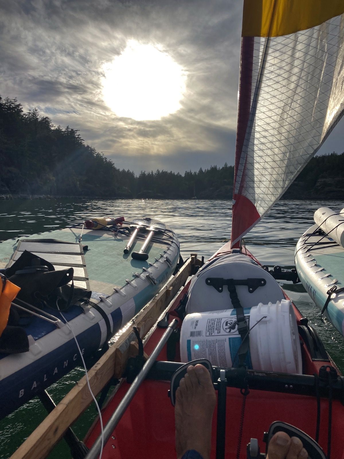
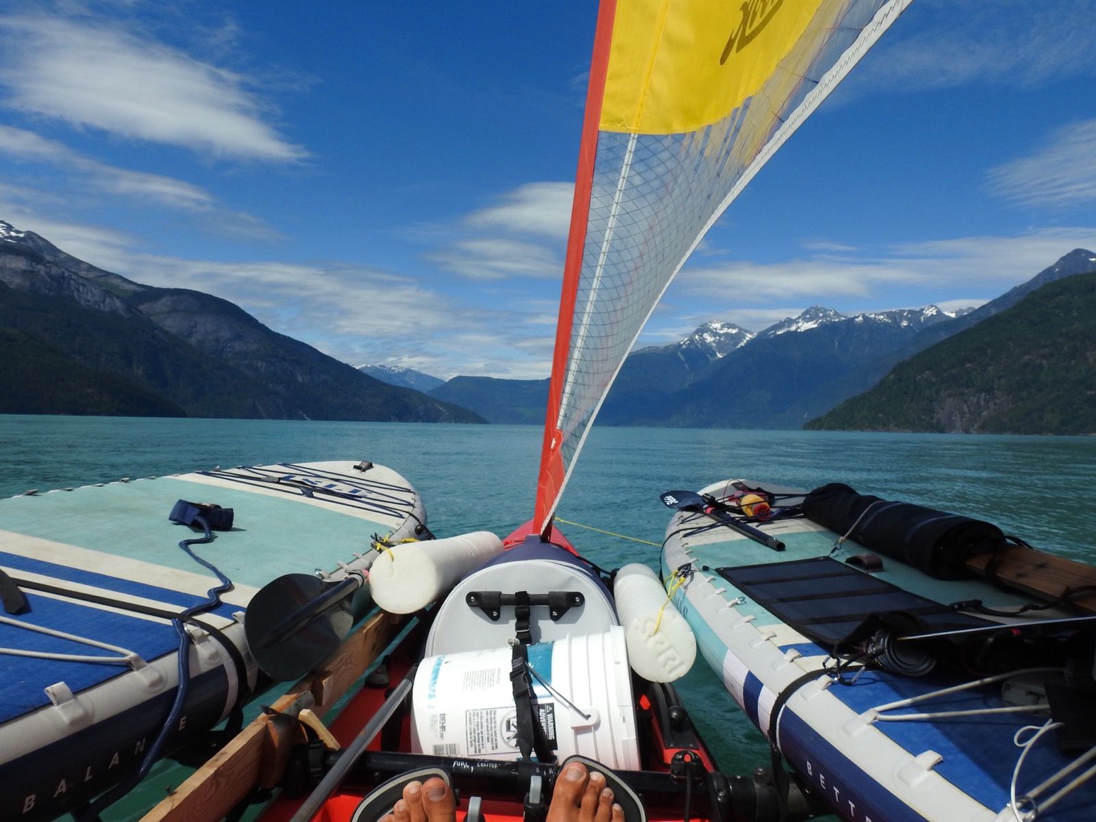
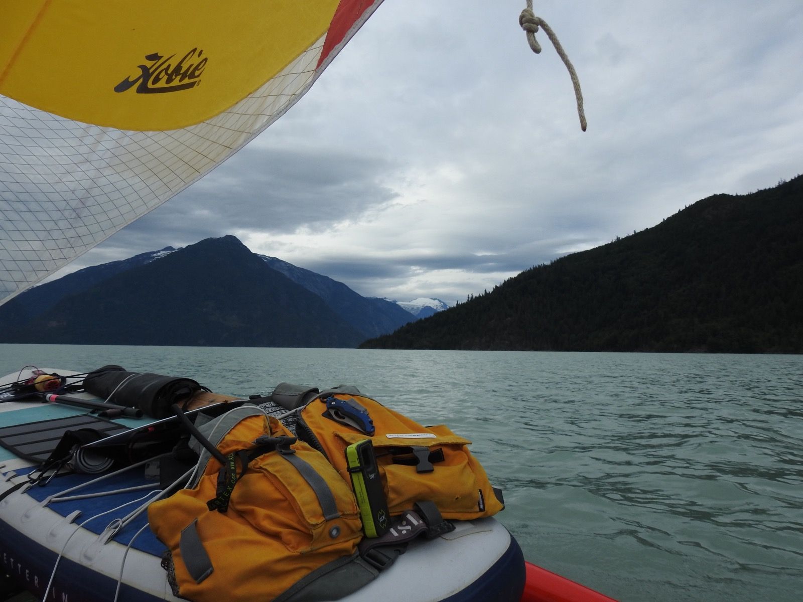
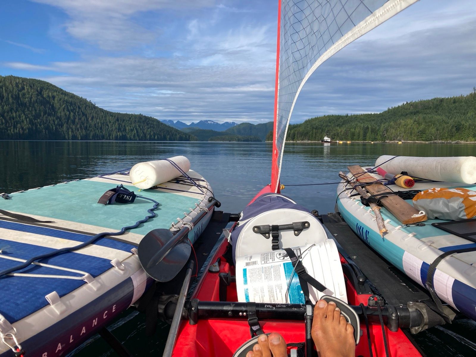
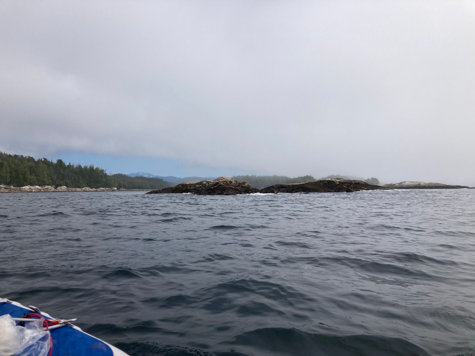
Much of the morning I had to tack into the wind and the current. I didn’t mind because it was a beautiful day with agreeable everything. But eventually I noticed my sail was now trimmed wrong. I let the main sheet loose and began delightful downwind sailing. No longer was pedaling necessary. I enjoy pedaling, but on a bike, you get to take breaks periodically- such as during a descent. This was to be my descent. I lay out flat on the paddle board – head to the stern – and pulled out the phone. I took care of some work and did a couple Duolingo lessons while giving minimal attention to sailing. I had fabricated a broomstick into a tiller extender, and used that to periodically adjust the course. The profound depths and wide waterways make the inside passage more amenable to this type of sailing compared to the ICW where narrow channels required constant attention and course corrections. I did have to thread the needle between two cargo ships, though. They came close enough on either side of me that I could comprehend the 8’ tall bow wave that would soon become a 6’ rolling swell that the Red Lobster would easily glide over.
With all this inattentiveness, I happened to sail right past Bedford Harbor – the place where I was supposed to check into Canada! Border crossing by boat is surprisingly casual. You’re supposed to go to this harbor where they have special phones – maybe like the red one on the US president’s desk with one button. You call and give them your details and viola! You’re in Canada.
Well, I sure didn’t want to give up all those Canadian kilometers, so I asked AI what to do. “Stop right now!” It said. But it also gave me a phone number to call. I obeyed the later advice while ignoring the former. Right away I was in touch with a border officer who asked where I had come from. “I started sailing in Washington,” I explained. “Oh, so you’re taking refuge from the United States?” He asked. “No,” I blurted out, worried that he would think im trying to stay… then it occurred to me; in spite of his deadpan remark, I thought he was joking. Border guys dont joke around, do they? I laughed and complemented him on his joke. Yes, he was just messing around. Well, that was pretty painless, and I even sailed another half mile during the checkin process!
I seem to be a magnet for salty old men. I landed at a possible campsite, and a man – excessively eager to talk to me like the other guys I have met so far – came scuttling over. He sails up and down the coast himself – never offshore. He said that up until two days ago, the weather had been bad, and now it is finally summer with good weather on the horizon. We talked for a while about this and that, and like another man I met the other day, he thanked me for talking to him. I get the feeling that there are men who like to talk sailing… and their wives who can only tolerate so much of it. I may be guilty of that.
I left the site; there was a church group also camped there – boys running around yelling, and smashing gooey oysters. I walked up to one of them as he smeared their bodies on the railing below à sign warning about the dangers of shellfish, “so do you eat the oysters,” I asked, obviating my naïveté. “No, we use them to fish,” he replied, looking me over as if I had maybe come from another planet. And maybe California is another planet when you’re sheltered from these kinds of things and spend too much time working behind a desk or lab bench. I left searching for a quieter spot.
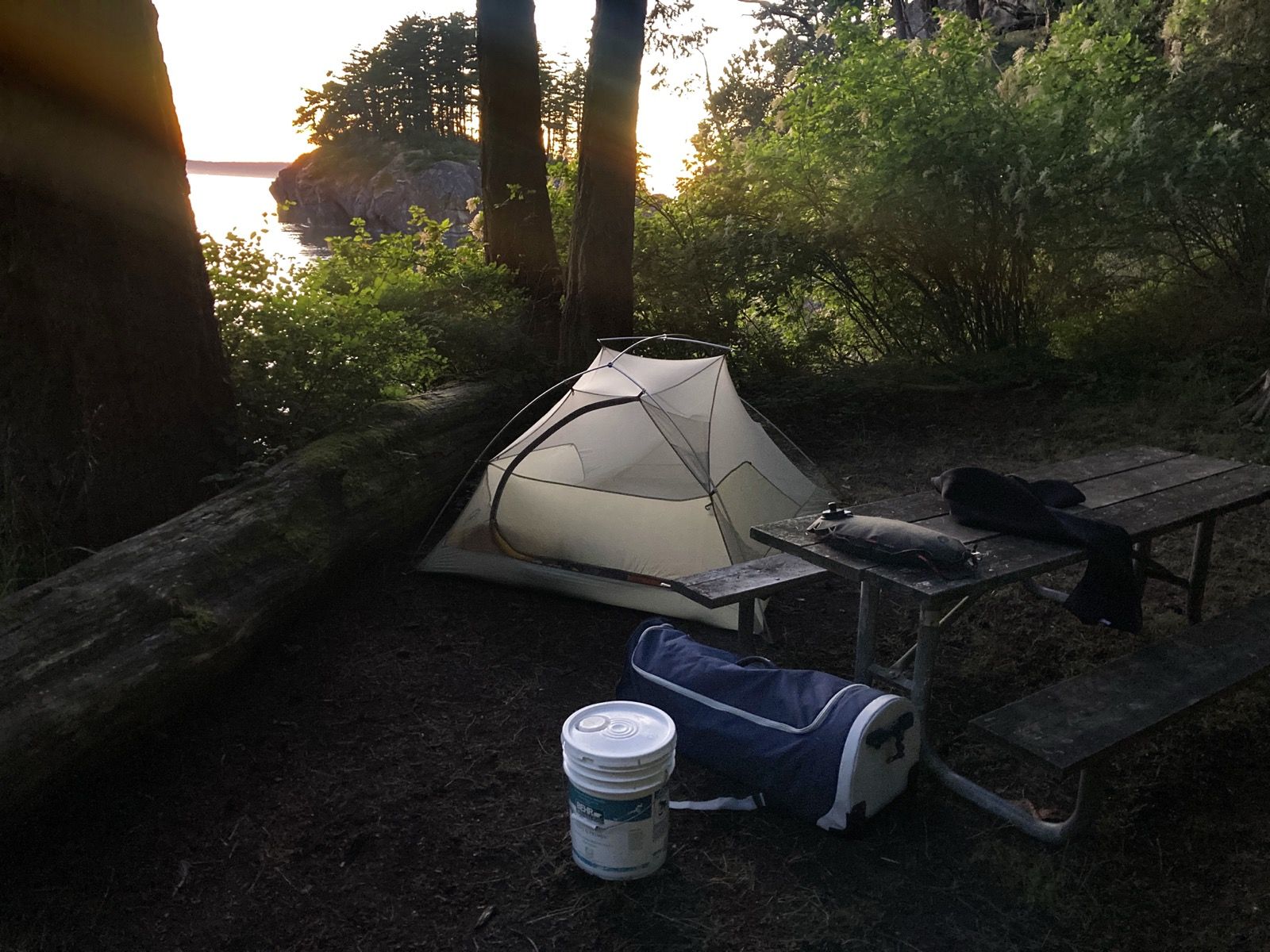
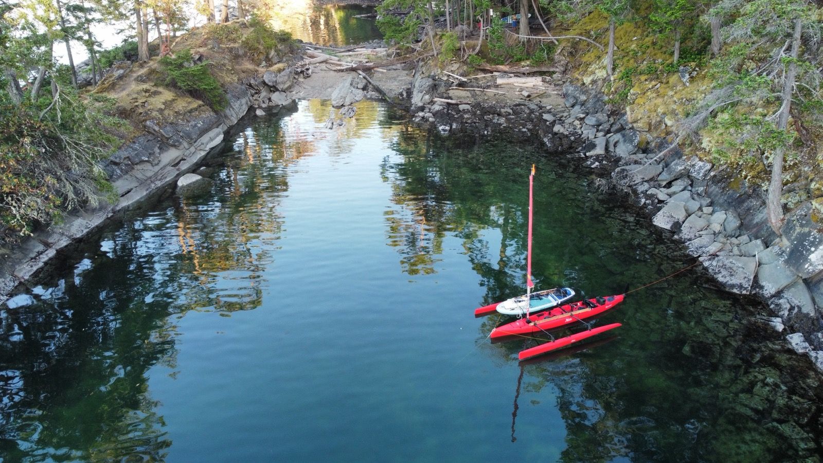
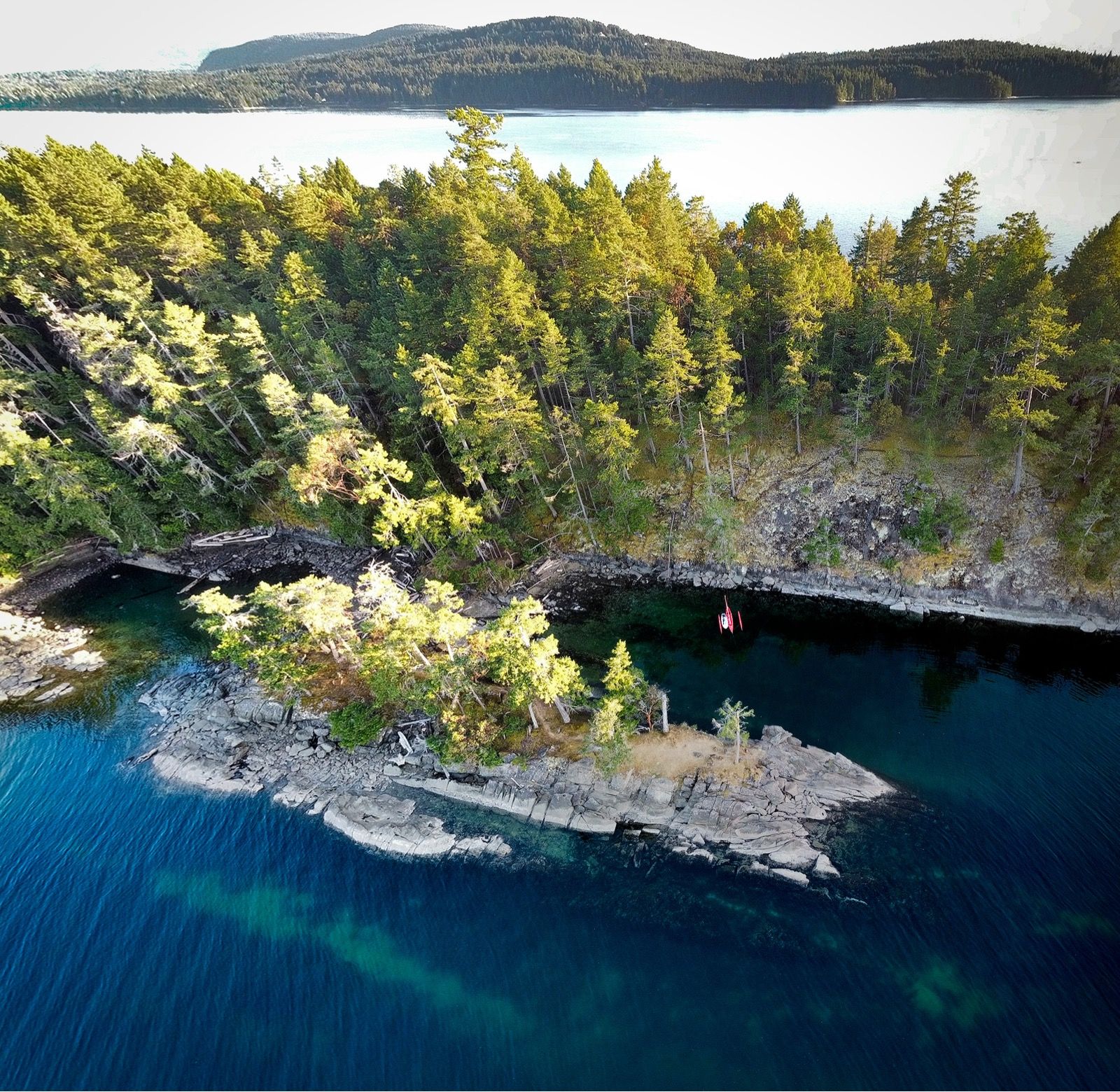
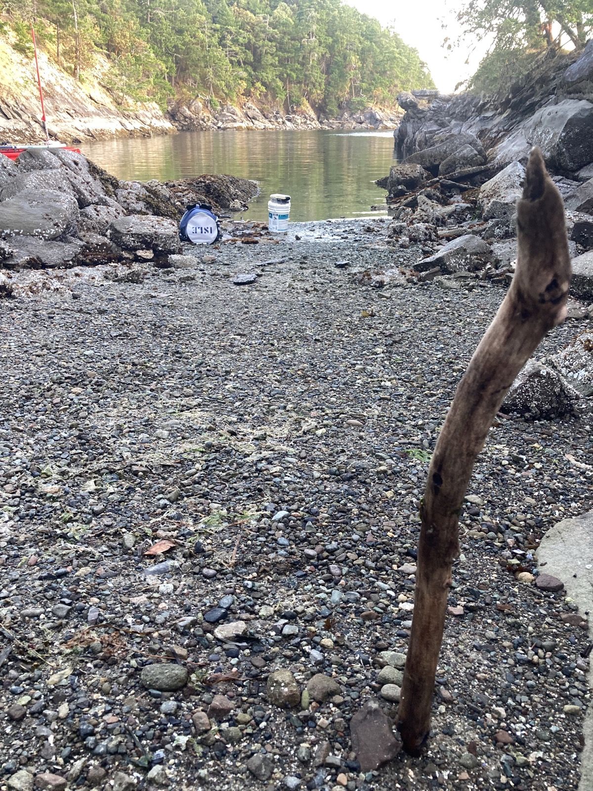
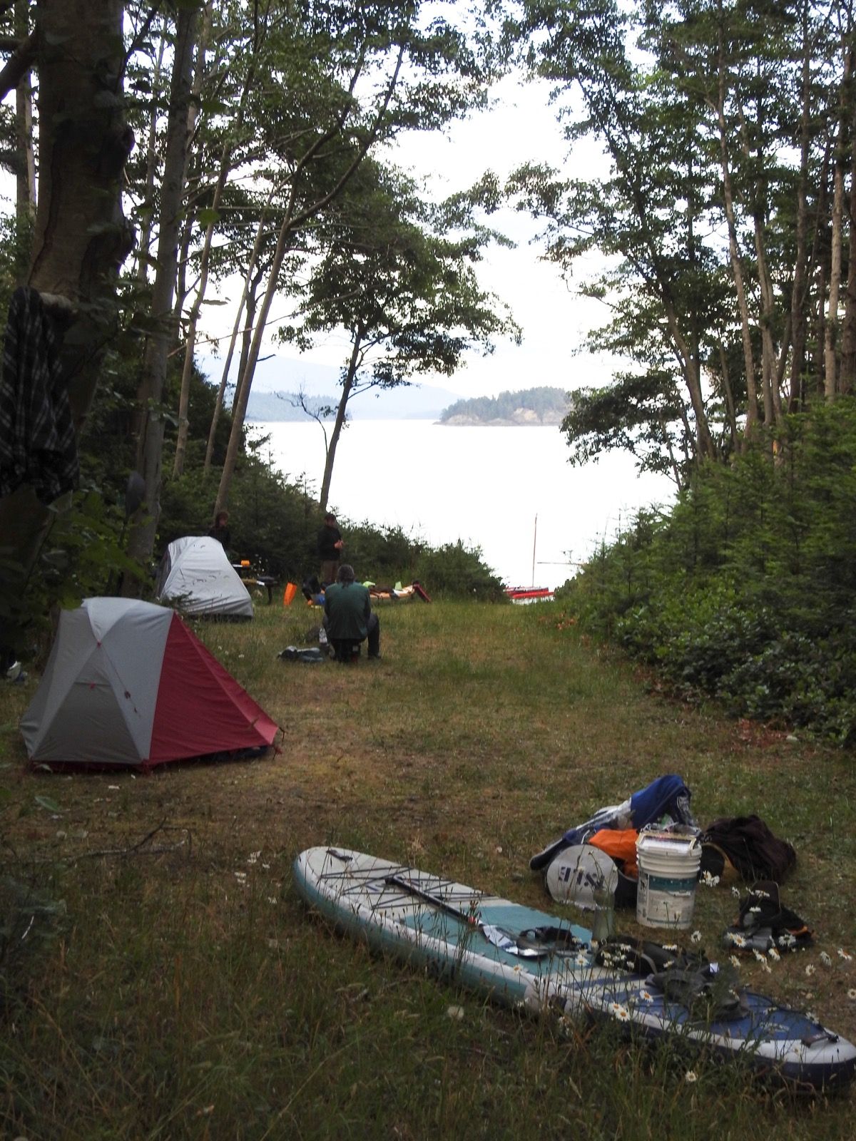
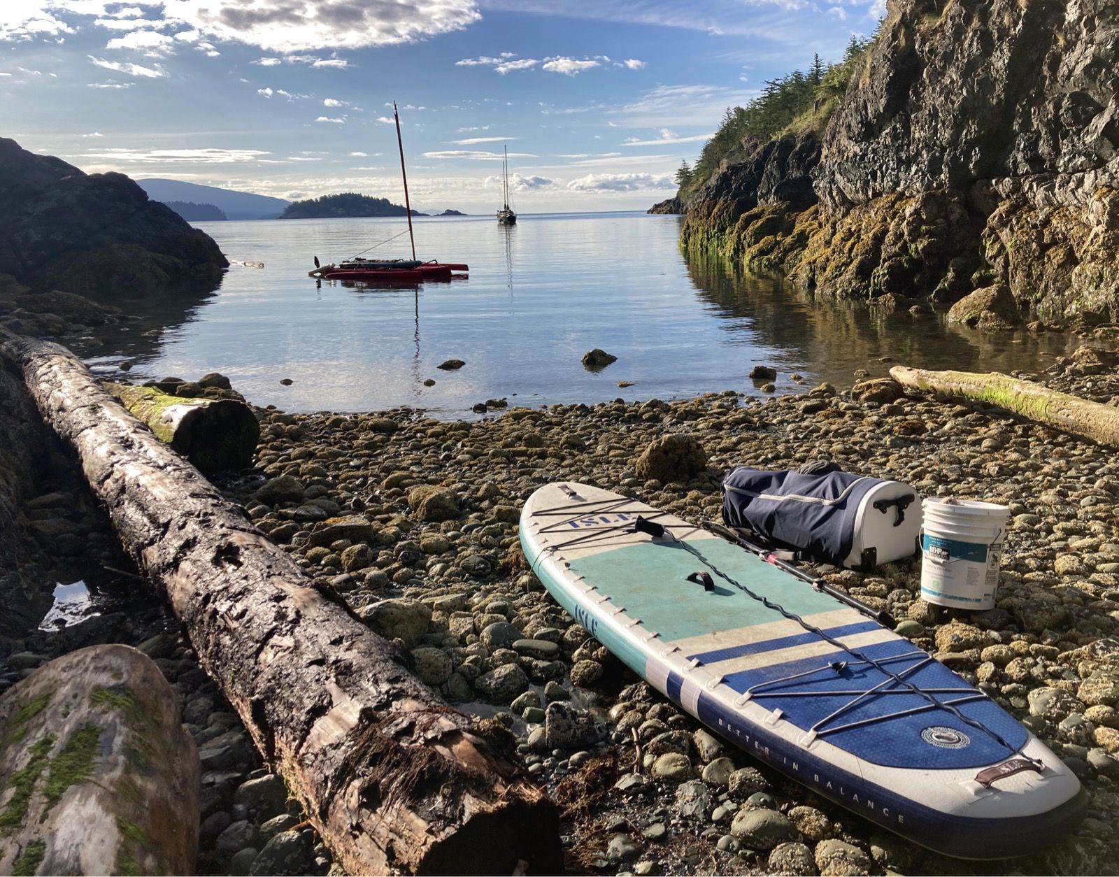
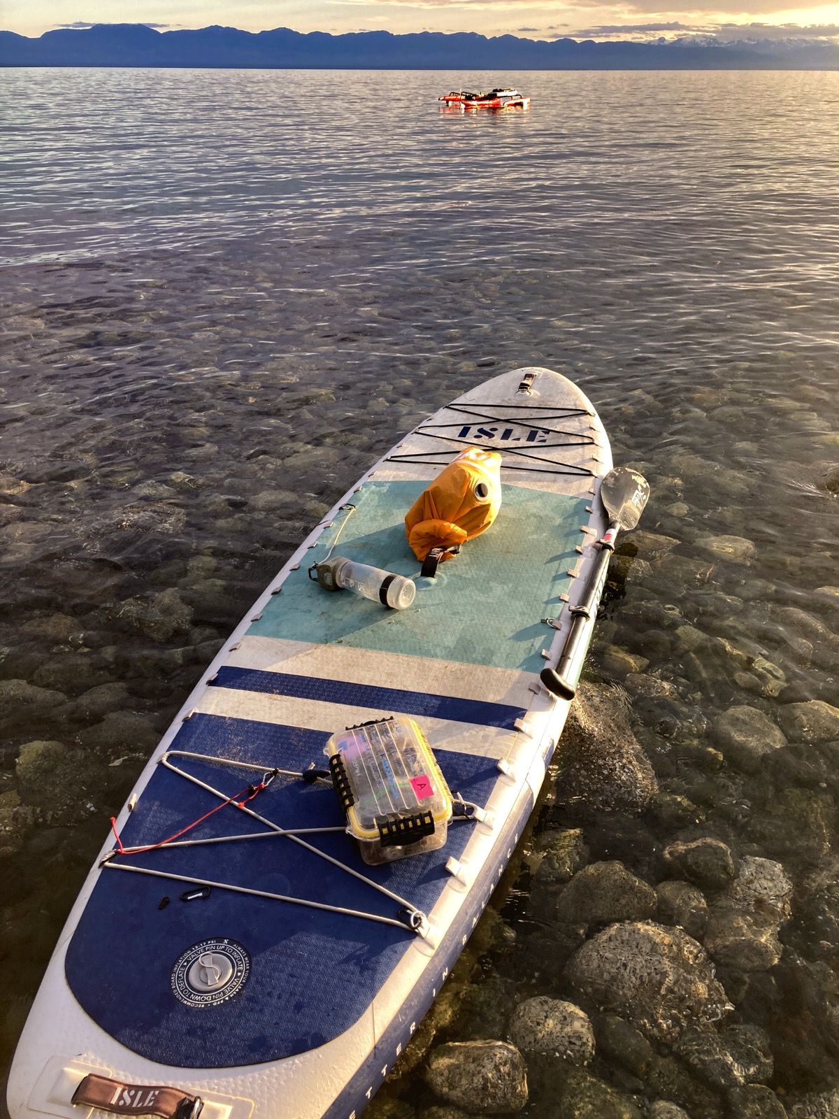
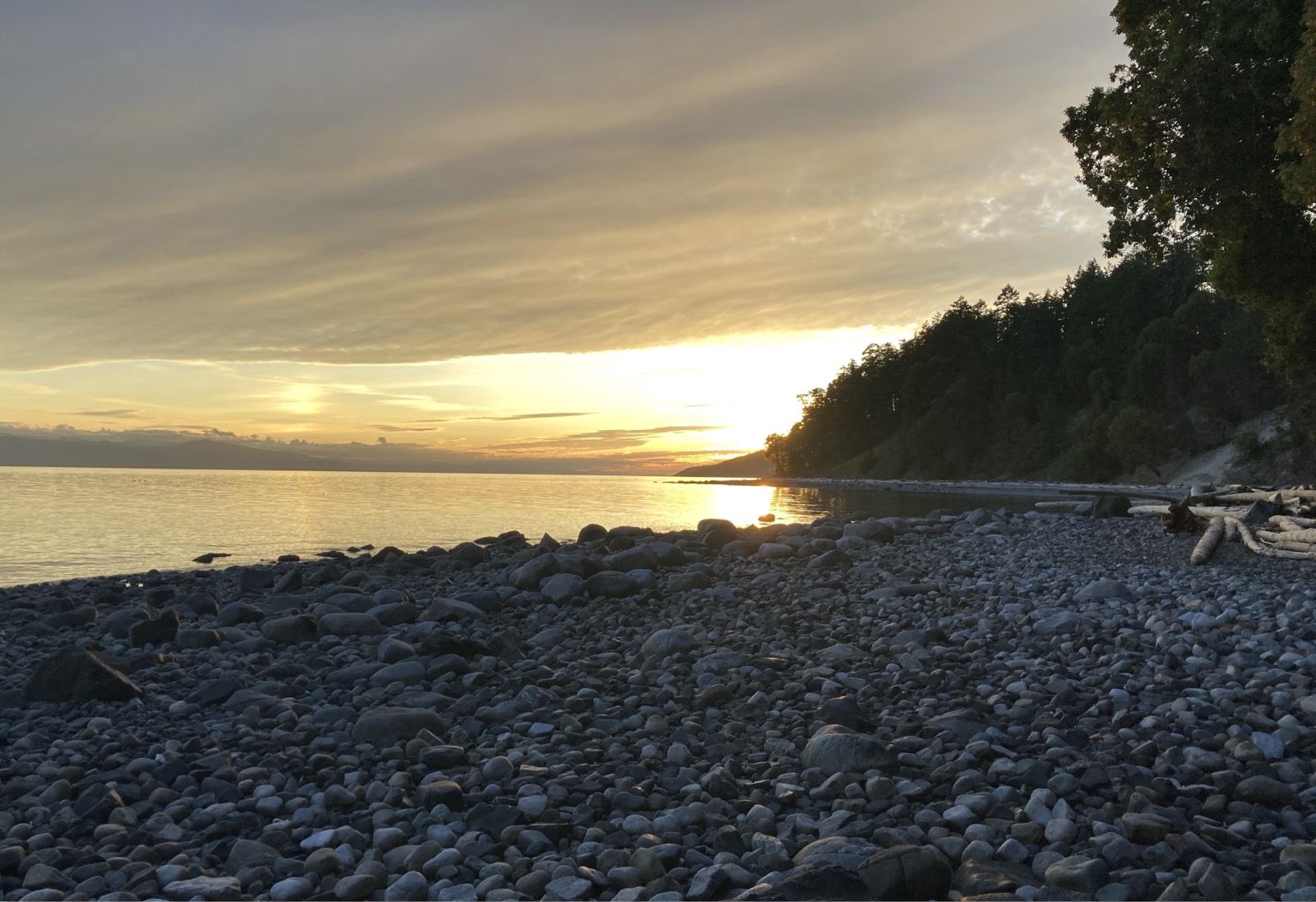
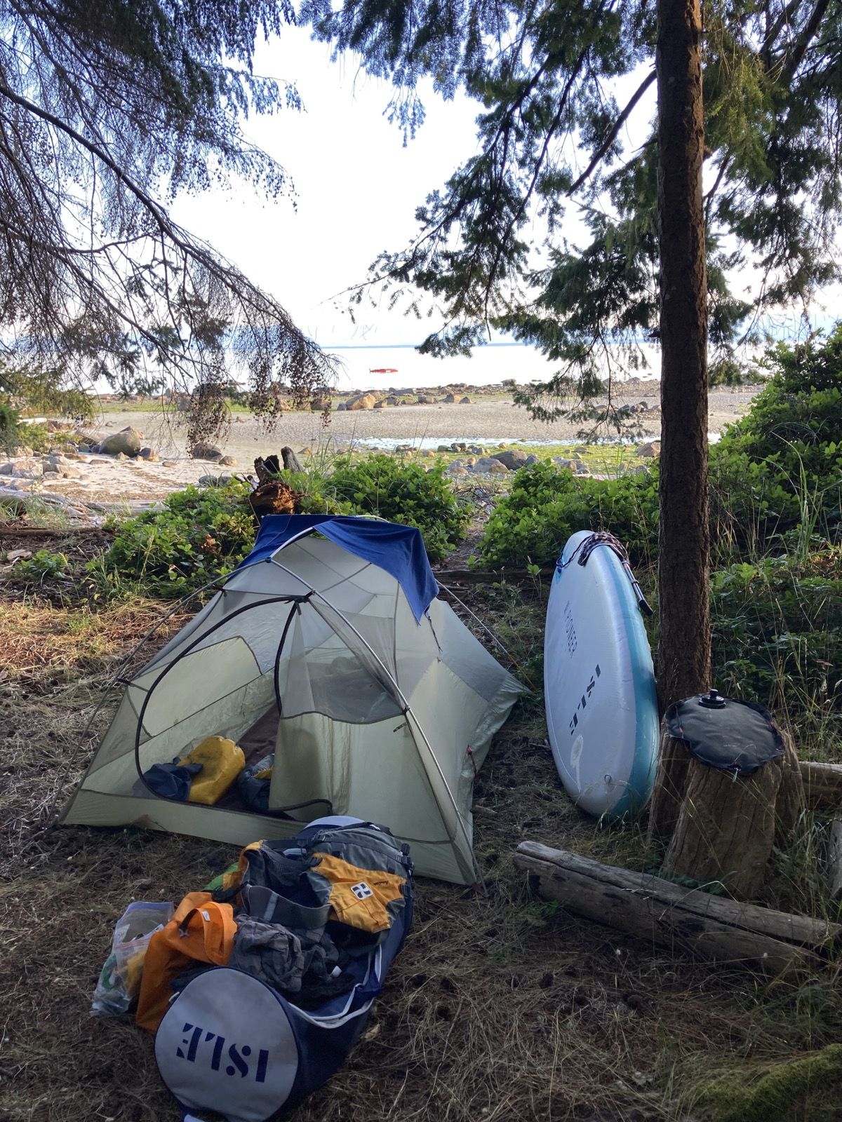
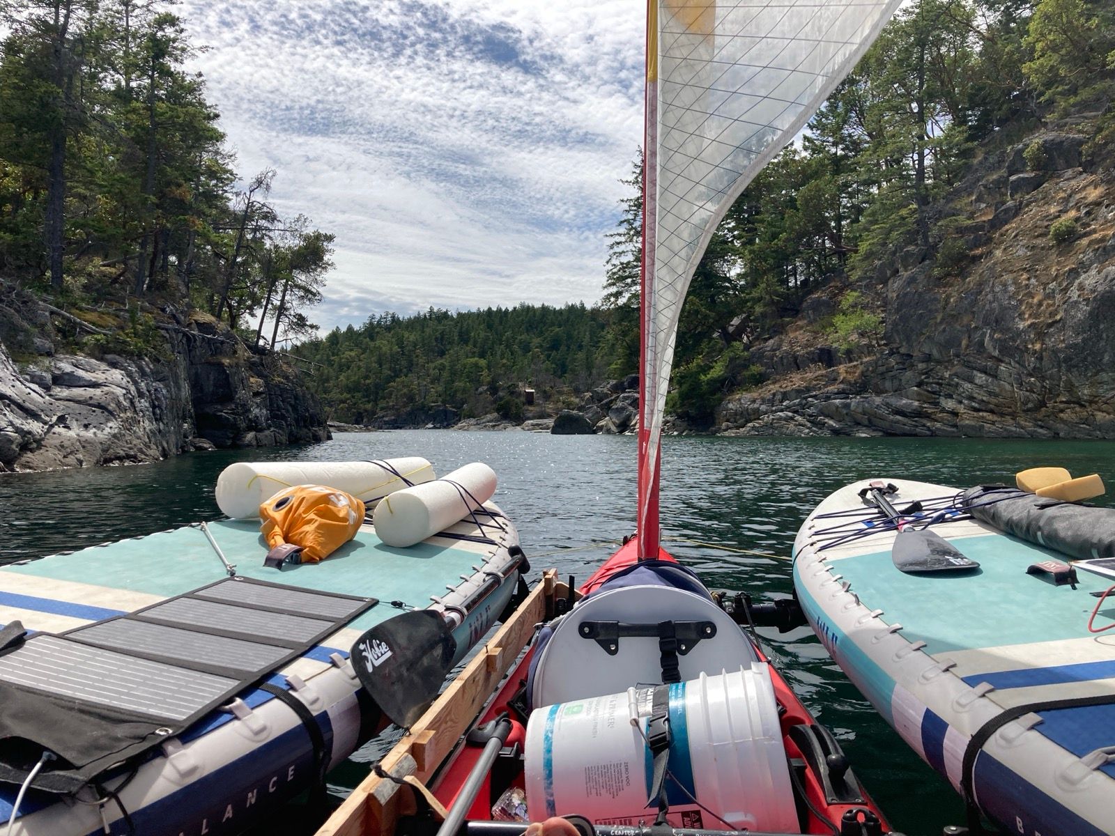
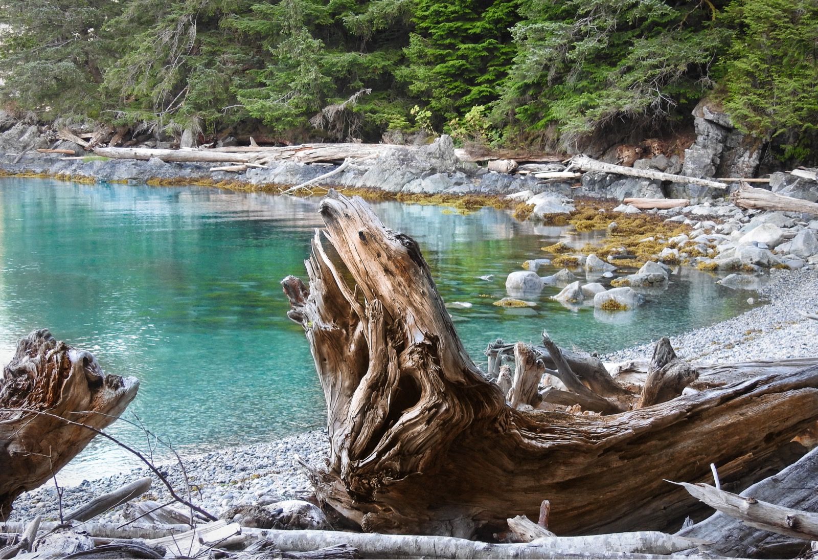
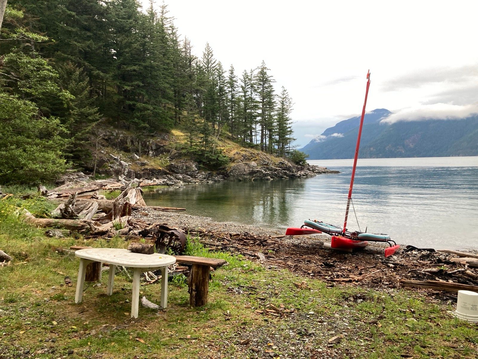
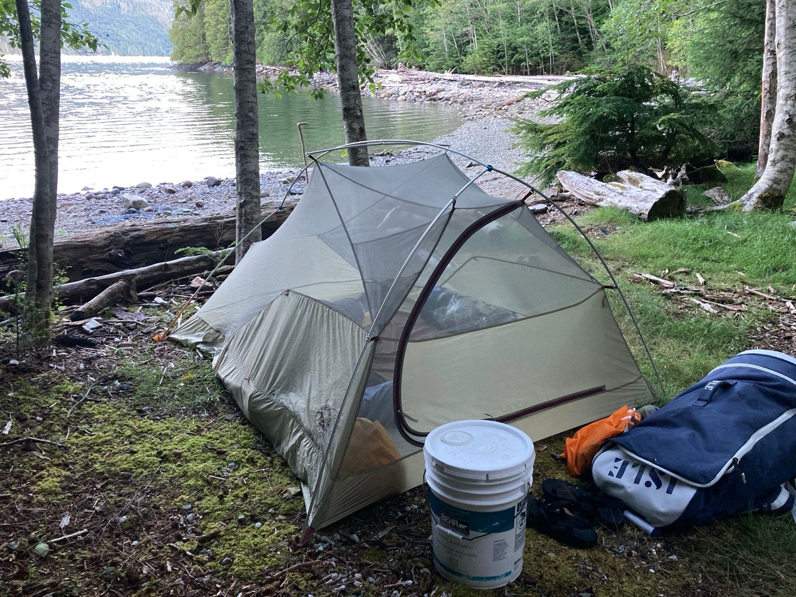
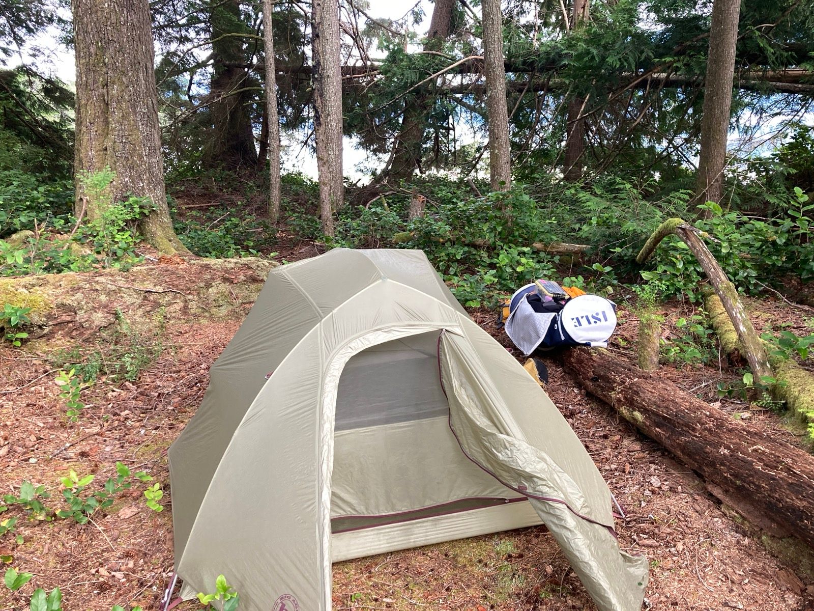
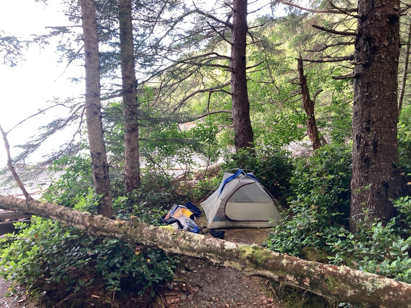
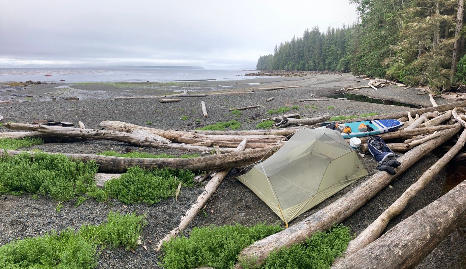
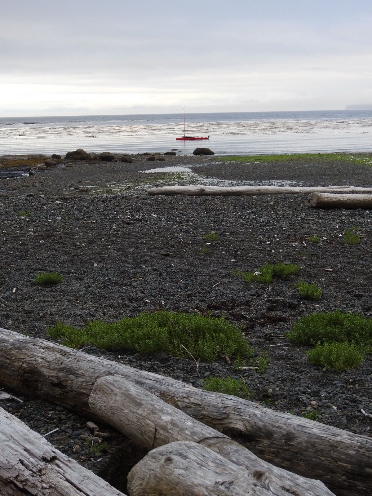
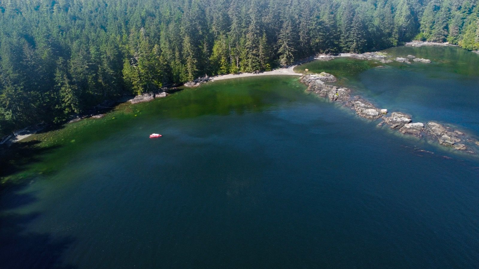
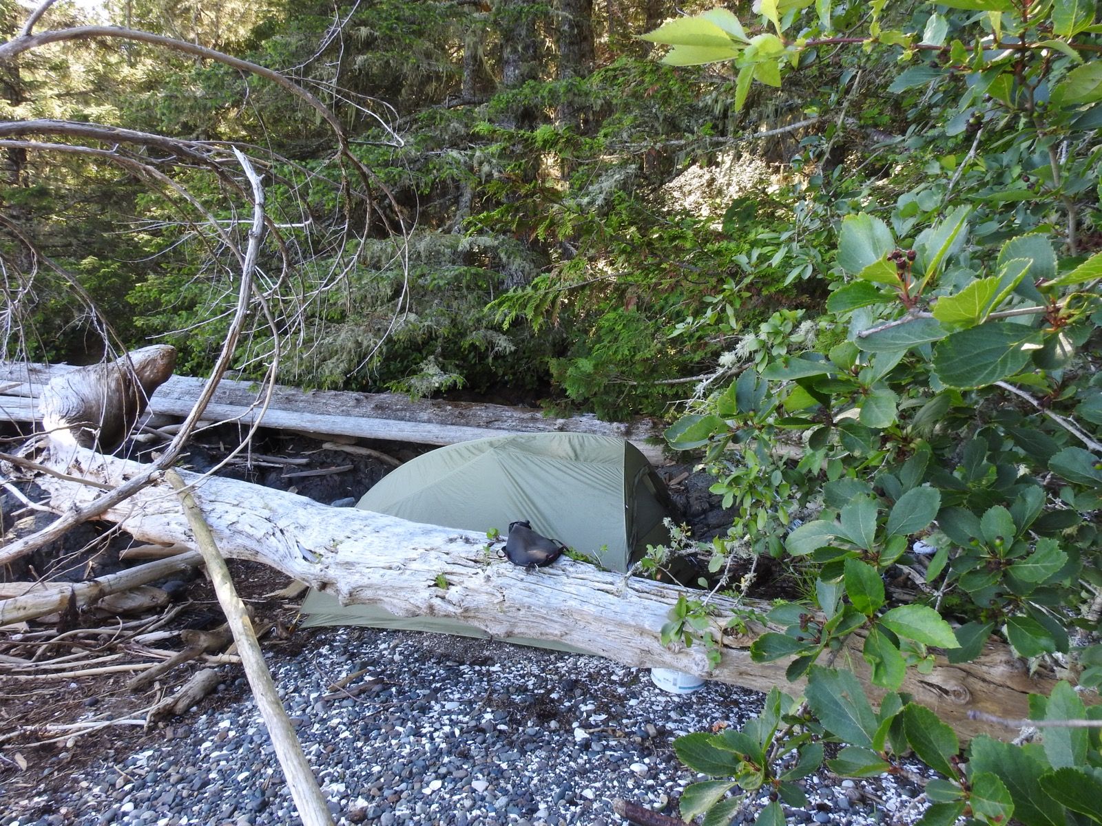
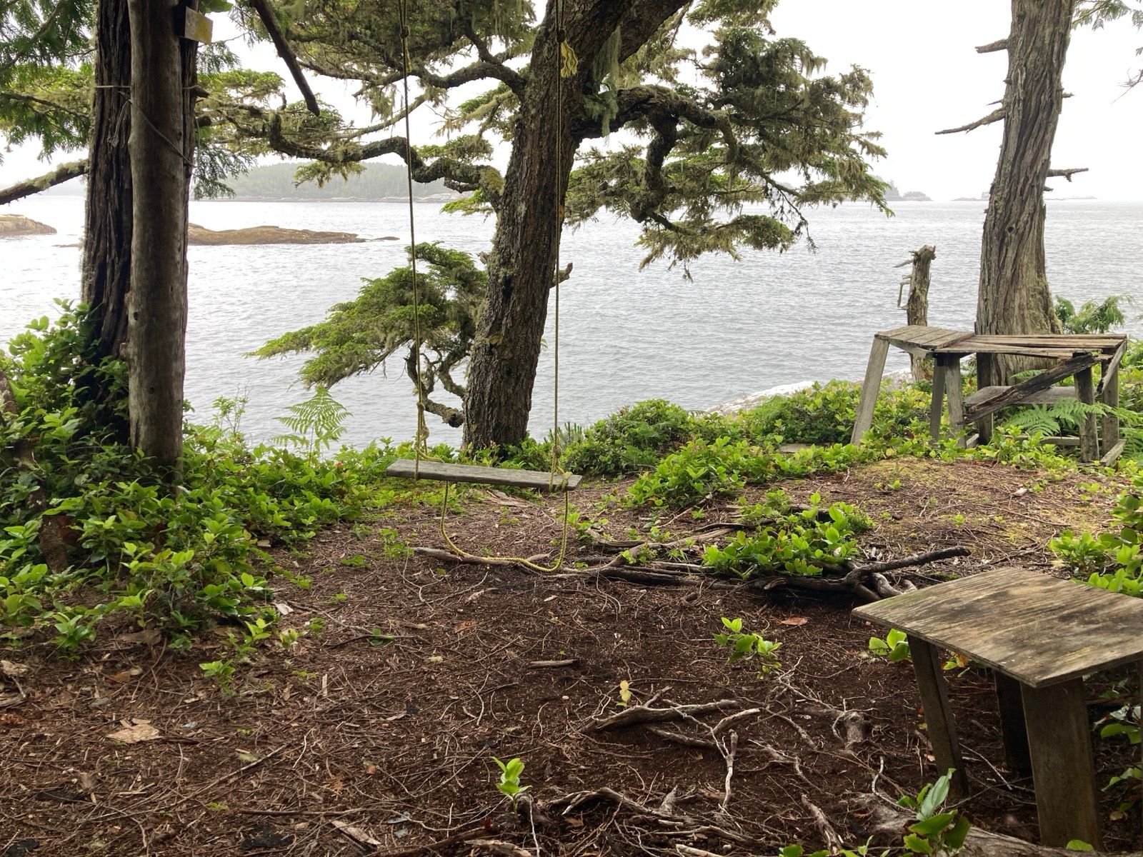
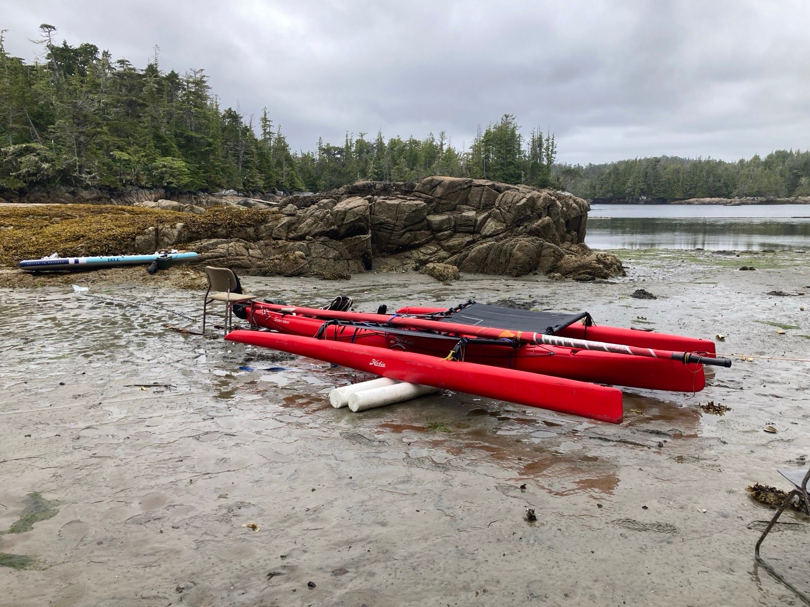
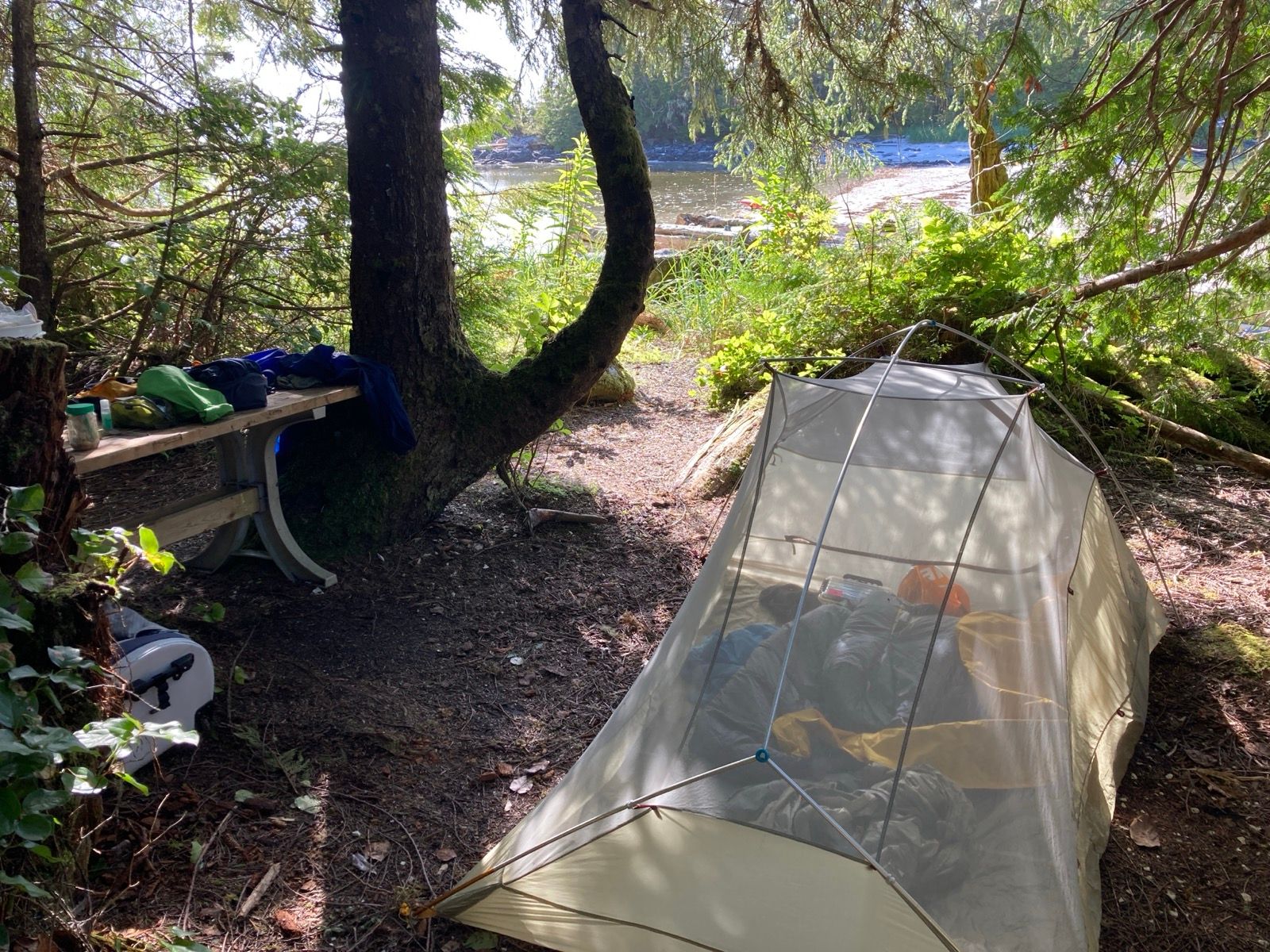
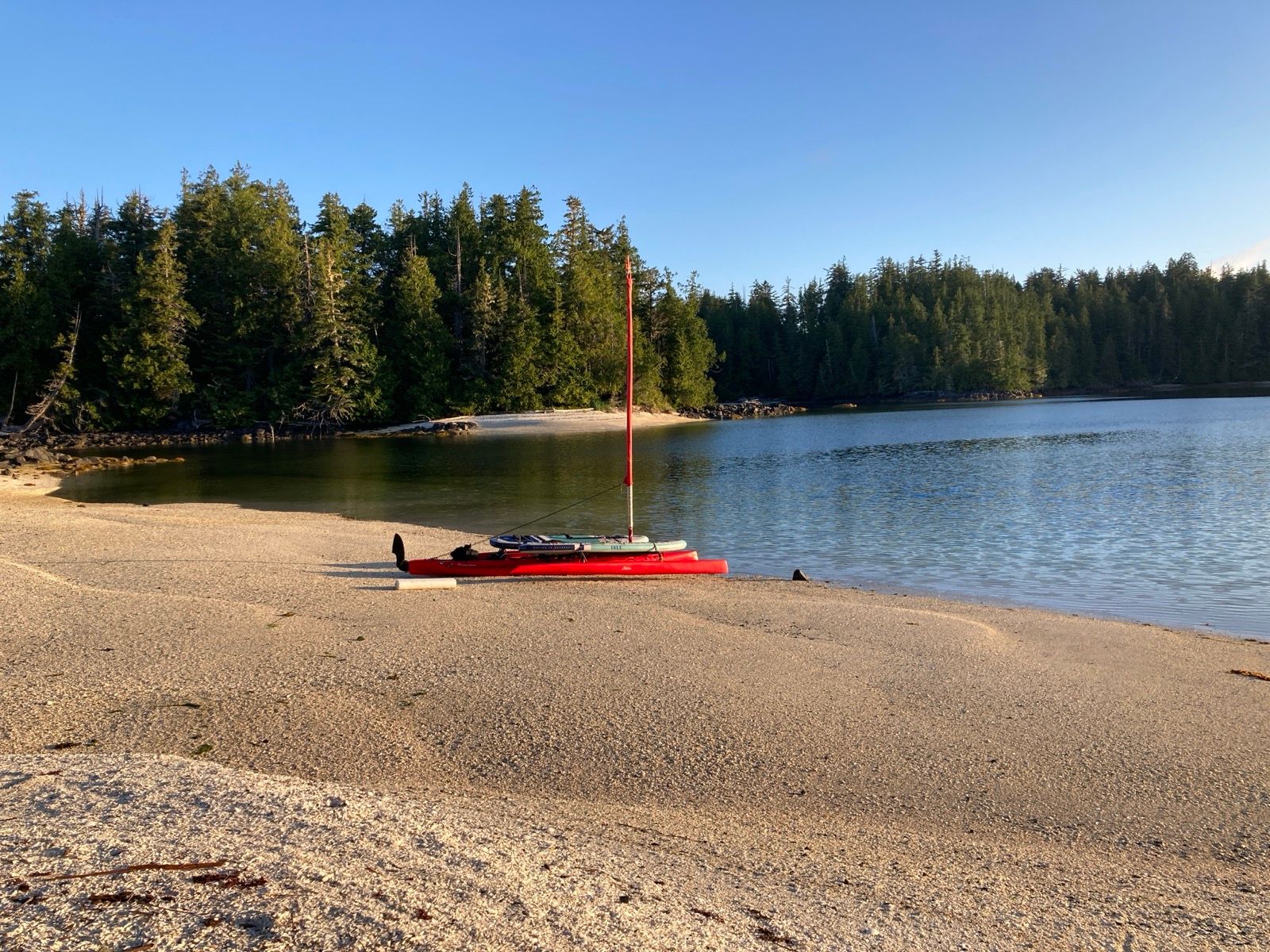
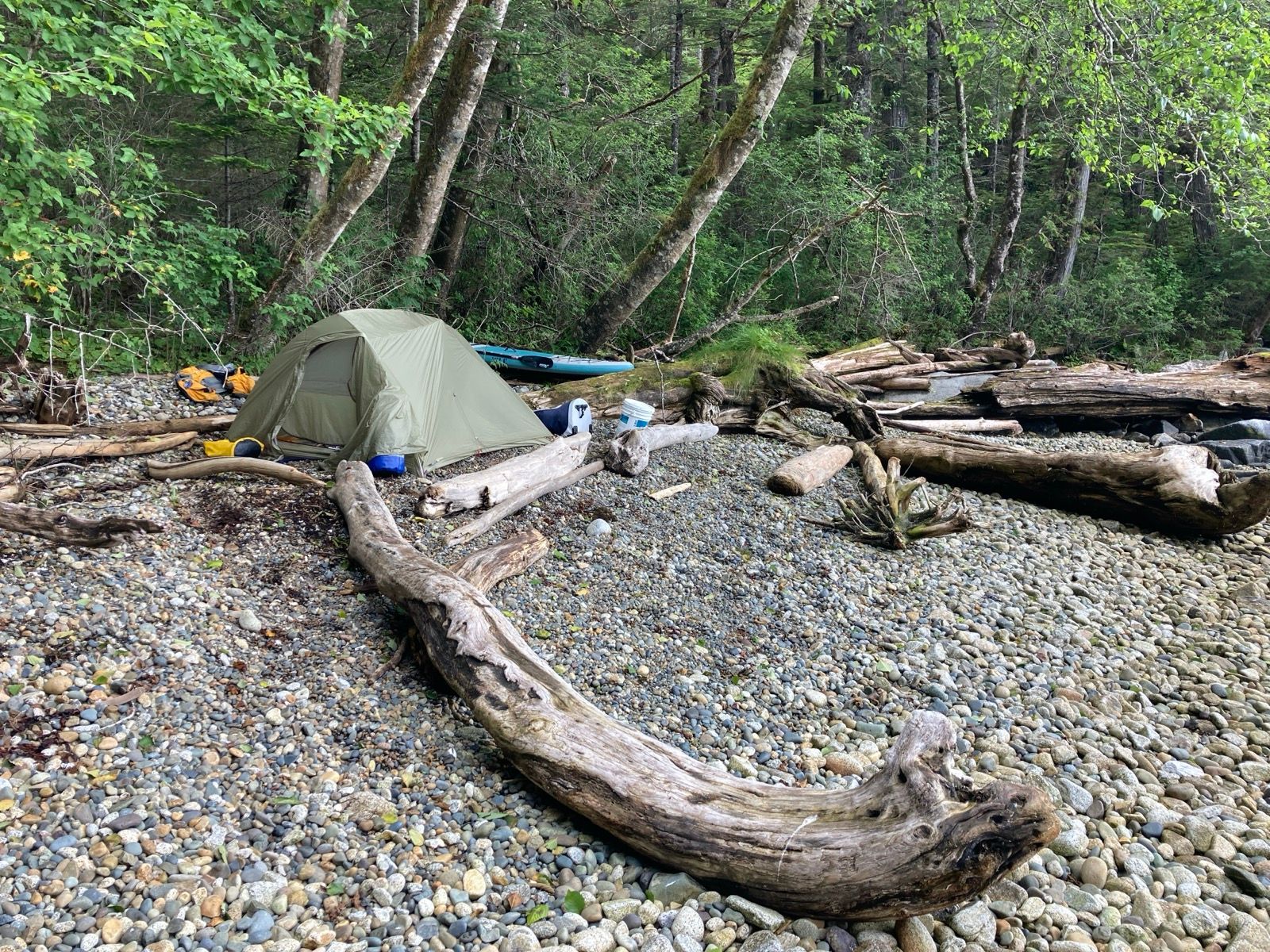
And I found it – à cove too shallow for à keeled boat. I copied what I have seen others do, and set the anchor on the bow, and tied the stern to a tree on land. This way, I wouldn’t have to ground the boat or do a long portage as the tides change dramatically and the land below the water is covered with sharp shells. I used the paddle board to then get to camp. It was a little clumsy transferring the bags, but like anything else, there is a steep improvement curve the first few times you do something new.
Bon Nuit!
Sunrise 5:14 Sunset 9:20
Moon 50% waxing
Photos:
Strava Comments:
Stan H.
Julie K.
Janet W.
Boris F.
Todd A.
Brian L.
Justen W.
Ann L.
Brian L.
Ride Stats:
| Elapsed Time | Moving Time | Distance | Average Speed | Max Speed | Elevation Gain | Calories Burned |
|---|---|---|---|---|---|---|
|
14:27:41
hours
|
13:29:39
hours
|
74.30
km
|
5.51
km/h
|
10.80
km/h
|
175.00
meters
|
2,765
kcal
|
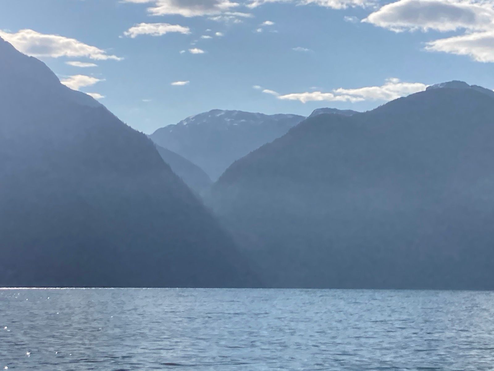
– Day 3 : The Blue Beyond [top]

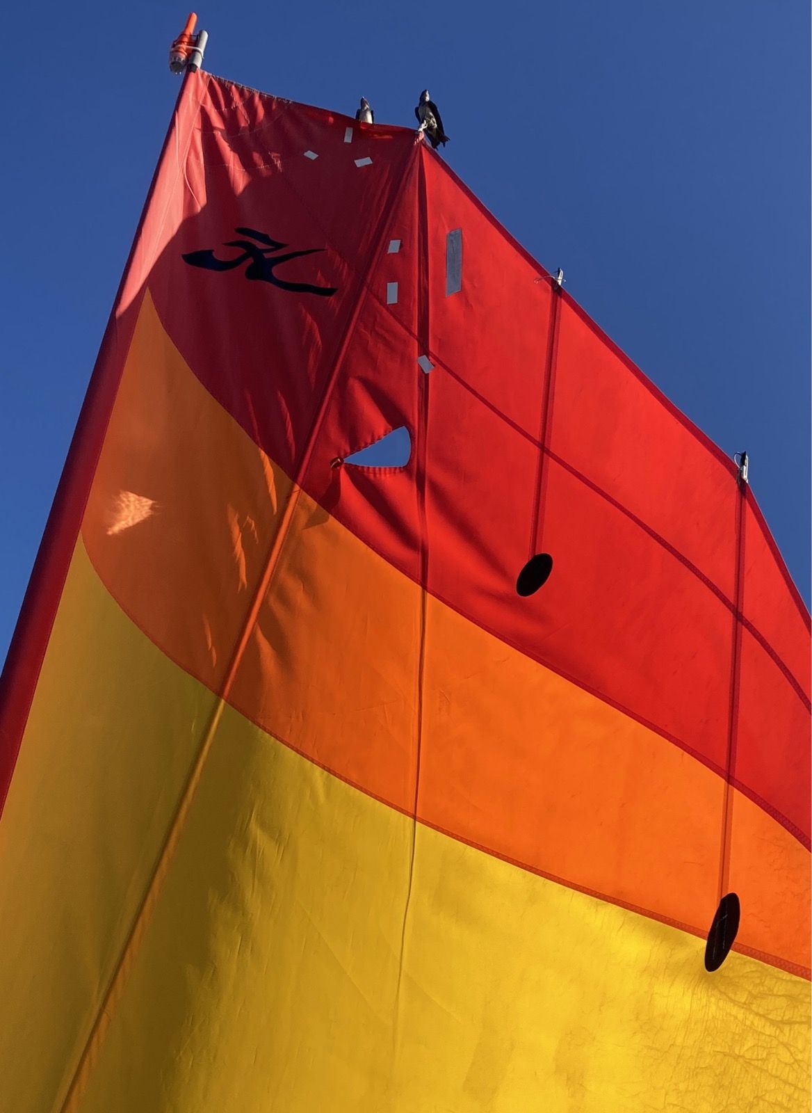
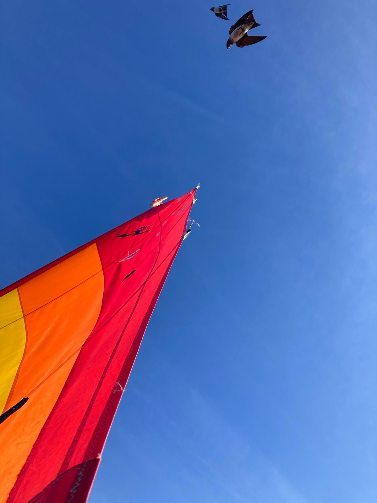
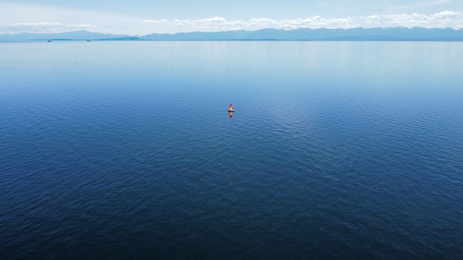
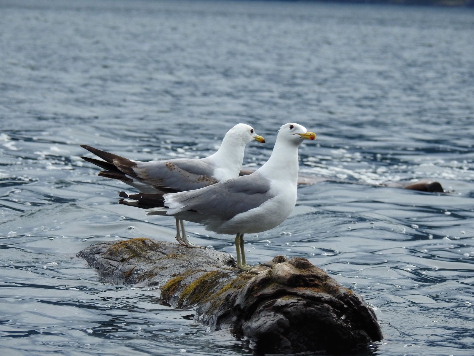
Two small birds had been courting my sail for what felt like hours, dancing an aerial ballet of indecision—landing, lifting, circling back. At first I tried to ruffle the sail to dislodge them – worried they might tear it or squirt a poop on me, but eventually I let them be and they perched on top. Later, I thought they were gone and then they showed up again an hour further into the journey… unless they were a different pair of birds. Admittedly, they all look the same to me.
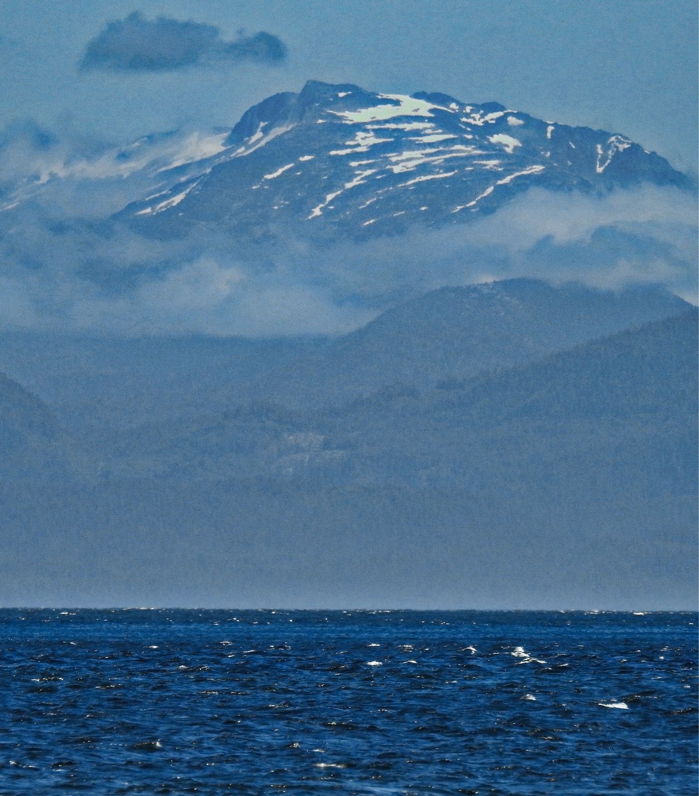
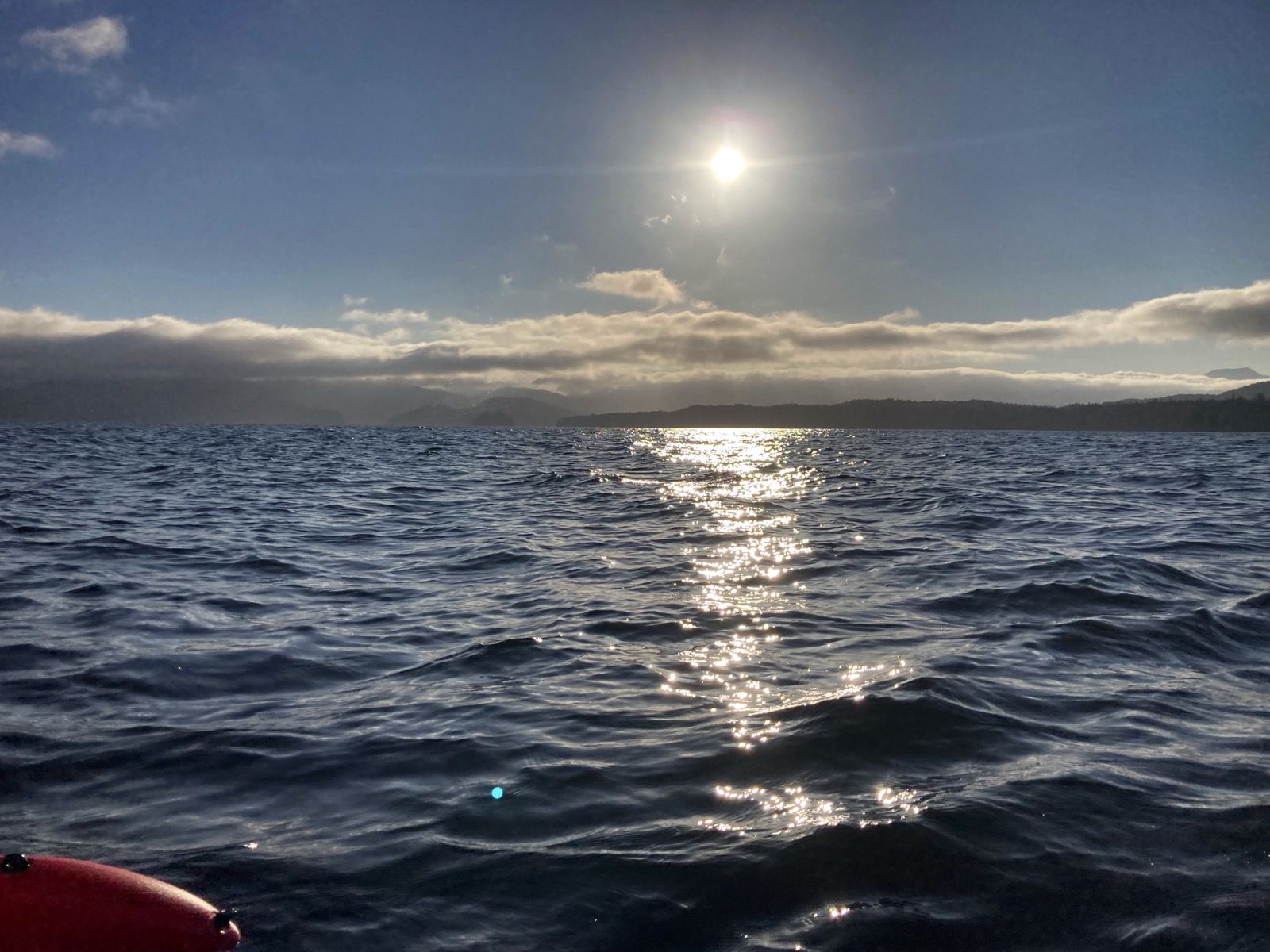
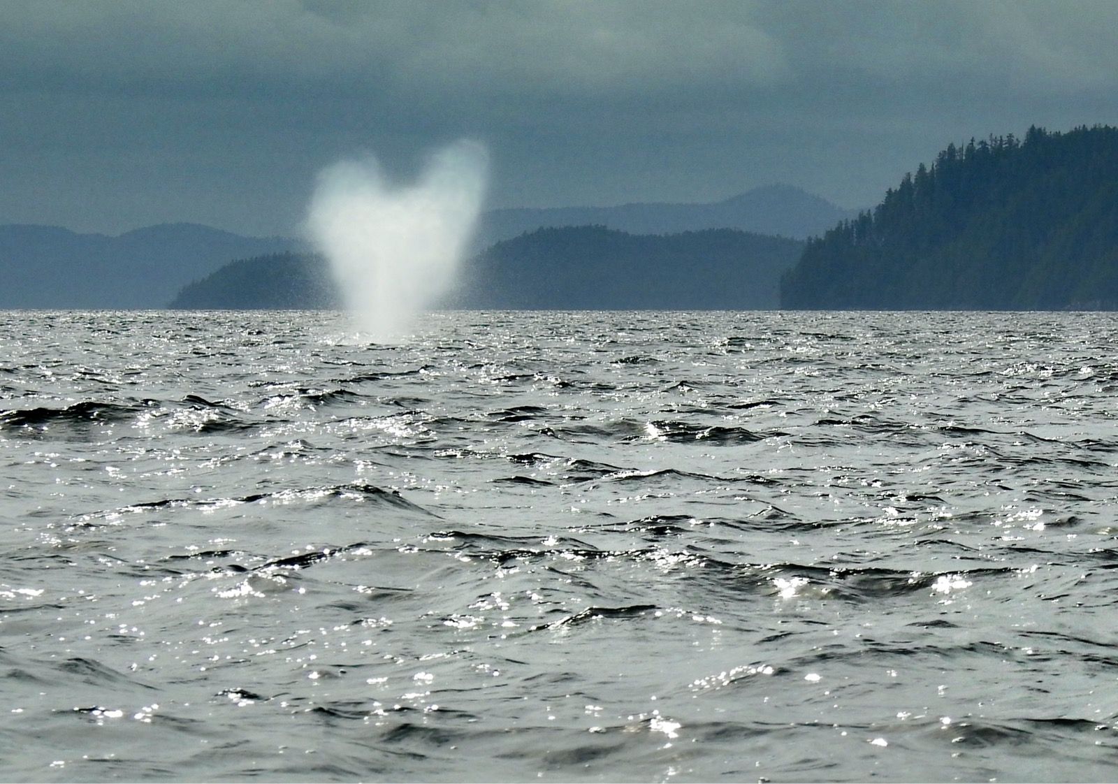
Out there in the vastness, distance plays tricks on your sense of scale and time. Whales breached à far, erupting in columns of spray that appeared to be as high as my mast.
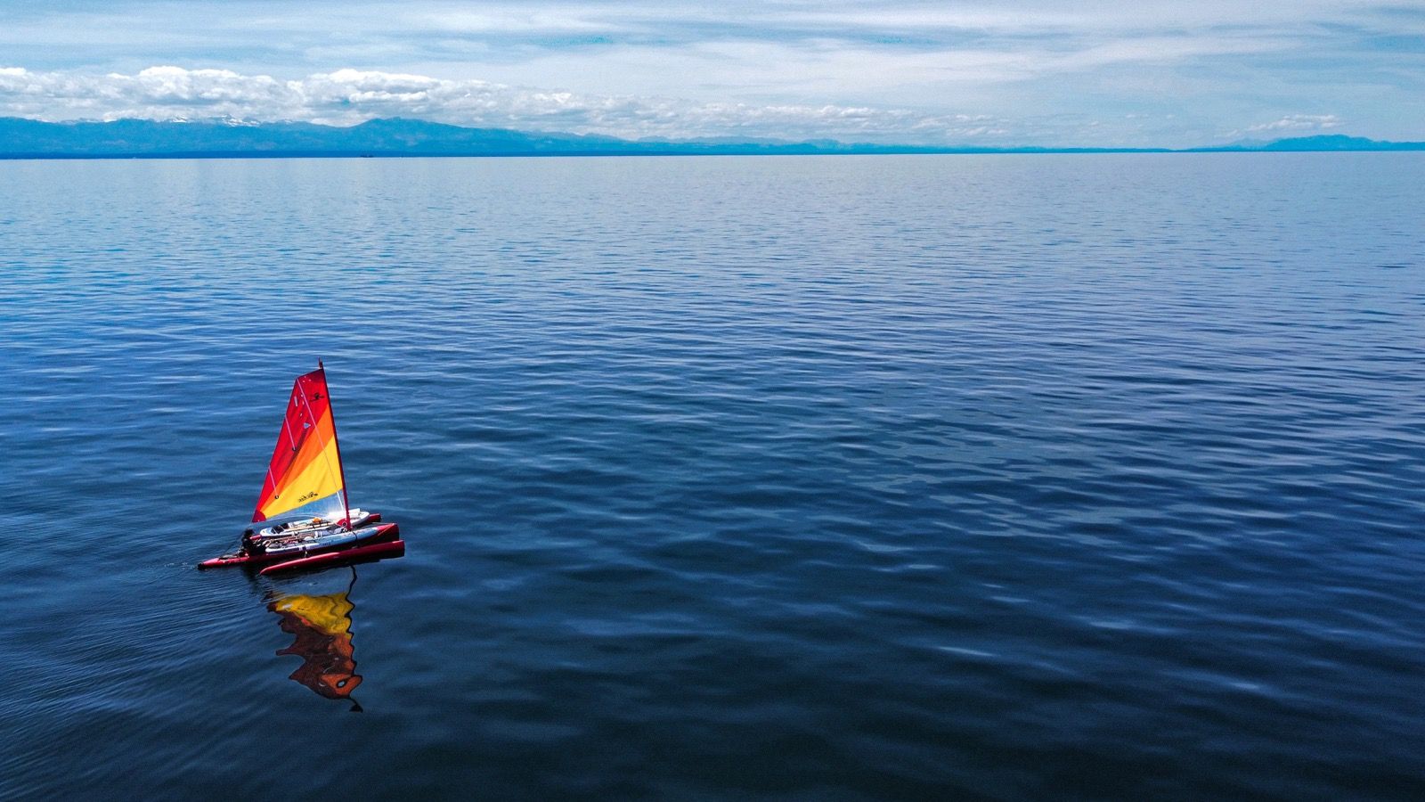
The water stretched in all directions, and I found myself an insignificant speck in this blue-bound crossing that took most of the day. I spent several hours of it talking with my sister. We can talk for hours and being that I was aboard my little spaceship on the sea – you have nowhere else you can go when there is only water 10 miles in every direction.
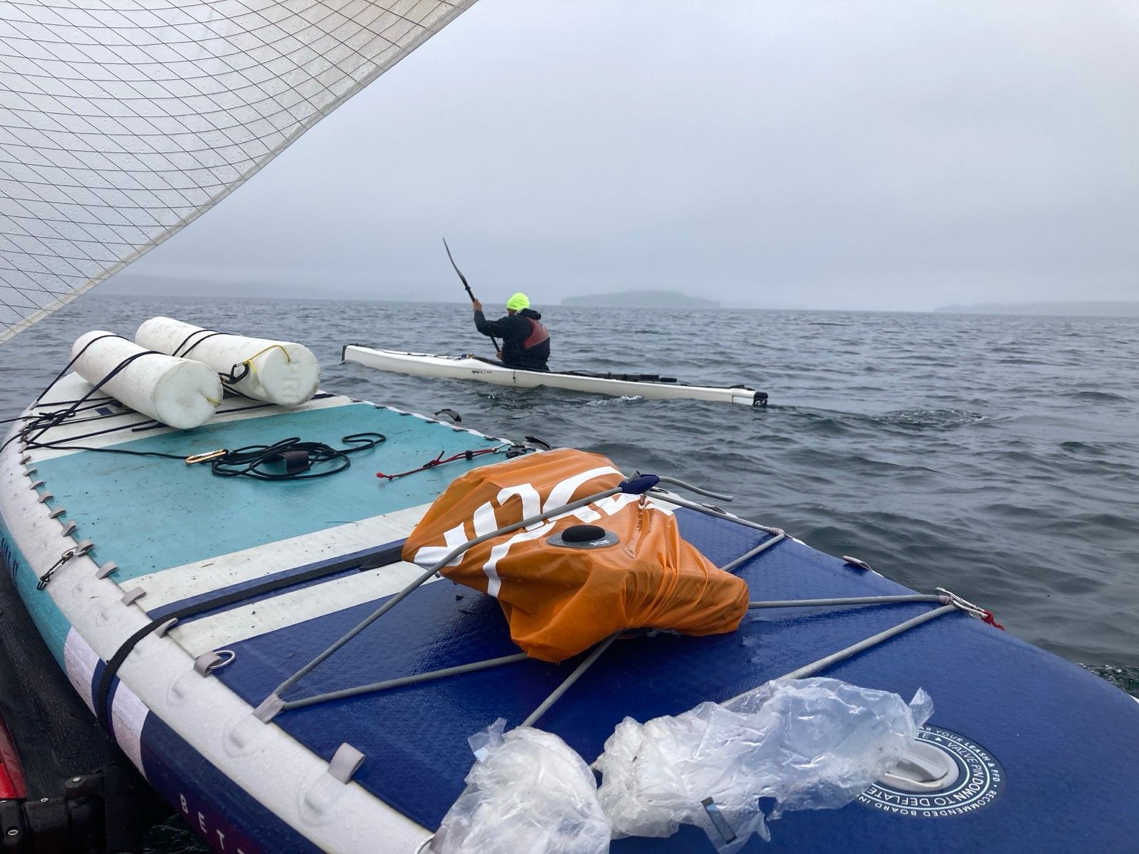
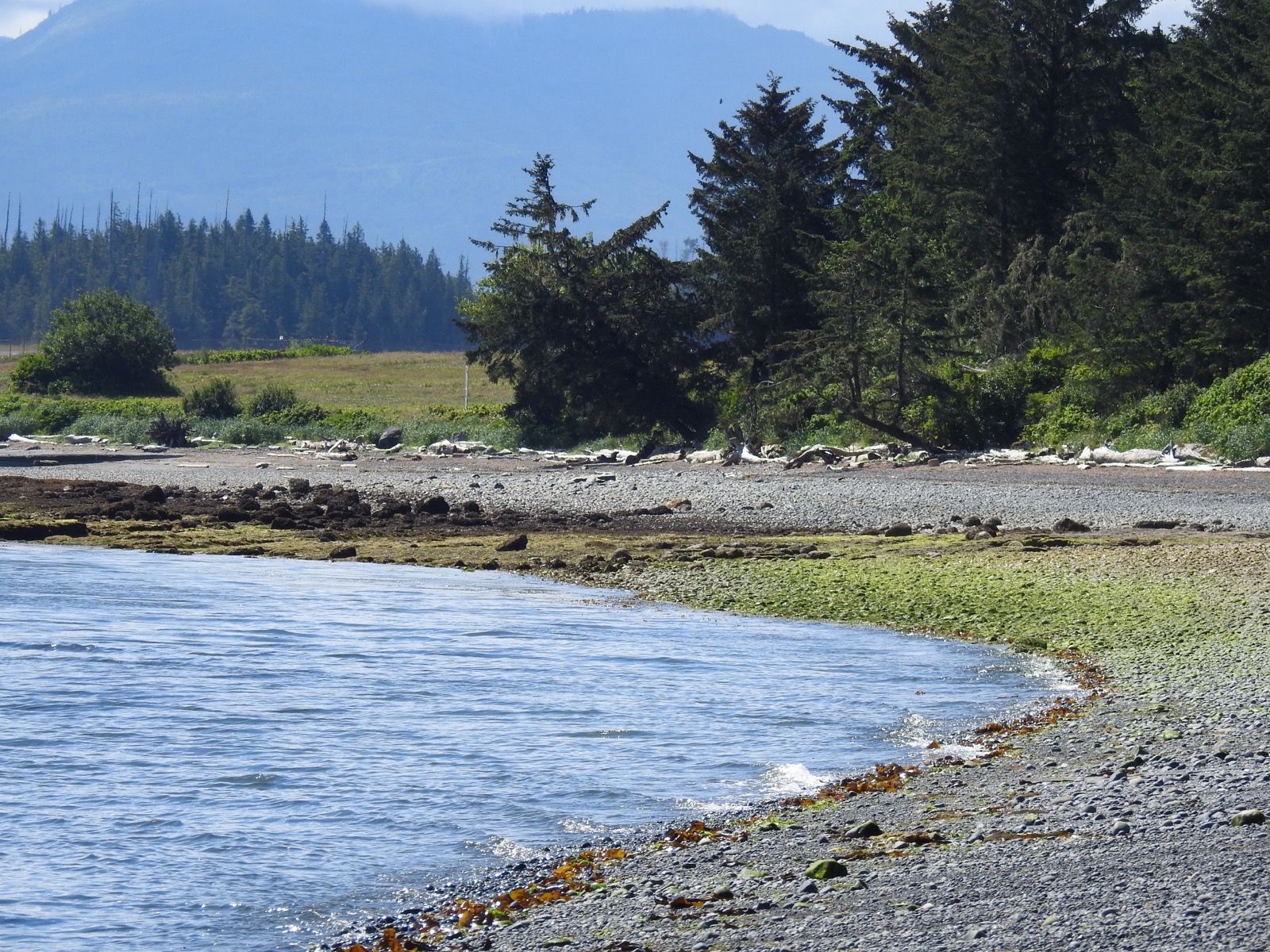
And then there was land. 3 other people were camped in the cove I had selected. Kayakers – a pair of guys, and Michael – who was traveling solo and eager to talk. Like really eager, and I had to go about camp chores while he leaned in. He gave me lots of tips about the sections I had planned – some turn into “waterfalls” at certain points in the tide cycle. I knew there were some tough sections ahead, so we will have to see about how to negotiate that.
Photos:
Strava Comments:
Janet W.
Todd A.
Ride Stats:
| Elapsed Time | Moving Time | Distance | Average Speed | Max Speed | Elevation Gain | Calories Burned |
|---|---|---|---|---|---|---|
|
15:13:42
hours
|
14:08:40
hours
|
72.02
km
|
5.09
km/h
|
11.45
km/h
|
33.30
meters
|
2,821
kcal
|
– Day 4 : Sunshine Coast [top]

I hardly talked to the other two kayakers, Wes and Matt. They seemed young, and well prepared. Michael said they were on a big adventure, but I forgot where. When I expressed impressment at these two long kayaking expeditions, he said, “You are in the right place,” alluding to my possible destination Alaska. I do have Michael’s email address and will ask where Will and Matt are headed.
Apart from the morning socialization, the rest of the day was a long period of solitude. I found no boats along the banks of Texada Island – perhaps related to the lack of harbors and landings on this side of the island. Being alone and far from shore, traveling at 3 knots can do many different things with your mind. I used to have trouble with this kind of thing – but now I ask myself, “if I were doing something else, what would I be doing?” And of course, the answer is daydreaming of being on this trip! Daydreams, like memories, tend to gloss over the dull parts.
Progress was slow as the wind diminished to zero. I pedaled to move forward, and finally got to an official campground-but the sites were quite a distance from the boat ramp. Plus, the tides are so exaggerated- even now during the half moon- that the effort of taking the boat out of the water is intimidating. I estimated that beach would probably retreat 100 feet by tomorrow morning, which is a long drag.
The satellite revealed a micro harbor – hardly protected from the big water, but a hook of land would slightly attenuate some potential weather. I anchored out, using the pedals to dig it deep. I’m grateful to have that extra 20 pound weight – I’ve been using it every day! Next I paddleboarded to shore and spent 45 minutes clearing à tent spot to enjoy the evening and sunset.
Sunrise 5:17 – Sunset 9:29
Moon 68% Waxing
Photos:
Strava Comments:
Janet W.
Janet W.
Ann L.
Sօʀƈɛʀɛʀ 🅅.
Mark G.
Ride Stats:
| Elapsed Time | Moving Time | Distance | Average Speed | Max Speed | Elevation Gain | Calories Burned |
|---|---|---|---|---|---|---|
|
13:53:16
hours
|
12:10:07
hours
|
61.16
km
|
5.03
km/h
|
11.02
km/h
|
55.70
meters
|
2,061
kcal
|
– Day 5 : That Sinking Feeling [top]

I woke this morning to find the boat resting on land! This was quite the surprise because I had anchored the boat in what appeared to be 7 to 8 feet of water. According to the tide chart, the tide the water would be 6 feet lower in the morning.
Fibonacci numbers may lure you into thinking that nature follows some sort of mathematical rules, but alas, my trust in the tides operating with such precision ended up causing me a few calamities today.
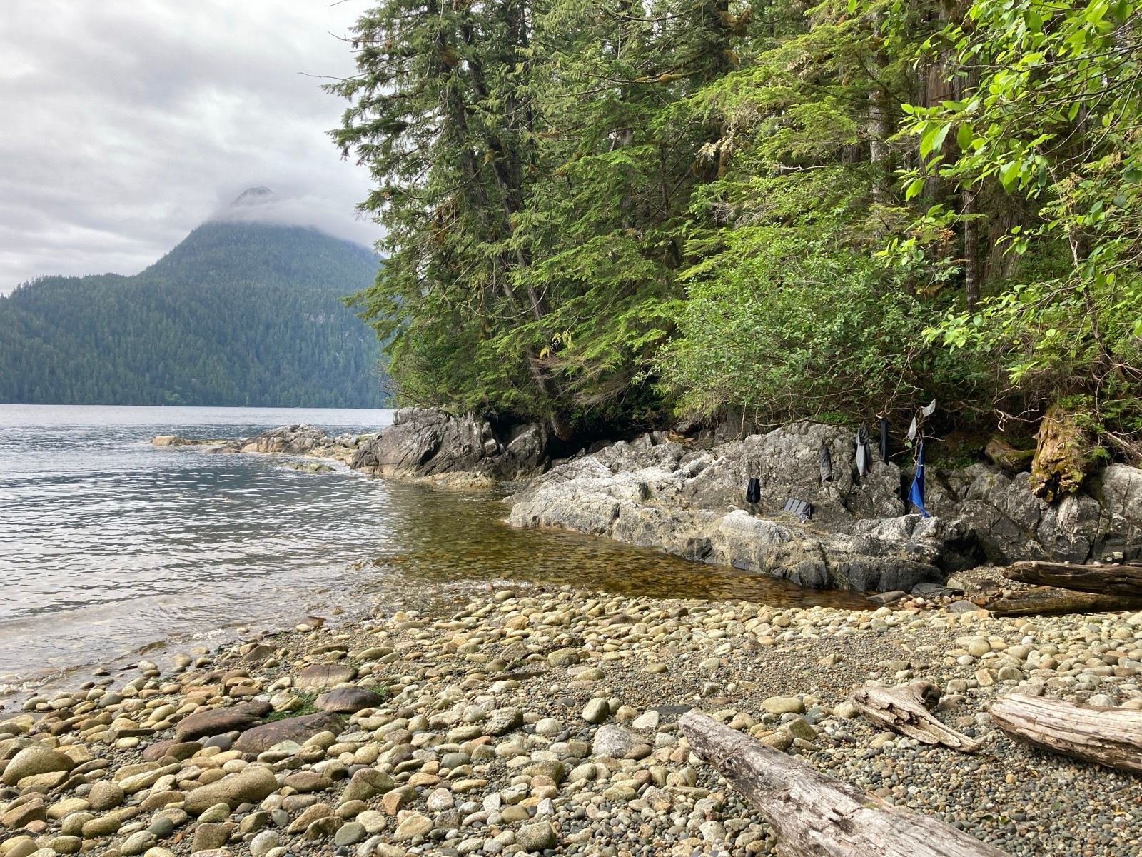
I jumped out of the tent as fast as I could, and ran across the enlarged cobbled beach and dragged the heavy boat a few feet back into the water; from there I coaxed the boat around rocks and set the anchor further offshore. I now had a long cobble rock run across boulders to get back to my camp to disassemble everything as fast as possible so that I wouldn’t have to drag the boat across a long stretch of Rocky land.
I took apart my tent and everything was on the bouldered beach in 18 minutes. Once everything was beside the boat, I loaded it up as quickly as possible, constantly floating it inching it to deeper water bit by bit. I set off and thought about how I was lucky that this all worked out. *Note from the future: I would discover that I accidentally left my tent stakes at that camp – Doh!!
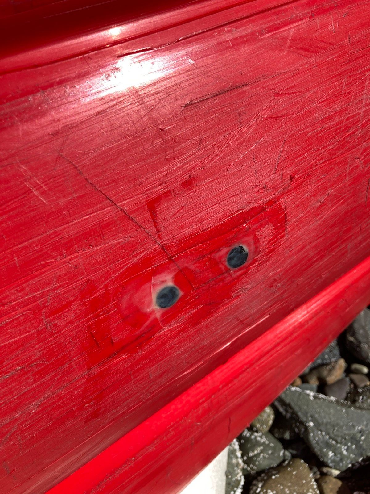
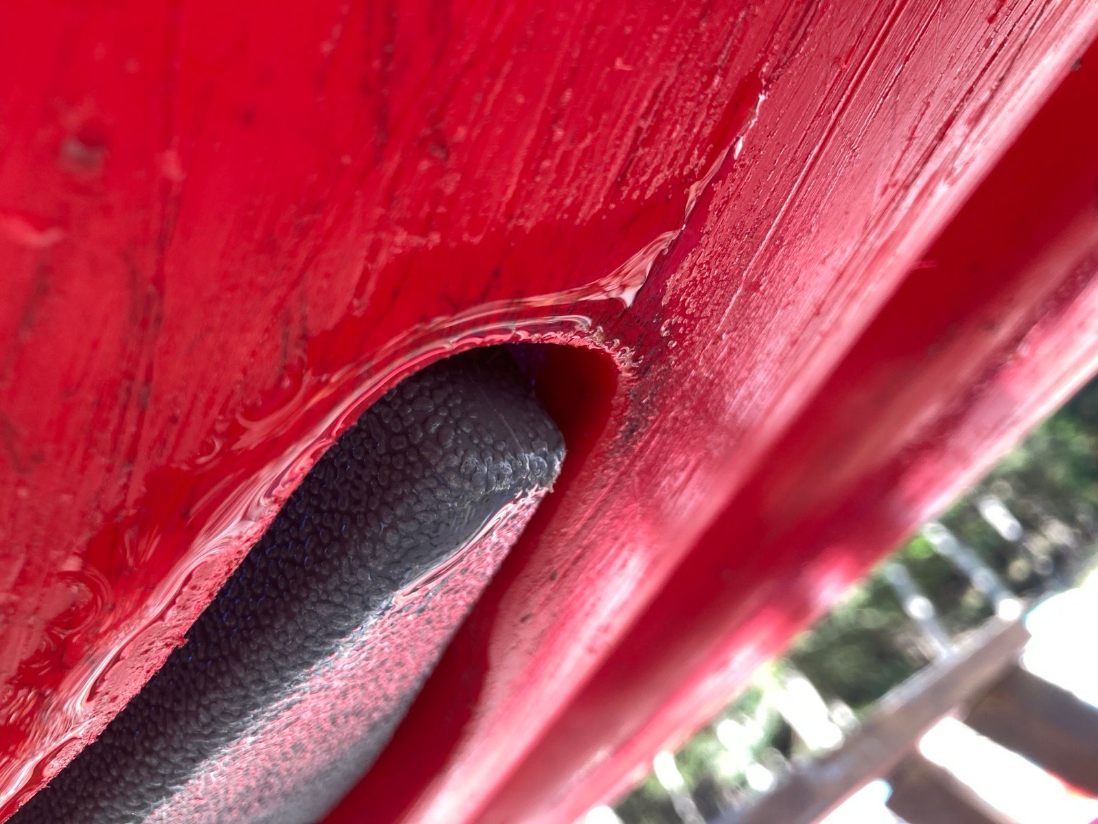
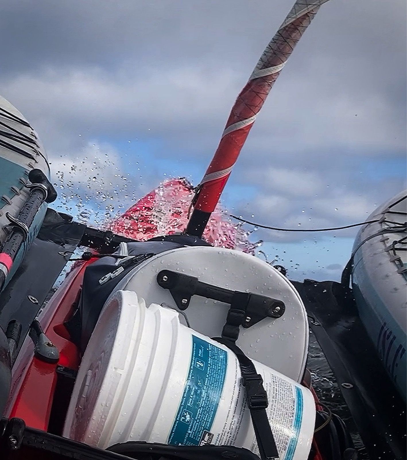
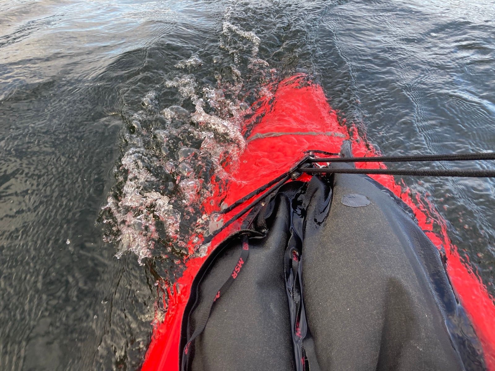
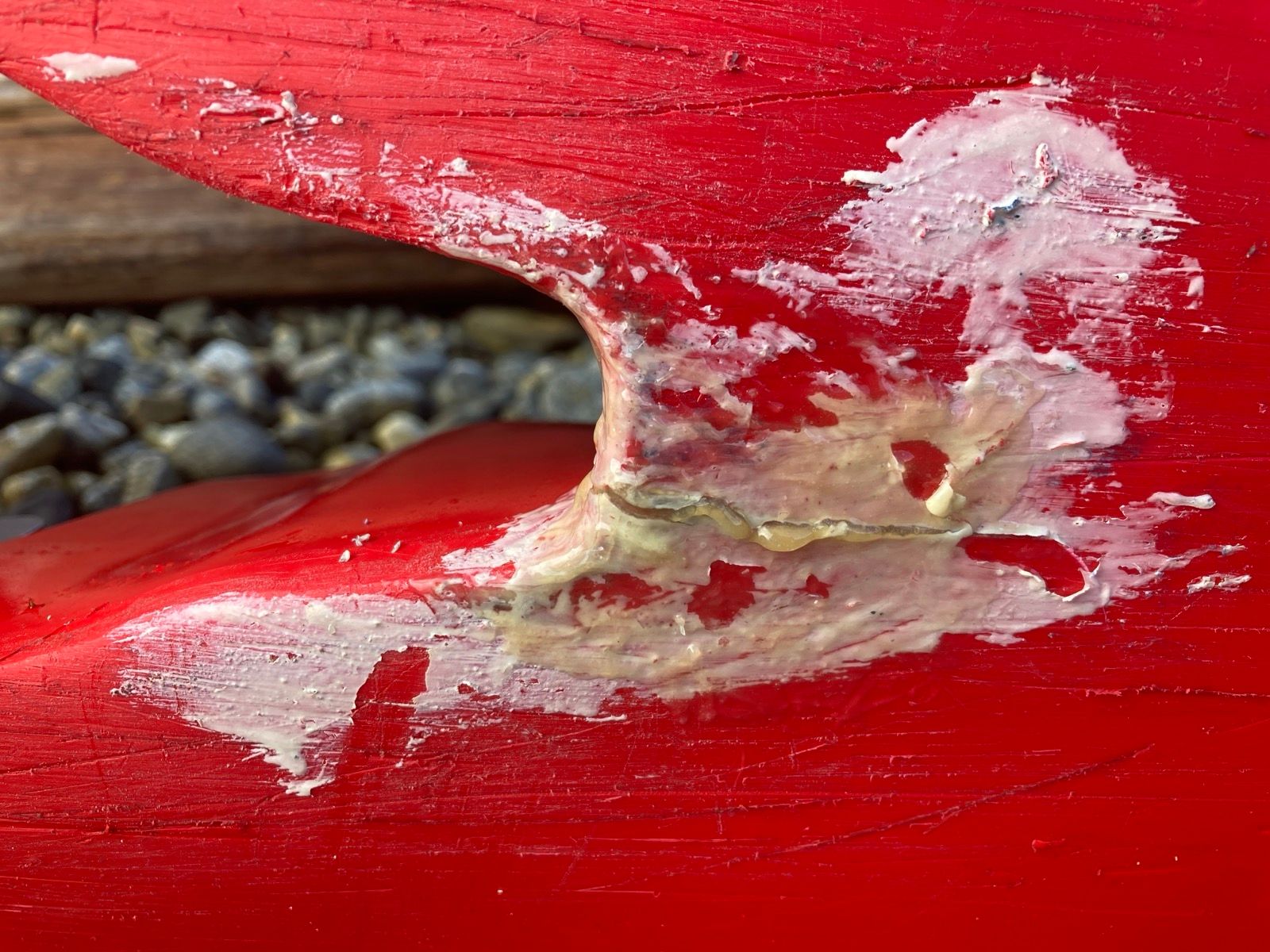
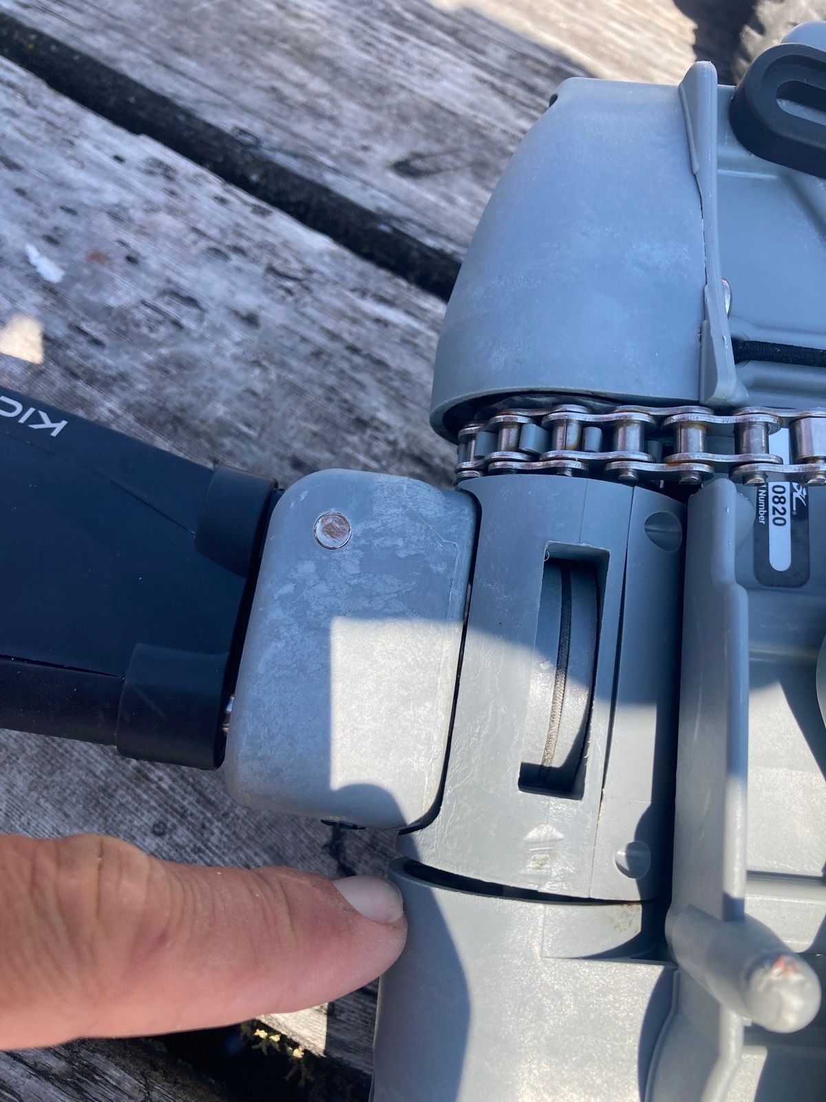
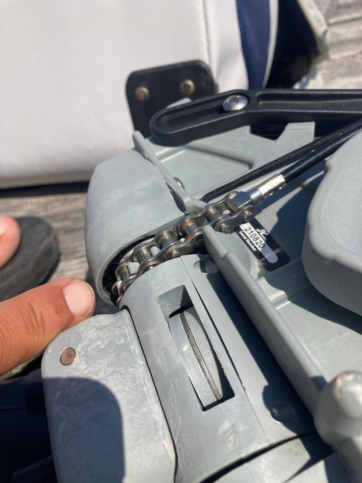
Once at sea, I figured I would put in my contact lens, take my medicine, and attend to all those other important things (such as drinking coffee). But the wind was coming from the north, and when you are beating into the wind, it’s not as luxurious as sailing down wind. The tiller requires your constant attention. Because of this, I delayed putting in my contact lens and my morning brew. At one point, I decided to open the hull to get out the battery for charging. I found 8 inches of water inside! I was sinking! It’s kind of surprising how this boat can still move along when it is full of water and I’m surprised that I hadn’t noticed earlier! I quickly grabbed the pump and emptied the bilge and thought to myself: “Was there water in there this morning when I put my Otter Case in there?” No there wasn’t. I was being kind of optimistic thinking that maybe that water had splashed in last night. Unfortunately, like a leak on a bicycle tube you need to try and find the the hole. I had a few suspects, but my worst fear was that I had gouged the hull on sharp rocks and oyster shells. I also suspected a couple of mechanical entry points that are built into the boat. The only way I could fix this would be by bringing it to shore and disassembling the entire vessel. This wasn’t a leak I could ignore; the hull repeatedly filled with water quickly each time I pumped it out.
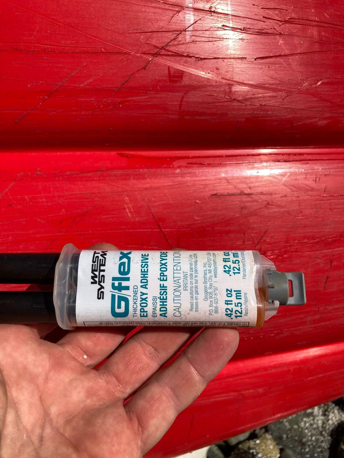
Once on shore, it would be a race against time to get everything done before the tide came in to sweep everything away. I made way, constantly pumping the bilge and trying to sail at the same time. This is very difficult to do as one person because you need to be on the rudder at all times, and you cannot pedal while you are pumping because the hatch that you’re pumping from is between your legs. So I carried on like this until I saw a rocky beach that looked like RL could land on it. It wouldn’t be great, but it was going to be the only way that I could possibly repair this without having to go another 15 miles in a sinking boat. I pulled the boat to shore and disassembled it in the shallows. The cove was very small, but it was actually quite protected, and the sun was shining and it was really a nice spot! I detected the sharp shells as they cut my toes even with my sandals on. Mystery knife slices appeared on my fingers, burning in the salt water. Apart from that, I was actually enjoying being in this nice little cove. I quickly took everything up to a large table size rock that was 4 feet higher than the ground that it was on and probably another 3 feet higher than the current water level. I figured that if I needed a lot of time, this rock would give it to me- but it was obvious that even this rock would be submerged soon because there was a puddle of seaweed in a little tide pool on top of the rock. Once everything was high and dry, I began to pull the boat out of the water using the foam rollers, which actually are turning out to be fantastic because there is no way that I could’ve used any type of wheels on this bouldered terrain. I got the boat just enough out of the water to tilt it on its side and let the bottom dry to take a good look. Before I had pulled it out I had investigated from inside, drying with the sponge, and I came to the conclusion that water may actually be entering at the base of the mast. There are two penetration points where the mast bolts to the bottom of the hull and they are covered with black caps. Sure enough one of the black caps was torn open just in a slight little corner; I suspected that that may be where the leak was coming from. I am carrying a product that I have never used before called G-flex epoxy and decided that this was going to be a great opportunity to give it a go. Unfortunately, I had never read the instructions and there aren’t any on the side of the tube. I went ahead and did what I figured you should do with epoxy: Mix the two components and press the goo into the holes that you’re trying to patch. Now it is a matter of waiting. Naïvely I had assumed that maybe this would take 15 minutes to cure but I had Internet access and discovered that a full cure is 24 hours! Unwilling to wait for that duration I decided to put some underwater tape on top of this epoxy patch. I would let the epoxy cure as long as possible before doing so. I began to run out of time as the tide began to swallow up the boat and eventually knocked it over. This is when I knew that it was time to go. I put the Nashua underwater tape on top of the epoxy and thought to myself that this stuff sealed so well that the tape alone may have been sufficient. Also, the Internet claims that the G-flex epoxy can cure underwater so even if the underwater tape let some water in beneath it, it is possible that the G-flex epoxy can cure in spite of the water exposure. Fingers crossed. This would be the second calamity (after the tent stake loss) caused by under-anchoring.
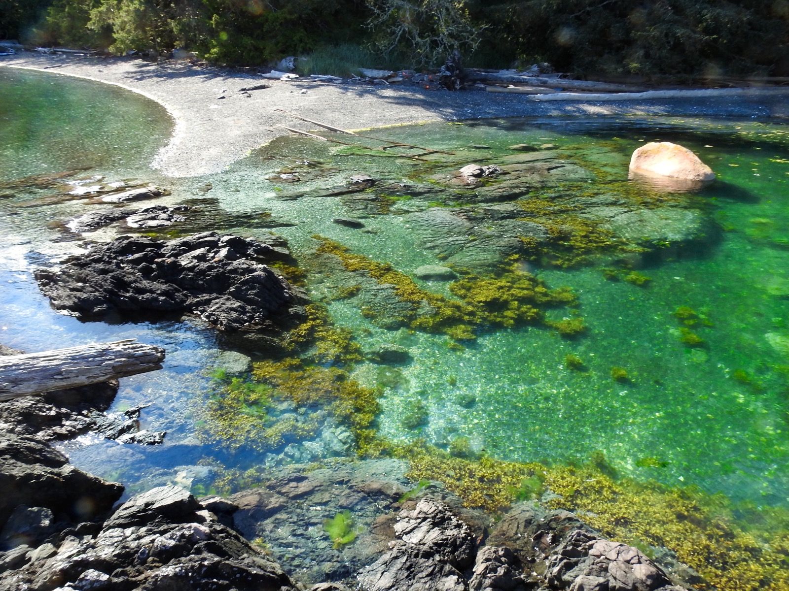
I then began to enjoy the surroundings a little bit and had myself two servings of coffee, which made the thought of being temporarily stranded on the beach even more enjoyable. The water clarity was fantastic and in my wetsuit, it’s actually very warm. The water here is supposedly only 55° but it is quite swimable without a wetsuit – I bathe in it each night. On paper it is 10° warmer than the water that Janet and I were experiencing along the intracoastal waterway North of Georgia, but it feels even more pleasant.
I am using that anchor and chain every day! It was one of the items that I was seriously considering leaving behind or ditching somewhere because I was so concerned about the extra weight. The anchor itself is nearly 10 pounds and it has a very sharp point and I have to be careful to not damage the boat or paddle boards with this tip. Also, there are nearly 10 pounds worth of chain attached to it, which is also useful because I know how long each length of chain is – facilitating depth estimates
Once everything was packed up, I waded out waist deep into the water and began sailing again. It was hot and windless, so I pedaled to another island. I talked to Janet on the phone and my nephew Connor is now drawing sailboats, coming up with an improved sail design, and fascinated with seals. 🦭 That kid is awesome and I want to take him out on the Hobie Tandem Island. He’s obsessed with the Shackleton story “Endurance,” and on the first day of the trip, I listened to “Madhouse at the end of the Earth” – another well written gripping encounter of a Belgian Antarctic exploration in the late 1800s. I recommended this book to Connor (and to you too if you’re reading this).
It took 2 hours to anchor the boat, shuffle the gear up the beach and set up camp. It is quite time consuming to come to shore, and invariably something gets scratched out cut (the hull or my skin). The boat sits further out tonight than last night – hopefully it is enough. Last night after dark, I saw a brilliant yellow light in the Northwestern sky. After it went out, there was a smoke trail that looked like one of those starlink launches – except I’m pretty sure that they don’t do launches this far North due to the spin of the Earth being an assist. Then, another yellow ball of light followed. Weird!
Sunrise 5:18
Sunset 9:31
Moon 82% Waxing
Photos:
Strava Comments:
Mark G.
Hugh J.
Scooter R.
Janet W.
Ann L.
Ride Stats:
| Elapsed Time | Moving Time | Distance | Average Speed | Max Speed | Elevation Gain | Calories Burned |
|---|---|---|---|---|---|---|
|
12:50:55
hours
|
09:51:43
hours
|
46.26
km
|
4.69
km/h
|
9.78
km/h
|
36.10
meters
|
2,556
kcal
|
– Day 6 : Heavenly! [top]

But even the tiny towns still get more visitors than they can handle. This was evinced by the “no this” and “no that” signs everywhere. Just finding a trash can where I could deposit my meager 6 days worth of trash was an expedition. The one ATM in town wasn’t working. I had wanted to get cash, but now I realize there shouldn’t be anywhere to spend money about 230 miles away. At 30 miles a day, that is over a week.
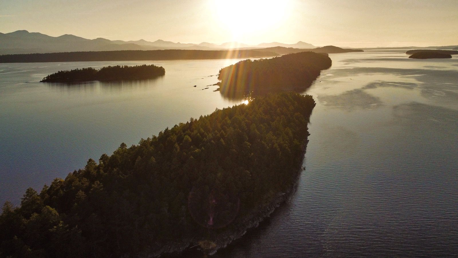
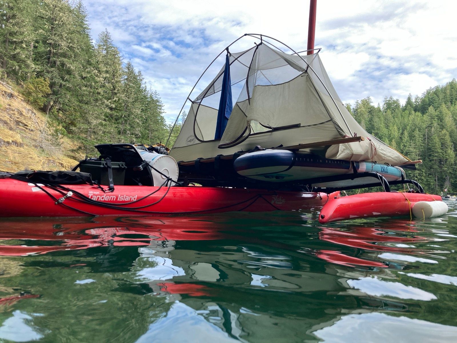
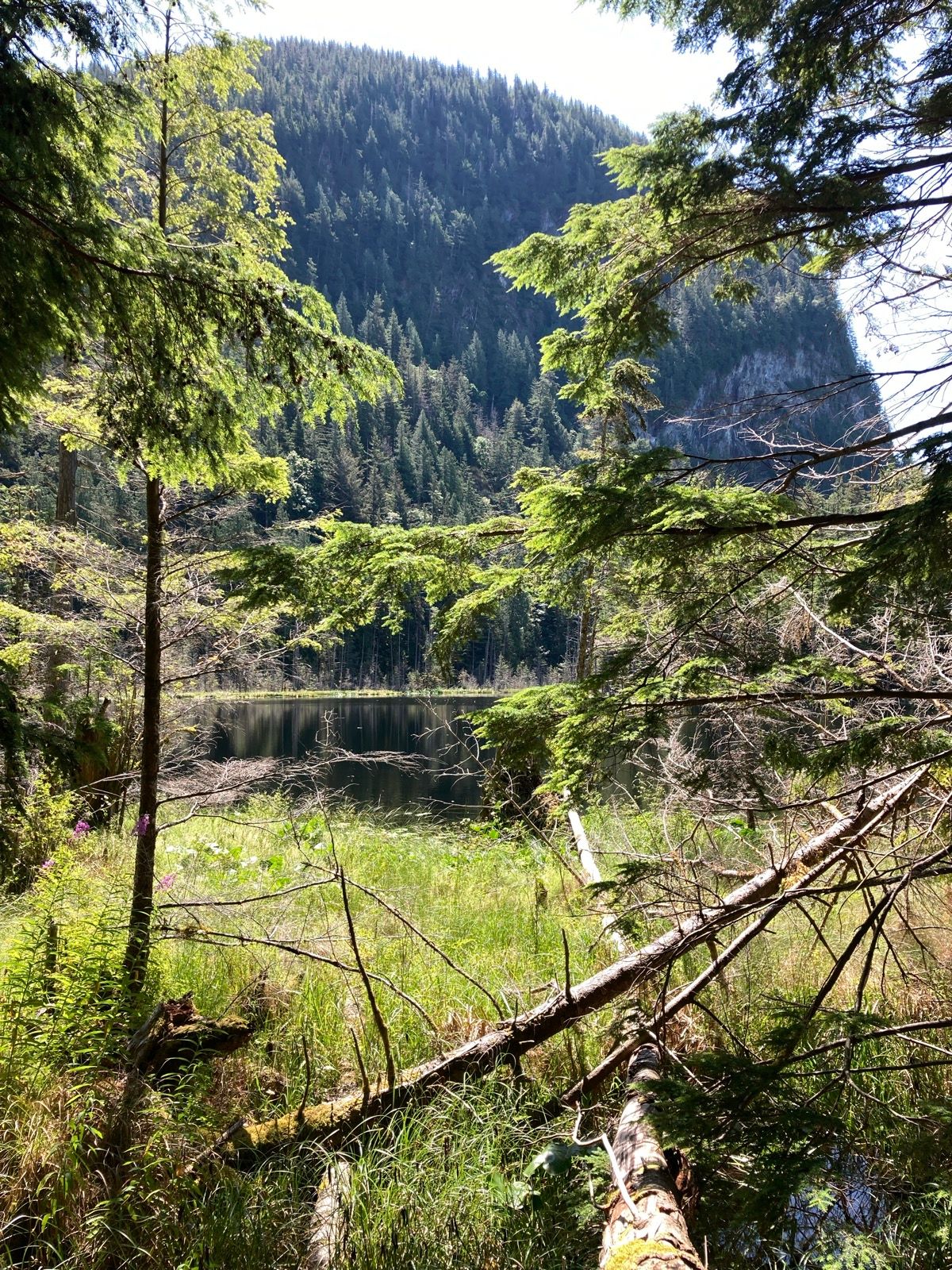
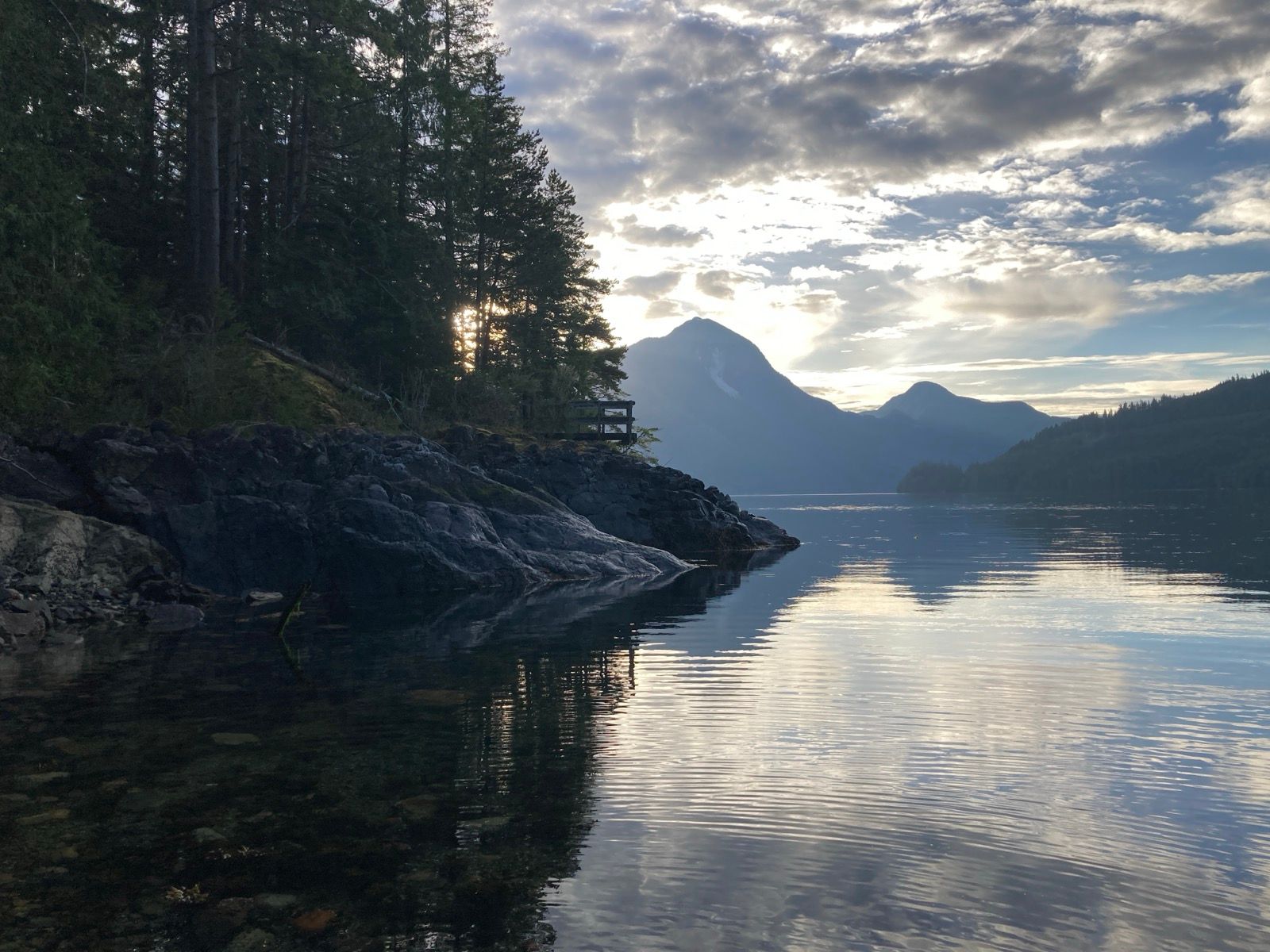
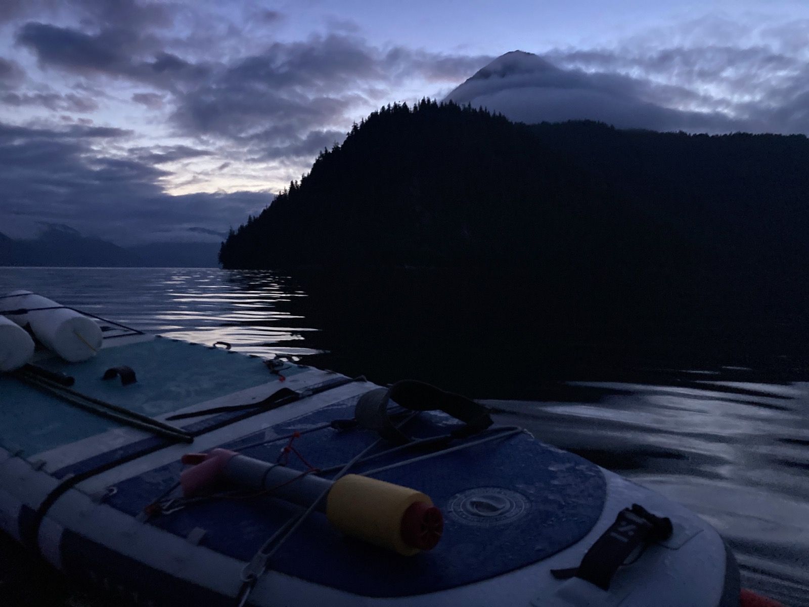
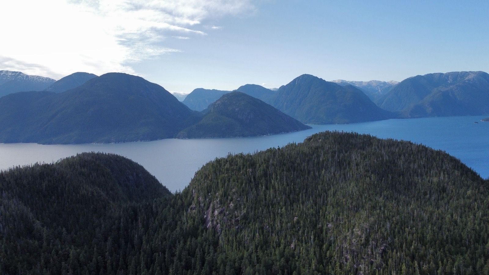
I pedal sailed into Desolation Sound. This is what I had been looking for! Lots of little islands and intricate passages and lots of nature. I decided to take it easy and slow down to enjoy this wonderful spot. I anchored off in a protected cove and decided to sleep on the boat. Im not sure if it is faster to set up my tent on top of the boat or shuffle stuff back and forth on land. The only way to find out is to get some practice! Also, moving forward, another reason to sleep on the boat (besides the tides) is near avoidance.
I did a little paddleboard trip and a hike and immensely enjoyed the evening – wishing Janet were here.
————————————
Sunrise 5:17, Sunset 9:32
Moon 78% waxing
Barometer 1021.4
Photos:
Strava Comments:
Janet W.
Mark G.
Ride Stats:
| Elapsed Time | Moving Time | Distance | Average Speed | Max Speed | Elevation Gain | Calories Burned |
|---|---|---|---|---|---|---|
|
11:18:09
hours
|
08:29:24
hours
|
43.38
km
|
5.11
km/h
|
12.74
km/h
|
70.60
meters
|
1,340
kcal
|
– Day 7 : R2AK Fandom [top]

People have done very fast times, and someone named Roger Mann (listed as “Team Discovery” has done the race on a Hobie Adventure Island (the one person version of the Tandem Island). His time was 13 days, 1 hour, 10 minutes! He went through some serious challenges to finish that quickly on a Hobie Tandem Island. (Like major risk taking). In 2024, “Forget Me Knot” was doing pretty well – also in a Hobie Tandem Island boat like mine, but she pulled out for a reason I don’t know. “Mr. X” finished last place in 18 days, 2 hours, 41 minutes – on a Hobie Adventure Island (one seater version of my boat). This gave me the confidence to do my trip in twice the time (with scenic detours, of course). I feel it is safe to take the slowest person’s time and go half as fast, right? But actually, this section with the narrow channels merits even slower travel because it is so beautiful.
———————
Sunrise 5:18 Sunset 9:43
Moon 87% waxing
Barometer 1018.3
Photos:


Strava Comments:
Carol D.
Nancy P.
Janet W.
Mark G.
Ride Stats:
| Elapsed Time | Moving Time | Distance | Average Speed | Max Speed | Elevation Gain | Calories Burned |
|---|---|---|---|---|---|---|
|
12:36:18
hours
|
11:31:48
hours
|
60.36
km
|
5.23
km/h
|
10.32
km/h
|
46.20
meters
|
2,003
kcal
|
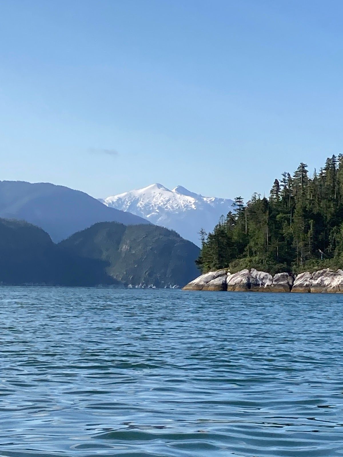
– Day 8 : Glaucolene [top]

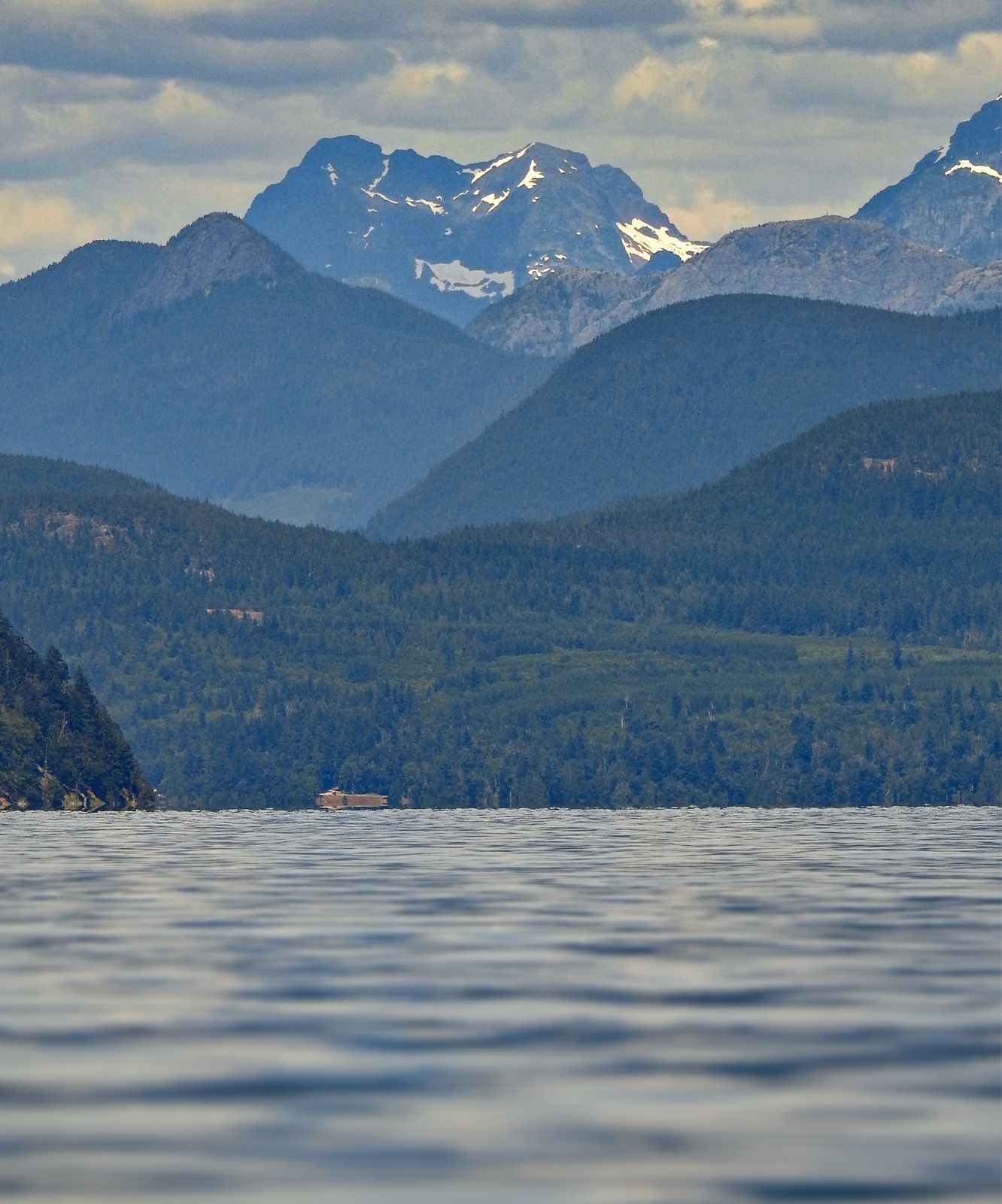
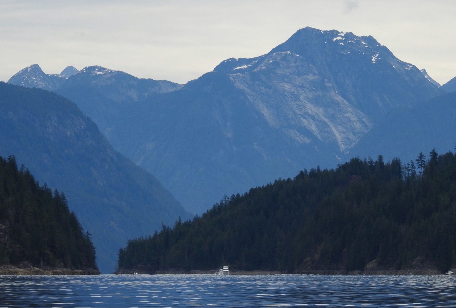
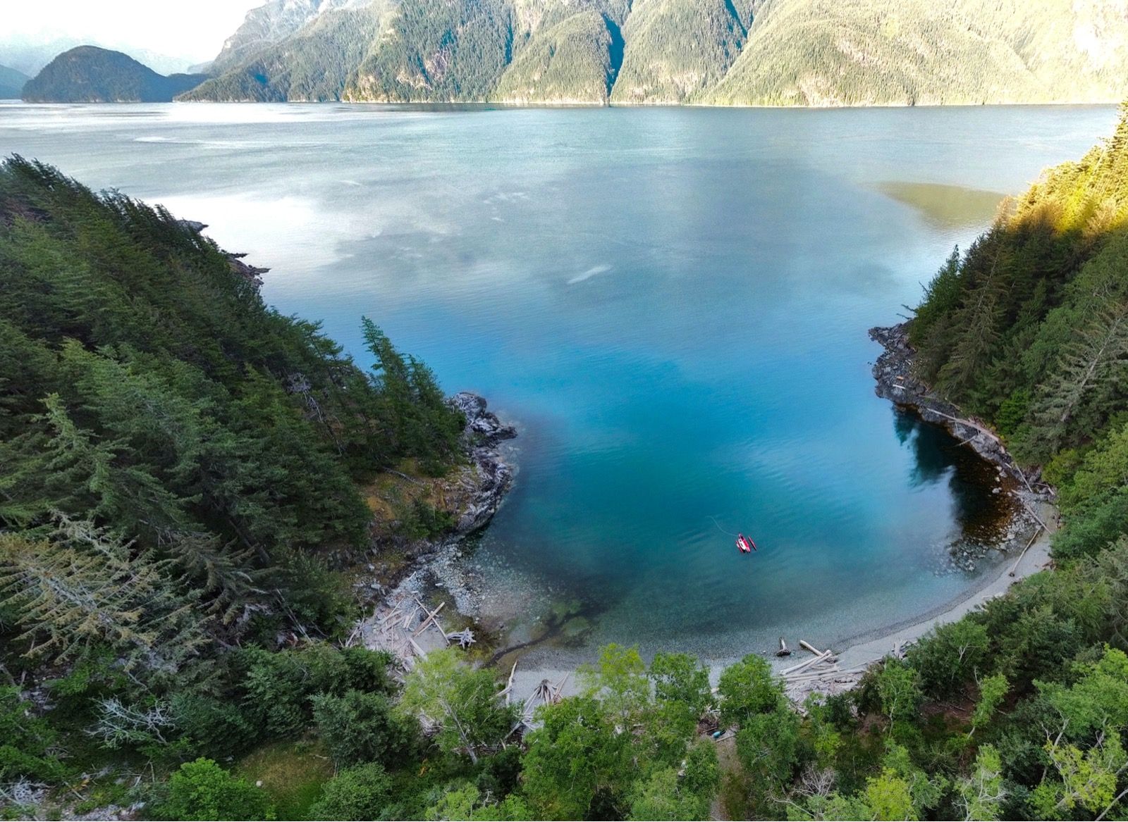
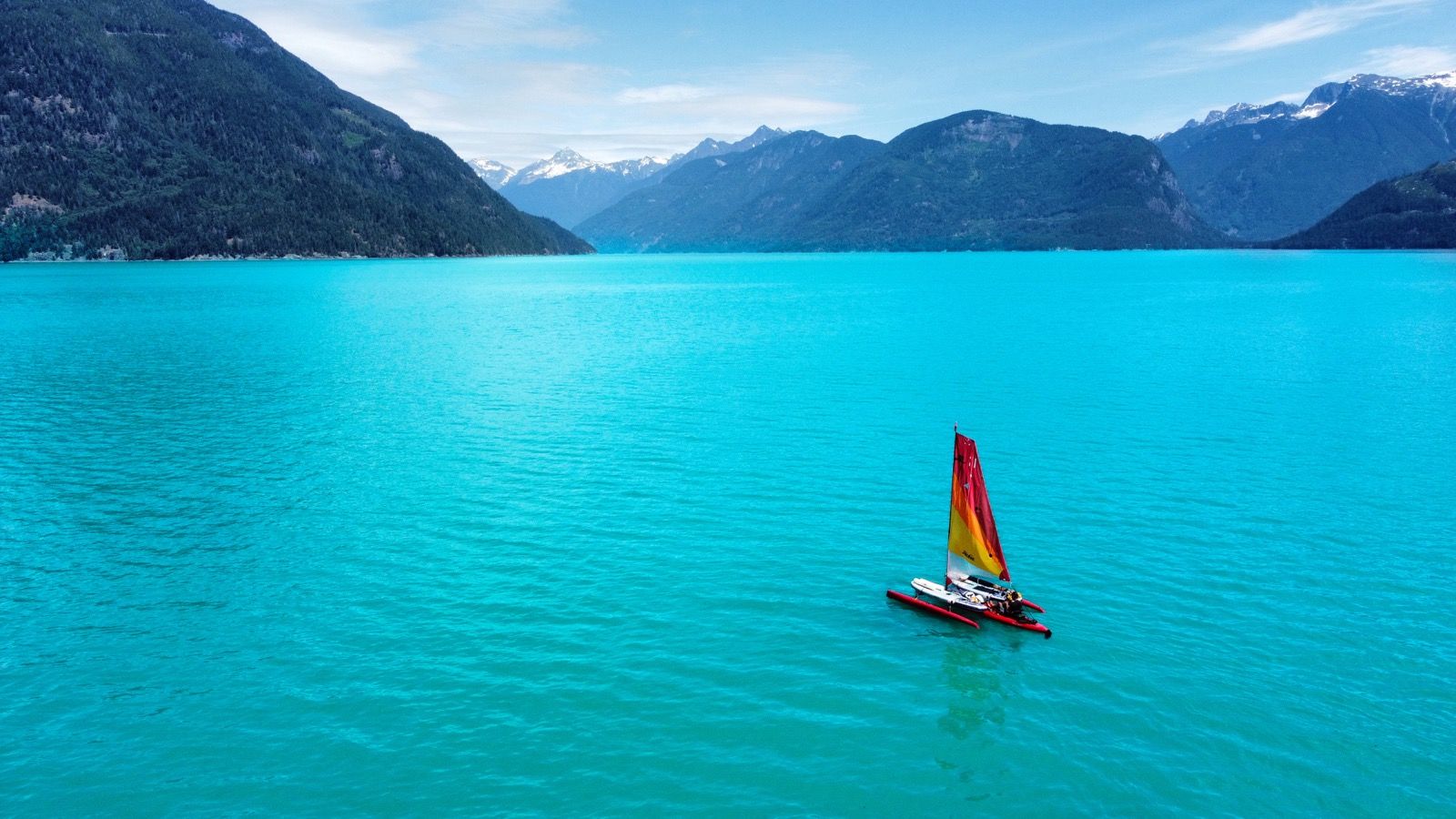
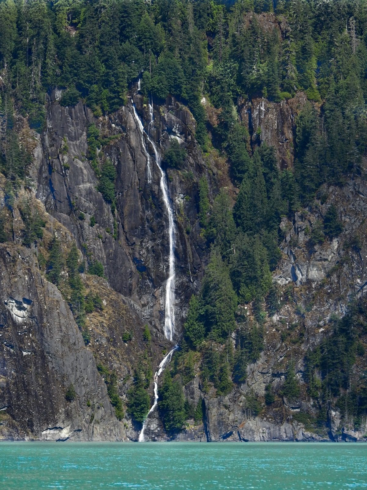
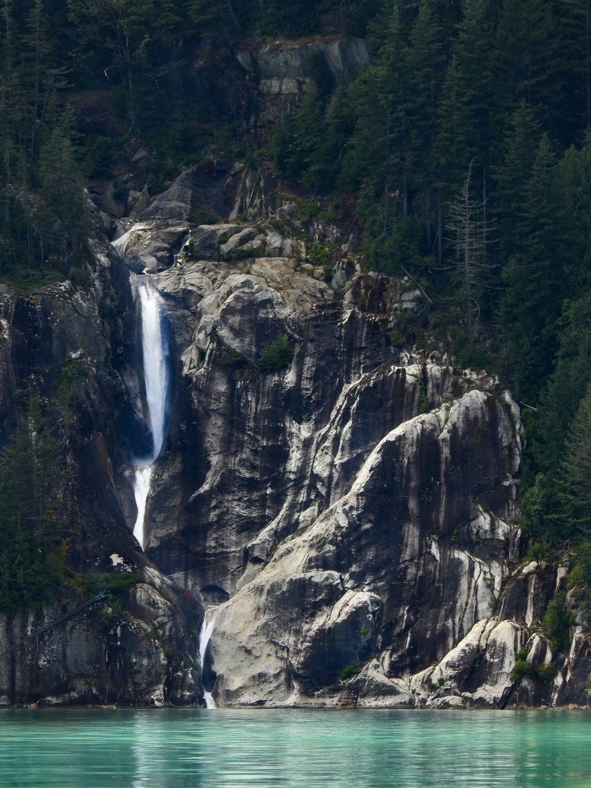
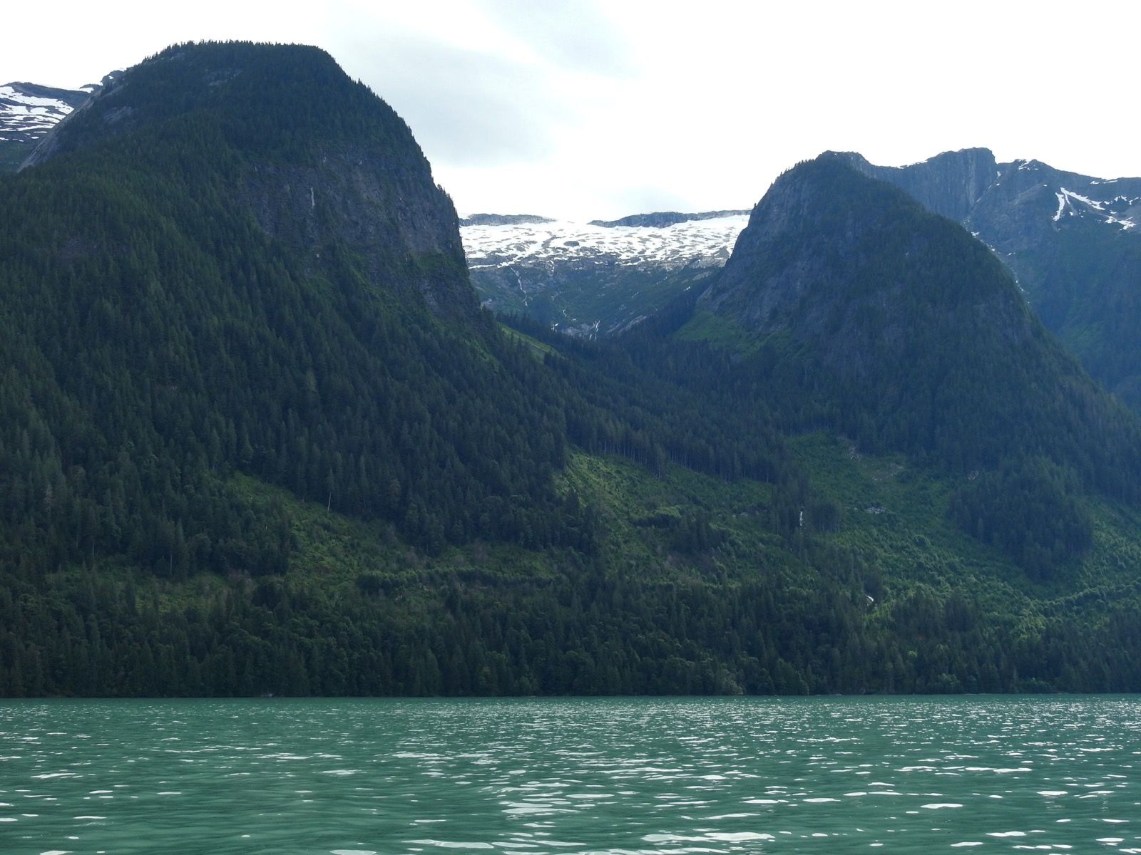
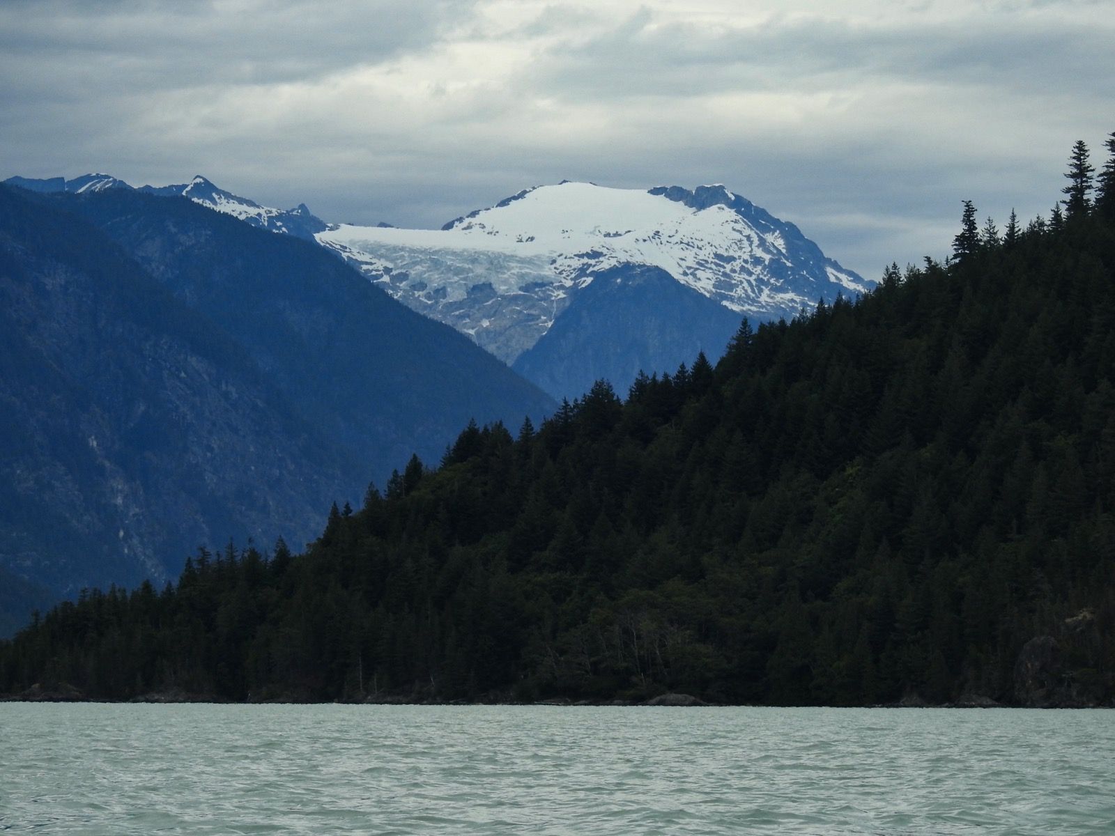
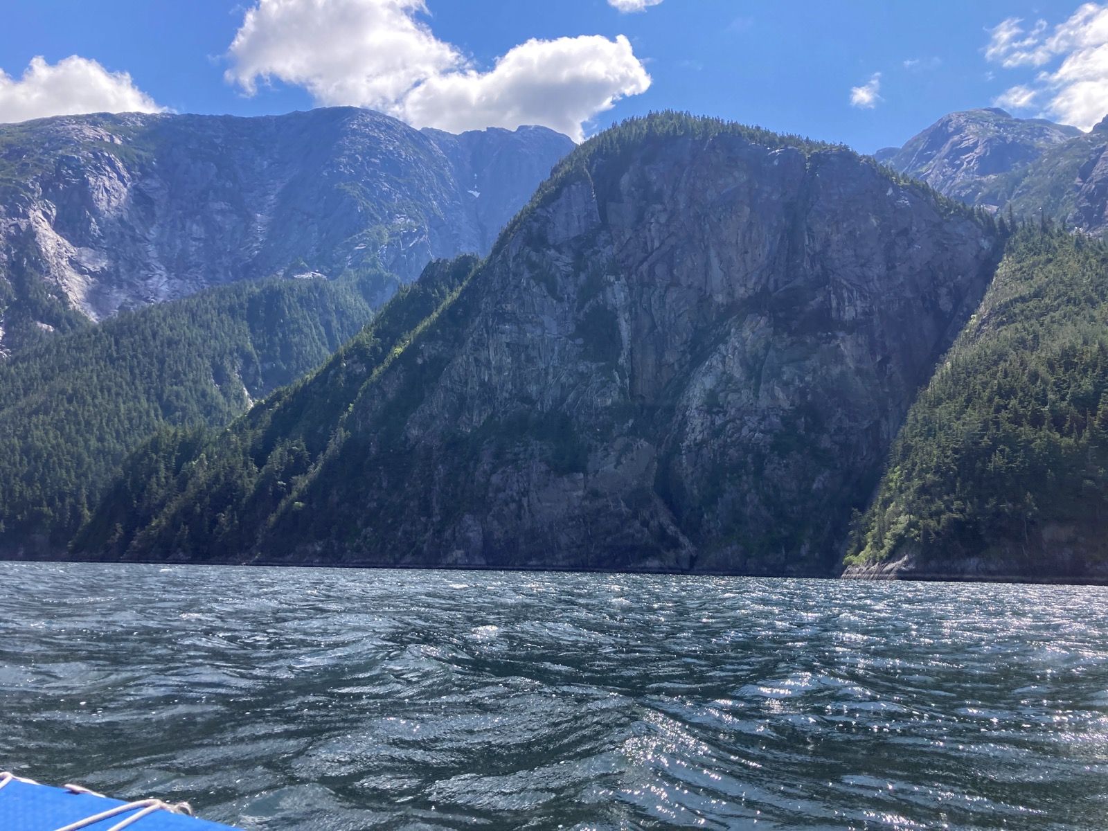
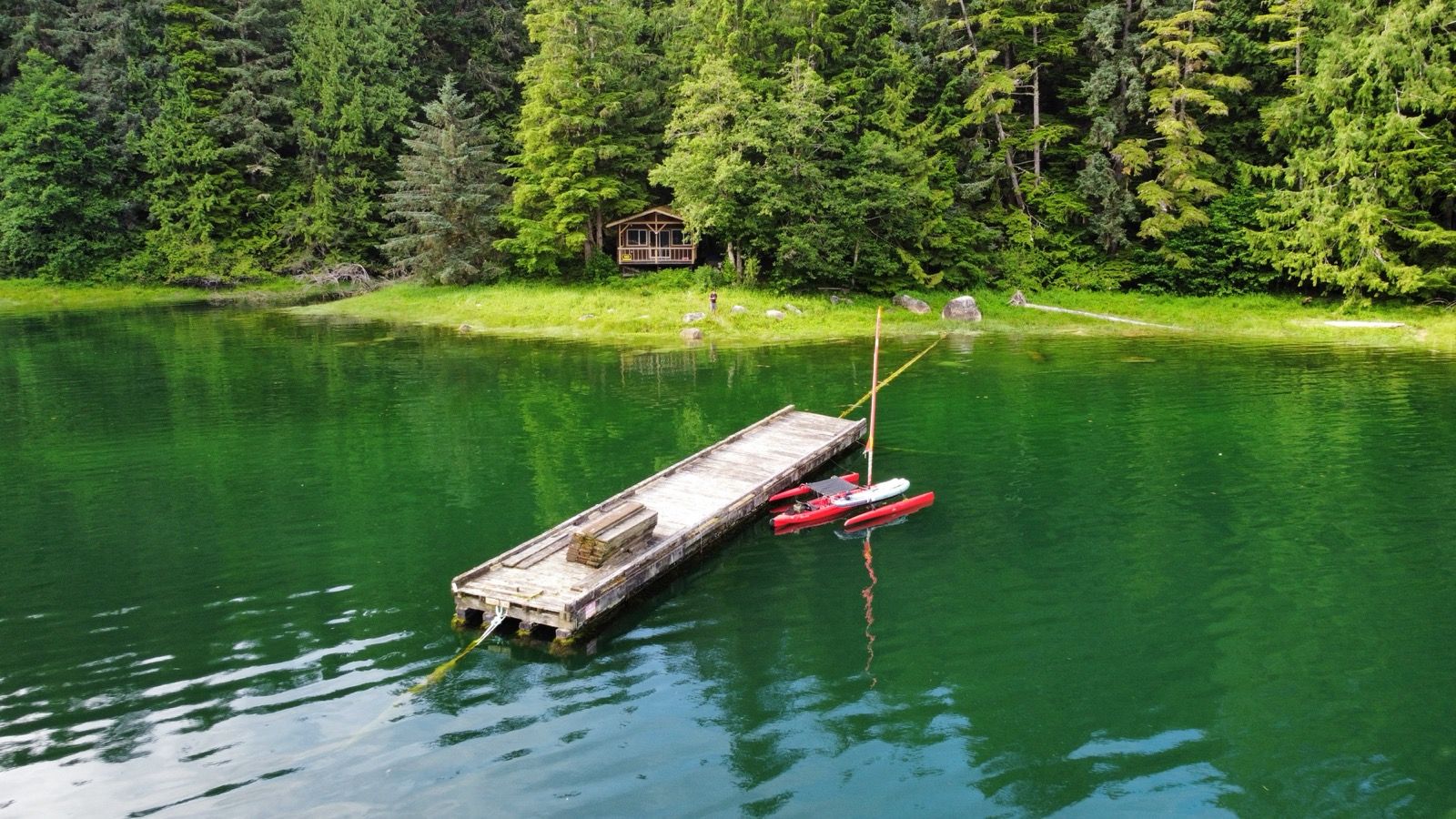
I decided to head up the Bute inlet today. Without a firm trajectory, I had that luxury. The satellite view painted tantalizing hues of aquamarine, luring me like the Sirens to an unknown destination. I had no information about this section, except for a few waterfalls marked on the map. I worried there would be nowhere to camp with the vertical walls of the fjord, and the possibility of bears at any creek inlet. I consoled myself, remembering I can always sleep on the boat if needed. Rain was predicted for Tuesday, so that option wasn’t the most enticing. I figured I would head up until 11:30 am, and then turn around so I could arrive at the Arran and Dent tidal rapids in time to make safe passage through the whirlpools.
But something kept calling, and as time ticked away, I lusted to go further up this increasingly beautiful inlet. I haven’t had internet for a while, so I used the satellite messenger to ask Janet for help. We could send back and forth 160 character messages and she was plugged into the internet feeding back information. She helped me do some research about à lodge at the end of the inlet. This would be perfect; a place to stay out of the rain, avoid bears and having to sleep on the boat. She wrote them and also gave me their number so I could try and use my satellite messenger to write them.
Long after turn around time, no reply. I worried, but pressed on, drawn further. It became eerie – I hadn’t seen a single boat or person in 7 hours, which was very unusual. Why weren’t there any waypoints in this inlet, I kept asking myself. It was a hot and sweaty pedal-trudge because no wind materialized.
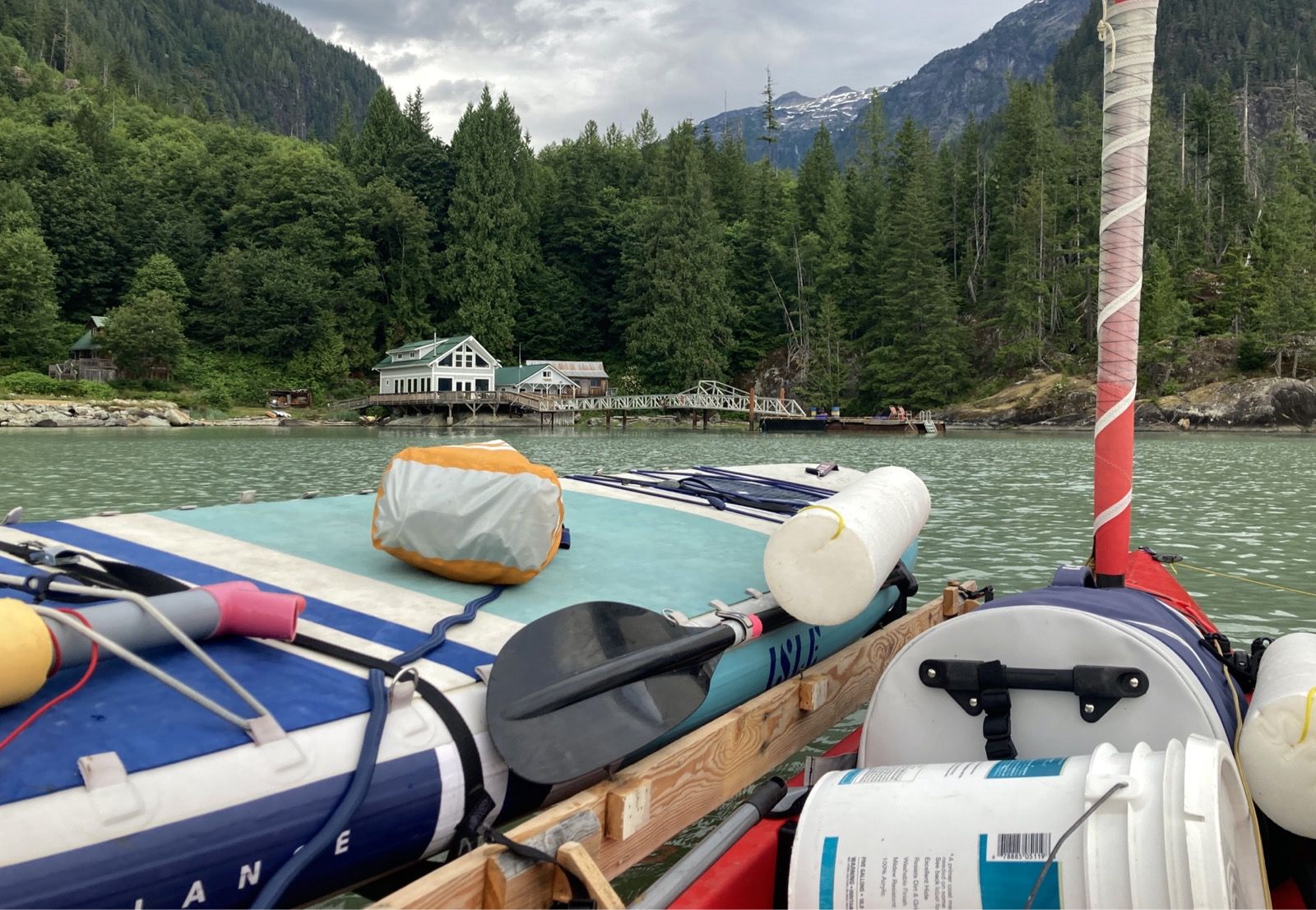
Janet messaged that this place had a dock, so I figured that if they were shuttered, I could land the boat and shelter under an awning. Late in the day, no word from the lodge. But after 7 hours, I met a couple of- Chloe and Heidi. Rather than radio me, they made a 90 degree turn and headed straight for my little Red Lobster – clearly coming to visit since it was an inefficient trajectory. They had seen me the day before and were surprised how far I had traveled. This was good, because it had felt inexorably slow to me! They had the free spirit-positive vibe about them, lithely scampering about the boat in bare feet, clearly at ease on this vessel. They assured me by saying that à “nice man” had sold them fuel for their boat at the lodge. Relief! At least someone was there.
I messaged Janet and asked her to write again; feeling a little desperate to ensure that this would work out. I also sent a 4th message saying “Im almost there in my kayak”. And that is what it took to get a reply!!
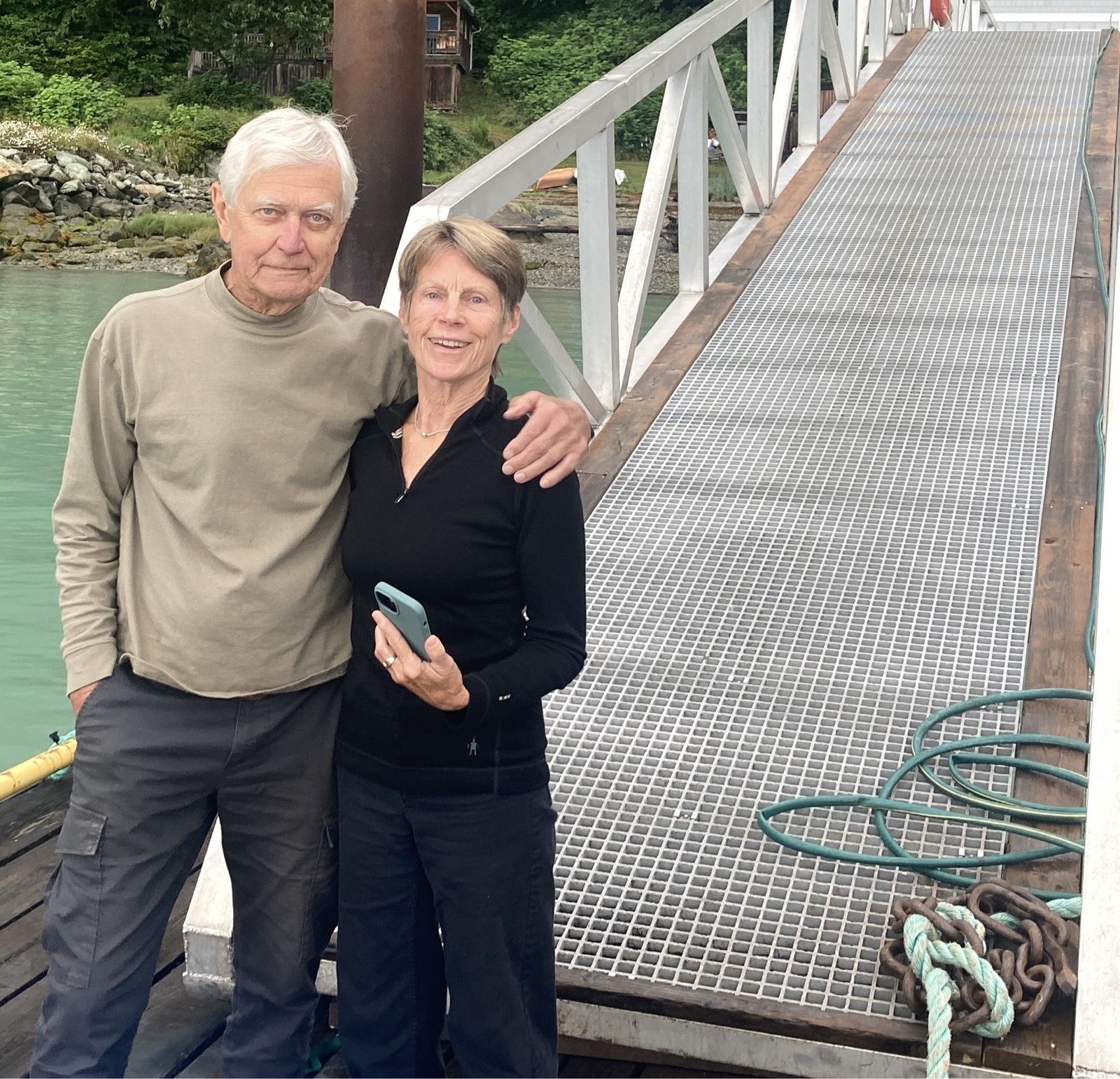
I met the caretakers Brian and Jane – easy to remember, as I told them that we are Brian and Janet (so just add a “t”). Oddly, They didn’t know the price, but coukd accept cash or à money transfer. It seems that US banks are perhaps the only ones in the world that can’t do “money transfers” because I have been to so many countries where there are easy ways to pay people digitally. In the end, I paid Brian via PayPal – he could then forward the payment to the owners. For this I paid à foreign transaction fee, and currency exchange fee. Perhaps there is some motivation to keep US financials status quo instead of adopting MobileMoney where people living on dirt floor huts can easily make payments with negligible cost using their dumb phones…
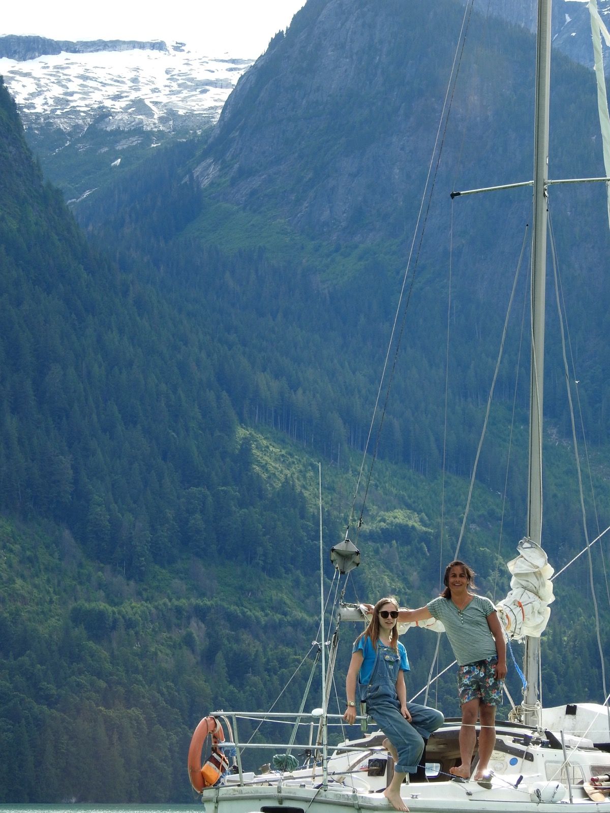
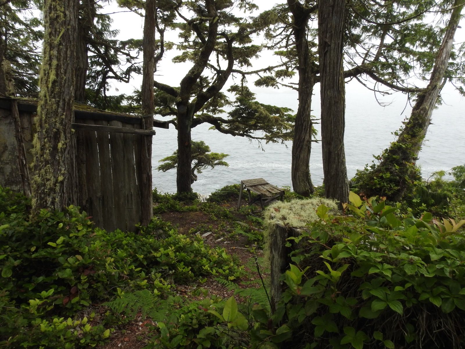
I spent the entire evening with Brian and Jane, enjoying a small delicious beer which got me a bit tipsy; they enjoyed their wine. I discovered the real reason the master planner had drawn me down this course – which was to meet them! The stunning scenery had just been a side dressing. Brian and Jane are in their late 70s, but have been white water kayakers, surfers, overland adventurers, actual farmers (and later volunteer farmers WOOF), scientists, teachers, foster parents, and 6 years in a row they self-organized 9+ month “cultural” trips taking other peoples’ kids on a bus from Canada to Honduras for a couple semesters of “home schooling”. I’m absolutely fascinated by all they have done and plan to spend Tuesday talking to them and hope to report back more to you tomorrow.
————
Sunrise 5:16 Sunset 9:36
Moon 92% Waxing
Pressure 1011.3
Photos:

Strava Comments:
Stephen Mark R.
Janet W.
Christy C.
Boris F.
Corrine L.
J&K S.
Judy I.
Gordon L.
David L.
Bern S.
Mark G.
Sօʀƈɛʀɛʀ 🅅.
Paula G.
Ride Stats:
| Elapsed Time | Moving Time | Distance | Average Speed | Max Speed | Elevation Gain | Calories Burned |
|---|---|---|---|---|---|---|
|
12:33:48
hours
|
11:39:29
hours
|
55.38
km
|
4.75
km/h
|
9.77
km/h
|
60.60
meters
|
2,286
kcal
|
– Day 10 : Muir [top]

Anyway, One of Muir’s trips departed California in June and he canoed from August to December. He spoke casually of the hardship – hardly even mentioning the strong currents that surely set them back. He delighted so much in his natural surroundings, that it barely seems he gave a second thought to discomfort. Somehow, with his dry, yet soothing words in my ears, I became accustomed to the battering. Eventually I decided that this was more comfortable than pedaling in the windless hot sun like I had for the past week.
Listening to Muir, I felt less alone in my struggle. Occasionally, I could pull behind a headland for a break to take care of myself – eat, pee, take a photo along with my medicine, etc. Again, I saw no one for 7 hours, and then when I got within view of the tidal gate, I could see little white dots scattered along the shore. These were fishing boats. Around 5pm, all of them – about a dozen – suddenly jetted towards the entrance to the rapids. For me, it would two another 2 hours to get to the mouth, so I was alone again on the other side of the gate.
Early in the day, I had hoped to pass through two of the upcoming rapids – Arran and Dent. It appears you have a 15 minute window where one in a vessel of my limited power can safely make it through before whirlpools begin to form. Interestingly, AI told me that it is unlikely that a whirlpool could suck my boat under. Meanwhile, Brian (a very experienced river kayaker) said, “oh yeah they can sink your boat. They kill people”. Just to be safe, im going to believe Brian, and not AI.
The sun came out briefly mid day before the rain returned. The leak (or perhaps a new one) returned with a vengeance forcing me to bail à half full boat à dozen times – sometimes with waves crashing over the deck and undoing 50 strokes of the pump in a second.
With the rain and soaked gear and a late arrival to the tidal gate, I returned to my camp from a few nights ago. I would figure out the next move after some rest; it was way too late to try and pass the tidal gate that was flowing over 7knots by now.
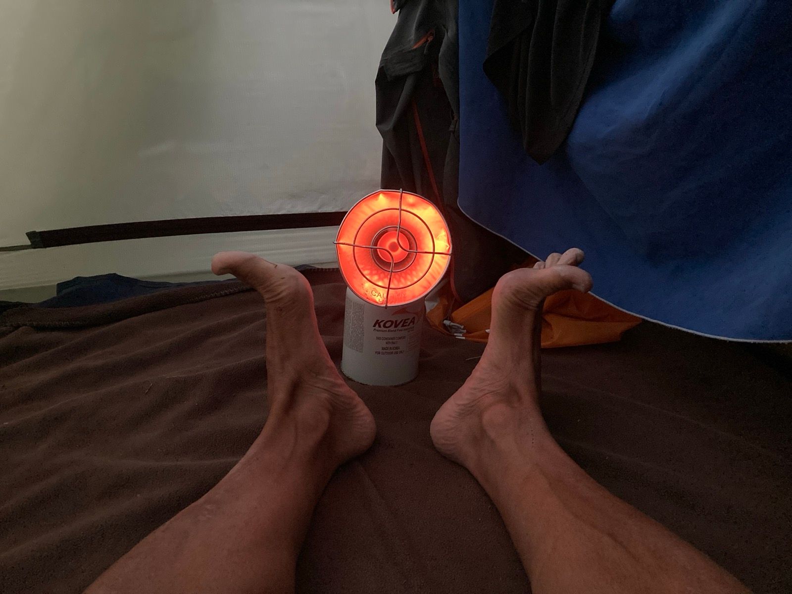
Thankfully, the rain abated while I set up the tent. I am carrying 2 pounds of butane fuel, so I ignited the heater in an effort to dry gear and warm up. It was very effective at warming me up, but probably wasteful as a clothes drier.
Surprisingly, I was never cold throughout the day. My mood had dipped in the morning, as it became evident I was going to have to do an additional 10 to 12 miles zigzagging the channel (tacking into the wind). I thought to myself, it would have been better to come IN on this day and go OUT the day I came in… but that is how the cookie crumbles. I quickly fixed the mood issue when I pulled behind a headland and made a particularly strong (and late) brew of cold instant coffee. After that, I was singing out loud and the boat no longer felt like it was crashing into waves, but dancing upon them.
———-
Sunrise 5:22 Sunset 9:31
Moon 98%
Pressure 1021.0
Photos:
Strava Comments:
Judy I.
Stan H.
Stan H.
Mark G.
Mark G.
Ride Stats:
| Elapsed Time | Moving Time | Distance | Average Speed | Max Speed | Elevation Gain | Calories Burned |
|---|---|---|---|---|---|---|
|
11:54:37
hours
|
11:22:44
hours
|
72.51
km
|
6.37
km/h
|
11.95
km/h
|
14.30
meters
|
2,432
kcal
|
– Day 11 : Fixing and Feeding Frenzy [top]

At 4:30 AM, nder crepuscular light, I took the boat into the water, having let it drain out all night. By the time I had set the anchor, the previously dry hull was 1/5 full of water. It was time for a new plan.
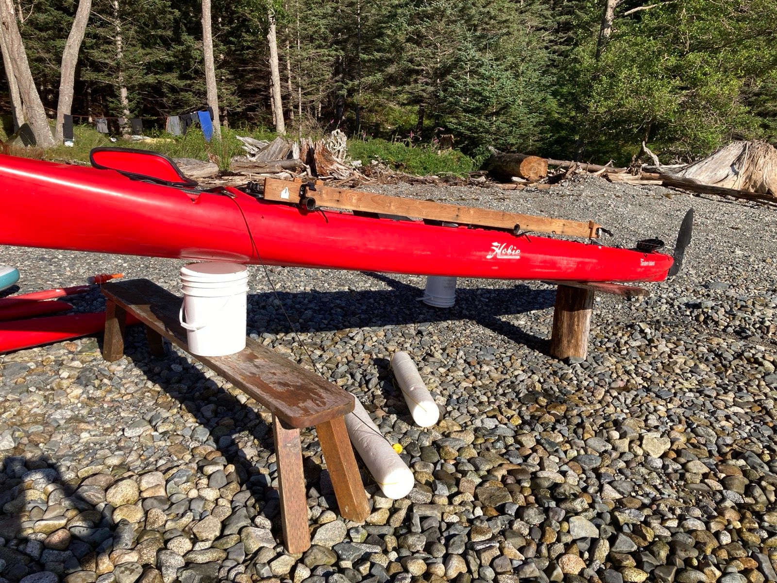
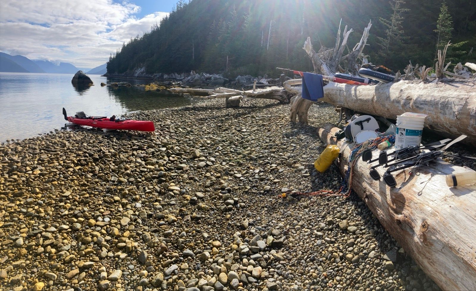
There were logs, crude benches, and buckets left behind on my camp’s beach, so I devised a plan to take the boat out of the water and do a proper repair. I could use the logs to elevate the boat and the buckets to fill the hull with water which would enable me to find the leak. This campsite felt like the room in a video game where you go to pick up extra life. And a cow gun.
With this new plan, Instead of passing the tidal gate at 10am, I would do the repair, give the epoxy time to dry, and then tape over it with underwater tape. I could attend to other chores such as drying all the gear. Also I would reconfigure my sleeping platform; the old one worked, but it is too heavy and bulky. In my minds eye, I continually make improvements with the long solitary hours; fodder for a brain eager to solve problems.
After putting the boat back in the water, I napped from 5am to 6am, and then went to retrieve it from anchor; now it was 1/3 full of water, confirming the urgency of this repair. I began the laborious process of pumping out the mischievous intruder, and started breaking the boat into its individual parts. I moved buckets and logs to the cobble beach to support the vessel. I filled a 5 gallon bucket with sea water and on the very first pour over, it was obvious where the leak was: The front pedal well. This is a common place to leak, I have read.
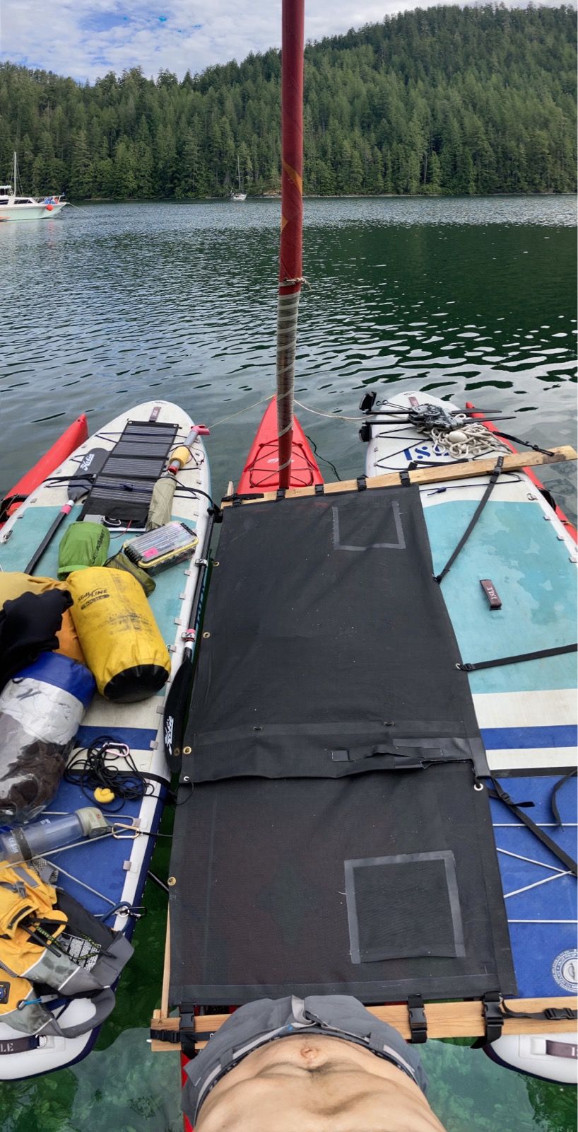
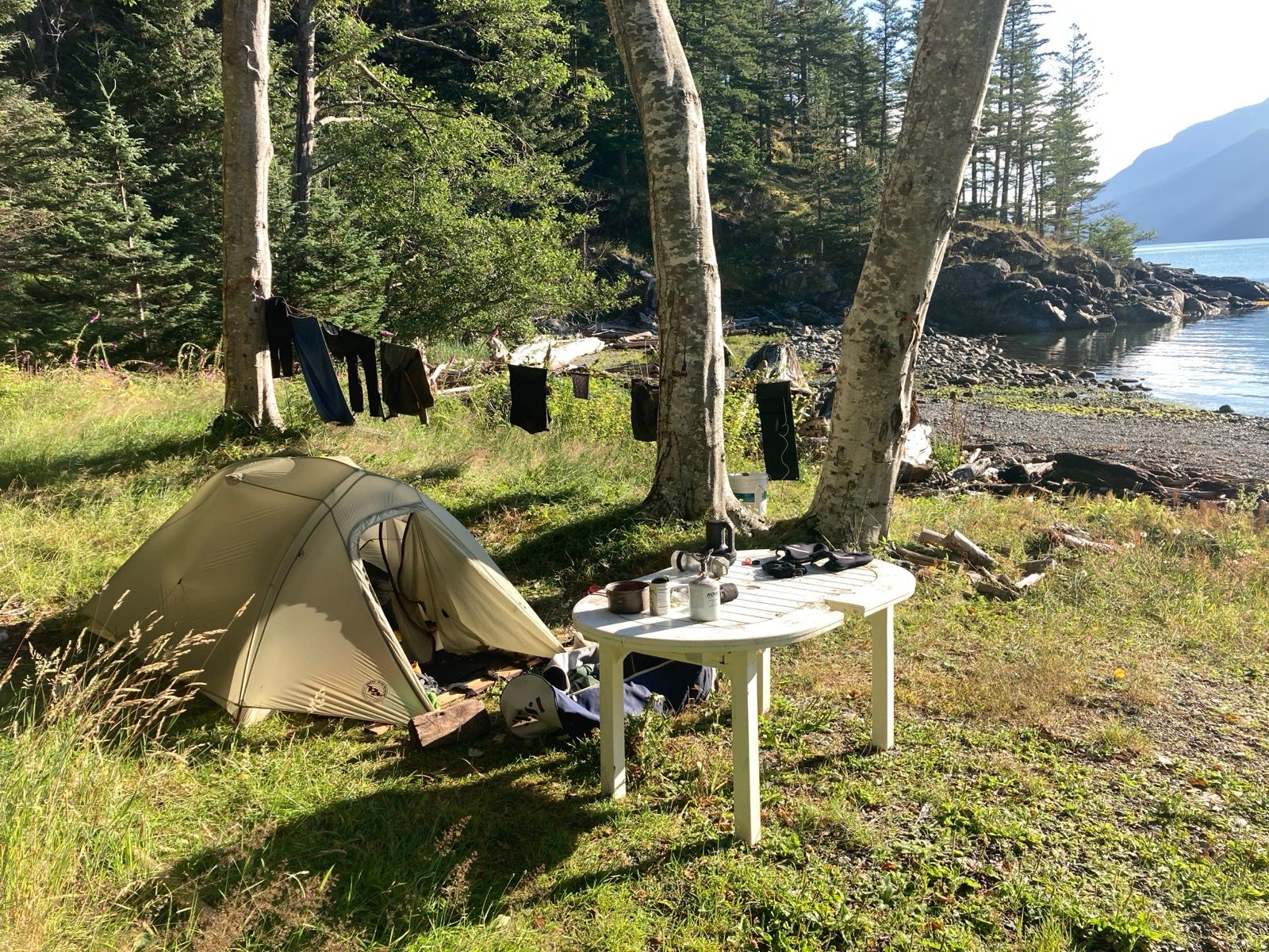
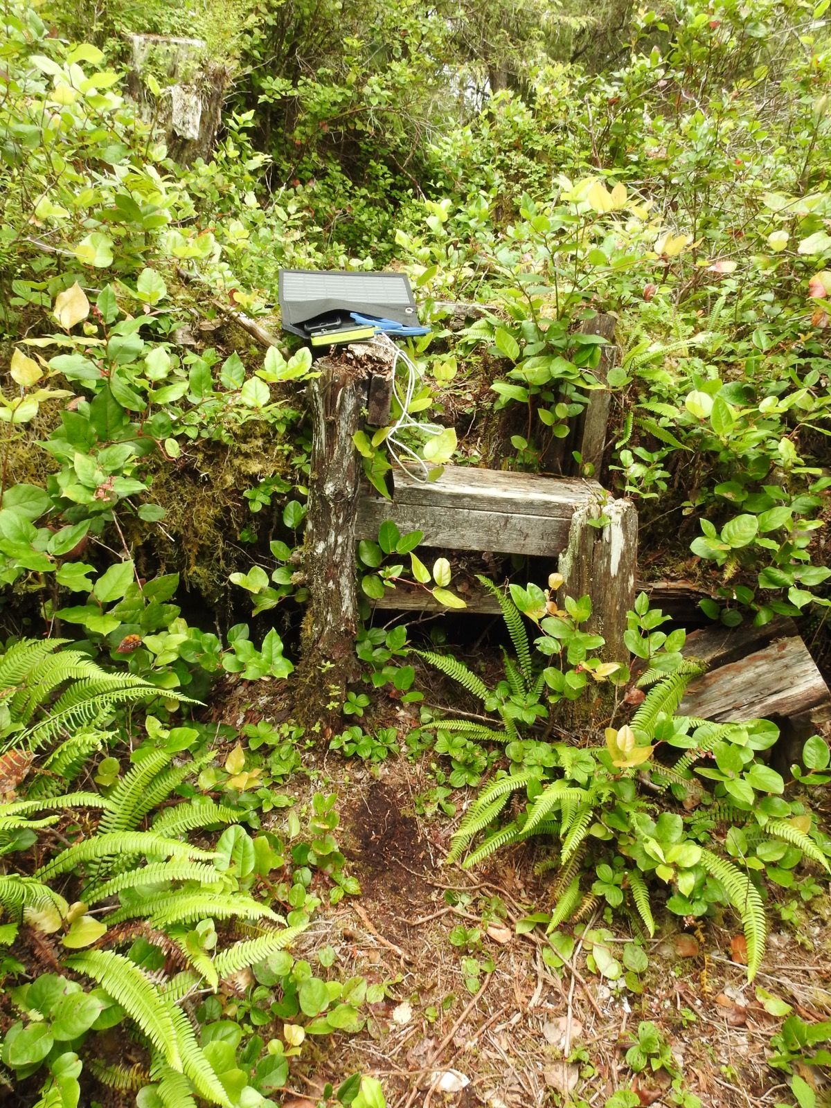
I dried the area as best as possible, and began the epoxy repair. Now, I had 8 out of the recommended 24 hours to let it cure and do other chores. I strung a line to dry the clothes, “donated” my spare solar panel to a pile of kayaks on the beach, and then devised a new sleeping platform from a thin tree branch, depositing two of the three boards which were no longer needed amongst the plethora of flotsam.
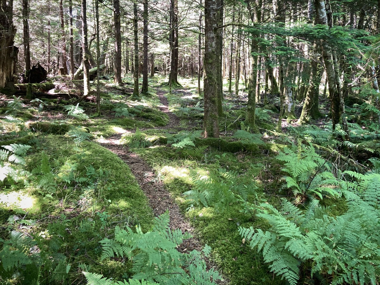
I made improvements to the lashing and quick release system for the primary (now only) solar panel, and after lots of camp chores, eventually went for a hike to Eagle Lake.
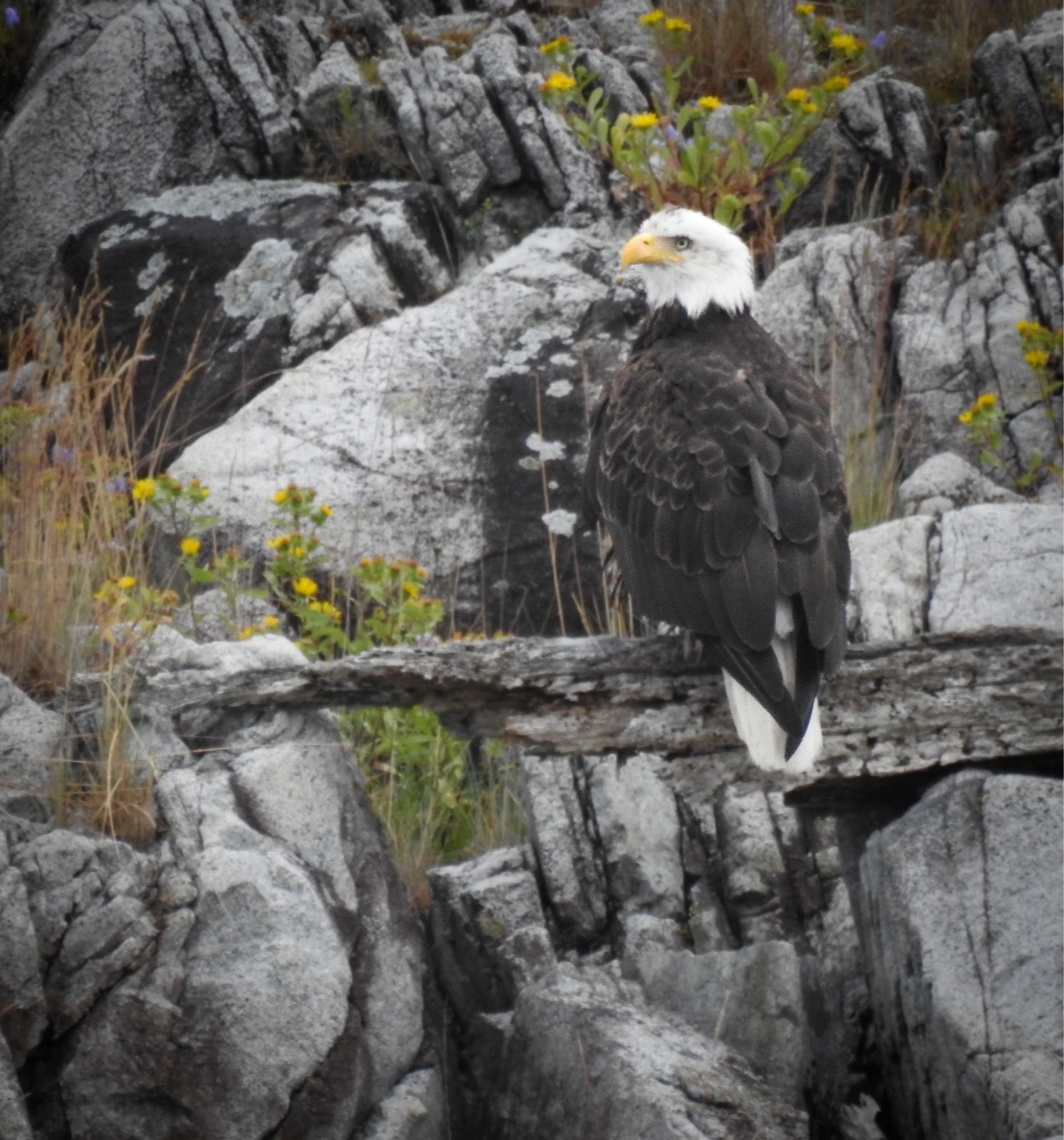
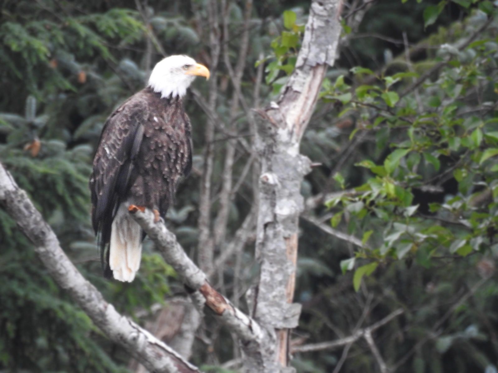
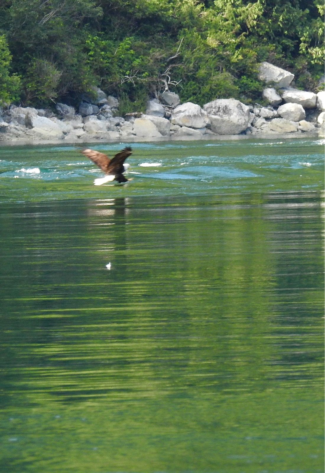
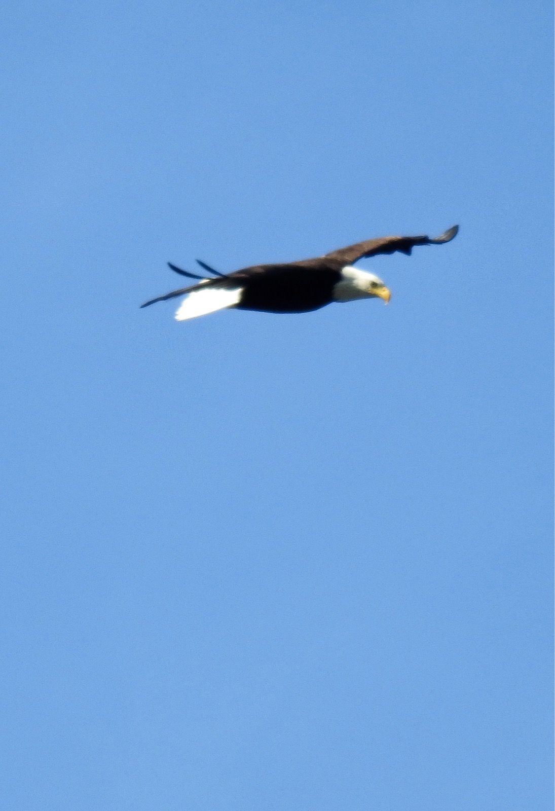
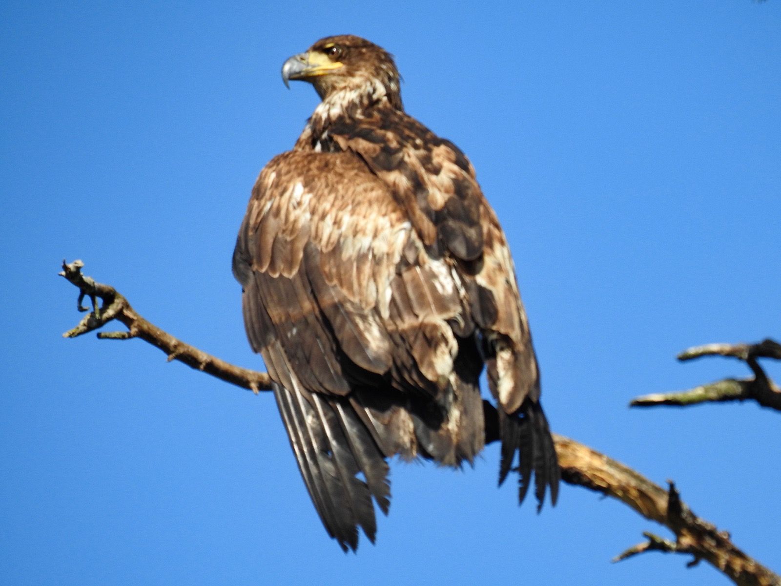
These places get their names for a reason, but I was still surprised by the sheer number of bald eagles encountered once I reached the little pond. Every step I took would frighten one or two eagles and you could hear the rush of their huge wings creating negative pressure above as they launched themselves into the air. I’ve rarely seen bald eagles in my life, and now at least two dozen took flight at close range. I didn’t realize how big they were!
I reassembled everything at a leisurely pace over the course of an hour. The water, which had been 40 feet away came to greet the red stern, and it was time to hit the rapids. The boat felt light and fast, and a quick inspection revealed it was dry inside. According to my calculations, I may have had up to 30 gallons (240 pounds) of water in the boat over the sinkage of the last week and a half. Even after pumping it as empty as I could, likely the boat retained 50 plus pounds of ballast in the bilge . I decided to hit Arran rapids as the water was still coming in. I’d have to fight against it – and probably wouldn’t make progress until it slowed down – but at least I wouldn’t miss the slack tide.
Surprisingly, I was being sucked into the rapids rather than pushed out. À strong eddy on the edge was flowing in reverse. You could hear the rush of the water, even though there were no rocks for it to flow over. The sound was from two currents shearing against each other like two tectonic plates.
I kept close to shore, in the eddies which pushed me quickly, sometimes threatening to dash the plastic lobster into rocks. Then, with each promontory, I’d pedal like mad only to creep around the corner into the next micro bay where I could relax and enjoy another eddy push.
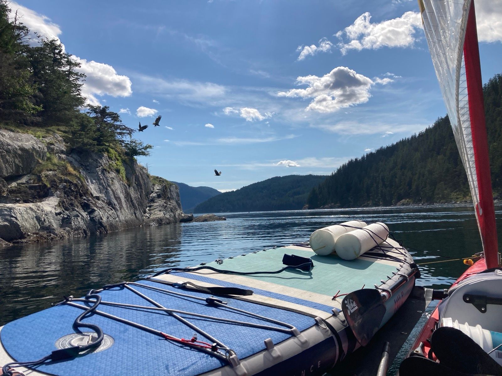
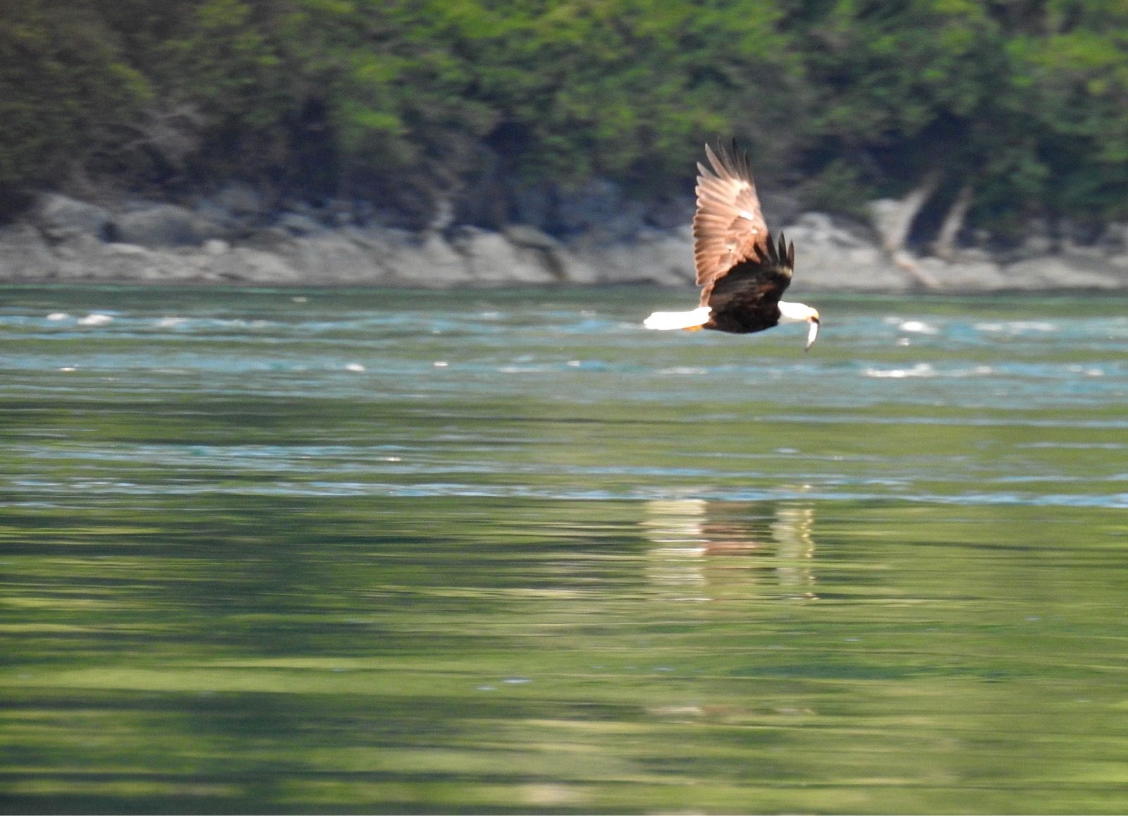
Before my eyes, nature was putting on a spectacular show! 3 or 4 dozen bald eagles were swooping in and diving to retrieve fish that were coming in on the strong flow that I was trying to go against. So spectacular was the show that I decided to tuck into one of the eddies and take a chance by trying to a rock. I could afford to watch these amazing creatures go at it for 15 minutes before the urgency to leave the rapids would become too great.
After making it through Arran rapids – even against the current – my confidence was boosted. By the time I reached Dent rapids, it was truly close to slack tide, and these were tame by comparison. It was a joyous section.
With all the time I spent on the beach today, it occurred to me that in this location, you might as well have a bigger boat. The benefits of my smaller boat are that I can (theoretically) beach it… but I’ve been anchoring out almost every night anyway. Another advantage on the ICW is that we could slip under bridges – but here there aren’t any. Most of the water here is very deep. In a very short distance, you can go from shore to 2,000’ depth – so having a boat with a deeper draft wouldn’t be a hindrance. If I were to return, it would be on a bigger boat; there are plenty of anchorages. I’d bring folding bikes, paddle boards, and fishing gear. It is an amazing location.
———————-
Sunrise 5:22 sunset 9:32
Moon 99%
Pressure 1023.6
Photos:

Strava Comments:
Mark G.
Mark G.
J&K S.
Janet W.
Stan H.
Sօʀƈɛʀɛʀ 🅅.
Corrine L.
Ride Stats:
| Elapsed Time | Moving Time | Distance | Average Speed | Max Speed | Elevation Gain | Calories Burned |
|---|---|---|---|---|---|---|
|
04:30:05
hours
|
03:28:02
hours
|
19.78
km
|
5.71
km/h
|
10.77
km/h
|
20.60
meters
|
790
kcal
|
– Day 12 : Overfalls [top]

This rapid was fun and exciting, so now that I had crossed 3 tidal rapids at the optimal time, I naively consider myself to be somewhat experienced, leading to my nonchalance entering into the wider Johnstone Straight.
I made predictably slow progress; this didn’t bother me, because I already had “money in the bank” with this morning’s push. Now the tide had turned and it was time for payback. What I hadn’t expected, however, were the conditions in Johnstone straight. As I rounded Helmcken Island, I found myself in some serious rapids. I had become blasé about rapids by this point, an consulted the chart. There were some wavy lines right where I was – indicating waves. The surface of the water had topography, in that you could see that in some places, water was lower elevation… à downhill of sorts. Given the weight of my boat, I knew I had to avoid these low-lying areas – because there is now way I could power “uphill” to get out of them.
If you look at water enough, you can sometimes tell which direction it is flowing. Although I knew we had a strong flood tide (coming in against me), I could see areas where the water was flowing out (the way I wanted to go) in what appeared to be a strong movement. I focused on the water and linking together these “pathways” of water going my way – always pointing the boat West. It felt like I was going fast – all that water rushing by. I consulted the land and various fixed points, which also indicated I was moving, sometimes quickly.
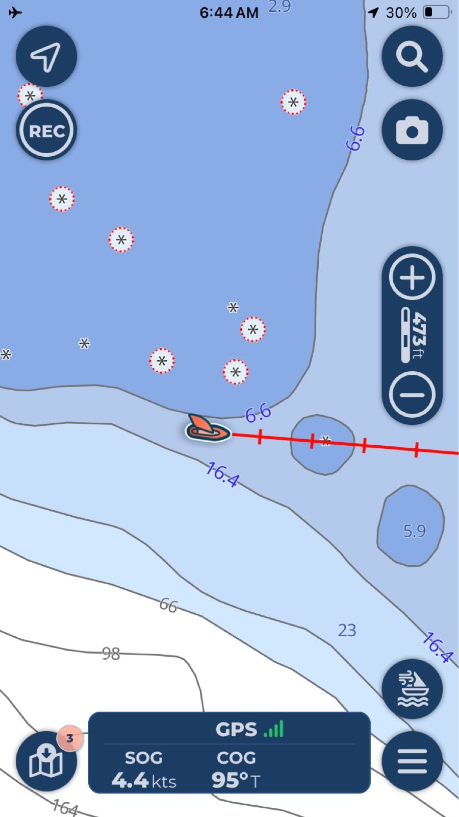
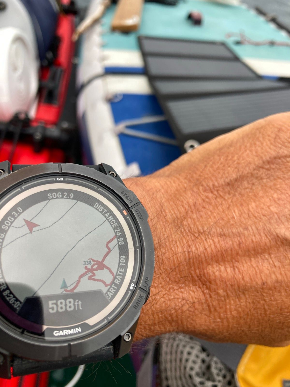
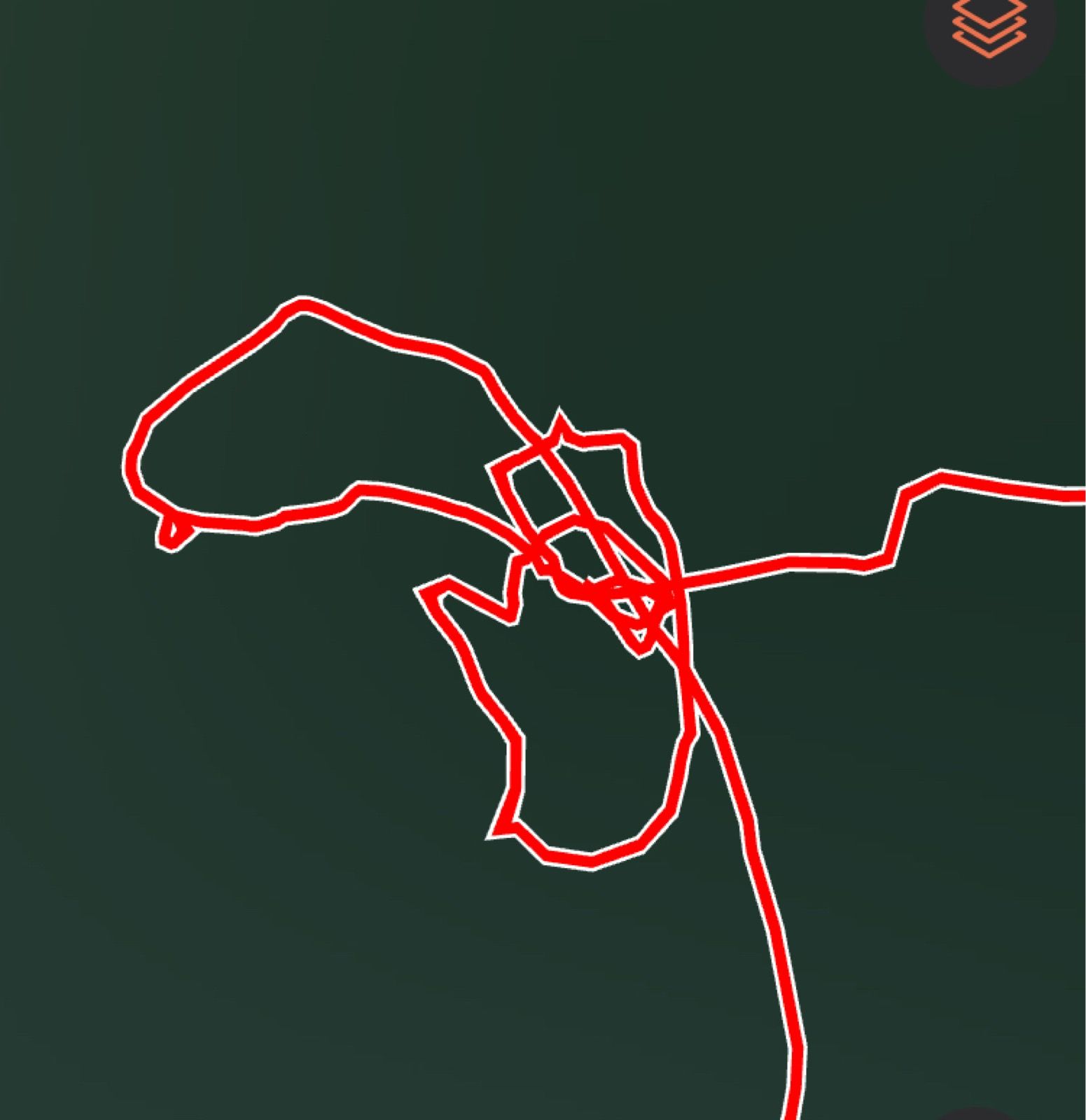
The one thing that didn’t agree with what my brain and eyes were telling me was the GPS. I hadn’t looked at it in a while, but when I did, à horrifying fact emerged: I was stuck in a giant whirlpool! A brief panic came over me. I wasn’t súper-scared as I figured that eventually the water would reject me and the boat… but in the near term, I hadn’t been going anywhere!
I decided to brute force it. I pedaled all day about 150Watts and so I cranked it to 450Watts. I moved laterally to the current. It seemed as if the water closer to the island was headed West. Under my maximum power, though, I was not breaking free of the current’s stronghold. Trying to head to the island where the water might be going my way just sent me into a tailspin.
Now I was just a little bit West of my loop-de-do area. I knew I couldn’t go back there or I would get stuck again, so I powered max power directly West instead of towards the island. Inch by inch I crept forward. Looking at the land it appeared that I was going West very slowly… but again, à glance at the GPS had me going due North – à 90 degree angle to the direction my boat was facing. I pumped as hard as I could, probably dropping down to 330W, something I could sustain for maybe 15 minutes tops. Little by little, the boat crept North. I kept it pointed West anyway, fearing that trying to go any other direction would sentent me back into the whirlpool.
Finally after a lot of work and patience, I reached the shore where the current was against me, but I could use the eddies to make forward progress. Now I relaxed and just powered in short bursts around points. A couple of times I had to overcome short stretches of current that were truly like a fast moving river… but with the help of the shore, I made progress assiduously.
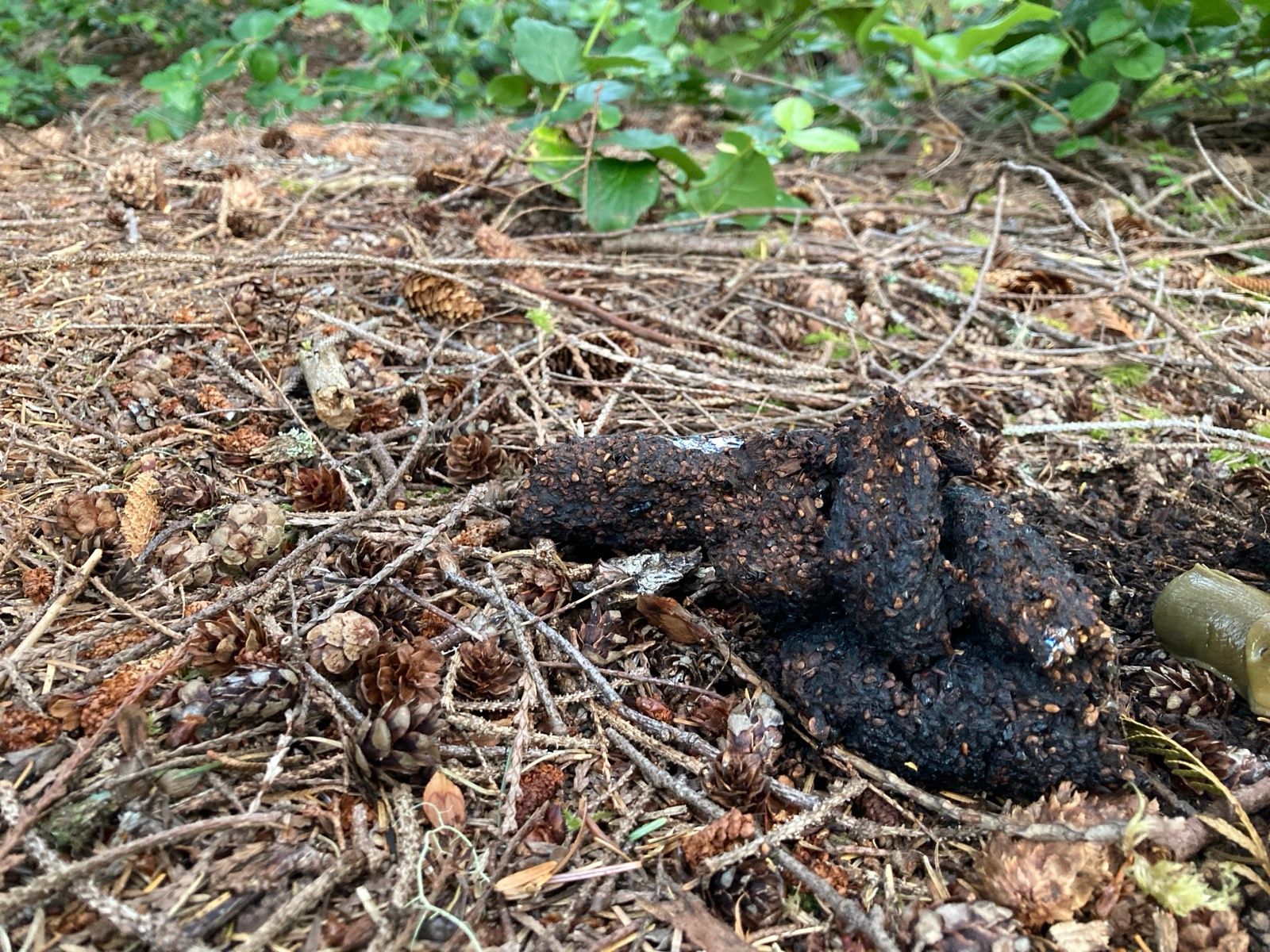
And so i came to the sheltered bay I had picked to camp. I got off to investigate, and found a flat spot above the beach – perfect, except a huge bear poop! I searched the beach for another location, but everything was impenetrable. I went back to the boat, but now it was far from the water which had gone away. With great effort, I foam rolled it back to the water and decided to sleep on the boat. I anchored far out, and tried to erect the sleeping platform – right as the wind picked up. Rain clouds could be seen, and I realized there was only one choice left – bear poop camp. I undid the platform, and moved the boat again to anchor as close as possible to the beach. The water was going to drop only 2 more feet, so anchoring in 6 feet ought to be sufficient.
I left my food on the boat, excepting two candy bars. I could have forgone those too if I didn’t have diabetes. I took the paddleboard to shore just as the wind picked up even more. Now it is gusting and im happy to be on land!
Sunrise 5:26
Sunset 9:34
Moon 98% Waning
Barometer 1022.1 falling
Photos:
Strava Comments:
Mark G.
terri W.
Janet W.
A B.
Ann L.
Todd A.
Sօʀƈɛʀɛʀ 🅅.
Nancy P.
Brian L.
Ride Stats:
| Elapsed Time | Moving Time | Distance | Average Speed | Max Speed | Elevation Gain | Calories Burned |
|---|---|---|---|---|---|---|
|
13:41:20
hours
|
12:25:54
hours
|
65.45
km
|
5.26
km/h
|
14.67
km/h
|
38.90
meters
|
2,112
kcal
|
– Day 13 : Pirates of the Salishean [top]

Around the corner, though, quite a ruckus had built up. It was steep choppy waves in from wind over tide. I’ve been learning that currents do more to uglify the water surface than wind. I was in a sour mood, making little progress and losing control of the boat. The waves were so steep and frequent, that it was possible to be spanning 3 crests at once! The rudder often flailed out of the water. It was unpleasant, but I eventually figured out how to get under control and actually started enjoying the wild ride. Things simmered down a little and I eventually got the confidence to go out more towards the middle of the channel.
The day threw almost everything at me. Clouds, rain, headwinds, smooth sailing, hard pedaling, hot sun, doldrums. You name it!
Later in the day, I saw a guy in a kayak. It seemed strange to be kayaking this channel, but he is going to the Braughton archipelago. His name was Brian also. There is a possibility that I will be exploring there soon too, as the winds look too strong for me to be rounding Cape Caution (a 35 mile open ocean passage) within my comfort zone. I’m not saying I won’t do it, but right now im debating the pros of going further North (Hot Springs, new scenery, even more remoteness, sense of completion) vs the cons: (worse weather, fear of Cape Caution, challenge of having to get the boat onto a ferry to get back home from Alaska)… I may probe the open ocean section and retreat of I get scared. Fortunately, there are a lot of good options South of Cape Caution.
As I was working my way at 2knots, a small fishing boat slowly approached from behind. I figured they were coming to say hello. I turned towards them and said, “hi!” But they didn’t reply and crept closer. I said “hi” again, and louder, but no reply, just creeping. Now I could see their faces as they were getting closer. Something seemed wrong, so I said, “hey how is it going?” They came closer. Now, I could see that the guy driving looked like… well, let’s just say he kind of had the RFK jr look going on… and he seemed to have the Captain Jack Sparrow stagger.
Now upon me, they gazed over, and finally asked how to get to Port McNeil. This seemed kind of odd, but I showed them the general direction. “Is it around that island?” One of them asked, still glaring at me and slowly steering closer.
Something seemed off, and though I could not run away like I did successful over and over in Africa, I kept moving away from them slowly at 2 mph. They could crash into me, but there was enough chop that trying to board would be difficult.
I asked where they were from, and they mentioned a place I had not heard of. There are only a few places around here to put a boat on the water; it seemed unlikely that they didn’t know where Port McNeil was. Eventually they gave up examining my boat and took off leaving me on their wake; à cigarette hanging from the captain’s lips. I suspect they were both drunk.
I worried I would see them again, but luckily, did not. Instead, I came to a protected cove where there were already some kayakers camping. They had just come a couple miles and were spending the weekend here. This trip was a “wedding present” for the nephew of “Uncle Sean”. Sean had been a commercial kayak guide, but the other 4 people on this micro trip had never kayaked before! They seemed pretty happy, with a big campfire and good site.
I talked to them for a while, but eventually went to find a private site, as otherwise I would have been smack dab in the middle of their tent circle.
————-
Sunrise 5:30
Sunset 9:37
Moon 94% Waning
Pressure 1020.6 falling
Photos:
Strava Comments:
Sօʀƈɛʀɛʀ 🅅.
Sօʀƈɛʀɛʀ 🅅.
Janet W.
Ann L.
Ride Stats:
| Elapsed Time | Moving Time | Distance | Average Speed | Max Speed | Elevation Gain | Calories Burned |
|---|---|---|---|---|---|---|
|
13:25:21
hours
|
12:06:28
hours
|
76.22
km
|
6.30
km/h
|
11.99
km/h
|
31.60
meters
|
2,260
kcal
|
– Day 14 : Treading Water [top]

Michael and I had met over a week ago at the campground where I had camped with the other kayakers. He and I really hit it off and I had been writing him, but he does not have a data plan. I think he really does like living off the grid which is maybe part of the reason that I like him. Anyway we went together to the laundromat and then later to the grocery store. It was drizzling lightly and I was very itinerant about getting everything done whereas Michael was more nonchalant. He only had to go a few more miles today where I was. I had a very ambitious goal of crossing back to the mainland so that I would be staged properly for a crossing on Tuesday when it looked like the weather might be a little bit better.
Coincidentally, I met a friendly man on the dock named Ken. Ken messaged me his GPS track for making the rounding of Cape caution and he said that he had done it many times. We both agreed that today was the best day to do it, but with my slow boat, it would be impossible to do it today and even Tuesday the other mediocre day was going to be a stretch. This paragraph is just a sidenote, which is foreboating what we will see later on in the day….
So, after rushing through my chores, Michael and I set off paddling in the drizzle. We were talking incessantly, but it became clear that his boat is much much faster than mine in these conditions. We were going into the wind and also into the current and he was taking strokes with long rests , and he told me that he was getting cold, whereas I was pumping hard with my feet and the sail down and my blood sugar is going so low that I had to eat candy bars, three times! I definitely enjoyed talking to Michael more than ever today because we have so many interest in common. Unfortunately, when it was time to part ways, I looked at my watch and it was already 3 o’clock even if I went faster than I’ve ever gone before, it seemed unreasonable to expect to make the crossing to the mainland Until well after midnight, which seemed unsafe in the fog and gloom that was settling upon us.
I worked hard inside the channel against the wind and against the current and eventually I looked at my GPS only to find that I hadn’t gone anywhere at all! I had been treading water for a very long time. Not only was this discouraging, but it was also very instructive. Focus is of the utmost importance. Because I have been relaxing with Michael and enjoying the conversation, I neglected to use the eddies to make progress. Even if I had retained my focus, however, it is clear that the current was far stronger than I can overcome. This isn’t all too different from how life really is though. Being out here and vulnerable on a boat that is human powered is a stark reminder of how little control I have over the outcome of things. During those times when I do feel like I have control, It’s mostly an illusion. Just like I can use my sail and rudder to manipulate these forces that are so much stronger than an individual human, it’s not as if one can harness and tame these forces to do exactly their will. Instead, the best you can hope for is a gentle nudge in the direction that you are hoping.
I progressively shortened my destination until eventually it was actually only a few miles past where I knew that Michael would be spending the night. However, he was spending the night in a campground that you have to pay for and I prefer my quiet wilderness camps so I am happy with where I am staying.
Upon arrival, I received an email from the man who I met on the dock named Ken. He wrote me to say that going around Cape caution today – a day that we both agreed would be the best in the foreseeable future – was very rough for him. And he was in a large power yacht! I thanked him profusely for writing me back, and then set about asking artificial intelligence. What the next steps should be. Should I turn back and explore the islands more thoroughly? There are still so many things to see south of here, and the weather ought to be better. Or, should I hang out and wait on the beach until the weather gets better and then try to go to Alaska? The main thing I am interested in seeing north of here are a couple of clusters of Hot Springs. That look really cool. Apart from that though, I don’t expect the scenery to be any better than the amazing fjords that I’ve already been through. More over there is the inconvenience and cost of taking the ferry back. I’m not saying that I have made up my mind yet, but I do think I’m leaning more towards turning around soon And taking a more leisurely tour of the nearby islands.
Photos:
Strava Comments:
Stan H.
Janet W.
Ride Stats:
| Elapsed Time | Moving Time | Distance | Average Speed | Max Speed | Elevation Gain | Calories Burned |
|---|---|---|---|---|---|---|
|
12:45:09
hours
|
09:59:05
hours
|
50.01
km
|
5.01
km/h
|
16.99
km/h
|
37.50
meters
|
2,921
kcal
|
– Day 15 : That’s swell [top]

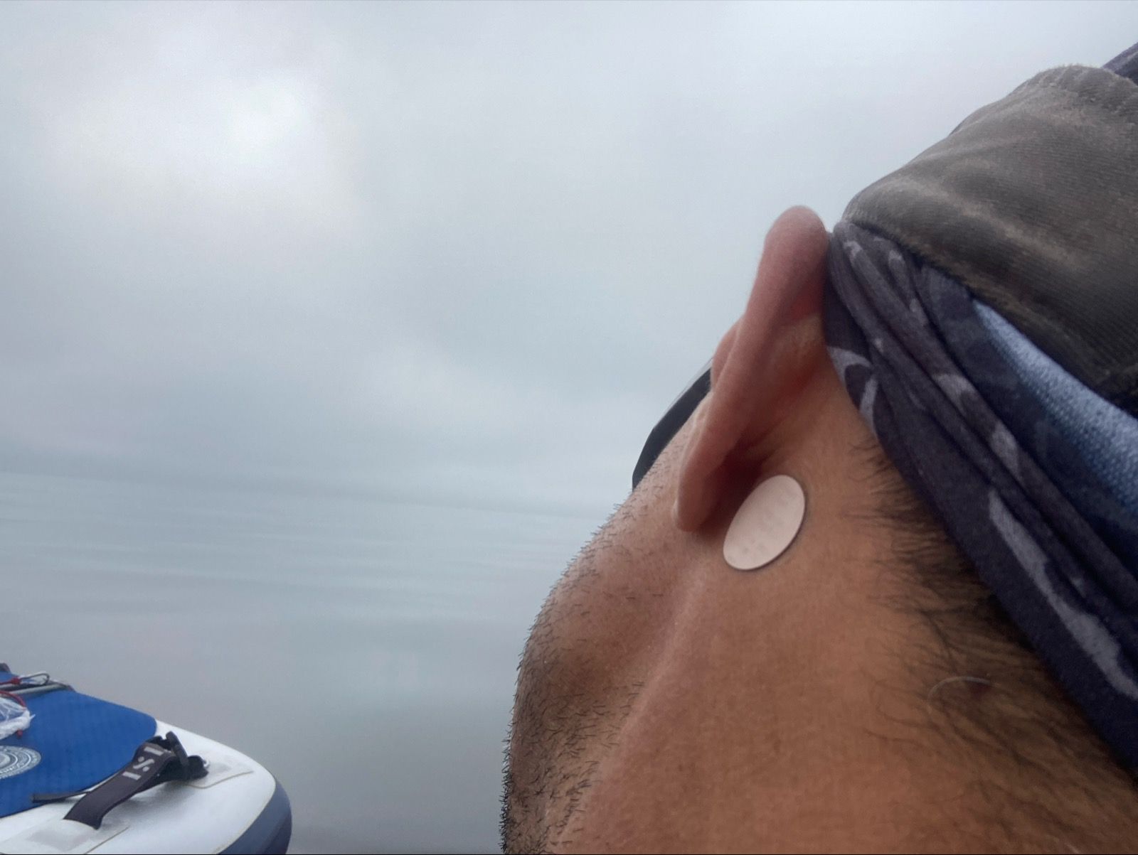
I surprised myself by not being afraid. I don’t know if it was the Scopolamine patch I had put on behind my ear, or my progressive introduction to the crescendoing waves, but I stayed calm… except for the frequent collisions with Bull Kelp. This stuff was a monstrosity; it is so heavy that I couldn’t lift it off the boat. It seems as if it is alive with tentacles as it managed to grab onto my rudder, daggerboard, and pedal fins on several occasions. Without pedals and/or rudder, you’re suddenly helpless and floundering. The sail often needs to be doused, and on one occasion, I had to use a knife to cut myself free of the errant kelp.
Although there was a little bit of fun in sailing fast, I just haven’t been able to sail towards my actual destination quickly. So, on a fun scale, today was pretty low. Similarly, on a scenery scale, it wasn’t too great either. I think back to the Desolation Sound and other sections earlier in the trip where the fun factor was higher. Out here nearing the ocean’s mouth, conditions aren’t so benign.
Several times throughout the course of the day, I altered my destination – basically steering towards wherever seemed “easiest.” Well I guess the easiest thing would be to turn around and sail downwind – so easy is relative.
I finally came to a small cluster of islands. I briefly took shelter behind Cattle Island, and then went to the only boat I saw all day – Jack was parked and hiding out behind Peel Island. He came out to say “hi.” I asked how he was doing, and he said, “ok.”
“Only Ok,” I questioned.
“Yeah, I dumped my coffee a second time in two days; I’m getting old, eh?” He replied.
A cushion was propped up drying on his deck.
“I could sail in this weather; I’ve never felt like this boat would go over. It has 7 ton displacement. I’m up here for fishing and I’ve been all over this coast but now I’m 72 and I won’t do things like that anymore, eh?”
Jack seemed a little scatterbrained; either he hadn’t talked with anyone in a long time and had been saving his logorrhea for me, or he was in the early stages of dementia. I’m going with the former, because after our long conversation, he remembered my name as I departed.
I then headed off to Patrician cove. It opened to the South East, and the wind was fierce from the North West. Even inside the bay, the water rippled with striations as the powerful winds whistled through the trees and agitated the water. I set my anchor very carefully and took down the mast. I haven’t been able to give the proper 5:1 rode ratio for the anchor anywhere for fear it will swing into rocks, but it has been holding so far.
On the beach, I spent a great deal of time looking for a place to put the tent, but there wasn’t one. I did meet a couple named Megan and Andy with their two kids exploring the beach. They came from Ontario where there is a smoky heat wave going on. Then I spent 90 minutes moving logs and breaking branches, and then leveling shells and gravel to create a flat-enough spot for the tent.
I dried clothes, charged batteries, and pondered the next move; still undecided about where to go next.
————-
Sunrise 5:34
Sunset 9:39
Moon 79% waning
Pressure 1021.0 falling
Photos:

Strava Comments:
Matt K.
Lance M.
Janet W.
Mark G.
Ride Stats:
| Elapsed Time | Moving Time | Distance | Average Speed | Max Speed | Elevation Gain | Calories Burned |
|---|---|---|---|---|---|---|
|
09:39:31
hours
|
06:16:27
hours
|
33.39
km
|
5.32
km/h
|
11.76
km/h
|
62.90
meters
|
1,769
kcal
|
– Day 16 : Decisiveness [top]

I headed off toward Port Hardy. I had drawn a return route on my phone last night, but I wanted to get a replacement phone wire (I’ve already destroyed two), and I figured I’d buy another five days’ worth of food so I could linger in the Broughtons.
As I headed out into the dense fog, a decision suddenly came to me: I would go to Alaska. The idea of retracing my steps just wasn’t appealing. Even though I could visit some new places, I’d still have to repeat certain sections.
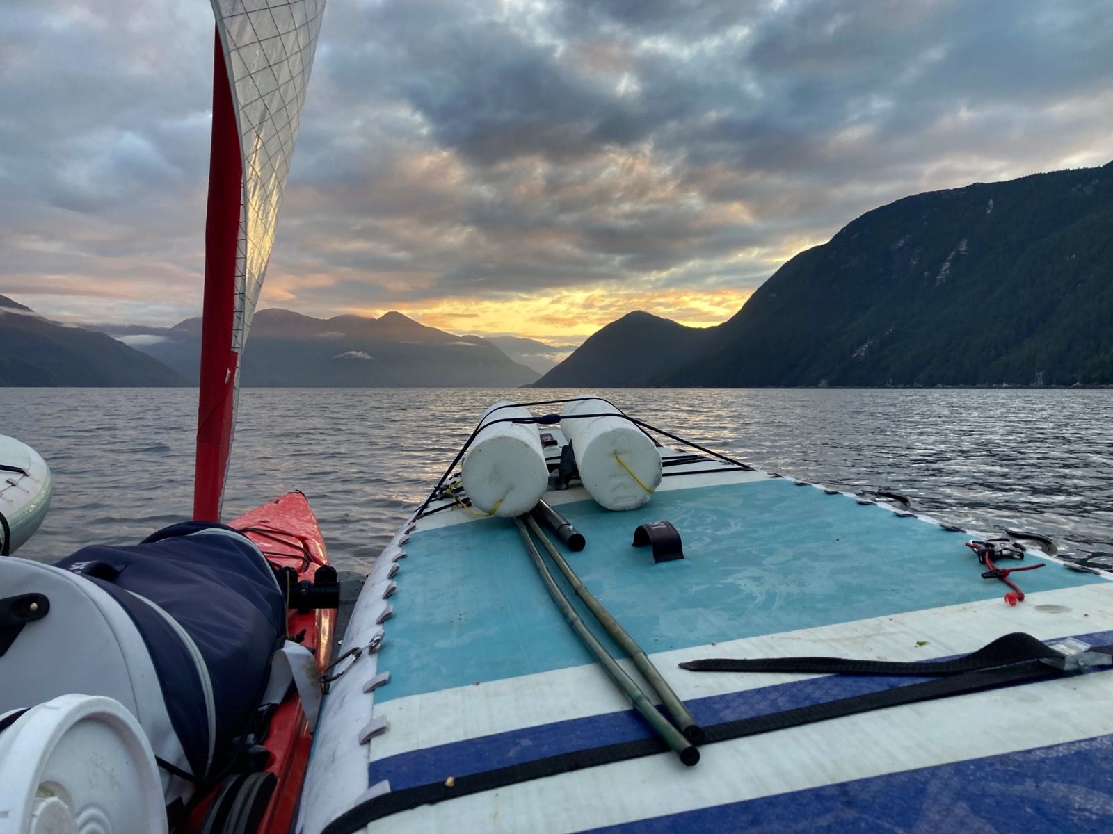
With firm resolve, I went straight toward the mainland. I plotted a new course en route, and now I’m committed. It’s a 30-mile open ocean crossing. I had calm weather this morning and finished just as the wind picked up. It was a comfortable ride, even with the five-foot swells spaced about six seconds apart. I suspect the anti-nausea patch was working.
There’s a good weather window on Saturday and Sunday mornings—hopefully enough for me to jump an ebb tide to get out of here and catch a flood tide to ride back into protected waters. In the meantime, that means three days of hanging out.
But it’s good. Skull Cove is extremely protected, and there are about a dozen cabins—I’m using one of them. There’s even cellular reception, somehow, and I have a solar panel, so I can talk to Janet when she finishes her backpacking trip. Maybe I’ll even get some work done or catch up on Duolingo.
I’ve already explored many of the trails in the immediate area.
⸻
Sunrise: 5:34
Sunset: 9:40
Moon: 72% waning
Pressure: 1017.3 and falling
Photos:

Strava Comments:
Nancy P.
Stan H.
Janet W.
Mark G.
Ride Stats:
| Elapsed Time | Moving Time | Distance | Average Speed | Max Speed | Elevation Gain | Calories Burned |
|---|---|---|---|---|---|---|
|
08:27:00
hours
|
07:00:49
hours
|
44.92
km
|
6.40
km/h
|
9.86
km/h
|
54.50
meters
|
1,924
kcal
|
– Day 17 : The Waiting Game [top]

But I don’t mind the day off. There is a new, 3rd leak in my boat, so I undertook the clumsy effort of hauling it out as the tide went out, propping it up (on a chair from one of the cabins), hiking through the mud to get bags of water, filling the hull with 15 gallons, finding the leak, draining the water, drying the patch area, doing epoxy… and then waiting to tape it up before cleaning everything up and reassembling. Ugh 😩
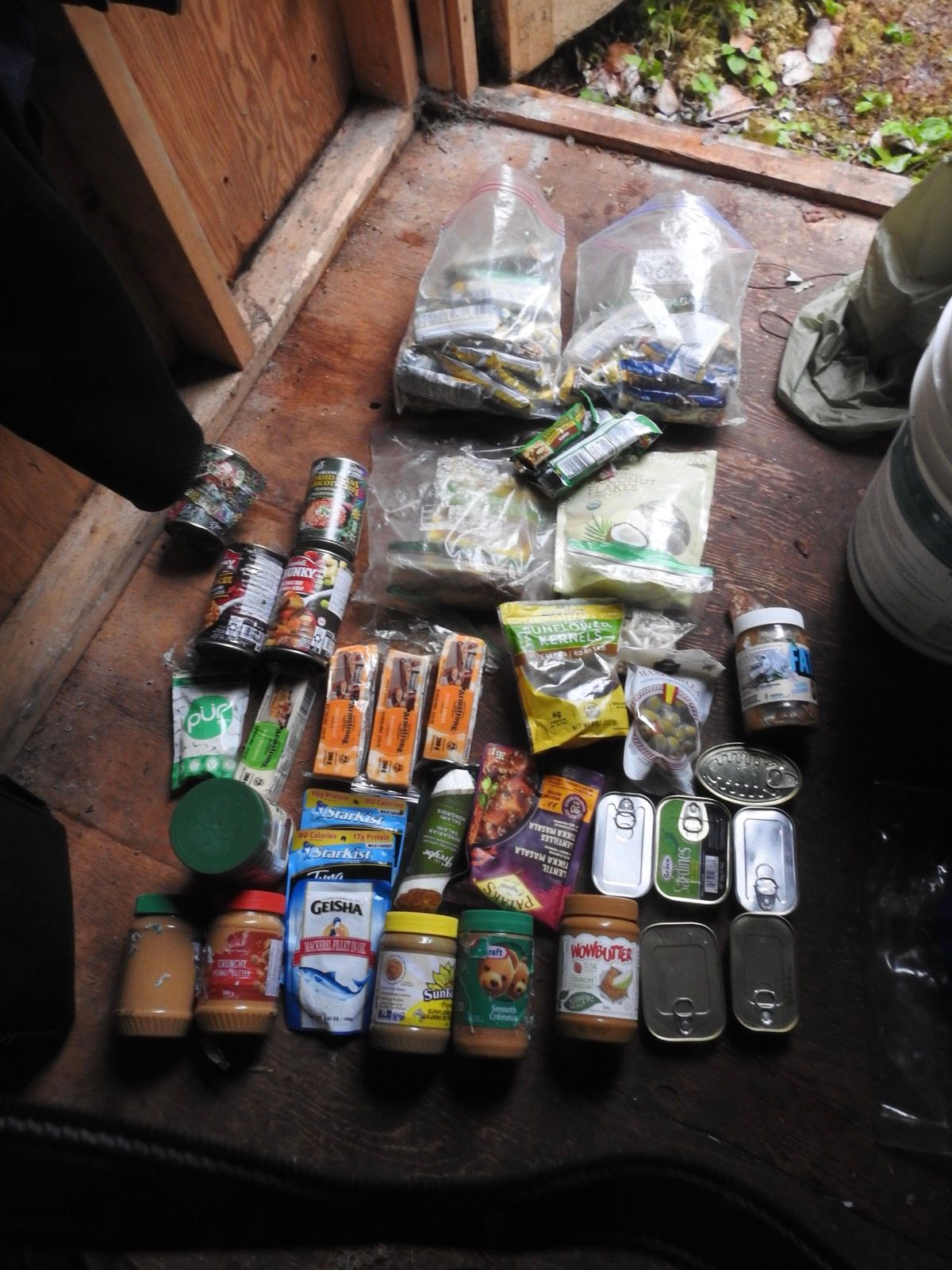
While I was waiting for the epoxy to cure, I worked on supplementing my food cache with clams and mussels. I dug for clams, but I swear they can dig themselves deeper faster than you can dig. I managed to get enough for a tasty (but gritty) meal, though, which buys me a little extra time. It is a long distance between food stores now, and Im resisting the temptation to eat more. My total daily dose of insulin is down to 10 units, and when I pinch to inject, the fat layer appears to be 50% less thick. I still have a lot of food, but I don’t have a guarantee that I’ll make it to the next store anytime soon. Im optimistic that it will be less than 7 days, but want to play it safe.
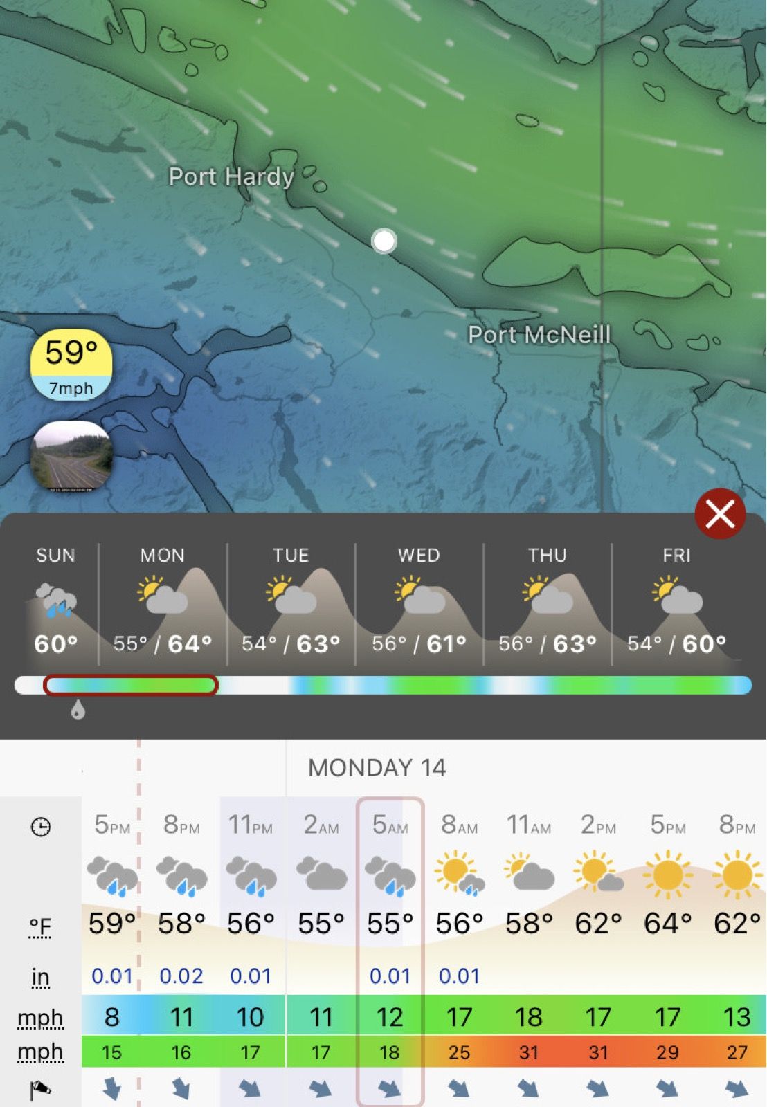
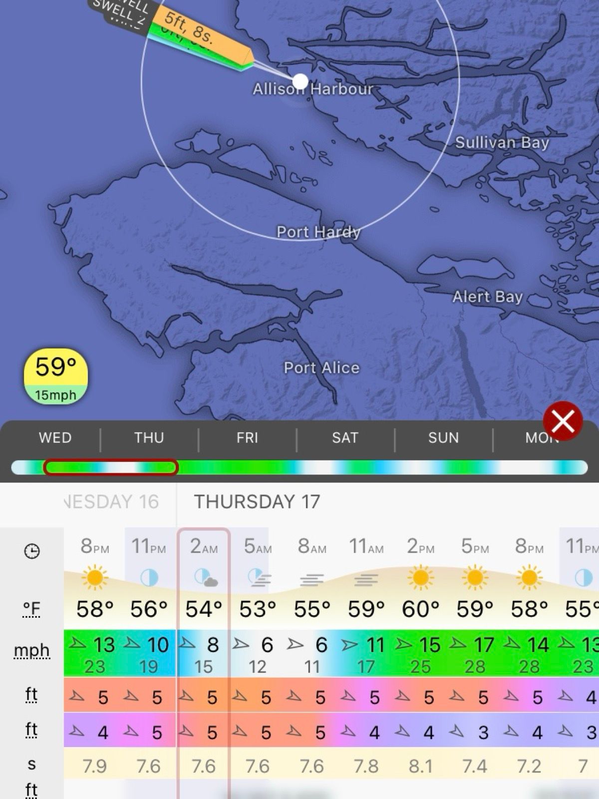
Also, the weather for tomorrow has chilled somewhat – I think it is good enough to go. I don’t love the 5 foot swells, and Saturday/Sunday are only 2 foot swells… but my main concern is wind, and that seems OK until noon-ish, meaning à 5 am start tomorrow in an attempt to round Cape Caution!
————
sunrise: 5:35
Sunset: 9:39
Moon 61% waning
Pressure 1017.9 rising
Photos:

Strava Comments:
Boris F.
Joffrey P.
Nancy P.
Janet W.
Mark G.
Judy I.
Ride Stats:
| Elapsed Time | Moving Time | Distance | Average Speed | Max Speed | Elevation Gain | Calories Burned |
|---|---|---|---|---|---|---|
|
04:50:46
hours
|
00:48:10
hours
|
5.97
km
|
8:04
min/km
|
7:00
min/km
|
0.00
meters
|
630
kcal
|
– Day 18 : Into the Mystic [top]

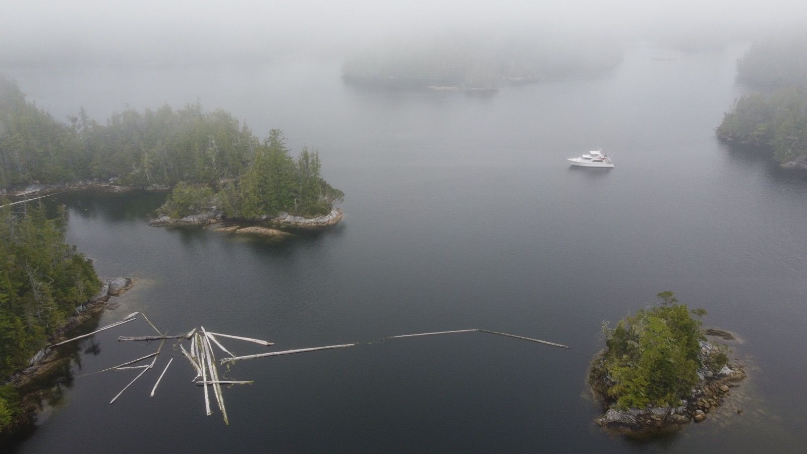
It was an early start – though not as early as I had hoped. The tide would be high and going out for the first half of the journey, and then it would be coming back in on the second leg. I would be in front of Smith Sound during the slack tide – idea because two people told me it had the strongest currents and tidal fluctuations of anywhere in the world – I would need to be careful for rips.
The wind would be negligible until noon, and then for the last few hours I might be able to sail on a beam reach. The only negative was the 5’ swells, which is a touch high.
Once at sea, I noticed that some of the swells were quite large – over 7’ with huge valleys below you. It is a little creepy, but I got used to this. Also, I had put on a new anti-nausea patch, meaning that everything felt just fine. I pedaled hard as predicted. My knees began to hurt so I took an Aleve. When the wind picked up, I was grateful – it was just the right velocity, and from a useful direction.
I pulled into Fury cove to find a great campsite with benches and a table. This would be useful because my boat is leaking badly AGAIN!! I think this is now the 5th time I have take it out to repair. I put in 7 buckets of water and never found the leak – even though it was a bad leak because I had to pump the bilge 4 times today. I went ahead and re-repaired the big one under the mast. This has been a major drag on the trip, having so much trouble finding the leak. When I get home, I can do a proper repair.
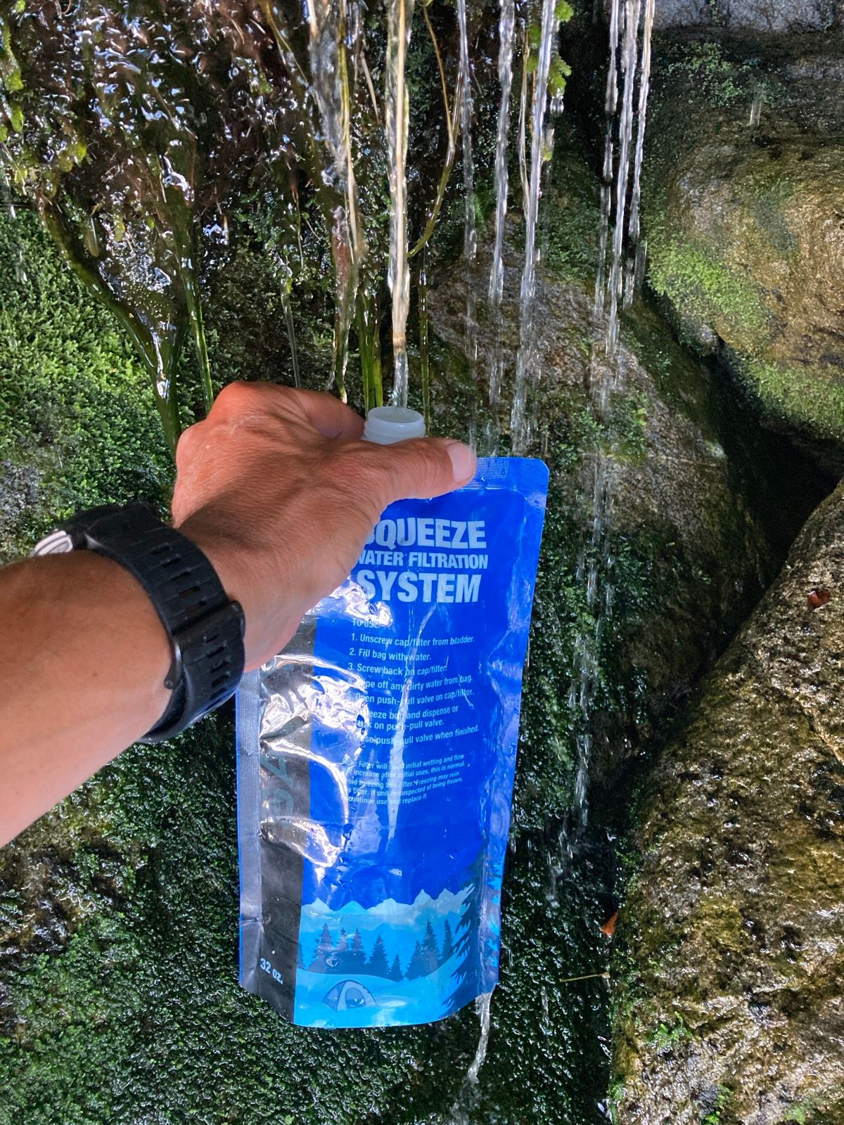
Once repairs were complete, solar charging was underway, and clothes were hung to dry, I took off on the paddleboard and to my relief, I found some water I could filter! Happy to have this water. Actually, I think there has been water at all but one of my camps. The life!
————-
Sunrise 5:34
Sunset 9:40
Moon 49% waning
Photos:


Strava Comments:
Judy I.
Mark G.
Brian L.
Janet W.
Clayton C.
Ride Stats:
| Elapsed Time | Moving Time | Distance | Average Speed | Max Speed | Elevation Gain | Calories Burned |
|---|---|---|---|---|---|---|
|
11:37:11
hours
|
10:14:10
hours
|
64.98
km
|
6.35
km/h
|
11.21
km/h
|
16.40
meters
|
2,529
kcal
|
– Day 19 : The Stowaway [top]

The sun was out, so I could get caught up on charging batteries when the wave action wasn’t too powerful. Several times today, I found the boat moving quickly.
I had a few problems: even after hauling the boat out for a repair last night, it is STILL leaking. I don’t think I am going to be able to fix it on this trip, so I have been pumping my unwelcome stowaway out while underway about ten times per day.
Another problem has been the “gourmet” coffee powder. It is excellent coffee, but it has a high affinity for moisture – something that happens to be in abundance here – and it turns into a sticky glue, wherever the dust lands. So, in the evening, I had to wash and dry everything inside of the food bucket.
I’ve been doing the math and hopeful I can make it to the first hot spring tomorrow! Also, I think that tomorrow will mark the halfway point of my journey to Alaska.
——-
Sunrise: 5:33
Sunset 9:41
Moon 37% waning
Pressure 1018.9 falling
Photos:
Strava Comments:
Susanne H.
Judy I.
Menso D.
Mark G.
Brian L.
Janet W.
Clayton C.
Ride Stats:
| Elapsed Time | Moving Time | Distance | Average Speed | Max Speed | Elevation Gain | Calories Burned |
|---|---|---|---|---|---|---|
|
11:05:34
hours
|
10:16:25
hours
|
77.01
km
|
7.50
km/h
|
14.35
km/h
|
12.10
meters
|
1,902
kcal
|
– Day 20 : Sinking Emergency Landing [top]

I carefully walked across the barnacle encrusted rocks, placing all of my gear about à foot from the water, which was coming back in now. Then I gently eased the boat into the water and tried to hold it in place while simultaneously loading my gear. This is hard to do in the daylight, let alone in the dark. I was finally underway.
I wasn’t sure if being on the rocks had damaged the boat, but it seemed to be filling with water more quickly. I looked at my speed 2.5 knots. The current should be going with me, but once again, it is going out as the tide is coming in. It’s a mystery.
The boat was definitely riding lower. I checked inside – already half full of water. This was not good, but what could I do? There is nowhere to land in these fjords.
The boat got lower and lower, but I figured that with the amas supporting the sides, eventually the bleeding would stop. It didn’t. My butt was getting wet. I looked back and the entire rear end of the boat was under water! This was scary because sitting in cold water for a long time wasn’t going to be safe. I pedaled harder. The boat sank deeper – now the backs of my calves were slapping the water. Oddly, I was now going 3.5 knots, even though the entire rear end of the boat was under water – me up to my belly bottom in water! I rounded à point and urgently looked for a pull out, praying for a spot to appear. One did. I got my cold body out of the water and quickly began disassembling the boat. As always, you have little time on the beaches with the tides.
Desperately, I poured and pumped water out of the hull once I got everything piled high on the drift wood. I rolled the hull upside down for a better look, and there it was – à 1.5” long crack near the front pedal well. Maybe it cracked when the boat ended up aground last night? This was big, and I don’t know how effective my repair kit has been.
I put g-flex epoxy inside and out, but I didn’t have 24 hours to stay here for a cure. This beach would be gone soon. So, I did the underwater tape over the epoxy job like I have done in the past. This tape helps, but it has been coming off over time. I put on more layers than usual.
And then it was time to put the boat back together again. This is an exercise in patience, because I only expected to do this twice: on arrival in Bellingham and after the trip was through in Alaska. I’ve had the boat apart nearly a dozen times already.
Once on the water, I could tell it was holding out water better. It still leaked, and I had to sponge it out, but at this rate, I could keep up.
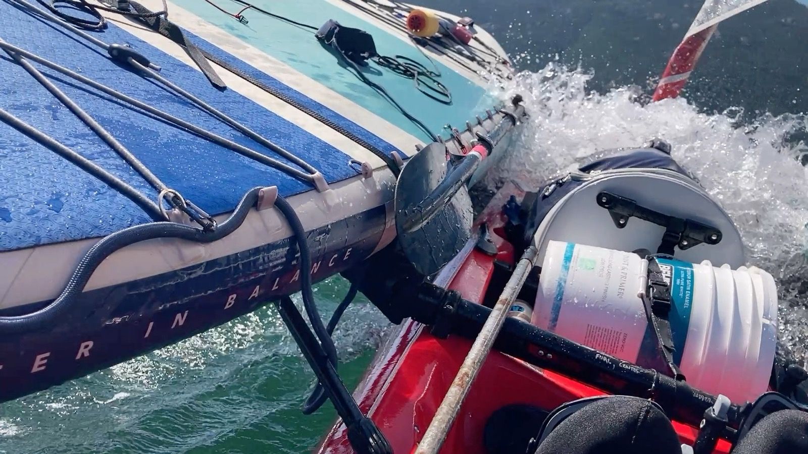
The wind built up – à following wind, which is good for getting pushed along, except this wind got stronger and stronger. Soon I was in the throes of barely being able to control the boat! I reefed the sail, which helped, as often the boat began to pearl, the bow deeply submerged below the surface. This happened multiple times, and I would drop the sail in the hope that easing up would let the wave pass under me. Nope, I was surfing these steep waves – induced by wind over tide. About as difficult as it gets. Occasionally, the boat would try to broach as it surfed down wave after wave. It took all of my kayak skills to keep the boat aligned.
Sometimes the wind eased slightly. I was still hauling, but since it wasn’t as bad as it had been a moment ago, I would relax. But I couldn’t let my guard down too soon, as it would suddenly intensify with à bellowing gust; the boat accelerated like a rocket.
Then the route turned slightly to the left.. and all the wind was gone! Now I had to pedal hard. Swells came around the corner, still about 4 feet crest to trough. That is when my pedals felt funny. I pulled them out to find that the spline broke! I don’t have a way to repair it, so I grabbed the spare drive. Now I don’t have a spare anymore. With about 500 miles to go, I’m not sure what to do. It’s looking pretty grim. I could repair all this stuff at home, but here I see no people and hardly have access to land. Getting the boat away from the water is a major challenge.
I saw an anchorage on my chart and decided to go for it. When I got in the protected bay, I noticed two tiny cabins – and decided to cam near one (even though it said “no trespassing”).
If there were an easy way to pack up the boat and go hike to fix it; I’d do that now. So much stuff needs repair. But there isn’t a way to do that… so I guess I will just press on and keep pumping that bilge every 30 minutes….
———-
Sunrise 5:32
Sunset 9:41
Moon: 24% waning
Pressure 1018.1 steady
Photos:

Strava Comments:
Judy I.
Janet W.
Mark G.
Ann L.
Brian L.
Pinkypants W.
Clayton C.
Ride Stats:
| Elapsed Time | Moving Time | Distance | Average Speed | Max Speed | Elevation Gain | Calories Burned |
|---|---|---|---|---|---|---|
|
13:57:24
hours
|
11:44:08
hours
|
67.22
km
|
5.73
km/h
|
13.44
km/h
|
24.60
meters
|
3,006
kcal
|
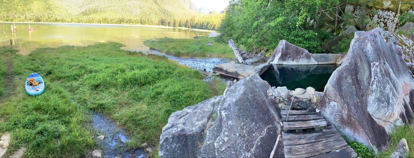
– Day 21 : The Hunger Games [top]

This really reminds me of video games where the graphics card can only render so many zombies at a time and so instead of getting all the zombies at once, you just get a steady flow of them, and no matter how many you kill they just keep repopulating. Can there be any other explanation?
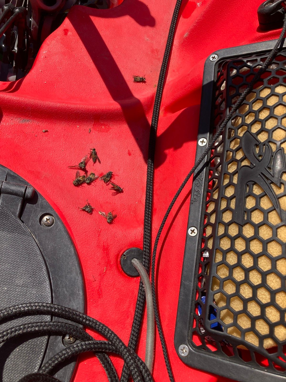
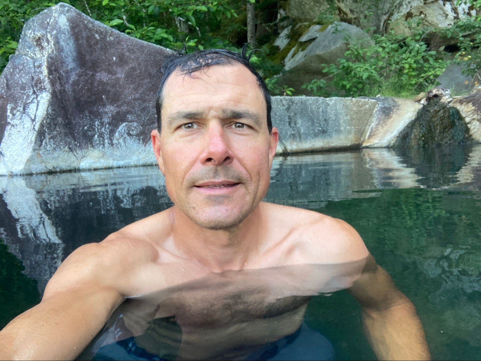
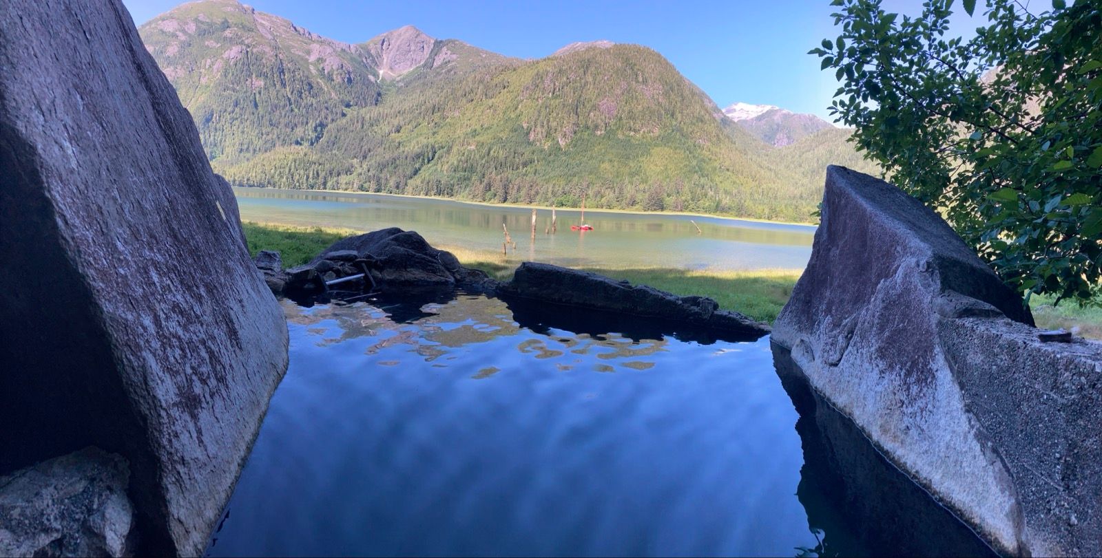
I actually managed to enjoy the hot spring, because the flies could not get me under the water. Also, it was a very nice hot spring – perhaps one of the best that I have ever been to in my life! I really wish that Janet were here with me to enjoy that hot spring. After the soak, I went back to my boat which I had anchored, and I attended to the hourly task of pumping out water. this was a dangerous proposition, because I was balanced precariously, and every two seconds swatting a fly, hopefully to its death. Also surprising is how hard I can hit a fly and have it land on the paddle board, only to bounce back up and fly away!
Unlike on a bicycle, where you can go relatively quickly, to outrun the flies, this boat cannot escape. They swarmed me, and I swatted continually until the game-makers presented the next challenge: strong winds and breaking waves. I was actually almost looking forward to it! Quickly the flies were gone, but now I was crashing into the waves sailing into a headwind.
These inlets felt really isolated; I had seen no people in what seemed like days, when a boat appeared and headed towards me. Their names were Pierre and April, and they seemed to know the area quite well, telling me which hot springs were the best, and offering me freshly baked cookies – gluten free because they have celiac’s. If I didn’t have type 1 diabetes, I would have said yes! At this point, though, I am “getting away with” more and more carb and less and less insulin. In fact, I have reduced my basal injection, and don’t take any mealtime insulin until I stop for the day. Even with this low, low dose, I got hypoglycemia today and had to eat two candy bars. Maybe I should have said “yes” to the cookies! This is happening because I eat so little compared to normal. I’m probably “only” eating about 3500 calories per day.
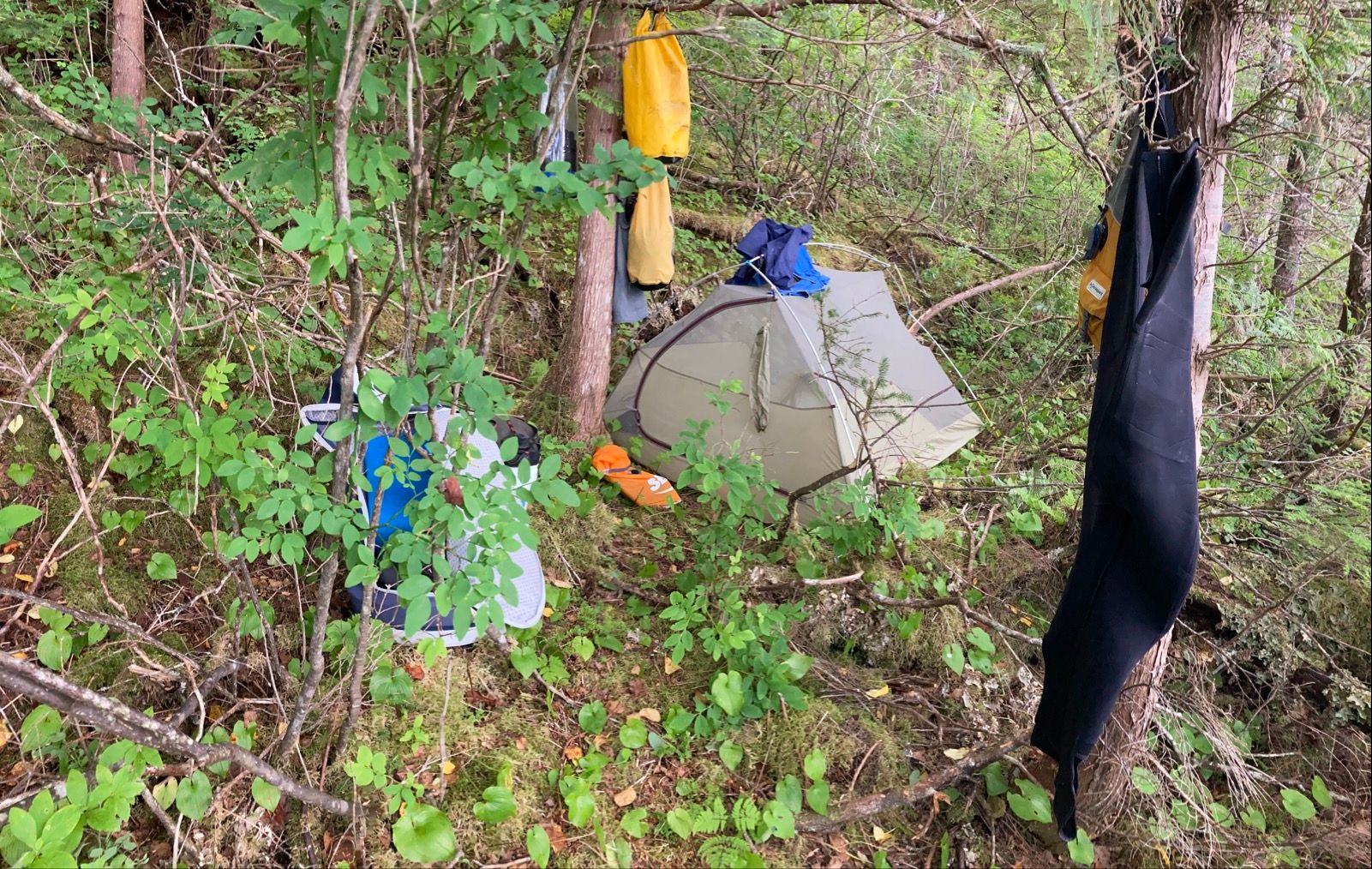
The winds and waves became too strong to make any reasonable progress, so I had to stop. I saw a slightly sheltered bay – honestly not that sheltered – and worked hard to attain that last mile. I dropped the anchor far enough from shore that the boat wouldn’t hit ground, and let out the full 100’ of rode. This should prevent anchor drag. Just to be safe, I also dropped the mast to reduce windage. It was a choppy effort to get my gear to à shore that had almost no space for a tent, but I managed to carve out a tiny spot. With 2.5 hours of work, I had the tent set up, clothes drying on the cobbles, the solar panel charging my gear, and water purified from the stream that was a bouldery 400 meters away – à tough walk.
I saw a mouse as I was drying out the food bucket – so happy to have a mouse proof container. There looks to be 2-3 more days of food left, which is good because I’m only 1.5 days from a store! I haven’t been to civilization in a week now!
———
Sunrise 5:34
Sunset 9:40
Moon: 17% waning
Pressure: 1014.6 rising
Photos:
Strava Comments:
Mark G.
Ann L.
Nancy P.
Brian L.
Chris C.
Nancy P.
Janet W.
Todd A.
Paula G.
Ride Stats:
| Elapsed Time | Moving Time | Distance | Average Speed | Max Speed | Elevation Gain | Calories Burned |
|---|---|---|---|---|---|---|
|
11:34:17
hours
|
08:14:38
hours
|
50.26
km
|
6.10
km/h
|
12.24
km/h
|
109.90
meters
|
2,148
kcal
|
– Day 22 : 😊 [top]

When I woke up to look for the boat in the twilight, it was gone! I panicked, looking right and left. The AIS beacon was off for charging, so I’d never find it. I hadn’t put in my contact lens yet, but eventually I saw something very faint… the boat had moved 200’ in the opposite direction (logically, based on the rode)… but the landscape is so different when the tide goes out and the boat was just a speck. But it was there. I like my anchor. WHEW!!
Sailing was actually good today! Wind, but no big waves. Things were going well. Got to a town called “shearwater”. It is so funny that everyone says the inside passage is remote in this North Section, but coming BACK to the inside passage seems like finally being back in civilization after being up the inlets. Admittedly it was only 4.5 days without cell reception, but it felt longer.
First order of business was to call Janet, which i did from the water, but once in town there was no cell reception anywhere! I decided to get a hotel room for the WiFi. That way Janet and I could FaceTime. The guy offered $150 cad if I paid cash. I went to the ATM, but no matter what options I tried, no money was dispensed. I was willing to pay full price though.
I gave them my credit card and while standing at the reception, entered the password in my phone. Nothing.
“Does the Wi-Fi here work?”
“Sometimes it connects after a few hours if you stand by that building over there..”
I explained that the only reason I was getting the room was WiFi, and they said, “What we tell most people is that they came here to get away from it all.”
They were sincere and kind… and their comments likely appropriate for most visitors to this town. Luckily they hadn’t quite processed the card yet. They were very helpful and everyone in this town was exceptionally friendly.
So, I used the marina laundry and showers and bought 5 minute epoxy. I took a paddleboard and in the water I stood on it and placed it perpendicular to the boat and shimmied the boat on top of it, nose first. Eventually, the leaky part of the boat was out of the water!
Then I did my 5 minute epoxy inside (instructions say wait 30 minutes) and met a guy named Cedric who had passed me under motor while coming in. He was impressed with the speed of the Red Lobster, and he said that he worked repairing rental kayaks with coke bottle plastic caps (melting them with soldering iron). This is probably what I will do when I get home).
Anyway, the boat seemed a little better once in the water – but definitely still leaking. There may be multiple leaks.
I sailed over to a nearby island and leveled a spot in the forest just above tide. Then Cedric came over from his nearby boat to ask if I wanted help fixing the boat. He invited me over and we spent the evening with Max and Zoe watching the sunset. Max and Zoe are his friends who he is teaching how to sail, and encouraging them NOT to buy a boat (because stuff always breaks). I felt better about my own calamities.
Max asked me, “What was the most relaxing part of your trip?” Funny he should ask that.
“Now! I haven’t taken a break like this where I didn’t think about weather, currents, tide, food, water, boat repair, chores…”. It was really nice to take my mind off it for a bit.
Max said, “Im in love.” He was referring to his new love of sailing. He looked to be in his early 30s, and you could tell that sailing has captivated him like it has me. Cedrick, also about the same age, provided the gentle background support of this new passion, while casually mentioning a few of the “realities”. Zoe and Max were both friends with Cedrick, but did not know each other before the trip. Both were cycletourists, so we really hit it off.
Also, being out of town, the cell phone worked worked and I was able to talk to Janet. Happy day!
———
Sunrise 5:38
Sunset 9:40
Moon 7% Waning
1014.4 steady
Photos:
Strava Comments:
Julie K.
Stan H.
Chris C.
Gregg B.
Brian L.
Janet W.
Mark G.
Ride Stats:
| Elapsed Time | Moving Time | Distance | Average Speed | Max Speed | Elevation Gain | Calories Burned |
|---|---|---|---|---|---|---|
|
12:59:33
hours
|
08:55:07
hours
|
58.83
km
|
6.60
km/h
|
12.19
km/h
|
55.20
meters
|
1,822
kcal
|
– Day 23 : Southern Man [top]

I made quick enough progress, but eventually developed quite a pain in the tendon behind my right knee. By happenstance, I discovered that you can alleviate the pain by adjusting just the right crank arm to have a shorter stroke – kind of like lowering your saddle in a bike, except you can do it one leg at a time. As much as I berate Hobie’s engineering…. kudos on that one.
While rounding the points out in the ocean, I saw several masted boats with black sails… except they suddenly disappeared beneath the surface! I realized these were Orcas, and as I drew closer could see several of them swimming in the opposite direction.
The Southerly piped up quite a bit, making the boat unstable. I reefed the sail, which is always something done reluctantly… because psychologically you think you’re going to go slower… in reality, you have a more relaxing ride, just as fast. Unfortunately the current was against me, so there were no amazing speeds, but much better than having both in contrary.
The good news is that I only had to pump the bilge 4 times today – so the leak is less than half of what it used to be before the 5 minute epoxy job. In fact, there may simply be a second leak that im unaware of – maybe the big crack is “fixed”. I imagine that the crack will reopen the minute I put any pressure on the hull, so my new goal is to treat the vessel like a real sailboat – it doesn’t touch land until the end of the trip. I can handle the current leak rate if it stays as-is.
As an aside, I re-listened to Ray and Jenny Jardine’s account of kayaking the inside passage. They named their folding kayak “the sea tub” because it always filled up with water. They joked that it should come with some rubber duckies to float around inside. They met one other kayaker on their trip, and she had a fiberglass kayak – that was also leaking! So this made me feel somewhat better. I have 5 “floaty things” (main hull, two amas, and two paddleboards) whereas these kayakers only had one. Other peoples’ hardships make me feel better about my own. Perhaps someone reading this blog may get the same benefit. Mainly, listening to the story again made me sad, though, because I first listened to it with Janet on the ICW – making me miss her and talking with her about our good fortune to not be in their predicaments!
The map showed a protective cove and I pulled into a beautiful spot out of the wind. There are still whitecaps just outside the cove, but in here it is like the meadow in the Wizard of Oz. Only problem is that we are on the new moon again, meaning large tidal fluctuations. Just to be safe, I built an elevated platform with the paddleboard to give an extra foot of elevation- every bit is going to count tonight! I also found the leak on the thermarest – exactly where it leaked before. I had already repaired Two of the 4 corners near the valve, and last night discovered that the other two corners had given way. This appears to be some sort of defect. Speaking of defects, the place where I bought the drives – new for this trip – wrote back saying that they would reach out to Hobie to warranty the broken part. So lots of good news.
———-
Sunrise 5:40
Sunset 9:43
Moon 3% Waning
Pressure 1015.5 steady
Photos:
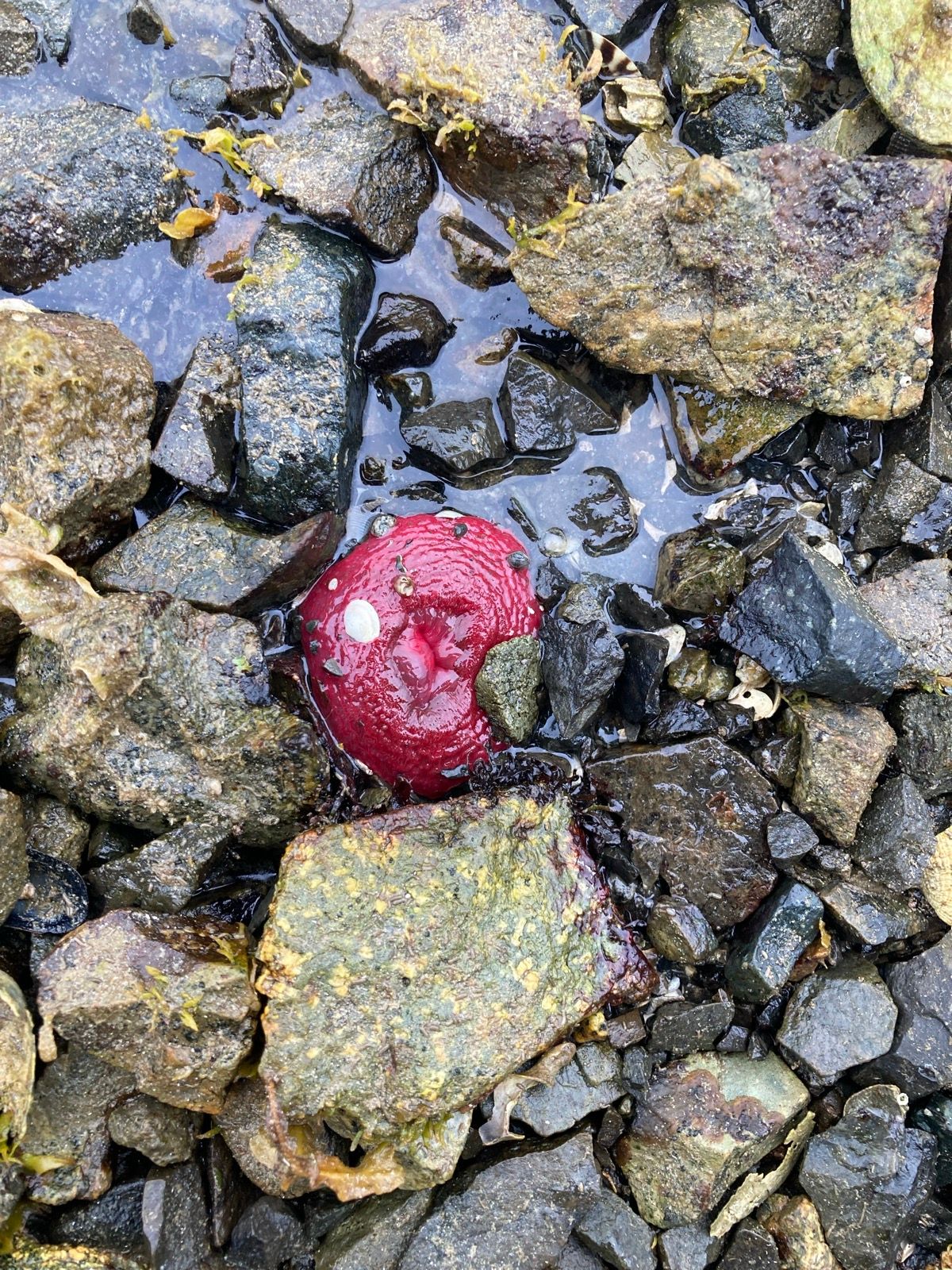
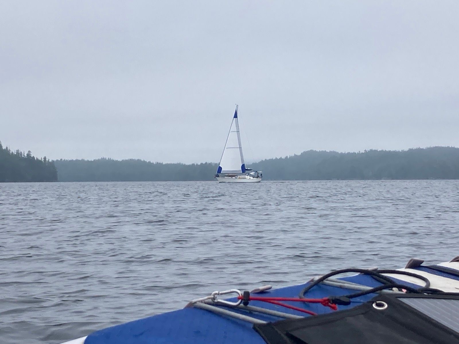
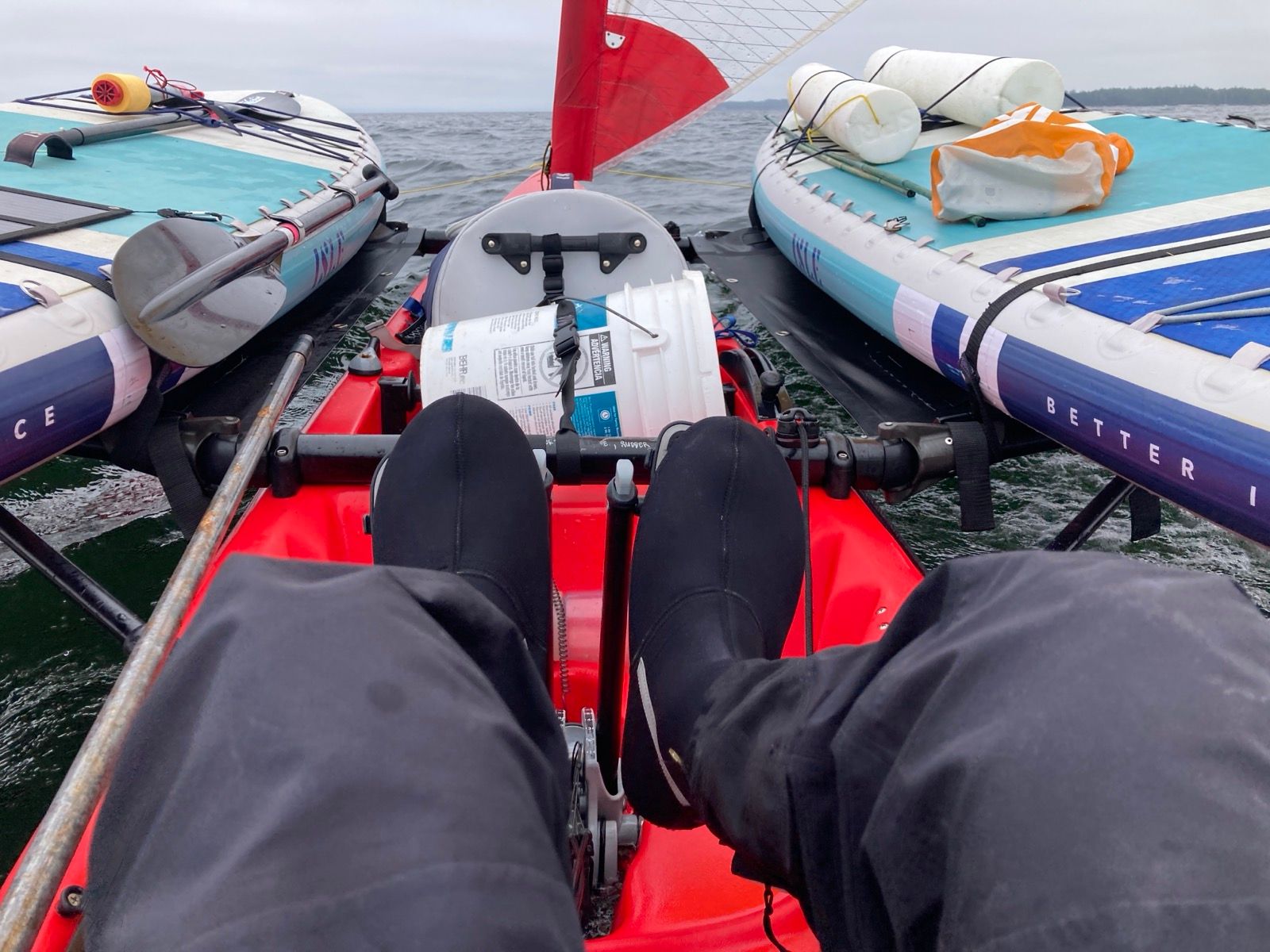
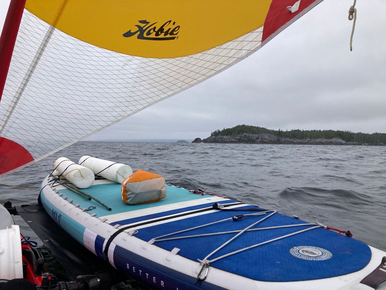
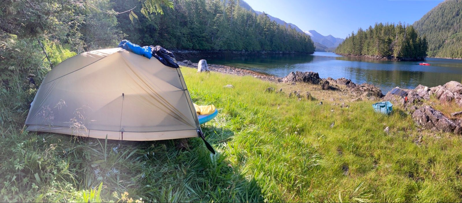
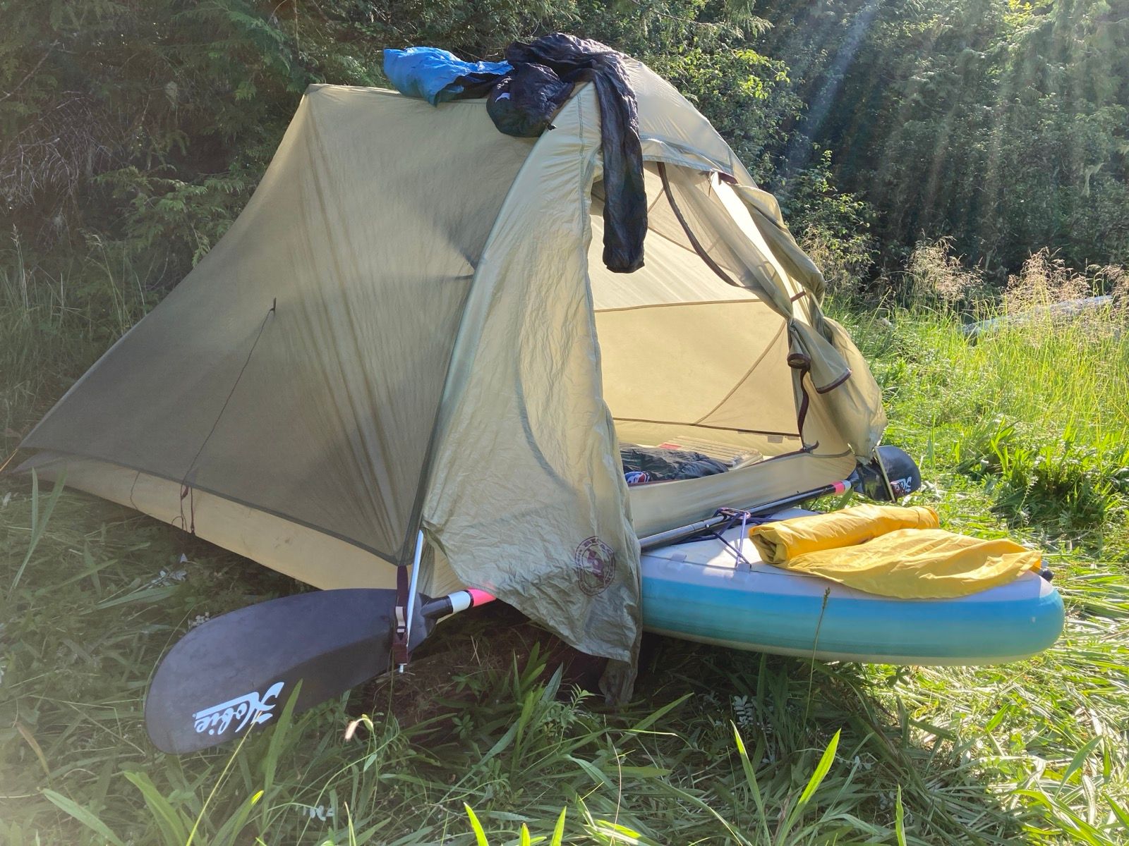
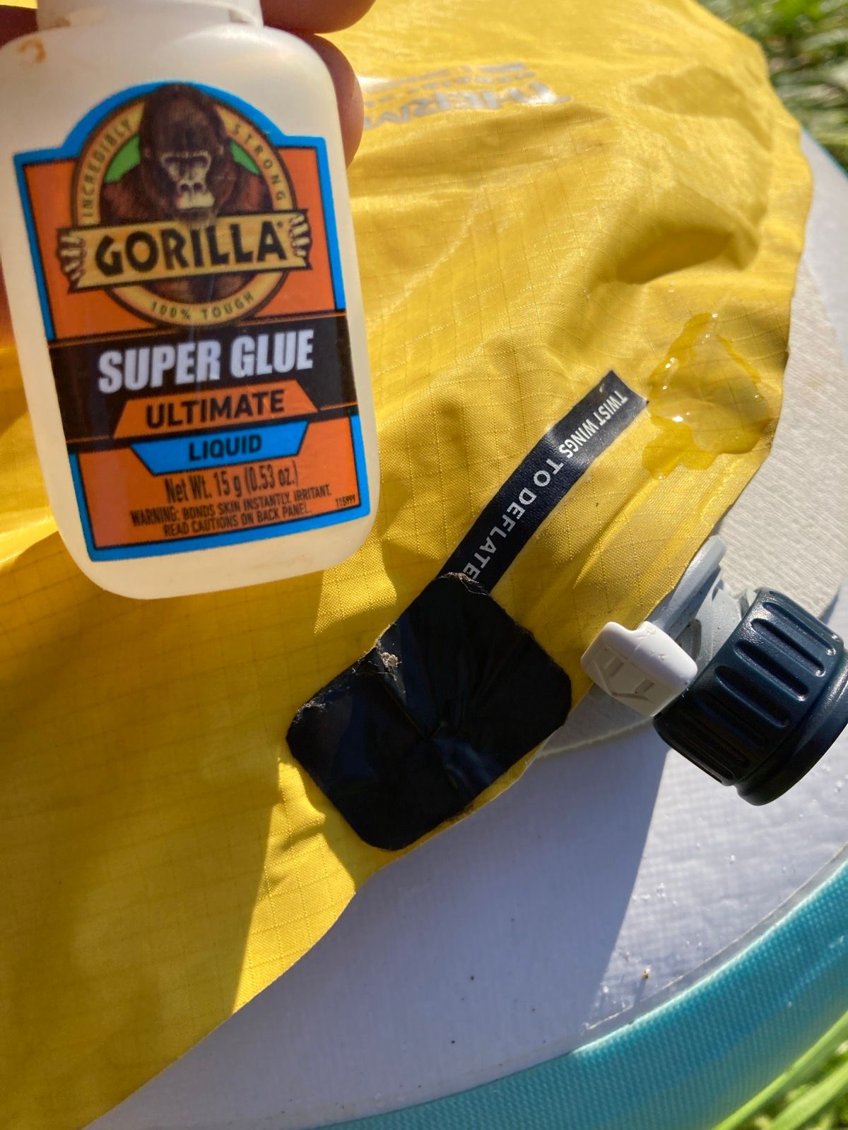
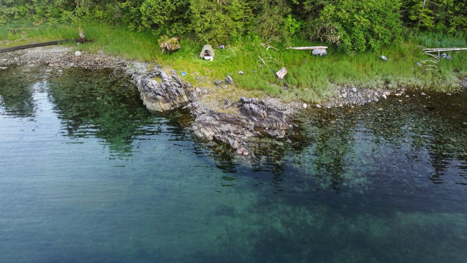
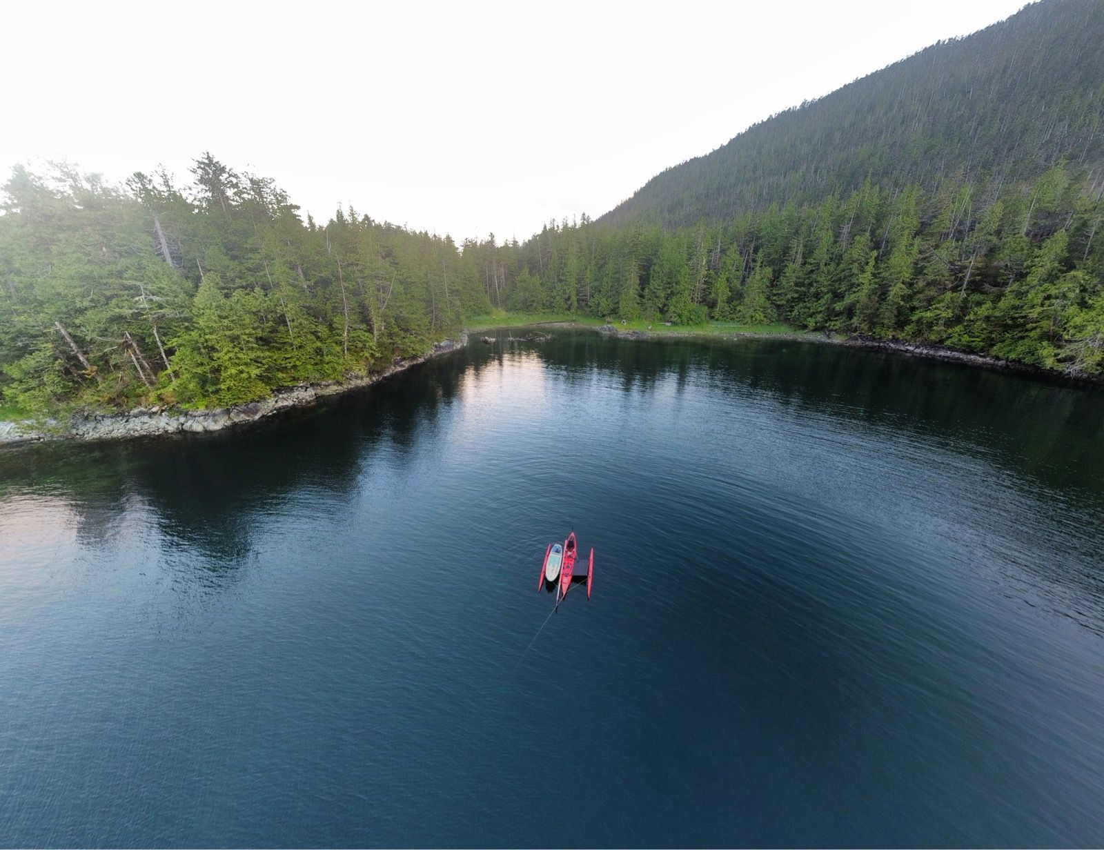
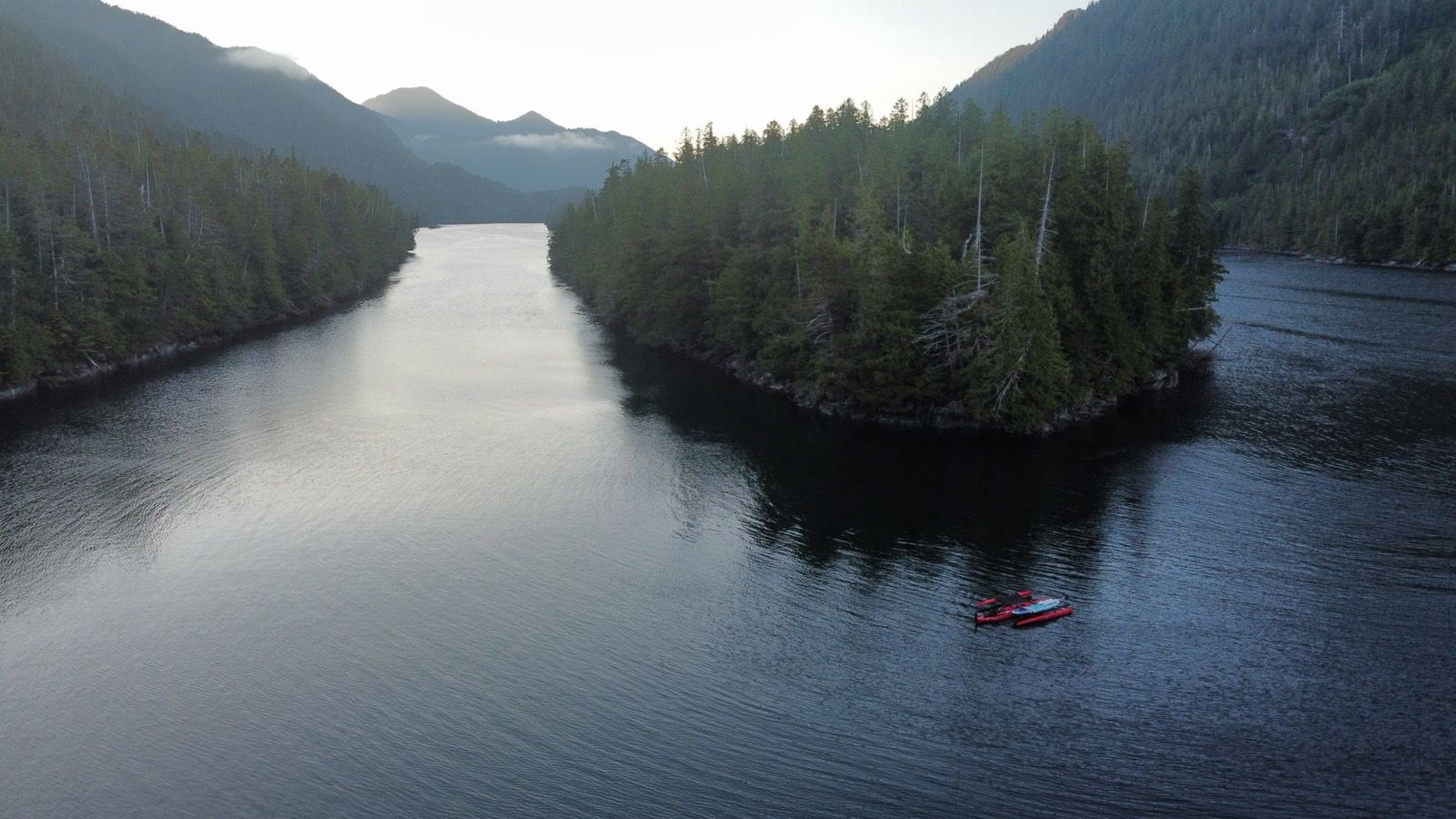
Strava Comments:
Janet W.
Nancy P.
Mark G.
Mark G.
Mark G.
Ride Stats:
| Elapsed Time | Moving Time | Distance | Average Speed | Max Speed | Elevation Gain | Calories Burned |
|---|---|---|---|---|---|---|
|
10:30:05
hours
|
09:36:39
hours
|
62.70
km
|
6.52
km/h
|
11.58
km/h
|
16.30
meters
|
1,298
kcal
|
– Day 24 : it’s the waxing and waning that’s always on your mind [top]

Last nights camp atop the paddleboard was great! Im glad I tried this experiment, because in addition to elevating yourself above high tide line, this method of camping also enables you to make a flat surface out of lumpy terrain (provided you have the requisite smooth driftwood). As I drifted off, I thought of the importance of comfort in being able to carry on with this. I’ve brought a fleece blanket which I put on the floor to feel like a “carpet”. Fleece is an amazing material on the sense that it doesn’t feel wet in humid environments. I also let my gas heater burn for quite a while. It is very successful at keeping me warm, but does not work as well as I had hoped for the task of drying wet clothing. Also, for this trip, I purchased a synthetic sleeping bag. The cost of a synthetic bag is a tiny fraction of a down bag, and in terms of comfort (in a humid environment), I deem it to be far superior to down. It is noticeably heavier than my comparable down bag, but I never worry about the night. It is a keeper.
I took a quick stop in Klemtu to top off the food. I am anticipating about 9 days without any services because I hope to visit some out-of-the-way hot springs. I arrived 30 minutes before the store opened, and there was loud construction going on nearby. I took a moment to update the blog and talk to a woman who had also come by boat. I don’t see many people up here, but end up talking to almost everyone I see. Like many of the people I have met, she was a “hop on; hop off” person – joining someone on their boat for a portion of a bigger journey. That seems a common way to do things. Living on some of these boats looks quite nice.
Klemtu is a very quiet Native American town (I believe it is now called “First Nation”). A man called out to me, “Where is your motor?” He was serious. I told him, “no motor; that is the point!” He chuckled, and had no other questions.
The staff in the store was once again very friendly, and the shelves were stocked very well for someone with standard dietary habits. For my low carb approach, I had to make compromises for calories, but I am glad to have an extra security net to be able to make this next leg.
The rest of the day was enjoyable. The wind helped as the current went the opposite direction all day. As I rounded islands near the slack tide, I managed to going at the worst possible time for a current-assist. Therefore, I was grateful that at least the wind was just right. I’ve had to pedal quite a bit, and the tendon in my right knee is giving me quite a bit of trouble.
Camp was in a South facing bay, which isn’t the best when you have a Southerly, but it was calm enough and there were not many other protected areas. Camp was on a small gravel shelf, just above high tide line (which is going to be quite high tonight). I didn’t have to do too much work to make it sleep-able. The boat is not very far offshore, but the anchor went VERY deep. This is quite a dropoff in this bay.
———-
Sunrise 5:39
Sunset 9:43
Moon: New
Pressure
Photos:
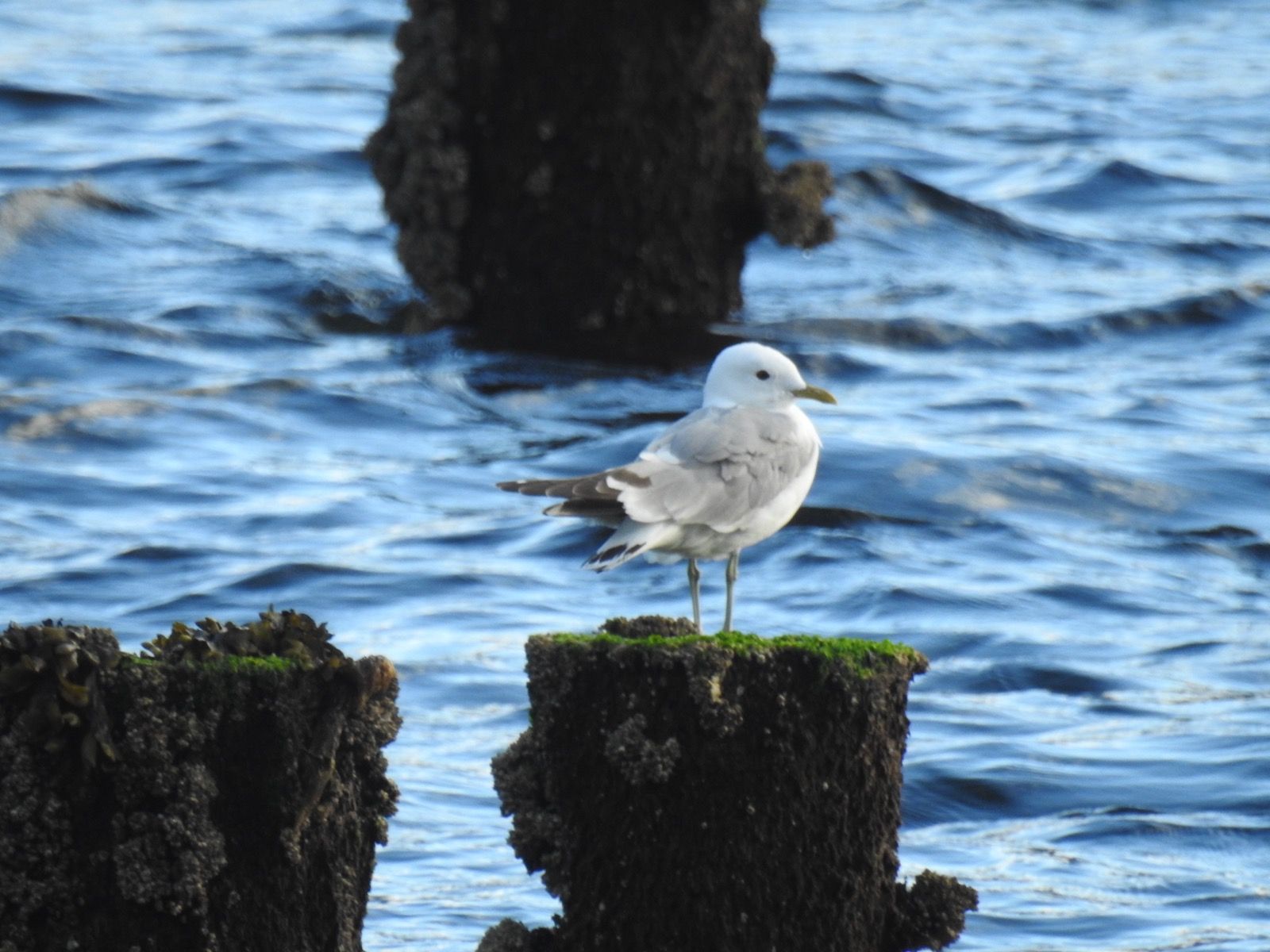
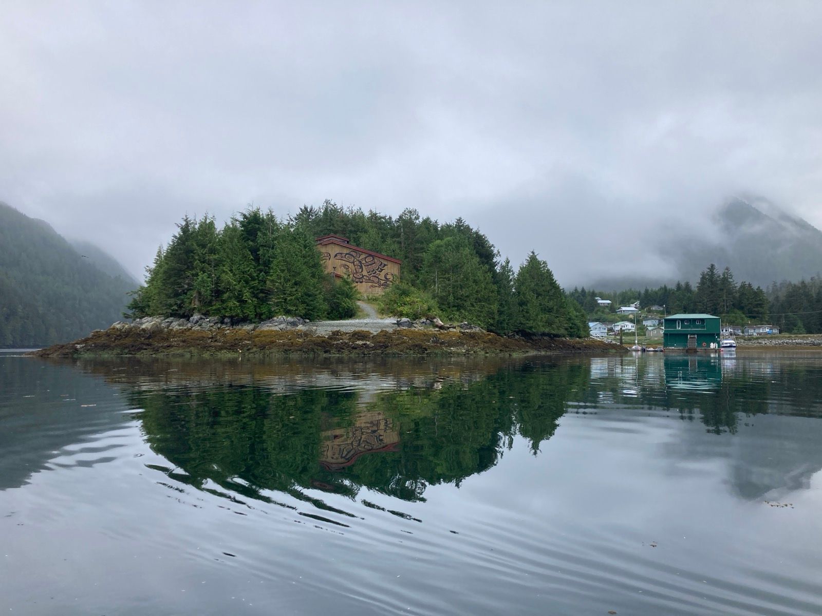
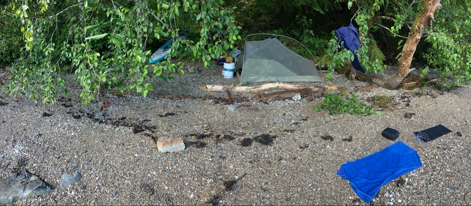
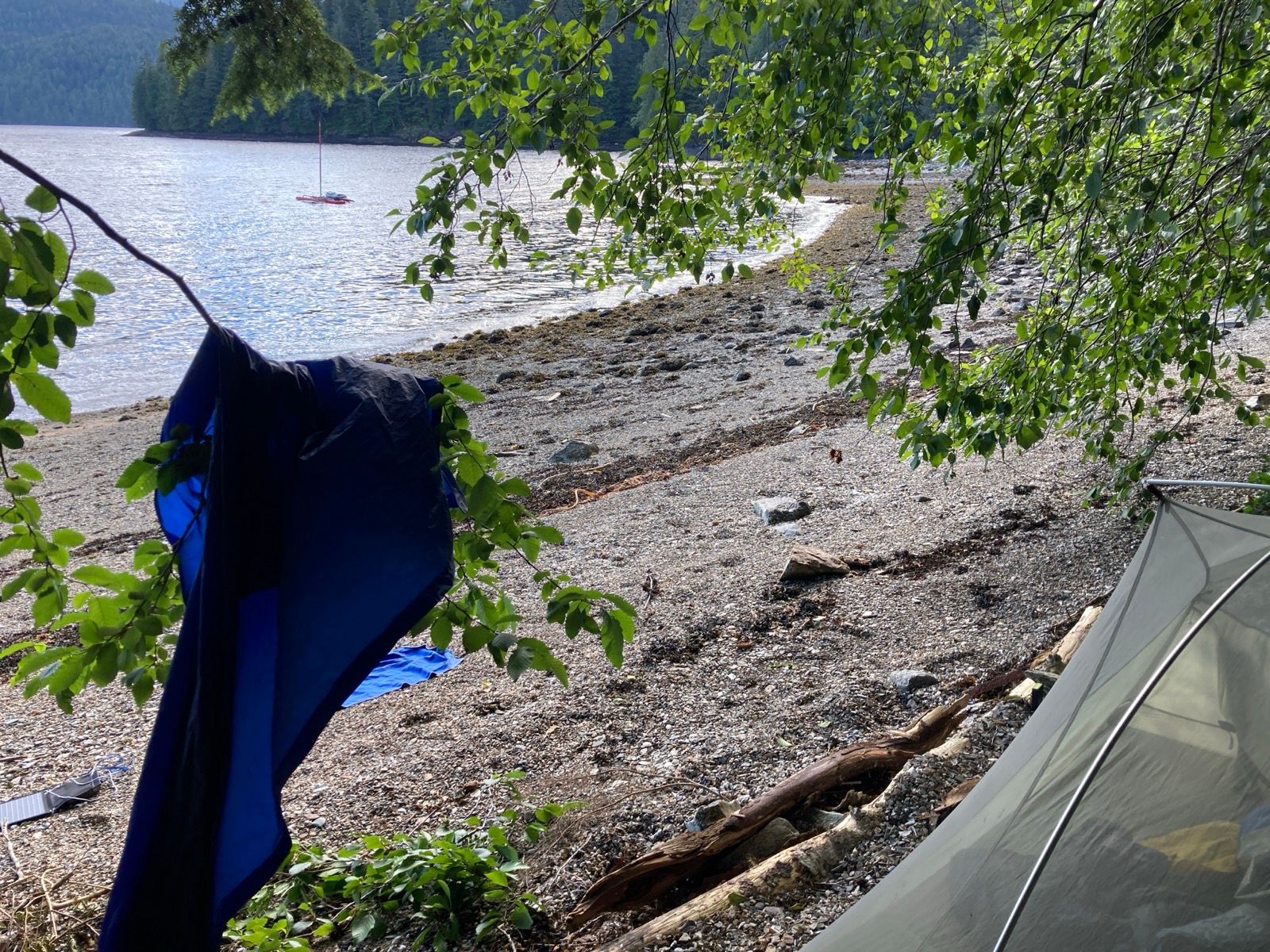

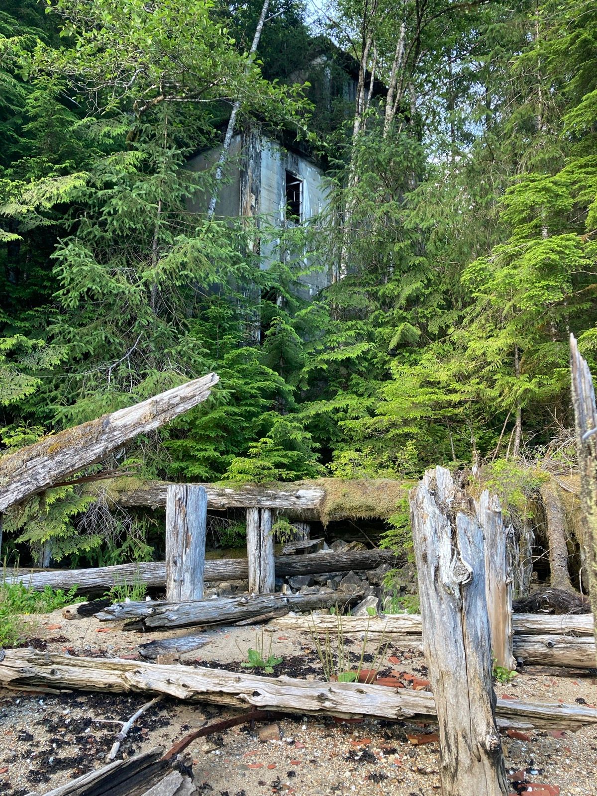
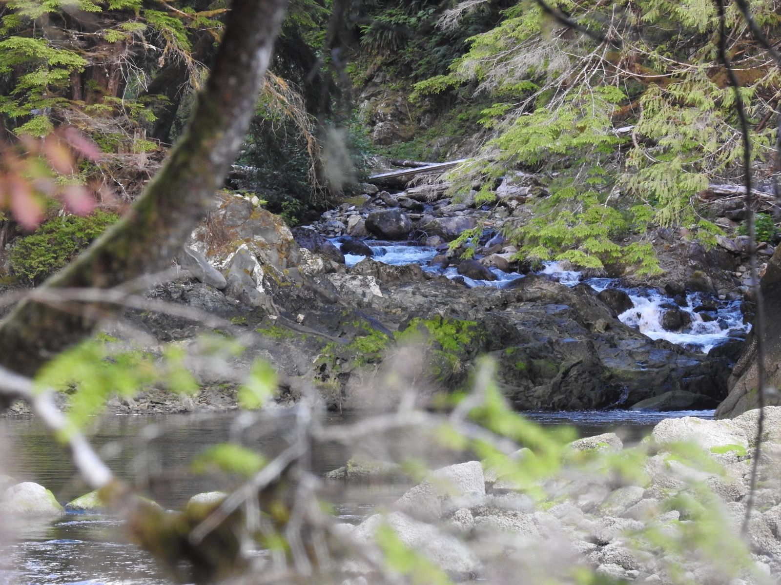
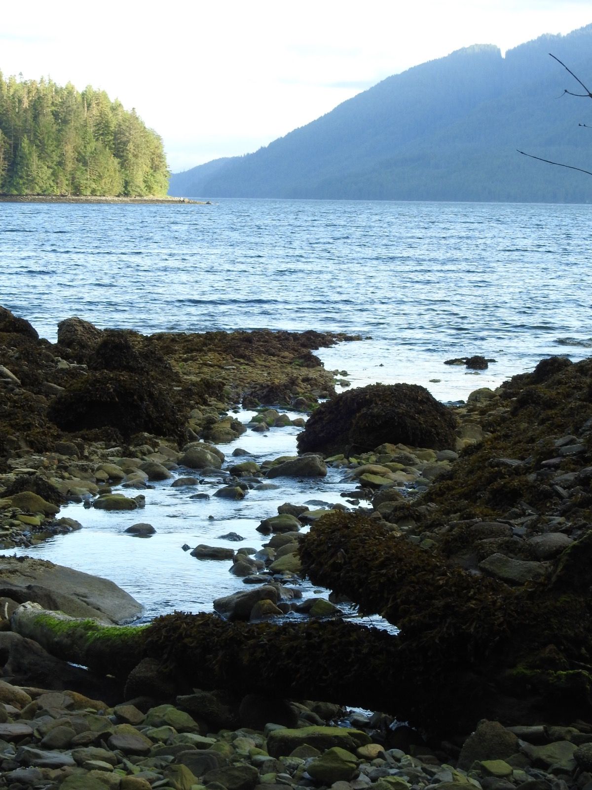
Strava Comments:
Janet W.
Todd A.
Sօʀƈɛʀɛʀ 🅅.
Sօʀƈɛʀɛʀ 🅅.
J&K S.
Ride Stats:
| Elapsed Time | Moving Time | Distance | Average Speed | Max Speed | Elevation Gain | Calories Burned |
|---|---|---|---|---|---|---|
|
10:45:29
hours
|
08:48:34
hours
|
54.56
km
|
6.19
km/h
|
12.50
km/h
|
40.40
meters
|
1,243
kcal
|
– Day 25 : Whale Tales [top]

I took my time in the morning, a luxurious treat. I enjoyed Tetley tea (much better than Lipton) and then began loading the boat. The reason for the luxury was that I was waiting for the tide to flip in my favor.
For the first 25% of the day, I had favorable wind and tide, but then the tide turned against me – for the remainder of the day.
I sat in the channel watching whales for hours – the island I had rounded in the morning still visible hours later. Progress into the wind was slow. It drizzled several times, and I switched frequently from rain gear to t-shirt and shorts. The solar panel gets put out and packed away repeatedly. The panel works very well, but to stay on top of everything, you need to always have something being charged, even if it is a cache battery.
I enjoyed the whales and used the satellite messenger to text Terry Lentz for his birthday. He and Louise are coming to Alaska! Maybe I will see them?
The last hour and a half was some of the most awful time I have ever sent on the water. I have a new back injury from hoisting the anchor, and that combined with my knee injury makes pedaling painful – but I HAD to pedal because of the worst potato patch of confused currents combined with scattered winds. The hulls slapped against the water slamming back and forth while the mast rocked side to side, and progress was a slow 1 to 2 mph – usually not towards the destination.
Camp required putting the boat very far out. We are going to have a 20 foot fluctuation in the tide. This meant a long portage across cobbles. I built a fire, and it consoled me. I put a pot of water atop the flames and made a hot shower. It is nice to be at camp.
————-
Sunrise 5:40
Sunset 9:45
Moon 0% new
Pressure 1017.9 steady
Photos:
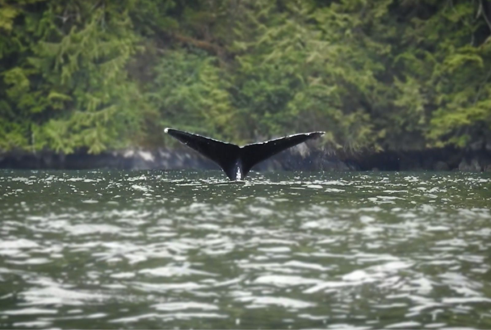
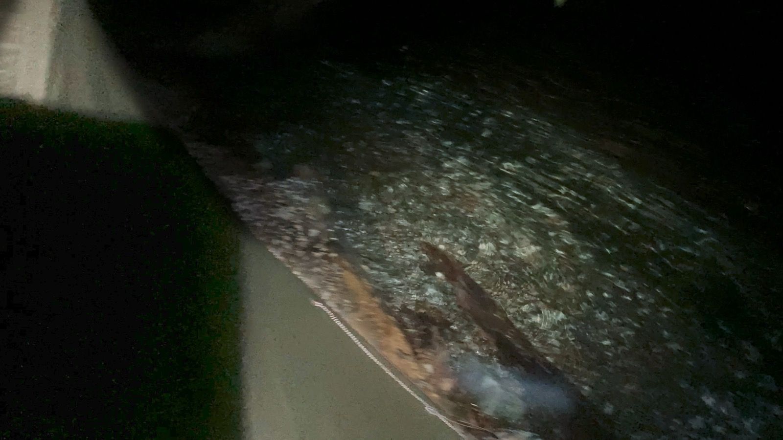
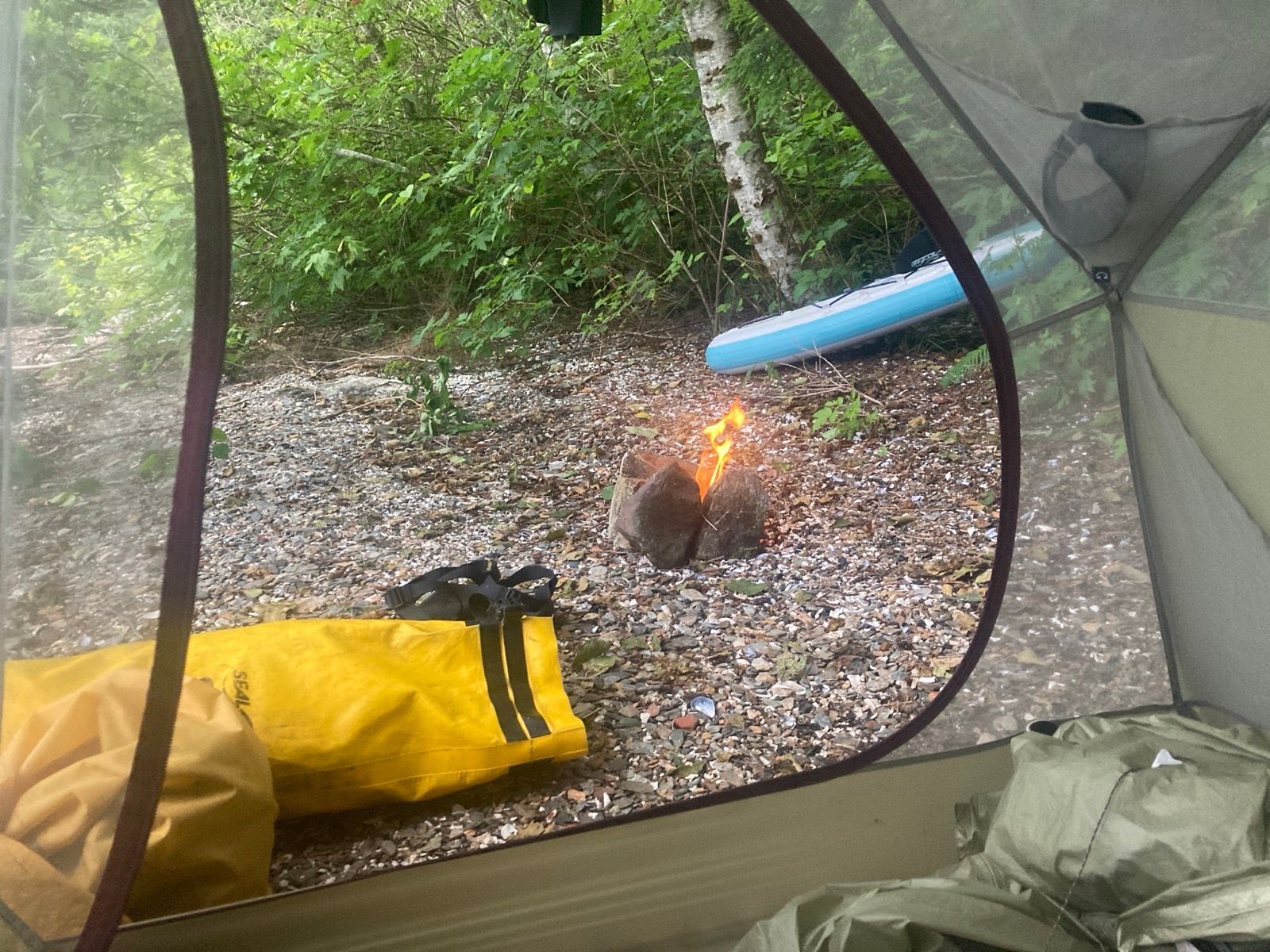
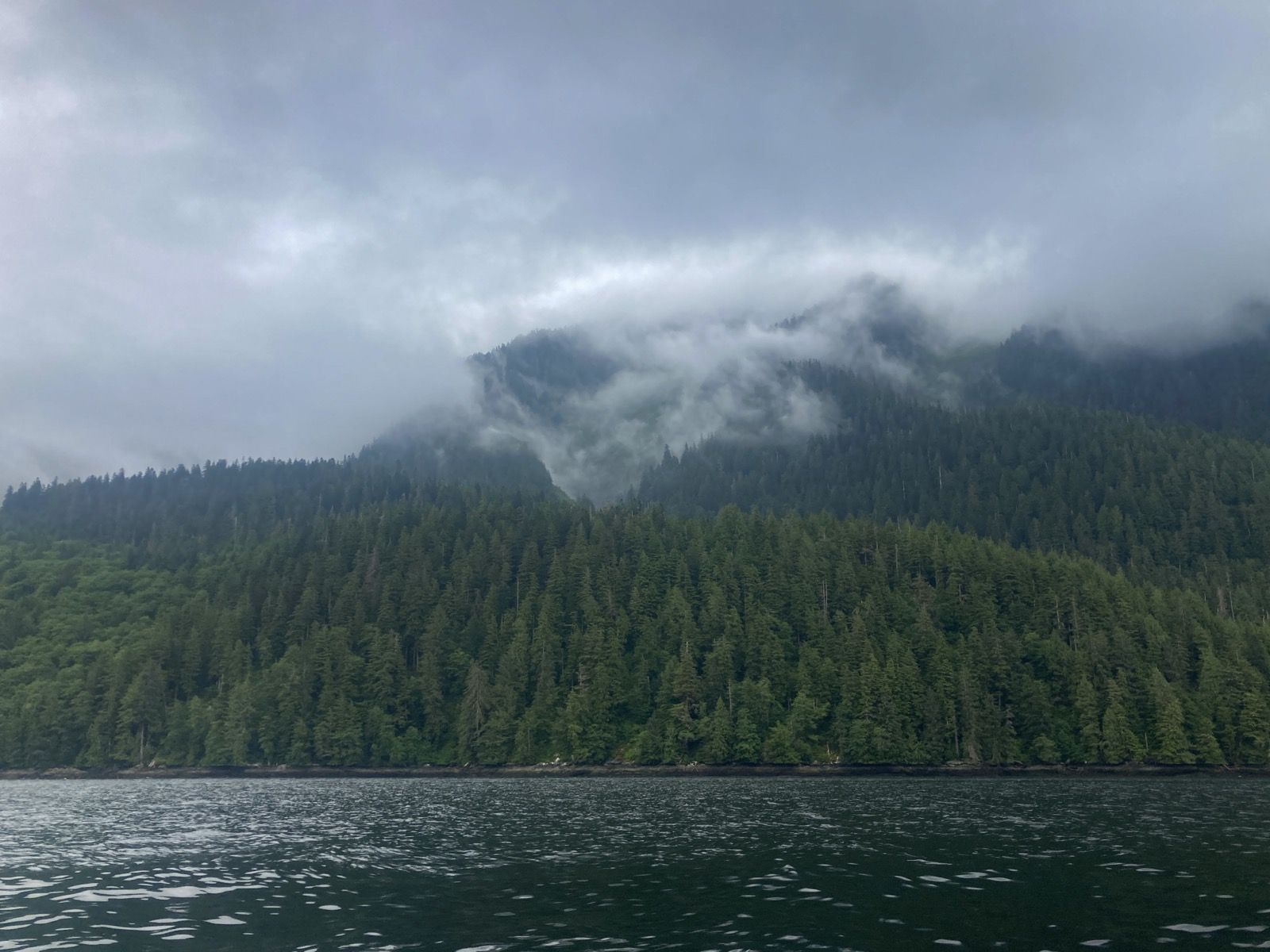
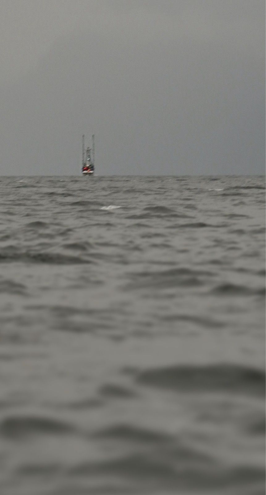
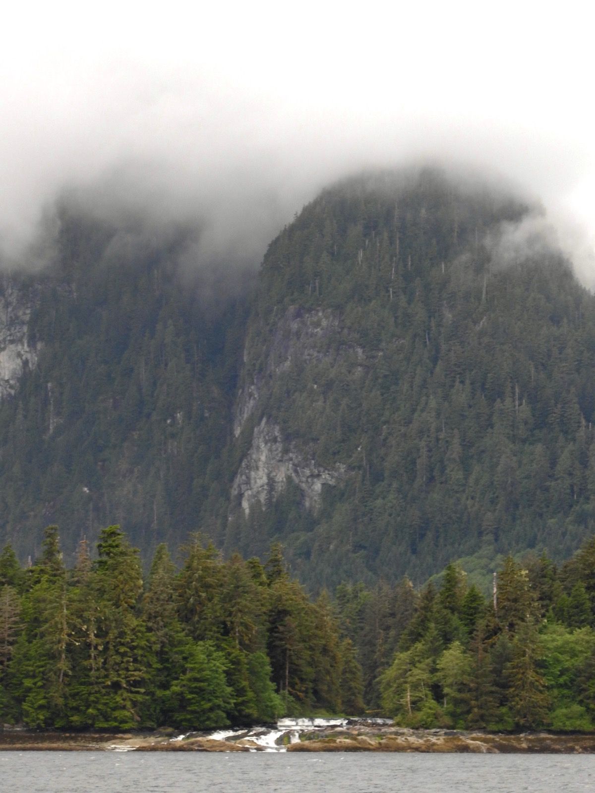
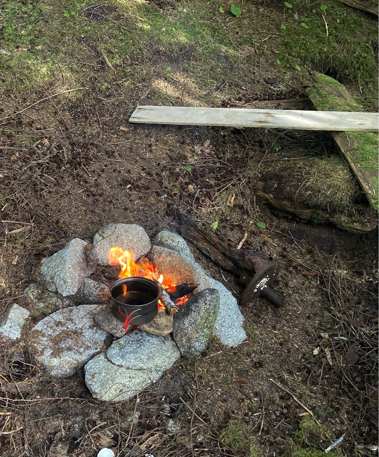
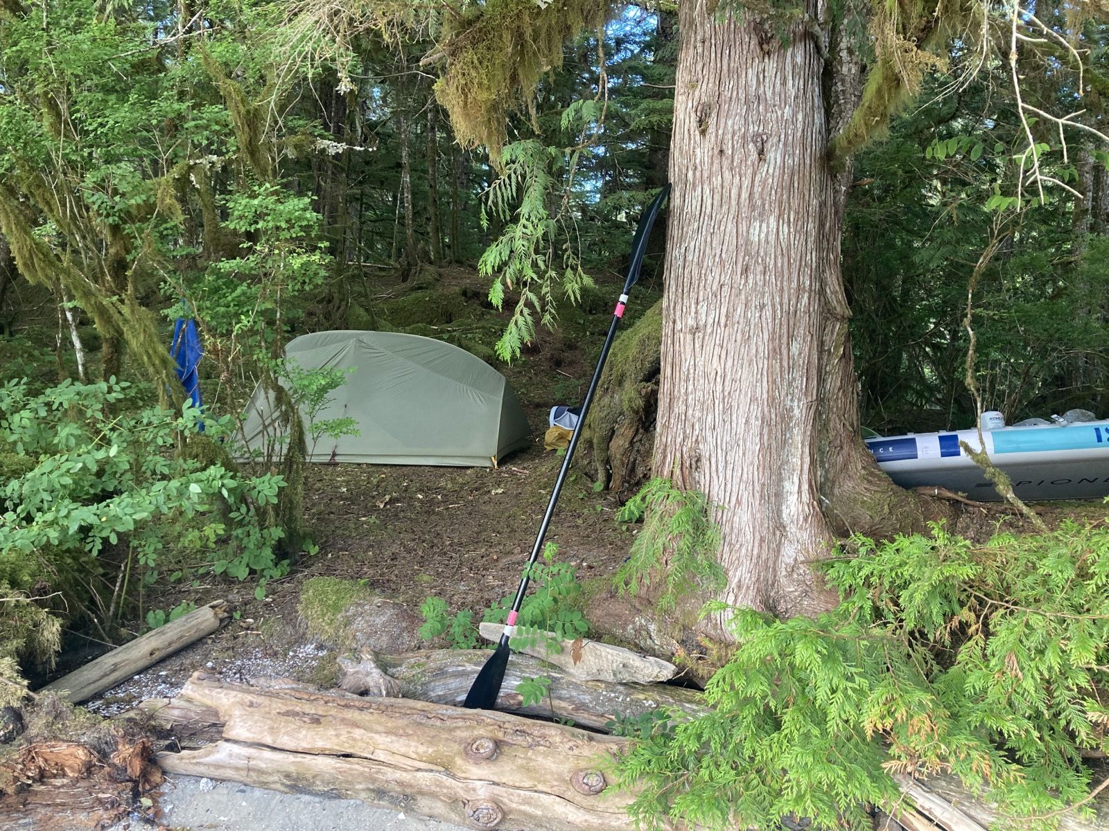
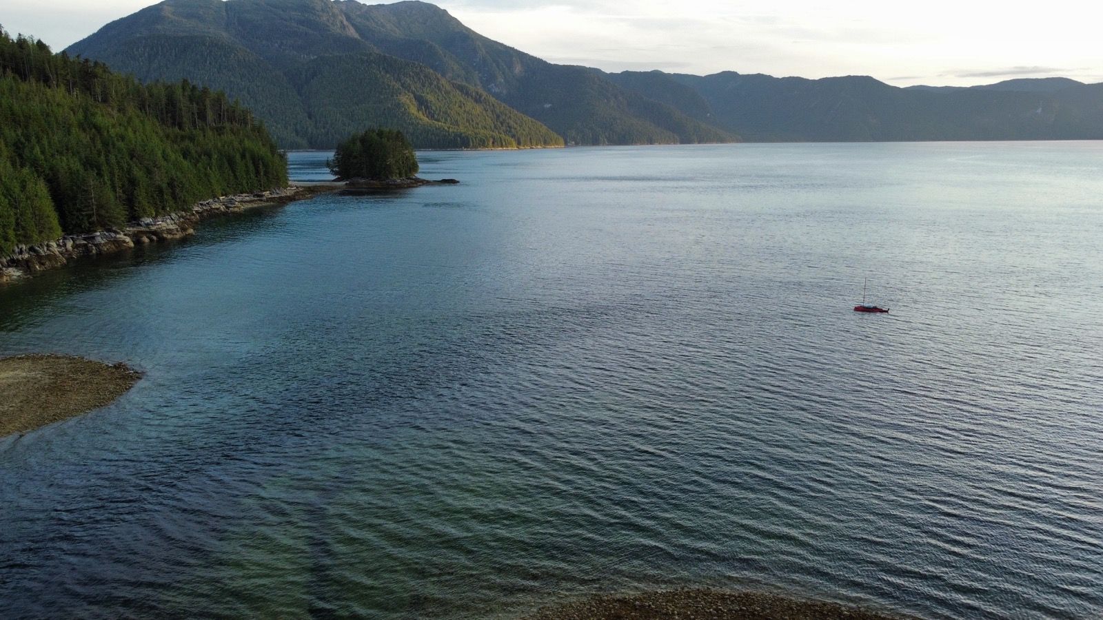
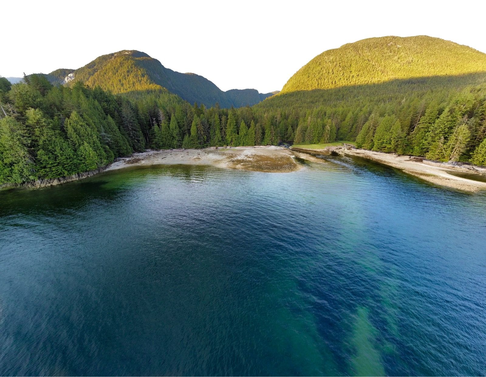
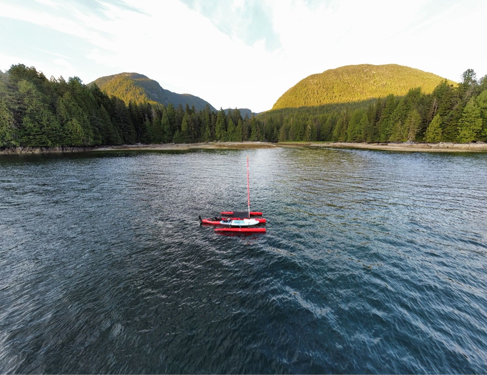
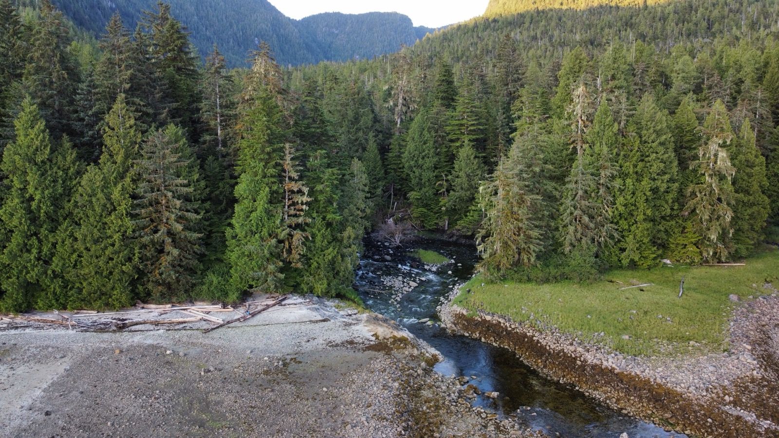
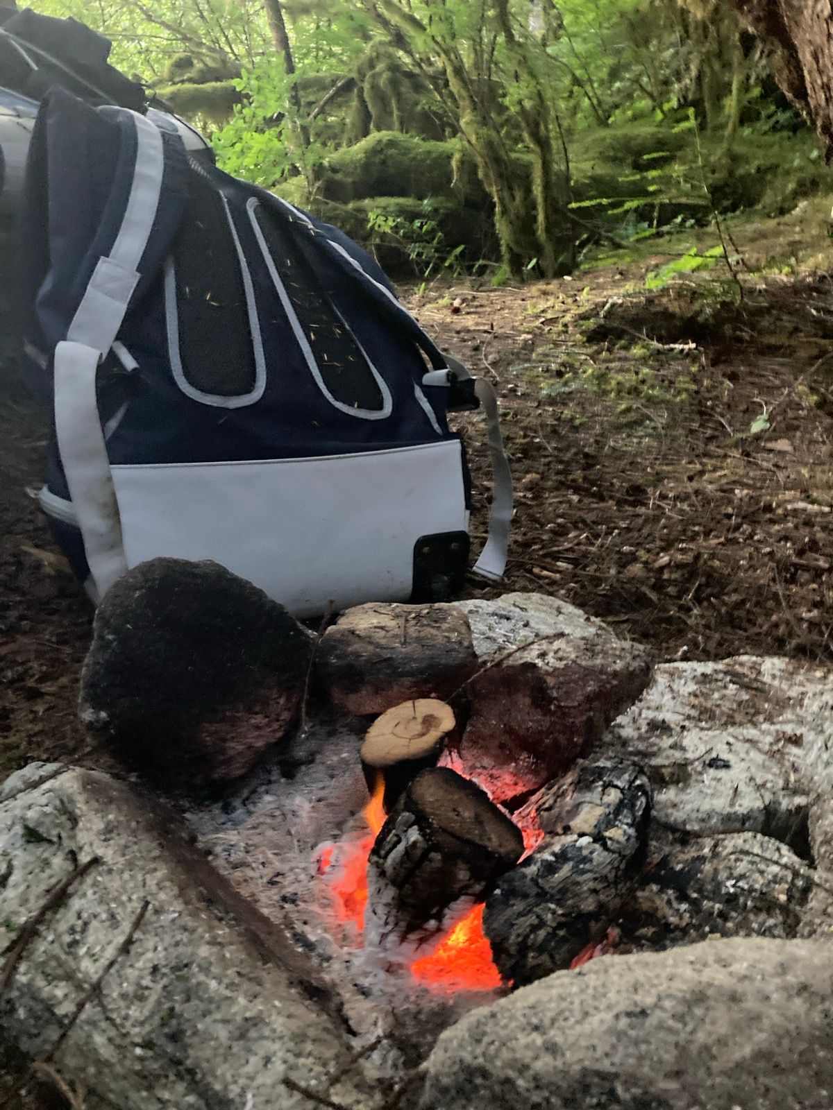
Strava Comments:
Anthony C.
Janet W.
Mark G.
Ride Stats:
| Elapsed Time | Moving Time | Distance | Average Speed | Max Speed | Elevation Gain | Calories Burned |
|---|---|---|---|---|---|---|
|
11:11:10
hours
|
09:55:05
hours
|
54.50
km
|
5.49
km/h
|
11.52
km/h
|
17.50
meters
|
1,456
kcal
|
– Day 26 : Food for thought [top]

I finally made it to Bishops Bay, Hot Springs. I haven’t seen a human being in a couple of days now, and I have been feeling kind of lonely. Last night I made a fire again and I was thinking to myself how somehow the fire makes things a little bit less lonely . It is hard to explain. I was trying to figure out why that is. In regard, I remember my niece named our fire Calvin one time as if it had a personality of its own so I reflected on that quite a bit as I sat near the warmth. The other possibility is that the fire is something that I need to take care of. Kind of like a child or maybe another person who is in need of your help which makes you feel less alone because you have a purpose. Either way, the fire brought a little bit of light into my evening – which had been the end of a very hard day.
When I finally got to Bishops Bay Hot Springs, I was a little dismayed to see lots of people there. This may sound strange to say right on the heels of saying that I had been lonely, but for some reason I had envisioned enjoying the hot springs all by myself.
I pulled up to the dock, and right away a guy named Clayton came out of his boat and said,
“So you’re the Red Lobster! I saw you on the AIS, and I thought you were going to be a bigger boat!”
The highlight of the Hot Springs was not actually the Hot Springs themselves. These particular springs had a wooden roof over them which somehow made them seem closed in less natural. Also, they were probably a dozen people in the spring or on the deck nearby, making it feel a little bit claustrophobic. It is kind of crazy that I can go so much time without seeing a single soul and then all of a sudden in this remote place, see a dozen people.
But the people were nice and I went into a tub with three people from Klemtu, which was the town I had bought food in 2 days ago. That town has about 200 people and it is comprised of a First Nation population (Americans, think: Native Americans). This group of three were here because they were on a little retreat from their job, which is multifactorial. A big part of their job however, as the young woman told me, is resurrecting a language That now has no native speakers. The last woman to speak this language died about 10 years ago and they are working hard to record as much as they can from people who knew her so that they can keep this language alive. They are building a curriculum so that other people can learn this language before it is completely lost.
“so are there a lot of people who want to learn this language?” I asked.
“Ha ha, I wouldn’t say that,” she replied. But apparently they are working to make sure that it is taught anyway.
I wondered about the purpose of learning a language that no people speak, but I also thought about the sadness of losing something regardless of its utility. The name of the language is “Skwxwú7mesh,”
After I soaked in the hot springs, I went back to the dock and there I talked to a couple of other people who had come in and spent the night more there. One couple was from BC, and they offered me eggs from their chickens and a little box of dehydrated hashbrowns. You know I don’t eat carbs, but I am worried about my food supply running low because I still have several days before I get to Prince Rupert. Then two guys who were power boating, a boat from Sitka Alaska back down to Washington also offered me food. Their names were Matt and Erik. Eric was from North Dakota and Matt was from Washington. They offered me smoked salmon that they had caught and venison that Matt had shot “in his backyard. “ They also gave me a bag of nuts, a bag of granola, and a bag of vegetables, all of which Matt had prepared himself at home and then vacuum sealed. Even though I probably could have food-rationed my way to Prince Rupert on the provisions that I have, but this gives me a lot more comfort and lack of worrying about running out of calories. Already I have had to expand much more energy than anticipated because the last two days have been against current, when I expected the current to actually be pushing me along. Normally, I am the type of person who says no to any type of charity. I’m really not that good at taking gifts from people. But today, I truly was worried about having enough food to make it, especially since I had been burning through calories more rapidly than anticipated, so I am very grateful for the kindness of these people.
As I was pedaling away out of Bishop Bay, the driver of the three First Nation people who I had met, pulled their boat close to me, and I could see that the young woman who I had been talking to had a bundle in her hands. She indicated that they had a package for me and so we pulled alongside each other and she tossed a bag of six premade sandwiches into my lap “snacks” she said. I thanked her and now I definitely have plenty of food, though I am a little bit concerned because I haven’t eaten bread since Africa.
One of the many good lines from the Lee Brice song “love like crazy” goes: “don’t outsmart your common sense.” That single line seems to apply to much of life – and today’s events highlight that. I tried to outsmart the movement of the water, which is clearly a fool’s errand. Moreover, this morning, I thought I wanted to be alone at the hot springs, yet through the strange twist of events – my spirits were buoyed by people’s fascination with a pedal powered plastic boat and their generous desire to help with food. I had been thinking of skipping one of the 3 hot springs out here – but they renewed my motivation and provided the sustenance needed to pedal through.
—-
Sunrise 5:43
Sunset 9:45
Moon 2% Waxing
Pressure 1017.5 steady
Photos:
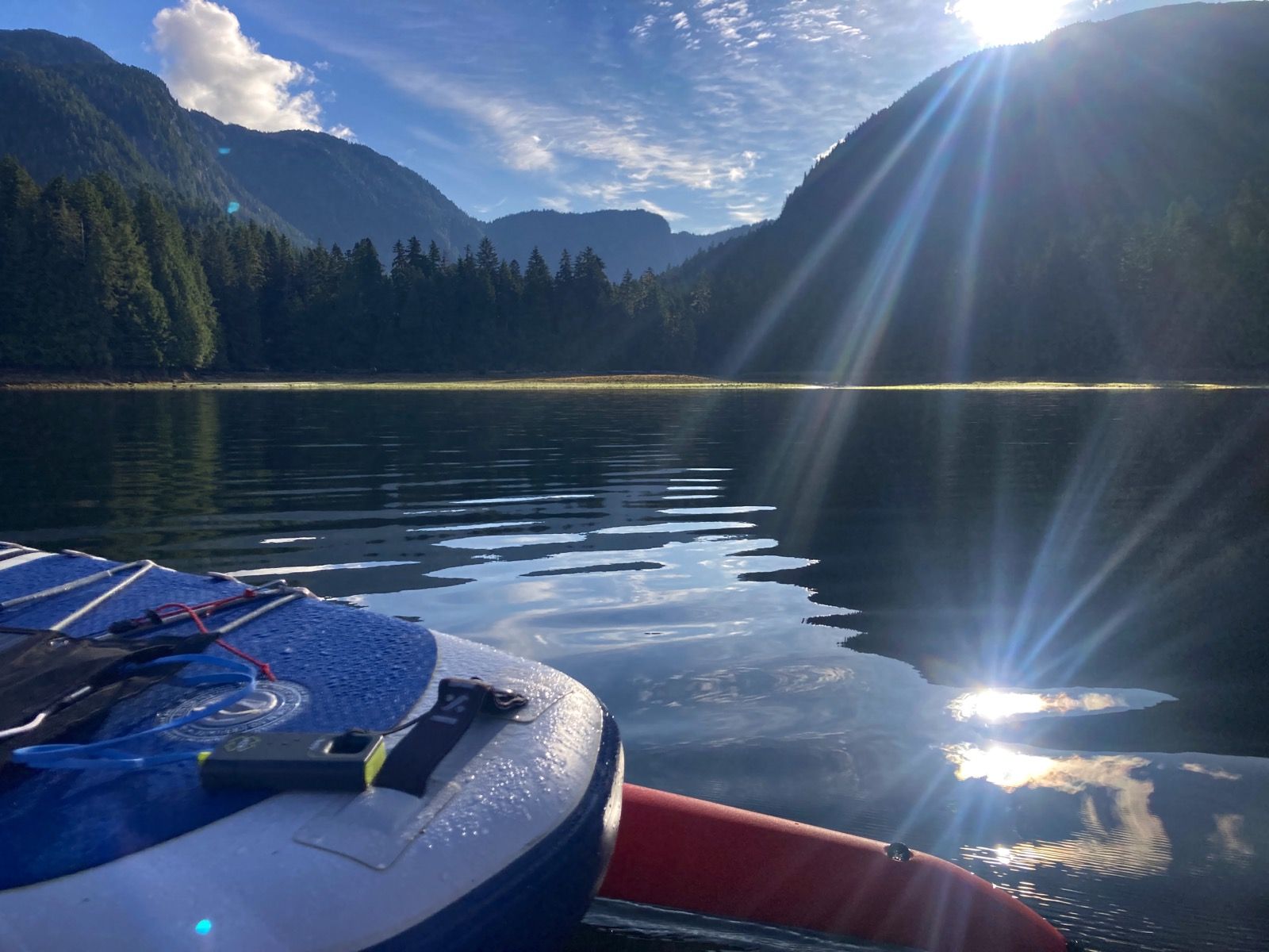
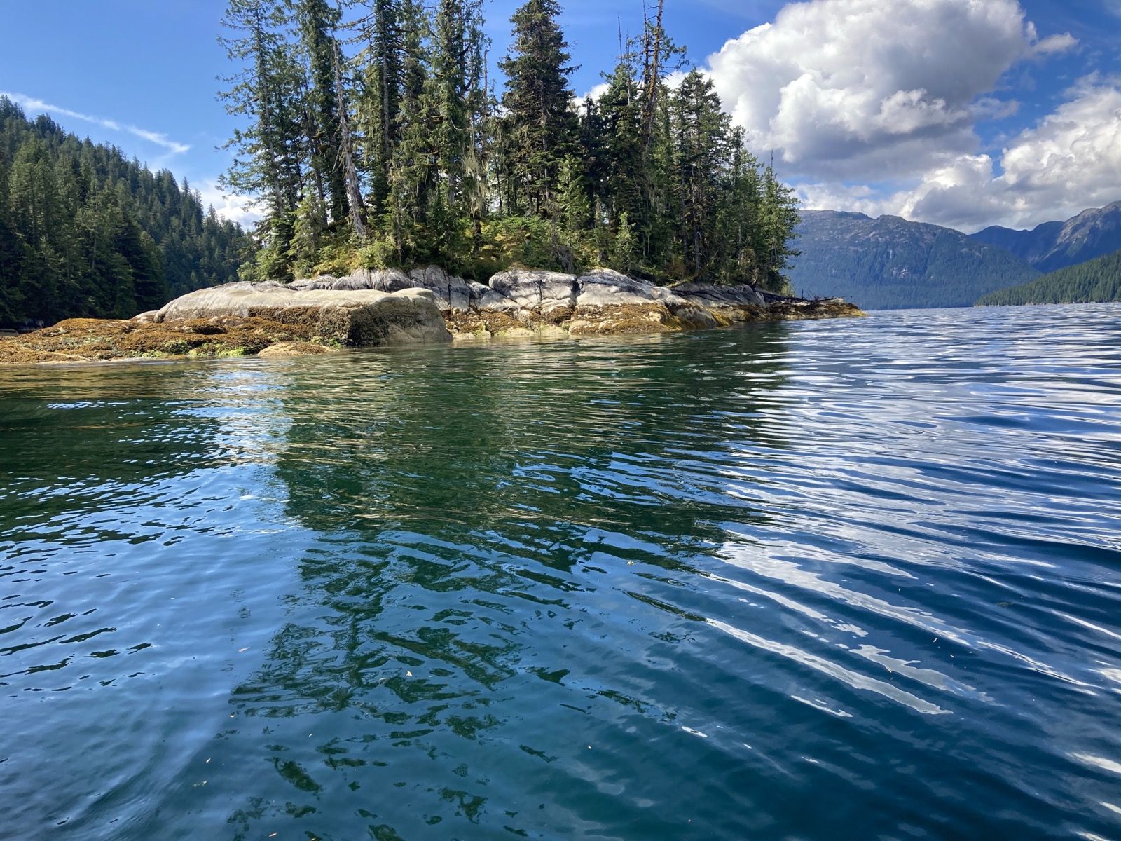

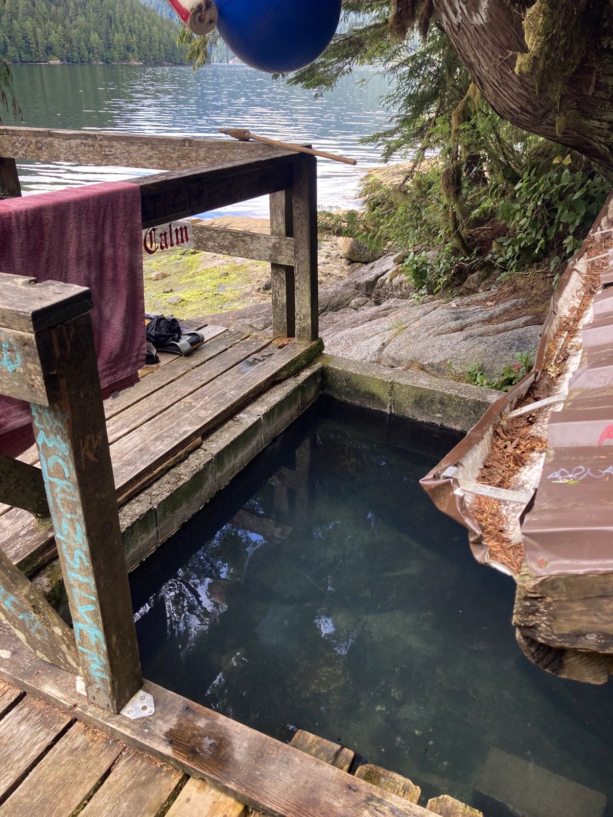
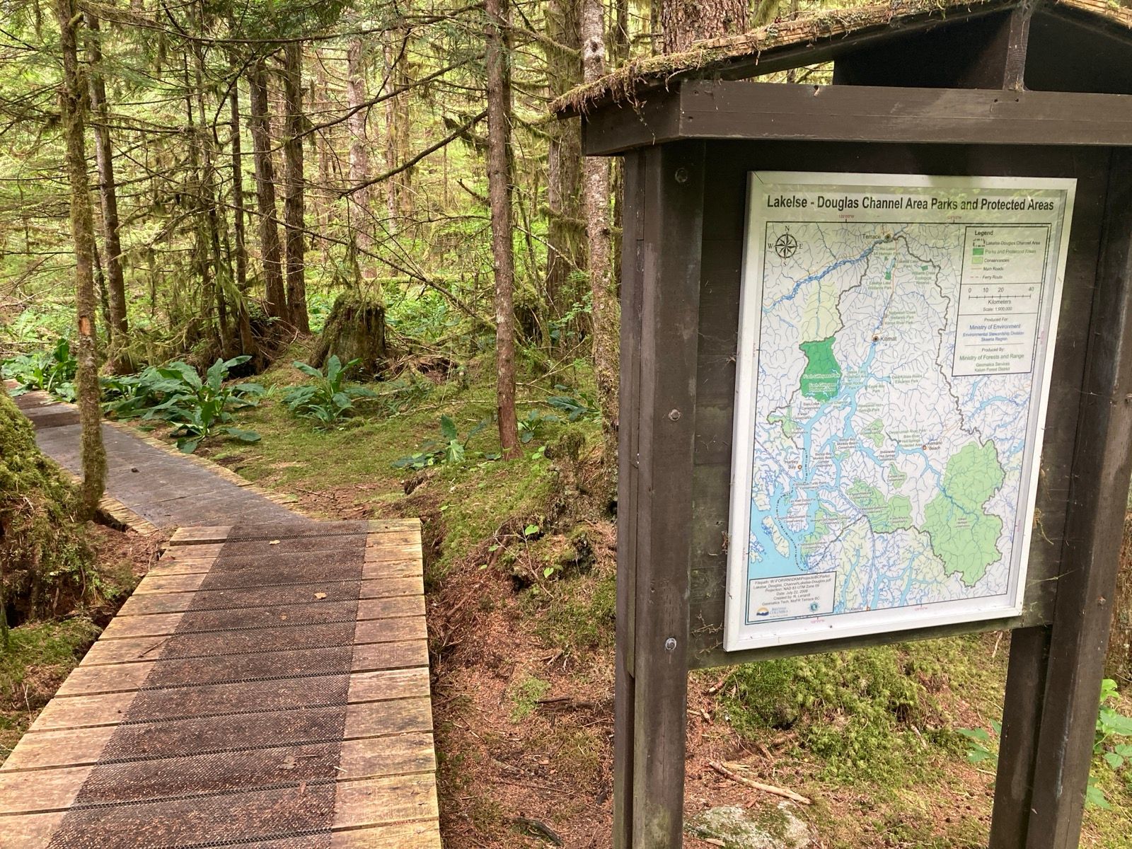

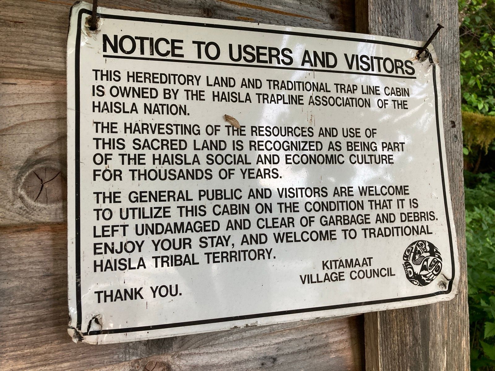
Strava Comments:
Tracey A.
Janet W.
Brian L.
Mark G.
Clayton C.
Ride Stats:
| Elapsed Time | Moving Time | Distance | Average Speed | Max Speed | Elevation Gain | Calories Burned |
|---|---|---|---|---|---|---|
|
09:47:43
hours
|
07:43:10
hours
|
35.06
km
|
4.54
km/h
|
7.40
km/h
|
21.30
meters
|
1,372
kcal
|
– Day 27 : The dark side of the moon [top]

I fought the contrary tide for over an hour, sometimes being unable to make any progress, even slipping backwards or drifting laterally at some point. The foul Tide produced a foul mood, but nothing lasts forever – a positive aspect of bad things – and soon the tide turned briefly in my favor. Just like yesterday, the sun was out in full force, and because there hadn’t been any wind yesterday, there was nowhere left to store the Helios’ munificent energy. All of my batteries were fully charged, except for the one Iniu battery that refuses to accept a charge from a solar panel. So I decided to use another cache battery to charge the Iniu battery and then charge that battery using the panel; a sort of a robbing-Peter-to-pay-Paul scenario. I need the Iniu battery, because it is the only one capable of producing a high enough voltage to charge the AIS beacon or run the raspberry pi. The only other thing that can provide this kind of voltage is the solar panel, which is satisfactory for the AIS Beacon – but dangerous to try on the raspberry pi.
Speaking of the raspberry pi, I haven’t actually had to use it, nor have I had many opportunities. Typically, I like to plug it into a television screen for a display, rather than use my tiny phone. During the entirety of my trip, I have not come across a television screen . I tried to do some work the one day that I had Wi-Fi, but did not make much progress given my phone‘s tiny screen. Last night, however, I discovered that the app for my Nikon P900 only lets me transfer photos via Wi-Fi, not videos. So I did use the raspberry pi last night to copy the videos from the camera card to the pi, and then from the pi onto my phone.
This trip has been unique enough to me that I have decided to start recording video so I can produce a low-budget type video for YouTube.
One reason I want to document the journey is simply to remind myself of how much I like it out here. There are definitely times when I am very frustrated by foul tides, relentless sun, or choppy seas, but there are other times when I think that there is nothing else in the world that I would rather be doing. I really do love it up here, with the long days and agreeable temperatures in the shade. Even when it rains, I find that the temperatures are comfortable.
The current reversed for my entire journey up the inlet – the tide was coming in strong, but the water was flowing OUT – fast. Could it be that the streams and rivers feeding the inlet dump more water than the tide can push in? If so, that means I have a free ride out of here at any time of the day tomorrow.
Luckily, a solid wind from the North West whipped up, pushing me over the flowing water. I even stopped pedaling for a while and read 22 days of Janet’s journal entries. It was nice to see more detail about what she has been doing. I am so alone out here. I like it, but I also miss her a lot.
I arrived at Shearwater (Europa) Hot Springs at 5pm, and first checked out the cabin for sleeping, but decided to use my tent instead. Maybe I am like a dog who feels safe inside a crate, but last night I didn’t sleep as well inside that cabin as I do inside of my tent.
After clearing a spot and putting up the tent, I built another fire – this is unusual for me to have so many fires, but I used this one… I took the venison that Matt gave me yesterday and skewered it and rotated it over the hot coals. This meal lasted an hour as I cooked each piece one-by-one. It was heavenly! I never imagined venison to be so good. I thanked Matt and immensely enjoyed this quiet hour cooking and eating.
Next I paddled over to the actual hot spring – it was several minutes away by paddleboard. I’ve started to become comfortable and confident getting in and out of the water all the time. Basically, you’re gonna get your feet wet… and maybe your thighs. Once I stopped trying to avoid that (during the ICW last winter) things started going much more smoothly. The hot springs were delectable. Supposedly the best on the North Coast – and Im going to go ahead and agree. I had the crystal clear pools all to myself.
Finally it was time to settle on – but on the way back I saw my boat was dangerously close to some submerged tree trunks that hadn’t been exposed earlier. Actually, the boat had drug the anchor! I pulled it up and set the boat much further out, but no matter what I tried, I couldn’t get the anchor to set! Finally, I gave up, figuring that the wind would diminish soon, and that the anchor (while not set) would still provide a decent amount of resistance. Not sure why it wouldn’t set, though.
Apart from these challenges and the baking sun, today was a wonderful day!
——
Sunrise 5:42
Sunset 9:42
Moon 7% waxing
Pressure 1012.8 rising
Photos:
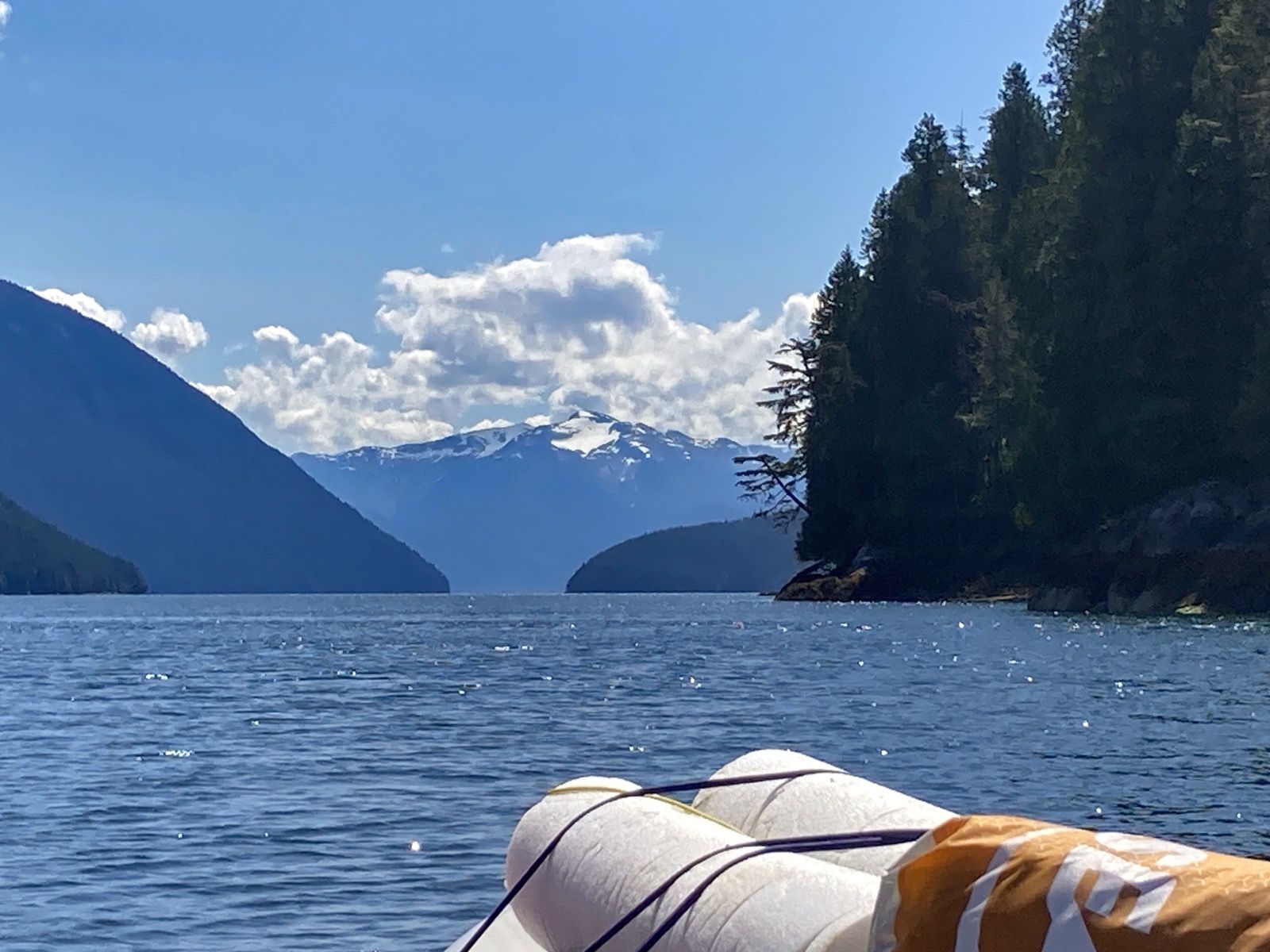
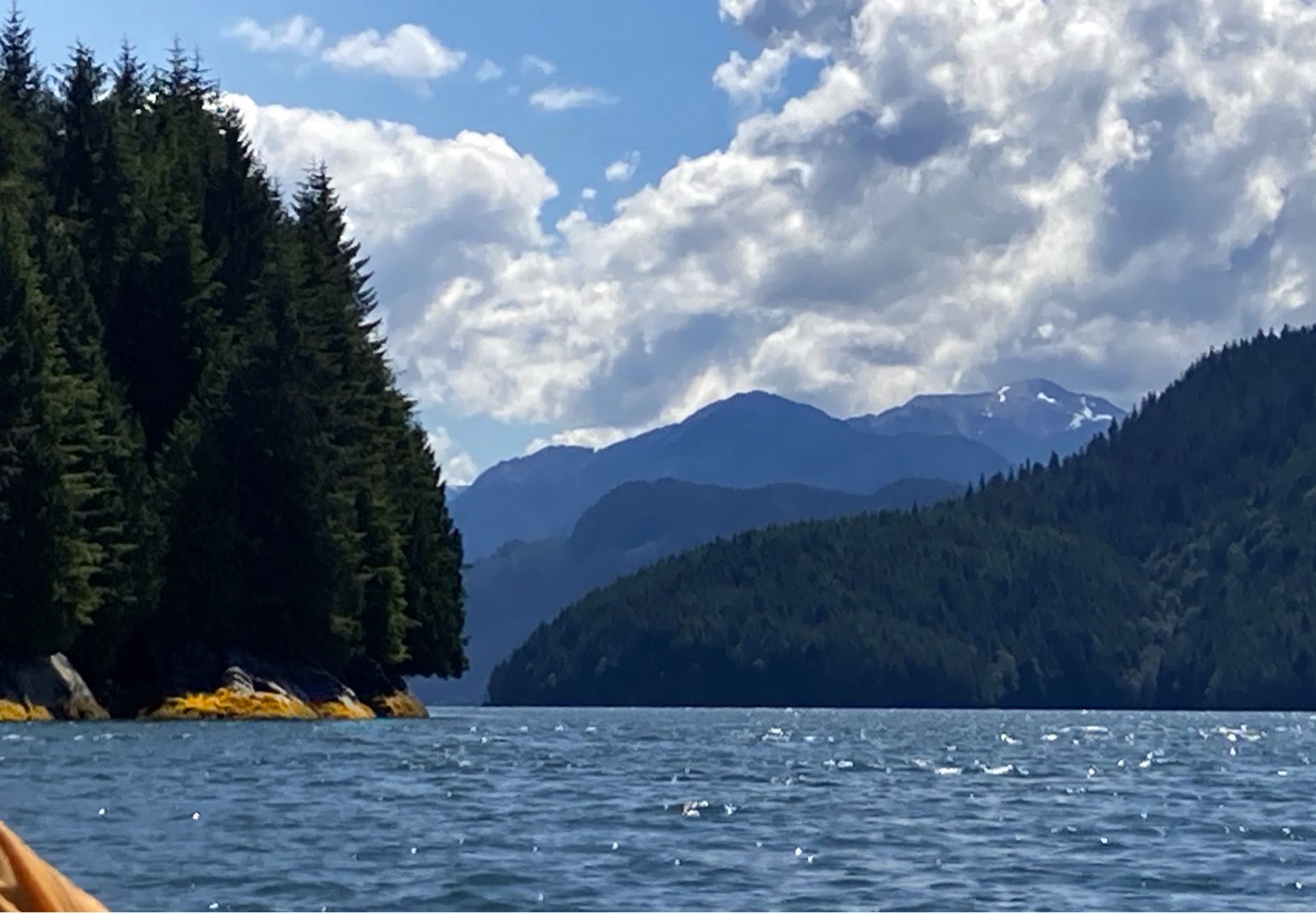
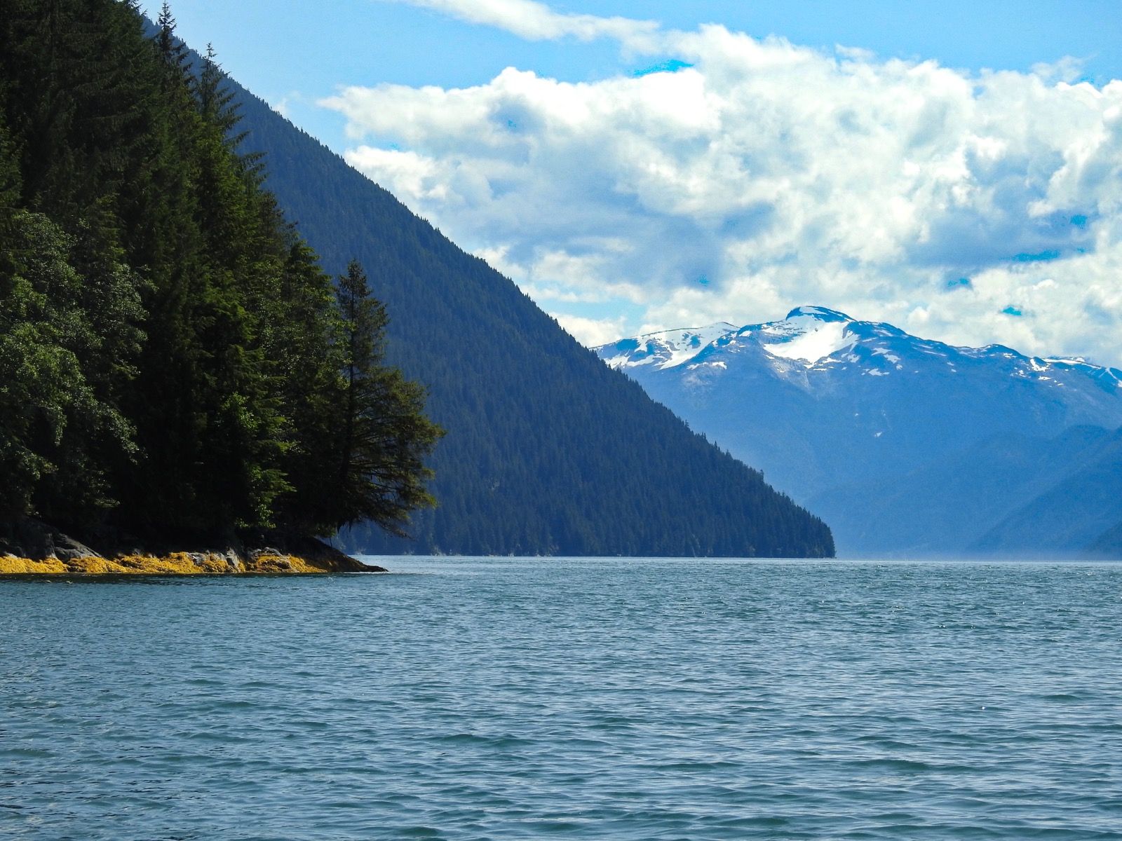
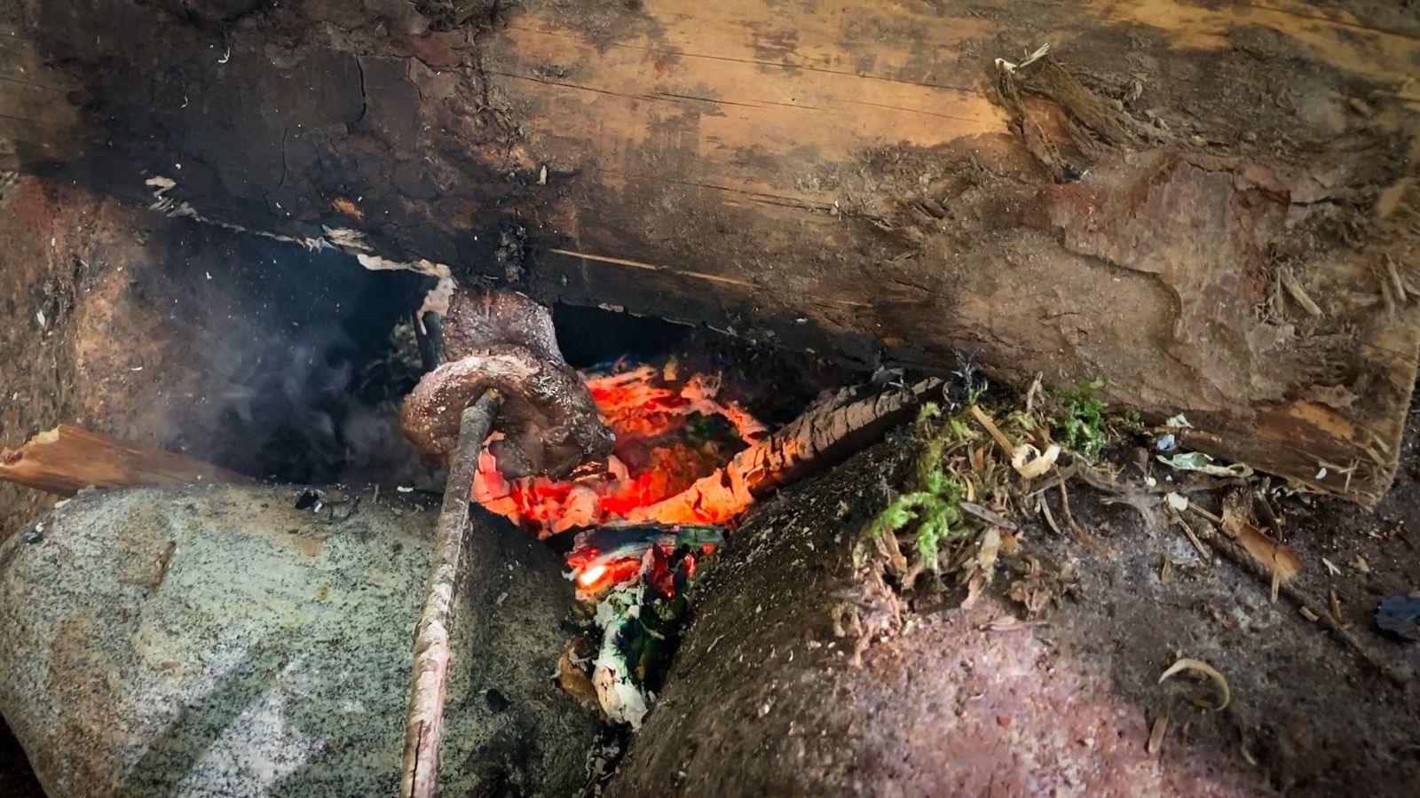
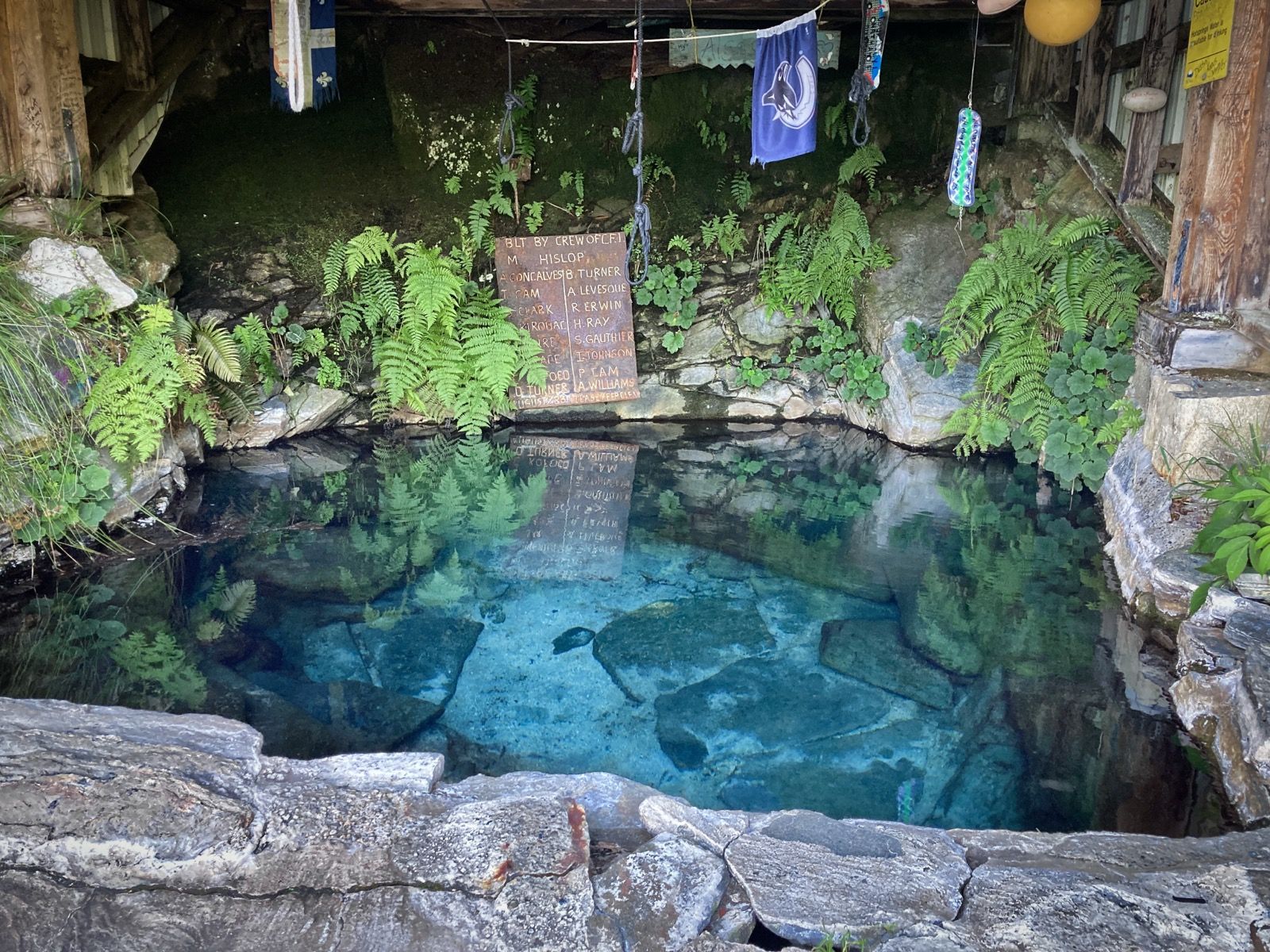
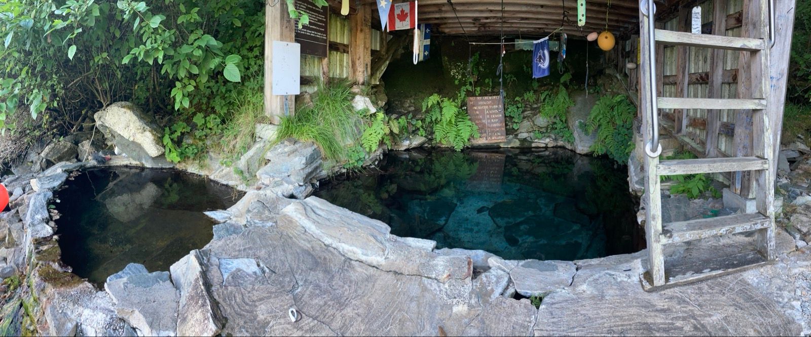
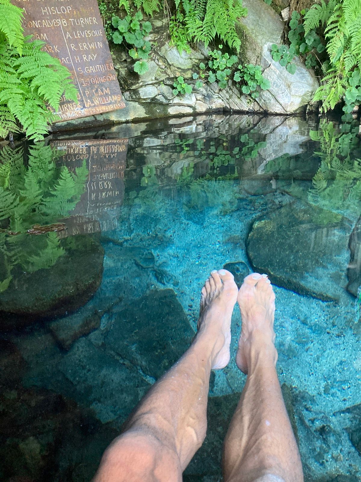
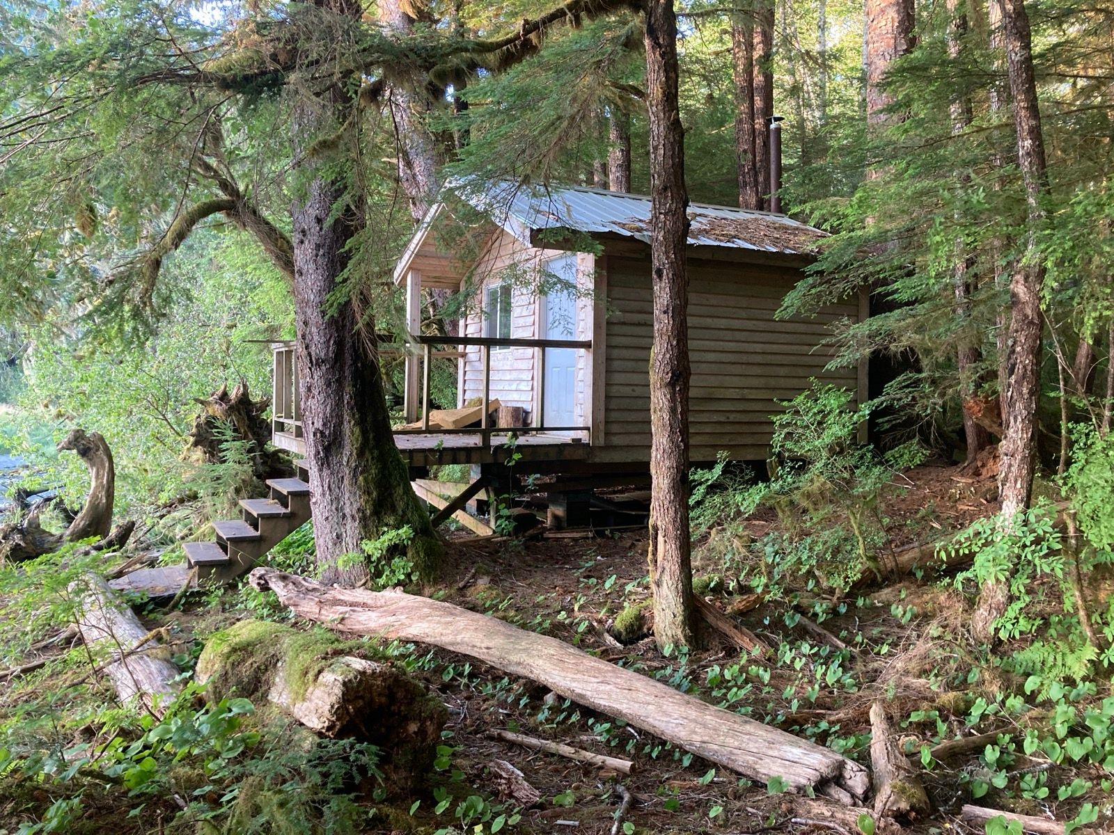

Strava Comments:
Janet W.
Stan H.
Mark G.
Ride Stats:
| Elapsed Time | Moving Time | Distance | Average Speed | Max Speed | Elevation Gain | Calories Burned |
|---|---|---|---|---|---|---|
|
10:50:20
hours
|
09:27:48
hours
|
44.82
km
|
4.74
km/h
|
11.63
km/h
|
11.40
meters
|
1,521
kcal
|
– Day 28 : On Eagles Wings [top]

Once the tent was up, I built a fire and used it to boil the eight eggs that I received from the couple from Kitismat. These were from their own chickens. Interestingly when you boil water over a fire, it is much slower than cooking it over a stove. As a result, the eggs came out just right. I let the eggs cool and then went to soak in the hot spring, which was nice, but would have been nicer without the big horseflies. I spent about five minutes, swatting them and eventually killed all but three. These three were the most adept at evading my swats, and they would even taunt me by flying as close as possible to my head. I did not want to give up because I knew that if I let these three survive, they would be the ones contributing to the gene pool – definitely the least desirable ones to have offspring. With a bit more effort, I finally dispatched these three as well and was able to enjoy the hot spring for the remaining time.
Then I just hiked around, relaxed, harvested, blueberries, enjoyed the scenery, and started another fire to cook the vegetables which Matt had given me. For some reason those too were absolutely amazing. I don’t quite understand why the food that he gave me would be any different, just because he prepared himself. After all, packaged food is packaged food, right? Maybe it is just my imagination.
Since the Internet was created, this is going to be the longest period of time that I have spent away from it. I still have several days until I get within reach of a cell phone tower. At first, I was a little apprehensive about the duration of this absence . Now that I am out here, however, I am trying to think of ways that I can prolong my time, enjoying this wonderful nature and solitude.
——-
Sunrise 5:43 AM
Sunset 9:42 PM
Moon 11% waxing
Pressure: 1018.3 study
Photos:
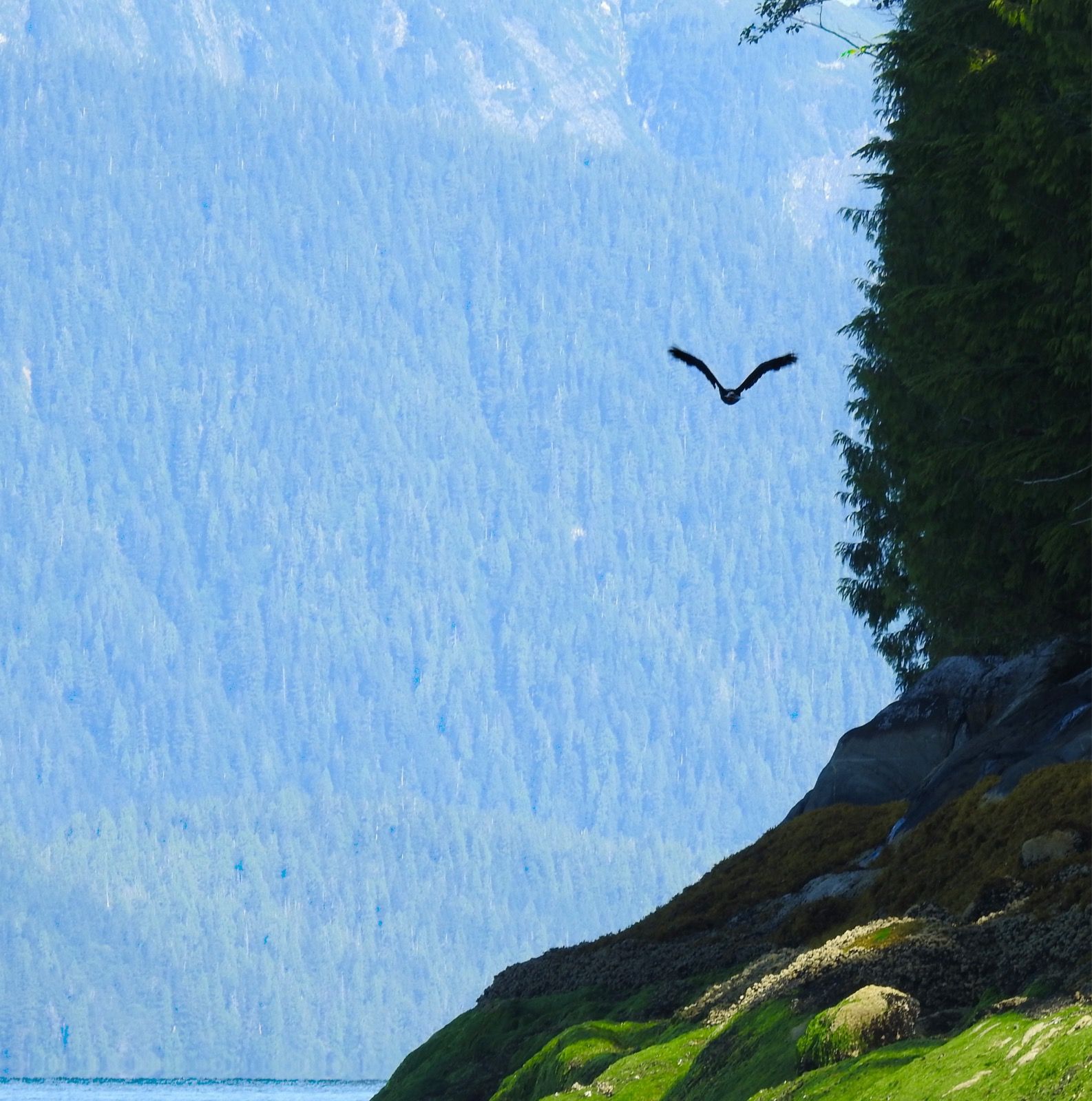
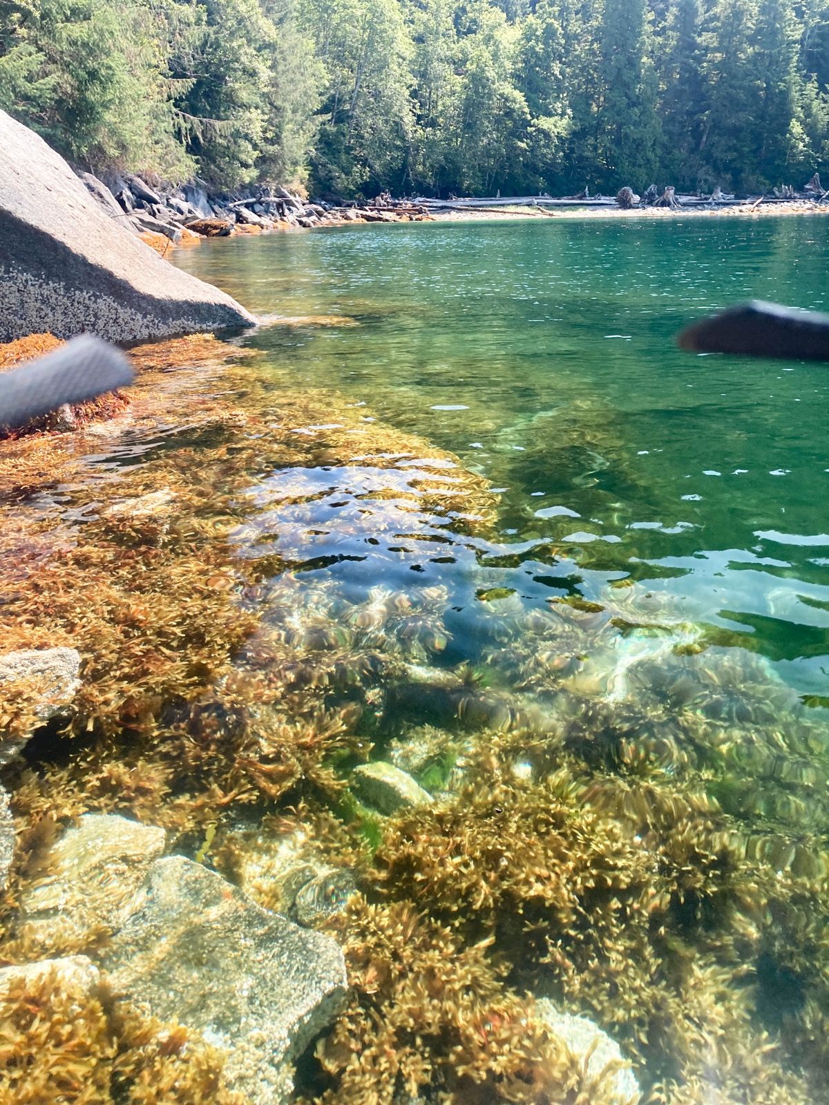
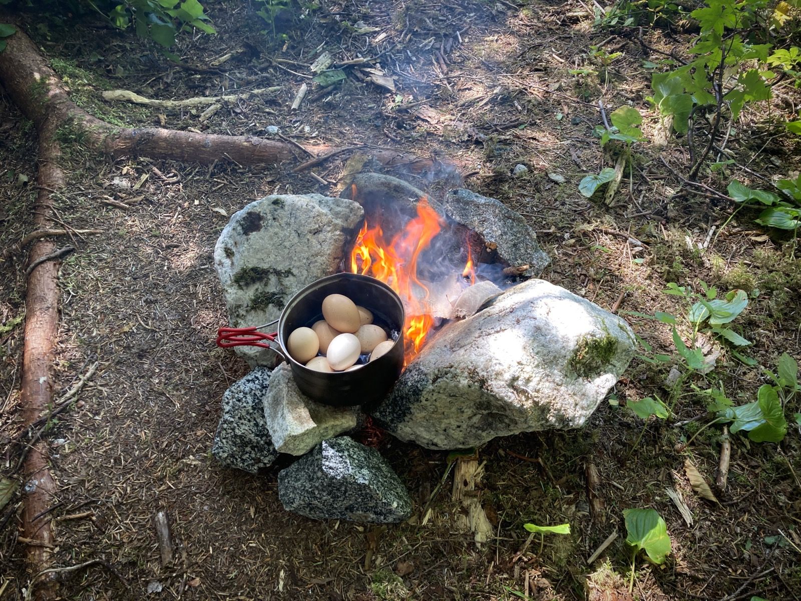
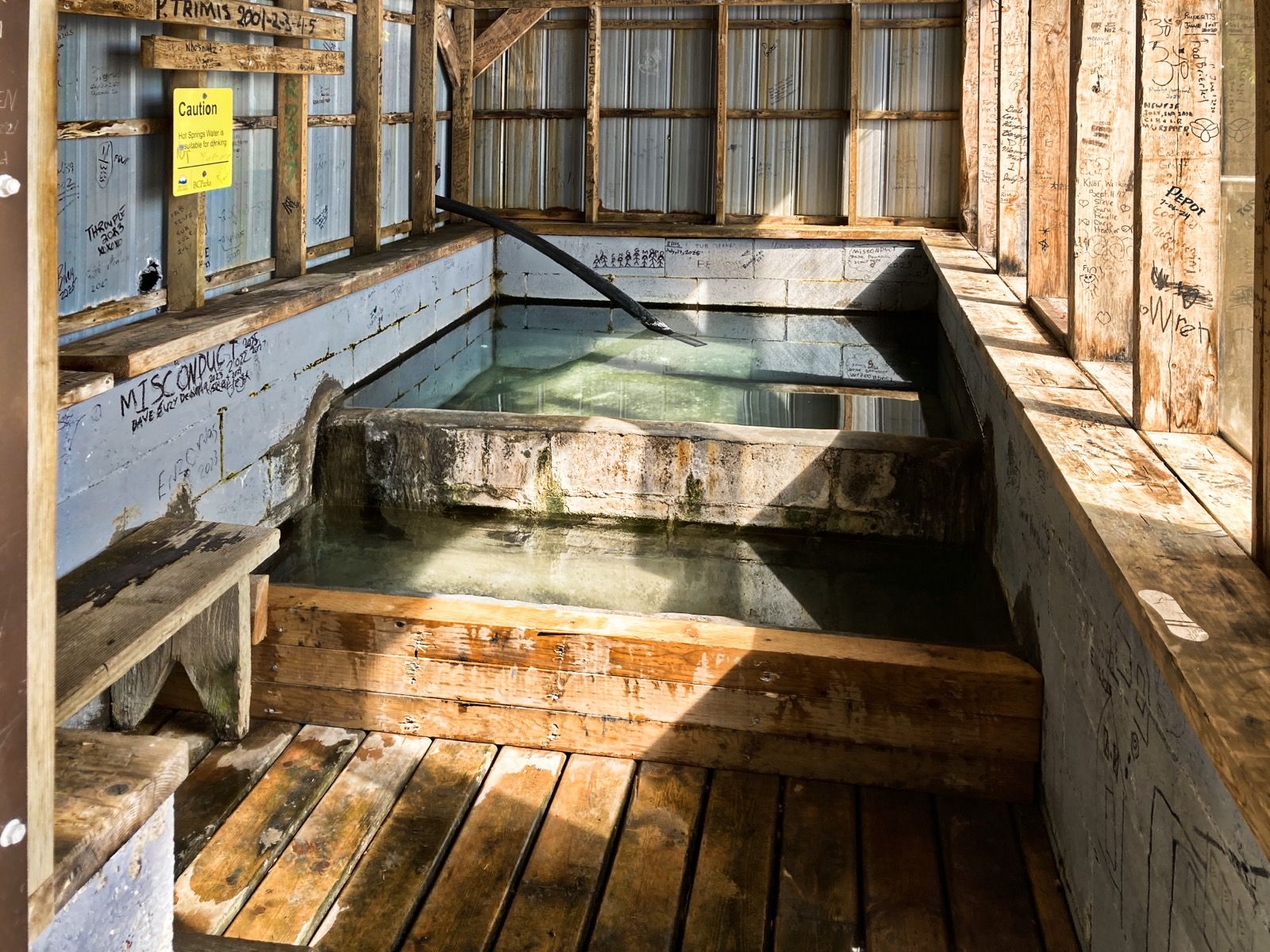
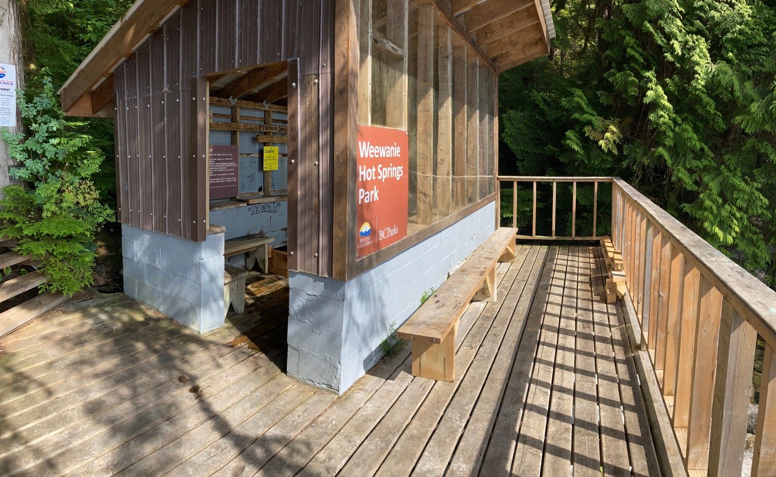
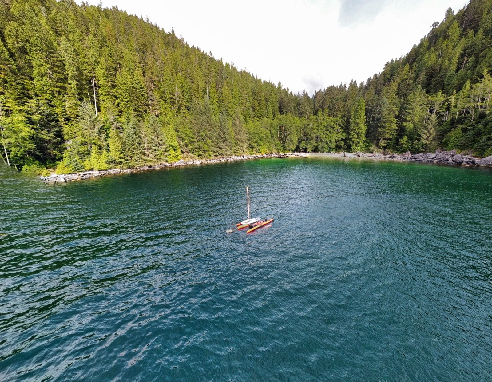
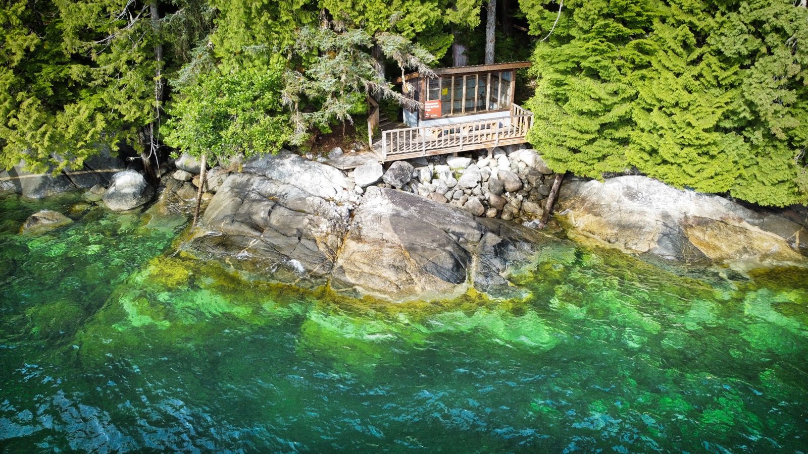
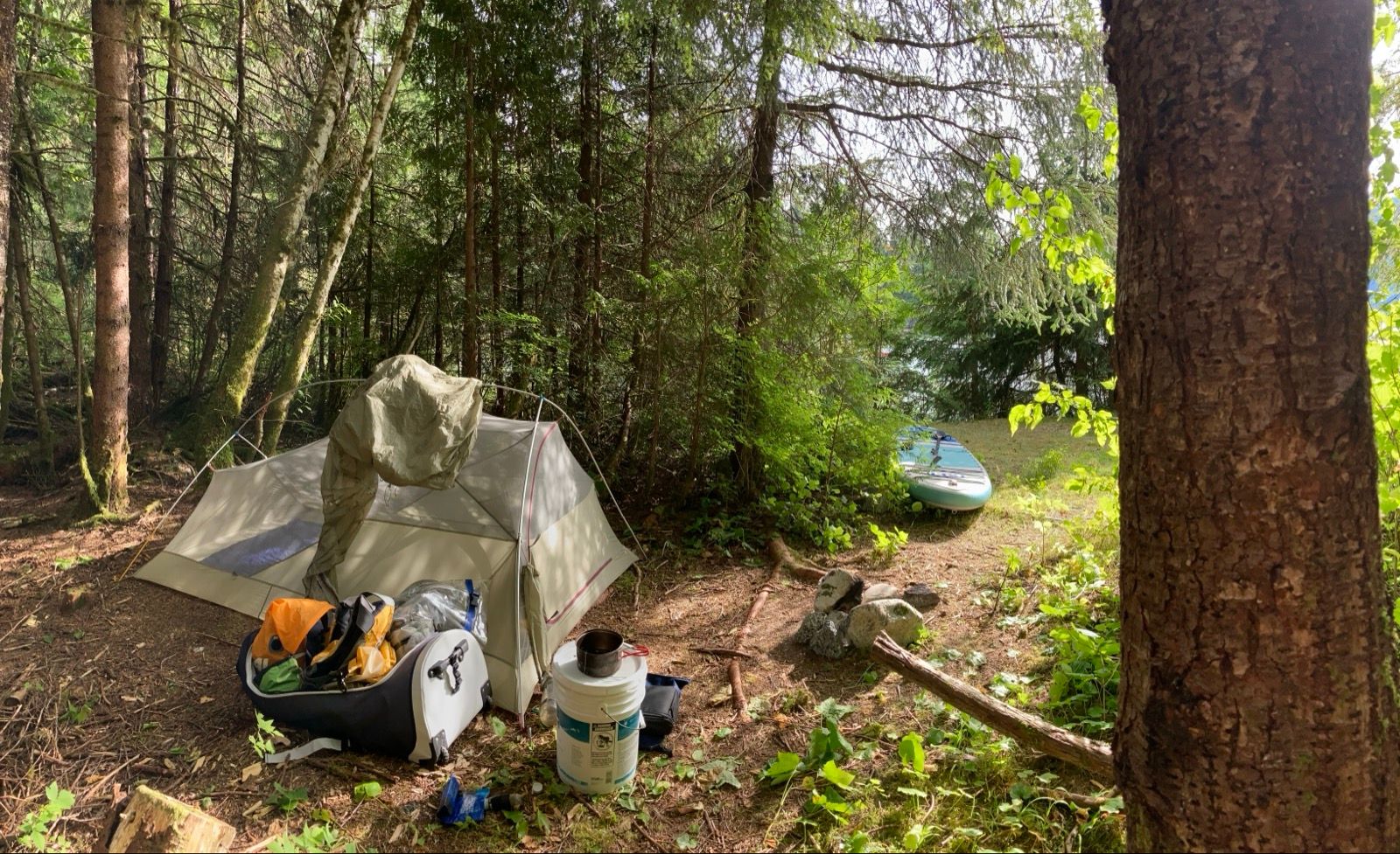
Strava Comments:
Janet W.
Mark G.
Clayton C.
Ride Stats:
| Elapsed Time | Moving Time | Distance | Average Speed | Max Speed | Elevation Gain | Calories Burned |
|---|---|---|---|---|---|---|
|
08:38:37
hours
|
07:06:19
hours
|
39.92
km
|
5.62
km/h
|
12.83
km/h
|
88.40
meters
|
1,187
kcal
|
– Day 29 : Water Solitaire [top]

A strong headwind brewed out of the south , but I was periodically able to make use of it to make headway. Typically a southerly would be very welcome, but today I am returning to the inland passage from my little Hot Springs Loop, which meant I was heading south.
Today there were a lot of high clouds in addition to the wind, but I kind of liked it because one of the biggest problems I have been facing is too much sun. I wore all of the rain gear since I was getting splashed by the 1 foot chop and the headwinds , and this is actually quite a bit more comfortable than baking in the sun, wearing my T-shirt and shorts.
At camp, I gathered blueberries and built a sleeping platform using the foam rollers combined with my paddleboard. I really like these cozy campsites that I’ve been making. I am also a little bit spoiled after having so much good food from the people who I met in Bishops Bay . Tonight‘s dinner did not compare, and I decided to forgo a fire.
——
Sunrise 5:48 AM
Sunset 9:41 PM
Moon 19% waxing
Pressure 1023.1 rising
Photos:
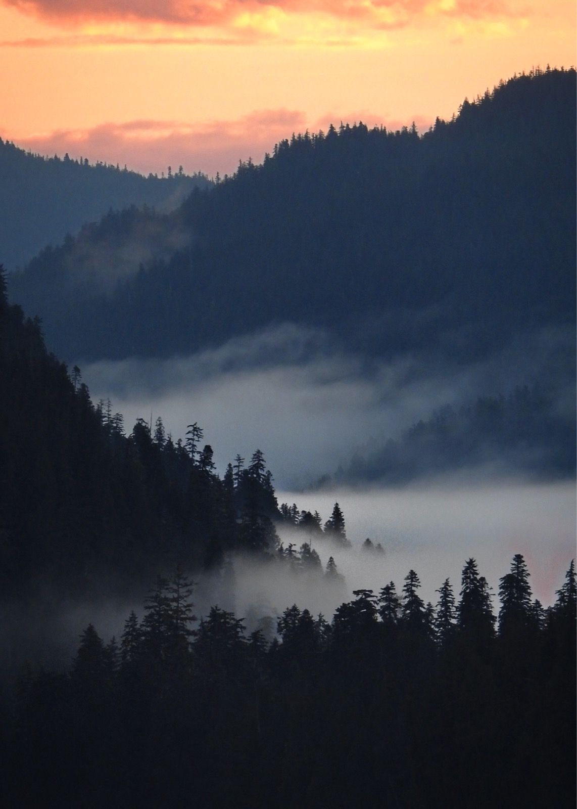
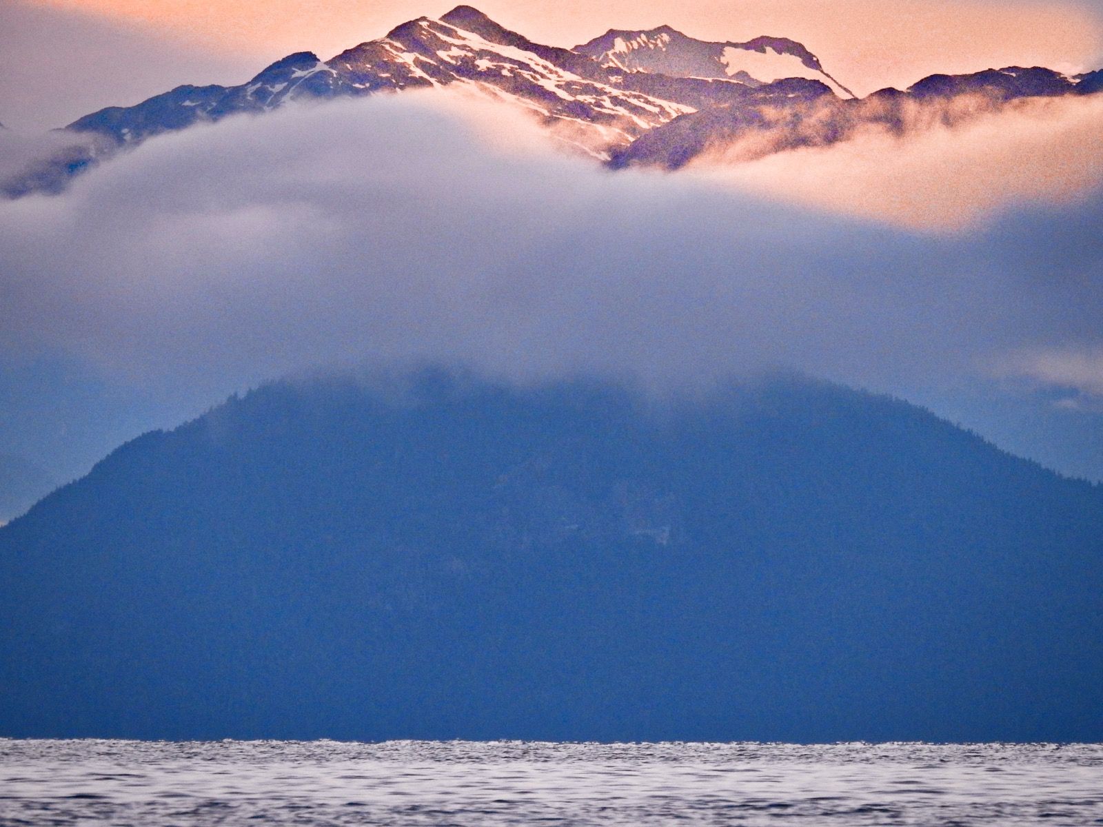
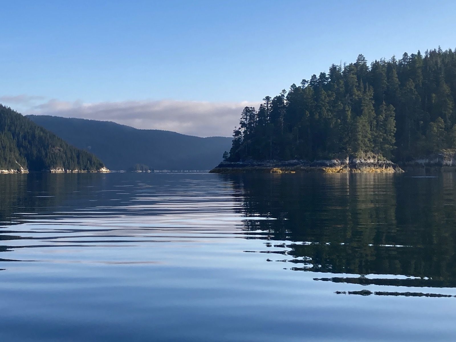

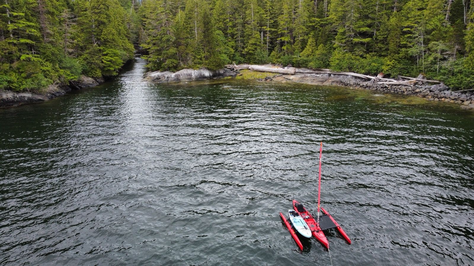
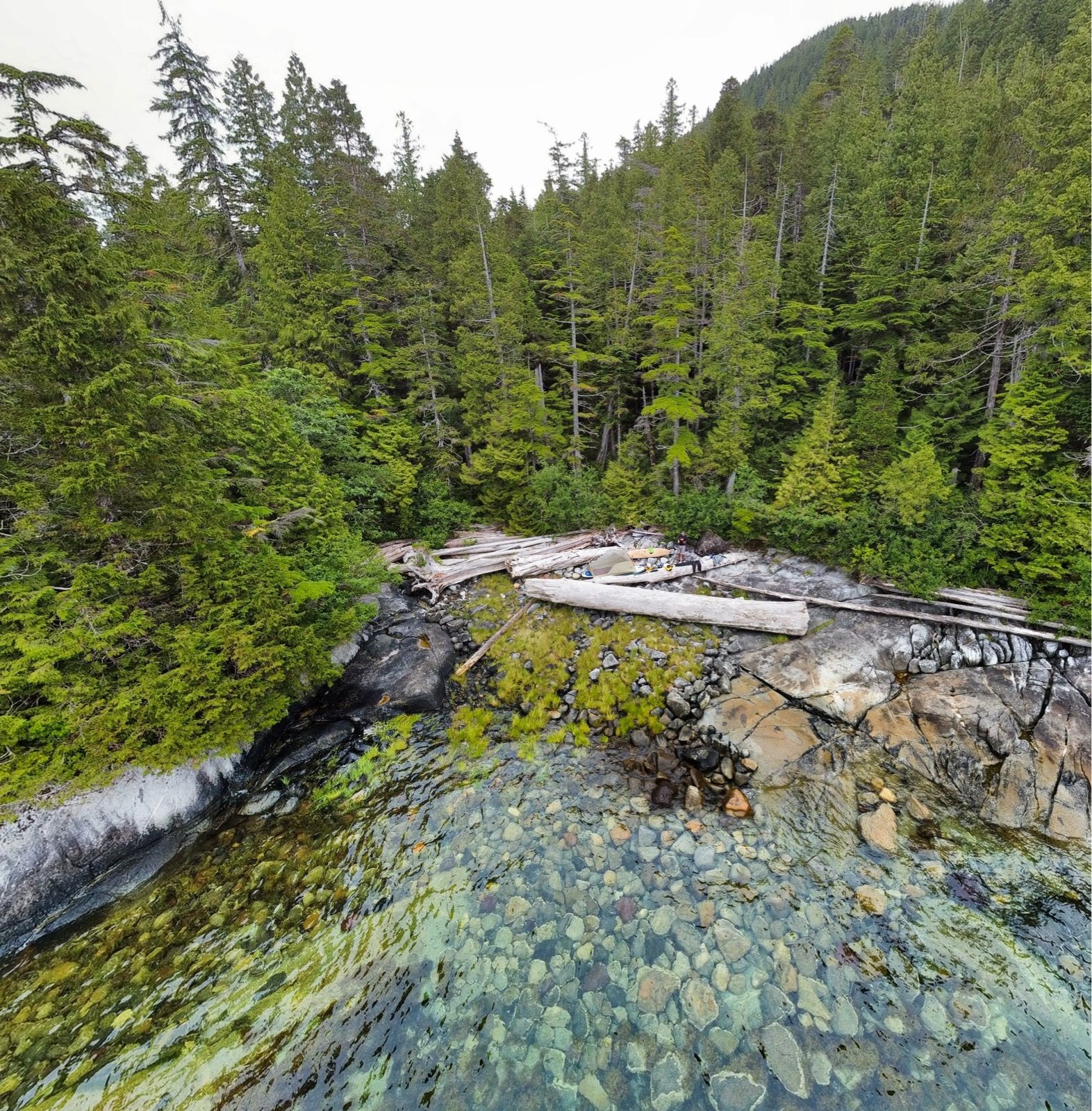
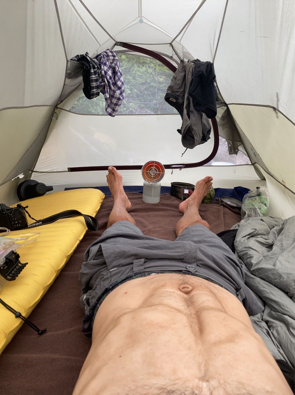
Strava Comments:
brian W.
Brian L.
David L.
Brian L.
Mark G.
Ride Stats:
| Elapsed Time | Moving Time | Distance | Average Speed | Max Speed | Elevation Gain | Calories Burned |
|---|---|---|---|---|---|---|
|
11:45:55
hours
|
10:23:44
hours
|
63.17
km
|
6.08
km/h
|
10.67
km/h
|
23.10
meters
|
1,960
kcal
|
– Day 30 : Wildlife Extravaganza [top]

While I was on the dock at Hartley Bay, a guy named Edgar came up to me and told me that he had the same boat as I do except he had the single person version. This boat is called an adventure island. He had sold the boat though so he could buy a skiff for fishing. He told me that he has a YouTube channel called Edgar fishing . He had two large earrings at the bottom of his earlobes that I could have stuck a good size sardine through.
Just as I was paddling away, another person showed up his name was Taylor, and he was paddling a foldable canoe. He had quite a bit of gear, so I asked him where he was going. He said that he was doing a loop, but all the places that he mentioned I had never heard of. I am hoping that he will send me his map; we exchange contact information. He said that he ported along a few sections and that it was a lot of bush whacking. I thought my trip was hard! When he did his portages, he had to make three trips so by now there might actually be a trail in the sections that he did because he would’ve had to cross six times total carrying each part of his gear separately. I will give you an update if he ever makes a YouTube video; he said he didn’t know what he was going to do with the footage that he was taking. That is kind of how I am: it is a lot of work to make a video and for an adventure the last thing you want to be doing is sitting behind the computer, because usually you are dreaming of the next trip! I asked him what he was doing here, as there was no store. He told me that he had friends here. He used to be the mayor or something of either this community or this region. This is of course, a tiny little settlement with very few people. But I thought it was interesting because he was a white guy, and this was clearly a first nation community. I thought a little bit about how that might work, first nation, People being governed by a white guy? Also, in some of my previous posts, I may have said “Native American“ which is may be true, depending on your perspective of the naming of this continent, but here I think they call the people that lived here before the Europeans arrived as “first nation people”
The reason I did not talk to Taylor longer is because I had a schedule to make. In order to avoid fighting the current in the Greenville channel, I had to get into it around 10:00 AM. I succeed in doing that and enjoyed a very wonderful push up the channel all the way to the lowe inlet. I saw the usual whales everywhere… except that today one suddenly surfaced just a few feet from my boat! I was shocked. It was very big, but definitely not the biggest of whales. It only made minor waves and then it went back under – not very interested in me, I guess.
My guess is that in a few more miles, the behavior of the current will be the opposite of what it was today, so therefore I am thinking about starting tomorrow at 3:00 AM to make the most of the current that is going to push me out the other end of the channel.
At lowe inlet, I found a waterfall at the backside and noticed that there were tons of salmon, trying to go up into the lake above it. I figured that this would mean that there would be bears, and I decided to look for them from the safety of my boat. Not only that, but I was in need of water and I was hoping that the flow would be strong enough that I could just scoop the water from around my boat and purify it. Unfortunately, the water was still quite salty, even though it seemed as if the majority of the water was actually coming from the lake above. Therefore, I needed to find another little stream to get pure water for drinking.
I ended up not seeing any bears, but I did see quite a few salmon. Of course I have been seeing salmon every few seconds every day of this trip, so it was only a little more exciting to see them trying to jump up the little waterfall.
There was a cabin indicated on my map, which took a while for me to find, but when I did, I use the wood-burning stove to build a fire. I then dried my shorts which I had not washed in a long time over the heat of the fire. I set up my tent outside. Even though it will take me more time tomorrow to disassemble the tent, I think I will sleep better outside with the cool air instead of trying to sleep inside of a stuffy cabin. Of course, I would be grateful to sleep inside of the cabin if it were raining.
———
Sunrise: 5:50 AM
Sunset: 9:41 PM
Moon: 27% waxing
Pressure: 1023.4 falling
Photos:
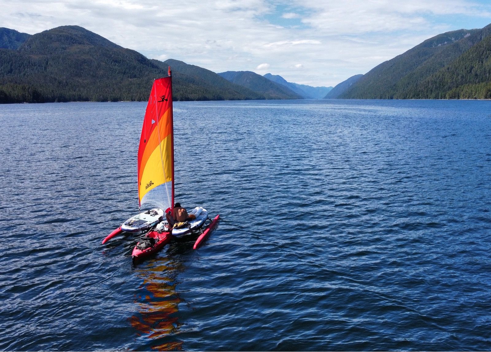
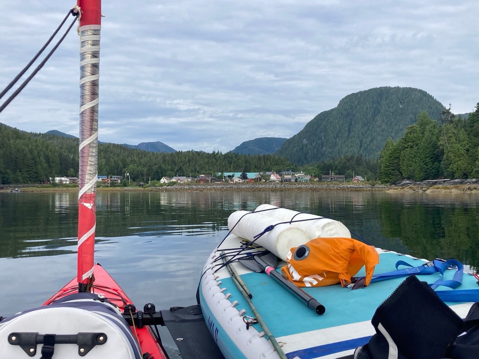
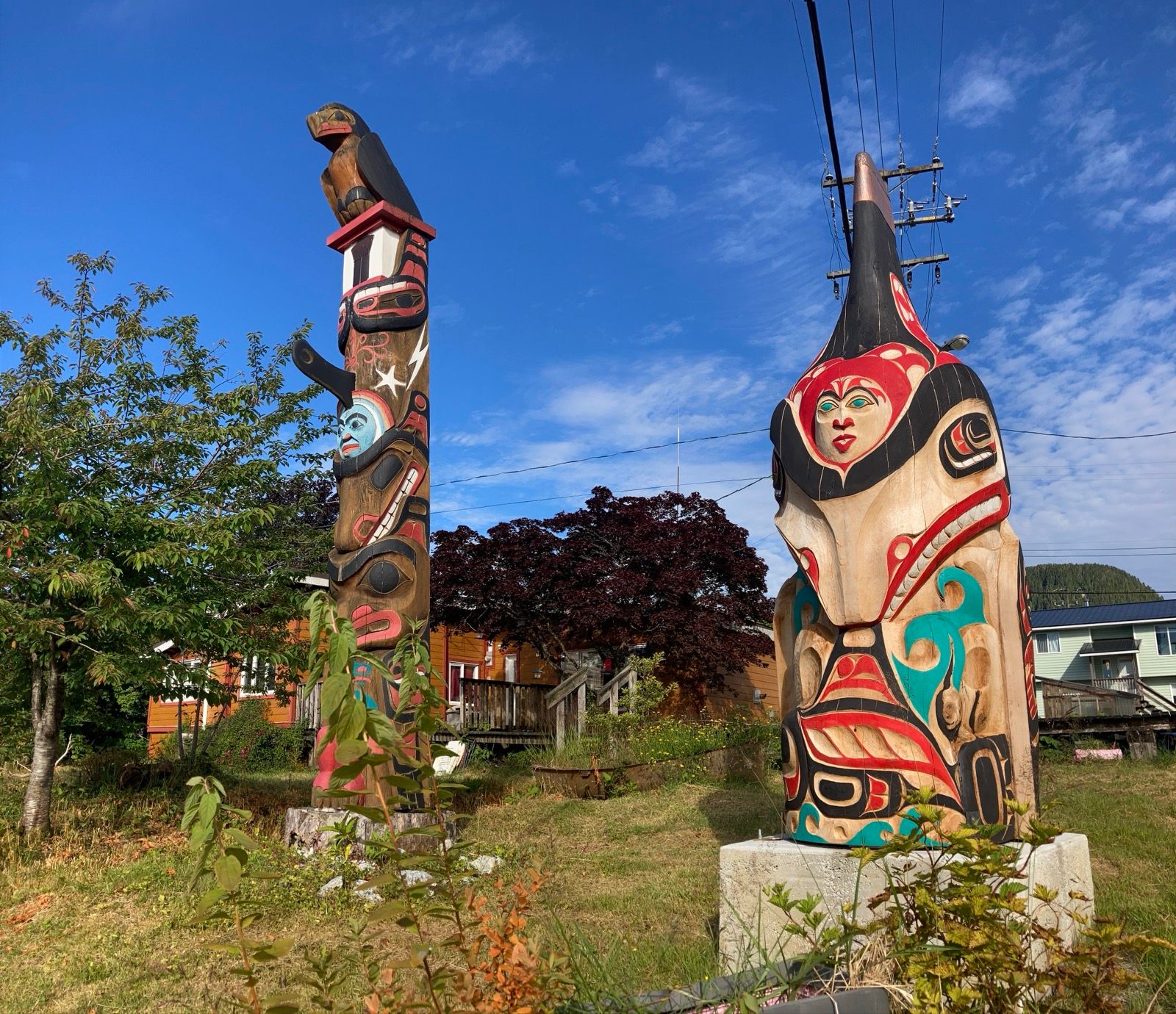

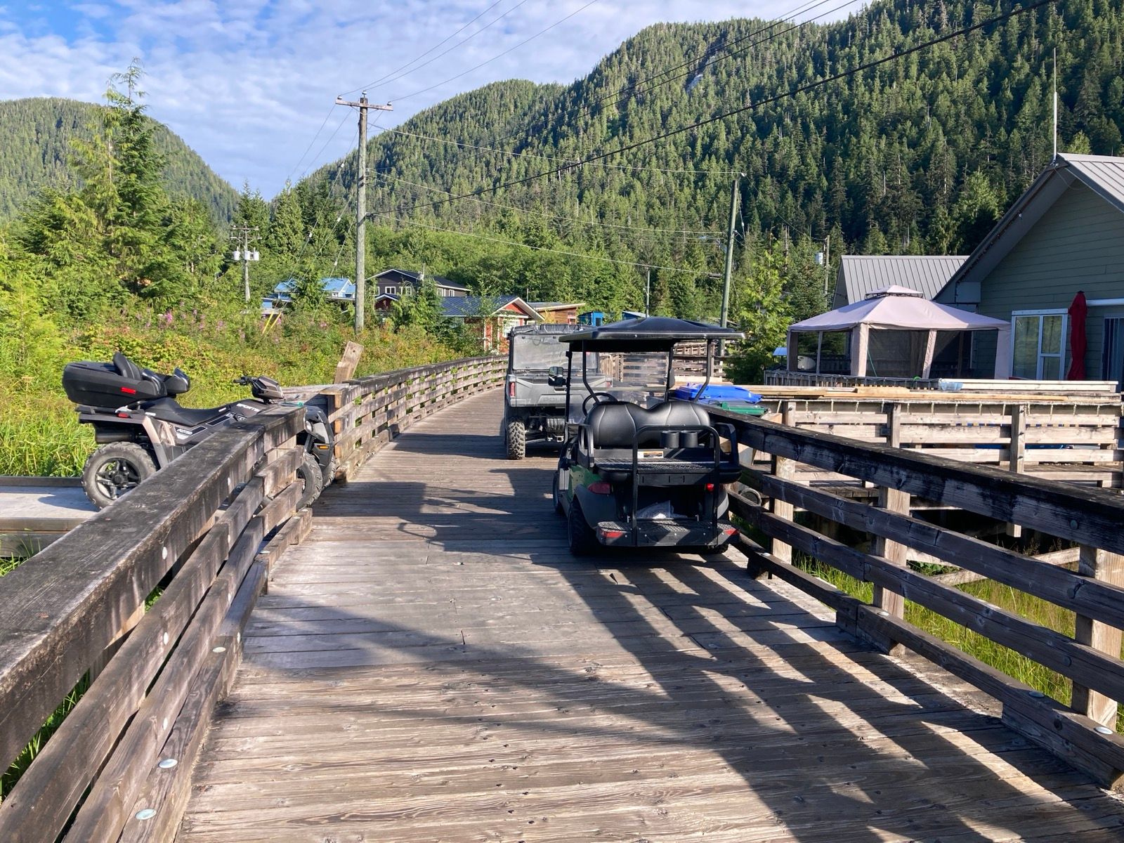
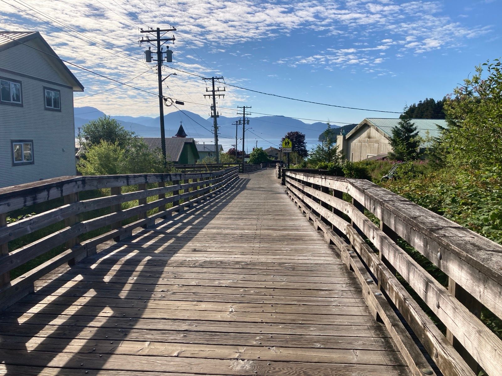
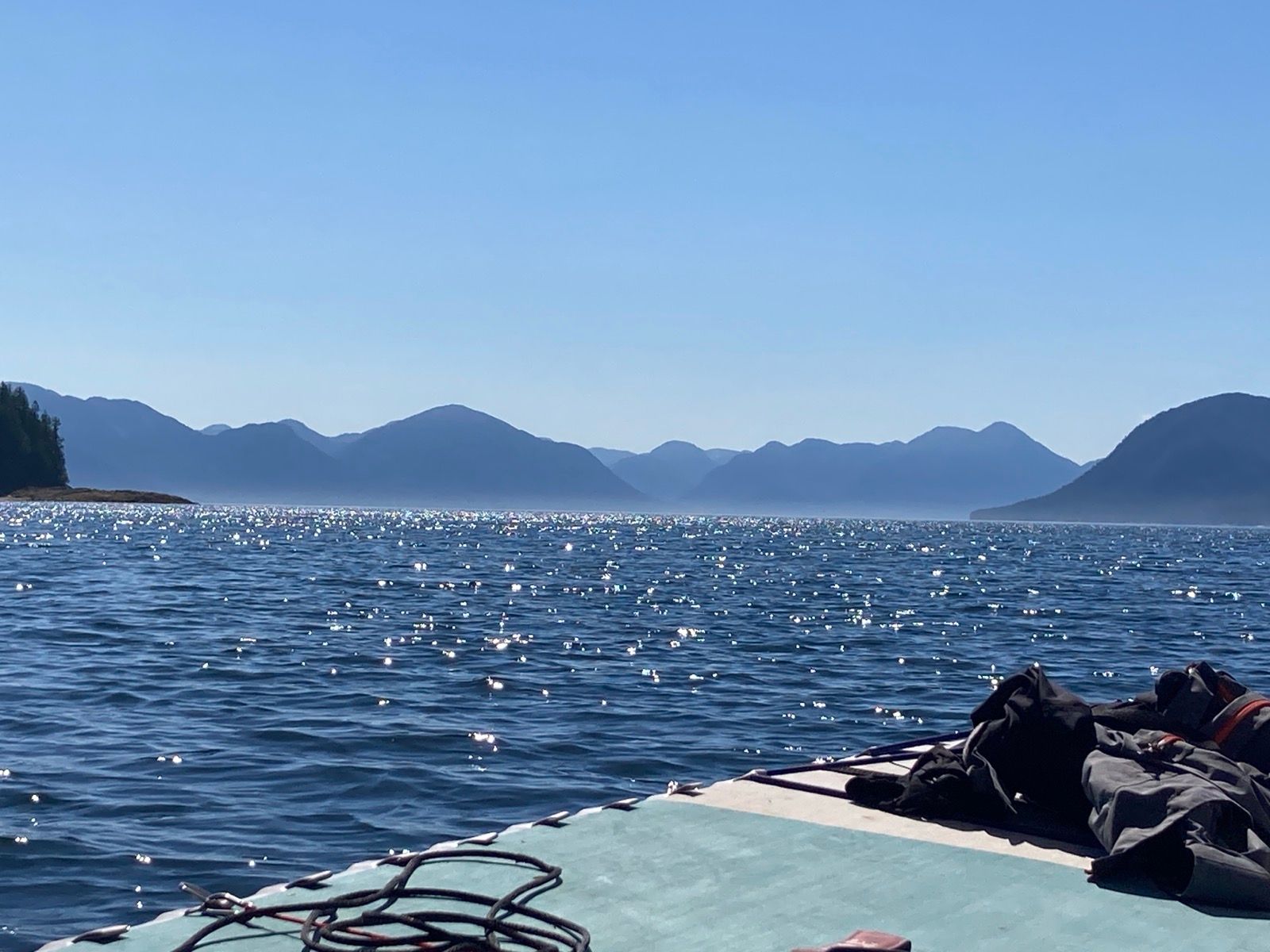
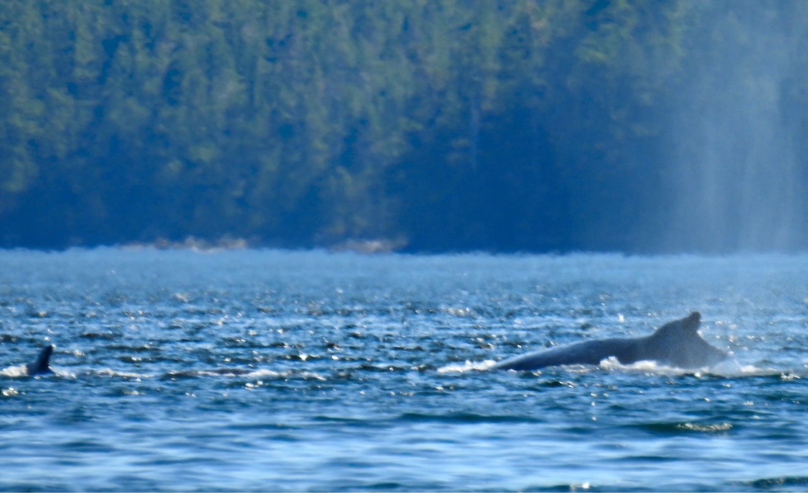
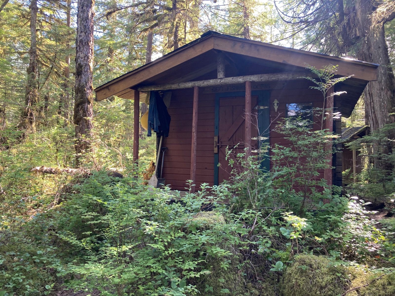
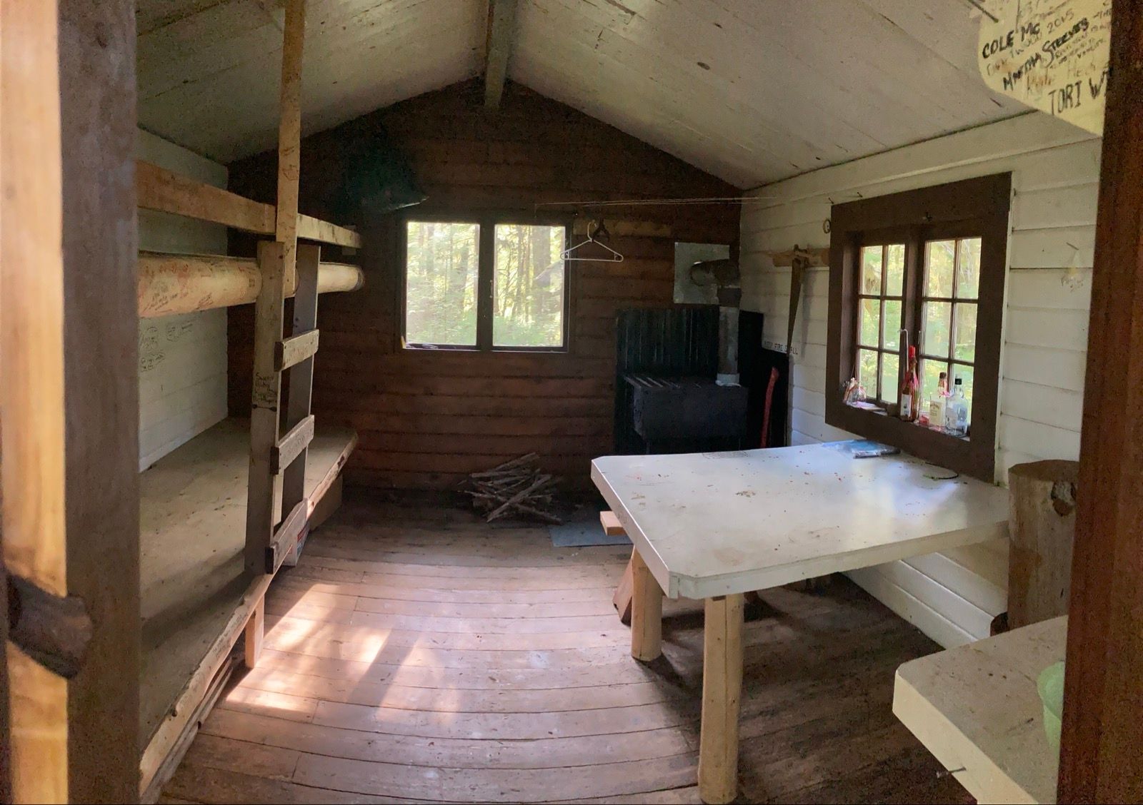
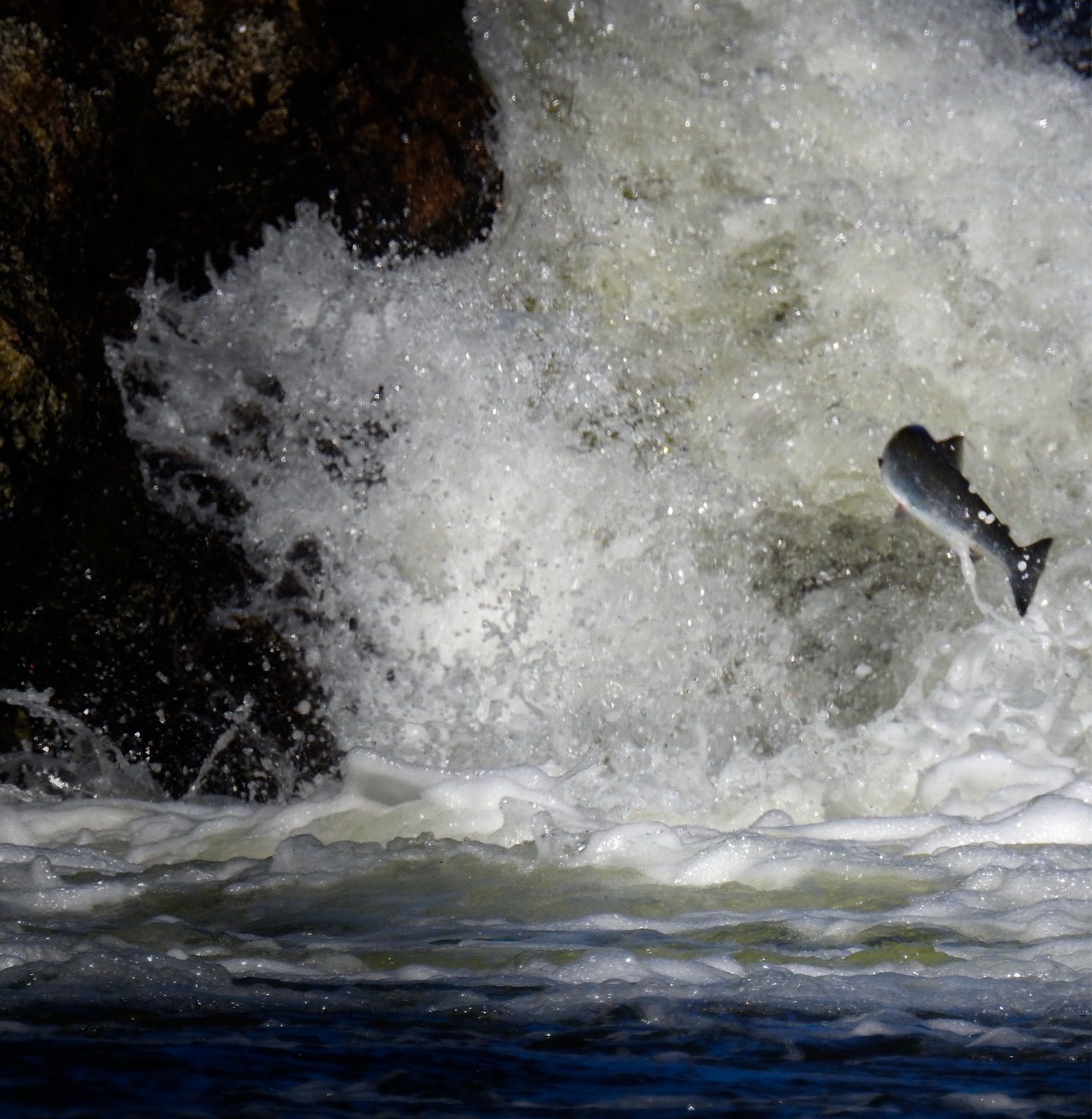
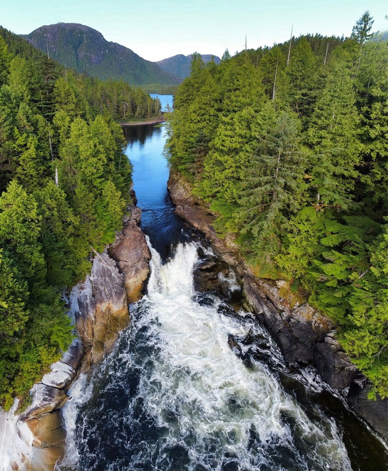
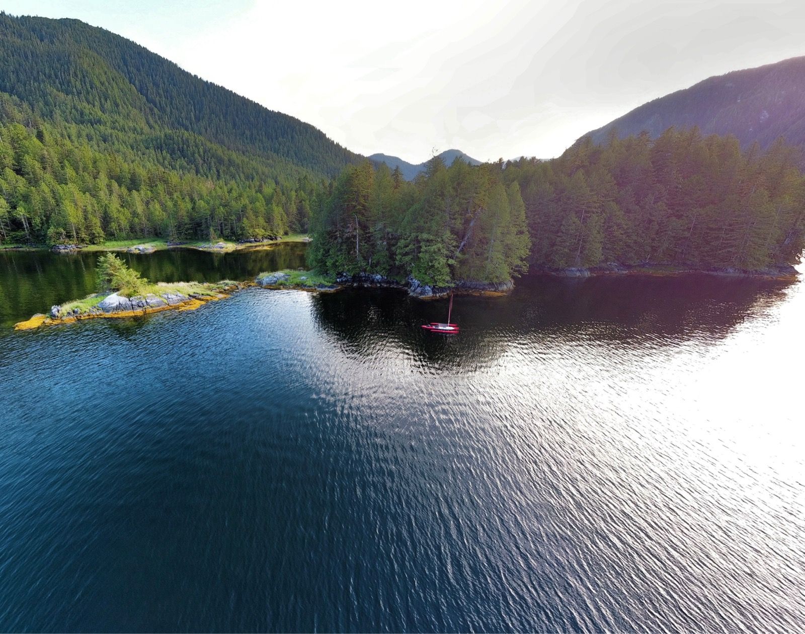
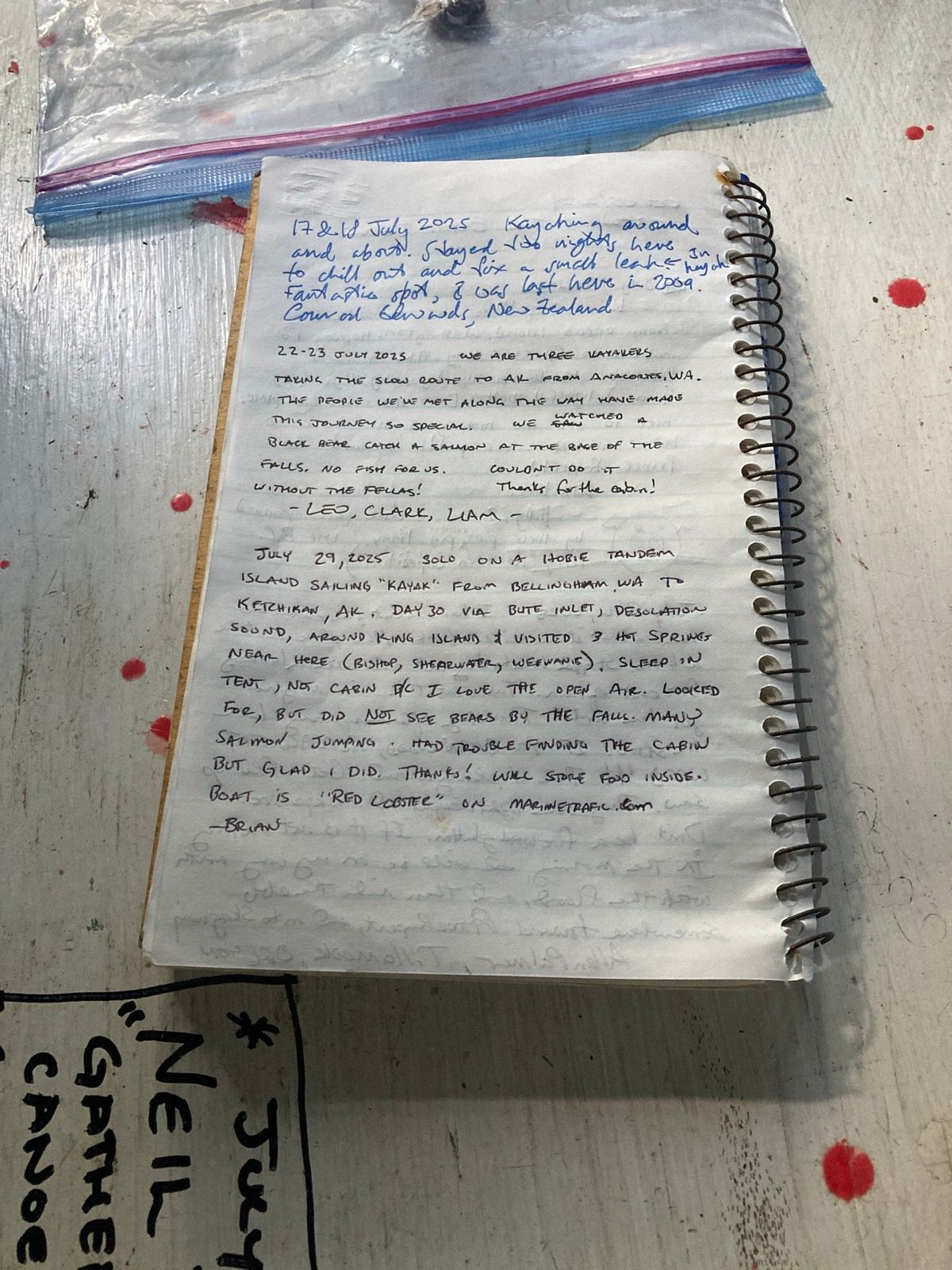
Strava Comments:
David L.
Brian L.
Mark G.
Ride Stats:
| Elapsed Time | Moving Time | Distance | Average Speed | Max Speed | Elevation Gain | Calories Burned |
|---|---|---|---|---|---|---|
|
11:14:04
hours
|
08:22:16
hours
|
50.09
km
|
5.98
km/h
|
12.17
km/h
|
58.10
meters
|
1,763
kcal
|
– Day 31 : Run for the border [top]

Via satellite messenger, I received a message from Janet. Starting on Saturday night – four days from now – a storm is coming. After having only one day of real rain, now there would be six days of rain in a row; basically as far as the forecast goes out. It is not the rain that concerns me so much, as even when it has drizzled on me lightly the temperature is still been quite satisfactory. My concern is about the winds that come with storms, coupled with the fact that the timing of the storm would have coincided with my crossing of the Dixon entrance – the third and last open ocean stretch of the inside passage. This would be a bad time to be experiencing 40 knot winds with 50 knot gusts. Basically it is a no go in most vessels – especially my little plastic boat.
I thought long and hard about what would be the point of taking the ferry back home on August 13 – my original plan because I need to get home to screen new tenants. What would be the point of hanging out in a hotel room for at least six days up here Being away from home just so I could do fewer miles per day? I know that I am capable of doing 40+ mile days, as I did several of those already on this trip. That is what it will take in order to finish before the storm. After quite a bit of thought, I resolved to do the remainder of the distance over the course of the next four days. For me, this will be a very hard push some days may go into the 15 to 17 hour range – especially if I continue to have the wind and current both be against me. But I believe that I can do it, and the prediction for the swell height in the Dixon entrance is 0 to 1 foot for the next three days, whereas during the storm it is over eight or 9 feet. Also, I know that even after storms pass, it takes a day or two for the seat to settle down, which means more waiting.
So I started putting the proverbial pedal to the metal. And pedal hard against the current. When the current is against me even pedaling very hard I can only manage about 2 1/2 kn sometimes even less. If I stop to change my clothes or plug-in a device for charging, or eat a snack, or pump out the bilge, the boat will drift backwards, sometimes at an alarmingly fast rate . I will look at my GPS a couple minutes after I have resumed pedaling, only to find that I have finally got back almost to the place where I stopped for the break. If you were only to look at your surroundings, you would not believe this because it looks as though the water is flowing past you such that it looks as if you are moving forward, but in reality, you are drifting with the current backwards. Therefore, I am starting to write this journal entry 11 hours into my journey, and I have probably only ceased peddling for accumulative 30 minutes during that time.
Also, I am using dictation because my touchscreen does not work much being so wet all the time from the air. This is why the word peddling is almost always spelt wrong. I am getting tired of manually having to go back and correct it. Another problem is that the letter P on my keyboard does not work well either because the screen protector is cracked, so don’t think that I am an idiot who does not know how to spell peddling.
normally, I fuel on low carbohydrate food, but with this level of effort, I suddenly started going through four or five granola bars per hour – and not the low carb ones. Fortunately, I bought 10 boxes of sweet granola bars specifically for this purpose. Janet usually has sugary food, but I cannot rely upon her to provide sugar for me. I take a scheduled amount of insulin that lasts throughout the day in addition to small doses of a more potent and fast acting insulin, but with this level of effort, I completely skip the fast acting insulin, that is normally used for meals. Also, if I do this for four days in a row, I will have to drastically reduce the amount of basil background insulin that I use, otherwise, I will glow into a glycogen deficit to rapidly.
From here, the plan is to rapidly resupply at Prince Rupert. This will consist only of buying a lot of food – including sugary snacks – and filling my water bags to the top. When I am on a more relaxed schedule, I have the luxury of looking around for streams, and then filtering the water that comes out of them, but with this more rushed schedule to beat the storm, I need everything to be fast and that includes camping and eating.
In some ways, rushing through the last stretch may sound like it isn’t fun, but I feel like now this journey will have had many different facets of things that I enjoy. For example, I had superfluous time at Hot Springs when I arrived early in the day and would relax and enjoy them by myself and build campfires to fill the time. I had the luxury of enjoying myself and wildlife viewing in certain places when there wasn’t a rush. As a person who is not a stranger to ultra endurance events, these last 3 to 4 days will be another facet, which is testing myself And how hard I can pedal to beat a storm. It isn’t relaxing, but there is an element of my personality that enjoys challenges also, and I feel like my time at the Hot Springs and when I had two rest days, also fulfilled the need for relaxation. The idea of sitting in a hotel room for six days and going an additional week without seeing Janet – to what end? Makes me realize that the right choice is to push hard through this last section. Moreover there were only one or two deviations that I had planned on taking up here – to somewhat remote Islands called Lucey Island and Rachel Island. I will probably skip these, or at least one of them, but there is nothing wrong with leaving a little bit left for the next trip. These islands are in an exposed section of the sound, and truthfully, probably no more or-less beautiful than all the other amazing islands that freckle this landscape.
——-
Sunrise: 5:52 am
Sunset: 9:44 pm
Moon 38% Waxing
Pressure 1019.6 steady
Photos:
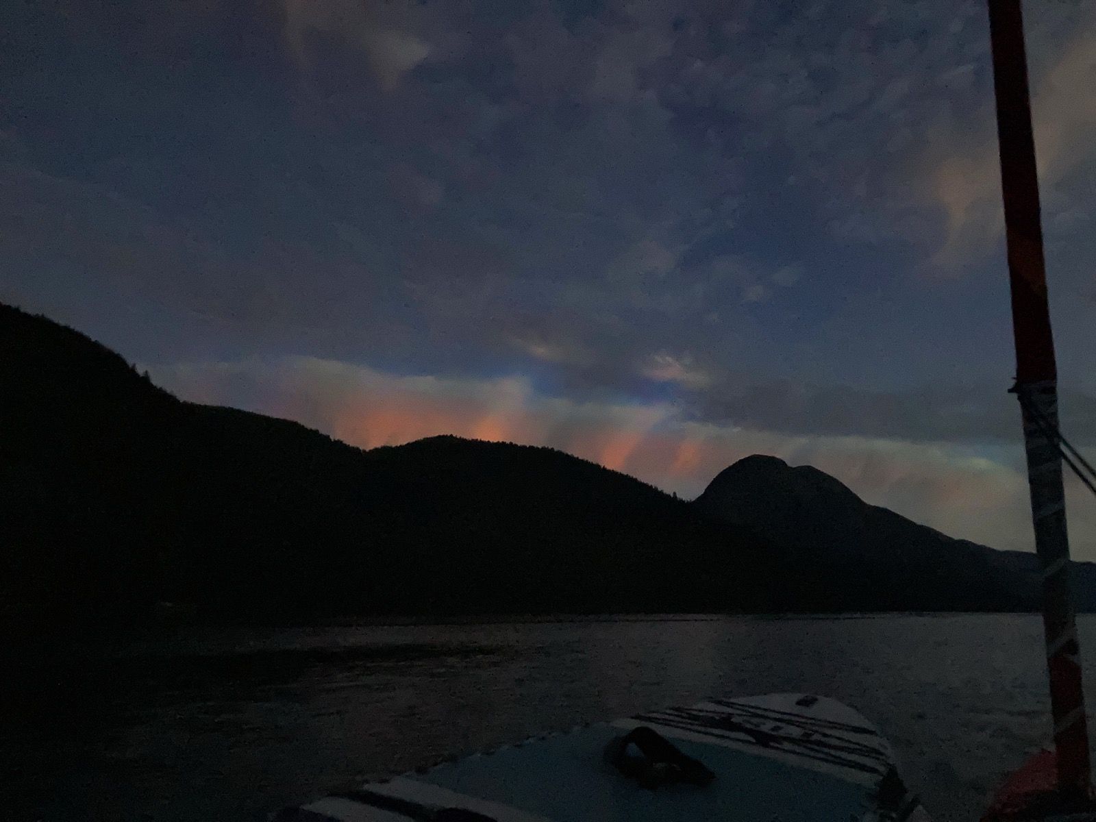
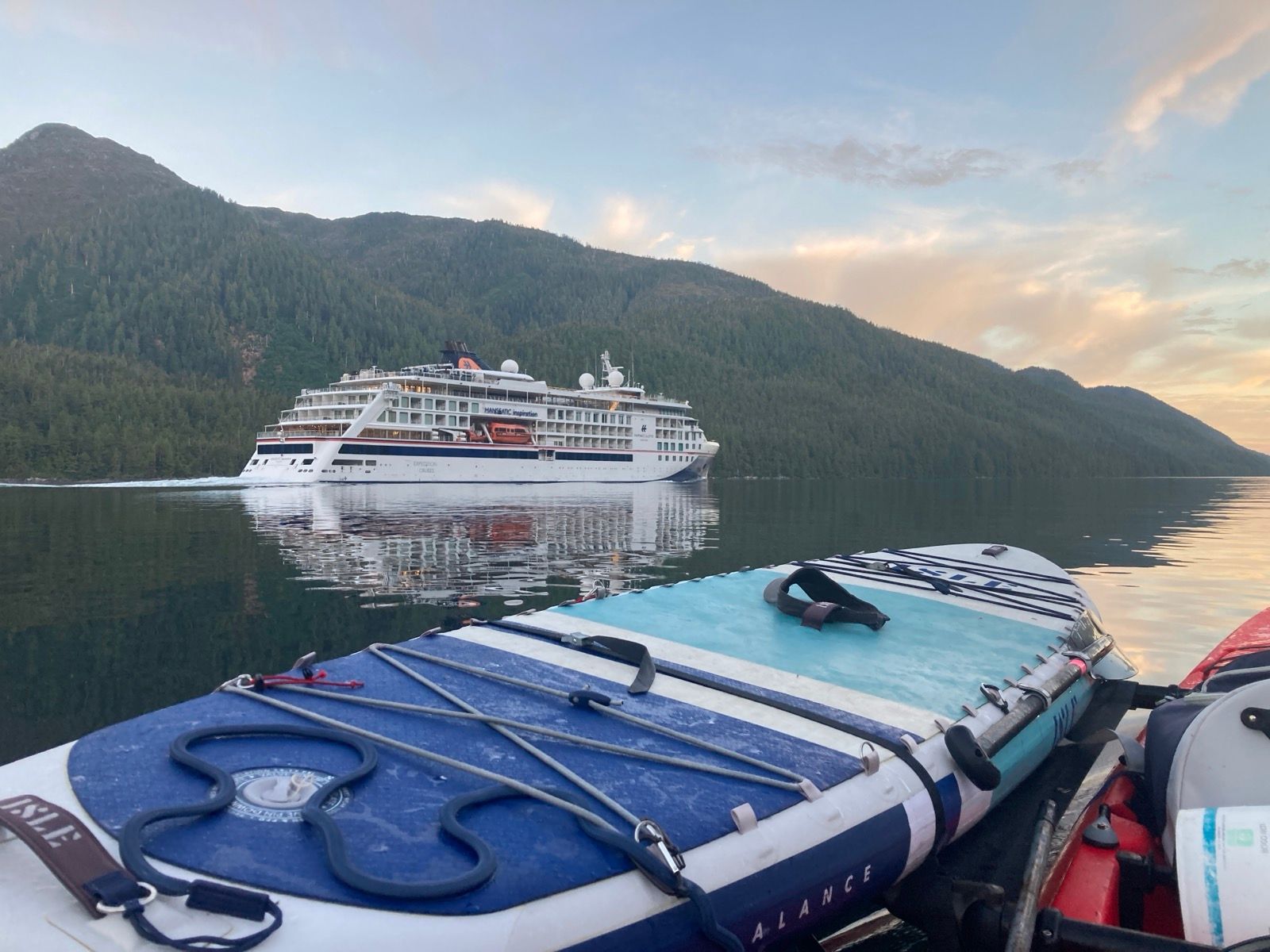
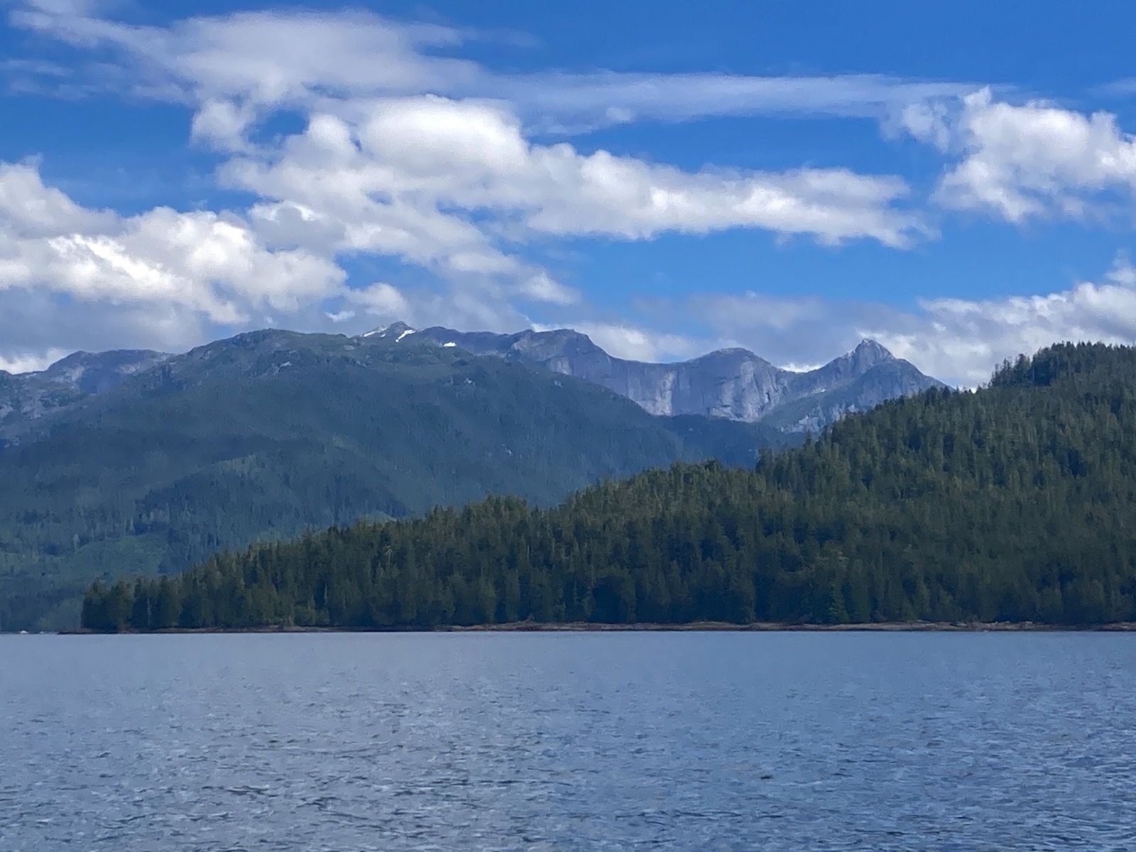
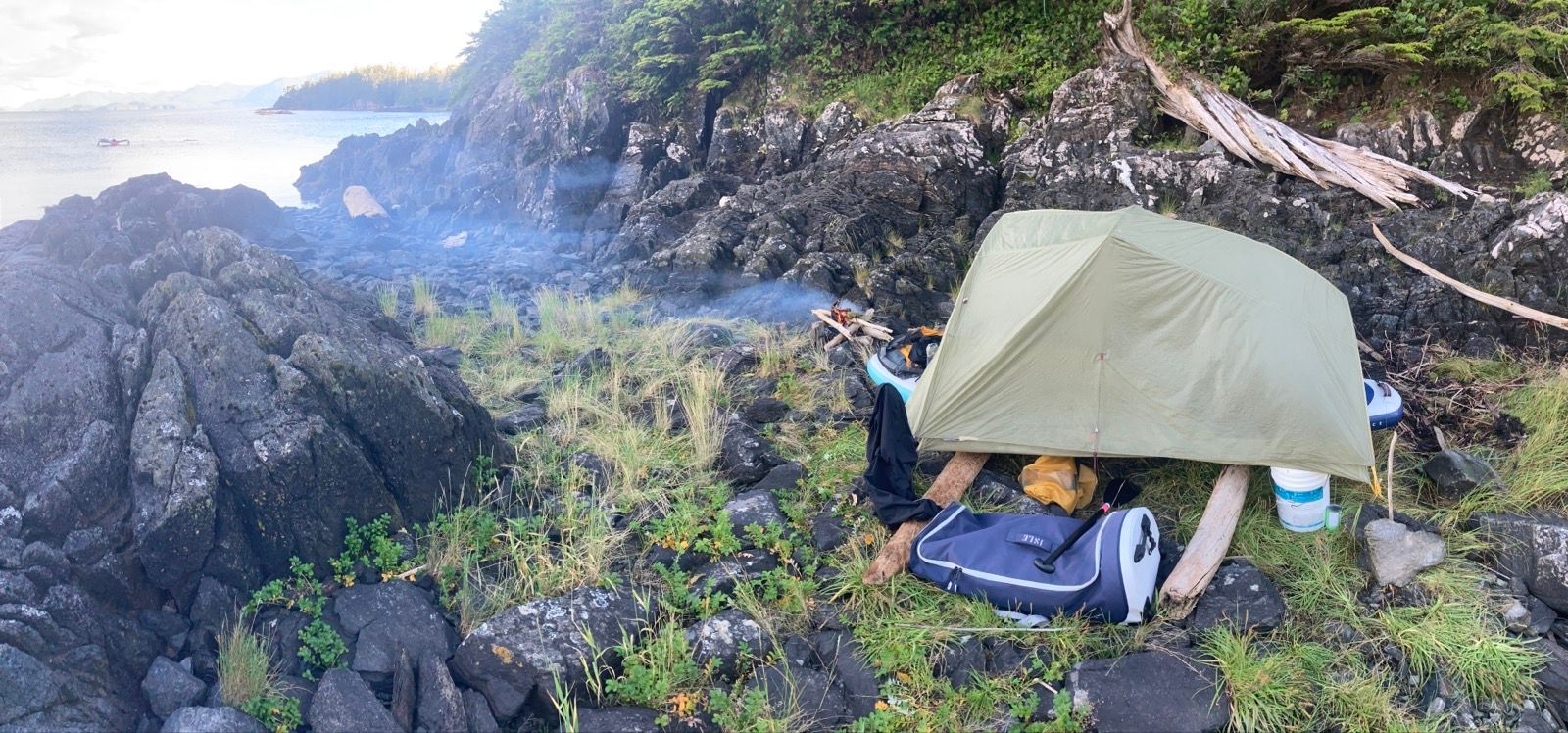
Strava Comments:
A B.
terri W.
Mark G.
Ride Stats:
| Elapsed Time | Moving Time | Distance | Average Speed | Max Speed | Elevation Gain | Calories Burned |
|---|---|---|---|---|---|---|
|
15:19:15
hours
|
14:05:59
hours
|
78.25
km
|
5.55
km/h
|
9.72
km/h
|
4.80
meters
|
3,459
kcal
|
– Day 32 : Plan. Execute. [top]

Like yesterday, I packed up in the dark. I need to make a lot of miles still in order to get around the Dixon entrance before the storm comes. I did the packing a little begrudgingly considering that I had gotten up at 3 AM the day before. I made some coffee and put it on the front of my paddle board platform, but when something fell inside of the tent, I reached for it quickly and managed to knock my coffee – which hadn’t even dissolved yet – into the tent. The tent was now not only soaked with coffee, but it was also very sticky because the granules were only partially dissolved. I said the F word, then I got about rinsing the tent. The only way I knew how – in the ocean. I only had a liter and a half of water remaining for drinking and had a big Trek to get to Prince Rupert before I can get any more water easily. I needed to save that water for drinking.
As you might imagine, I was not in a very good mood. I feel like this trip now is just a rush to get it over with before the storm comes. Normally I wouldn’t be so concerned about a storm, but given that I have the Dixon entrance ahead of me, which is one of the second most challenging sections for a boat like mine, I really do want to get it done before that storm. Unfortunately, there is just barely enough time to make that happen, and EVERYTHING has to go right. I am just one broken pedal drive away from needing a rescue. I am just one or two more millimeters larger of a leak away from needing a rescue as my boat sings. Speaking of which for the last week or two it felt like the boat was leaking more slowly, but today the boat had filled with much more water than usual. I began the morning by stroking 388 times, and I would need to stroke approximately that many times every 45 minutes on the way to Prince Rupert. I decided that I would try to overlay some extra tape over the known crack while I was in Prince Rupert, but I also know that that is somewhat of a futile effort because a I don’t know if that is the only crack and be putting tape on while the boat is underwater is a little bit of a fool’s errand.
As I was heading into Prince Rupert, I noticed that I again was having some misfortune. Going to Prince Rupert is an in – out effort. While I was heading in, the tide was at his strongest flowing out. While I was shopping, the tide was switching, so therefore when I was going out, the tide would be coming in even stronger. It doesn’t have to be this way – it could have just as easily been a different point in the lunar cycle, where I would’ve had the tide coming in with me and going out as well. That is an entirely possible scenario, but it is luck of the draw. Today in order to have made that happen I would have had to get up at something like midnight or 1 AM and then probably have to wait at the store for a while for it to open. I am now dictating this while pedaling as hard as I can into the current and again into the wind, which is not coming from the predicted direction. And in a little bit of a foul mood, just because I feel like I have been unlucky. I am a little sad, because I feel like this type of luck should be 50-50, but it feels like it has been 9010.
I shopped expediently at the Prince Rupert Safeway. As I was pedaling in, I also made sure to check the Internet to see if I could find information about where I might camp along this remote stretch in Alaska. I found a website called Alaska Marine trails.org, and They mentioned a cabin that was about 26 statute miles from Ketchikan. This reduces the burden of mileage quite a bit before the storm, so I see it as a potential place where I can wait out the weather or at least the winds and maybe realistically achieve that distance. I do not know if the cabin actually exists because it’s just a little Dot on a map with no other information, so I am putting a lot of faith in that. I then loaded all the food onto my boat, and lifted the front of the boat up onto the paddle board. I then made it a half ditch effort at taping The main crack that I am aware of. But of course it was constantly filling with water, and now that I am underway again I can tell that it has not subdued the leak whatsoever. So that was just a waste of time. I will continue to pedal and pump.
On the dock, I met a couple named Heather and Kirk. They offered me eggs from their chickens. I actually declined this time because I had just bought a ton of food, including some perishables. I also met a guy named Tom from San Luis Obispo – practically my neighbor .
After that, I headed out into the open ocean section. I had to fight a current because it had switched while I’ve been shopping and trying to repair the boat. The incoming tide was actually stronger so it required constant focus and lots of carbs. In addition, the wind was straight in my face. It is weird that the wind was coming from the west when it was predicted to come from the south.
Once I broke free of the channel, the currents were no longer a factor. Out an open water the currents are usually a lot weaker. I took this opportunity to call Janet and she really brought me out of my funk. It had been a tough day and we swapped stories and it was great to hear her voice as well as what she had been doing in more detail.
While talking to Janet, my day brightened both literally and figuratively. I was moving along at a fast rate out in the open water. The waves were big maybe 2 foot and I was going at 5 kn with water splashing over the deck. We talked and talked and it seemed like neither one of us wanted to hang up. It was great.
I changed my plan once out on the water and instead of going into “big bay“ I went for a tiny little island. Because the moon is in the first quarter the tides are much more relaxed, and when I arrived at the beach, I knew that what you see is what you get – so if there’s beach there, that’s the way it’s going to be all night long. Excellent! I felt like I was on vacation. Having to find a campsite Above high tide line has been such a challenge this last week. It is so nice that things are mellowing out. In a few days, though they will start getting difficult again, but I am hoping to be done by then.
I had intended to have a go go go mentality for the next three days, but I had purchased some beef tenderloin, hoping that I could emulate the experience I had while eating the venison from Matt. I prepared a fire first thing when I arrived to camp, and then Turned it the meat over the fire on a stick. Unfortunately, this meat, which had been very expensive, was extremely tough. It had excellent flavor, but I had to chew it and chew it and chew it for ever it may as well have been stew, beef or chuck roast. Your portions that I could not chew so I eventually put those really tough pieces into the fire. I wonder how Matt got that venison to be so tender?
After that, I set up my tent on top of the paddleboard like I have been doing. This is so much more convenient than trying to create a level site because all I have to do is create two level crossbars instead. Also, it is predicted to rain tonight, so the 10th floor will be several inches off the ground, and I am hoping that will help keep things drier inside .
————-
Sunrise: 5:53 AM
Sunset: 9:45 PM
Moon: 47%
pressure 1017.5 falling
Photos:
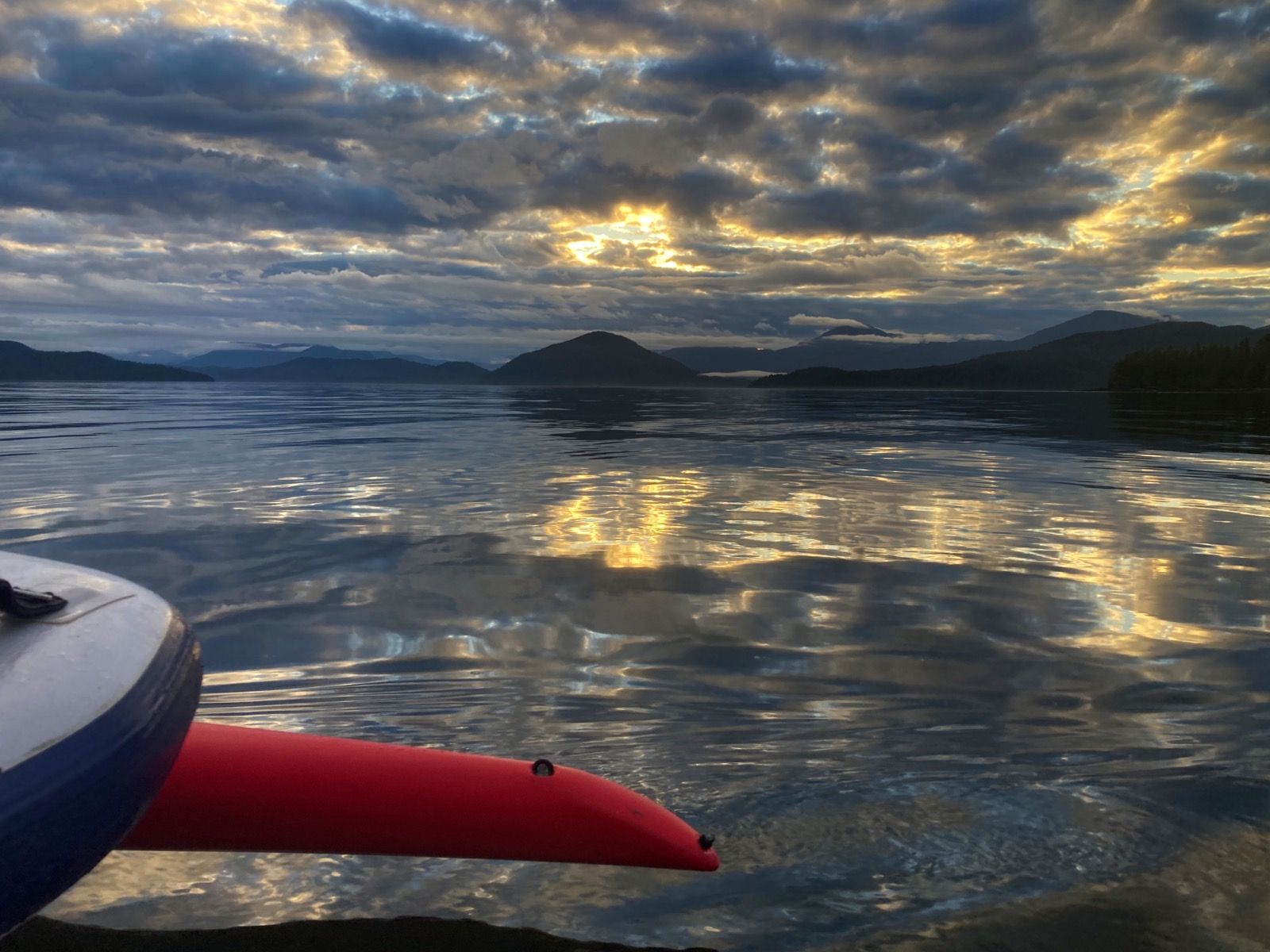
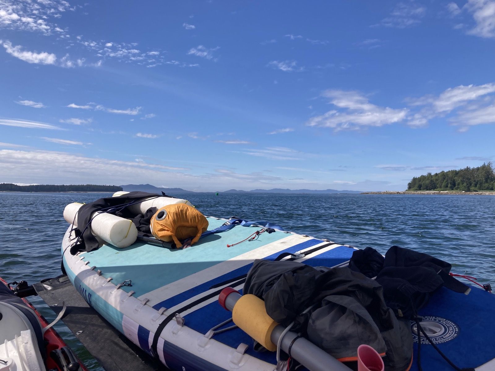
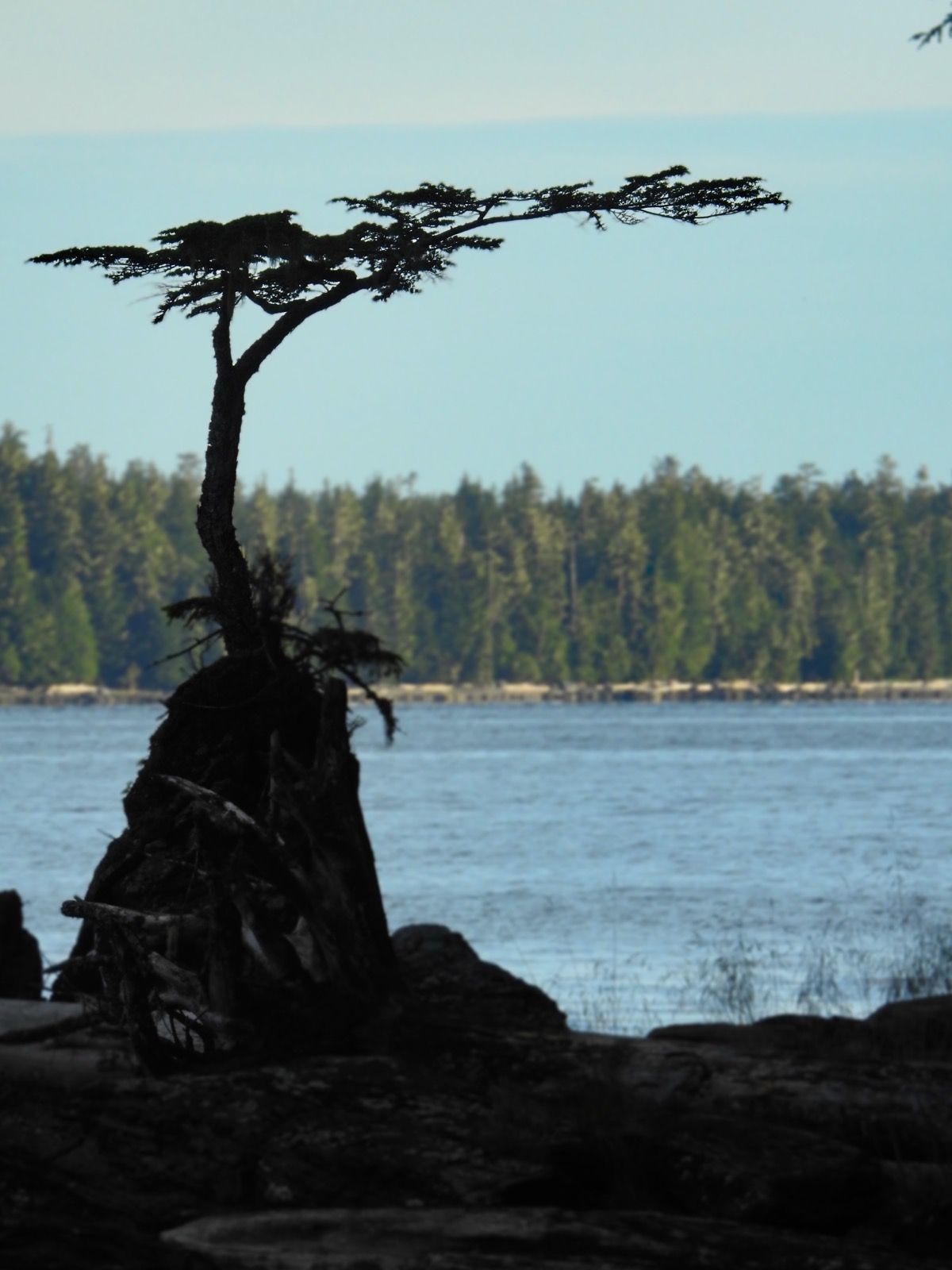
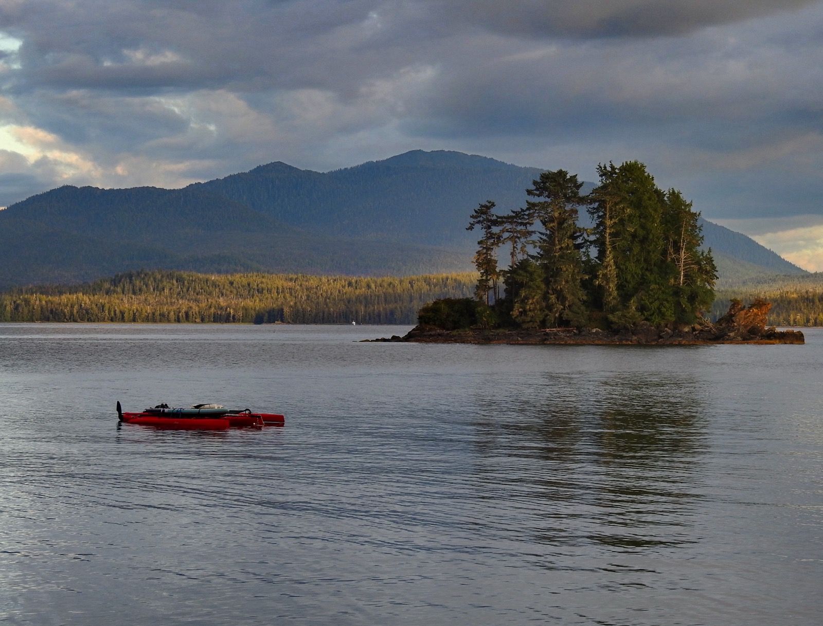
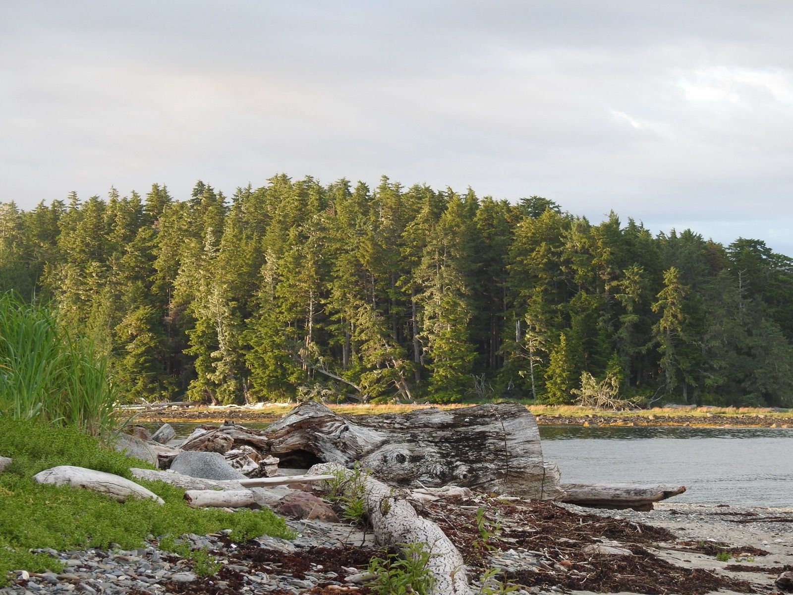
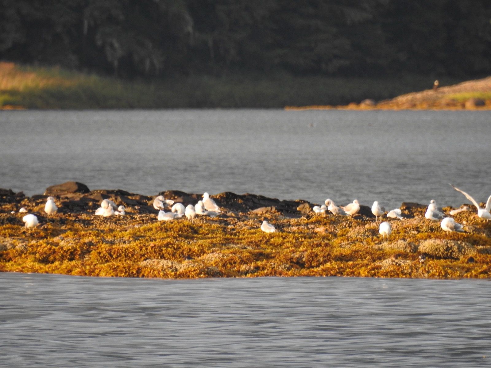
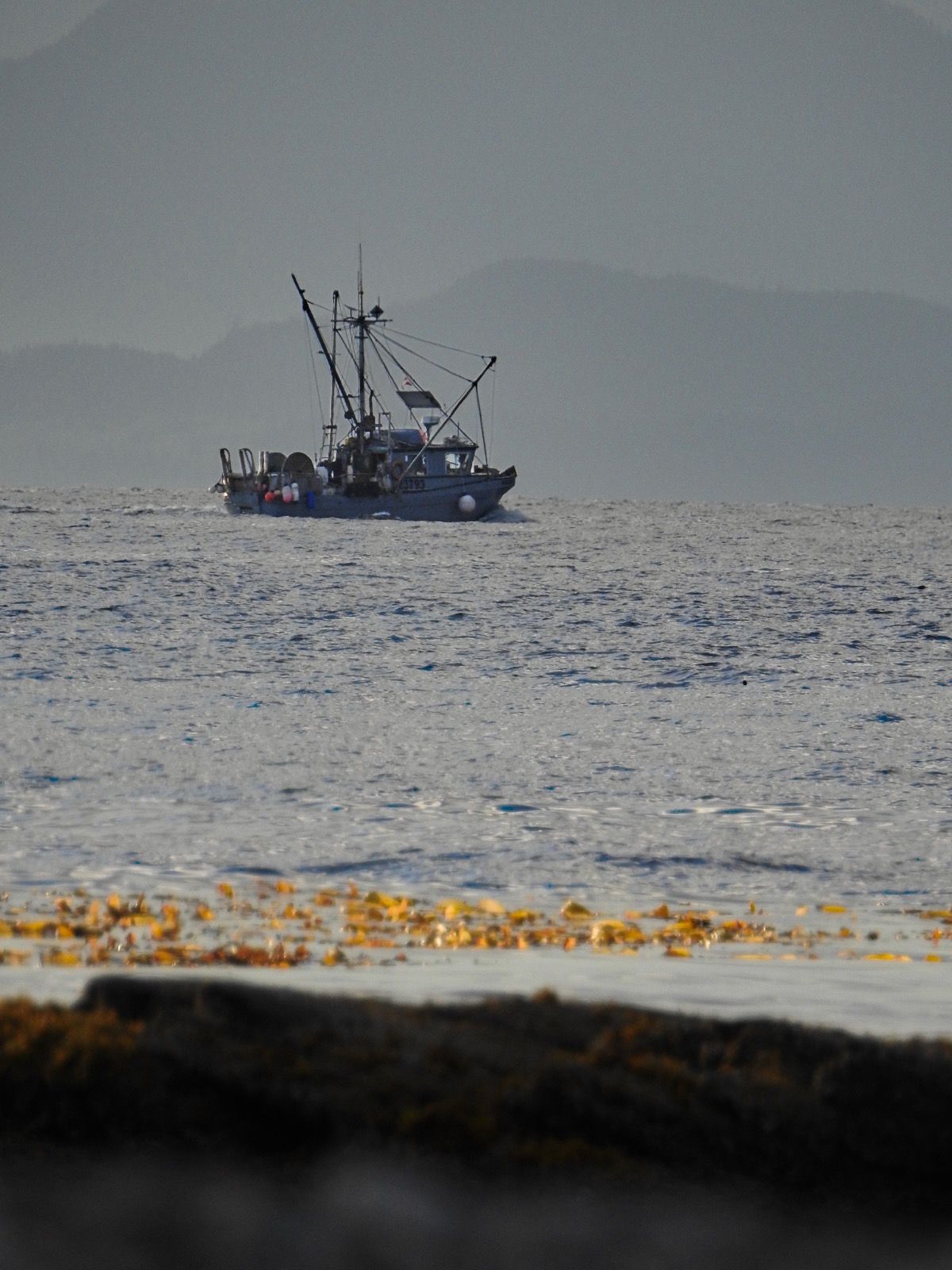
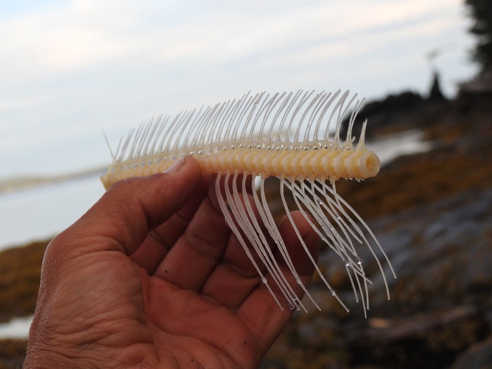
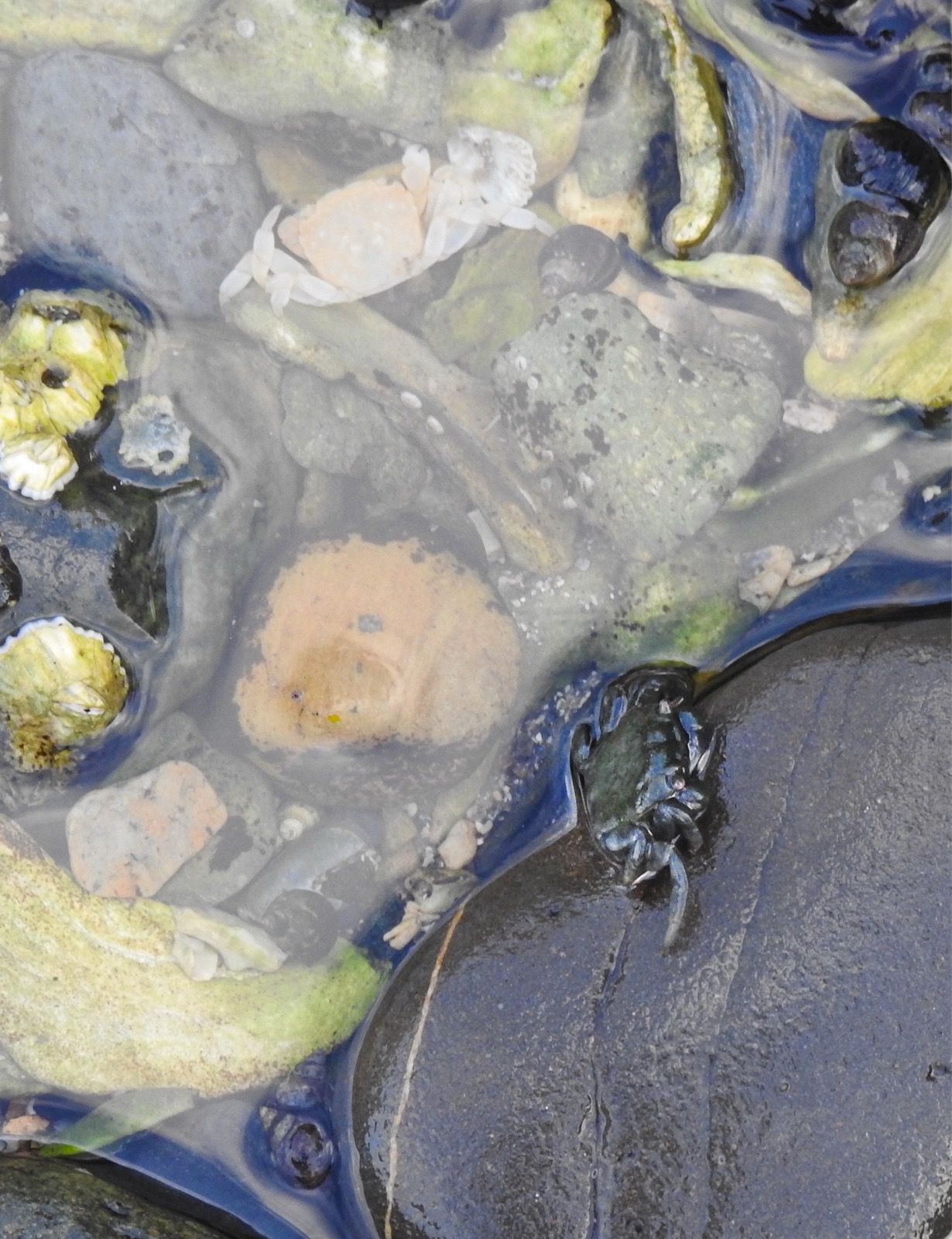
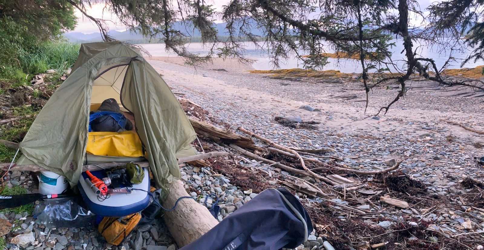
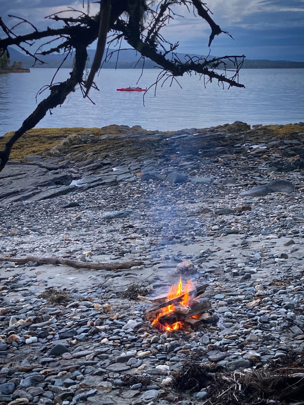
Strava Comments:
Corrine L.
Mark G.
Ride Stats:
| Elapsed Time | Moving Time | Distance | Average Speed | Max Speed | Elevation Gain |
|---|---|---|---|---|---|
|
14:43:25
hours
|
12:04:16
hours
|
73.12
km
|
6.06
km/h
|
60.87
km/h
|
40.80
meters
|
– Day 33 : Doing Dixon [top]

This plan actually worked out. I did have a current pushing me sideways all the way until about 2 PM, but that was not a problem because it was a vector in the direction that I wanted to head. All I had to do was point about 20° off of where I wanted to go and the current would take care of that portion of my travel. Me and the current, we work together. Ha ha ha.
It turned out that the ocean was like glass all morning. This meant that the seas were very calm, which is a good thing. But it also meant that I was going to have to pedal a lot.
In previous days, I was pedaling a lot and eating very little. This caused me to lose quite a bit of weight. Also, I would pedal at all day pace, which is probably about 180 W or maybe even less. Ever since I went to Prince Rupert to buy more food, I have been pedaling harder and feel stronger. I have been eating a lot more carbohydrate which assists with that. The only problem is that my blood sugars have been pretty high, suggesting that I am now over fueling. Also, I get what feels like a blood sugar crash, which is kind of strange because when I test, the sugars are still high. So I just eat more carbs. I used to be fixated on maintaining a blood sugar between 80 and 90, but nowadays, I am a lot more relaxed about that because I have seen other people do fine with quite a bit higher blood sugars. It is difficult to quantify how many days or weeks or months Having high blood sugar could take off of your life. But if you think about it, logically, your life could end in an instant on a bicycle ride or while you are driving because of the danger of motor vehicles. Far more life-threatening than the much-maligned, shark or bear.
The only disagreeable portion was rounding the point of land that sticks out into the ocean. Here, two currents converged. This caused very confused seas. The waves were only about a foot high, but the hull slapping about was very uncomfortable. I figured it would last about 2.5 miles, which it did. The problem was that I was only able to go about 1.8 mph in this section so the duration of suffering was kind of long. You may find it interesting, but I dislike these 1 foot waves way more than seven footers! Of course, if the seven footers were confused, I probably wouldn’t like them at all, but I figure it is worth mentioning that size isn’t everything.
I ended up camping a little bit earlier than I had planned. The site that I selected for camping is not as protected as I normally like. Alaska is different, or I should say that the terrain has been changing gradually. There are different plants and different ratios of plants. I know this because trying to start a fire is a little bit different than it was in BC. I also am intrigued about how difficult it is to start a fire. I have dry material at my disposal, but even with my newest techniques of ensuring powerful airflow, I sometimes struggle to get the fire started. I do have a 1 ounce blowing device that I used to inflate my air mattress. They mention that it can also be used as a fire starter. It works very well by adding air to the flames. I don’t resort to using it very often though, because I don’t want to wear it out or use up the battery.
At camp, I decided to fly the drone, but while I was doing it, a porcupine started creeping across the beach. Normally, I don’t like to fly the drone near animals, but a porcupine is kind of a creature that you don’t want to come near you anyway. Let me just say that there are certain creatures like mosquitoes raccoons, and I guess, now porcupines, that I don’t feel too bad about disturbing. So I hover over him for a moment and took a short video. He did not seem to mind the drone at all. I will post one second of the video, even though I also have a longer one.
I was hoping that this would be the last that I saw of him. But then I got scared when I heard noises and saw a whole bunch of slippery looking creatures running into the water from the rocks near me. I am wondering if these were mink or something related? I watched them for a while, and they kept appearing. More and more. So I went and grabbed my long lens camera and snapped a photo of one just as it was slipping into the water. It would’ve been nicer to get a photo of his face so maybe you could help me identify him. Also, I saw deer footprints in the sand, suggesting that there are quite a few animals in this area. I am on the mainland now, so animals have access and do not need to swim here. My main hope is that no bears come by this evening or tomorrow.
I built another fire and enjoyed it immensely, cooking my dinner over the fire once again. I am using my canister fuel now to run my little heater, which feels so luxurious. I’ve got to be honest with you – there have been quite a few times, where if I had a teleportation device, I would’ve just teleported myself back home. I don’t quite know why that is, but I will say that most of those times when I wanted to do the teleportation, the feeling was intense, but brief. I must also say, that there have been many times where I have thought about the next trip up here. I have equally powerful and intense feelings of love for this region. Sometimes I get so happy thinking what an amazing place this is. I am so grateful that wilderness like this still exist on our planet. There are still so many places to see on the inside passage. I have a list of places to go. I feel like I have used up this season, however, and don’t want to take chances with the weather that typically comes starting mid August. This trip has been so great and I want to end on a high note. But also, I really do want to return.
———-
Sunrise: 4:54 AM
Sunset 8:47 PM
Moon: 57% waxing
Pressure: 1021.0 falling fast,
Photos:
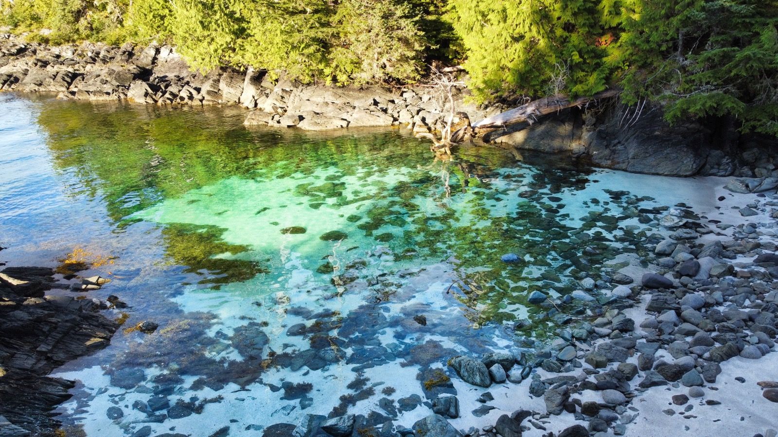
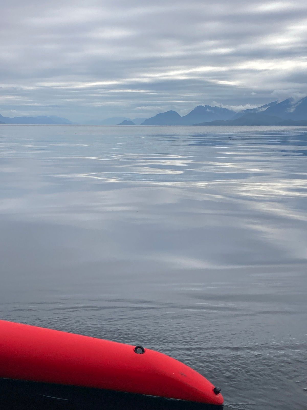
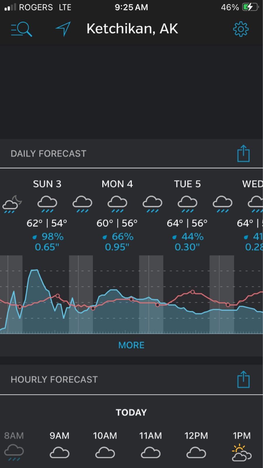
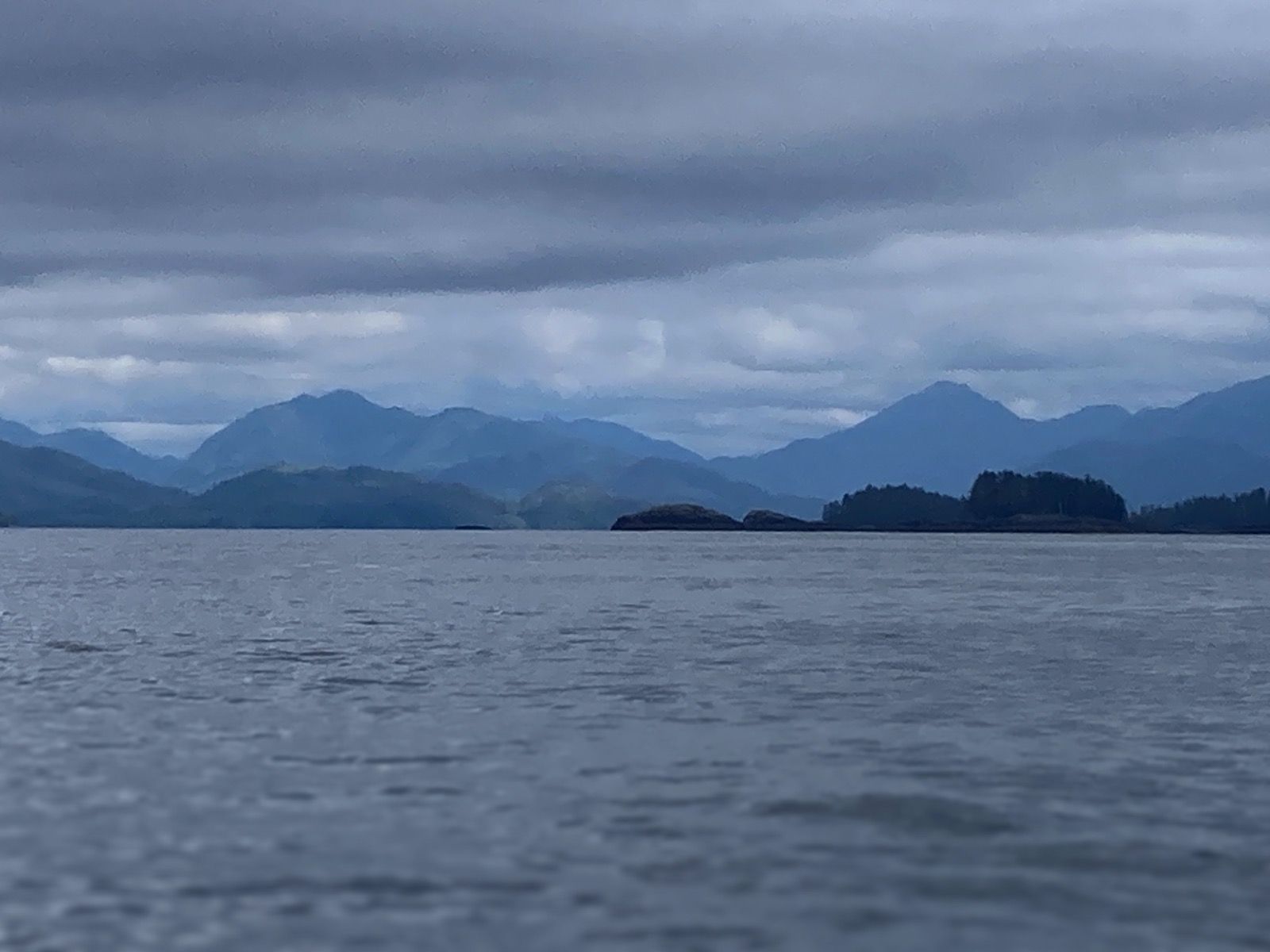
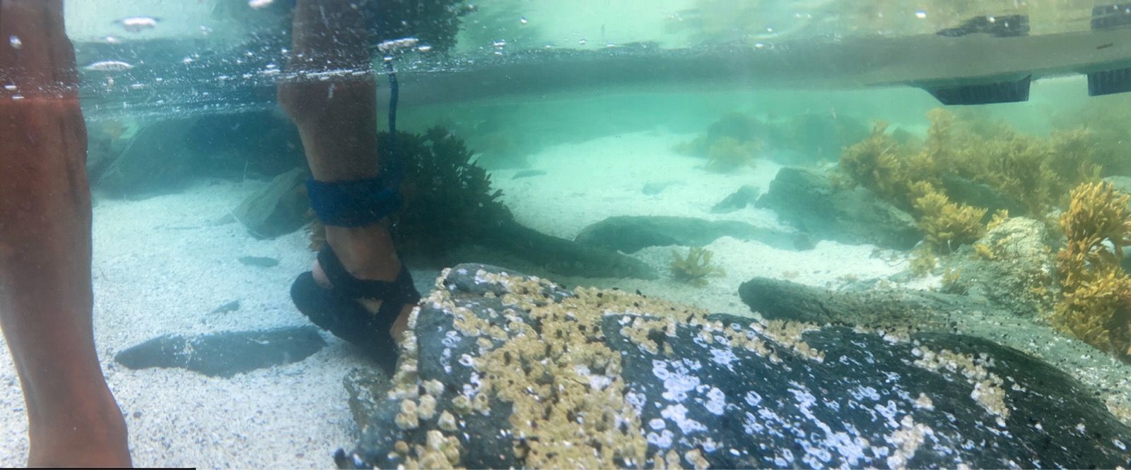
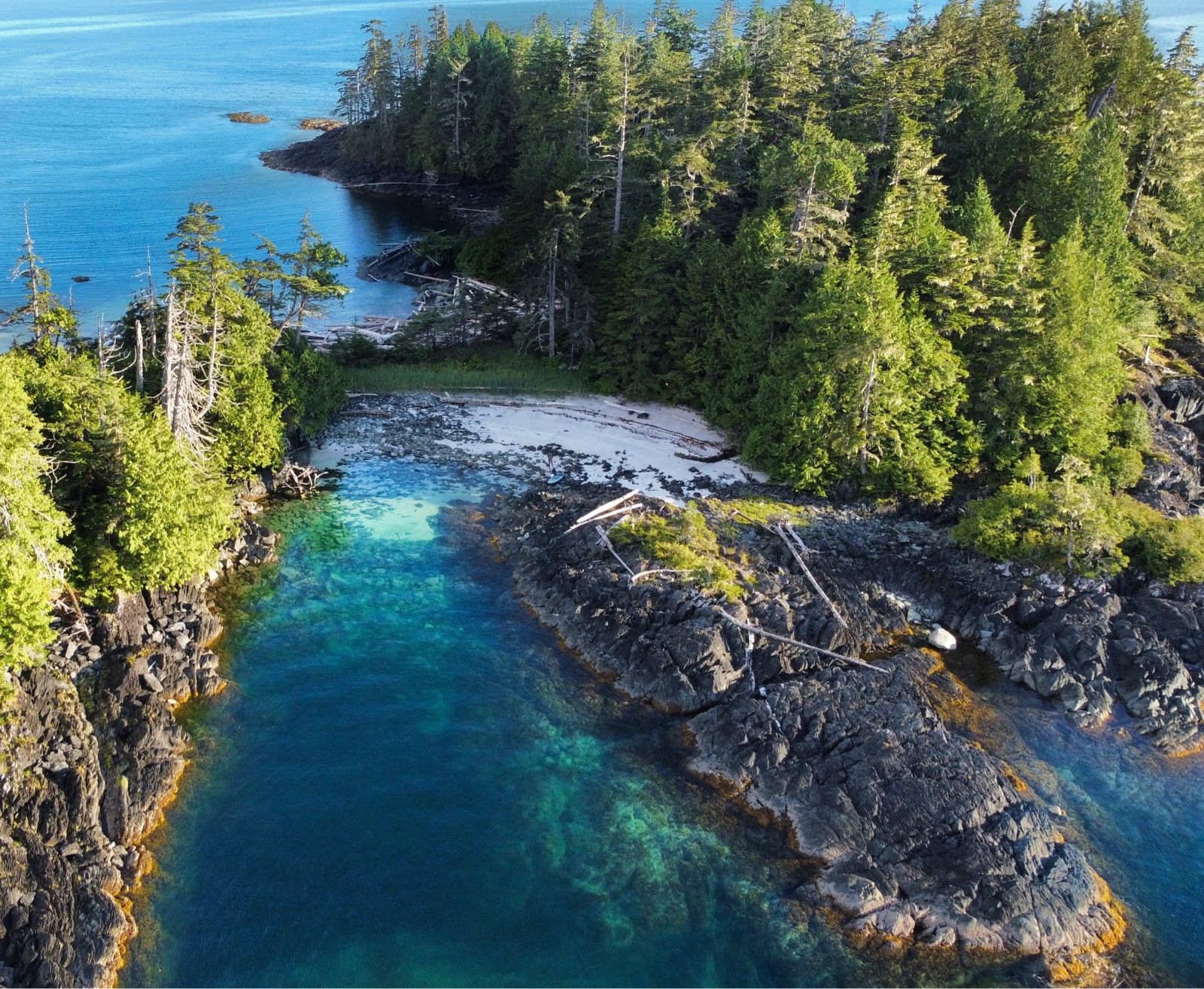
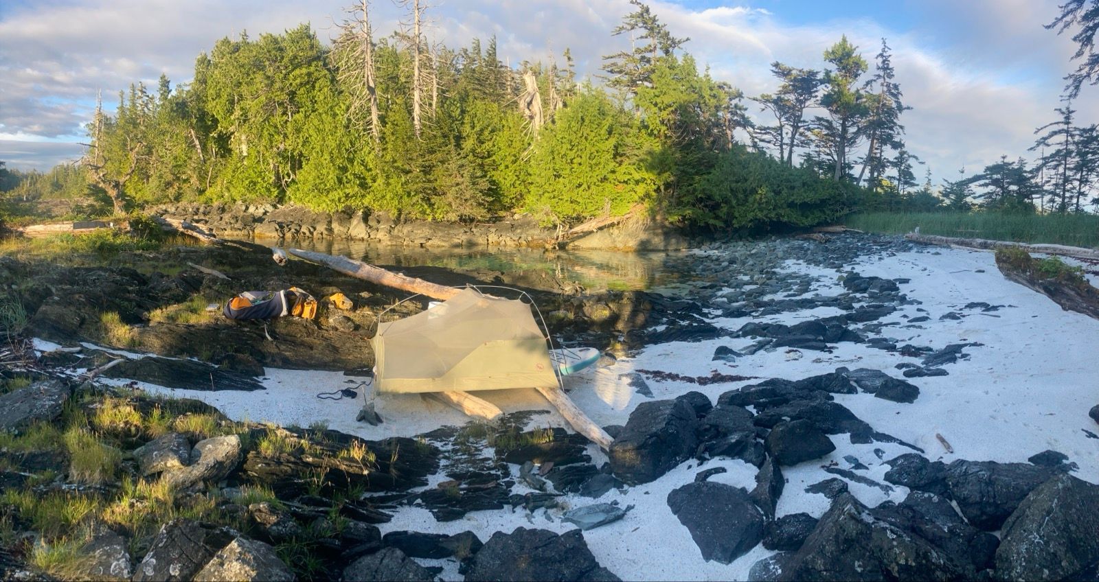
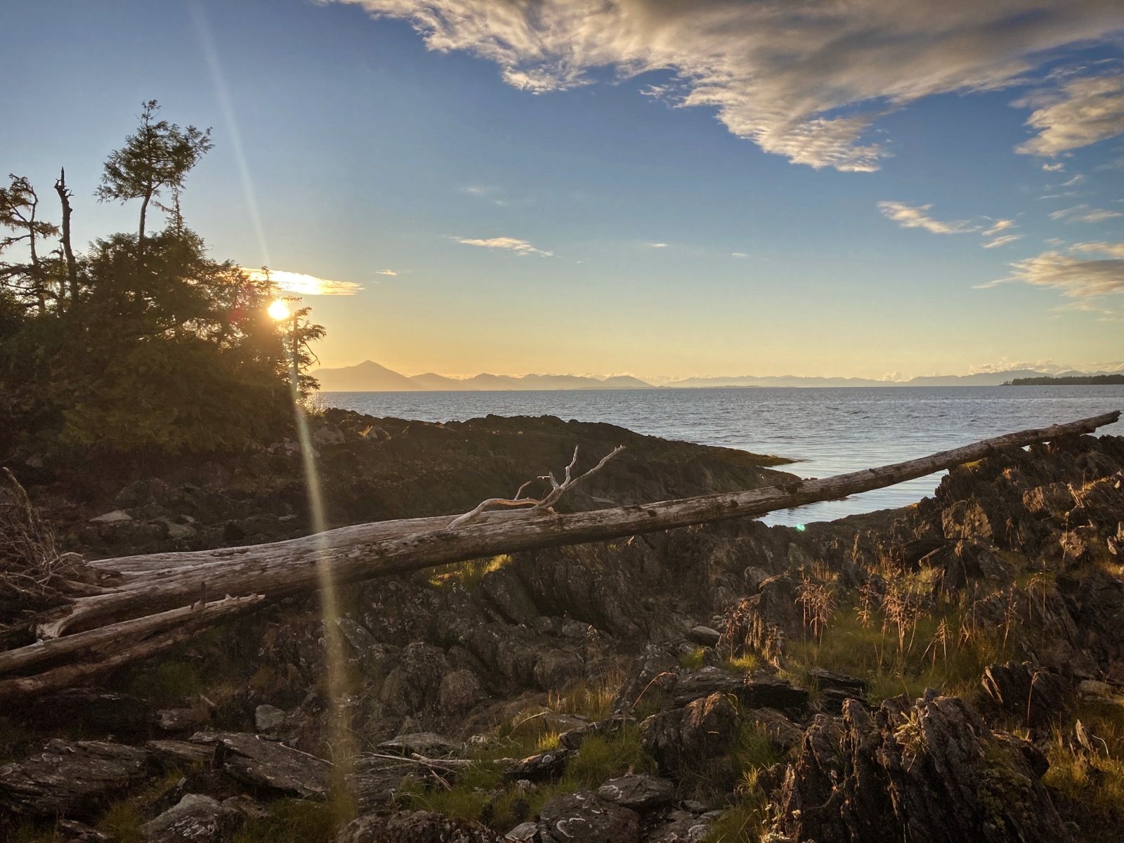
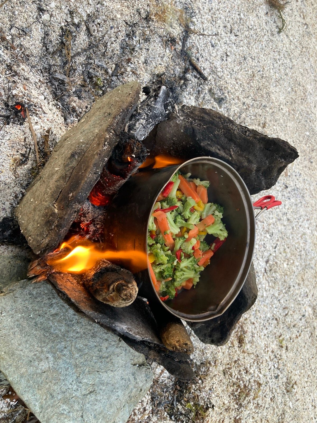
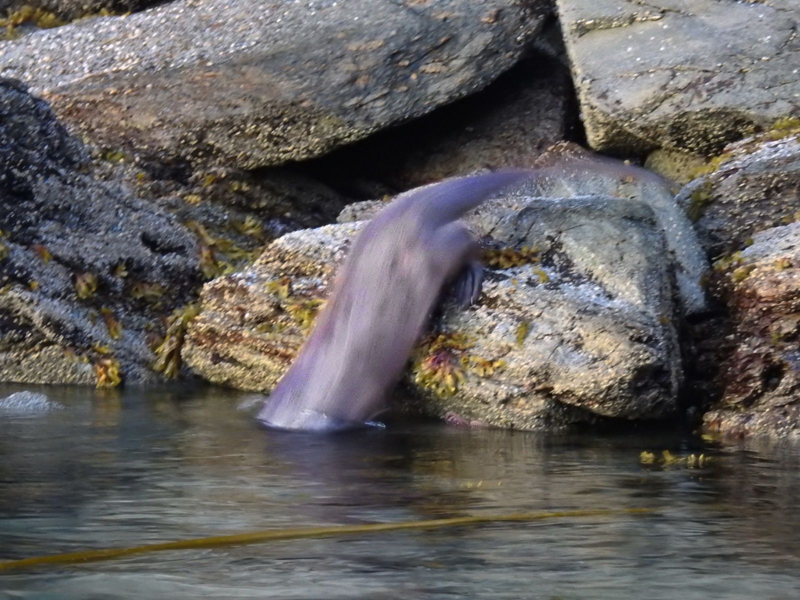
Strava Comments:
Bill B.
Stan H.
Corrine L.
Tracey A.
Marty P.
Nancy P.
Mark G.
Ride Stats:
| Elapsed Time | Moving Time | Distance | Average Speed | Max Speed | Elevation Gain | Calories Burned |
|---|---|---|---|---|---|---|
|
13:57:16
hours
|
12:32:21
hours
|
64.13
km
|
5.12
km/h
|
10.90
km/h
|
608.10
meters
|
2,322
kcal
|
– Day 34 : Orinoco Flow [top]

On the water, occasionally had cell phone reception and was able to talk to Janet as she was driving to Colorado. We were both “captive audiences” so we talked about everything under the sun. We were disconnected several times. I also was able to call my dad and Make a reservation for a hotel in Ketchikan, Alaska.
I arrived at the cabin relatively early and it was unlocked. Inside there’s a little book and it says that you need to pay online. I tried to go to the website and actually got part of the page to load. But with just one bar of cell reception, I tried for about 15 minutes and then finally gave up. I wasn’t even able to send out emails or text messages or make phone calls, But I did have a flickering bar of reception. After coming to all of those free cabins in BC, I wasn’t super excited about paying $88 plus tax to stay in the same type of cabin with no additional amenities here in Alaska.
This was a good opportunity to do a few chores on my gear. Since there is only one paddling day left, I don’t plan on bothering to fix the boat. I’ve been pumping it many many times a day and that wastes a lot of my time, but I have not had success trying to repair the boat without the proper tools or set up where I can find the leak.
I plan to hopefully meet up with Terry and Louise who are going to be camping about 5 to 6 miles out of town for the next three days. The weather is not predicted to be very good, but I am excited to see them and hopefully we can do something fun . They were on the northbound ferry with another friend who is from Alaska named Corrine. I think it is interesting that I know two couples on that particular ferry. I tried to introduce them to each other online because both couples are interested in long distance cycling.
I am very sad to be coming to the end of this trip. I’ve enjoyed this region immensely. Having said that, I will confess that there were a number of times where I wanted out of here! If I had a Tardis and could explain escape, I probably would’ve done that a few times. It is so strange how your mental state can change very rapidly – just like the weather. But the majority of the time I was really enjoying myself.
———
Sunrise : 4:56 AM
Sunset 8:48 PM
Moon: 66% waxing
Pressure: 1023.7 steady
Photos:
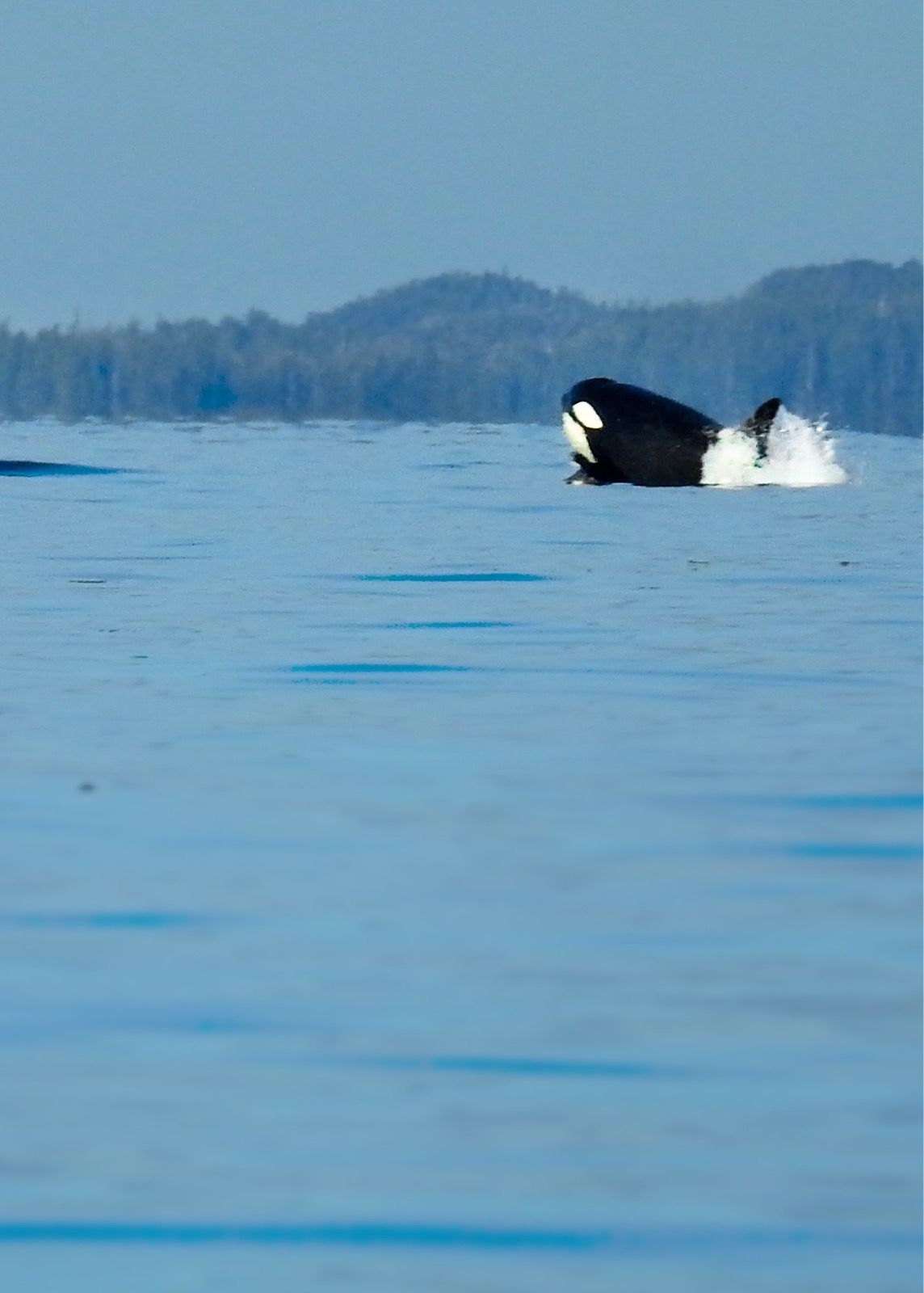
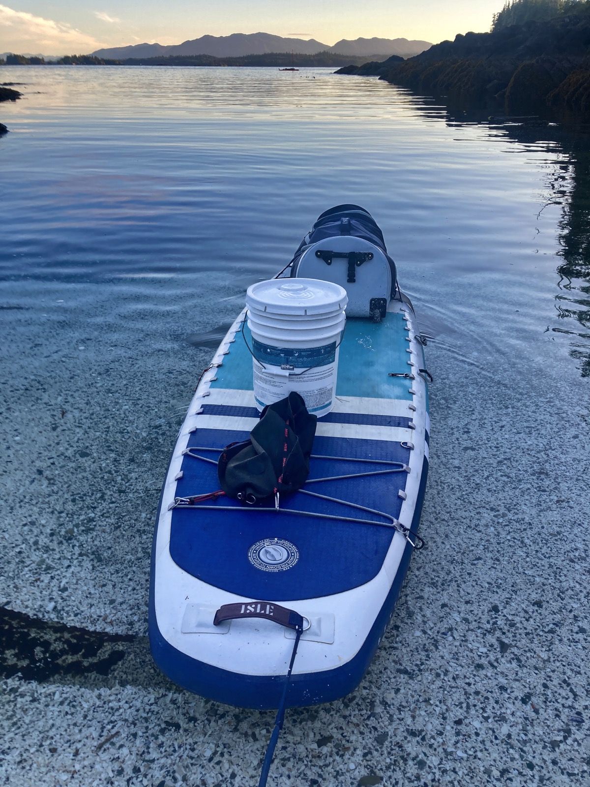
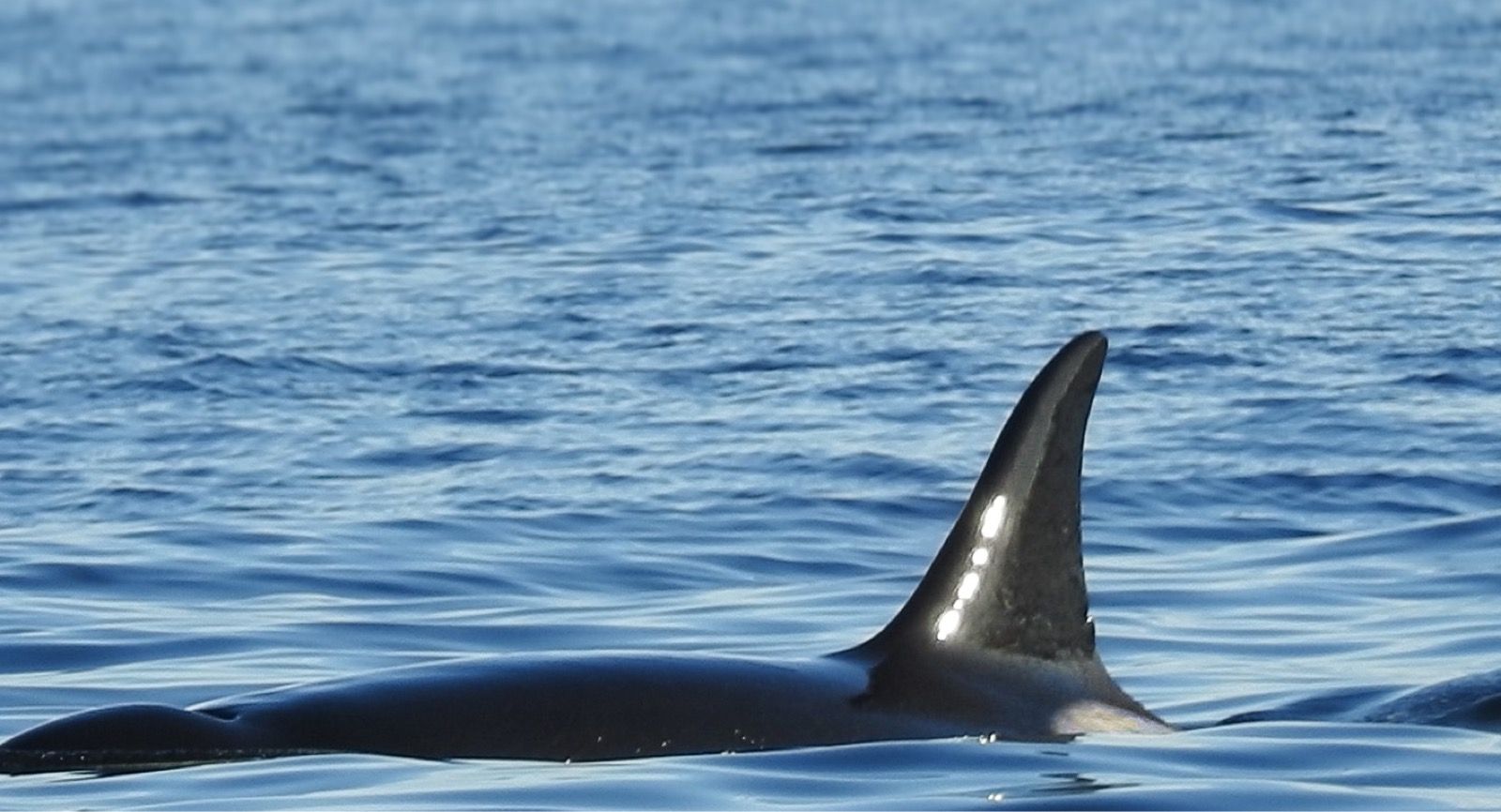
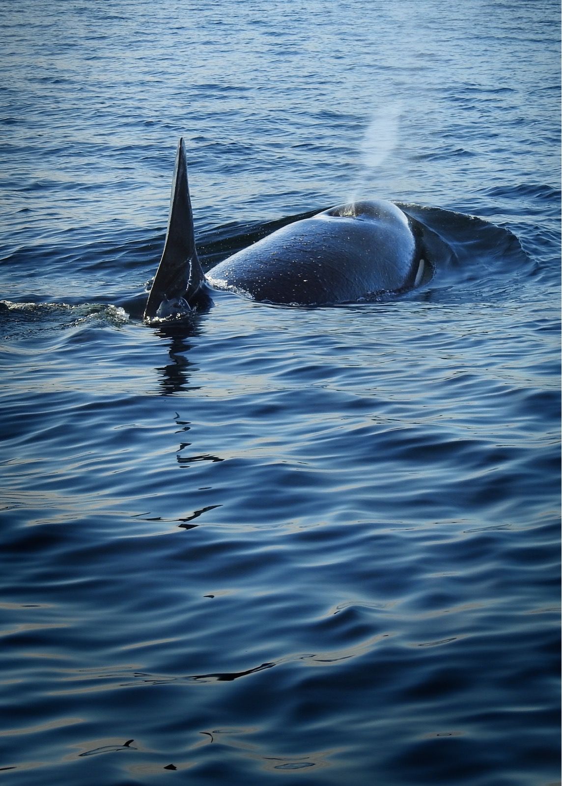
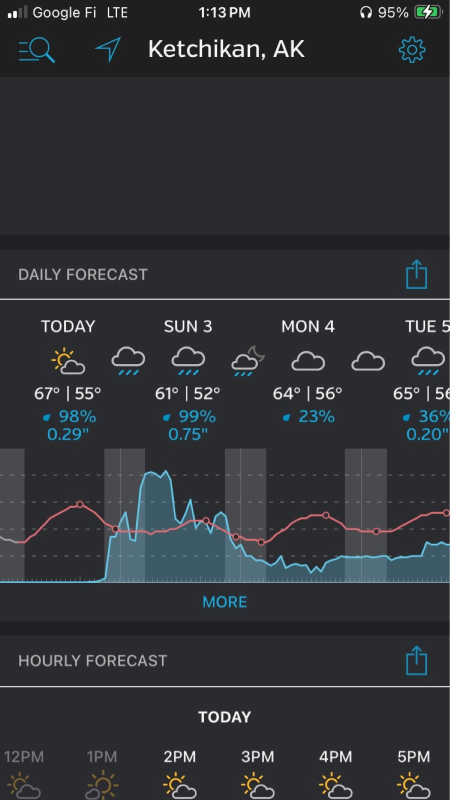
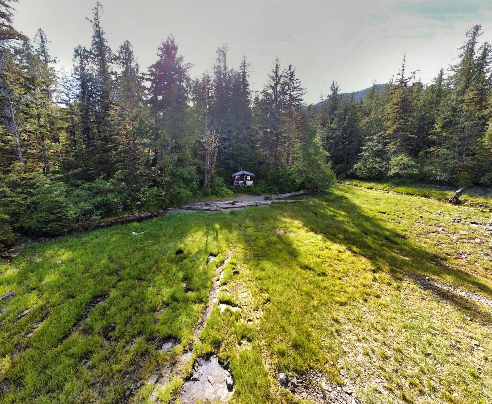
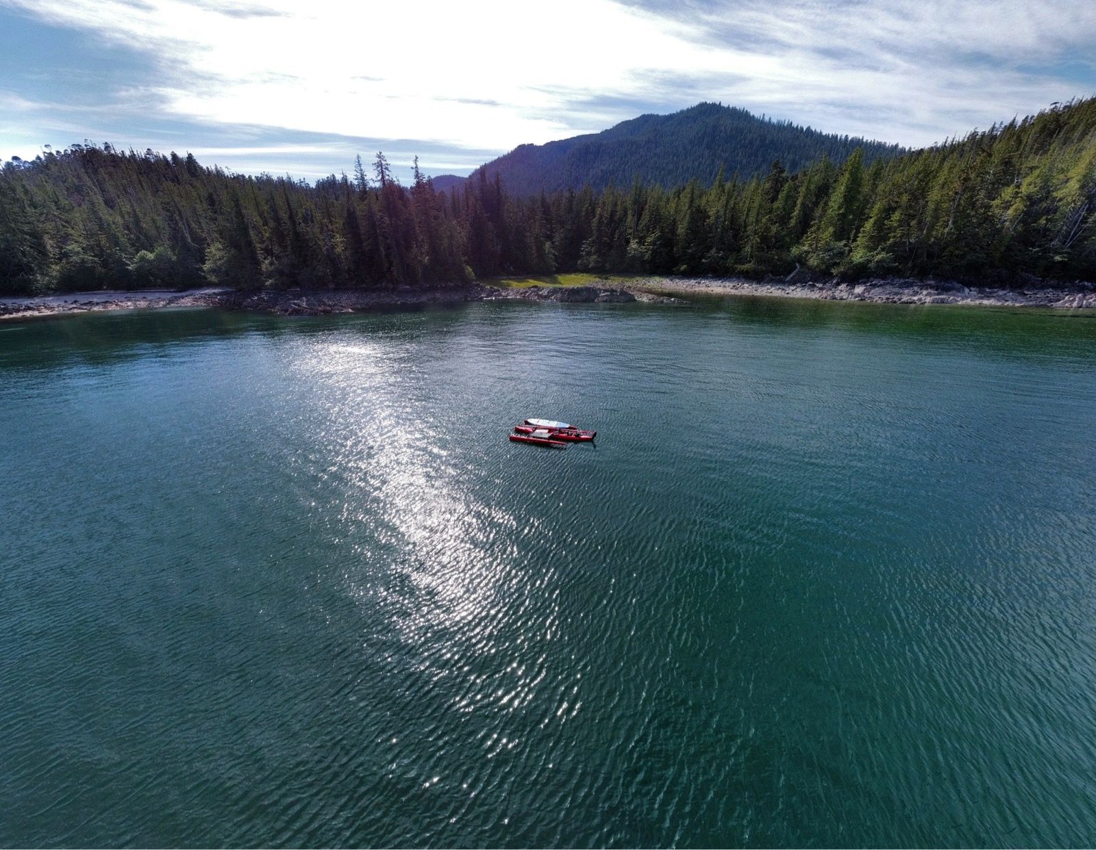
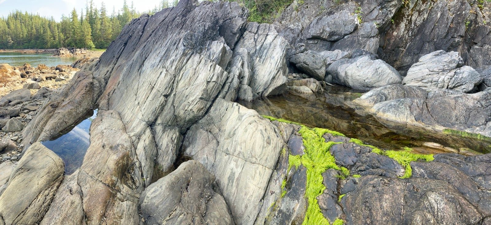
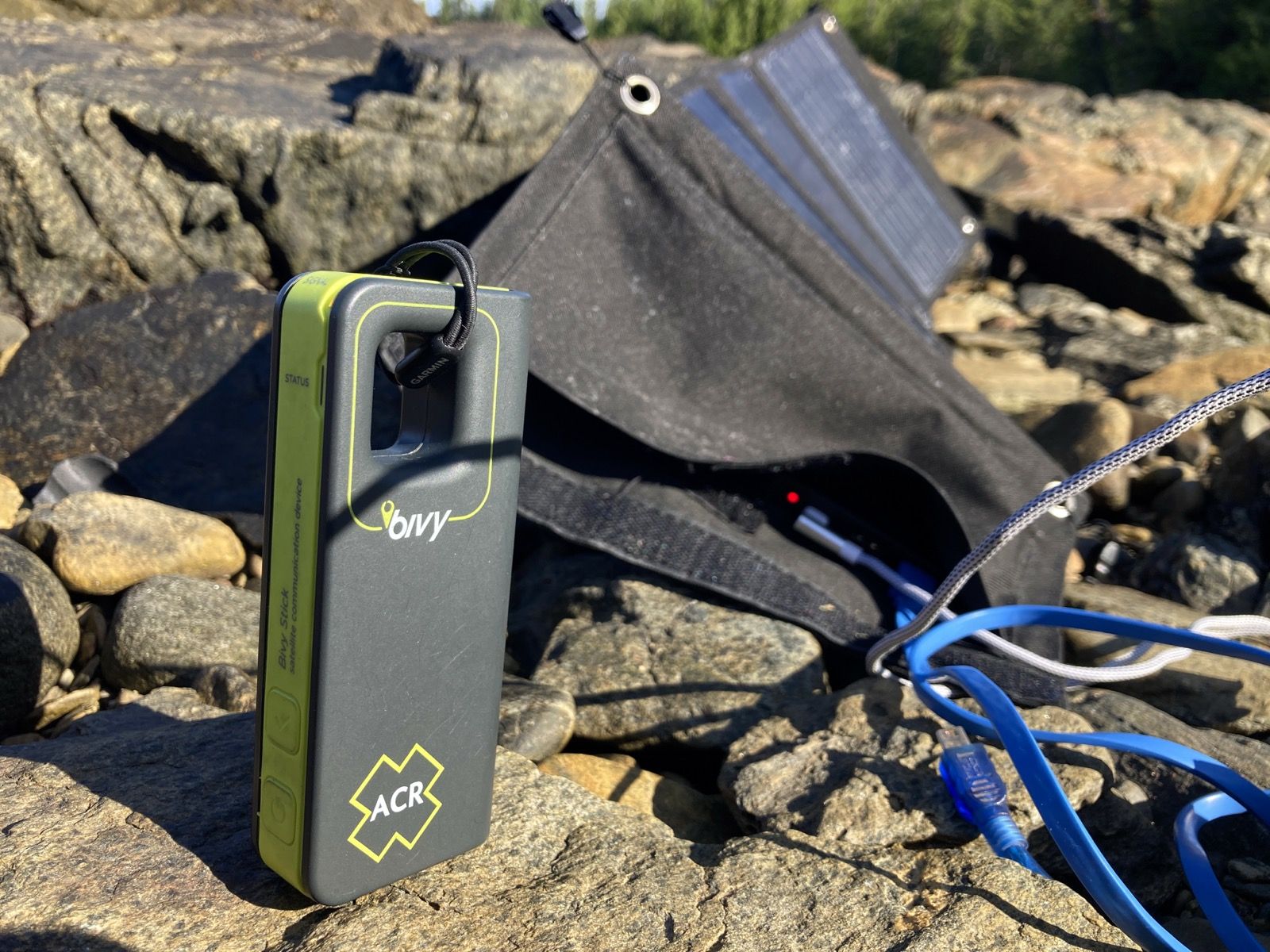
Strava Comments:
Nancy P.
Todd A.
Nancy T.
Mark G.
Josh R.
Ride Stats:
| Elapsed Time | Moving Time | Distance | Average Speed | Max Speed | Elevation Gain | Calories Burned |
|---|---|---|---|---|---|---|
|
08:57:55
hours
|
07:46:54
hours
|
38.27
km
|
4.92
km/h
|
8.70
km/h
|
759.50
meters
|
1,436
kcal
|
– Day 36 : Catch a Can [top]

Once I was tacking into the headwind and into the current, I noticed Blue Pacific was out in the main channel. I was finally under sail and moving along at about 3 1/2 kn. Blue Pacific is off to my Starboard side, and all of a sudden turns around and begins to drop nets. It starts hauling perpendicular to my path at about 10 to 12 kn. They are dropping their fishing net and headed nearly straight towards me (just a few degrees off my bow). Rather than wait 30 seconds for me to go by, they charge right in front of me, maybe 150 feet away. As they pass my bow, they all start yelling “go around,” motioning to the bow of their boat as it is moving at 12 kn! Obviously my boat that is only capable of going 3 1/2 kn cannot go faster than their boat which hasn’t slowed down an iota! Meanwhile, they have completely blocked any path to the right with hundreds of feet of fishing net. I am trapped and unable to pursue any forward vector. I try to maintain my cool in most situations, but this was not one of them.
I swore like the fucking sailor that I now am. This must be my rite of passage. I recited a few other words that I learned, obviously one that started with the letter F, I may have called them idiots, and may have provided hand signals that are equally understood both on land and at sea.
Regardless, they were very rude and I had little that I could do because they were the big guys with a motor. I pulled up my dagger board, rudder, and pedals, and was able to finagle my boat over the floats comprising their net – much to their chagrin as they were now turning and making a net circle around me. What surly characters!
After I had gotten over their net, I did make sure to call on the radio on channel 16 (which the Coast Guard will hear) and say their name and remind them that vessels under sail power have the right of way – especially under these conditions where they it would’ve been the most minor of inconveniences for them to wait an additional 30-60 seconds before dropping their net, or for them to easily veer a single degree and go behind instead of in front of me. There was no reply from their radio.
I did write an extremely detailed description to Grok because I’m not 100% educated in right of way on the water. I am now thinking that I need to take a class. Here is the real deal… First of all, the determination of who had right of way was actually nebulous. They were considering to be a “powered vessel” before they began deploying their net. Once they transitioned to becoming “actively fishing,” it is my job to defer to them. Here is part of what Grok said:
“Right of Way: The fishing boat likely gained the right of way as a “vessel engaged in fishing” once they began deploying nets, per Rule 18(b)(ii). Before that, as a power-driven vessel, they were required to avoid you. Their transition to fishing status while you were close shifted the burden to you, but their rapid net deployment made compliance nearly impossible.
Fault: The fishing boat’s decision to deploy nets when you were already close, without slowing down or communicating, was discourteous and potentially unsafe under Rule 8 and Rule 2. Their instruction to “go around” was impractical, given your speed and the net barrier. You were not necessarily “in the wrong,” but COLREGS required you to attempt to avoid them once they were engaged in fishing, which was practically unfeasible.
• Practical Issue: COLREGS doesn’t fully account for scenarios where a slow vessel (like your kayak) is trapped by a faster vessel’s rapid net deployment. The fishing boat’s actions exploited this, creating a hazardous situation.“
So I learned a bit.
After that, things got better. I talked to Janet on the phone and also Nancy and Marty, because she is visiting them. That was really fun and uplifting. I got to tell them my story because it actually happened in the middle of my conversation with Janet; Ihad had to hang up on her. As I told the story, my voice was shaking.
Arriving at the dock in Ketchikan, I was warmly greeted by the harbormaster, Craig, who discussed the R2AK with a big smile. Then I walk/jogged to the hardware store. It was time to do one of the last 3 Difficult Things: find a cart to pull 300 pounds of kayak and another 100 pounds of gear the 1/2 mile to the ferry.
I looked into buying wheelbarrow wheels: nearly $100 each! I had invented a design in my head with a steel axle, PVC and two wheelbarrow wheels. In the end, I bought a Gorilla Cart which à staff guy named Jerry had Jason assemble for me. They were super nice at True Value Hardware. I worried, though, that this cart had 4 wheels. I would need to somehow steer it while it was placed mid ships. Also, it had a plastic “dump” bin that didn’t seem up to the task, even though it claimed 600 pounds of capacity.
I walked this cart back to the dock, and after over an hour of shuffling and portaging gear and boat, I managed to get the vessel precariously on top of the little wagon and up the ramp. No need for a gym membership with this kind of life.
I had booked a hotel room, but after spending $165 on a wagon, was not too excited about spending over $500 for a hotel. I called another hotel closer to the ferry and asked how much it would be to leave my boat in the Parking Lot. It would be Free at a hotel/bar called “The Landing,”. I canceled my reservation at à hotel called “My Place,” and upon arrival at The Landing, met very friendly Jeff who told me about his “Hobie Pro Angler,” and smiled a lot as he guided me to parking. I resolved to treat Terry and Louise to dinner here to repay “The Landing” for their kindness; leaving an outsized tip to express my gratitude for their warm reception- something that they deserved.
As I waited for Terry and Louise to arrive, I decided to change into my Monday’s Best. One laundered t-shirt and pair of shorts that I washed weeks ago in Shearwater and hadn’t worn yet. My salt encrusted outfit with torn hems, although it matched my skin festering with sores from salt water and flaking skin from sunburn, was probably not up to par for a nice restaurant. I stood on the sidewalk and changed my shirt. Then, when I changed my shorts (keeping the boxers on, of course) I heard a scream from inside the building. Apparently they could see out through the dark windows I was in front of – because a woman came running out.
“You’re in front of my business,” she exclaimed.
She seemed upset, but she also kind of had a wry smirk – like she thought this was funny.
“What is your business,” I asked, glancing at her name tag.
“The Landing Hotel and Bar…..So, are you homeless?”
I explained that I don’t have a home in Alaska but that I kayaked here. But I do have a home back home. Suddenly she was my best buddy and apologized. I apologized for dropping trou in front of her window, and told her that I was going to eat at their restaurant- and had to be presentable. “Welcome to Ketchikan,” she replied. She explained that there are a lot of homeless people her, “but you don’t look like a homeless person.”
I pondered what makes a person look homeless or not – but decided not to get into a philosophy discussion with her. But since I can’t let things go so easily, I’ll do it with you instead – what IS the difference between a homeless person and a homemore person? What difference does it make, really, if you own a home? Technically I’ve been homeless for over a month. It’s a nice life in many ways; I love the freedom it entails. Coming into Ketchikan, I quickly was reminded of how anti-social I am. Out in the inlets of BC, I smelled the sea and cedar. Coming into a place where people inhabited, the noxious fumes of burnt diesel filled my lungs. Boats sped around me. Airplanes landed all around me on the ill-defined aquatic runway. Captain less fishing boats veered towards me – a fishing boat with 6 folks on the reel (and zero at the helm) drifted straight at me. The guy called out, “where are you from?” As I was taking evasive action and they were all just “having a good time” fishing – unconcerned with the imminent accident that I was circumventing. No wonder John Muir was nothing but cheer in his diaries of Alaska as he explored largely uninhabited regions of the coast. No wonder sailors come to port, drink alcohol, and then go back to sea…. Maybe it really is a sailors life for me….
——
Sunrise: 5:03 AM
Sunset: 8:44 PM
Moon: 86% waxing
Pressure: 1013.7 steady
Photos:
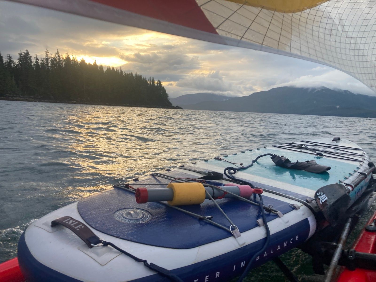
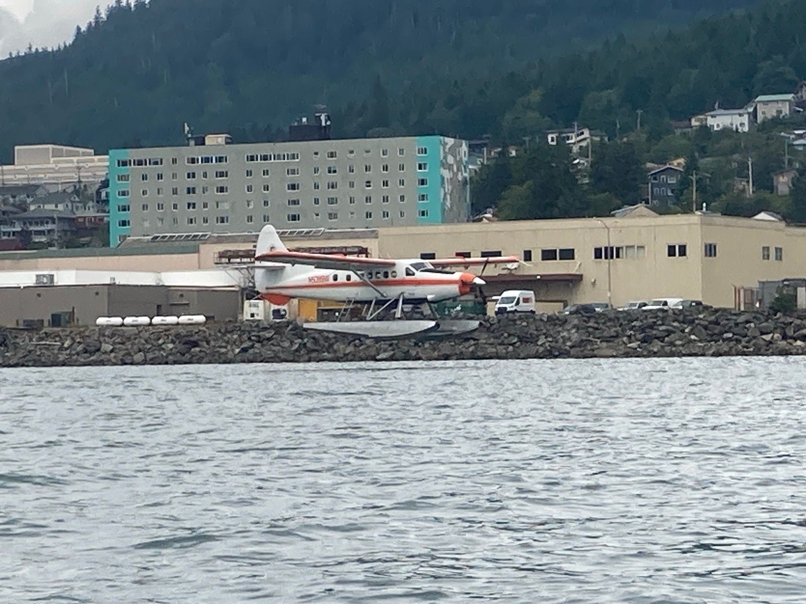

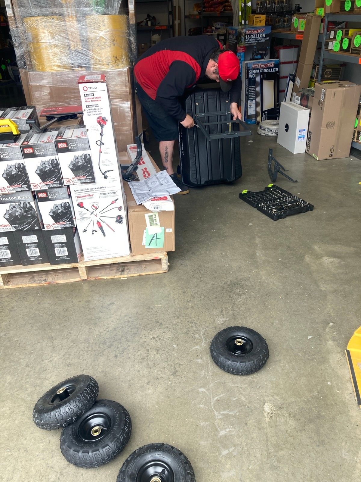
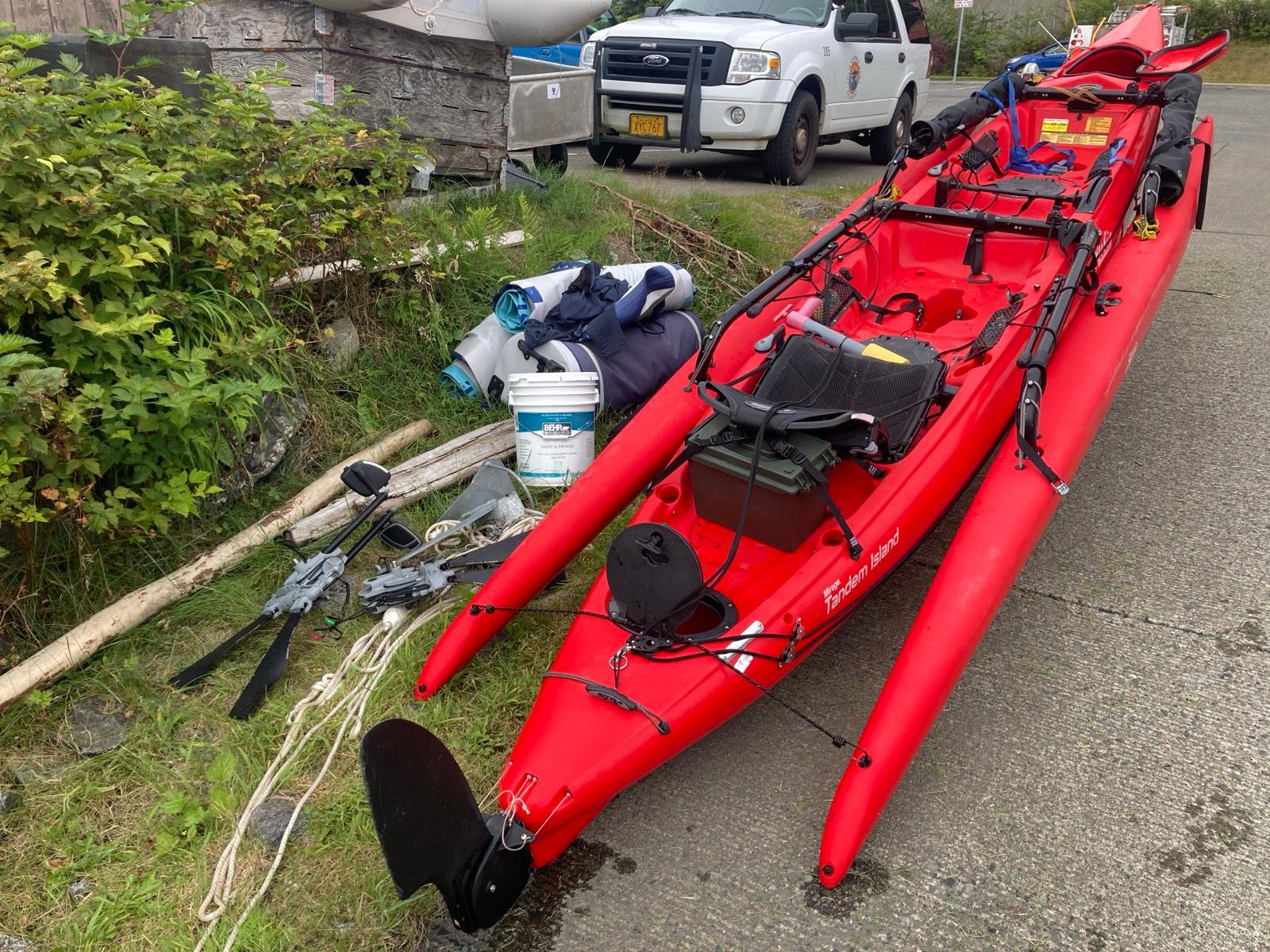
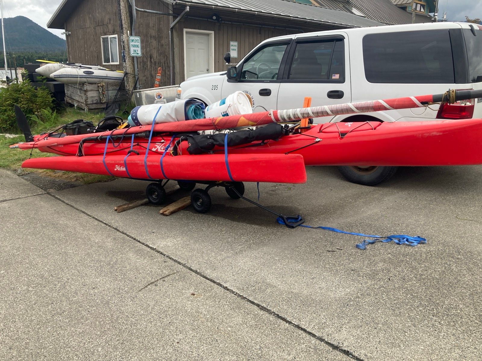
Strava Comments:
Scooter R.
Stan H.
Menso D.
Todd A.
Nancy G.
Gordon L.
Nancy P.
Ann L.
Judy I.
Janet W.
Osman I.
David L.
Marty P.
J&K S.
Clayton C.
Ride Stats:
| Elapsed Time | Moving Time | Distance | Average Speed | Max Speed | Elevation Gain | Calories Burned |
|---|---|---|---|---|---|---|
|
12:14:50
hours
|
08:46:30
hours
|
52.90
km
|
6.03
km/h
|
22.62
km/h
|
1,181.80
meters
|
2,483
kcal
|
Fun Stats
Favorite unexpected piece of gear:
-Anchor
-Honorable mention – Solar panel
Most unreliable piece of gear:
-The leaking cracked hull (my fault for anchoring too shallow)
-iPhone charging wires (4)
-Iniu cache battery
Gear I could have left at home to save weight and space:
-Drone
-Long lens camera
-Wetsuit
Number of pump strokes to bail out main hull (estimated): 27,500
Things I like the least:
-My boat leaking and having to pump it out-sometimes every 30 minutes
-Baking in the sun
-Fighting unexpected currents
-Horse flies
Megafauna seen:
-Orcas: ~14
-Non-orca whales: too many to count
-Black bears: zero
-Grizzly bears: zero
-Bald eagle: too many to count
-Jumping fish: too many to count
Places I liked the most:
-Roscoe Bay
-Skull Cove
-Fury Islands
-Sheerwater Hot Springs
-Eucott Hot Springs
Things I liked the most:
-Swimming
-Freedom
-Seeing no other humans for days at a time
-Campfires
Hot Springs visited:
-Nascall (closed)
-Eucott Bay
-Bishop Bay
-Shearwater (Europa)
-Weewanie
Injuries:
-Tendon behind tight knee: ~3 days
-Lower back right: ~5 days
Books “read”:
-Madhouse at the end of the earth (Julian Sancton)
-Unsheltered (Barbara Kingsolver)
-Travels with Charlie (Steinbeck)
-John Muir‘s Alaska diaries (Muir)
-Station 11 (Emily Mandel)
-Heart of darkness (Joseph Conrad)
-Look for me there (Luke Russert)
-Left Hand of Darkness (Ursula le Guin)
Best 2 books:
Madhouse at the end of the earth (captivating; similar to Shackleton story)
John Muir’s Diary (dry, but inspirational to me)
Worst book:
Look for me there (Author seemed purely focused on name dropping)
Number of days where I felt too cold: 0
Number of days where I felt too hot: ~12
Number of days with Heavy Rain: 2
Number of days with light precipitation: ~3
Number of days I sailed in heavy rain: 0
Number of days not moving on water: 3 (2 waited out heavy rain; 1 waiting to cross Cape Caution)
Number of days elapsed: 36
Distance covered: 1,143 miles (statute; my second longest voyage on a Hobie Tandem Island after the ICW trip)
Hours spent on water: 325
Average speed: 3.51 mph
Number of times I had to fold back the kickup fins: 2 (Both were hitting Bull Kelp. By comparison, on ICW, I had to do this several times a day).
Here is the link to my live tracker. This tracker requires that I push a button, and this tracker is on my life jacket. I can also be tracked via an AIS beacon which is associated with the boat. You can track using the following websites (note that as an unpaid user, you can only see positions updated via land-based towers. The AIS signal is also received by Satellite, but that requires a subscription. As such, there may be days where position is delayed until I come within range of a land-based tower):
- Marine Traffic – Most popular and easy to user interface, but free version only shows when I’m within range of land based towers.
- Vessel Finder – Sometimes sees my AIS when Marine Traffic Cannot.
- Ship Finder – you can see me via satellite, so most accurate… but with 12 hour delay for the free version.
Thanks for following!
You may also like...

Type 1 Diabetes Blog
-

When is a carb not a carb? The great fructose experiment.
August 4, 2023
-
-
My Type 1 Diabetes Diagnosis Story
May 31, 2021
-
-
Type 1 Diabetes FAQs – What food do you miss the most?
November 12, 2018
-
Type 1 Diabetes FAQs – You Can’t Eat That, Right?
November 3, 2018
-
Symlin for use in Type 1 Diabetes
October 30, 2018
-
-
-
-
-
-
-


-
August 22, 2017
-
-
August 23, 2015
-
-
Ionian Basin Traverse and Tehipite Gorge
July 17, 2015
-
-
Leor’s Devils Falls and Hellhole Falls Loop
May 16, 2015
-
Little Sur River Fastpack Exploration
November 14, 2015


Highlights
-
February 9, 2024
-
Utah Bikepacking – All The Routes
September 30, 2021
-
Bikepacking Death Valley – Valle de la Muerte
February 12, 2021
-
Wandering the West Bikepack trip
October 23, 2020
-
October 10, 2019
-
October 9, 2018
-
January 12, 2018
-
December 8, 2015


