Bikepacking Arizona’s Black Canyon Trail
The Black Canyon trail in Arizona is 70 miles of single track bliss. You might be able to do it in one very long epic suffer-fest, but why not enjoy it over the course of 2-3 days instead? We took the 3 day option, and will describe how you can do it too.
Riding Direction:
We recommend riding the trail from North to South. There is more downhill in that direction, and on our 3rd day when the winds were up, we enjoyed a strong tail wind all day. Winds may vary, so check your weather report.
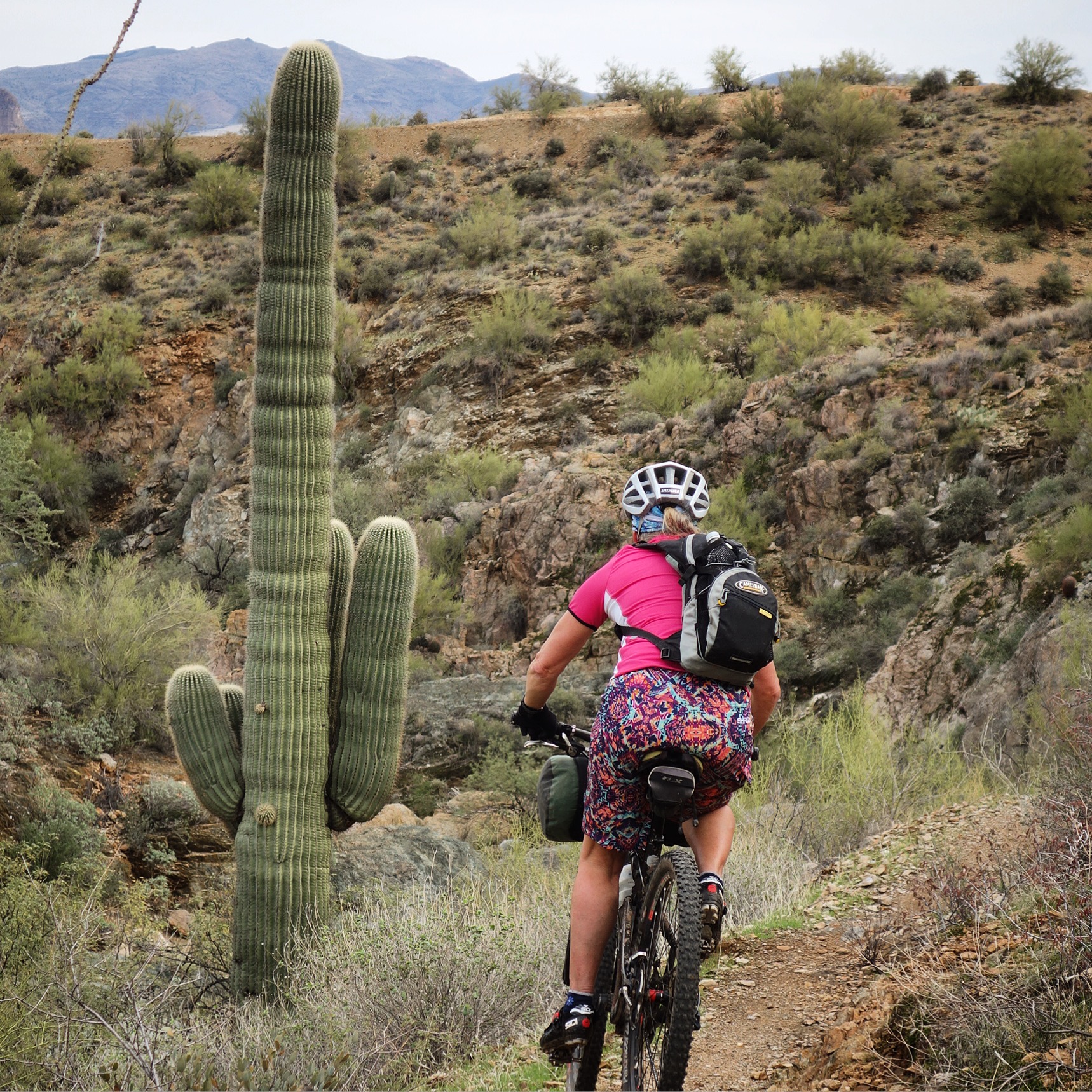
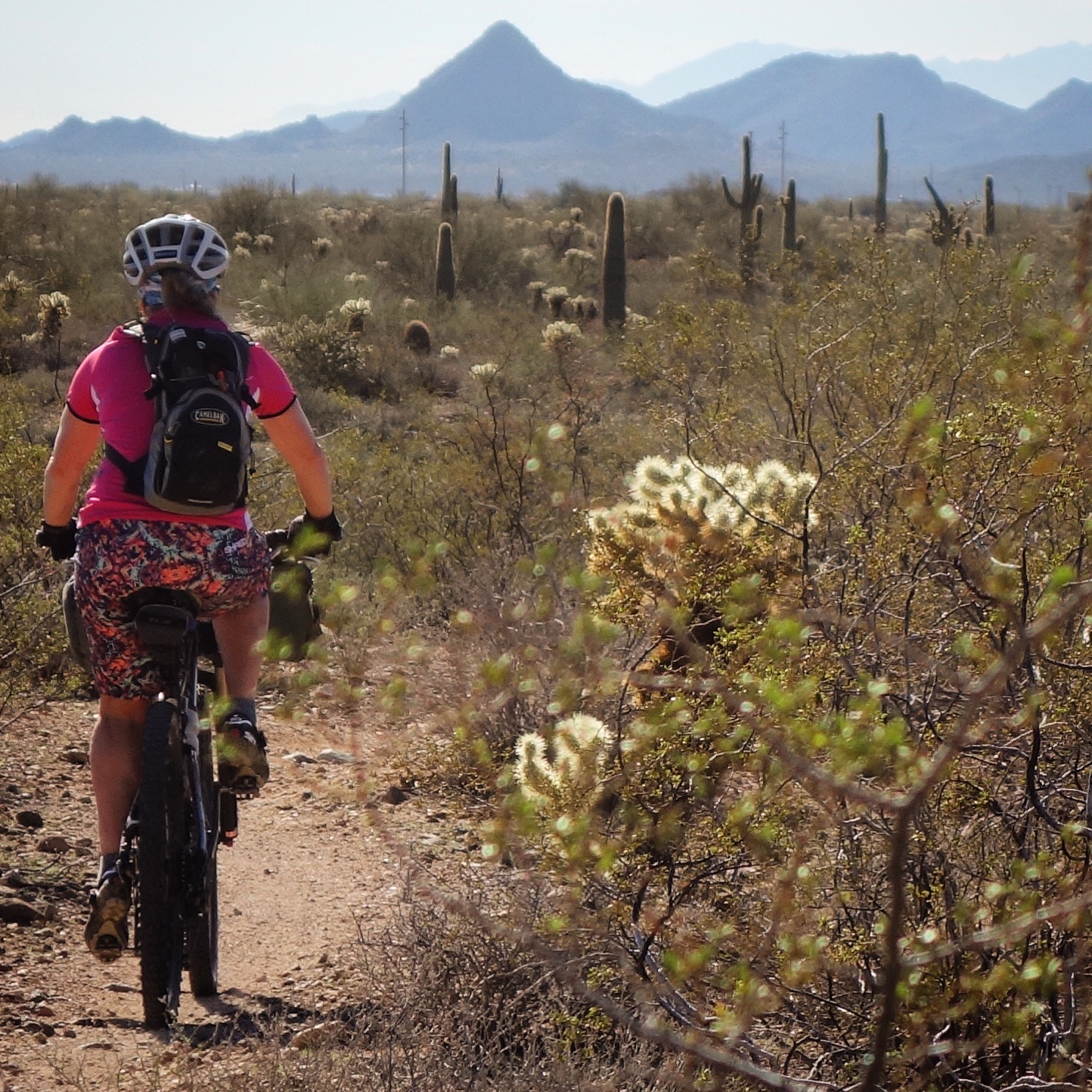
Loving the Saguaros!
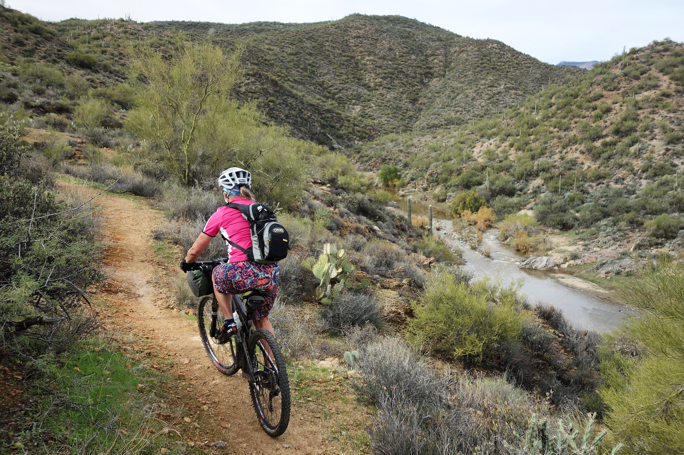
Stream Crossings:
I did not expect this to be a problem (after all, this is the Sonoran Desert)!.. We were surprised to find that there were 4 significant river crossings (and a few smaller ones). We were barely able to cross the significant ones – and if you are riding the trail at a time of higher water, you probably won’t be able to cross. We happened to meet a local out there who told us that they’ve been having “100 year floods” every 5 years. The last time, the river rose 15 feet above the banks…
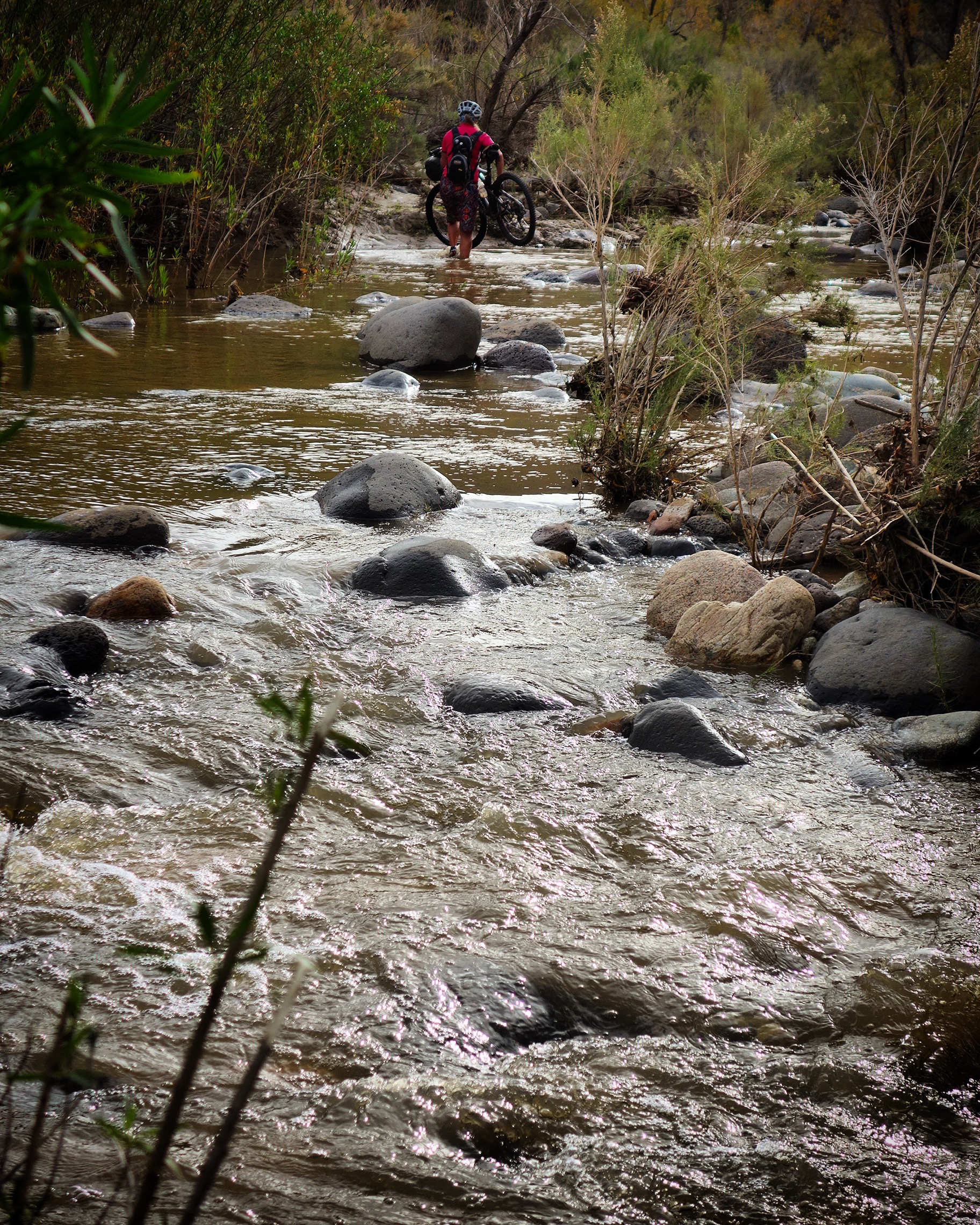
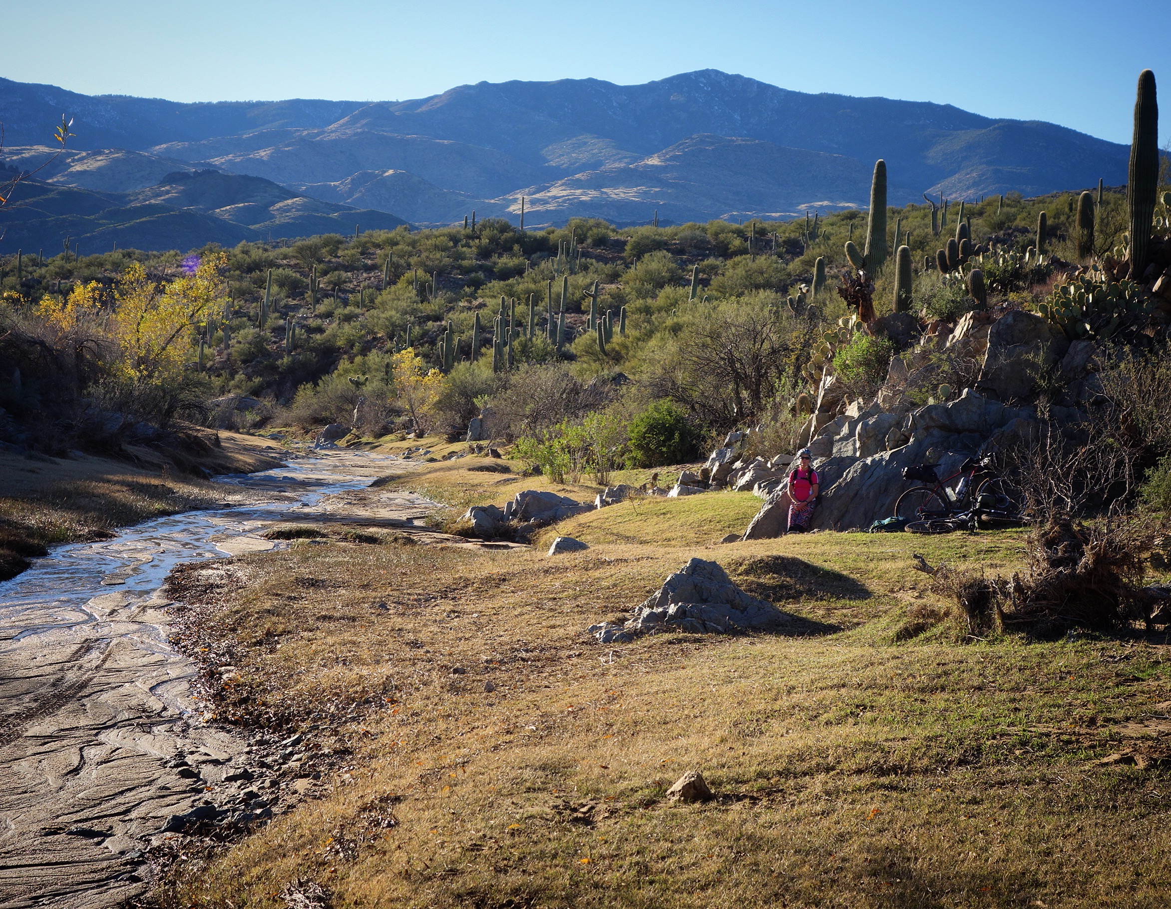
On the 2nd day, we had to do 3 river crossings. This was the second and is located at 34.05376° N 112.16808° W You can probably get water here most of the year.
Weather:
One other surprise we encountered was mud near the beginning portion of the trail on the first day. This mud got to be less and less after the first 8 trail miles, but there was a clumpy red-clay section that mired our tires for 45 minutes or so! Therefore, when deciding when to go, we suggest that you try to wait until it has been several days since the last rain. We began our ride just two days after a significant storm.
Ride-ability:
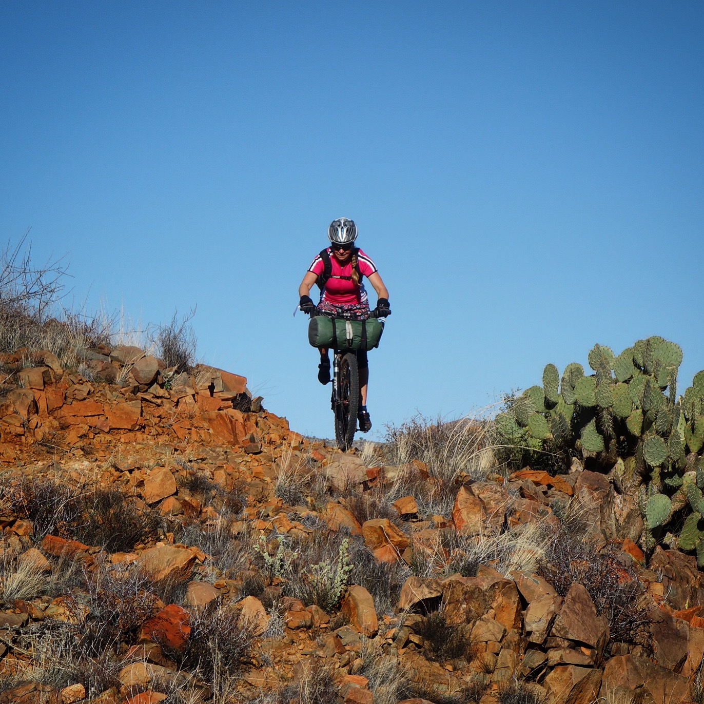
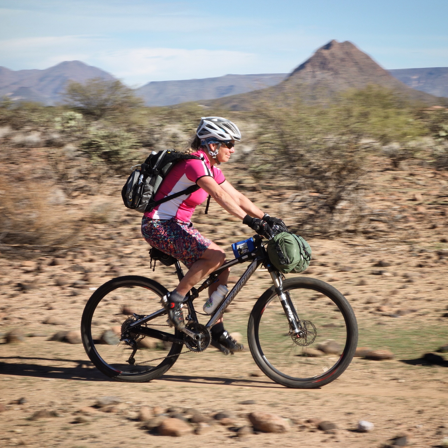
Janet estimated that this route was 99.0% rideable. I deemed it 99.7% rideable. The quality of the riding is outstanding. The trail is rolling single track with enough challenge to keep you interested the whole way, but not enough challenge to make you frustrated.
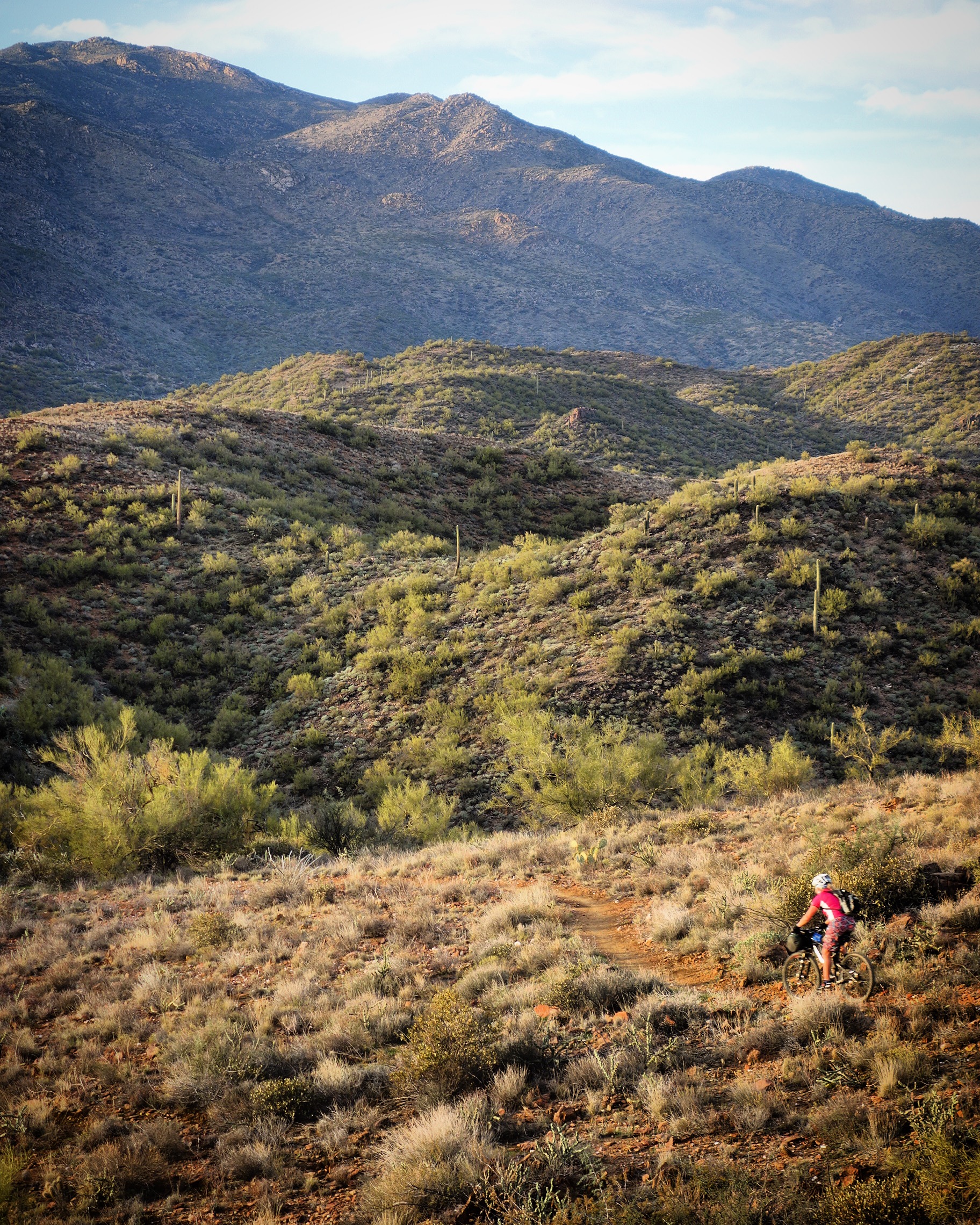
The hills are amazing!
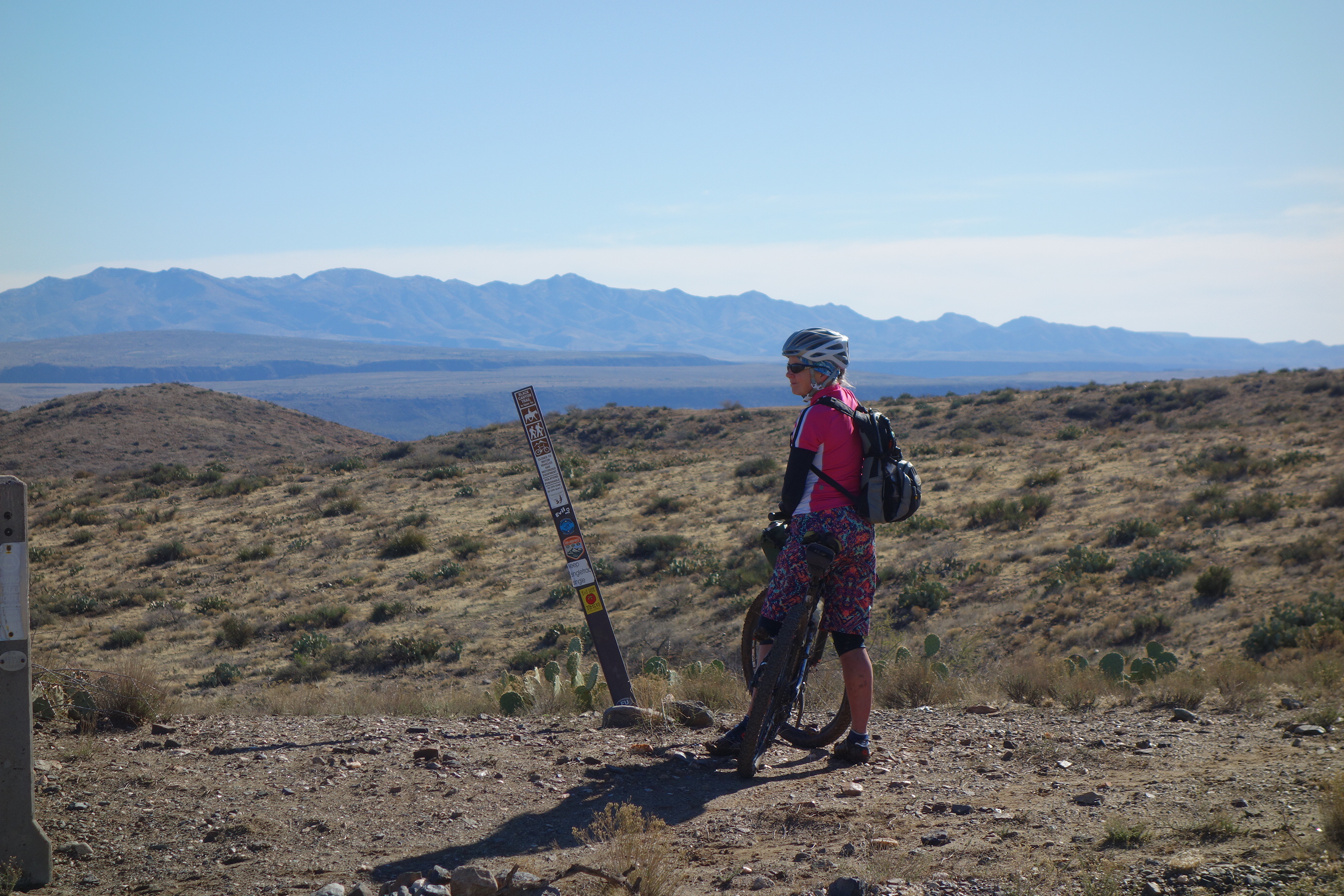
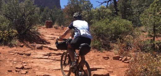
Finding the Route:
The trail is somewhat well marked – but having a GPS track will make route finding a lot easier. We used Open Street Maps to find the route, and it was particularly important when we deviated to cross the rivers. Having a GPS will also help you in areas where the route shares dirt with a fire road for a short distance.
Accommodation:
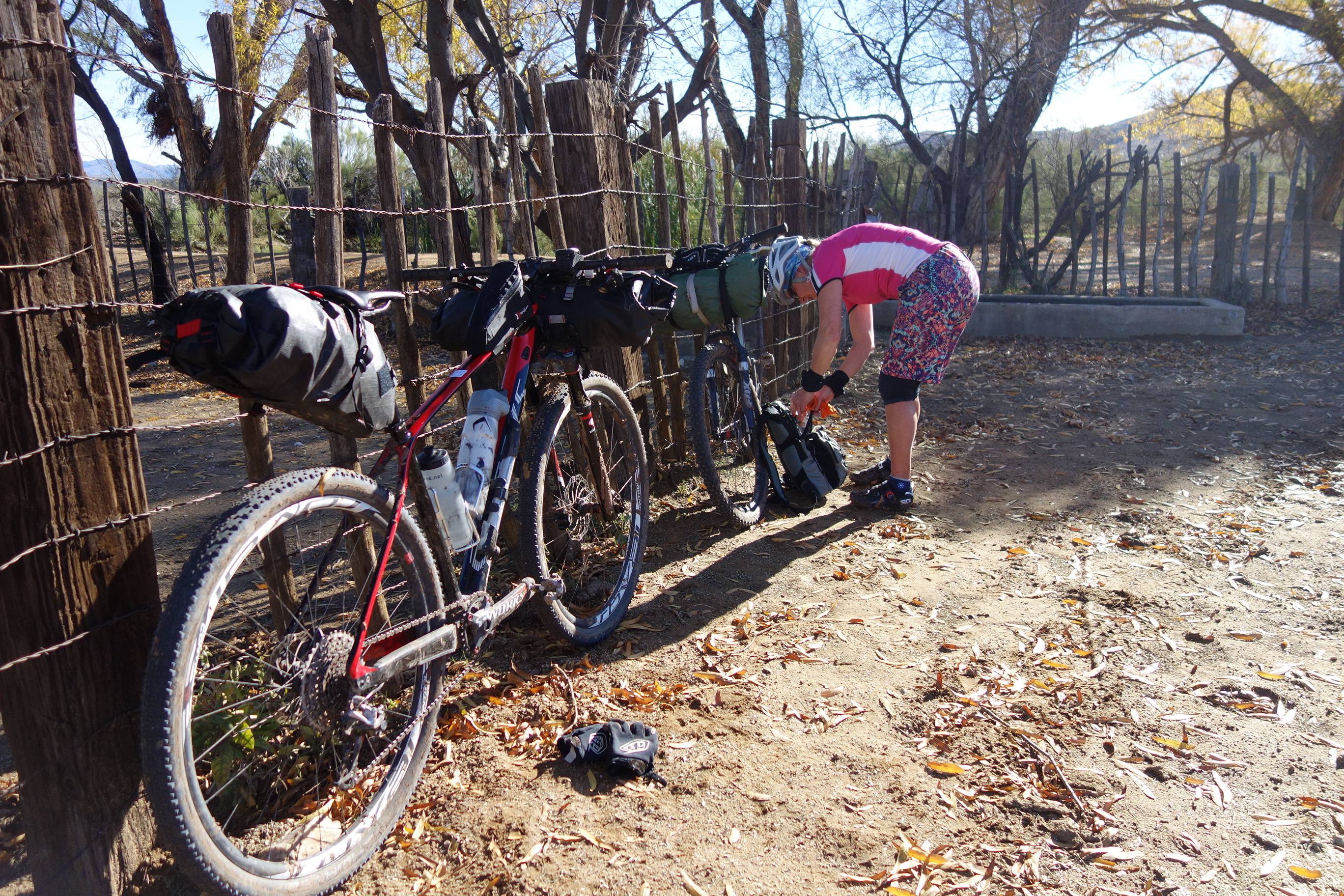
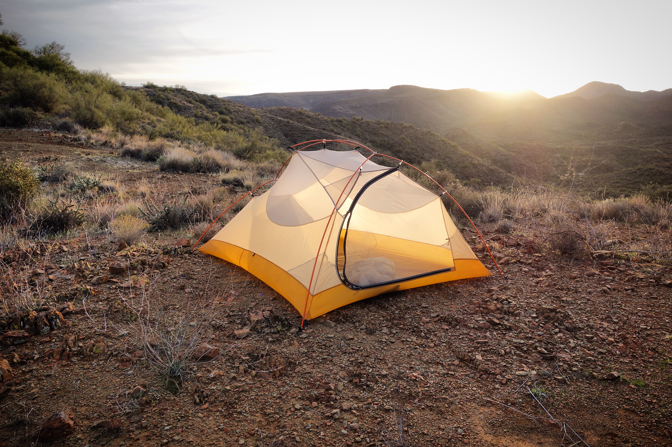
The distances work out so that you could do a “privileged” 3-day, 2-nighter and evenly divide your days spending the first night at Bumble Bee Ranch, and the second night in Black Canyon City. Of course, Janet and I did the “free camping” method. The first night, we had a spectacular camp site, but we made the mistake of camping on a ridge the 2nd night – strong winds buffeted our tent and threatened to break the poles all night long. Eventually we woke at 5am and broke camp in the dark because we were so worried about the tent ripping. We rode in the dark to the place where I had originally planned to camp (by water)… and sure enough, the air was still in that deep culvert.
This is where we should have camped: 34.03438° N 112.19225° W aah, retrospect.
You can camp at the ranch at Bumblebee… or you can camp here – 34.19195° N 112.16337° W like we did. As you can see, there was even water present (though not much)…
What it’s like:
I’d divide the trail into about 5 different “sections.”
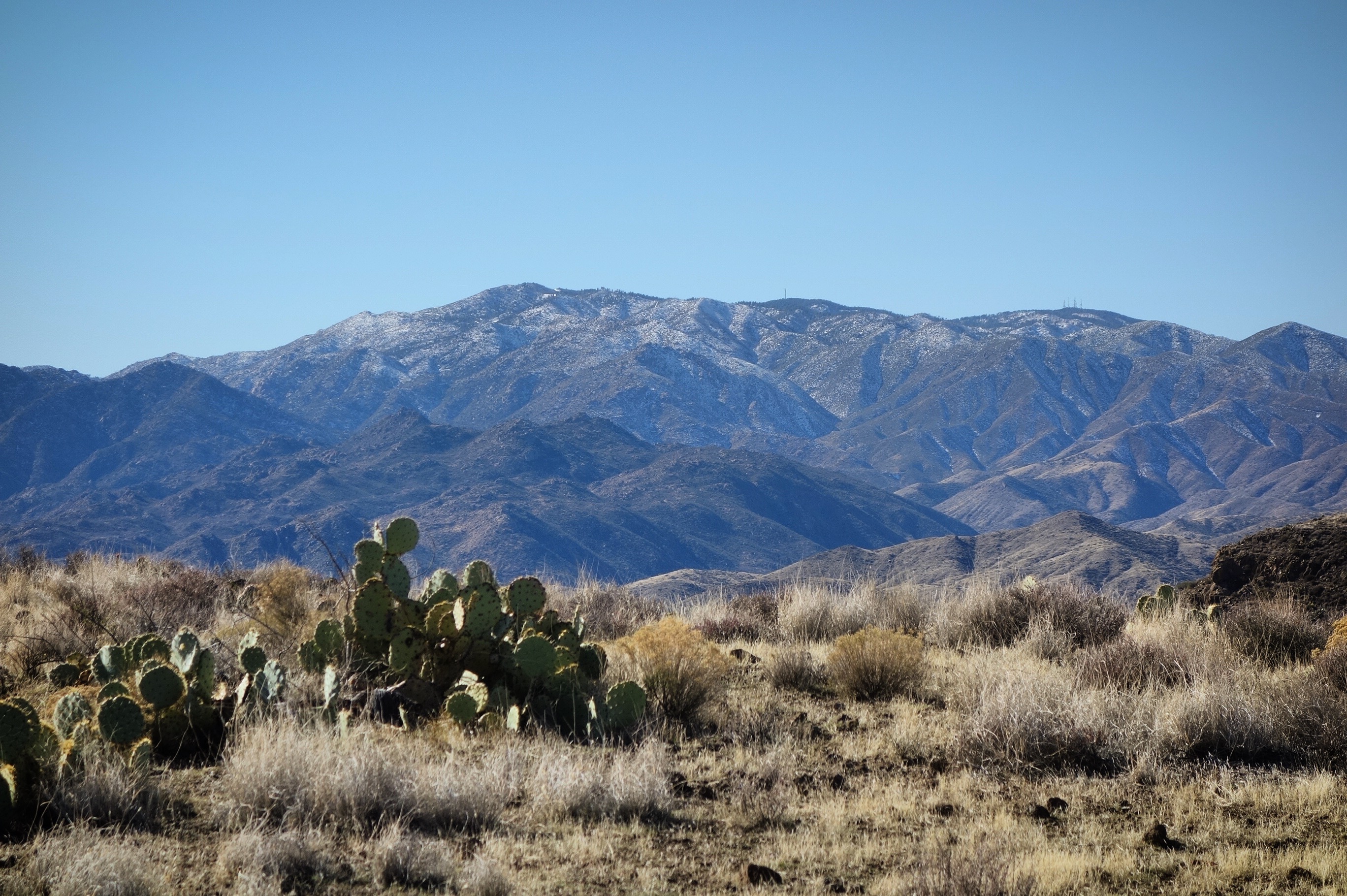
The first section (miles 0-10) up by Mayer was somewhat challenging due to mud and holes made by cow prints. Although you may not have the mud, I imagine that the cow-holes persist year round. Scenery is a little more pastoral, and in our case included snow covered mountains in the distance. It is ranch land interspersed with paddle cacti.
Don’t despair! There is a patch of mud that is unlike the rest located at 34.33748° N 112.18950° W Fortunately, it is only a few hundred feet long. Obviously, it won’t be there if conditions are dry… but if you encounter it, don’t turn back. We saw some other riders do just that, and they missed the awesome riding on the other side.
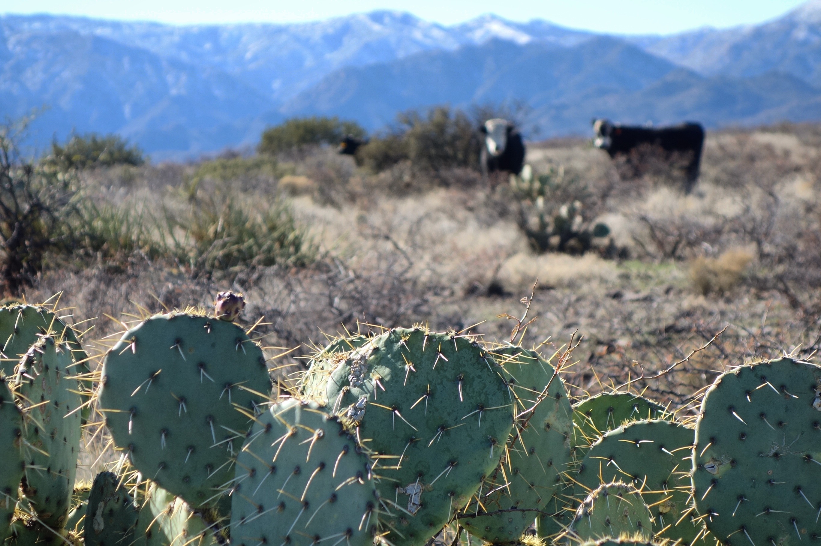
You share the high country with the cows.
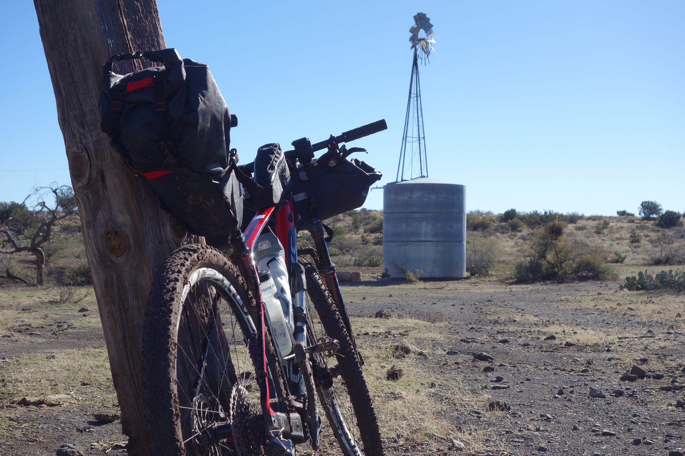
The old windmill located at 34.31414° N 112.18833° W
Bradshaw Mountains to the West.
The second section (miles 10-23) takes you down through a shallow canyon. It is characterized by fun descending and wider views than most of the journey. On this section, you see the quickest vegetation changes. If it is cold or snowy, this will also get you to drier and warmer turf. We reached this section in the middle of the first day.
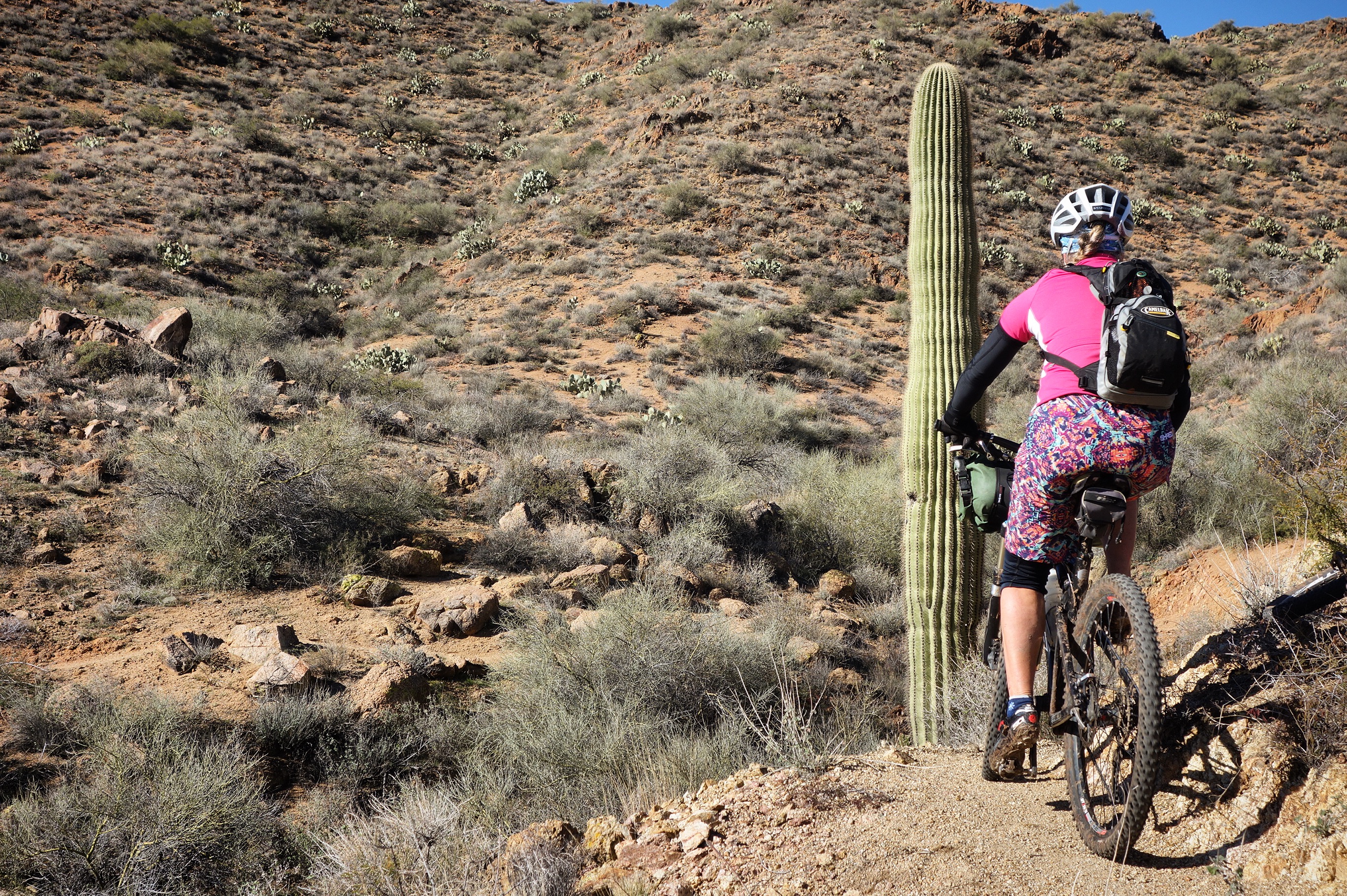
Once you lose some elevation, the Saguaros become more common.
This water stop is kind of hidden, but pretty essential. It is located here: 34.25515° N 112.17438° W It was pointed out to us by a local who told us it is piped down from a mountain stream, and he rides his ATV in to maintain it weekly.
The third section (miles 23-57) is characterized by lots of climbing (and descending). Climbs are generally short, increasing in duration as you head South. The single track is amazing, with twists and turns. This section is probably the most difficult if you consider that there are some major river crossings.
Looking down on Black Canyon Creek
I feel that the best bike for the route is a 29er with tubeless tires.
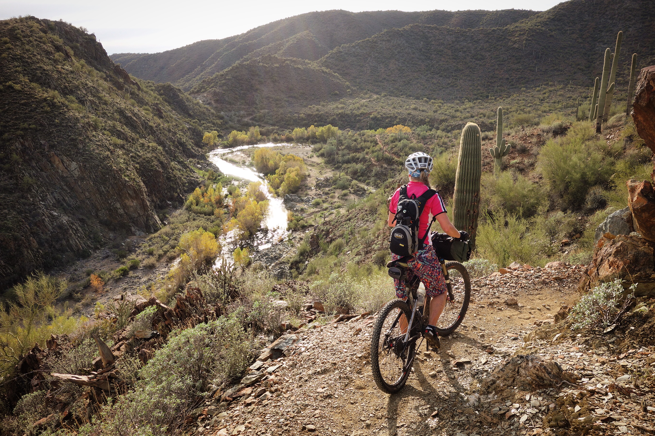
Looking down on the Agua Fria river.
On the 2nd day, we had to do 3 river crossings. This was the last of the day. Located at : 34.04170° N 112.16187° W You can likely get water here most of the year.
On the 2nd night, we camped on a ridge with a beautiful view. About 2 hours after lying down, strong winds picked up. I knew that camping on ridges was a bad idea, so not sure why we let our guard down this time. Originally, my plan had been to camp here: 34.03440° N 112.19220° W and upon scouting it out the next morning, it would have been a good spot with water.
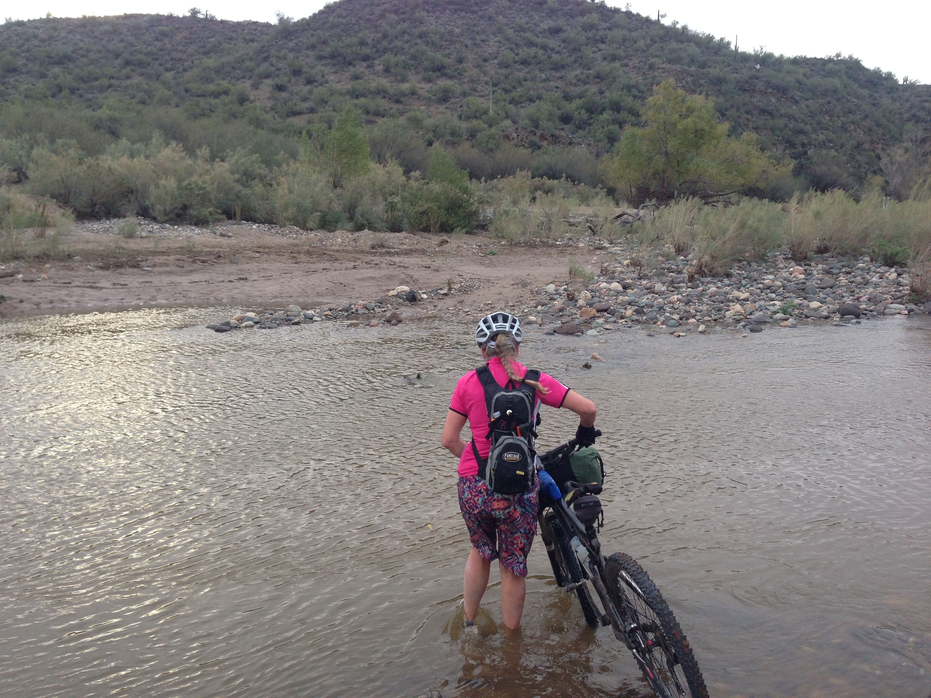
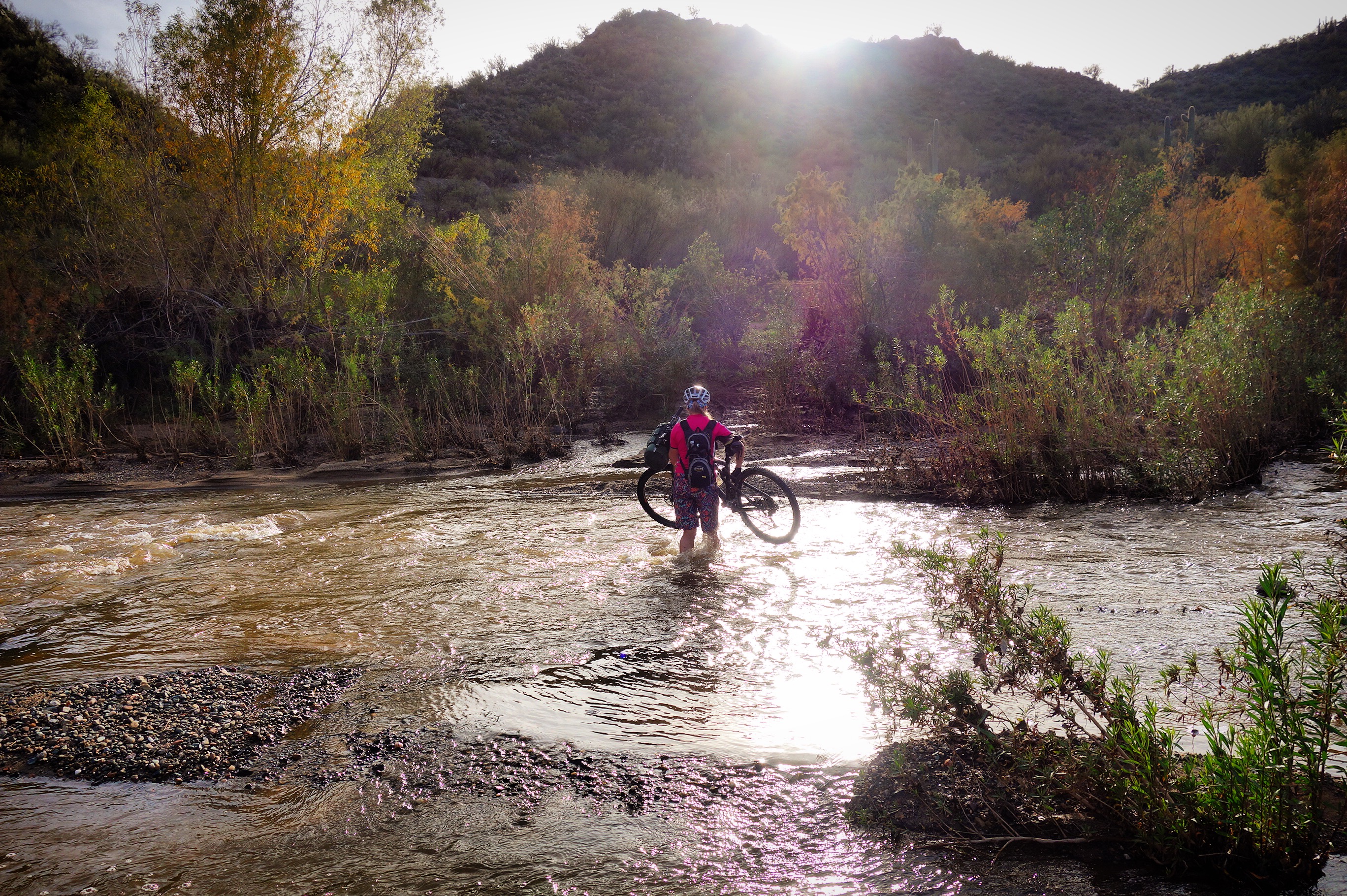
The last difficult river crossing as you come from the North. This is the Agua Fria River. Located at 33.99999° N 112.18553° W This location may be your last spot to get water as you head South.
There is one last possible location for water (if it has been wet recently) located at 33.99155° N 112.17862° W This is where we got our last water because it was clear (puddles) instead of silty and flowing like the location in the picture above.
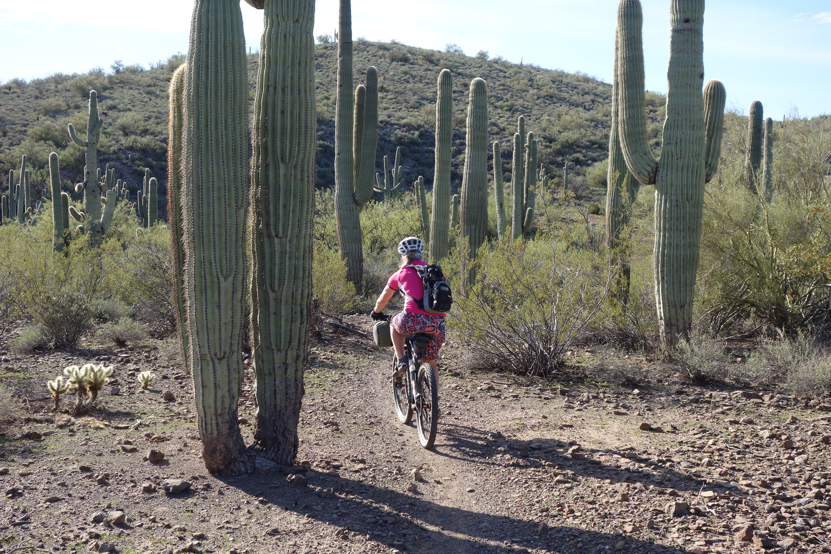
There are Saguara Forests down in the lower elevations.
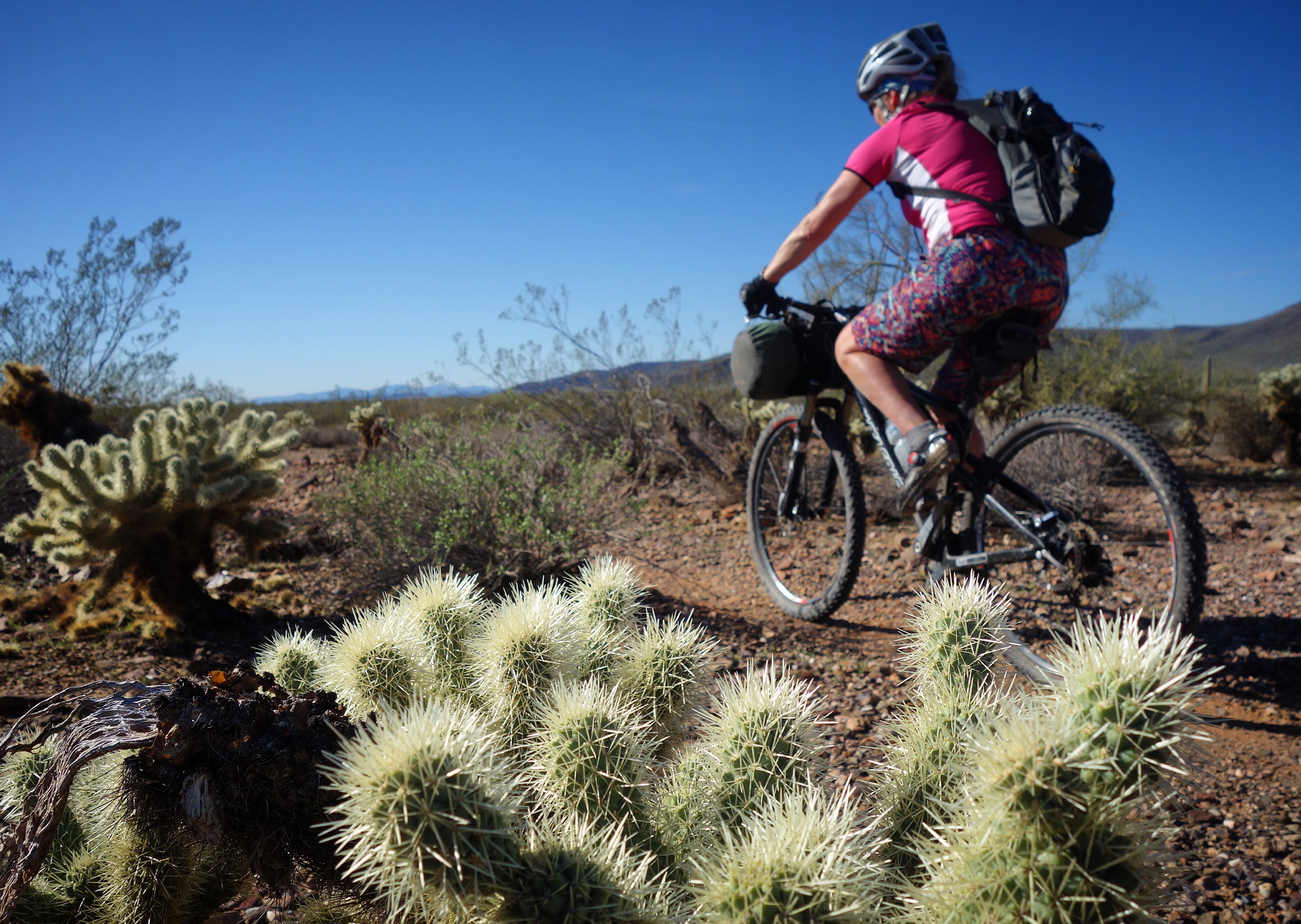
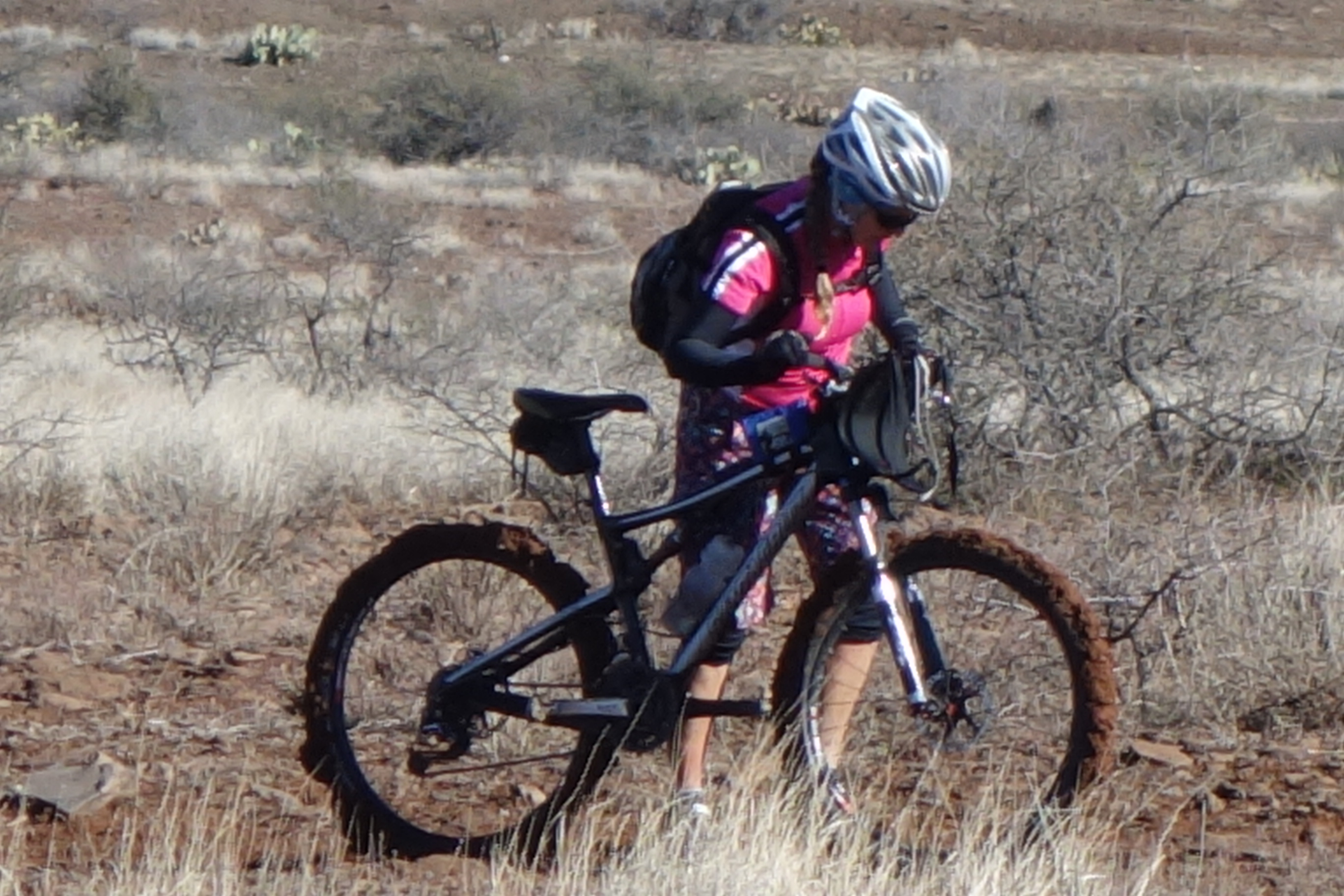
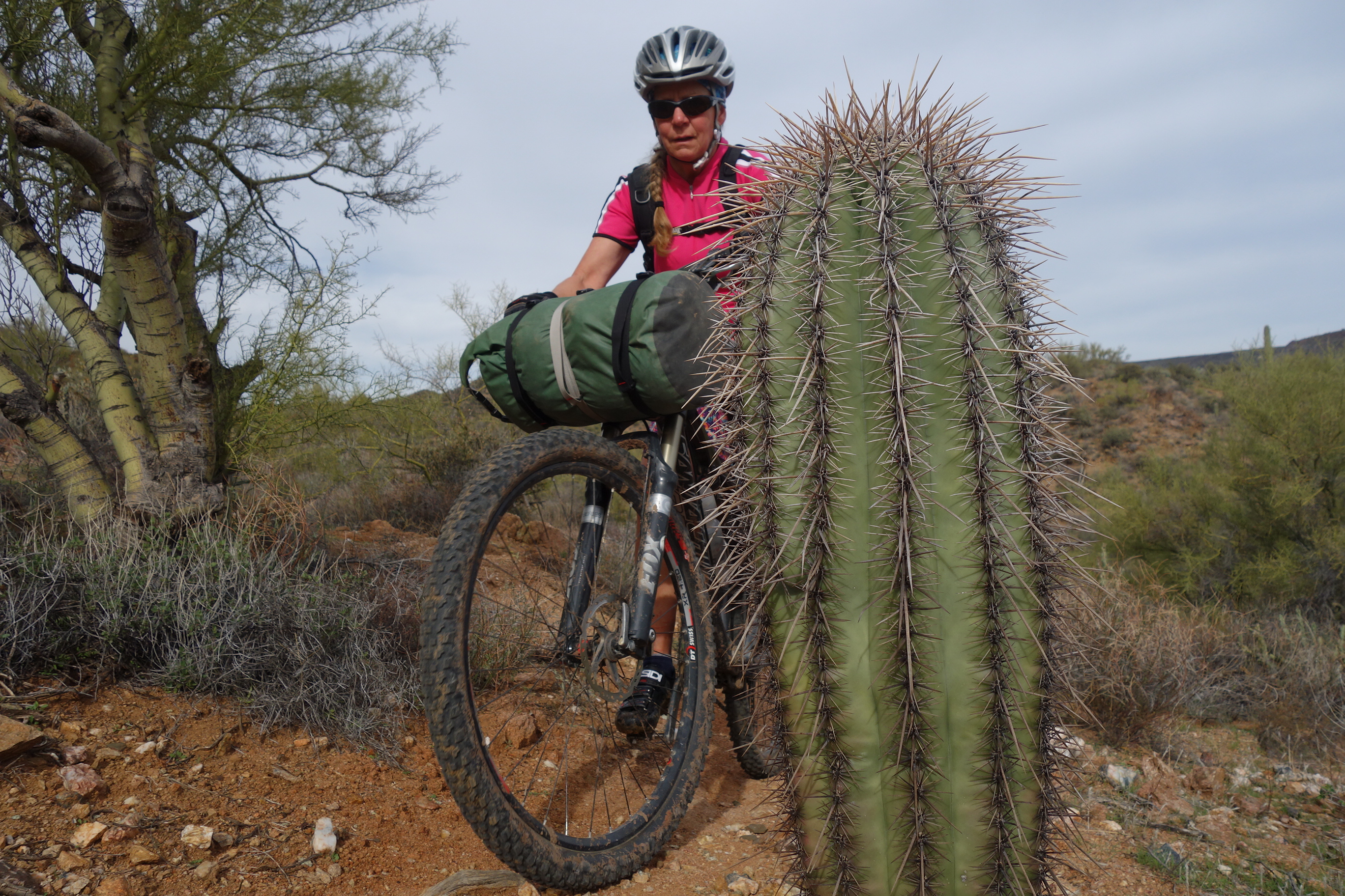
Watch out for the Cholla cactus (also known as “jumping cactus”). Janet got one on her ankle, and we had to pull out two dozen spines.
The fourth section (miles 57-63) is characterized by super fast descending. I found this section to be really enjoyable & the low elevation desert scenery was fantastic.
Section 4 – to my surprise, one of the most beautiful sections! It was flat, but the desert was gorgeous. Easy riding with a tail wind made this portion exceptional. 33.88855° N 112.18168° W
The fifth section (miles 63-70) is less used, and a little harder to find (especially without GPS). It is still fun, but not as tidy as the rest of the route. I think a lot of people stop at New River Road (end of section 4) and call it a trip.
Not everyone will love the Southern-most portion of the route to the Carefree Highway. I loved it, but the route is a little disorganized near the end.
This is the map for the entire route discussed in this post. To Export GPX files, click on the three horizontal bars in the upper right hand corner of the map and select Export selected map data…
To see full screen, click here (opens in new window)


Thank you so much for posting this. Hands down the most useful piece of info I’ve found on the trail yet.l