Kayaking the Entire Chain of Channel Islands
Kayaking the Chain of Channel Islands
a “how to” guide for the four main Islands
Our first inspiration to go to the Channel Islands was by Margarete Collins from our local kayak shop. After she made the suggestion, I hit the maps. A quick look at the map, and it made sense that one could put together a great trip by “island hopping” from San Miguel Island to Santa Rosa to Santa Cruz to Anacapa, and then return to the mainland. All of the distances between the islands looked kayakable, and it looked like a beautiful place from the pictures in the National Park Service Map.
We started planning the trip eagerly , using information gleaned from the internet, books, and maps. It didn’t take long before we were bummed out. The biggest problem we were facing was the campground locations. You are only allowed to camp at the 5 major campgrounds (which aren’t conveniently located for paddlers). Furthermore, only 2 of the islands have fresh drinking water available, you aren’t allowed to land on most beaches (to protect wildlife). We also soon learned that the winds on the outer islands are frequently over 30 knots – sometimes even stronger due to their location relative to Point Conception.
We decided keep planning the trip. We wished that we had some sort of guide where we could find out everything we needed to know in one place. It was a lot of work making the necessary phone calls, and gathering all of the (varied and sometimes erroneous) information. No single guide exists for kayaking from island to island (to our knowledge), and so I decided to make one after I returned home. During the trip, we learned many things that would be useful to people who want to plan a similar expedition to the four main Channel Islands. We later discovered that a number of people have done similar trips before. In fact, a staff member from Island Packers named Jimmy had paddled out to, around, and back from this chain of islands twice! We were appreciative to have his advice during our travels. There are many reports on the web by people who have kayaked from the Mainland to Anacapa. If you know the right keywords to use, you can use Google to find reports of people who have even paddled kayaks straight from the mainland to Santa Barbara Island and back! (Those guys are pretty brave)
Pictured above is a map out the route we eventually took while paddling the chain of the four main Channel Islands. The Red paddle route is created from our GPS track while kayaking. Using Photoshop, I drew in the green and blue routes by hand. As you can see from the map, we only paddled three of the four major crossings. Our main hesitation in doing the paddle from Santa Rosa to Santa Cruz was the necessary distance (27 miles) from Becher’s Pier to Prisoner’s Harbor. We were concerned that there wouldn’t be any emergency landing spots along the way. Now that we have seen the Northern Coast of Santa Cruz island (by Island Packers’ boat), we are certain that it could be done.
The best source for kayaking information (other than this page, of course) is the National Parks Page of Kayaking the Channel Islands. Their page is handy for paddling on certain islands, but not much use for inter island kayak travel. You may wish to call them and have them mail you their kayak specific brochures. They make a separate brochure for each island that is not available on the web. If you are looking for a map of the Channel Islands, I’d highly recommend the National Geographic map. No other map we found had as much detail and information for the size. We considered using the USGS maps, but they would have cost way too much, had too much detail, weren’t water-proof, and would have taken up too much space. We used nautical charts downloaded (for free) from NOAA. Scroll to the bottom of this page to download a JPG image of each map – easily printed and laminated at Kinkos.
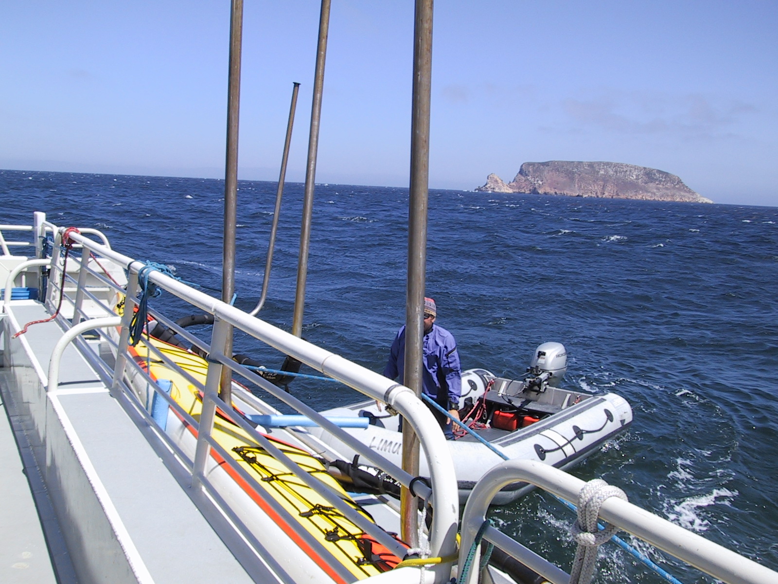
Unless you want to paddle out and back, the first thing you will need to do when planning your trip is to arrange for transport to the islands. If you just want to go “the easy way” (i.e. downwind) I’d suggest taking an Island Packers Boat out to San Miguel, and paddle your way West to East with the prevailing Northwesterly. We were very impressed with the service and staff of Island Packers. Their trips out to the islands are not just basic transportation – they also bring along a naturalist who describes and educates over a loud speaker during the journey. Also, depending on conditions, they will take time to stop for wild-life viewing (we saw tons of common dolphins right up alongside the boat)! They also will stop for whale viewing (They even went a few miles out of the way to scout out whales since they had extra time). Also, if conditions are good, they will spend some time exploring the coastline of the islands (yes, they ventured almost as close to shore as we would in our kayak). They took us a good ways into painted cave when we were going from Santa Rosa Island to Santa Cruz Island. I doubt we would have gone much further into the cave with our kayak! We found their prices to be very reasonable considering the service – and yes, they took great care of our Seaward K2 fiberglass kayak. I’ve read negative reports elsewhere – but we thought they were very careful with our possessions. Alex, one of the Island Packers staff was kind enough to take pity on me (I puked on the trip out to San Miguel due to the heavy seas) and he gave me a pack of motion sickness pills. Those pills were the one thing we wished we had brought on this trip; having them really helped me out! Thanks Alex!
The next thing to do (once you have arranged transport to the islands) is to make reservations for camping. This was the only hassle of the entire trip (and it was minor). The NPS charges a $13.65 cancellation fee for any campsite reservation that you change in addition to the standard $15 per site reservation fee. I thought that they would be flexible with our reservations given our dependency on the fickle weather. This was not the case – when I called the main line to change a reservation, the operator was very rude, and made it a hassle to exchange just one day of reservations. Fortunately, it all worked out.
We discovered that the rangers on the individual islands aren’t strict like the phone operators about the reservations. For example, we were delayed a day on our way from Santa Cruz to Anacapa. We had paid for a night on Anacapa – but were still at Santa Cruz. The ranger let us use our Anacapa reservation for Santa Cruz. He didn’t charge us any fees, and we didn’t have to fill out any paperwork. This should work for you if the campgrounds aren’t full – but if they are, you might have a problem. The least windy times for kayakers (September and October) also happen to be in the shoulder season. Another option is to make your reservations on the fly. You can make reservations by phone – or VHF radio. We found that the old Analog cell phones (not modern GSM types) work from locations as far as the North side of San Miguel Island thanks to the higher operating wattage. You can also contact the Park Rangers via VHF 16 and arrange your camp day-of. Keep in mind, this will only work if the camps aren’t full (though I’m sure they’d help you out in a pinch).
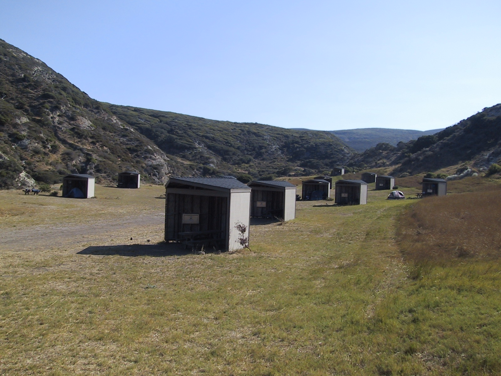
One thing that we initially found confusing was the distinction between backcountry and Campground camping. The Channel Islands operates 4 campgrounds on the main islands (see red dots on map below). These campgrounds cost $15 per night. You are also allowed to do “beach” or “backcountry” camping for free – but you make the reservation separately. To make a backcountry or beach reservation, you will need to call (805) 658-5711. Only campground sites (the $15 ones) can be reserved on the web. Below, I have made a map which I hope clarifies the camping situation. The red dots are clickable for our view of each campground.
These are the only places you are allowed to camp. You can see that it’s a comparatively long way from the red dot on Santa Rosa (Bechers bay campground) to the Blue Dot on Santa Cruz Island (Del Norte Campground). (Also to get to that Blue Dot on Santa Cruz called “Del Norte,” you will have to hike a hilly 4 mile route!) It’s about 27 miles of kayaking from the Santa Rosa Campground in Becher’s Bay. For most people, this is too much mileage. It would be nice if there was an in-between campground on the Western half of Santa Cruz island. To camp legally, you will need to trust leaving your kayak on the shore and then hike 4 miles to camp. Ouch!
The Western 75% of Santa Cruz Island is owned by the Nature Conservancy, and they do not open camping on any of this land to the public. You can get a permit for landing on their property for day use if you needed a break, but no overnight. Day use allows you to go about 50 feet from shore (and no more). I asked a friend of mine to pull some strings at the Nature Conservancy (he works for them), but nothing ever came of it. Because of the distance and our uncertainty about the weather, we did not paddle this section. Now that we have seen the landscape (via an Island Packers boat) We now feel confident that we could have paddled this section. For those wishing to make the crossing, the first good landing on the North Side is Cueva Valdez. Prior to that (heading from Santa Rosa) the island is sheer cliffs. After that (working your way East), there are a number of good harbors, some with easy beach landings (Lady’s Harbor, Diablo, Fry’s, and Twin Harbors). While on the Island Packers boat, they mentioned that some of these landings are good even in the worst weather. On the South end of Santa Cruz island (Usually in the lee of the winds Northwesterly) there are also a number of good places to land. On the day we went out via Island Packers, the seas between Ventura and Santa Cruz were choppy with 4 ft wind waves. On the South Side of the island, the water was like glass. If you decide to paddle from Santa Cruz, you will need to be physically capable of a marathon kayak day. Maybe you can make special arrangements with the Nature Conservancy.
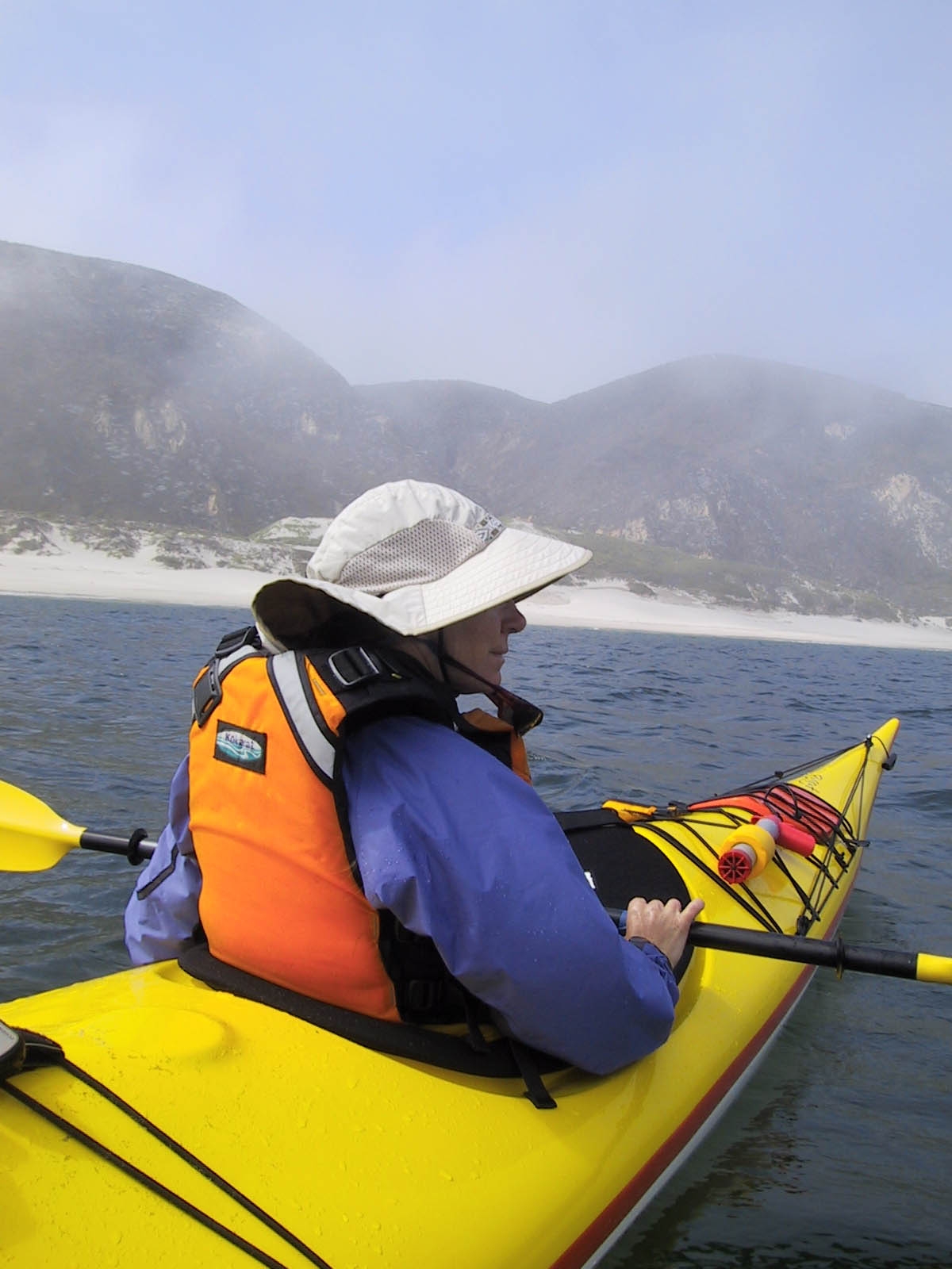
Once you have figured out the above details, the rest of the paddle should be pretty standard. Photographs indicate that the islands are beautiful in the spring, but we decided to go in September (After Labor Day) to reduce the chances of strong winds. Average wind speeds a little lower during September and October. We decided to mark off 14 days on the calendar and only paddle when when the conditions matched our abilities. The winds were unbelievably strong the first 3 days we were out there. But as we discovered, if you wait long enough, the wind and waves can become placid too.
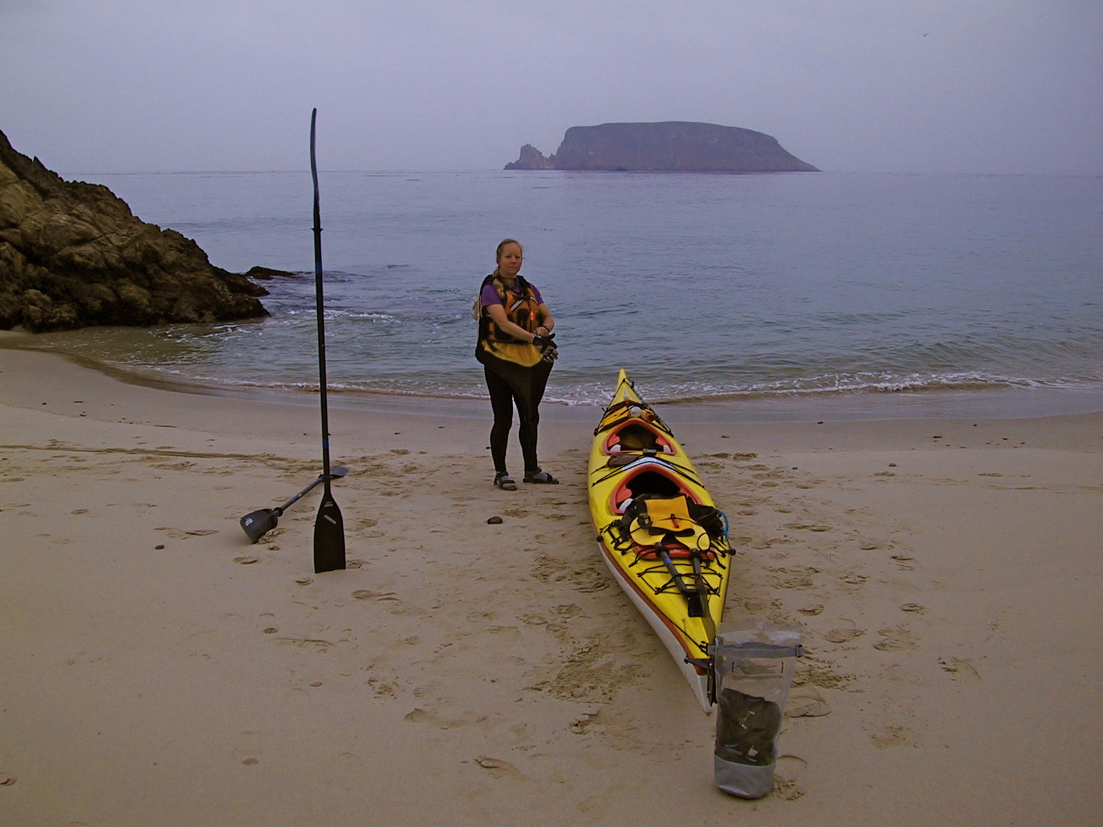
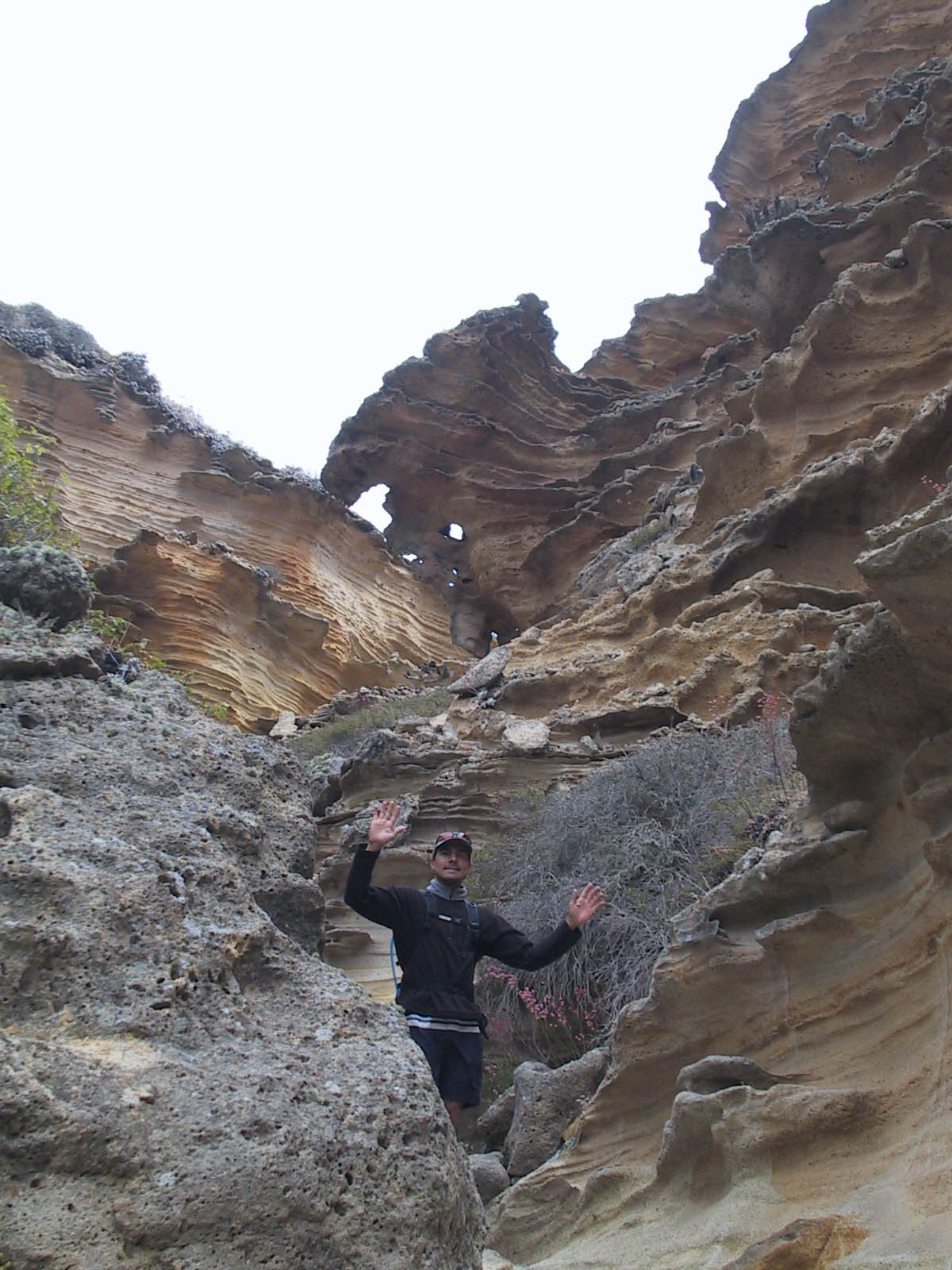
So, which islands are the best to see? When I spoke with Bill Faulkner – the helpful park ranger at the Ventura location (805) 658-5734, his voice sweetened when he spoke of San Miguel island. He said you could easily spend 3 or 4 days on that island alone. He helped us plan a rough itinerary over the phone. When we first arrived, we were kind of shocked. Why did Bill think this island was so great? We were stuck – you aren’t allowed to hike anywhere on the island except between camp and the beach! Janet and I initially joked that it was like prison. Since the rangers were “in-transition” on our first day, all we could do was hang out in camp. Our attitude quickly changed, though – and after the trip, we both feel that San Miguel was the most awesome experience of the whole vacation. For one thing, the restricted travel on the island forced us to do what we came here to do – relax! Once we got into “vacation mode,” this site became very appealing. By the time we were scheduled to leave, we were quite sad to depart. During our stay, we had the island to ourselves – most campers come for the Friday to Monday period. We arrived on Monday, just as everyone was leaving. Ian Williams was the ranger for our week. He’s been working this island for 14 years (as of this writing), and we had an excellent time learning everything we could about this island’s history, flora, fauna, and geology. We were amazed at how much learning you could fit into a 4 mile hike! We did 2 of the 3 hikes (Cardwell and Harris Points). Both were beautiful, and there is a lot to learn along the way. We spent mornings exploring Cuyler harbor – which was beautiful and has good snorkeling. Unfortunately, the weather was not good for kayaking past Harris Point. We would have liked to stay for an extra day to do the Point Bennett hike, but we finally got a break in the weather after 4 days, and decided to head for Santa Rosa.
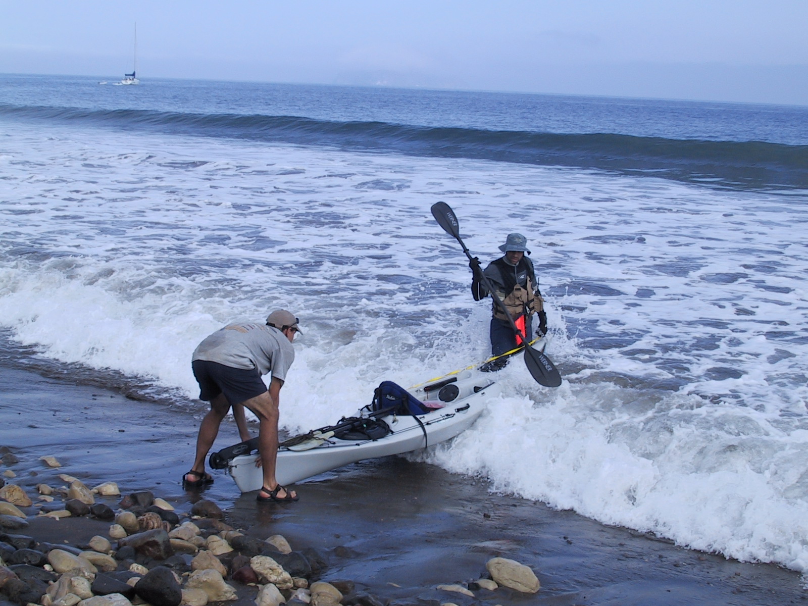
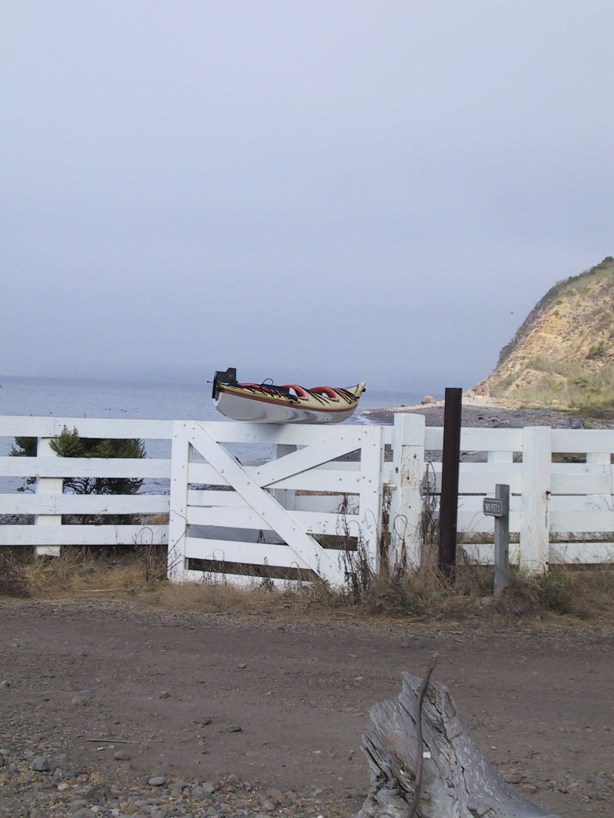
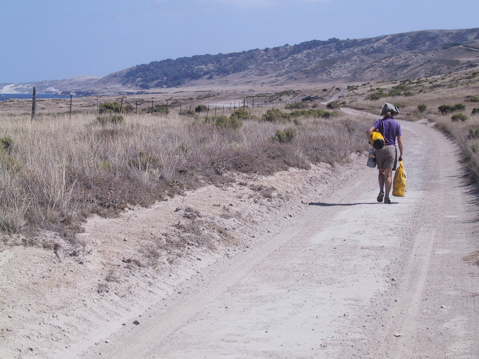
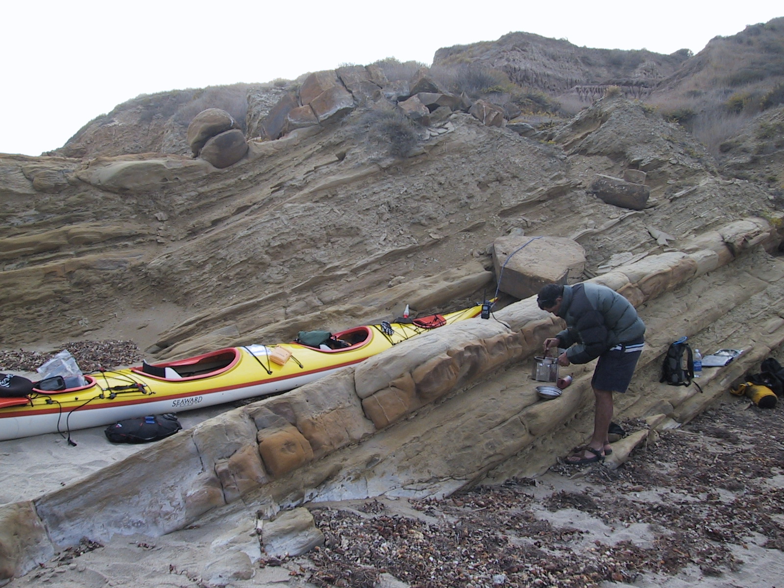
Heading to Santa Rosa Island by kayak, you have two choices (depending on the time of year). If you want to go quickly, you can just paddle the 21 miles from Cuyler to the Pier in Becher’s Bay. From the pier, you will have a 1.3 mile flat walk to a campground with hot showers, plumbed bathrooms, and excellent wind shelters. This route is practical for those in a hurry, but Janet and I were more satisfied taking the longer route around the South Side of the island. Since we were kayaking before September 16th, we were only allowed to beach camp in the area between Johnson’s Lee and East Point. This made for a 21 mile paddle to Johnson’s lee. If you go a little later in September, you could camp at China Camp (also along the South Side). This would make for a shorter paddle in one day. The day we did this, there was a 5 foot South Swell. This made landing and take-off a little interesting. The waves on this beach were real dumpers. I suggest you check your weather radio before you decide whether to go South or North. Our camp at Johnson’s Lee was wonderful and Quiet. This was truly a great experience getting to camp here. The next morning, we headed for Becher’s bay. From Johnson’s Lee, this is about a 16.5 mile paddle (to the pier). Therefore, by going around the South end, you will do 37.5 miles instead of the 21 miles around the North end. We assumed that landing at the Pier was a good idea. I’d strongly suggest that you skip landing at the pier. Instead, land here: N 33.99447 W 120.04153. This will leave you with a MUCH shorter walk to the campground. There is a good place to hide your kayak on this beach, and if you are coming from the South Side of the island, you won’t have to kayak as far (it will also shorten your trip to Santa Cruz a bit as well). We really wished that we had landed here (oops). Santa Rosa has excellent facilities, and Ranger led hikes. There is a “hunt” going on for most of the island, you you are kind of restricted in terms of hiking. From talking to the volunteer, it sounds like you just need to let them know where you will be hiking so you don’t accidentally become a target. We did the Lobo Canyon hike and the Torrey Pines hike. We were impressed with both of these trips. We’d highly recommend doing them with the volunteer – it’s much more fun. Our volunteer’s name was Kathy, and she was friendly, and knew the island very well. Leaving from Santa Rosa Island, we opted to take the Island Packers ferry. As mentioned before, it is definitely possible to paddle to the Prisoners Cove landing and hike to the Del Norte Campground – but it would likely be too tiring for all but the most accomplished kayak teams.
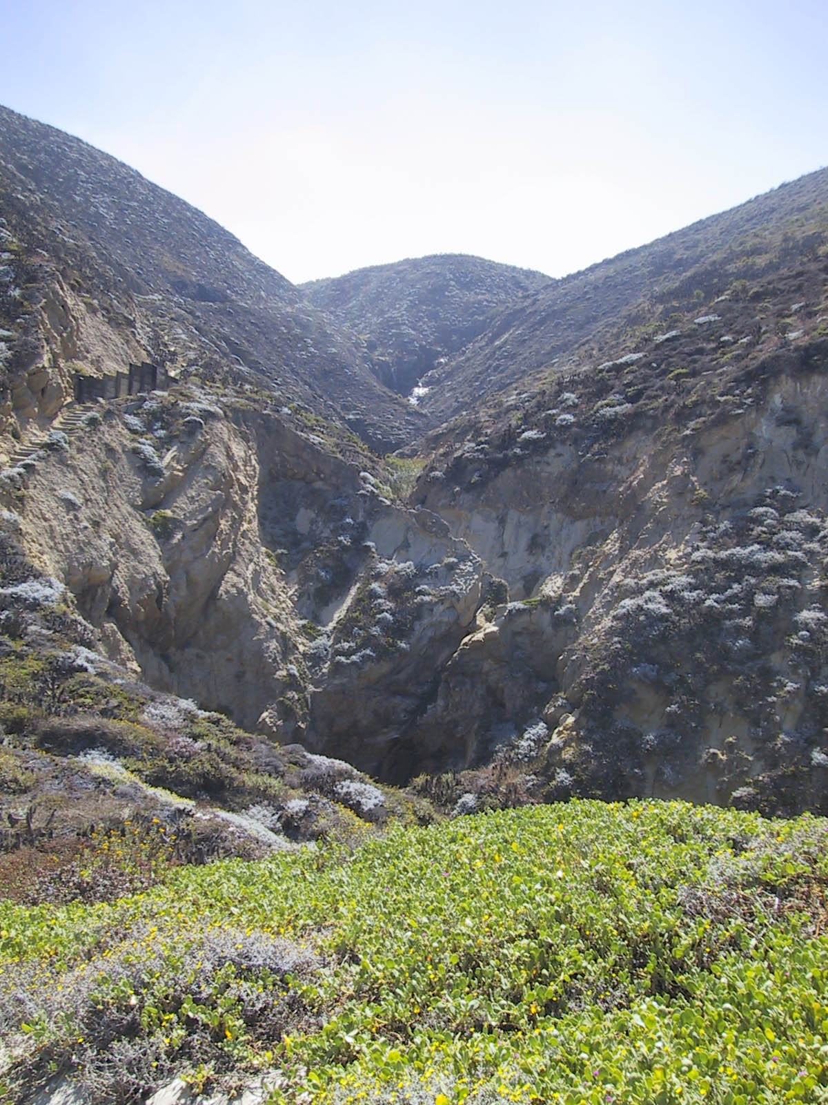
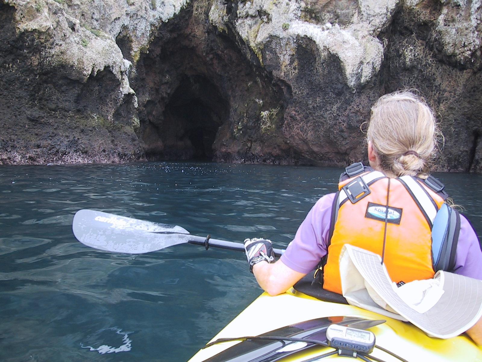
Santa Cruz Island is probably the most visited island of the four. There are good kayaking opportunities here (just for short trips). And most of the cave exploring goes on here. We didn’t see any sizeable caves on San Miguel or Santa Rosa. In order to do as much as possible by Kayak, we went to Prisoners instead of Scorpion. It was an awesome 8.7 mile paddle from Prisoners to Scorpion. We were very glad to do this paddle because the views are stunning. As you near Scorpion, there are lots of caves to explore (and a lot more people). We even went through some tunnels with our double 22′ kayak. The best kayaking (in my opinion) is along the North side of the island – and the scenery is fantastic. The entire North side is beautiful and rugged – rock. The south side is grassy and a little less rocky. The campground at Scorpion Cove is a short walk, and like the Santa Rosa Campground, it has potable water. One note about the water situation – San Miguel and Anacapa supposedly don’t have water. I’d suggest that you assume this is true. Nevertheless, we found some filterable water streaming down Nidever Canyon – even in September. Also, the maintenance guy at Anacapa promptly offered us some water – apparently visitors had left behind large quantities of water. I wouldn’t rely on either of these sources, but in the event of an emergency, you may decided to tap them. A water filter might be handy on this trip if you think you will spend more time backcountry camping. We hiked to Smugglers cove, and found that the kayak landing situation was more difficult than at Scorpion. Most of the inner island is dry and hot. We only did two hikes on Santa Cruz island; I felt that the snorkeling and kayaking was very good on this island – but the hiking was so-so. (I like trees, and there weren’t many).
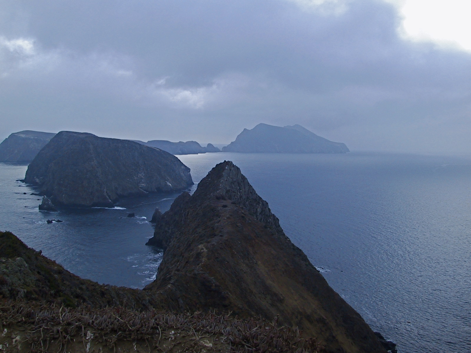
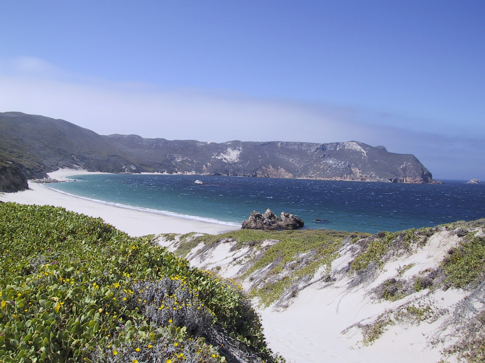
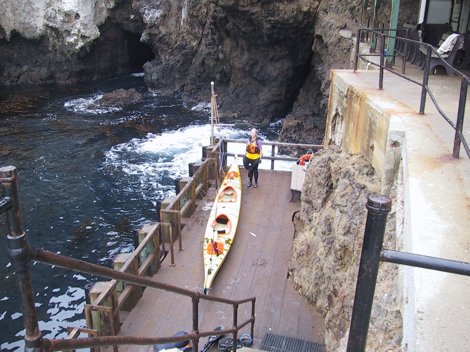
Traveling from Santa Cruz to Anacapa might be the most popular crossing (of the four possible crossings being San Miguel to Santa Rosa, Santa Rosa to Santa Cruz, Santa Cruz to Anacapa, and Anacapa to mainland). I suspect that this crossing is also the most likely to be calm because Santa Cruz Island creates a significant lee unlike some of the smaller islands. With a strong Northwesterly, you might still get pretty calm conditions 1/2 of the way to Anacapa. The day we opted to travel to Anacapa from Santa Cruz, the water was glassy. It was a great paddle, and once we arrived to the Western tip of Anacapa, we got to explore the shore. There are some sea caves (one of which goes pretty far back – enough room for our 22 foot boat to turn around)! You can spend plenty of time exploring this shoreline if the weather is good. The only place you can land easily would be Frenchy’s cove. No camping is allowed here. If the waves aren’t too big, you can cross to the other side of the island between West and Middle Anacapa, and Middle and East Anacapa. There are some tide pools on the South side of Anacapa – adjacent to Frenchy’s cove.
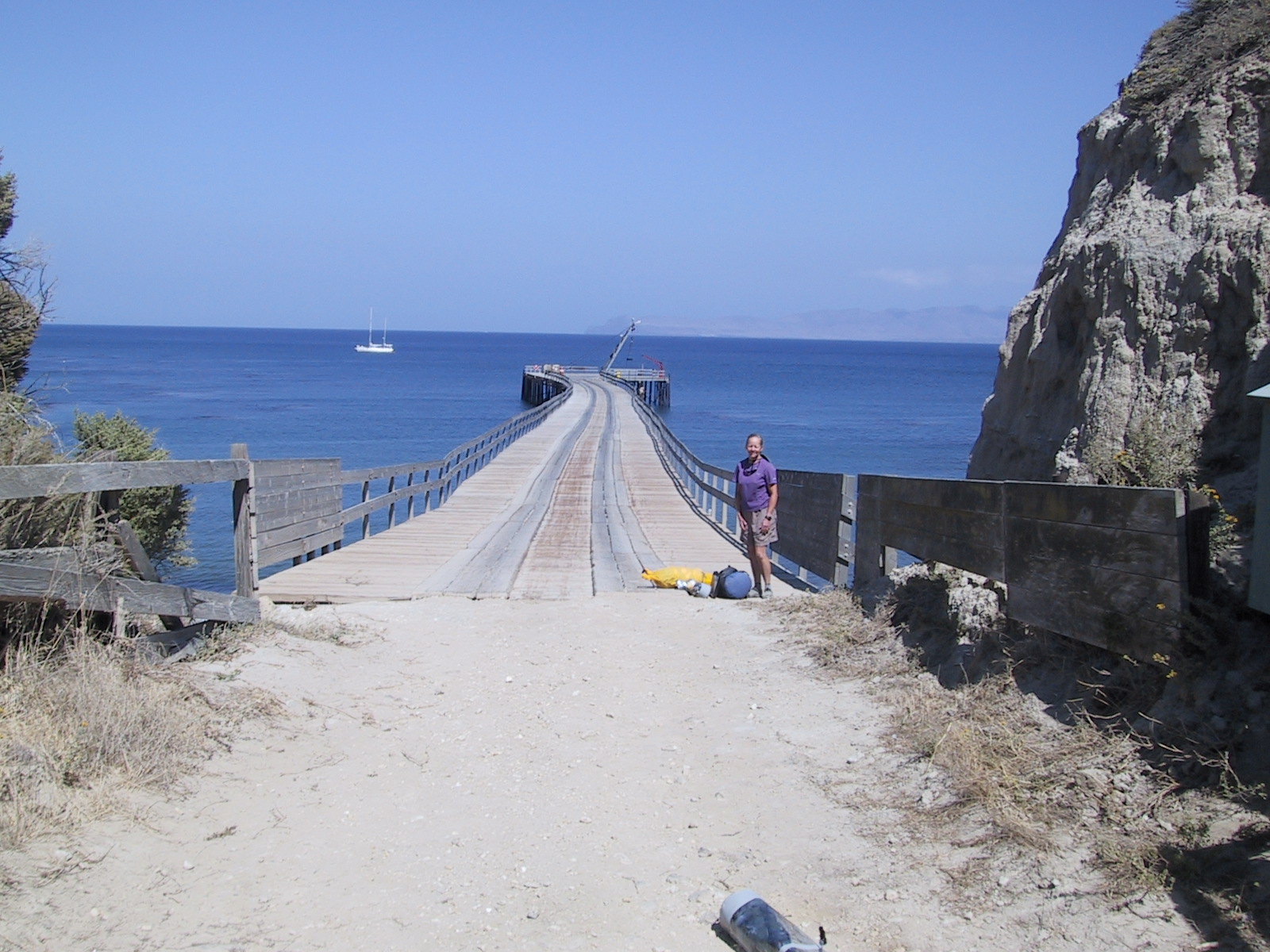
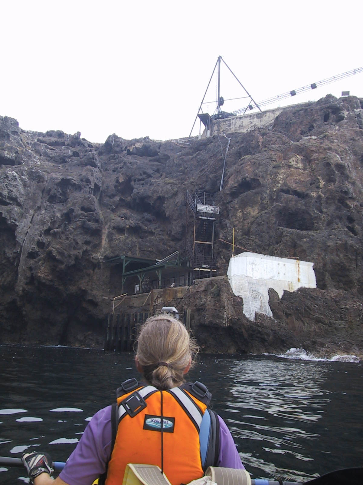
When we made our reservations, we planned to spend 3 nights on Anacapa. This was probably a mistake – we ended up spending just one night on the island. The island has about 2 miles of trails to hike, and you are pretty restricted as to where you can go in other parts of the island. We were able to paddle from Santa Cruz, leisurely explore the Anacapa shoreline, do all the hikes, and even go into the light house (an unexpected treat thanks to the maintenance guy) all in one day. I suppose that you could spend a second day if you went snorkeling, and exploring the South side of the island. We didn’t do that because getting our double kayak up using the hoist was a bit of a hassle, and the weather mandated that we leave.
It’s worth preparing for the hoist (also called a davit) before you depart on this trip. We opted to unload the hatches before pulling out boat out of the water. In retrospect, this was a bad idea. The water in the cove was surging up and down about 3 feet. I straddled the moving kayak – trying not to float away from the ladder while handing gear to Janet from the hatch at the same time. It’s quite amazing that neither of us fell in or drifted into the blow hole a few feet away! Janet had to carry gear up the ladder; imagine climbing a ladder with 20 -30 pounds, and the use of just one hand! Putting the kayak back in went much better because we thought about it more. The plan we devised was to load the kayak prior to using the hoist. I’d suggest hoisting your kayak out of the water with gear in the hatches as well. Attaching the kayak to the hoist was easier the second time around too. The hoist attaches at a single point. You can pull your boat out like a fish if it’s plastic, but a cleaner way of extraction would be to tie a tight line between your bow and stern loops, and hook the line in the middle (kind of like how you hang a picture with a wire going across the back). Since our kayak was so long – and laden with gear, we reinforced this line by tying 1″ tubular webbing circles around the midsection of the kayak as well. This distributed the weight bearing portion over more of the kayak. You will still have to straddle your kayak as it’s bobbing in the water to do that step – unless you have carabineers and pre measured sections of webbing which you can loop under the kayak while you’re in it.
The paddle from Anacapa to the mainland has a new hazard – you will be crossing one of the busiest shipping channels in California. Those giant ships look small from far away, but they get closer more quickly than you might imagine. The day we decided to leave Anacapa was fairly blustery. By the time we were on the water, wind waves were averaging 4 feet crest to trough, and there were white caps everywhere. Being in the trough of a wave makes it difficult to see who is coming, so I’d suggest picking a calmer start than we did for this crossing (the shipping lane is really close to Anacapa – so you will be out of it just a few miles after leaving). We were somewhat concerned by the combination of challenges – so our adrenaline charged crossing to Oxnard only took 2 hours and 45 minutes. Standard crossing time is 3 to 4 hours… but I’ve read reports of it taking 6 to 7 hours. One final thing to think about – Island Packers boats to the outer islands only leave from Ventura. This means that if you want to get back to your car from Anacapa, you will have to paddle to Ventura – 16.5 miles as the crow flies by my GPS. The trip to Oxnard is only 12.6 miles (also as the crow files). Also, heading to Oxnard may be more favorable, depending on the direction of the wind and seas. You can see from our GPS track that we found it was initially easier to paddle towards Ventura – but then we eventually arced toward Oxnard (mainly to get off the water sooner).
Landing in Oxnard provided us with the last challenge of our trip – getting the car. Since I hadn’t stashed a bike at the Oxnard harbor, I had to run in sandals to do the pick up. I’d advise planning alternative transportation prior to departing – in case you have to land in Oxnard and your car is in Ventura.
Kayak safety is too broad of a topic to discuss in this short write up. Obviously undertaking a trip of this scope can be dangerous. Please be responsible and make sure that you and everyone in your group is very well prepared for all of the possible dangers that can be encountered on this trip. Some of the main dangers to kayakers are hypothermia, collisions with rocks, injury during surf launch / landings, and collisions with other vessels. There are many precautions that one can take to be prepared to deal with and prevent these dangers. Other dangers, which are more difficult to prepare for can include drowning and aquatic predators. No matter how much time you have on the water, one of the most important skills an experienced kayaker can have is knowing when to stay on land.
This is the map for the entire route discussed in this post. To Export GPX files, click on the three horizontal bars in the upper right hand corner of the map and select Export selected map data…
To see full screen, click here (opens in new window)


This is an incredibly detailed tripping-tik.
I am looking forward to a similar trip.
Q: Tides?
Link to Strava GPS tracks:
Day 1
Day 2
Day 3
Day 4
Day 5
Day 6
Day 7
Day 8