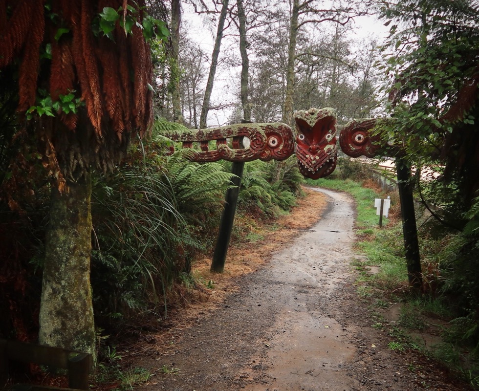
Our Own Tour Aotearoa
Suggested 3wk Itinerary | List of all NZ GREAT RIDES | Our Photos | NZ Likes/Dislikes
I had been toying with the idea of bikepacking New Zealand for many years; ever since I heard of the Tour Aotearoa Route. I figured that the best time of year to experience this land would be to start in the South in mid-February and work your way North to arrive in mid May. Since you’d be heading North, this would “follow the seasons” so you would always have the best weather of each region during a 90 day stay (the maximum allowed without a special visa). Normally, Janet and I are finishing up Latin America travels at this time of year and getting ready to plant our garden in April/May – which means we’ve never bothered to make this trip happen. This year, though, Janet broke her collarbone in the late fall – meaning we spent the early winter at home instead – opening up an opportunity to put New Zealand on the calendar.
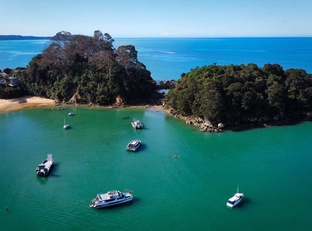
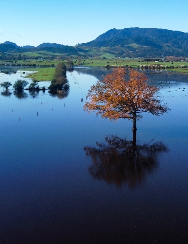
This is the map for the entire route discussed in this post. To Export GPX files, click on the three horizontal bars in the upper right hand corner of the map and select Export selected map data... To see full screen, click here (opens in new window)
I had long heard about New Zealand being a great place for outdoor activities, so it seemed like a no-brainer that we would enjoy it. One hesitation had been that New Zealand is relatively expensive compared to some of the other countries that we have been to, but we found that our bikepacking living expenses were about 90% of what they are in the US. We noted that anything related to tourism such as tours, boat rides, etc. was HIGLHY inflated. As bike packers, we don’t usually do as much of the tourist-trap stuff unless it looks really cool.
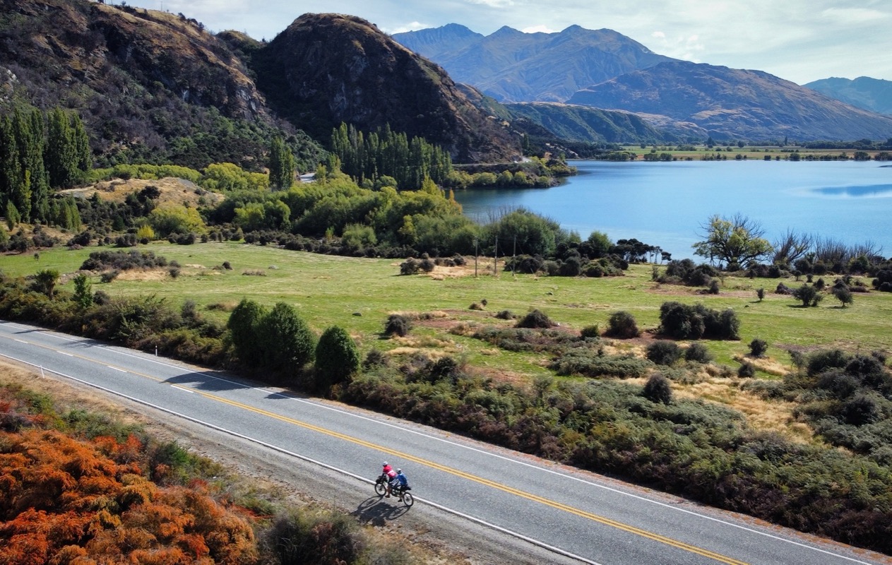
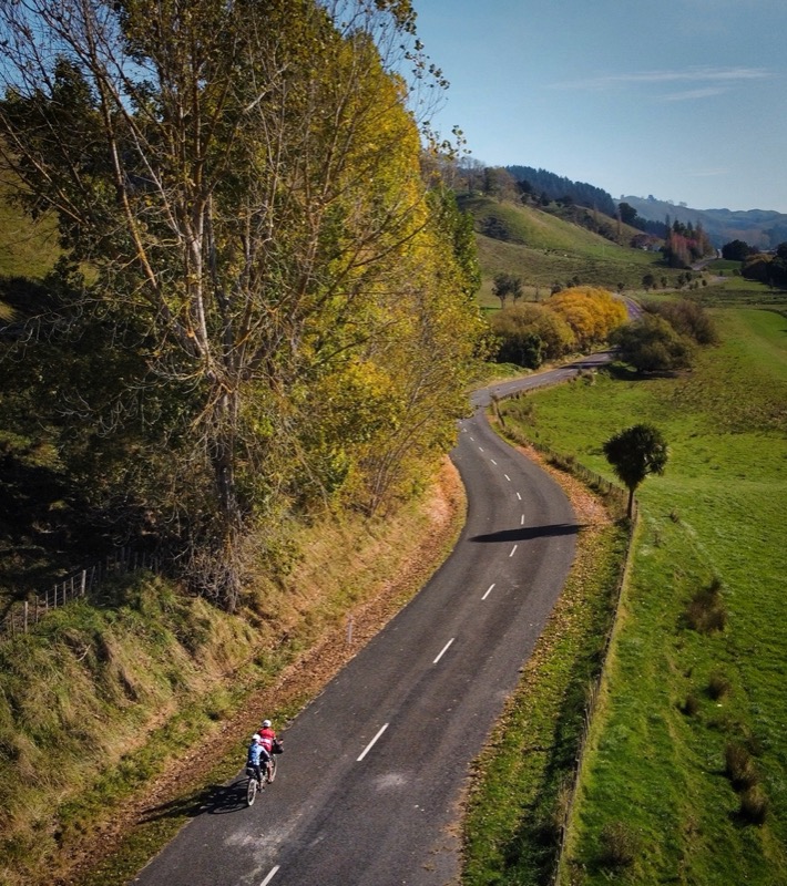
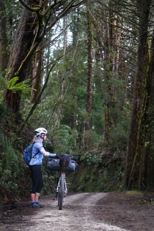
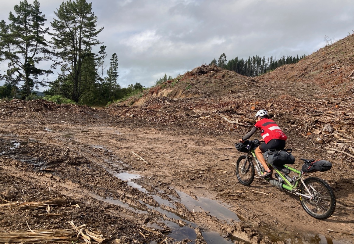
We quickly learned that New Zealand is an excellent locale for mountain biking – and a despicable location for road cycling. I’ll warn you right away that as a whole, the roads in NZ felt less safe than any of the 38 other countries we have cycled. Seriously. The reason for that are three-fold:
- The roads are narrow, and almost none of them have a shoulder.
- The people drive two lane roads at speeds normally reserved for motorways/freeways.
- The law states that cyclists should receive 1.5 meters of clearance, but that is not observed.
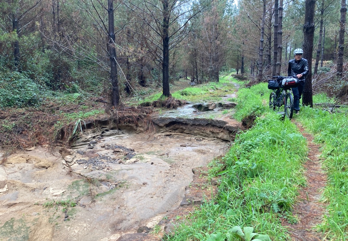
If you decide to follow any part of our route, please take that into account. We endeavored to ride “mostly trail” – and succeeded a lot of the time… but we did have to make necessary connections in places where no trail existed. In the process, we used our Google Satellite skills to find twistier roads that were dirt (thus forcing vehicles to drive more slowly)… and in some cases we found better riding. If in doubt, though, you could just hire transport to help you connect between the good riding areas. I’ll discuss which were our favorite sections later in this post.
New Zealand has a number of “Great Walks” and “Great Rides.” An easy way to find them is to use the Great Rides App. The Great Rides and Great Walks are definitely the best outdoor aspect of New Zealand. In fact, I think the Great Walks may be the crowning asset of New Zealand because of the fantastic scenery they expose you to. Here is a list of the rides on the Great Rides app (I have highlighted in red the rides that we did. Routes that haven’t been built yet are in green. Routes we didn’t do are black.)
List of all GREAT RIDES in New Zealand
- Lake 2 Lake (bonus ride) (link)
- Around the Mountains (link)
- Welcome Rock Trails (bonus ride) (we only did Nevis Road Portion – but rest looks fun) (link)
- Queenstown Trails (link)
- Coronet Loop Trail (bonus ride) (link)
- Kawarau Gorge Trail (planned; we did by boat)
- Upper Clutha Trail (planned) (link)
- Lake Dunstan Trail (link)
- Clutha Gold Trail (link)
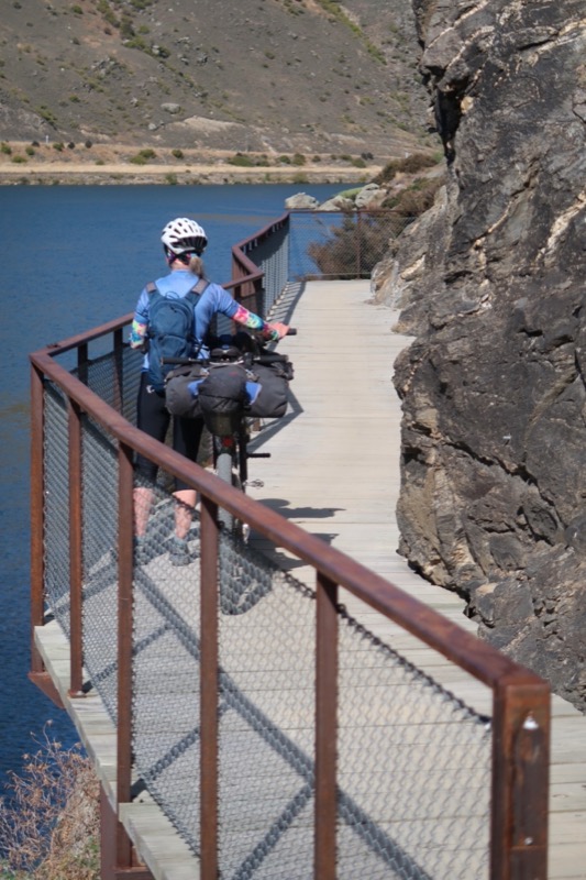
- Roxburgh Gorge Trail (link)
- Otago Central Rail Trail (link)
- Alps 2 Ocean (link)
- West Coast Wilderness Trail (link)
- Paparoa Track (bonus ride) (link)
- St James Cycle Trail (link)
- The Whale Trail (planned)
- Kawatiri Coastal Trail (This trail is not complete, but we rode from Okari to Wesport) (link)
- The Old Ghost Road (link)
- Heaphy Track (bonus ride) (This trail is only open seasonally – otherwise we would have LOVED to ride it).
- Great Taste Trail (link)
- Coppermine Trail (this is a loop, not a thru-ride near Nelson)
- Link Pathway (link)
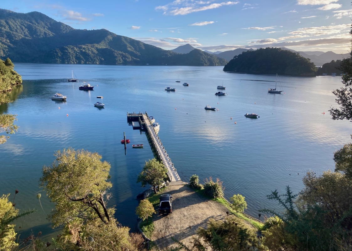
- Queen Charlotte Track (link)
- Remutaka Cycle Trail (link)
- Mountains To Sea (link)
- Hawke’s Bay Trail
- Timber Trail (link)
- Taupo Trails (bonus ride; we rode what we could – much was closed due to Cyclone Gabrielle) (link)
- Great Lakes Trails (link) Rides around Lake Taupo
- Whakarewarewa Loop (We only rode part of this coming into Rotorua)
- Motu Trails (link)
- Waikato River Trails (link)
- Te Awa (bonus ride) (link) *We transected this paved bike trail going to Kawhia
- Hauraki Rail Trail (link)
- Twin Coast Cycle Trail (link)
Out of all the trails mentioned above, Janet and I easily agree that our two favorites were the Paparoa Track, the Old Ghost Road, and the Coronet Loop Trail (with Paparoa being our favorite of the three). The rest of the trails on this list were more like single-and-a-half tracks. Of the remaining tracks, we really enjoyed: The Timber Trail, West Coast Wilderness Trail, Waikato Trails, Queen Charlotte Track, Dunstan/Roxburgh Gorge Trail/Clutha Gold.
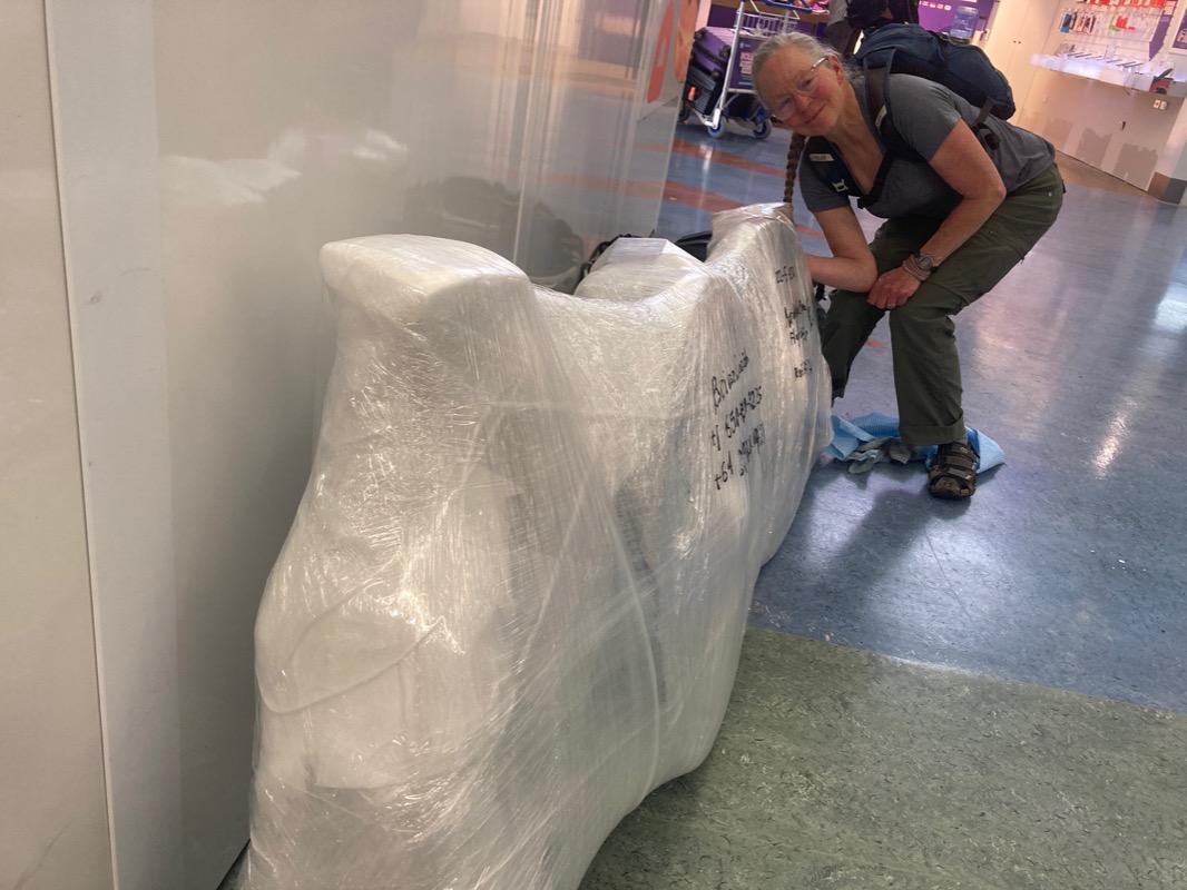
TSA got into our bike – that long slit they cut. Luckily, we were prepared for them and taped everything down inside of the package – including water bottles filled with stuff you can’t take in the cabin such as tent stakes, lube, tire sealant, and knives. They just cut it open and move on. (And leave you a friendly note reminding you they are allowed to do this).
Reminds me of a video I saw about border security looking for contraband in shipping containers at port. They would cut the locks off the shipping containers, probe bags with long swords 🗡️ as beans or rice or tea came spilling out. “No drugs here” they would say, as the merchandise spilled to the ground. They just moved on to the next container – leaving a broken lock and perfectly good food spilled all over the floor.
BONUS! A Recommended ~3 week itinerary based on us cycling most of both islands
While I’m really glad we went to New Zealand, 3 months was plenty long enough to see what we wanted to see. I realize that not everyone has this amount of time available to visit NZ. If you’re an intermediate to advanced mountain biker, and you only had ~3 weeks to explore NZ, I’d consider only visiting the South Island. Probably the best “bang for your buck” route would be as follows: Fly to Wellington and take the ferry to Picton. Jump on a small boat and take it to “Ship Cove” where you can start the Queen Charlotte Track. From there, follow our tracks along the link-pathway backwards to Havelock. Don’t forget to follow our track over the Pelorus Bridge to avoid the HWY. Next take the Maungatapu track (a bit of effort, but saves hwy riding) over to Nelson and along the Great Taste Trail to Motueka. If the Heaphy Track is open (May 1 thru November 30 as of this writing), see if you can do that! We didn’t do this because it was closed during the time we were visiting, but if you can do it, this makes for a great segue into the next track we recommend: The Old Ghost Road. If Heaphy Track is closed, just follow our tracks backwards along the Great Taste Trail, and then begin the Old Ghost Road. South of Westport, continue along our route backwards and then jump on the Paparoa Track. After the Paparoa, you can follow our tracks backwards to get onto the West Coast Wilderness Trail, ending in Hokitika. At this point, you have a decision to make: If you want to avoid long sections of pavement, I’d suggest hiring a vehicle or taking a bus to Wanaka. The West Coast would be a really nice drive – like California’s HWY 1.. but if you only have 3 weeks, why spend it driving the road? From Wanaka, I’d recommend the out-and-back that we did to Mount Aspiring National Park. Also, if it is open by the time you visit, I’d recommend taking the Upper Clutha River Trail and finding a way to connect to Thompson Gorge – riding our route backwards once again to Omakau. From Omakau, you could follow our route backwards all the way to Cromwell. This gives you exposure to the Otago Rail Trail (not too interesting, but safe riding)… and then later you would get to do the Clutha Gold Trail, Roxburgh Gorge Trail, and Lake Dunstan Trail – all of which are awesome. From Cromwell, it’s a great ride along the Nevis Road to Garston. Once in Garston, I would suggest that you figure out a safe way to make the short distance to Queenstown where you can ride the Coronet Loop and maybe out to Skipper’s Canyon before flying from Queenstown to Auckland. If you had enough time, you could follow our tracks backwards to Queenstown the long way on the “Around the Mountain Trail,” but that trail wasn’t special enough for me to recommend it.
Photos from our 3 month ride across NZ
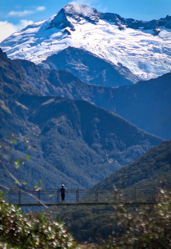
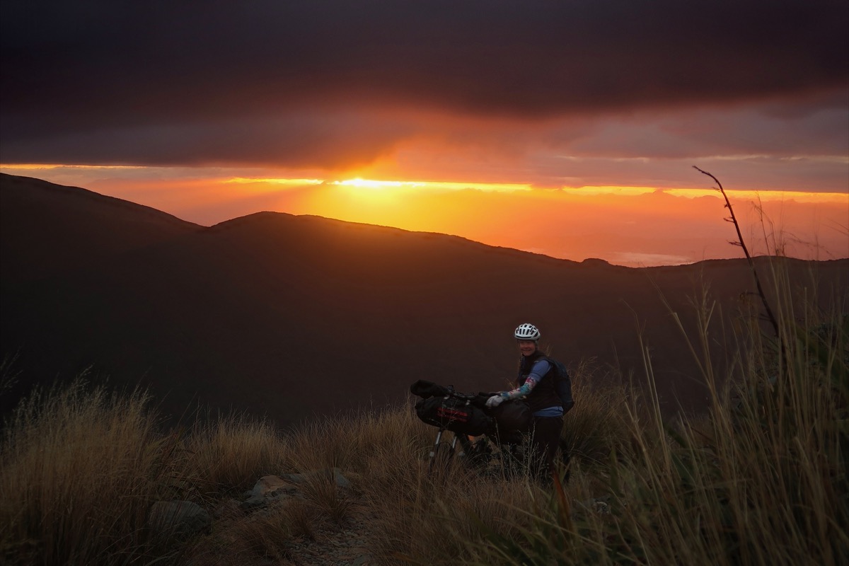
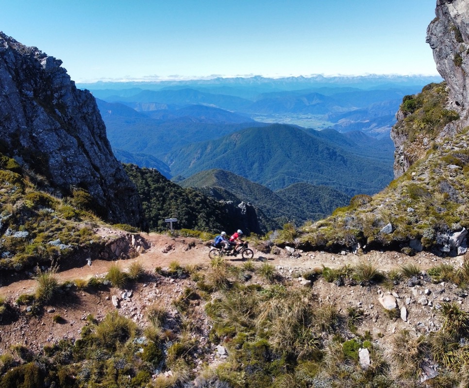
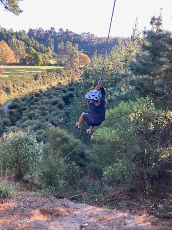
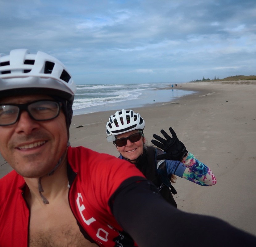
Riding up to “The Remarkables” – an out-and-back trip.
Our planned ride for today was to visit the Remarkables Ski Area: start the trip with a monolithic climb. From below, the top was enshrouded in clouds. We discussed only going part way up, but the clouds seemed to be ascending just as slowly as us – meaning that there were periods of clear skies and even some sun!
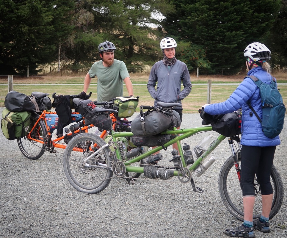
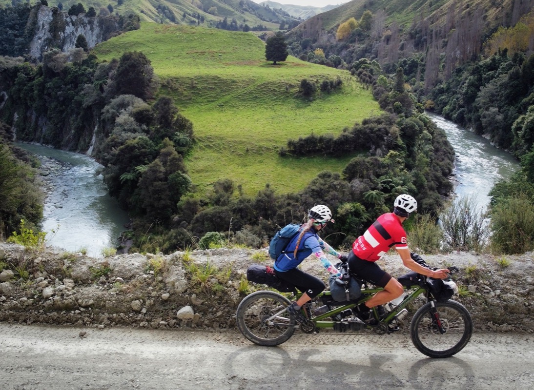
Can you see the tandem riding along?
It’s only our second day here, but today was amazing! After riding in the canyon, we went back on another single track trail called the “Coronet Loop Trail”. It was buff single track with lots of switchbacks that were just wide enough for the tandem. We haven’t ridden trails this fun on the tandem in a long time!
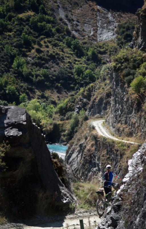
Today Janet and I rode out to Skipper’s canyon. It was described as a scenic route, but what we didn’t know is that we’d be doing miles of exquisite mountain biking!
We descended the single track on the far right, and hours later came up this dirt road in the foreground.
Janet and I took the ferry from Queenstown to Mount Nicholas Bay with Southern Adventure Tour Company. Most people use the TSS Earnslaw to Walter Peak. The boat we took was a less expensive ride and it actually allowed us to avoid a few miles of boring riding.
Janet and I met Dicky and Meg. They are riding around the world in one year! They travel like we used to – fast and heavy. They even have an orange tandem like our old one! They have already ridden from the UK to Turkey and across parts of Asia where they could (they experienced some entry blockages due to COVID and such). They are here for 5 weeks and next plan to go to Australia and then to South America. It sounds like it has already been a great adventure with plenty more to come. I wish that our itineraries overlapped more so we could get more stories out of them…
Here are links to their instagrams:
https://www.instagram.com/meghibbs/
https://www.instagram.com/dicky_hibbert/
I washed my jersey last night to get out the salt. It didn’t dry because it was a foggy night, but the candles inside of the cabin helped provide just the right warmth to help dry it quickly.
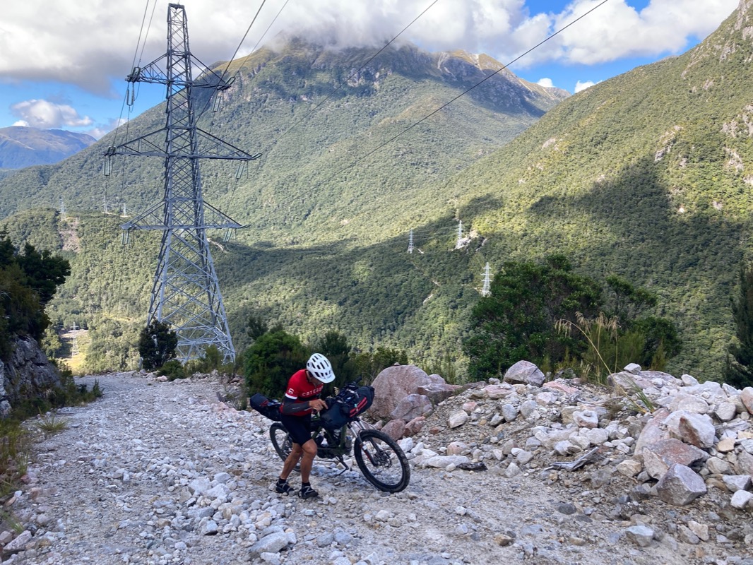
The climb that greeted us was very difficult. Some stretches ascended 1,200’ per mile, which would be outrageous if it were paved… let alone loose rock. Janet took the bag to alleviate some of my suffering as we toiled this way for a couple of hours…
…we carried on when suddenly the gravel road ended abruptly in some trees. My GPS course continued into the trees. There was a sign indicating this was a “expert mountain bike route. 5/5”. If you know me by now, you know that I push on like a stubborn bull through pretty much anything – often claiming “this isn’t impossible; it’s just difficult.” I still believe that, but I decided to scout ahead – ditching the bike and climbing up using my arms to ascend the boulders sandwiched between the trees – only to find a landslide a few feet up. I carried on without the bike up a narrow chute littered with climbing boulders and engulfed in trees. I had climbed 100’ along the trail… a trail that my GPS told me would ascend 750’ in the next 0.5 miles… That’s 1,500’ per mile on an overgrown “trail.” I’ve never been so decisive about something like this: “Janet, we have to turn around!” The New Zealanders can forget their Haka dance… all they would have to do is show this trail to their opponents, and they would run away with their tails between their legs. That is what we did! The problem was that we had invested ~50 off road miles and ~6,000’ of climbing into getting to this point… The thought of retracing those steps was so painful, but that is what we started to do….. until…..
..With no upward heading options, we began the tedious descent, undoing our last several hours of work. At the bottom of the drop, we took a short side route to the lake. We had been shooting for the West Arm of the lake, and I prayed to God that there might be a boat at South Arm (pictured) to carry us the 14 miles on the water around the mountains to the West Arm. Sadly, nothing was here. I had done some math in my head though: 14 flat lake miles at 3mph would only be 4.5 hours versus the many hours of climbing that lay ahead of us if we had to ride all the way around back to the highway reversing yesterday’s and part of todays ride.
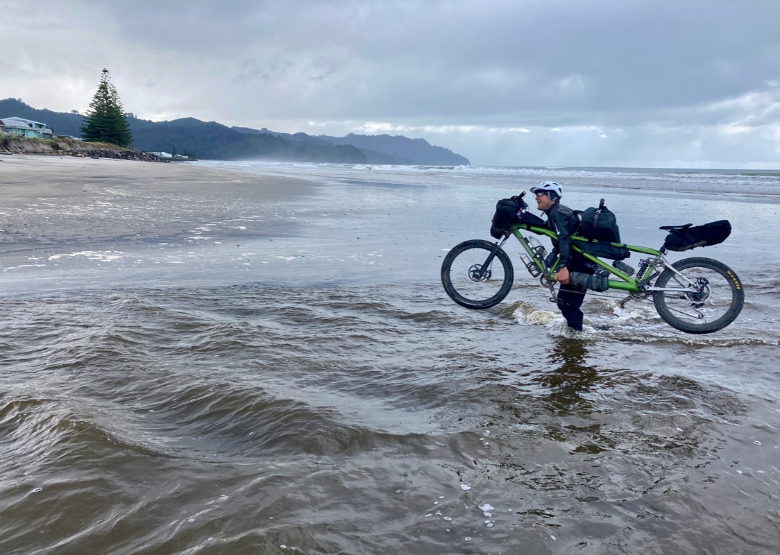
At the beach, I set about gathering logs that were longer than the tandem. I arranged them half-way in the water because I knew that once I finished building the raft, it would be too heavy to launch. See that plant in the foreground? Those would be stripped to make “rope” that would tie the logs together. The logs were surprisingly buoyant, and I figured that if we can go 6 mph on a kayak, we could manage 3 mph in a makeshift raft. As I searched for a log to go 90 degrees across the 4 log “base raft”, Janet walked over and said, “do you want some help, even if I’m not going to go with you?” I said, “where are you going to go if you don’t go on the raft?” She replied that she would “walk back.” The idea of her walking a distance that seemed too far to ride was preposterous. This was a test that said, “if you really love me, you will let me be in charge of this plan – and it’s not going to be on your stupid boat-raft.” I consider taking Noah’s lead by telling her, “God told me to build it.” But God hadn’t really told me to build it unless you consider the fact that God didn’t put a real boat there for us as a sign that we were supposed to build one instead. Janet said, “We could drown. I’m not going.” OK, at that point, I decided to abandon ship. We left my carefully arranged drift wood, jumped on the bike and began the slog back to the same place we slept last night.
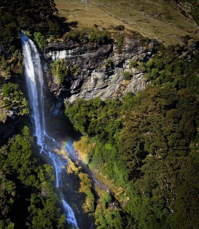
We learned that the “Routeburn Track” – one of the famous “great walks” of New Zealand is not open to bikes. If a bike could go through, it would have been an 18 mile shortcut around the mountains. Alternatively, one can do a ~300 mile out-and-back trip to Milford Sound (and then back to Queenstown). I tried to think of many ways to do this route, but with my foot still in so much pain, anything involving walking isn’t really an option. As a “consolation prize” we decided to ride 20 miles out-and-back down to Humboldt Falls along the Hollyford route. This is a spur off our primary out-and-back to Milford sound.
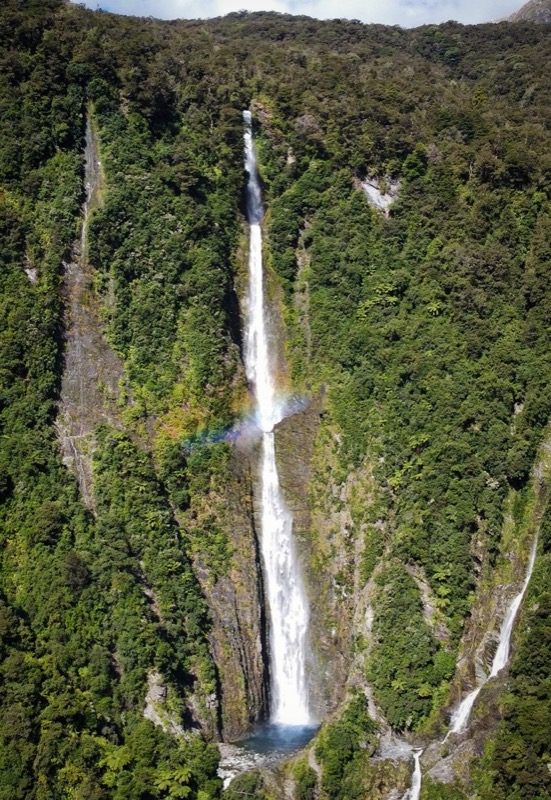
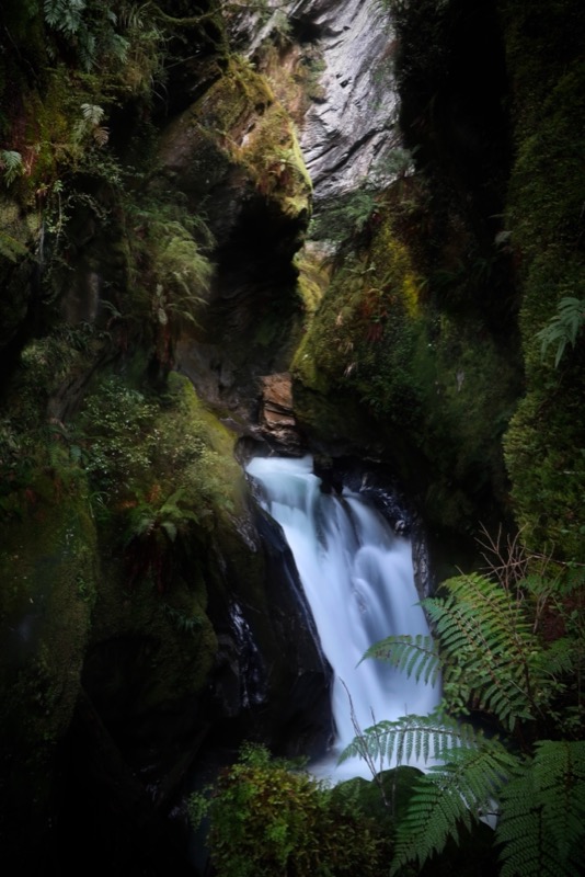
This is Humboldt falls; double falls.. but only a single rainbow. 🌈
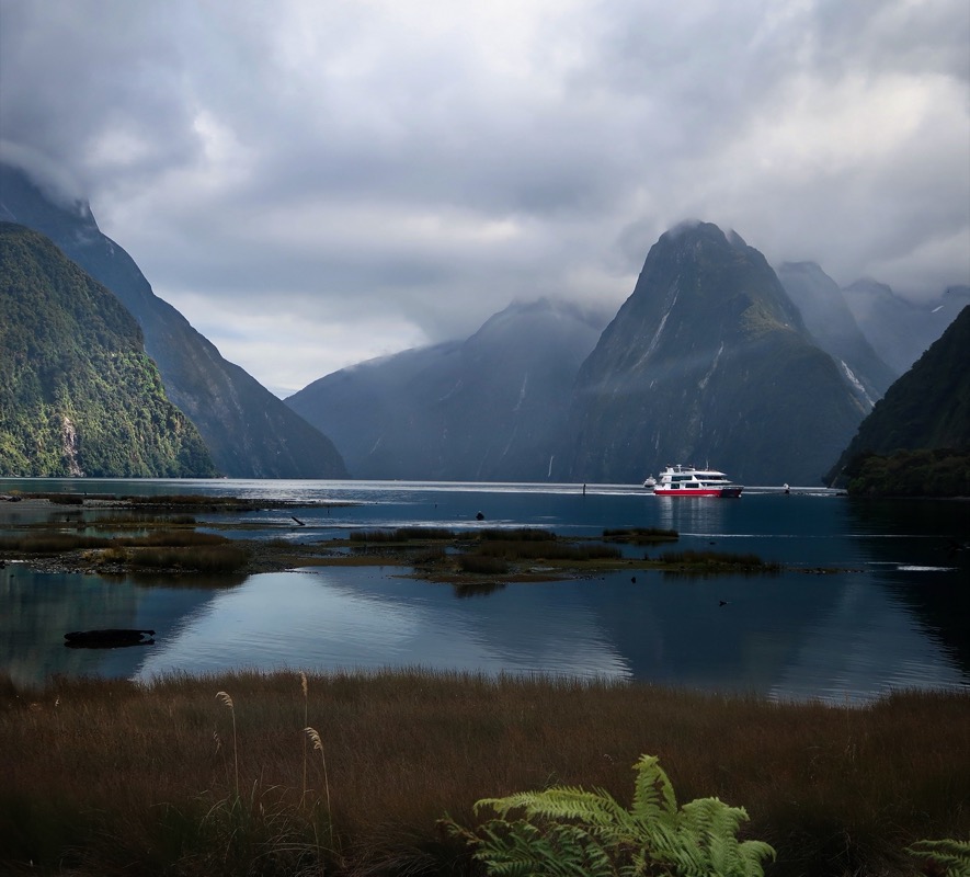
This is Milford Sound. Janet and I took a boat out to the Tasman sea to see Fur Seals 🦭, dolphins 🐬, glaciers 🧊, and waterfalls 💦. Janet quipped that she was surprised I didn’t try you build a boat to go around to Deception Sound. I’m still a bit miffed that she thought my raft would sink before I had even finished building it. We did look for a boat (built by an actual shipwright) that would have taken us all the way around to where we had been trying to go a few days ago – but that would have required a 70 mile open-ocean voyage and no one was offering that package. The 14 mile lake-paddle would have been much more tame!
Shortly before finishing the day, we met Cyrus (left) and Miles (right). I joked to Janet that it will be easy to remember their names: just think “Miley Cyrus”. Janet surmised that they were brothers, and I said, “no they aren’t!” Keep in mind, she said this when they were kitted up in helmets and looked quite different. Well, as usual, Janet is right. They are actually twins from WA and touring 400km together before going backpacking and then trail running… and maybe even fun-ride that trail we did on day 2. They knew Josh Kato and Corrine Leistikow who we know from bikepacking, making it feel like a small world \u0026 giving us lots of fun stuff to talk about. I’ve been enjoying meeting new people frequently on this trip. We are spending lots of time talking with other travelers more often than locals, but that is just as fun! We plan to watch Cyrus on his Tour Divide run in 2023. You can too:
https://www.strava.com/athletes/12086521?oq=cyru
Janet on the “Around the Mountains” trail. It was nice enough, but it paled compared to our list of favorite rides.
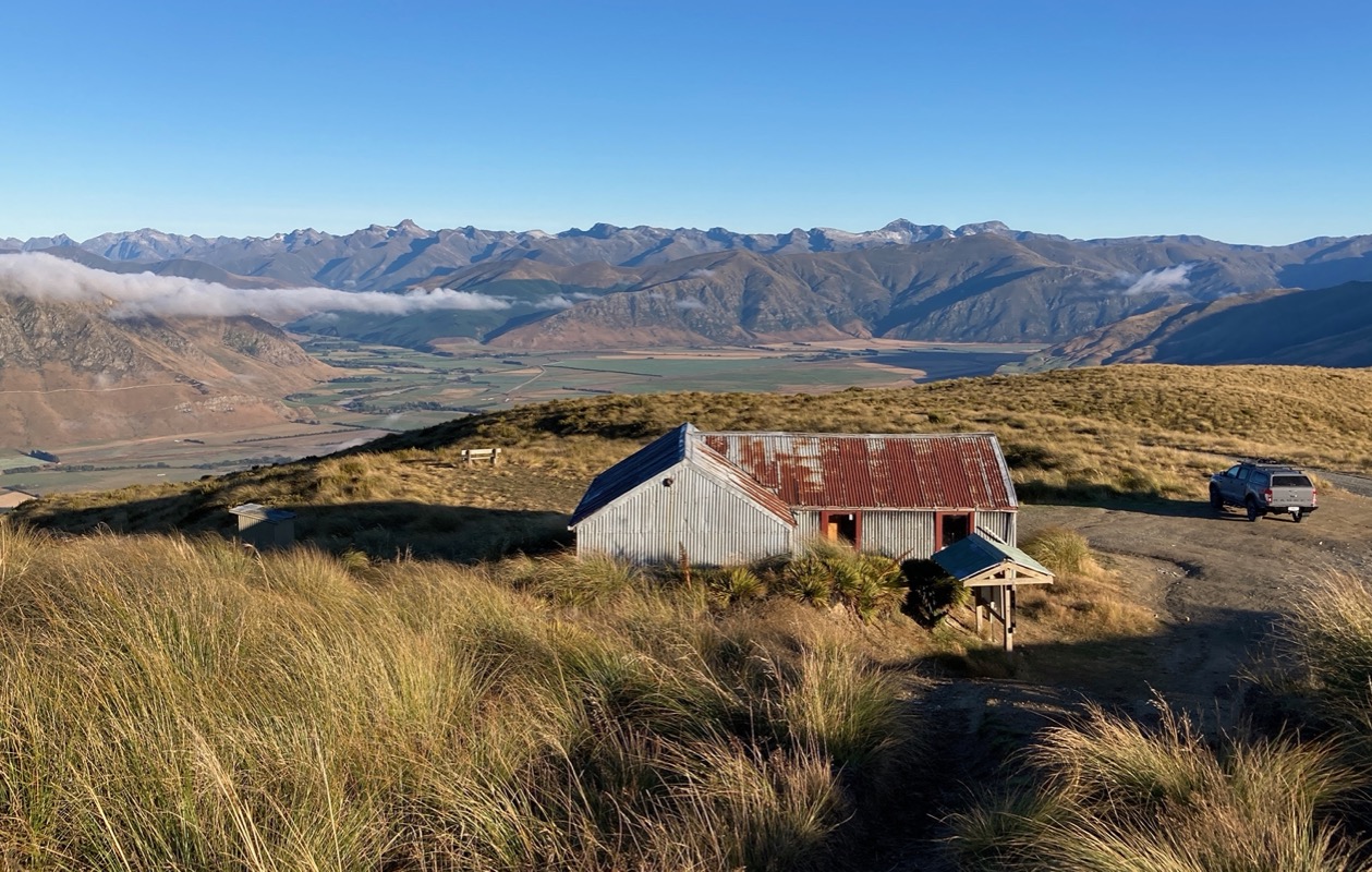
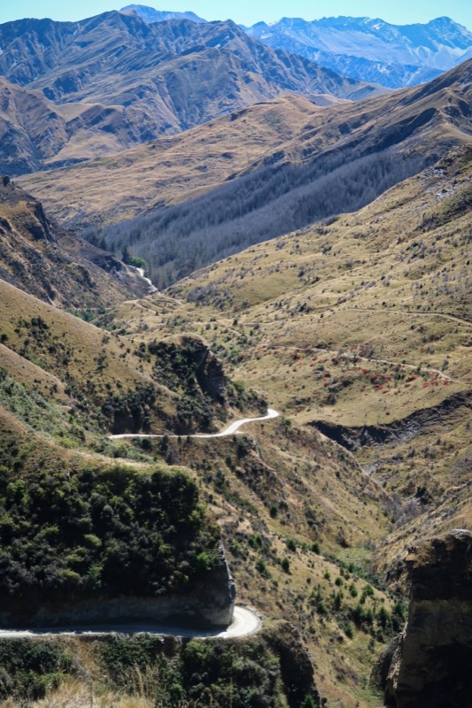
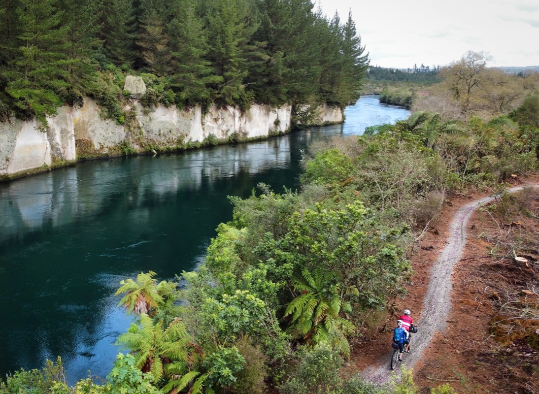
The Garston Ski Hut along the Nevis Road. This is a dirt road that takes you up to the “Welcome Rock Trails” mentioned earlier in this post. The ride from the hut to Cromwell was excellent; it was a remote double track that crossed a creek several times – plenty rugged and saw zero cars.
Later in the day, Janet and I rode the Dunstan Bike trail. In planning our route, I had dismissed this bike trail because it looked “too easy” in the brochure. Ok, you can laugh at my foolish attitude… I was thinking it was some flat beginner trail. I actually like easy routes… but they have to be interesting too. It turned out to be quite an exciting trail with lots of fun sections, plenty of ups and downs, and great scenery. The last 8 miles of this day were on the 150th Anniversary River Track – which was super fun, easy snoopy single track! Highly recommended!
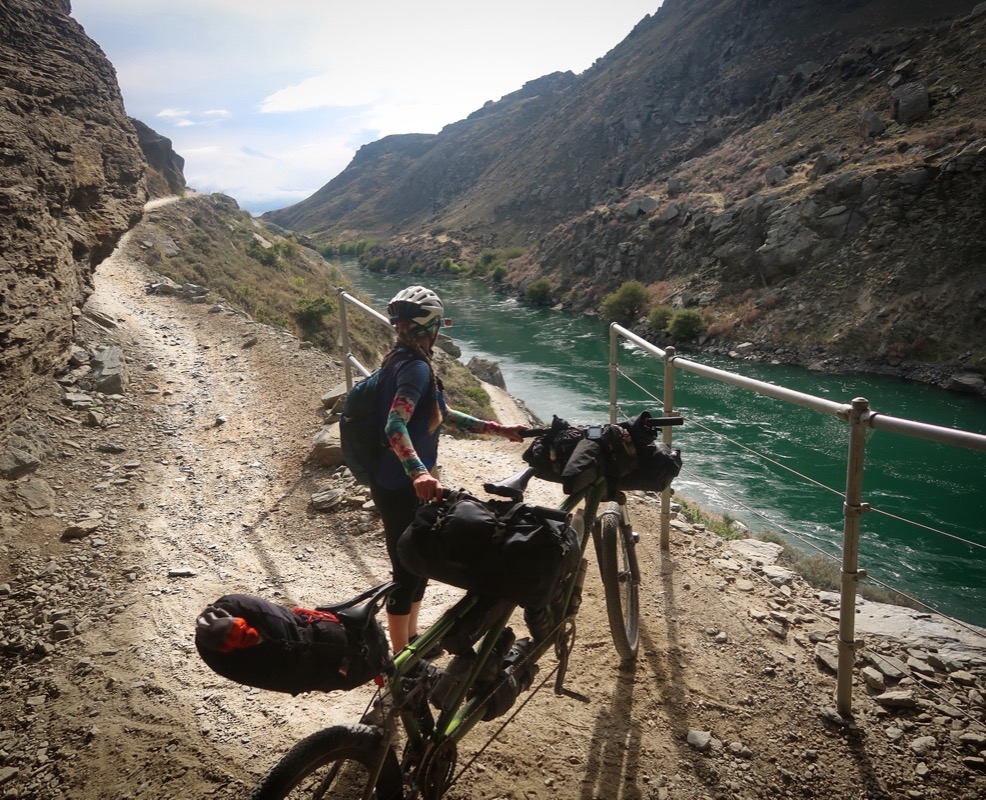
This is the Roxburgh river trail. It’s pretty fun and flows… but it has a catch: 8 miles in the middle are missing. That’s fixed by a pair of jetboats that transport people through the trail-less piece of gorge.
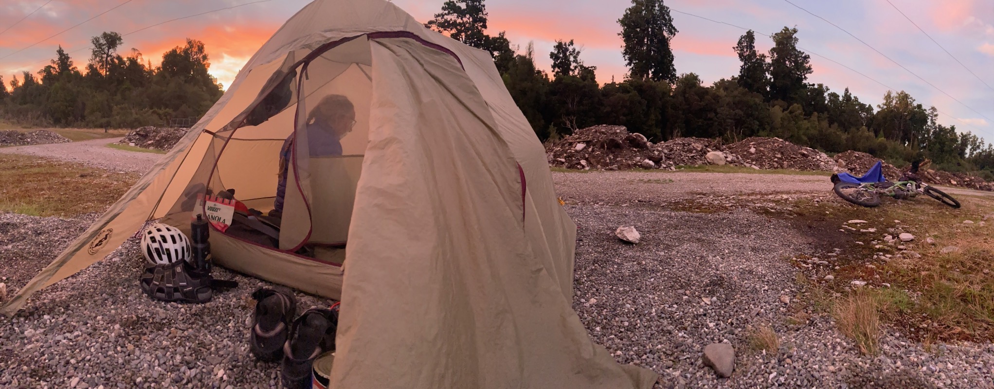
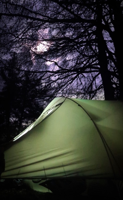
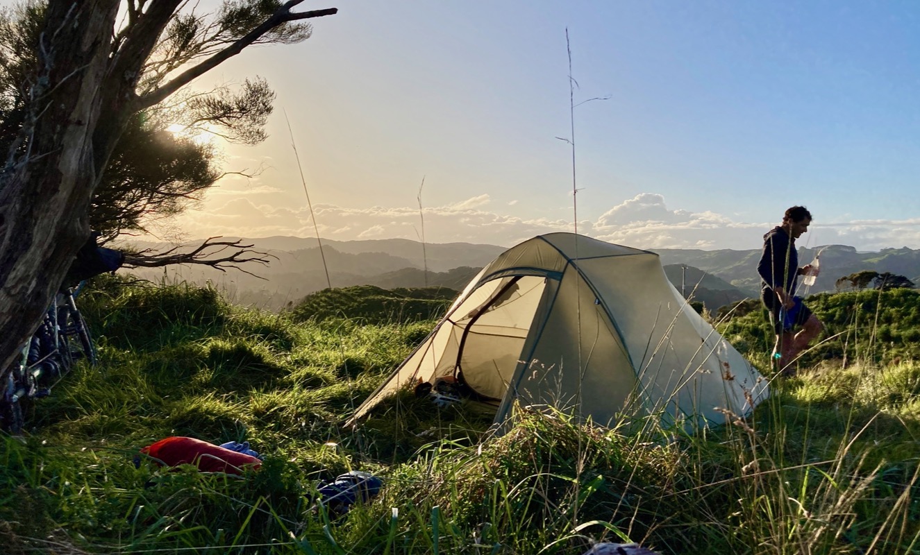
“Let’s camp here!” At the perfect time for camping, a perfect spot appeared, so we stopped. That’s our tent bottom right. We were here for about 15 minutes when a car pulled up and just parked. My mind went to creepy places because I had recently seen a disturbing scene from “the zodiac killer” movie at Janet’s sister/brother in law’s house… I worried a bit, but we distracted ourselves by working on the bike. Another 15 minutes passed when the creepy car drove closer towards us and the driver got out and started walking towards us with one arm raised towards the sky with an oblong object in his hand. I was less scared now seeing his face. “Hey man…” he said, “you guys want a joint?”
Relieved, we thanked him and said, “no thanks!”
🚬
🚬

We designed a “connection route” between the end of the Clutha Gold Trail and the start of the Otago Rail Trail. It was on mixed surface roads, but it was great because it had very little (almost zero) traffic. However, once we made the crossing, we had to ride on Clark’s Junction Road for a bit. That road didn’t have much traffic – but the cars that were on it drove fast and without a shoulder, it wasn’t fun.
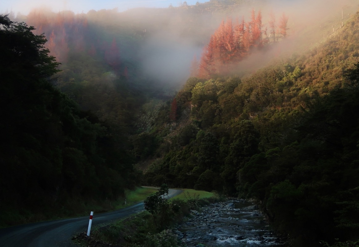
Today was the day of cool lighting. Clouds came and went – even a little rain on us – but the lighting kept changing, making for nice scenery in an area that wouldn’t have been as interesting otherwise.
🌈
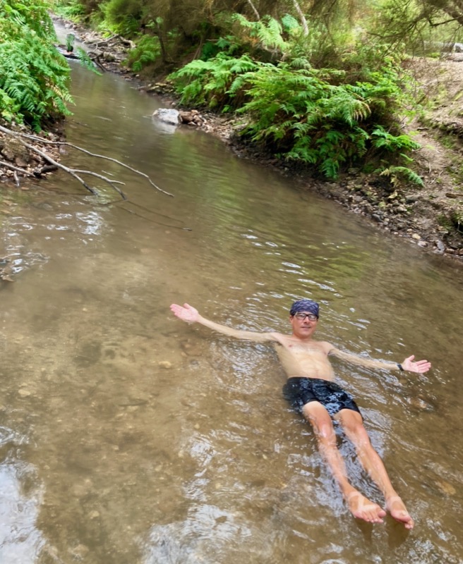
Every night we try to do some form of cleanup. Last night, we had a river so I went for a swim. But here, all we had was the water we had carried in. I used one of Janet’s water bottles to do my “750ml bottle shower” – carefully working from top down to rinse the salts and dust off the skin. A few dribbles made it into my mouth revealing that this was no ordinary shower, but a sweet one made from partially diluted diet 7up! 🚿
🧼
It’s a rail trail. It’s beautiful. We are happy. We go uphill on 2% grades all day at 12mph. Not your typical Janet and Brian route – but we are enjoying it. In a couple days, back to the original route.
I suffered a series of hypoglycemic episodes today – all triggered by forgetting one injection 2 days ago; the reverberations of trying to make up for that one missed shot have lingered for 48 hours. As I lay on the ground recovering by these jumping sheep, Janet and I discussed God. I said, “I don’t buy the anthropomorphic version of God, but I sure do believe in a unifying force.” Janet seemed to agree that this was possible, so I continued, “I mean, think of all those sheep with their own individual brains… and somehow that one sheep dog knows where he’s supposed to be guiding them – and exactly how they will react to his guidance.” Around this moment, the dog crouched low – almost in predator mode – to sway a lone, errant sheep to get back on-track. Janet said, “Yeah, Maybe God is just a Sheepdog.” This idea of God and Sheep… at the time, it seemed really deep.
🐑. 🤯
This is on Thompson Gorge Road – an excellent gravel road connection between Omakau and Wanaka (well except for the last bit into Wanaka which will be solved once they finish the “Upper Clutha Trail” that is mentioned at the top of this post.
Yesterday we propelled the bike hard into the wind, and still had a great day along the trail. The wind took note and fought back even harder today, as we drove into its stalwart flow.
At the end of each day, we like to review our highlights of the ride, and I’ve been starting to notice a pattern emerging (at least in myself). I actually really enjoyed this mountain section… even though it was steep uphill and headwind. In contrast, the last 20 miles were on a paved road (same wind but not steep)… and that part really sucked my enthusiasm. For me, good scenery and no cars can trump the challenges that might otherwise bring you down.
Image
A brilliantly clear morning spent riding the surprisingly technical trail around the lake. We rode a mix of single track and paved roads around the edge of Lake Wanaka – headed out towards Mount Aspiring National Park.
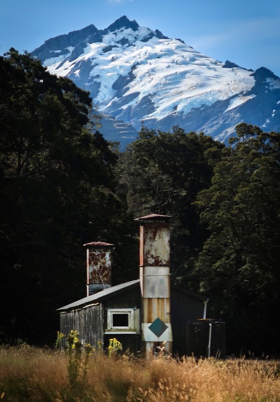
There are fewer glaciers on the planet now than when I was born, making visiting them something of a “now or never.” Bikes are allowed out as far as “Aspiring Hut” which is a pretty good allowance considering that the trail became quite technical before that. In fact, our permit was for camping near Aspiring Hut. The trail is fairly slow-going considering it looks pretty easy on the map. It was worth the effort to ride out there, though because then we were able to do the hike towards the Rob Roy Glacier.
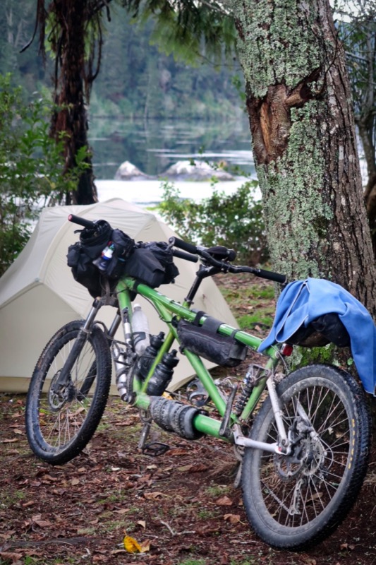
This is Cascade Hut. If you have been to NZ, you probably know that they have a pretty big hut system. For people like us who do things “seat of the pants” style, they don’t help too much because many need to be reserved months in advance. Some are free and don’t need reservations. We are moving towards the wet West coast in a few days – so likely will be seeking shelters more often.
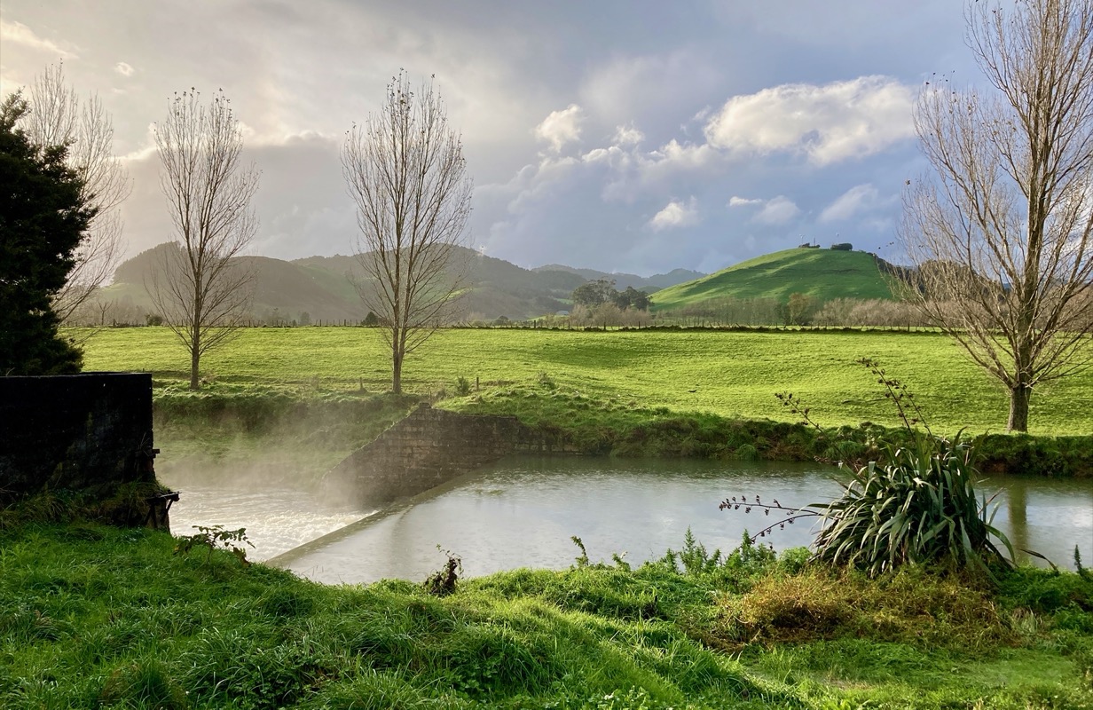
Yeah, this is an uplift zone. The plates are rising at the extremely fast rate of 10-20 cm per year. As we were riding back to civilization, I felt like we were riding equally as fast (slow). Finally I asked Janet if we could pull over and brew a second pot of weak coffee from the river water. She said, “sure!” We rode a fair bit faster after that recharge! Also, our spirits were buoyed because we would be meeting up with Dave and Aglaja this afternoon!
This is the bridge that takes you to see the Rob Roy Glacier. The effort to scenery ratio made this the best glacier we saw on the trip. We would later go to Fox Glacier and Frans Joseph Glaciers, but neither allowed us to get as close as the Rob Roy.
Rob Roy Glacier.
Another beautiful morning! But “red skies by morning, bikers take warning”…. Rain is coming!
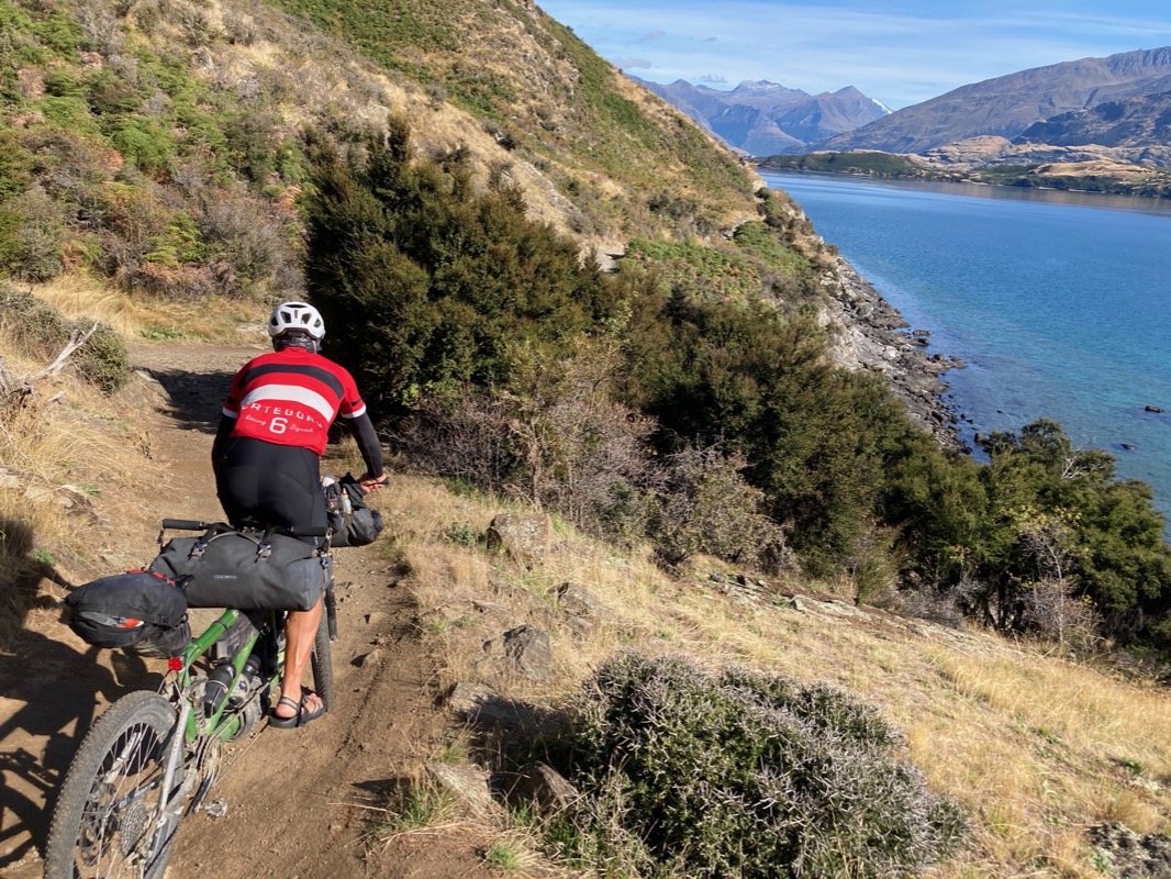
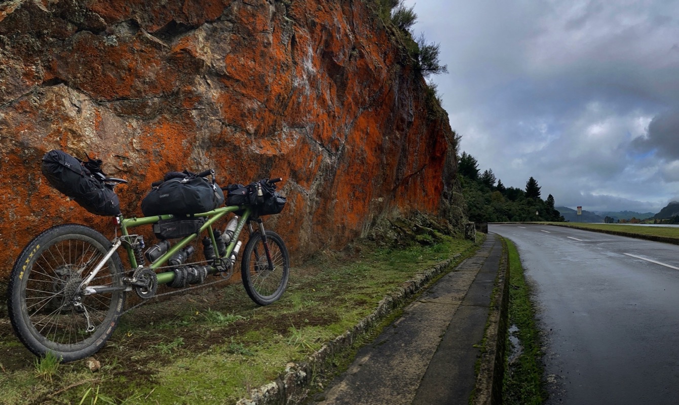
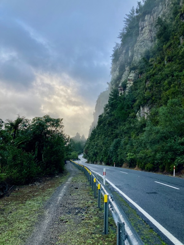
While seen riding along the West Coast Road. This road had us on pavement for 3 days heading North. While the scenery was very good, unfortunately there were no shoulders along the way. Luckily, there wasn’t too much traffic; there are worse roads to ride in NZ than the West Coast. The part of the West Coast Road from Wanaka to Makora was the worst. Farther North, it got better. By the way, if you do this, make sure you follow our route into Lake Hawea instead of taking the highway straight out of Wanaka.
At the beach coffee cart we met Jenny and John from the UK. They are on an unsupported 8 day hotel bike tour from Christchurch to Queenstown. They had nice rented Surly bike and new panniers.
We heard about this couple (Jeff and Pip from New Zealand) from another cyclist couple as we were heading North. We were told they had a green tandem the same color as ours – their bike was from California, so maybe the same brand? Sure enough, coming in the opposite direction, we see a tandem – and it is Gumby’s (much younger) twin!! Look at how their 29-er wheels are monstrous compared to our little 26 inchers! It was nice to meet an enthusiastic tandem couple. They knew what they were doing, but advised us against riding the Old Ghost Road and the Paparoa Track. I’ll let you ponder the probability that we will take that advice 😛. We might even meet up with them up in the North Island where they live in a month or so!
👻
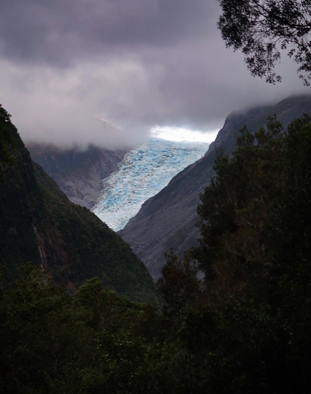
The main purpose of today’s leg was to visit the Fox Glacier. Due to “the largest active landslide in New Zealand,” the route on the other side of the river was closed. We had scoped that route out on Strava, and were confused because on the segments, people had gone out there, but the heat map was pretty much blank. A little trail-side sign saying to turn back wasn’t about to stop us until we figured it out: the segments were from 2013… whereas the heat map was from 2022-2023. A knocked down tree was the final clincher – we turned back and went the way you’re supposed to go – on the South side of the river. Indeed, the views of this glacier aren’t as amazing as I had hoped – but if you’re not afraid of helicopters, you can fly out to get a better look. I’m really happy we made the effort to hike/bike to the Rob Roy glacier, which was much closer than Fox.
🦊
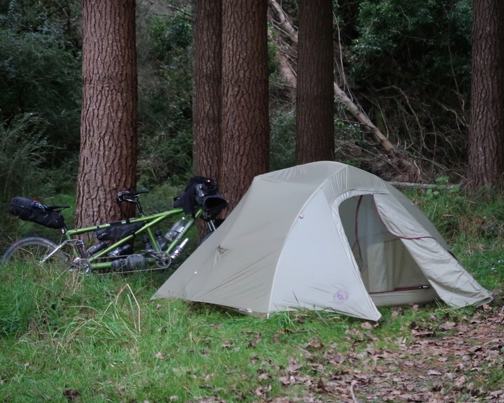
And the final camp! On top of gravel to keep the bottom from soaking through! We had to go past two fences (one of which we temporarily removed from the hinges (don’t worry – we put it back!)) This kept us safer from the riff raff.. but maybe more at risk in case an official person came. Luckily no one did and we got outta there at first light!
This is along the West Coast Wilderness Trail.
The thing that really got me into cycling when I was a kid was the freedom of being able to go far away places. As I got older and now didn’t need permission to go further and further, I was always astounded by how much progress you could make down a road with just a bicycle. Riding roads is how I got into it. Now, after the last 4 days of riding pavement, the realization has really sunk in that I no longer enjoy road riding. It isn’t the pavement per-se, but just the constant fear of cars. Levels of traffic that I used to deem as “light” now feel like heavy traffic. Hwy 6 really didn’t have THAT much traffic (the other cyclists thought it was great)! Luckily, today was spent almost entirely on the “West Coast Wilderness Trail.” It’s not wilderness by USA standards, but it was total delight to ride and be away from cars!
🚗
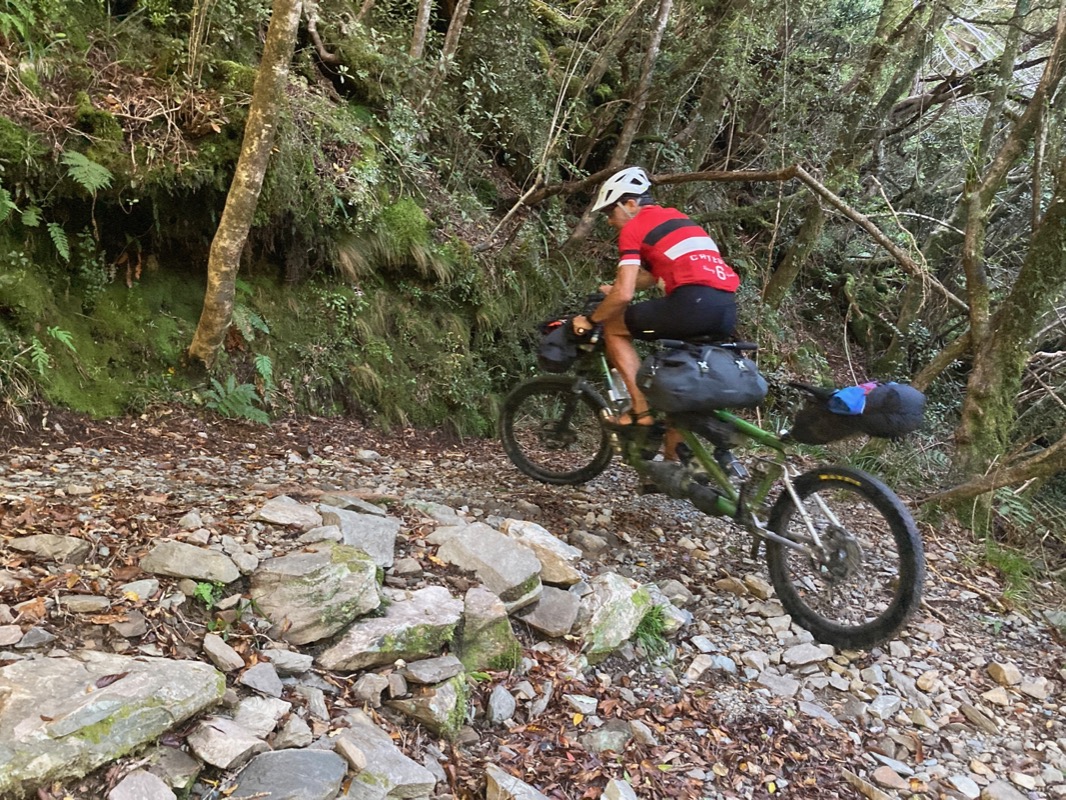
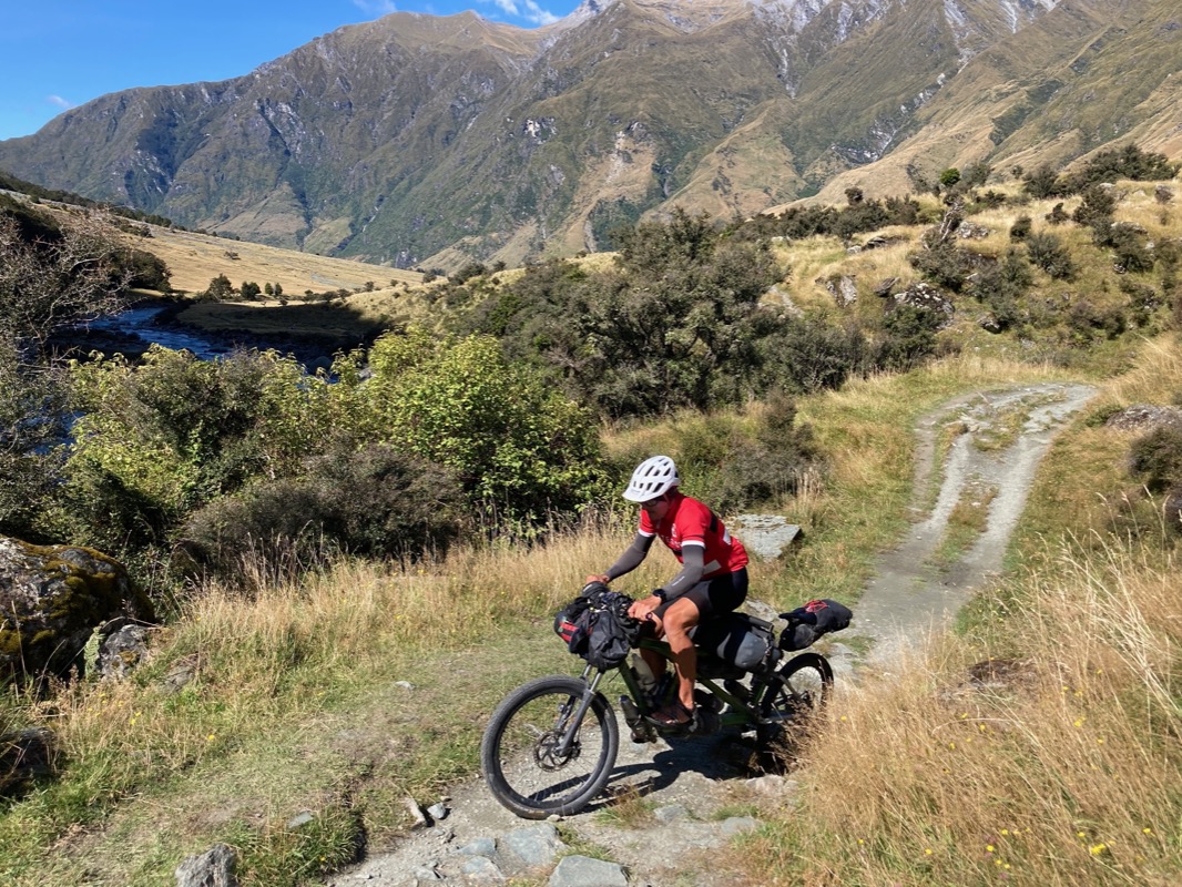
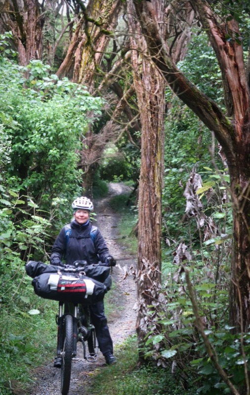
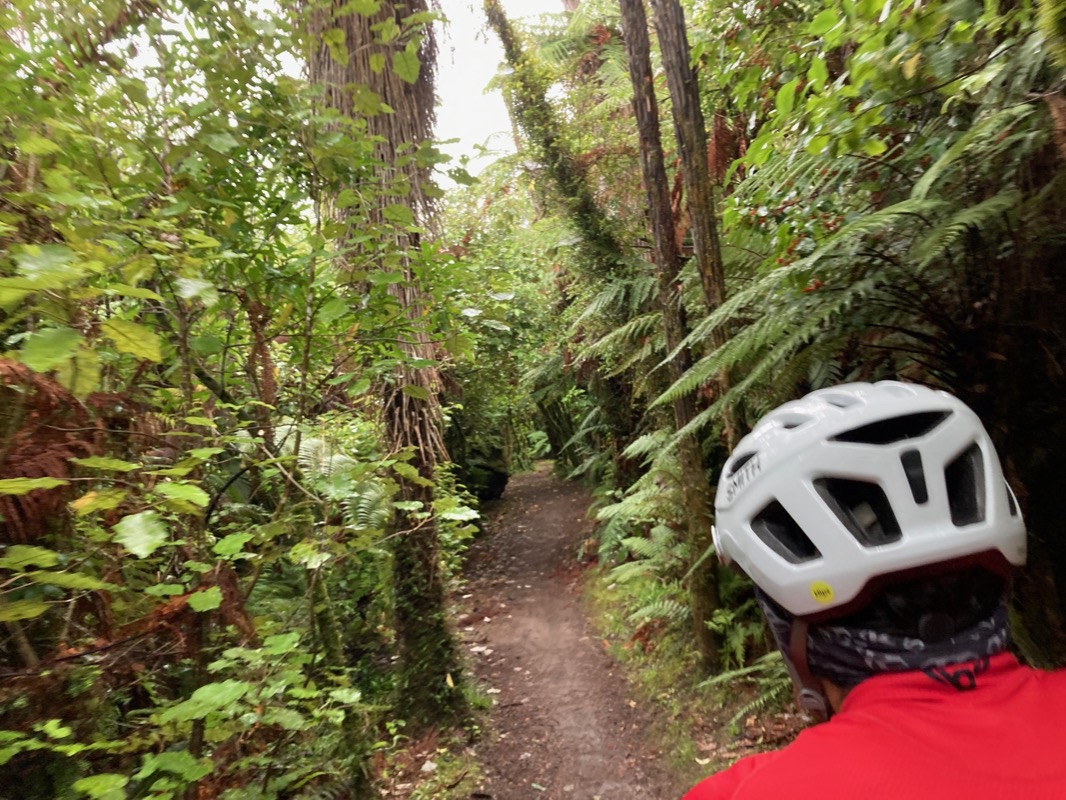
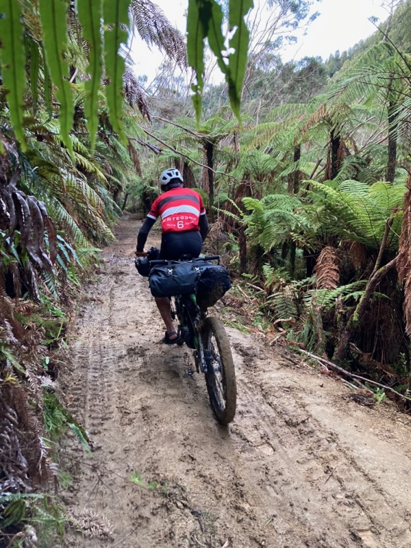
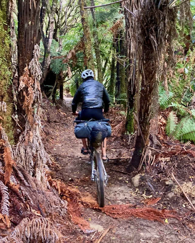
In NZ, it’s “single and a half” track.
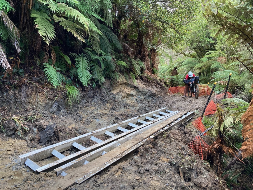
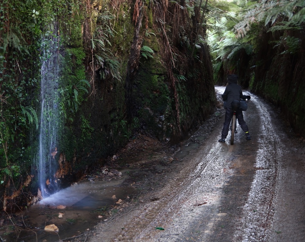
Most trails so far are on raised, compressed gravel. It is an amazing surface for cycling – you still get that gravel crunch sound – but it is efficient to ride and drains heavy rain easily.
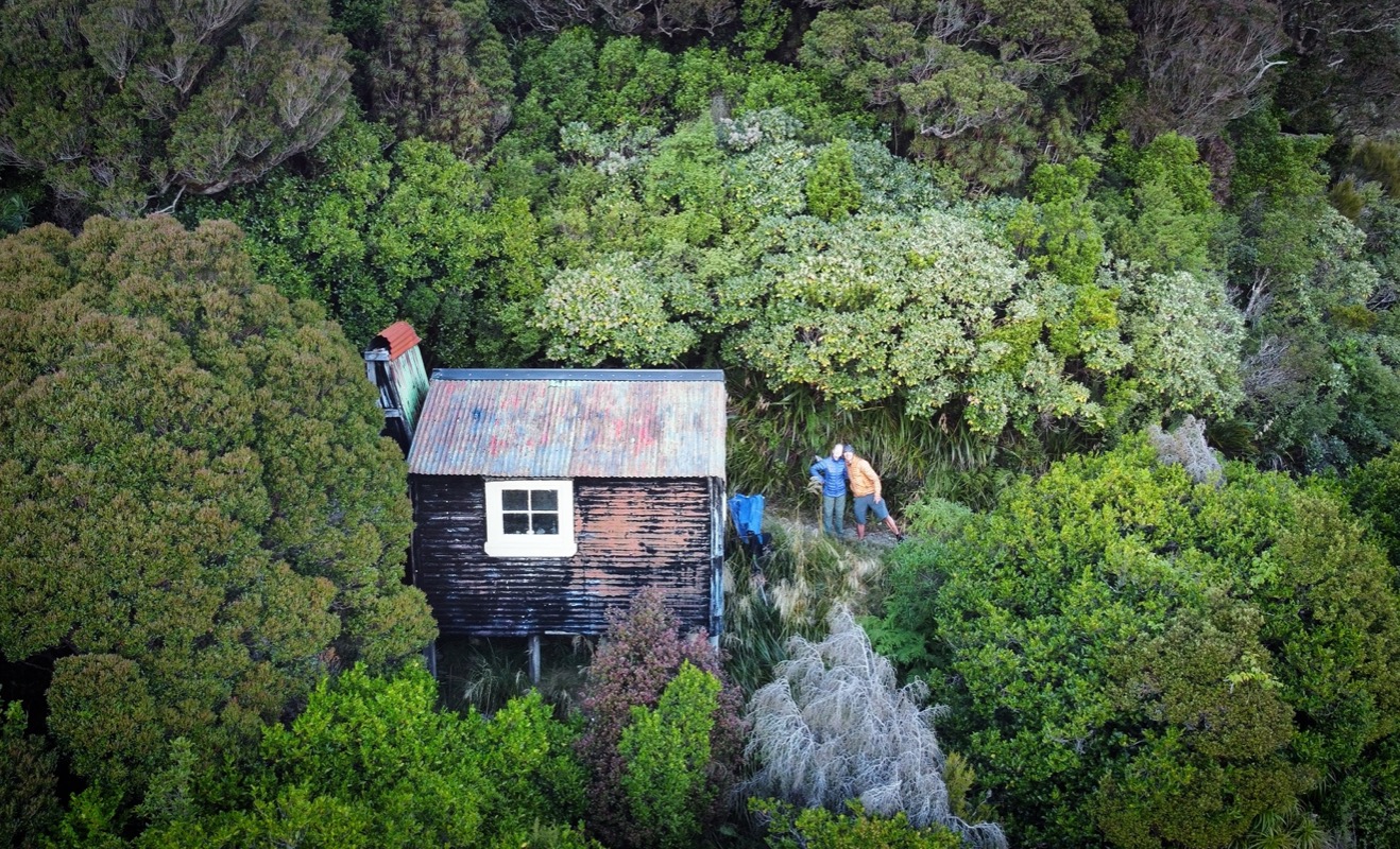
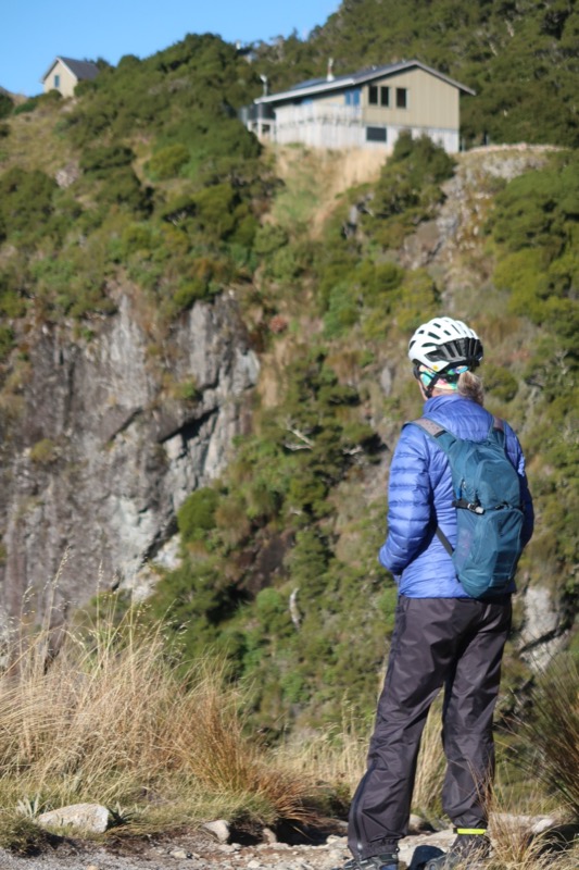
Camp sweet hut! There are two huts next to each other up near the ridge. One of the huts, you have to reserve so you can sleep crowded in with 16 people. It boasts a kitchen, lights, running water, and excellent construction. The other, more humble hut is kind of an emergency shelter – but room for 3. When we arrived, one guy named Andy decided to default on his reservation at the big hut citing that he wasn’t excited about sleeping with 15 other people. We weren’t too excited about sleeping with Andy, but he turned out to be a nice quiet guy and it worked out well with all 3 of us in our quiet, mostly fart-free hut!
Morning view from our cabin. We shared the cabin with a hiker named Andy. He got up early like us – but he split long before this photo. He was a good cabin-mate. In other countries, we have always had the non-reservable wilderness cabins to ourselves. We are kind of spoiled in that way. In NZ, there are just lots of people traveling similarly to us meaning it is hard to reserve huts, camping, or lodging of any sort. There is not any flat ground along Paparoa, otherwise, we would have tent camped in bliss!
The morning began well for us – climbing on loose rocks but no rain in the forecast at least!
⛅️
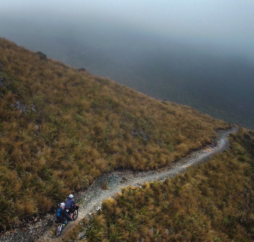
At first I was bummed! We climbed into the clouds and the infamous ridge of Paparoa looked like it would have no visibility…
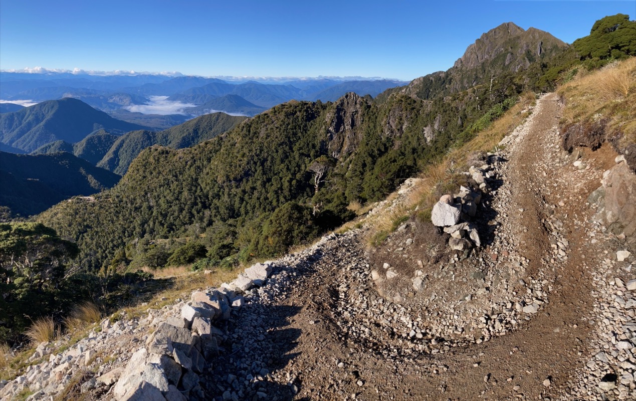
This is on the Paparoa Track.
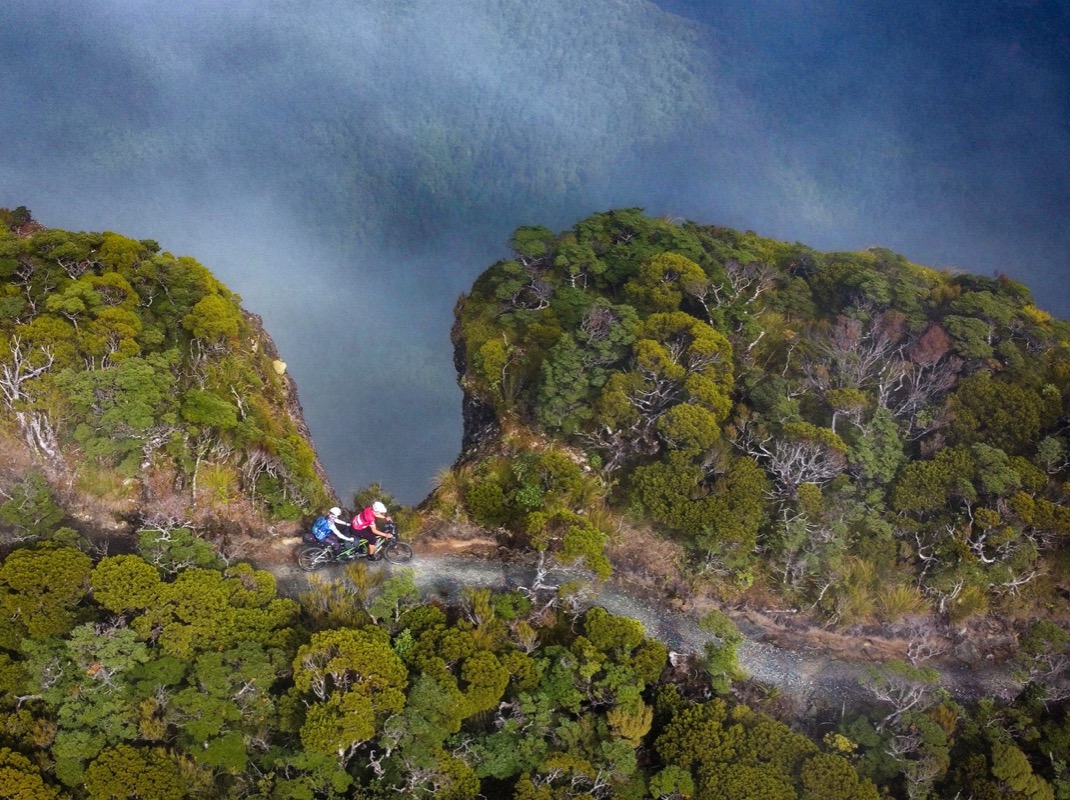
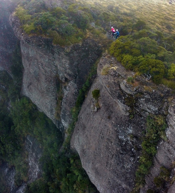
Then the sun came out! Just in time for us to ride by this notch! The sheer drop off was staggering.
More Paparoa Track.
From this angle, it looks like you’re close to the edge, but Janet and I simultaneously commented that in spite of all the warnings, this is a lot more tame than the Porcupine Rim trail in Utah.
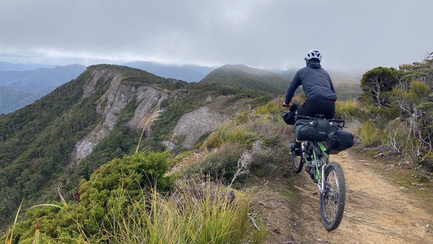
It’s the Paparoa track. Janet and i were excited to do this trail from the get-go, and it did not disappoint! Plenty of rowdy riding and just right for the tandem.
Took a day off to hide out from the rain. Clearing skies predicted for tomorrow. Let’s go to the beach!
Long exposure with polarizing filter. Looking for penguins
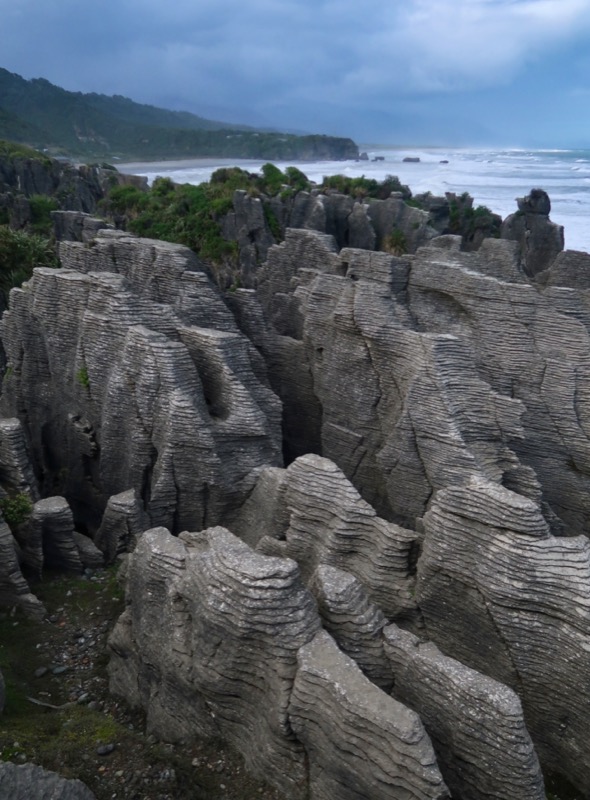
We missed the Pancake rocks and blowholes on our way to the lodging the other day. The weather was unsettled, so we retraced our steps to pay a visit to this formation and a cavern along the way. We have been hoping to see penguins, but so far all the signs make it sound like we are about one month too late for them.
Janet and i were able to take pieces of a trail that is still in the process of being built. We passed by a beautiful Co-Motion Java tandem parked at a cafe. Further down the trail, we were stopped for some insulin top-off and Justin, Laura, and Matt (not pictured) rolled up. Justin is working here for 6 months as a nurse. There is a big demand for that here because médics get paid better in Australia- so they all leave NZ. He said here on the west coast, there aren’t permanent doctors at the clinics and hospitals. The few doctors just travel up and down the coast, so if you live in Westport (for example), the doctor is “in” on Monday only. It’s easy to complain about our own health care system, but I keep seeing issues in other countries as well. Anyway we couldn’t stop talking to these guys about all sorts of topics (including tandems!!) and they invited us to stay with them! I’m so grateful for Janet’s willingness to travel “seat of the pants” style because without pre-existing plans, it opens up the opportunity for us to say “yes” to new cool experiences and friendships.
Matt took this picture of us with Justin and Laura. Laura just retired and she has a multitude of interests such as learning Italian, playing the harp, and writing. She is writing a book called “She’s not pedaling” – the stupid refrain that Tandem riders hear almost daily like a cat-call while riding past people who think they just came up with the funniest comment in the world. Laura sent us the intro to the book and Janet and I are excited to start reading it tonight (it looks like it will be funny so we may share some bits with you). Matt and Justin will be riding the Old Ghost trail in the opposite direction of us – so we will be seeing them again soon; they started today to celebrate Justin’s birthday.
Saw Matt and Justin a couple days later – they were riding the Old Ghost Road in the opposite direction of us.
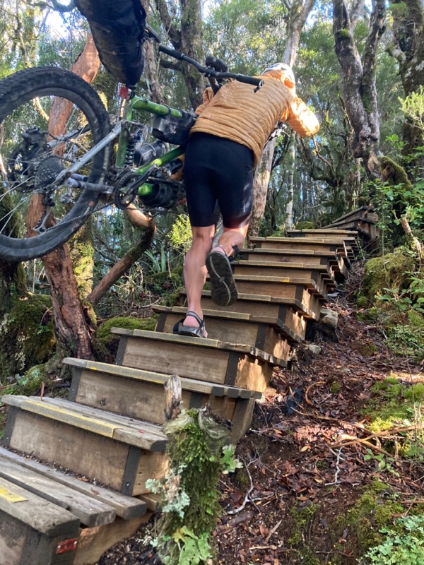
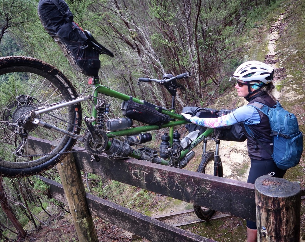
People kept telling us we were going the wrong direction – because they thought it would be easier to go down the Skyline Steps instead of going up. For us, with the tandem, it was no big deal to just carry the tandem up the stairs. I think it would have been harder for us to go down because I wouldn’t have been able to carry the bike, and would have had to use the brakes to somehow negotiate the bike down the stairs. I can’t really imagine doing that.
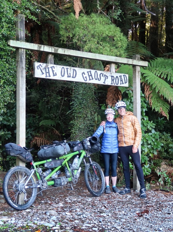
Probably the first time New Zealand crossed my radar as a cycling destination was many years ago when I saw some friends’ post about Mountain Biking “The Old Ghost Road.” Their pictures of tight singletrack in the rainforest were tantalizing, and so were the descriptions… fun fun fun…. Years later, when researching the Tour Aotearoa route, I sought to see how we could integrate this trail into the TA route.
Every person we met along the trail had some sort of warning for us. The stairs would be impossible to go up on a tandem, we wouldn’t be able to ride the tandem on the trails; it would be too hard or impossible; we are going to need 3 days to do it; we wouldn’t make it to Blackball in 2 days, “Did anyone tell you about this trail? You’re going to have to turn back.” With all of these warnings, it set our expectations nice and low – so each time we encountered one of the “challenges”, we just kind of laughed them off. Here is Janet carrying the LBJ up the steps with good footing and no risk of slipping backward more than you walked forward 😂. Much easier than ascending this grade on loose rock. I wish I could go back and tell the naysayers that we made it!
🇲🇽
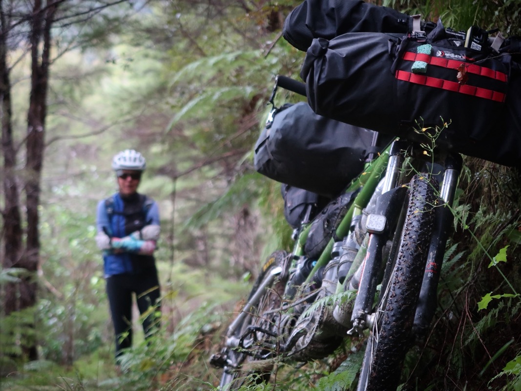
In spite of the name, The Old Ghost Road is actually a singletrack trail. It is a highly developed, extremely well maintained, machine built trail meaning that it is challenging, but also very rideable. There are no “services” along the way, but quite a few reservable well-sealed huts with stoves and water so you can sleep indoors with 19 other people. That’s not our cup of tea – so we elected to camp instead. If you’re a mountain biker who doesn’t want to carry as much stuff – but wants to do an overnight – and don’t mind the risk of snoring and farting* cabin mates, this would be a very fun tour.
*We have heard stories
💨
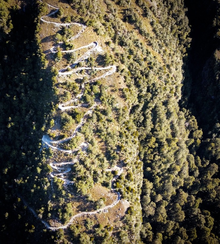
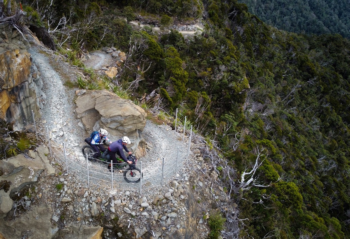
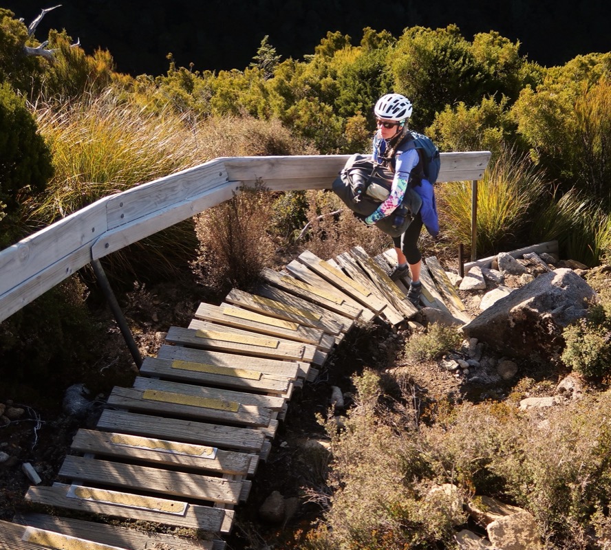
We wanted to take a drone shot of us on the switchback climb, but it was impossible to see us. I think we were on a switchback above what you can see here maybe? Anyway, a photo of us wouldn’t have looked good because of the scale. I did have to walk more than half of these switchbacks due to loose rock in the turns – but someone (like a certain Sorcerer®) with a single bike could ride these with ease.
The high elevation cabin on the Old Ghost Road.
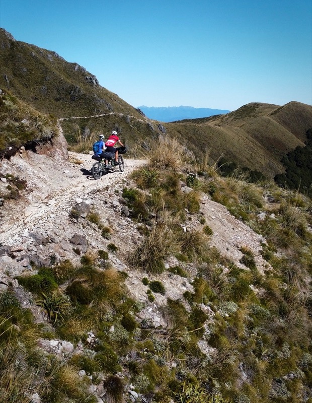
A lot happened today… but the most fun happening is that we got to ride the rest of the OGR (Old Ghost Road). This trail was fantastic and I can see why everyone loves it so much. Well built, well maintained, not too many people (due to the hut system requiring reservations). Fantastic views both along the ridge as well as at the bottom on either end. Enough challenge to keep it interesting, but never too hard. This trail has it all.
This is aptly named “Heaven’s door”. Maybe one of the most scenic bits of trail. We are so grateful that we got clear skies today. The riding up here was superb and well graded.
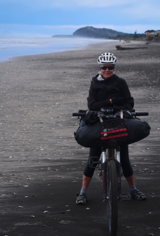
It’s nearly impossible to start the day with a dry tent in NZ. In fact, on non-rainy nights, the tent actually gets wetter than if it were raining!?! It seems that the dew point causes us to get condensation inside the fly as well as on the outside. Our routine is to shake the fly in the morning, pack it wet, and then do some sun-drying at the first opportunity of strong rays. A cell signal during drying time is an added bonus so we can post-load Strava updates!
At the hostel/campground, we met Kate and Rowan. Both nights, they kept us entertained with stories about their journey. They sold their house and started walking the TA route (the hiking version of what we are doing)… that was 6 months ago… The even had been carrying a 3kg pack-raft that could carry both of them and all their gear. You can imagine I was a bit jealous after the “build a raft” incident. Eventually they realized they wouldn’t make it to the South of NZ before winter – so they bought bikes and now they are bike touring… on their 5th day after all that hiking! The adjustment has been pretty major. If you need another couple to follow, here you go:
https://kiwihobos.co.nz/
🥾
This morning on the Tour AOTEAROA was grand. As we are going North, the weather is getting muggier. We are traveling opposite of the seasons. Another note: last night the time changed here. So, when we left California, the time difference was 3 hours (well actually 21 hours)… Then daylight savings began in California, so our buddies back home were 4 hours apart from us. Now, daylight savings ended here, putting us 5 hours off! From a jet lag perspective, coming here was a breeze! We will see how it is going home.
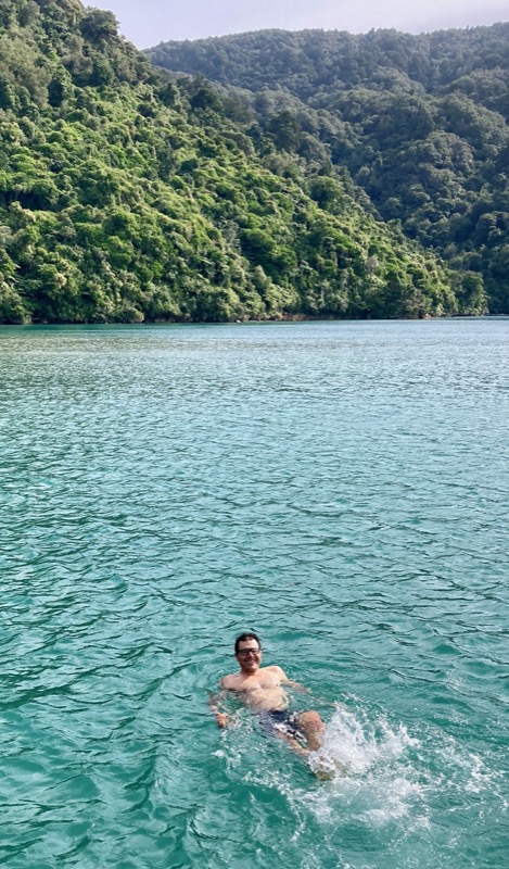
We went to the edge of Abel Tasman National Park. Didn’t go in because there isn’t really stuff for bicycles – but a good place to swim in the not cold (but not hot) water. I was surprised to find the water that got into my mouth was practically fresh water – no salinity!? Wonder why that is?
Janet and I saw an icon for bathrooms and a picnic table on Open Street Map. Let’s make it our destination! 🤞 When we arrived, it looked good – what you see here. We had to ascend a steeply rutted road to get here so assumed no cars would come. After a nice dinner and discovering that Janet got me back for losing her socks (by losing my shorts), we settled in to relax. Moments later some stinky vehicles came up the road. One struggled and spun around a lot. Then a dog came and jumped on the tent. Uh oh. NZ rednecks. 😆. The two cars pulled alongside each other shining their lights on the tent. They exchanged lots of words – most of what we couldn’t hear. Then they both peeled out spraying gravel as one of the kids yells out the window, “SORRY FOR DISTURBING THE PEACE!!”
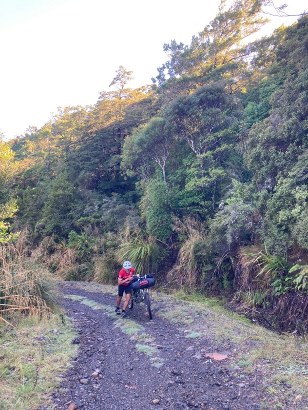
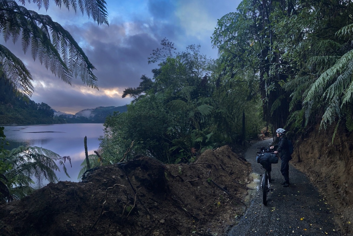
Janet found an amazing alternative route to get into Havelock today. It avoided HWY from Pylorus bridge and took us on an interesting gravel road. Major kudos to her. 🙏 We did have to go 0.6 miles on a no-bikes-allowed trail to make the connection, but after seeing all the big trucks on the shoulderless road, we knew we’d risk offending some hikers vs risking our lives. Luckily, we only met one group of hikers and they were happy to see us and asked us to take their photo. We have been told that the death rate on NZ roads is double that of other countries… or the EU as a whole. Someone told us it was the highest in the developed world. I haven’t fact checked that yet, but having seen how people drive, I feel like I can say it rivals the worst countries we have been to for drivers caring about the lives of cyclists. Luckily, we have been mostly on bike routes and gravel roads – but sometimes we do need to ride on the main road.
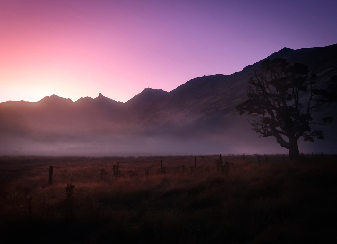
We both slept well and were excited about today’s ride. It did have a reputation of being one of the harder sections of the TA route, but after we did that hike-a-bike towards Doubtful Sound, we feel well prepared for this section. The morning delighted us with partial low clouds.
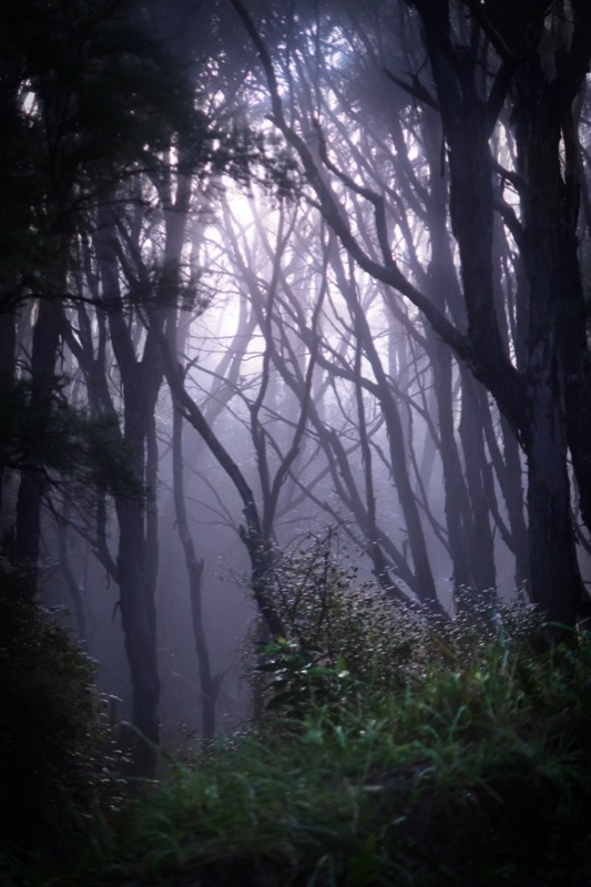
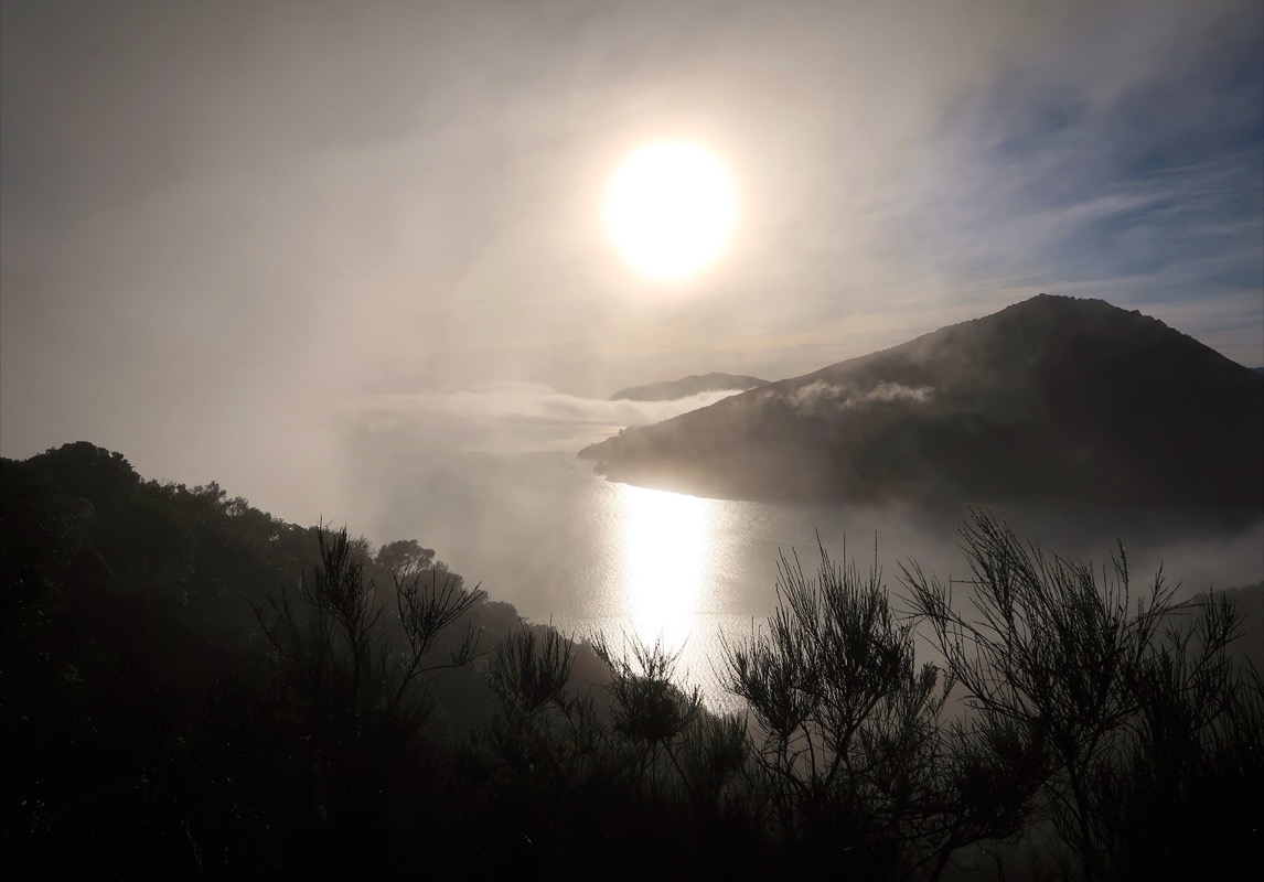
Spooky morning fog. Happy climbing in the cool
As Janet and I were pedaling up the hill, a guy on a quad (side by side) stopped us. “You aren’t going to be able to make it, you know that right? I had to rescue other cyclists. I live at the top of the hill and they had to catch a bus and go around..”. Janet and I queried if the pass was open. “It’s open, but it is really rough. I don’t think you will make it over.” I told him that those other people may have been riding gravel bikes, but we had a “full suspension bike.” He eyed our bike and said, “no, they had nice bikes like yours, and they still couldn’t make it.” Anyway, he wasn’t going to stop us and we carried on. The road did get rockier and we had to walk, but it was much better than riding on deadly Hwy 6! When we got to the top, Cara (pictured) and Scott showed up on real mountain bikes coming from the other side. They are riding the whole TA. Neither one of them even said the climb they had just gone up was hard! Obviously they were well prepared cyclists. Not sure what that quad guy was talking about, but I do wonder if people are getting a little too entrenched in riding gravel bikes on terrain best suited to MTBs. Happy to see this smiling couple with no complaints or worries at the top of the pass!
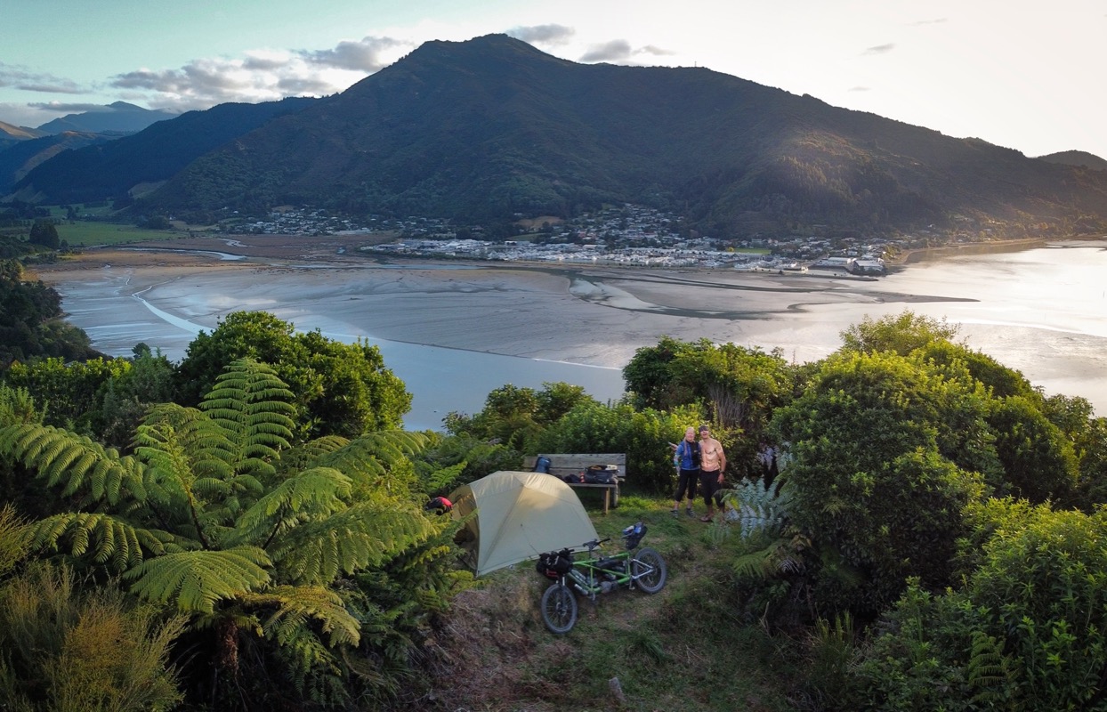
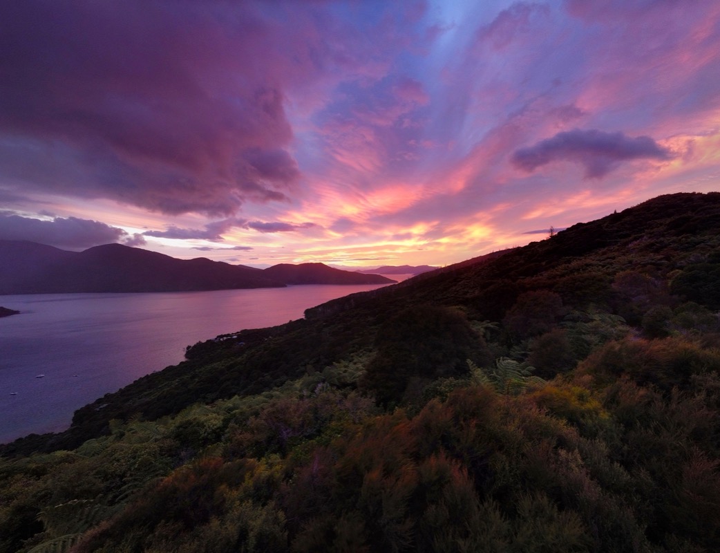
We found a small campsite nestled on the side of the hill. It is absolutely beautiful here. As we ate dinner we stood and watched the changing color of the skies – constantly getting a new view and set of colors.
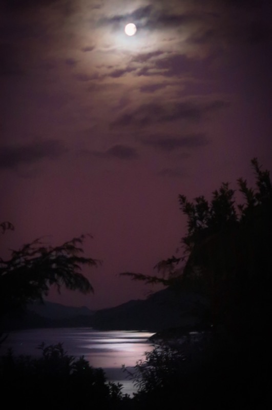
And then the moon came out!
🌚
Even with no coffee stop on the agenda, the morning did not disappoint! Although our things are perpetually wet from 8pm until 10am, I do enjoy the beauty that all this water-in-the-wrong-places provides.
Sitting in Limbo! Everyone has been telling us about the major catastrophe where there is no ferry space between the South and North island of NZ. This is because one company has had many of their boats break down due to lack of maintenance. Also it is related to the cyclone that hit the week before we arrived. Janet and I took it casually – we figured a bike is easy to get on the ferry compared to a car. Since we would be arriving the day after tomorrow at the ferry terminal, we decided it was a good time to book a ticket. Oops! None available for 8 days! Janet can be a stubborn person on certain things (like finishing something she started – which is a good thing)… but blessedly, she is also supremely flexible – so after a few minutes of disappointment, we decided to book the ferry for the date 8 days away and do some more exploring on the South Island. Flexibility is 👑!
Last minute campsite views and a new hope for tomorrow…
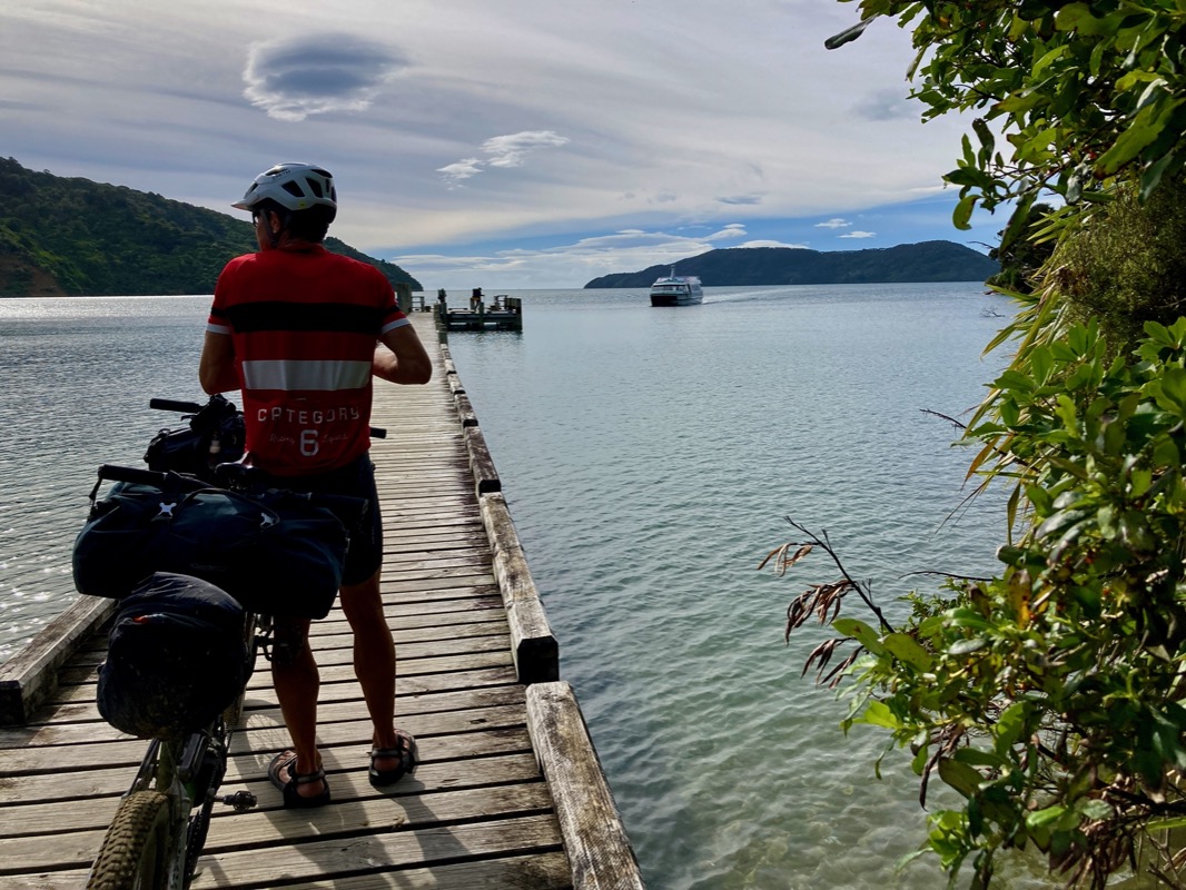
Janet and I had a ferry scheduled to take us from the end of the trail to the “big port” where we would catch the inter-island ferry in 8 days. Ferry was booked for 2:30pm, but we realized that the quality of our day would be much better if we didn’t end the day after dark – so we “dropped the hammer” and gave it everything we had to try and make the 10:30 ferry instead. For me, this was about an hour of high threshold effort. No time for pictures, and “flying” though the trail (which was fun) at a whopping 5 mph. I calculated that we maybe-kind-of couldn’t make it – but still put forth the effort as if we could – and we got there early! They accepted our impromptu time change and this would lead to a cascade of good following events!
Some cyclists arrived at the dock when the wind blew their helmet into the water! It turns out that the guy who lost his helmet did not like water, but I was happy to jump in and get the helmet because I had just swam in the (relatively) warm water.
Janet and I changed our ferry reservation because they repaired the broken down ferry! We were able to get it in 2 days instead of 8. We had already decided against Hamner Springs (due to rain and probably snow)…. So we decided to do an all-quiet-road-and-trail loop to enjoy the 2 “burner” days. Yesterday’s leg challenged us with lots of steep ascents, but we didn’t mind so much until near the end when we got tired. Today, though, promised to be hard – on a steep singletrack trail… This is the Cullen Creek WALKway… Bikes are allowed, but not recommended.
This is the Cullen Creek WALKway… Bikes are allowed, but not recommended.
I’ll note that Janet did lots of trail work on the route – she would go ahead of me and toss off branches and even roll logs off the trail! Janet helped a lot!
The ascent was actually great. Steep, but rideable in sections. The biggest challenge was the slippery-like-ice hard packed mud (that looked like rock). We made good time up the hill and I was happy.
So, we found a place to put up the tent next to Sarah (seated; fishing). She warned us about camping next to her, “I’m a hooligan and you’re going to have to put up with my shenanigans,” she introduced herself. We joked around with her and sensible Janet gave the green light for camping here; she seemed safe. We asked what her shenanigans were and she said, “well I’m going to be playing NZ music.” I asked what that is and she just gave me a scrunched up face.., but as the night progressed,I didn’t mind the playlist of Tracy Chapman, Gordon Lightwood, Fun, Simon and Garfunkel,etc. 🤔. Next she told us there were bats here, and I spouted off my knowledge bestowed by Nancy Prier, “bats are the only native mammals in NZ!” She corrected me: “Bats are marsupials not mammals!” I wearily pointed out that even given the activities of being a marsupial and being a mammal are mutually exclusive, now that we are discussing this: bats are not marsupials, ** to which she replied, “no, they are marsupials, not mammals! “I should know because I’m a Montessori teacher,” she witted as she took a drag from her marijuana joint, “you know I do the drug; that’s why I burn this incense.” Next she told us the largest insect in the world lives here: the Giant Wētā (look it up)! A lot of interactions happening here – I could write a short story on the evening camping by Sarah. Janet and I eventually retired to the tent when a drunk guy pulled up to stay here as well. He walked right up to her and got extremely close to her (ignoring us). It appeared that he knew her by his body language and proximity- but he didn’t! He started asking her name and basically hitting on her, asking why she was single (to which she replied, “I’m particular”). They drank, hugged, and did drugs together just outside our door – worrying me about safety as the night would progress. He began slurring to her “I’m your friend. I’d never do anything to hurt you.” I wondered if we would have to go out and protect her, and I thought, “guns are illegal in NZ… so we could probably safely help her.” Then I thought, “wait a minute, this lady Sarah could probably take out me, Janet, and the drunk guy all with one blow.” She seemed a lot tougher than him or your narrator the Lycra-clad-lad.
Janet and I survived last night camped next to Sarah and the drunk guy described in yesterday’s post. I was pretty worried, but by 10:30pm, I think they got drunk and high enough that they passed out. Before bed, though, they did team up with Dave – a nearby camper in a curvy bus-like vehicle. All I know about Dave is that I could see that he and his partner had MOST of their shades drawn – but not drawn enough for me to NOT see them dancing some sloppy boogie-woogie in their limited space. I almost took a video for you, but wasn’t sure about privacy laws here.
It’s time to leave the South Island and begin exploring the North. The South is known for being more “outdoorsy” and the North maybe more populated. My favorite aspect of NZ here at the halfway point has been the mountain bike trails (quality of building, and how fun these trails are). Also really liking the food options in small towns. Not especially impressed with the caliber of the drivers (for example, today I saw a guy slowing as we stood in the crosswalk… I said to Janet, “this may be the first time someone let us cross!” Nope, he was slowing to make a left turn right in front of us). I enjoy comparing countries, and there are many categories / aspects plus and minus for each… but Janet and I talked about it this morning, and in spite of some shortcomings, our favorite country is still home!
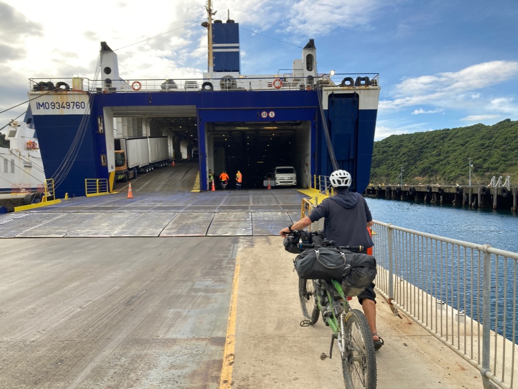
Taking the ferry from the South Island – to begin a new adventure in the North Island.
Love birds 💕 like me and Janet!
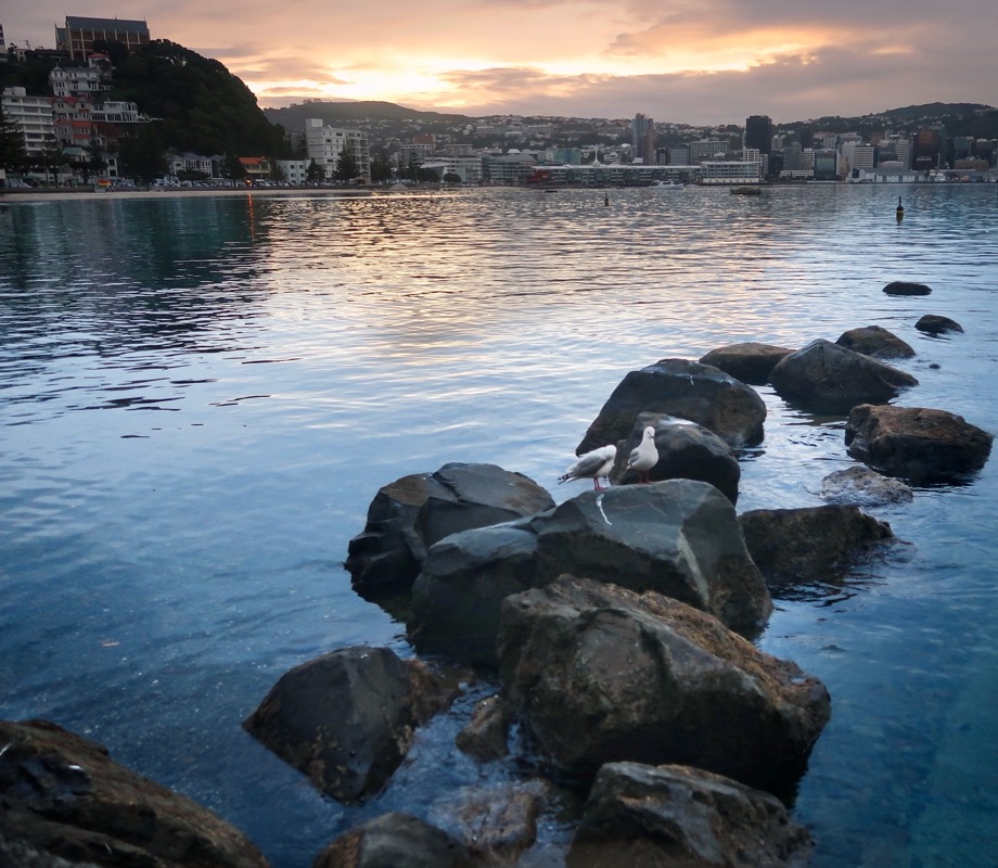
Welcome to Wellington, the capital of New Zealand. Did you think Auckland was the capital? If so, you’re not alone; I thought that too! Janet and I are going to take one of our longest bike touring breaks ever here (3 full days!). We spent the last 7 days in a row traversing quite difficult mountain bike terrain and would like to recover a bit. Oh, and it’s predicted to rain every day in the foreseeable future – so there is that too!
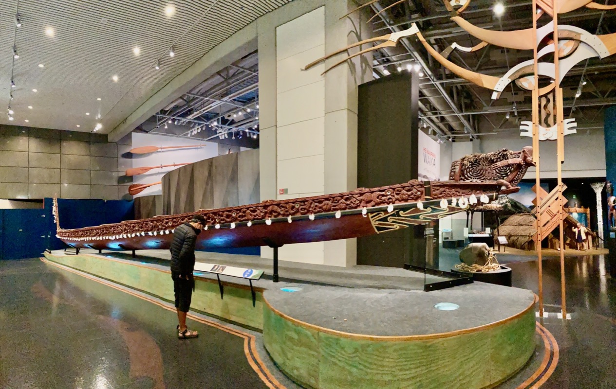
Janet and I went to the New Zealand Museum in Wellington.
Wellington is the capital of New Zealand. This tidbit may come in handy if you choose the blue category in Trivial Pursuit. Speaking of Trivia, I happened to be reading front page news here, and there is a shortage of public toilets in this area! Did you know there are “only” 40 public toilets per 100,000 people in Wellington? That is a shortage in NZ, but one of the excuses for not building more is that public toilets may encourage “antisocial behavior”. If you saw our “Toilet Time” episode #44, you are “privy” to us flipping this antisocial toilet behavior on its “head.” And one more bit of trivia for you: New York City only has 4 public toilets per 100,000 – a tenth of the dunnys in Welly.
Me performing a Haka for Janet. Or maybe just a photobomb…
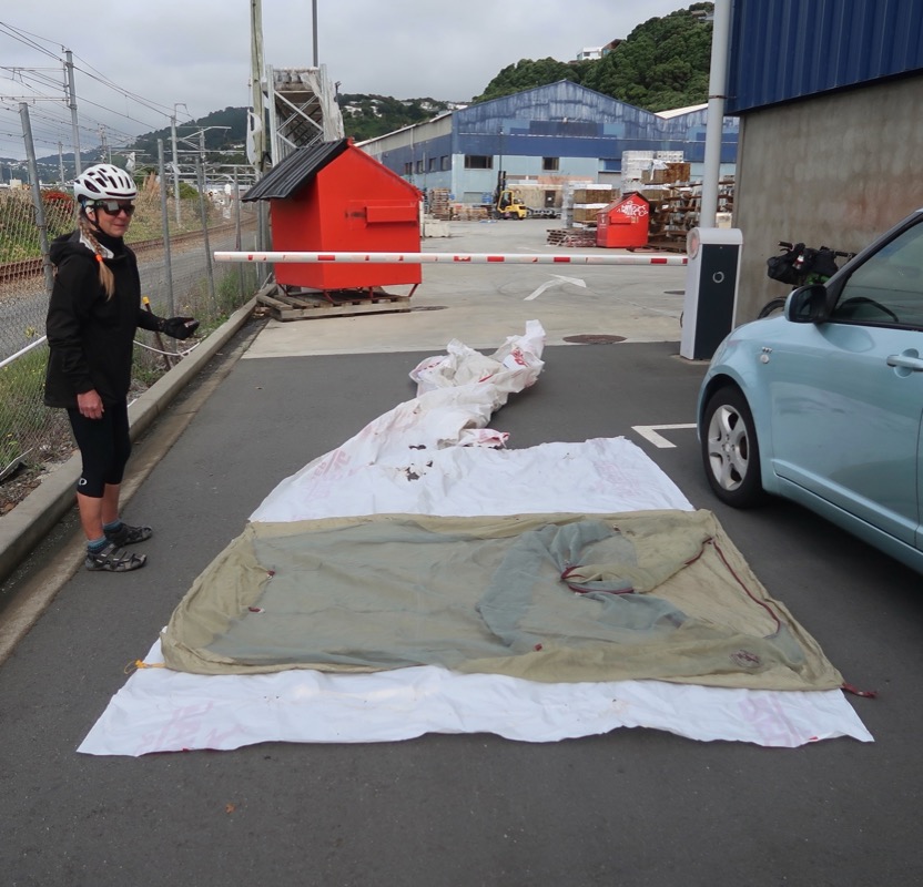
We were riding through an industrial part of town – past places that looked like the NZ versions of Home Depot. I had been thinking lately that a tent footprint would be useful. Normally I eschew this expensive extra piece of fabric because of the weight and packing space required, but in NZ more than other trips, we have had to set up the tent on soggy ground. This means that you instantly have a damp floor. We have been working around that by putting plastic bags on the tent floor, our pac towel, and our ground pads. Here is the deal with the footprints sold by manufacturers: they aren’t waterproof either – so basically you’re looking at a one minute delay before the soggy ground wets out two icees of fabric instead of one. I’ve heard that Tyvec (used for house wrap to keep moisture out) is a better product because it is abrasion resistant and somewhat waterproof. If you have ever used a flat non cardboard mailing envelope in the US, you may have felt this material. I wanted to go into the store and try buying some Tyvec, but then Janet had a better idea (a free one; always better!). She saw the plastic wrap that the lumber was delivered in, and said, “could we use that?” One dumpster dive later and some scissor action, and we had a perfectly cut footprint made from some relatively thick plastic. It will definitely be waterproof, but it did have some small holes. It’s maybe not as light as tyvec and we have to strap it outside because we are strapped for space, but we will let you know if it works!
**Hint: It DID work, and saved us many times over!!
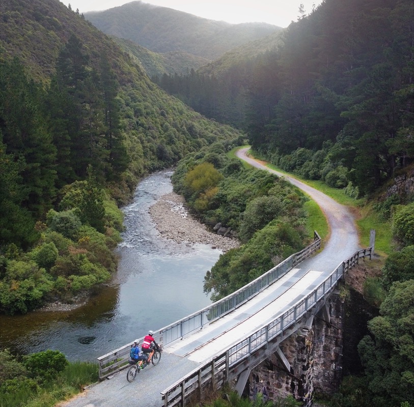
Hooray for rail trails! This is the Remutaka Rail Trail.
Now that Easter is over, we are finally into the real “shoulder season” here. Contrary to other legs of the Tour AOTEAROA route where we would see many touring cyclists per day, we didn’t really see any active distance tourists today. Although it’s fun to meet people, I do kind of prefer quiet solitude and less competition for resources. When we got to this campground, we found it was empty. All the signs warned “no camping here” (under various trees) due to risk of branches falling. That is a good warning – because even though it is rare – people have occasionally been killed by falling branches. Please always consider that when selecting your campsite!! Anyway, we paid heed to the signs, and noticed that the practically the only place that didn’t have prohibitory signs was this nice little “rail station.” We took that as a sign and camped sheltered from the rain that fell periodically during the night. We did have to share the space with some roof rats (or perhaps possums) that lived in the rafters above us. Never saw them, but they scratched about peacefully above us weathering the storm like us – in style!
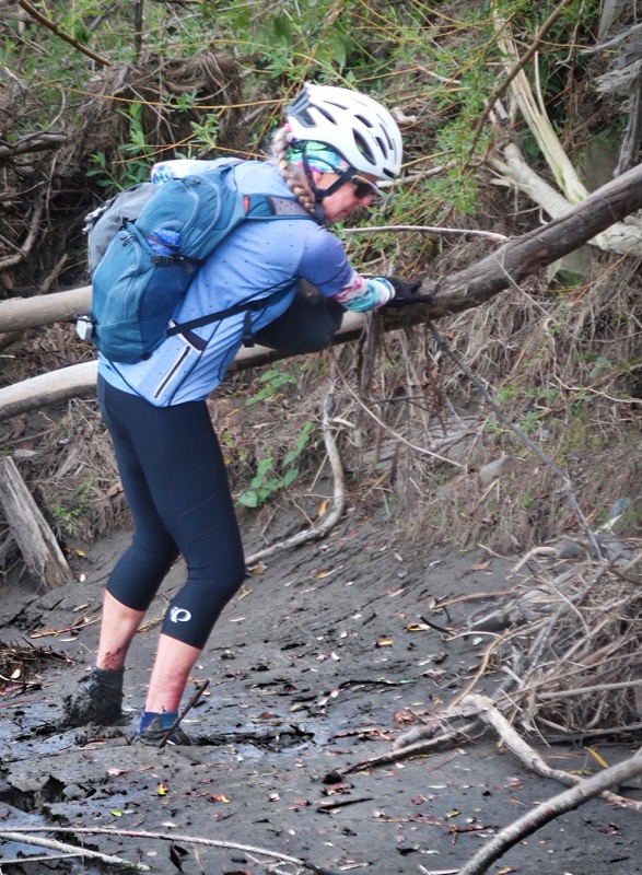
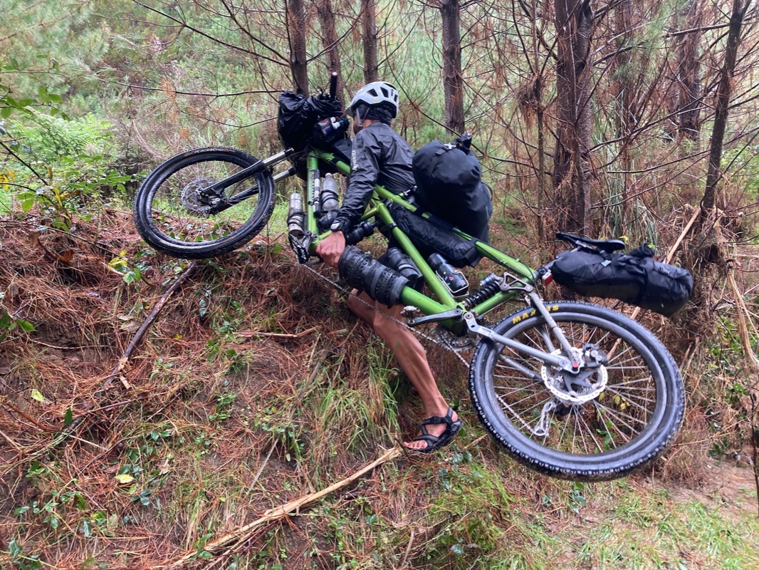
Janet always apologizes to me if I have to carry the bike. I tell her: “People pay lots of money to lift heavy things in front of a mirror. I get to do this free in front of good scenery too!” I’m serious when I say this. As long as my legs aren’t getting all cut up from bushwhacking or things are breaking on the bike from us sliding down slopes, it’s just using muscles that if I didn’t use would otherwise wither away anyway. As cyclists, many of our upper bodies are atrophied, so having to carry a bike now and then is a good thing as far as I can tell.
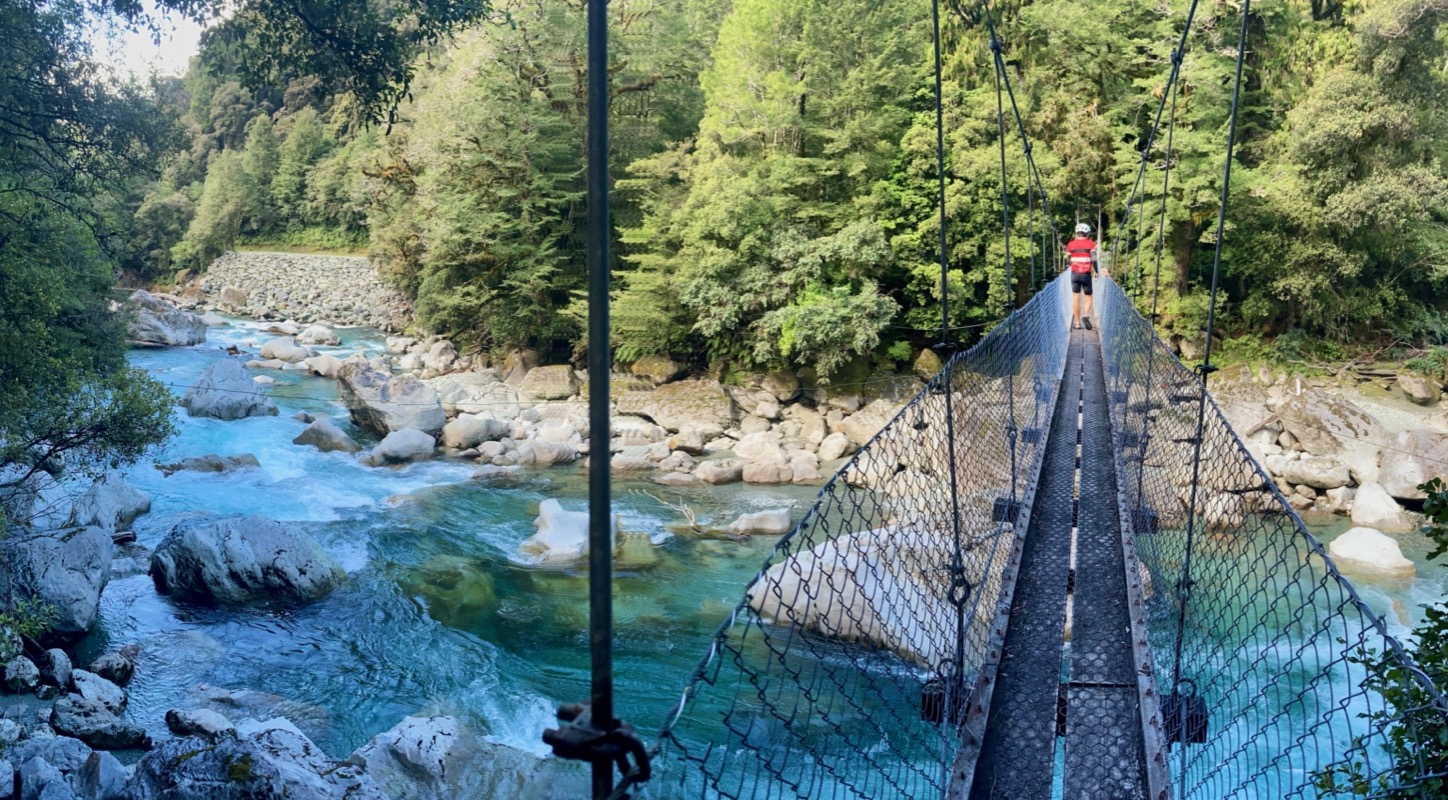
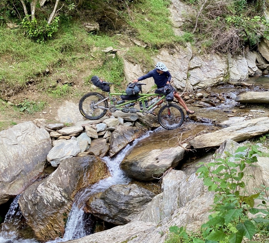
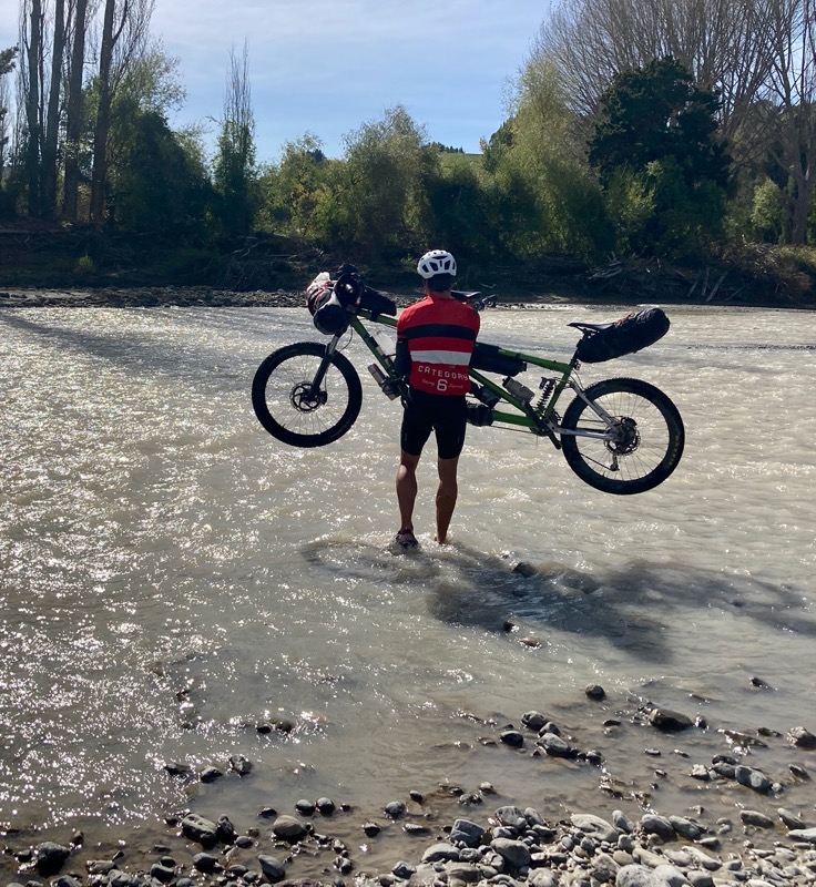
Crossing the river was actually the easy part. Handling the bike down and then up the flanking banks was tedious. Luckily, Janet is game for challenges!
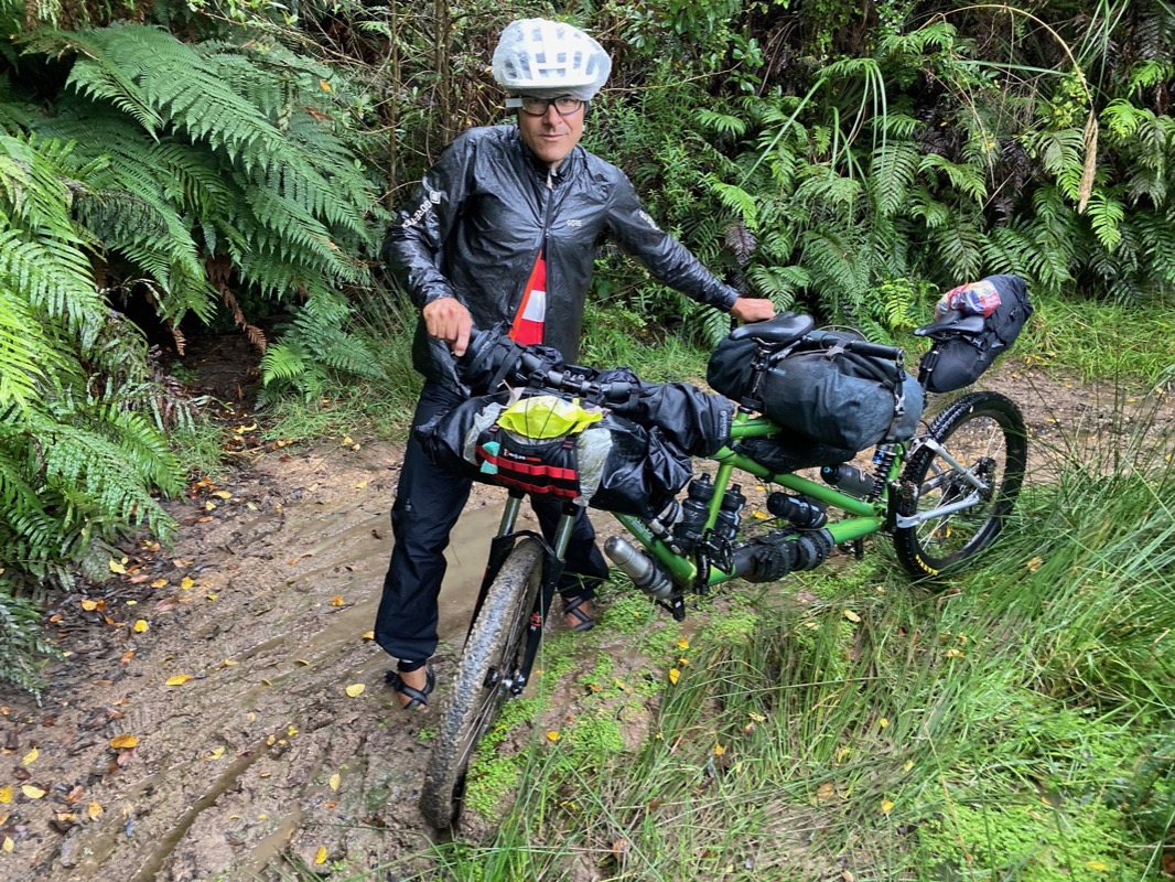
Maybe you heard about the cyclone Gabrielle that hit New Zealand? It hit in February, a couple days before we landed in NZ 🛬. The Auckland airport was flooded 3 feet deep right before we got here… and now that we are on the North Island, we are seeing the results of that destruction. An example was that blown out bridge in yesterday’s post. Even in this bridge, you can see the accumulation of the debris. All the rivers are still running muddy – after all the crystal clear rivers we enjoyed in the South Island. So far, we have been able to do our planned route – many landslides (which they call “slips” here) have already been cleared.
Today was just a great day. Now the fall colors are in full swing, and apart from a 3 mile stint on the main highway, the rest of our ride was on backroads or gravel. Simply a great day of riding and feeling good.
Looking for camp at the end of the day. The last road of the day was one of the best – very quiet and no signs of people… just sheep and cows in rolling hills and forested terrain. We saw a sign on a side road indicating that it was for 4×4 bicycles (huh 🧐?) only… that seemed right for us. We found a flat enough spot and put up our tent. Then we took our usual naked showers from water bottles and climbed into the tent to eat and chat. But we kept hearing creepy noises. One noise, Janet identified as a bird flying through the trees. I disagreed, but decided to accept that because it was less scary. Then we heard what I was sure was human voices… but who would be out here? Sometimes a sheep’s “baaaaaaa” can sound like a human voice…. I tried to ease up and for the night, and put in my earplugs….
Remember those scary human voices we heard last night? Turns out that two women had been planning to bike camp in the same spot we did last night (but we got there first)! There really were people in that valley! They saw our tent and thought we were hunters so they camped elsewhere… funny because I thought the noises may have been coming from hunters also. We rode along with them – surprised that they had elected to ride this road instead of the official bike route… turns out they were more or less locals on a 6 day loop. As we rode side by side, we saw a calf that had escaped the fence. One of the girls wanted to reunite the calf with it’s bellowing mom, so she opened the gate as Janet and the other girl herded the calf. As cute as Janet is, she’s not a sheepdog, and herding proved challenging! The calf tried to bust through the fence multiple times, to the point where I thought we were hurting calves better than we were herding them! Eventually the calf exploded through the fence instead of the gate. Happy to be at peace with mum.
—
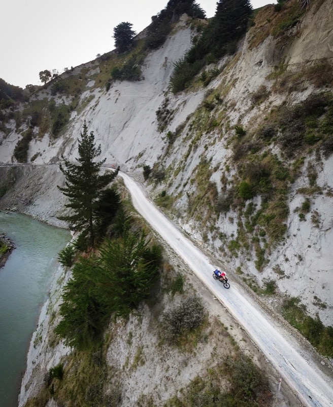
Obviously this road has seen many landslides. The topography and the fact that Google street view didn’t go very far up the road are reasons why I thought it may not go through. Luckily, no issues and many sections like this with great scenery.
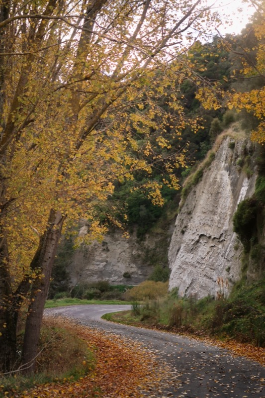
Today would end up being out best road of the trip! Oddly, this is NOT an official bike route. One can find National Bike Routes on various maps – including Open Street Map, but what I keep finding over and over is that the “official bike routes” are sometimes less to my liking than the backroads we find through careful investigation. In fact, I kept asking myself: “does this road go through? Why wouldn’t they have made THIS the bike route? There must be something wrong with it”. My theory is that the bike routes seek to connect commercial interests (i.e. places where people can spend $$) – and in order to have that, you need services… and in order to have services, you need cars. Maybe that is why? Hard to say, but the road we took today does indeed go through and it is amazing and car free.
Best part of the route!
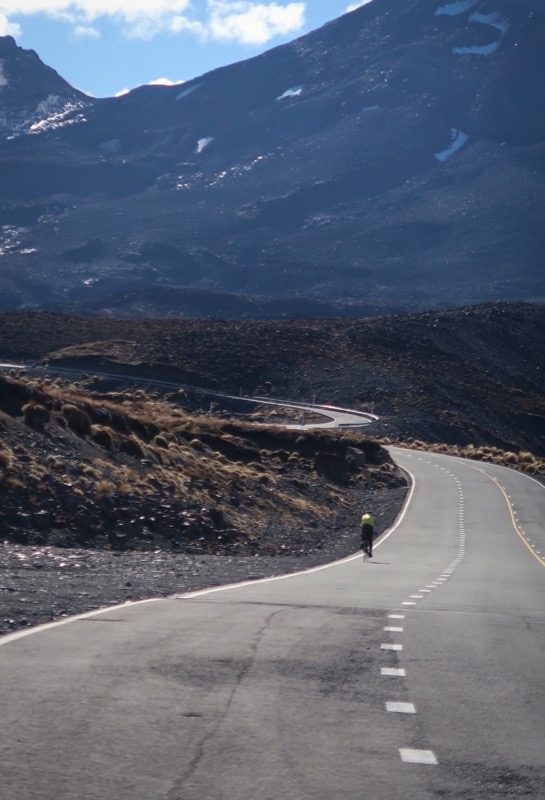
I rode up as far as I could towards the Mount Ruapehu volcano from Ohakune. Then I hid my bike amongst the rocks and began hiking…
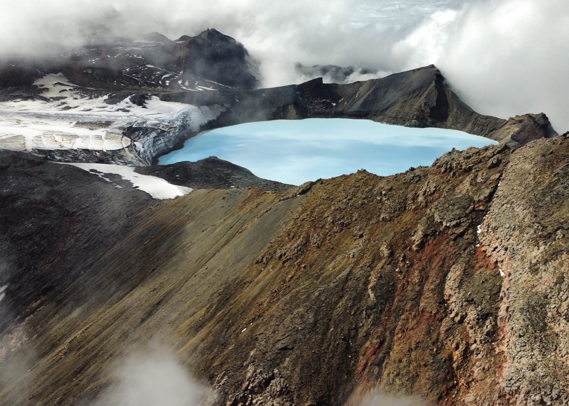
Luckily the clouds cleared for a clear view of the crater in Mount Ruapehu!
Janet’s Birthday!
After the volcano trip, we took a couple more rest days. This was mostly because of the weather, but partly because we knew rest would be good for us. We are getting better at resting and I think we have more fun as a result. Anyway, we also spent quite a bit of time analyzing the upcoming route. The official TA route didn’t even go to the volcano, so this has been a side trip to begin with. We planned to rejoin the official route – right where you would need to take a 20 mile jet boat ride up river due to a missing chunk of trail (they drop you off at an aptly named spot called “bridge to nowhere”. Much analysis on satellite, street view and blogs revealed that the Old Coach Road would probably be more fun for us than riding the pavement down to the river – only to take an expensive boat ride to a muddy trail where cyclists have died slipping off the side! We think we made the right choice because this morning’s trail was very fun and scenic!
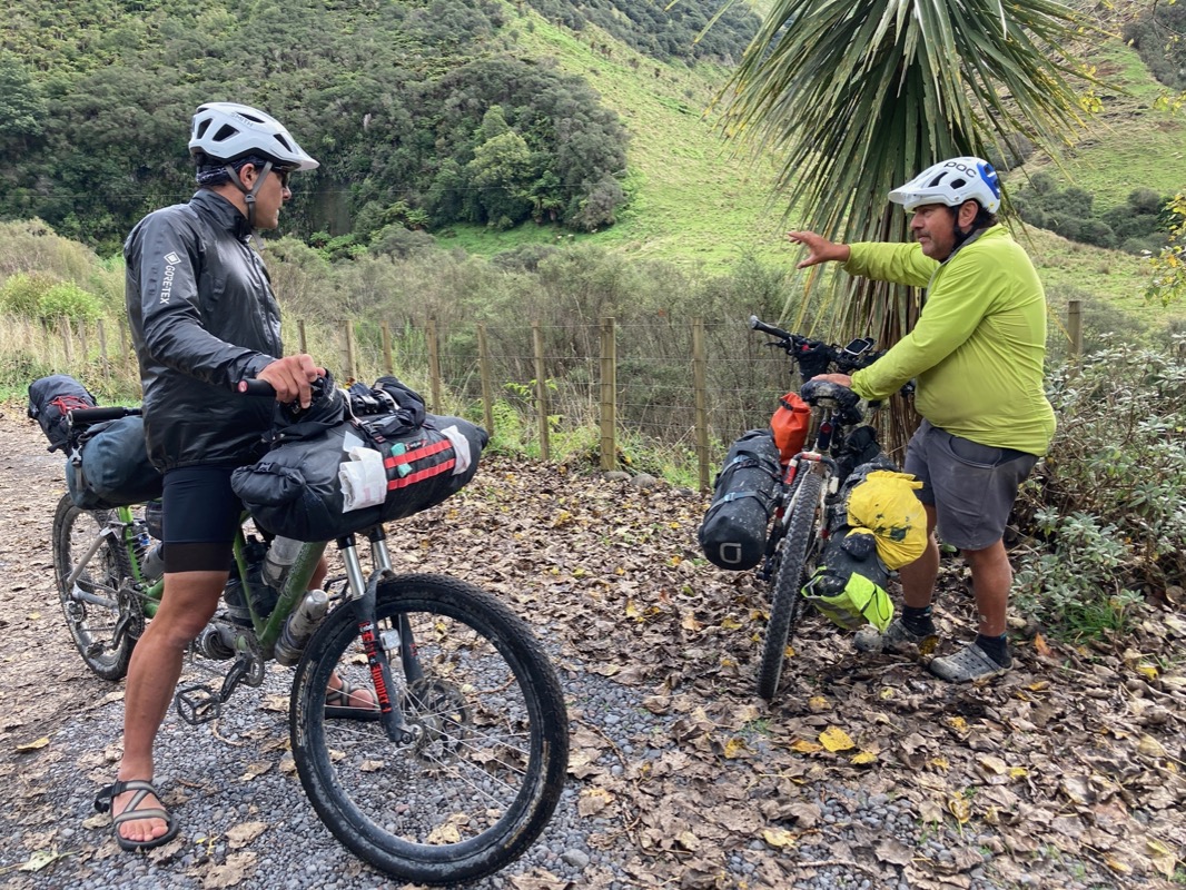
Janet and I pulled over just as “Willie” showed up. He started cycling at the bottom of the South Island the exact same day as us… and he has already ridden to the top of the North island and is now on his way back to his home in the South – mostly following the TA route (though he made the same decision as us about the muddy trail and boat ride – to skip it). We enjoyed talking to him – though he did seem like he may have been riding alone for quite a long time. He told us about the muddy route ahead of us – as well as some super important information: There is a shelter at a campground – right about the perfect distance for us to stop for the night. He also told us that there were some “friendly goats” ahead as he smiled.
🐐
Today Janet and I did a short side route to check out a campground. A frazzled woman came up to me and said a bunch of stuff I didn’t understand. I asked her to repeat herself and she said, “I don’t know how to explain this, but do you have something to remove a fishing hook?” I saw a small boy of about 7 years leaning on the van behind her. His eyes were red and he looked worried. I suddenly noticed that he had a very large hook embedded in his chest. What were these guys fishing for that they needed such large hooks!? Anyway I got out my pliers, and handed them to the man nearby as he started working on the patient – first cutting away his shirt with the knife. I wanted to suggest that they push the hook through in an arch to get the pointy end out – then cut it at the old entry point and pull it out with the pliers by the pointy end (so they wouldn’t have to pull the barb backward which would have been devastatingly painful)… but I didn’t feel it was my place. It started to become clear that neither the man nor the woman were his parents… (the woman asked the boy something about what his mom would do…). I noticed that in his right hand, he was gripping a small chocolate bar – probably to make him feel better about this situation. Before we could get into the nitty gritty of hook removal, someone announced that there was a nurse who was fishing – she would come take a look. She sauntered over – all kitted up in her fishing gear. She took a look at the injury and suggested that maybe they could take the kid to a center where it could be removed. This sounded like a good idea… it would probably be less likely to get infected and they could give him something for the pain. But we were pretty remote, so I asked the nurse lady, “how far away is it?” She replied, “well… tomorrow is Monday, so they should be open by then.” I said, “wait, are you serious?” She looked at me sincerely and said, “it won’t get infected by tomorrow. Yeah!” A couple more fishermen came along to inspect it and poke and wiggle the hook a little bit. Not so much sympathy for the kid, but instead this was just something interesting. So then we asked the kid if it hurt if he didn’t move it or touch it. He kind of grimaced, but then shook his head “no.” So it was settled; his kid friends came over and he relaxed a bit and they kind of puttered about as if there wasn’t a big hook in his pectorals anymore. He’d get it pulled out tomorrow by the proper people and I got my knife and antibiotic cream back. When I was a kid, I thought adults knew everything, but really we adults are just like bik kids bumbling about with our “best guesses”.
We knew the trail would be muddy. A couple cyclists coming towards us were pretty well coated… and they hadn’t even gone this far. In fact there was a lone tire track in this mud; presumably belonging to Willy as he had come through here just this morning. When we finally stopped, we didn’t even clean the chocolate pudding coated chain, brake calipers or brake arches. It is going to be a crunchy ride tomorrow – but we still have 6 more miles of this atrocious mud. That may not sound like much until you consider how long it took us to go through the last 4 miles of it! I’ve been learning how to just not worry about this kind of stuff and shelve it for tomorrow. Instead, we had a nice candlelight dinner at our camping shelter.
This is along the Mountains-to-the-Sea route; the portion along the Kaiwhakaka trail. This section is notorious for being super muddy (and dangerous as a result of being slippery). They seemed to be doing work to fix the trail by laying down gravel. Not done yet..
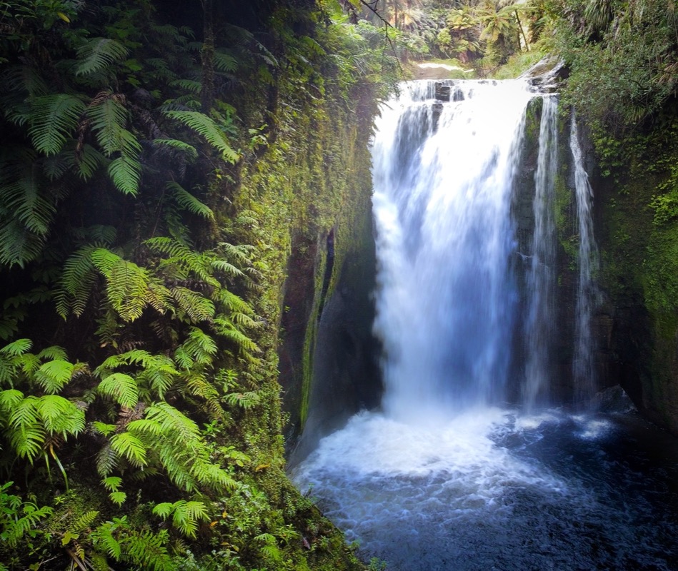
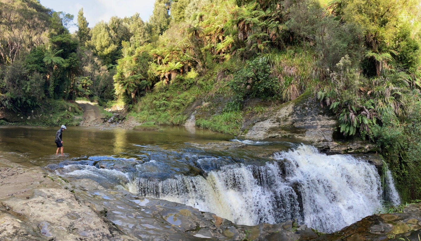
Hey, a nice way to start the day to keep our minds off the mud! Let’s go visit a sweet waterfall

Our coldest morning yet… freezing temperatures, but we were warm inside the tent. I’ve improved my sleeping system somewhat so I can use a lighter weight sleeping bag in colder temperatures.
In the middle of nowhere, on the side of the road: exactly what we needed! Wow! Why is this here? Thanks, New Zealand; that was cool. No more mud shadow (for a few miles at least)…
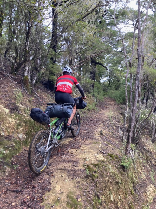
Janet on the Timber Trail. This was our ~3rd favorite trail in NZ after Ghost Road and Paparoa Track.
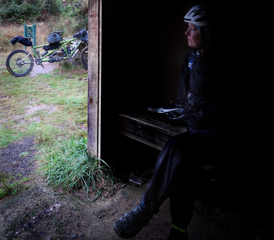
We shoved the tent into this shelter- good thing because it did rain a bit. This is luxury camping for us!!
Glamping
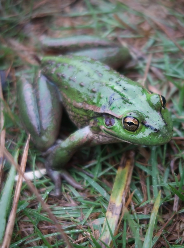
This guy doesn’t mind the rain!
🐸
Janet and I have been utilizing these shelters… just a little too small for the tent.. but we will take it! Every night in New Zealand is like a rainy night – even if it the skies are completely clear! Waiting out the drizzle before a full day of 100% fun singletrack!!!
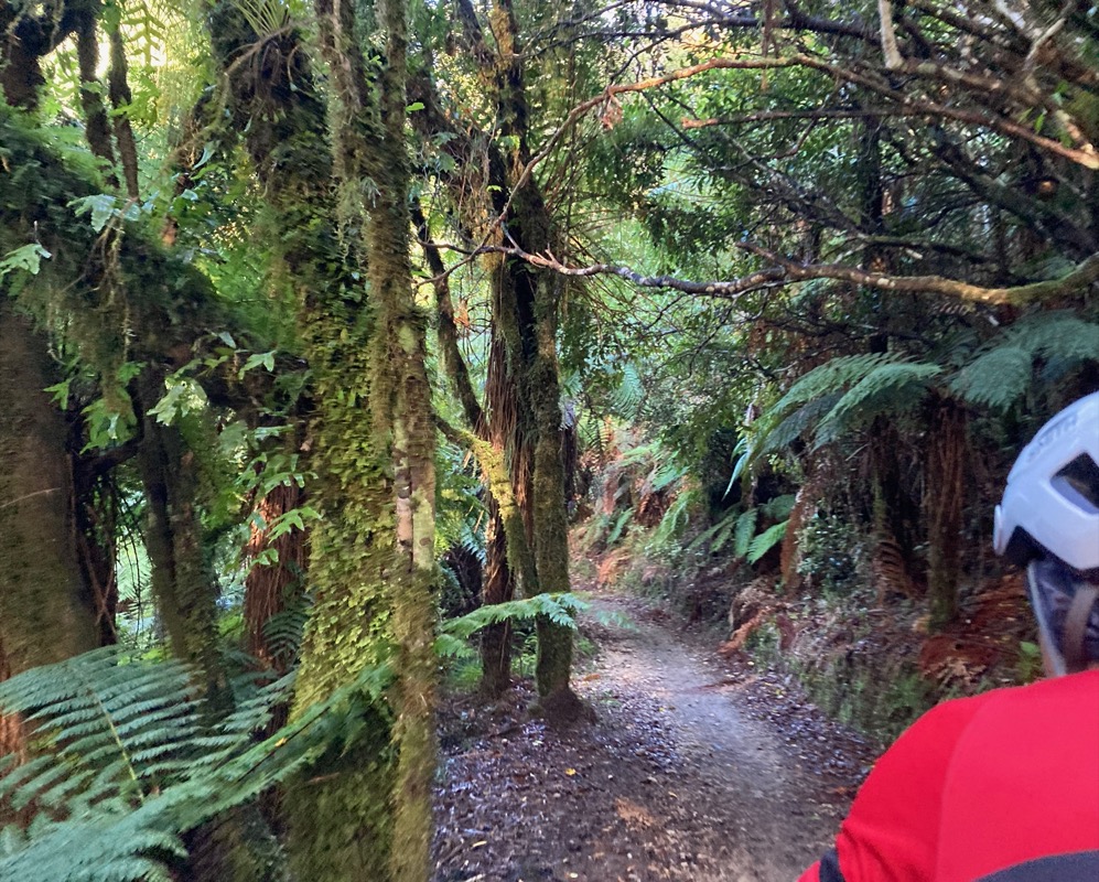
Timber Trail.
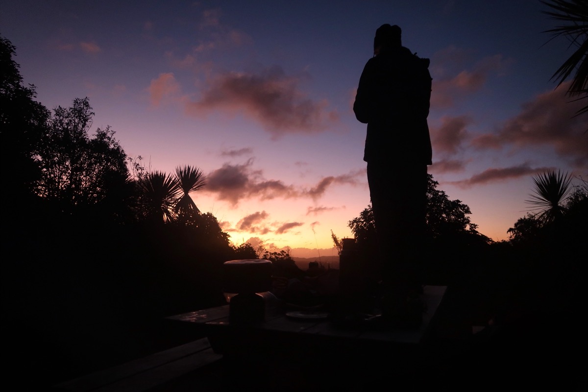
Janet atop the picnic table near our camp. I went to fetch a pail of water while Janet built the tent. It was a beautiful spot to sleep as you can see. At 4am, though, some critter thought our place was a good location to do some wood scratching. I never found him (or her). I couldn’t help but wonder if we were listening to the calls and cries of the several endangered species that we had been reading about on signboards along the way. Many of these are species that only come out at night. Too bad we are not experts in identifying bird calls.
This is the bridge with a hole in it. At first glance it looked like an easy crossing – but I soon found that I couldn’t just walk the bike along the path. At first I tried removing the rear handlebar and turning the front bar 90 degrees – but even then the bike caught on the sides, and the pedals kept snagging the chain-link. There wasn’t anywhere for me to walk. I decided to heft the bike over my head, using my helmet as a balance point because of my weak T-Rex 🦖 arms. This worked but I couldn’t look where I was going and stepped through a hole in the chain link! This cut my leg as it dropped through the hole. The bike stopped because it landed on either edge of the cable, and I caught my body by snagging my elbow on the wire. It wasn’t very good, but considering what happened, my injuries were minor.
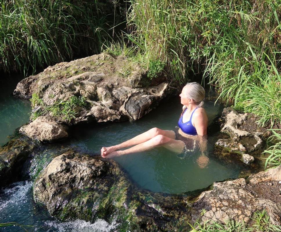
Hot Springs at Taupo. These are free and worth the relatively short trip down a trail to get there!
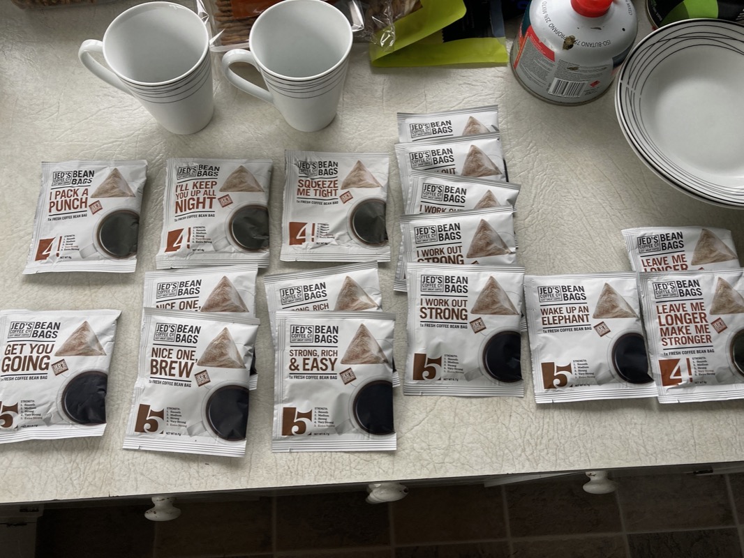
Coffee – Jed’s was our favorite coffee – sold like “tea bags” in most stores.
Here is a story from Friday about Janet. We go to a store to buy Nikwax (a non-detergent solution that should clean the tent). We ask the lady behind the counter, “how much is the Tech Wash?” She says, “You can’t use tech wash to clean tents. It is only made for clothes!” I have used this product many times on tents, so I tell her such. She says, “well, it shouldn’t work…. It’s not meant to clean tents. We have this other product for cleaning tents.” I started to doubt myself: Maybe I have been using the wrong product this whole time? That is when Janet pipes up, “maybe it isn’t working; the tent does keep getting dirty!” 😂
I had a good hearty laugh at that one, but not the sales clerk! She just kept up her spiel about how it wouldn’t work! 🤓
This hot spring is called “Hot and Cold”. Luckily, it wasn’t cold! It’s a flowing hot river and turned out to be really nice. Some reviews said that it was trashy, but the place was really clean and not very crowded when we arrived. Maybe because it was an overcast, rainy day?
Our second hot spring of the day was Kerosene Creek – another free hot spring. I really liked this one due to the beautiful natural setting. Also, because it was a long hot river, we were easily able to find a spot just for us. Of course, it was drizzling so maybe that is why there weren’t too many people here.
We began the day taking the trail from Kerosene Creek to Crater Lake. The trail was fairly overgrown, muddy, and it was raining. We weren’t anticipating it to be so hard (it was a grade 2 out of 5)! In retrospect, I’m glad we did it – but at the time, I felt grumbly!
Today we endeavored to avoid the paved roads, which we managed for all but a very short distance. The trails today were actually great! Lots of singletrack (albeit slippery) through Rotarua’s famous mountain bike park. We thought were the only ones foolish enough to be riding there until at the very end we saw what must have been the local high school mountain bike team – some 9 teenage guys and girls rippin’ the trails. By the way, did you notice this is a redwood forest? Felt like home in the Santa Cruz mountains!
Lots of fun riding the Taupo Trails! The trails were wet and muddy (and slippery in places), but we had a blast and the whole park to ourselves it seemed.
Janet in the Puarenga trail. There were more trails we could have done (have to plan ahead because several are one-way). The loaded tandem in soaked conditions isn’t the optimal setup/time to be doing these trails. We opted for mostly the “Grade 1” (easy) trails today.
In the Early Morning Rain…
🎶 I’m a long way from home; lord I miss my loved ones so. 🎶
Today started with wet drizzle, but that doesn’t mean it was bad! Good singletrack trails and a quick visit with the French couple who told us briefly about their trip across Asia from France to Singapore. “Just Do It!” Said Fanny. I liked her attitude, and carried some of her inspiration as we left the singletrack and enjoyed beautiful car free farm roads.
Soon we got to the “Waikato” trail. A couple weeks ago, a guy had been raving about the “White Kettle Trail.” I looked on my map and said, “I can’t find it.” He repeated what I thought was “White Kettle”… but finally I realized he was saying “Waikato.” Good news: The route I made in December already planned on doing the whole trail! “It’s really good,” he said. So far, he is right!!! We had a blast.
Stop by a large hydroelectric dam. Still in great moods and the rain is easing up.
💥
A happy day, made a bit somber when my friend Dennis wrote to let me know that Gordon Lightfoot had died. Janet had gone to his concert with Roberta Flack in 1974. We both like his music and dedicated the ride title to one of his songs (which seemed to be somewhat appropriate for today). Then we danced around a bit singing along to a few of his songs from “Gord’s Gold”, all while listening to variety of birds and fish jumping in the river. An excellent day all around, except for the news.
Non-stop rain was predicted… so when it stopped, so did we – to enjoy the scenery! I soothed my soul listening to the fish jump, the birds cry (or whatever combination of noises they were making), and watch the moon rise.
The Waikato trail does not disappoint! Wow! It’s a 10/10 on surface quality – in fact, in rain it is better than riding the road because the gravel drains better than sealed pavement. It hasn’t been very technical so far, just fun swoops twists and turns. We want to savor it – and we did – honestly having fun in spite of the rain that came down most of the time (I took this photo during a break in the cascade). Along the way, we saw signs saying “metal* for this trail donated by J.Swap”. THANK YOU J.Swap contractors. Today was sweet-as.
At first we thought this was a lookout… but it was the trail. 🙊. No problem; quick go-around on the side of the road. Actually turned out to be a great lookout too.
The muddy Waikato Trail…
The Waikato continued to be fun and swoopy in the morning. We aren’t bothered as much by the rain (while riding) now. Partly because the surface is so good.
In spite of all of my efforts, the cable housing was giving us tons of trouble. During our recent Honduras trip, we had some serious mud and more than double the climbing (and extremely steep; mud and climbing are both known drivetrain killers).. but New Zealand has actually caused more rapid destruction due to the ever present moisture. I’ve mentioned this before, but even if it doesn’t rain, everything is wet all the time due to the humidity (or dew point maybe).. anyway the drivetrain was doing all sorts of crazy ghost shifting, and I’ve never trained lifting weights 🏋️♀️ with my thumb… it was taking tons of force to move the lever. We found a shop that was in a tiny town – and they had 9speed stuff… and no mechanic on duty. No problem! I wouldn’t trust someone to work on my bike anyway! The guy behind the register said, “look, I don’t know much about bikes, but sounds like you do. You can work on it in the stand if you want”. YES!!
All we really needed was new cable housing (normally I like to “use up” the chain and cassette and then buy a whole new drivetrain for the next trip when we get home…) We only have 2.5 weeks left, but the grit was sucking the joy out of me. And bike travel is supposed to be about joy, not suffering…
Like many of the trails in this part of the North Island, there is some form of cyclone damage from the storm that hit the week before we arrived. Many main routes have been closed – let alone these sneaky passages that we find. As you saw yesterday, we encountered two sections of impassable trail. One we found an alternative, but the other resulted in a big turn around. Today was looking grim – we might have to turn back. We encountered a huge washout just after this photo was taken. Not only was it washed out – but importantly, it was covered with thorny brambles.
And eventually we encountered some nice trail! This is where the fun part began, because about an hour after this the rain started to really back off. We ended up riding a nice long section of singletrack that made the connection we needed to avoid the roads!
Not to be deterred, we spent some time and worked out some go-arounds…
(Photo credit: Janet)
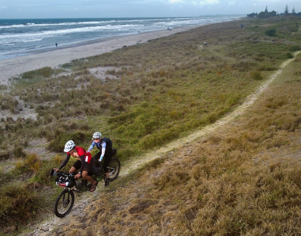
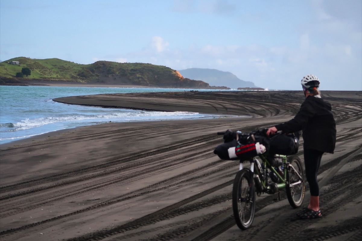
… and then we came to the beach! Janet has been wanting to see the beach again…
We just rode the packed beach sand for 5 miles! It was a super highlight! We had a quartering wind, managing 17 mph in super high spirits! It would have been fun no matter what, but after having gone through so many challenges lately, it was a supreme high! As any drug addict will explain: The highs get higher when the lows are lower. Hmm not sure is this is a good thing 🤔 but right now, we will take it!
Today we got to meet Mark and Hana! I was very excited to meet these guys, as they are veterans of bikepacking and we have followed each others’ tracks over the last 6 years. You may remember in 2019 when we did their Cuchumatanes Route in Guatemala which we loved… and then again last we we followed sections of their TransMexico Norte route and most of their TransMexico Sur route. Mark and Hana have become somewhat famous in the bikepacking world for their challenging routes that they have designed and shared. The routes tend to be a bit understated in difficulty 😉. They also have authored 2 other routes (Camino del Puma and Capitan Lemos (see the Capitan Lemos comments to get an idea of what I mean about difficulty understatement haha)).
You can find all their routes here:
https://bikepacking.com/author/highluxphoto/
Whenever we find ourselves faced with pushing through long stretches of mud, or down-scaling walls with a bike, or having to cross tightrope lines with a bike, we alway think of them first: “Mark and Hana would do this!” So we knew beforehand that we would really enjoy meeting these kindred spirts who have been to some amazing places. Just last week, they returned from a 6 month journey in Chile/Argentina. They are so dedicated to experiencing a place that they spent several days repeatedly trying to view some peaks in the “just right” weather. Their blog a fun one to follow if not just for the professional eye-candy photos alone… you can escape into mountain-dream-land with their stunning mountain photography (this is worth the click; especially the most recent posts if you love mountain light photos):
https://www.highlux.co.nz
Also, if you like adventure stores, their narratives can be quite gripping at times…. such as the time Mark did a tyrolean traverse to retrieve a carriage to get their bikes across a river:
https://www.highlux.co.nz/2022/12/argentina-el-sosneado-bardas-blancas-via-the-ruta-de-los-reales/
If you just want easy eye candy:
https://www.instagram.com/beinghana/
https://www.instagram.com/highluxphoto/
We discussed how their routes through Mexico has actually changed things there. When Mark and Hana first went through certain regions, people were initially shy. But in some places, that is now changed; an example was when we met David and Marta in Chaucingo:
https://www.strava.com/activities/6484392198
David told us that recently there have been many bikepackers through the region. Marta told us how it was great for her because the bikers stopped at her store to buy lots of stuff. They were so happy that bikes came through – and it’s thanks to Mark and Hana’s route that foreigners were finding these places. It’s good for both parties – partly because it helps the local economy, and partly because the great connections people make reduce xenophobia.
So fun to meet Hana and Mark – and have so much to talk about!
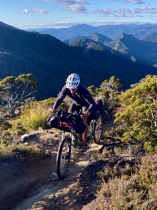
Bypassing some pieces of highway with Mark and Hana. Actually, today’s road stretch was the best we have ridden in NZ because it may be the longest piece of road with a shoulder that we have ridden here. So not too bad!
This beach ride was even better than the last – no people or their pups – just lots of natural beauty (and Janet beauty)! Also tons of shells that crunched under the tires simulating gravel. Or maybe simulating broken glass.
While riding the beach, we encountered some flow that we decided to carry the bike across to protect the hubs.
That isn’t a lake normally. That is grazing land. Now you can see what the cyclone + tropical storm we just sustained has done to the area.
If you are what you eat, then I am the boss. The coffee boss!
☕️
Time to go to the hot water beach!
🏝️
If the sun comes out, so does the rain fly to dry. For the last month of our trip to New Zealand (apart from a single sunny day), we would only have a few minutes of sun here and there. Some days, there was never an opportunity to dry the tent during the entire day!
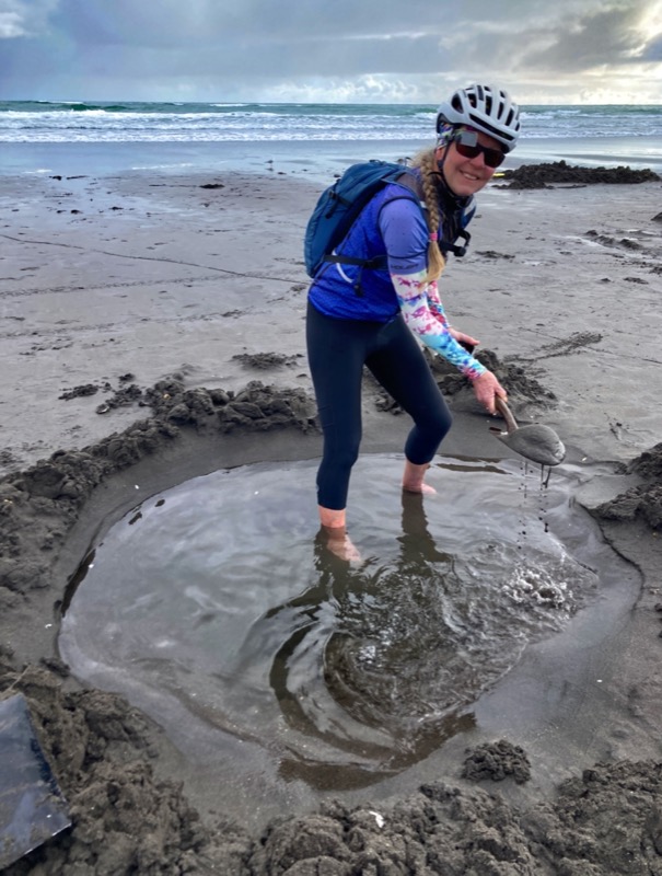
Todays objective was the hot water beach. You have to dig out your own hot tub in the sand and the hot water seeps in from below. Luckily, there was someone who had 2 shovels that we could borrow!
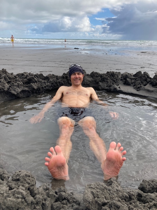
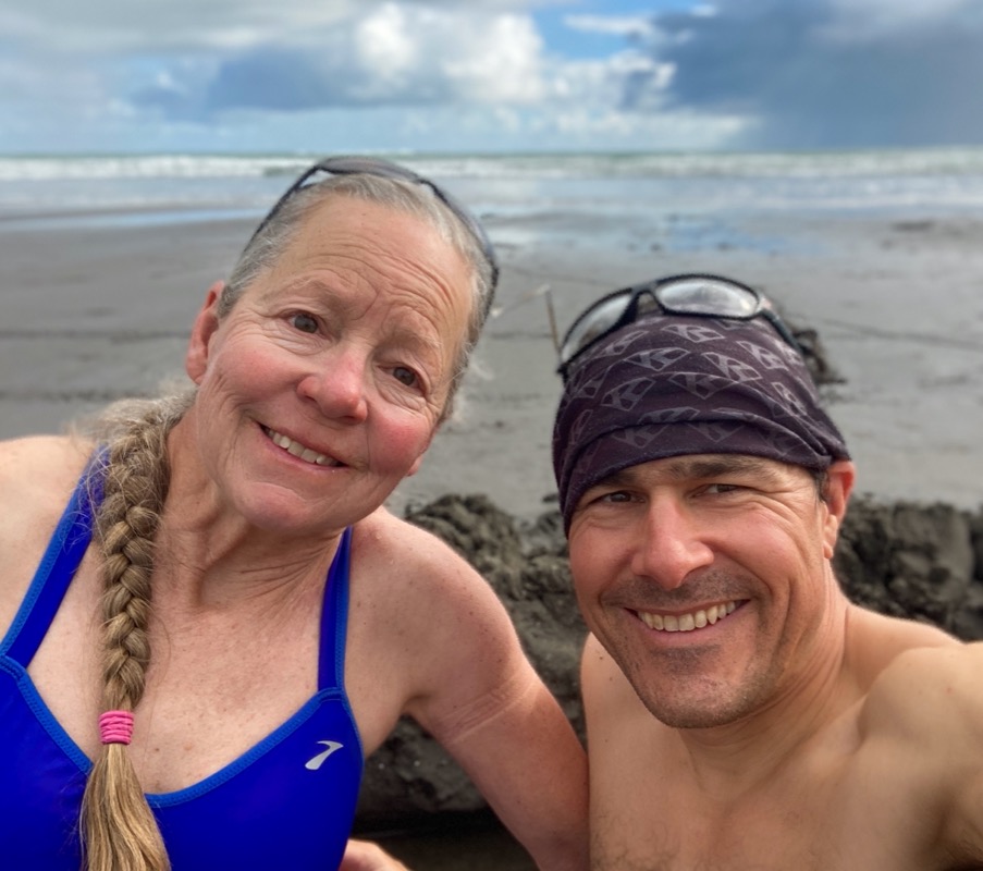
Soaking in the hot tub that we built together 😊
A local we met on the beach told us we could ride around the point… so we figured local advice is good. Well, not always! Several rain squalls hit and we had to lower the tires to 10psi to ride the sand (in some places we had to walk)… but then the sun came out and we changed our minds: Worth it!
Cold wind, tide moves in
Shivers in the salty air
You may think the rain has gotten us down – but surprisingly, it hasn’t really. The rain has made the non-rainy times that much better. We appreciate those glimpses of sun and green when we get them!
It was all gravel today – and all smiles from both me and Janet. This was good – one of our best days in NZ. Just like last time we planned our own route that was not part of the official bike-route system, we are extremely happy. That isn’t to dis the NZ routes. All of the trail bike routes were spectacular; it’s just the road ones that scared us.
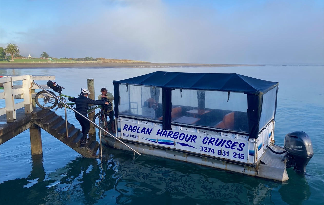
Planning the new route was fun. I found lots of gravel roads North of Raglan… but there wasn’t a way to get there. Janet did a great job here and searched the internet and found a French guy who directed her to Ian – who could take us across from Raglan for a car free day! Nice find, Janet! It was $40 NZD which is about $25 USD for the short ride. Worth every penny to avoid the roads.
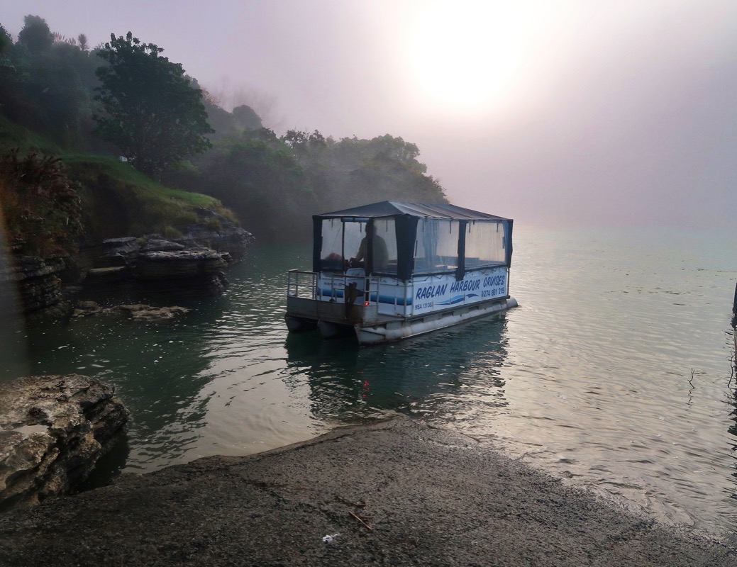
Maybe the best day of the trip? Hard to say, but after so many days in a row of rain, the contrast makes this perfect car free day shine above the rest.
Visiting the Botanical Gardens in Auckland.
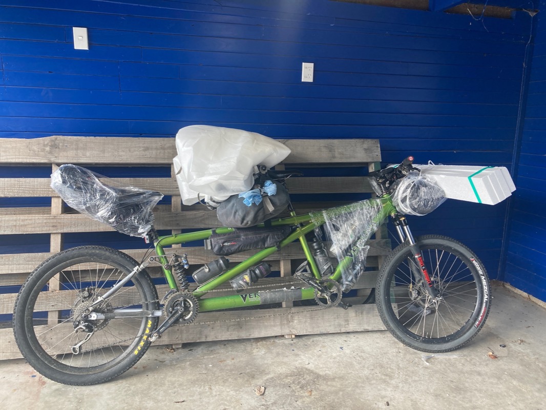
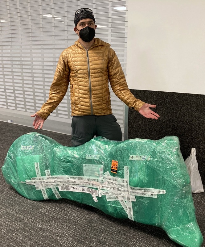
Leaving our AirBnB with packing materials we scavenged from the dumpsters (and a roll of pallet wrap that we purchased from a hardware store).
The bike – ready to fly. Once again, no charge to carry the tandem on the plane with Air New Zealand!
Likes and Dislikes about New Zealand
NEW ZEALAND LIKES
Trails: Many of NZ Trails cover relatively long distances. They are built to drain water and in most cases the surface is covered with gravel, which prevents the formation of mud.
Availability of outdoor gear: Quality replacement outdoor gear can be purchased pretty easily – even in smaller towns. It is not necessary to travel to the capital city to buy items such as tires, stove fuel, and high quality clothing.
Showers at the airport! I get all hot and sweaty wrapping the bike. My stress is on HIGH because I fear flying plus having to manage the bike is stressful. Taking a shower after the bike is wrapped: super awesome.
Travel SIM: Spark has a 3 month plan. Our plan expires midnight tonight. We have been here exactly 90 days. That is exactly the max they give Americans here to stay (but you can extend it if needed). It fit our needs perfectly and worked well. Cell coverage is interesting here – sometimes in remote parts of the West Coast, they would have a micro cell tower that only served the parking lot! As a result, cell coverage was good enough for our needs. Cell pricing was fair as it has been in almost any country except the US. Those prices are in NZD, so you can multiply by 0.6
Weather: Don’t worry, this is going to go into the “dislikes” section as well…. But one positive of the weather that we experienced during 3 months here is that it was almost never “too cold” or “too hot.” We usually slept well getting cool air for sleep, but not being too cold during the day. Although persistent, the rain was always a warm rain in our experience.
Food: Some people have told us they don’t like the food in NZ, but I think they may be referring to restaurant food. We never gave restaurants a try, but we liked being able to buy a variety of produce, meats even in the smallest towns. In the US, towns this small might have a gas station with some junk food; in Latin America, maybe a house selling Candy… but in NZ, you can find a pretty well stocked grocer in all but the tiniest of villages. We also got wine periodically, which is hard to find in some countries.
Hiking: We did not do a lot of hiking trails. I had injured my foot before the trip, and this made it very painful for me to walk. However, the trails we did on the South Island took you to rugged terrain quickly (and without high altitudes). If you are an outdoorsy type, New Zealand seems best for hiking, second best for mountain biking, and a BAD IDEA for road cycling. My favorite places to go hiking are off trail routes in the California Sierra Nevada. Places like this, you can get away from crowds, and be in really rugged terrain. It’s my favorite! In New Zealand, those options exist too, but in most cases, it seems that you’re going to have to do a lot of bushwhacking or crossing swampy land… or maybe glacier travel. But if you are the type of hiker who likes multi day hikes in great scenery and enjoys sleeping inside huts and socializing with other people in the evening, this is definitely the number one activity that you can do in NZ. In fact, I think that hiking in NZ edges out Mountain Biking because there is so much infrastructure in place for long hikes (including a very organized hut system and bookable transport to and from the popular trailheads). Conversely, a bicycle becomes a burden the minute you leave a (safe) trail and have to connect to the next trail via a road. Since I prefer more “reclusive” wild hiking, I could tell that the organized hut system wasn’t quite best for me. Also, I prefer to travel “seat of the pants” style – and huts require a LOT of prep work unless you’re traveling after Easter or before Halloween. Luckily for us, we found a couple “no reservation” huts that we had to ourselves (except twice).
NEW ZEALAND DISLIKES
Sand Flies: Almost everywhere we went, except for the Eastern Side of the divide (on the South Island) had sand flies. These little critters leave painful scars that last for days.
The Roads: While the trails in New Zealand are well built, their roads are not. On the South Island, we did not find any roads with a shoulder, however people drive these narrow two-lane roads at US-Freeway speeds. In fact, if you’re a road cyclist, I would 100% absolutely encourage you to stay home or at least leave your bicycle at home and hike instead. Another option would be to hire a bike at a trail-head and ride the trails instead.
Lack of Empathy: People have told us that “kiwis are so nice.” Everyone’s experience is going to be different, but given that we spent 90 days here, I feel we have a more reliable assessment of the general culture than had we stayed 2 weeks. On several occasions, Janet and I would have to stop to do work on the bike. When this happens in other countries, I always have to prepare to say “thanks” a lot because most cars will stop and ask, “Are you OK?” Even worse, sometimes I will have hypoglycemia so severe that I need to lie down on the side of the road to recover. This is super embarrassing in other countries because people always stop to check on you. In New Zealand, no one stops. Ever. Not once. Well, actually one person stopped for us in 3 months, but she had a strong French accent. Maybe Kiwis have a “rugged independence” and they figure that they don’t need help and neither does anyone else? Although I really appreciated being left alone when we didn’t need help, it did make NZ feel a lot less friendly than other places we have been. Similarly, as you know by now, people don’t ever stop for pedestrians and give that friendly wave – even if they are going to have to stop in just a few meters. It simply doesn’t happen ever – EXCEPT if you’re at a zebra crosswalk, then they are quite good about stopping. It’s the law here, but basically, pedestrians and bikes don’t seem to have too many rights. There is a 1.5 meter passing law (give space to bikes), but it is rarely observed. The statistics (see my screenshot) confirm this – as well as the cyclists who we have met who were more terrified for their lives here than in any other countries they have cycled. None of this is to say that the people we met were rude. They weren’t. Most people were friendly enough. A big proportion of the people we met were travelers, so that isn’t even a fair assessment. As far as locals are concerned, we did meet a number of our AirBnB hosts, and they were all pretty nice.
Rain …. Rain. I’m just sick of rain.
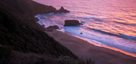
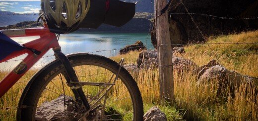
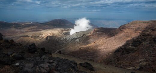


This is a fantastic resource, Brian! Many thanks for putting all of this together.
It’s been a great start for putting together a trip with my gravel bike (MTB-gearing, 50mm tyres and tons of alpine experience, riding 15k km/yr – so hopefully this will get me through things like the old ghost road).
Looking at your 3-week highlight plan, I was wondering if you see any downsides in doing it the other way around from south to north?
(fly into queenstown, pick up a rental car in wellington after and see how much time & motivation there is left to explore the north island bikepacking or rather doing more comfortable hotel travels there)
Many thanks!!
Hi Thomas – Thanks for the comment. The 50mm tires sound great. You will be happy to have those, I’m sure. In terms of direction, I don’t see any downsides that make one better than the other… There are some downsides (and upsides) to either direction; I’d argue that overall, it’s a wash. Your plan sounds good & Old Ghost is worth it, even if it is challenging!
I just loved all the pictures and commentary. Looks like you both had a mostly good time. I’m glad you are home safe and sound.