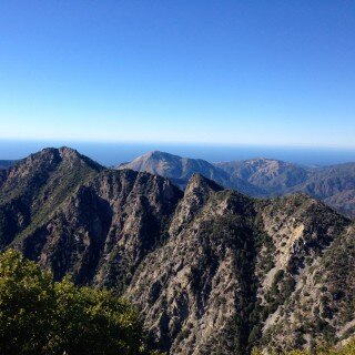
Mineral King Over the Great Western Divide
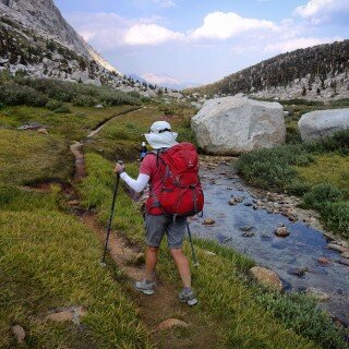
I’ve been meaning to begin a trip from Mineral King, and we finally had an opportunity to squeeze in a 3 day backpacking trip to this new location. The route we selected could be...
Exploring good routes and bad ones to help you decide where to go
Running is a method of terrestrial locomotion allowing humans to move rapidly on foot.
I’ve been meaning to begin a trip from Mineral King, and we finally had an opportunity to squeeze in a 3 day backpacking trip to this new location. The route we selected could be...
Just North of Point Sur, underneath a sweeping bend in highway 1, the Little Sur River dumps into the ocean. This river makes it’s beginning on the North flanks of Ventana Double Cone and...
Studying the map, I often find dead-end trails that seem like they were meant to form part of a loop. In an effort to connect the missing pieces of a dead-end trail in Desolation...
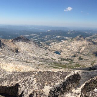
I had been wanting to do a solo fast pack, partly as preparation for the SHR that Leor and I want to do this summer. The initial inspiration for this route came last week...
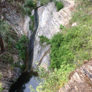
After last weekend at Canogas Falls, Leor carefully studied the satellite imagery and he discovered several previously unreported waterfalls. The official approach to Canogas Falls is only open one day per year, and that...
This winter, I was studying the Big Sur Map ( http://bigsurtrailmap.net ) and I saw a cool looking, isolated waterfall called “Canogas” falls. I contacted Leor, and he said that this area is closed...
The Little Creek / Big Creek Falls Loop is a 14 mile loop that starts at the Rinconada parking lot near Pozo. It is a very rewarding loop, as you get a chance to...
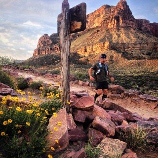
Crossing the Grand Canyon on foot would be very difficult at certain times of the year. Fortunately, we visited in April and got the weather just right. Navigation is unbelievably simple, and the trails...

When is a carb not a carb? The great fructose experiment.
August 4, 2023


My Type 1 Diabetes Diagnosis Story
May 31, 2021


Type 1 Diabetes FAQs – What food do you miss the most?
November 12, 2018

Type 1 Diabetes FAQs – You Can’t Eat That, Right?
November 3, 2018

Symlin for use in Type 1 Diabetes
October 30, 2018


August 22, 2017

August 23, 2015

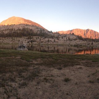
Ionian Basin Traverse and Tehipite Gorge
July 17, 2015

Leor’s Devils Falls and Hellhole Falls Loop
May 16, 2015

Little Sur River Fastpack Exploration
November 14, 2015
February 9, 2024

Utah Bikepacking – All The Routes
September 30, 2021

Bikepacking Death Valley – Valle de la Muerte
February 12, 2021

Wandering the West Bikepack trip
October 23, 2020

October 10, 2019

October 9, 2018

January 12, 2018

December 8, 2015