Bikepacking Peru – Huancayo to Cuzco via Choquequirao Ruins
This section does not need as much explanation as the rest of our South America Routes. It is fairly straightforward, and almost entirely paved, and far more services than our previous routes. In spite of being along the primary corridor, there isn’t too much traffic between towns and cities. There are other ways to move South in Peru (including routes on dirt roads)… but we don’t ride dirt just for the sake of riding dirt. We need a purpose such as good scenery or avoiding cars. The reason we rode this route is because we wanted to visit two important archaeological sites: Choquequirao and Machu Picchu. I am glad that we went to both. Though there is a ton of commercialization surrounding Machu Picchu, it would be foolish to come this close without checking it out. If you are avoiding Machu Picchu because of the expense, we detail everything you need to know to see pretty much everything in Machu Picchu for less than $50 USD (initial research will probably leave you believing that you need to spend upwards of $800 USD to visit these ruins).
Rather than enter the busy city of Huancayo, we stuck to the West side of the city, and cruised quiet roads that allowed us to escape to highway 3S. Our route is good if you have a suspension mountain bike. It is not busy and eventually you reach good quality pavement.
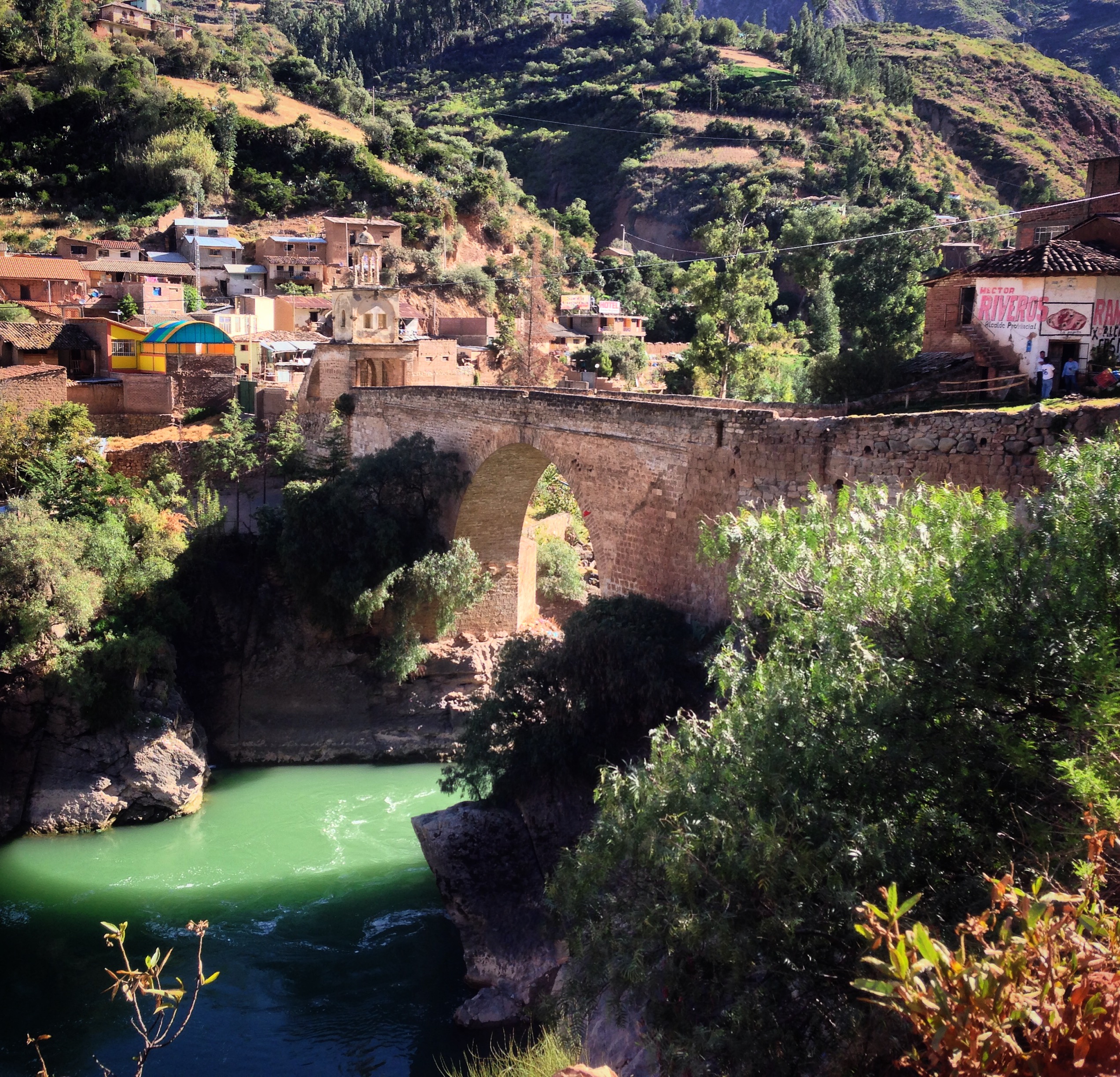
The bridge at Izcuchaca. This little town is something of a touristic town, but I think the tourism centers around this bridge. We stayed at a hotel which had no road access – you had to walk down the train tracks to get there: 12.50001° S 74.99822° W There are other hotels – but they all seemed to be in the process of renovation or construction.
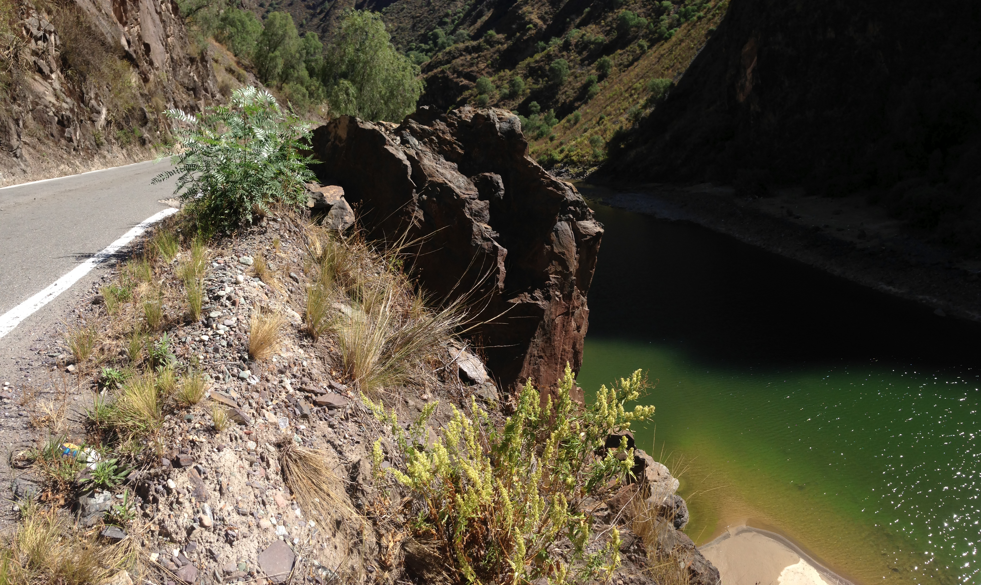
Peru’s Highway 3S is the most major paved road in the region – but it is quiet and about 1 to 2 lanes in width.
As you can see above, hwy 3S is pretty idyllic for cycling. We only saw a few cars on this band of pavement that was about the width of a really wide bike lane.
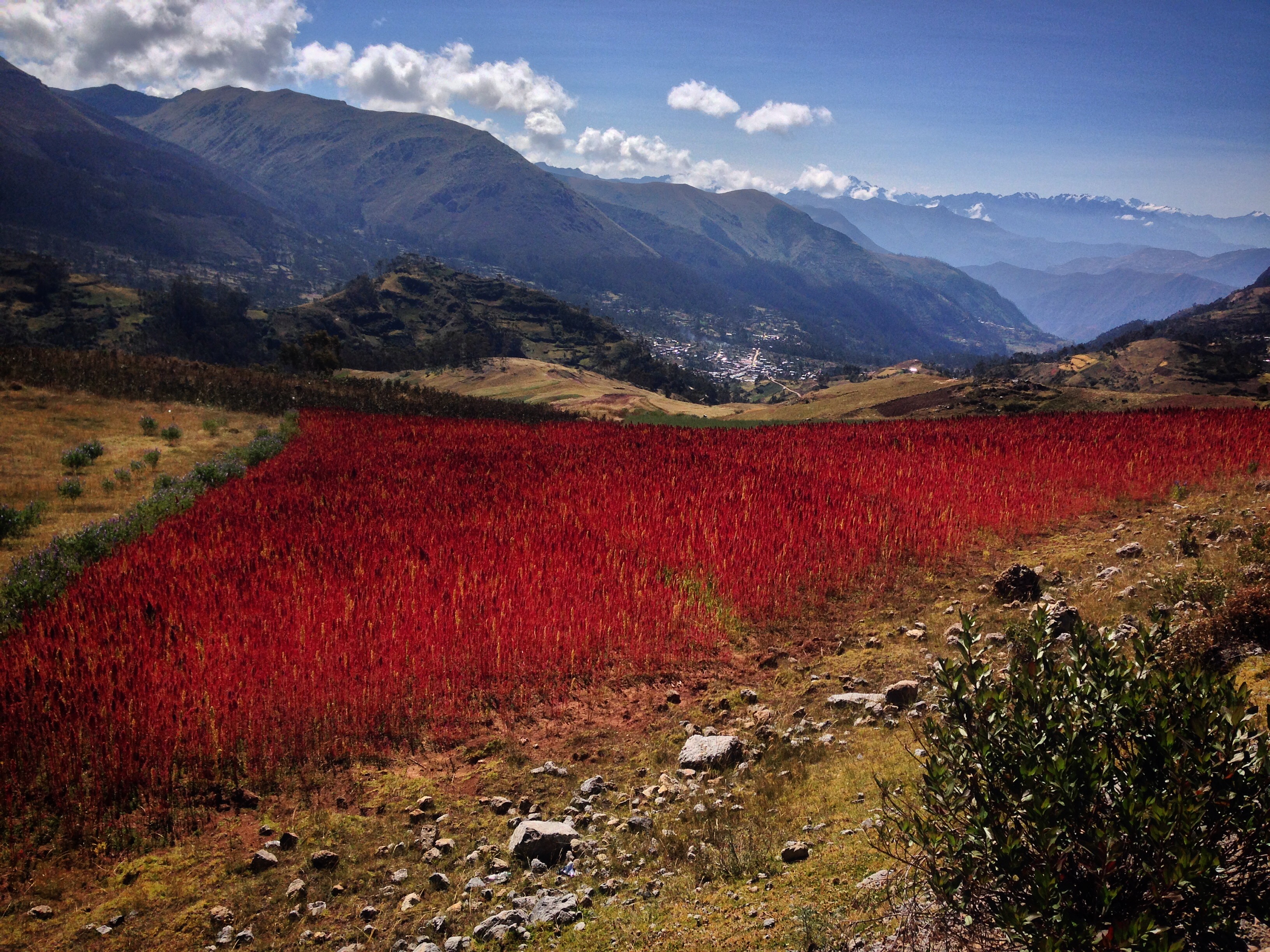
Quinoa in bloom!
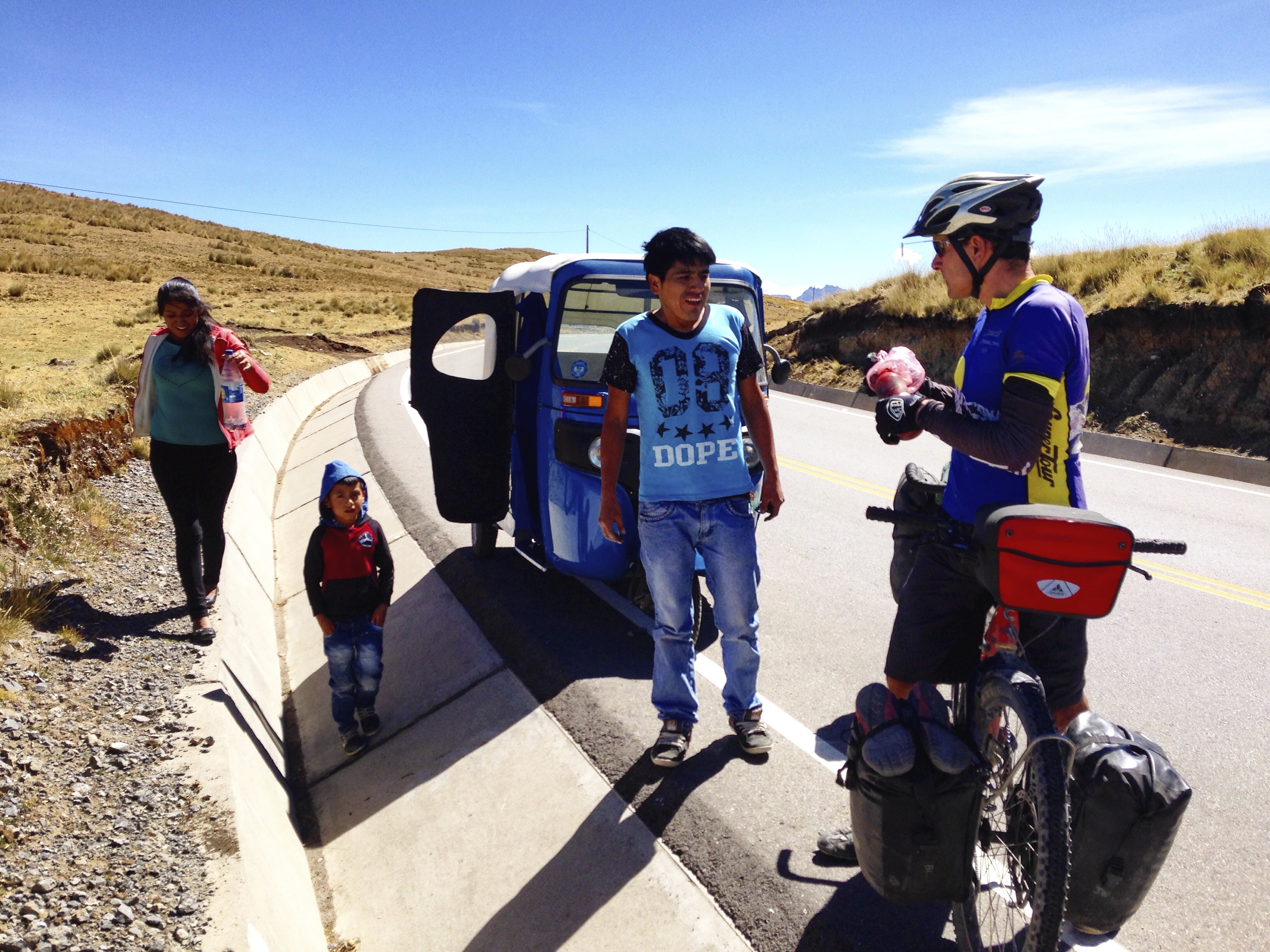
On several occasions, we have encountered people who have run out of fuel for their vehicles. We always carry gasoline to power our camp stove – so we have helped a number of people by filling their tanks just enough to get them to the next gas station.
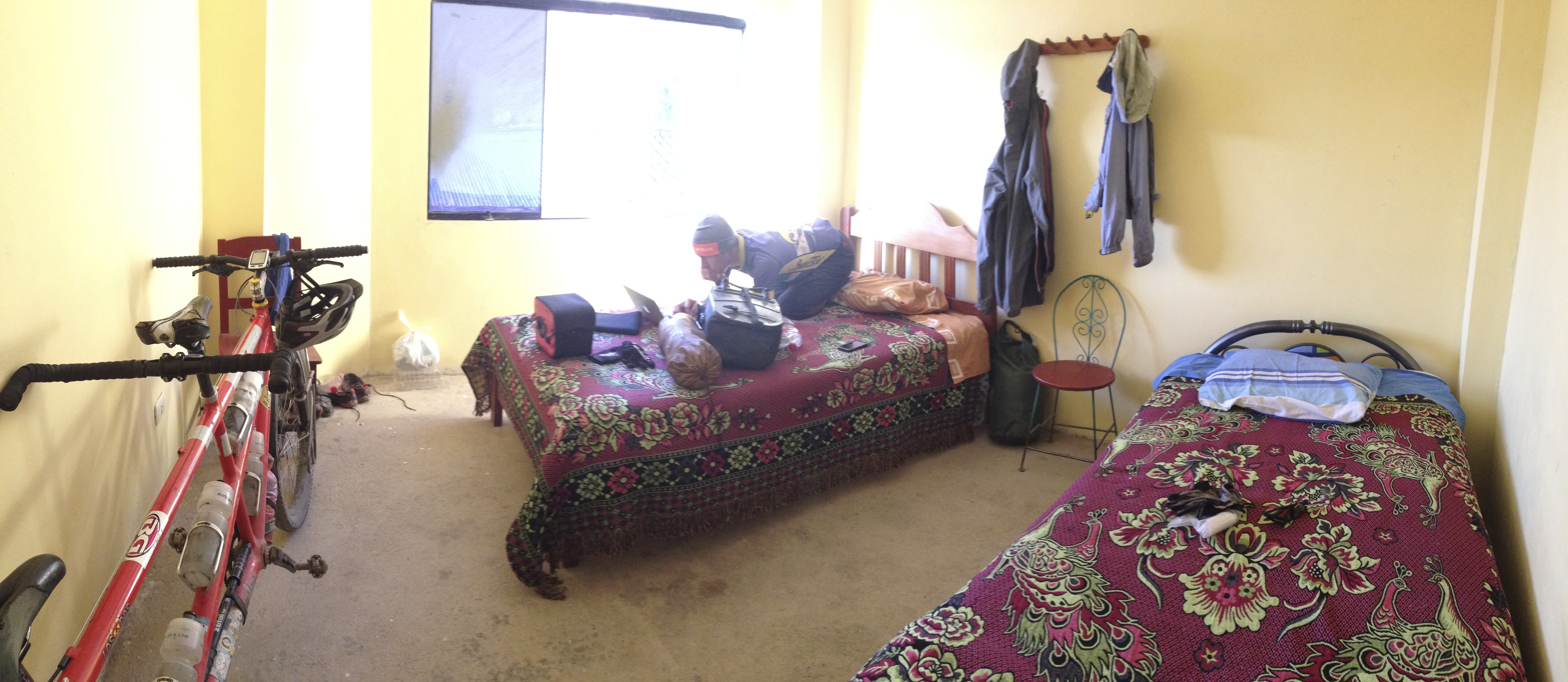
We arrived late in the dark in Ocros. I was in a bad mood because the day had not gone well. Fortunately, we met two children (Juan David and Angel Rodrigo) who started politely talking and joking with us. They both said that they liked school, and Janet joked with them asking, “but do you guys like homework?” and they both jumped up and down saying, “yes!” They really brightened my mood. There are no signed hotels in this town, but we found a room in a building located at these coordinates 13.39160° S 73.91561° W (pictured). It’s not as good as it looks. If you are coming from the North as we were, we suggest that you do NOT follow our route where we deviate onto the dirt road from the highway. Much better to take the pavement all the way to the gas station and then access the town from there.
The man who rented it to us also works at the gas station located here: 13.39440° S 73.91615° W
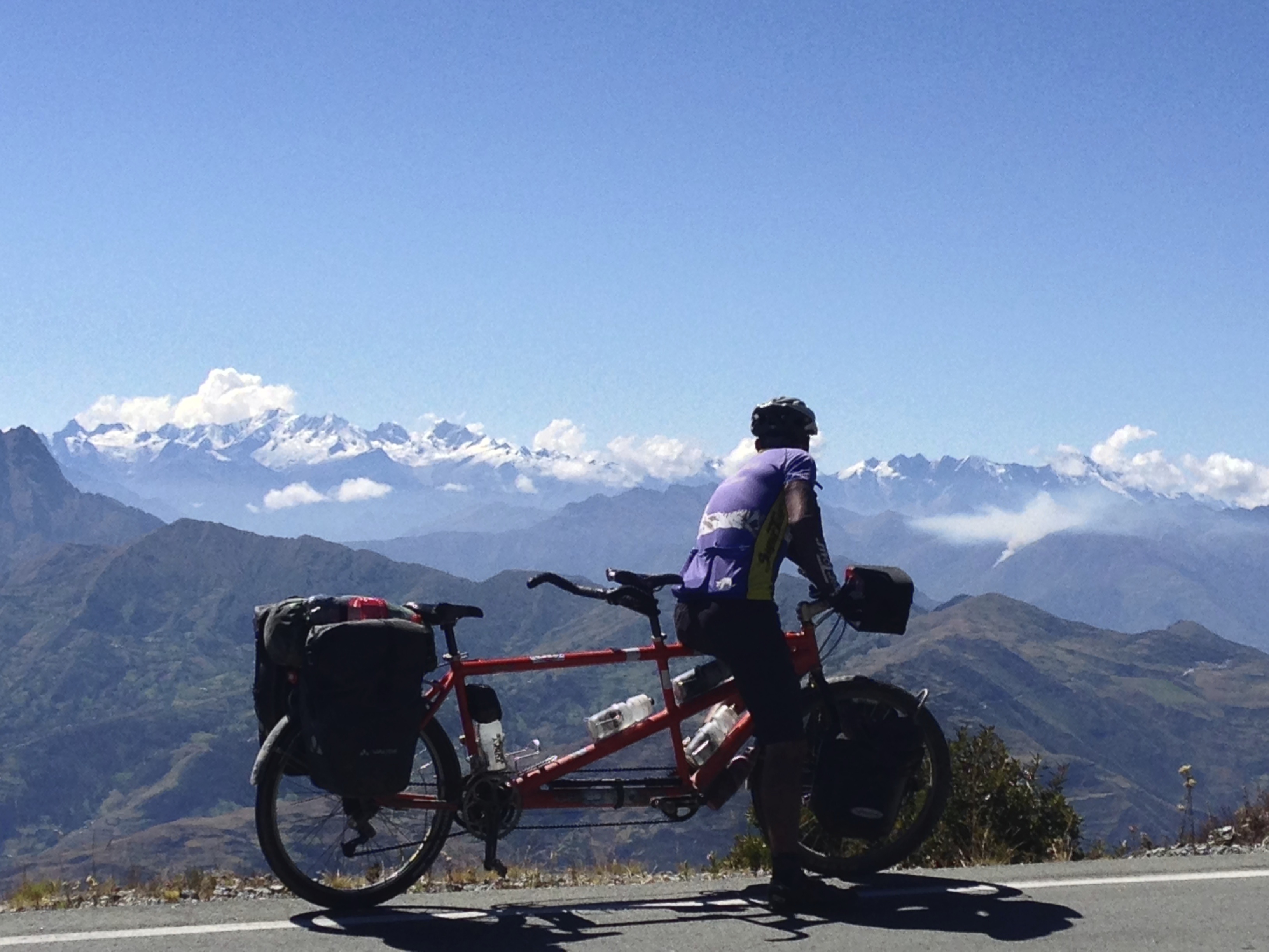
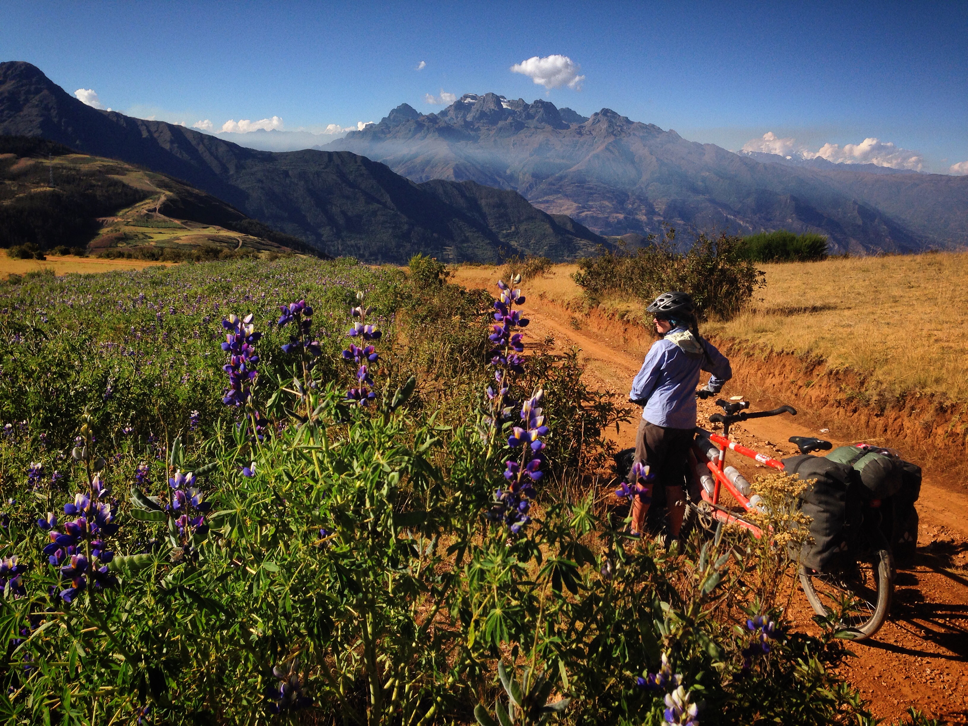
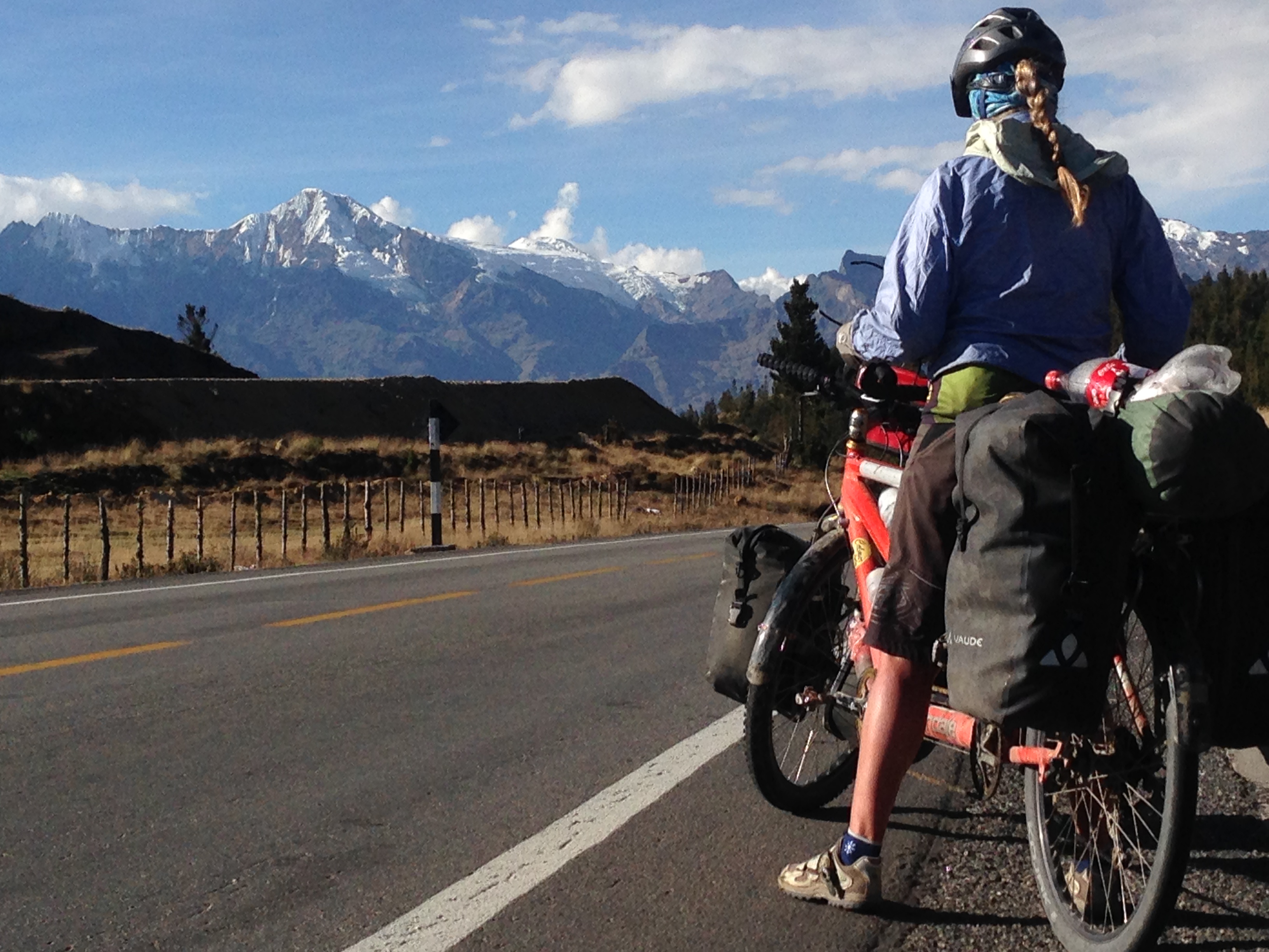
Pondering the set of mountains and valleys we will need to cross to get to Choquequirao.
Near Kishuara, we left the highway 3S here: 13.68563° S 73.12825° W The idea was that we would avoid the paved climb towards Huancarama. Our route was on dirt – but the quality was good. This picture was taken right before we started descending quite steeply on a deeply rutted road. Janet had to walk a bit as I navigated the tandem through the ruts until we got to Sotapa.
Our route in the picture above follows the contour of the mountain, and is quite a bit shorter. Eventually, though, to rejoin the highway, you need to drop steeply starting here: 13.69899° S 73.02709° W
How to visit Choquequirao
Treks to Choquequirao start from the villages of Cachora or Huanipaca. We started our own self-guided trek from Cachora simply by following a trail that resembles a steeper and less maintained version of the Grand Canyon trail in Arizona. There are a number of official campsites along the way – some even claim to have food or restaurants. When we passed, however, most seemed to be closed and unattended. Therefore, I would recommend that you plan to bring all of your supplies for the out-and-back hike. We were very fit, and did the trip in 3 days (one day in, one day visiting the ruins, and one day out). Most people seem to do this trip in 5 days (two in, one visit day, two out). You could easily spend 2 or 3 full days exploring the site. Even being very fit and running between sites, I couldn’t see everything. The advantage to doing the in/out in one day is that you do not need to camp at lower, hotter elevations with the biting bugs. The biting bugs vanish around the 8,500′ mark. Although Choquequirao’s site is almost as grand, and larger than Machu Picchu, it only averages about 15 visitors per day due to the difficulty in getting there. If you consider that Machu Picchu now averages 3,000+ visitors per day, you can see why this is a totally different and worthwhile experience.
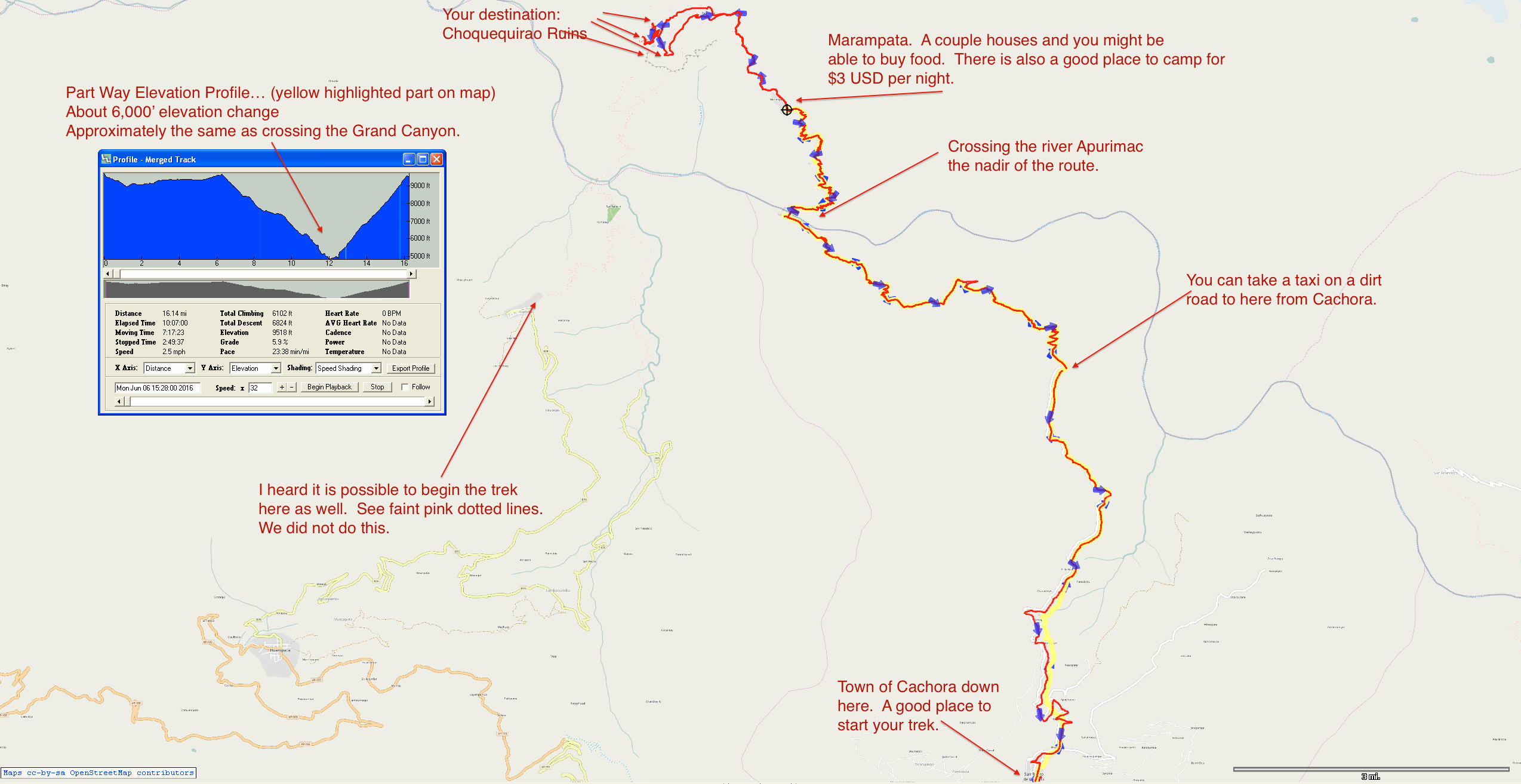
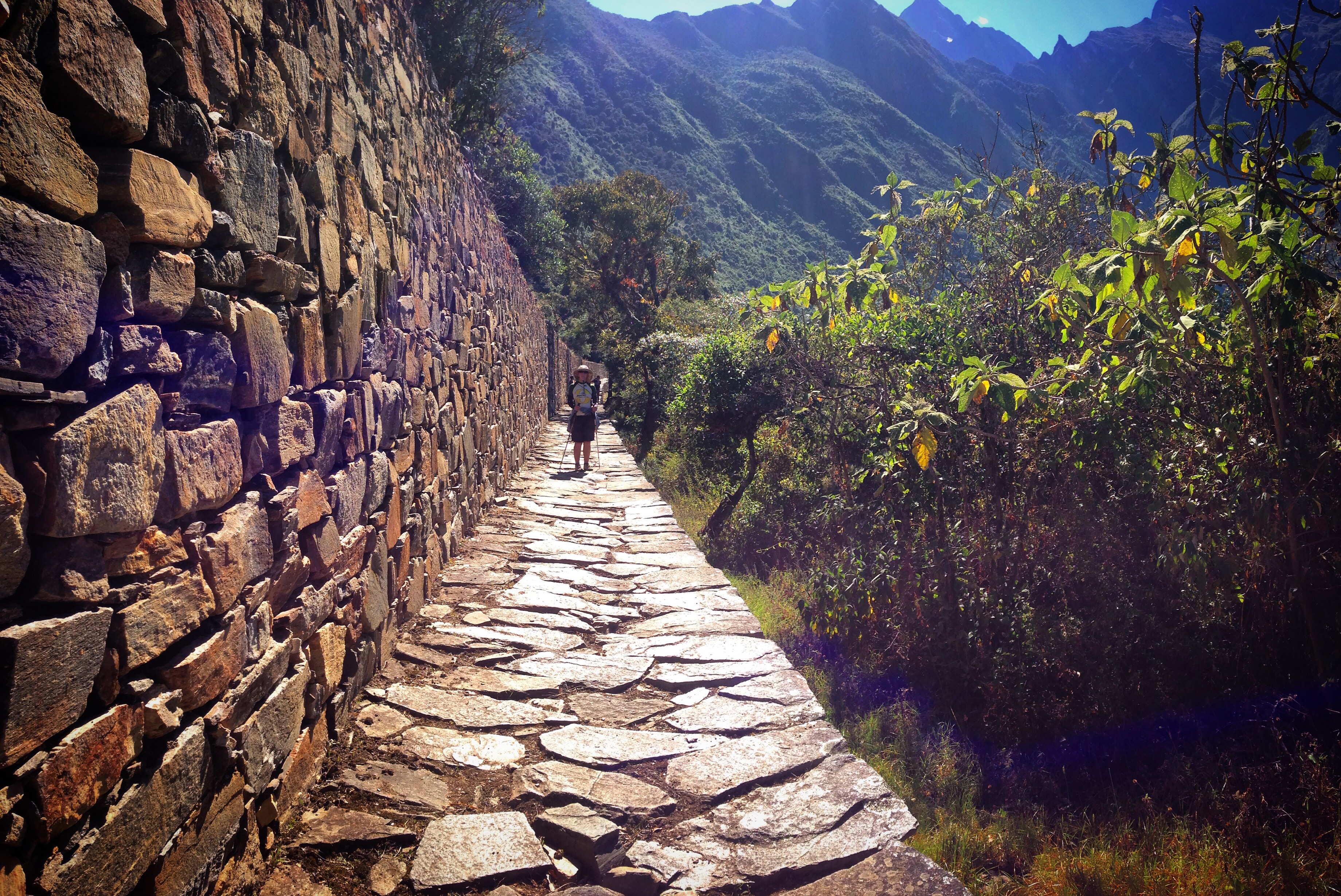
Visiting Choquequirao on foot detail.
Your visit will likely begin in Cachora. It is best to stage with a hotel in town so you can gather your supplies. If you don’t already have backpacking gear, there is a place to rent a pack (location in captions below). Also, there are signs for two more upscale lodging locations that are outside of town (both are to the North). From the pictures, these seemed like they would help you arrange your trip (one seemed to have English speaking skills). Also they might have gear for you and/or rentals of mules. Mules are for carrying your gear, but in a pinch, they are allowed to carry people. When we crossed the Apurimac river, we were asked to show our passports. About half way between Marampata and the park entrance, we were asked for about $17 to purchase tickets for entering the park.
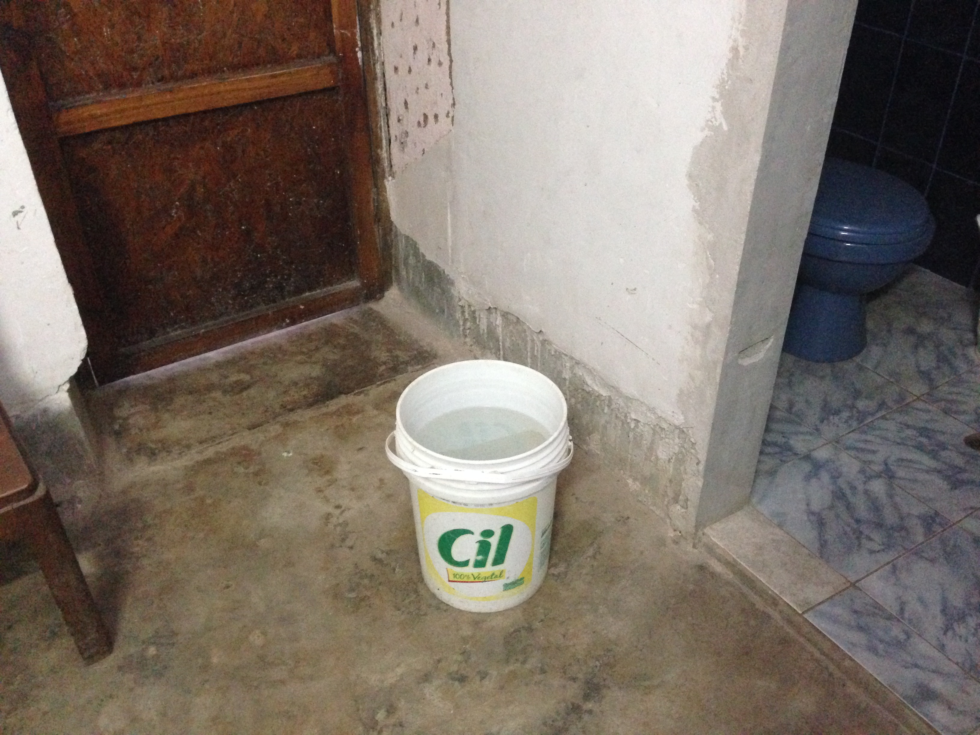
Our first night in Cachora, we stayed at a hotel located here: 13.51329° S 72.81277° W Unfortunately, the woman did not explain that the water is off most of the day. The rest of the day, you get a bucket for the day – enough to flush and take a bath.
Later, we increased our comfort by moving to the nicer looking hotel located here: 13.51301° S 72.81348° W The water was usually on here (shared bathrooms), but it was not hot (the owner told us he would fix it each day, but I started to realize that he was just saying that after several days).
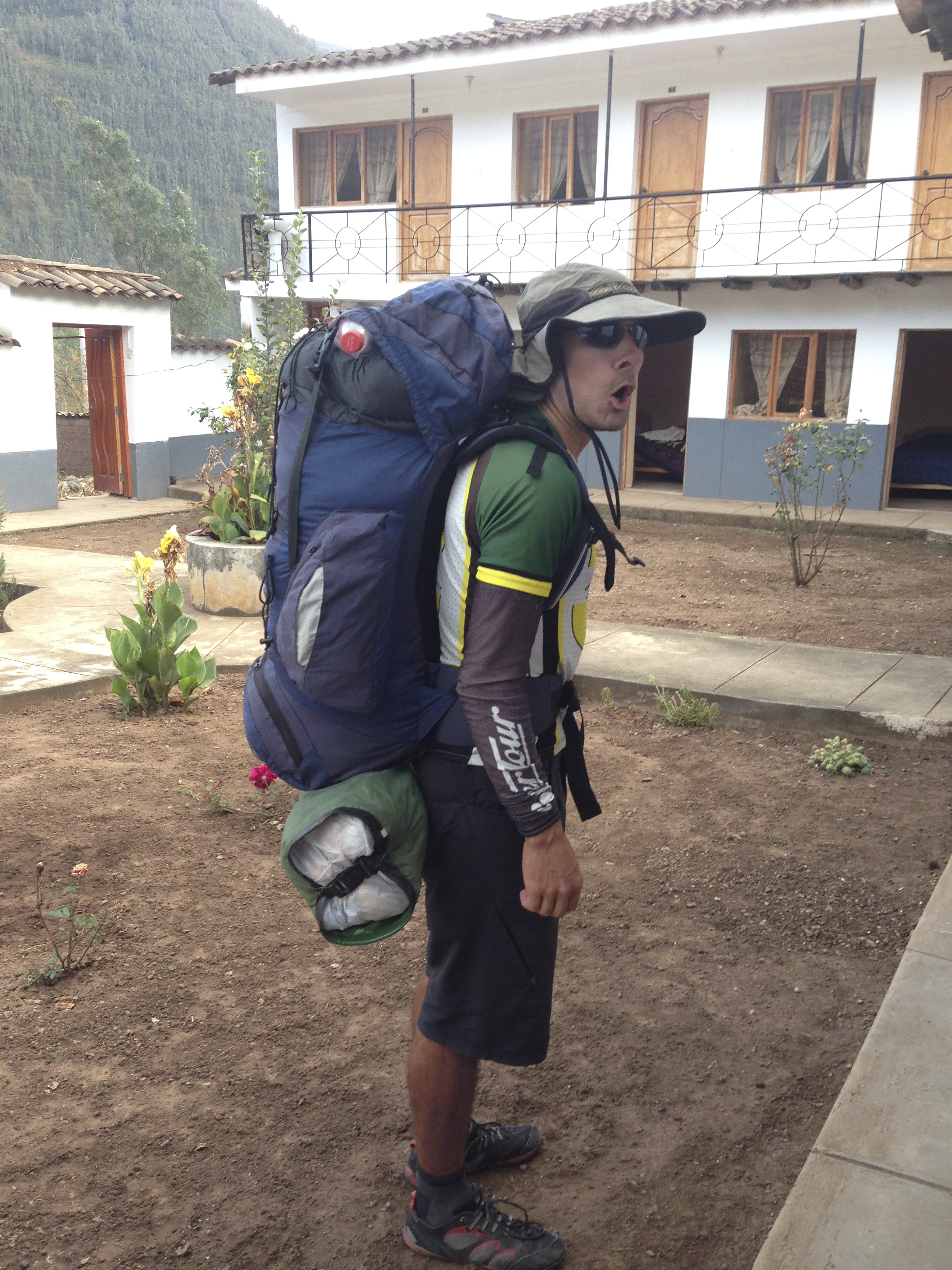
Getting ready to hike into the Choquequirao. We were able to rent a decent quality backpack from the store located here: 13.51182° S 72.81244° W
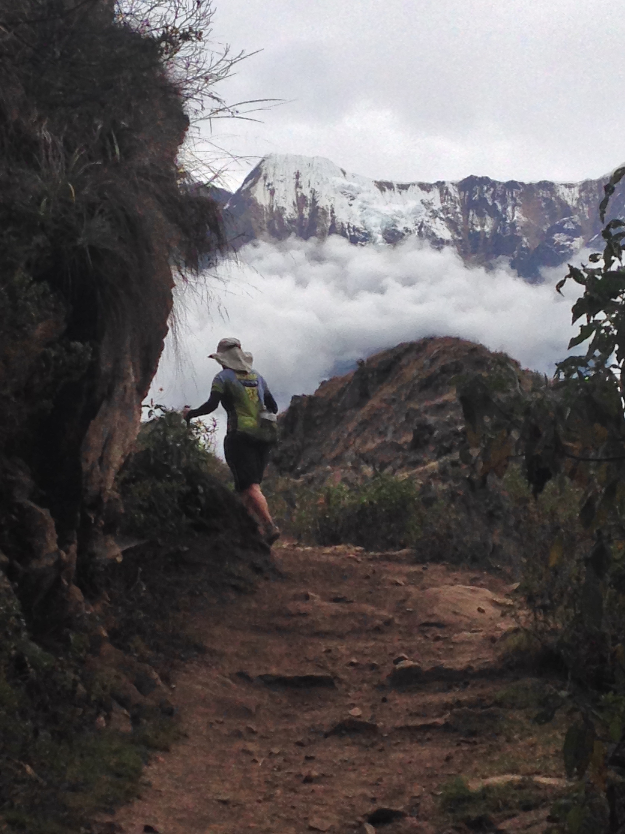
Janet hiking the trail into Choquequirao. We made the mistake of hiking directly from Cachoras. This is fine if you have the time and energy – but it is about 4 miles on a dirt road (some single track options on the side). The scenery doesn’t get good until you get here: 13.44670° S 72.80885° W If you decide to take a taxi from town, this is where they will drop you off. There is a staging area with a little store at the place you get dropped off to begin your hike.
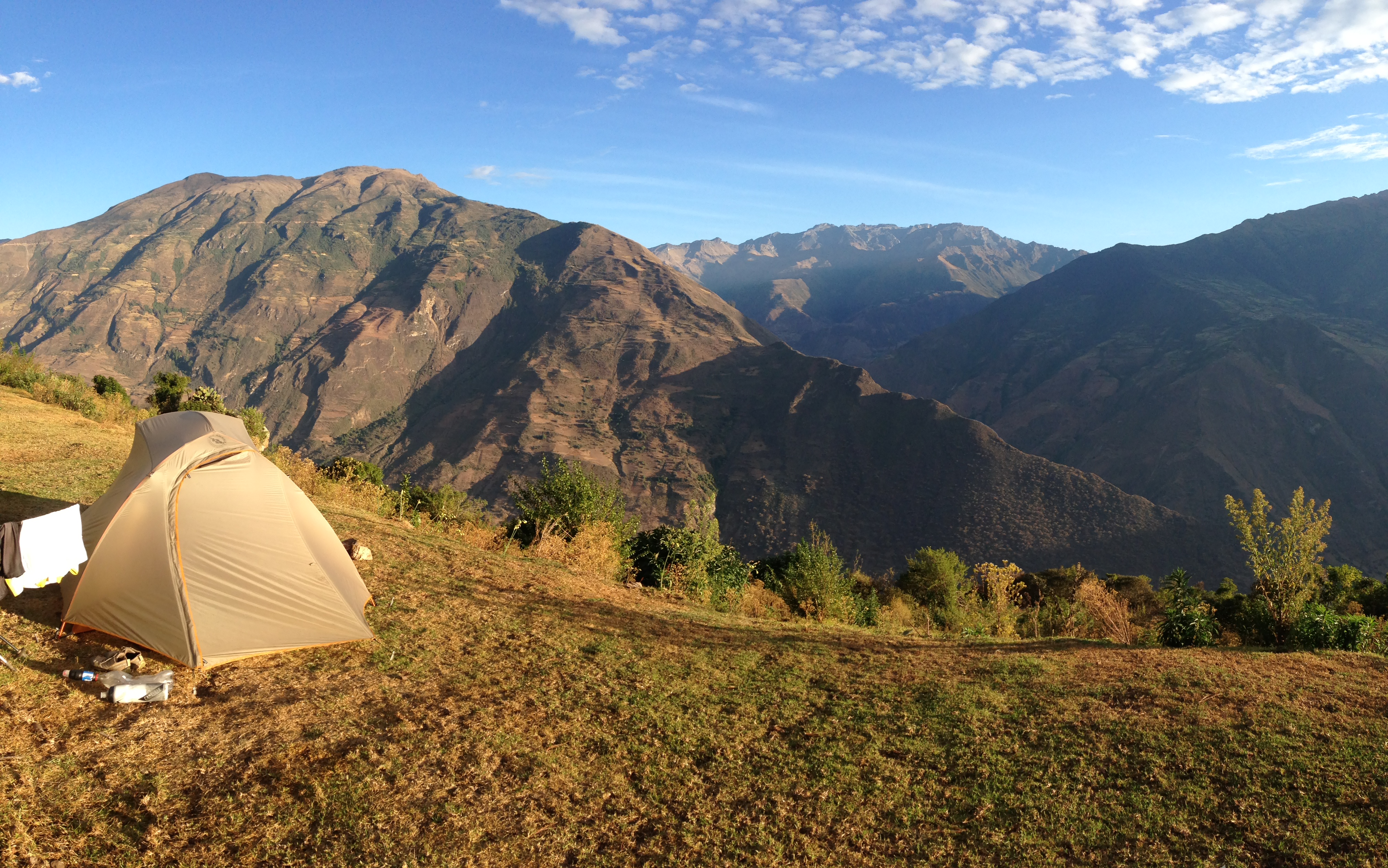
Our campsite at Marampata.
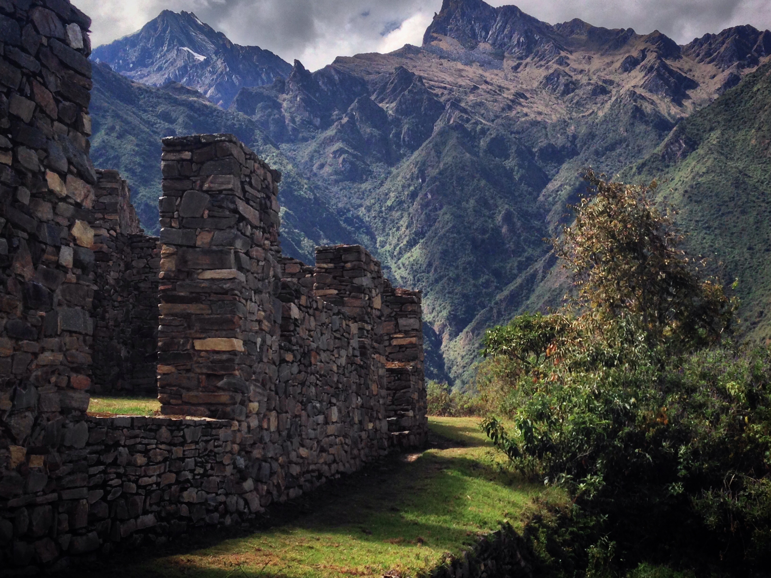
The ruins at Choquequirao.
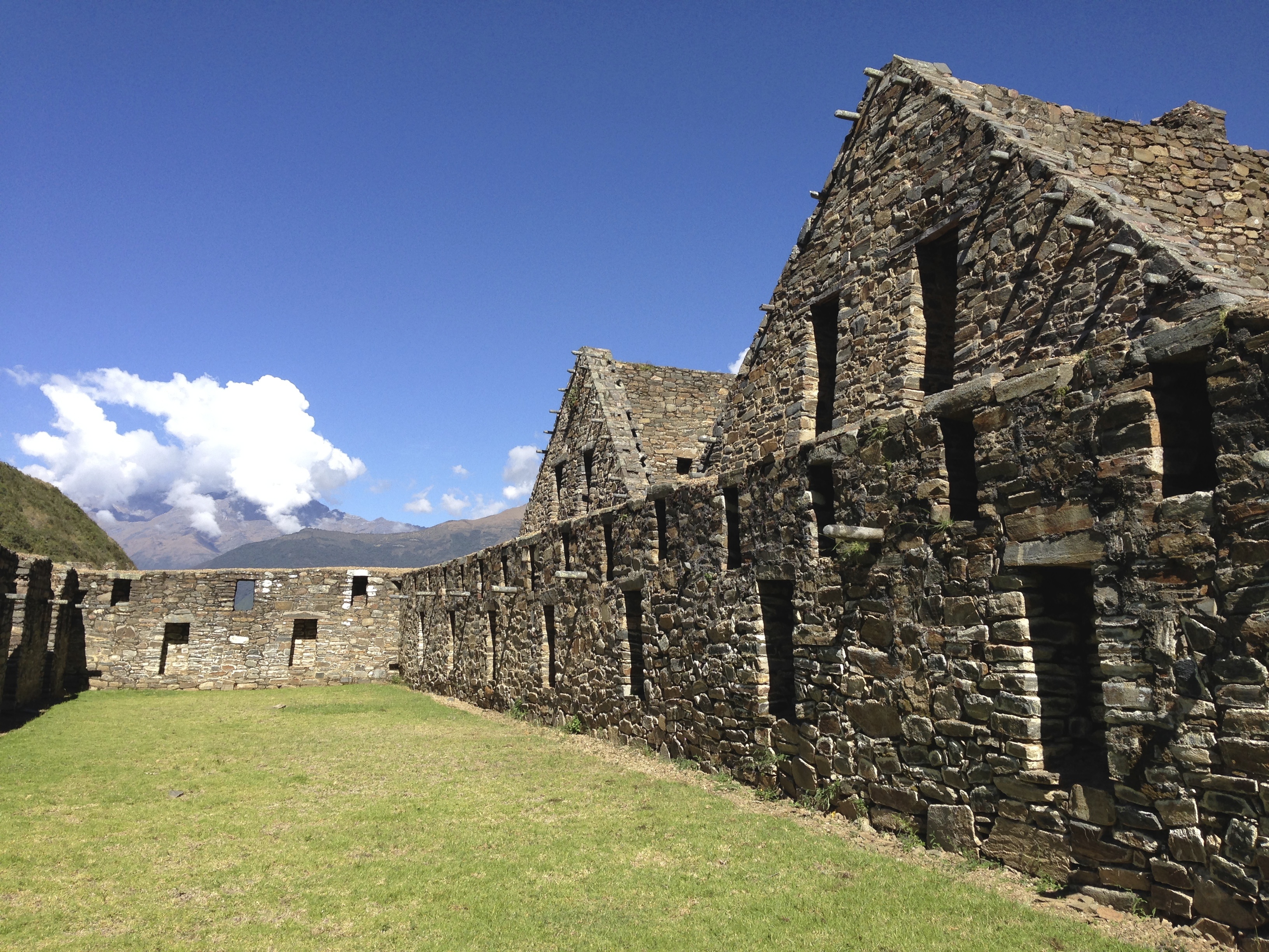
The ruins at Choquequirao are in great condition, and although it would take you a couple days walking to explore end-to-end (really, it is huge) it is believed that only a small fraction has been uncovered. The site is much larger than Machu Picchu! Also, unlike Machu Picchu, at the time of this writing, you do not need to pay a fee to do the trek to the ruins.
Only discovered recently, the llama terraces are impressive – each step is about 8′ high…
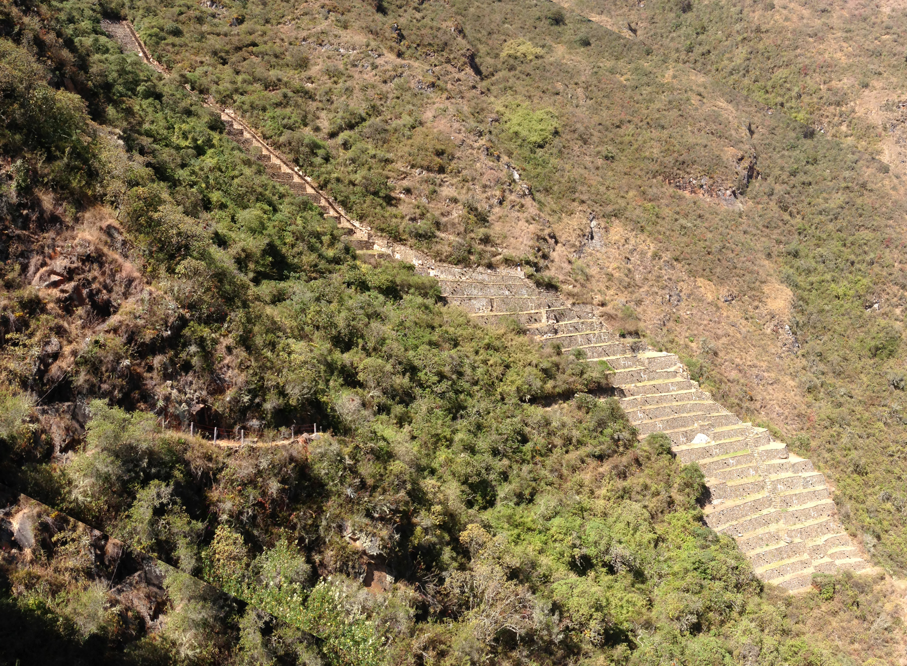
This picture helps give you an idea of the magnitude of the llama terraces (detail seen in previous picture). To get to this side of Choquequirao where I took this picture, it is neary 2 hours walking time each way from the other side of the archaeological site. This place is enormous!
The priests house.
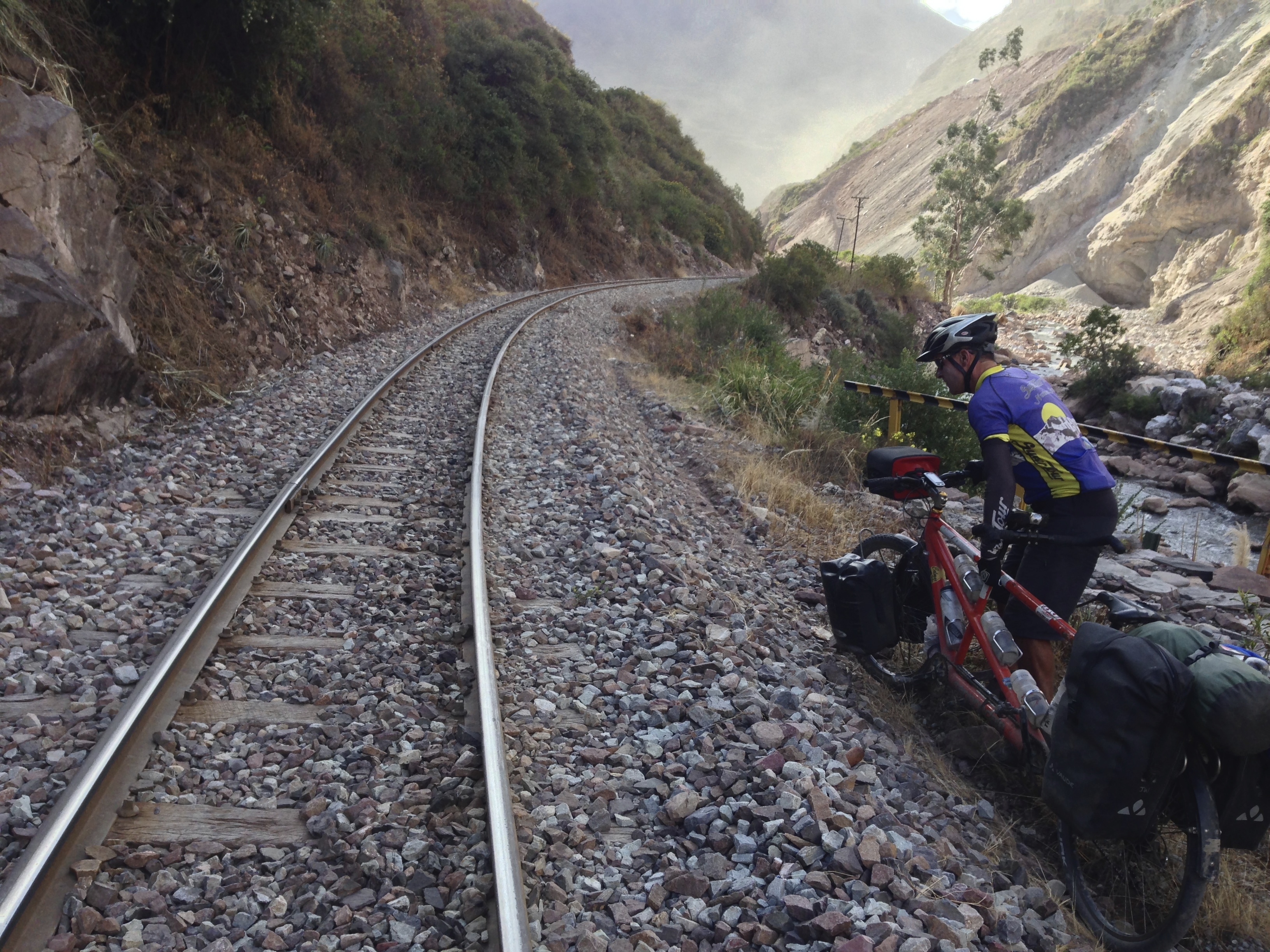
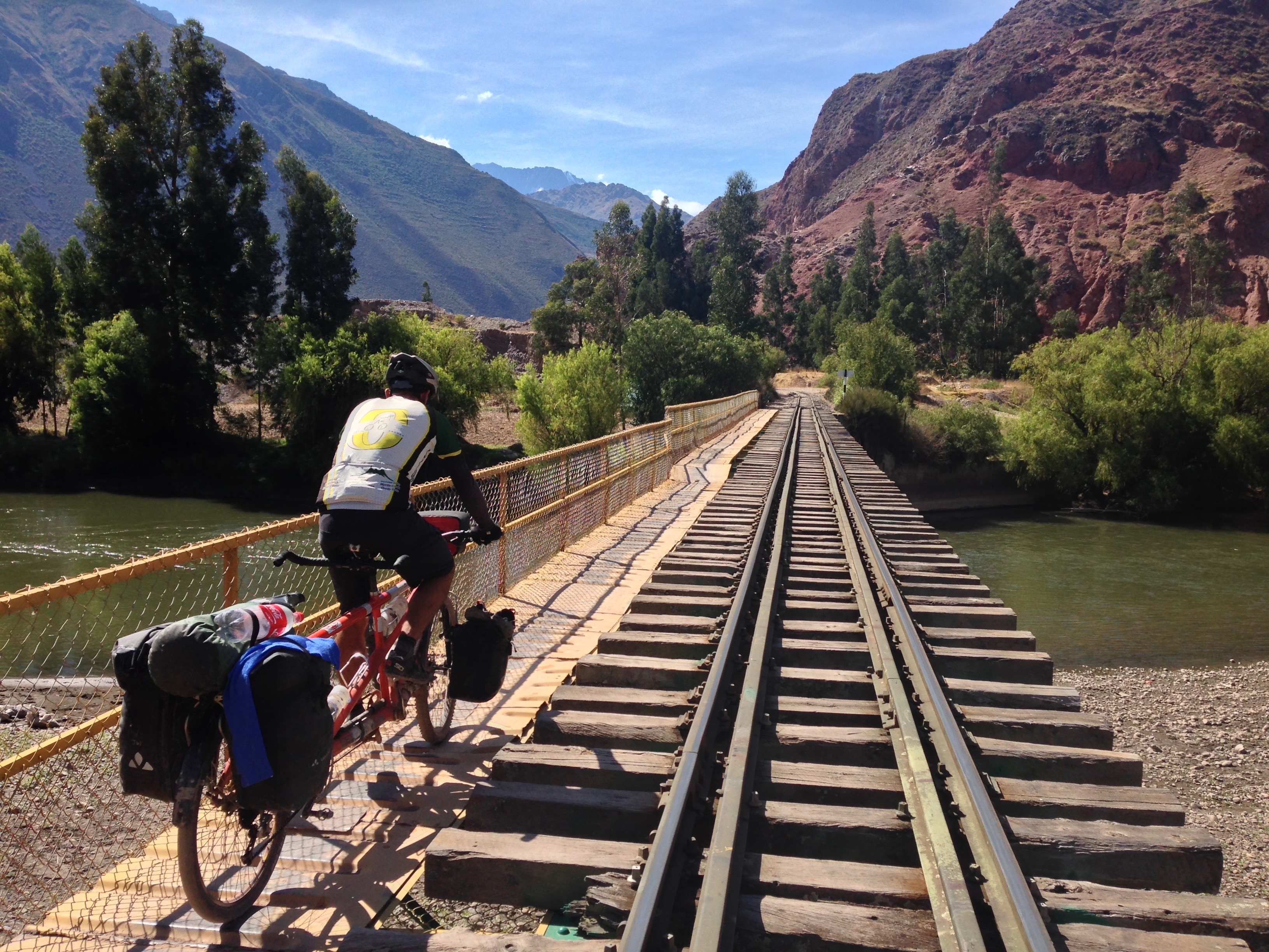
From the town of Anta, we left highway 3S in the hope of finding a shortcut to Ollantaytambo. This route was mostly dirt, but of good quality. Unfortunately, they were doing construction on the road, and would not let us through (the guy was nice and helpful – but firm). He let us leave the road and walk along the train tracks (warning us that a train would come in 30 minutes). We spent over an hour straining every muscle carrying the bike on these tracks, but the train never came.
How to visit Machu Picchu on a budget
It would be a shame to come this close to Machu Picchu and not visit. Like so many cycle tourists before me… people who are used to living the simple life… I cringed at the idea of entering a crowded, expensive tourist destination. After doing a lot of research, I found ways to ameliorate the pain, and have described them here in detail. In fact, I describe how you can visit Machu Picchu with for $50… with the benefit of fewer crowds… and you can even get in a Peruvian trek if you follow our Choquequirao route above.
How to visit Machu Picchu on a budget of $50 USD.
How to visit Machu Picchu on a budget of $50 USD.
In this post, I’m clearly advocating saving money, which benefits the traveler – but what about the locals? On a personal level, my aversion is not to spending money, but instead it is to wasting money. For example, I would willingly pay $20 USD to a local family to sit down with them over a simple meal of chicken and rice provided that we had good conversation exchanging learning about our two different cultures. Meanwhile, I would cringe at the idea of paying even $10 USD to look at a waterfall to an company who is merely capitalizing on the fact that they happen to own the land where the waterfall is located. Your sense of value may differ from mine, but I feel like it is important to consider where your money is going, and who it is benefiting. As you have probably read elsewhere in this blog, I have mixed feelings about the influx of money into 3rd world countries. On one hand, it is usually beneficial for the locals to increase their income by engaging in commerce with foreigners… On the other hand, it can cause severe gaps of inequality – Those who do commerce with foreigners start becoming very wealthy by local standards. Those who don’t or can’t participate in this – those who used to feel like they were doing fine economically – now start to see their prices for basic needs rise because the influx of foreign money has started an inflationary cycle. There isn’t much you can do about this problem in the localities surrounding Machu Picchu – it’s too late. But you can think about it when you visit up-and-coming sites mentioned in this blog such as Choquequirao and Quelap.
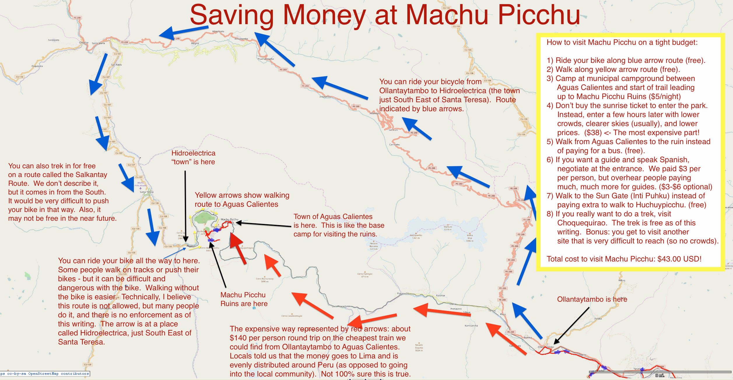
How to visit Machu Picchu on a tight budget:
1) Ride your bike along blue arrow route (free).
2) Walk along yellow arrow route (free).
3) Camp at municipal campground between
Aguas Calientes and start of trail leading
up to Machu Picchu Ruins ($5/night)
4) Don’t buy the sunrise ticket to enter the park.
Instead, enter a few hours later with lower
crowds, clearer skies (usually), and lower
prices. ($38) … The most expensive part!
5) Walk from Aguas Calientes to the ruin instead
of paying for a bus. (free).
6) If you want a guide and speak Spanish,
negotiate at the entrance. We paid $3 per
per person, but overhear people paying
much, much more for guides. ($3-$6 optional)
7) Walk to the Sun Gate (Into Puhku) instead of
paying extra to walk to Huchuypicchu (free)
8) If you really want to do a trek, visit
Choquequirao. The trek is free as of this
writing. Bonus: you get to visit ruin site
that is very difficult to reach (so no crowds).
Total cost to visit Machu Picchu: $43.00 USD!
If you’re on a budget, we recommend riding your bike to Ollantaytambo. From there, ride North-West around the big mountains over to Santa Teresa. From Santa Teresa, you have the option of carrying on with your bike all the way to Hidroelectrica, or getting a shuttle. From there, the only way to get into Aguas Calientes (the staging point for Machu Picchu) is by rail. You can walk the rails – though there is some question about the legality of this. Many people do it every day, and there does not seem to be enforcement as of this writing.
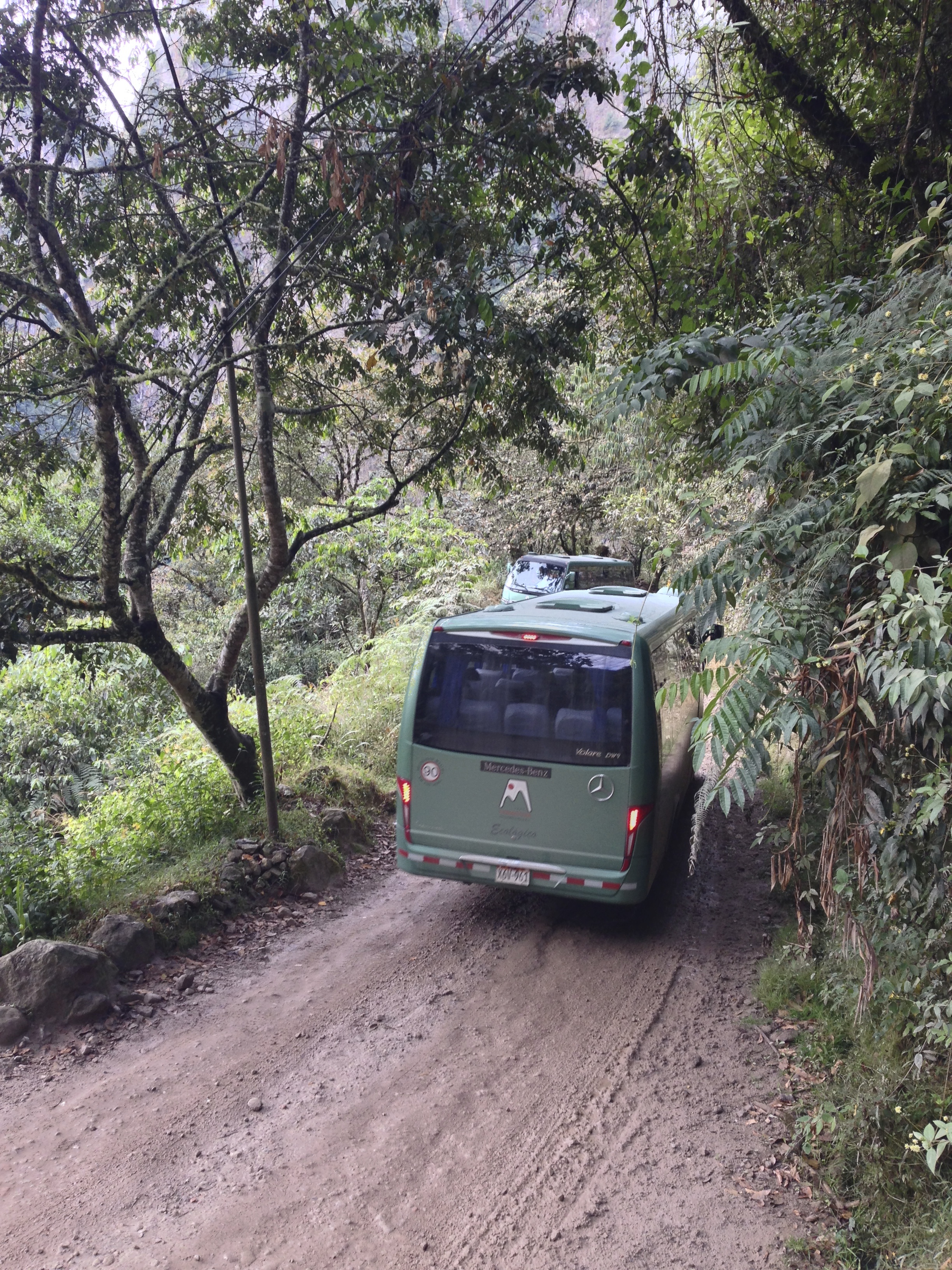
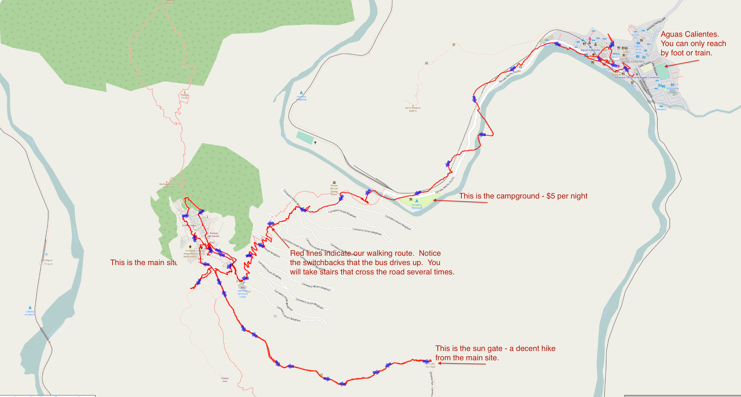
Busses head up and down the road to Machu Picchu every few minutes.
From Aguas Calientes, most people take a bus – but you can easily walk up the trail that takes you to the main ruins.
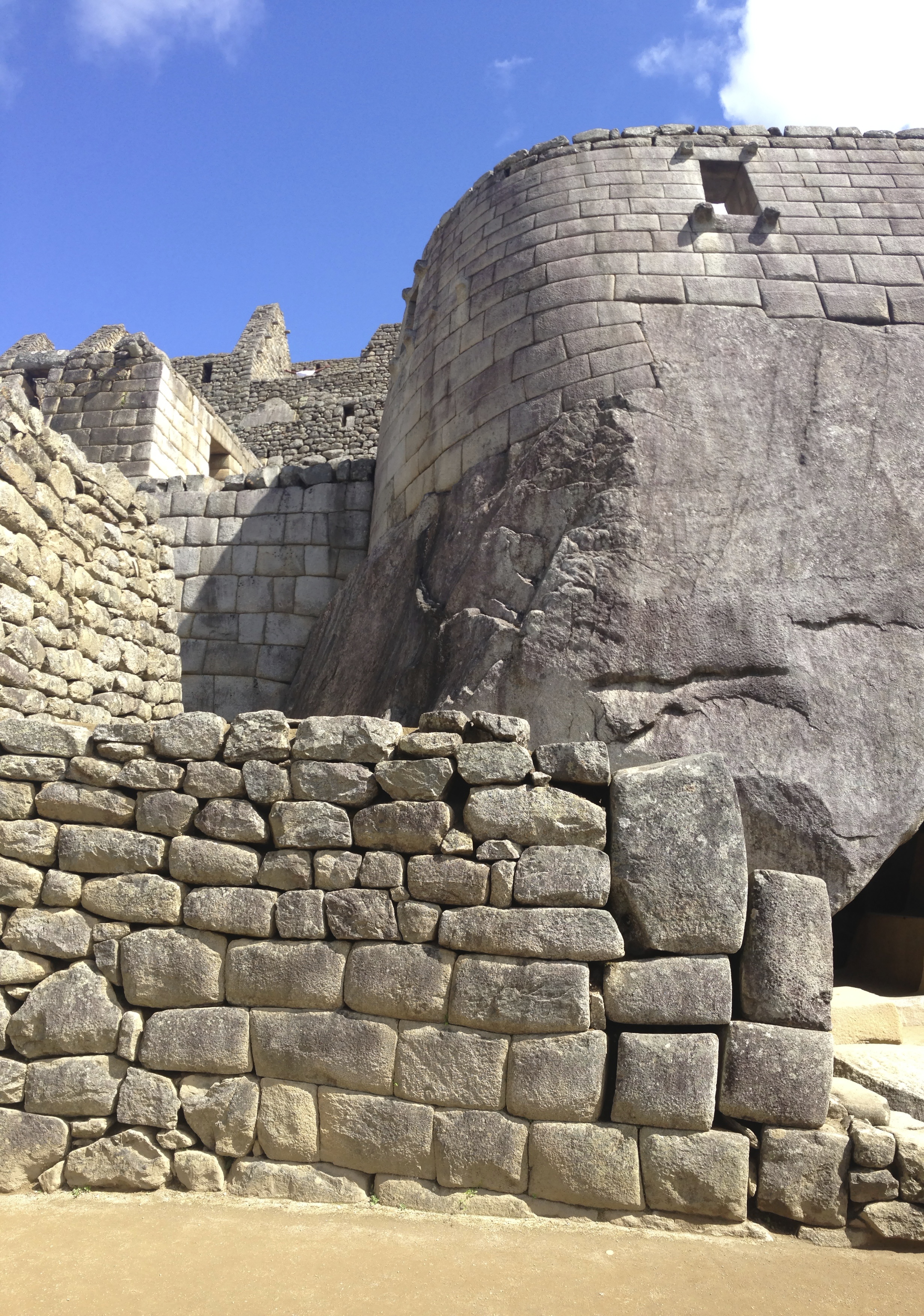
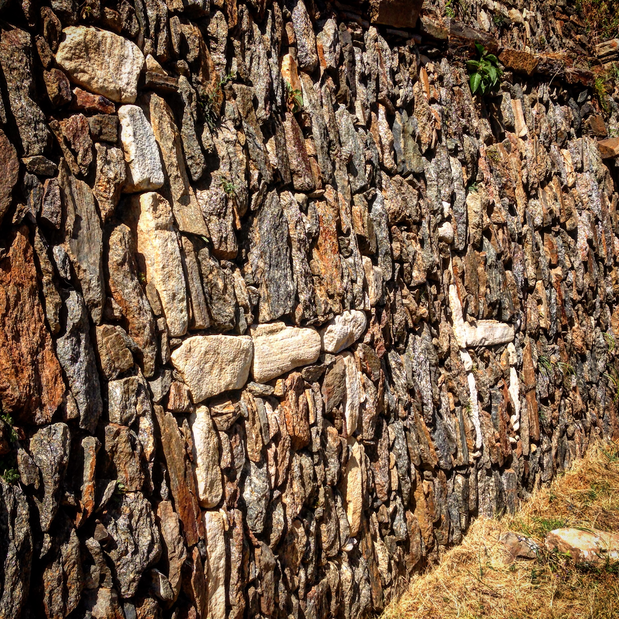
A sample of the careful stone cutting at Machu Picchu. See how the blocks fit together so well? This is what differentiates the Incas from the myriad of other pre-Colombian civilizations.
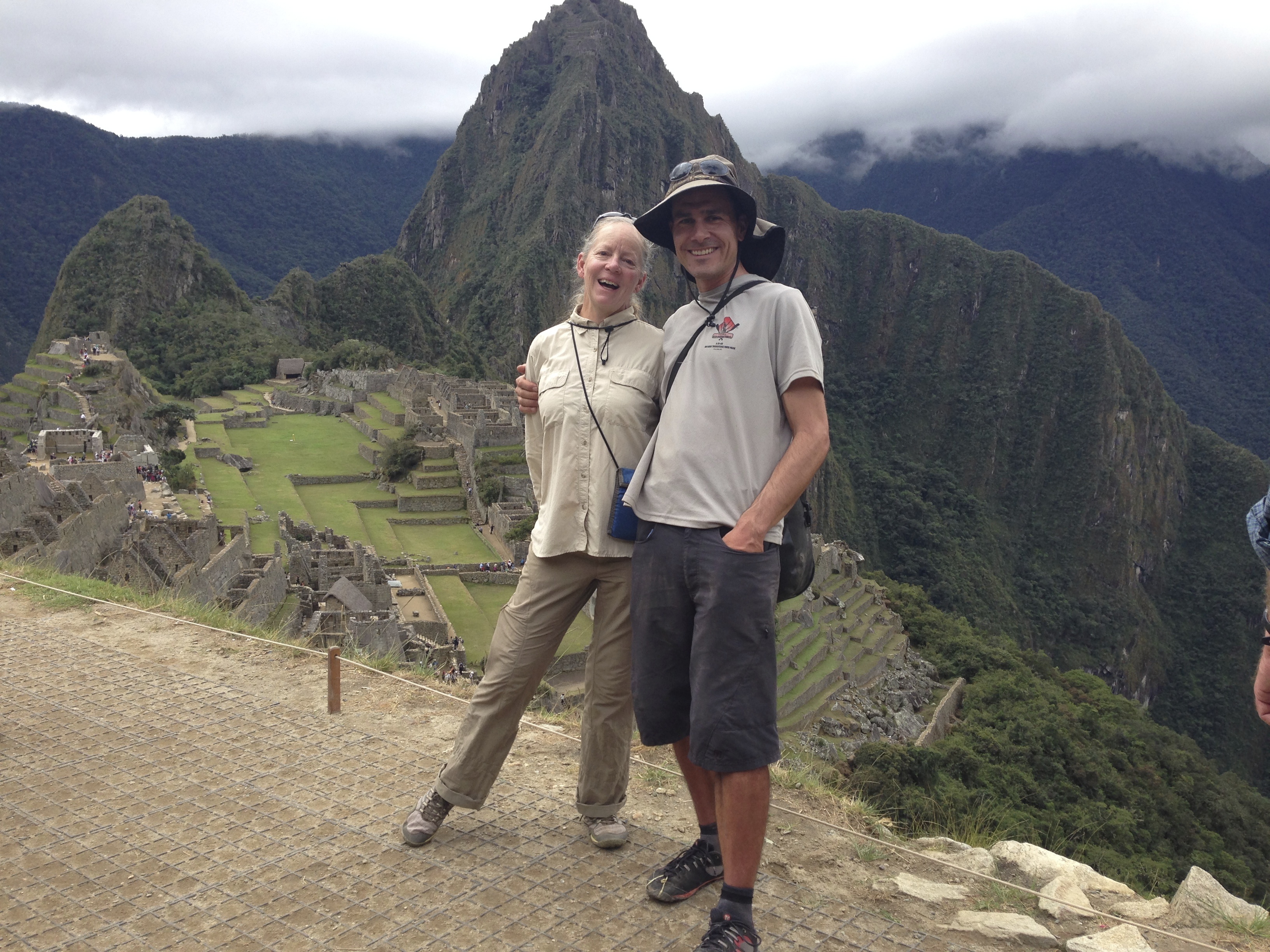
Janet and I – in good moods because we made it!
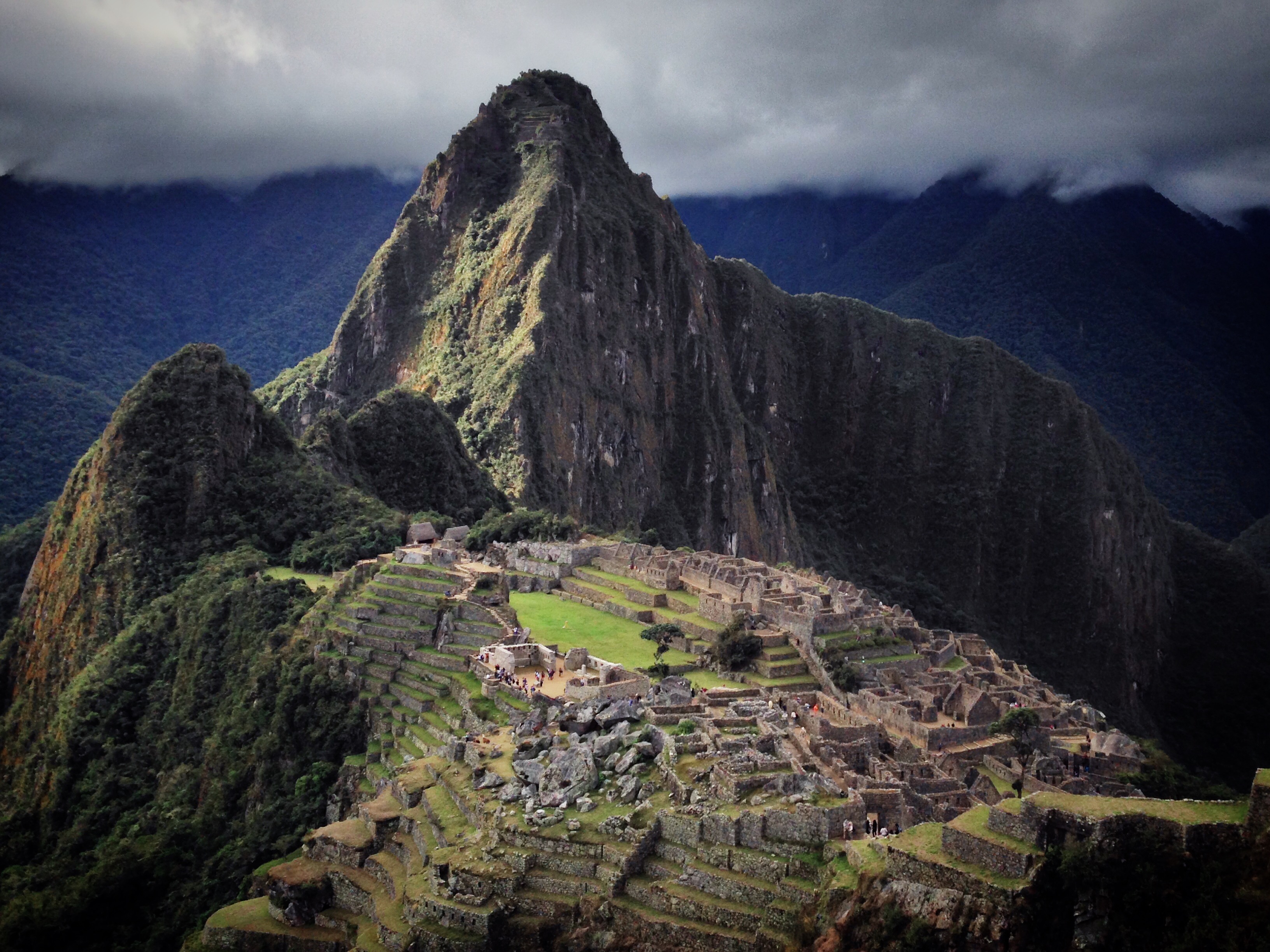
The classic shot.
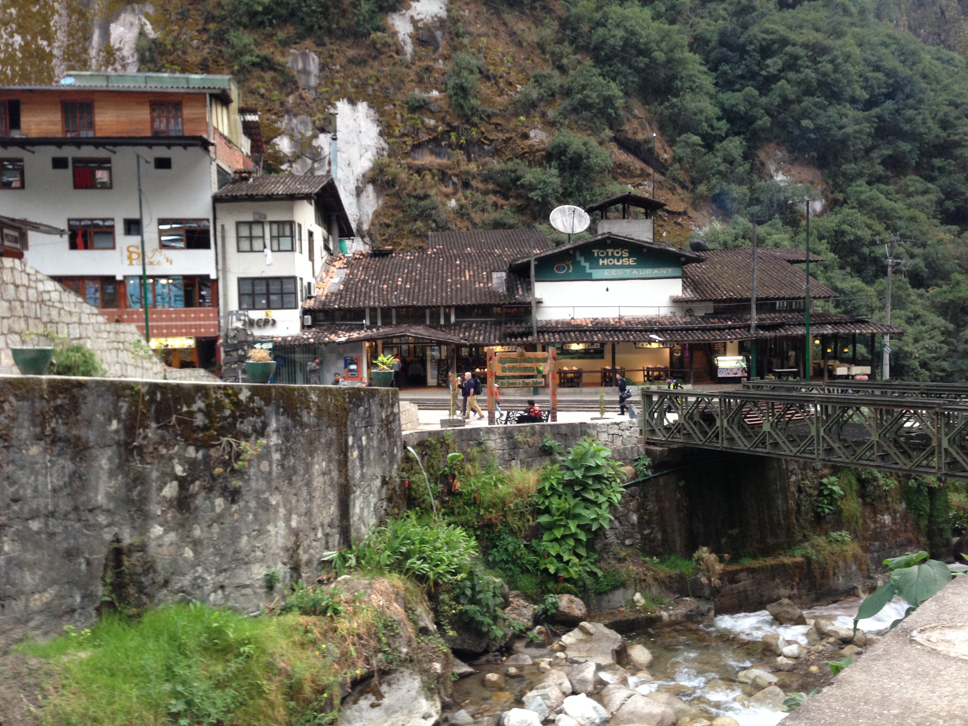
The town of Aguas Calientes.
Leaving Machu Picchu, there is a bike route that comes and goes as you head down the sacred valley. At this point, the path abruptly disappeared.
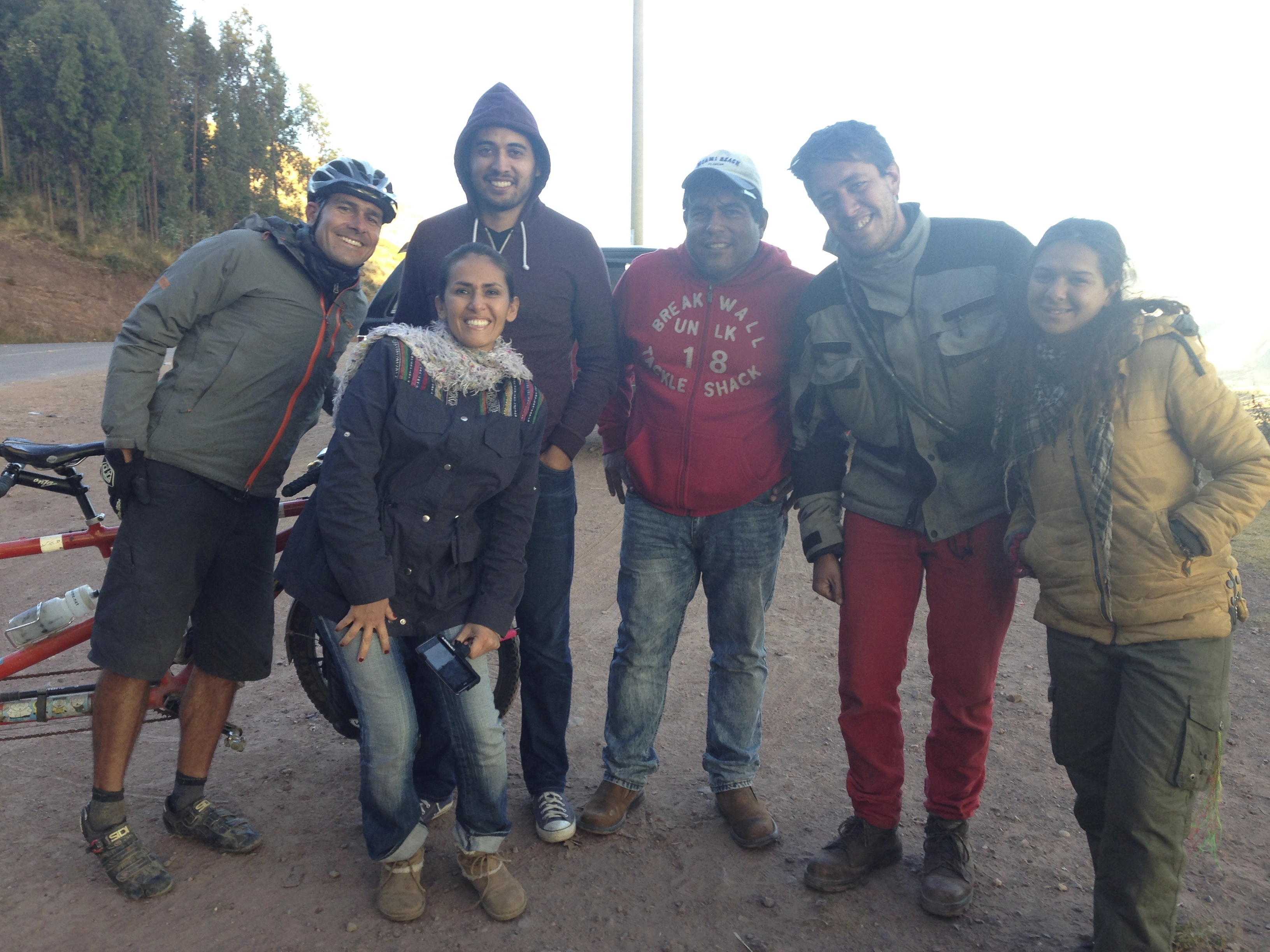
On our way into Cuzco, we met these guys on the side of the road. Two different couples had stopped to talk to a guy from Argentina who was riding his motorcycle through the Americas. Though Spanish is not our primary language, we found ourselves helping translate between the Peruvians and the Argentinian – because in the course of learning Spanish, we had learned many “-isms” that are region specific.
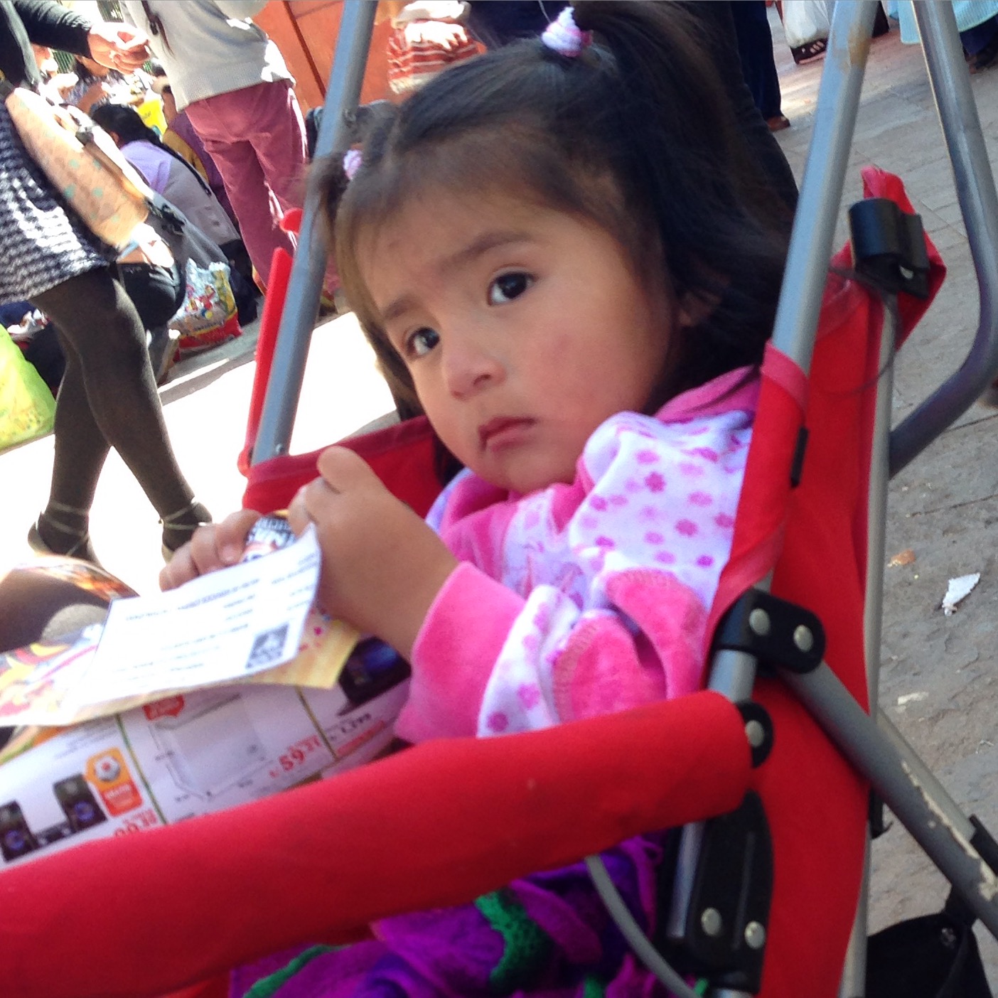
I’m sitting on a bench in the sun by two women eating street food. Janet is exploring the market. An older woman pushes this stroller up to the two women, introduces herself as Liz, and asks them to watch the girl. They agree quite readily. The woman walks off, and I’m thinking she looked too old to be the mom. Janet comes back, and I tell her that I think we are witnessing a child abandonment. I’m trying to think of what to do. Who leaves their child with strangers? Is it common here? I want to stick around, so Janet heads back to market. The women finish their food. They start to fret. They ask the girl, where is your mama? They also randomly shout out the woman’s name, looking around for her. At what seems like the last minute, the woman returns – bearing gifts of gelatin in plastic cups for the two women. Whew!
Cuzco is where we ended our 6 month voyage along the spine of the Andes. The journey began in Bogota where we explored both forks of the Andean spine. South of Cuzco, there is still more of the Andes to be explored as the terrain becomes less glaciated and jagged, leveling out into the altiplano.
This is the map for the entire route discussed in this post. To Export GPX files, click on the three horizontal bars in the upper right hand corner of the map and select Export selected map data…
To see this map in a full screen, click here (opens in new window)