Bikepacking Cuchumatanes, Guatemala, and the Riviera Maya
In Winter 2018/2019, Janet and I designed a route that started in Southern Mexico, traversed Guatemala and Belize, and ended in the tourist resort city of Cancun. A short, but significant part of our route for this 75 day journey was designed by Mark Watson and Hana Black. Here is where they published their route on bikepacking.com: RUTA MAYA DE LOS CUCHUMATANES. The portion that they designed is challenging, very steep and mountainous. It is not easy for folks on single bikes – and definitely demands everything a tandem team can possibly muster. We made some slight changes to the route in order to integrate it with our own plans to see the other half of Guatemala. A main change we have suggested to Mark and Hana is to re-route the GPS track after Concepción Huista – the GPS track takes you up a steep and faint trail that is not rideable. You are on a steep (and barely rideable dirt road) prior to the departures – and that road does go through to where you’re going. It doesn’t show up in the satellite view because it had not been built at the time of Mark and Hana making the route. It’s there now, and Janet chided me for following the GPS track instead of her intuition! Another change we made was the routing to Nebaj via Laguna Magdalena. I believe this is a must-do as it was our favorite part of the route. I’d only do it in the dry season because Mark and Hana ventured into this region during the wet season and were unable to make progress. The rest of this post details our ride in photo captions and a detailed, clickable map at the bottom. As always, message me if you have questions about riding in this excellent bike packing destination!
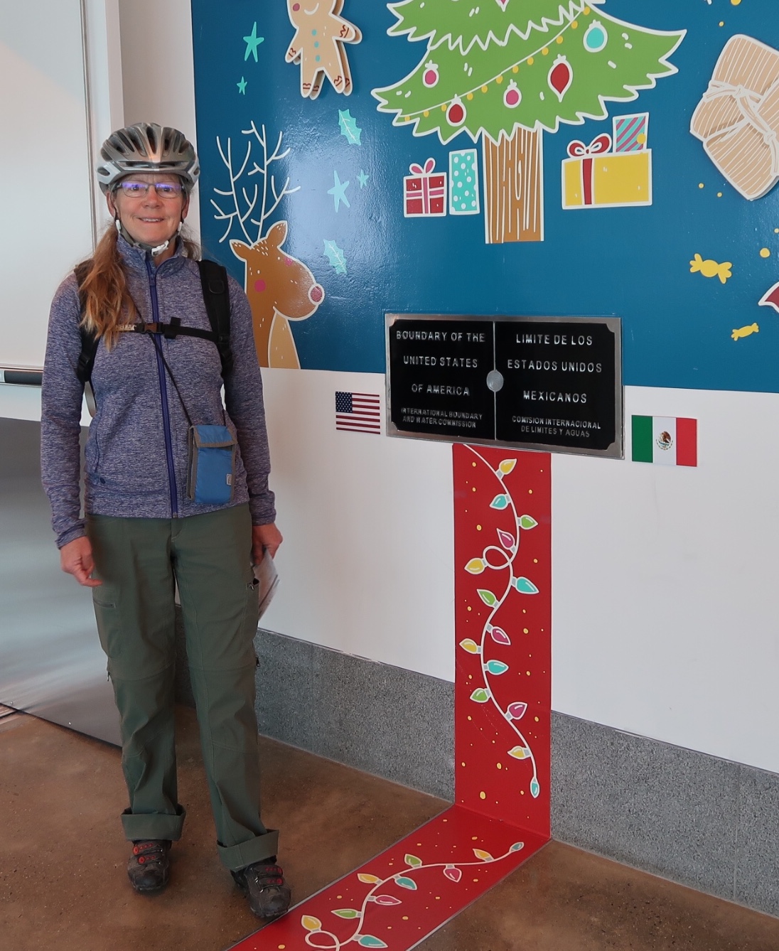
Janet and I discovered a useful way to save money on flights to Mexico: Take a domestic flight inside of Mexico. Because we live relatively close to the border, we drove to the “Skybridge.” It turns out that the Tijuana airport is right on the border of California, and for a $16 fee, you can expedite your entry into the airport without having to deal with surface streets in Tijuana. Moreover, the access to inexpensive flights within Mexico makes up for the border fee. Finally, it is so much easier to fly with the tandem from any country other than the USA. We show up with a plastic wrapped tandem and they don’t bat an eyelash!
I understand that not everyone likes zoos – but if you do, the Mexico City Zoo is a 1 or 2 day visit. And it is free entry.
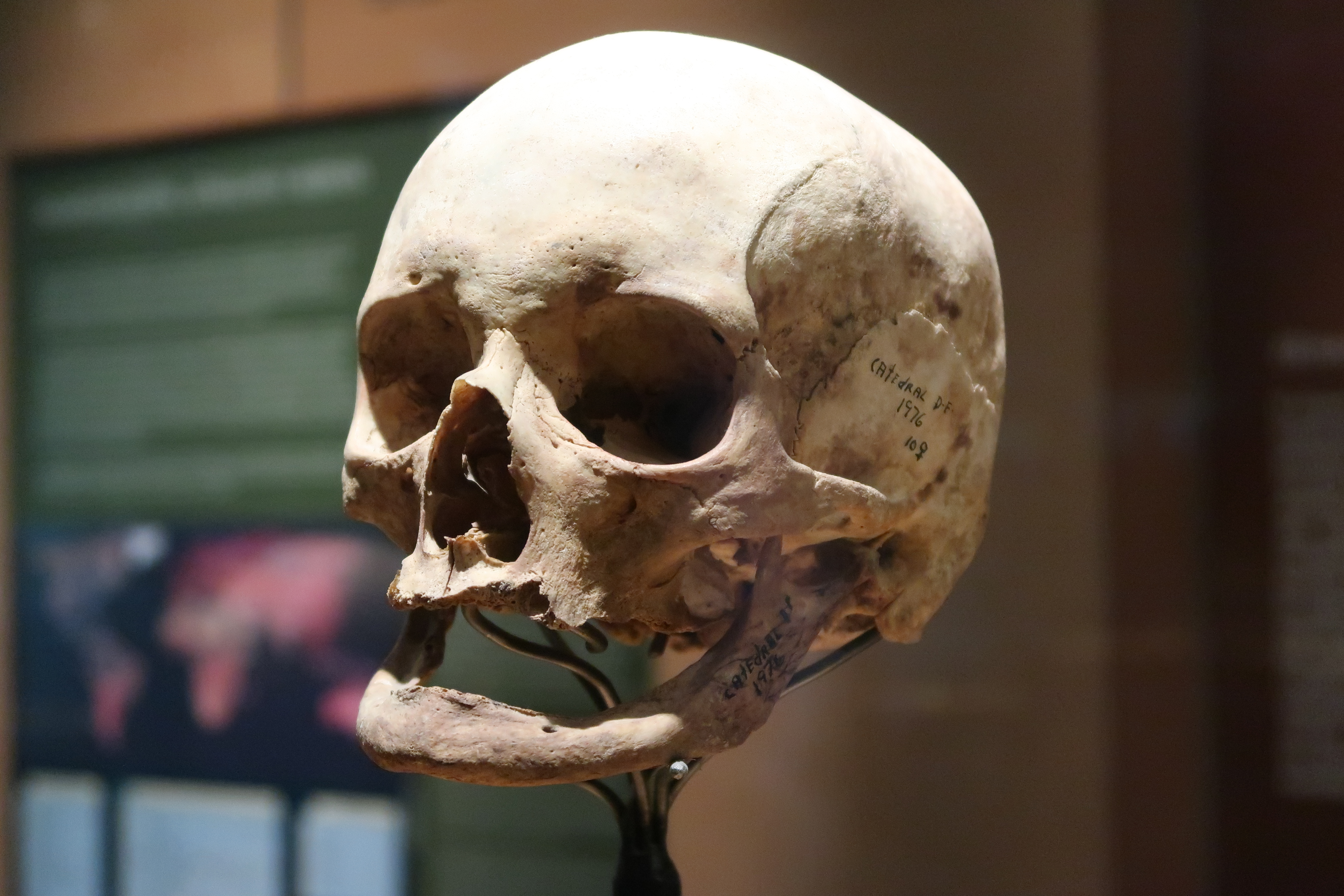
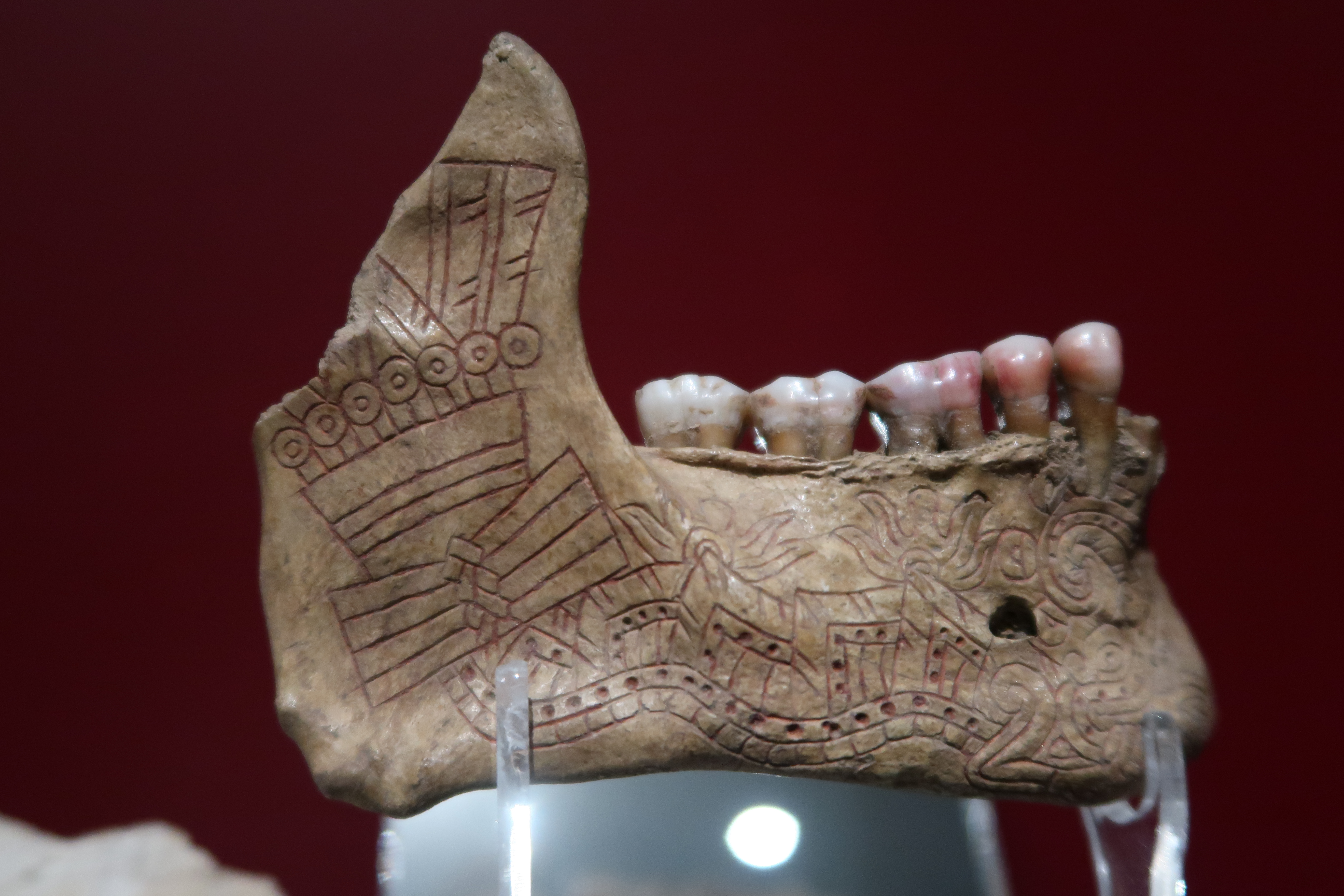
Prior to our bike packing trip in Guatemala, Belize and Mexico, we visited the anthropology museum in Mexico City. This is an ALL day event – in fact, you could spend 2 days in this museum. We were exhausted afterward – but so glad we visited.
Prior to our bike packing trip in Guatemala, Belize and Mexico, we visited the Frida Kahlo museum (her former home) in Mexico City.
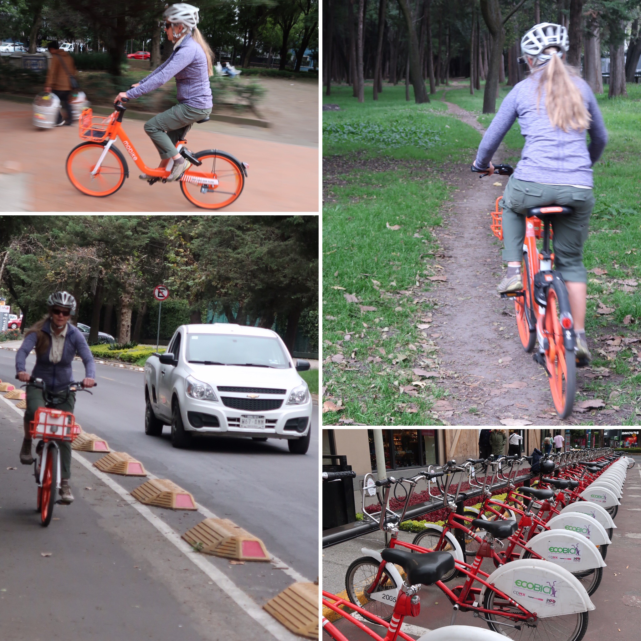
In Mexico City, prior to our bike packing trip, we rented MoBikes. This company has bikes available in many cities around the world. In Mexico city, you are fairly limited as to where you’re allowed to ride them (due to theft of the bicycles in certain parts). We worked out some ways around that and their time limits (by swapping bikes between the two of us every 59 minutes). One word of warning: if you ever encounter MoBike and decide to rent from them, the app’s default setting is to bill you monthly for the bikes. Unless you plan on using the bikes long term, make sure you change this setting to one-time billing. MoBike was impossible for me to contact, so I had to reverse the charges by calling my credit card.
Scene from along the route taken from El Quetzal towards San Cristobal Cucho. (For location, see clickable map at the bottom of this page for our route taken on December 5, 2018).
Along the super steep climb from El Quetzal. We had to walk most of this section, but it was very rewarding because we met a lot of people who wondered what the heck we were doing out here. (For location, see clickable map of our route taken on December 5, 2018).
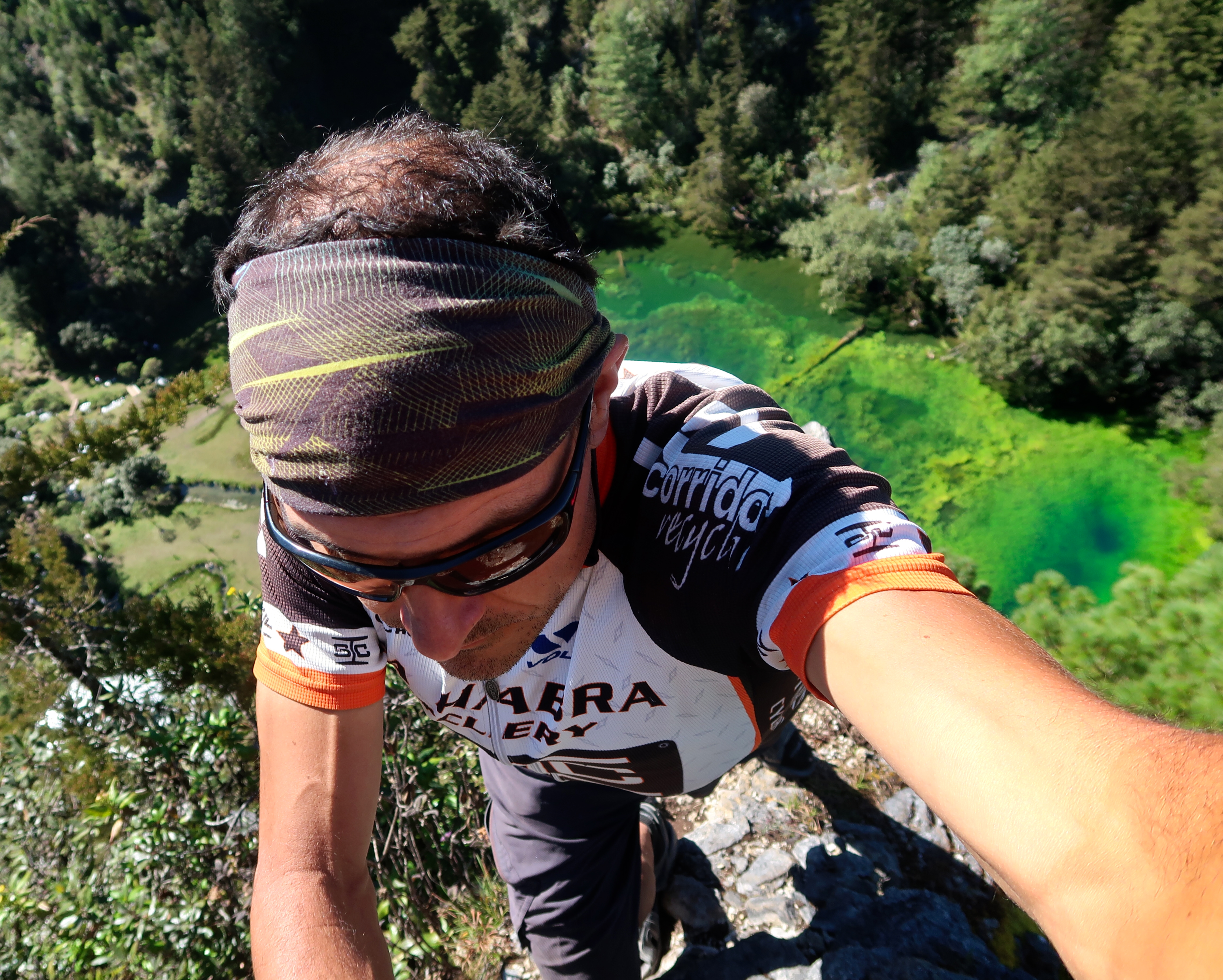
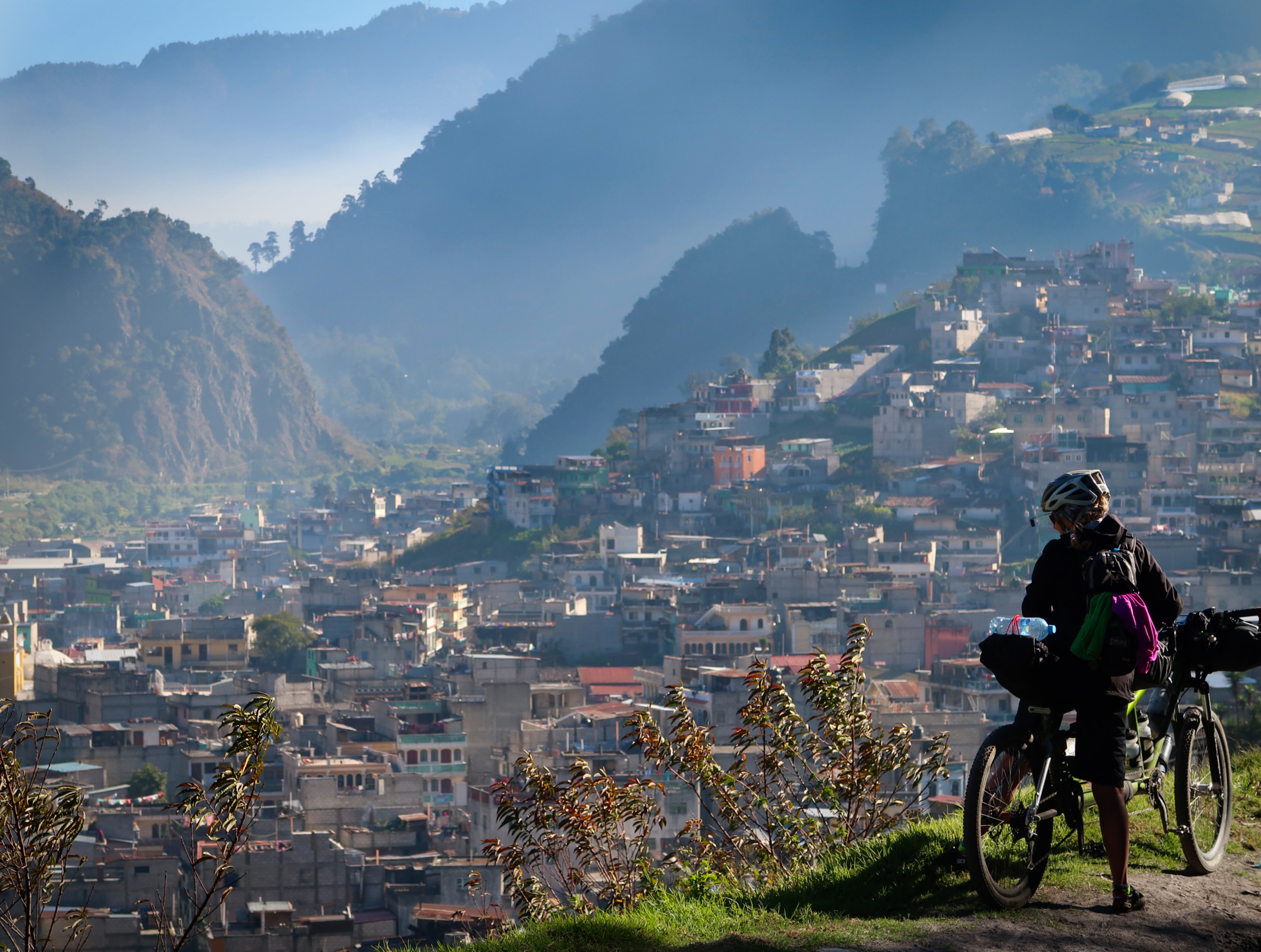
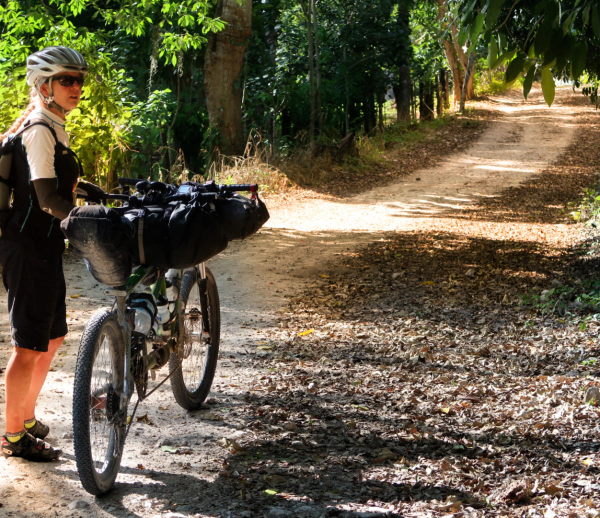
I had been seeking a new route to Quetzaltenango from Tapachula. Over the years, I had already ridden into Quetzaltenango on all of the arterial roads that go into the city. Now that we are touring on a full suspension bike, it opened the possibility of a more creative and adventuresome route. There was no information online about anyone having ever ridden what we did from El Quetzal towards Concepción Chiquirichapa. I did find one person on Strava who had ridden between El Quetzal and San Marcos – but when I wrote him, he discouraged me from trying it. I studied the satellite imagery, and put together an unmapped route that ended up being extremely difficult and steep – but worth it! We only saw a few TukTuks and a couple of trucks the whole day. Otherwise, most of the traffic was just people walking. Interestingly, locals told us that the route did not go through – and one person even chased us down to warn us that it was impossible. Nevertheless, the route did indeed go through and avoided busy roads for a long time. (For location, see clickable map of our route taken on December 4th and 5th, 2018).
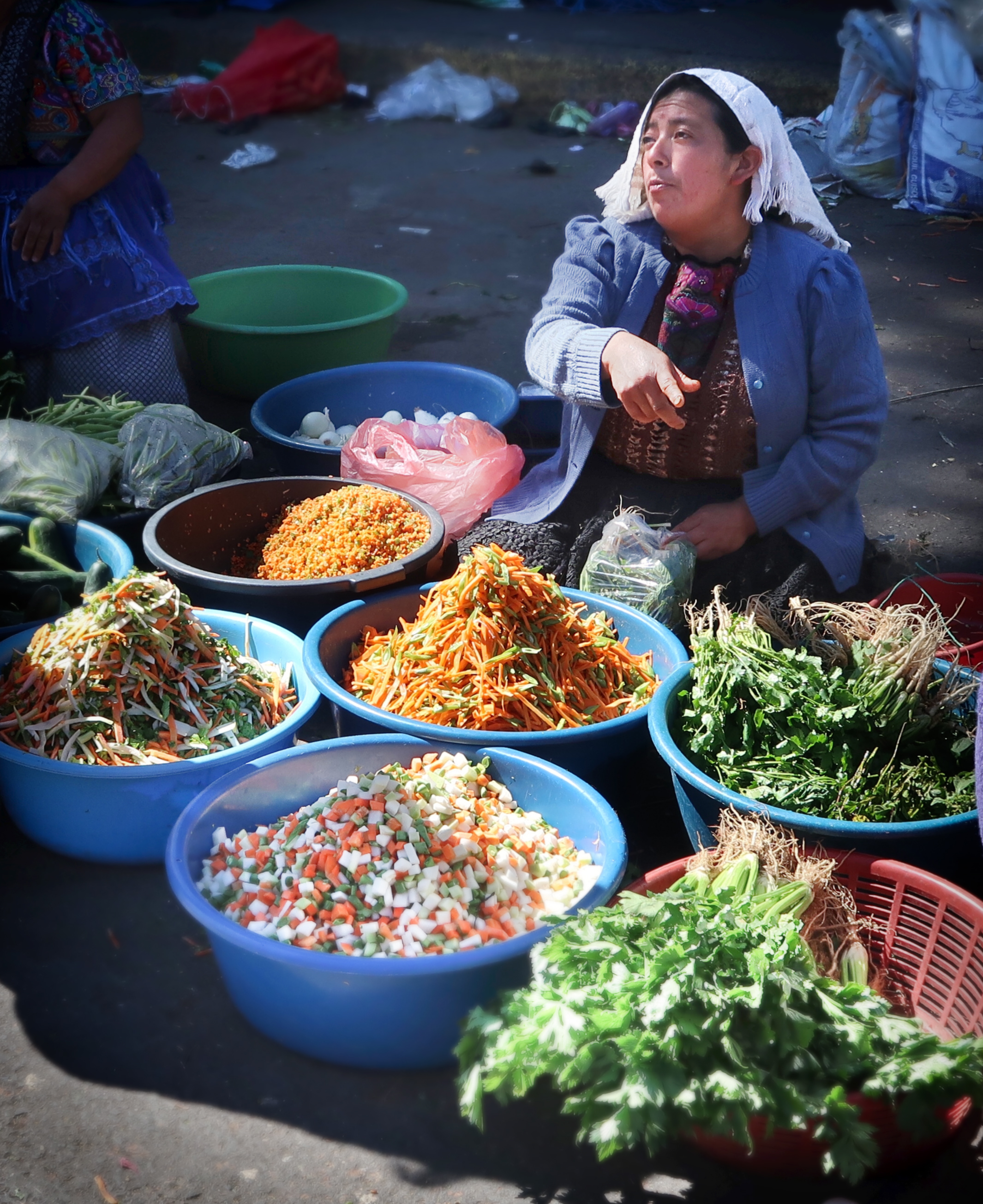
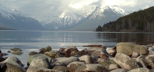
The markets in Guatemala are always a colorful sight.
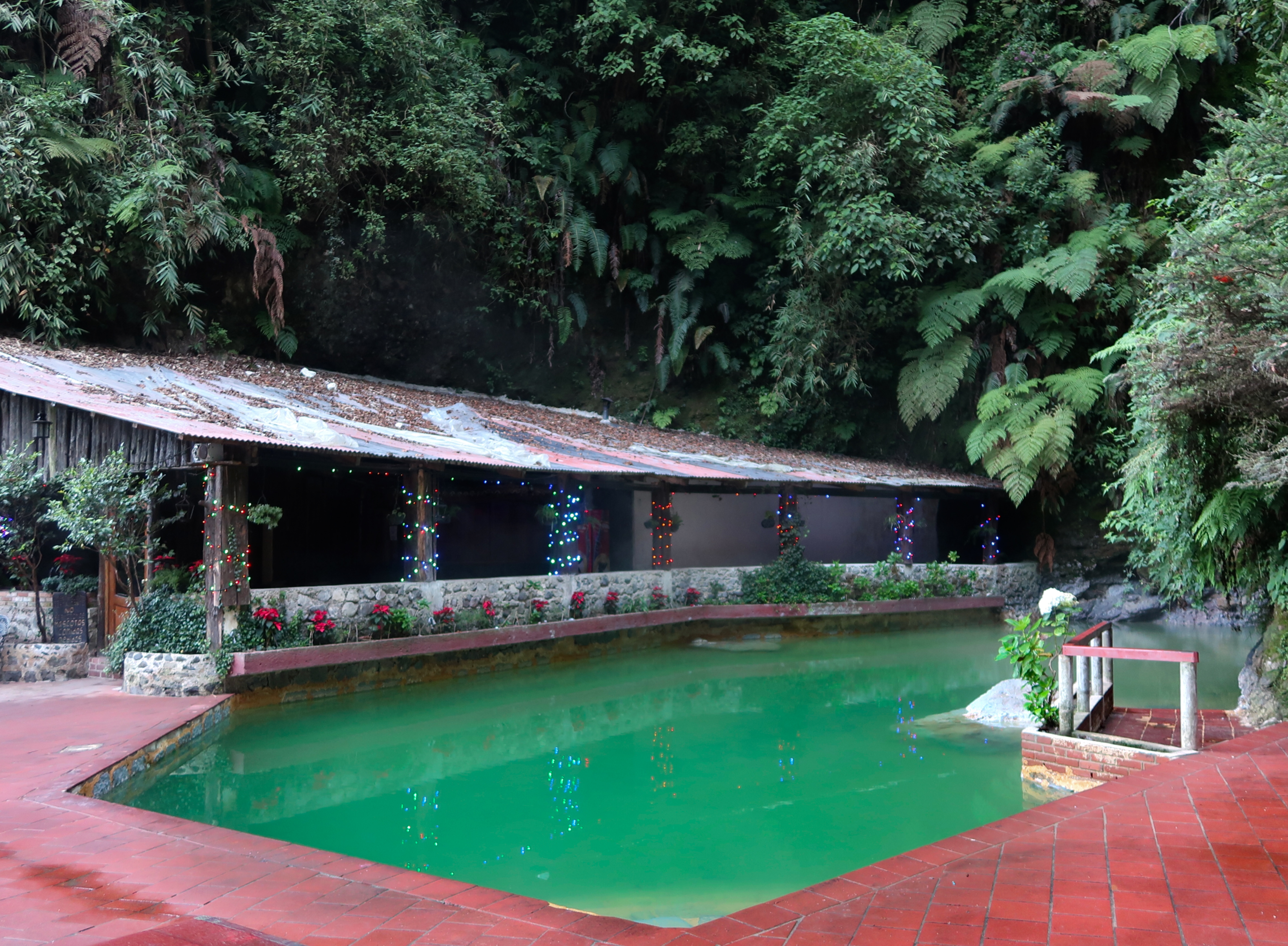
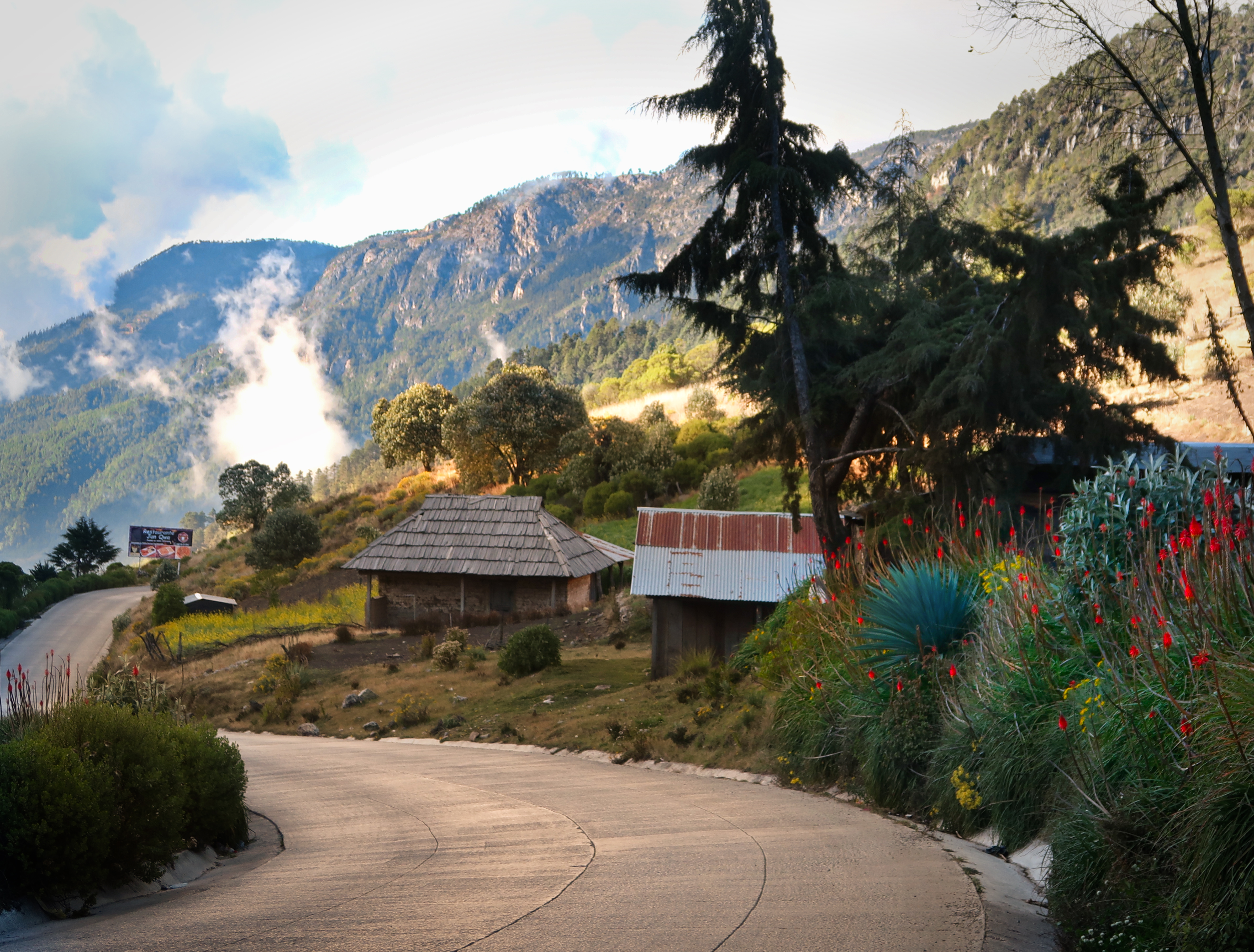
Fuentes Georginas: We have blogged about these hot springs in the past – and historically this is one of my favorites in the world. Unfortunately, on this visit, things were a little different: the water wasn’t very hot, and it wasn’t perfectly clear as it had been in the past. I wonder if there is a geological explanation for this? Anyway, it is still a pretty nice place to visit. (For location, see clickable map of our route taken on December 22, 2018).
Utz Ipetik. This waterfall is not on the official route guide for the Cuchumatanes route, but we noticed a little sign as we were passing just after Momostenango and decided to hike down. It was a worthy deviation from the route! I also added it to Open Street Map. (For location, see clickable map at the bottom of this page for our route taken on December 23, 2018).
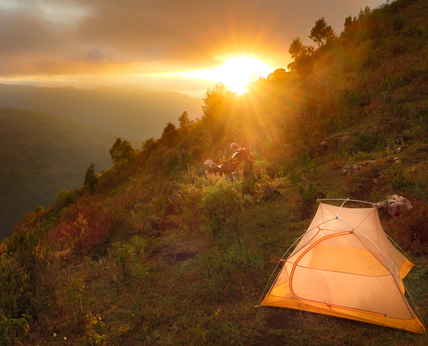
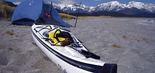
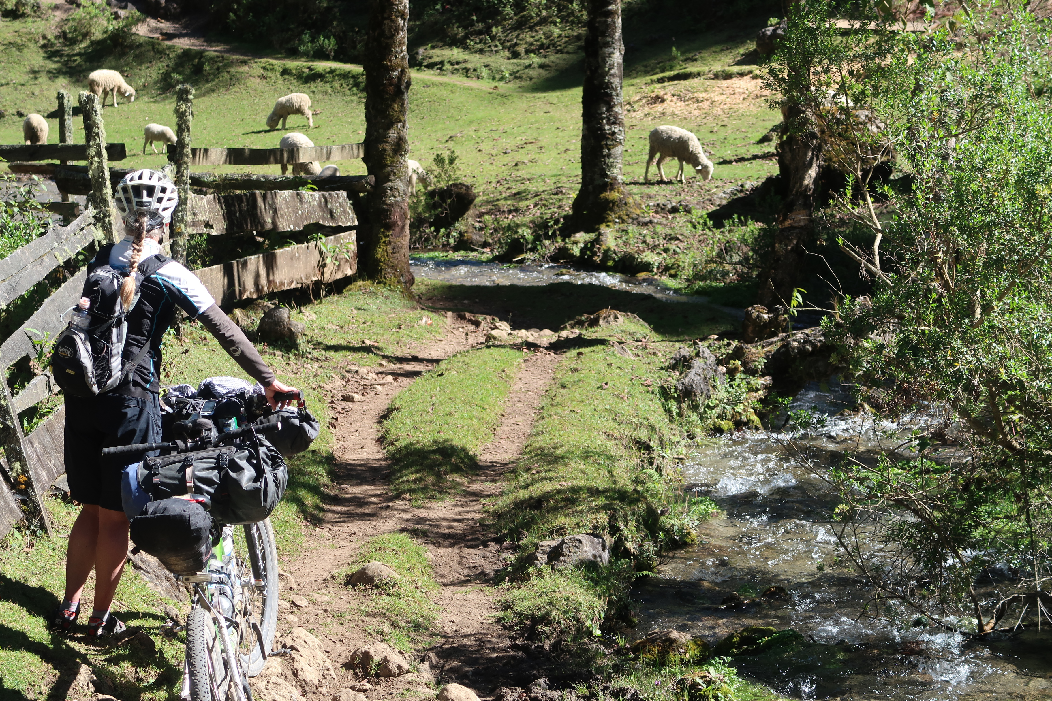
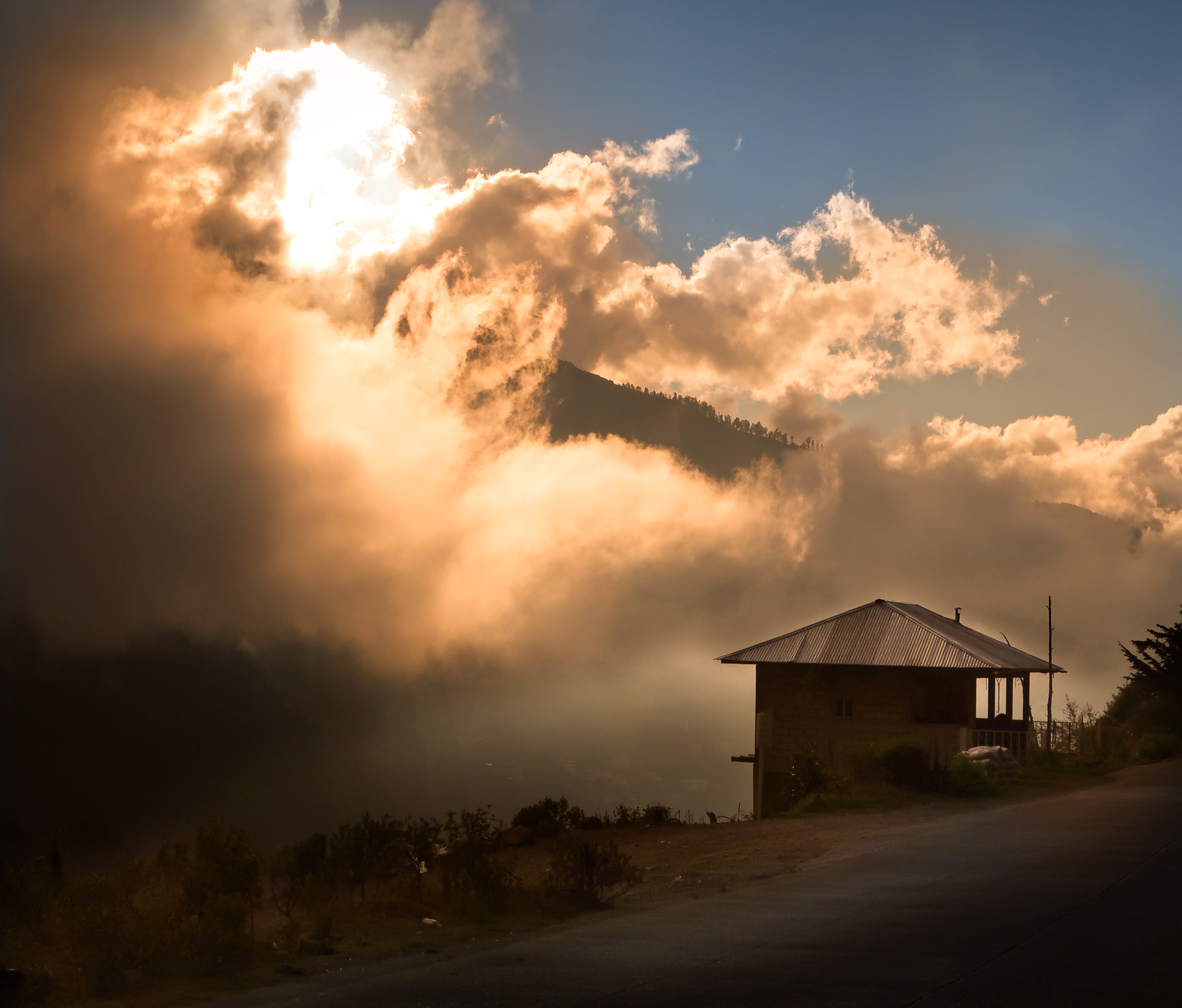
Camping along the Cuchumatanes
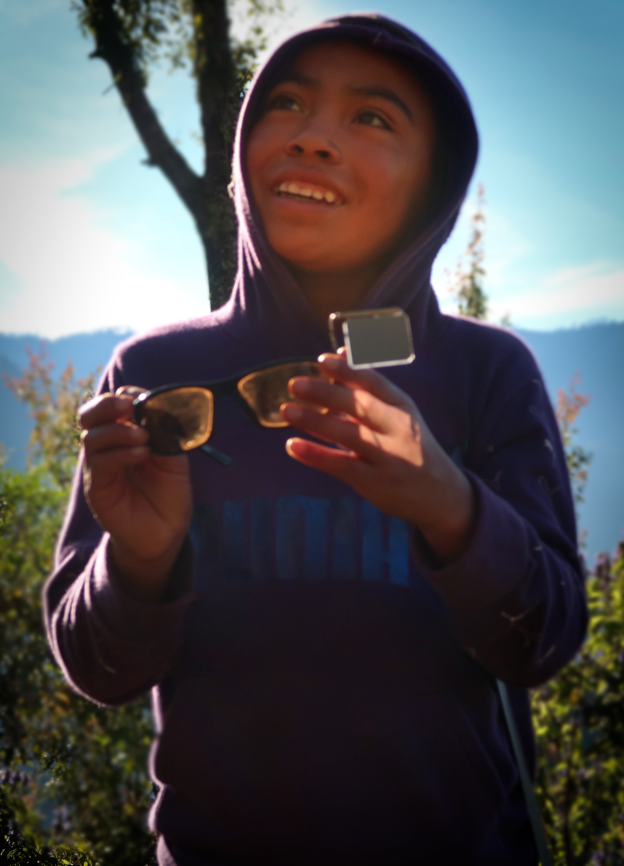
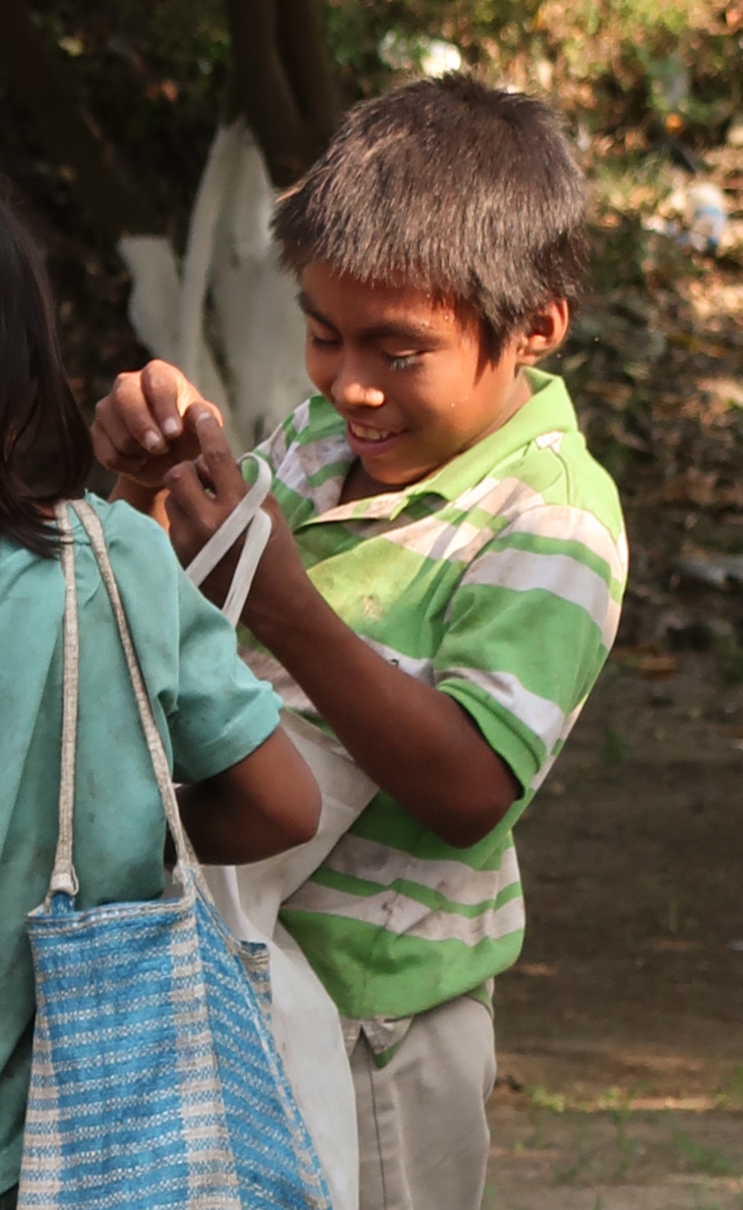
We met this friendly and inquisitive kid named Abel when we camped at a dirt switchback in the road that happened to be near his home. He came and visited us in the morning and showed us all of the music he had in his flip phone. His phone card was unpaid so he could not make calls or send texts – but he could receive them. Periodically while we were in Guatemala, I’d send him short messages even though he couldn’t write back.
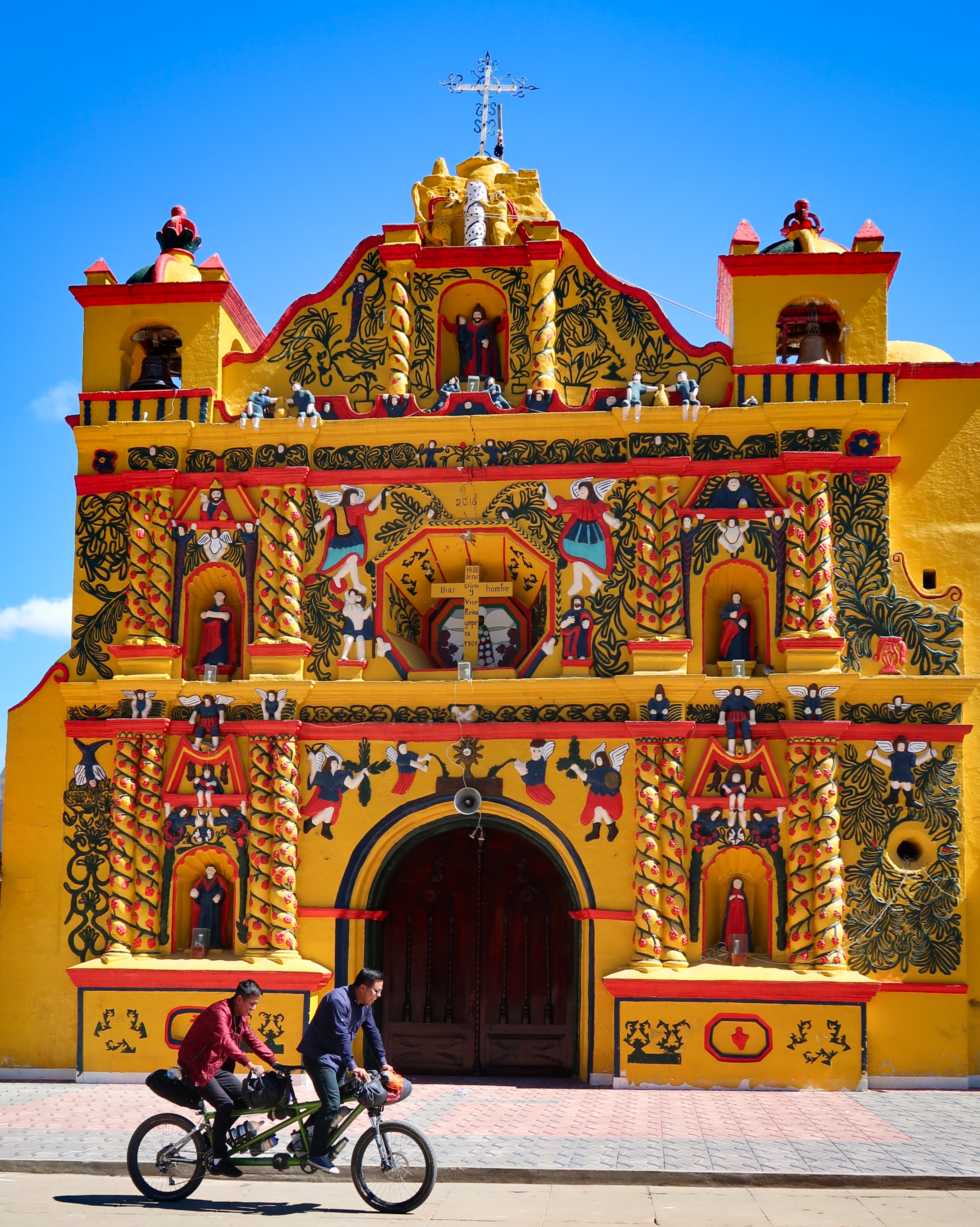
Iglesia del Calvario at San Andrés Xecul. This is the keystone photo for the Cuchumatanes route.
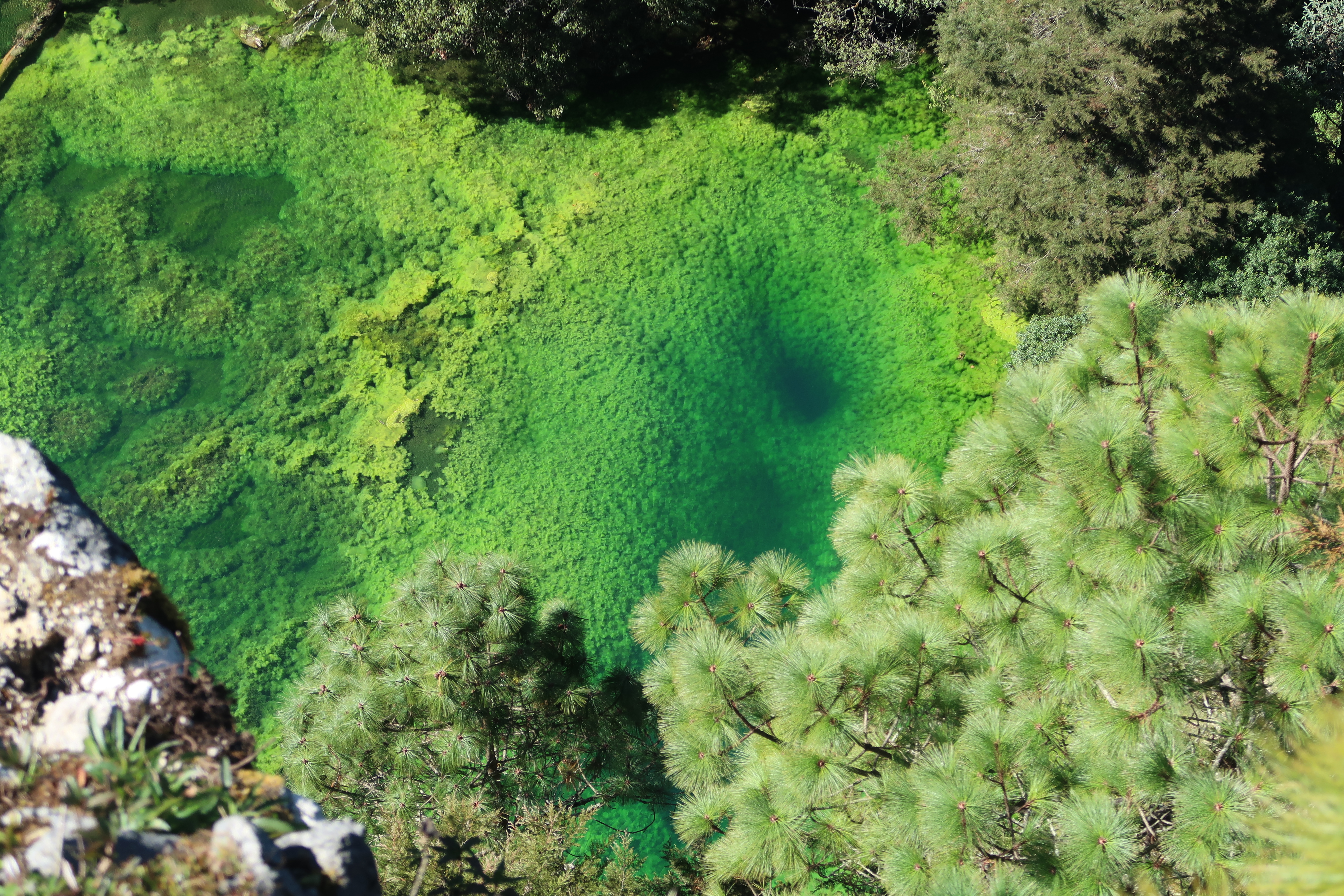
View from the climb above Cascada Laguna Magdalena (For location, see clickable map of our route taken on January 1, 2019).
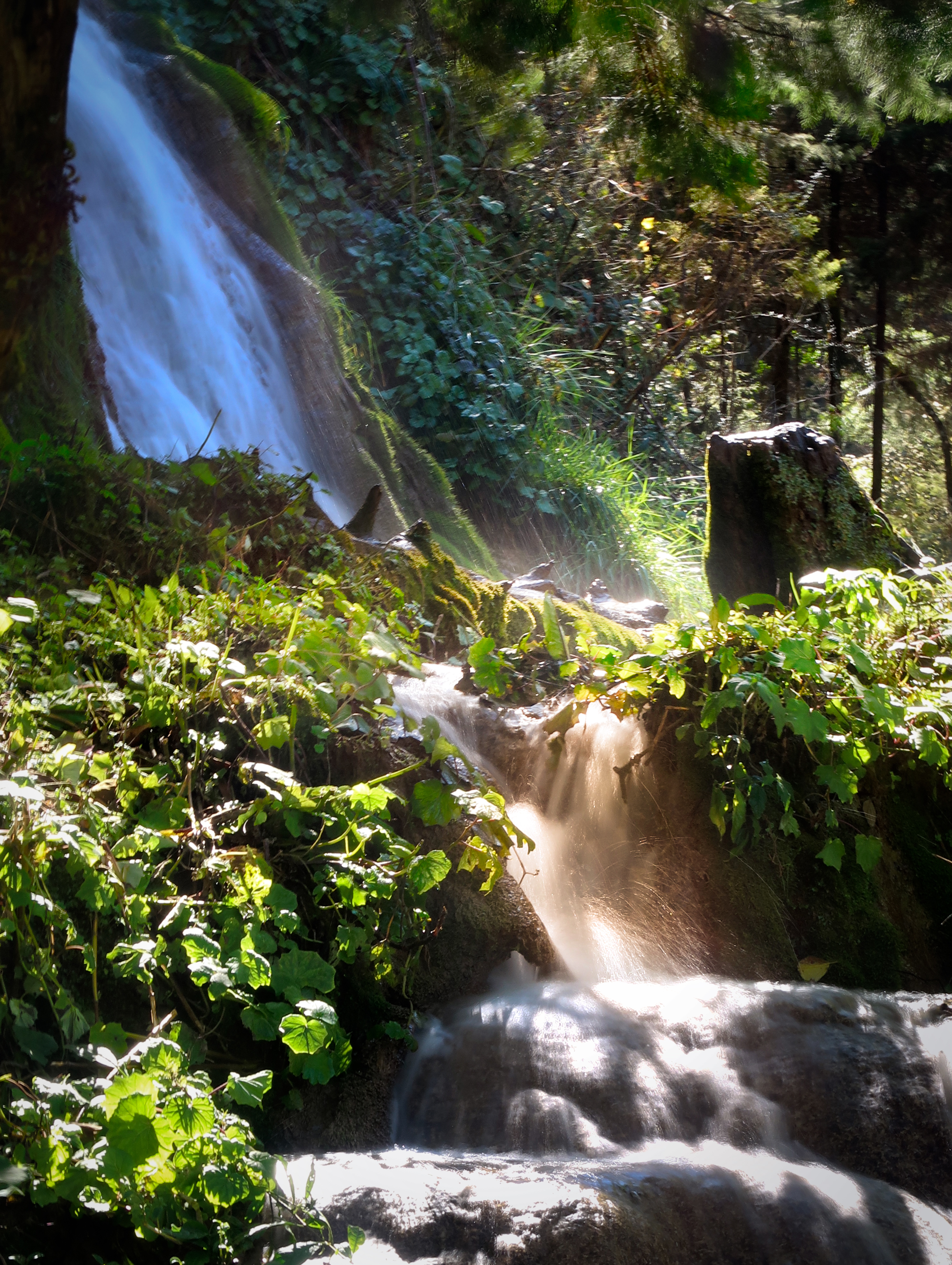
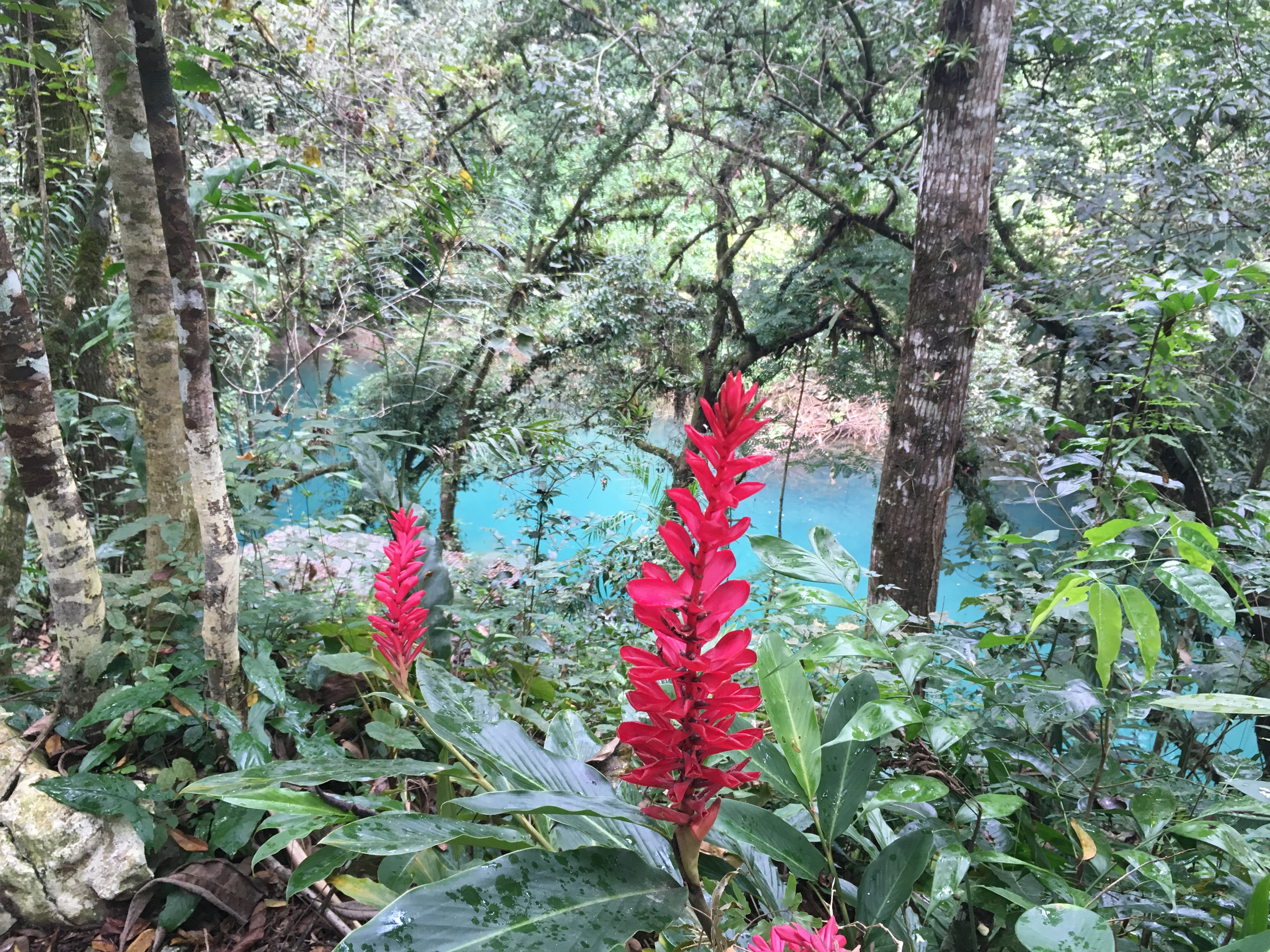
Laguna Magdalena provides so much scenery: waterfalls (as seen here) as well as a crystalline laguna. It is definitely worth a visit! (For location, see clickable map of our route taken on January 1, 2019).
View from the climb above Cascada Laguna Magdalena (For location, see clickable map of our route taken on January 1, 2019).
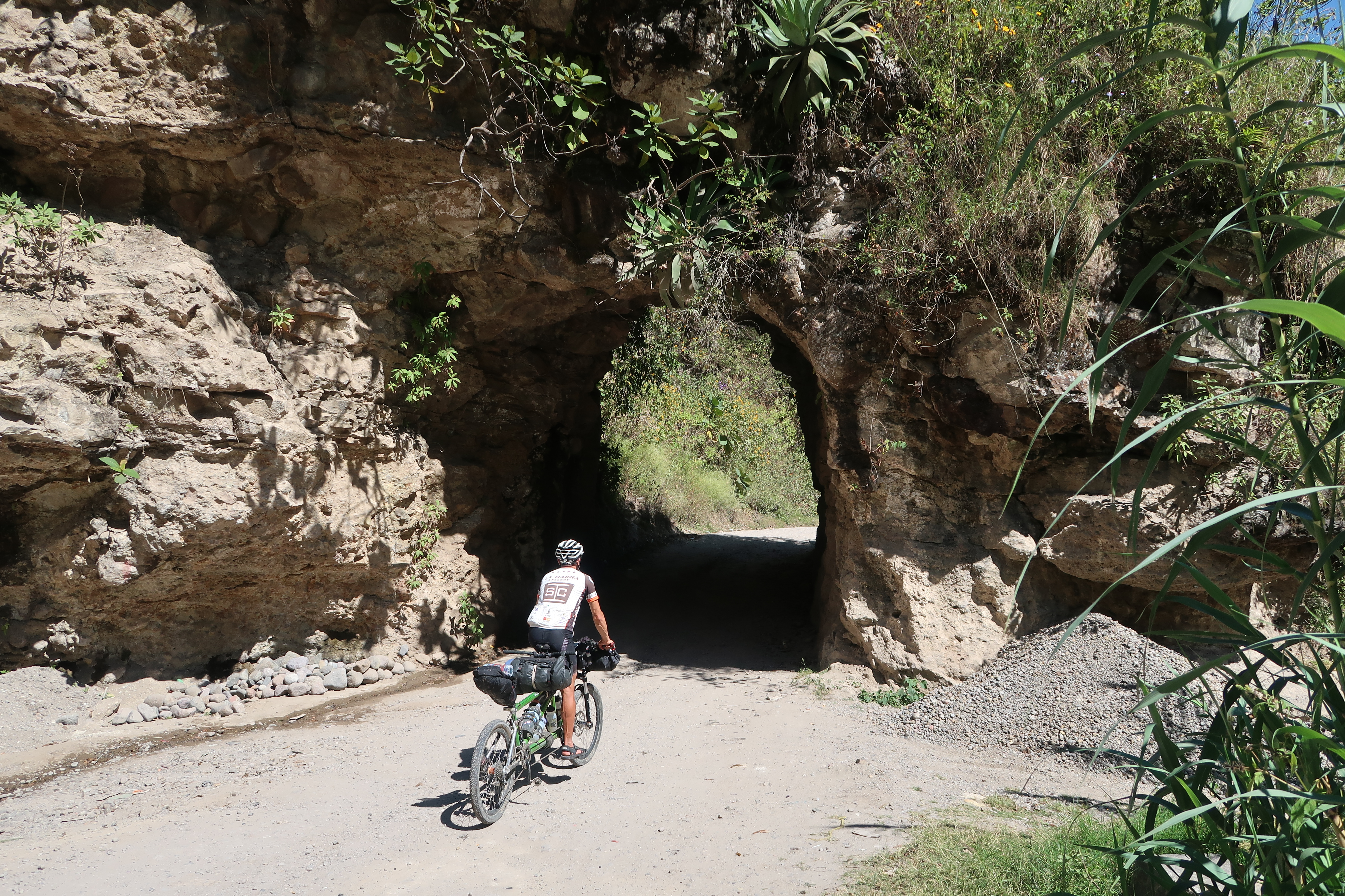
Along the Cuchumatanes route. The climbs and descents on this route were very difficult! (For location, see clickable map at the bottom of this page for our route taken on December 26, 2018).
We modified Hana and Mark’s Cuchamatanes route to include a trip to Laguna Magdalena. We are really glad we did! Hana and Mark also had tried to get into the area, but they experienced a ton of mud because they were there in the wet season. If you’re there in the dry season, we recommend following our route instead for a visit to Laguna Magdalena! (For location, see clickable map at the bottom of this page for our route taken on January 1, 2019).
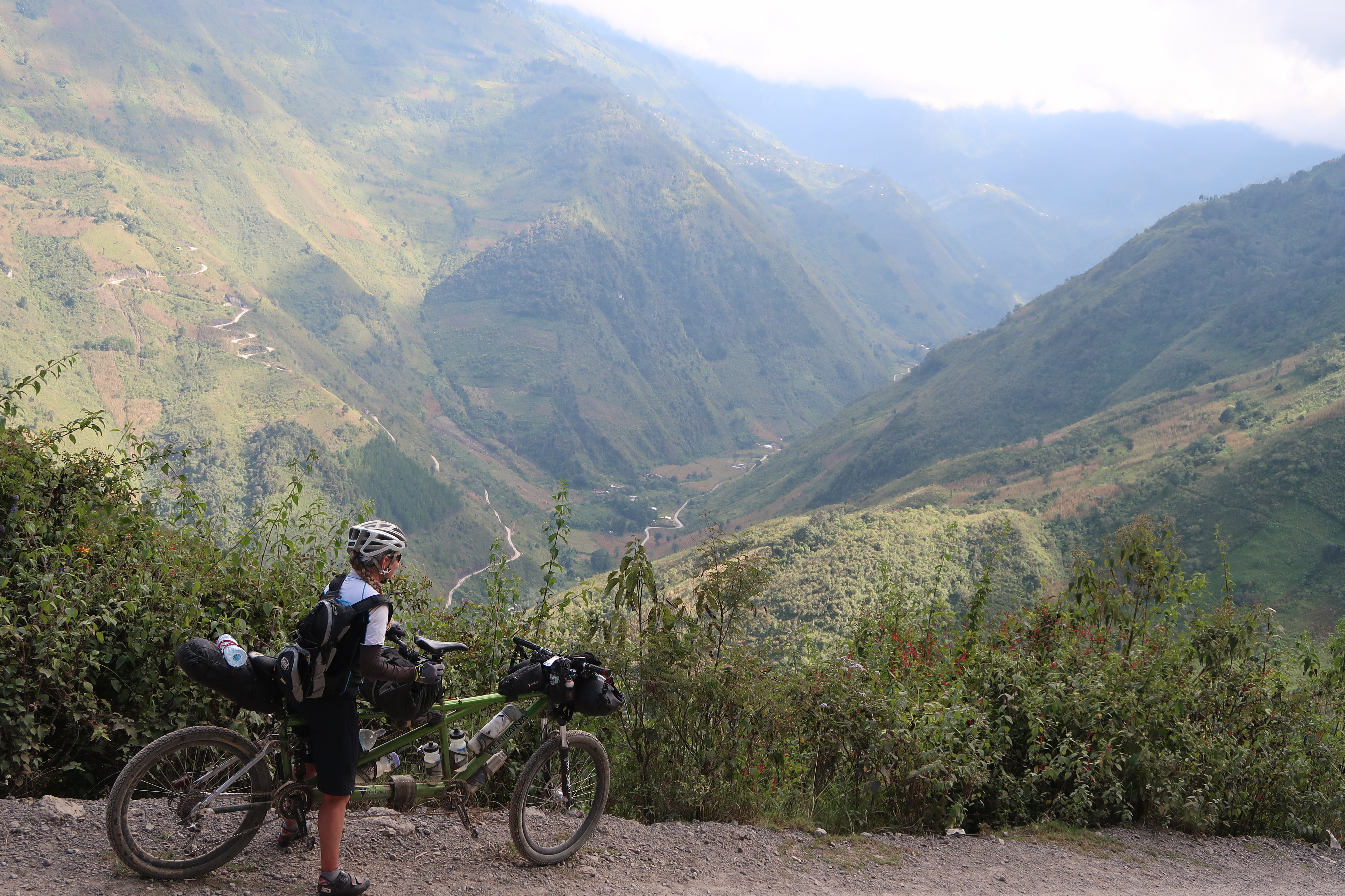
On the way down into Todos Santos Cuchumatan, we saw some of the best scenery of the Cuchumatanes route. (For location, see clickable map at the bottom of this page for our route taken on December 25, 2018).
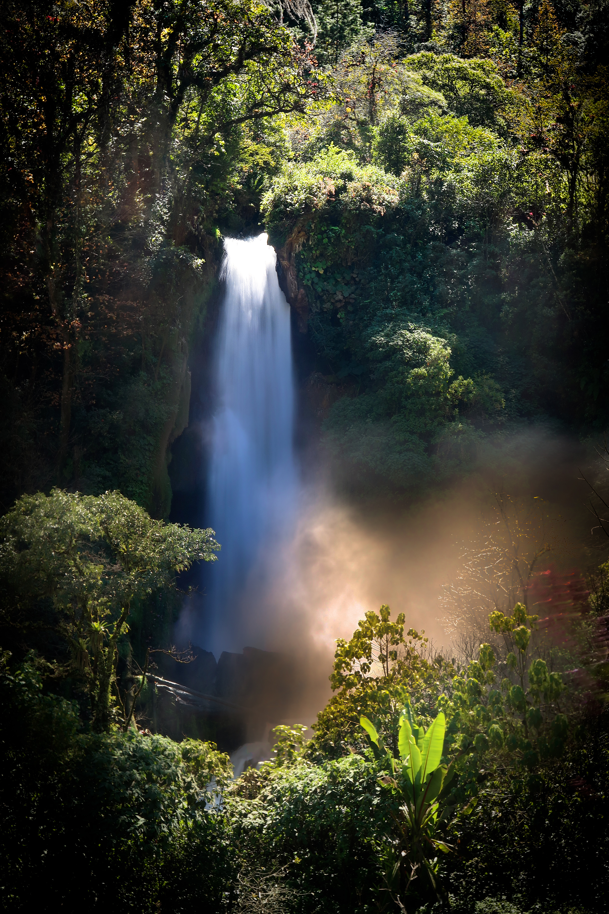
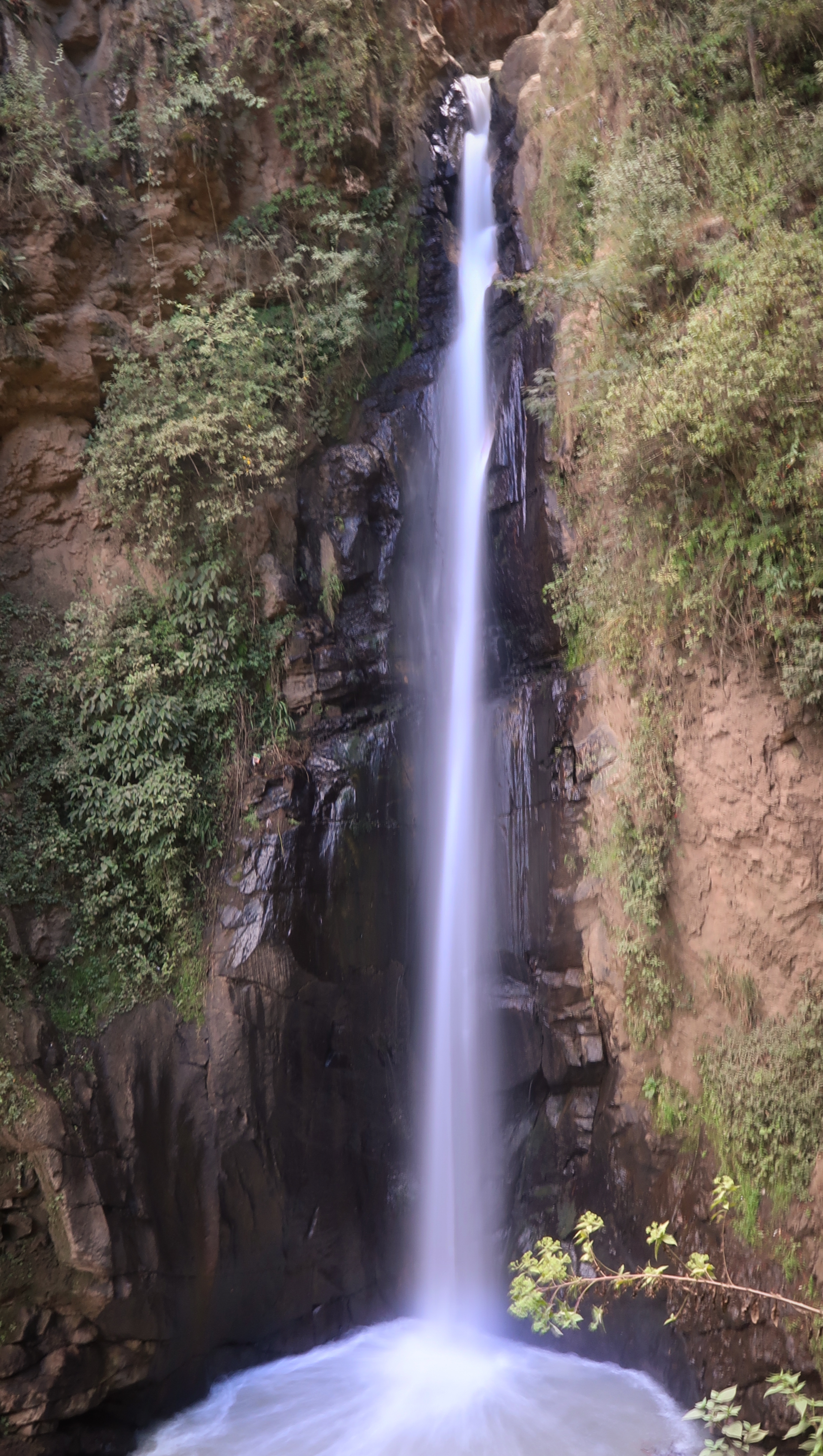
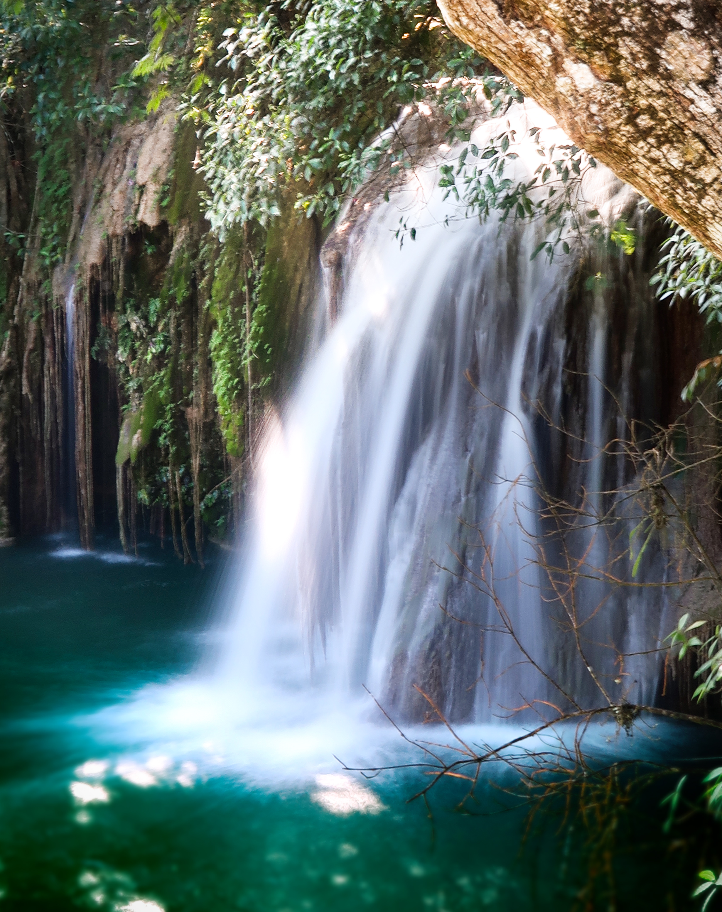
I saw this waterfall on Open Street Map and decided to make it into a destination. We had no idea what it would look like, as it had not been documented online yet. I was very pleased with the powerful rush and spray of the water! Only one negative was that there was the faint smell of aerosolized sewage in the air – probably due to poor sewage disposal upriver. (For location, see clickable map at the bottom of this page for our route taken on January 2, 2019).
On the way down into Todos Santos Cuchumatan, we saw some of the best scenery of the Cuchumatanes route. (For location, see clickable map at the bottom of this page for our route taken on December 25, 2018).
This is one of Janet’s favorite photo stops, so I decided to replicate a photo she had taken a few years ago. It is overlooking the town of Zunil. (For location, see clickable map at the bottom of this page for our route taken on December 23, 2018).
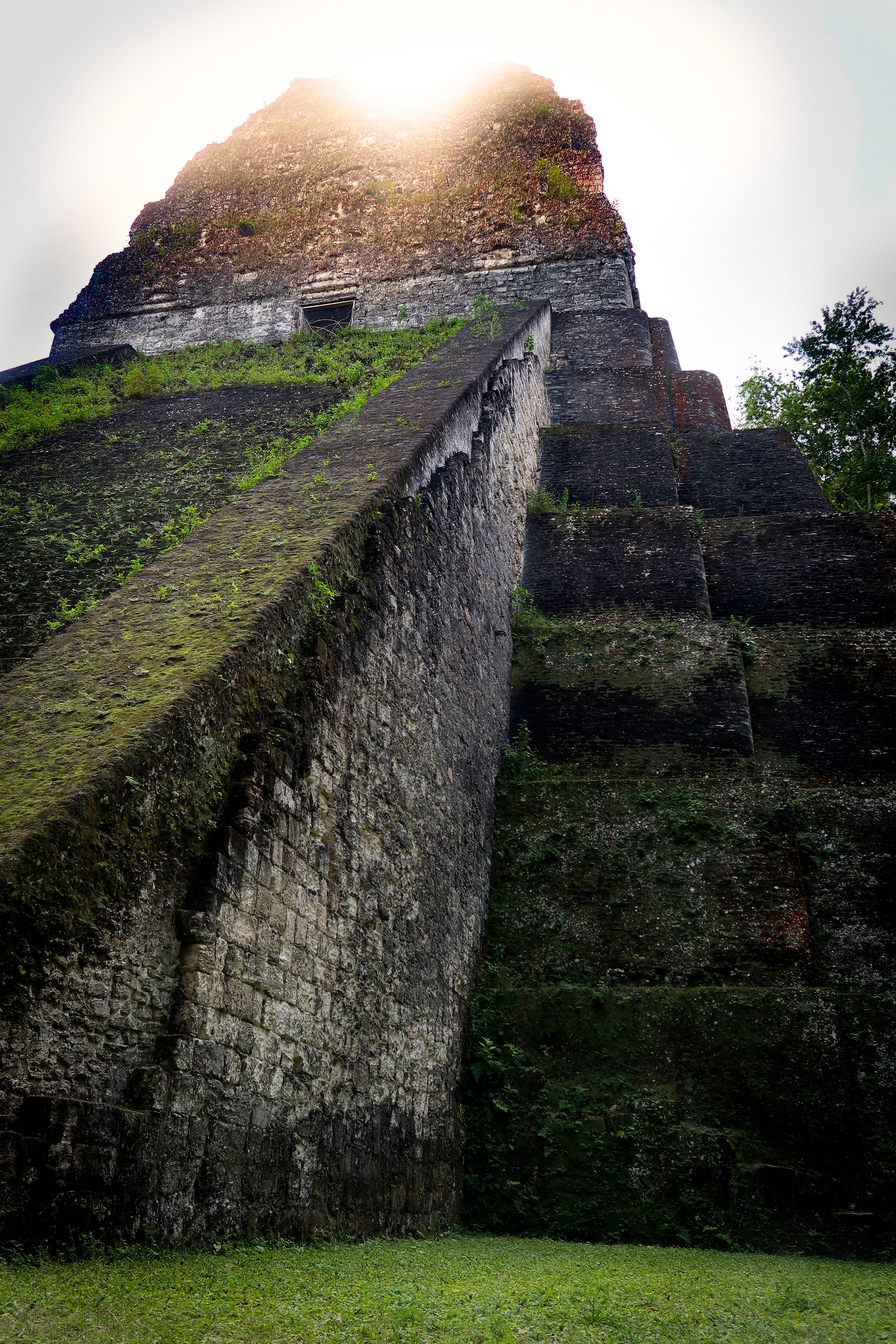
This temple in Tikal had not been uncovered yet the last time I was here (20 years ago).
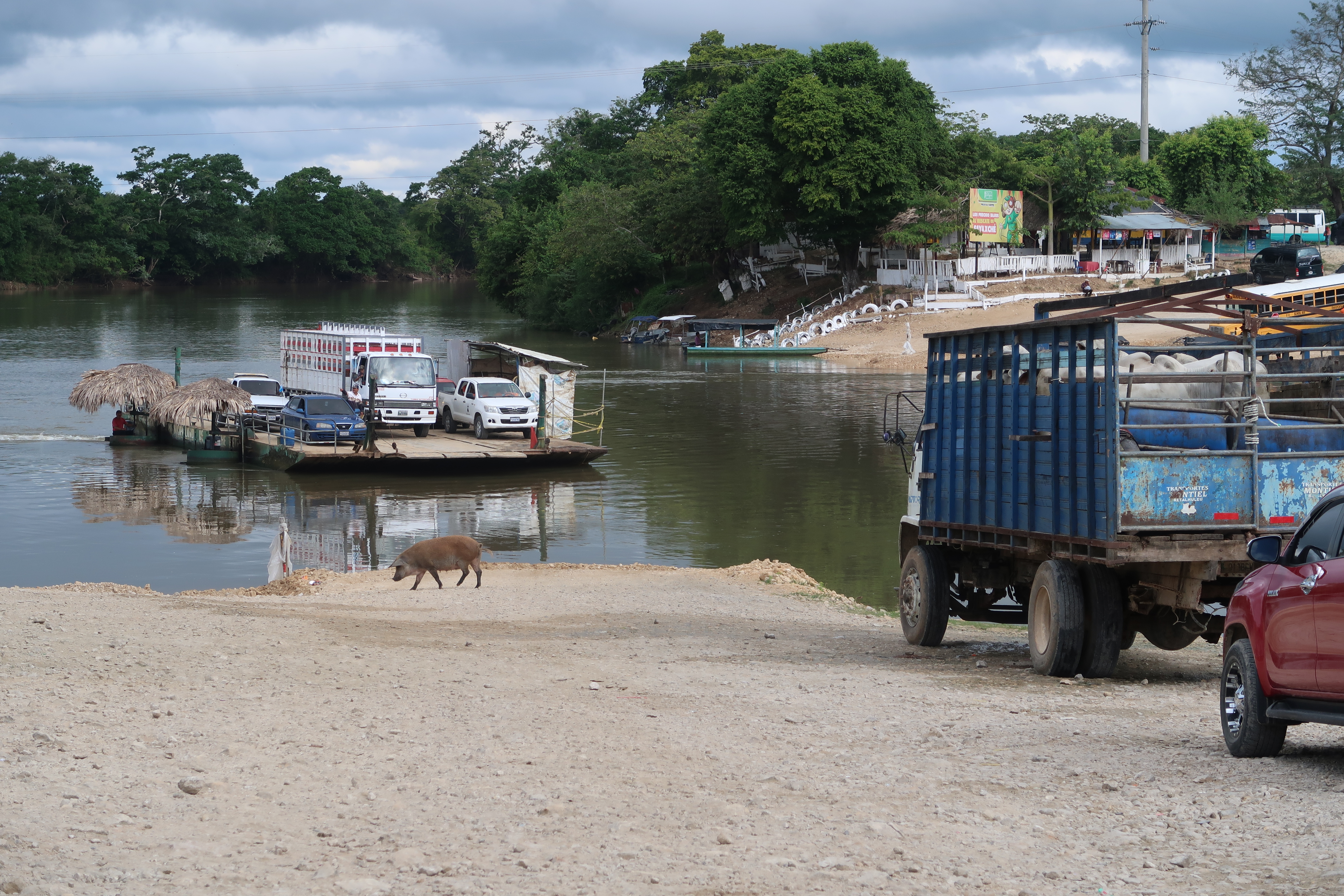
Crossing the Rio de la Pasion. (For location, see clickable map at the bottom of this page for our route taken on January 9, 2019).
This little deviation to Cataratas de Mopan is from an excellent bike packing dirt road (PET-06) is worth it if you’re a waterfall lover. We paid a very small entrance fee just to see the waterfall – but there are rope swings and zip lines if you’re into that. No one was there when we visited. It is in a very remote location near a village called “Calzada Mopan” (which I also really liked and they even had an unsigned and very basic hotel). (For location, see clickable map at the bottom of this page for our route taken on January 17, 2019).
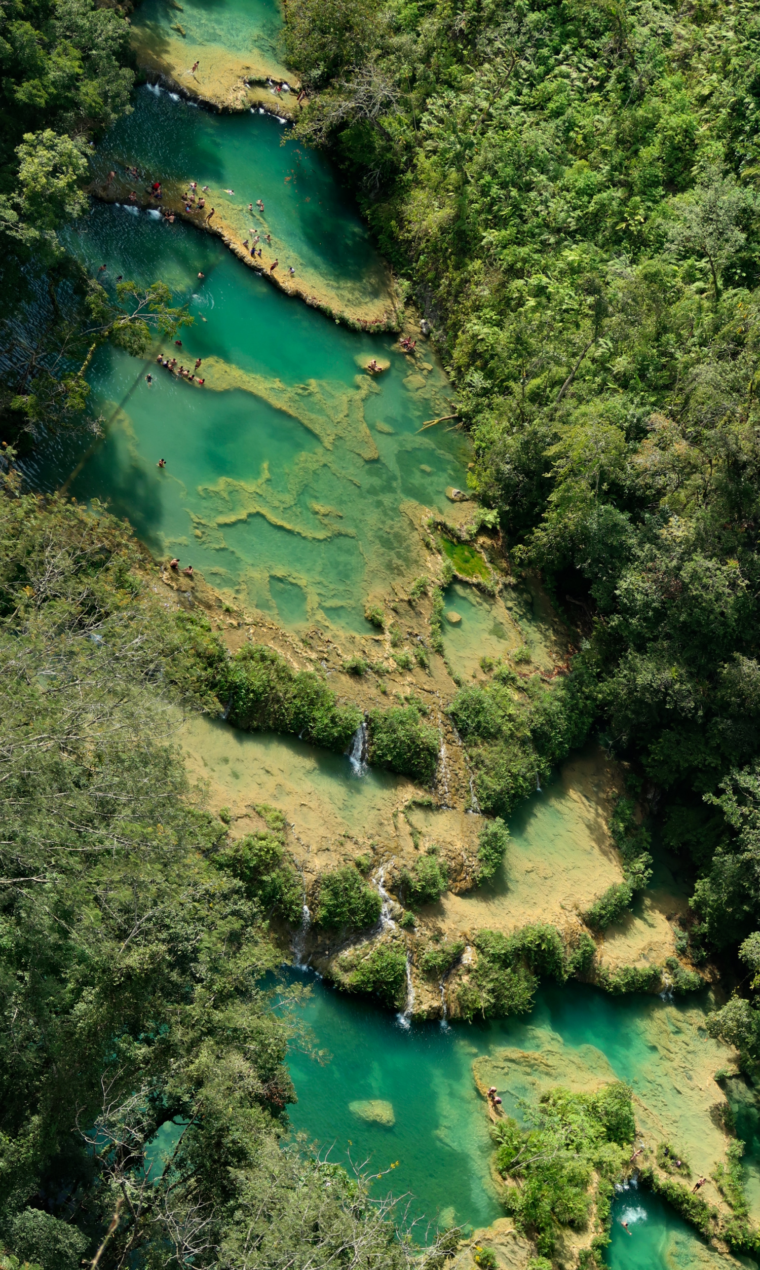
If you search the internet for “Where to go in Guatemala” probably the first thing that will pop up is Semuc Champey. I always fall into the trap of FOMO (fear of missing out) and plot courses to visit some of the popular places as well – and then I always find myself feeling disappointed at the crowds, higher prices, and relative equivalence of the special place. In other words: Semuc Champey is beautiful – but there are plenty of less crowded locations along this same river that are just as beautiful – without the cost or crowds! Therefore, I’m not sure I would recommend the effort to get out there unless you have a severe case of FOMO. (For location, see clickable map at the bottom of this page for our route taken on January 6, 2019).
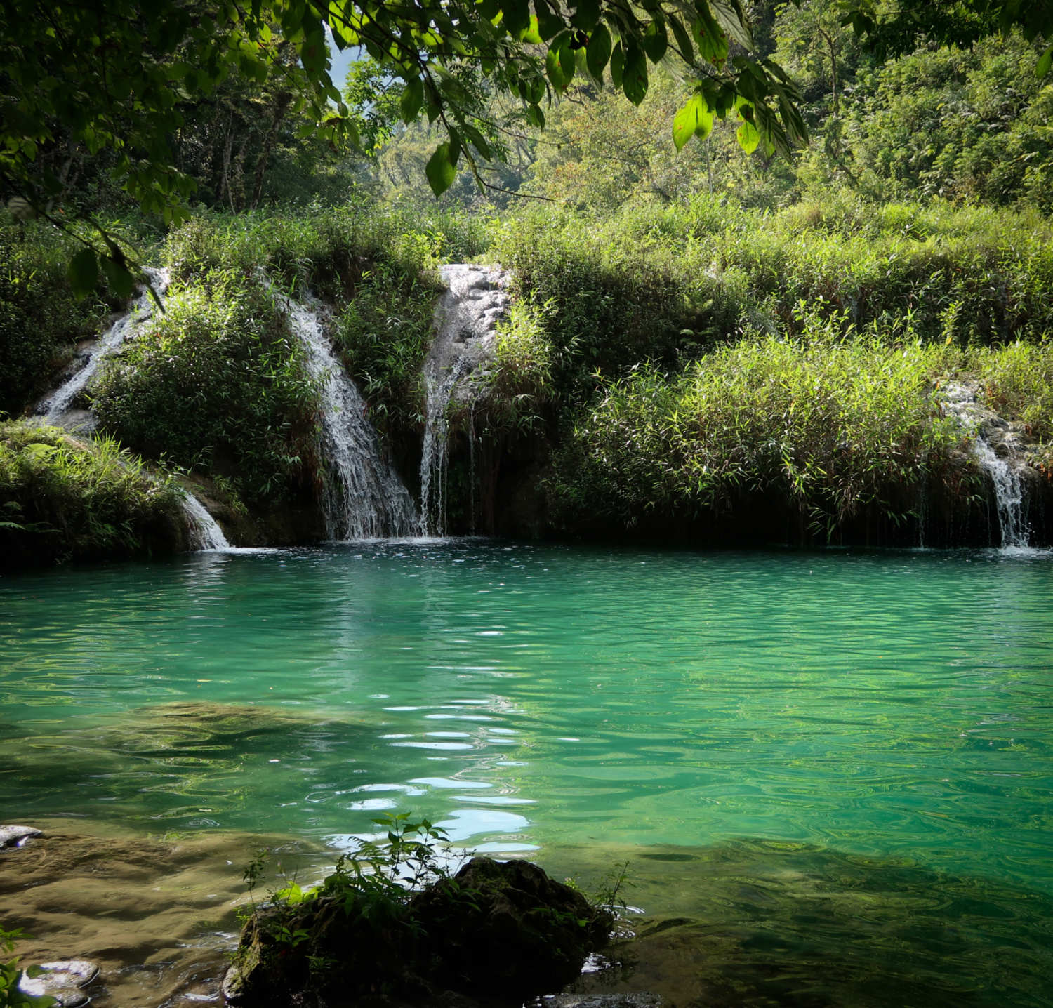
Semuc Champey
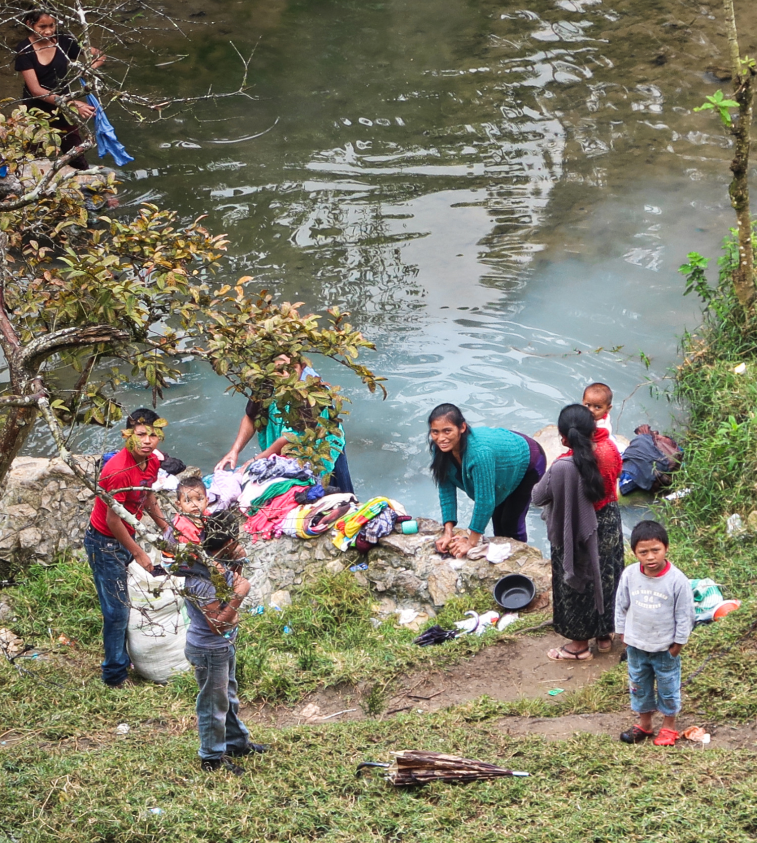
Even though we move towards more environmentally friendly practices around the world, it is still common to see people washing their clothes (or themselves) in rivers of Guatemala as a regular practice.
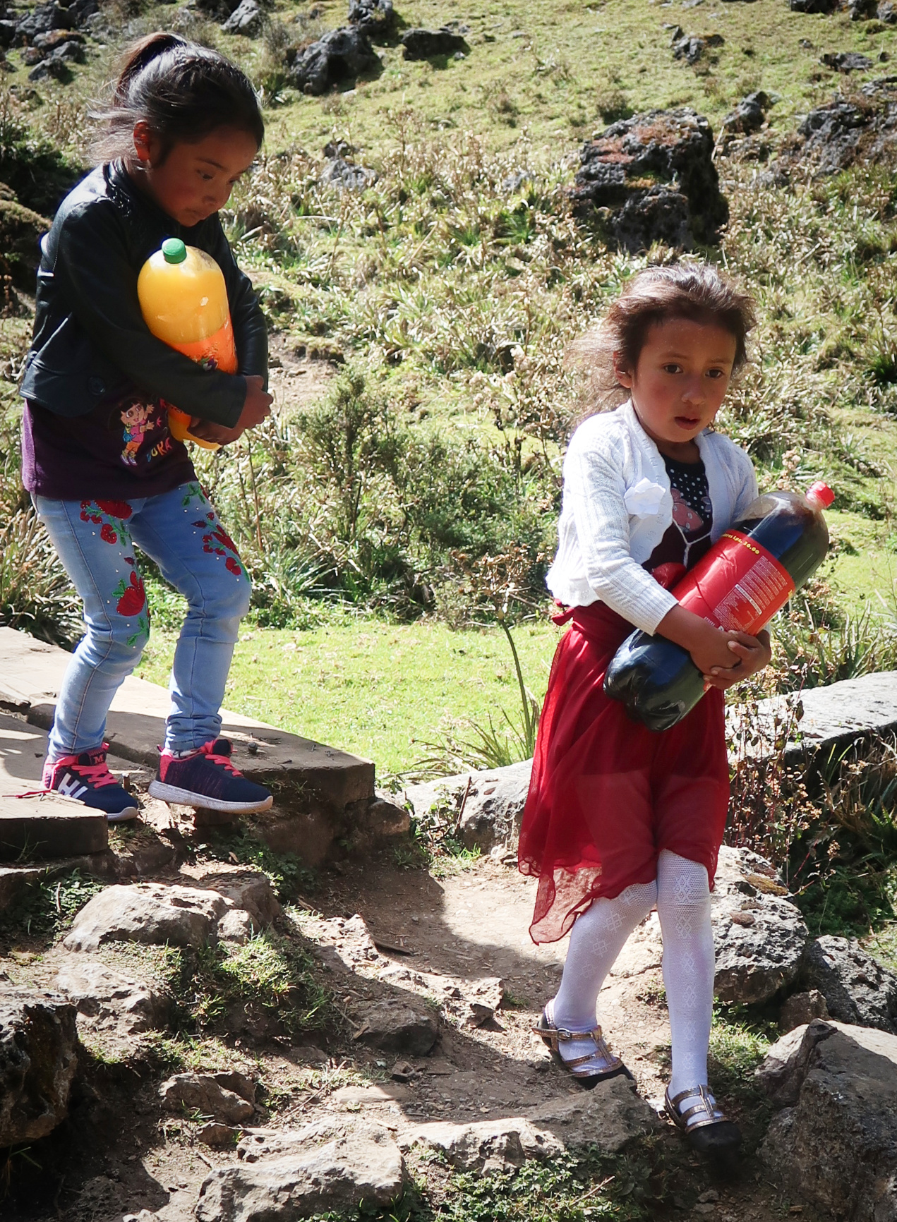
In Guatemala, we noticed that many people buy huge containers of soda. Soda is the one “food” you can find in all corners of the country.
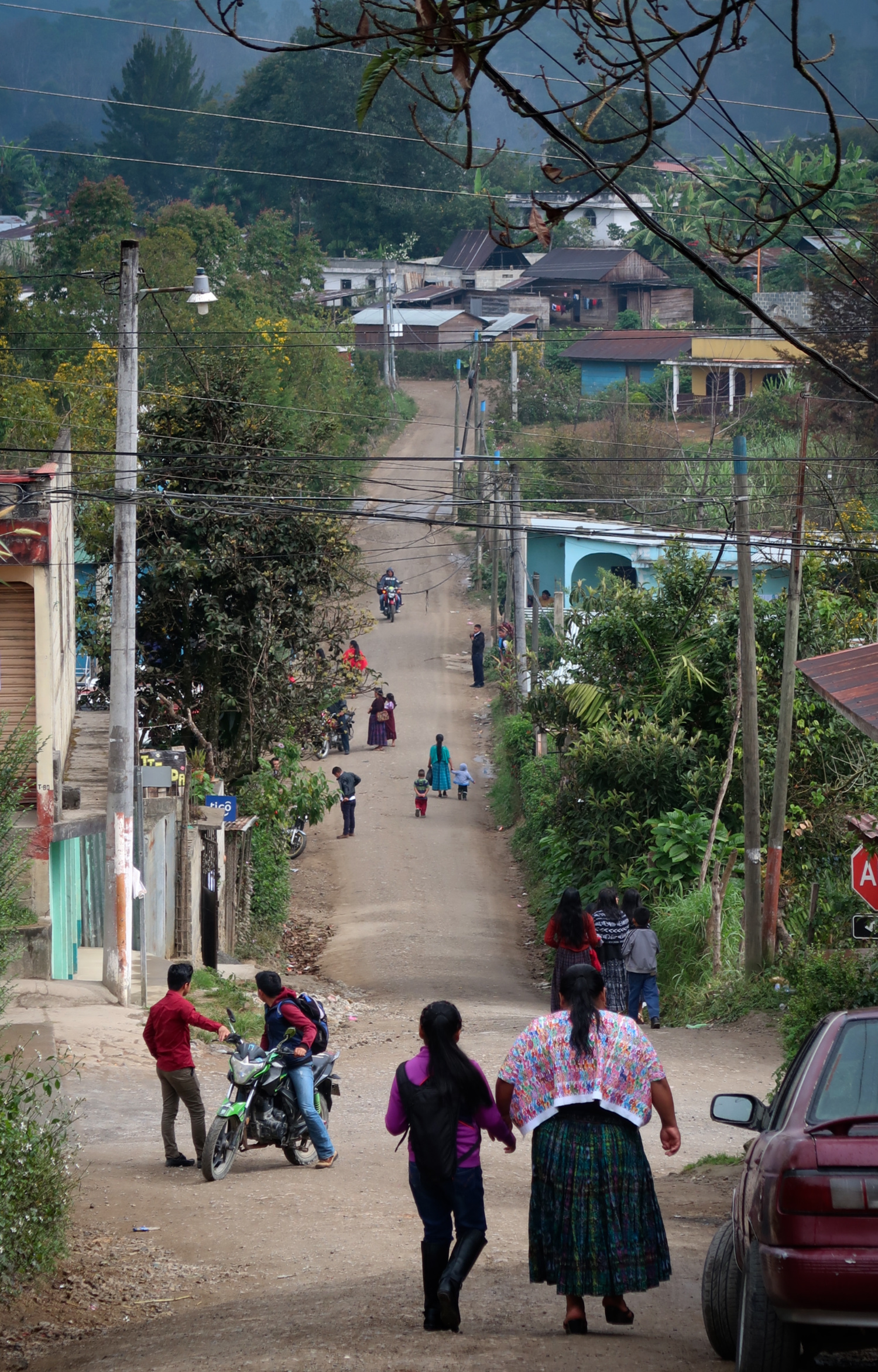
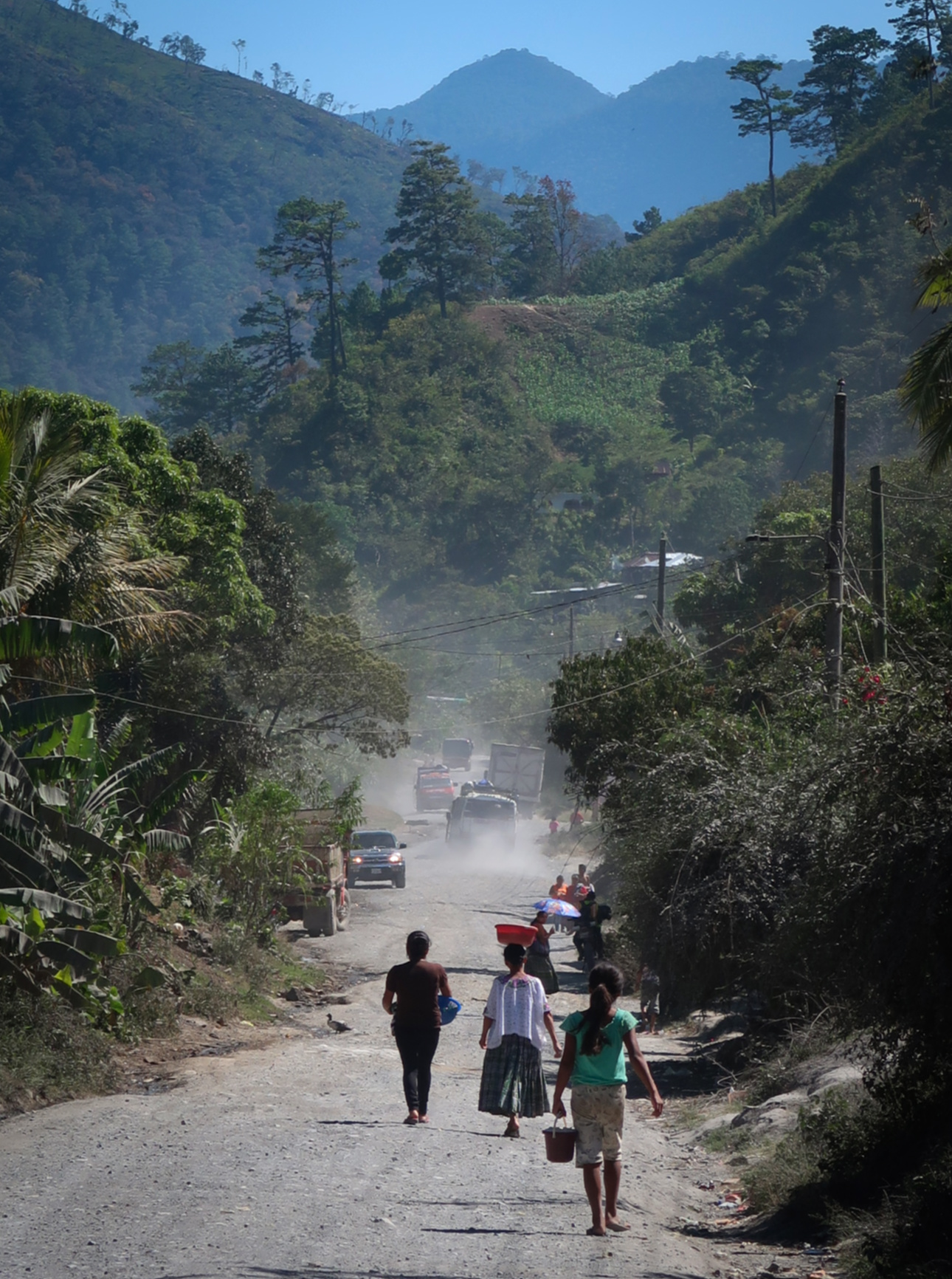
After we left the Cuchumatanes route, we designed a really fun route from Nebaj to Lanquin. In particular, I really enjoyed the dirt route from San Pedro Carchá to Lanquin. As you can see, in this region, people largely get around by foot, which makes for nice bike riding. (For location, see clickable map at the bottom of this page for our route taken on January 5, 2019).
The Boquerón canyon has very recently become a popular tourist attraction due to the “Instagram effect.” The guide who we paid to take us a short distance up the river told us “Thanks to God for the internet” which basically brings people (and thus income) to this beautiful canyon. There aren’t a ton of people visiting because it is so remote – but enough to help support the local community. Local cooperatives have formed to help distribute the income and improve the lives of the local people. From a bike packing perspective, this region is worth a visit, as the road was very quiet and an easy, paved ride. We ended up walking the road as part of a semi-rest day. (For location, see clickable map at the bottom of this page for our route taken on January 21, 2019).
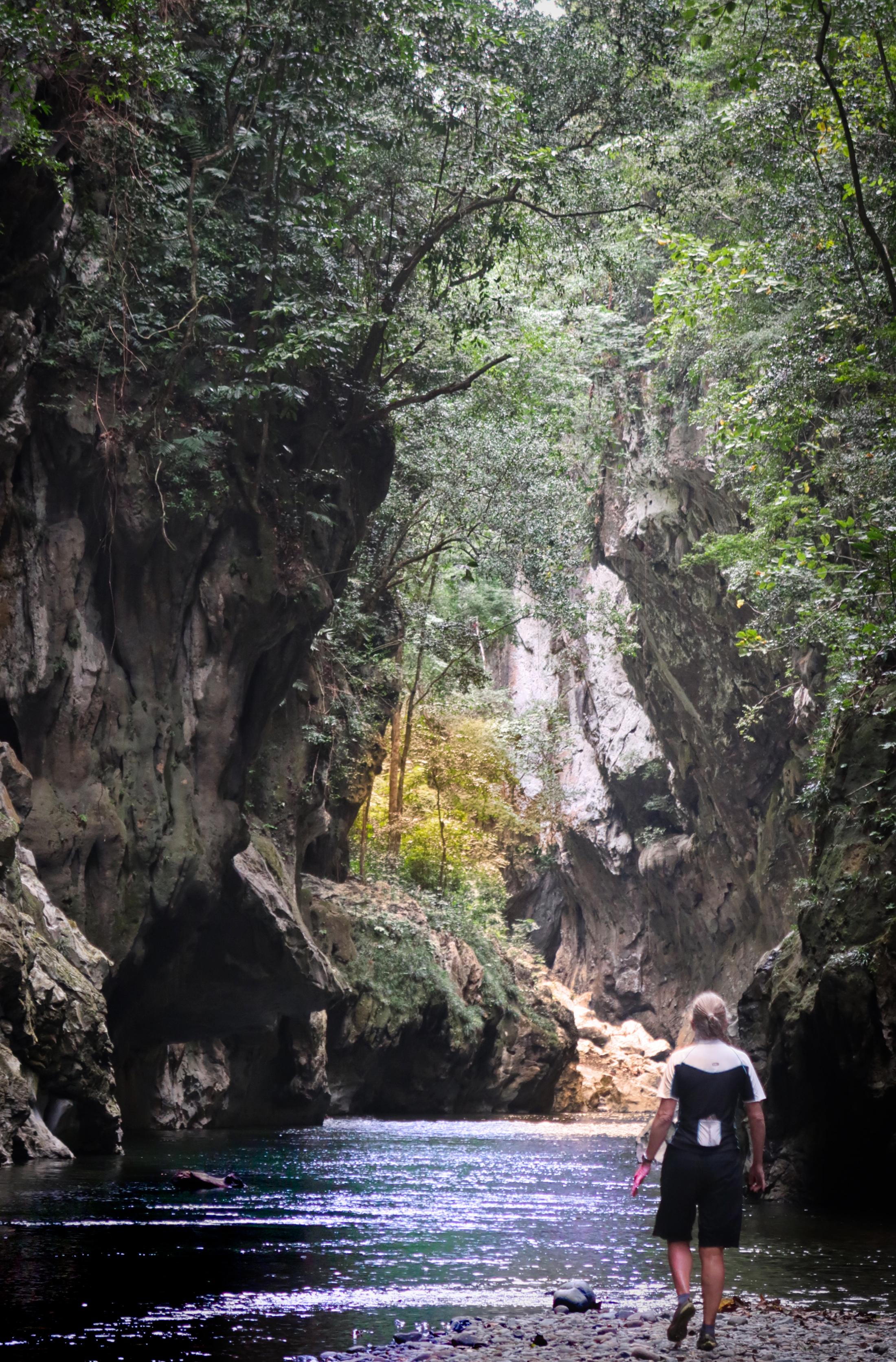
After the Cuchumatanes route, we made up our own very satisfying way to explore the Eastern side of Guatemala. We highly recommend our route from January 5, 2019 in the map below. This photo is from the entrance to the Lanquin Caves (For location, see clickable map at the bottom of this page for our route taken on January 6, 2019).
The Boquerón canyon has very recently become a popular tourist attraction due to the “Instagram effect.” The guide who we paid to take us a short distance up the river told us “Thanks to God for the internet” which basically brings people (and thus income) to this beautiful canyon. There aren’t a ton of people visiting because it is so remote – but enough to help support the local community. Local cooperatives have formed to help distribute the income and improve the lives of the local people. From a bike packing perspective, this region is worth a visit, as the road was very quiet and an easy, paved ride. We ended up walking the road as part of a semi-rest day. (For location, see clickable map at the bottom of this page for our route taken on January 21, 2019).
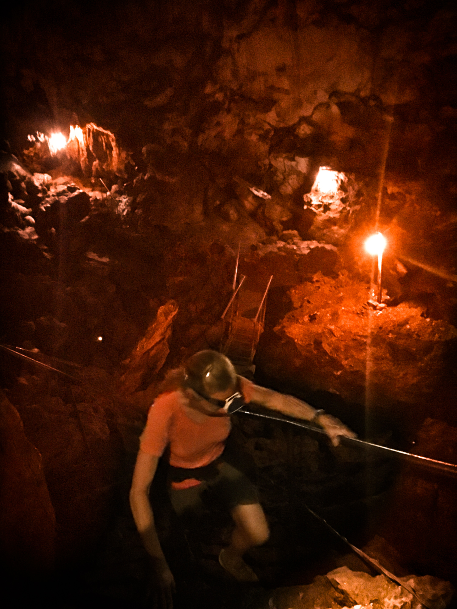
Inside the Lanquin Caves
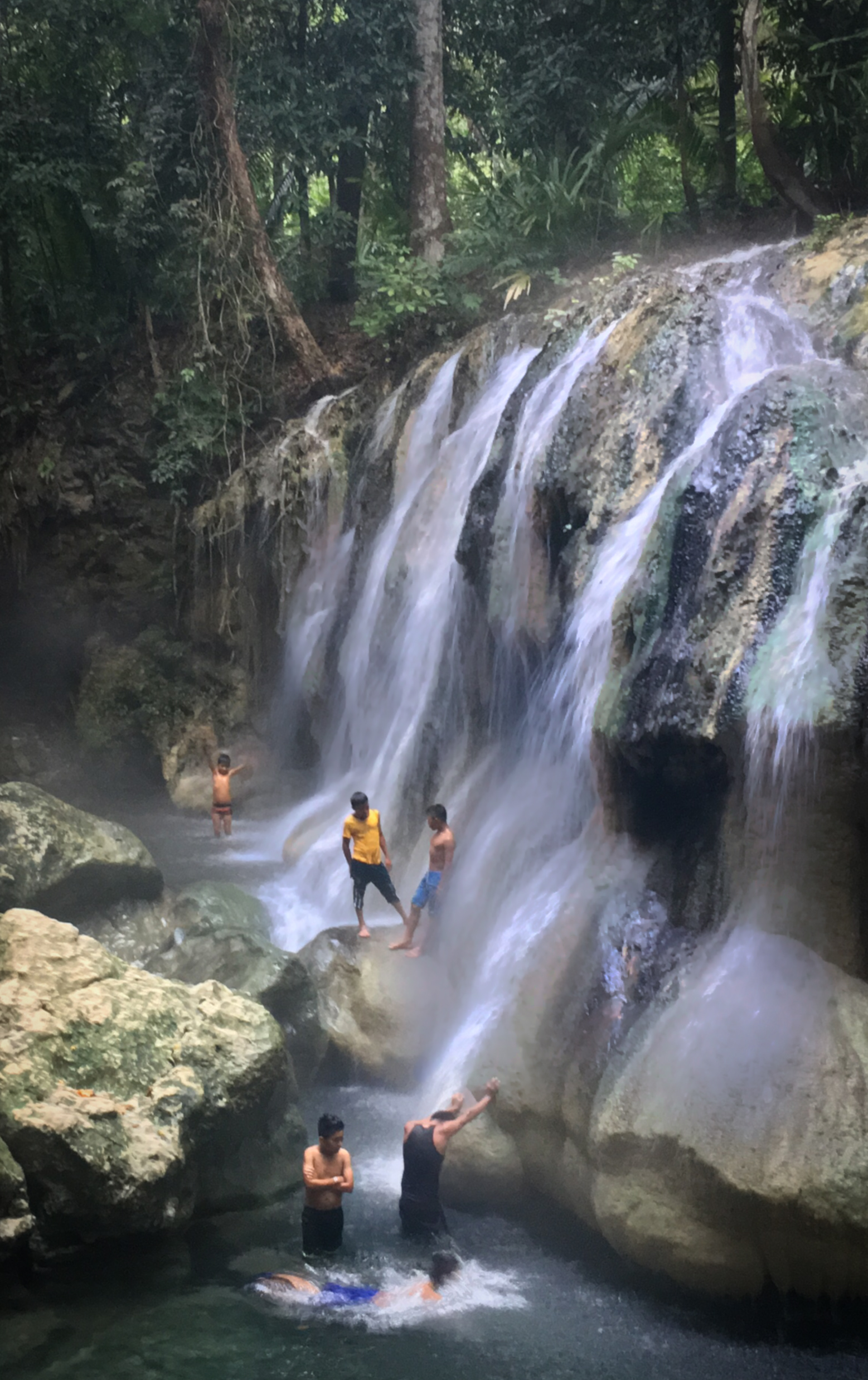
This place was awesome. It is a waterfall that is coming out the temperature of a hot spring. You might think that being in a hot waterfall in the steamy jungle would be uncomfortable, but the air temperatures were actually pretty cool most of the time we were in the Guatemalan lowlands in January. We stayed at the friendly Cabañas Brisas del Lago. (For location, see clickable map at the bottom of this page for our route taken on January 20, 2019).
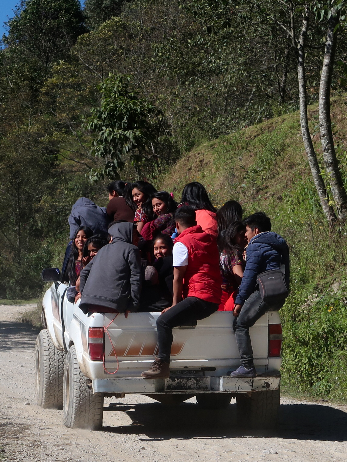
Latin Americans don’t mess around when it comes to ride sharing!
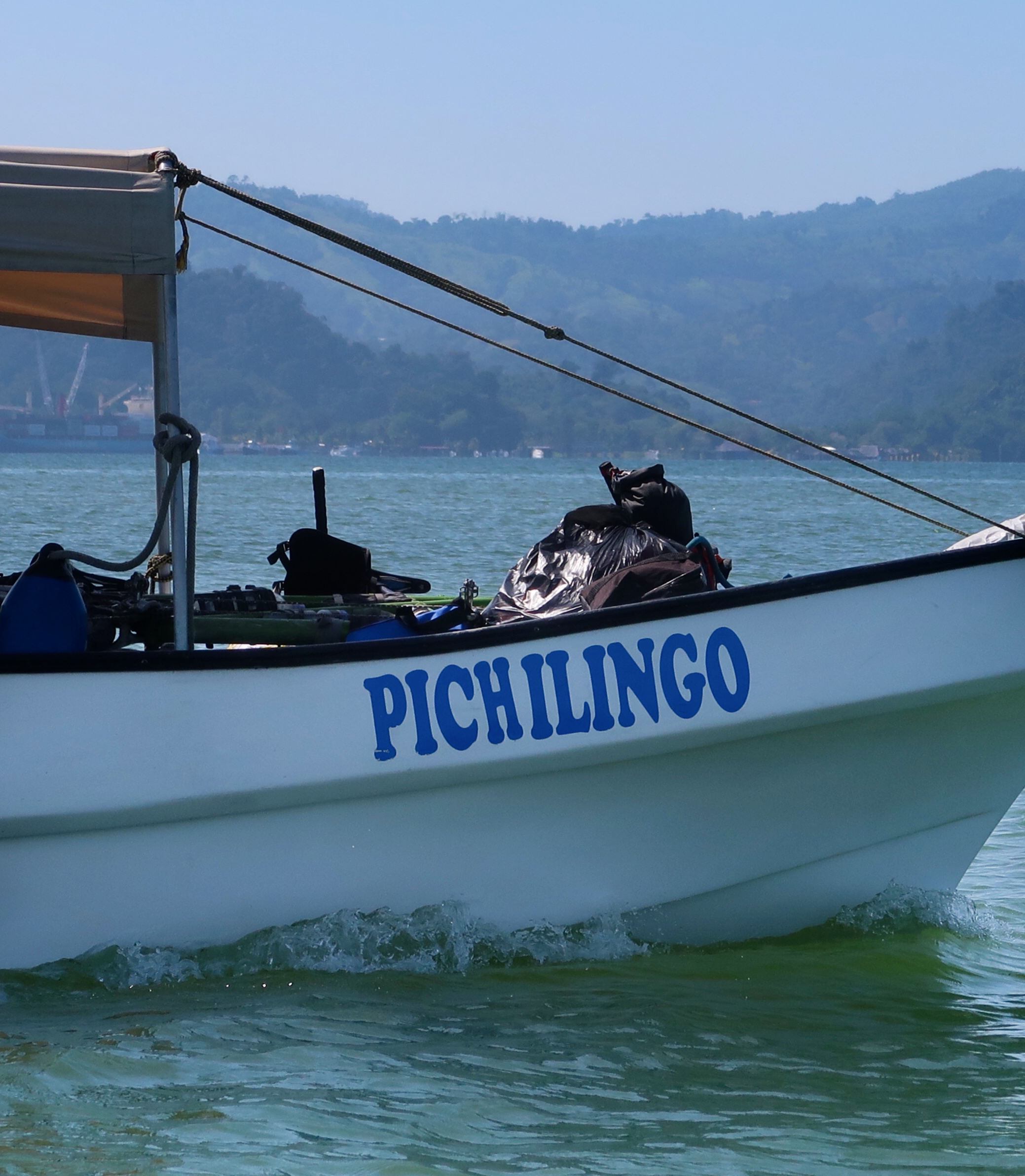
In order to achieve an aesthetic and continuous route through Belize, we decided to take a boat from Puerto Barrios, Guatemala into Belize. Having done it now, I wouldn’t necessarily recommend it – probably better to take a boat from Rio Dulce to Livingston instead. The road route from Rio Dulce to Puerto Barrios has nothing to offer besides miles. Later on, we heard a rumor that there is a dirt route that is rideable on the North side of Rio Dulce between Livingston and Rio Dulce. It is unmapped and I couldn’t see a complete route on the satellite image due to tree cover – but it may really exist in case future bike explorers wish to give it a try.
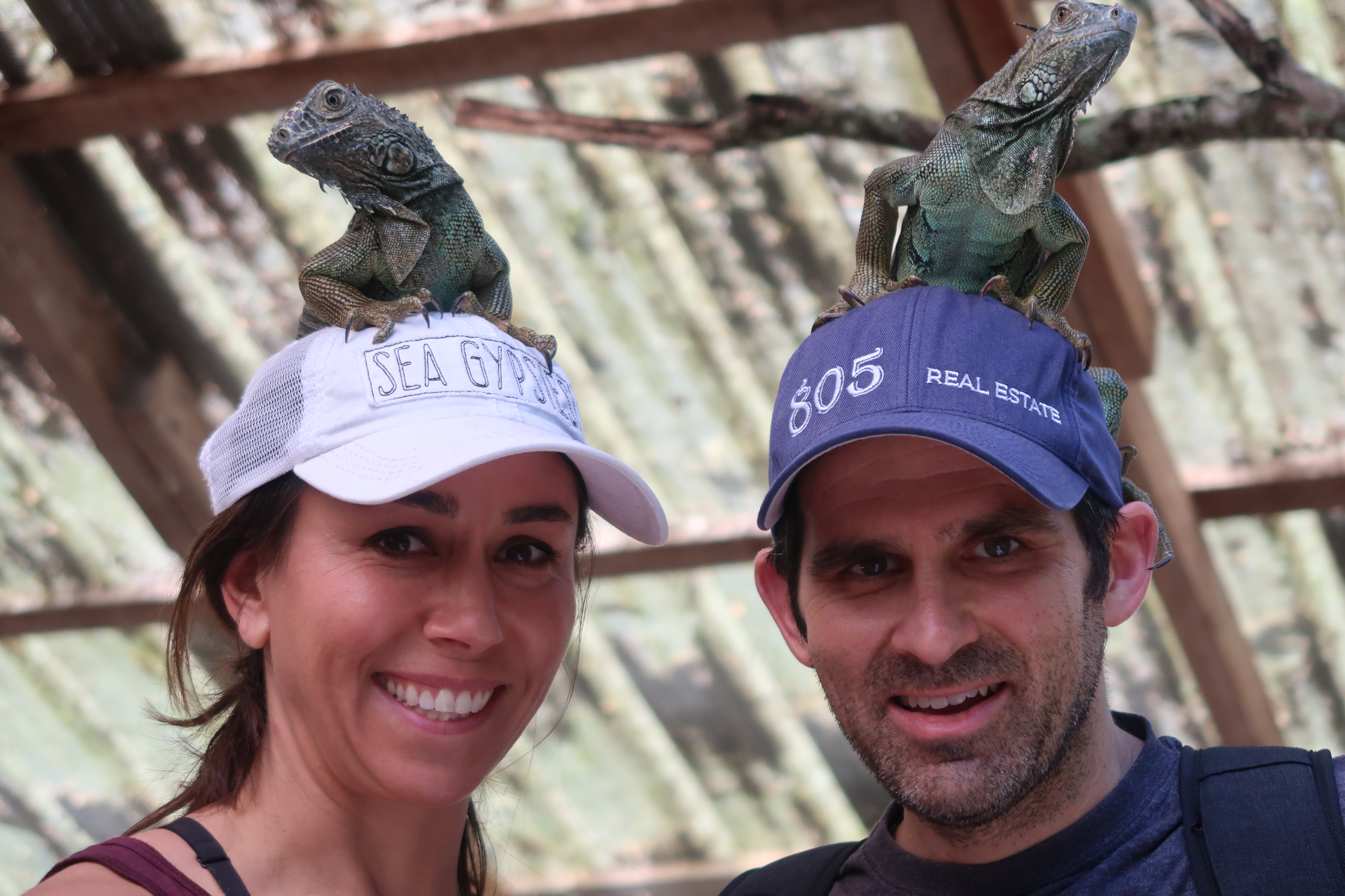
We made a side trip with my sister’s family to this Iguana Park at the San Ignacio Hotel in Belize. It was a good place to take kids, and we learned a lot about iguana behavior and life cycles. (For location, see clickable map at the bottom of this page for our route taken on January 28, 2019).
I used my phone as a remote control to capture a selfie of us in Belize.
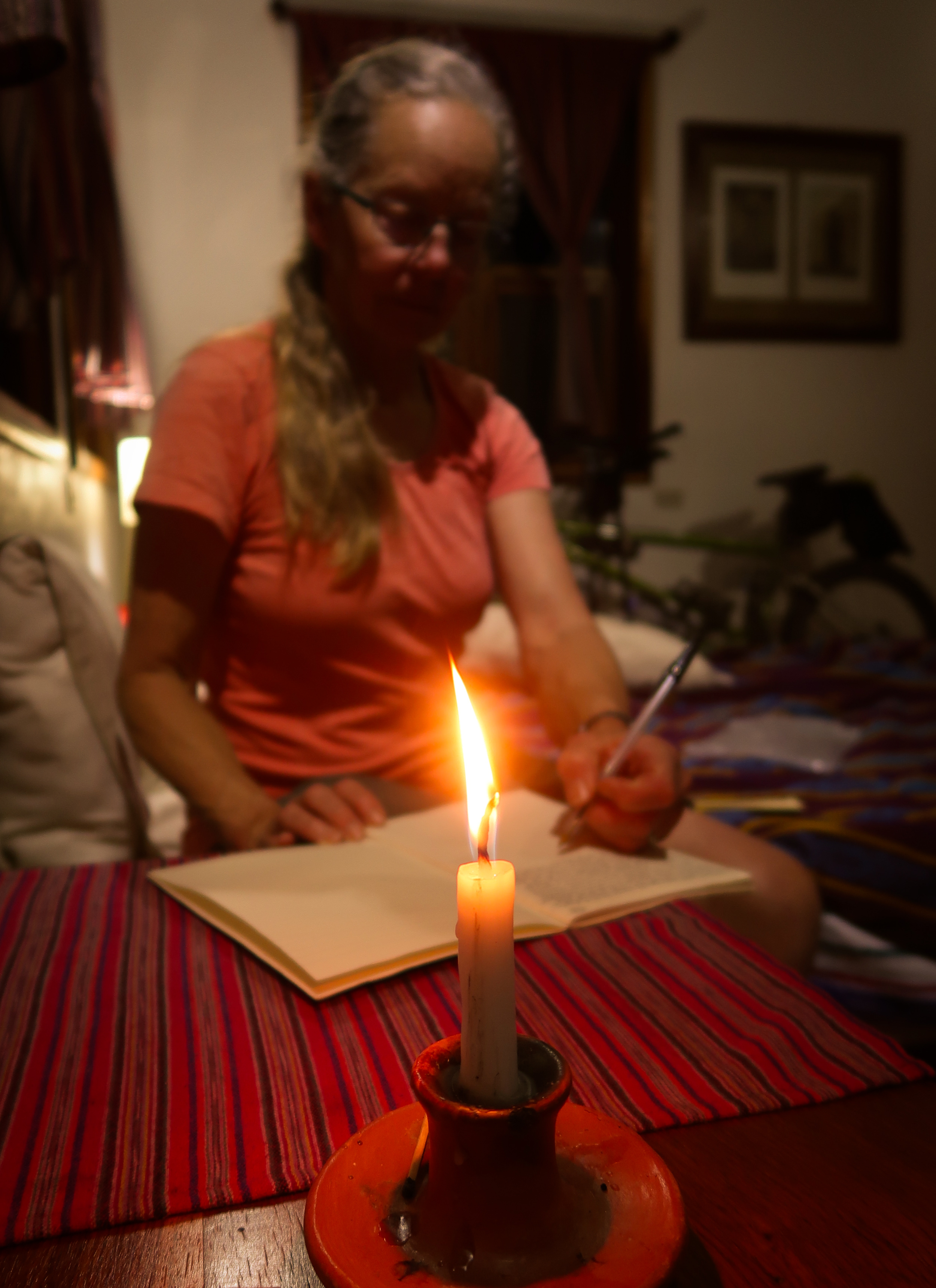
Janet writing in the daily journal during our relaxing stay at Finca Ixobel near Poptun. Here they have horseback riding, a basic cave tour, Las Pozas Riverpools, and a very adventuresome River Cave tour that I have done before (but we didn’t do this time). Finca Ixobel is a great place to relax with accommodations for most levels of comfort: camping up to fancy, but slightly rustic rooms.
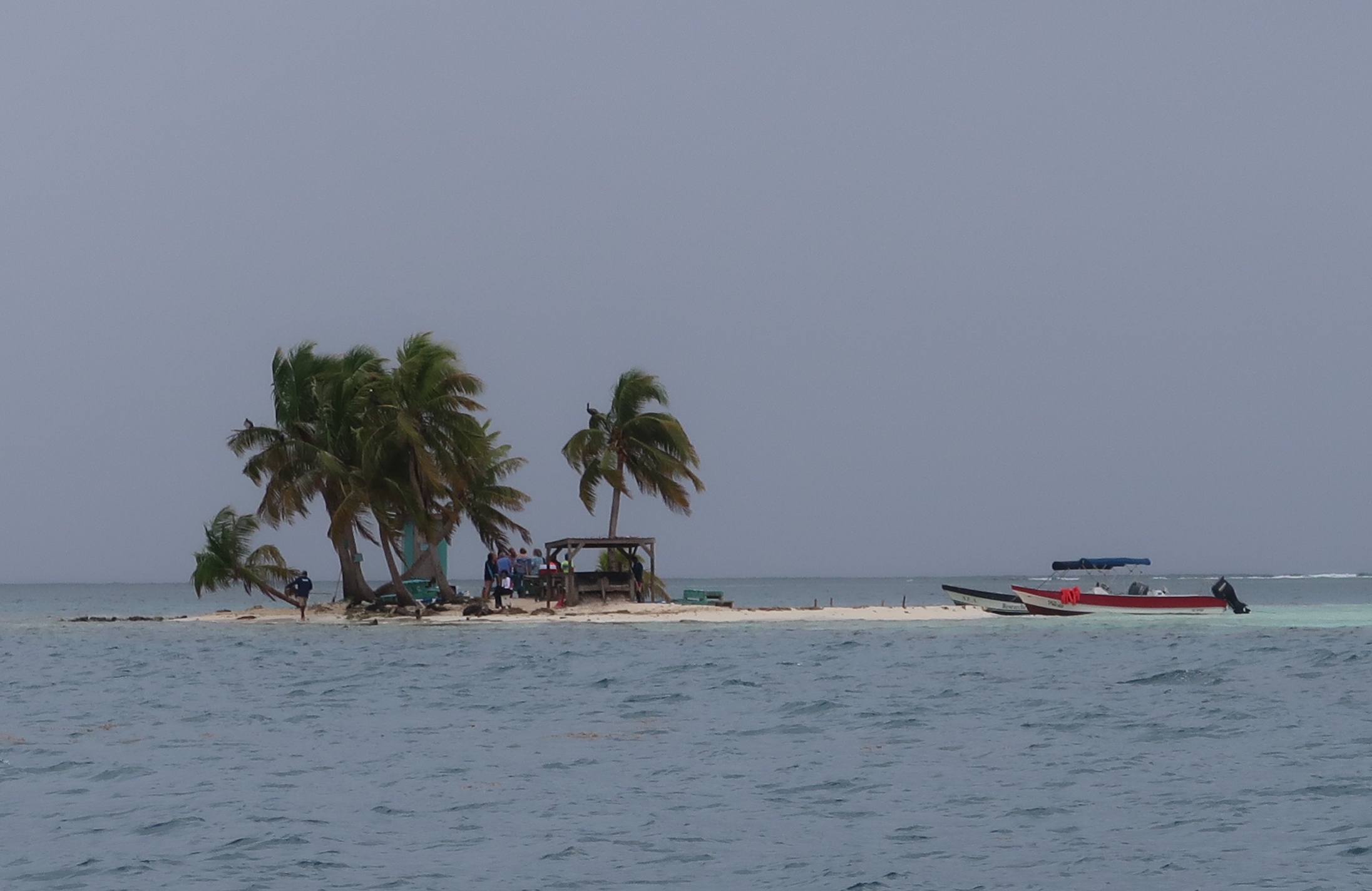
Janet and I took a snorkel tour out to silk Caye from an operator in Placencia, Belize. It wasn’t a perfect weather day for snorkeling, but otherwise I would recommend this spot! The coral is in great condition as far as I could tell and it was teeming with aquatic life.
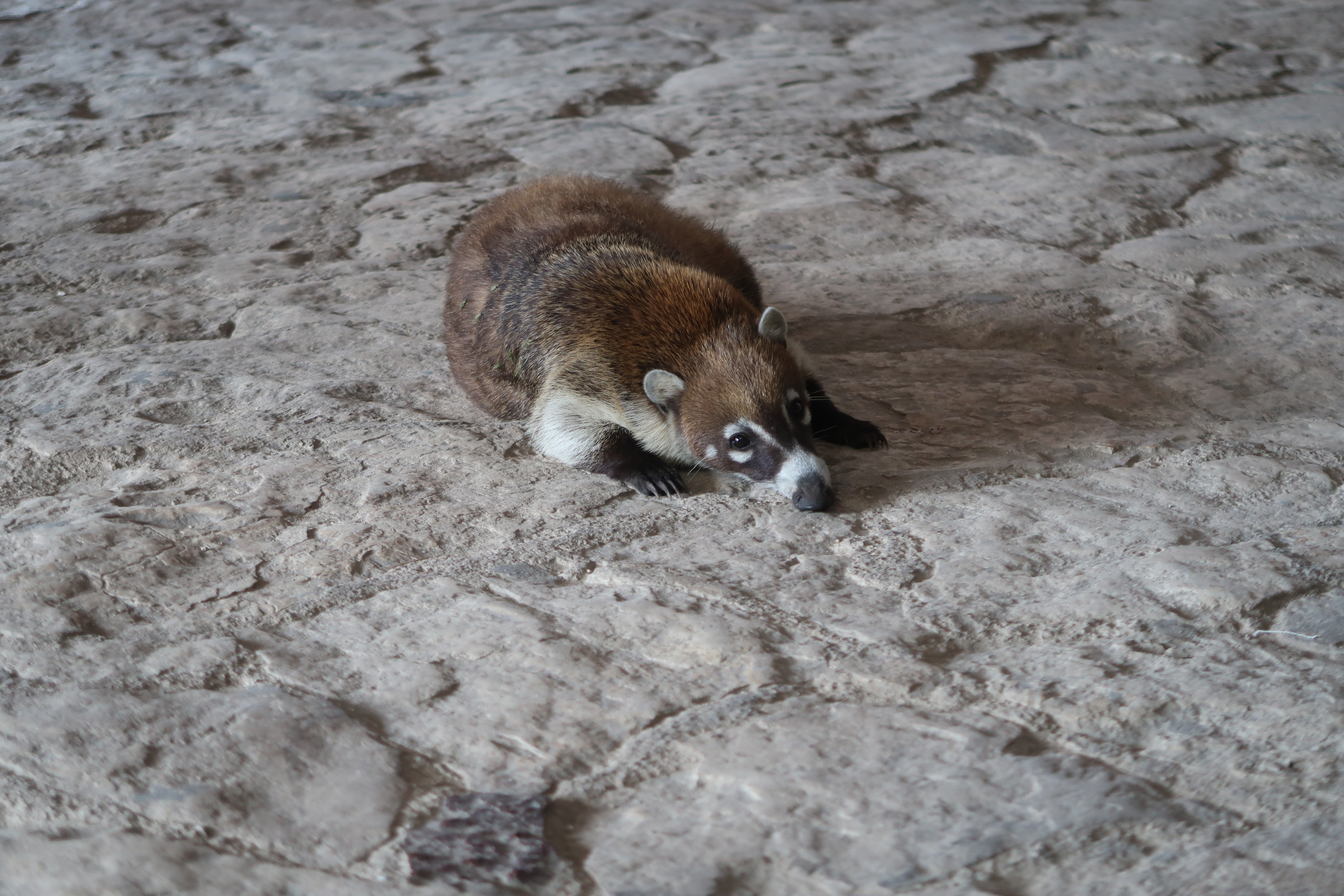
The Coati in Tulum are practically domesticated!
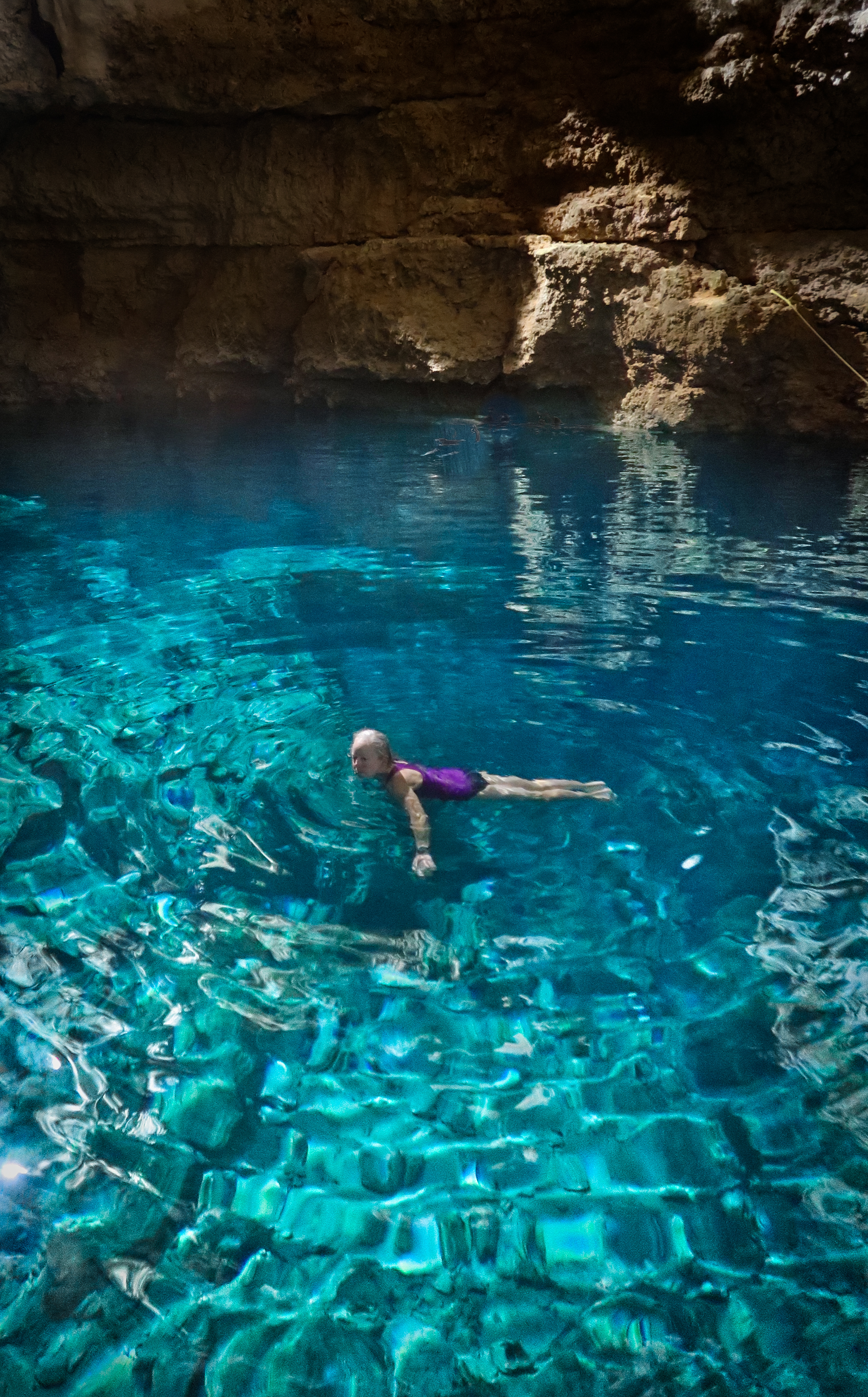
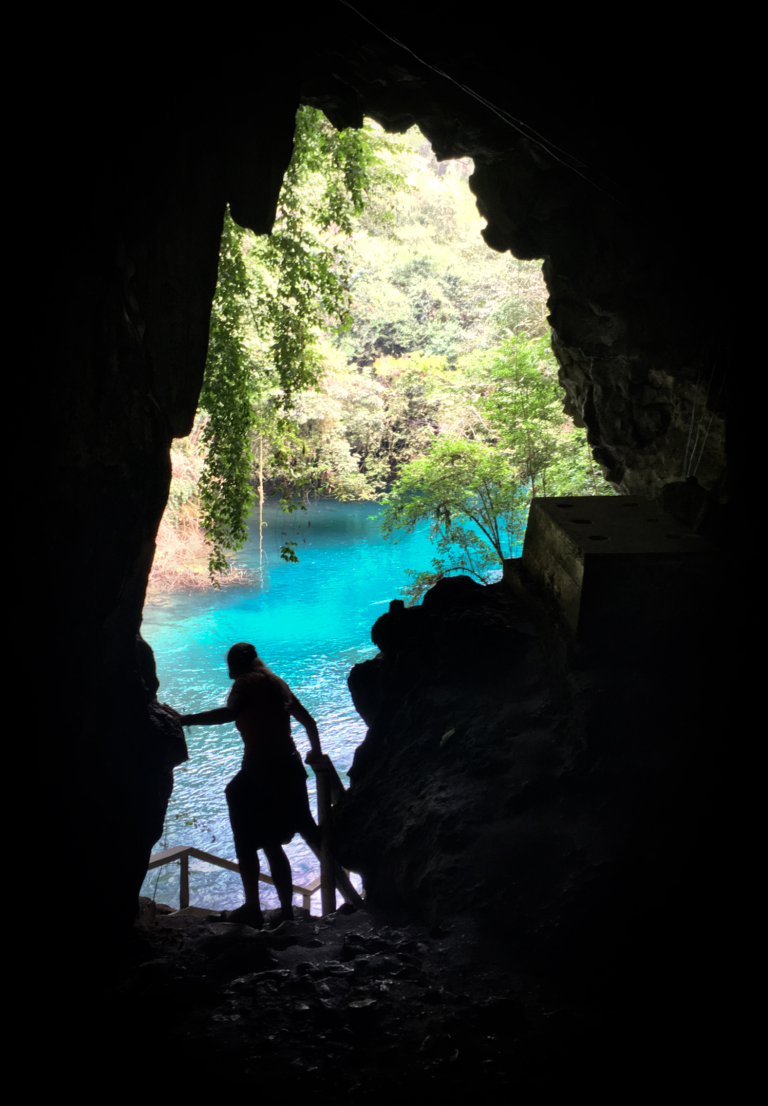
From inside the underground cenote called Multun-Ha. (For location, see clickable map at the bottom of this page for our route taken on February 4, 2019).
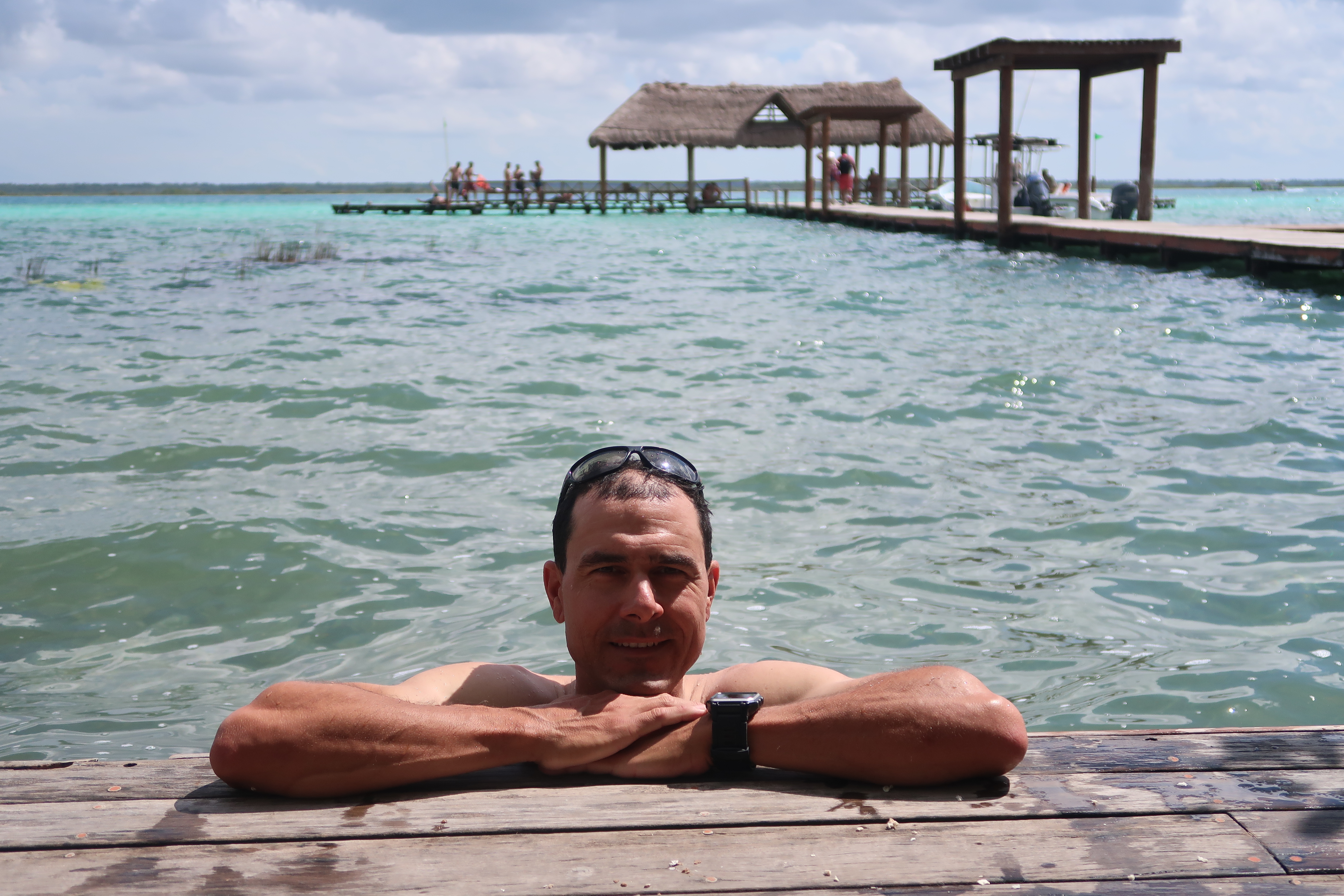
After exploring the Cuchumatanes and Eastern Guatemala, we headed to what is now called “the Maya Riviera”. Much of Cancun’s influence has spread South, and there is a ton of traffic along the Yucatan peninsula. I cannot recommend following any of the cycle routes we did North of Tulum, but the Yucatan riding we did from Bacalar to Cobá was splendid. (Feb 2 to Feb 5 in map below). This picture is at Bacalar, which still has a “backpacker” type feel. In other words, it is a beautiful location that has already attracted a lot of backpackers. My guess is that as the tourism influence spreads, the big hotels and chaos will eventually reach as far South as Bacalar, and this gorgeous laguna will some day be reminiscent of modern day Cancun / Tulum. Best to enjoy it now in its relative tranquility!
This is a picture I took of Janet in a tiny town called “Señor.” The riding during these days was not our typical bike packing route. It was very flat and easy… and we loved it! One of my favorite things about bike packing in this part of the world is chit chatting with people in the little towns. For example, in one town we met some kids who claimed to have ridden their bikes a distance that took us 2 days to complete! And they claimed to have done it on crappy bikes unsupervised. In a sense, it was hard to believe – but they were so sincere that I do believe them. If you don’t mind flat riding, this route we took through the Yucatan was highly enjoyable, and the people in the tiny towns were extremely friendly. (For location, see clickable map at the bottom of this page for our route taken on February 3, 2019).
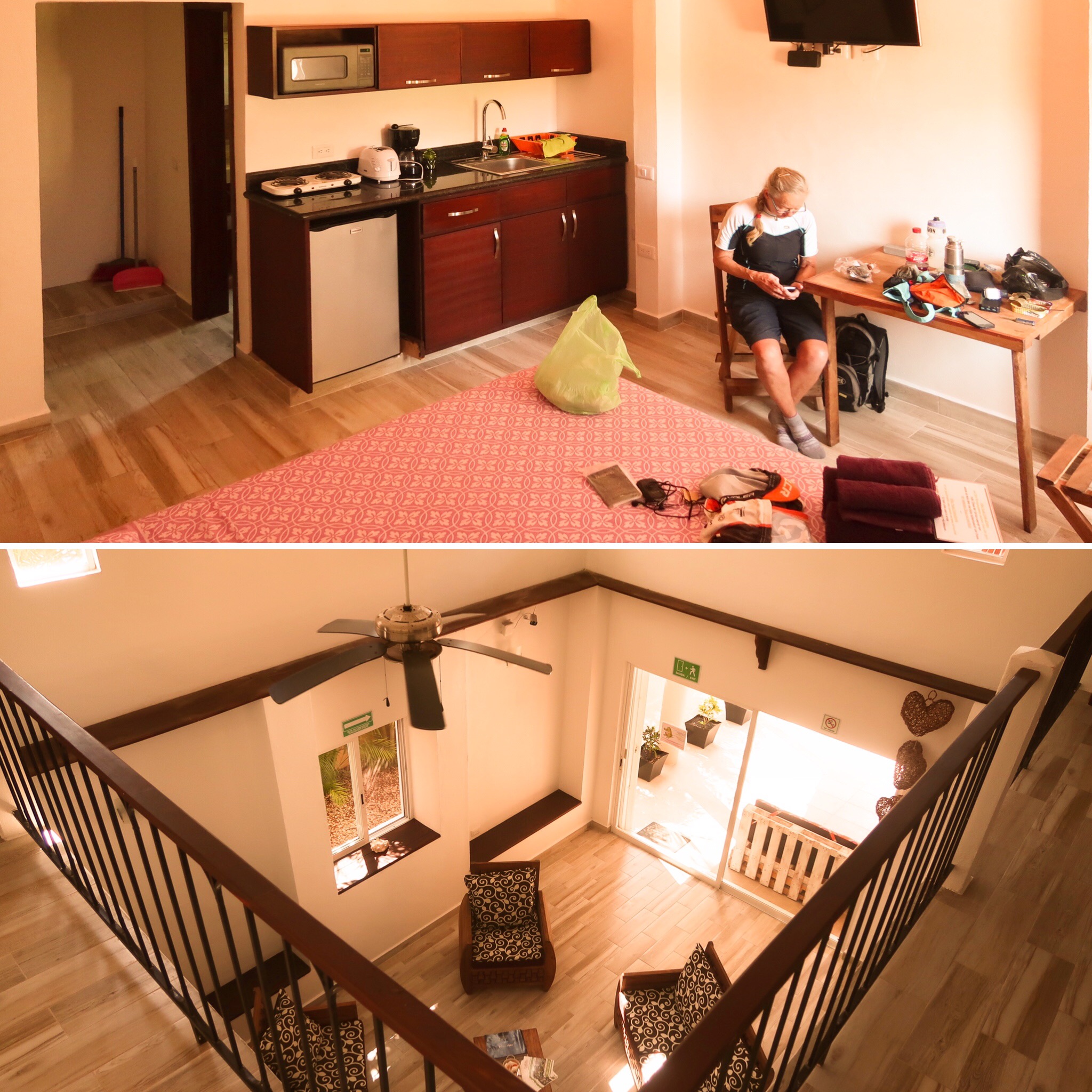
Normally, Janet and I seek very basic accommodations or camping – but we found this impossibly inexpensive house to rent on AirBnB. We figured why not give it a go. It turned out to be really nice – and it was so inexpensive because the owner wanted to build up a reputation online. He told us that when people search online, they look for places that have a lot of reviews, and that it matters less if the reviews are actually good or not. He seemed to be very intelligent and have a good business sense. Apparently, we were part of the “building up reviews phase” – and of course we were super pleased to have such a nice place at such a low price – so he got a stellar review from us.
Janet and I had been trying to bike to “El Mirador” ruins in a very remote region of Guatemala. The day before this, we had tried to ride there form Tikal. I had only been asking permission to go to a place called “Dos Lagunas” (really we wanted to go to El Mirador). Anyway, the Tikal headquarters seemed to be considering granting us permission, but after a lot of run around, they said no. We asked about Mirador, and they said we needed to go around via Carmelita. We did that riding another day… and got to a guard station. The guy started having us fill out the paperwork so we could visit this super cool and remote ruin. Then another guy showed up and said that we can’t go without a guide for 2000Q each! We asked about all the options, and although I was bummed inside, I kept that hidden and was cheerful, thankful, and polite with these guys. They were also very nice to us as well – and he called some people on the phone who said the same thing. I talked to the people on the phone too; One guy was from the Carmelita Coopertiva (which I had read bad reviews about online). Anyway that guy said that we couldn’t go because it is 70% mud. Later, he said that we could go with a guide for 2,000Q each, and we could even do the bikes! But it has to be arranged a day away in Santa Elena Monday thru Friday. Nothing can be arranged at these gates anymore because Guatemala is trying to become bribe-free. In other words, you cannot just show up to archaeological sites and expect to do anything. We experienced this in Tikal also – you had to commit to the campsite without seeing it. Once you get there, there is no one to take your money – so you can’t camp. It was 22 miles round trip to the place where they take your money for Tikal – and from this side it two days round trip to Santa Elena if we wanted to do this Mirador trip. Anyway, the guys who work at the park are just doing their job, and they told me that if the guy who started to register us had let us in… and then something had happened to me or Janet, that guy would go to jail. I think they are serious too, and I sure didn’t want anything bad to happen to them – they were being very nice to us even though they were saying we couldn’t go. I mentioned that I had seen 2 other cyclists ride this section on Strava. They clarified that confusion: either a guard like the one that almost let us in didn’t know the rules and let these other cyclists in…. or it was before 2016 when the legend of the “gringo perdido” happened. Legend has it that a gringo got lost in the jungle for 20 days and 20 nights. When he got out, he was dehydrated and on the edge of survival. Ever since that, gringos are not allowed past the gate without a $250 per person guide. So, we could have arranged a guide for $500 US and done a 5 day trip walking out there. For us, it was only going to take 3 days because we are more fit than the average tourists. They were willing to help us make that happen. After some long hard thinking, we decided to save that $500. It was a tough call, but then we took an adventuresome route back (pictured) that made us pretty happy and we even went through a Finca and were warmly received. My conclusion is that since 2016, there is zero legal way to visit El Mirador, Nakbe, Dos Lagunas etc independently. You can try and sneak through, as some have done, but there were three guys with heavy guns at this post, and apparently there are two or 3 more armed checkpoints out there. They told us that the military has escorted people out of that part of the jungle. The main military presence, though, is to stop drug trafficking from Mexico. They cited “safety” as the reason we couldn’t go. I said we had a lot of experience, and they said what they love to say: “there are jaguars out there.”
The Laguna Yaxhá at the ruins of Yaxhá. I really enjoyed visiting these ruins! They were so much more tranquil than Tikal and there was a really cool bike packing route out to Nakúm ruin. I highly recommend biking and camping in both of these places. Note that the area is pretty buggy, including ticks. Otherwise, it is remote and off the beaten path – we saw no other tourists at these sites over the course of 3 days spent. (For location, see clickable map at the bottom of this page for our route taken on January 15, 2019).
Exiting Lanquin Caves
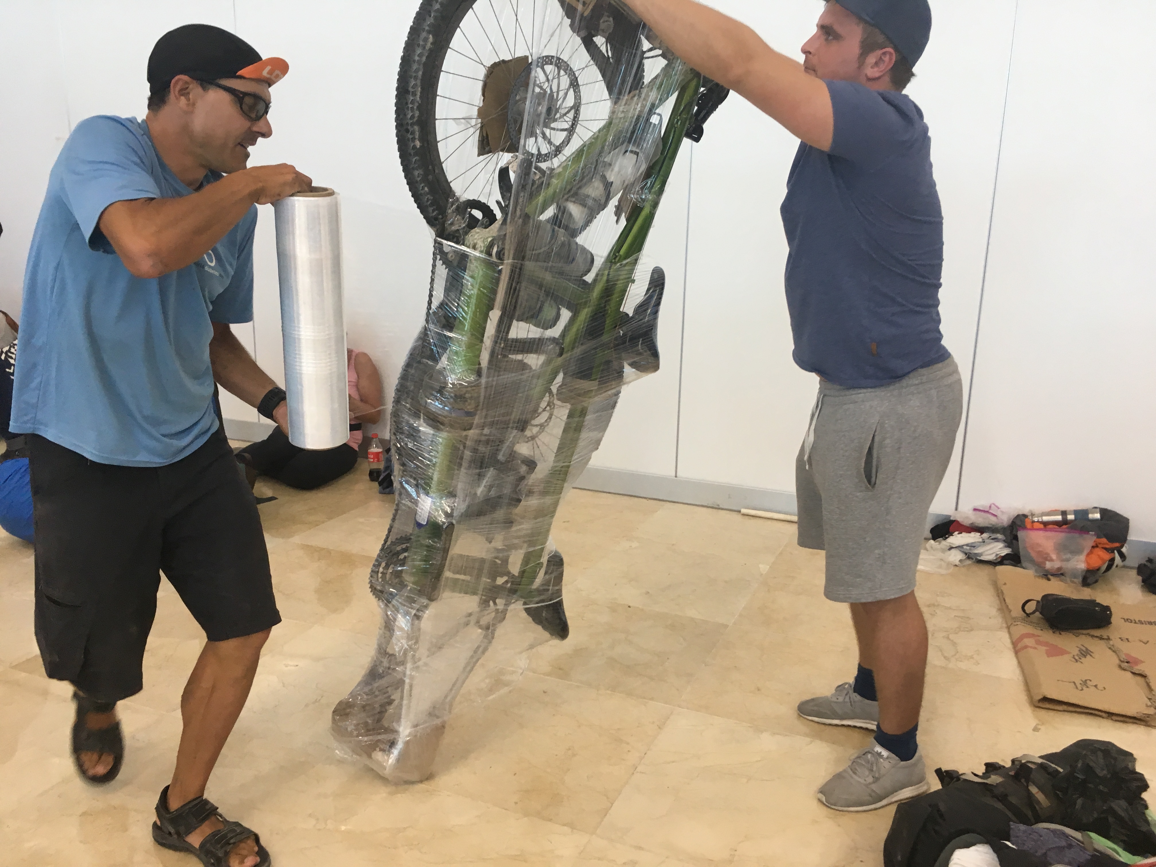
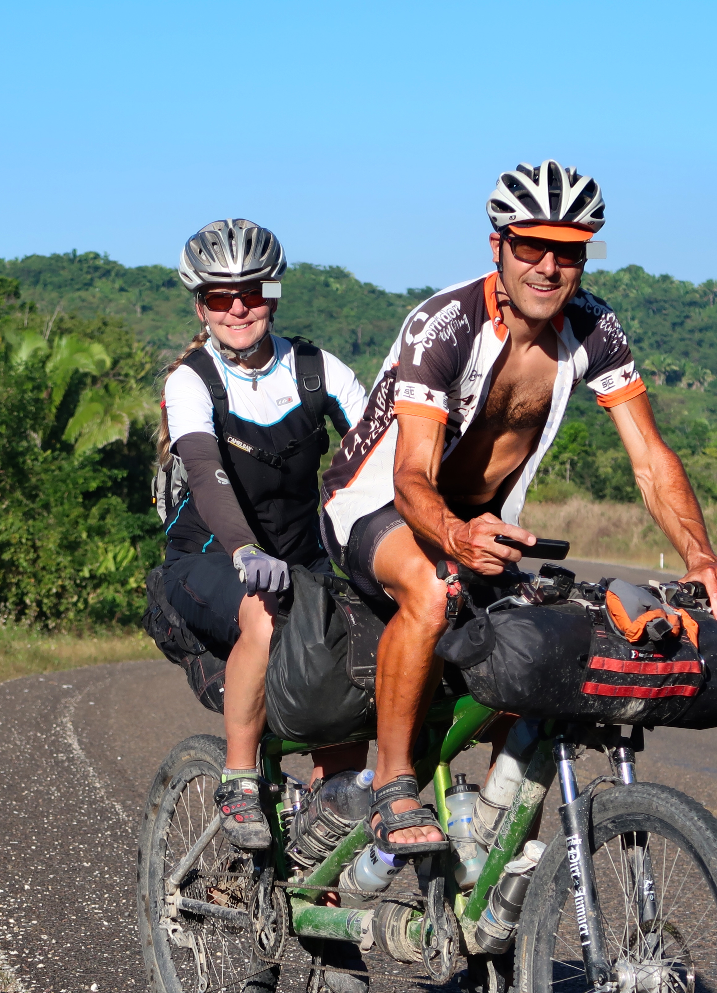
We have had good luck doing this many times now – we wrap our tandem bicycle in a heavy duty plastic wrap instead of trying to find a box. It is always so hard to find a box! Many people insist on buying bikes with couplers, but (knock on wood) we haven’t needed couplers so far. This is also the first time we took off both wheels – normally we leave both wheels on.
This is the map for the entire route discussed in this post. To Export GPX files, click on the three horizontal bars in the upper right hand corner of the map and select Export selected map data…
To see full screen, click here (opens in new window)