Bike Touring El Salvador
El Salvador is a country that North Americans don’t always discuss: especially as a travel destination. It is the smallest of the seven Central American countries, and has had many years of civil war – particularly from 1979 to 1992. The film “Romero” gives some insight into this conflict. Worldwide, El Salvador has the 5th highest homicide rate. It seems that some touring cyclists believe that El Salvador is still a country that’s “in the way” of the other countries further South. We wanted to give El Salvador a chance, so we deviated again from the Pan American Highway – plotting our own route – for the mountains. We found a land of people who understandably live daily with some degree of fear, as well as a natural paradise waiting to be developed and discovered.
02/26/2014 Day 35 – Las Chinamas to Near Cerro Verde 62 miles
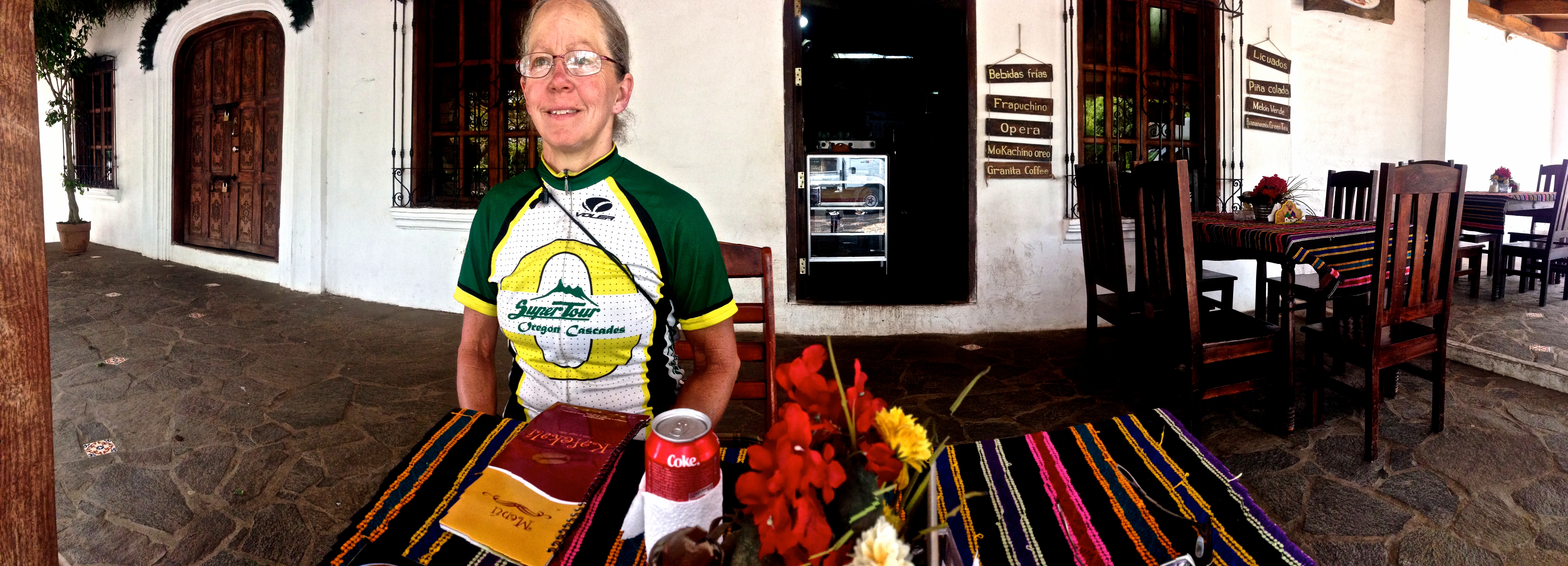
Today’s route takes you to Ataco, El Salvador. This town looks like it is ready to accept a horde of tourists… but no one was there. We found that as we arrived in each touristic destination in El Salvador, it was practically devoid of any other tourists. I’m not sure if it is the season, or if this is just the norm for El Salvador. We enjoyed a great meal on a plaza front patio.
Good eating in Ataco
From Ataco, we rode through the mountains towards another tourist oriented town: Juayua, which is pronounced something like “who are ya?” really fast, with a diminished “r”. Again, this town that seemed ready for tourism was quiet and devoid of any tourists. It’s a beautiful town, otherwise, nestled in the mountains. Along the way, we saw a number of these carts. Men would load the back portion with cut wood from the mountain, and then you’d see them rolling down the hill sitting in the front portion. The carts were often decorated with “bling,” and they sometimes included license plates, tail reflectors, and floor mats.
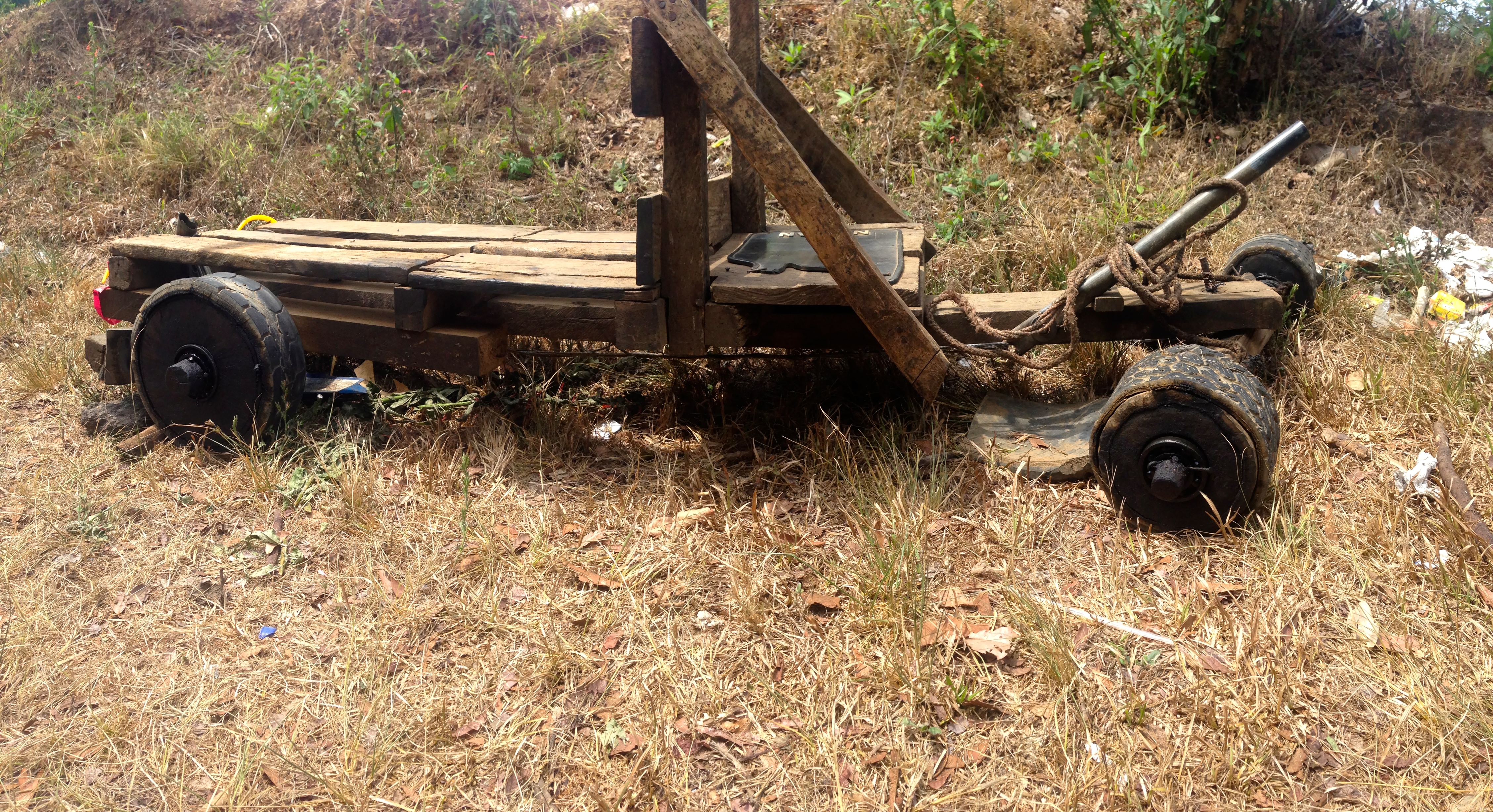
These cars were seen in El Salvador for transporting wood down the hill.
Carts are not the only place where the people of El Salvador choose to express themselves: Busses are often decorated and lifted up front to look like those hot-rodded busses seen on TV.
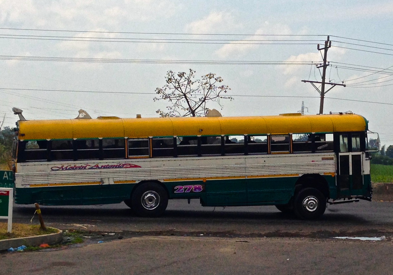
Many busses are hot-rodded in El Salvador
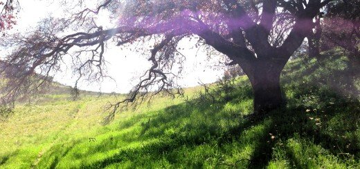
After Juayua, the route takes you through one more pass, and then down a long, fast gradual descent. The air warms quickly at this latitude, and becomes humid. Santa Ana has been described as a dangerous city, and given what we saw later in the day, I’d agree that it is probably true. The route turns right on HWY 1, which is very busy, but has a munificent shoulder, so you can move quickly. The main thing to watch for is the vendors selling wares in the shoulder. You will likely need to venture into the traffic lane to get around them, even though the shoulder is 8 feet wide. From the town of El Congo, you want to turn right towards Volcan de Santa Ana. This is your objective, as there are a number of volcanos at the end of this road which you can hike to the top of as well as camp. We did not make it to the park in time to spend the night, so we ended up arranging impromptu camping at the Los Pinos coffee finca seen at the end of our track. They don’t officially have camping, but they allowed us to camp on the playground. More importantly, they do have cabins and a beautiful restaurant overlooking Lago Coatepeque. Ideally, though, you’d camp within the park – which was our objective for the day.
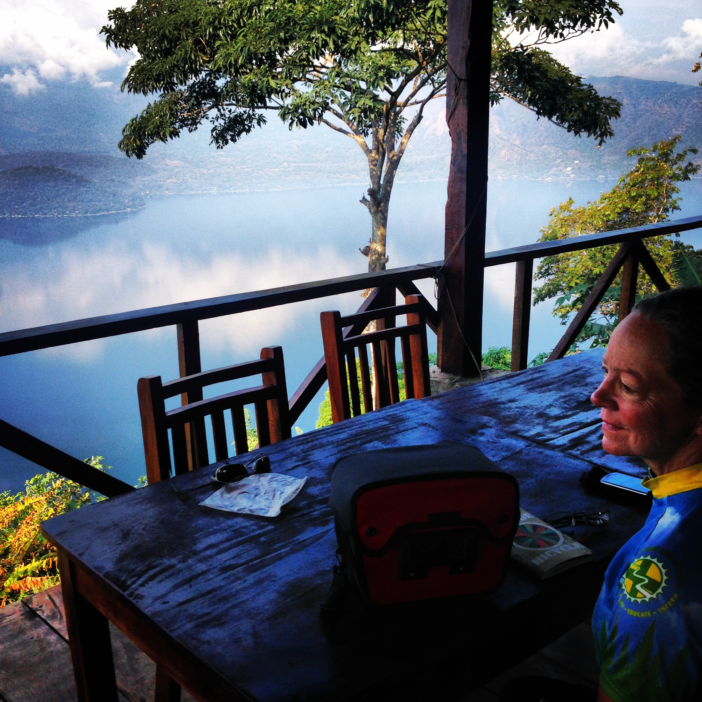
Janet enjoying the view over Coatepeque Caldera from the restaurant at the Coffee Finca.
02/27/2014 Day 36 – Short day Up the volcanos 13 miles
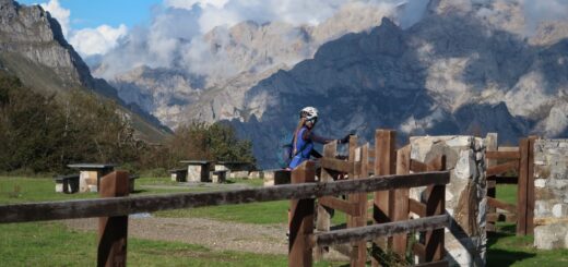
The Parque Nacional Cerro Verde is one of the most beautiful places we saw in El Salvador. There is camping available here, but again, it is not very official seeming. There were restrooms, but no showers. During the evening, everything closes down (the small food concession is closed by early afternoon). While we were there, a very small bus of tourists arrived. It stayed briefly, then we had the entire park to ourselves. There are a number of trails in the park, but with the exception of the immediate area, all the trails have gates saying that solo travel is unauthorized. You must have a guide and armed guard to accompany you at all times. I asked about the reasoning for this, and apparently it is because of bandits: they don’t want visitors getting robbed or attacked. Although we didn’t see anything that would suggest that this really happens, this is such a huge effort that it is almost certainly a response based on actual events. The entire park is closed in by a high gate at night, and there is are armed guards throughout the night. We stood on the lookout enjoying the view with one of these guards. It seemed such an odd juxtaposition to see a man armed to the hilt – here to protect us from ugly things – in a place that was dripping with beauty.
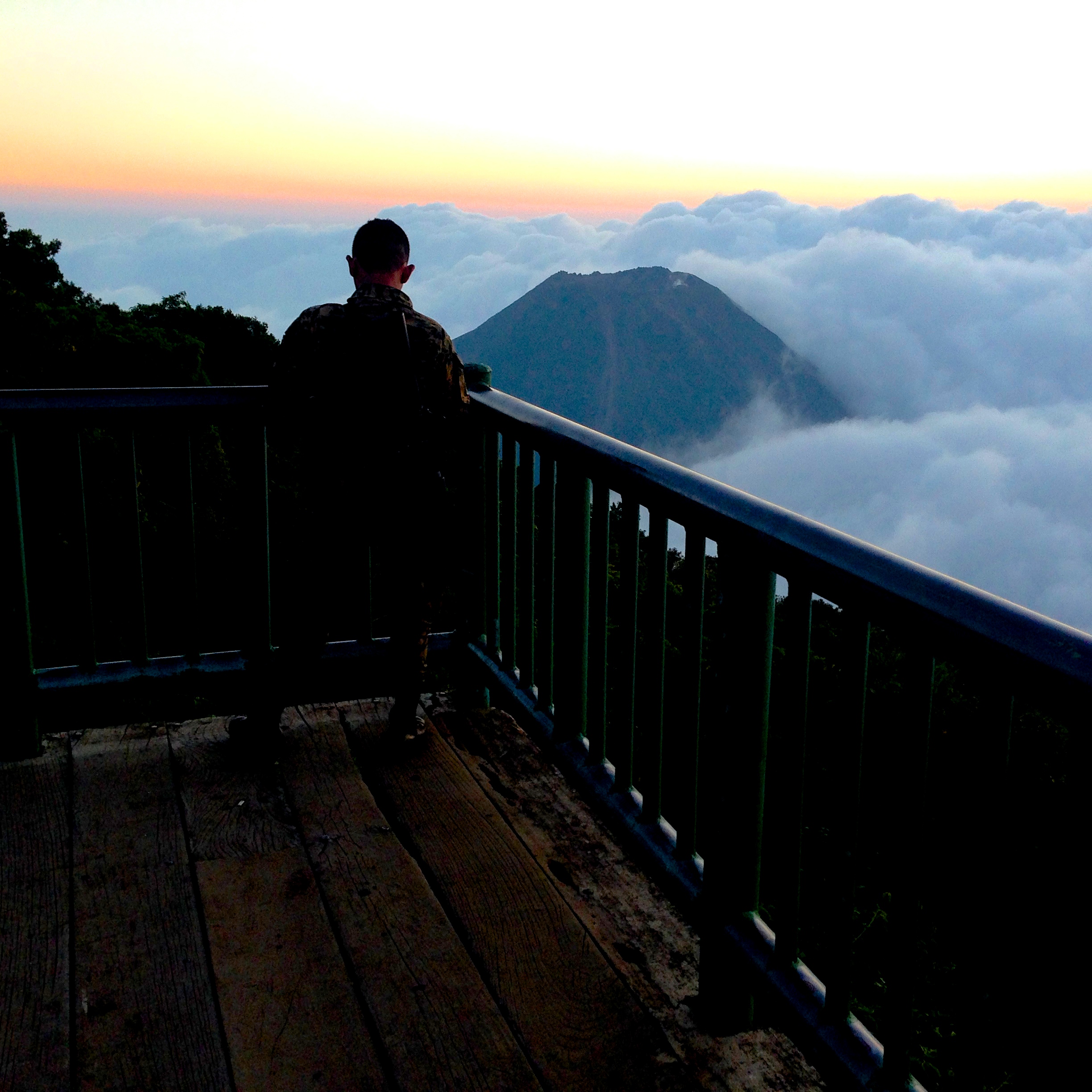
An armed guard checks his text messages while overlooking Volcan de Izalco
I found that as we moved through El Salvador, people seemed afraid. They didn’t seem afraid in their daily lives, or in their mannerisms – but there were signs of the fear everywhere.
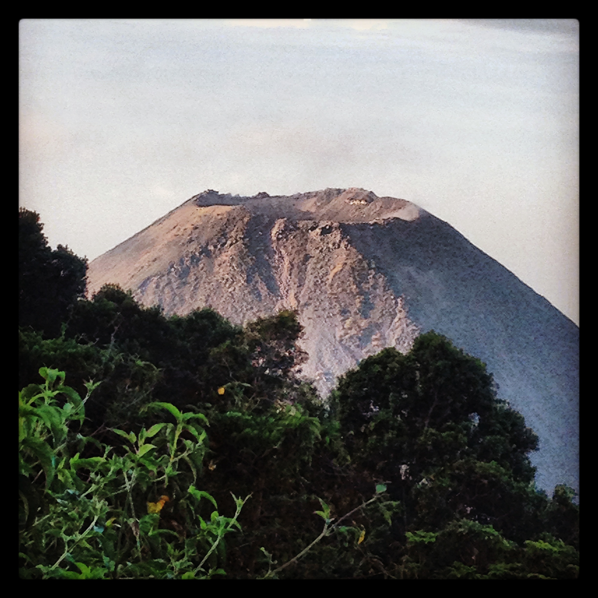
Volcan de Izalco
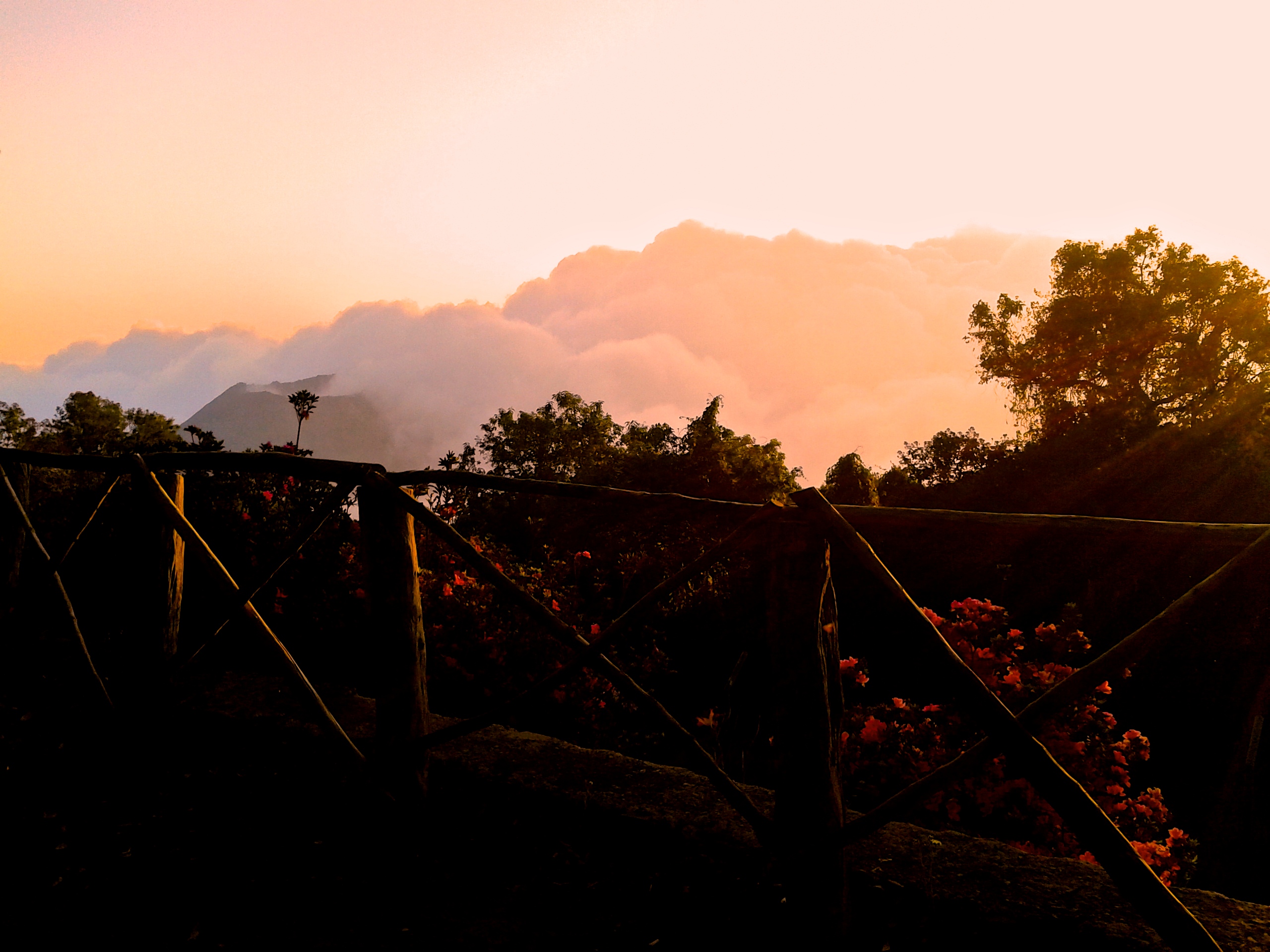
Beautiful sunset from Cerro Verde Park in El Salvador
Ordinances like those mentioned above, as well as bars on windows everywhere – including gates that would surround the premises of every home. Hotels and businesses all seemed to have heavily armed night guards. This level of security is obviously frightening and comforting at the same time. You feel reassured by the authority and the fact that there are people around who are being paid to protect you. At the same time, the presence of such armament is very frightening if you consider the risk of misappropriation of these weapons.
02/28/2014 Day 37 – Volcan Santa Ana to Playa Tunco 80 miles
Todays route takes you from the mountains to the coast on a long, gradual descent. Eventually, at the coast, from Mizata to Playa Tunco, you have a long series of short climbs and descents as the road attempts to follow the contours of the hills dropping down into the ocean. The scenery from the HWY 8 junction to Mizata. Also, the roads are busier until Mizata. The beaches along this section of coast are popular with young foreign tourists. As such, you should expect to see surfing, partying, and maybe some people who drank a little too much vomiting on the beach. El Zonte and El Tunco are two of the more popular beaches. Fortunately, the road to the West of El Zonte affords some beautiful sea cliff views over the warm ocean.
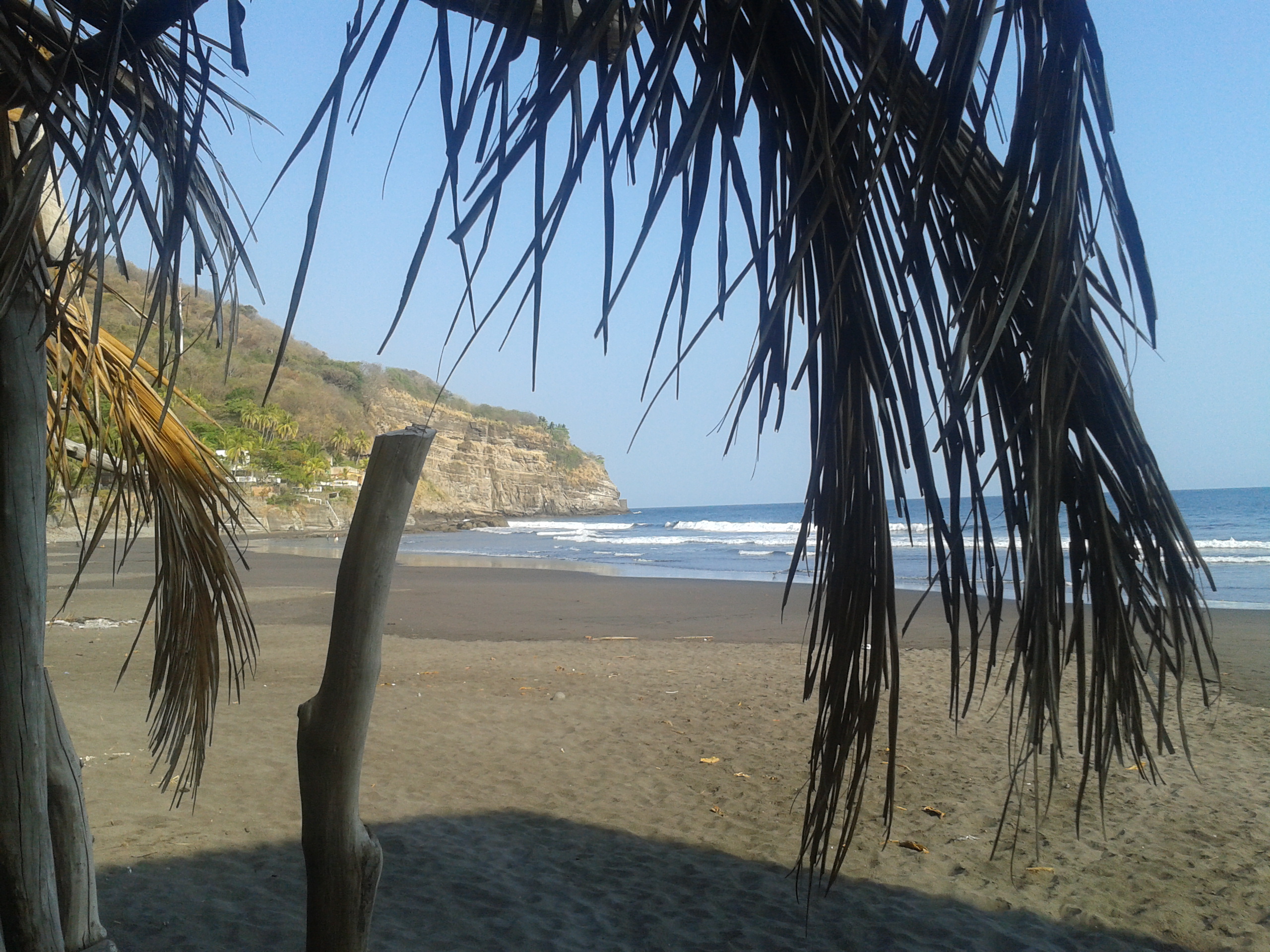
El Salvador Beaches
03/01/2014 Day 38 – Playa Tunco to San Miguel 101 miles
The route for today is almost perfectly flat. The climate is warm and humid. However, mid-day, I met a woman who exclaimed, “hay frio!” Today was definitely cooler than yesterday, but I was still sweating a lot. People who live here are obviously adapted to warmer temperatures and humidity. If temperatures dip below the 80s, people here generally find it too cold, whereas I find it “tolerable.” This route is somewhat entertaining by all the activity you encounter on the side of the road. Even though this is a fairly major road, all along the way you see people walking or riding bikes a long the road side. When you’ve been riding challenging roads for a while, it is comforting to be riding alongside kids, adults, and families cycling comfortably as a way of life. This was the case for the entire day, approximately from La Libertad to El Delirio. Before you enter San Miguel, there is a hotel and a strip of restaurants alongside the road. We had the experience of a significant Earthquake this night in our hotel, which sent the guests outside into the humid night air checking to see if everything was OK.
03/02/2014 Day 39 – San Miguel El Salvador to Nacaome Honduras 82 miles
Today’s route wasn’t what we originally intended. My suggestion, if you’re trying to cross Honduras at it’s narrowest point, is to just ride through like we eventually did. We had done some research about traveling in Honduras, and found that Honduras is considered to be the most violent country in the world. This cloud of fear hung over our heads, so we decided to try and take a boat across the Gulf of Fonseca straight to Nicaragua. This is a relatively short trip, and there are a few possible destinations in Honduras that could supposedly be achieved by boat from La Union. Upon arrival, though, we had a little trouble finding the departure point. We found a military dock which we were informed was not the correct place. Eventually, we followed instructions from various people and found the dock.
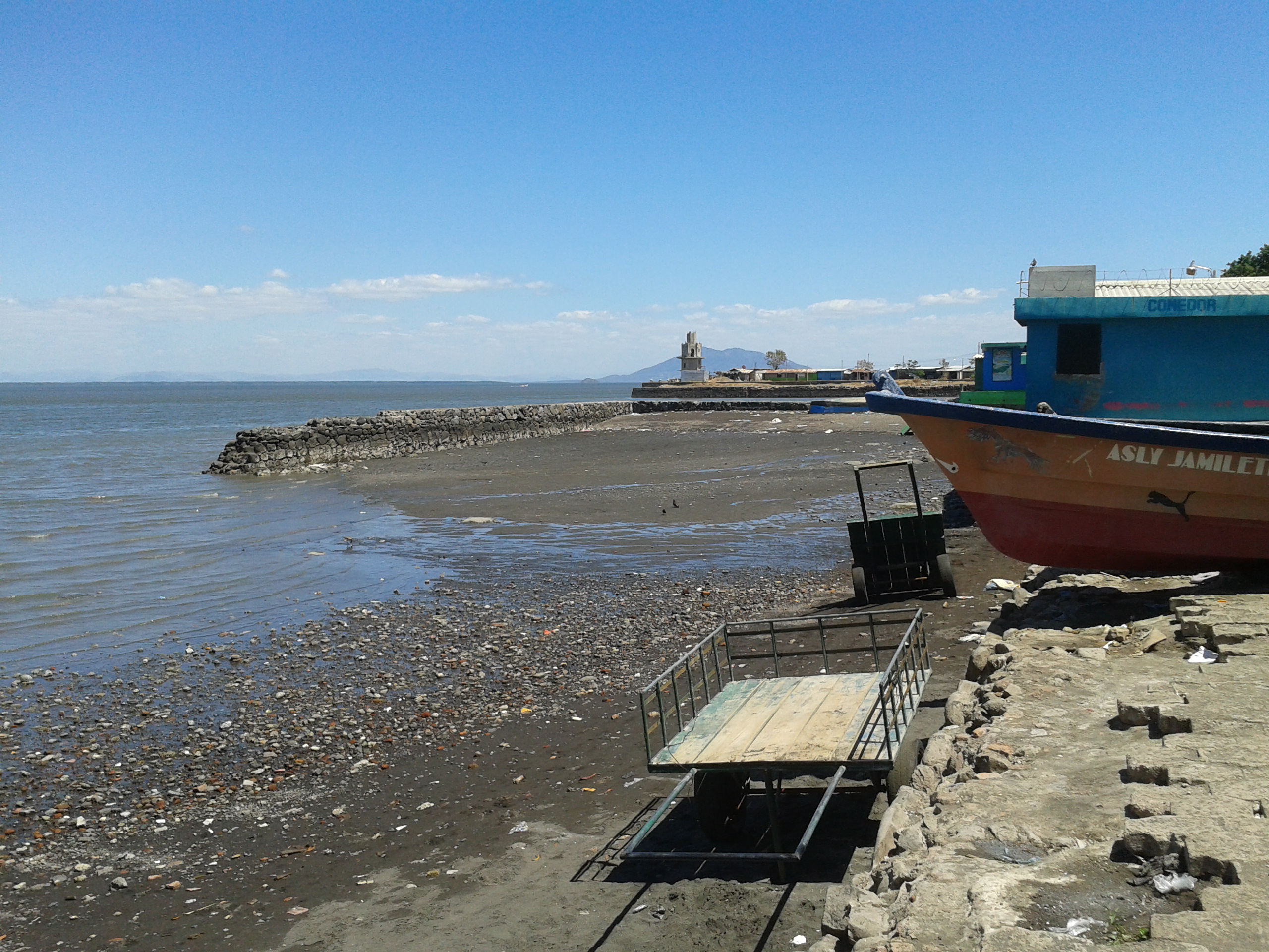
The dock at La Union, El Salvador, where you might be able to pick up a launcha to Nicaragua.
The “dock” was a little less official than the unofficial dock that we were expecting. We did see people leaving in launchas from this beach. The owners would load people up on the mud, and then push the loaded boats into the water. Sometimes the passengers would help. There is a little cantina here by the shore, and this was the official place to solicit a ride to Nicaragua. We asked, the man made some calls, and determined that we could probably get a ride in a few days. That wasn’t going to work with our schedule, so we thanked him for his effort, and we ended up retracing our steps to the highway so we could ride into Honduras.
This is the map for the entire route discussed in this post. To Export GPX files, click on the three horizontal bars in the upper right hand corner of the map and select Export selected map data…
To see full screen, click here (opens in new window)
This concludes the El Salvador Cycling Guide Portion of our trip. You may now wish to proceed to the following locations:
Bicycling Latin America – San Diego, Baja California, Mexico, and Central America Hub Page