Roper’s Sierra High Route
Unlike most of my posts, which are more like tour-guide descriptions, this post aims to detail my personal experiences on the route. If you are looking for more of a tour guide, check the “Highlights” section below or Steve Roper’s book “Sierra High Route: Traversing Timberline Country.”
About The Route / History
The Story of My Experience on the SHR
Highlights
Gear Carried
Map made from my GPS tracks
NEW – More Complete Photo Album
About The Route / History:
The Sierra Nevada is likely only a recently explored range. The original people living on this continent probably had little interest in visiting these high peaks of rock, snow, and ice. The mountains were difficult to enter, and they had no sustenance value. The one resource that may have been of human interest (snowmelt) is freely delivered to the florabundant valleys below. It wasn’t until the 1800’s (and the evolution of “leisure time”) that people began to exploit these mountains for their most renewable resources: Adventure, exploration, scenery, austerity, and tranquility.
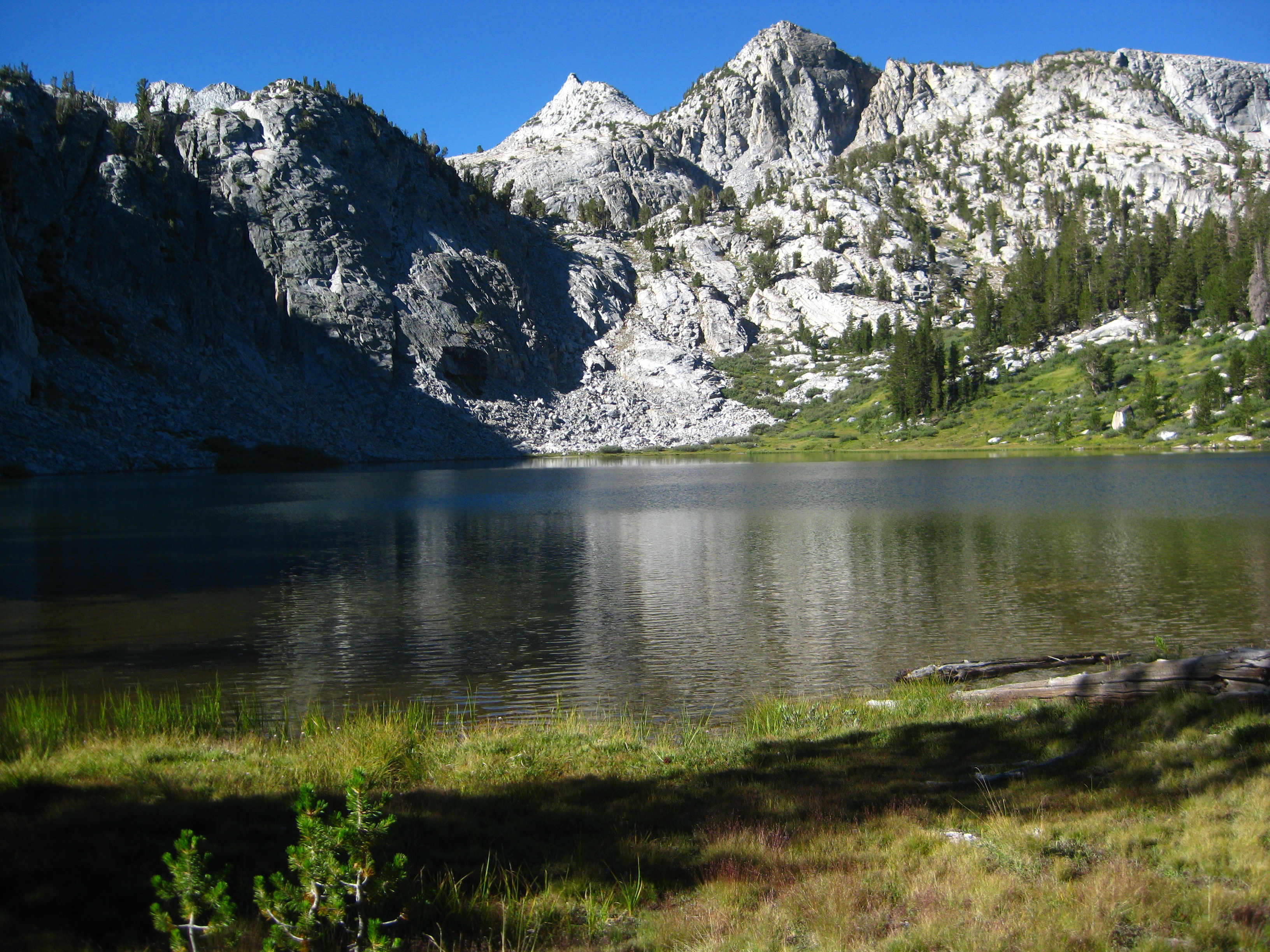
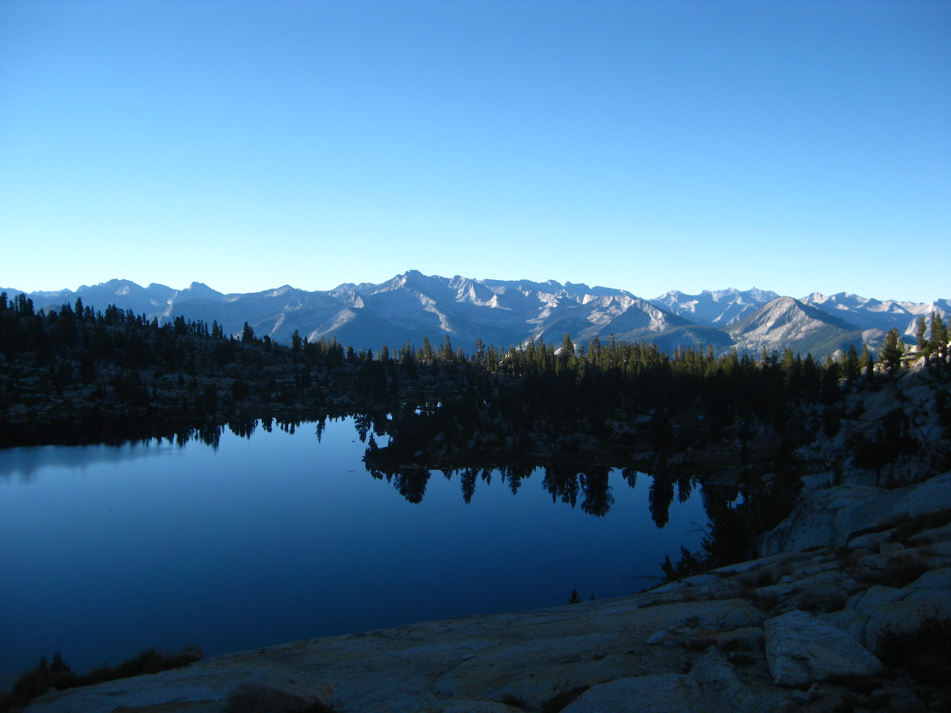
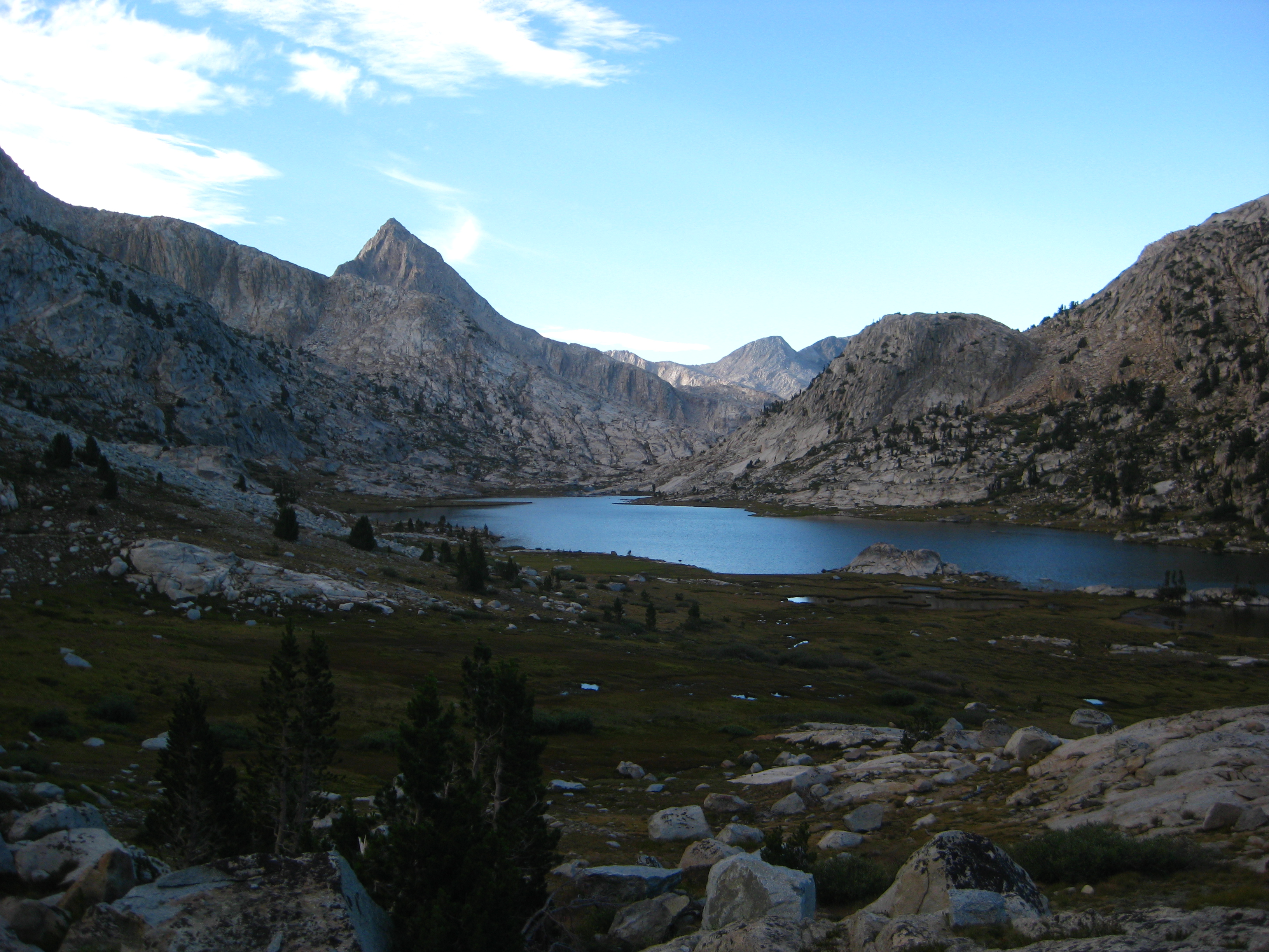
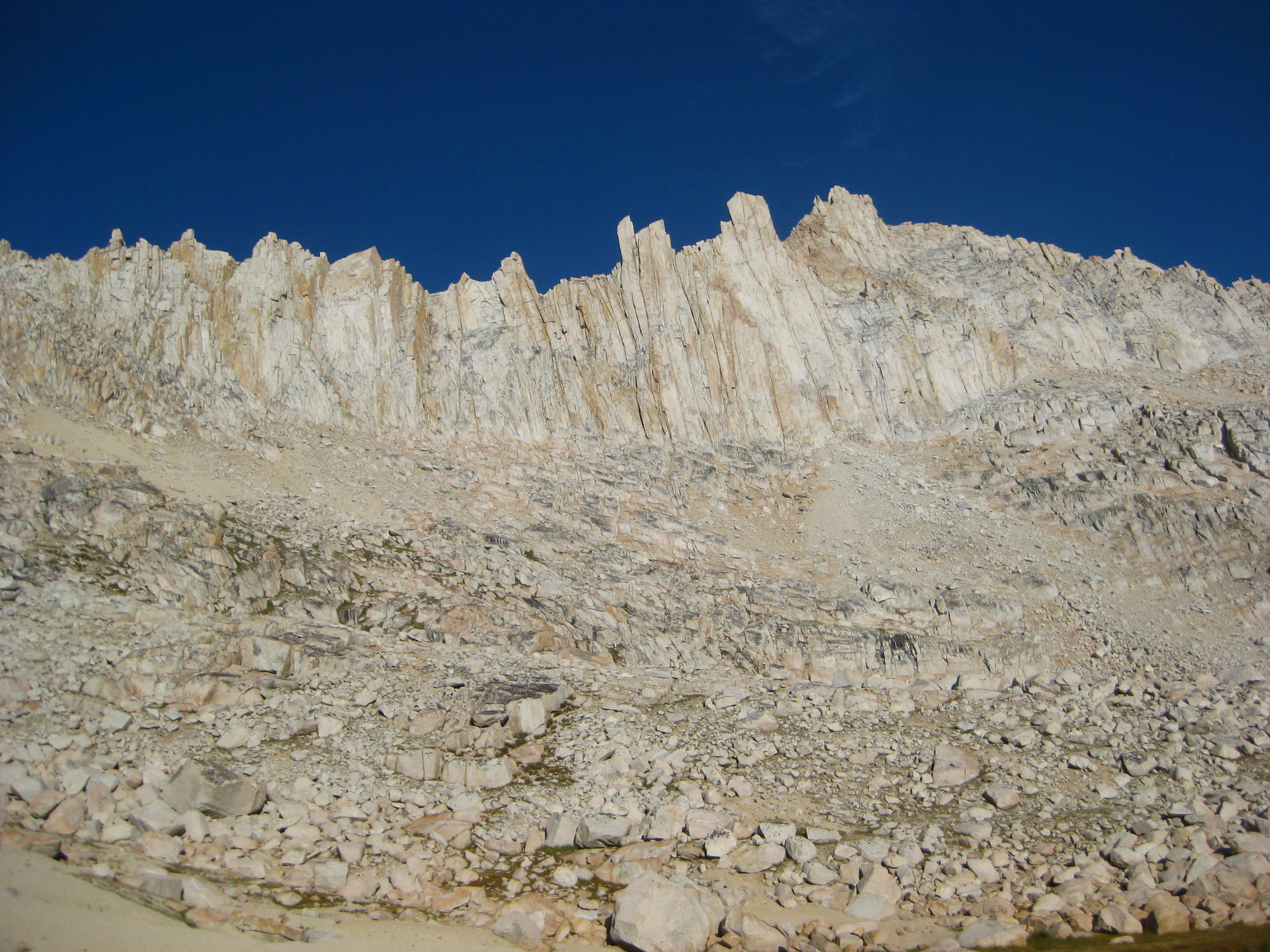
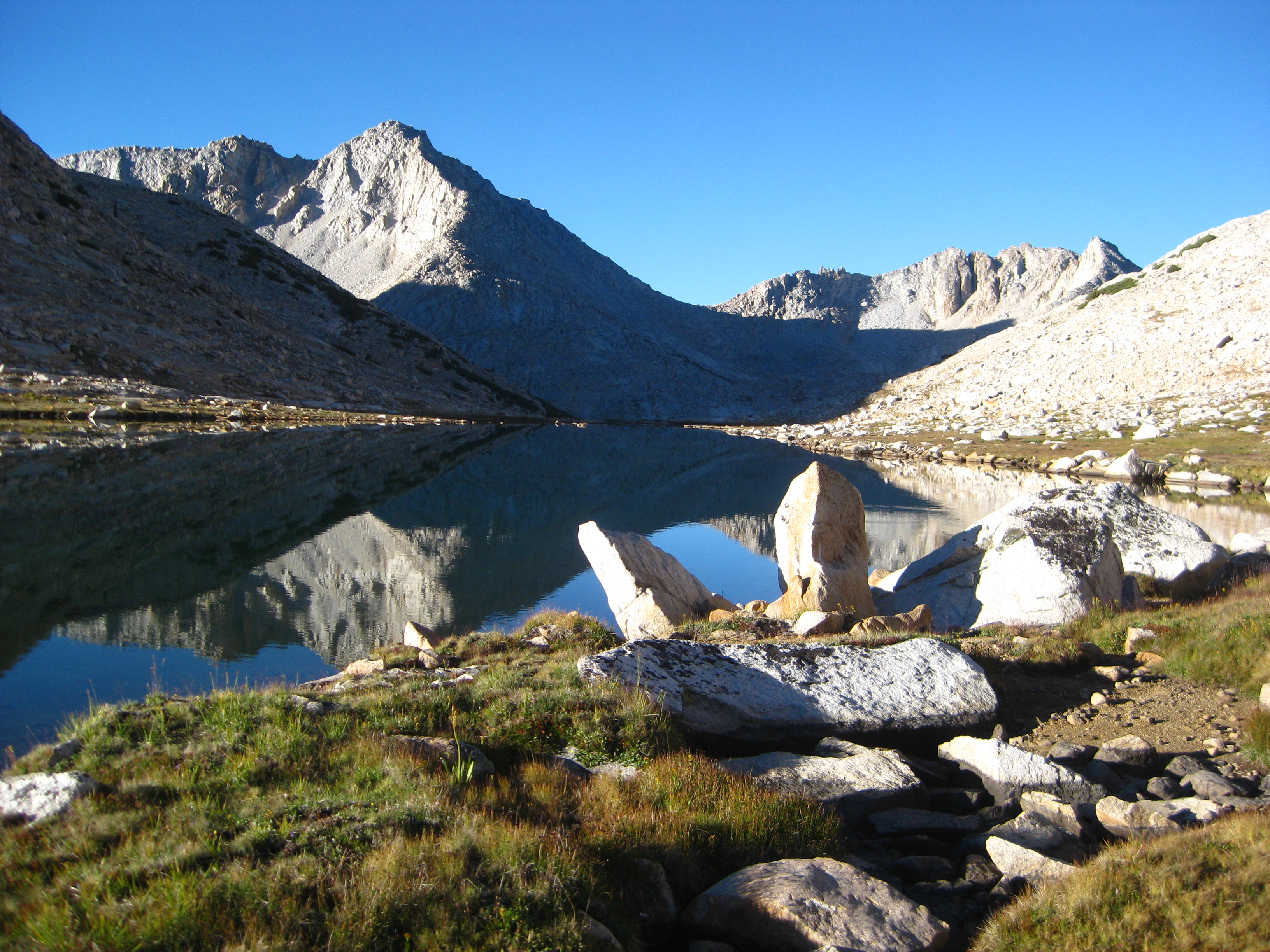
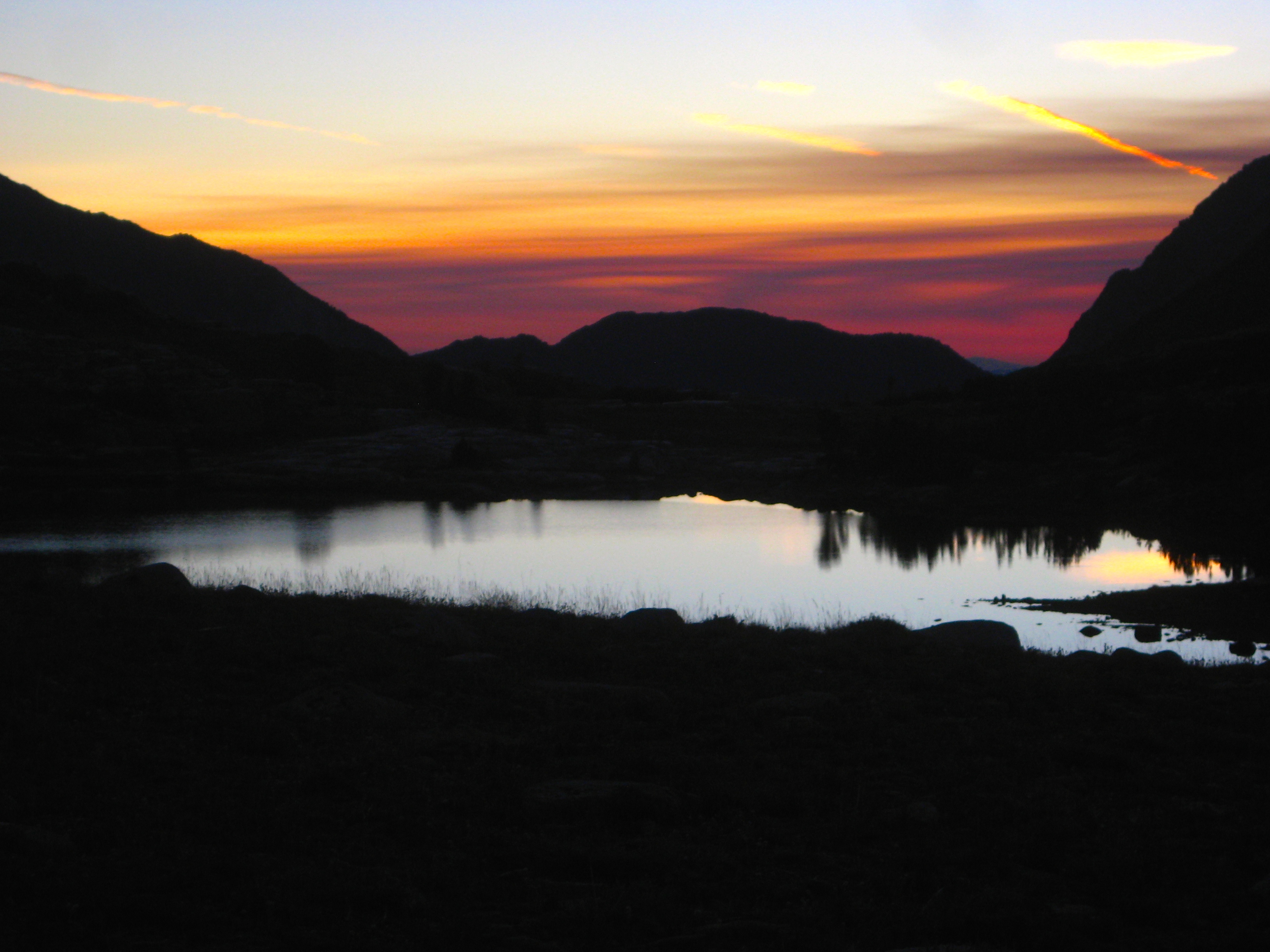
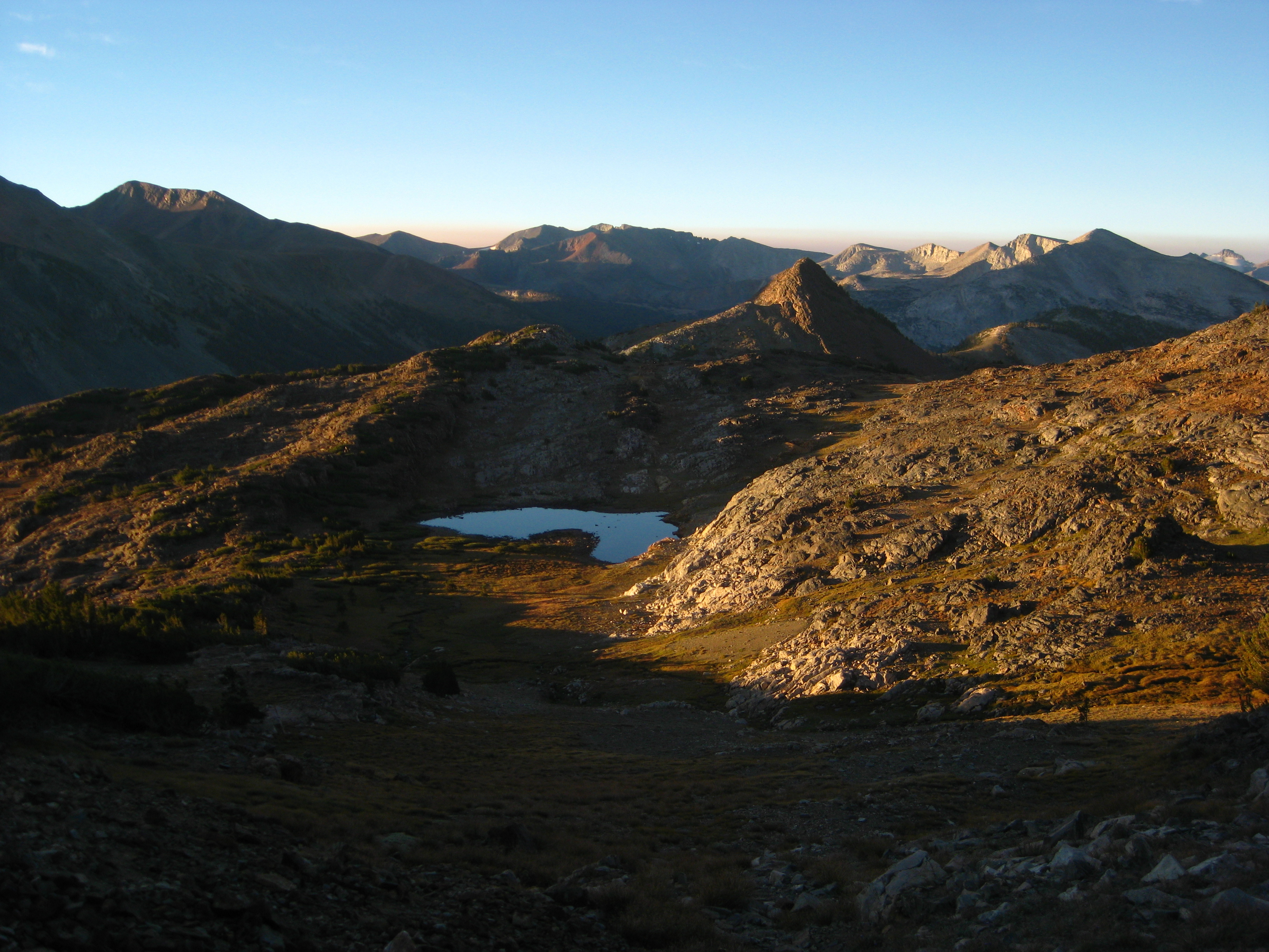
Lake 10,429 – one of the Glacier Lakes
In the California Sierra, living things become stunted above 10,000’ (this is called the Krummholz limit: the elevation where trees no longer reach their normal size). Above 11,000’ feet, the environment deals too many challenges for almost any living thing to survive. It is at this elevation that the Sierra High Route trundles along: the threshold between the rocks and the trees… the organic and the inorganic… The living and the dead.
The name “Sierra High Route” is actually a pretty generic name. In fact, it is often confused with the “High Sierra Trail,” which is an actual trail. The “Sierra High Route” was created by Steve Roper – author of the book “Sierra High Route: Traversing Timberline Country.” In the late 1970s, he spent several summers exploring alternatives to the popular John Muir Trail. While the iconic John Muir trail is extremely popular with backpackers, it spends a lot of time at lower forested elevations. These elevations do not afford the scenery and majesty of the high passes, and this is why he sought a new route.

The Muir Trail Hut, looking kind of cool enshrouded in smoke from the Rough Fire. I only experienced smoke from ~3pm to 9pm on the first two days.
Roper, in his book’s introduction, discusses the dilemma he had with publishing the route. On the one hand, he had created this scenic route that is beautiful and austere; he wanted to share this wonderful “discovery.” On the other hand, the best way to keep such a route wild and clean would be to keep it secret. After agonizing over this dilemma for a year, he ended up publishing the book quoting Karl Marx: “The road to Hell is paved with good intentions.” Fortunately, years after publishing the book, he is still convinced that the types of people who would undertake this route are the same people who would take the necessary care to preserve the region’s untrammeled wilderness. Now that I have traversed the entire route, I would agree; the only evidence I witnessed of human passage was footprints.
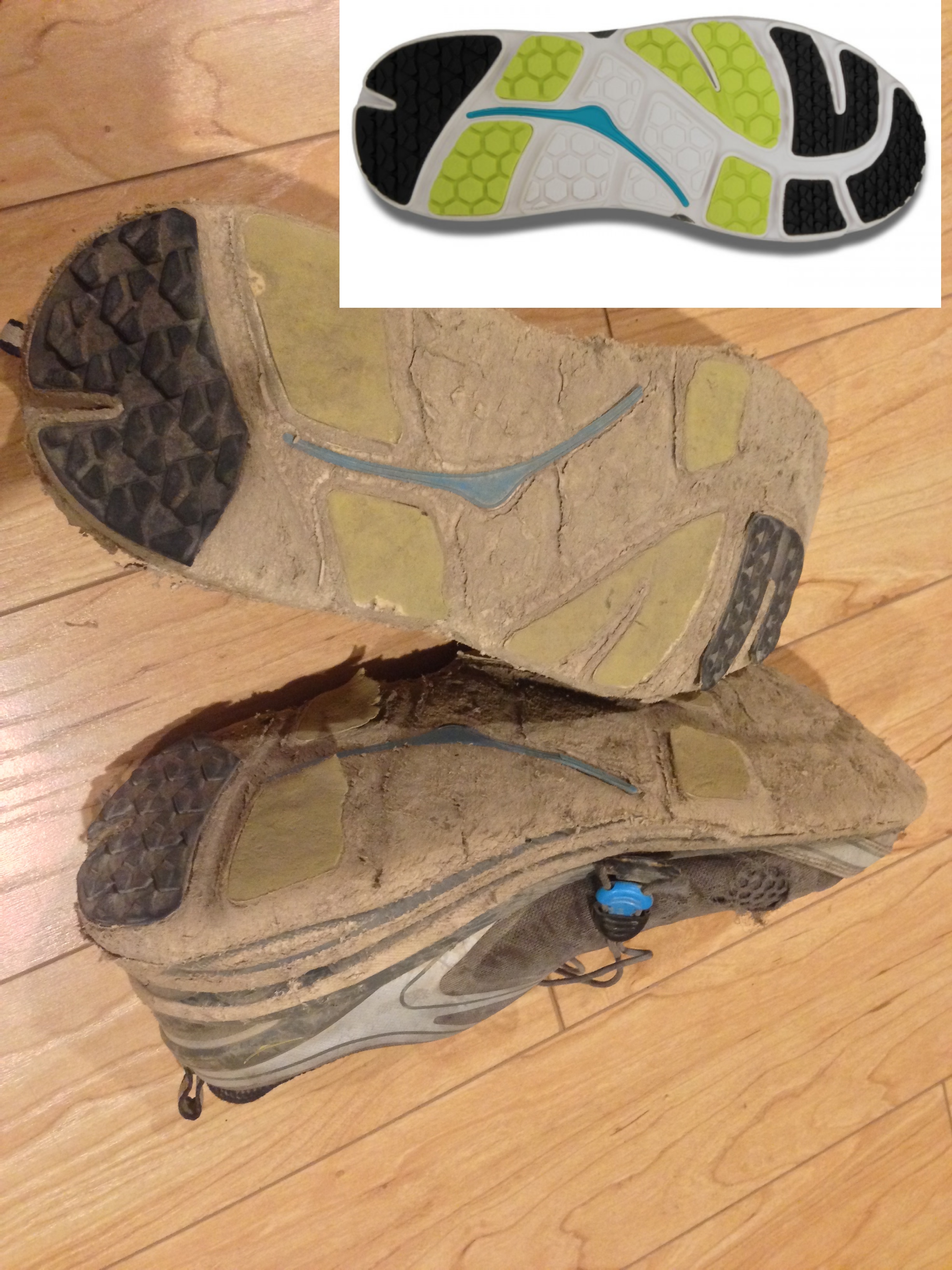
Speaking of footprints, this is what my shoes looked like after the Sierra High Route. They were new (inset) at the start of the trip!
For the numbers people, the route is a 195 mile largely off-trail trek with 59,000’ of climbing. For the non-numbers people, that’s like driving half way from San Francisco to Los Angeles, with two Mount Everets in between. The numbers are diminutive of the true difficulty of this route. About half of the mileage is spent leaping from talus block to talus block, climbing rock walls, or arduously slide-stepping up 50 degree scree (scree is like kitty litter where you take one step forward, and slide 2/3 of a step back). Besides the physical onerousness of the terrain, there is the constant challenge of finding the right way. Accidentally scaling the wrong pass could be a big setback. Map and terrain reading skills are essential; from below you may see 5 adjacent passes, and you need to know which one to scale in order to make it to the next point. Roper intentionally did not provide a “line to follow” or maps. Instead, he has provided a text description that would ensure that on the off trail portions, people would take slightly different routes. The route is given in this form: “Move left towards the reddish colored outcropping. There you will encounter white slabby sections with a few class 2-3 problems… Drop down into a meadow and follow a ‘hidden’ valley to the North… When this terrain steepens radically, leave it and contour left on easy terrain.” With this guidance, it is ensured that no two travelers will follow exactly the same route. The advantage to this is that each newcomer gets to experience the wilderness in much the same way as those who have gone before.
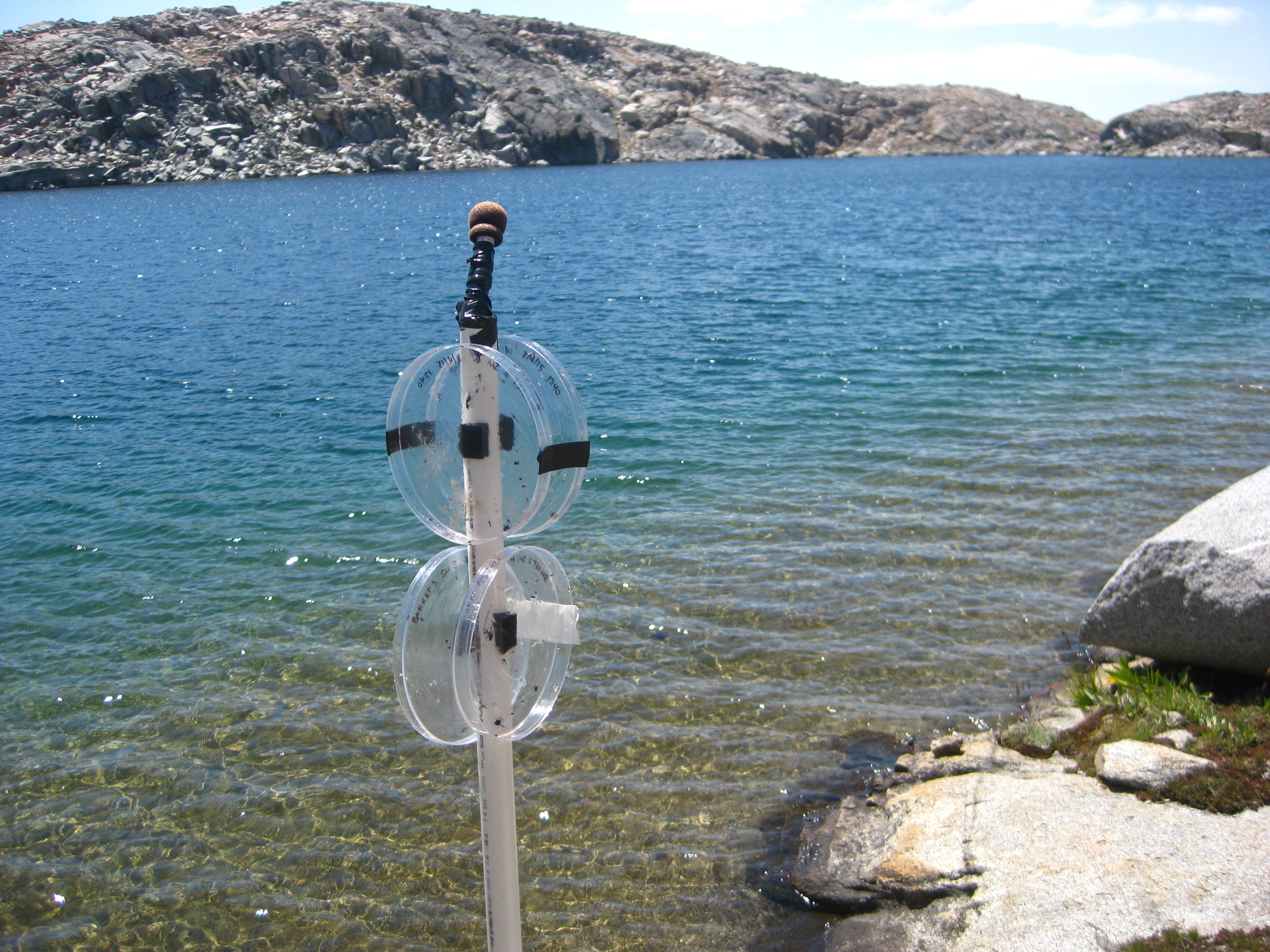
I found this device placed on the Northern shore of the largest Barrett Lake. No trail goes here; the lake is remote. A little blurb on the device says that UC Davis has placed the device here to record the sounds of the wilderness to preserve them for future generations.
If you are a lover of the Sierra, the book is a great investment; the first 83 pages are dedicated to telling the tale of the early explorers of the region. Learning the stories of people like Clarence King, Theodore Solomons, and Helen Marion LeConte gives the reader a stronger connection to these predecessors when places bearing their names are seen on the maps. Along the route, you may wonder: Am I placing my foot in the same place as one of these explorers did over 100 years ago? These early explorers lived in an era without iPhones, Google Earth 3D, and lightweight gear. But when we’re both standing in the same place, separated only by time, we’re asking ourselves the same question: “I wonder what it looks like on the other side of that pass?”
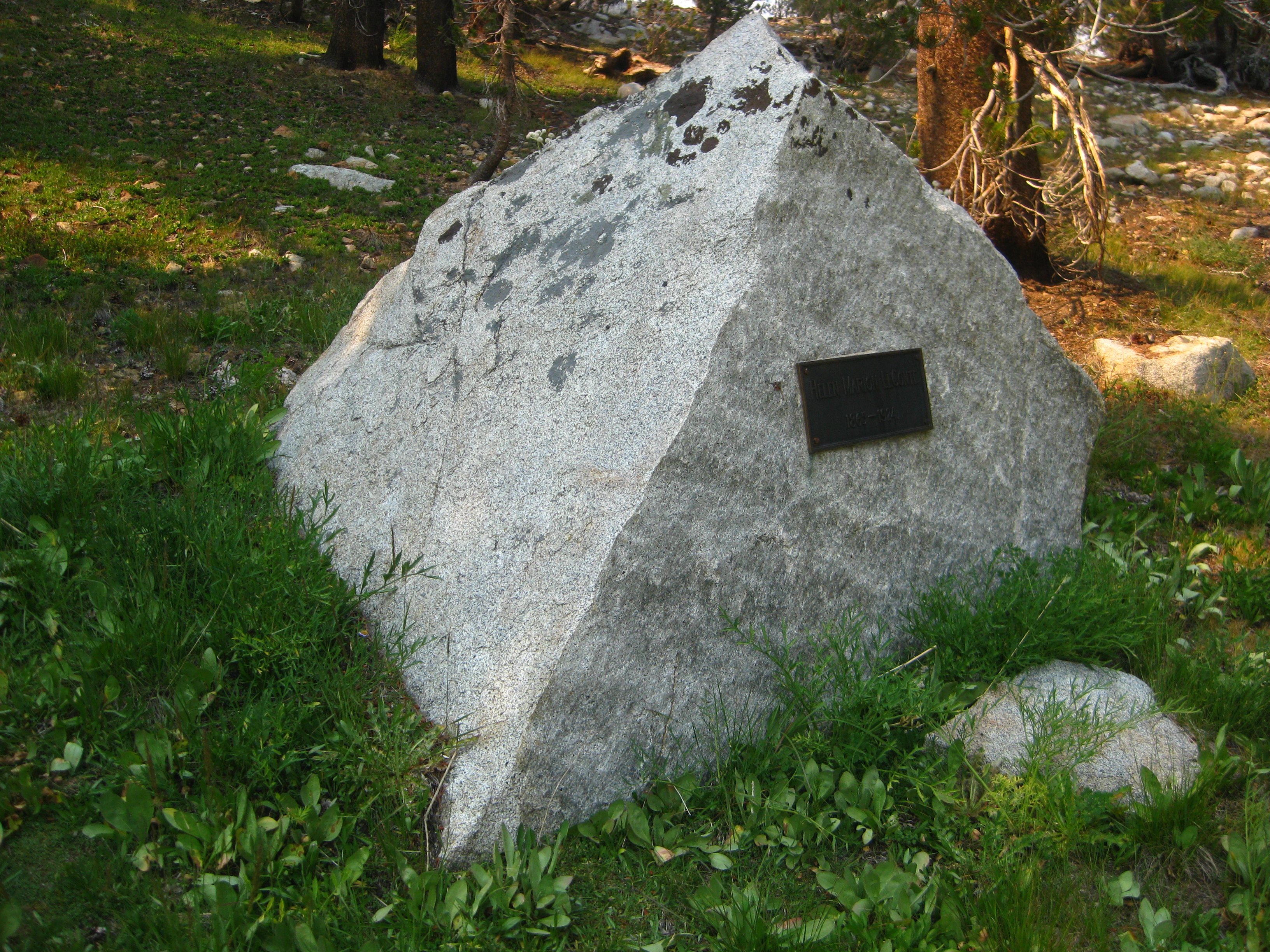
A plaque dedicated to Helen Marion LeConte found at the tip of Marion Lake. No trails lead to this lake; the lake was named after her.
I initially heard of the Sierra High Route from my friend Leor Pantilat. This route has been an aspiration of his for many years. On one of our adventures in the Ventana in the Spring of 2015, he told me about the route for the first time. He told me he wanted to do an FKT (Fastest Known Time) on the route. He mentioned that one problem was possibly of finding a partner. Without hesitation, I said, “Sign me up.” Leor stopped and looked at me with his wry smile – probably wondering if I was serious. Over the next few months, we discussed gear, food, and transportation. I bought the book and spent 16 hours translating Roper’s textual descriptions into a line on the contour map. I studied every inch of the route on Google Earth, trying to figure out where those “reddish white” outcropping were, and what the Class 3 “gray cliff” might look like in 3D. I wrote a Cliff’s Notes version of the book, and sent Leor my maps for review. Leor arguably knows the Sierra better than any living person today. He is a genius with maps, and within an hour of me sending him my enormous map file of the 195 mile route, he wrote back with 5 detail oriented corrections! After making these fixes, I knew my map was ready for game time; When it comes to any aspect of the Sierra (navigation, terrain, weather, fires, etc.), I trust Leor implicitly.
Our planned departure was in June, but the timing was never exactly right. In June, the Sierra had bad weather almost the entire month, and I had a groin injury. Early July brought more bad weather, healing to my groin, but an achilles injury for Leor. Late July found me on a second intense “practice run” through the Ionian Basin. Upon my return I wrote (but then did not send) a text to Leor: “You go without me. This is going to be too much pain.” August brought repair to Leor’s tendons, distant memories to my pain in the Ionian Basin… but new challenge: fires. Leor was particularly concerned about the fires obscuring pristine views, but he had encouraged me to go solo (twice in fact). Time was running out this season, so I decided it was time.
A big part of Leor’s purpose in doing this route had been a FKT. Although we would not have been in contention for the unsupported record (because unsupported also means unaccompanied), it would have been great fun to travel with Leor. Now that I was going solo, I decided that this was an opportunity to add my own “side dressing” to the trip. I wanted to travel fast and light, so why not make it a challenge as well. To achieve the unsupported record, I would need to carry all of my food from the start, and travel unaccompanied. I announced my intentions of an FKT.
The previous “record” is held by Andrew Skurka and Ultra-running legend Buzz Burrell. I put record in quotes because judging by their fun video, it seems that they were not simply focused on speed. They completed the route in 8 days and 4 hours starting on July 1, 2008 from the Southern Terminus. Skurka himself says that he could have gone faster at his usual pace.
Andrew Skurka has done some amazing solo trips through Alaska. I first heard of Skurka from my friend Gary Gellin when he said, “Come here and watch this. You’re gong to love it!” It was a TED talk by Skurka about his trip through Alaska. Andrew includes self video and peripatetic talk about his emotions and experiences. At one point, he is crying into the camera saying, “I haven’t figured out why I’m crying right now, but..” I was intrigued by this depth of emotion he was feeling, but like he said, I didn’t understand. I was glad that he included this; I briefly wondered about this new layer of human emotion that I had never felt.
Buzz Burrell Buzz is an ultra-running legend: The former record holder of the Colorado Trail and the John Muir Trail. A veritable hero of ultra-runners all around.
I’ve had a bit of an ethical dilemma attempting a FKT on this route. Roper intentionally did not provide maps with a “line to follow” as mentioned above. Part of the experience is “finding your own way.” If trails start to form, then some of the sense of adventure is lost. The ethical dilemma is this: To claim an FKT, you need to provide verification, and I’m doing that by sharing my route – a GPS track that has a point taken every few seconds. This is akin to providing a map with a line on it – exactly the type of line that Roper wanted to avoid. The dilemma was solved when I realized that this “line” is already out there. On The Trail.org provides a free GPX Track of the SHR (though it deviates VERY significantly from Roper’s route in several places!) Besides several small deviations, their GPX goes over completely different passes with huge deviations in: 1) Humphrey’s basin 2) around Mt. Goethe 3) Dusy Basin 4) From Lake Basin to Upper Basin. Also, Andrew Skurka sells maps and a dataset of the route for $15 on his web page. (I have not examined this route for accuracy). If this “line” – which Roper had been trying to conceal – is already available to the public, then what would be the harm of me making my own interpretation of the line public? Once again, “The road to Hell is paved with good intentions.” So, let the fun begin…
The Story of My Experience on the SHR
Day 1 (30.6 miles, 12,367′ of climbing):
I awoke naturally at 3AM in the Moraine Campground near Road’s end in Kings Canyon Park. I packed up my Ultimate Direction Fastpack 30, and drove to the Copper Creek Trailhead. First step on the trail was at 4:01 AM, but within a minute I stopped to double check that nothing was forgotten. Walking up the familiar trail in the dark, I gained several thousand feet. I knew I needed more sleep, and I had read that whales sleep half of their brain at a time, keeping the other half of the brain alert. They sleep with one eye open. Since it was dark and I already knew this trail, I began to sleep up the trail. I’d close my eyes for 12 steps, then open them for an instant to memorize the rocks and roots coming up, then “sleep” again. Unbelievably, I felt well rested by the time I reached the top – just as the indigo light was gently beaming through the trees.
Grouse Lake with Grand Sentinel in the background
This was also exactly the time that you started needing your eyes full-time, as the route would be off-trail for the rest of the day. You really ease into the terrain, as the first off trail sections were very mild. With the great scenery and relatively easy progress, I began to think to myself that maybe I could finish this route! I had been sick to my stomach the past few days. A week and a half prior, I had done a long run in Tahoe, and my Sawyer Mini filter was getting clogged.* My patience and thirst were at odds, so I drank 3 bottles from a small high tarn, figuring that 1) Leor does this all the time, and 2) The ultraviolet light from the sun in the shallow water might kill any germs. 7 days later I was sick: and still sick on this trip… with Giardia. Also on my mind was the fact that Luke Nelson had essentially announced on his Facebook page that he would be starting the Sierra High Route tomorrow at 7am with the goal of speed. Although my primary motivation was not speed, this knowledge somehow changed things. In a way, this became kind of a race, and given his credentials, the race would be a painful one.
Dropping down this steep gully to Marion Lake. This lake is named after Helen Marion LeConte (the wife of Joseph LeConte). These two took some amazing, long adventures in the mountains in the 1800s. The duration of some of their days would rival mine.
This early physiological strife may have ended up being an advantage in the long haul: The nervousness in my stomach from the “competition,” and the pain from the Giardia meant little eating, and more food for later. This would be key, as I was going to run out of food at the end.
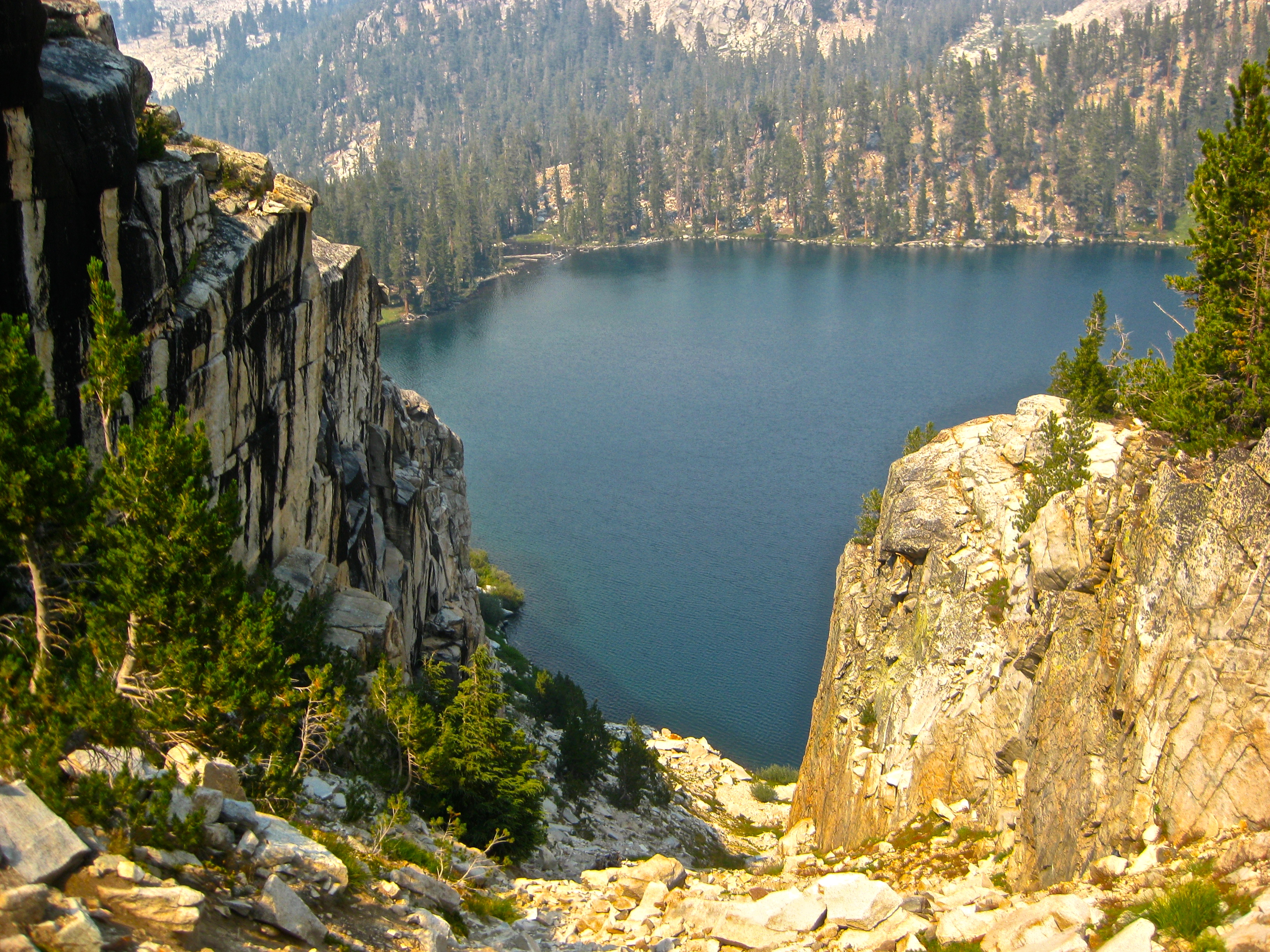
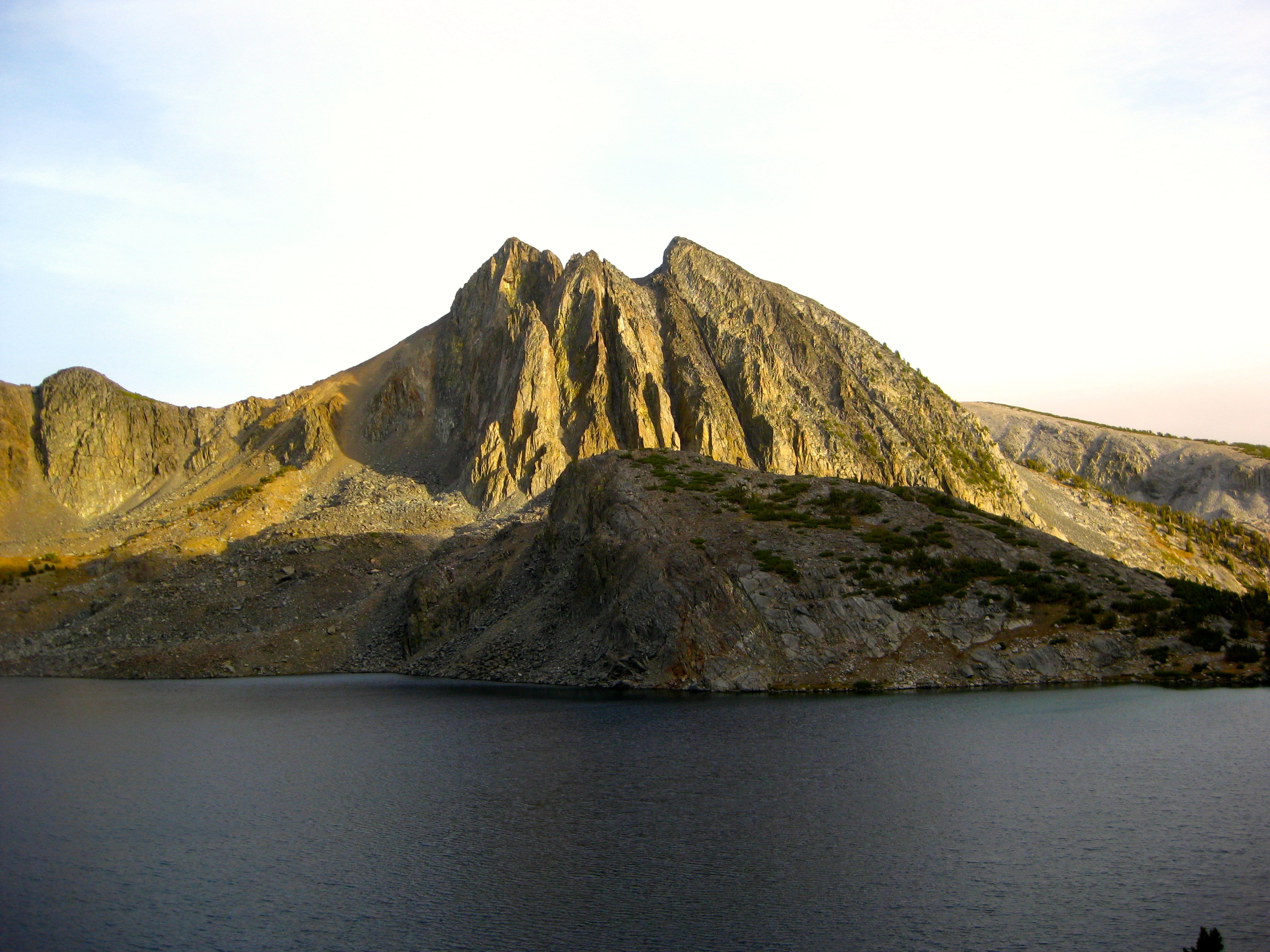
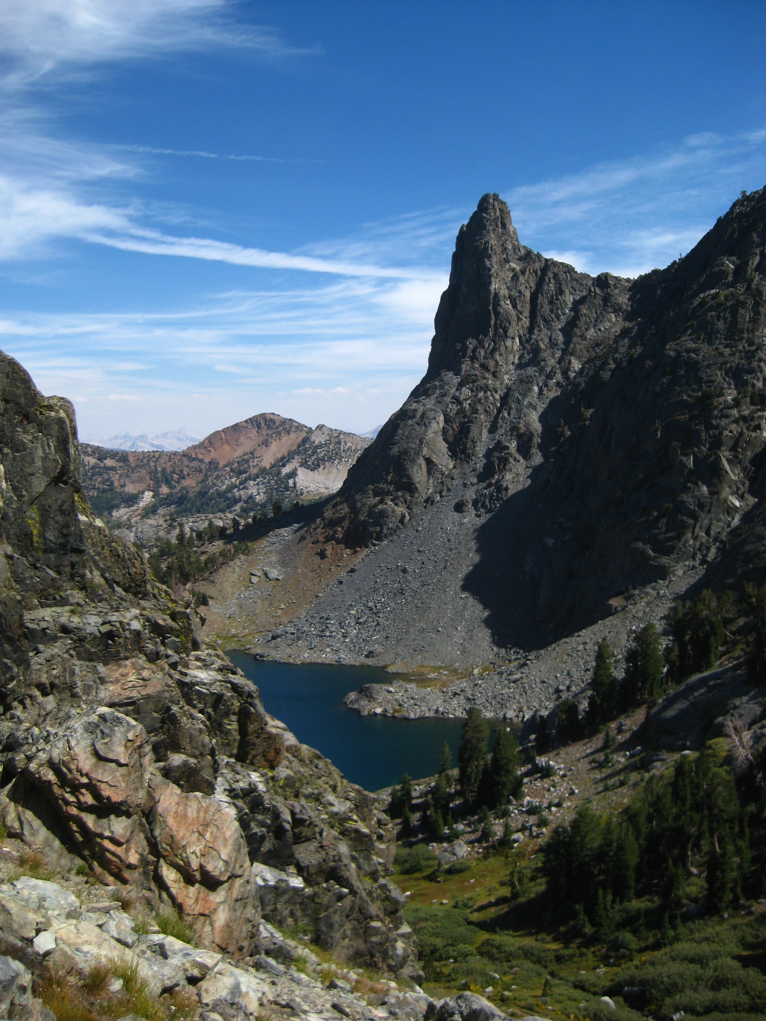
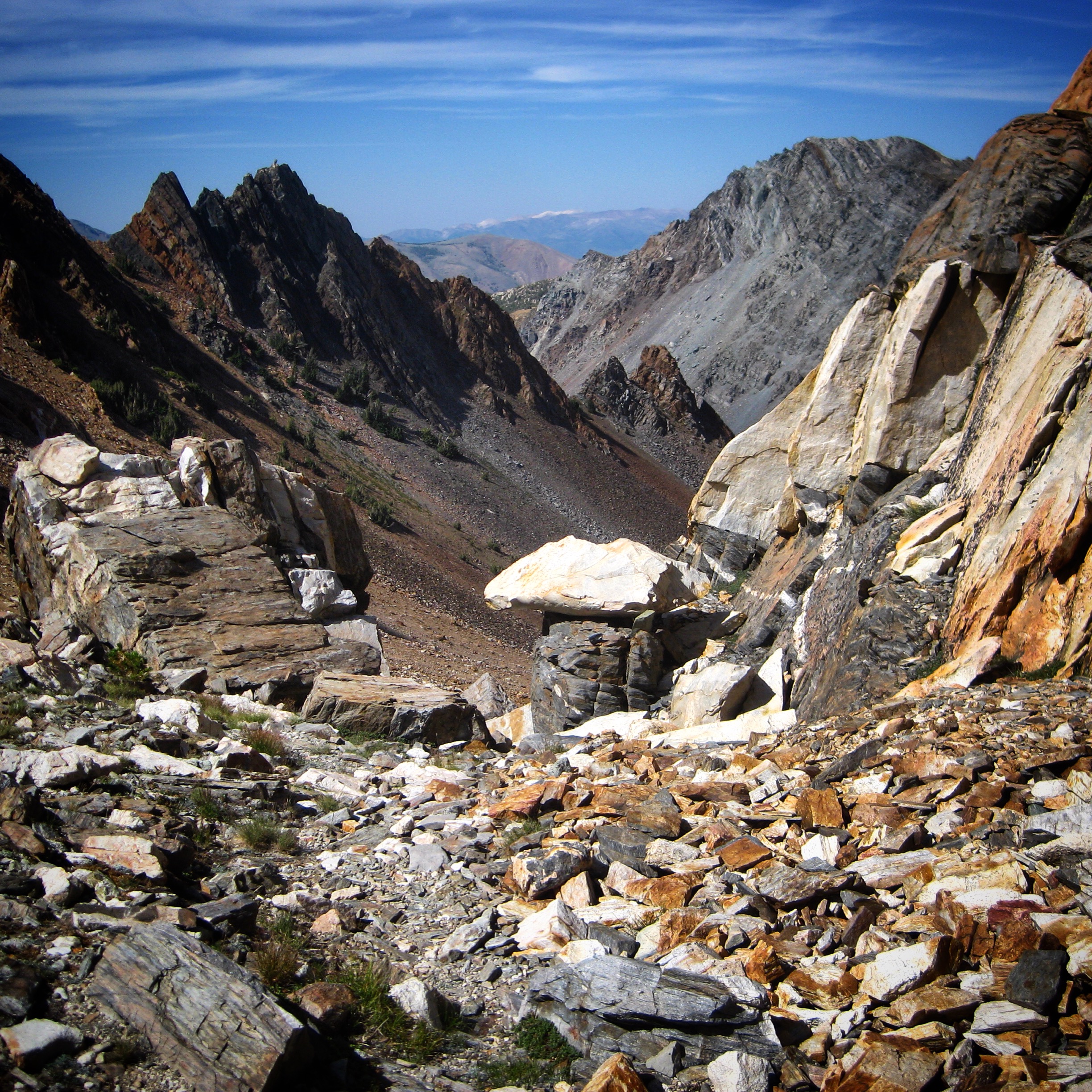
Around 3PM, smoke from the Rough fire appeared, obscuring views a little. This detracted from the scenery somewhat, but it was tolerable. Near the end of the day, I met the first and only people I would see that day. Dan and Lori were doing the Sierra High Route for their 8th time (in the opposite direction). They were on their 27th day. Their positivity and enthusiasm for the route was contagious, and it buoyed me over Frozen Lakes Pass, one of the more tedious passes of the trip.
The view to the side of Frozen Lakes Pass. Early Explorers tried to cross the pass (seen on the left in the picture), and were dismayed at the vertical walls encountered. I descended to the left from here.
Day 2 (29.7 miles, 8,579′ of climbing):
I had taken 2 of my 6 ibuprofen tablets last night to deal with the headaches I usually get when hanging out over 12,000’. That may also explain why my body felt surprisingly good and ready to hit Mather Pass on easy trail the next morning. I headed up the pass with high spirits, the excellent and improving scenery making each step go by quickly.
Lower Palisade Lake – one of the many beautiful lakes encountered on the route. This lake also happens to be along the JMT.
The beauty of Pallisade Lakes made things even more enjoyable. Shortly after the lakes, I jumped off trail again to travel a series of passes around the bowl of Pallisade Basin.
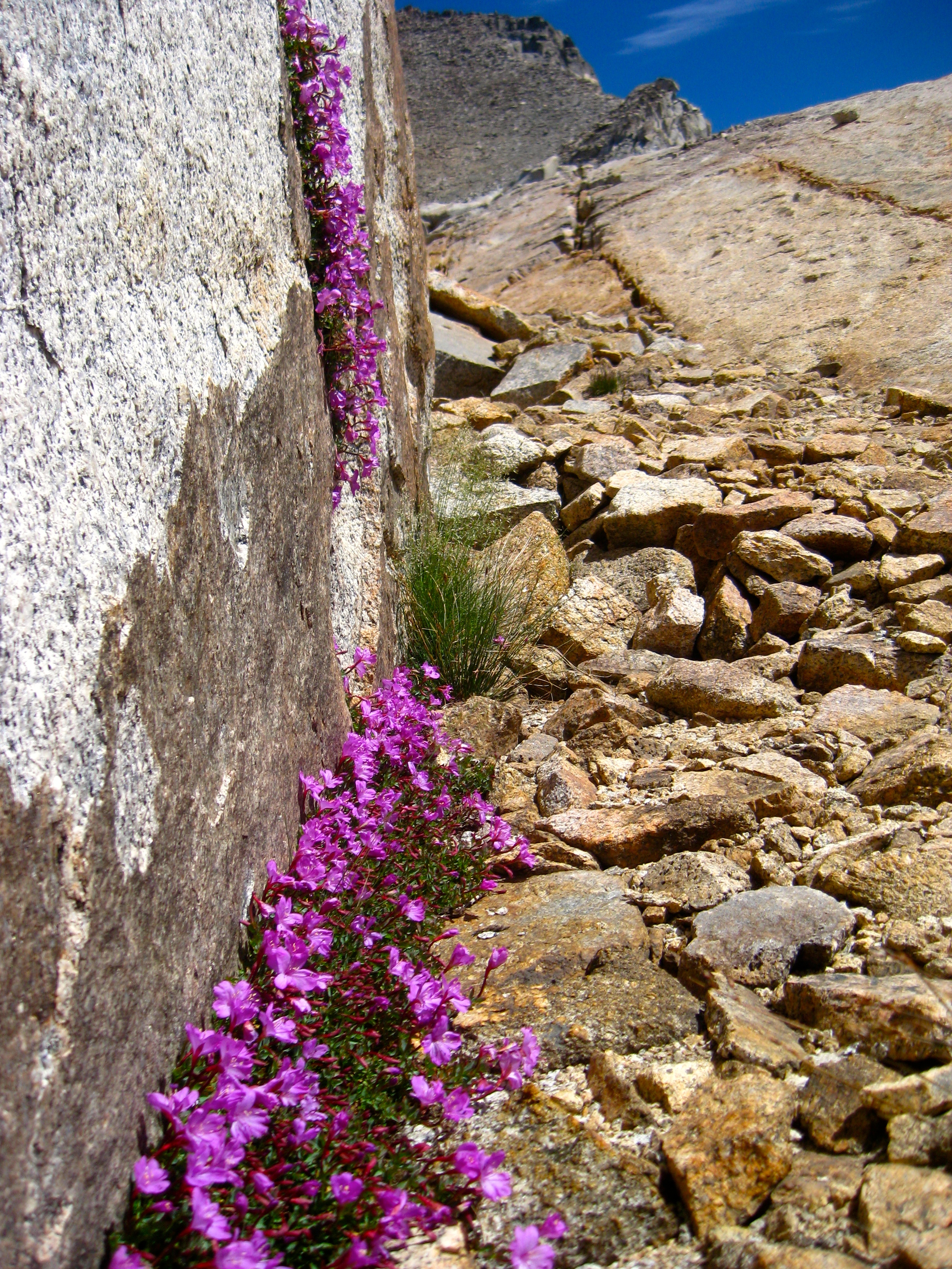
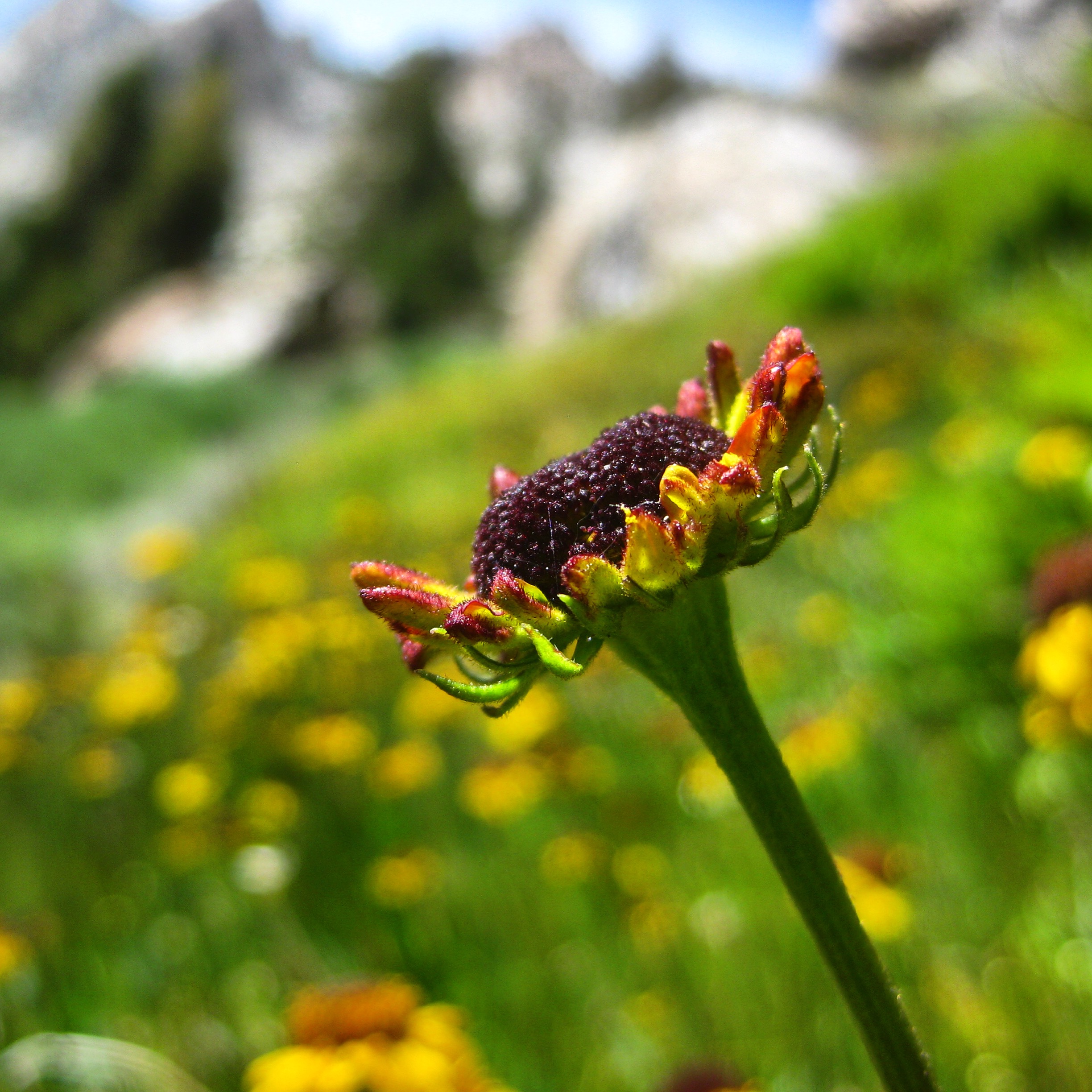
Some flowers I encountered while ascending Potluck Pass
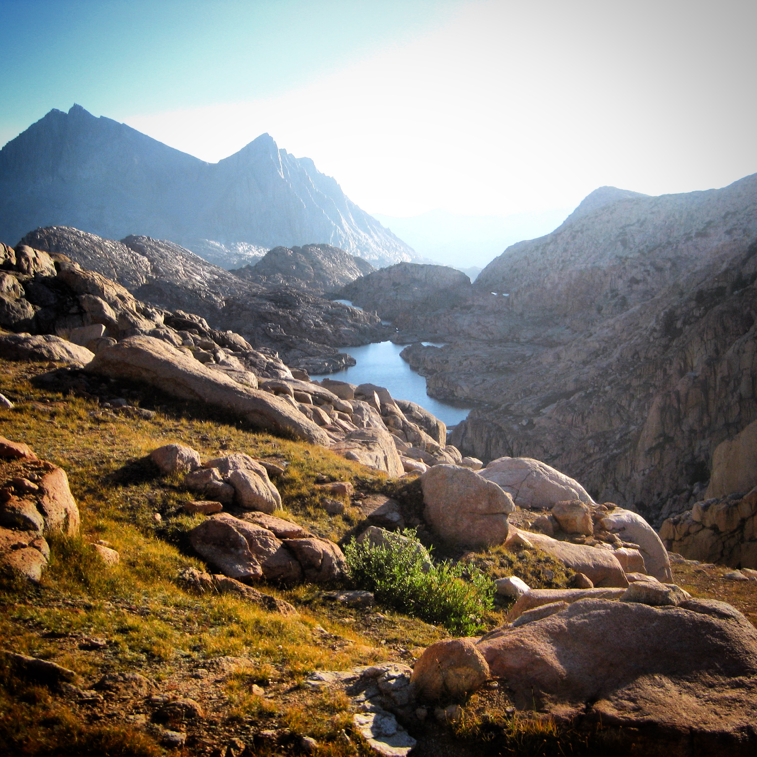
This section was challenging and time consuming, taking nearly 4 hours to traverse 6 miles of passes and traverses. Descending the Dusy Basin trail was somewhat unaesthetic. Smoke had drifted in again around 3PM. The miles ticked by slowly both in my mind and on my GPS watch. Being solo, all I had was my internal thoughts, and although they bounced around, they seemed to continually drift back to the idea of when and how I could wrap the trip up early. In retrospect, I ask myself: why did I want to quit? I think it was just the loneliness talking. I was in one of the most beautiful places on Earth, pursuing my dream! What strange thoughts to be having! I cruised up the lower portions of the JMT from LeConte Canyon to Muir Pass. The higher I got, the more my mood lifted! I was learning something: my mood was almost directly proportional to the scenery! Knowing this, I was about to get a big dose of visual Prozac: Going over Muir Pass and down the other side, you pass gorgeous Wanda, Sapphire, and Evolution Lakes! Sure enough, I arrived at Evolution Lake with tired legs, but positive spirits.
Day 3 (23.1 miles, 6,427′ of climbing):
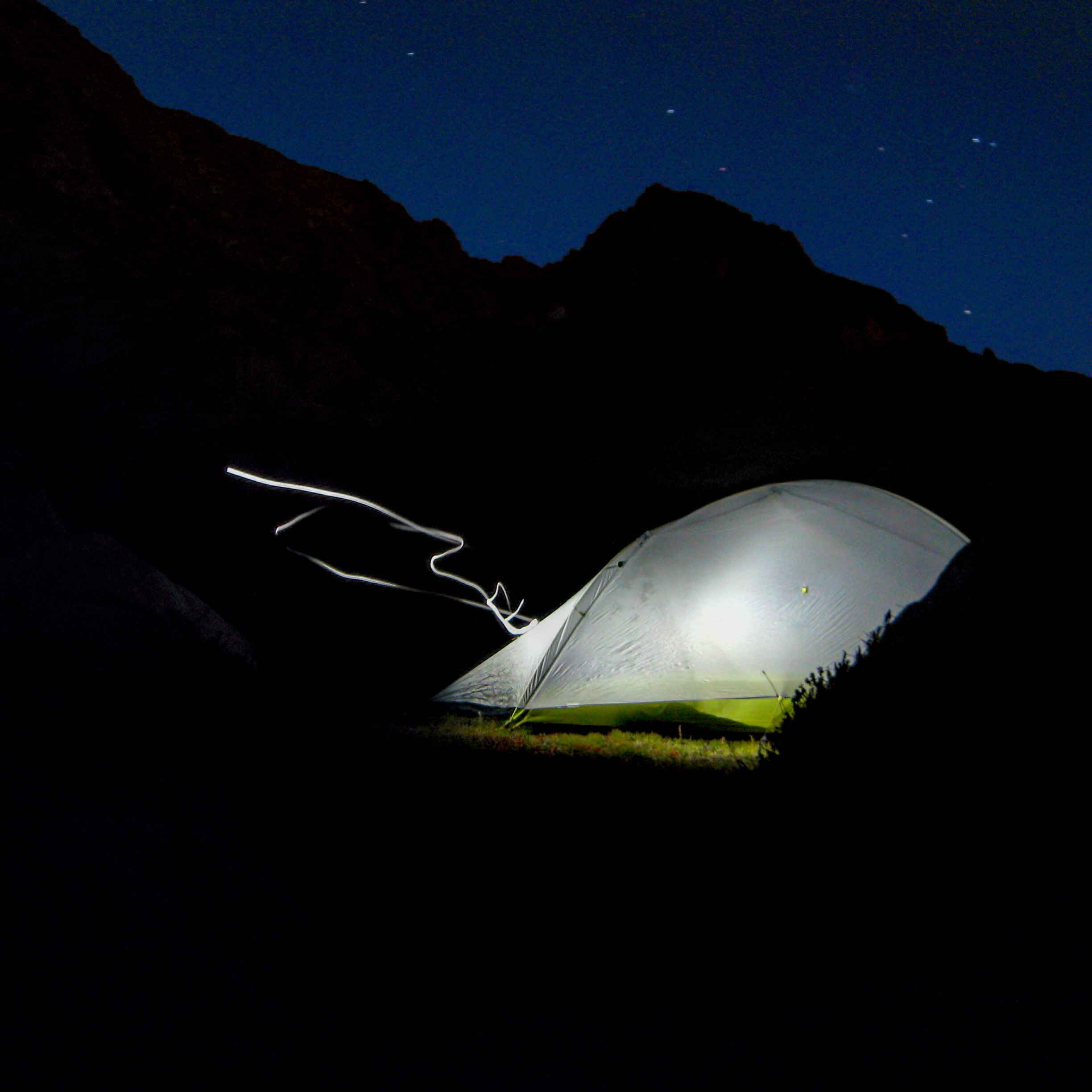
Last night, strong winds picked up at 9PM… and never abated. This meant that I spent the entire night awake with my arm up to brace the tent. The winds were so strong that they were pushing the top of the tent down onto my sleeping bag – bending the single-T pole with vehemence. I lay awake late into the morning.
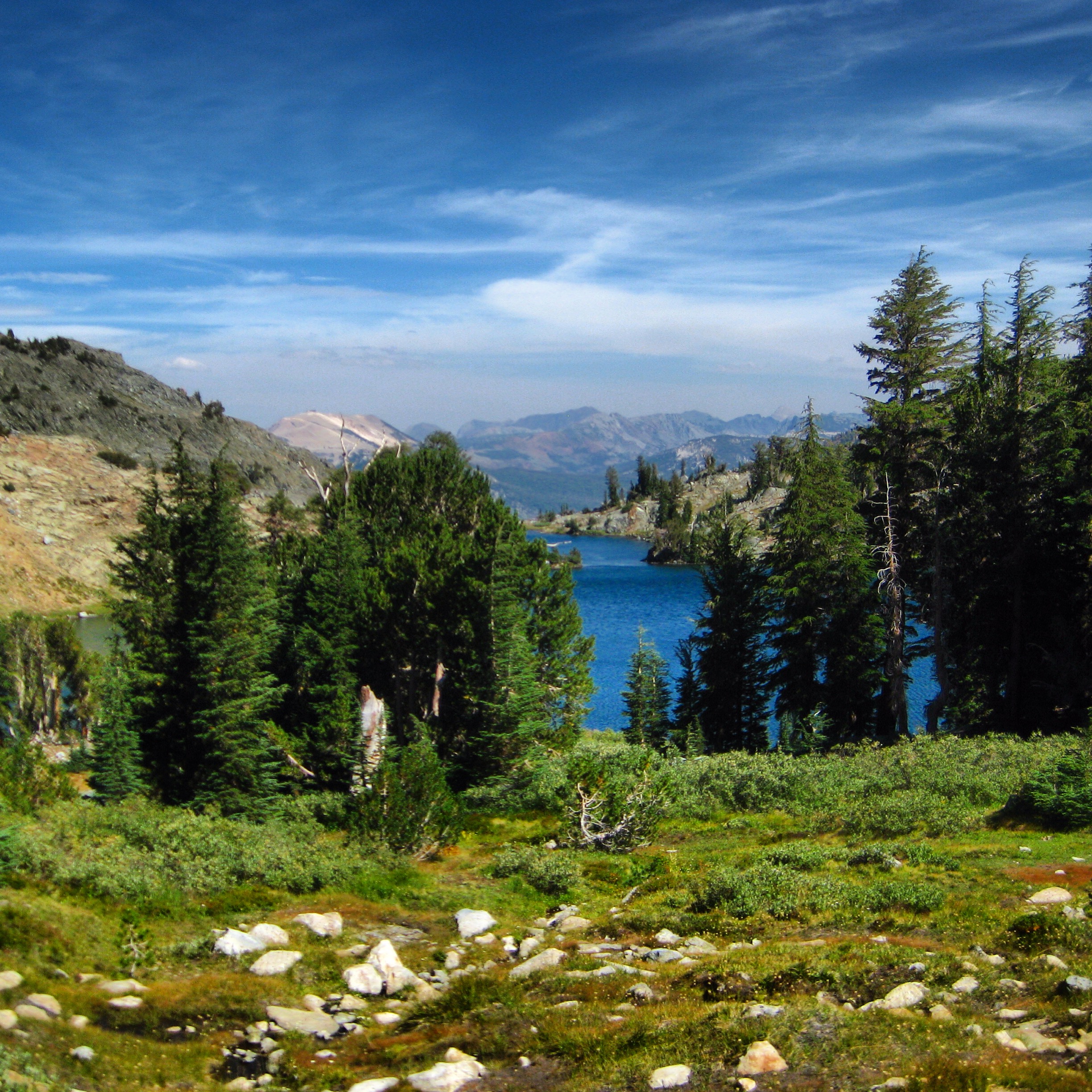
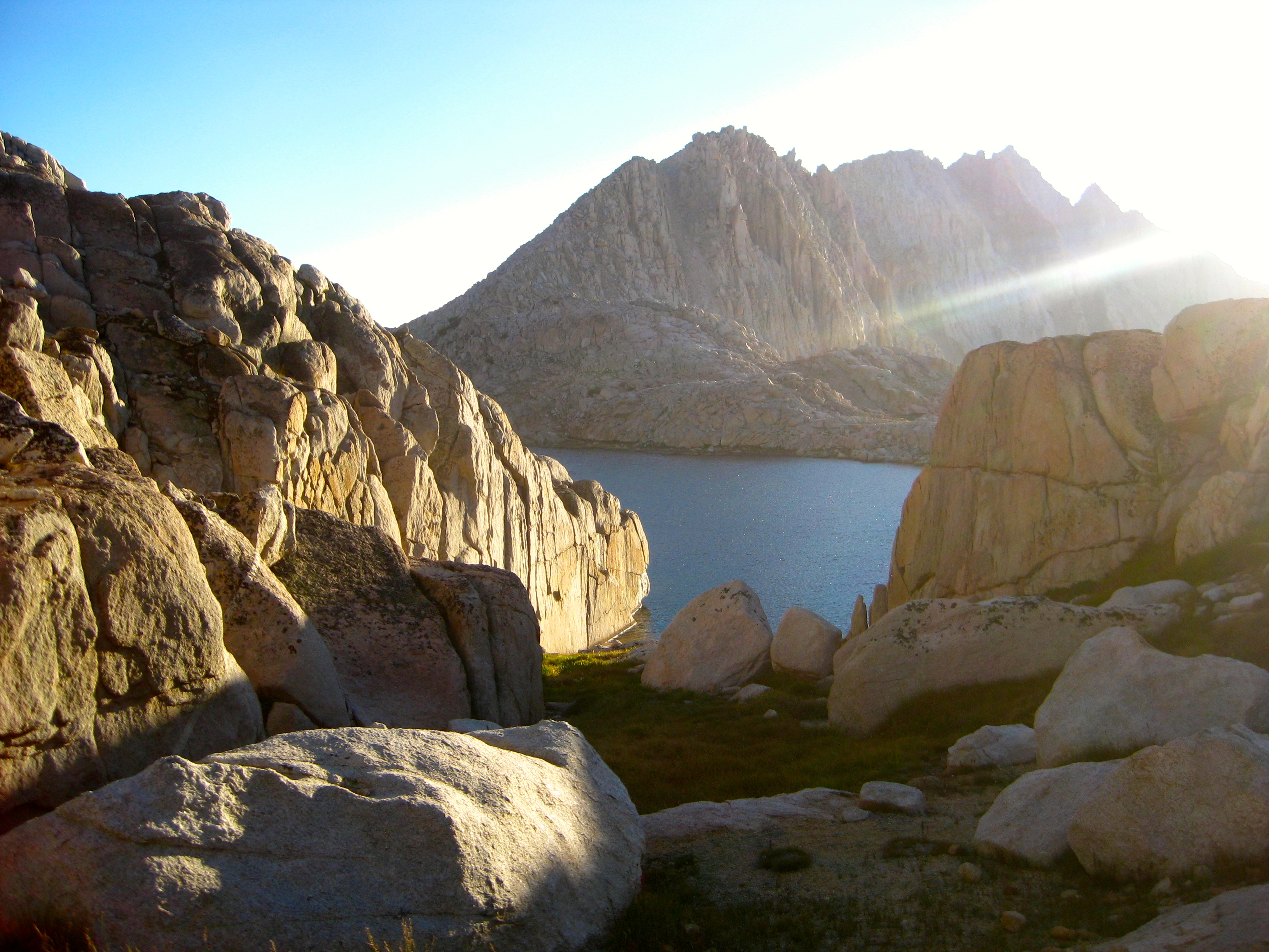
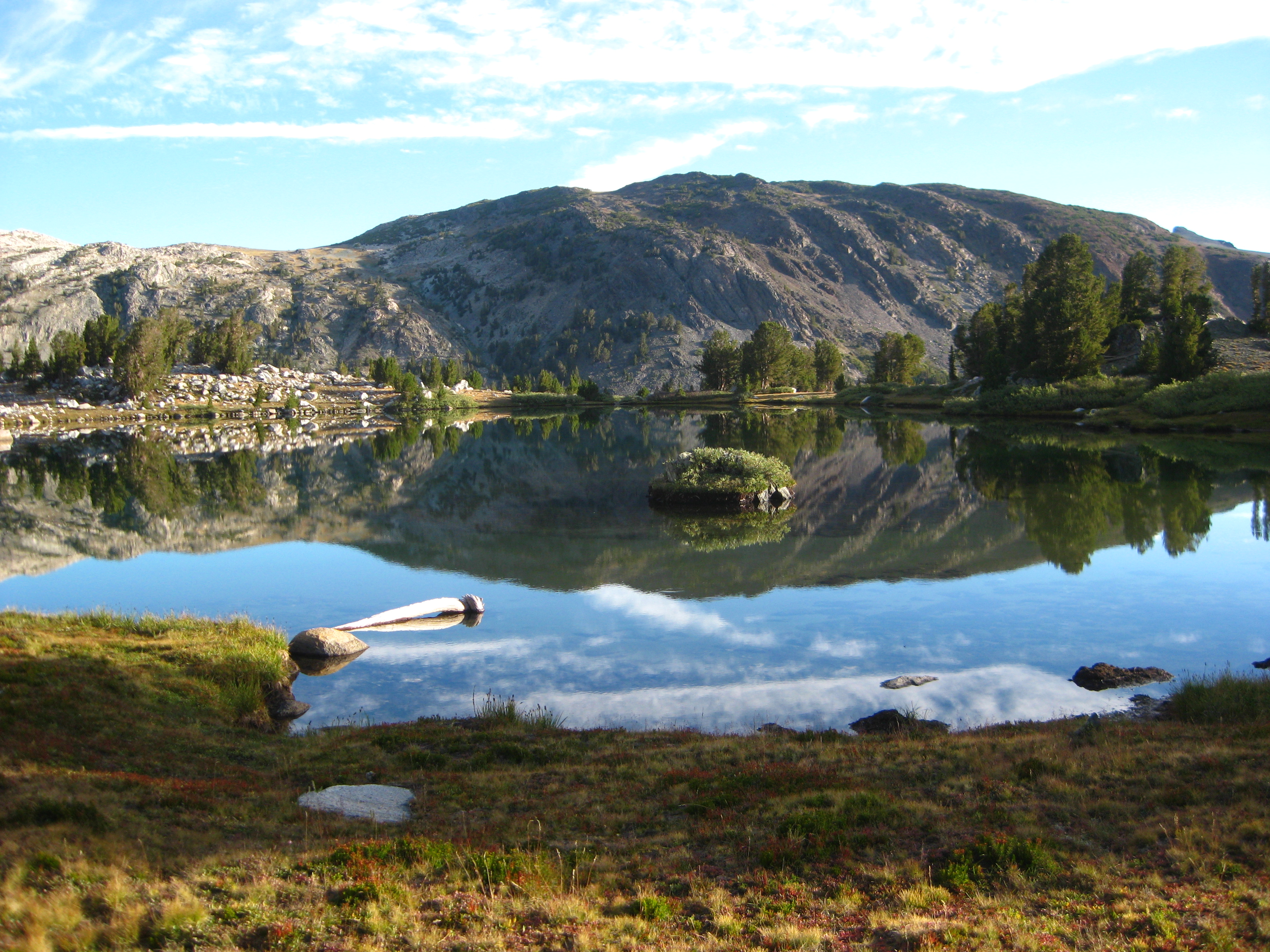
Morning view of Evolution Lake
Morning View of Evolution Lake. This lake is wonderfully inspirational!
Tired in my head and in the body, I trudged across a difficult off-trail section with lots of route finding near the Darwin Bench towards Lake Francis, and then up Snow Tongue Pass. Snow Tongue Pass had a scary back side. Fear requires the ultimate focus, leaving no time for circular thinking. By the end of the trip, I would find myself looking forward to the mental challenge of the difficult passes. I enjoyed these passes many times more than trails such as the Rafferty Creek Trail and Isberg Pass Trail.
Looking down the backside of Snow Tongue Pass into Humphrey’s Basin. This was one of the scarier passes.
After a long relatively flat but fun section in Humphrey’s Basin, I crossed the Piute Pass trail. Sitting there were 4 hikers who had done a loop from Dusy Basin, along the great section of the JMT that I had done yesterday, and back up the Piute Pass Trail. To spice the conversation up, I told them that I was going to try and set the FKT. Their wise-cracks and conversation buoyed me through the next section as I mostly walked over Puppet Pass and headed to Puppet Lake. I ground up to Merriam Lake and saw two hikers with red backpacks coming down the wall above. Knowing that talking to people was like eating the two cherries in Pac-Man, I scrambled quickly up the wall to find them – but they had somehow vanished into the forest. Maybe they were SHR hikers? The next section was a crescendo of scenery, and the inspiration got better and better from Merriam Lake, to La Salle Lake, to the Ursine Lakes.
Looking back towards Feather Peak and Pass.
This is the Ursine Lakes Region, just South of Lake Italy. It was one of the major Highlight Regions of the trip! It helped being there near sunset; I could not stop taking pictures. This is Big Bear Lake, with Little Bear Lake in the background. There are a number of other “bear” lakes in the region: Black Bear Lake, Bearpaw Lake, White Bear Lake. All are amazing!
I finished Feather Pass and decided that I could risk one more pass (White Bear Pass) before dark. I was tentative about White Bear (especially late in the day) because Dan (The SHR hiker I met on my first day) had said that White Bear pass was one of the hardest ones. The glory of a sunset over White Bear, Teddy Bear, and Brown Bear lakes had me taking so many pictures that I really did almost run out of daylight before setting up camp above the lovely Hilgard Branch. The pass wasn’t that bad, either.
Looking over the edge of Brown Bear Lake with Teddy Bear lake in the background. The scenery this evening was highly inspirational and made the long journey well worth it!
Looking back on Brown Bear Lake with Feather Pass in the background.
Day 4 (29.3 miles, 7,585′ of climbing):
Roper describes Lake Italy as “fundamentally ugly.” Roper obviously did not see this lake at Sunrise! My spirits were high, and the camera button was getting a workout. The sprit of my friend Paul McKenzie was with me this morning, as I knew that he had done this next section over Gabbot pass with his wife. He guided me clearly in our pre-trip correspondence: “DO NOT FOLLOW OUR ROUTE!” His advice was helpful, as I did manage to find a sort-of trail next to the waterway.
Roper describes Lake Italy as being “fundamentally ugly.” Surely he was not there at sunrise!
I was surprised to see ice forming on the North side of Gabbot Pass
After the Second Recess, it was a long, but technically easy climb to Bighorn Pass, then a puzzle-piece traverse to Shout of Relief Pass. Things were moving well, and I had entered another region of great scenery – Cotton Lake and Izaak Walton Lake. Enjoying the scenery in this complex terrain wasn’t the best idea – the lack of focus caused me to frequently arrive at unscalable cliffs. A few times, I just got lazy and instead of back-tracking, I threw my poles down thirty feet and nervously down climbed some class 5 sections.
Laurel Lake with Bighorn Pass in the Background
After “Shout of Relief Pass,” There was a lot of very complex terrain descending to Cotton Lake and Izaak Walton Lake, and eventually Horse Heaven
Finally navigating the complex terrain to Tully Hole, I was back on the JMT, though there were fewer people on this portion. I met a girl named Erin who was dressed cleanly and colorfully with her cap tilted sideways and designer sunglasses. She was friendly and on her 3rd day from Tuolumne to Whitney. She asked me if I had a cure for blisters, and I felt like an idiot for saying, “Pop them?” Her peppy spirit gave me another boost, as did the amazing Lake Virgina and Purple lake. Things were going well. I kept motoring to Duck Lake, wondering when Luke was going to pass me. His Facebook post had been cryptic, but he was asking for a ride to Road’s End, and that he would be back to his car “in a few days.” I figured he meant 3 days. That seemed impossibly fast, but who knows what elite athletes are capable of. I had mixed feelings about his impending arrival. I was sure to like anyone who wanted to jump on this trail for a fast run. I thought that maybe we could even camp together, which would help with the loneliness. Maybe I could keep up with him if I had the extra motivation of his company.** Duck Lake was another beautiful lake, and I ascended Duck Pass where I got my first cellular reception. I sent a text to Janet and to Glenn. My friend Glenn Ohler had come very close to coming with me at the last minute. It would have been a joy to experience the route with him. He loves challenges, and he doesn’t give up. His mind is solid, and his will is superlative.
Looking over Duck Lake on the way to Duck Pass. I passed so many beautiful lakes on this section: Especially beautiful were Lake Virginia and Purple Lake
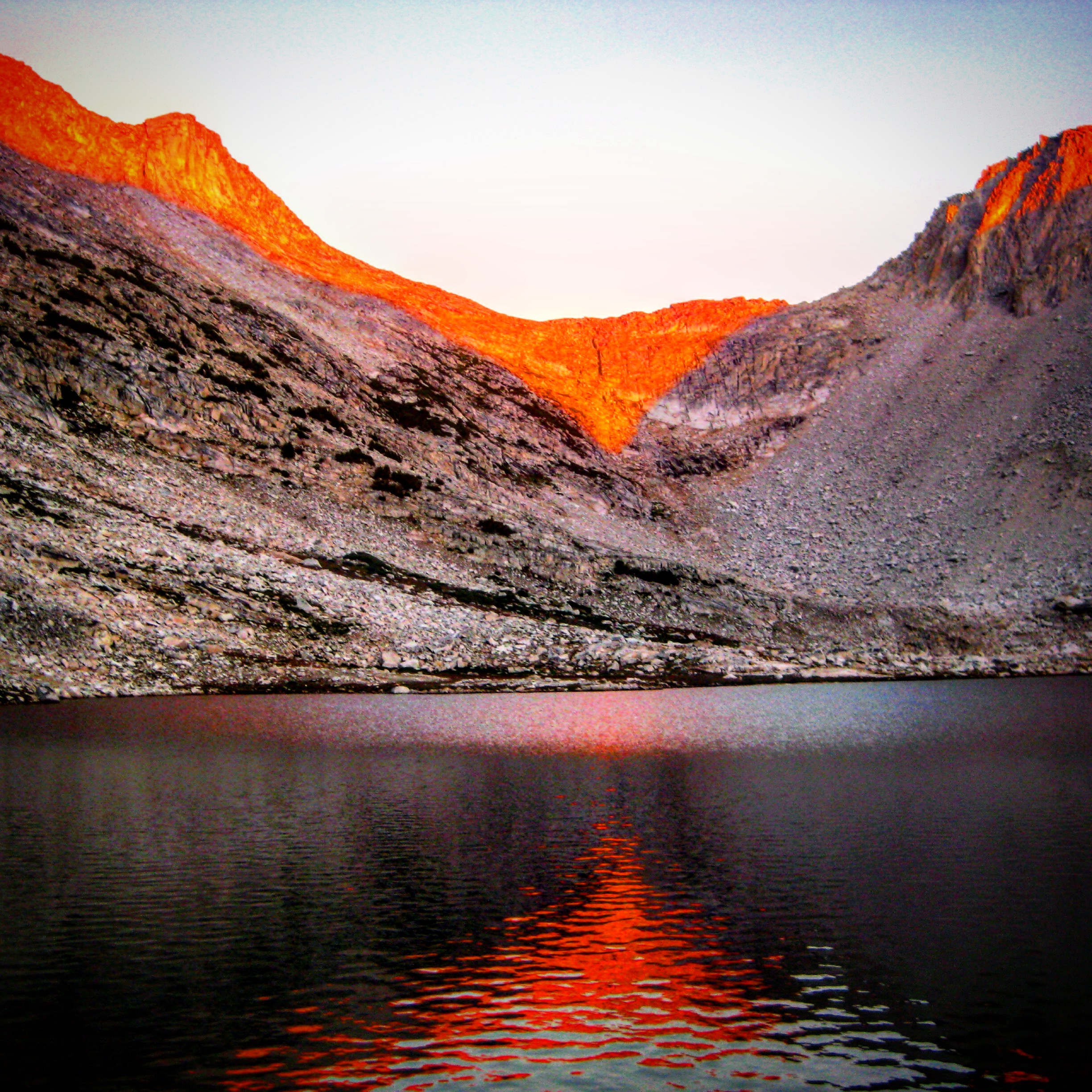
After Duck Pass, I was a little worried to be going off-trail so late in the day, but this proved to be a delight: The sunset over deer lakes was only enhanced by a small fire somewhere to the North. This was another super night. I took two ibuprofen prophylactically, and marveled at how good my body felt. I was getting stronger.
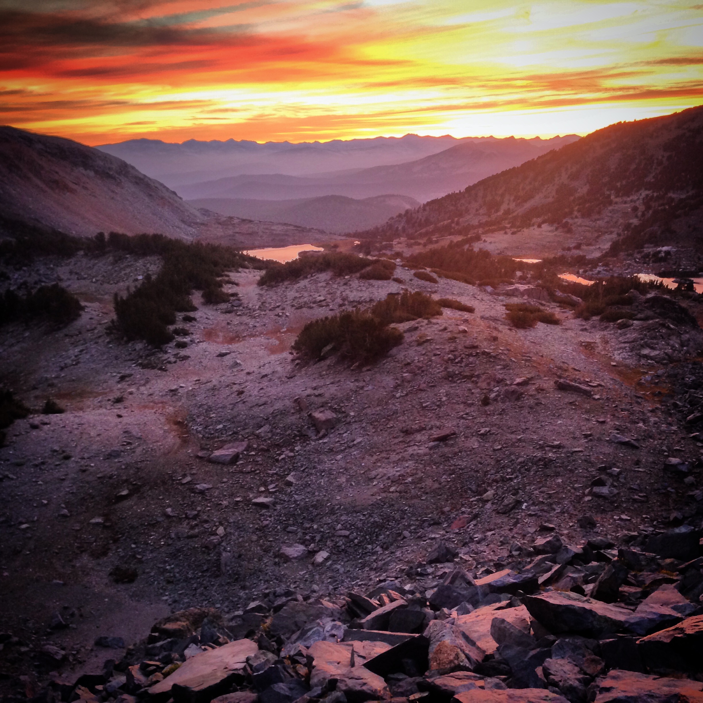
A late evening picture above Deer Lakes. As it turned out, I was very lucky with my schedule, landing me at amazing locations just in time for sunrise and sunset. The fires near Mammoth only enhanced the sunset views as far as I was concerned. I had to boost the lighting in this picture because it was getting dark, but this is really how it looked! Heavenly!
Day 5 (27.4 miles, 7,995′ of climbing):
I was excited this morning! I knew that I would have real cellular reception which meant an early call to Janet. I had been running along the Mammoth Crest, which bore an actual trail. The sun was just rising, and it’s yellow glow illuminated the Minarets to the North West and the low shrubs of the plateau. Looking down to the East was a vertical cliff of beauty. I was experiencing that kind of euphoria that runners and first-time coffee drinkers know. My phone suddenly said “4G” and I called Janet. I had never pushed my body so hard, and talking to Janet momentarily was some sort of a release of this push. I started crying talking to her, and I can’t even really tell you why. It was just this flood of overwhelming emotion; it felt like some sort of drug – a good one.
This is a view of the Minarets from the Mammoth Crest. The Mammoth Crest by sunrise was one of the highlights of the entire trip! On your right, you have a steep cliff dropping off a thousand feet. On your left, you have rugged terrain like the Minarets. I encountered some runners here going in the opposite direction. I was nearly in tears of joy as I said, “you’re running in the most beautiful place in the world!” I don’t know if they heard me, though, with their headphones on.
Arriving at Red’s Meadow, it was finally time for business! I wanted to upload my GPS tracks en-route, so I went into the store and asked if there was a USB port where I could plug in. The Garmin Epix has Bluetooth syncing via the iPhone, but I knew it was kind of flakey, so I wanted to conserve my battery pack during this potentially time consuming activity. There is a USB port on the floor of the laundry room behind the washing machines, so I retrieved it with my hiking poles and set to work. Sync failed. Sync Failed. I met a woman from New York/Germany who also needed charging and we gabbed at length as she philosophized about why she had started to lose her love of backpacking. Sync Failed, Sync Failed. I wasted over an hour solely trying to upload my GPS tracks – and only got two days up.
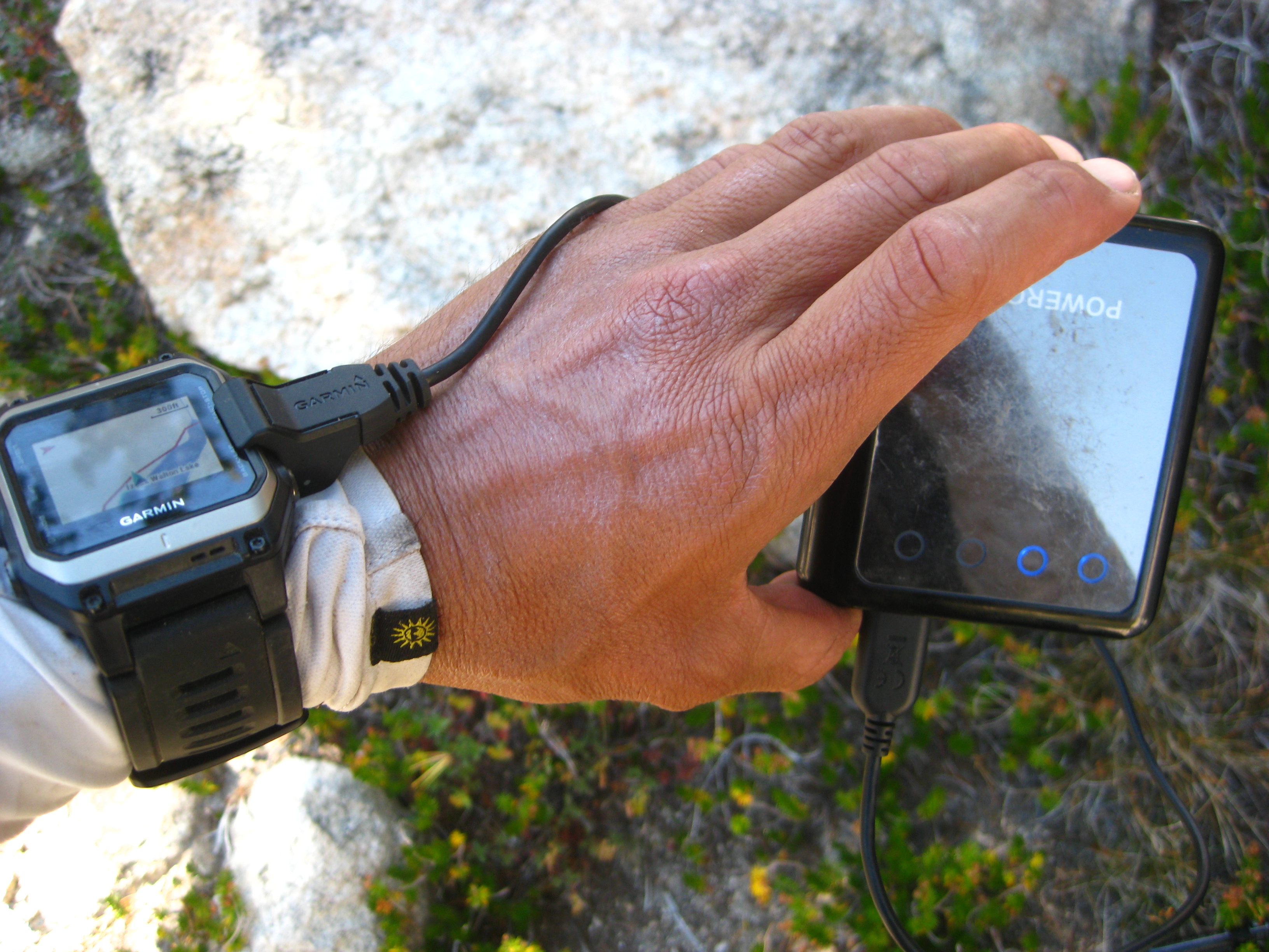
At the time of this writing, the software that came with the Garmin only let you get about 7 hours of usage. Since then, they have released a few updates and I’m happy to report that the Epix will last about 19-20 hours on a single charge. Garmin Epix.
The Garmin Epix was my only piece of disappointing gear. Not only did I blow one hour with no sync success, but I was also having to charge the promised “20 hour battery” every 7 hours. I must have looked like bionic man, running down the trail with a wire clipped to my watch and trailing into my pocket recharging twice a day from the battery pack. **Update March 2017: Garmin has recently released the Fenix 5X. Also, earlier this year, they released another software update for the Epix. I’m happy to report that I plan to stick with the Epix! For one thing, the battery lasts a lot longer now that they have updated the firmware. Furthermore, they have fixed several of the original issues… and most importantly I can charge the Epix while I’m running, which is not possible with the mapping Fenix 5X.**
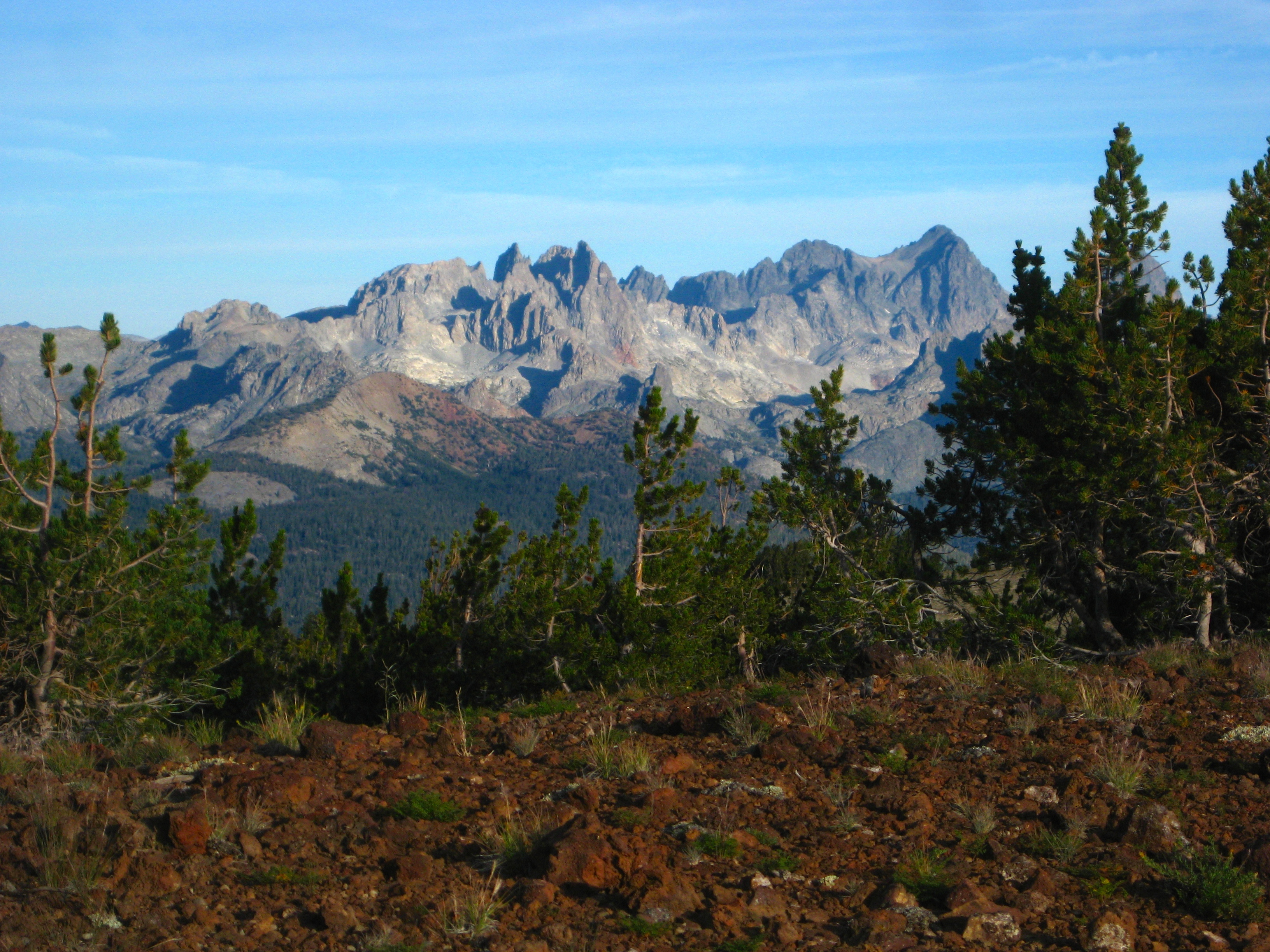
Minarets
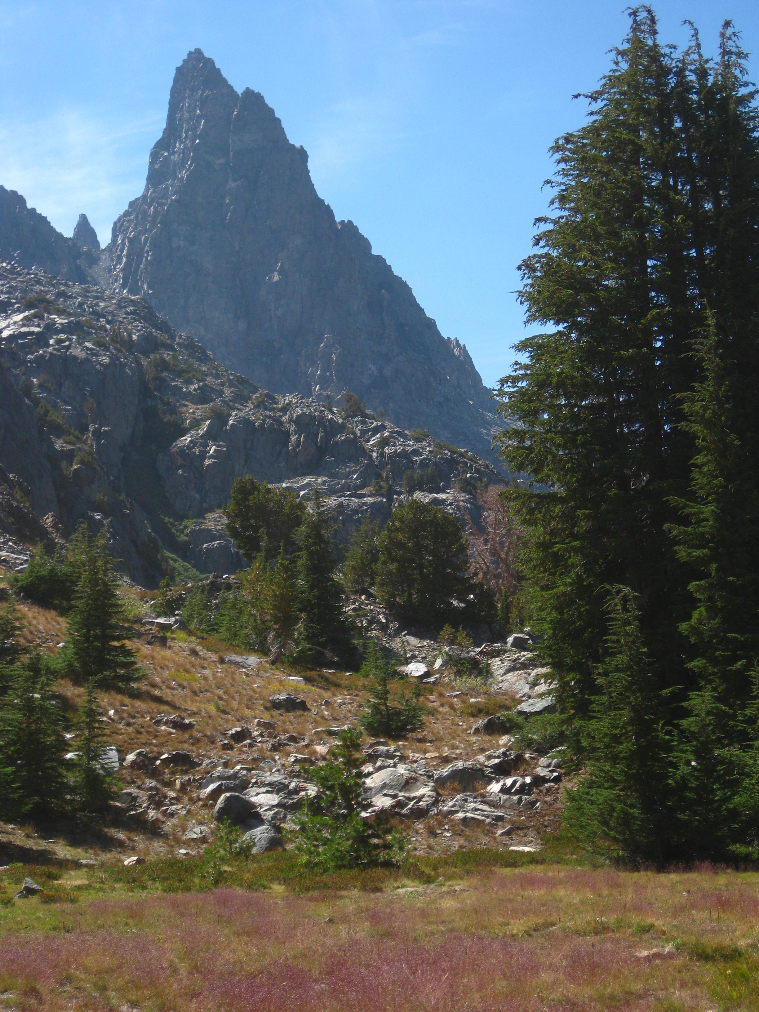
One of the Minarets
The flowers were beautiful ascending Nancy Pass
After Nancy Pass, you can really see the Minarets and Minaret lake. This area is convoluted, and one of the most beautiful of the trip. In the middle of nowhere, off trail, I met a guy named Ed Musyak who was going the opposite direction. Meeting in a place like this is so improbable; we were both excited to see each other. I went over Whitebark Pass and then ran down the other side and met Ted, Bill, George, and Jerry who were doing a section of the SHR. Ted wore pink socks. I wanted to ask him about this, but ran off before sunset into the beautiful Thousand Island Lakes. I had been feeling strong all day, and charged up Glacier pass – a little scared to do this because it was getting dark again. The terrain was sharp and austere. On the other side, you encounter tall cliffs that you should navigate around. It was getting dark and I had to hurry. I found myself throwing my poles down 30 footers again and trusting my obliterated Hoka Bondi 3 shoes to get me down some class 4-5 cliffs to avoid tall waterfalls. This may not have been wise, my heart was pounding for a few moments. In the crepuscular moments, I set up camp on a cliff, no worries of bears.
The view from my camp just below Lake Catherine. I had climbed Glacier Pass late in the afternoon, and descended to a tricky section overlooking the North Fork San Joaquin. Roper describes some class 2-3 sections away from the waterfalls, but it was getting late so I threw my poles down and reverse-climbed a couple 5.6 sections in the waning light. This was a little more challenge than I had bargained for!
Day 6 (33.8 miles, 7,818′ of climbing):
Despite a good sleep on a quiet cliff, all my strength somehow seemed to be stuck back in yesterday. This morning I doggedly navigated to Twin Island Lakes. Something didn’t seem right: Roper said that I’d have to wade across a major river: The North Fork San Joaquin, but not even a trickle showed up. The major river was beneath my feet on my Galileo GPS iPhone map, but not there in real life. I felt confused and lost. Then I wondered which of the twin island lakes I was at. Things weren’t matching up with the map, but it turned out I was going the right way. Next, I lost my sunglasses. I went back to look for them, but their color matched the rocks. Looking at white granite for the next couple days was going to involve a lot of squinting.
The scenery on Vogelsang Pass was so-so, but I did meat a guy named Bill McConaghy sitting at the top of the pass drinking an Heineken. A fun, positive guy, he boosted my spirit for the next section of mediocre scenery. For a moment, I really wanted to sit down and share a beer with him.
Then, there was the issue of food: I had brought enough food for 140 hours (20,500 calories) – but I was on track for a 160 hour finish. I started to worry about food supply and having to quit at Tuolumne. I heard Tioga Pass road was closed by fire, so escaping there wouldn’t be an option. The quandary of what to do about food was with me throughout this less scenic trudge day. In my mind, I replayed the many options:
1) Buy food at Tuolumne, and give up on the “unsupported” designation of the FKT.
2) Maybe the food I have will be enough.
3) Find food.
I grabbed pine cones and looked for seeds – my sister had told me that there are edible seeds in the cones, but squirrels usually get them first. Finding no seeds, I sampled the inner portions of the cone, and found it fibrous. I saw some sap on the bark of a lodgepole pine, and sampled that. This might work. I found whitebark pines with sap near the cluster of needles. While messy on the fingers, this actually tasted ok. I sampled the leaves of mules-ears, but immediately spit them out due to bitterness. On the second day of the trip, I had scared a fish so badly that it jumped onto dry land. I carried it back to the water, but that gave me an idea: I could probably catch a fish using this method in a shallow area. Raw fish sounded dangerous… Oh wait – sushi! This became a real possibility. I started eying black lizards, but thought they might be poisonous. I eyed birds, small mammals. I even looked at a nearby 4 prong buck with the curiosity of a primordial human. Although I’ve felt more bodily hunger sitting in front of my computer at home, something was going on here: I was hungry, but my body was letting me off easy by not bothering me with hunger pangs. In the end, no living creatures were harmed. I never really felt painfully hungry. I made a plan: Skip dinner tonight, and save the granola to be eaten in small portions. The theory was that during the night, my body would have the time needed to convert fat to glycogen. Because the process is slow, I decided it was better to eat while running instead of before bed. By morning, there should be 30 minutes worth of glycogen in my muscles, and 2-3 hours worth in my liver.
It was getting late, but the scenery was improving. Around here, I met Monty Tam
Last Day! (23.9 miles, 6,703′ of climbing):
I woke early, still with no hunger problem. The food was going to last! I started my rations, and took off crunching across the frozen grass. One problem with not eating yesterday was that my metabolism had ramped down significantly, making it difficult to stay warm during the night.
Small tarn by Mine Shaft Pass. This area, just North of Tuolumne is amazing. In Tuolumne, you see domes and slick granite. Just a few miles away, you encounter this red shale. The views by sunrise were amazing everywhere you looked, and the mine was fascinating as well.
Gaylor Lakes by Sunrise
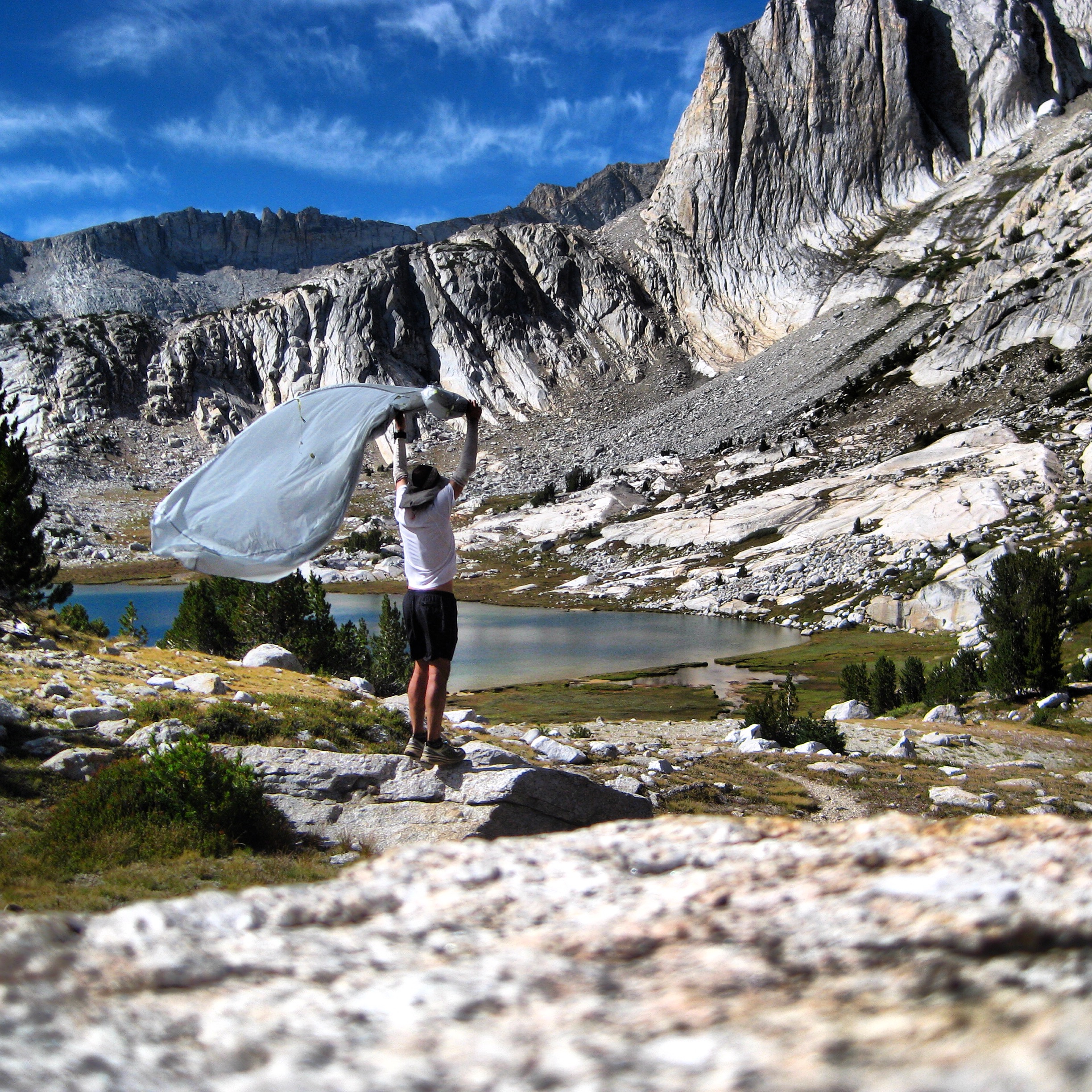
One of the few selfies of the trip. I wanted to dry my tent (to reduce weight and to keep the seam tape from delaminating) – so I set up a self timer shot. I felt so free standing above that lake with the wind blowing. This area was one of the highlights of the trip!
After yesterday’s relatively dull scenery, sunrise over Mine Shaft Pass and Spuller lake was a real treat. Everything passed quickly and easily over Mount Conness’ East Ridge, Sky Pilot Col, Stanton Pass, and up Horse Creek Pass.
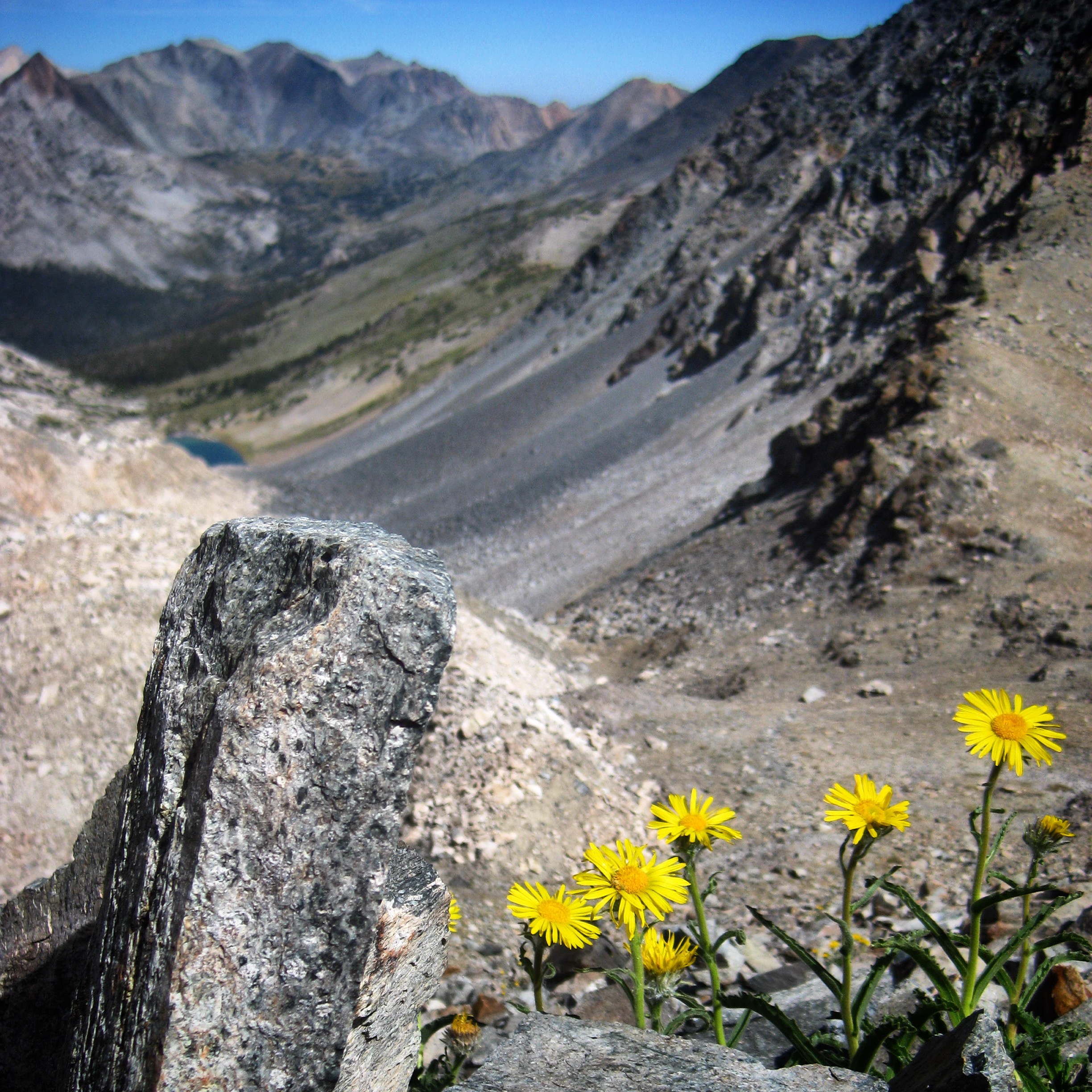
Looking down the backside of Sky Pilot Col. This pass had an extended talus section that threw every type of talus as you that you could imagine. Unfortunately, I did not see the flowers that are the namesake of the pass, so I took a picture of these instead.
I even saw a couple named Annie and Joffery beginning their 17 day adventure on the High Route in the other direction (They were also going to go over Mt. Whitney as well as completing the High Route!) They must have thought I was an idiot when I asked, “So, it’s all runnable on the other side of Horse Creek Pass, right?” They looked at each other and said, “well, no, I mean, I guess, um.” Since there were only 6 miles to go, I figured I was home-free. Instead, I found myself on melting glaciers, careening down into rocks, using the tips of my hiking poles to self-arrest at the last minute. “Get it together, Brian,” I told myself. This was not a time to lose focus. The terrain was challenging for 4 of the 6 miles. Psychologically, I had “let go” too soon, and all the pain was starting to flood in. It is amazing how you can put pain on the back burner – but in an effort like this, you need to make sure that you keep it there until you’re done!
In the last moments of ascent up Sky Pilot Col, you encounter this gully with two types of rock on either side. It was quite amazing, but slow going over this two-steps-forward,one-step-back terrain.
Horse Creek Pass. This is the last pass heading North, but as you can see, it is difficult! It continues like this for nearly 4 miles. Only the last 2 miles are beautiful, blessed, runnable trail.
Finally, the last two miles were runnable. I let my legs flow down the trail, and finally saw Janet (who had walked up 1/4 mile to meet me). This was the moment I had been waiting for! We embraced, and finished. I let my timer run an extra 5 minutes walking from the trailhead sign to the parking lot via a swamp that was up to my thighs. Who knows where the real ending is? Who cares? 6 Days, 13 hours, 35 minutes.
Aftermath:
I write this several days later, and my most significant observation is this: For days, everything around me made me so happy. That first Bacon Cheeseburger was such a delight! I am so grateful every moment I see Janet. Every sip of beer is the most luxurious elixir I can imagine.
If our true goal in life is to seek maximum happiness, then I think that undertaking challenges and temporary deprivation is one way to achieve that. During the event, I was very happy spiritually: Taking in beautiful views and experiencing a mental clarity only achieved by solitude in the wilderness. Afterwards, the simple pleasures of food and companionship have at least temporarily been amplified to the point of providing sheer joy.
As time distances me from the journey, the big thing on my mind is: “How can I get back to that wonderful place?”
Highlights:
You do not need to do the entire Sierra High Route in order to experience its best parts! In fact, there were some dull stretches (specifically, the stretch from just after Blue Lake Pass to Tuolumne Meadows). Some of my favorite areas were:
1) The “Bear” Lakes Area. These lakes are Just South of Lake Italy. Probably the easiest way to reach these remote lakes would be to start at Lake Thomas Edison, and take the John Muir Trail to the Hilgard Branch. From there, ascend the (barely existent) Lake Italy Trail. From here, it’s going to be cross country to these beauties – but well worth it!
The Bear Lakes area was one of the most variegated and beautiful areas of the trip. While somewhat difficult to get to, solitude and extraordinary beauty will be your reward.
2) The Mammoth Crest – This area is fairly easy to access; you can reach it from the Horseshoe Lake Trailhead (one of the Mammoth Lakes). A steep, sandy ascent awaits you as you gain access to the Mammoth Crest. Once you’re up there, though, it is relatively flat, and there is a use trail that affords fantastic sunrise / sunset views. See if you can go all the way to Deer Lakes.
The Mammoth Crest offers sweeping views of the Minarets and a unique cliff view over the Eastern Sierra.
3) The Minarets. Take the John Muir Trail from Red’s Meadow towards Minaret Lake. There is a trail that goes along Minaret Creek to Minaret Lake. If you’re feeling adventuresome, you can venture off trail to visit beautiful Cecile and Iceburg Lakes.
Minarete Lake has one of the most intriguing blues of any mountain lake on the trip. The sharp spires of the Minarets provide the perfect backdrop.
4) Mine Shaft Pass Area. Easily visited from Tuolumne Meadows. Simply take the Gaylor Lakes trail, and then continue ascending the red rocks above the lakes. This area is beautiful by sunrise or sunset.
Looking back at the Gaylor Lakes
5) Cascade, Wasco, and Conness Lakes. These lakes are easily accessed from the Saddlebag Lake Trailhead on the Eastern Sierra. There is a boat that will take you across the lake so you can skip some of the more mundane portion of the trail and get to the good stuff more quickly!
Gear Carried:
For a detailed run-down of the Fast Packing Gear that I’ve been carrying lately, Click Here:
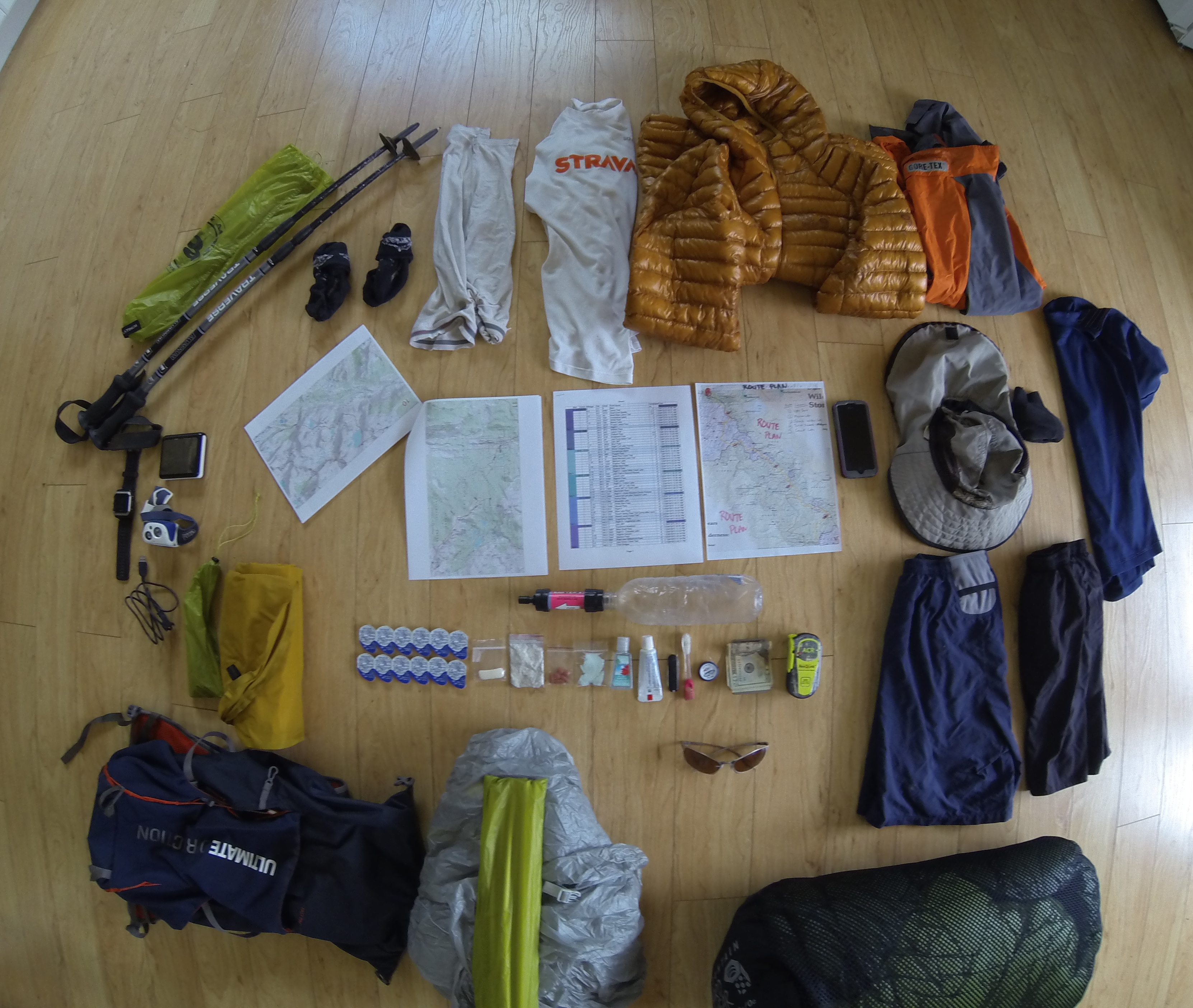
The Gear – no food is included in this picture.
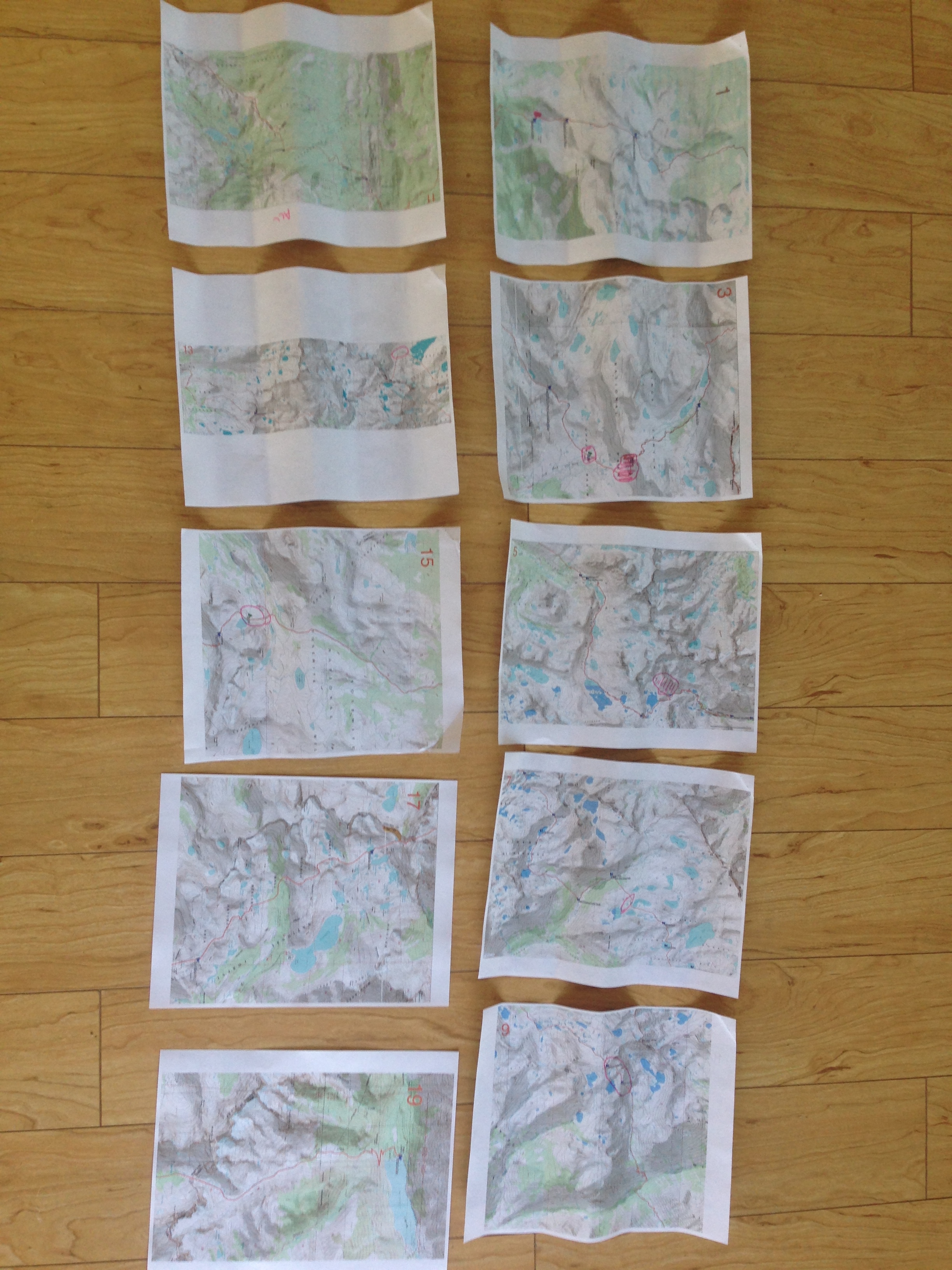
10 double sided pages for a total of 20 pages of maps! I made these maps by interpreting Roper’s text and drawing in the route.
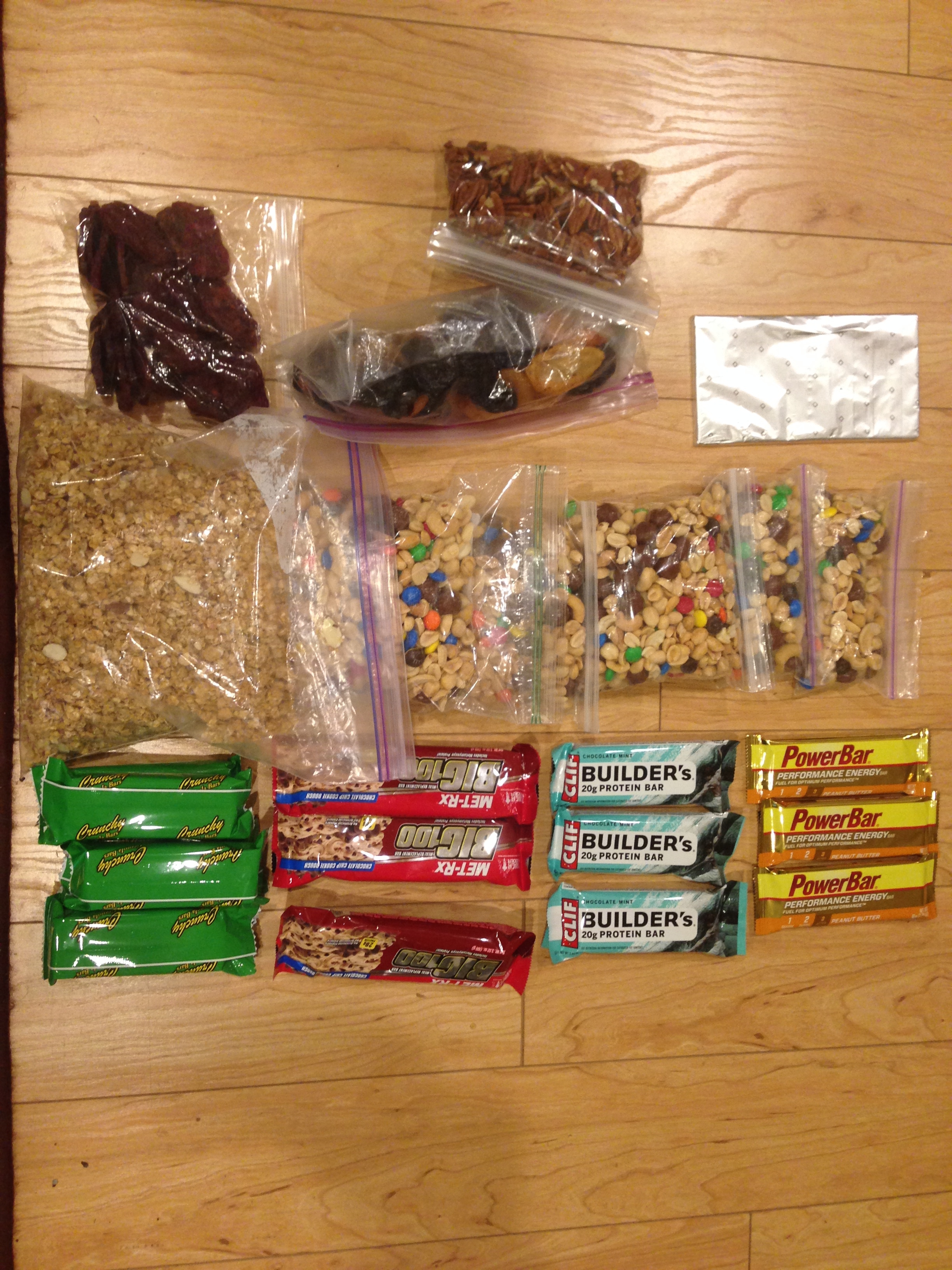
This is what 20,500 calories worth of food looks like.
This is the map for the entire route discussed in this post. To Export GPX files, click on the three horizontal bars in the upper right hand corner of the map and select Export selected map data…
To see full screen, click here (opens in new window)
Footnotes:
* I ended up buying a Sawyer Squeeze to replace my Sawyer Mini – right before this trip. I’m much more pleased with the flow rate of the squeeze, and the weight is only a little higher. Thanks to Mark Glenesk for this recommendation!
Go Back
**Luke Nelson began running the Sierra High Route one day after me with a partner named Cody Lind. Being a pair, this would have put them out of contention for the unsupported record, but it would have been neat to meet them along the way. Unfortunately, they deviated significantly from the route, going around instead of over two major passes (Frozen Lakes Pass, and Snow Tongue Pass). The ended up abandoning the project at the Piute Pass Trail. It will be interesting to see them go for it again next season. Here is a link to his report/
Go Back
*** Major Thanks to my partner Janet, who kindly shuttled me back from Twin Lakes!


Nice go Brian! I was dreaming of doing this trip in this style, maybe some day. Did you do much traveling in the dark? Did you do much running?
I hope you do this trip. It’s a fantastic route, with only a couple mundane sections. I did about 5 hours travel in the dark – most of that was on the first ascent from Road’s end. I would run on the non technical descents (unless they were really steep), and non-technical flats. I ran more as the trip progressed due to the pack being lighter.
BTW Brian. I am transfixed by your photos. You did an incredible job of capturing the amazing terrain while you were working your ass off hammering the route
Thank you, Don!
Wow Brian! What an incredible accomplishment. I Thank you for the time that you took to share it with us. Roper was one of my heroes in my formative years and I suspect he would be pleased how you have honored a brilliant route. But dude, down climbing 5.6 in shitty shoes; that is BOLD
Just finished reading about your epic journey. I’ll be dreaming of the high sierras and I’m getting a little teary just thinking about it. Some of my most vivid memories from childhood are from time in the Sierra, though there are not that many they sure had an impact on?…well, me I guess! From the summer my father was a ranger naturalist at Lodgepole when I was 6 to my last backpack trip with my dad when I was 18 and had to hike out 20 miles with blisters because, well, I quit. Good night!
Great trip and write-up!
Many people have noted it would be possible to do the SHR fast, but I think that style would best be undertaken on one’s second trip – the first time it seems better to experience and enjoy the mountains.
Fantastic write-up Brian!
Your description of the emotions you experienced literally brought ters to my eyes as I recalled my feelings during a couple solo trips I had taken in the Sierras in 2010 & 2011.
Looking forward to returning!
Thanks for the account of your trip. What an adventure!
For a few years now I’ve been trying to cajole my hiking companions into trying the Gaylor Lakes to Conness Lakes segment with the aid of a car-shuttle. Maybe your report will inspire them.
Bill – That sounds like a great route. I hope that you do it. This was one of the highlight regions for the diversely colored rock. It wouldn’t be too difficult to shuttle. The Mine area is pretty neat. If you follow Roper’s route on the flank of Mount Conness, it’s not too hard either.
Sounds like an awesome trip. I didn’t see a bear canister in your gear/food photos. Did you carry one?
Excellent question, Josh. No, I didnt carry one. It turns out that Bear Canisters are only required in certain areas. The trick is to download the map ( http://sierrawild.gov/bears/food-storage-map ). Unfortunately, on my last night, I was on the threshold of a bear canister requiring area. I should have kept going about another mile to be in a legal zone. However, I did laugh at the irony: the bear would have obtained a pitiful handful of granola – the only food that remained.
I just want to know what is in the foil in the food foto in the upper right corner of the picture? I’m hoping its dark dark brown and sweet.
You bet! Chocolate is definitely great on the trail. Unfortunately, it melted, so I had to put wads of chocolaty aluminum in my mouth, suck out the chocolate, and then spit out the aluminum. Next time, M&M’s will be the chocolate of choice!