Bikepacking Ecuador – Baños to Cuenca via Chimborazo and TEMBR
We spent a little extra time in Baños because fellow bike-packers Scott and Sue had just arrived from a brief hiatus in the States. They’re on a multi-year trip from Alaska to Tierra del Fuego, and like everyone, needed a little family time and an opportunity to give the legs a rest from the bike.
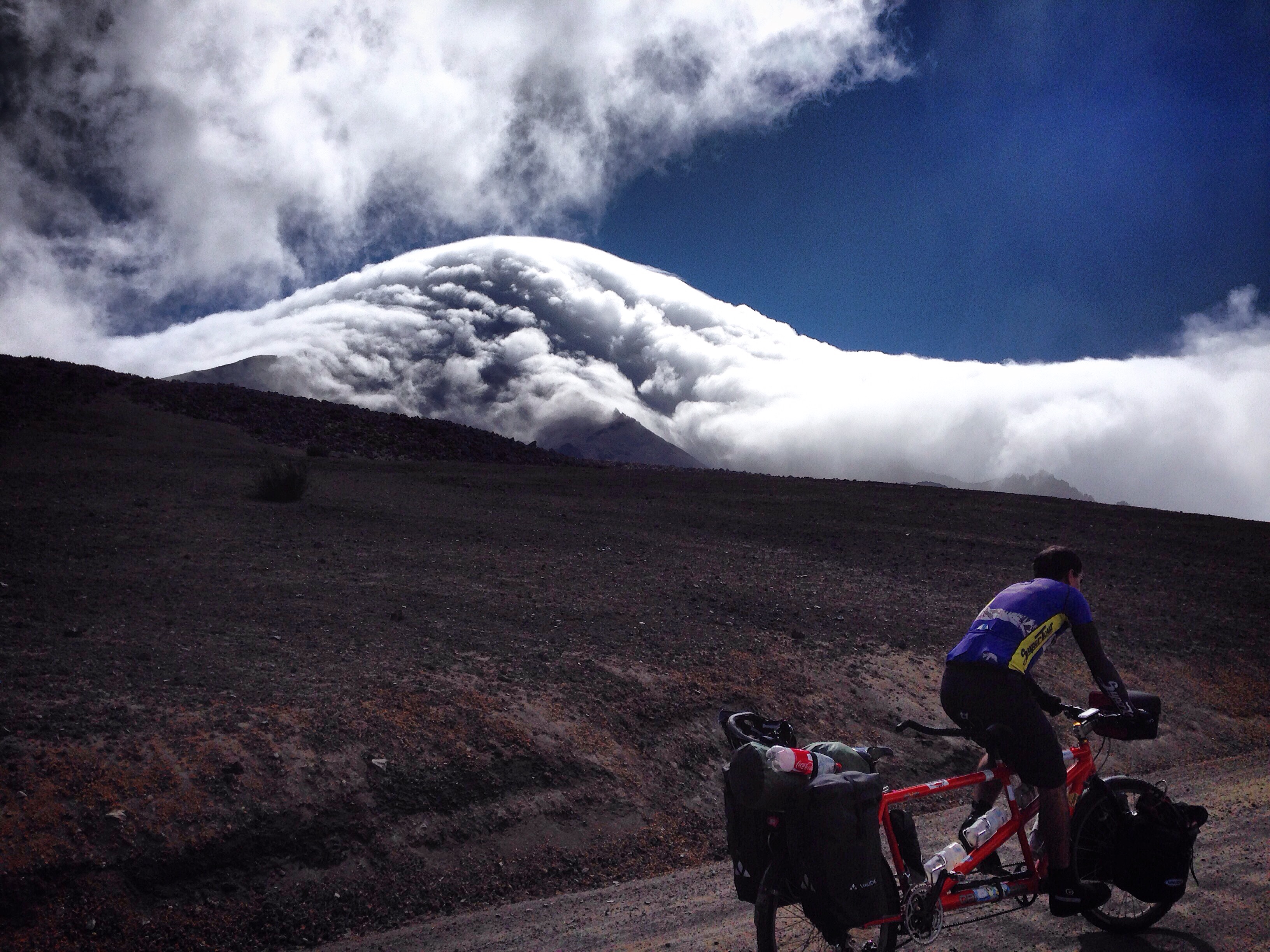
Chimborazo looms.
This turned out to be very opportune for us; my sister mailed a big batch of daily contact lenses to Scott’s sister – and he transported them back to us in Ecuador! Shipping them to Ecuador would have been a major expense and hassle. It may have been possible to get a prescription and purchase lenses here – but in my attempts to consult with a couple opticians, it sounded like it would take several weeks.
Baños to Chimborazo by Bike
Our route out of Baños was surprisingly nice – we were worried about Ambato being heavy on traffic (and in the center, yes, it was busy) – but for some strange reason, both of us really liked the vibe of this bustling small city.
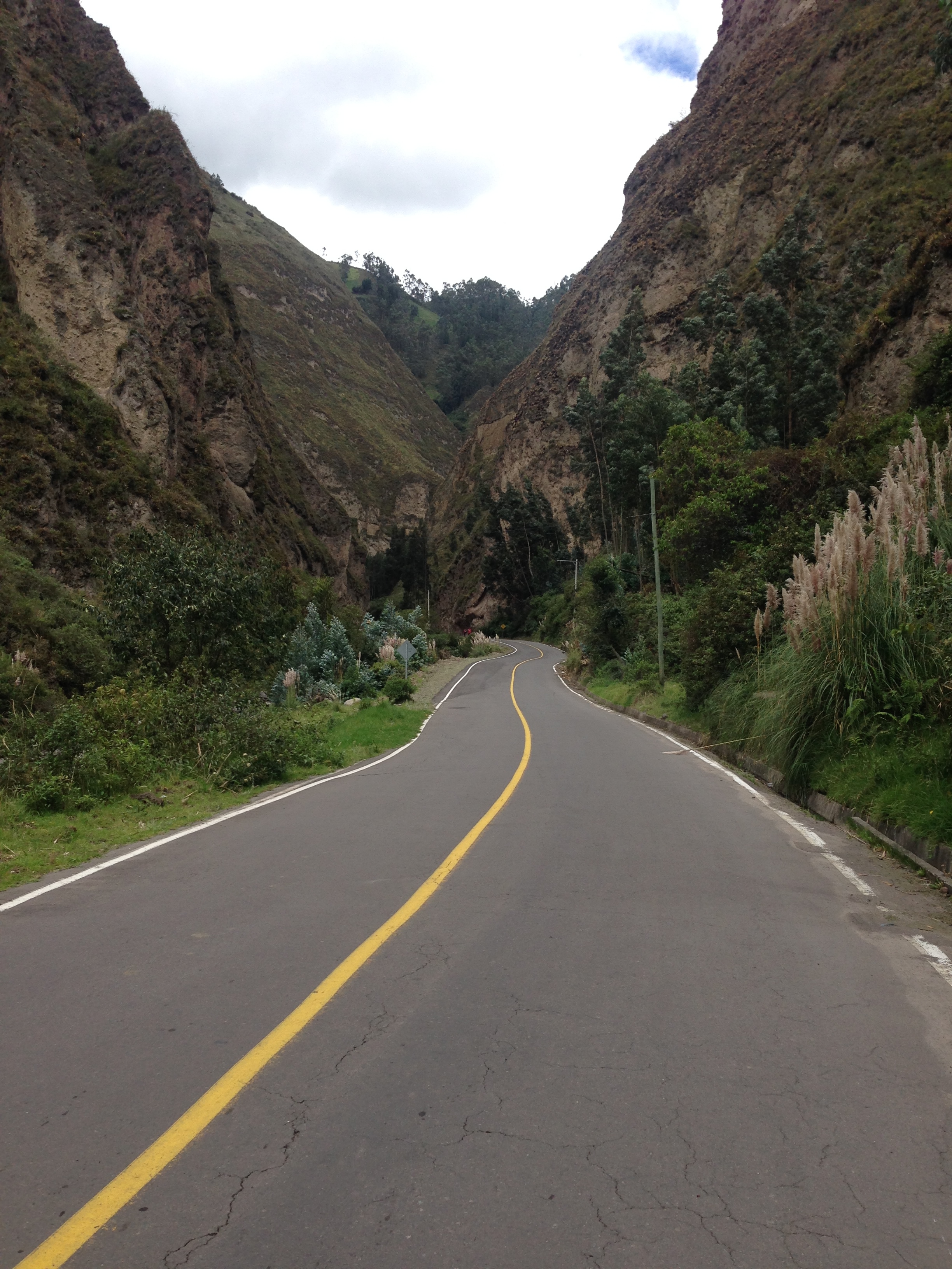
The Antigua Via Flores (out of Ambato towards Chimborazo) is paved, and gently graded through a canyon that looks like this. With no traffic, this is a cycling highlight!
The original plan had been to ride down into the Amazon Basin via Puyo, and then climb back up the Andean spine out of Macas. We decided to nix the idea after having done a day trip most of the way down into the Basin, and after seeing pictures of Chimborazo.
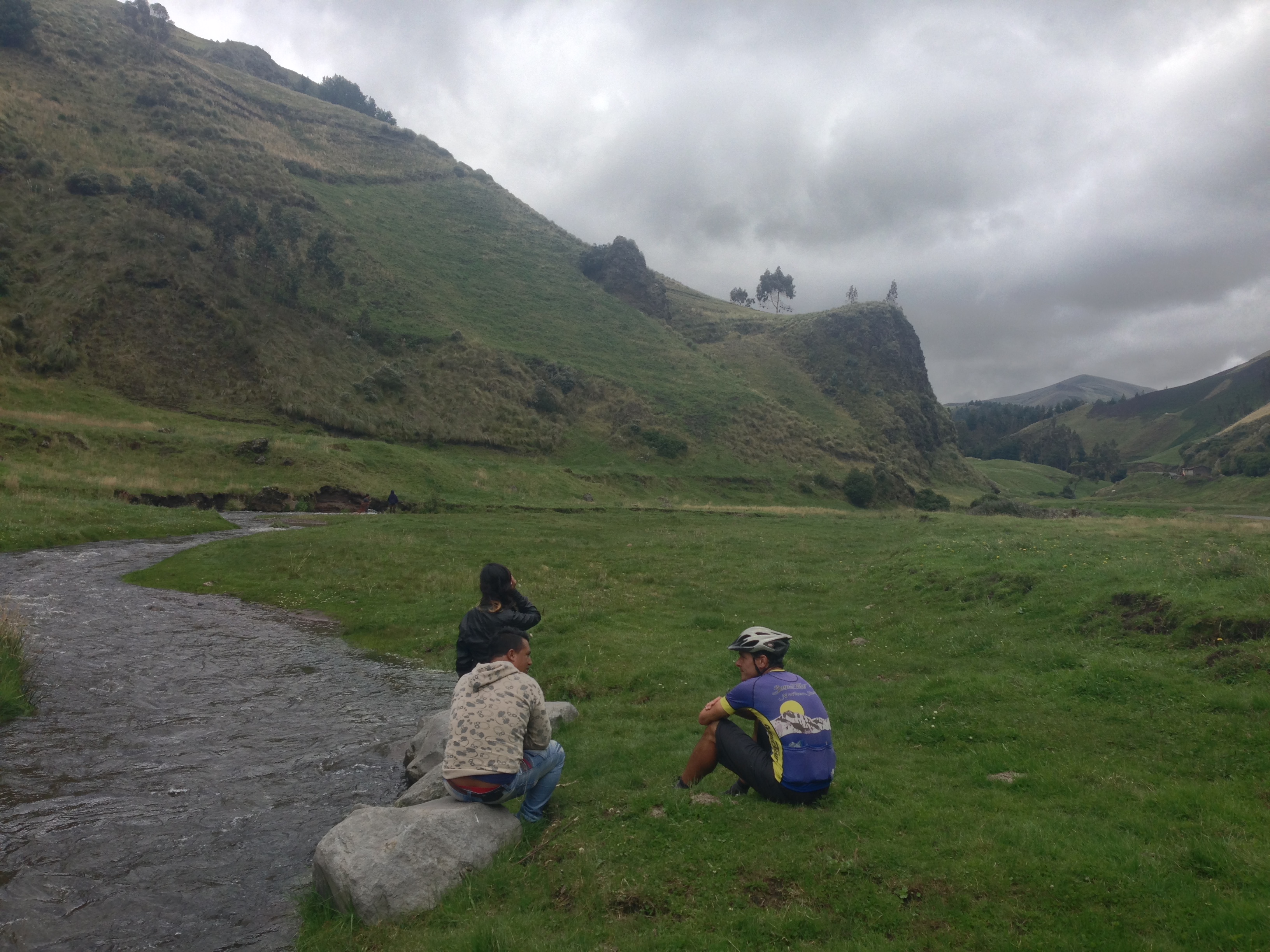
At the higher elevations, we stopped by the side of the road to chat with some people who were fishing in the stream with a net. To my surprise, they said it was easier to catch fish when the water was opaque. Even though they can’t see the fish as well, it’s more important that the fish can’t see them.
We have no regrets on this decision – the road from Ambato to Chimborazo was superlative for cycling. No traffic, good pavement, and lots of gently graded climbing. Chimborazo would also be a significant marker for us: the highest elevation we have ever traveled: 16,700′. In fact, you can travel higher on foot – but it’s required to have a guide.
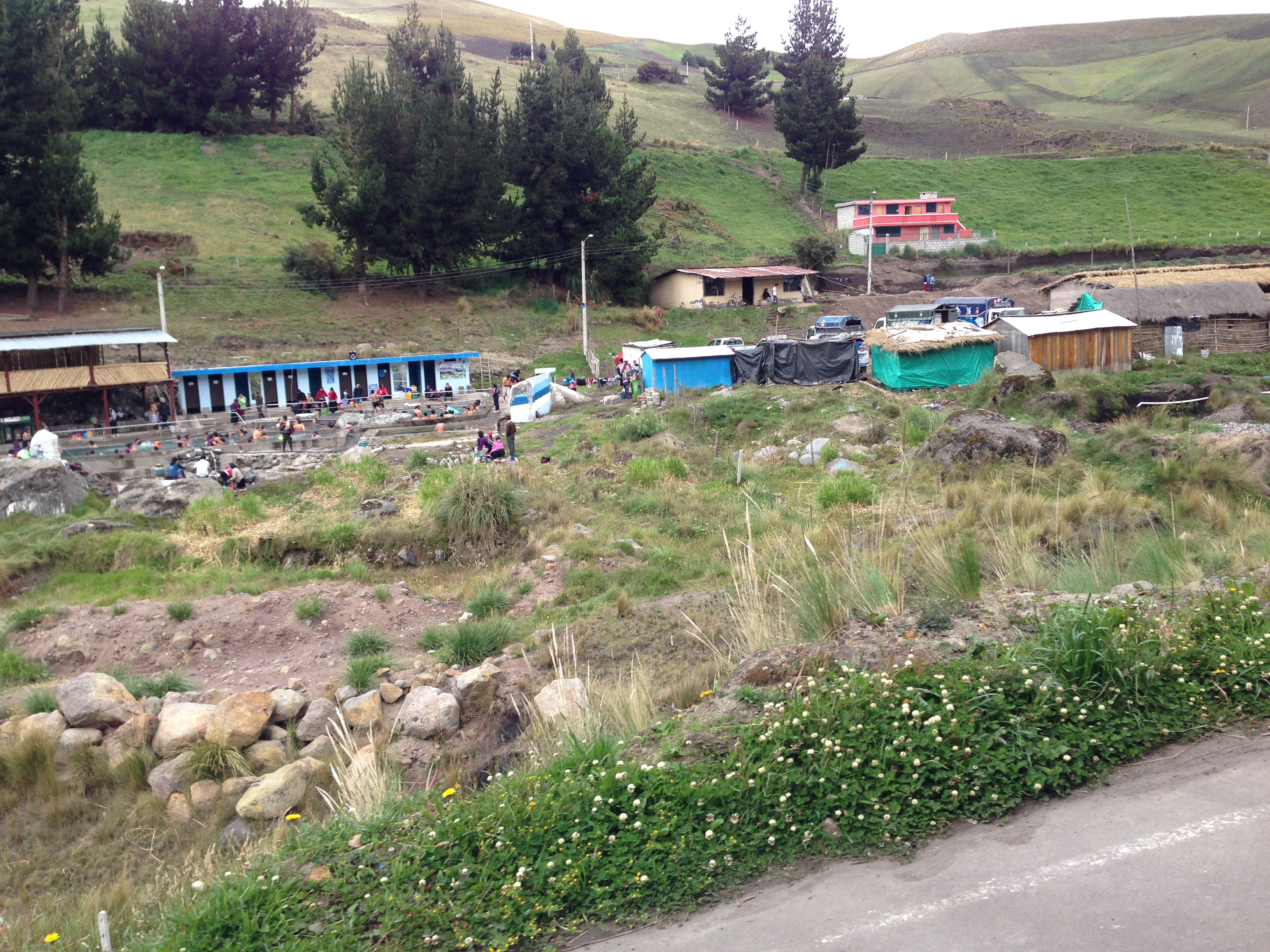
Termal Agua Blanca located at 01.33821° S 78.86544° W This didn’t really look like our scene, but we heard that you can also lodge here.

Vicuña – protected under law from hunting. The wool is extremely valuable, and warm. Today, there is a government-sanctioned “chacu” where people herd the animals, sheer them, and release them back to the wild. They live up around 14,000 to 15,000′ in elevation!
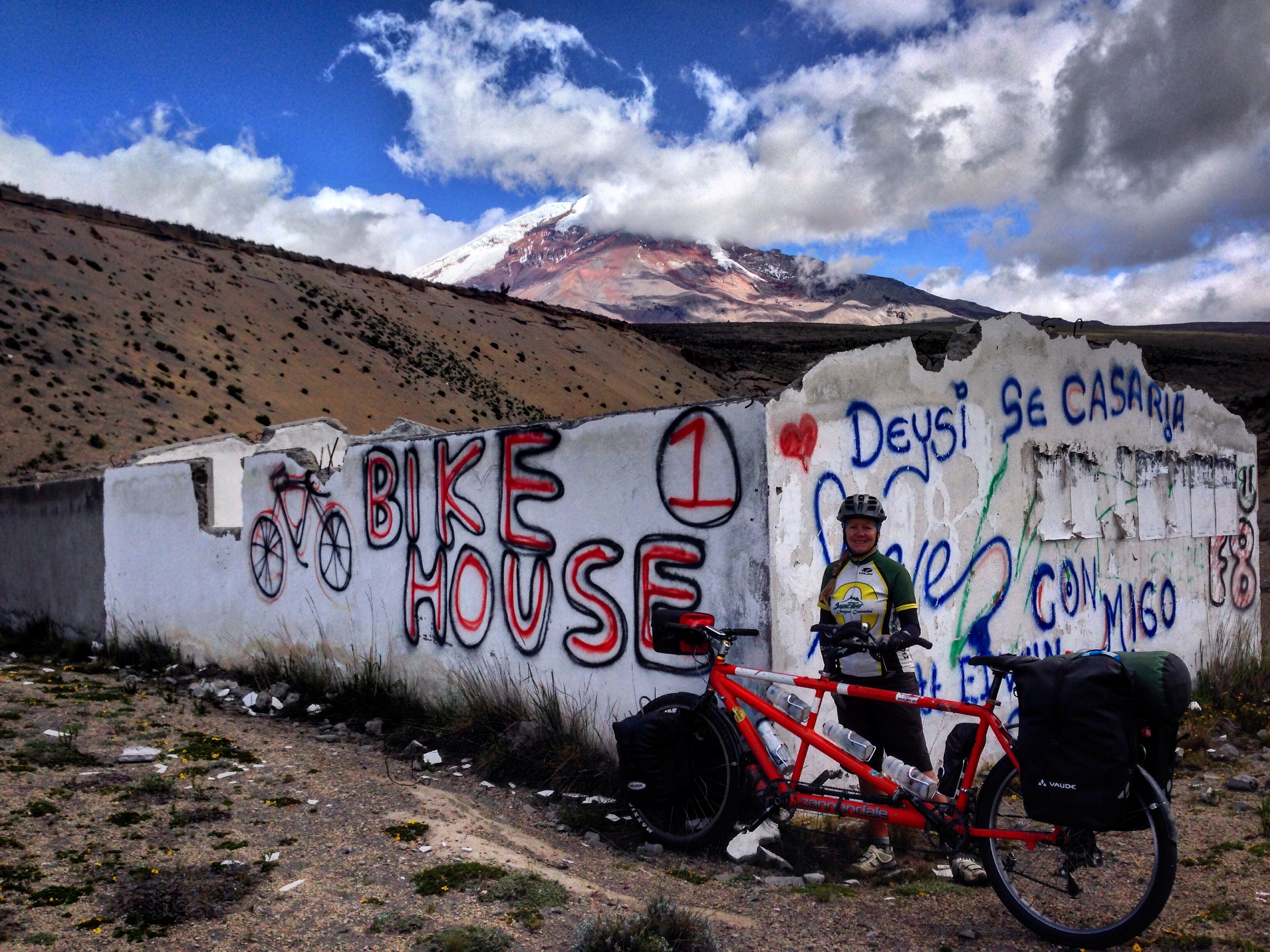
We saw this sign indicating a “bike house.” This didn’t seem like a suitable place to spend the night, but we took a photo.
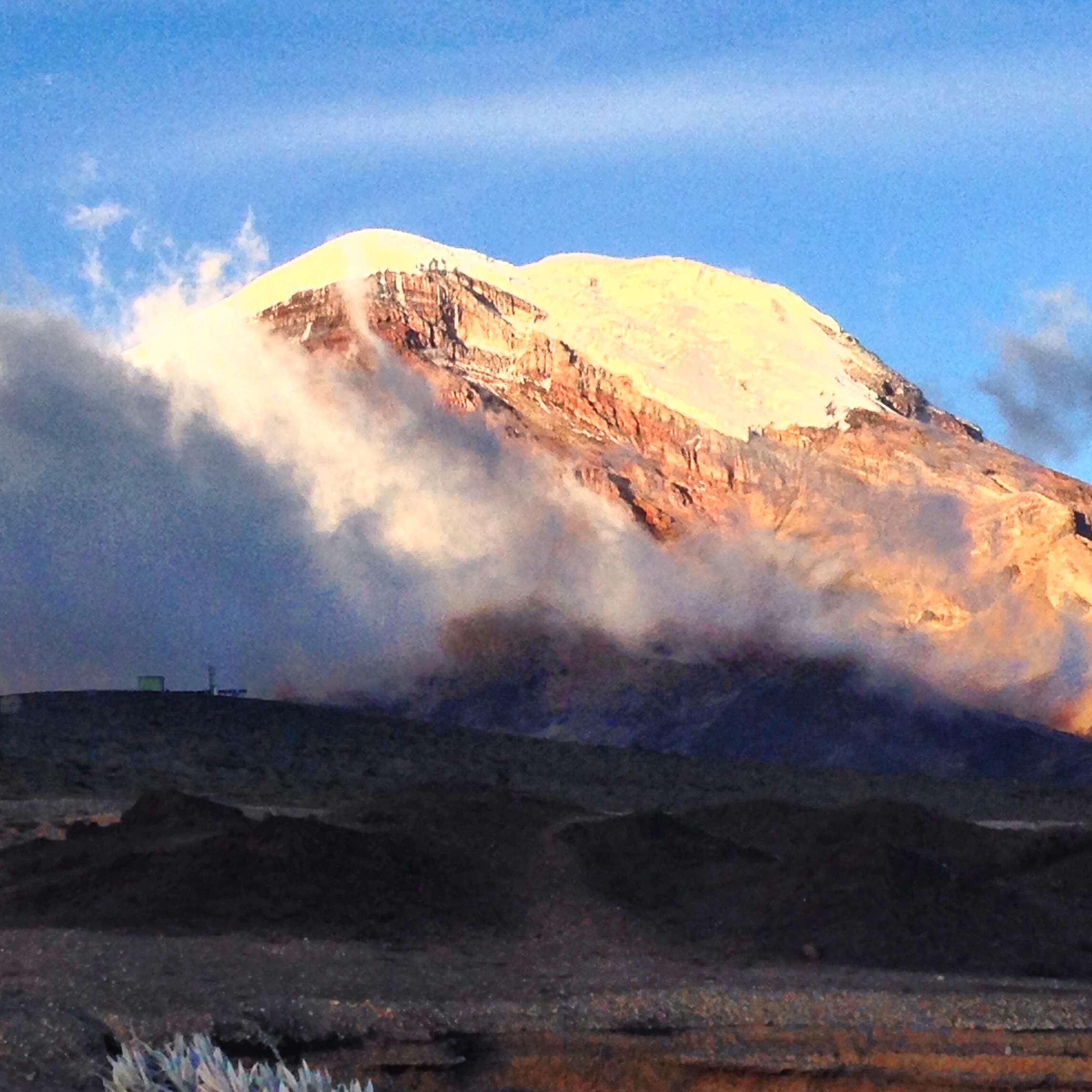
A clear view of Chimborazo’s summit. Most of the time, Chimborazo is in cloud. The summit of Chimborazo is the point on the planet that is farthest out into space (or in other words farthest away from the center of the Earth). Mount Everest is higher above sea level, but due to the bulge at the equator (and Chimborazo’s proximity to the equator), this peak gets to hold that lofty title.
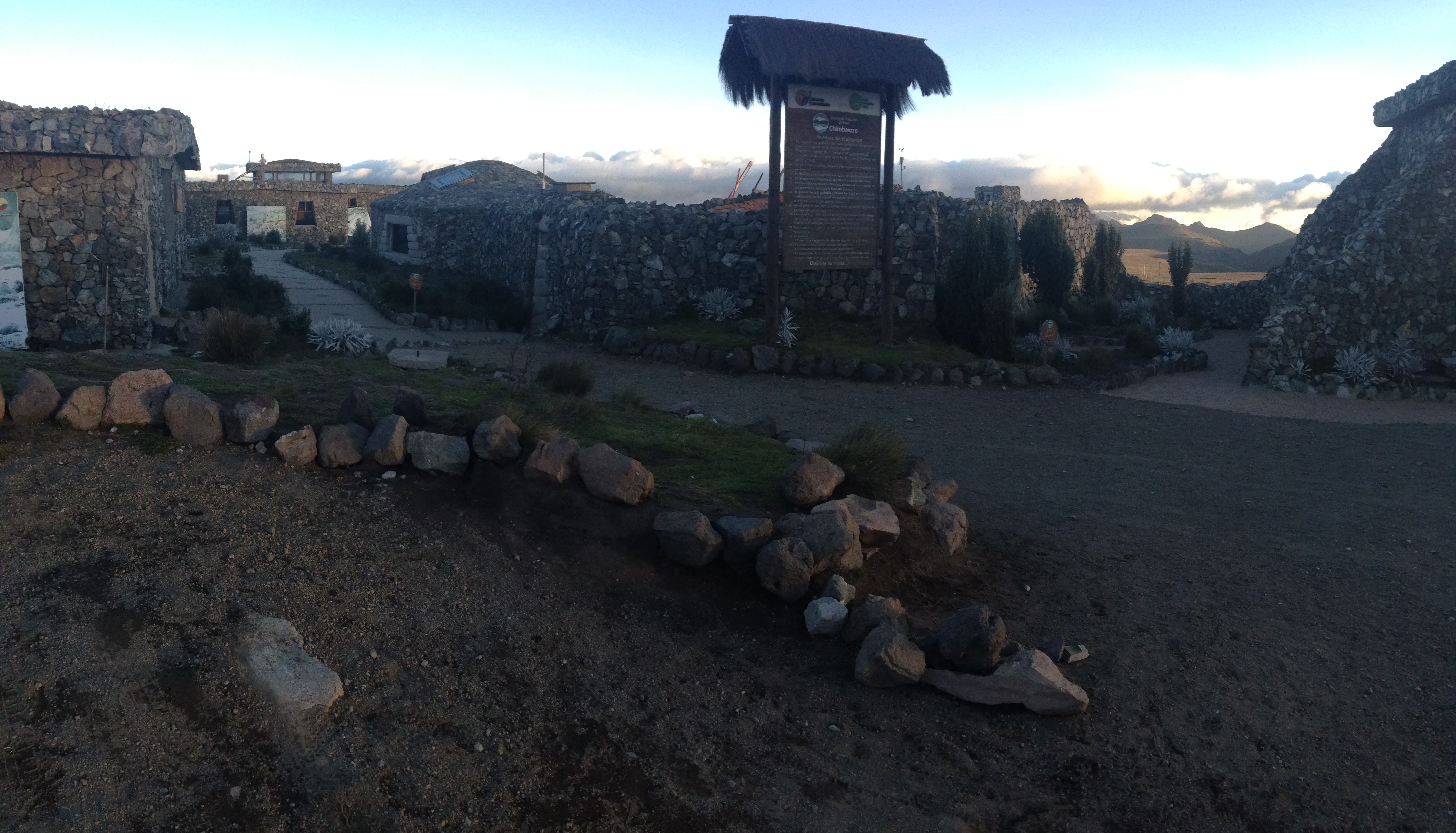
This is the visitor center at the turnoff for Chimborazo, situated at about 14,200′. There is not any formal camping here, but as soon as we arrived, the security guard allowed us to spend the night in between buildings – protected from the fierce winds. The bathrooms (which have water) were open all night, making this a convenient location. You can also spend the night at one of the two refugios above. If you follow our track from 03/26/2016, you can see that we visit both (the lower is Refugio Carrel, the upper is Refugio Whymper). These are good acclimatization sites if you plan to be climbing the mountain. We spoke with the man who manages the lodges, and he told us that he could easily arrange a guide and equipment directly from the lodge (i.e. no need to start in Quito). The cost was several hundred dollars – negotiable, and probably the best value out there. I opted out, though, because the weather was extremely windy – unsuitable for an ascent.
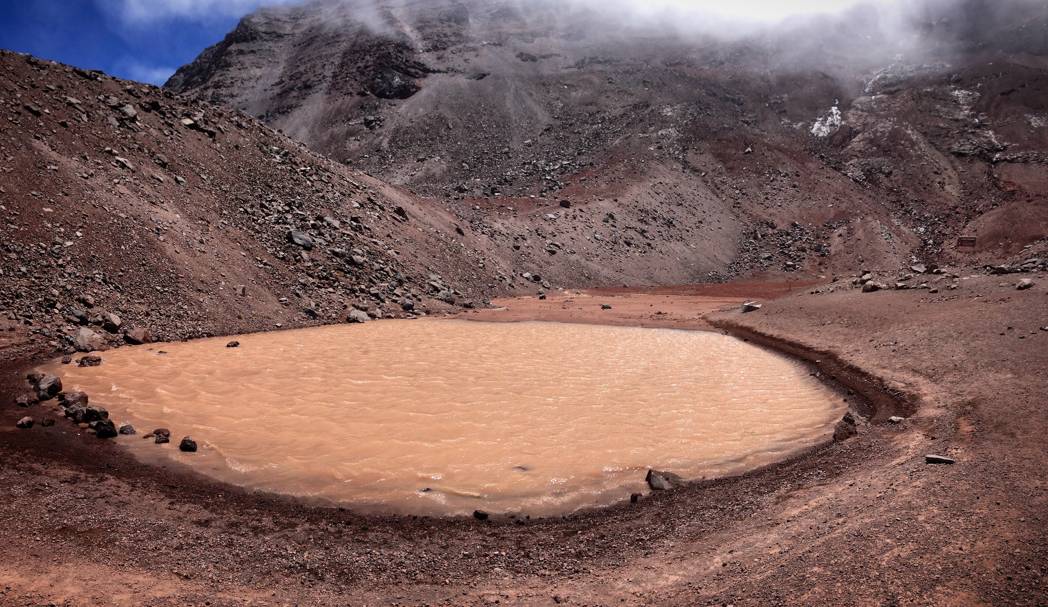
Just above Refugio Whymper is a lagoon… I’m not sure it was worth the visit.
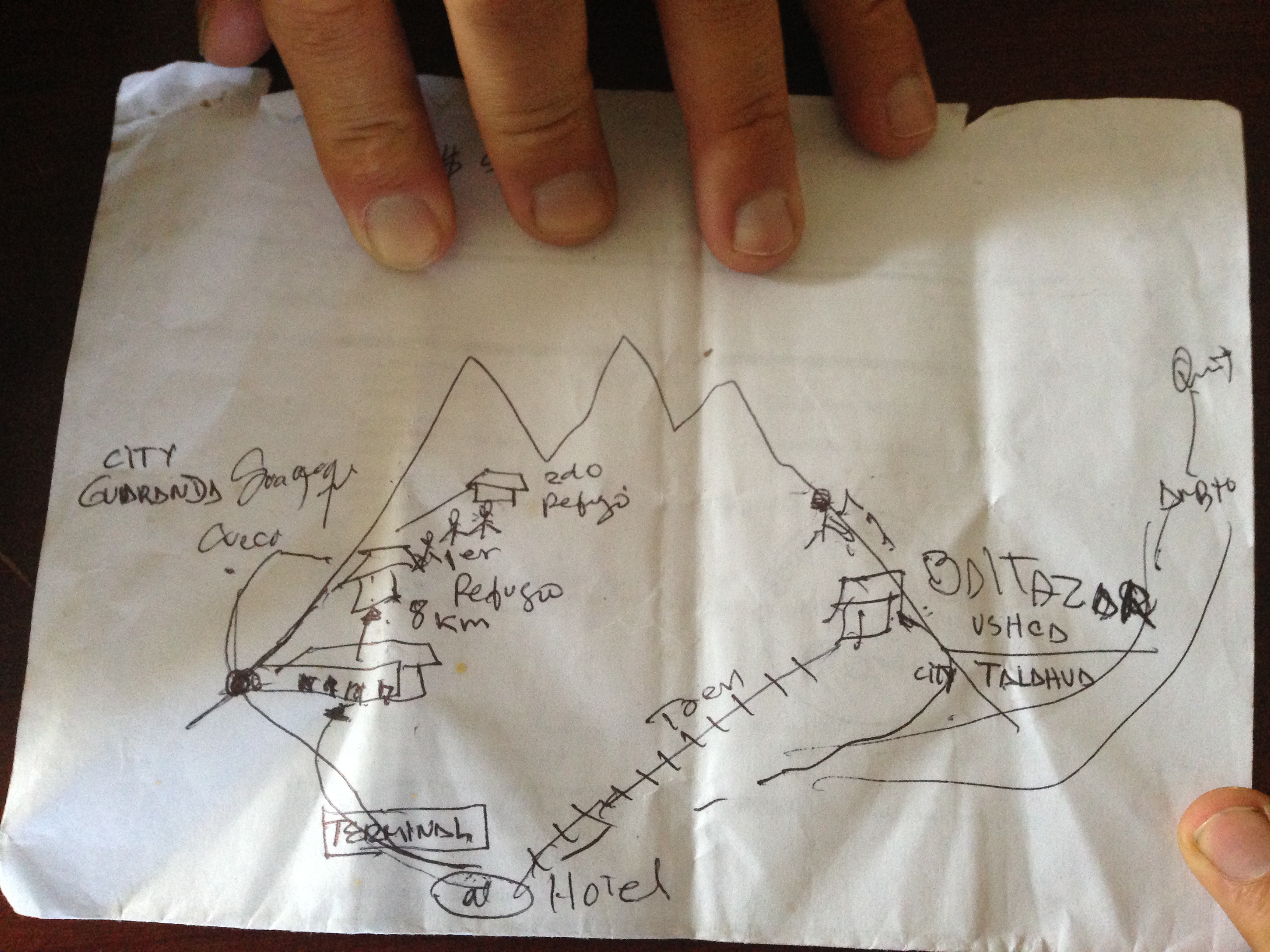
We did not do this, but we were told that there is a man named Baltazar Tenesaca who lives near Urbina (East side of Chimborazo). This man has walked up to the glacier twice a week for over five decades to bring down ice to sell for $5 in the market. A man we met up on the mountain showed us this hand-drawn map of how to find him, and join Baltazar for his walk up the mountain. https://www.zozi.com/journal/travel/chimborazo-volcano-ice-climber
Chimborazo to Guasuntos via TEMBR
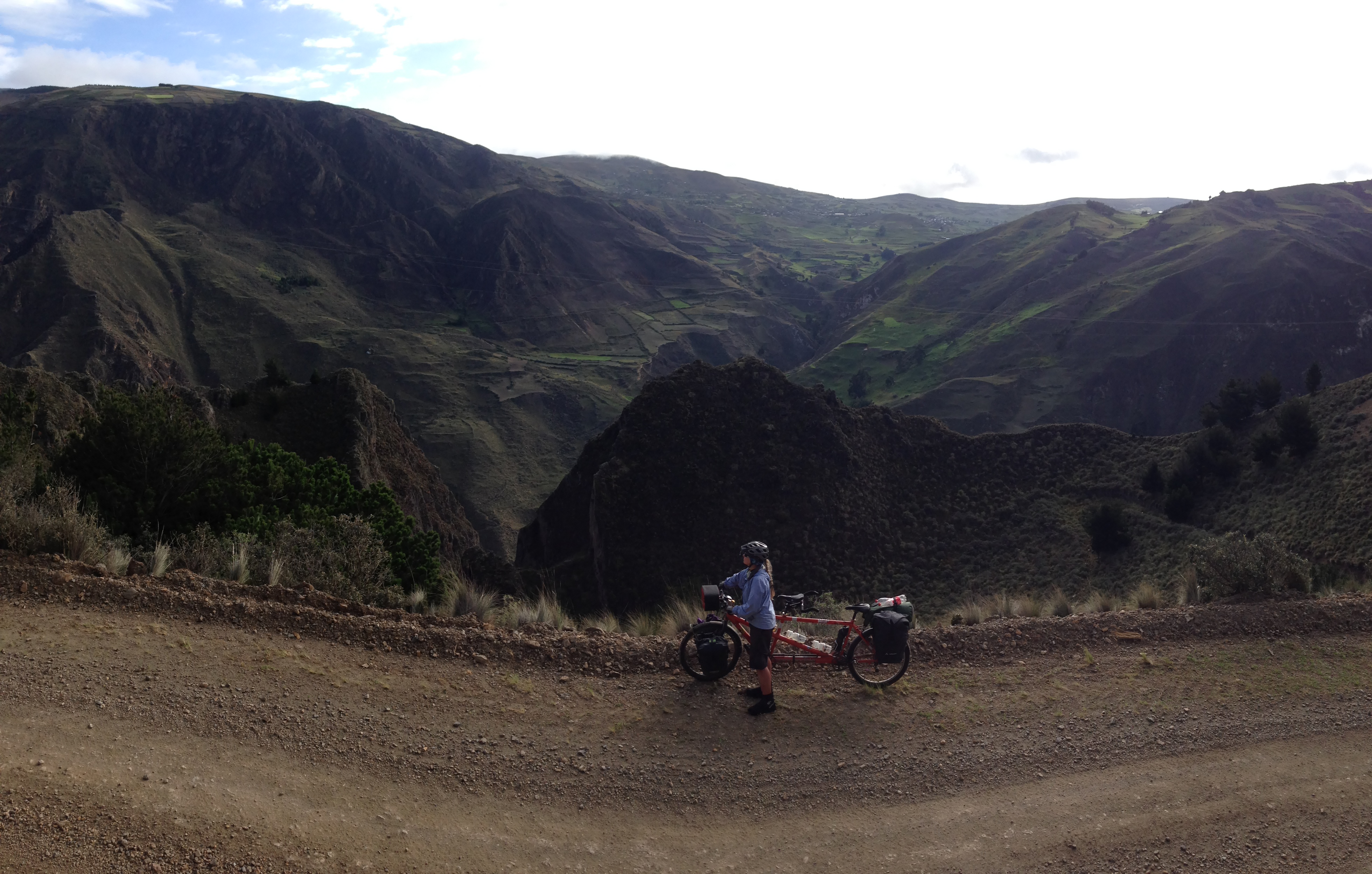
After coming down from Chimborazo, the next project was to work our way South. We didn’t like what we saw of the PanAmerican Highway, so we decided to resume riding the TEMBR. We had inadvertently been on the TEMBR a few times earlier in our journey, and now that we had learned more about it, we were eager to explore more unpaved routes in Ecuador.
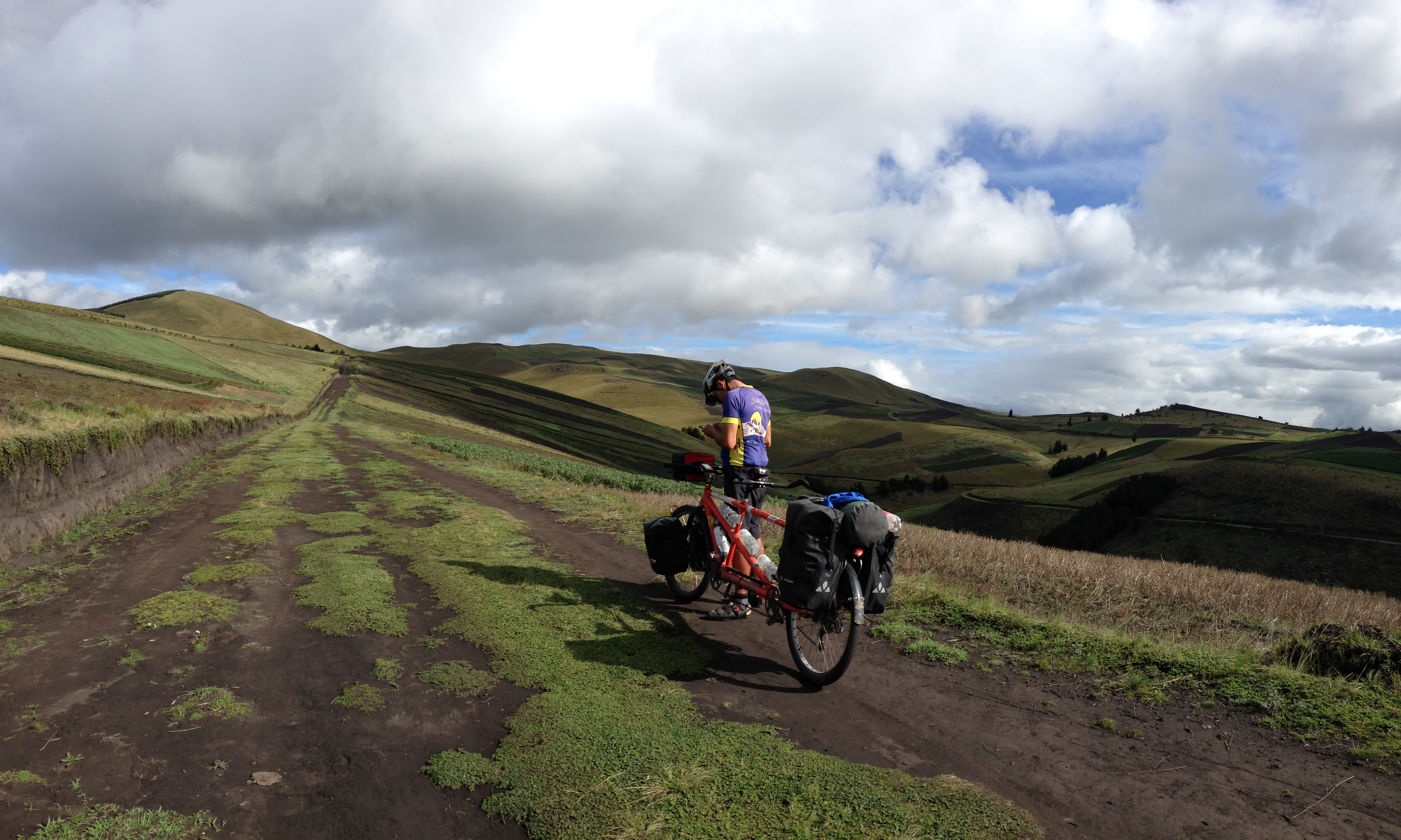
Following the TEMBR (Trans Ecuador Mountain Bike Route) – it turns into a dead end shortly after this! If you are following our track from 03/27/2016, save yourself the trouble when you get to the spot that looks like this, and make the left turn seen in our track (we did an out-and-back)
The TEMBR is a fledgling project to create a Trans Ecuador Mountain Bike Route. The idea seems to stem from a trip done by fat biking bloggers Cass Gilbert and The Dammers. They have circulated some GPS tracks of a route that they designed using maps and Google Satellite imagery – and other people have followed their footsteps. Most notably, bike packing blogger Nicholas Gault has followed quite a bit of the route. We met Nick in April 2014 in Panama – and have come really close to connecting with him again for some more riding.
Of course, the TEMBR is not yet a plug-and-play route, and once I studied the satellite imagery post-ride, it seems that it can be improved somewhat. Having said that, you’re more guaranteed an adventure when your future holds unknowns and problem solving…
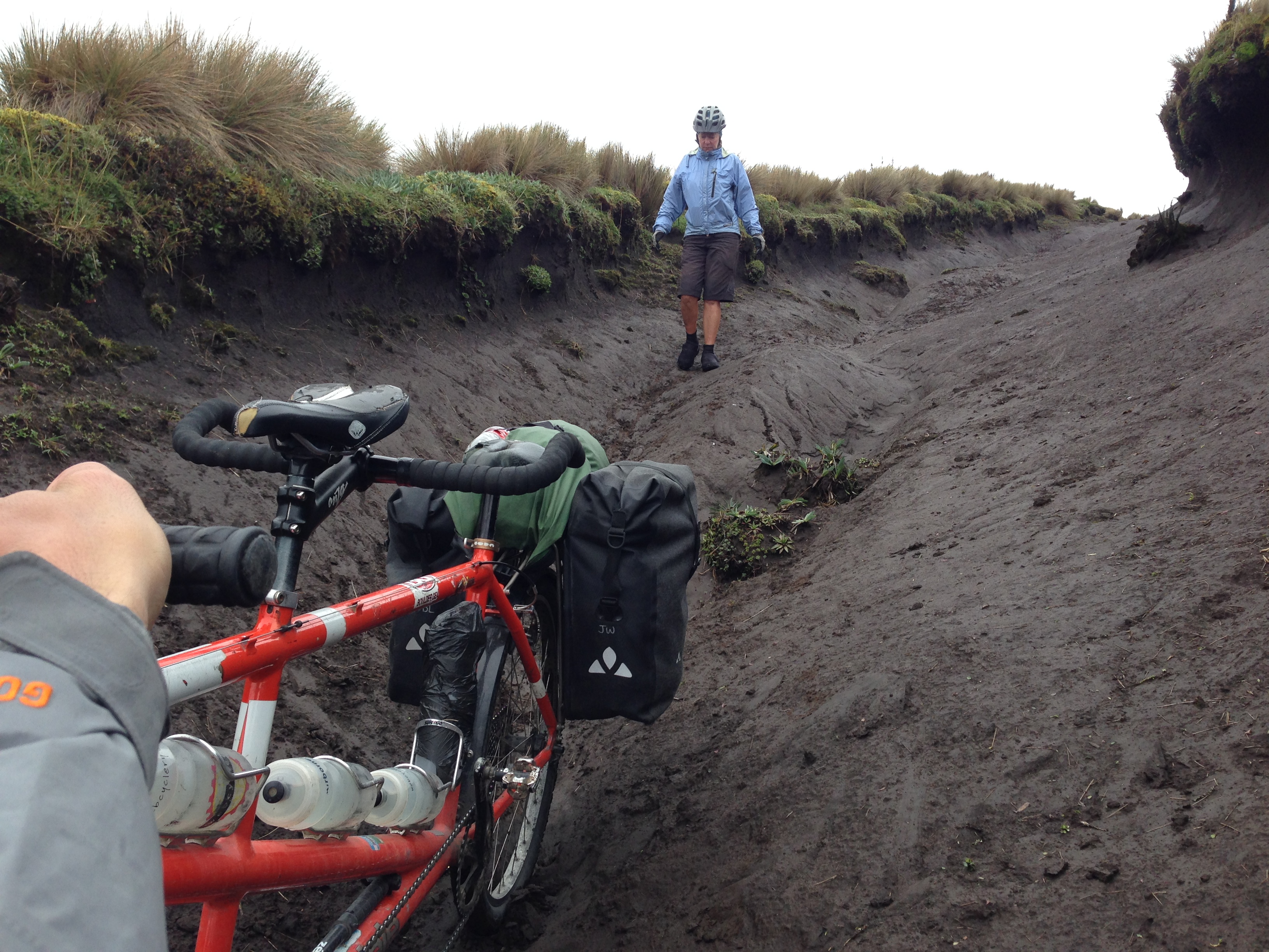
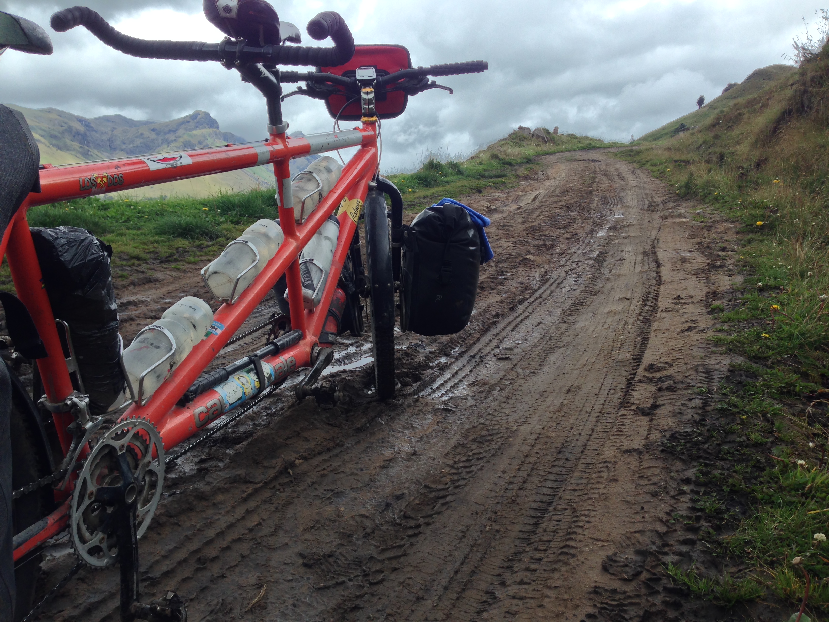
While following the TEMBR tracks, we would sometimes see sections covered with lastre (you might call it “class-2 road base” in other countries). Lastre is a decent surface… Of course, the GPS track for the TEMBR would take the hardest, muddiest possible route. There are a couple places where (with hindsight and satellite views) we could have envisioned a better route.
This portion of the TEMBR did not disappoint. In fact, during these several days, I experienced at least as much joy as anywhere else on the entire journey to date!
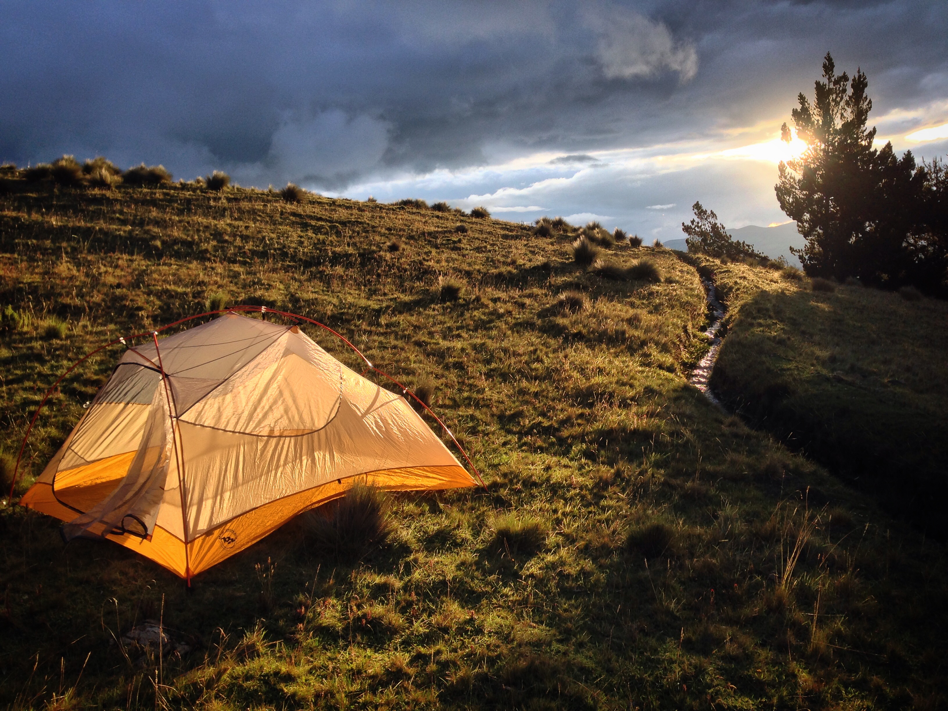
Beautiful camping on the night of 03/27/2016. You cannot see anyone in any direction up here – nevertheless, we were approached in the dark by a couple of men on motorcycles. They came over with friendly “hello’s” (we had turned off our lights for fear). It turned out that they thought we were sheep thieves. Apparently, they had been out “hunting” the wild dogs that had been killing their sheep. When I saw they were unarmed, I asked, “how do you hunt the sheep?” They said that they hunt them with sticks (meaning that the just chase them away).
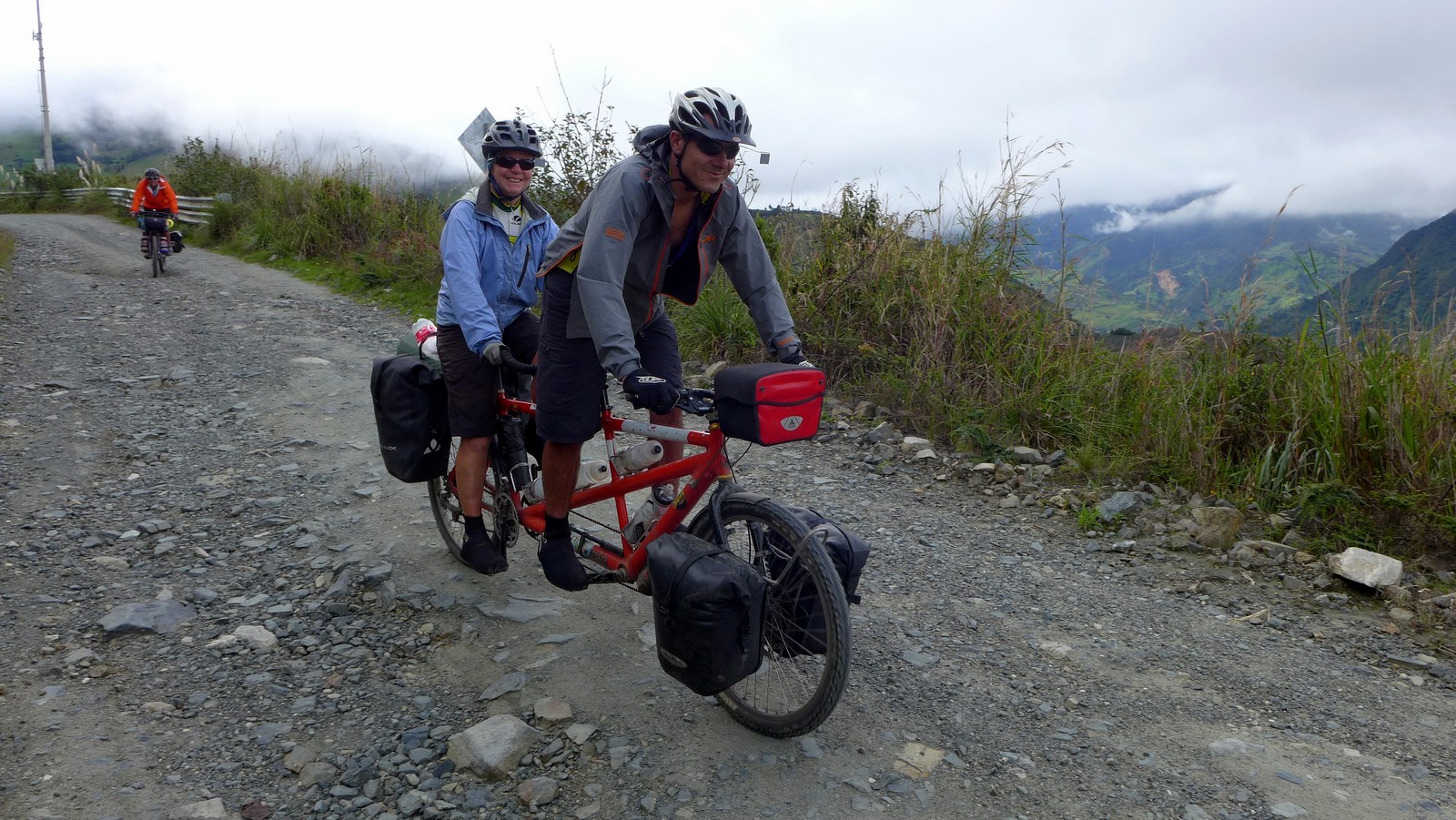
In fact, I was so delighted with this route, that with just the help of a strong cup coffee each morning – I found myself grinning all day – and this is in spite of mud, constant rain, and the fact that we were on the worst possible bike for the terrain – a rigid and fully loaded tandem.
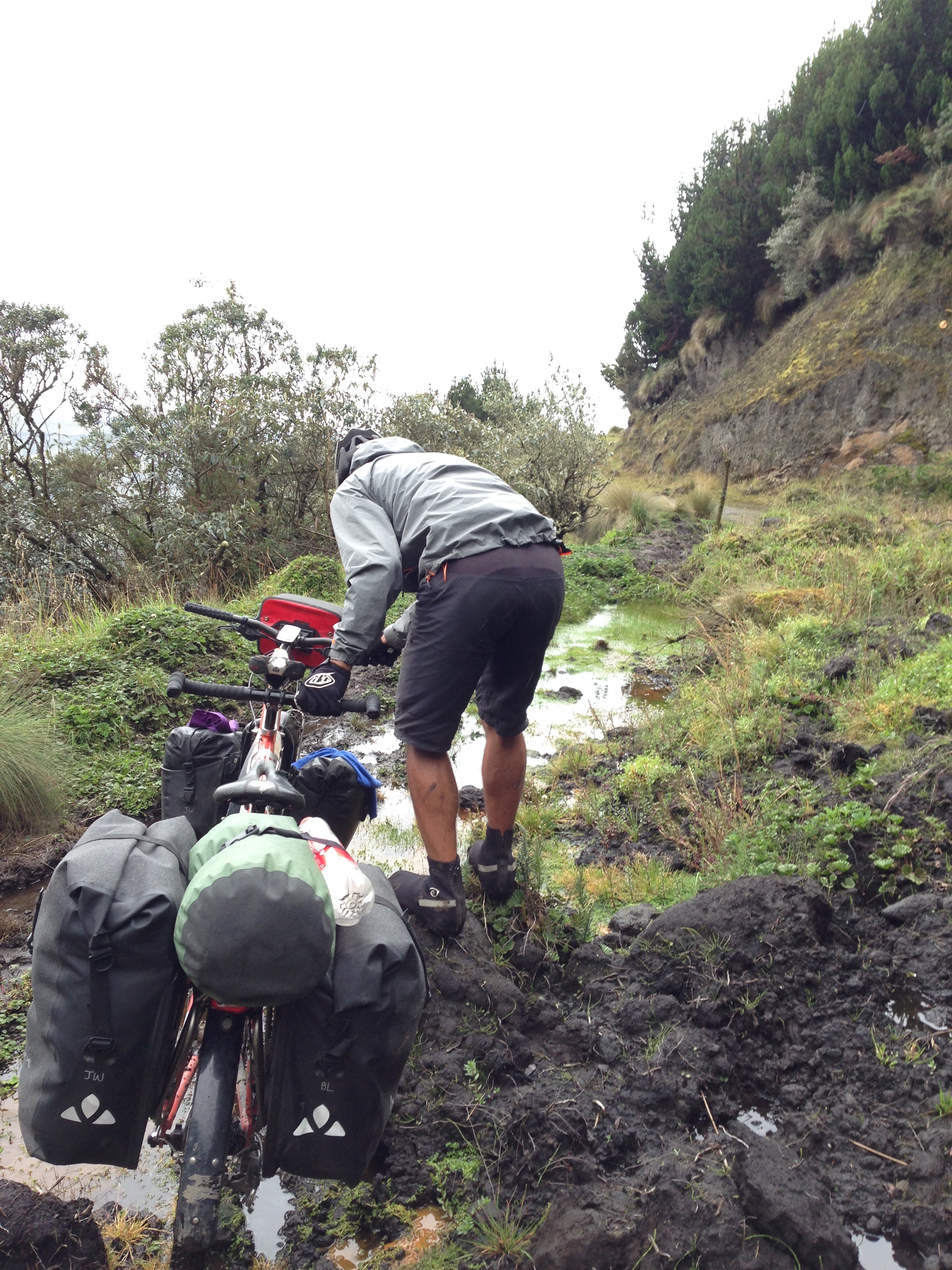
Much of the route on 03/28/2016 was covered in land slides. In spite of the huge difficulty surmounting the mud, I’d highly recommend this route for the scenic beauty and the interactions we had with people who had probably never seen any foreigners.
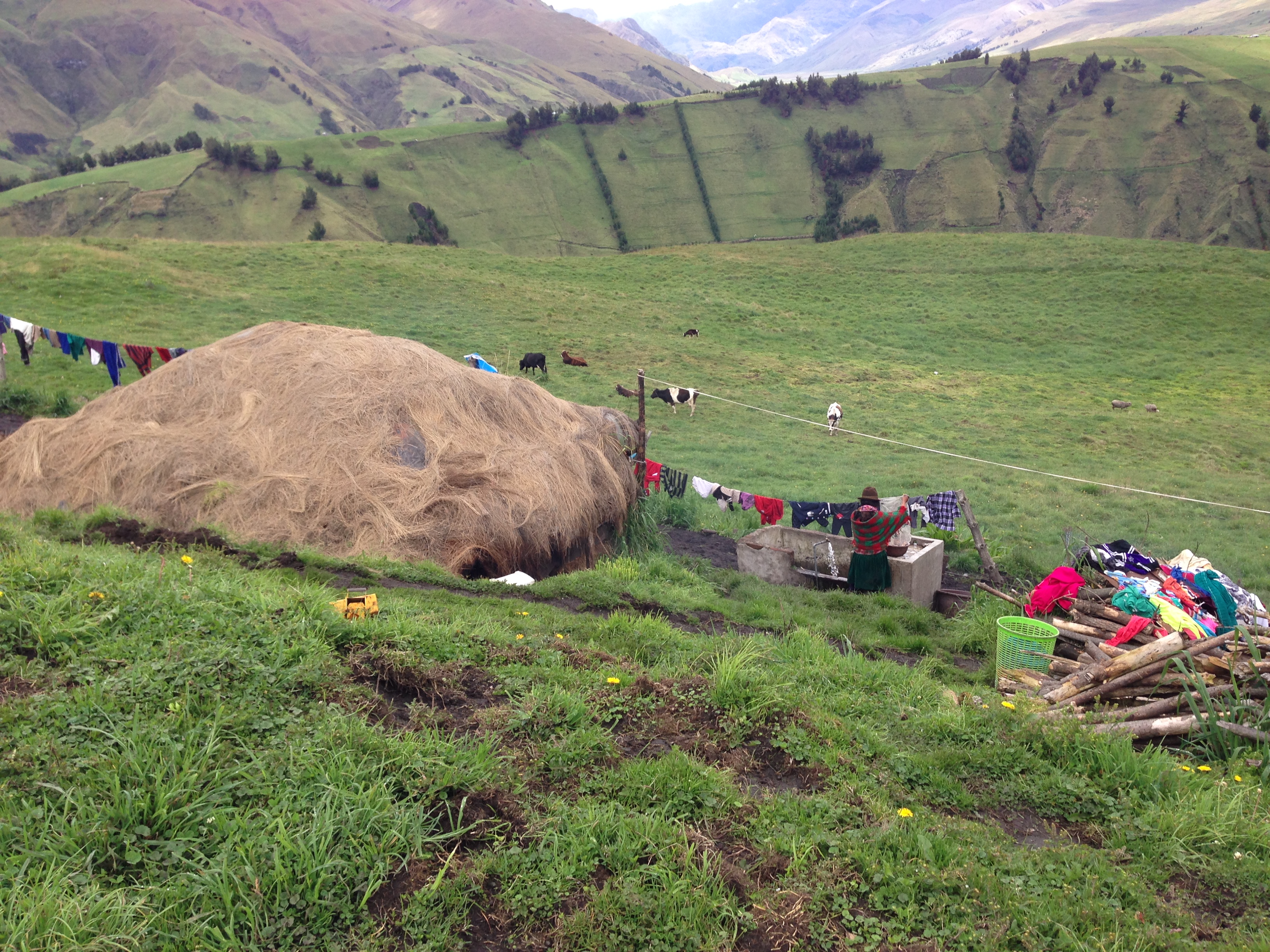
Out along the TEMBR, we noticed very simple dwellings out in the country. In spite of the relatively small geographical area, we also noticed significant differences in traditional wear. The basic women’s style of a bowler hat, sweater, shawl, skirt, stockings was consistent, but the colors varied from community to community.
TEMBR – the Trans Ecuador Mountain Bike Route. The route is mostly attributed to Cass Gilbert and The Dammer Brothers.
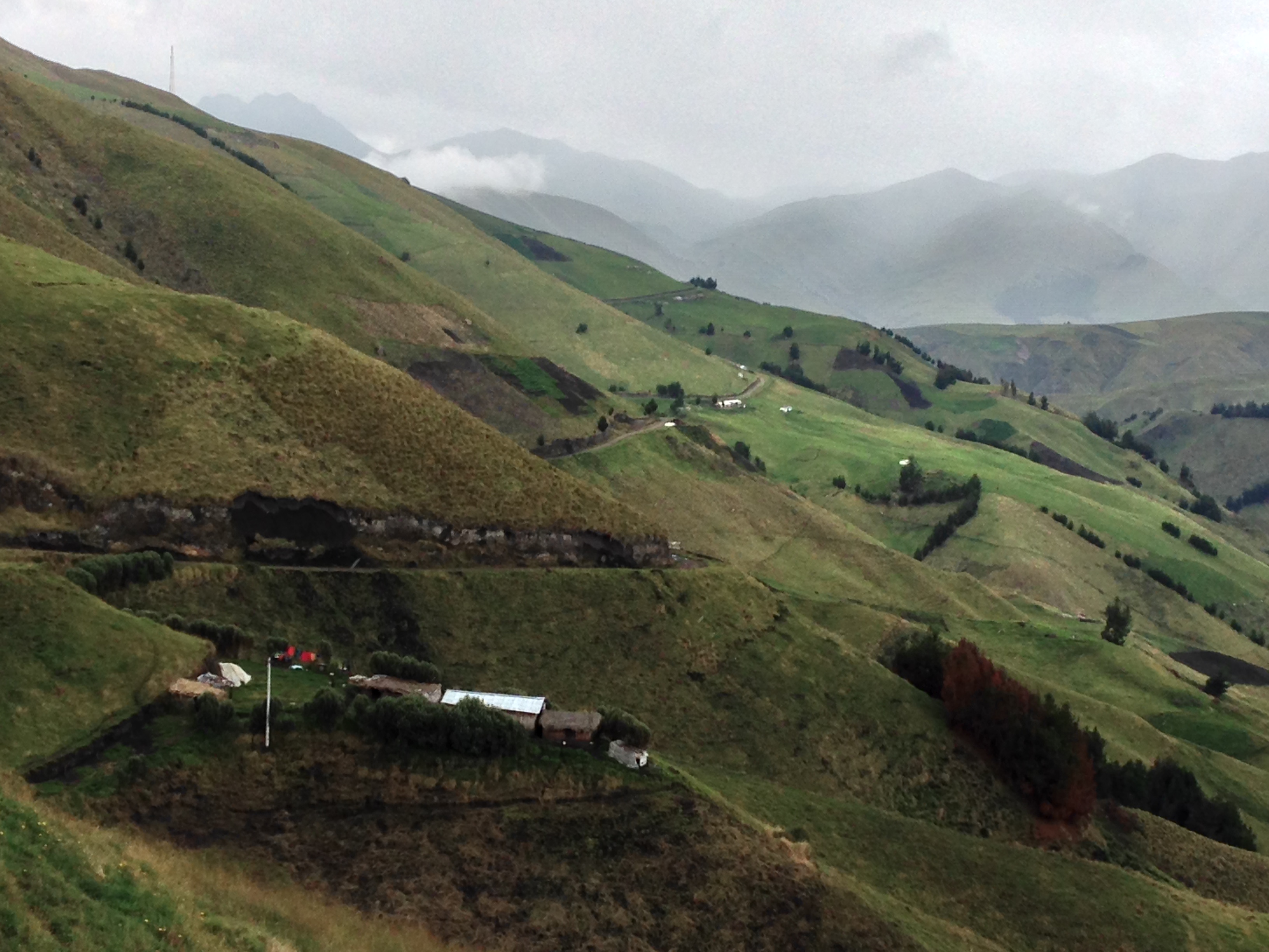
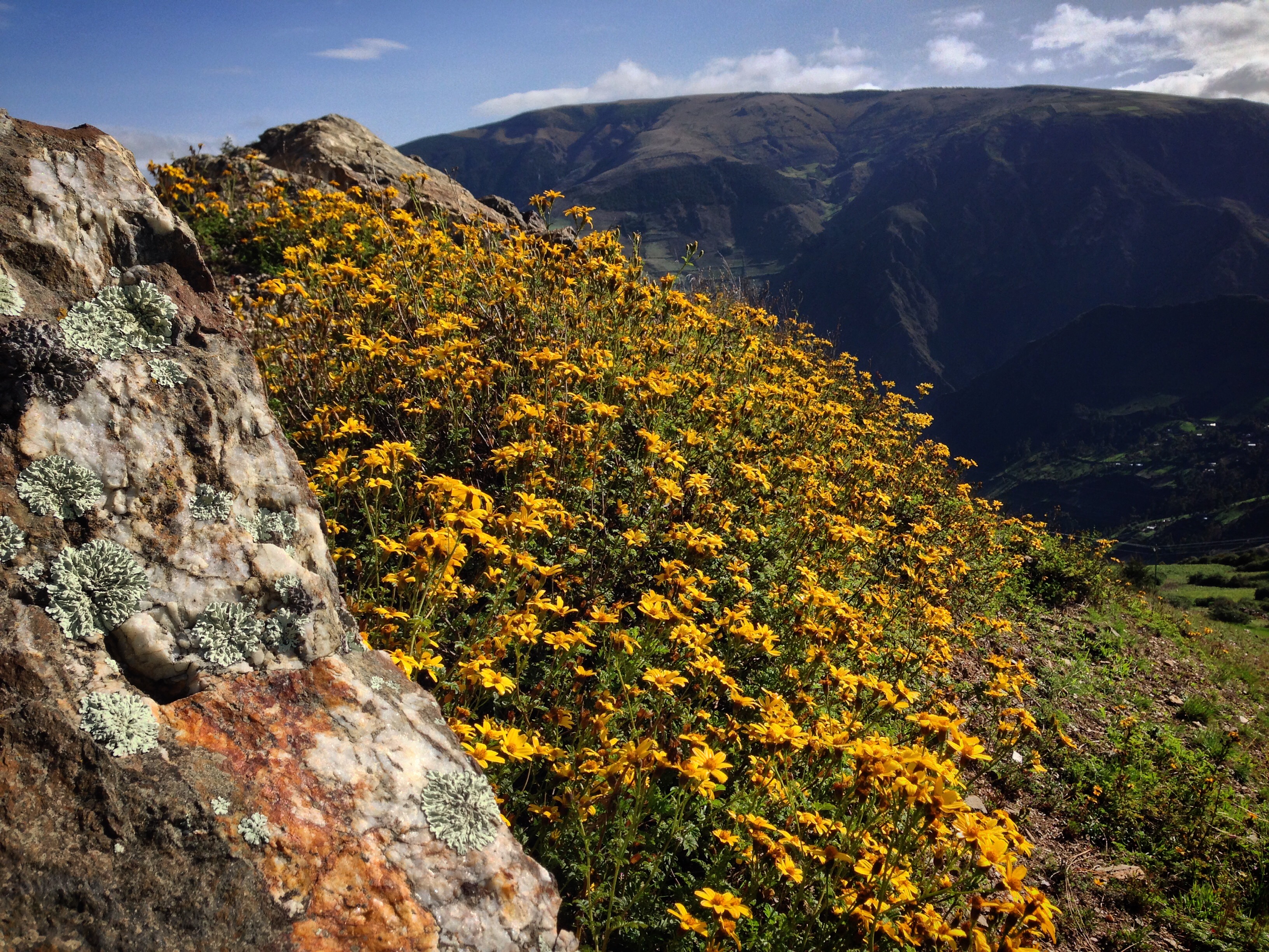
Views along the TEMBR
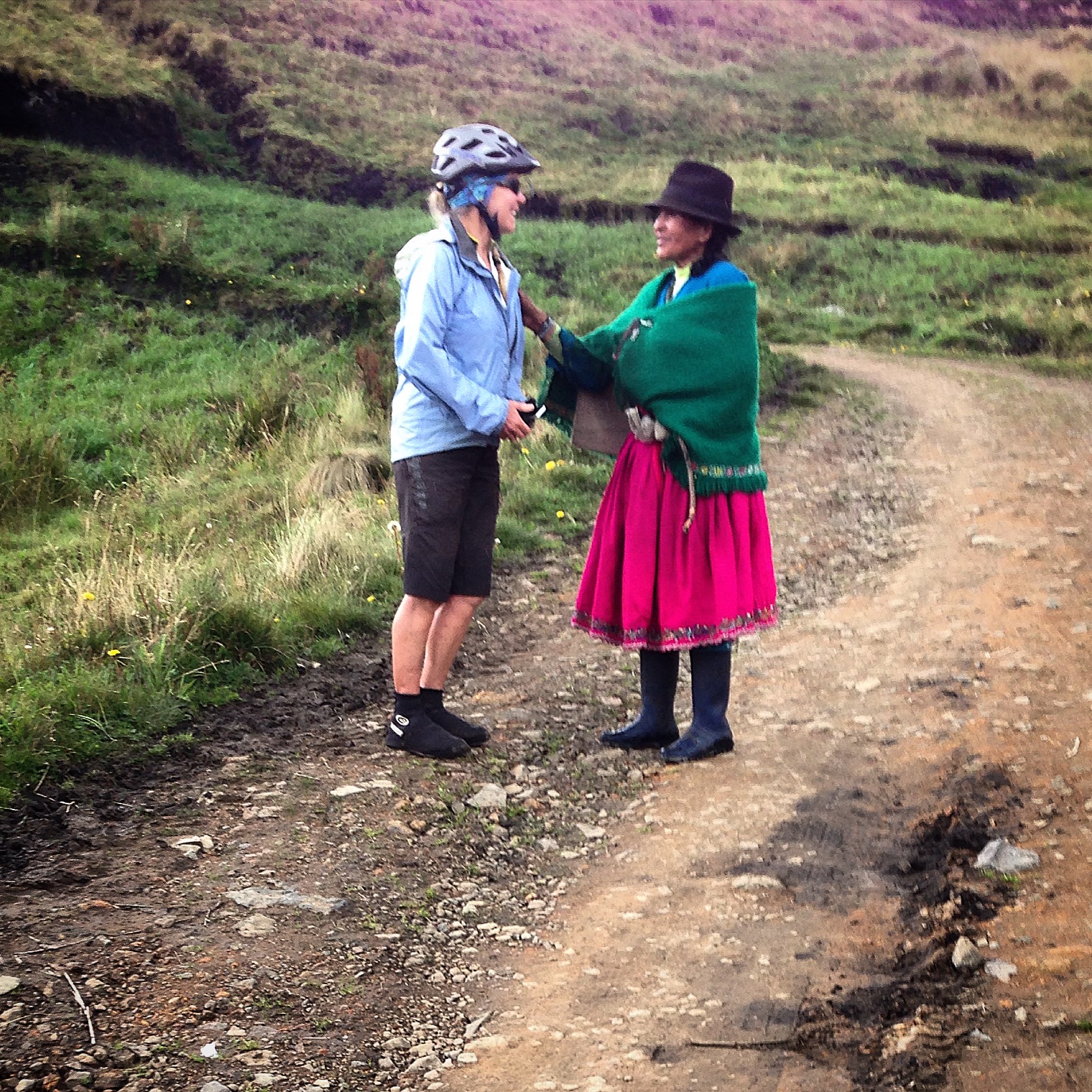
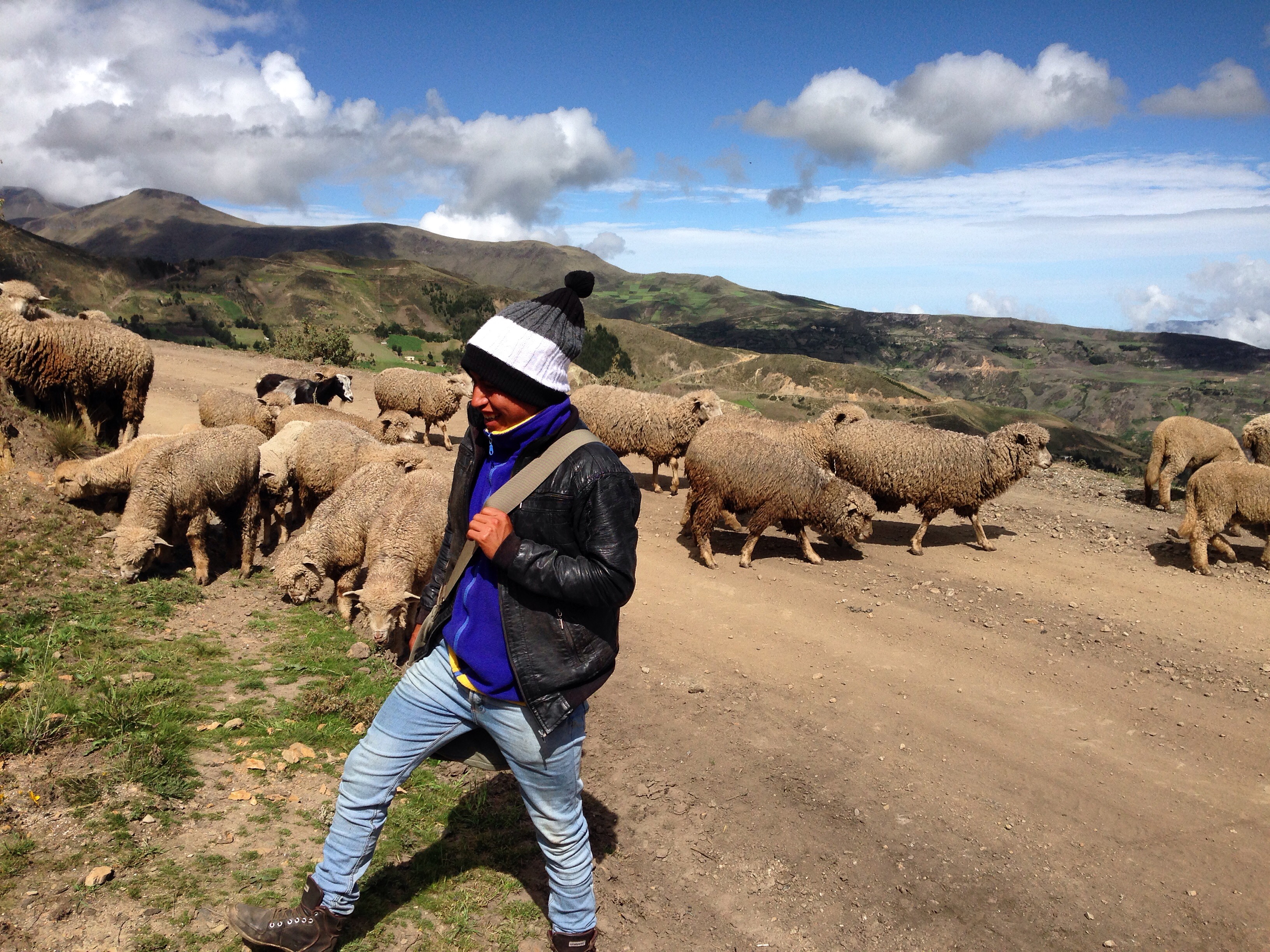
This region probably rarely receives any foreign visitors. It’s remote, and there aren’t any “tourist attractions” out here – and that is exactly what makes it so appealing for bike packing. The roads are mostly impassible for cars meaning that people get around on foot – using the main “road.” On several occasions, we’d meet friendly people in the road for a conversation. This woman told Janet that she could not hear. Janet breathed a sigh of relief saying, “At least she cannot tell how bad my Spanish is!”
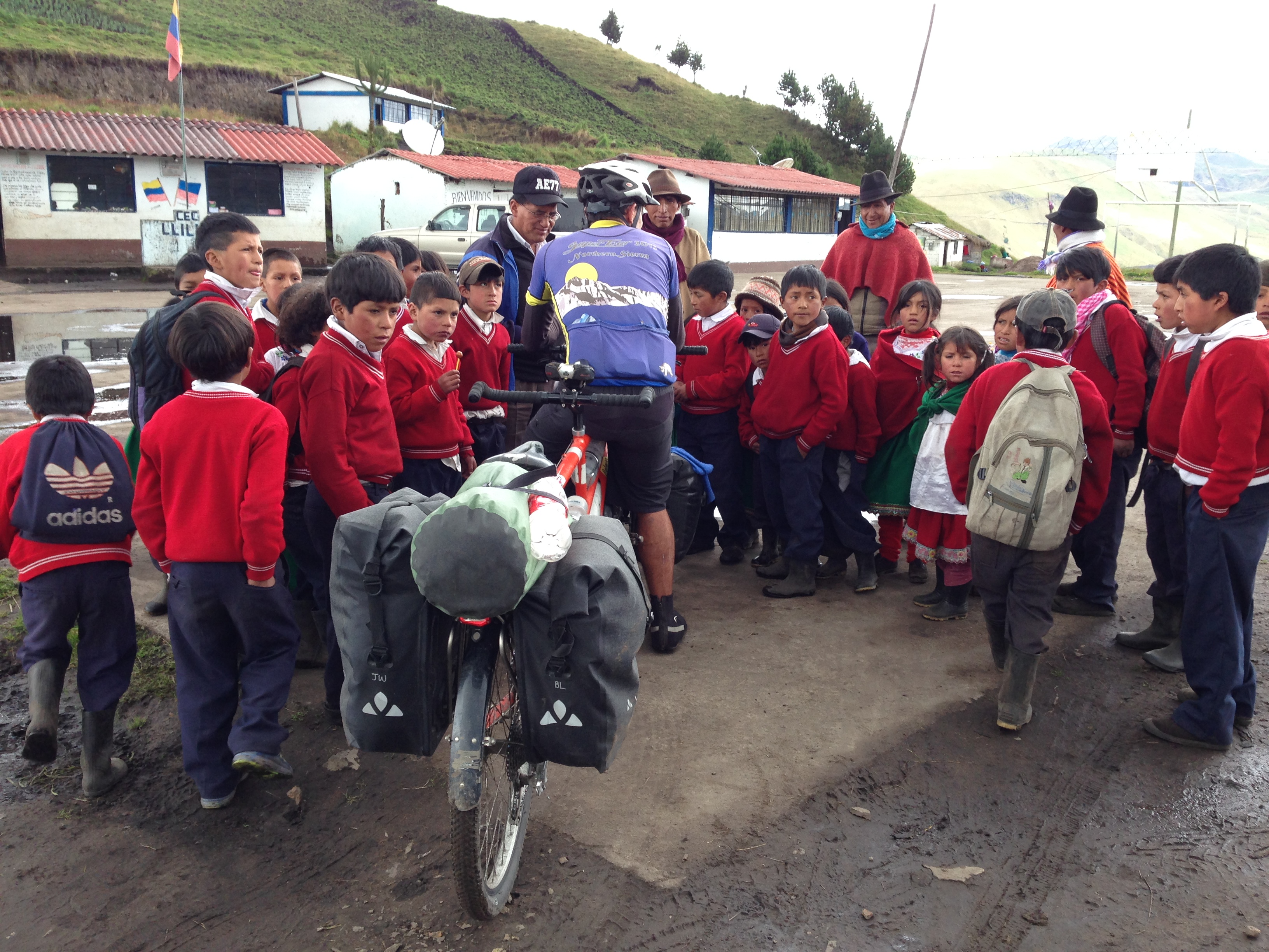
On two occasions during this section, class was halted when they saw us riding by, and the teachers brought the students out to meet us. The teachers were excited for their students to have an opportunity to meet foreigners and/or hear a little English. We exchanged Quechua words for English words. After the particular meeting shown in this picture, a young boy aged 12 (though he looked to be about 7) ran home alongside us. He asked us a variety of intelligent questions, and told us about his interests and dreams (he would like to be a teacher himself one day). As we parted ways, he asked for a gift: He wondered if we had a notebook so he could study English.
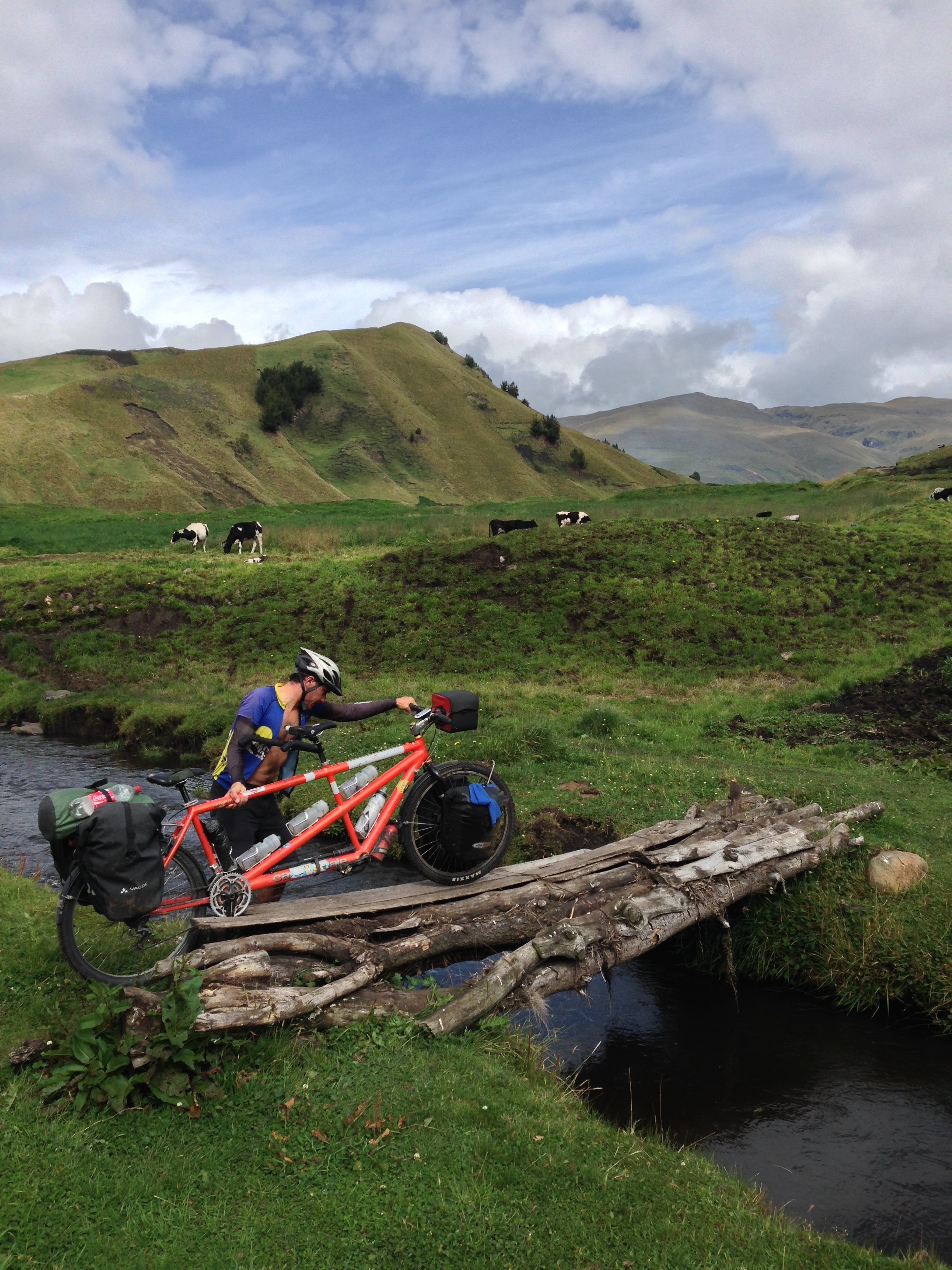
In some locations, the dirt road has a deep at-grade river crossing. Fortunately, due to the fact that the majority of traffic is by foot, there are usually bridges to get you across so you don’t have to submerge your hubs.
Getting near Achupallas.
I highly recommend this portion of the route for any strong and motivated bike packer – especially during the dry season. When we neared “civilization” again, I was a little disappointed that we couldn’t keep going. The next portion of the TEMBR (South of Achupallas) was described to us as “an old Inca trail.” It goes all the way to the Ingapirca Ruins (see below). The report was that the bikes needed to be carried most of the way. Since a tandem is difficult enough to carry unloaded over flat ground, we opted to ride the PanAm to complete the next leg.
Nearing the end of our time before joining the PanAm, we met this young man named Segundo while we were drying our tent.
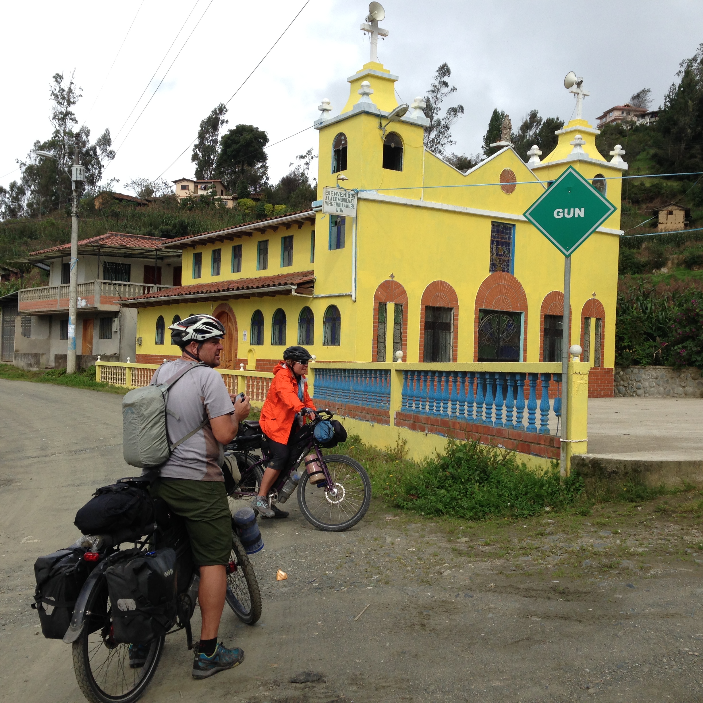
In Achupallas, there is a slight stir of foreign tourism. Many friendly people approached us and asked if we were going to ride the Inca trail to the Ingapirca Ruins. This small town is the launching point for that hike, and so the locals are probably used to see foreigners with that goal. We responded to the locals saying that it sounded nice, but difficult. Invariably, people replied that yes, you’d need to do it on foot or horse. Since no one said anything different (and we were eager to see Scott and Sue again) – we took the road.
Guasuntos to Cuenca via Ingapirca
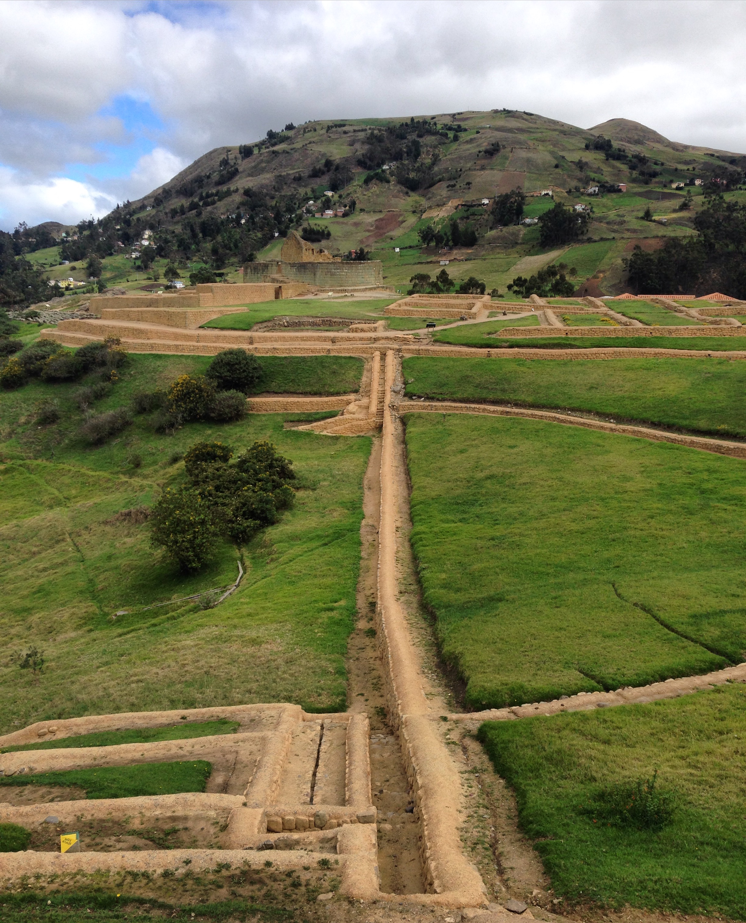
The ruins at Ingapirca. This is the largest known Inca site in Ecuador. Of course, like many sites that were attributed to the Inca, this place was originally settled by the Cañari indigenous people. Ingapirca is a very important archaeological site for Ecuador
In Ingapirca, we rejoined Scott and Sue who had been reacclimatizing to the Ecuadorian elevations on the PanAm. We were delighted to see them and share stories of our experiences, and visit the ruins with them. One thing on all of our minds was “savage dog alley” – the section of the PanAm we had just ridden here. Throughout our travels, we encounter an average of 30 barking and chasing dogs per day. On this section, however, we were chased by upwards of 50 dogs – one of whom even bit our tire!
Visiting Ingapirca was very pleasant. As there were no other tourists, we had our own personal guide (included in entry fee). It was a very worthwhile visit.
Moving South, Scott had been researching an alternative to the TEMBR that goes via Taday and Paute to Cuenca. Although we could have ridden from Ingapirca to Cuenca in one day, this route sounded exciting – and it was. This is an excellent alternative route to Cuenca, with the one caveat that traffic is heavy from Paute into Cuenca.
We’d heard the the TEMBR in this region was a muddy mess, so we took an alternative route via Taday and Paute (see our 03/31/2016 track). The route from Ingapirca to Paute was excellent (lots of climbing, with a fair amount of dirt, but also pavement).
Fun times along the Taday – Paute alternative route. (Photo Courtesy of Scott Mlynarczyk)
The town of Paute has plenty of reasonably priced lodging. Once you get into Cuenca, there is A LOT to do. We used this time for resting, errands, and visiting the amazing (and free) Museo del Banco Central. This museum has an aviary that competes with the best we have seen.
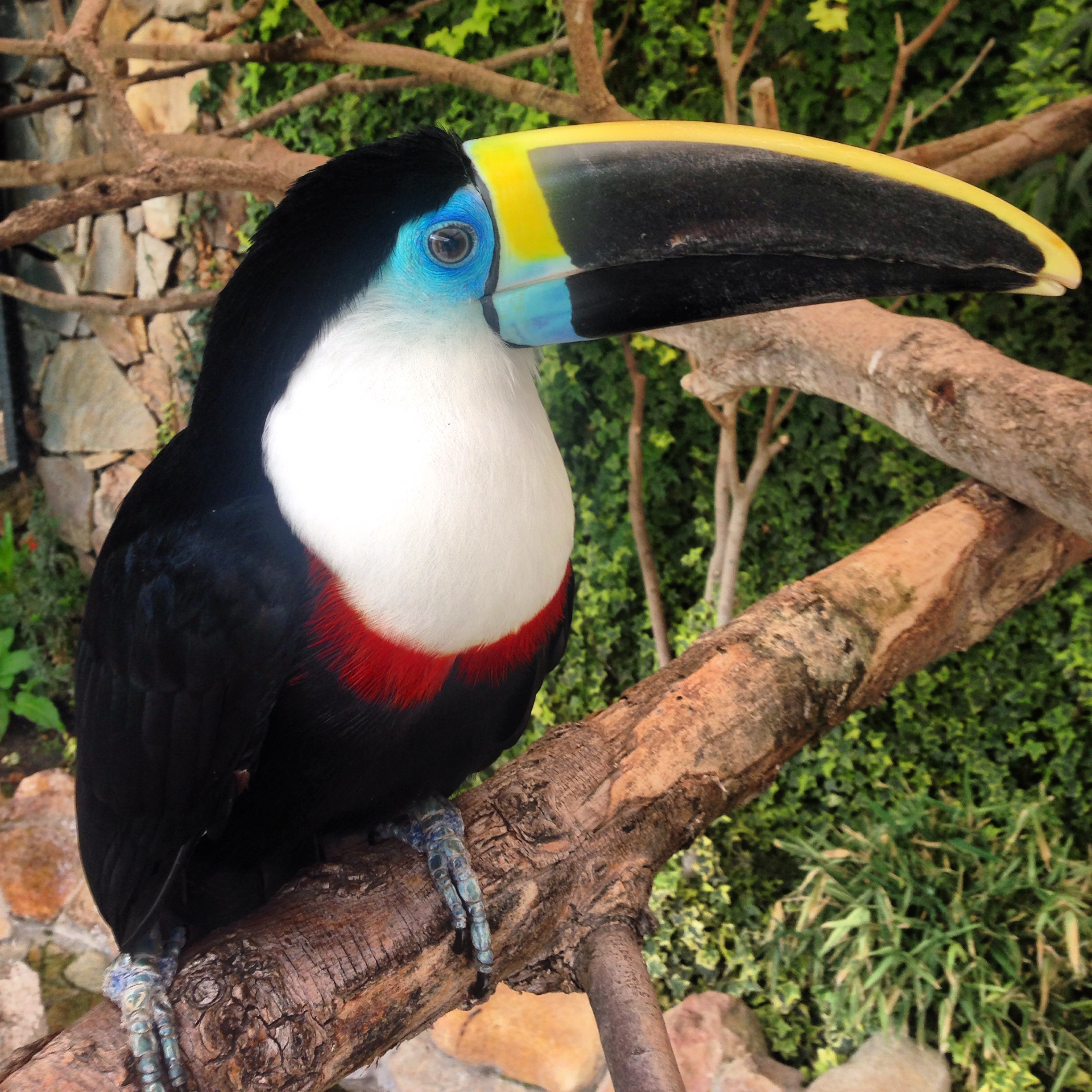
Toucan
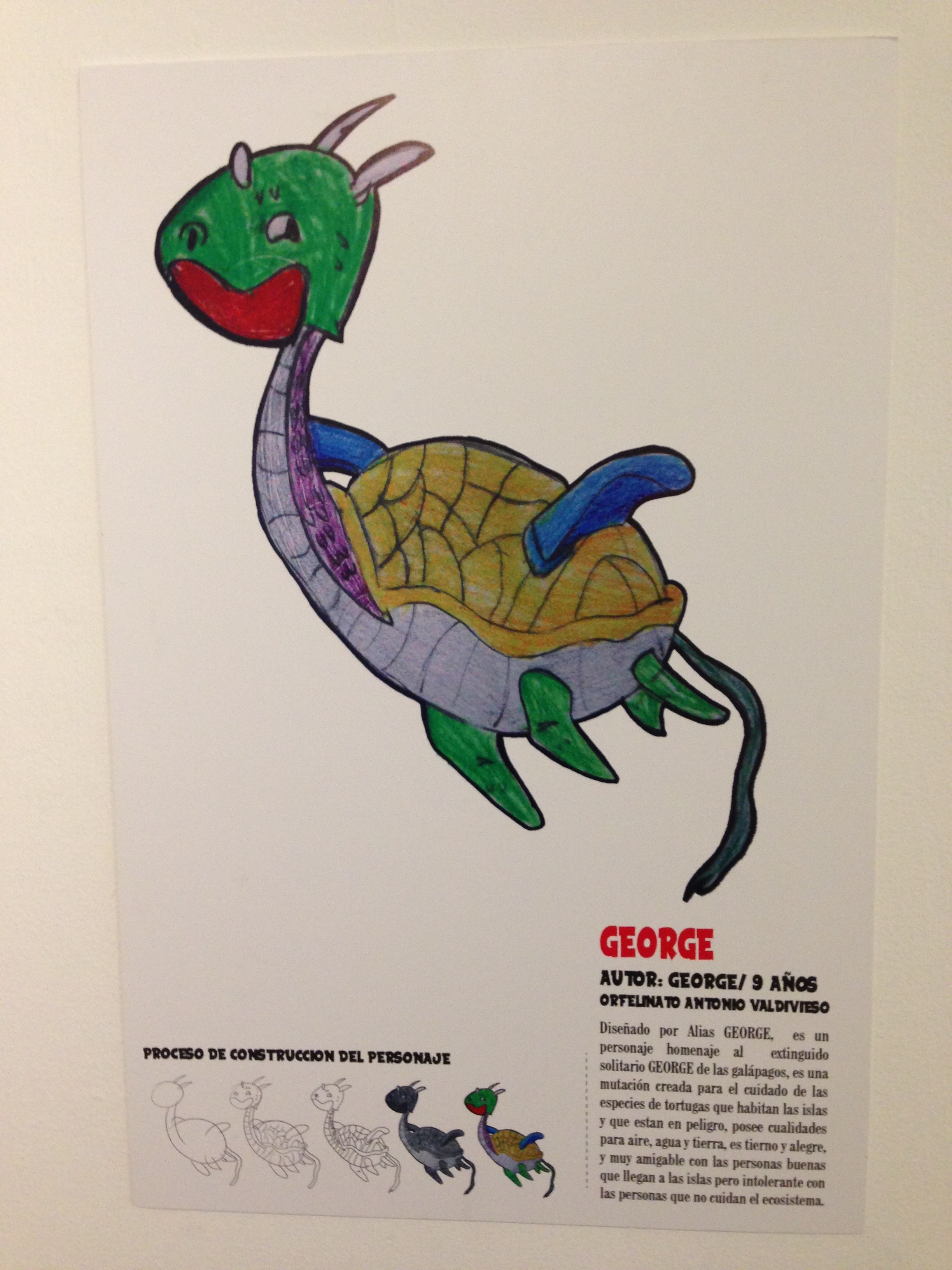
Exhibit of art in Museo del Banco Central in Cuenca. At-risk teens were given the project to draw a creature and discuss it’s (usually magical) capabilities.
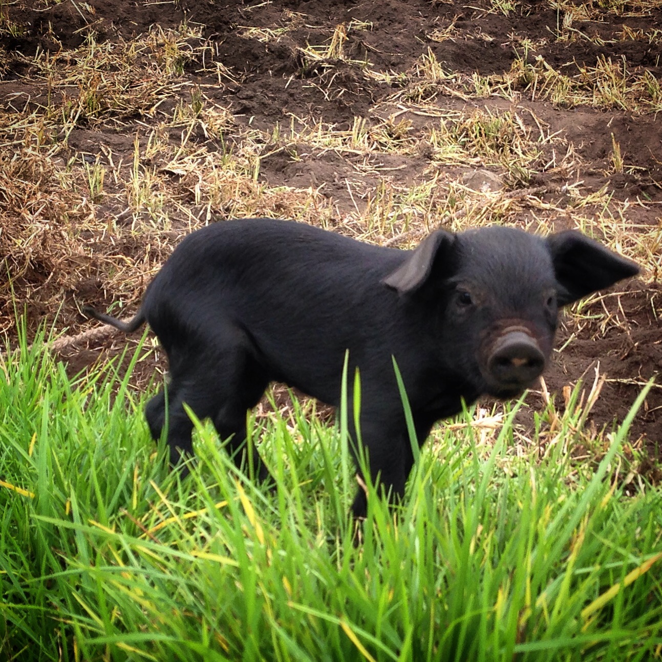
Pigs are abundant, and Janet loves them.
This is the map for the entire route discussed in this post. To Export GPX files, click on the three horizontal bars in the upper right hand corner of the map and select Export selected map data…
To see this map in a full screen, click here (opens in new window)