Bicycle Touring Baja California Guide
Many of our friends were concerned about us taking a trip to Mexico due to the drug conflicts that had peaked in 2012 (and have persisted until 2014, and perhaps beyond). We acknowledged that this was a risk, and then started doing some research online. My research discouraged me greatly. When some of the images of the conflict came across my screen, I got a severe sinking feeling in my stomach; this battle was grotesque. I then started looking at the statistics to help ourselves feel better. Reporting a homicide rate of 21 per 100,000 seemed a little frightening compared to my home countries’ 4.7 per 100,000… but I decided to look a little further. New Orleans is a city in my own country that I would probably consider going to… and their homicide rate regularly hovers in the 50’s per 100,000 – nearly double that of Mexico. It’s a fact that we increased our risk of danger by touring Mexico as opposed to our own Country – but the risks are localized. I printed a blank map of Mexico, and then used the US Government travel warning page to mark the “more dangerous” regions in red. In the end, we came up with a map that had a lot of red in Northern Mexico, near the US border. Some red in central Mexico (like near Acapulco), but a lot of clear zones in places like Baja, Southern Mexico, and the Yucatan Peninsula. To mitigate the risks, we went to these places and enjoyed them immensely. If you want to do the same for yourself, please check the Travel Warning Page. Obviously, this page is not comprehensive, and it may also be hyper-conservative… but in a world of events that you have little control over, it’s nice to be able to take one small aspect under your wing for a slightly improved sense of security.
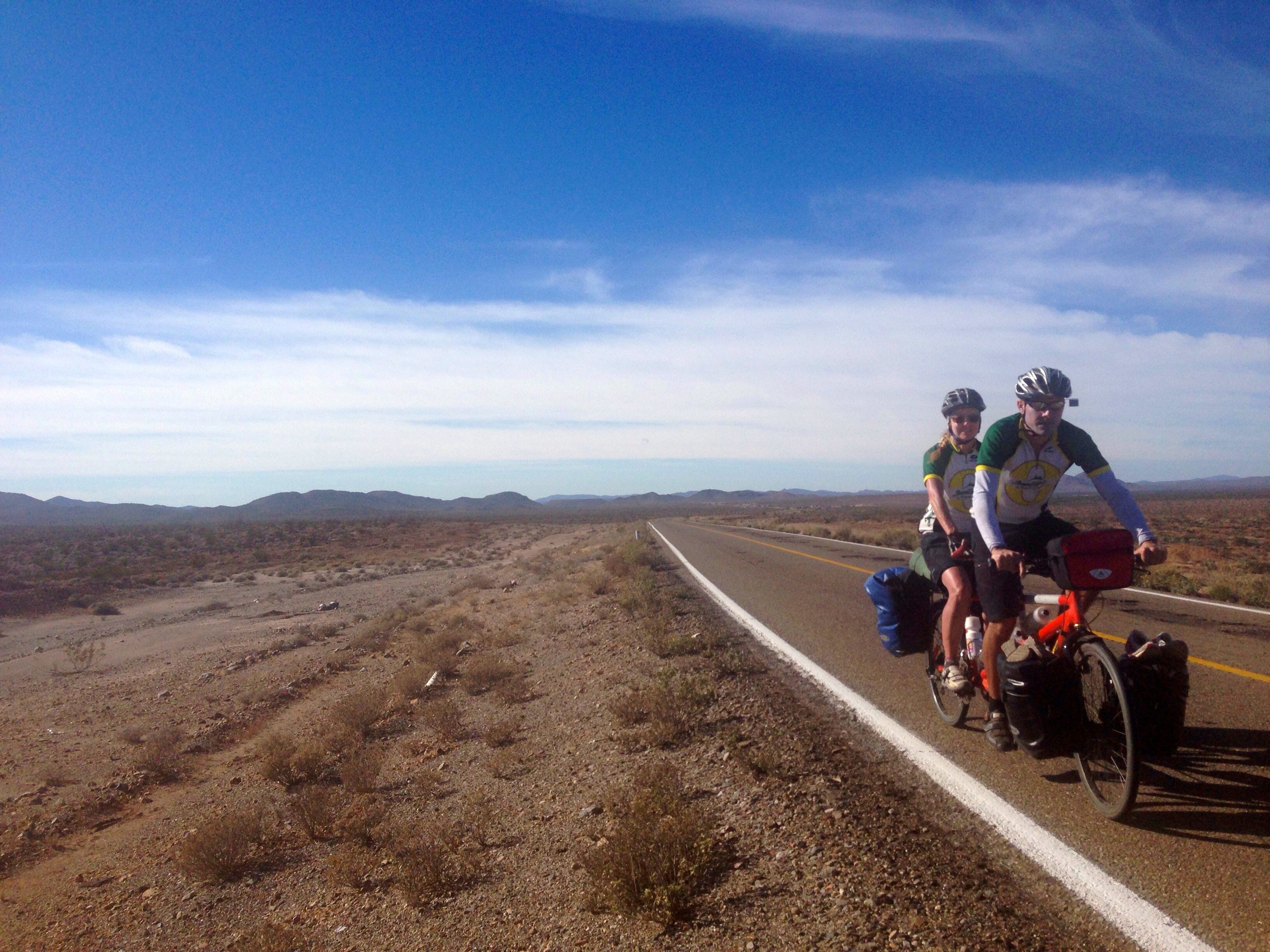
If you like long, quiet roads, then the roads south of San Vicente, Baja California, are the place for you. The shoulder isn’t that great anywhere in Mexico, but throughout the country (except in big cities which we avoided), the drivers are EXTREMELY courteous with cyclists. Coming from California (which has a good cycling culture), I was pleased to find that most countries we visited in 2014 had great respect for cyclists. Mexico was one of the best.
Now that we’ve discussed the security issue, let’s get on with the cycling – the fun part! Bike touring Baja California was one of the highlights of our entire journey from San Diego to Panama. In fact, it is one of the highlights of 2014, which also included a circumnavigation of Europe. Clearly, we think very highly of Baja for bicycle touring.
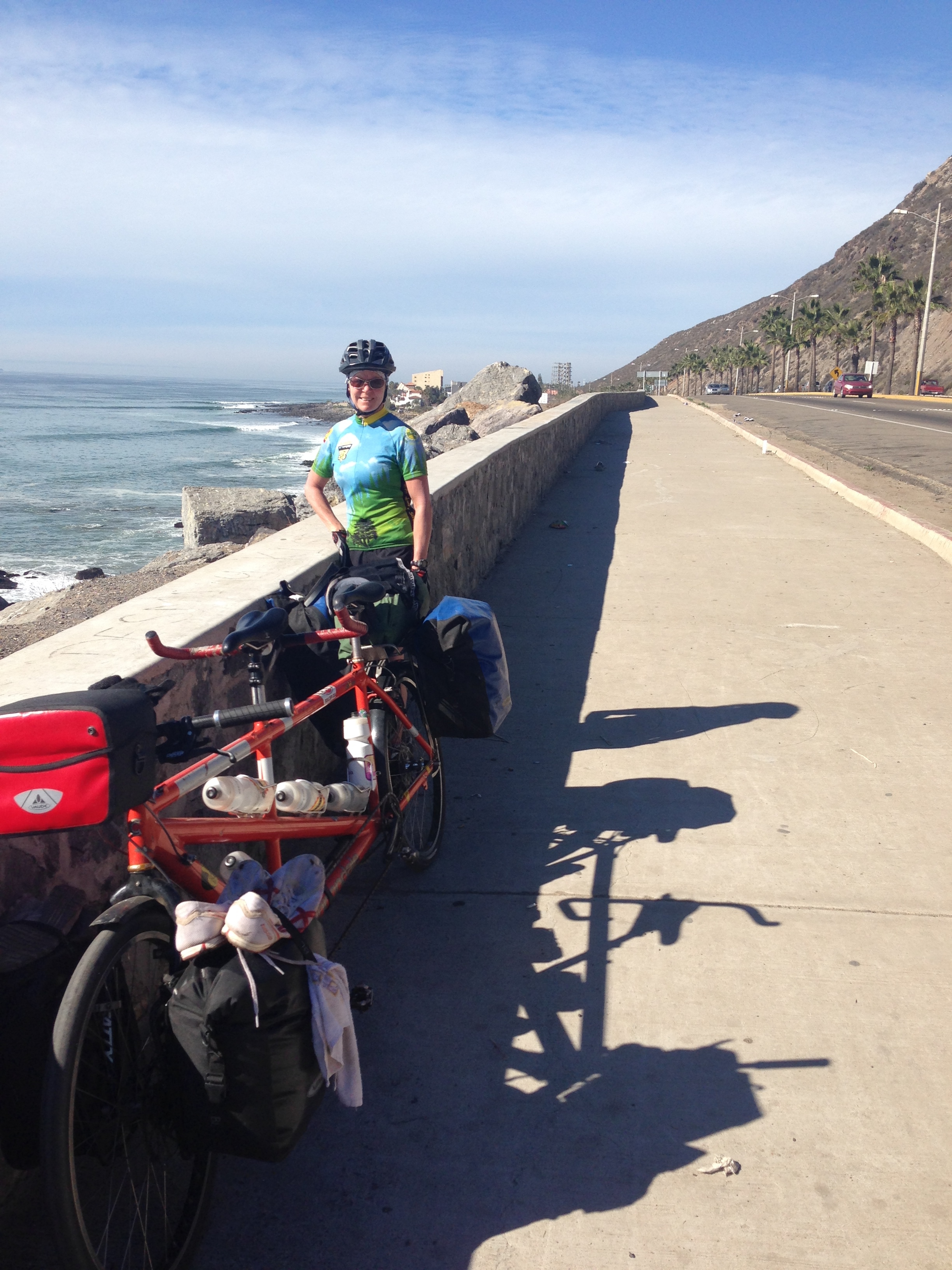
01/25/2014 Day 3 San Diego to La Mission 73 Miles.
Our Day numbers start with Day 3, simply because we had been traveling for 2 days to get to the Mexico Border. If you start in San Diego, you’d want to start with Day 1. The route from San Diego to La Mission is what I would consider to be a “necessary evil.” The worst, and most difficult part is navigating from Tijuana to “Puente La Joya” (this is where we first reach the coast on the linked map for this day). You will see we rode “Via Internacional” which is extremely busy with no shoulder. It felt very unsafe, but there are not a lot of roads that cross Tijuana. You will see from the map that there are 2 North South canyons that are not crossed by roads. You can finally exit the busy road at Playas Coronado and breath a sigh of relief that the worst section of the entire route has been passed. Riding along Mex 1 has been debated greatly online. The official rule is that bicycles are not allowed on this toll road. Nevertheless, it is certainly much safer than the free road that parallels it for two reasons:
1) There is much less traffic due to the fact that you have to pay money to drive it.
2) There is a wide shoulder.
It’s ideal for cyclists, and I had ridden it once before by “sneaking around” the toll booth. This time, we wanted to be official, so we rode up to the booth. The men informed us that we needed to ride around the toll booth. In other words, “sneak around” was the official solution. Bikes simply cannot pass through the toll booth, but it appears that they don’t care if you ride the road. It’s a minor deviation that occurs at mile 34 in the linked map. You rejoin the HWY at mile 37 on our map. From here, there is a lot of pleasant riding.
Wide shoulders on the way from Tijuana to Rosarito
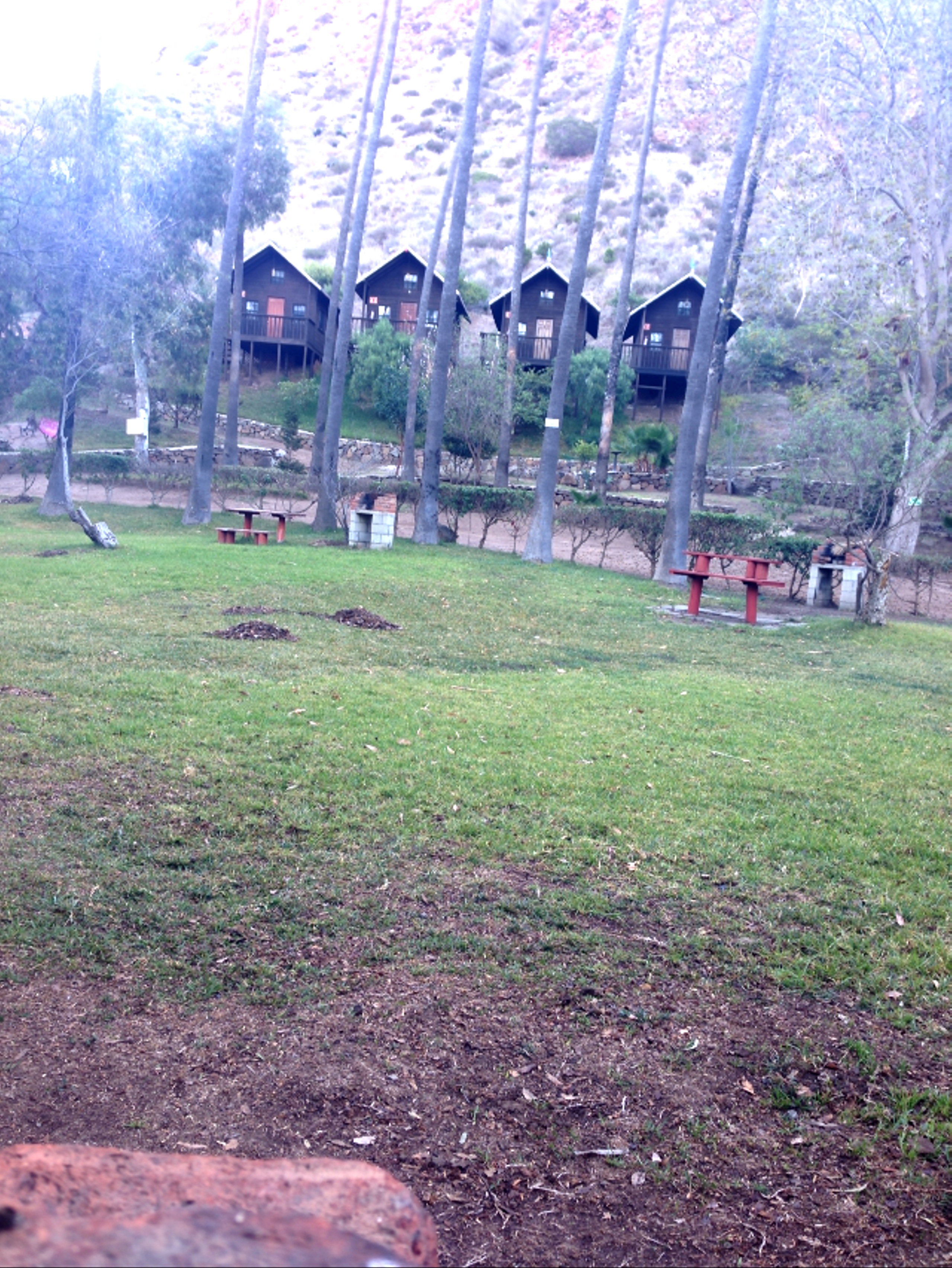
These are the cabins at the campground near La Mission
You ride on the mostly wide-shouldered road, looking at the ocean, and enjoying the comfortable temperatures. You see the remnants of hotels that were partially constructed during the economic boom, and then abandoned when the money ran out. Food is available all along the way – either at supermarkets or road side stalls. If you’re looking for a place to spend the night, there are two options where our GPS track ends. When you turn off MEX 1 in La Mission on “Camino Vecinal Las Palmas” on the left about 1/2 mile down, there is an official campground. It was not busy when we arrived, and the water was turned off. They were very kind when we arrived, and although they mostly provide “cabins,” they allowed us to use our tend on the nice green lawn area for a discount. They unlocked a cabin and told us to use the bathrooms in the cabin. Also, showers would be in the cabin. Unfortunately, there wasn’t enough time for the water heater to get started. Janet and I took a dip in the pool to rinse our bodies. The cost was about $10US.
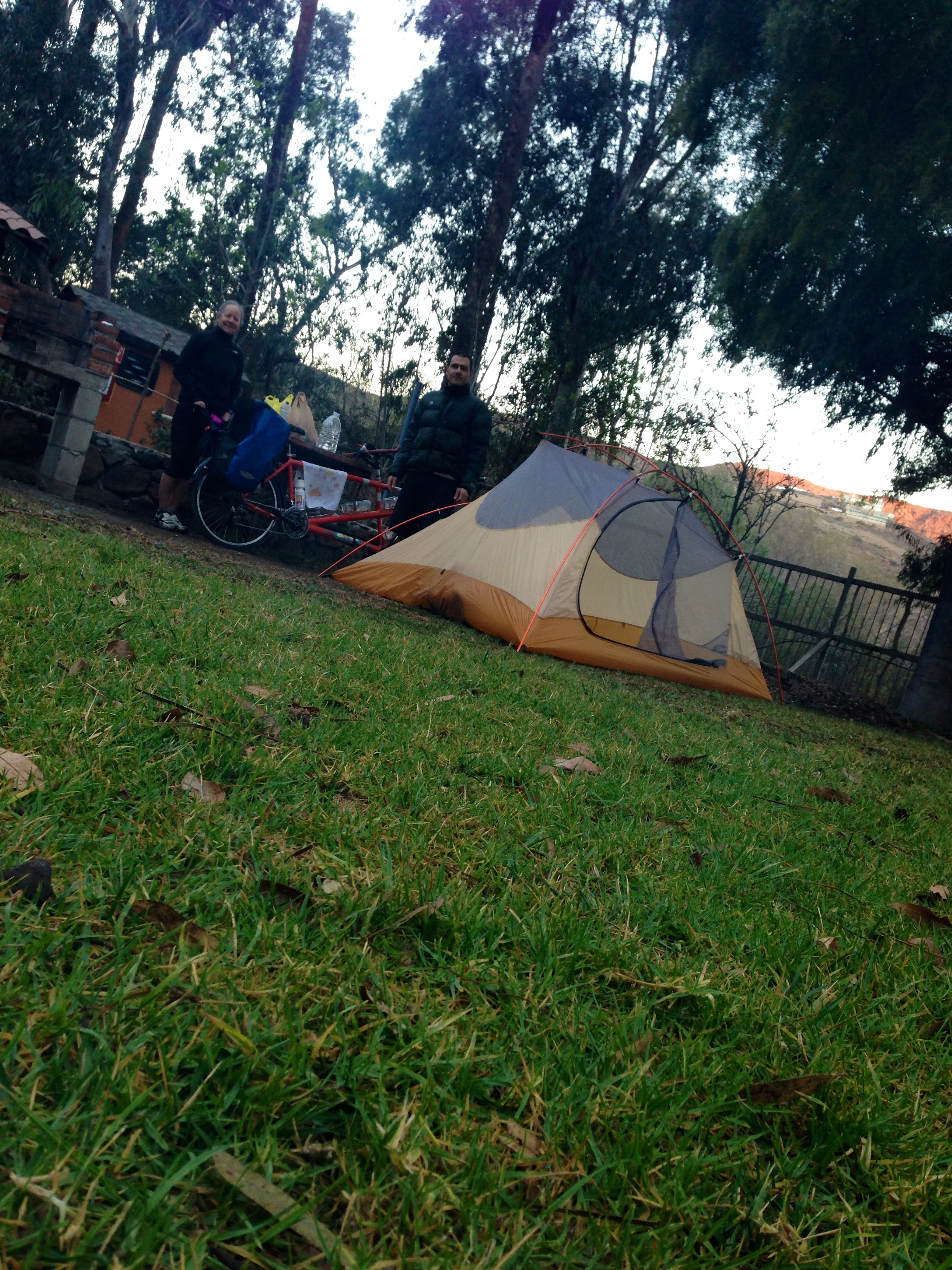
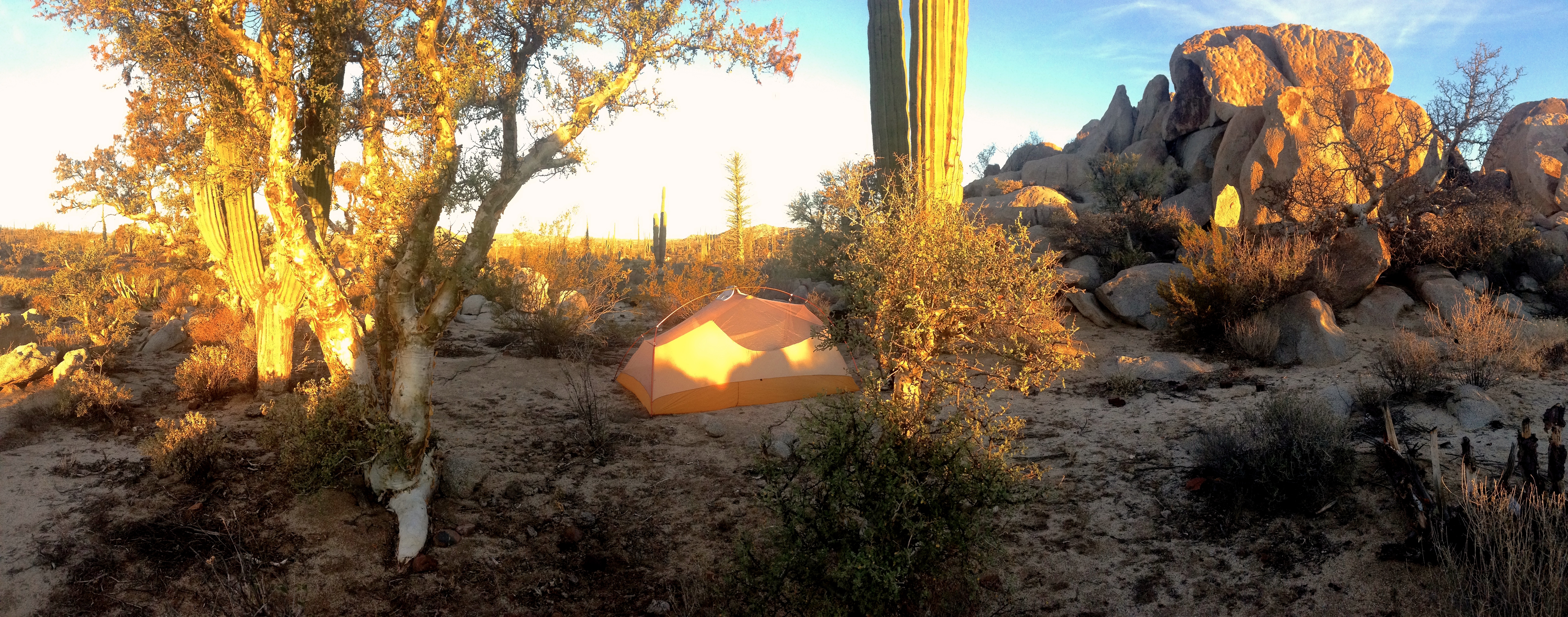
This is where we placed our tent at the campground in La Mission
The other (free) option is to ride to the beach. We did not do this, and we noticed a number of cars driving down to the beach, so we assumed it was a party area, and less suitable for cyclists seeking a quiet night.
01/26/2014 Day 4 la mision to San Vicente. 80 miles
If you are cycling in a normal year, you will want to continue on MEX 10 down the coast. This is the toll road. Unfortunately, the toll road had been washed out due to winter storms, and we were relegated to MEX 1, which wasn’t too bad. It had ALL of the traffic from both roads, of course, and no shoulder, and a 1,200′ climb. Nevertheless, drivers were very courteous, and never honked. We even had a “guardian angel” – a person who voluntarily drove slowly behind us for an hour so that when cars came upon us, they would be forced to slow down. This wasn’t absolutely necessary, but it did make us feel safer. 2 days into Mexico, and we were already on a major high! For us, we wanted to pass quickly through Ensenada. Our touring interests are related more towards scenery than crowds of people and traffic, so we rode quickly though this fairly pretty beach town. After Ensenada, services slowly became less frequent. Our bike carried 2 and a half standard bottles per person. It was about this point that we started carrying a 3.75 liter bottle in the pannier. It turns out that for a small price, you can get these bottles refilled at purified water filling stations. Once we discovered their availability, we would ask around at each town for these. This would save plastic, and a lot of money. We found that we could buy water for 3 pesos in some places (other places wanted 8 pesos). We found that we always had plenty of water for the entire peninsula by basically carrying about 5 liters each at all times. Of course, we would frequently hydrate at road side stalls which contributed to our enjoyment of the experience. In a few locations, the people who ran the stalls were friendly and told us stories about their lives that we would have otherwise missed if we were carrying enough water to just pass through. The last several miles of todays route become much more agreeable to the touring cyclist. The traffic diminishes, and the scenery becomes more interesting if you enjoy desert scenery. For sure, better scenery is coming, but this will hold your interest for now. We elected to stay in a hotel this evening for comfort and security. There are a number to choose from. We asked around for rates, and found the “Mini hotel” to be quite economical.
01/27/2014 Day 5 San Vicente to el Rosario 103 Miles.
At this point, you’re finally getting into real Baja desert scenery. The stretches of road are long, and still have some traffic, which will continue to diminish tomorrow. Along the way, we found food was still relatively plentiful; we stopped at a fish-taco stand around mile 50, right before Vicente Guerero for some lunch. Of course, you could ride into town and have a number of options as well. In El Rosario, we found a hotel named “Motel Sinahi” and a great price. Through no fault of the hotel, we had a power outage for the evening. This was not a very big deal, though, as we mostly just wanted to sleep anyway.
01/28/2014 Day 6 El Rosario to Catavina 76 miles.
This section is perhaps the scenic highlight of the entire Baja Peninsuala. Population becomes scarce, as you need to carry more food and water if you’re doing shorter mileage days. Nevertheless open food stalls always appear just as you need them. You will be climbing to a higher elevation, which could also mean slightly cooler temperatures. For us, in January, the temperatures were perfect. 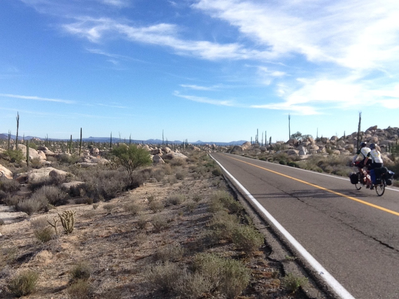 Catavina has a hotel and a restaurant. We spent some time trying to gain access to both (they seemed closed at the moment, but not permanently). People at the gas station assured us that someone would come to open them. By the time they arrived (which was nearly 45 minutes), we had made up our mind to camp nearby (just a little farther South, in the desert). We politely informed the person who had come to unlock the place. They didn’t seem to mind. Take this as a gentle warning if you’re expecting to get food/bed in a hurry here.
The scenery of Catavina is amazing. This is near the Valle de loss Cirios, which means the valley of the candles. The cacti here are named after candles.
01/29/2014 Day 7 Catavina to Nuevo Rosario. 95 miles
This section is beautiful and desolate, with very little traffic. You will find services after 6 miles (a cafe), at 32 miles (Nueva Chapala, where we had the best huevos revueltos of the trip thus far), and at 72 miles (Punta Prieta – small grocer). There are also probably other road-side stalls that we did not make use of, but these come at good points in the journey. The route for today is generally down hill, meaning that you can likely cover good miles. In Nuevo Rosarito (Mile 95), you will find food, and a restaurant that is owned by the same people who run the hotel. The hotel was nice, and so was the staff, but our room did not come with soap, and the hot water was turned off. Discovering this a bit too late, I walked over to ask them to fix the problem. The man returned with a plastic grocery bag where he had apparently run to the store to purchase a full-size bar of soap. Also, he did turn on the hot water, for which we had to wait. If you stay in this hotel, you may want to check these things before you disrobe for your shower!
01/30/2014 Day 8 Nueva Rosario to Visciano. 94 miles
Roads along this section are very flat. In fact, as you approach Guerrero Negro (the boundary between Baja California Norte and Baja California Sur), you will notice the big flag that every cyclist talks about – the one that appears on the horizon for way longer than it should as you seem to crawl toward it’s flapping flanks.
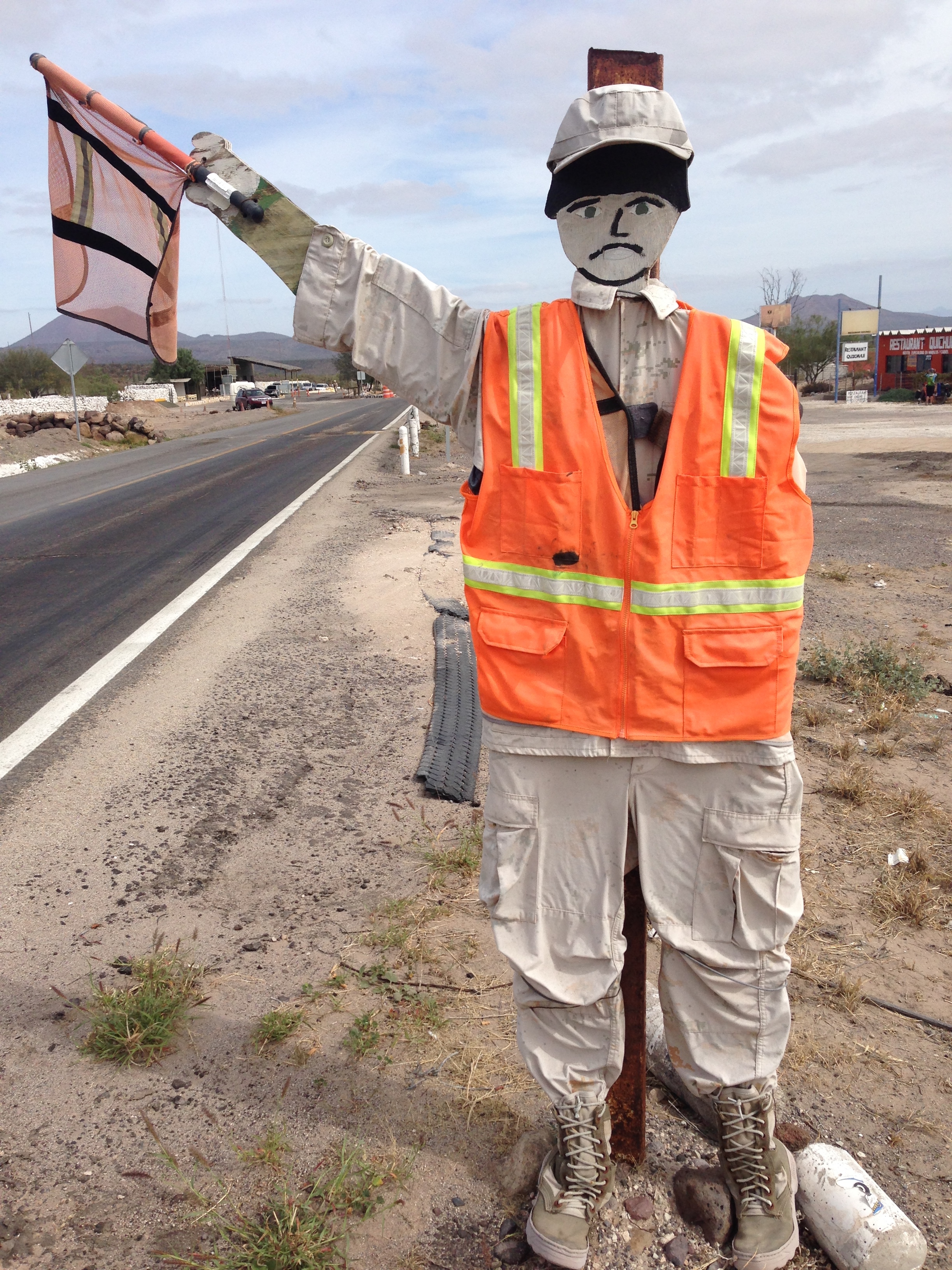
A Road Check Station in Mexico. These are fairly common, put up by the military presumably to check people to make sure they aren’t going to do anything bad on the other side of the checkpoint.
Along the way, we encountered a few check points, which as cycle tourists, we passed easily. Over the years, I’ve heard and read a number of reports about corruption at various check points and border crossings where officials try to extort money from the travelers. Many of these reports about “bribes” and “extortion” contain something like, “I spoke very little Spanish, and they spoke even less English…. I assumed they wanted my [insert object of value here, including money], so I gave it to them to smooth the transaction. They smiled and let me go!” With the exception of a flight leaving Cuba where I did experience someone truly asking for a bribe, I’ve made many, many border crossings and military checks in Latin America with no such problem. We found a great lunch place in Villa Jesus Maria at mile 27. One of our best lunch stops ever was in Guerrero Negro (mile 46) – one of the first places you come to on the before you enter town or even cross into Baja Sur. The food was fantastic, and the owner was kind and friendly. We ended up spending the night in Visciano next to Casa amarillo. The hotel was meticulously clean, and the reception was in the back on a dirt road. The owner was particular about us being clean and charged a 100 peso bike deposit, which we gladly paid. In return, we had one of the best maintained rooms of our trip thus far. She promptly refunded the bicycle deposit the next morning – without even checking the room! Free wifi is available in town between the chicken place and this hotel at the Worker’s party office. They were quite nice to share with us. Hopefully you did not forget to change your watch at the border between Baja Norte and Baja Sur – it is 1 hour later here.
01/31/2014 Day 9 Visciano to Santa Rosalia 90 miles
Prepare yourself for another great day of riding! There are a number of road side stalls that periodically dot the landscape – so you can refuel (or re-beer if that is your proclivity) along the way. San Ignacio (mile 43) has plenty of opportunities to restock. In San Ignacio, we’ve heard it reported that you can gather dates from the ground beneath the palms. At Caguama, you will begin a long descent (punctuated by a flat portion for several miles) to Santa Rosalita, which is on the gulf coast side of the peninsula.
Descending into Santa Rosalia is fun!
When we arrived in Santa Rosalia, we found that it was a very busy port town. This town had strong French influence, and a number of dining and lodging opportunities. This town is bustling, but definitely worth a visit even if your night doesn’t take you here. We went past the museum of mining history, and then looked for a place to spend the night. Accommodations were not as cheap here as they had been in other places.
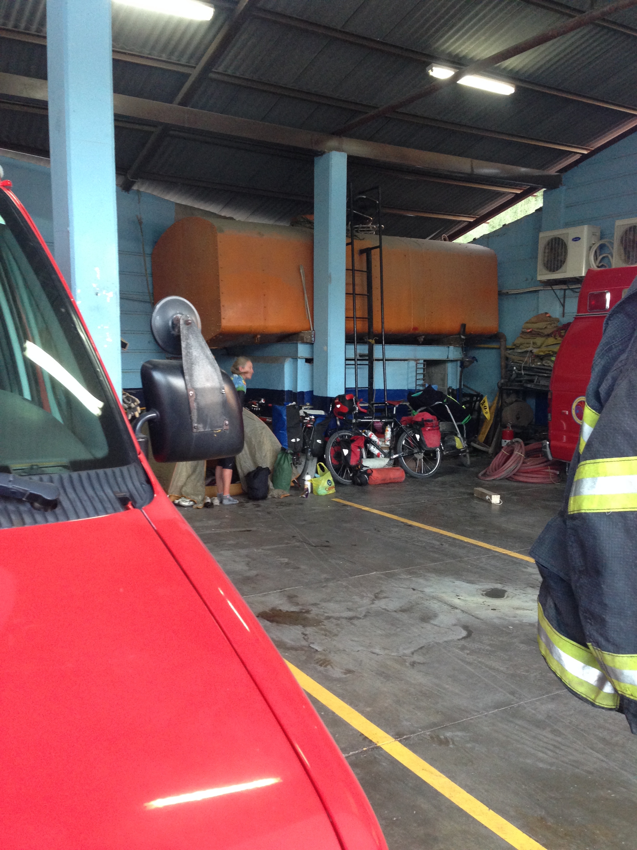
We spent the night at a fire station because we had seen a fellow touring cyclist named Tom Lucey already camped out inside. He was just beginning his cycle/surf tour from North America to the Tip of Tierra Del Fuego. He was carrying a surf board and planning to surf all the way down. I questioned this with regard to the region from Guatemala to Chile, and he considered that maybe things would change. In the end, he did finally make it all the way! He had a fantastic journey, and did eventually send the surfboard back home. I am very impressed by his perseverance – major kudos to this man! Throughout Mexico, it seems that the bomberos (fire stations) will allow cycle tourists to camp and spend the night. I’ve also done this once at a police station in the Yucatan. While the accommodations are not the most deluxe, I believe it is a good way to experience a slice of Mexican life.
As we were looking for a place to stay, we saw a pannier – laden bike in the Fire Station. We met Tom Lucey and he was camping within. We decided that this would be a good place for us to spend the night as well. Throughout the tour, we met a number of people on varying budgets. Tom was on a tighter budget than we were, so free accommodations were a priority. I’d consider us to be on a “medium” budget. We did not encounter very many people on a “high” budget. With traveling, I have determined that (as a generalization) the tighter your budget, the higher the probability of richer experiences. Having a very tight budget forces you to interact with new and varied people – this is especially true when seeking accommodation. Often times, asking for a place to stay results in a familial invitation where you get to know a new set of people, their customs, and their stories.
02/01/2014 Day 10 Santa Rosalía to Playa Burro 56 miles
The main problem with today was trying to decide: At which beautiful beach we wanted to camp? During the day at mile 38, you will pass Mulege, which has plenty of supplies and accommodation. It is a popular touristic town, and should have any needed amenities. We sought a quieter locale, so we continued South. After your reach the Bajia de Concepcion, there are a number of possible beach camping sites. As some of the bigger ones, you’ll also encounter restaurants right on the beach. Therefore, it is not absolutely necessary to carry a ton of food if you want to spend the night here. We stopped at Santispac and Playa Coyote. We eventually decided to spend the night at Playa Burro – and we were not disappointed. We enjoyed a beautiful sunrise AND sunset, as well as fantastic food and company on the beach.
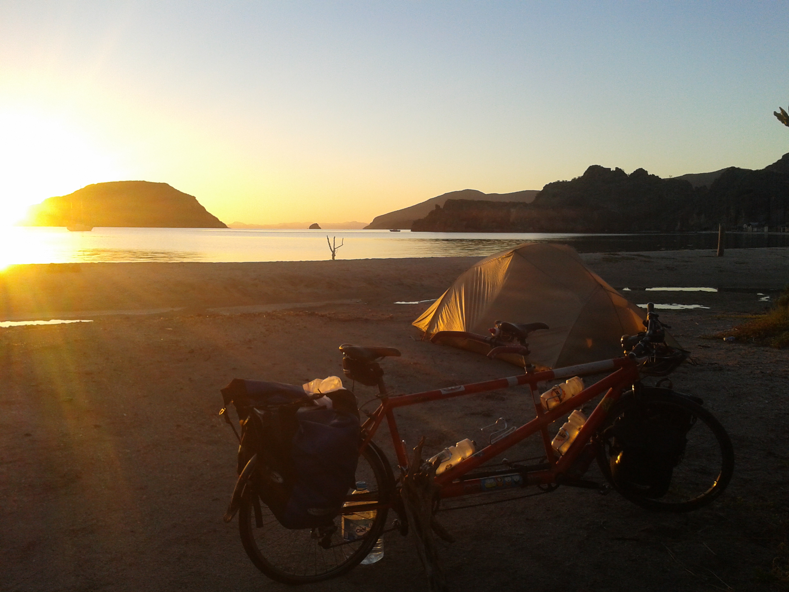
Playa Burro
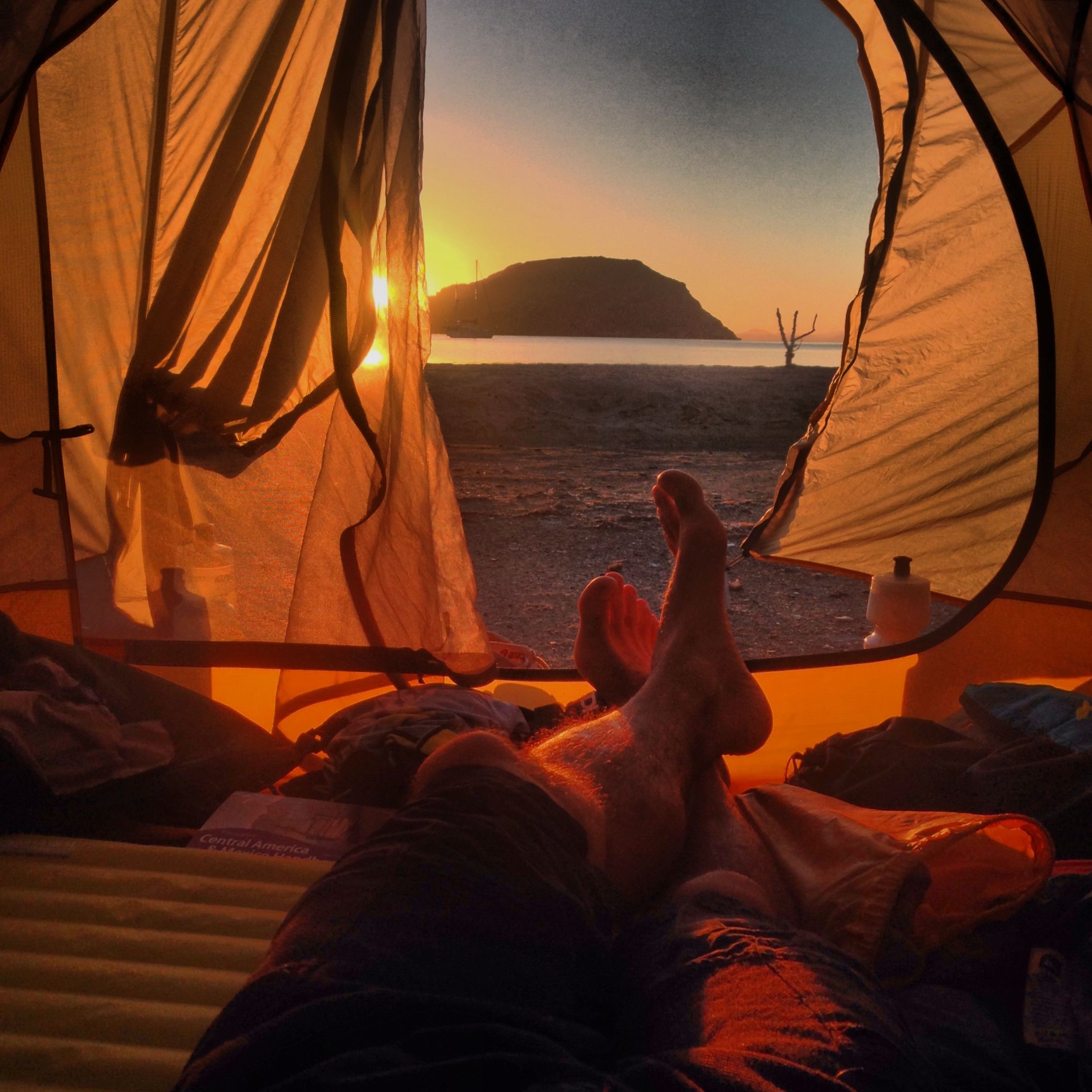
Playa Burro, enjoyed on Super bowl Sunday.
02/02/2014 Day 11 Playa Burro to Playa Ligüi 95 miles
After you leave Playa Burro, it is several miles before services are seen again. Surprisingly, this may be the most isolated stretch of the Baja Journey, in spite of the proximity to such wonderful terrain and beaches. There does seem to be an ex-pat contingent here, but they don’t provide services: they just live here. At mile 70, you will come to Loreto, where you can restock and check out the cool, tourist oriented town. After restocking in Loreto, we continued South to a quieter location. Climbing for the day ends up being fairly benign, with the highest hills being in the 800′ range. We had been hearing about this “huge grade” called Cuesta de Ligüi (don’t worry, it didn’t turn out to be that significant). We decided to camp right before the climb so we could do it in the morning. There were not any services at the base of the grade (except for an extremely expensive looking hotel), so we decided to head towards the water towards a beach that some locals knew about. You can see from our track that we missed the turn off and had to turn back. This beach is completely satisfactory for a night of camping, with Palapas, but no food. There are some abandoned restrooms that make you think twice about where to go. There are no services, however, so come supplied with food and water you purchased in Loreto. Camping is free on the beach. Directly adjacent to the beach, there is a fenced campground which seems to be oriented towards RVers. You’d have to pay to spend the night inside those gates, and you cannot see the water from the confines due to a perimeter of vegetation. It may feel safer, however, inside the gates. When we arrived at the beach, at first we felt a little uncomfortable for some reason. It was getting dark as we arrived, which may have been a factor. Ultimately, we found 2 other Mexican families camping, and a young guy named Mark from Montana who had been helping the families get their car un-stuck from the sand. In the end, it turned out to be an extremely comfortable and safe-feeling location.
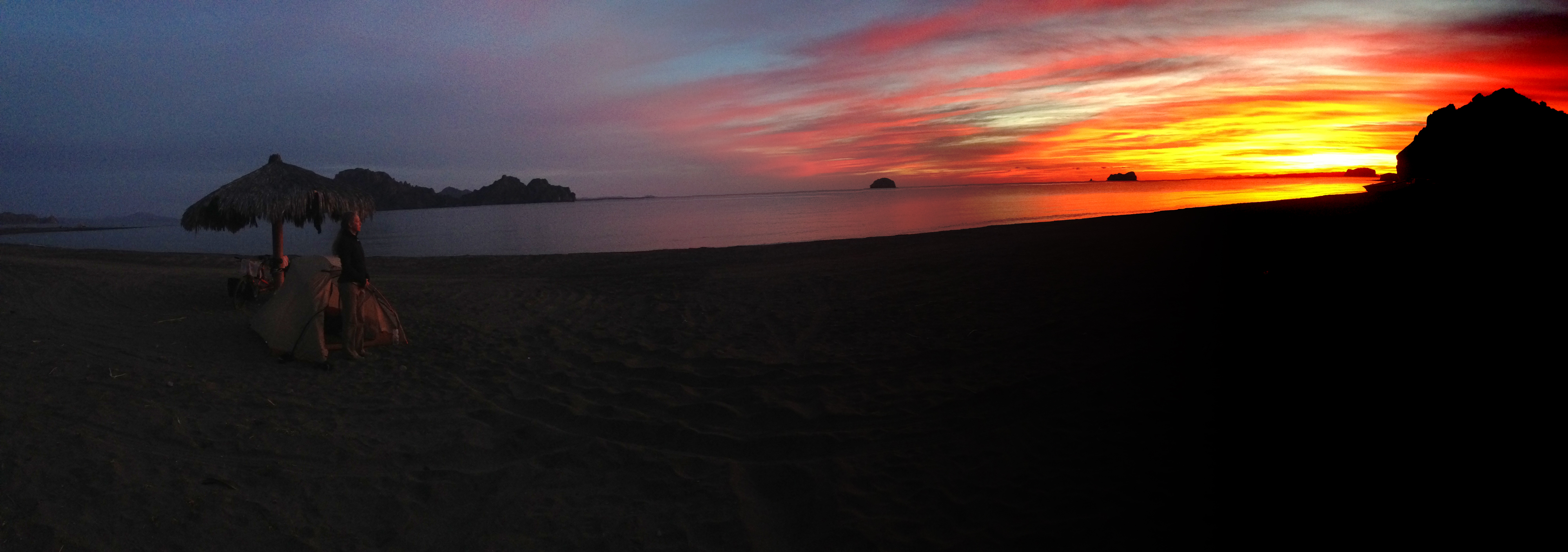
Playal Ligui – another night of great beach camping.
02/03/2014 Day 12 Playa Ligüi to Ciudad Constitución 70 miles
The dreaded climb – Cuesta Ligüi – ended up being less than 1500′. Perhaps that is a lot to you, but if you’re going to be riding in Mexico, Guatemala, or Costa Rica later, you will need to know that a “long” climb is more like 7 times this climb. With the exception of the climb (which is beautiful), the rest of this leg is relatively unremarkable. There is a restaurant on the left hand side of the road as you near the top of the grade. Other than that, there are not supplies until you reach Ciudad Insurgentes at mile 54. Although it was a gradual downhill towards Ciudad Insurgentes, it was time consuming for us: the prevailing winds seem to come from the West, and they impeded our progress. It’s an unremarkable town, but you can resupply here. The journey to Ciudad Constitucion is fairly easy by comparison, but there is not any scenery to enjoy; it’s a flat, straight road. Ciudad Constitucion is a good size town with a number of amenities. We found a great hotel here with easy access to laundry (next door).
02/04/2014 Day 13 Cuidad Constitución to La Paz 124 miles.
You may wish to break this leg up into 2 days. The terrain for the first half is fairly unremarkable, flat, and fast. You can fuel yourself at road side stalls in Santa Rita (mile 34) and Las Pocitas at Mile 62, and a roadside stall at mile 84. We did not see anything in terms of accommodations until we reached El Centenario, a suburb of LaPaz, but then again, we weren’t looking. In terms of services, it is pretty spartan. In terms of scenery, the views terrain does not get interesting until about mile 70. Even at that point, it is not superb. I remarked to people after the journey that I loved Baja, but given the option, I could have skipped the first 100 miles and the last 200 miles if needed. We ended up spending the night at a campground named Maranatha with an adjoining cafe. The cafe had typical coffee shop food, which was enough to sustain us – given its convenience. There are not any grocery stores within easy reach from the campground. The campground itself was very nice by Baja standards, with warm water showers and very friendly staff.
02/05/2014 Day 14 – Camp to Airport 3.5 miles
From the tip of Baja, you may wish to continue your journey farther South. There are a number of options that we heard from various people. Here they are, with links to the authors:
1) Take a Barge, freight type Boat Across to Mainland: Mazatlan. Fellow traveler Tom Lucey did this method. As you can see, it sounded relatively painless. I believe that this is less expensive than the regular ferries.
2) Take a regularly scheduled ferry to either Mazatlan or Topolobampo. This is probably the most expensive method, but it is also relatively easy to bring your bike on a ferry. The problem with this method (if you’re in a hurry) is that it takes more time than method 4, and their schedule is not usually announced ahead of time, and it can change due to weather
3) Take private passage. This seems fairly risky, as was the experience of fellow traveler Nicholas Gault. It can likely be less expensive, but may be unsafe. It could also be an adventure.
4) Take a flight from La Paz to the mainland. It turns out that flights within Mexico are reasonably priced. In fact, our flight was the same cost as a ferry (option 2) would have been. It was much faster, and the attendants at the counter didn’t blink an eyelash when we said that we wanted to transport a tandem bicycle in the luggage compartment. In fact, they said, it would be only $50 US to transport the bike. It got better: The attendant suggested that we wrap our panniers with plastic wrap so they counted as “one piece of baggage.” Since we’re given an allowance of 2 bags per person, the bike would count as a bag. In other words: THE TANDEM BIKE WOULD FLY FOR FREE. It did not require a box, and they just had us (pay to) wrap it in plastic wrap.
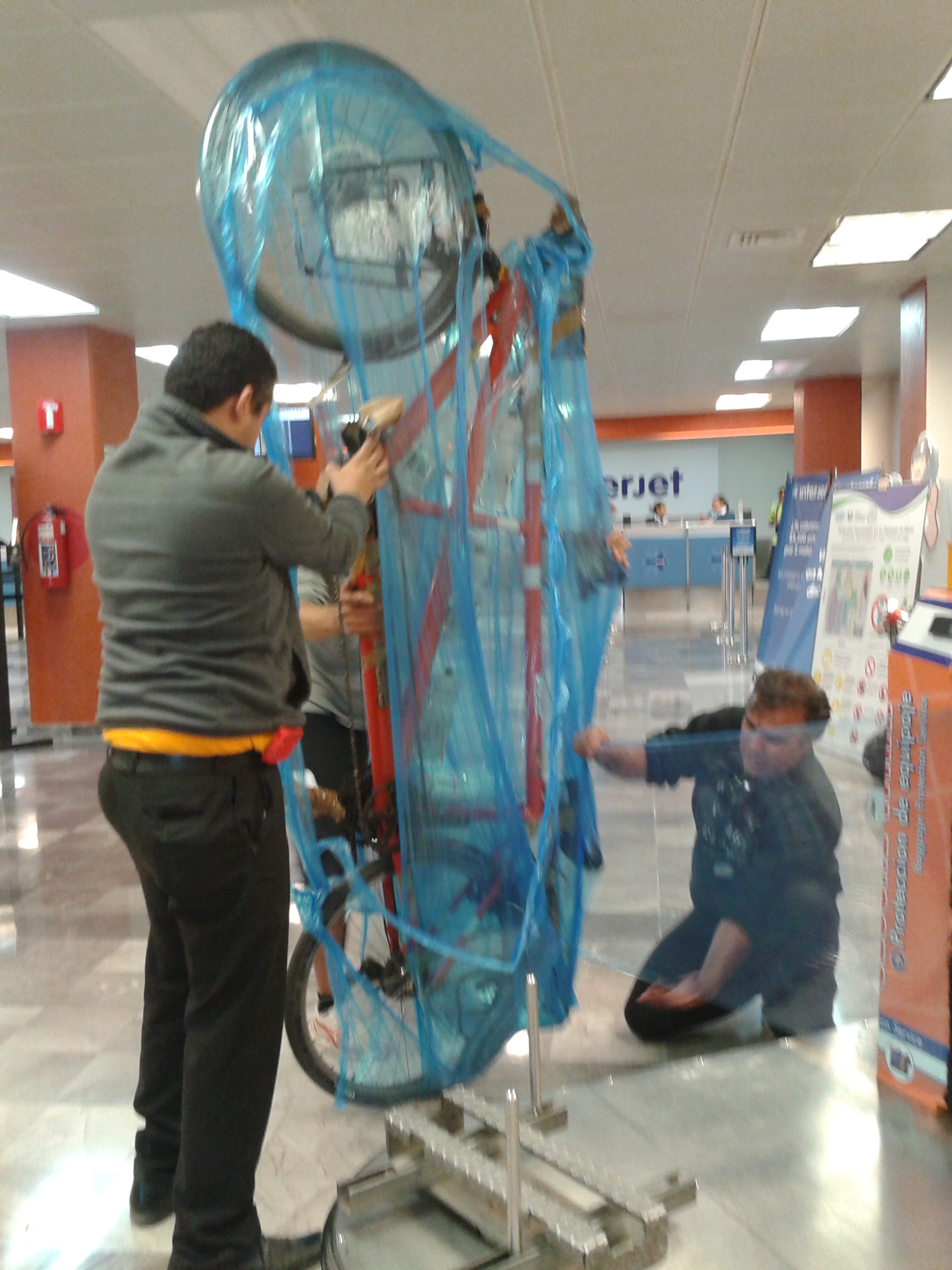
Although it did cost us to wrap the bike and the bags, we experienced the following advantages:
a) The cost was less than a “fee” to transport the bike.
b) We did not need to seek a box – this is huge, as finding a bike box for a tandem is nearly impossible.
c) Baggage handlers can SEE that it is a bike. On subsequent plastic-wrap flights, we’ve come to decide that this is the optimal way to present a bicycle to prevent damage.
d) We were rewarded with a large amount of entertainment at the airport as the tandem was wrapped in the lobby.
This is the map for the entire route discussed in this post. To Export GPX files, click on the three horizontal bars in the upper right hand corner of the map and select Export selected map data…
To see full screen, click here (opens in new window)
This concludes the Baja California Cycling Guide Portion of our trip. You may now wish to proceed to the following locations:
Bicycling Latin America – San Diego, Baja California, Mexico, and Central America Hub Page