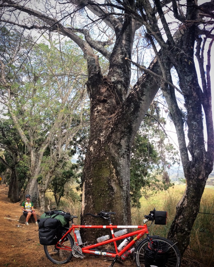
Bike Touring Colombia – Medellin to Nevado Del Ruiz
Traffic is suddenly coming to a stop. A man is walking across two lanes of traffic, lifting up the midriff of his blue shirt, revealing his chiseled six pack. Although cars don’t usually stop for pedestrians here, this small, weathered man with his big toothless grin has found a bold way to safely cross the road. Even Janet and I stop our tandem to watch the spectacle. As the man approaches us, I can see all the way into his mouth through his huge smile. He walks directly towards us, and kisses each of us individually on the shoulder. He steps back, and wishes us a safe and happy journey.
I’ve been remarking to Janet – of all the countries we’ve visited, Colombia reminds me the most of home. The reasons for this feeling are multi-faceted, but if I were to consolidate this “feeling” down to one word, it would be “optimism.” It’s an enormous generalization, and it obviously does not apply to many individuals… but as a whole, I feel like the optimism seen in my fellow Americans (and the wonderful Colombians we’ve been meeting this past month) is making us feel at home. Of course, we’ve also learned about some cultures and customs that are unique to Colombia…
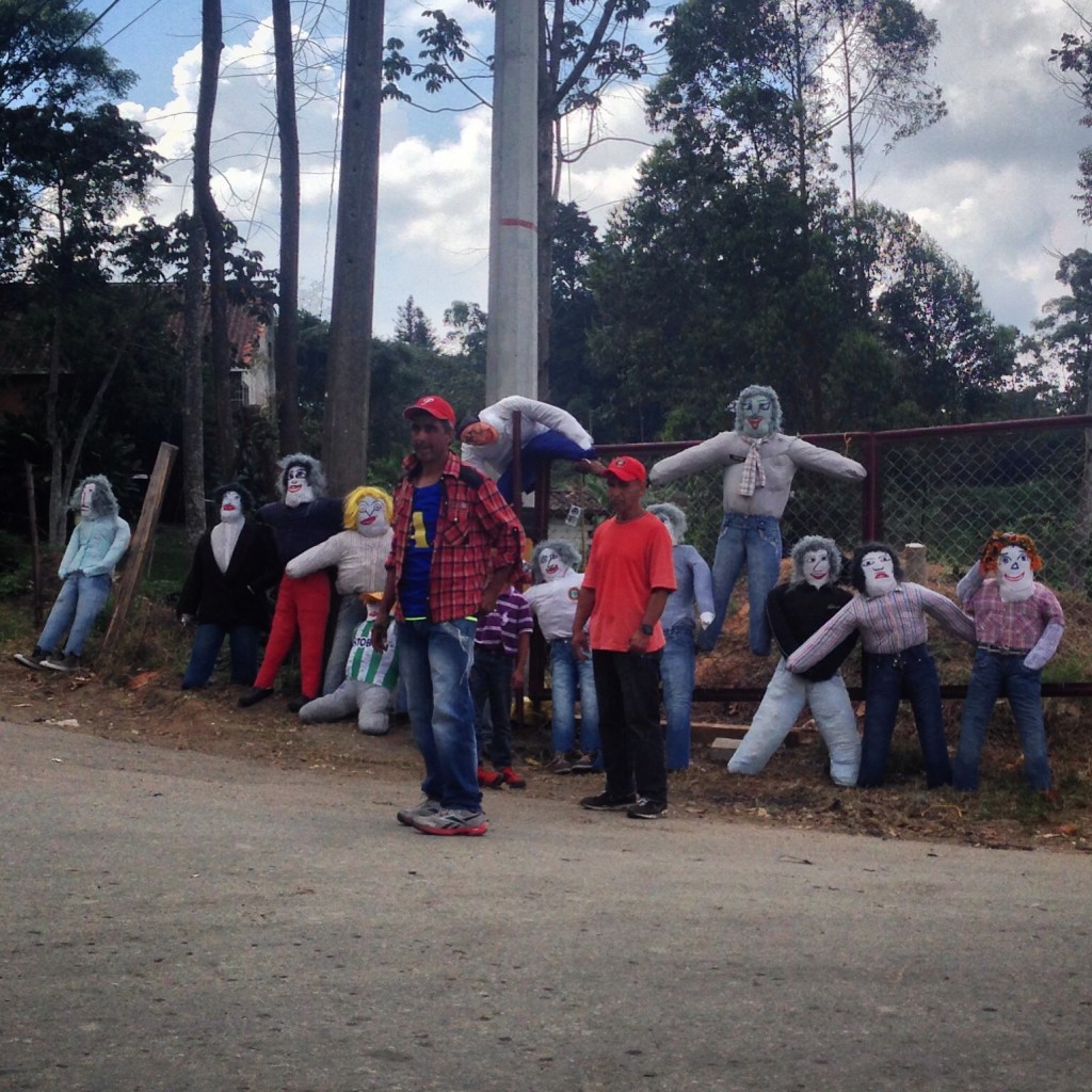
Who are these creepy looking guys? When I first saw them, some with ropes around their necks, I thought they were voodoo dolls, or worse, warnings to travelers saying: “This is what might happen to you.” It turns out that they are dolls named año viejo. Guys stand on the side of the road asking for money to fill the dolls with gunpowder. At midnight on New Year’s eve, Boom! They are going to be exploded. You see them everywhere, and they are totally illegal!
It is not uncommon to see people riding outside of vehicles. These Toyota Land Cruisers serve as Taxis in many parts of Colombia.
Every individual is different, but so far in Colombia, I feel we receive the same level of interest on our tandem bike that we do in the United States. Almost never have we received the long, cold stare that defined some other locales. People will greet us with “hello’s,” “how are you,” long, curious discussions about the mechanics of riding a tandem bicycle, friendly waves and cheers out car windows, and applause as we crest seemingly impossible climbs – about the same range of reactions we receive at home (minus the “she’s not pedaling” comments).
I’ve also noticed two welcome differences from home, however: The first is that we simply don’t ever receive angry horn honks from drivers (actually the United States seems to be the only country where cyclists in the road tend to drive people in cars to anger). The second is that people are extremely courteous and polite. You may be bored to tears of my commentary about the politeness here, but it is an enormous factor in my enjoyment of this country. In a few of the other countries we have visited, I would begin to dread interacting with people – even to ask simple questions or directions. In Colombia, nearly every interaction is uplifting and fun! The only thing that I am dreading is that eventually we’re going to need to leave.
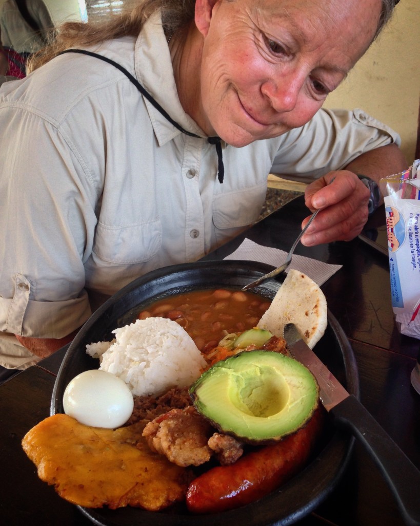
Janet before eating her “Bandeja Paisa.” “Bandeja” simply means “tray,” and “Paisa” is a self-appointed name that the people of the Colombian state Antioquia have given themselves. So, it’s a tray from this region. Loaded with calories – fat, protein, and carbs, it is a perfect dish for cyclists who ascend thousands of feet per day. Anyone else, however, would likely become obese after eating these for a month.
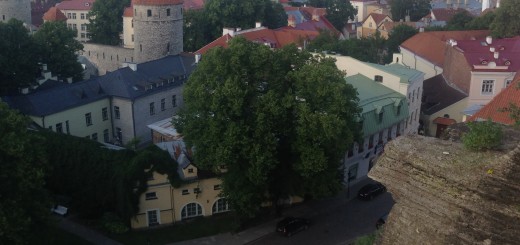
This entry begins in Medellin, Antioquia – the home of “The Paisas.” What is a Paisa? It’s a self-assigned name given to the people of the the departments of Antioquia, Caldas, Risaralda and Quindío. The Paisas were geographically isolated long enough that they are actually a genetically distinct population of Colombia. The Paisas think they are special amongst Colombians – and they’re not afraid to admit it either. Practically every conversation you have with a Paisa eventually comes around to the topic of how they are better than the rest of the other Colombians. It’s actually kind of a joke – but it comes up so frequently, you start to wonder if there might be a little truth to what their jokes.
Pro Tip: If someone tells you that they are from Medellin, do not try to show off your knowledge of what you learned on this Blog by saying, “Oh! Entonces, tu eres payaso!” (translation: “Oh, well then you are a clown!”). It’s Paisa, not Payaso.
We took a walking tour with Real City Tours to learn more about this city and the Paisas. What our tour guide told us dovetailed precisely with some thoughts that I have been thinking about for a long time. What I’ve been noticing in our travels is that the places where people are the friendliest are precisely the places where people have had it the hardest in recent history. These are places where when we talk to people, sometimes they tell us about their parents, brothers, or sisters being murdered – even in front of their own eyes.
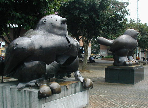
One of the many sculptures by Fernando Botero Angulo (born 19 April 1932). The most inspirational story of the trip involved this artist. Tragically, a bomb exploded near one of the plazas, and it partially destroyed one of his bird sculptures and killed at least 30 people. The city was going to remove the damaged bird, but Botero got on the phone immediately to say, “Don’t remove the bird. If we remove it, people will not remember.” Instead, he made a new bird, and placed it next to the old one. This represents Medellin’s violent past, as well as reminding people of its rebirth.
I was actually driven to tears twice during the 4 hour inspirational talk/walk with our tour guide. To me, the recent history of Colombia is definitely one of tragedy – but also one of triumph. In just 14 years, Colombia has made a major turn around. In fact, in 1991, under president Uribe, Medellin experienced a 90% reduction in crime in just one year. This was due in part to heavy monetary investment in social programs and public infrastructure – as well as heavy propaganda that elicited pride in the citizens for their city.
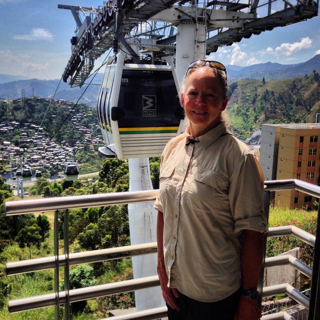
Medellin is very proud of their public transportation system. They have an extremely well engineered system of electric trains that arrive every few minutes and cable cars that bring affordable transportation to the poorer neighborhoods on steep hillsides.
During our tour, our guide mentioned that the metro trains (and metro cable) have been around for 20 years. She asked if we had noticed anything special about the trains… Did we notice that there was no graffiti, no carvings, etc. in either the trains or the stations? Sure enough on the return trip, I observed how immaculate these 20 year old cars were. How? Thanks to carefully engineered propaganda, the city was able to make the people of Medellin proud of “their” metro. In fact, Medellin is the only city in all of Colombia that has such an advanced transportation system – and the people treat it with care and respect as if it were one of their own belongings.
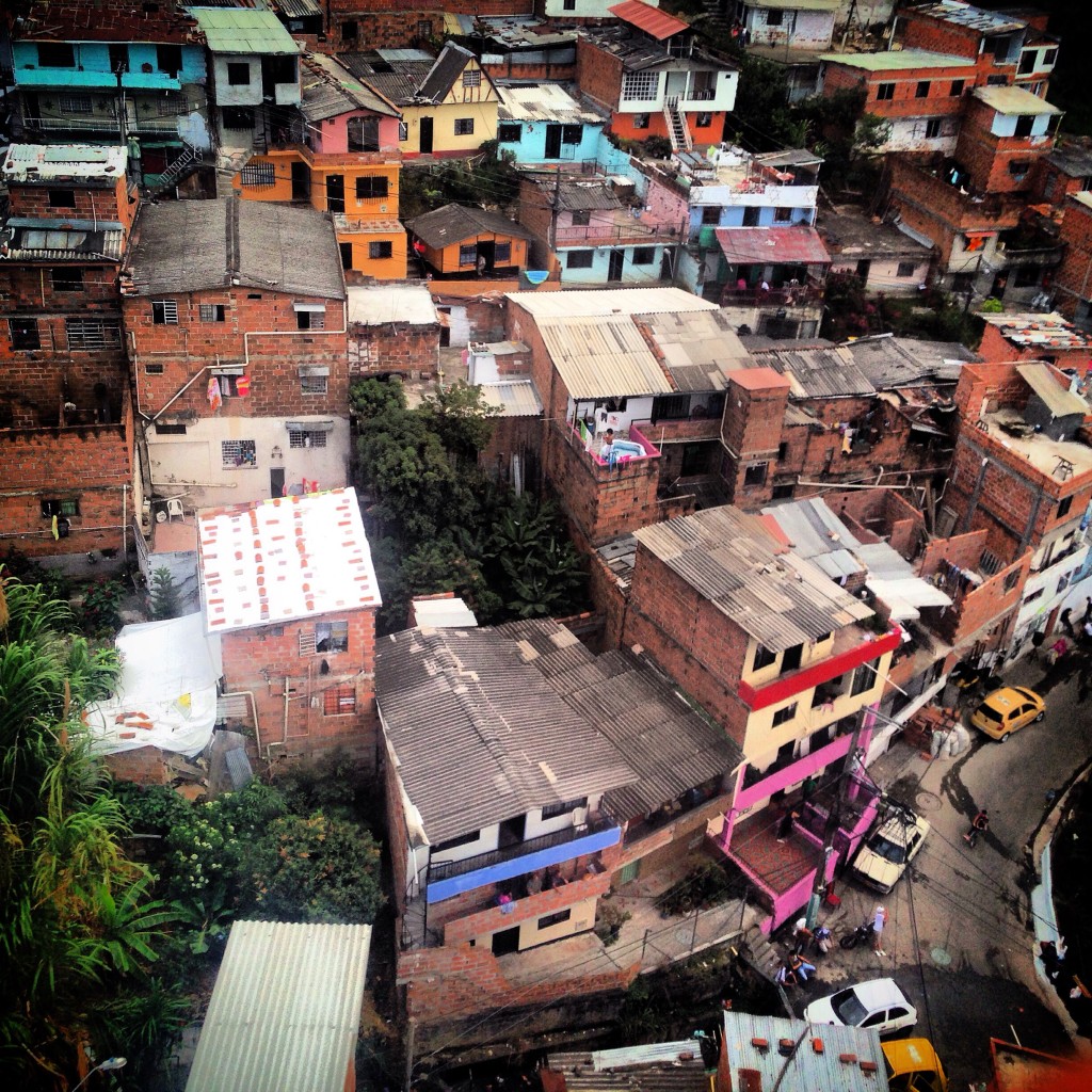
There are multiple Cable Cars that provide inexpensive transportation for the poor neighborhoods. The metro cable has become a tourist attraction as well as basic transportation. This photo was taken from one of the elevated cable cars.
I think about BART (Bay Area Rapid Transit) in my home state, and I wonder if it would have been possible to instill this type of pride in our own transit system. If we just told people, “This is YOUR BART,” would people take such good care of it? Or do we also need the recent memory of atrocities in order to make us really appreciate the good things that we have?
Eventually, it was time to move on to begin bike touring again. Before we left Medellin, though, we enrolled in some Spanish courses as well as visiting some great spots within easy reach of the city. Since we like great scenery the most, Guatape is our most highly recommended excursion after the city walking tour:
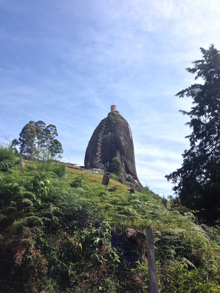
This famous rock formation is known as El Peñón de Guatapé. It is striking, and you can climb 740 stairs to reach the very top.
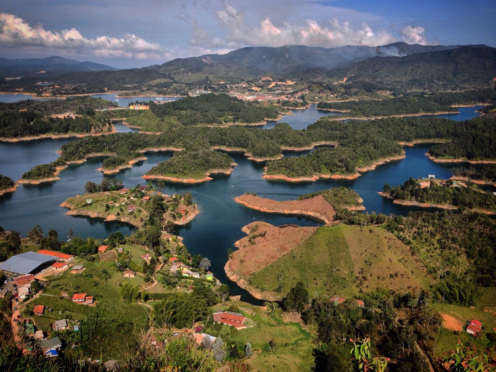
This is the view from El Peñón de Guatapé. You can see this amazing lake in 270+ degrees. The rest is mountains.
Route Information
Medellin to Manizales by Bike
We had a number of objectives after leaving Medellin. The first was to visit Nevado del Ruiz. This is one of Colombia’s 58 National Parks. The jumping off point for treks into Nevado del Ruiz is Manizales. To get to Manizales from Medellin, our objective was to find a route that had the least amount of traffic (and preferably as much pavement as possible).
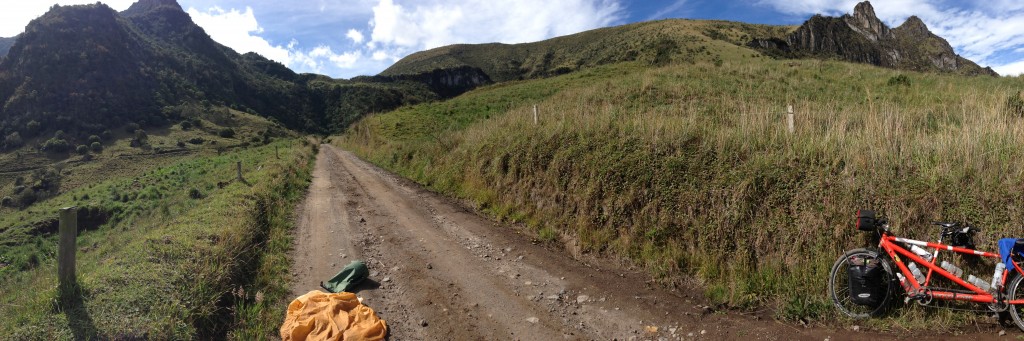
Down in the low lands on the way to La Pintada. The climate feels like a cross between desert and tropical. We observed some amazing trees along this stretch.
Not long after leaving Medellin, the traffic improved. The first leg was Medellin > Caldas > Camiloce > Los Palermos > Fredonia (shown below). The scenery and traffic improves with every mile along this route. It is entirely paved:
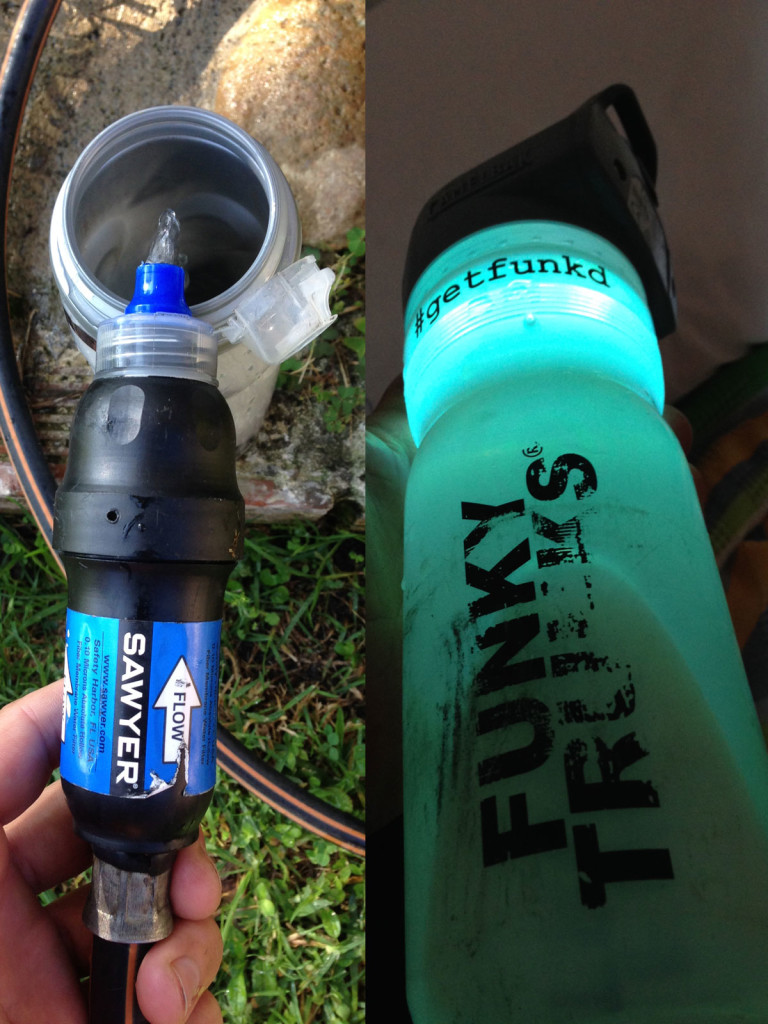
Janet and I are carrying our own water treatment plant. Water treatment is a two step process for us. In the first step, we filter the water using a 0.10 Micron filter. This should make the water safe to drink – but as a big fan of wide safety nets, we also use a Camelbak All Clear UV treatment after filtering. This system has only a small weight penalty, and prevents us from throwing away 5-10 plastic bottles per day.
The next leg takes you from Fredonia to Filadelfia. This route is very enjoyable – almost in its entirety. Traffic is very light, and it is entirely paved. In areas where there is slightly more traffic, there is an adequate shoulder. This leg takes you from Fredonia > La Pintada > La Felisa > Filadelfia. Despite the lack of towns, there are enough small restaurants and tiendas to keep you fueled. The “flat” section along the river is deceptive, as you’re constantly climbing or descending.
Looking down deep valleys on the steep climb up to Fredonia
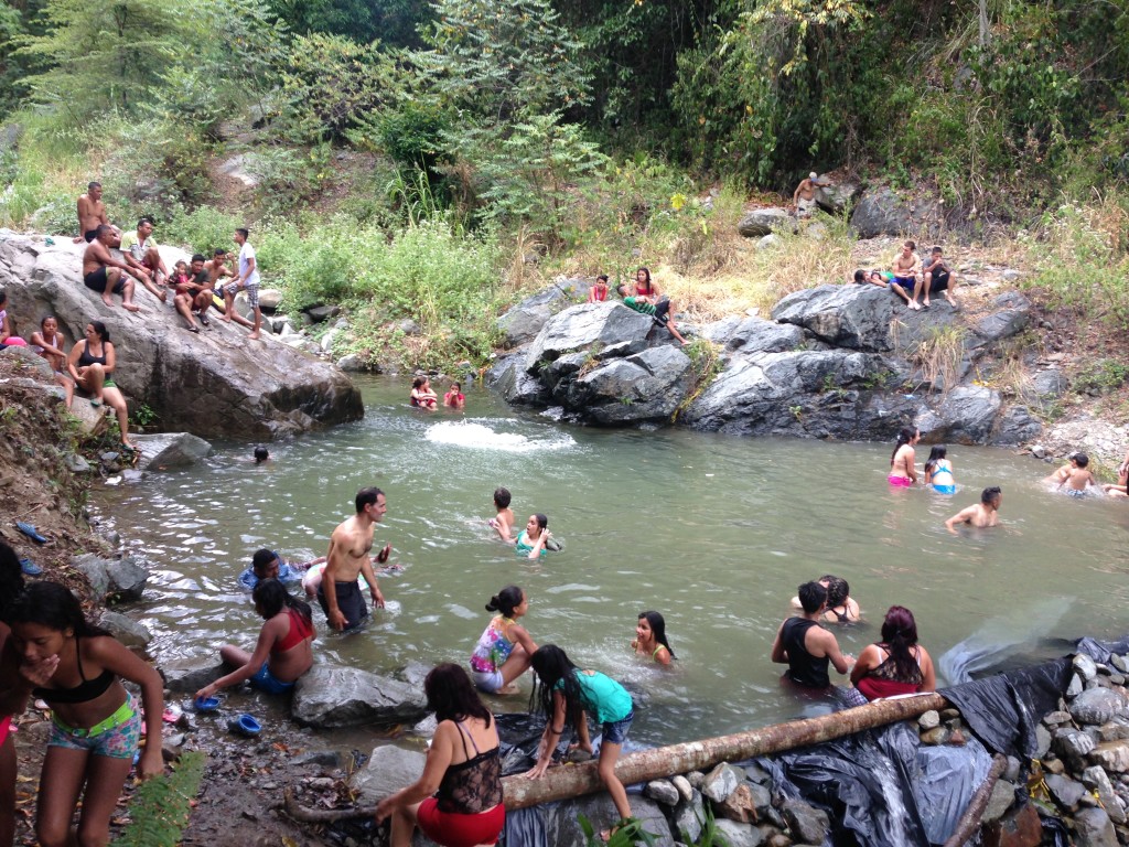
In the humid low lands, the best swimming holes are easy to find: just look for the throngs of people swimming in the water! This swimming hole is between La Pintada and La Felisa on the right hand side of the road as you’re heading towards La Felisa.
Manizales To Los Nevados By Bike
Manizales To Los Nevados By Bike
After carefully examining maps of Los Nevados del Ruiz National Park, we noticed an aesthetic North-South route through the park. The ideal aesthetic route was the following:
Leave Manizales heading towards Gallinazo (Termales Tierra Viva) the (following Green Line on the map below) > Pass Termales Ruiz Antiguo > Turn Right on paved road (following Black Line on map below) > Enter the park at “Las Brisas Entrance > Continue along Black Line in Map Below all the way to “La Pastora Camping” passing Lago Otun (the only lake along the black line). From La Pastora, head out to Pereira, and then back up to Termales Santa Rosa de Cabal. **NOTE: La Pastora camping sometimes seems to be referred to as “La Primavera.”
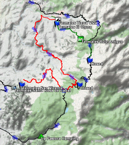
The black line represents the “perfect” aesthetic North-South route through the Nevado del Ruiz Park. Unfortunately, we discovered that there are a few problems with this route (discussed below). The main problem is that the park is closed between the two “closed” flags shown on the map due to “Orange Alert” volcanic activity. Some people have snuck through illegally on bikes, but, we opted to enter the park twice – once from either end. First we followed the green route up a dirt road to the Las Brisas Entrance (14,000′ near the Northern closed flag). Then we descended back to Manizales (6,500′) and took the red route back up to 13,500′ near the Southern closed portion. Both routes can be ridden on a loaded mountain bike – but full suspension would be preferable!
There are a number of problems with this route, however! The first of three problems is that the park is officially closed between the two flags (marked “Closed”) along the black line. The reason for this closure is that Volcano Ruiz is currently in a state of “Orange Alert.” This means that an eruption is probable in the next few days or weeks. In 1985, Nevado Ruiz erupted, killing 22,000 people. The government was criticized for ignoring warning signs for several months before the volcano erupted. As such, they are taking the cautious route by simply closing this susceptible portion of the park. In spite of this closure, however, you can still potentially cross – however it is illegal. Our friend Nick traveled this section at night, and you could too if you’re daring and don’t mind disrespecting the law. Link to Nick’s Blog Here.

Pointing the way – we still need to climb over those mountains!
The second problem (of three) with the aesthetic route is that bicycles are not allowed on the section from the main trail to La Pastora Camping. On the map above, this is the section along the black line from the “b” in “Santa Rosa de Cabal” to the tent pictured at “La Pastora Camping.” So, if you were to do this route, you’d also need to violate another law. We were not aware of this rule until we arrived at the Southern ranger station (also at the “b” in Cabal). We assumed it was legal because both Nick and Paul Griffith (Link to Paul Griffiths’ blog) took their bicycles as far as Lago Otun (the blue lake along the black line on my map).
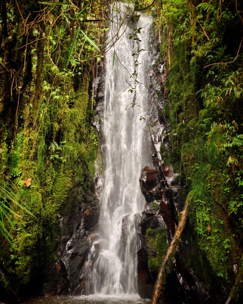
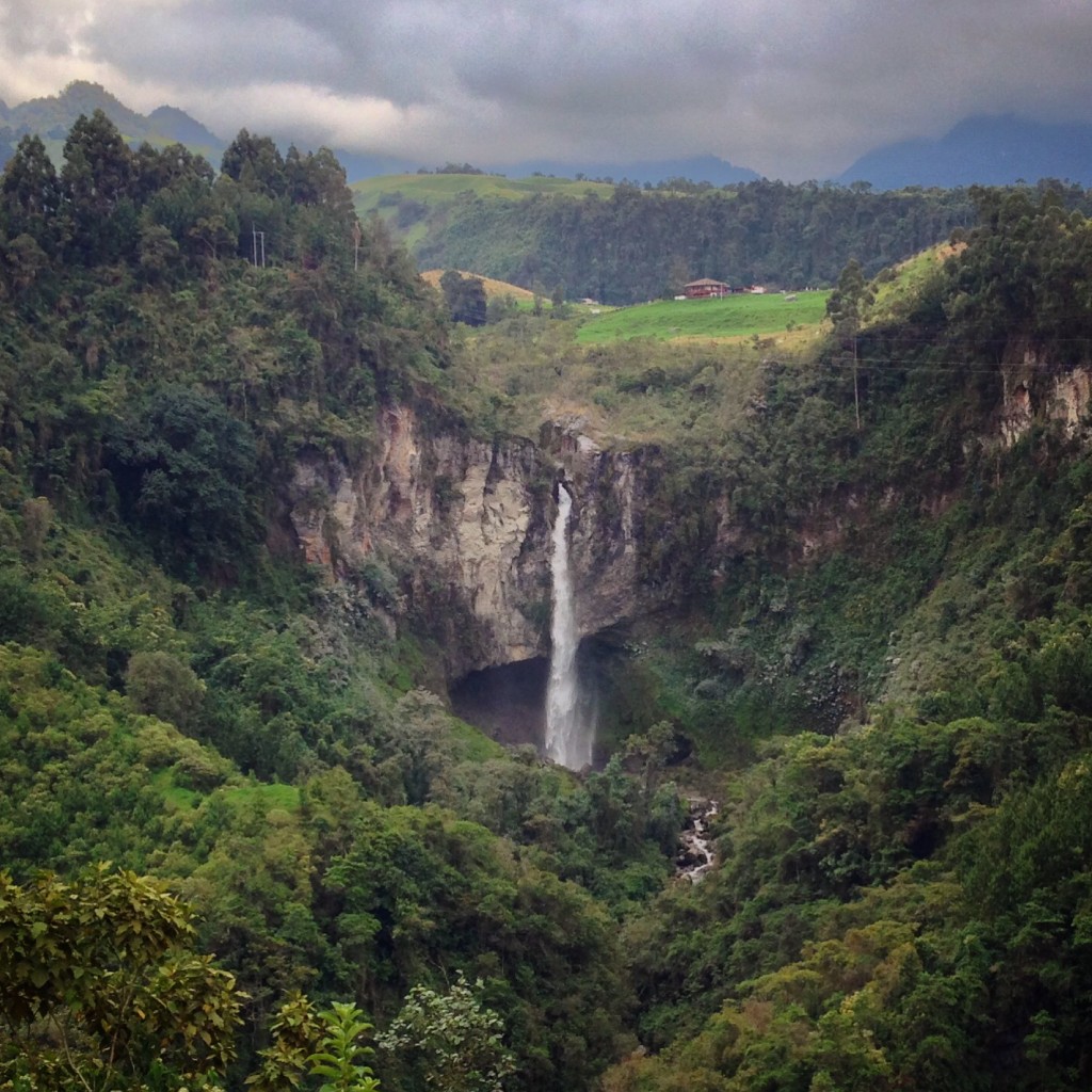
Waterfalls are abundant all over Colombia – and you don’t need to pay to go see most of them. The dry season is from December to January, but in spite of this, most falls are flowing gracefully.
The third problem (of three) is that Paul tried to take his bike past Otun, and found that it was exceedingly difficult! He ended up having to turn back. Here is a link to Paul Griffiths’ report. It’s quite a tale, too, as he ends us wandering around the paramo searching for a mysterious man who might have a horse to which he can strap his bicycle. Since we’re riding a fully loaded TANDEM, we knew that even without the first two problems, the third was going to be a deal breaker. We had to seek a new route!
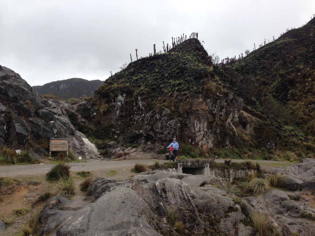
Checking to see if it is about to rain along the route to Nevados del Ruiz
The plan was to see as much of the park as possible. We’re not afraid of hard work, so we decided to enter the park twice – from either end. This was a very bold move, as each entry requires about 10,000’ of climbing (for a total of 20,000’) – at elevations up to 14,000’! It can be divided up into two sub routes – both of which we recommend highly.
Manizales to Las Brisas Entrance of Nevado Ruiz By Bike
Manizales to Las Brisas Entrance of Nevado Ruiz By Bike
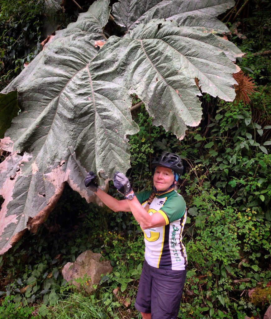
Janet is dwarfed by the enormous leaves in the rainforest. Theoretically, she could use this leaf as a blanket if it weren’t so spiny!
The Las Brisas Route is an exceptional route if you enjoy thermal hot springs, high elevations, climbing challenges, and scenic beauty. We highly recommend following this route in the direction stated because of the condition of the roads (i.e. we believe it’s easier to climb dirt and descend busy pavement). Starting at Tesorite (Just South East of Manizales on my map), head towards Termales Tierra Viva. You will quickly pass Tierra Viva, El Otoño, and a water slide park while ascending on good pavement. There is a nice looking hotel at Termales El Otoño, which costs about $70 for a double room in high season. After the water slide park, the road turns to dirt. It is littered with rock as well, so it would be best for a full suspension mountain bike. Expect to make slow progress up this beautiful road. You will encounter very little traffic, if any.
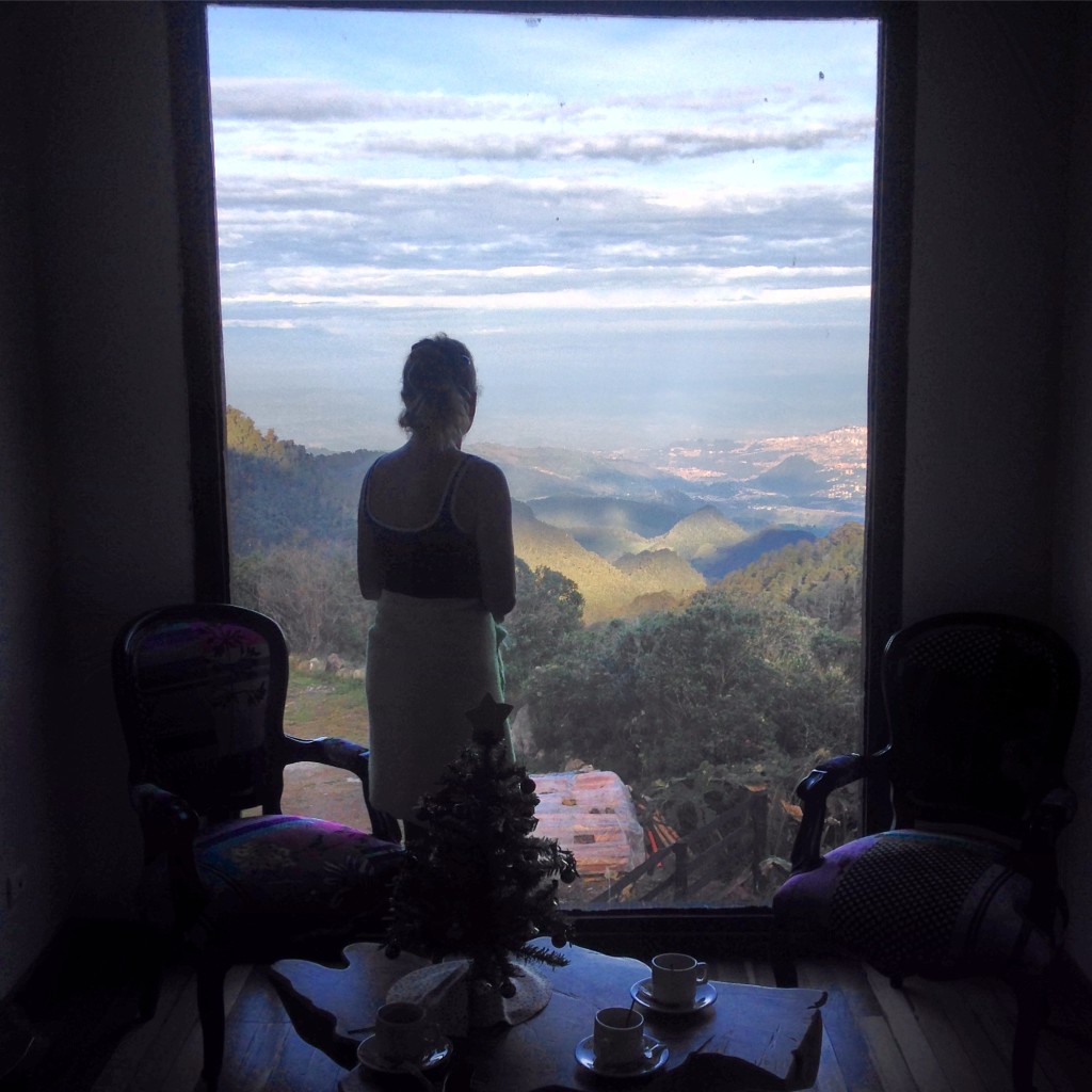
Janet looking down on Manizales from our highly recommended hotel at Termales del Ruiz.
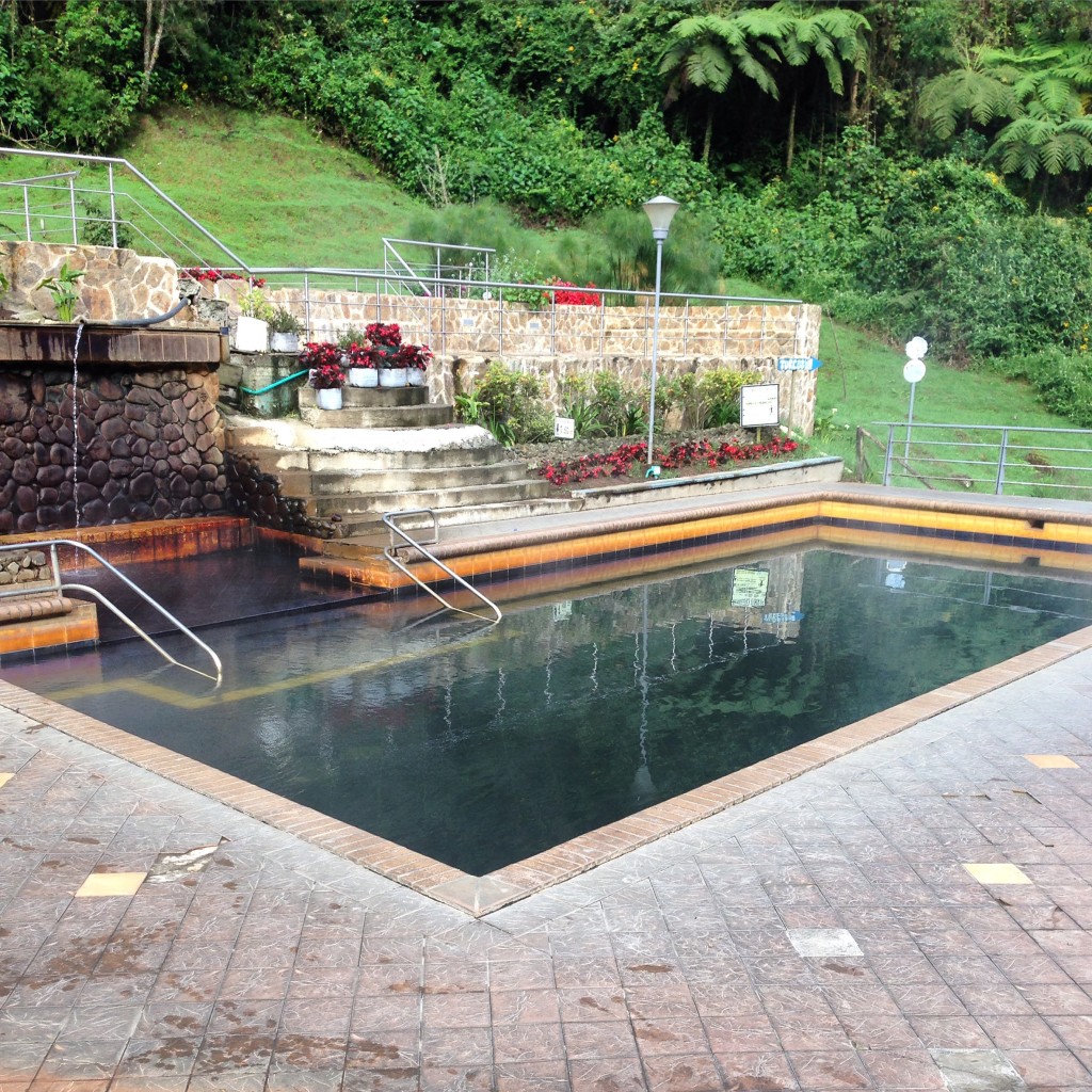
After climbing for quite some time, you will arrive at Termales Ruiz (or Termales Ruiz Antiguo on my map). Entry into the termales is $6US per person. If you decide to spend the night, you can pay for a room $75 US double occupancy, includes breakfast for two and the entry into the hot springs. The rooms are luxurious, and because of the elevation, cool and comfortable. The hot springs are extremely clean and welcome. There is a bar, and they will serve you drinks as you soak in the hot springs. Because it is a difficult climb from Manizales, and because we wanted to enjoy this location, we spent one of our best nights of the trip here. They do not offer camping yet, but the staff said that they are building the camping area, and there is currently camping 2KM before the termales along the dirt road.

The view from a hiking trail above Termales Nevados del Ruiz. This is the treat that you’ve earned by riding your bike up a massive, river-rock road!
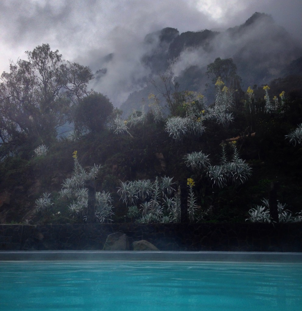
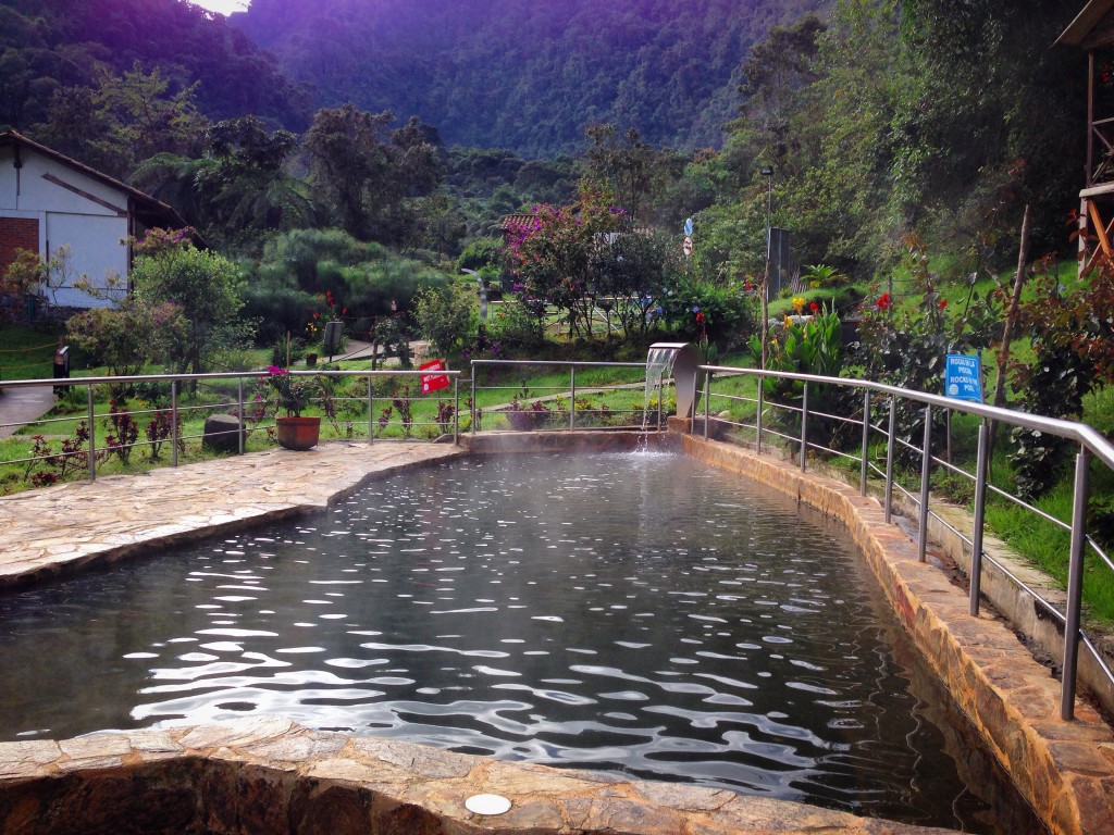
This is the view you will see from the hot pool at Termales Nevados del Ruiz. The view constantly changes as fog and hummingbirds move in and out!
The next leg takes you up to 14,000’, where you will ride to the Las Brisas entrance. You continue up, past the springs on the dirt road. Eventually, it becomes paved again as you ride through the Paramo. You will hit a well paved road, and turn right to continue ascending. After passing an abandoned restaurant (pictured below), the road forks left and right, becoming unpaved again. There is a fantastic waterfall that you can see to the left (towards Murillo)… and the Las Brisas entrance can be found on a steep rock road to the right.
Checking out some of the waterfalls near the split in the road to Murillo / Las Brisas
You never know what the weather will bring you in Colombia. In moments, we went from clear skies to heavy fog and rain. We took shelter in this abandoned restaurant. The volcano we were approaching killed 22,000 people in 1985 when it erupted. Currently, it is in a state of “Orange Alert,” meaning that another eruption is likely in days or weeks. Because of this, sections of the park are closed. We decided to ascend thousands of feet to one entrance, descend back down, and then reascend to 13,500′ in order to see as much of the park as legally possible.
At the Las Brisas entrance, you can pay about $9US per person to enter the park. You’re allowed to ride all the way to Valle de Las Tumbas (about 5Km), where upon the park is closed (the northern most “closed” flag on my map along the green/black line). At this point, you will turn around and descent back to Manizales. We suggest taking the black line because it is beautiful and paved. You will eventually encounter a main highway as you descend, which has more traffic than you’ve been experiencing (hopefully none). Nevertheless, you can descend almost as quickly as the cars, making it safer than if you were ascending this route.
Manizales to Lago Otún Entrance of Nevado Ruiz By Bike
Manizales to Lago Otún Entrance of Nevado Ruiz By Bike
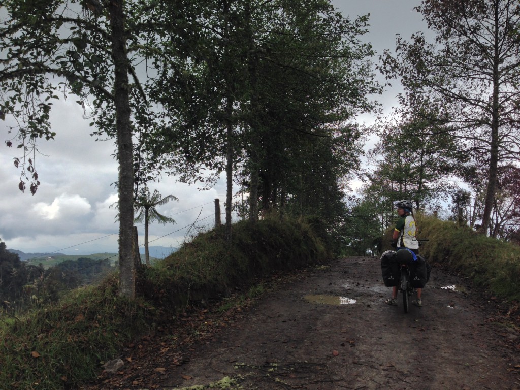
This route is a spectacular route that takes you up into the Nevado Ruiz Paramo. The best highlights, however, might be found on the lower slopes. Our route starts near Bosque Popular El Prado. From here, you can climb like we did (a VERY steep, unpaved logging road) – but we do not recommend this route. For one reason, it is closed to bikes every day except Sunday. Having said that, though, we did not encounter a single person or vehicle. We did have to walk up this steep road with sharp rocks.
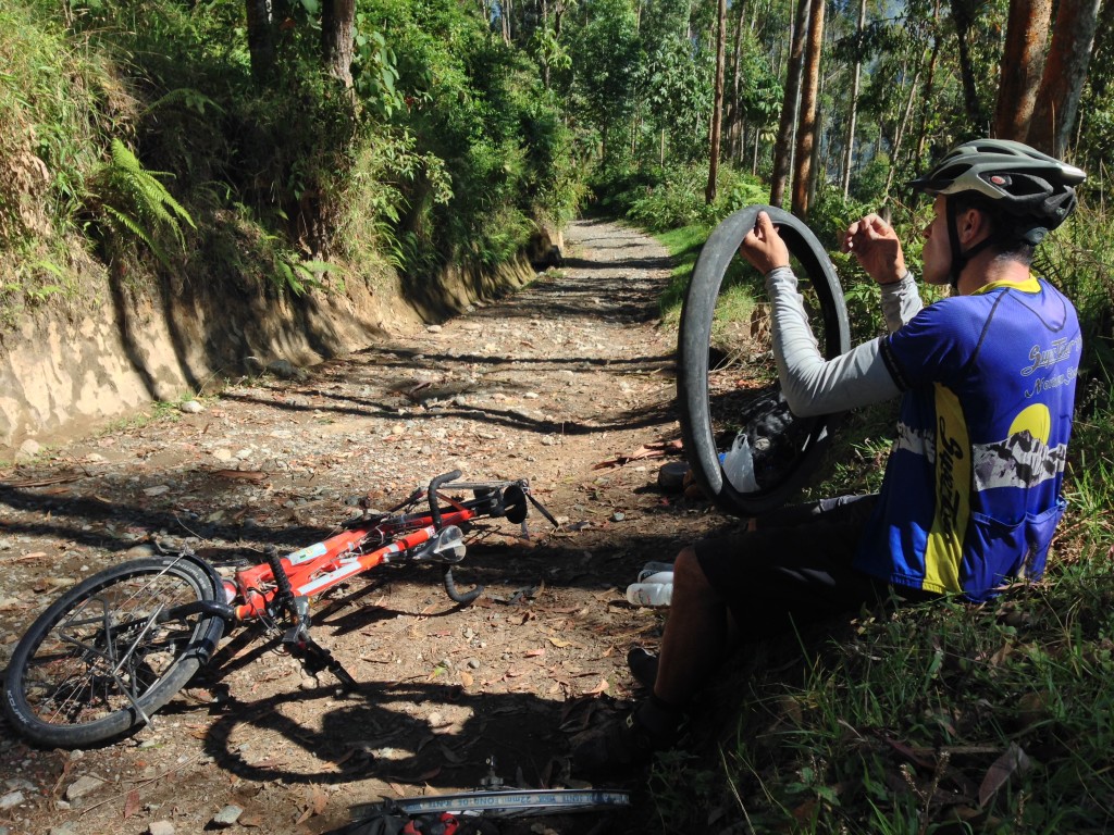
Days of dirt road riding cost us in terms of tires. We slit the sidewalls of our tires over and over again, eventually necessitating a sewing job. This repair lasted several hours, but eventually we had to dig into our spare tire supply.
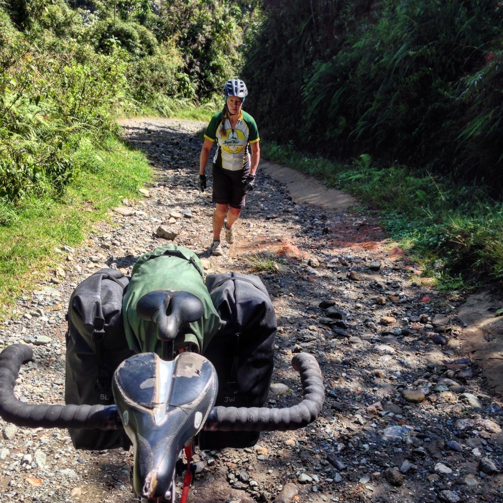
On a tandem bicycle, everything is harder. All but one of the roads to Nevada del Ruiz are unpaved and rocky. We found that when the grade pitches over 15%, it made more sense for Janet to walk while I rode on solo. In many cases, I had to push the bike as well due to limited traction without Janet’s weight on the back.
Instead of following our route (shown in the map above dated 01/05/2016), you would want to go to Villamaria, and head out towards Turin, then Tejares. In a couple miles, your route would join ours – with a surface that looks like the picture below:
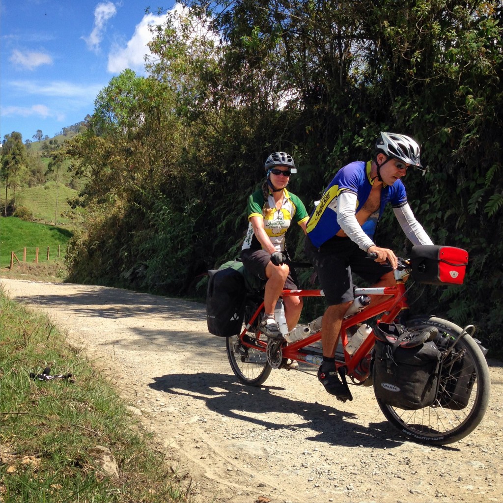
This is what we must look like to passers-by
You will climb and descend several times along this portion. A sturdy mountain bike is recommended. At about mile 10.5 along our route above, a beautiful waterfall will come into view!
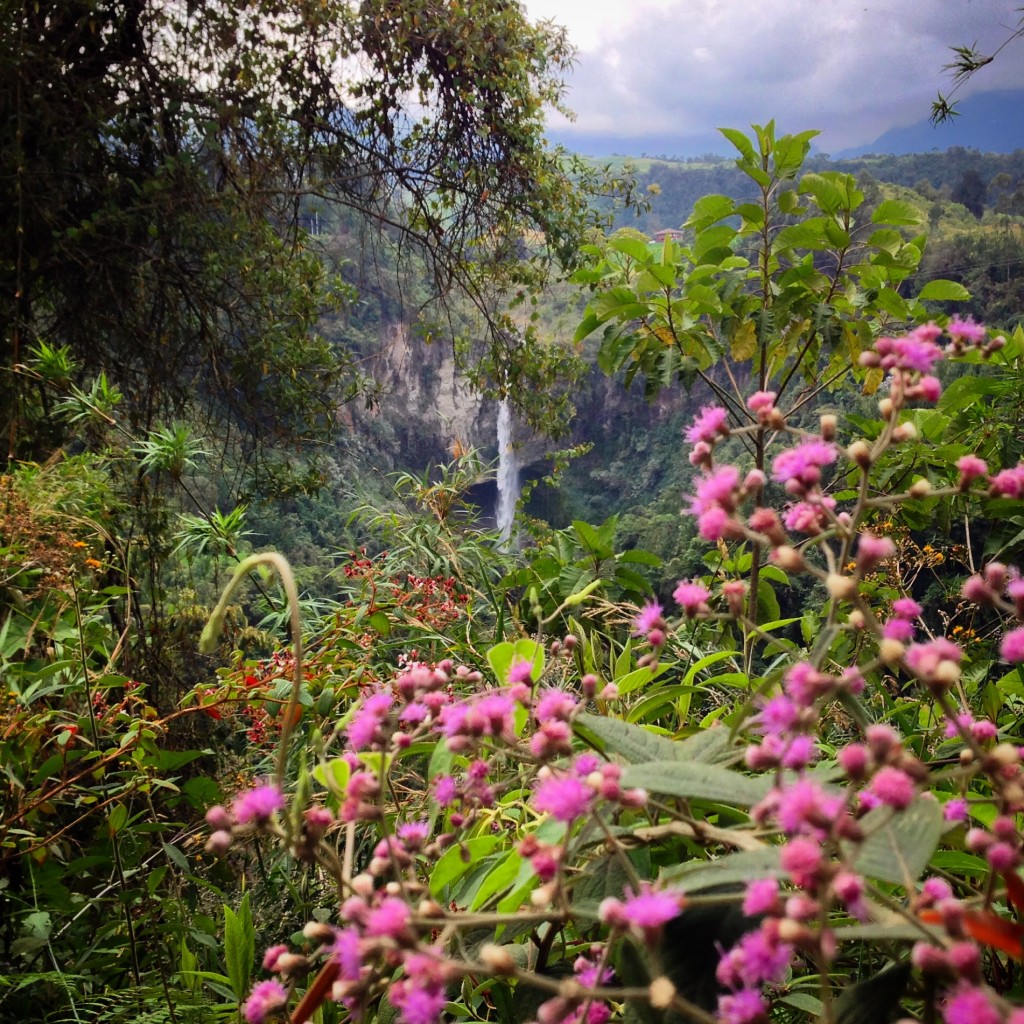
Janet saw this waterfall as we were riding by and yelped with joy. This is found along the dirt route from Manizales up to the Lago Otún of Nevados del Ruiz. There is a quiet Hostel named Las Lagunas nearby. Surprisingly, there were a couple people there (I found this to be unexpected because of the closures in the park).
At mile 11.5 (shown in the map above dated 01/05/2016), you will come to a hostel named La Laguna. This hostel has a beautiful veranda, and they charge about $6US per person for camping; about $20 for a room. Because we were here fairly early, we continued on – but had a fantastic and hearty lunch in their beautiful location. This is the last place along the route for official accommodation.
This is the veranda at Hostal La Laguna. The hostel is located at: 04.93204° N 75.46781° W They serve food, and have rooms and allow camping. It may be your only option for food and official accommodation on this route. Phone is +57 300-775-8327 (mobile) or +57 300 870 4962 (land line).
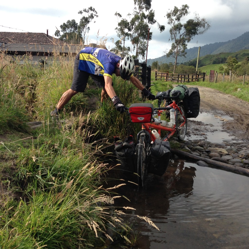
Keeping my feet dry while crossing some water.
The route continues to ascend. There is nothing for the tourist here – just dirt roads and some haciendas. Nevertheless, we met some very friendly and helpful campesinos along the way. We were offered a place to stay at one of the houses where the milk workers stay. The man told us that the workers would come back from the field at 6PM, and then return to work at 12AM. If you decide to stay at one of these places, keep in mind that you will likely receive a night time wake up call!

People making use of the tools that they have. This man was taking his calves down from the mountain. After the calves get their colostrum for a month or so, they are brought down to pasture in another area.
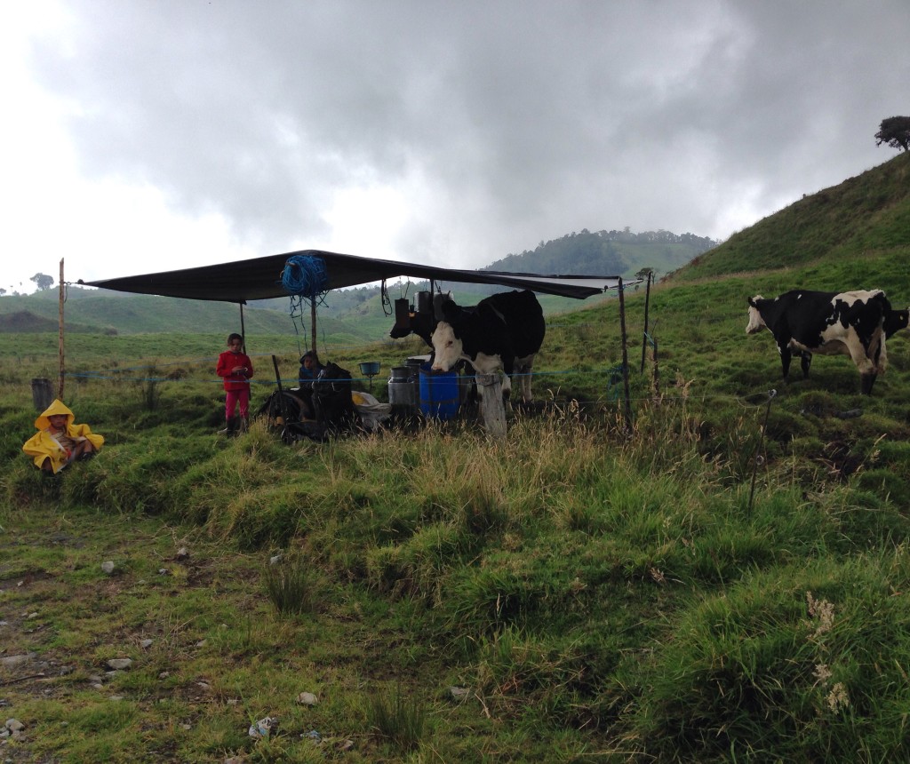
We rode through the heart of Colombian milk country. This is the kind of milk that Americans would pay $8 per gallon for. Grass Fed pastured cows, hand milked. Delivered by donkey (they strap 4 metal containers, two on each side, to a donkey). In less remote areas, the large metal vessels are left by the side of the road overnight. A milk tank truck comes to collect the milk and add it to the pool. In more remote areas, I’ve seen “self guided” donkeys loaded with milk walking down the road all by themselves – much like an Amazon Drone making a delivery. I wonder where all the milk ends up; all you see is UHT milk in the stores!
Looking up towards the last pass just before entering the Paramo
If you’re lucky, and the sky is clear, you will get to see great views of Nevado Ruiz here. At one point, we saw the ash plume coming from the mountain. Unfortunately, at that distance, our iPhone cameras are inadequate to produce an image worthy of the blog. In person, it can be much more exciting.
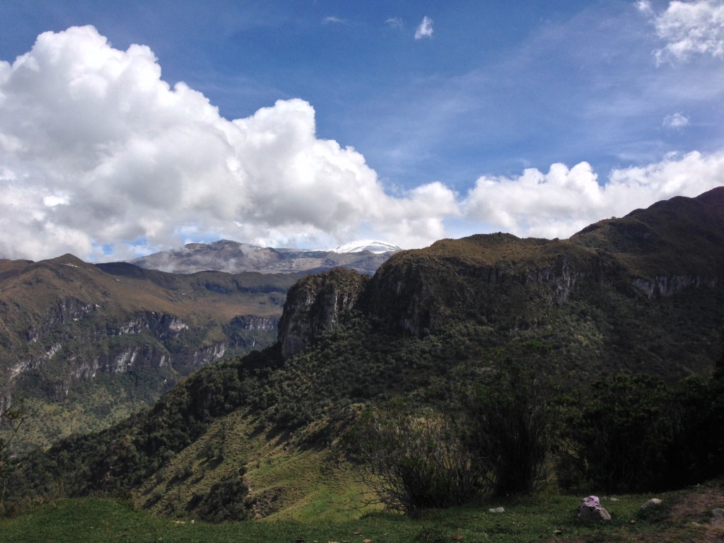
Looking our towards the glacier from the route. We were lucky that the clouds cleared for us to see the mountain briefly. As we got closer, thick fog enveloped us, prohibiting photography. People still climb Nevado de Santa Isabel. We saw a few guide jeeps pass us on the way there for an early start. This can be climbed in a day, starting at 4am, and returning to Manizales by 6pm. With the closure, no one should be climbing Nevado del Ruiz.
At mile 11 (shown in the map directly above dated 01/06/2016), you will come to the Lago Otun entrance to the Nevados Park (which for you will actually be an exit because you would have already entered the park several miles back). You may be asked to pay here, even though you’re exiting. This is also the turn off for Lago Otun. If desired, you can legally walk to the lake; if the park staff is there, they will likely guard your bicycle. The staff informed us that bikes are not allowed to Lake Otun. The riding from mile 6 to about mile 15 in the route above is very enjoyable. Eventually, it becomes difficult and rocky again, though. Also, do not be deceived by the apparently large amount of descending: there are a lot of very steep (20%) climbs that don’t show up well on the elevation profile, but can really set you back time-wise. You could end your route at Santa Rosa de Cabal, or you could do like we did and go to Termales San Vicente.
Don’t be deceived: this route has a lot of up and down before you get to Santa Rosa de Cabal!
We felt that the hot springs would be a treat at the end of this challenging route – but for our personalities, it was the opposite. This is a beautiful, natural setting, but unfortunately, the character of the place is that of a crowded, commercial site, which overwhelms the potential tranquility. There are 9 thermal pools, and we found them to be very crowded. Camping (along with park entry and meals) cost almost the same as Termales Nevado Ruiz where we enjoyed a very upscale room and quiet solitude in the mountains. In contrast, the camping at San Vicente is in a muddy field at the most distant end of the park (i.e. away from the services). In some regards, this is good: because it distances you from the mayhem in the pools. Keep in mind that in a place like this, you’ll be sitting with pursed lips, trying to prevent the water that is being splashed by children from entering your mouth and eyes – whereas in Termales Nevados Ruiz, you’ll likely be truly relaxing.
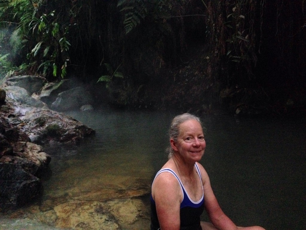
Janet seen soaking in the lowest pool at Termales San Vicente. While I highly recommend a visit to Termales del Ruiz, neither of us felt too positive about the highly commercialized Termales San Vicente. It would make a decent day trip if you don’t mind crowded pools, but many factors make it undesirable for an overnight stay.
One of the 9 thermal pools found at Termales San Vicente.
Another one of the 9 pools at Termales San Vicente. As you can see, this area is absolutely gorgeous. The challenge is: how to find yourself here without the swarms of people? I snapped this photo by getting up early and arriving from camp before the pools opened.
Beautiful Cascades!
This is the map for the entire route discussed in this post. To Export GPX files, click on the three horizontal bars in the upper right hand corner of the map and select Export selected map data…
To see this map in a full screen, click here (opens in new window)


What an absolutely fantastic journey! I’m afraid to show this blog to Mireya for fear she’ll force me to rebuild the tandem for touring and immediately hit the road… although that might not be a bad idea.
Keith – you’ve already got a tandem… That is awesome! Hope you guys get it running and do a tour!