Ventana Wilderness Backpack – Marble Peak Trail – South Fork Trail – Big Sur Trail – Pine Ridge Trail – Church Creek Trail – Tassajara Cutoff Trail – Horse Pasture Trail
This trip was notable for the fact that my friend Josh and I navigated the entire length of the South Fork trail according to the historical (GPS based) trail route. Along the way, we came across (now named by Jack Glendening) Rainbow Falls, who went out there the day after I posted this report. Hopefully the pictures will give you the idea of the trail conditions, but the best and most up-to-date guide for Ventana Wilderness trail conditions can be found here at BigSurTrailMap.net. Most of the trails were easily passable with the exception of South Fork Trail and Black Cone Trail. If you read the report below, you will see that our group split into two. It is difficult to determine which route is the easiest way to Pine Ridge Camp.
GPS Track for Day 1
GPS Track for Day 2
GPS Track for Day 3
GPS Track for Day 4
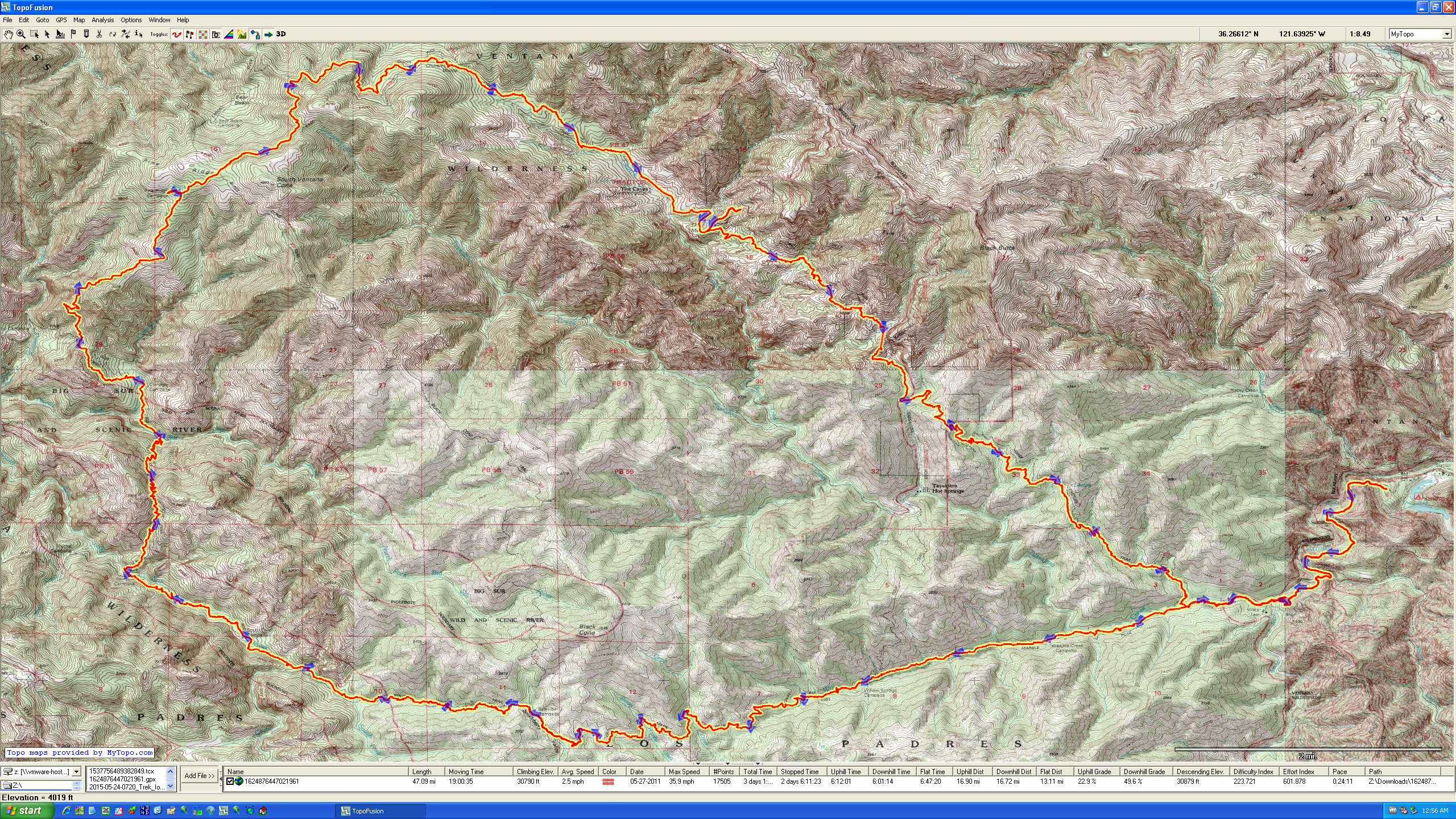
Overview of our Route
Tassajara Cutoff Trail
Church Creek Trail
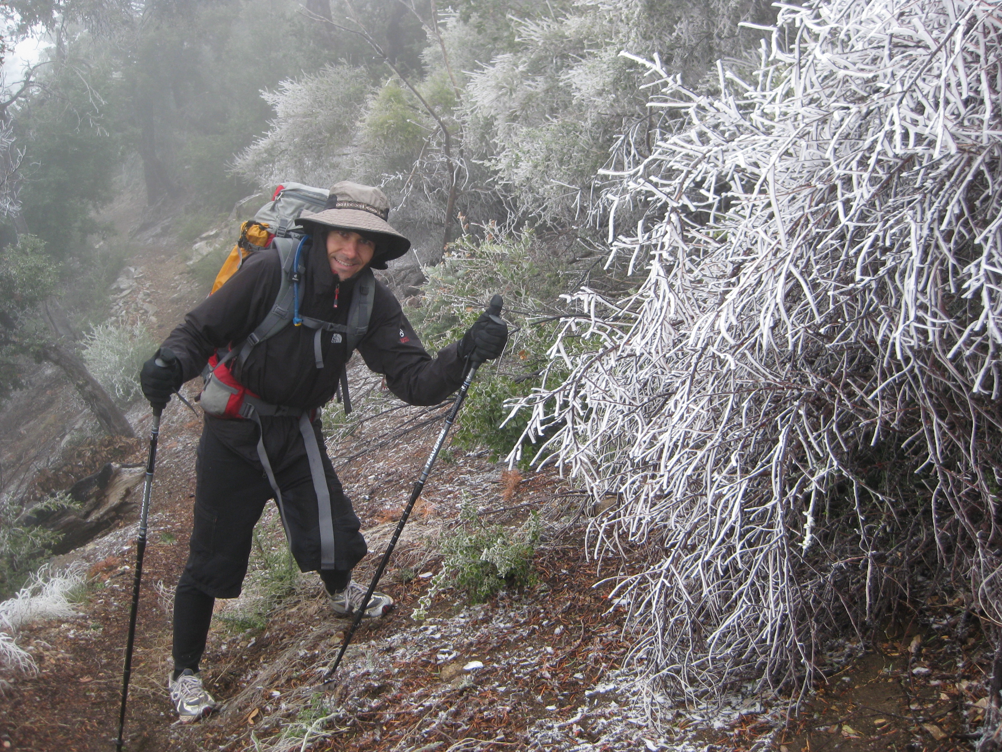
Pine Ridge Trail. Yes, it snowed last night (in May!!)
Church Creek Trail
Black Cone Trail was difficult to pass on this date. Greg spent a lot of time brushing the trail.
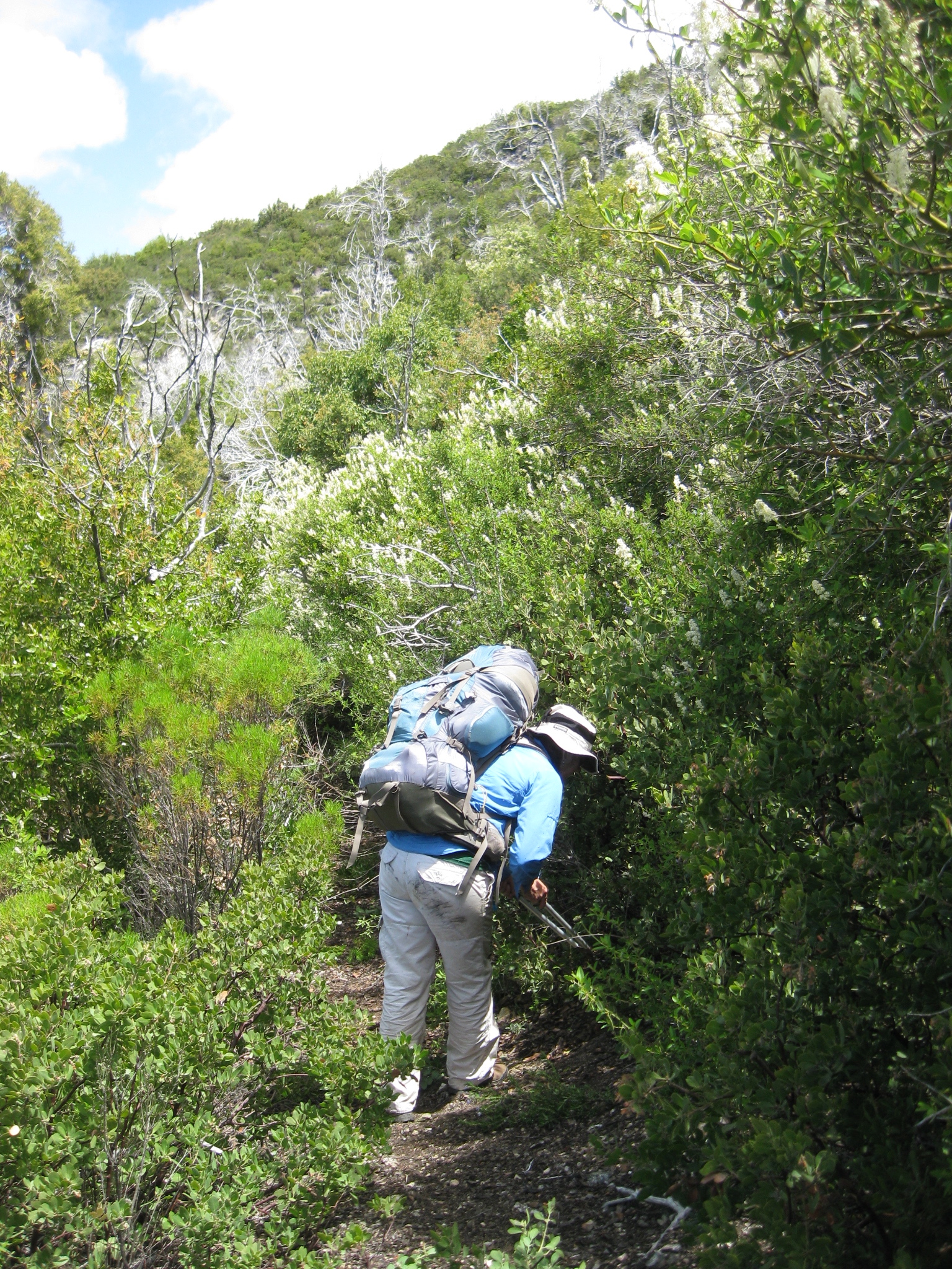
Black Cone Trail. Valerie is shown here brushing as she goes along.
The campsite at Strawberry camp (at the junction of Marble Peak Trail, Black Cone Trail, and South Fork Trail. As you can see, there isn’t a lot of flat space here.

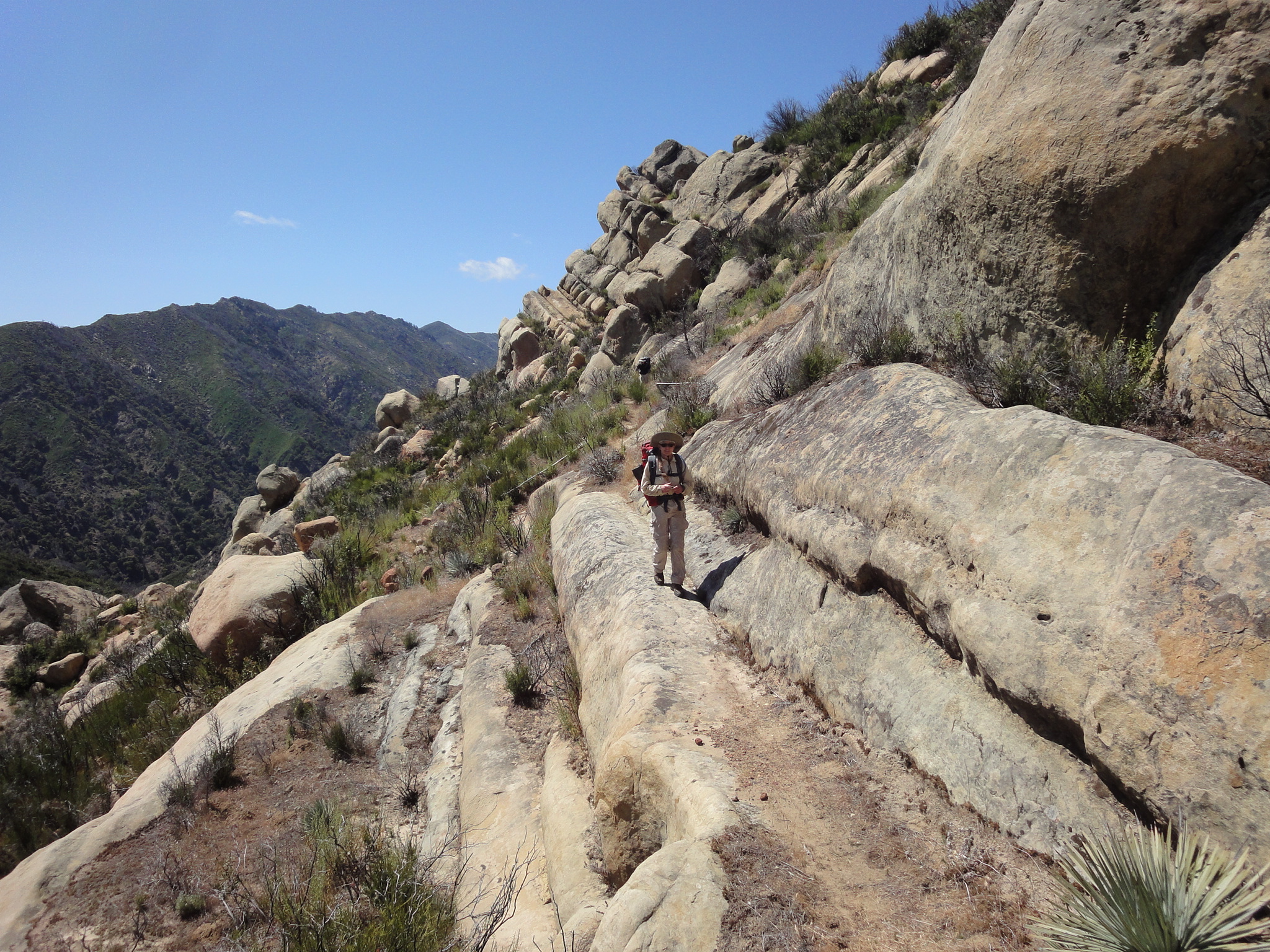
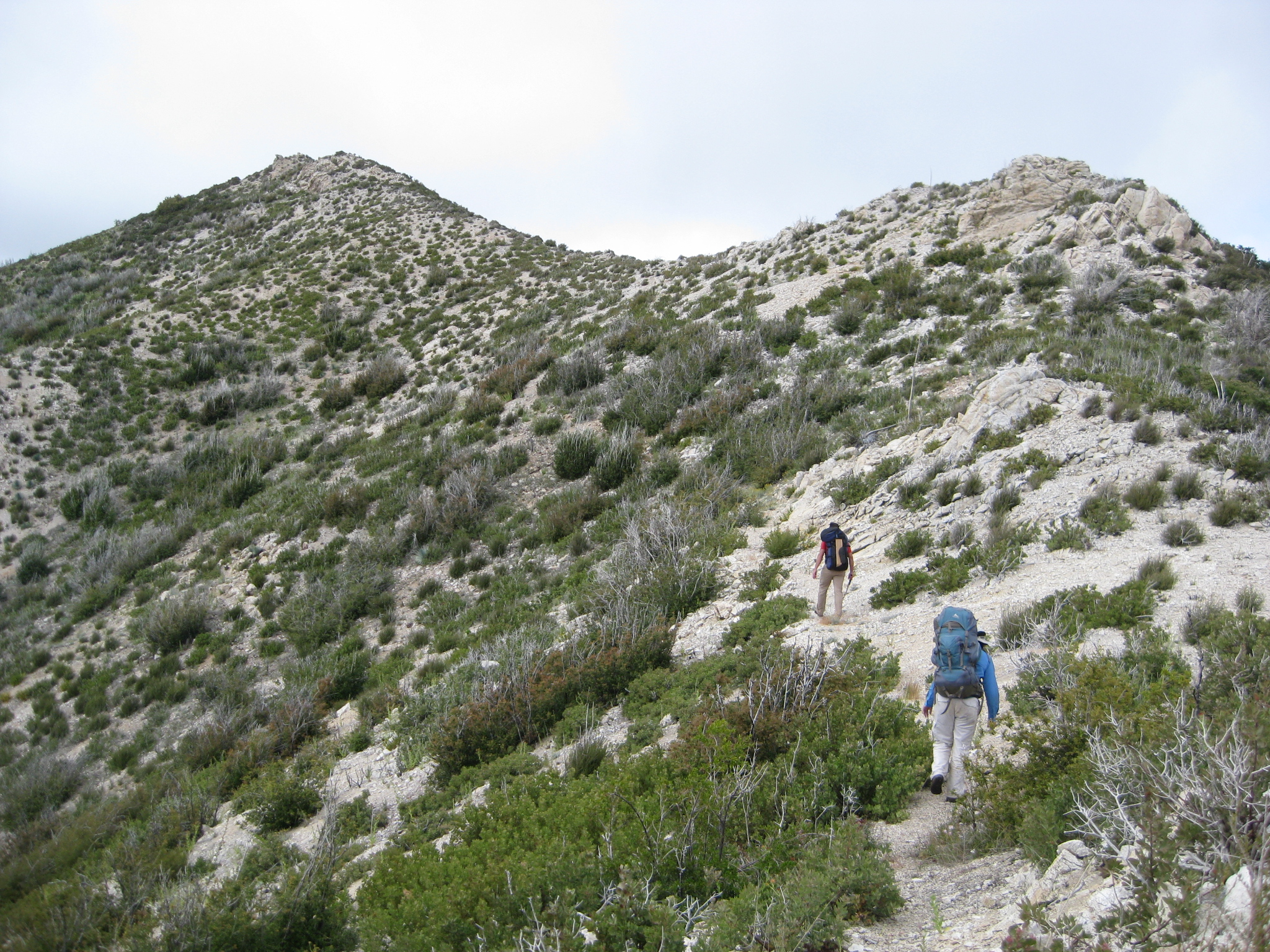
Marble Peak trail is fairly manageable throughout its length.
Day 1:
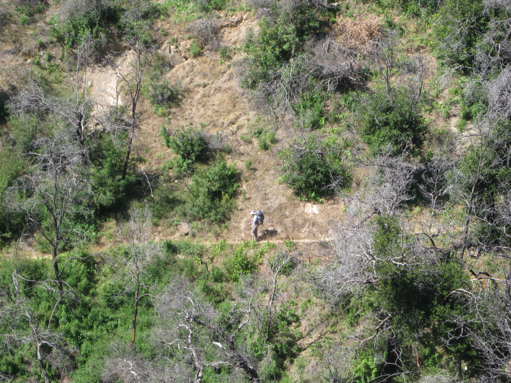
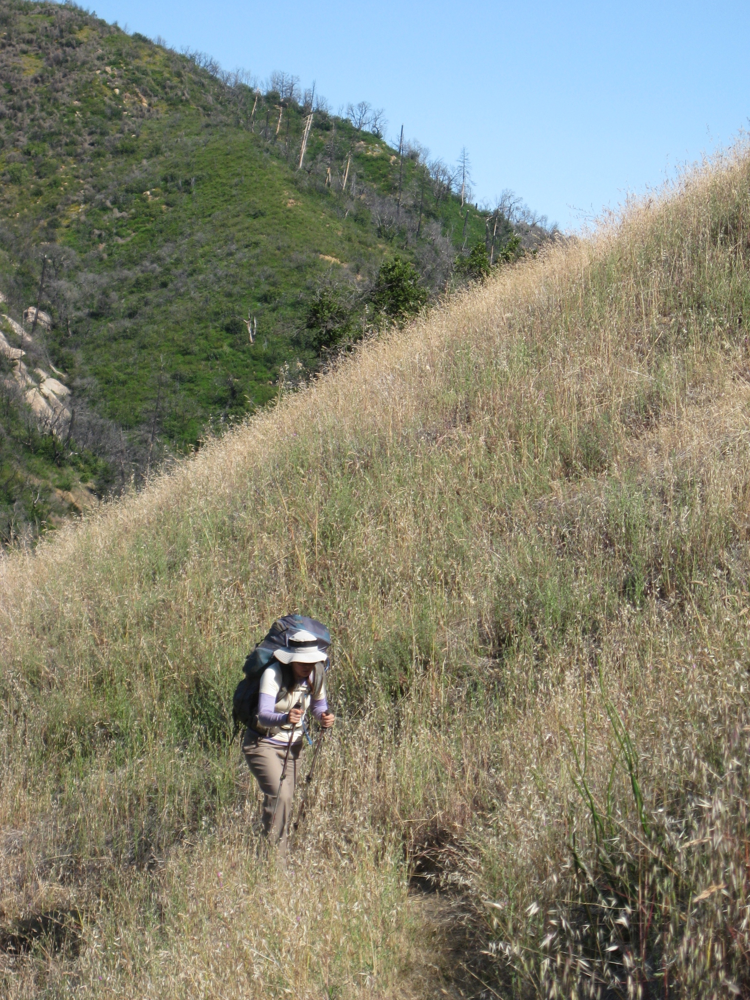
The trip began with 7 people. We were actually expecting 10, but we lost Bill when he heard that there would be no layover days, Bill’s son when he learned that there would not be any fishing, and my dad when I told him how far and rugged the trip would be. The trip began from the Arroyo Seco entrance to the Ventana Wilderness. We paid our $7 per night for parking, and then we set off (without Josh because he had to work late – as a speedy hiker, he would catch up and join us later). We hiked along Indians Fire road for a couple of miles, before descending onto the Marble Peak Trail headed towards Strawberry. Once we hit the Marble Peak Trail, we were met with surprisingly good trail conditions. There was nary a doubt about which way the trail went. We were concerned based on a couple of trail reports that we had read on Ventanawild.org prior to the trip. Greg had brought a machete and some loppers to make sure we could get through. He discovered that the loppers (with modified, extended handles – to keep his hands farther away from the poison oak) were mostly superior to the machete for brushing the trail. Greg brushed almost every mile of the Marble Peak Trail that day using the loppers – significantly reducing the number of poison oak branches over-hanging the trail, and attacking a number of other bushy species. There were several creek crossings – most of which required some balance – but none of which required getting your feet wet. As we got closer to Willow springs, the scenery got increasingly lush. Interestingly, an impromptu camp has formed at the base of the Tony Trail – many people seem to believe that this is Willow Springs (due to it’s representation on the map). Nevertheless, the real Willow Springs is a little farther up the Marble Peak Trail – in a location that has substantially more room for camping. At this point, the climb begins – and it is fairly gradual. As you get higher, the trail opens up. It was approximately at this point that Shelly started to feel her Plantar Fascitis flaring up. As anyone who has had this inflammation before knows, this signals the end of any activity that needs to be done on the feet. Somehow, Shelly managed to make it all the way to Strawberry Camp – suffering severely from pain in her feet. Strawberry camp was slightly sloped, but there was enough room for 3 tents on relatively flat ground. I improved one of the tent spots by creating a flat area large enough for a 3 person tent.
Day 2:
The next morning, Shelly made the wise decision to head back to the car. She managed to get out in one day – but the pain was so bad that she suspected crawling on her arms would have only been a little slower. It was at this point that the rest of the group splintered into two groups – agreeing to meet at Pine Ridge Camp. Josh and I wanted to explore the rugged region between Strawberry and Rainbow Camp, and Greg, Valerie, and Janet wanted to avoid the reports of nonexistent trail in this section. Greg, Valerie, and Janet took the Black Cone trail straight up to Pine Ridge. Josh and I continued on the Marble Peak Trail.
Greg, Valerie, and Janet were expecting “good” trail conditions based on reports for the Black Cone trail. This was not the case. They knew that there would be a trail work crew out this day (they met them). As they worked their way up the Black Cone Trail, Greg brushed vast sections – eventually passing the loppers to Valerie, and working with the machete. Unfortunately, all that swinging resulted in blisters on both of his thumbs. It’s a lot of work to remove this much brush. Weather started to come in the afternoon, and we had no way of communicating with Greg, Valerie and Janet (to perhaps select another camp that is less exposed than Pine Ridge), so we ended up pushing through. For Josh and I, the story was similar – however we only did the minimal amount of brushing because we believed that we would need all the time we could get in order to complete our route. From Strawberry, you ascend briefly on nice trail, but very shortly after the descent towards Rainbow begins, the trail disappears. Fortunately, some people had flagged the route (quite well, I might add). Shortly after start descending from the little pass out of Strawberry, you are on decent, steep switch backs. There is a landslide shortly after the switchbacks end (you will have to climb over some fallen trees before the switchbacks truly end). Once you hit the landslide, keep an eye out for the other side (South side) of the creek. You will hopefully get a glimpse of a short piece of trail across the creek shortly after you pass the landslide. We just blazed down the hill (and up the other side), and got on some decent tread that helped us move down river another few hundred feet. After that, though, you’re strictly following flags through non-trail. At the junction of the two creeks, the trail starts to become evident again. It isn’t exactly smooth sailing, but it very gradually improves as you get closer and closer to the camp. Before you get to camp, the flags take you up (on a trail) above a stunning waterfall that is ~150 feet high. Unfortunately, we could not find a good vantage point to safely observe the fall. Great thanks to the flaggers! We could have made it through without the flags, but they probably saved us some time – and were good for morale!
Josh and I made it through to Rainbow camp in about 2 hours. From there, we ascended the Big Sur trail over a significant ridge, and down into another valley. Along the way, we encountered 4 women heading the opposite direction. We were very surprised to see anyone out there, and these 4 were hardy, well prepared, but ready to be done. As we met them at the top of the ridge, we assured them that it was “all downhill from here.” …And we were telling the truth! As the weather turned into rain, Josh and I worried about the other group. Would they make it before us? Would all 3 of them be huddled in Greg’s 2 person tent? I was starting to regret that the group split up because we could not communicate with them.
After hiking in the freezing rain, we made it to Pine Ridge Camp, where, again to our surprise, there was a large group of boy scouts. Josh and I were shivering like crazy, and the rest of the group was not there! I wanted to go look for them, but Josh had a little more sense, and encouraged me to put up the tent. I was reluctant to do this, as it was still raining, and all we had was a mesh tent – but it ended up being a good idea – within minutes, I heard a “boop” – it was Janet, Valerie, and Greg walking into camp. I went running up the hill to greet them.
In spite of the rain and our 3 season tents (3 people were crammed into my paper-thin Big Agnes Fly Creek UL3 tent), everyone remained positive. I was probably the most worried of the lot. Everyone still managed to laugh, and crack jokes – even though they had blisters, and were crammed into wet tents. I believe that the presence of the boy scouts (and their fire) helped boost our group’s morale. Also, Greg, Josh, Valerie, and Janet are such positive people – they can really make lemonade out of lemons.
Day 3:
We were all hoping in the night that the weather would just pass – but we woke in the morning to falling snow. Dry snow can be better than rain, as it slips off your jacket – not getting you wet. Unfortunately, this was west coast slushy snow. We were warm in our tents, and joking about getting up and going for it… So finally we just went for it. Everyone packed up wet, heavy gear quickly, and got out of camp over 3 hours earlier than we had the day before. Because it was still drizzling, I had resolved to run back and get the car, and drive around to Wildcat to pick everyone up. I figured that if I dropped off my pack at Wildcat camp, unladen, I could easily run the remaining miles to the car. I scooted ahead of the group down the Pine Ridge Trail in an effort to save them waiting time in the rain. BUT by the time I reached the Church Creek Trail, I started to see evidence of sun. Suddenly the sun really did come out, and there happened to be a big sunny rock – perfect for drying. It was at this point that I again regretted splitting the group up. What would the group think about this change in the weather? Would they want to complete the trip, or still abort? Valerie and Janet had bad blisters, so maybe they would still want to abort… The weather was getting better quickly, so maybe they would still want to go for it. I decided to wait. After ~1.5 hours, they arrived, and the consensus seemed to be that we would carry on. We dried all our gear, and the weather improved dramatically during the rest of the day. Valerie struggled with turning down the ride in car option, but she found the strength that she needed to carry on – in spite of painful blisters. Fortunately, Josh came up with the brilliant idea of sharing his trekking poles with Valerie, which helped reduce the pain. Janet and Greg were also limping from blisters – but they too dug deep for the toughness needed to finish the trip.
We were in great moods in the sun near “The Caves,” hiking along Church Ranch Road – but when we turned off on the next section of the Church Creek Trail – we were again faced with very difficult conditions. This section of trail makes little sense – it does not take the most direct route – nor does it follow any contours. Instead, it takes you straight up and down 30+ degree slopes on a cambered, overgrown tread. This wasn’t the 3 miles of smooth sailing that we had been expecting to Wildcat. Greg worked hard to clear this section of poison oak. He lopped most of the trail, likely rendering it passable for the rest of the season. When we finally arrived at Wildcat, we were somewhat surprised. Based on the park map, we expected this camp to connect with Tassajara Road. As the crow flies, the camp is only a couple hundred feet away – but there is NO connection. We were also confused because there is a “P” (for parking) right near the camp icon. This camp was tiny, near a brook. I made a flat spot for a second (three person) tent near the brook.
Day 4:
I was sad that the trip was almost over, but we still had a good day ahead of us. The trail from Wildcat on is in very good condition. The views from this section are fabulous. We planned on heading down Tassajara Road, and taking the Tassajara Cut-off trail – but this trail is only shown on 1 out of 3 maps… so we figured it did not exist. Instead, we ended up hiking UP Tassajara Road a few hundred feet, and joining the Horse Pasture Trail. We later discovered that the Tassajara Cut-off trail DOES exist – and it is in great condition (near the top at least). Taking that trail would have saved us hiking over a significant ridge. The Horse Pasture Trail was in pretty good condition, and from it we could see some beautiful scenery – including a huge waterfall out behind the Tassajara Meditation center. There were some significant ups and downs, and Greg’s blistered hands were finally starting to be done with clearing poison oak. I some clearing of poison oak for a while, and Greg borrowed my poles to help with his knee. When we finally arrived at the Arroyo Seco River, the guys took a swim and washed up. The girls continued heading out to get to the car, and change into some more comfortable shoes. All in all, it was a fantastic trip! It was challenging, but getting to spend 4 days with wonderful people, and exploring remote parts of the Ventana Wilderness was one of my favorite experiences in a long time