Tahoe Lake Aloha Rim Loop
Studying the map, I often find dead-end trails that seem like they were meant to form part of a loop. In an effort to connect the missing pieces of a dead-end trail in Desolation Valley, I sought a loop route that covered some of the more interesting looking terrain in the Crystal Range with a dead end trail to Osma Lake in the Lake Aloha Basin.
This route starts at the parking off HWY 50 – near the Chapel of Our Lady of the Sierras. If you park here, you can ascent a steep, forested trail up towards Ralson Peak. Ralston Peak is a decent warm up for this route, but could be skipped if time is short. Although it is not shown on the Topo map, there is a distinct path leading from the South West to the peak. There is also a path (heading North West) from the peak back to the main trail. Both are fairly easy to negotiate.
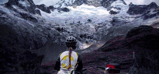
The view and Trail from Ralston Peak
If you examine the Topo map, you can see a dead end trail that leads from Lake of the Woods to Osma Lake. There is an interesting, complex region to the West of where the trail ends, and that was the region I sought to explore.
My route is in red; proposed changes shown in bubbles.
Heading West from Frata Lake, I encountered complex terrain that wasn’t terribly difficult. The region was interesting because you had to work your way around a maze of easy ledges. There were a couple of easy class-3 sections escaping the drainages of Pyramid Creek and Pyramid Lake. Gaining Access to Pyramid Peak is exciting. About half way up the peak, you encounter a chute, which appears to be the most efficient way to the upper talus coated slopes.
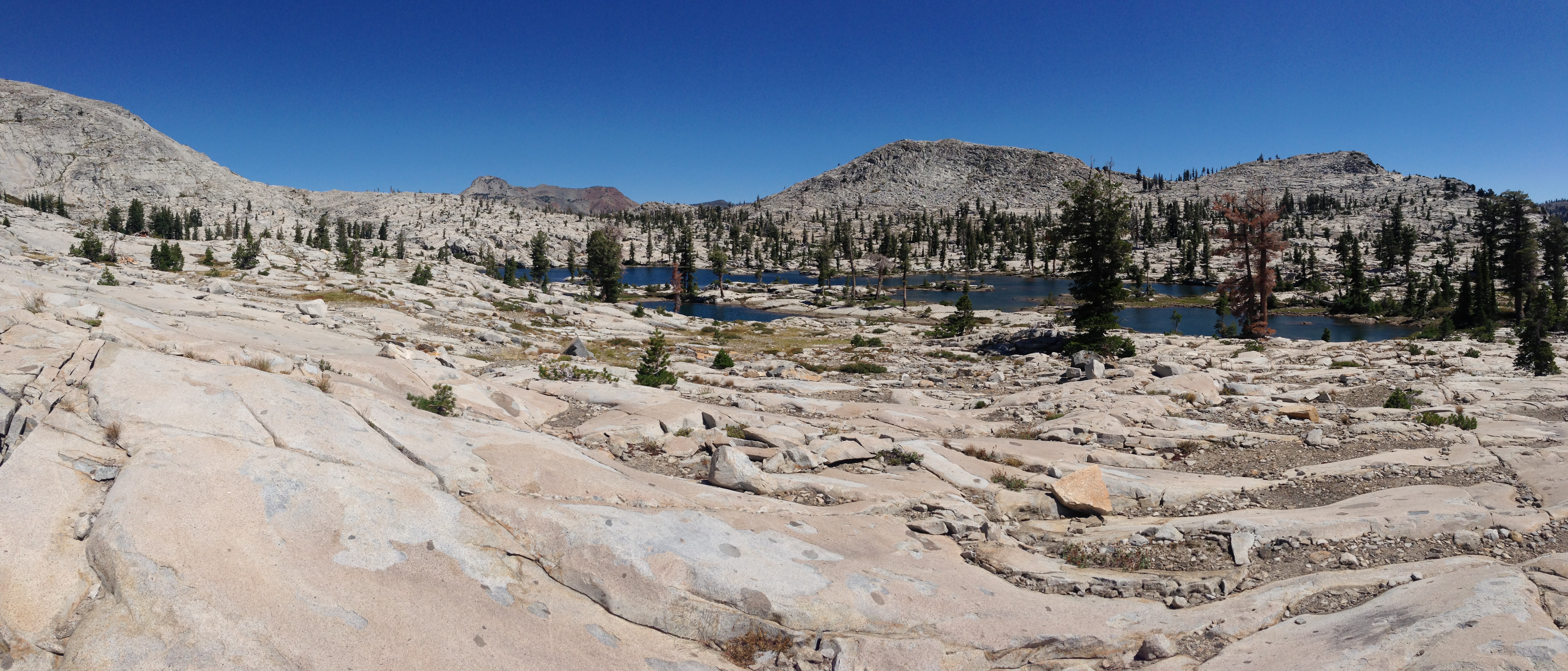
Off-trail section directly West from Lake of the Woods. This region was easy moving until the complicated terrain before ascending Pyramid Peak.
Some Topo maps (Juicy Trails) show a trail heading from Pyramid Peak to a location Just West of the Twin Bridges parking lot. I did not see any evidence of this trail, in spite of crossing its upper reaches at the 9,600′ level.
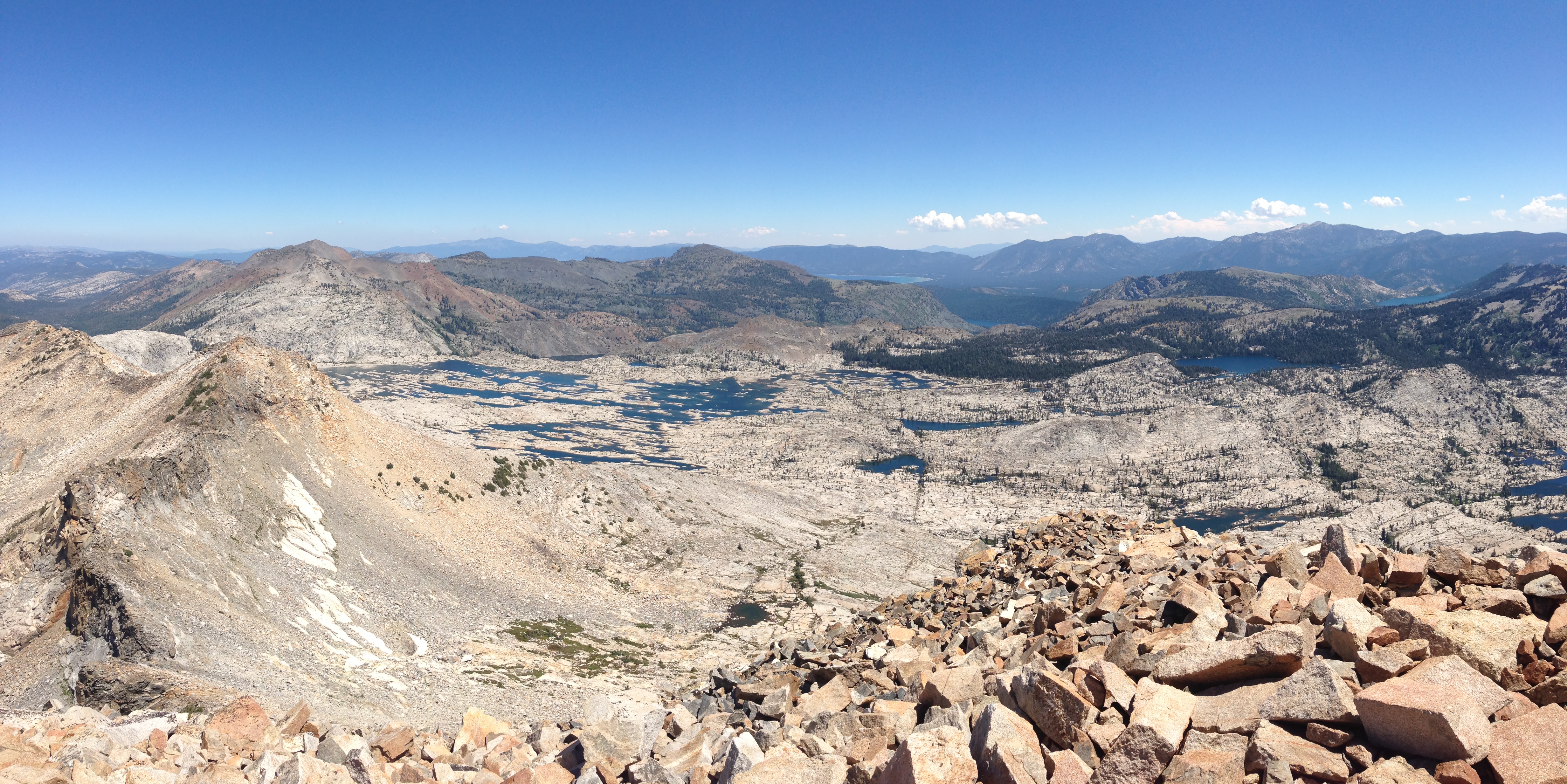
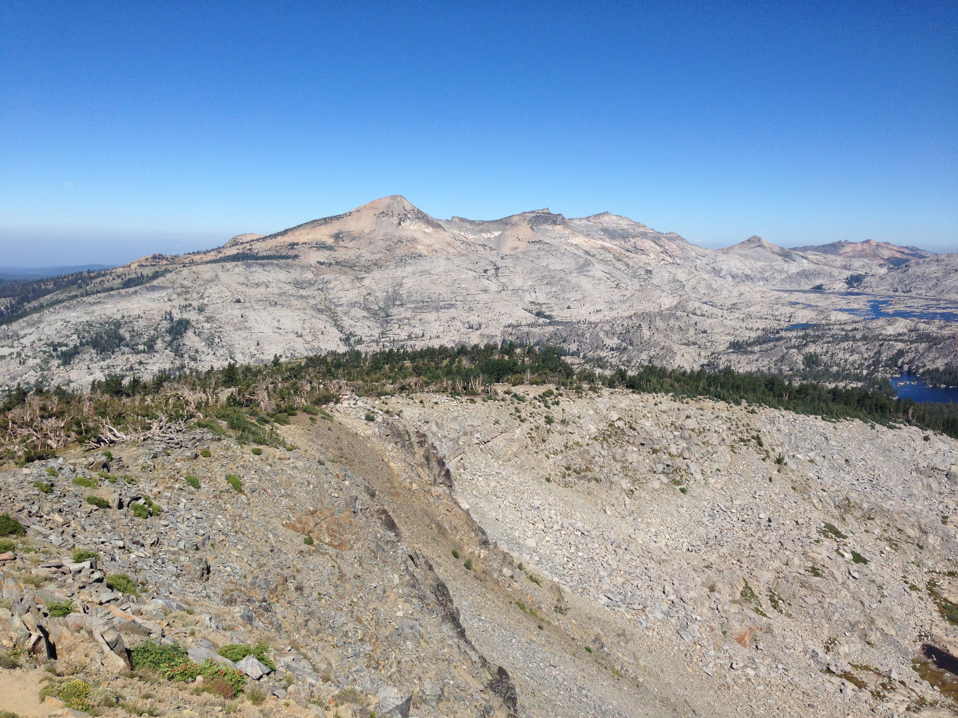
Looking at Lake Aloha from Pyramid Peak
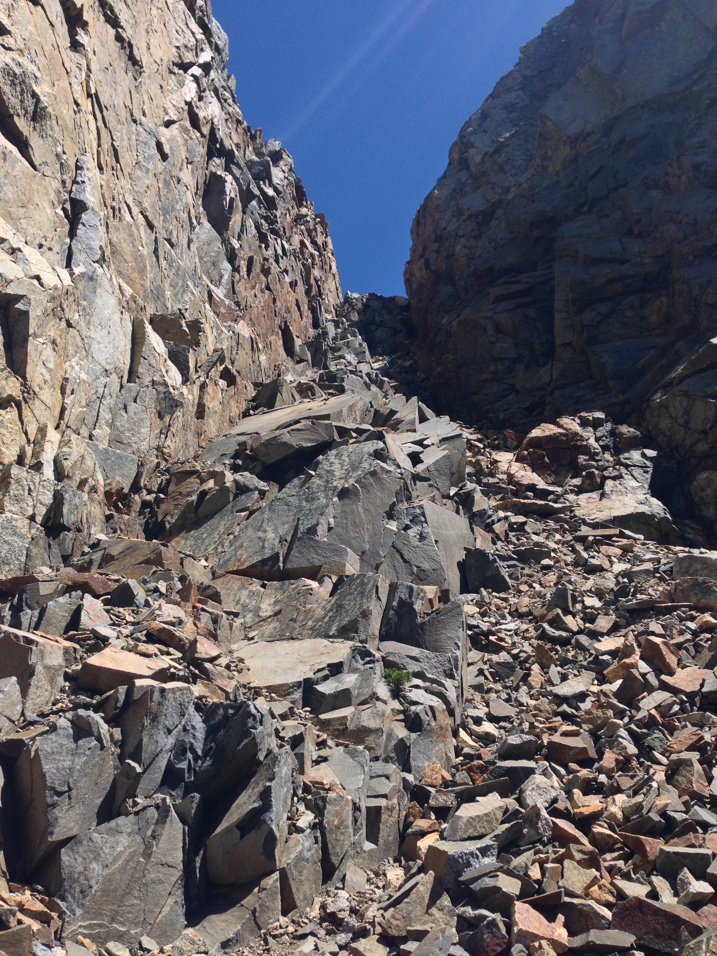
This chute, just North of Pyramid Peak allowed me to descend briefly to the West, and then continue North. I saw another group continue along the spine. It seemed we were moving about the same speed, but this “long cut” was much easier than continuing along the ridge like they were doing.
I initially wanted to traverse the ridge towards Agassiz Peak, but another party was working their way along the ridge, and it looked very slow. Instead, I dropped down a chute, and traversed the Sylvia Lake cirque at about 9,200′. The other party was delayed significantly because of their approach to Agassiz.
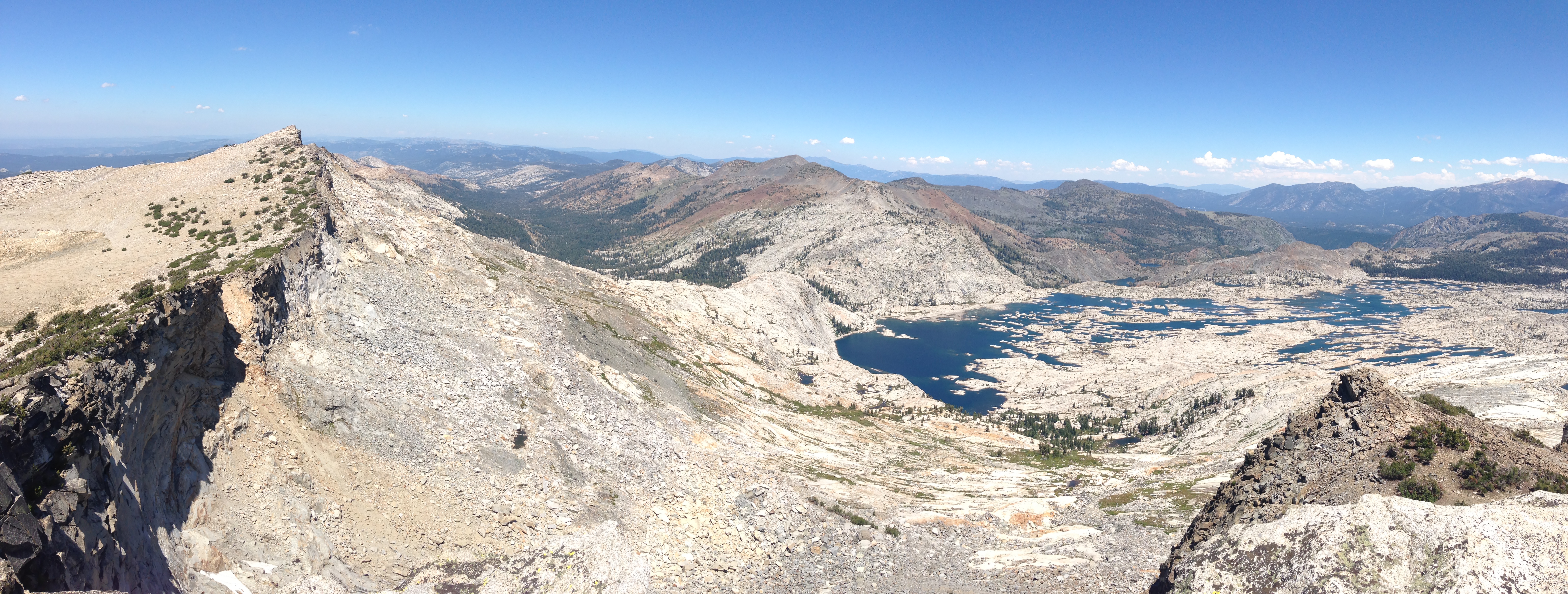
The route from Agassiz to Mt. Price is easy and clear, with great views of Lake Aloha.
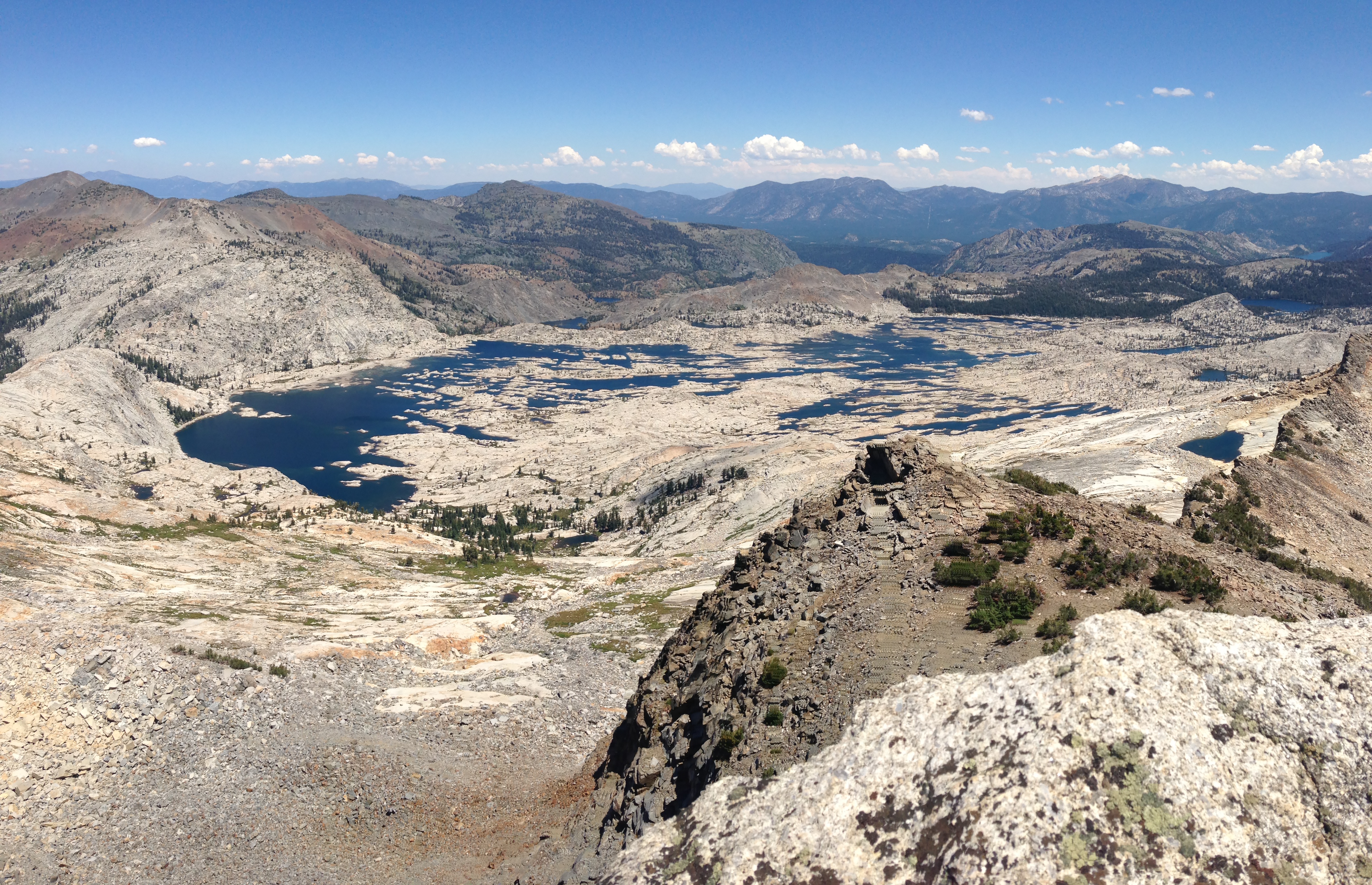
The views from Mount Price and the neighboring ridge are stunning. The sheer drop and dramatic rocks frame your view of Lake Aloha. It’s great!
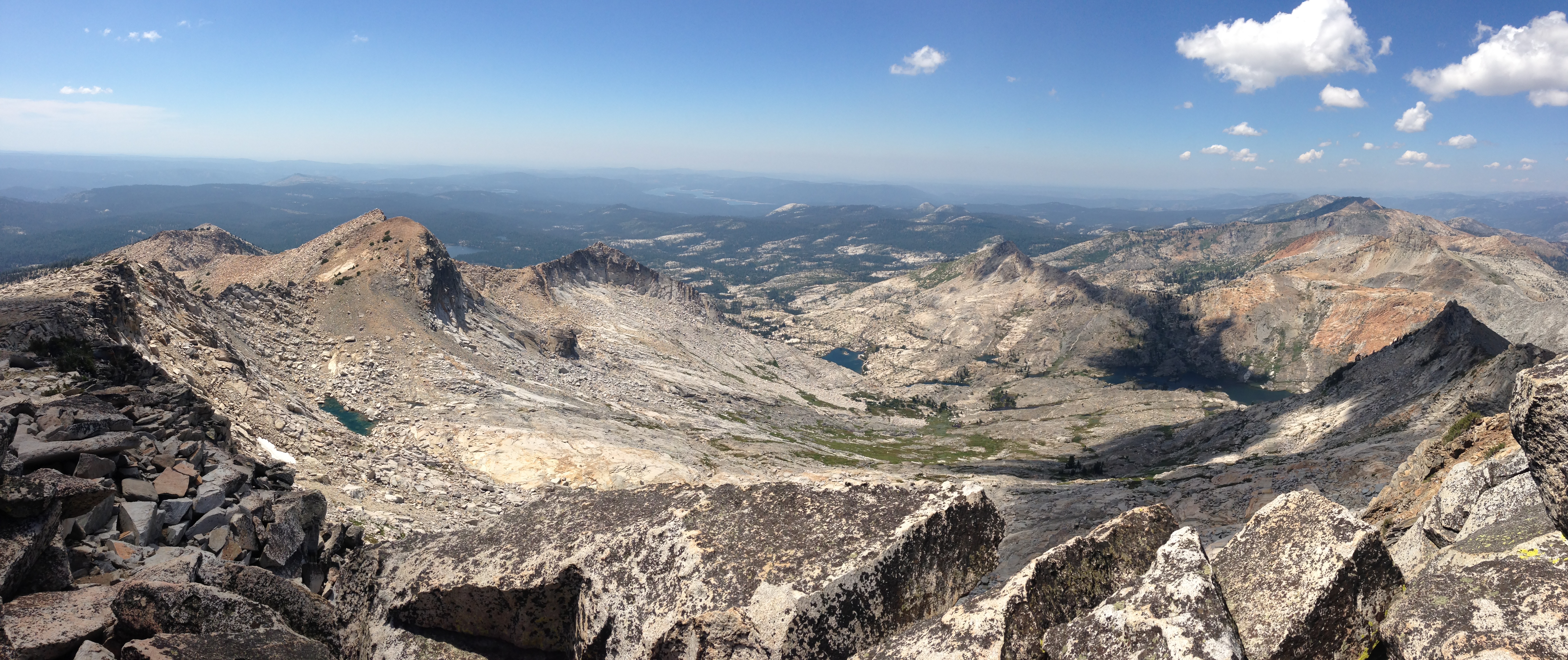
Descending from Mt. Price to Mosquito Pass is the most tedious near the top. I found a circuitous route heading North, and then North West from the peak. It was all Class 2-3, but there were a couple short sketchy sections. Once you reach Mosquito Pass, be prepared to start seeing lots of backpackers once again! It’s ironic that this is called the Desolation Wilderness – I feel I see more people here than in most wilderness areas!