Pinnacles Adventure Run
This Route was designed to be a ~22 mile adventure run. The objective was to see as many of the Pinnacles trails as possible, without repeating much. There are a couple errors in our actual route (which I will discuss), but if you do it correctly, you will have a ~21 mile run with about 4,500′ of elevation gain. You will see amazing rock formations, beautiful caves, tame lakes, and overgrown wilderness trails. All in all, you get a ton of diversity in a short distance.
The ideal route is described below. You could start at either the East or West Entrance; I will describe starting from the West Entrance. You can run it in both directions. If it is going to be a hot day, you might want to run it reverse (run through the more exposed area first during the cool part of the day, and then hit the caves when it is hot out).
Pinnacles West Entrance > Juniper Canyon Trail > Tunnel Trail > High Peaks Trail > Rim Trail > Bear Gulch Cave > Moses Spring Trail > Parking Lot Trail > Condor Gulch Trail > High Peaks Trail > Bench Trail > Old Pinnacles Trail > North Wilderness Trail > Balconies Trail > Go Through Caves, and Loop on > Balconies Cliffs Trail > Parking Lot
As seen from the Juniper Canyon Trail

Although the trails are in good condition, they can be steep.
From the parking lot, you get a brief warm up on Juniper Canyon Trail. Soon, it will rise quickly, and your pace will slow. On the Tunnel trail, you will go through an actual Tunnel, and then intersect with the High Peaks trail where you will turn right. Avoid the temptation to skip the Tunnel Trail by continuing on Juniper Canyon; the Tunnel – High Peaks portion is quite interesting, and not to be missed.
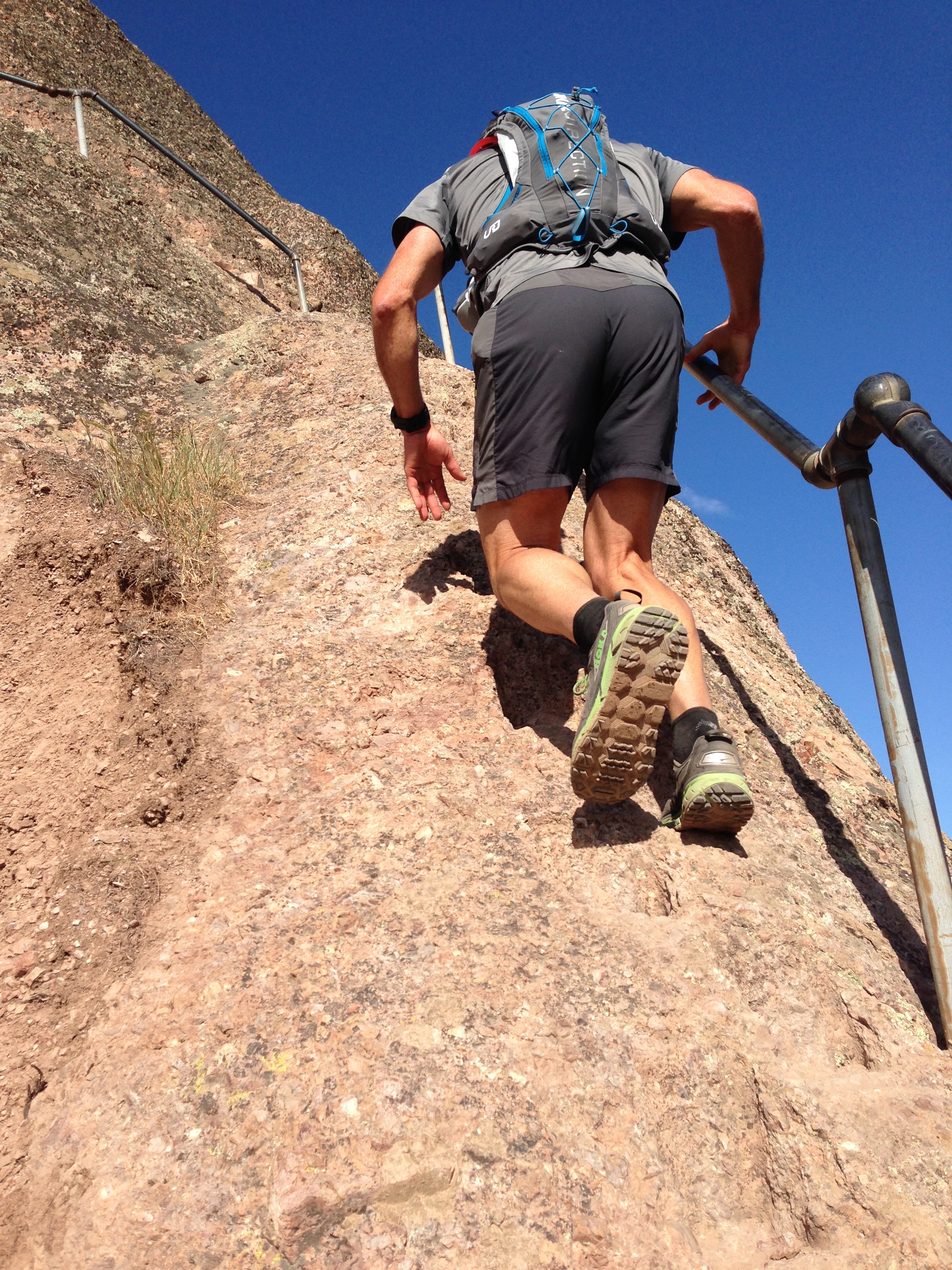
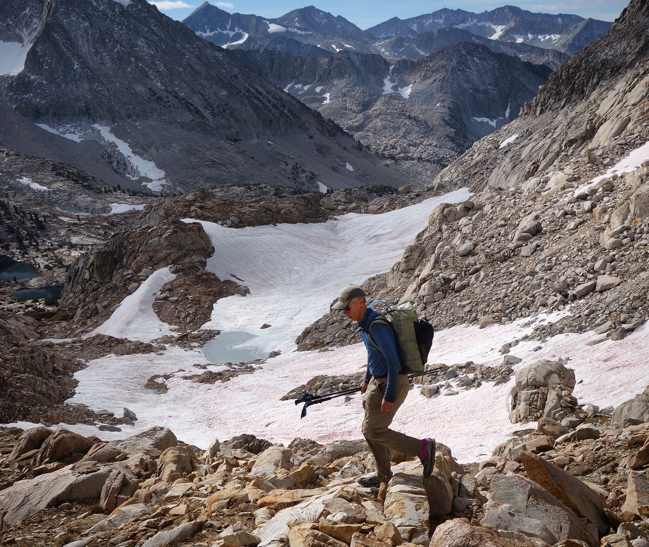
This is Glenn ascending the High Peaks trail. This portion of the trail is not really runnable.
There is a restroom at the upper junction of High Peaks and Juniper Canyon. The rocks here are amazing. Descend the High Peaks Trail, and be sure to turn right on the Rim Trial. This will allow you to do a continuous, non repetitive route. The Bear Gulch caves are sometimes closed due to flooding or to protect wildlife. If they are closed, you will need to go around on the Moses Springs Trail. Don’t accidentally take the Chalone Peak Trail!
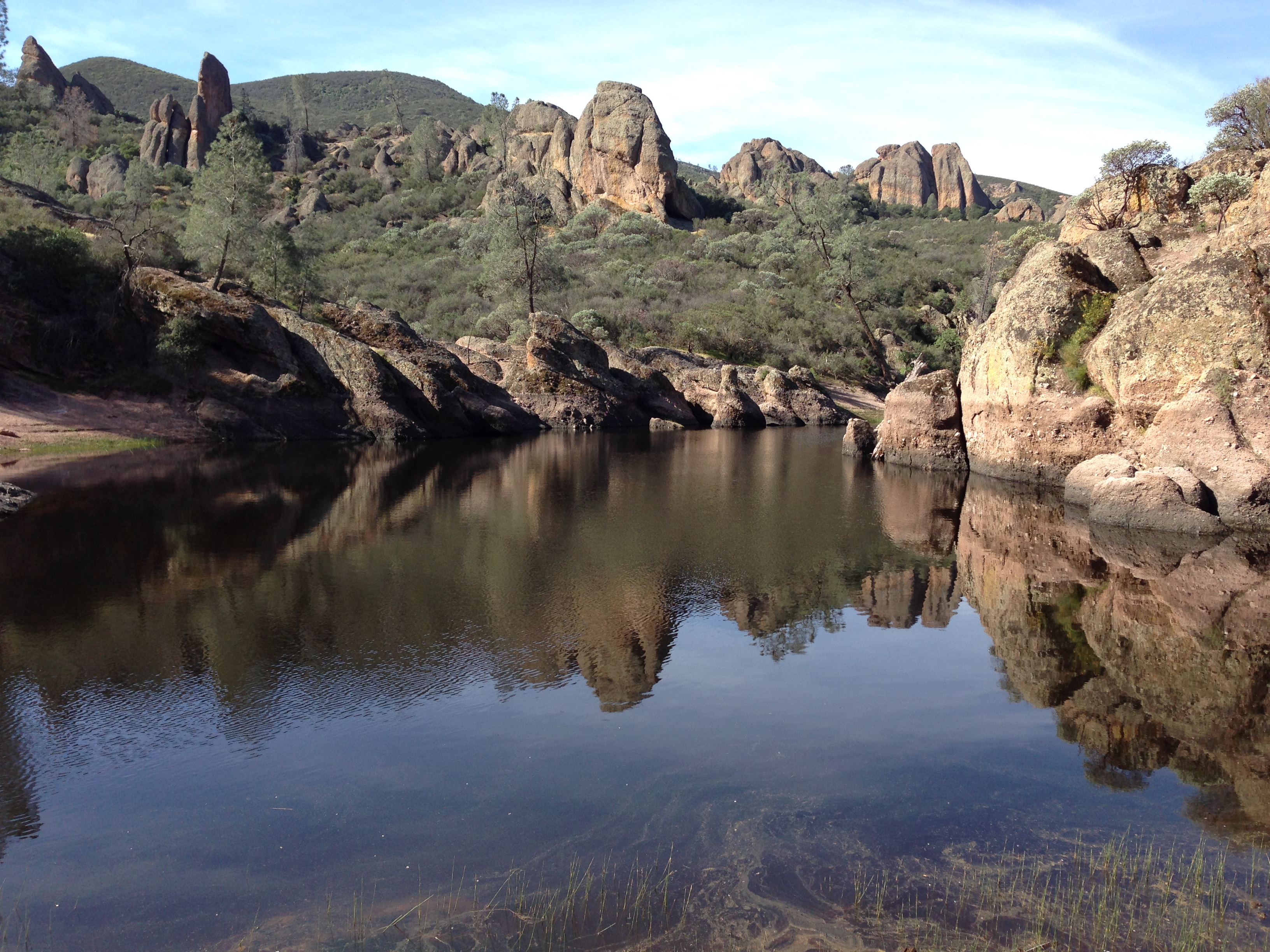
This is the Bear Gulch Reservoir. If you brought your Sawyer Mini Filter, this is a good chance to get some water (though there is usually water in the caves too)
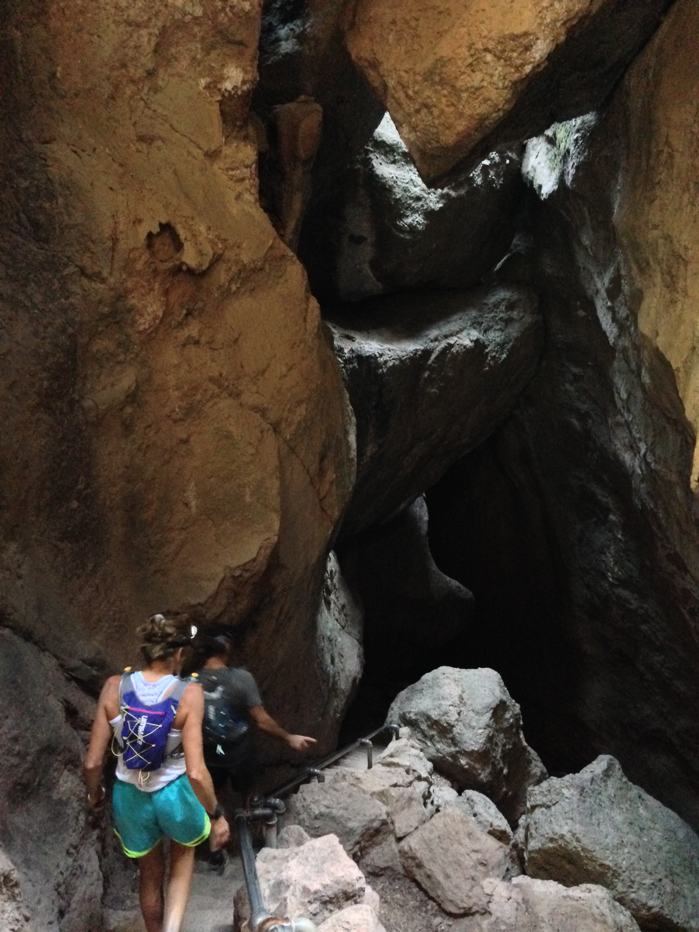
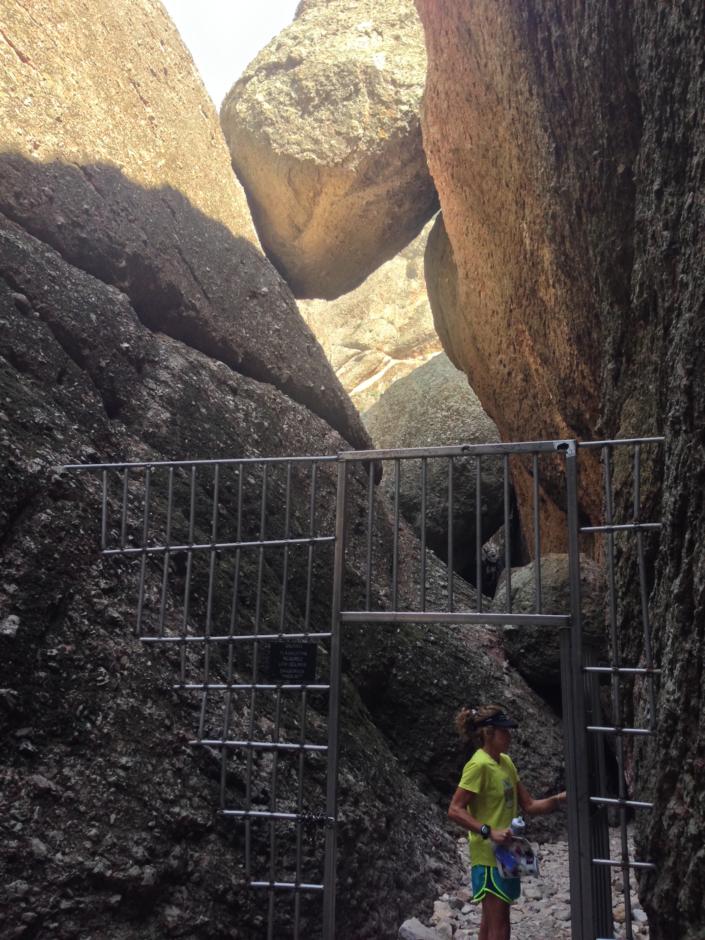
This is Bear Gulch Caves. Bear Gulch Caves are larger than the Balconies Caves.
Bear Gulch Caves. We were lucky: the caves were open when we arrived. A few minutes after we passed through, we heard from other hikers that they had locked the gates to the caves. You can still get around, but if your objective is to see the caves, you might want to check to see if they will be closed.
After exiting the caves, you will want to head down the lush trail towards the parking lot. There is a trail that parallels Pinnacles Road (on the left hand side) that takes you to the other parking area. In that lot, you will ascent the Condor Gulch trail. This trail isn’t too exciting, but it has a nice view point one mile in. Keep going, and you will hit the High Peaks Trail, where you want to turn right and descend. In the spring time, this side of the mountain is covered with wild flowers and oaks. It’s a stark contrast from the other regions you will visit on this run, and quite beautiful.
At the bottom, you can turn left at the Bench Trail (or if you’re out of water or need a restroom, head across the creek bed to the Chalone Creek Campground). The bench trail is flat, wide and easy. It will take you North until Old Pinnacles trail. If you need to bail out, this is your chance… Otherwise, split right on a narrow ribbon of trail called “North Wilderness Trail.” This trail is very narrow, somewhat overgrown (though not much poison oak). It is fairly flat and easy for the first 5 miles, but then suddenly ascends steeply for the next mile. After the steep ascent, it is rollers, and then descending back to the parking lot.
If you have the time, you can cot over on the Balconies trail making a “balloon on a string” loop via the Balconies Caves and the Balconies Cliffs trail. While you cannot run the caves portion, both sections of trail are worth a visit!
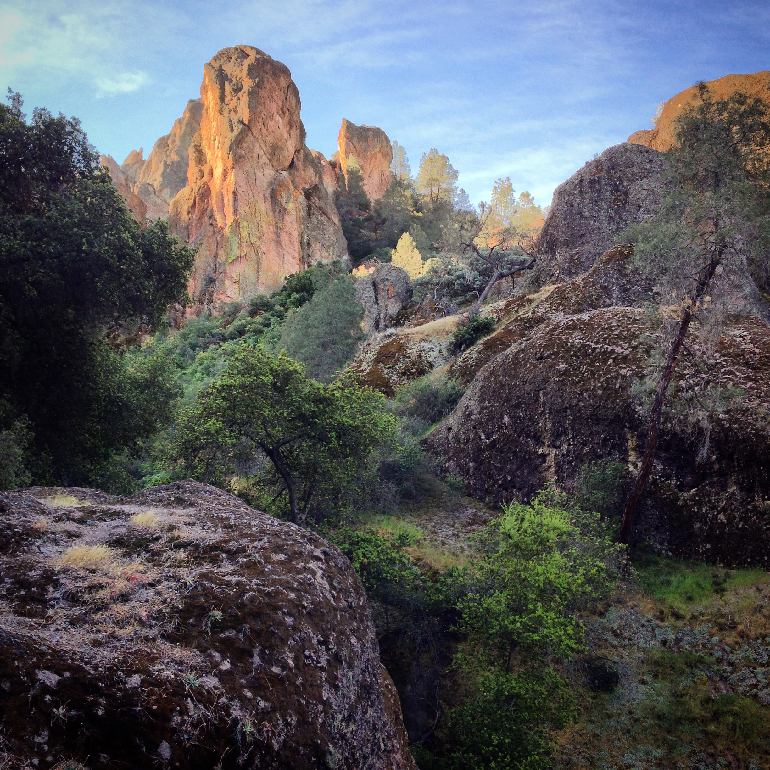
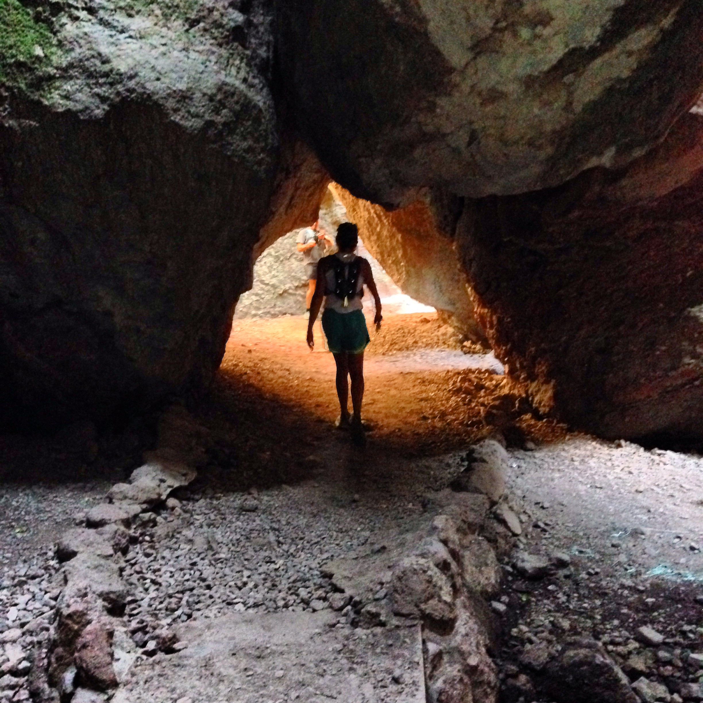
Balconies Caves