Muir Wilderness Fastpack
I had been wanting to do a solo fast pack, partly as preparation for the SHR that Leor and I want to do this summer. The initial inspiration for this route came last week while Janet and I were slow-packing in Kings Canyon. We were studying the map of nearby areas, and saw “Hell For Sure Lake.” We both thought, “what a name!” Given the number of lakes and the elevation in the area, I knew it had potential to be a beautiful spot, so I plotted a route that made use of as many trails as possible. One trail ends at Horsehead Lake, and I felt that it made logical sense to make a loop by connecting the trail at that lake to “Hell For Sure pass.” My Google Earth 3D view revealed a possible way to make the connection, and to visit the summit of Mount Hutton. In the end, the extra effort to visit Mount Hutton was definitely worth it! If I were to recommend to a friend, though, I’d suggest 2 improvements on the route. I was trying to achieve an entirely class-2 route. My suggestions would be:
1) Go over the top of the hump that immediately precedes the pass before Mount Hutton. Don’t go on the back-side like I did.
2) Keep traversing West before heading up. If you ascend from the South West side of Hutton, you will find that the terrain is quite easy. Otherwise, follow my GPS track as provided above.
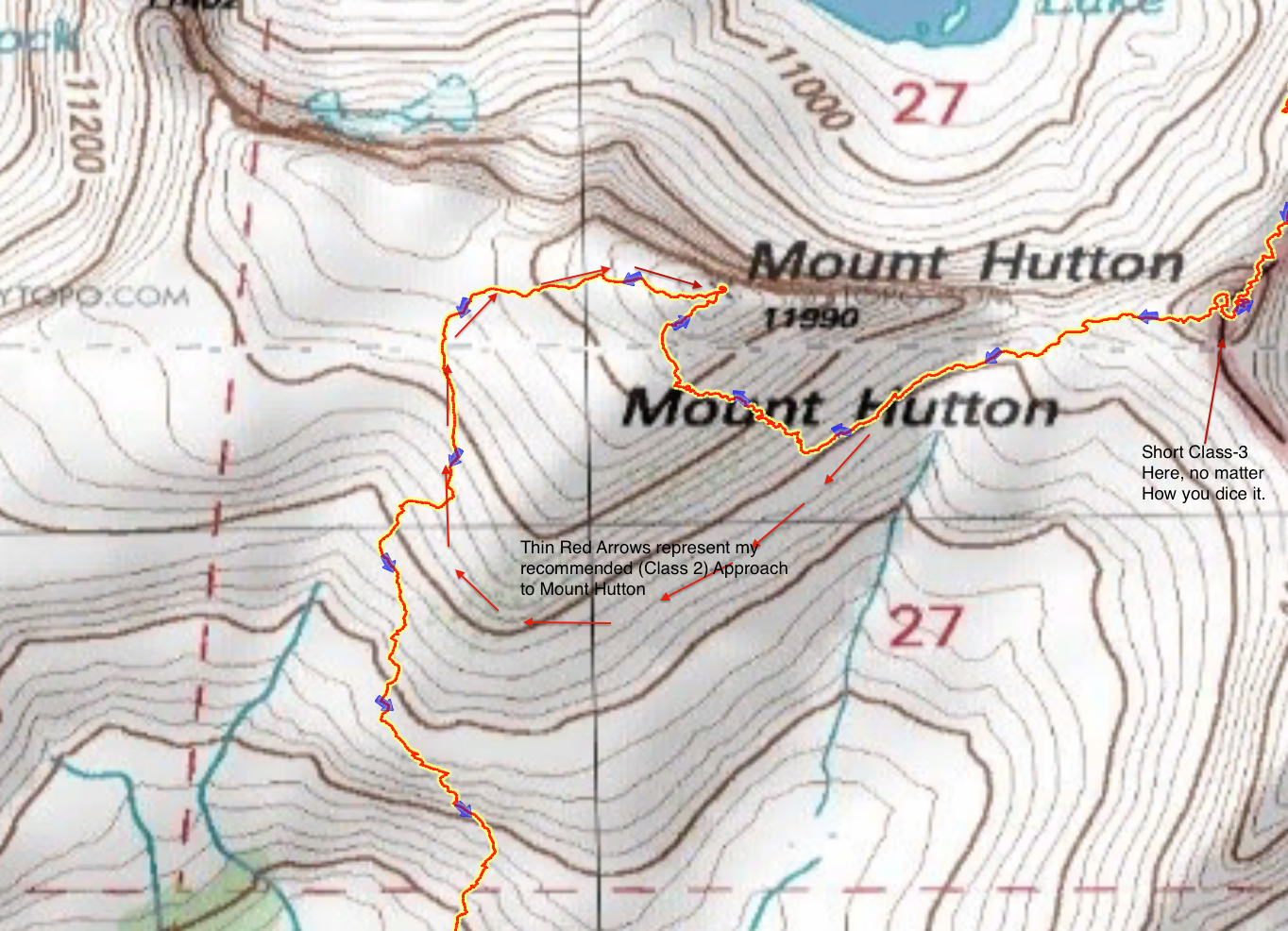
Map detailing changes I may have made to the Mount Hutton Approach
GPS Track for Day 1 of this route
GPS Track for Day 2 of this route
GPS Track for Day 3 of this route
Hutton was probably the highlight of the trip. Other highlights were the beauty of Horsehead lake – especially as sun set, and the “almost” summit of what I called “Triangle Peak.” When viewed from the meadow just below Portal Lake, “Triangle Peak” perfectly obscures (much larger) Finger Peak. Because of it’s shape, it immediately appealed to me as an ascent. Unfortunately, I had already put in about 30 vertical feet of exposed class-4 moves, and was unwilling to risk the last 20 feet. Nevertheless, I much enjoyed the experience.
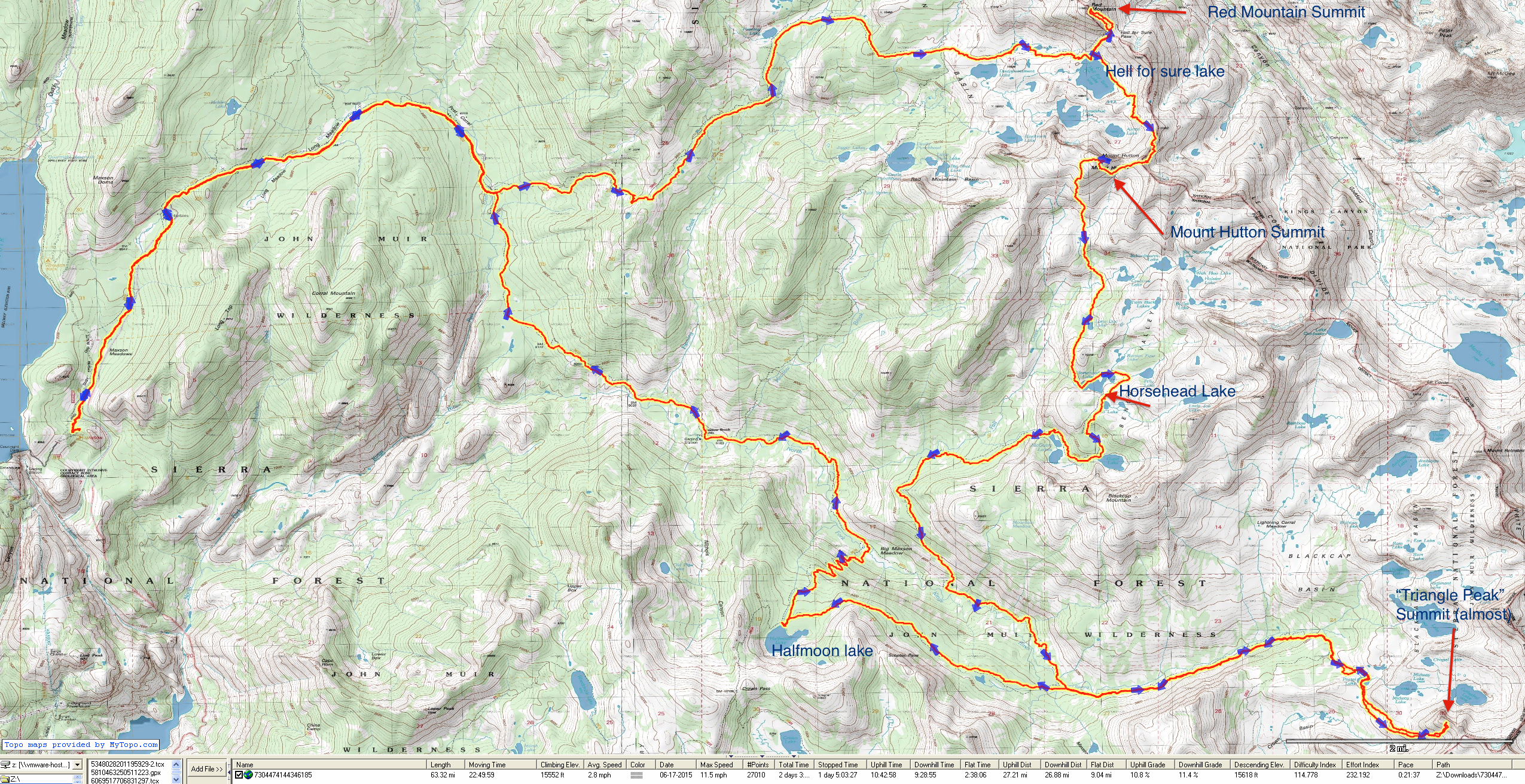
Overview of the Muir Wilderness Loop
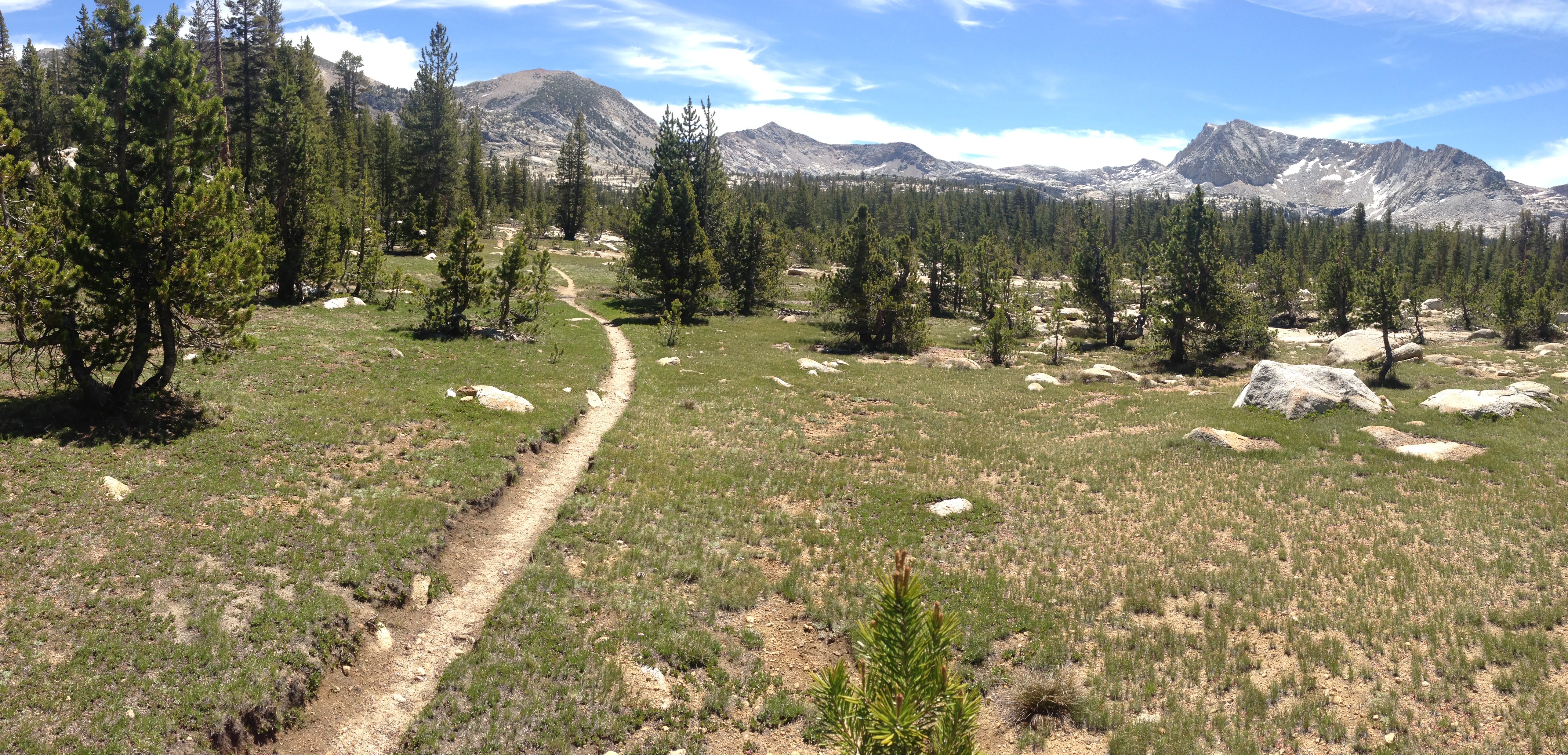
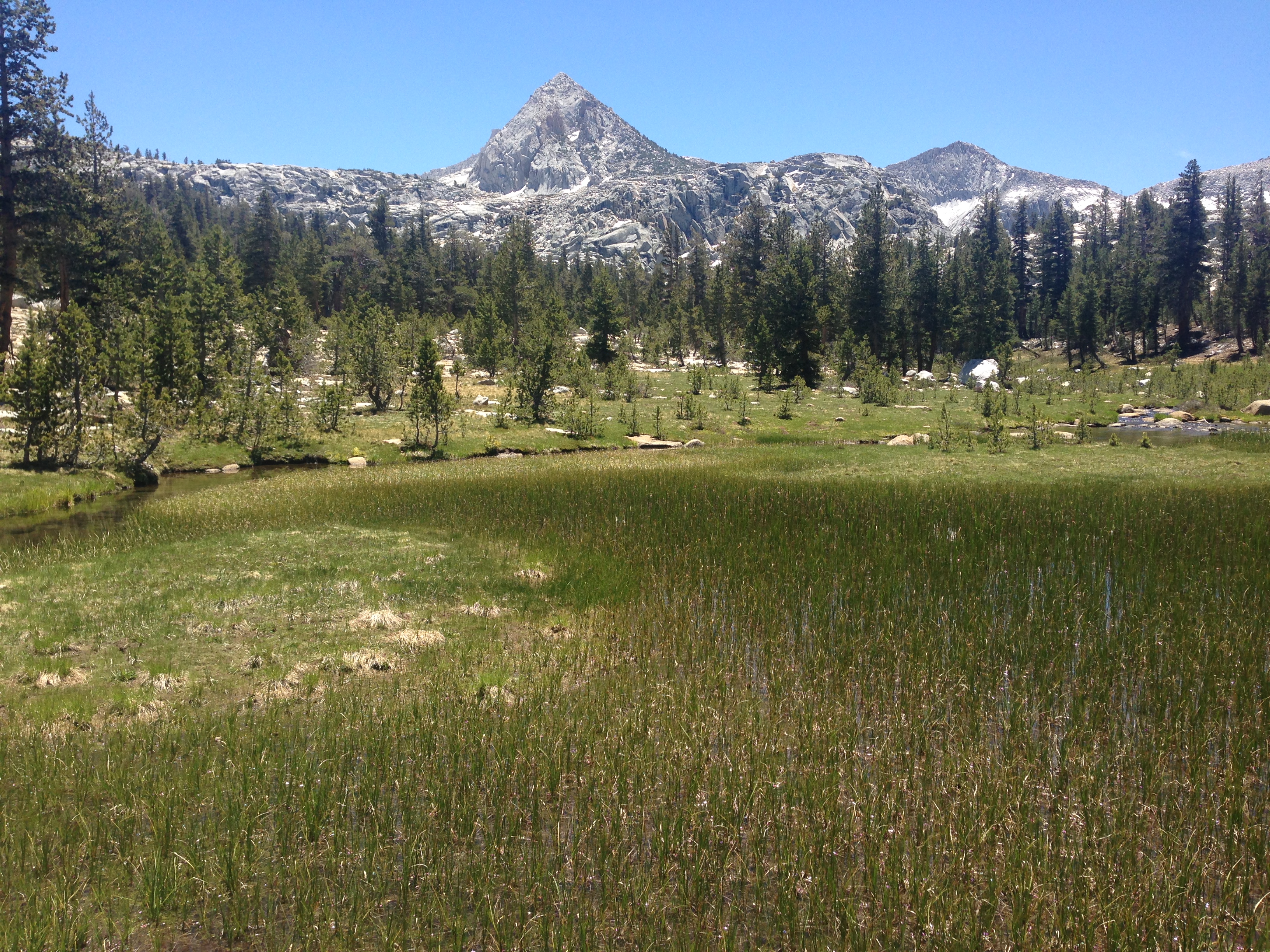
This is the view of Long Meadow Valley. It’s only a few miles from the parking lot, and you’re alread in great scenery such as this!
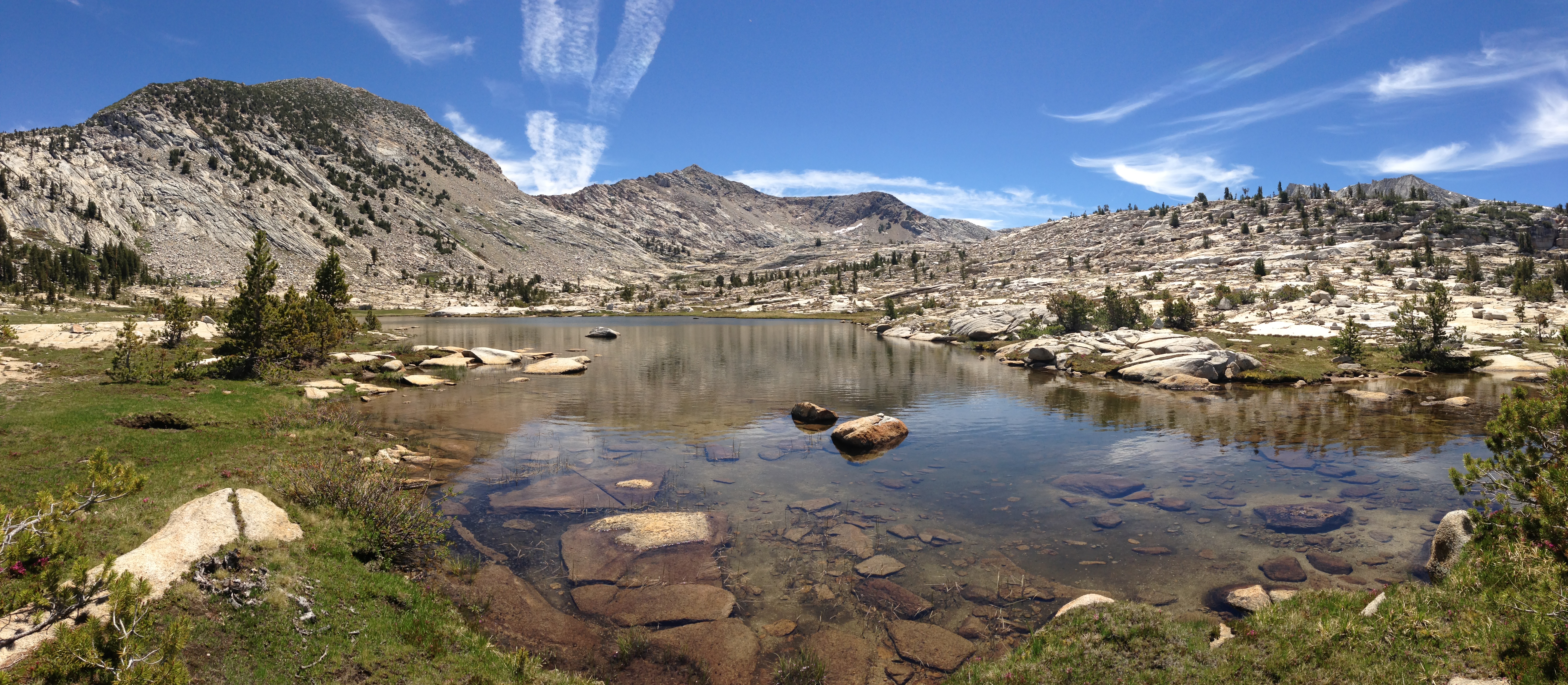
This is the view from the unnamed lake just below “Hell For Sure Lake.” What a strange, and inappropriate name for this lake! On the left, you can see Red Mountain. On te far right, poking up, you can see Mount Hutton. I climbed both of these today, using a traverse seen in the GPS track that involved coming back down to the lake.
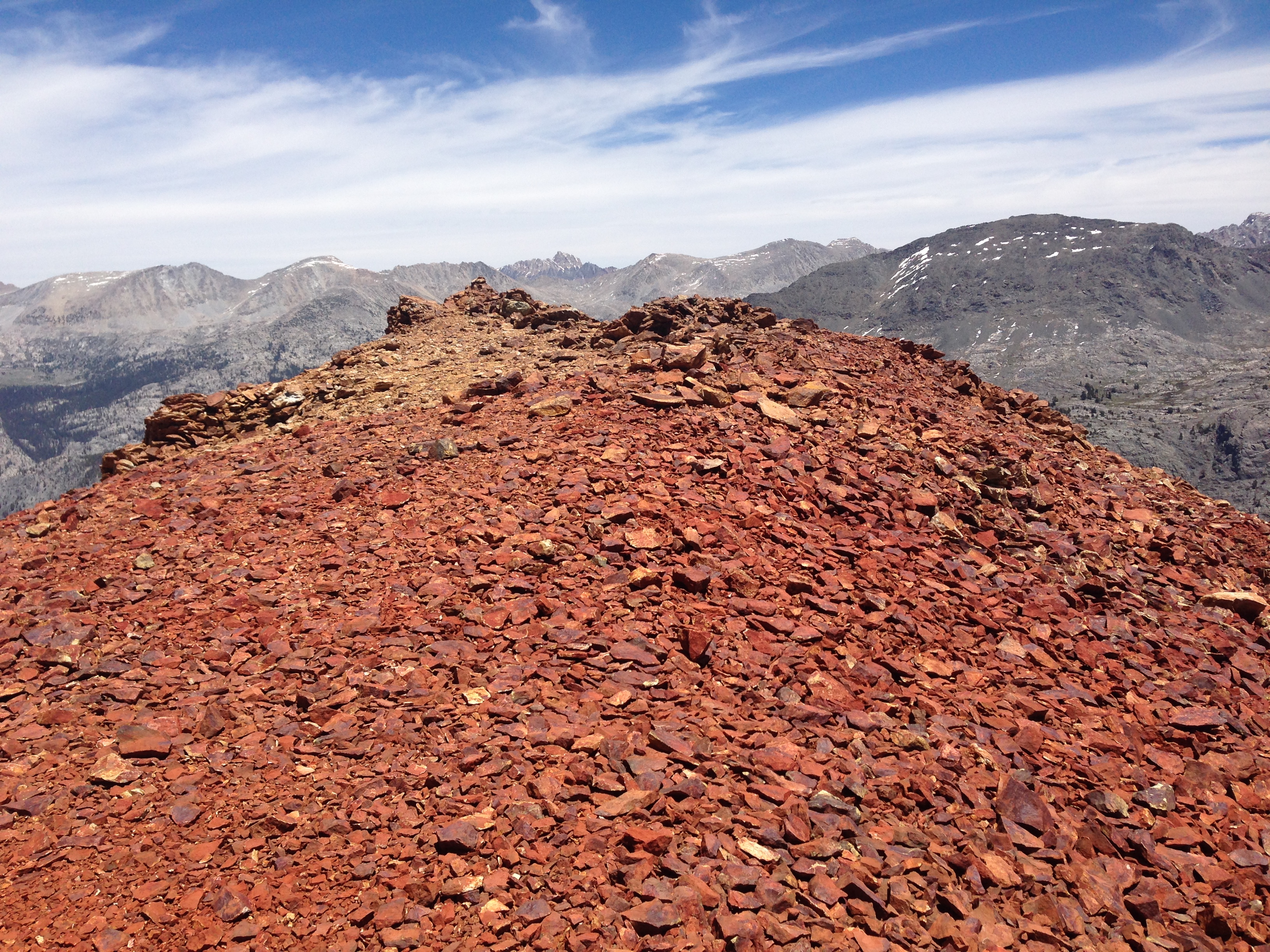
This is the view looking North East from Red Mountain. Now you can see how it got it’s name. There isn’t an official trail to the top from “Hell for sure pass,” But others have kind of made a rough set of paths that you can follow. It’s not that far off the regular trail.
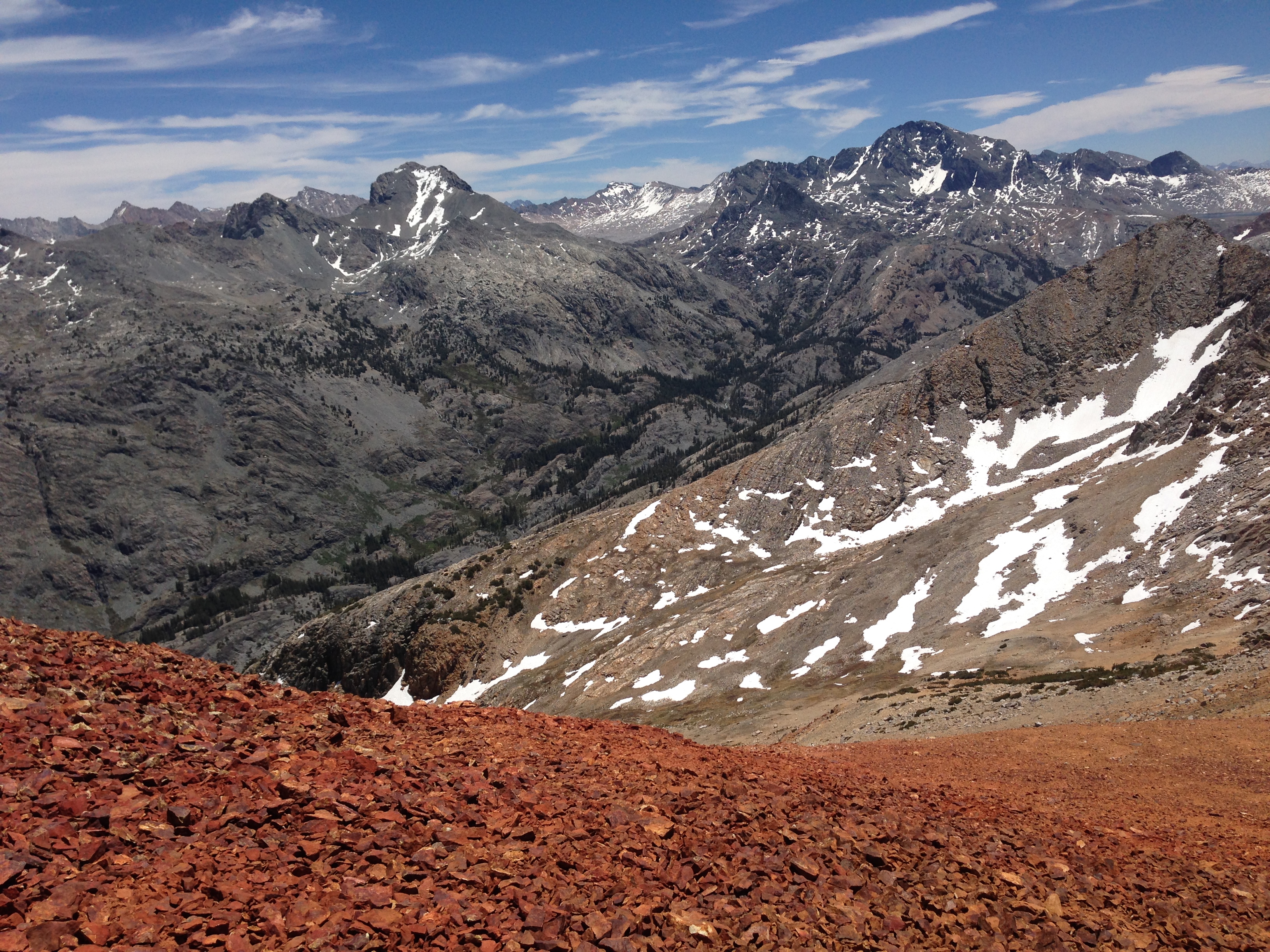
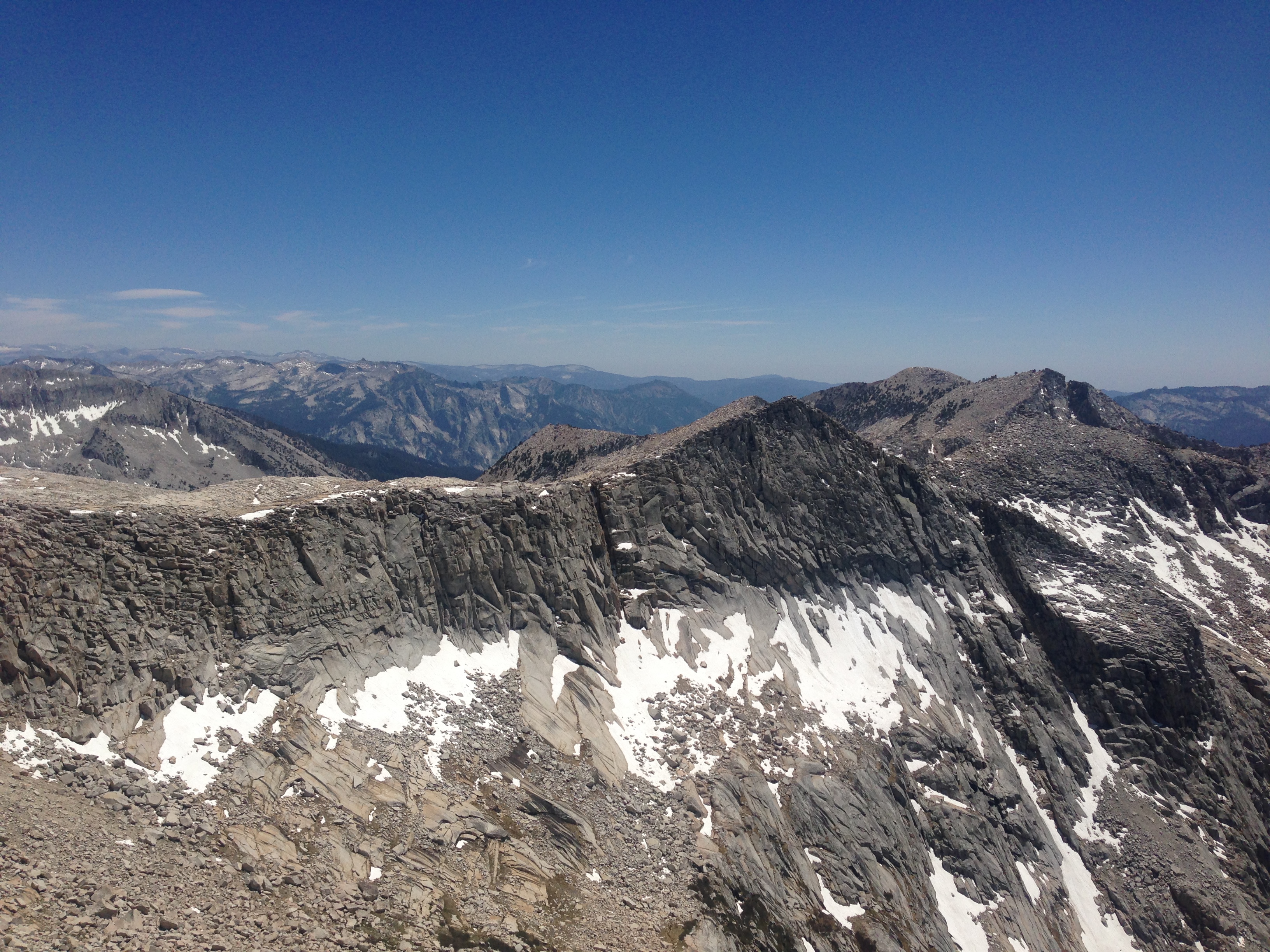
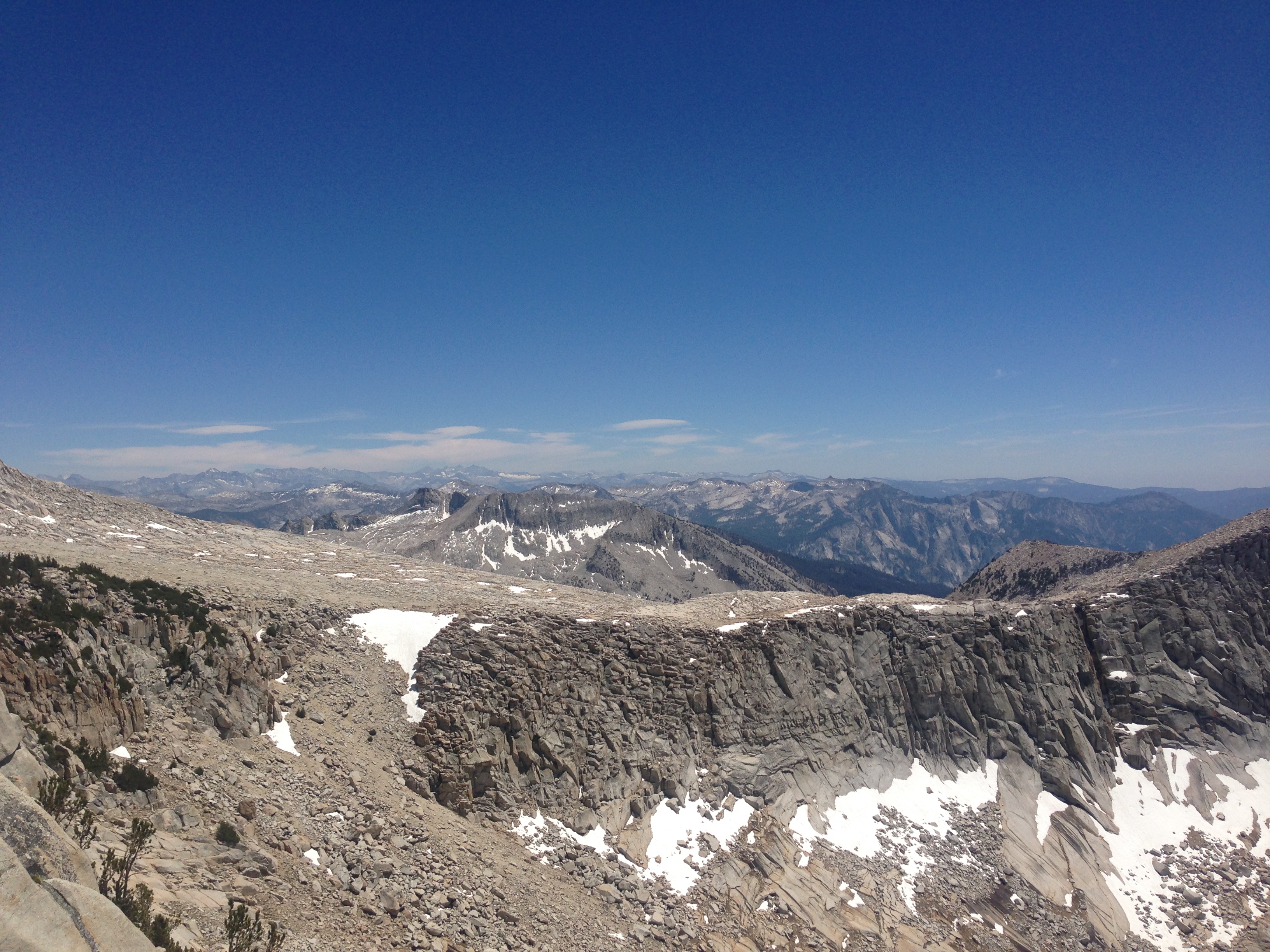
Wow! There are a lot more mountains left to explore from here! I love the way the background mountains contrast with the red.
Mount Hutton is the pointy peak – my 2nd objective of the day.
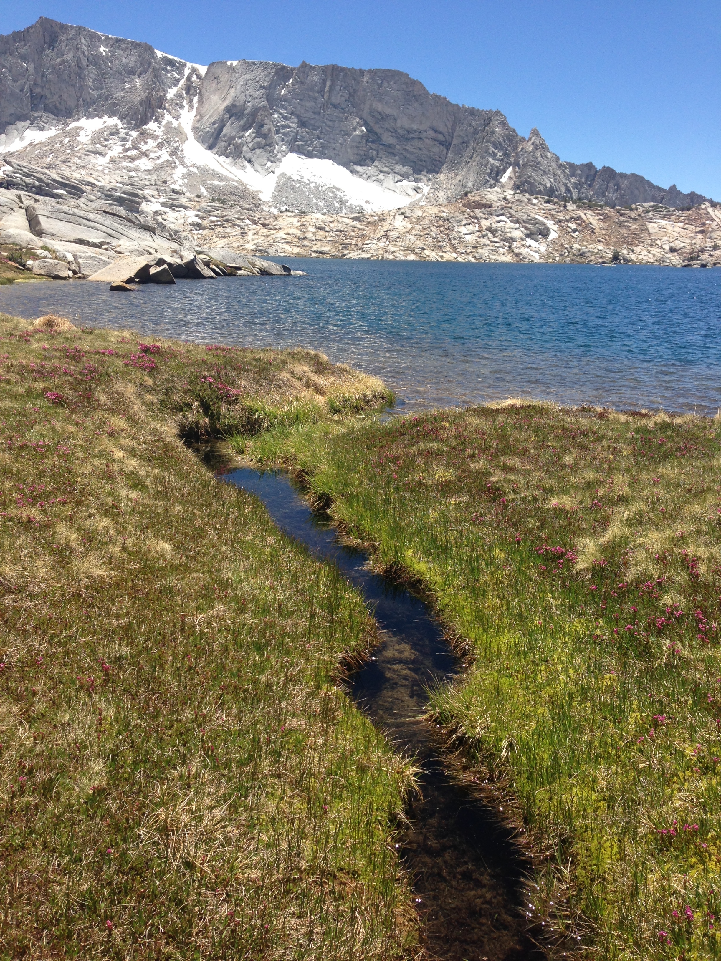
There are a lot of these clear rivulets in which you can usually see fish swimming quickly.
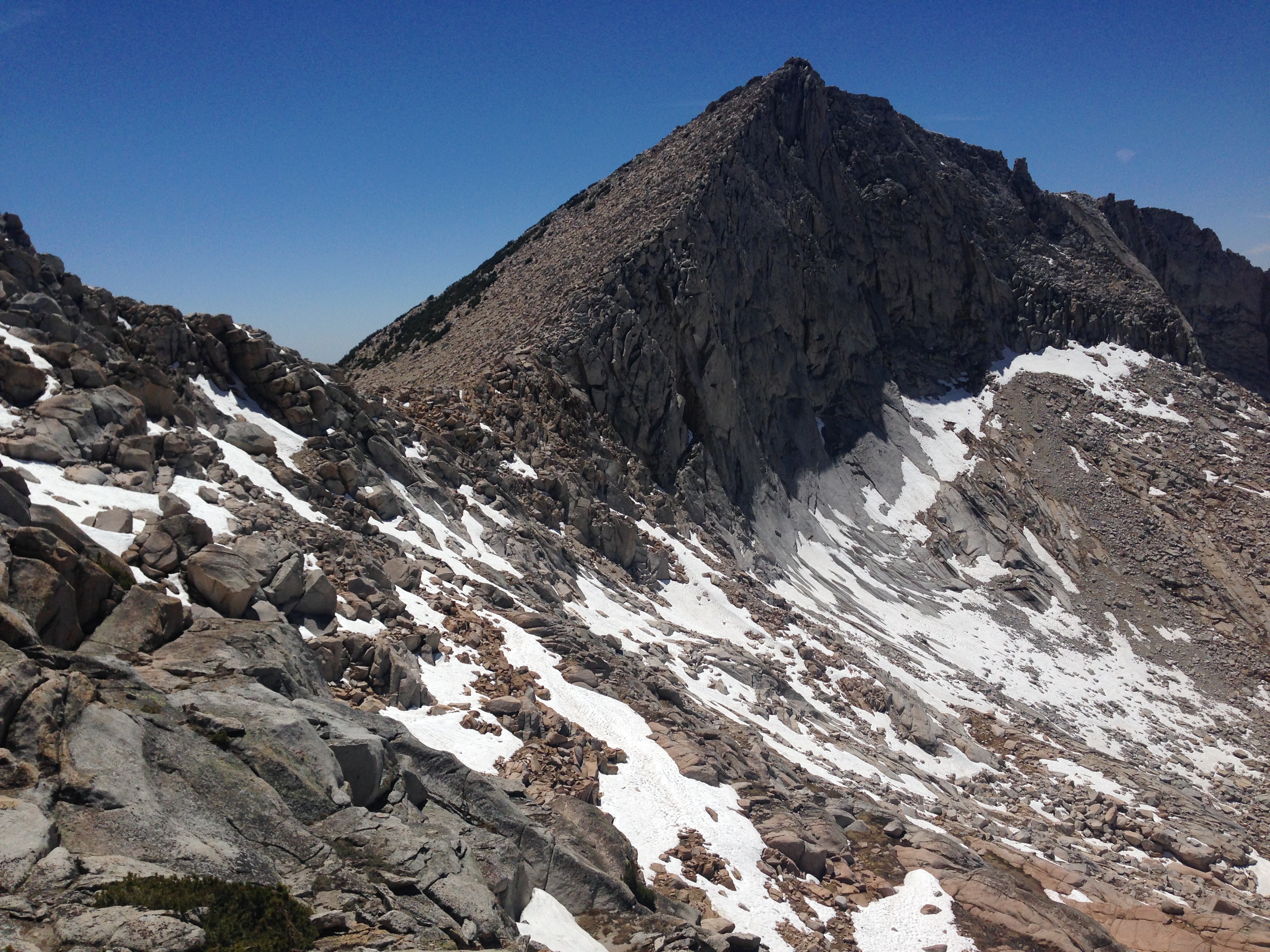
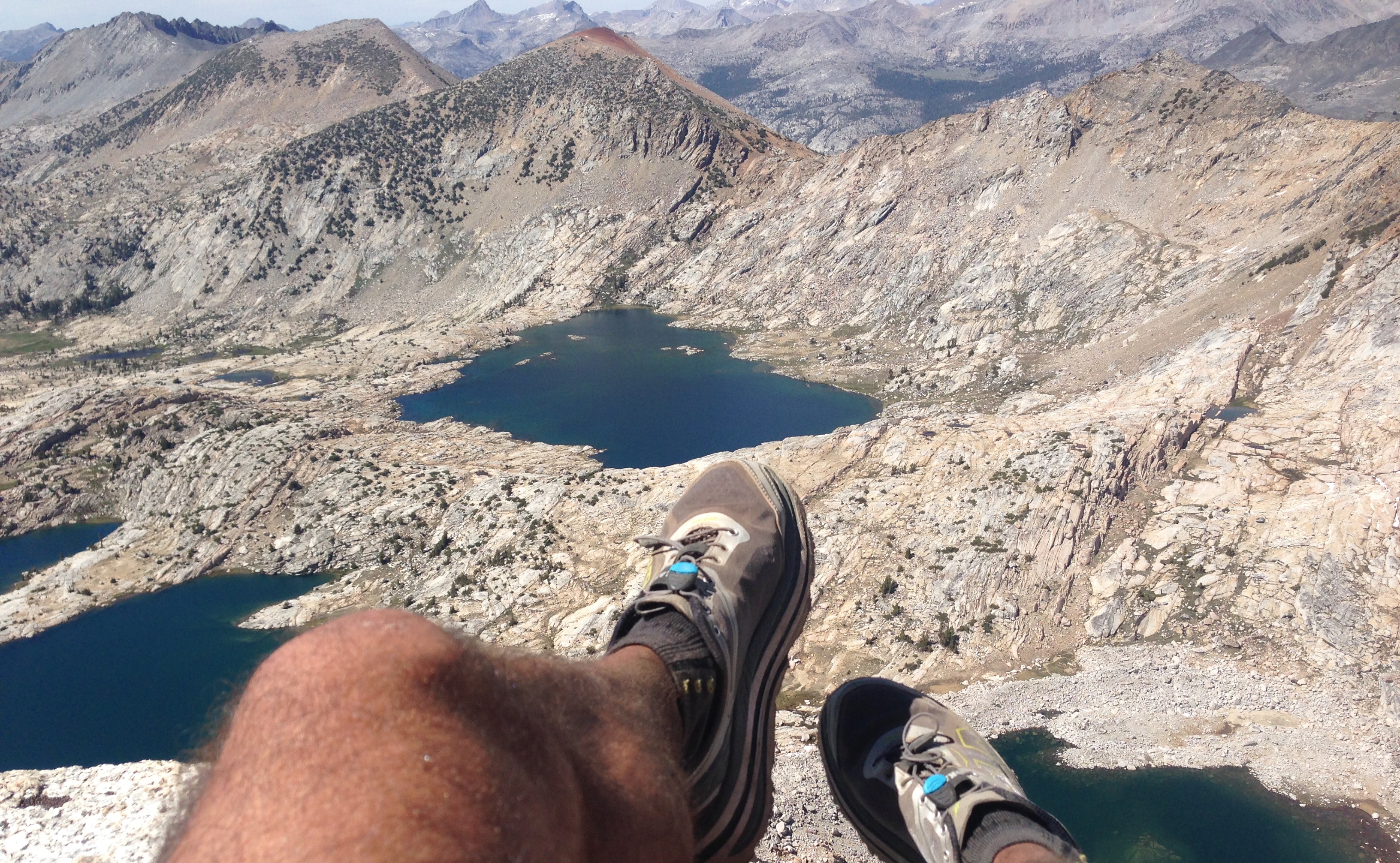
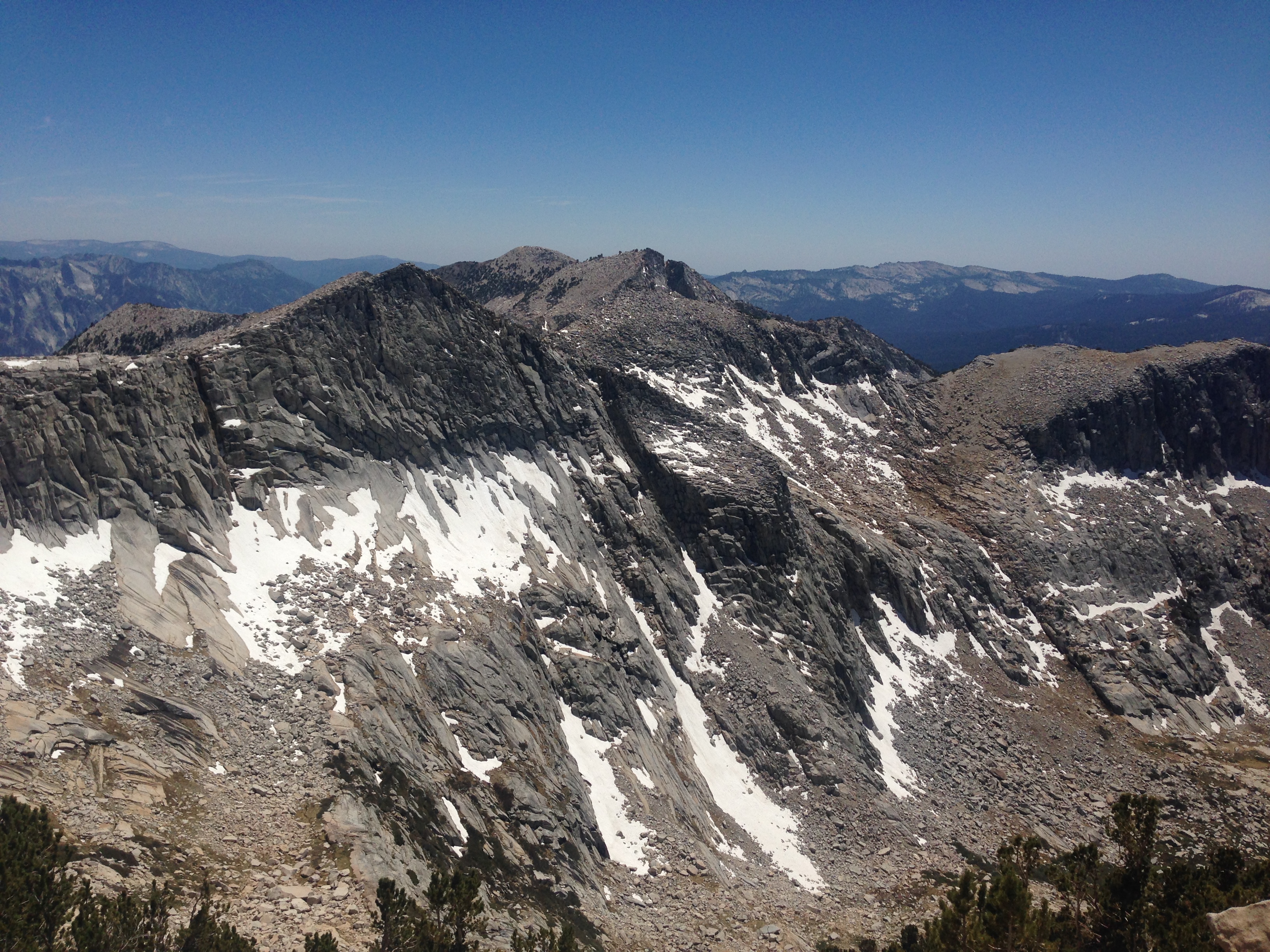
Mount Hutton – you can see from this angle that it is like a mini half dome. It was quite exhilarating. The approach from Hell For Sure was the right one. I was able to walk almost the entire way. There is a knob that you reach just before (previous to) where this picture was taken – and if you decide to do it, I’d recommend going over instead of around the back-side like I did. I think the entire route could be class-2 if you go over the top. I found myself in a class 3 situation going around back.
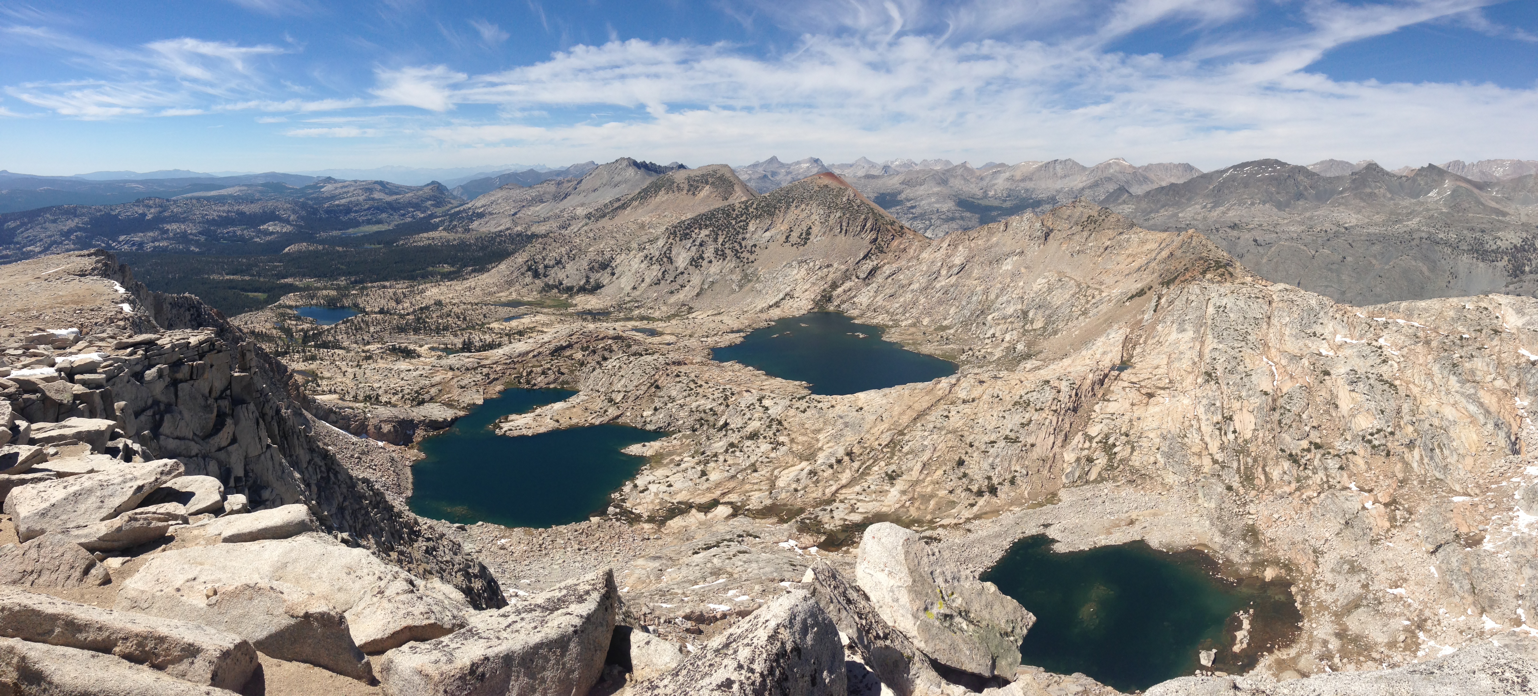
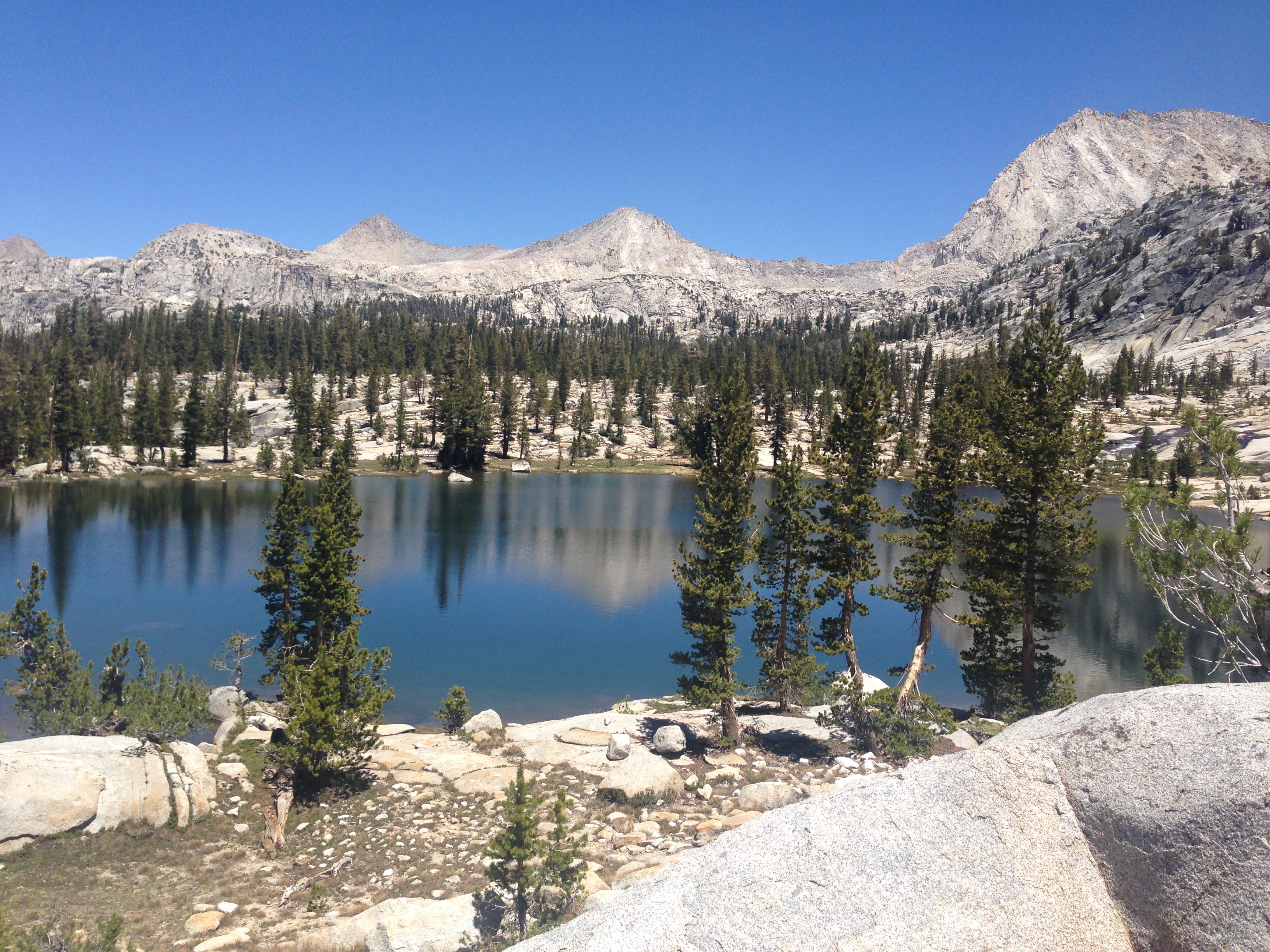
I like this angle because you can see all 3 named lakes (from left to right: Alpine, Horseshoe, and Hell For Sure.
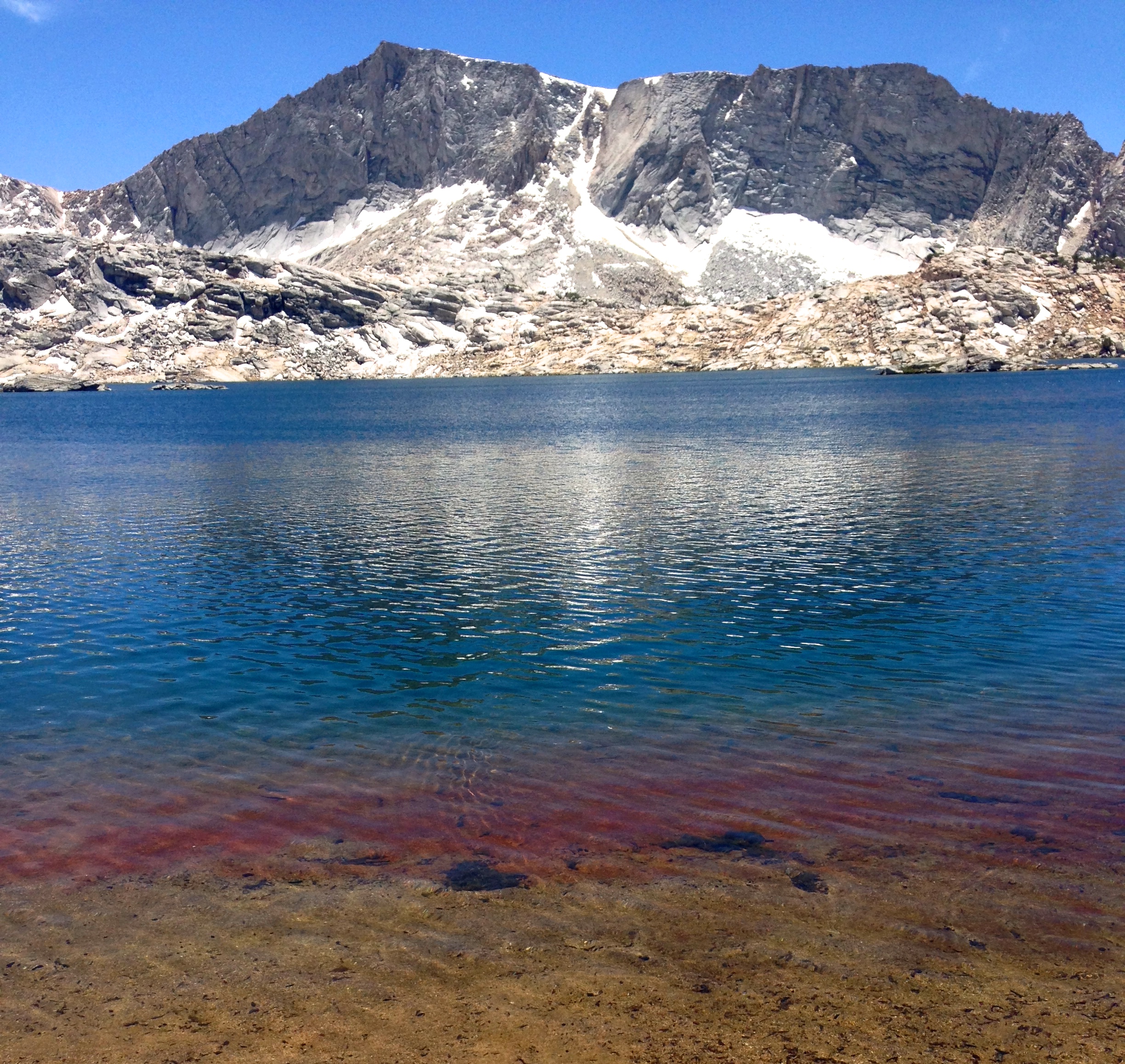
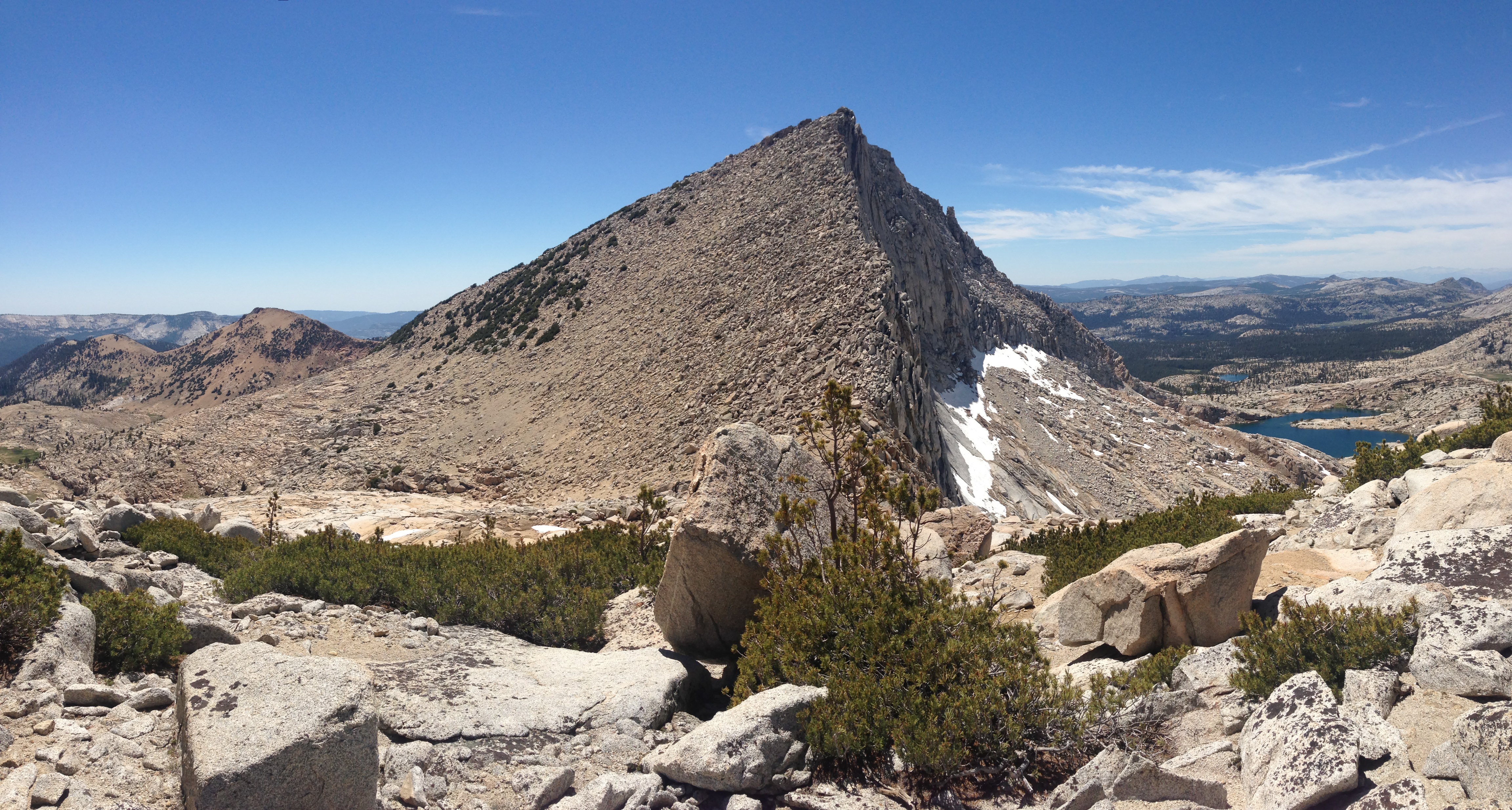
I like this angle because you can see how sheer the face of Mount Hutton is.
You can see Red Mountain in the distance.
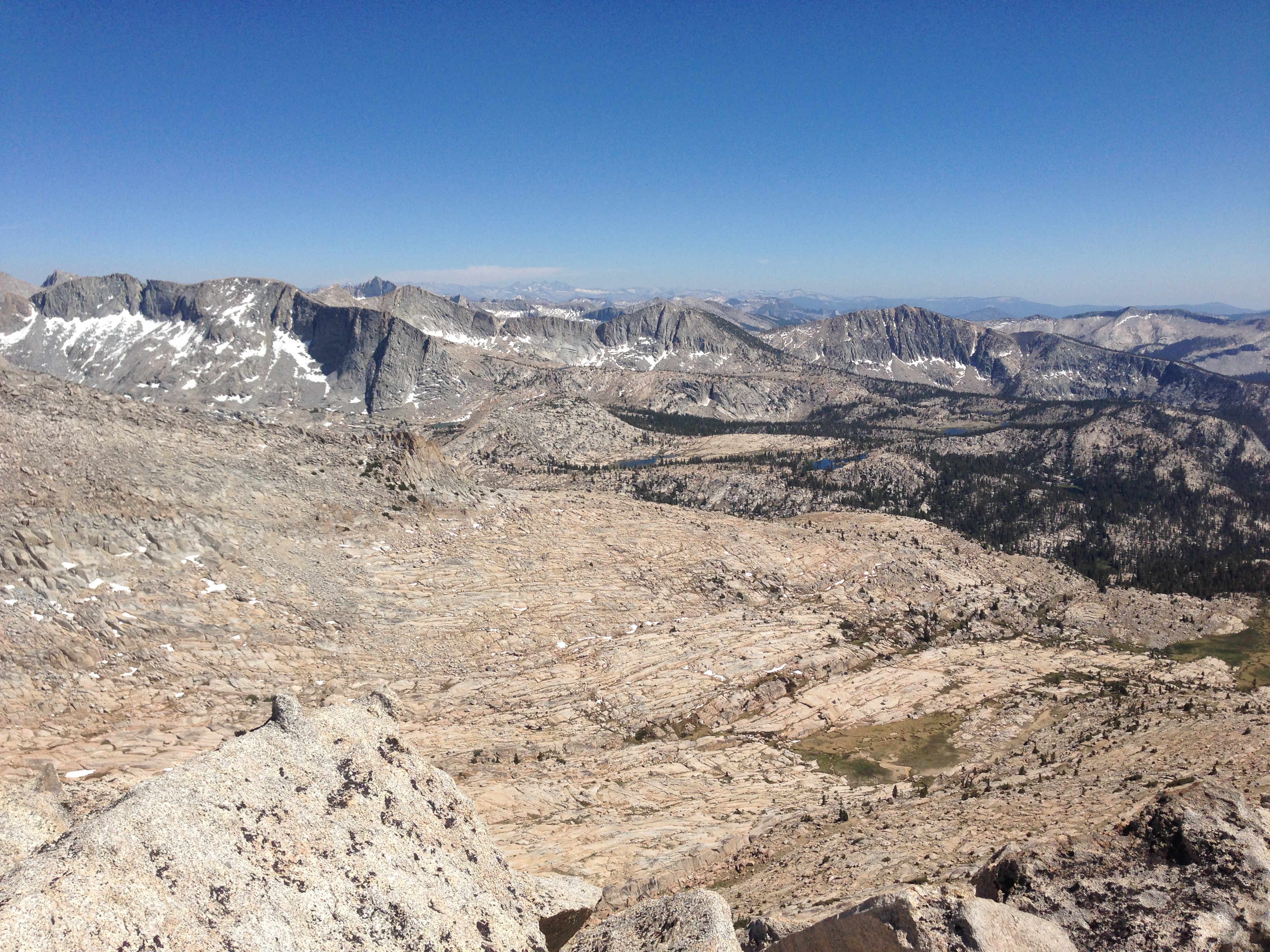
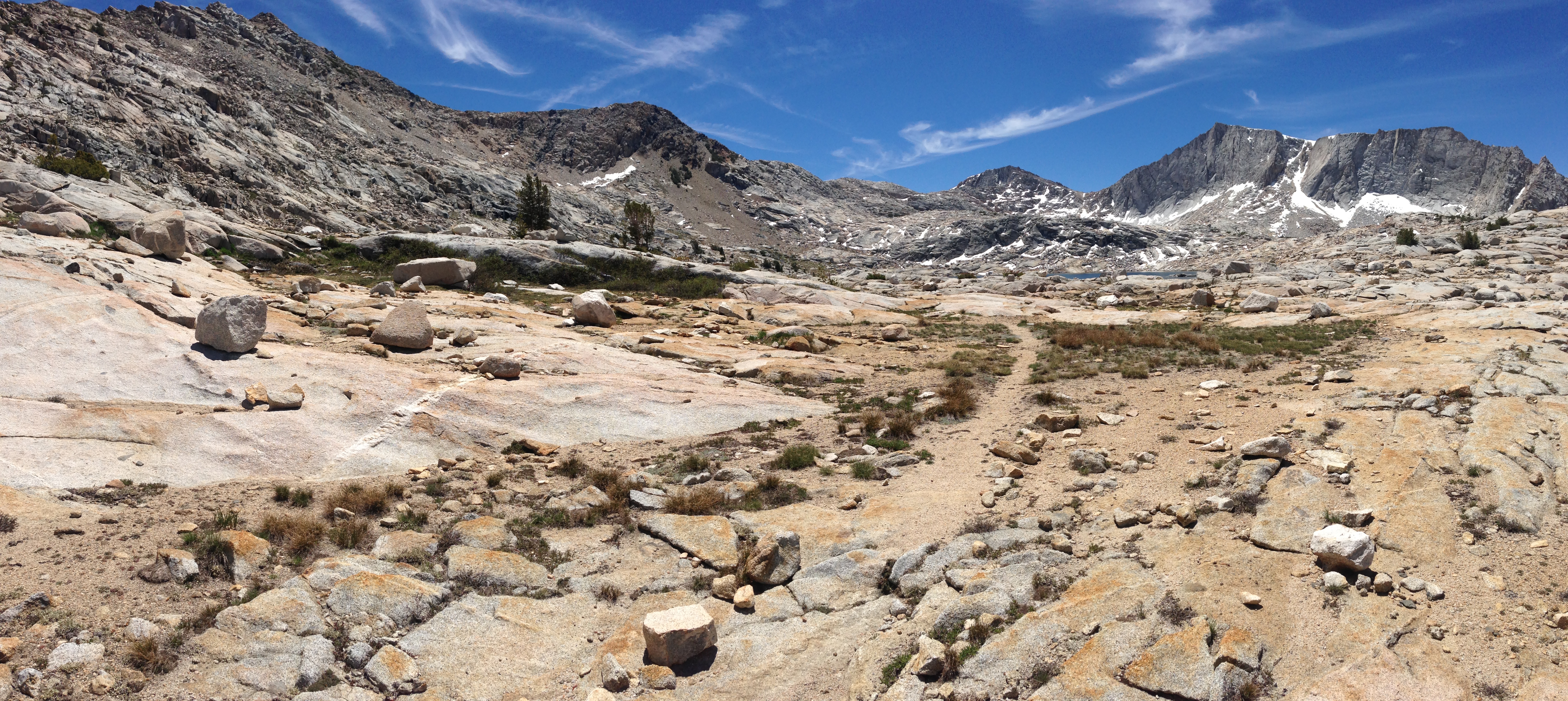
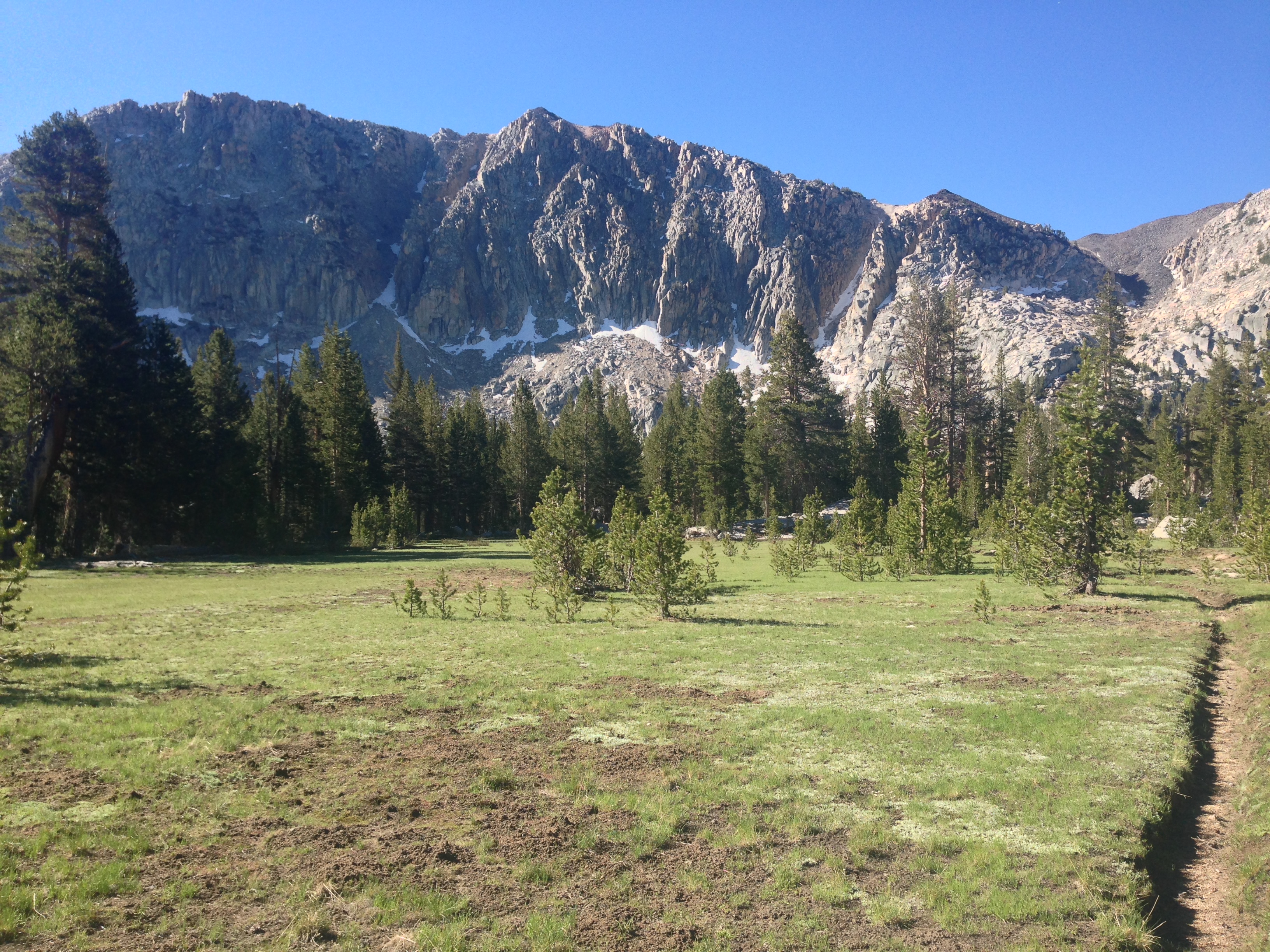
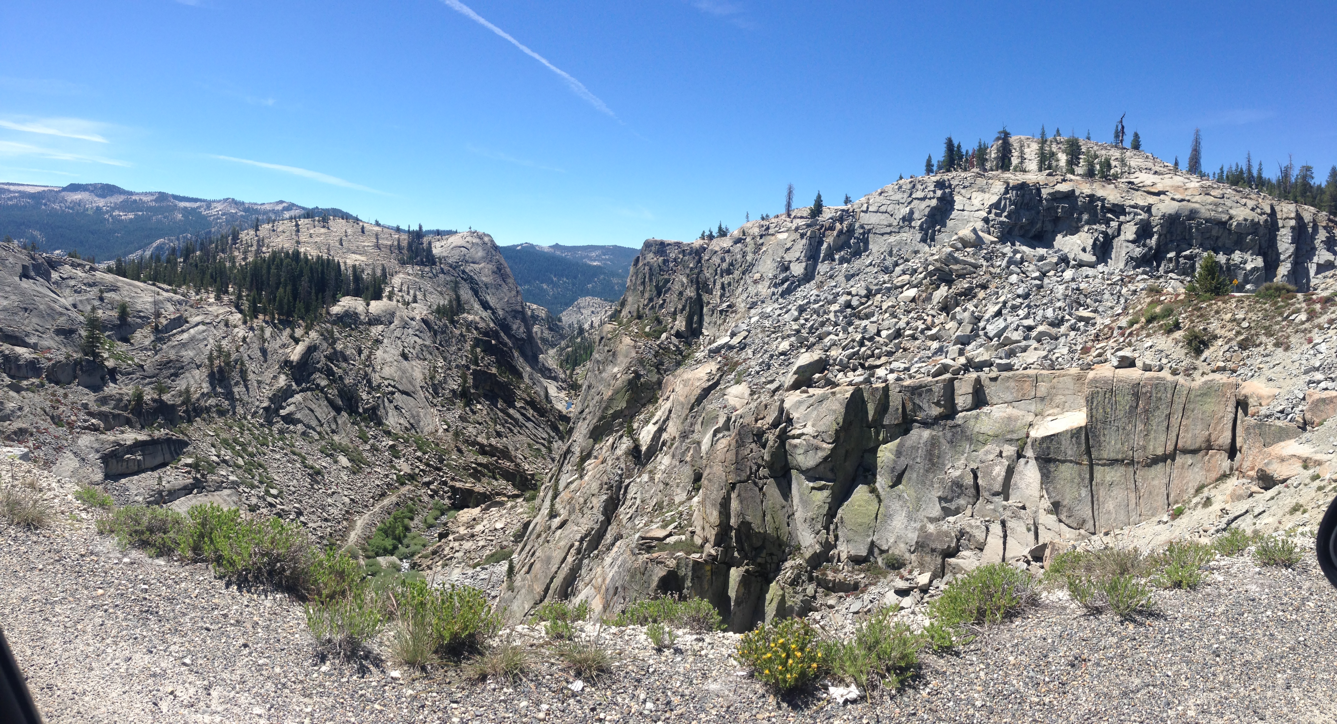
The rest of the route to Horsehead lake and beyond

I was quite relieved to see this! A total walk down on the other side of Hutton! If you want to ascend Hutton, I’d recommend traversing farther than I did at the bottom and then coming up this side – it would be easier and safer. This descent was a real treat!
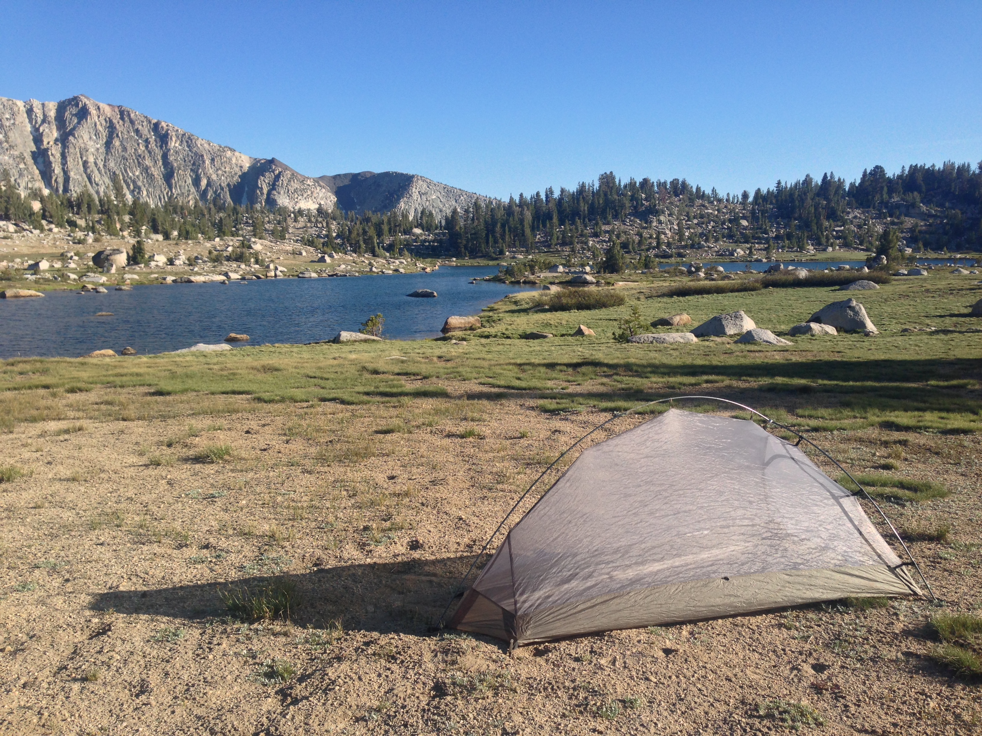
Horsehead Lake has some perfect camping! It’s at 10,300’ and if you approach it from the other side, there is a trail. The only negative was the abundance of mosquitos, which is a given at this time of year.
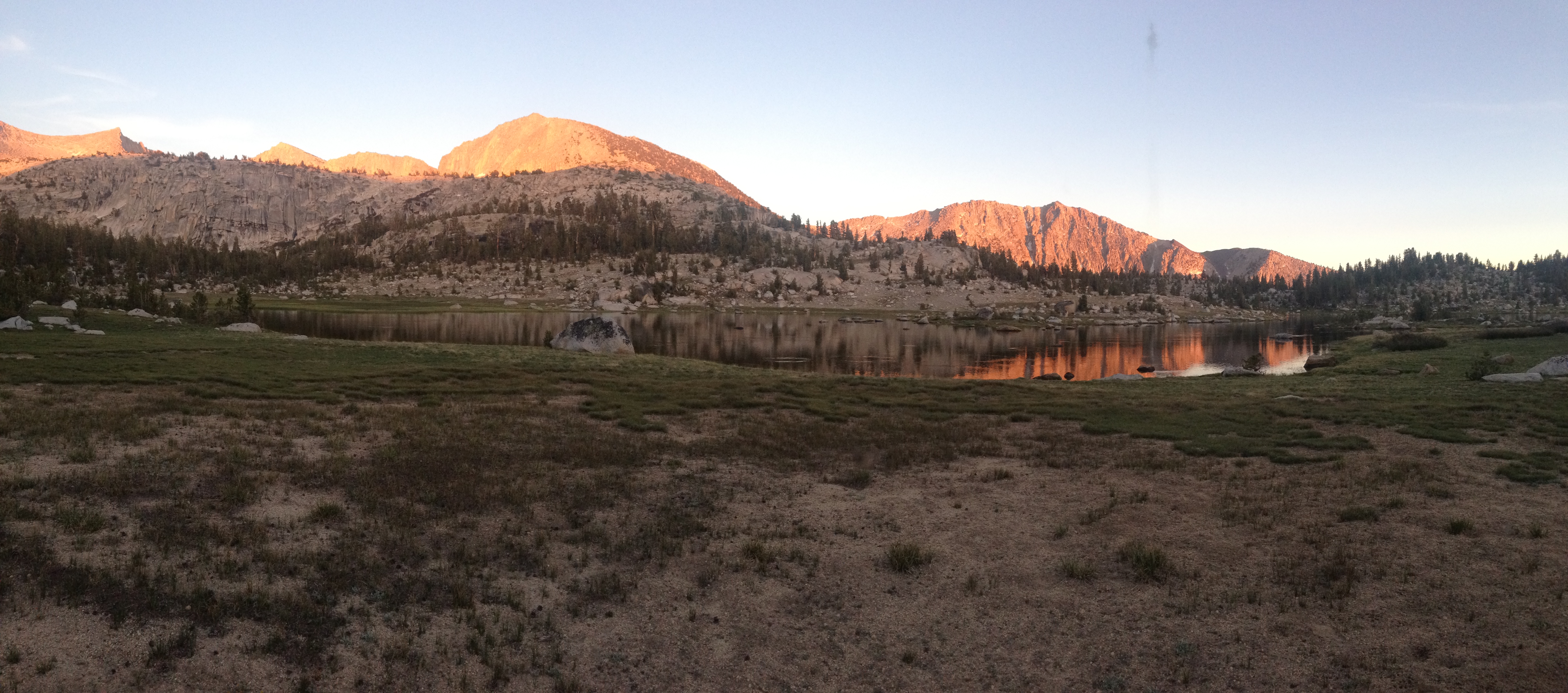
Horsehead Lake sunset
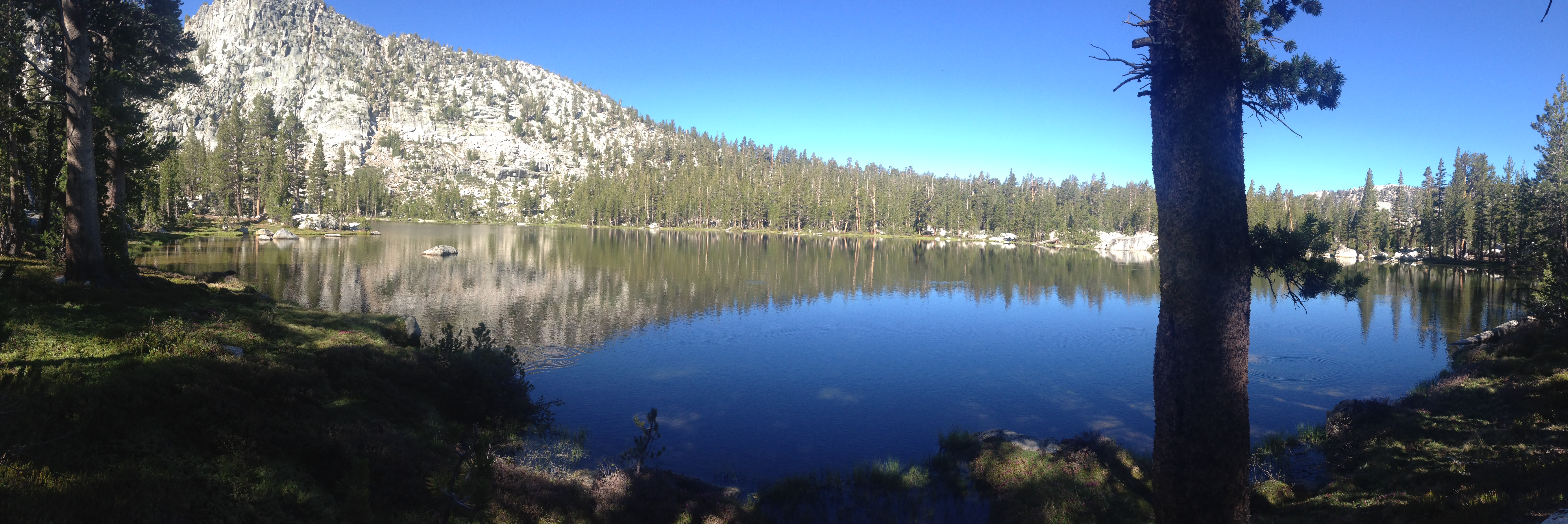
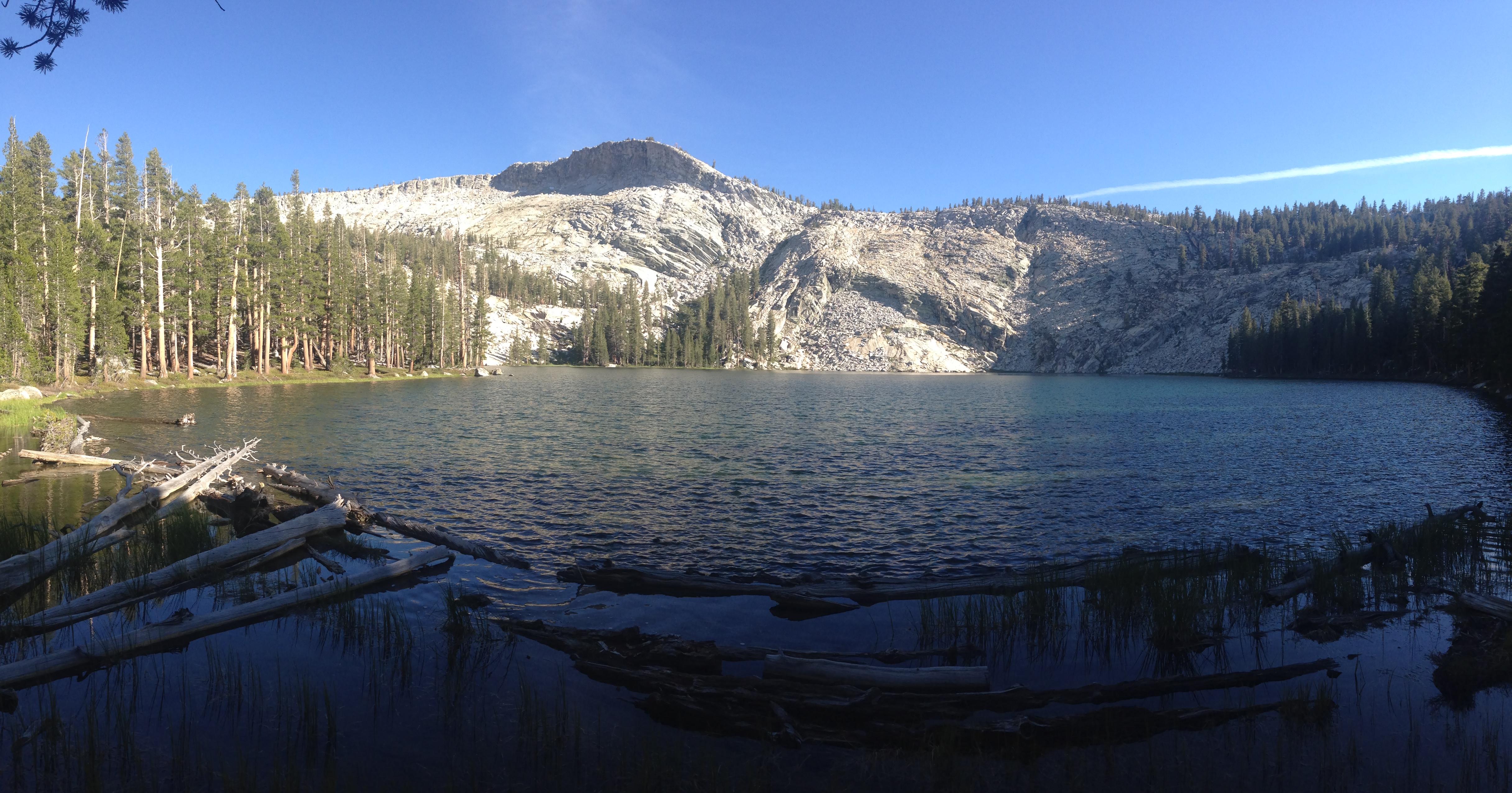
McGuire Lake
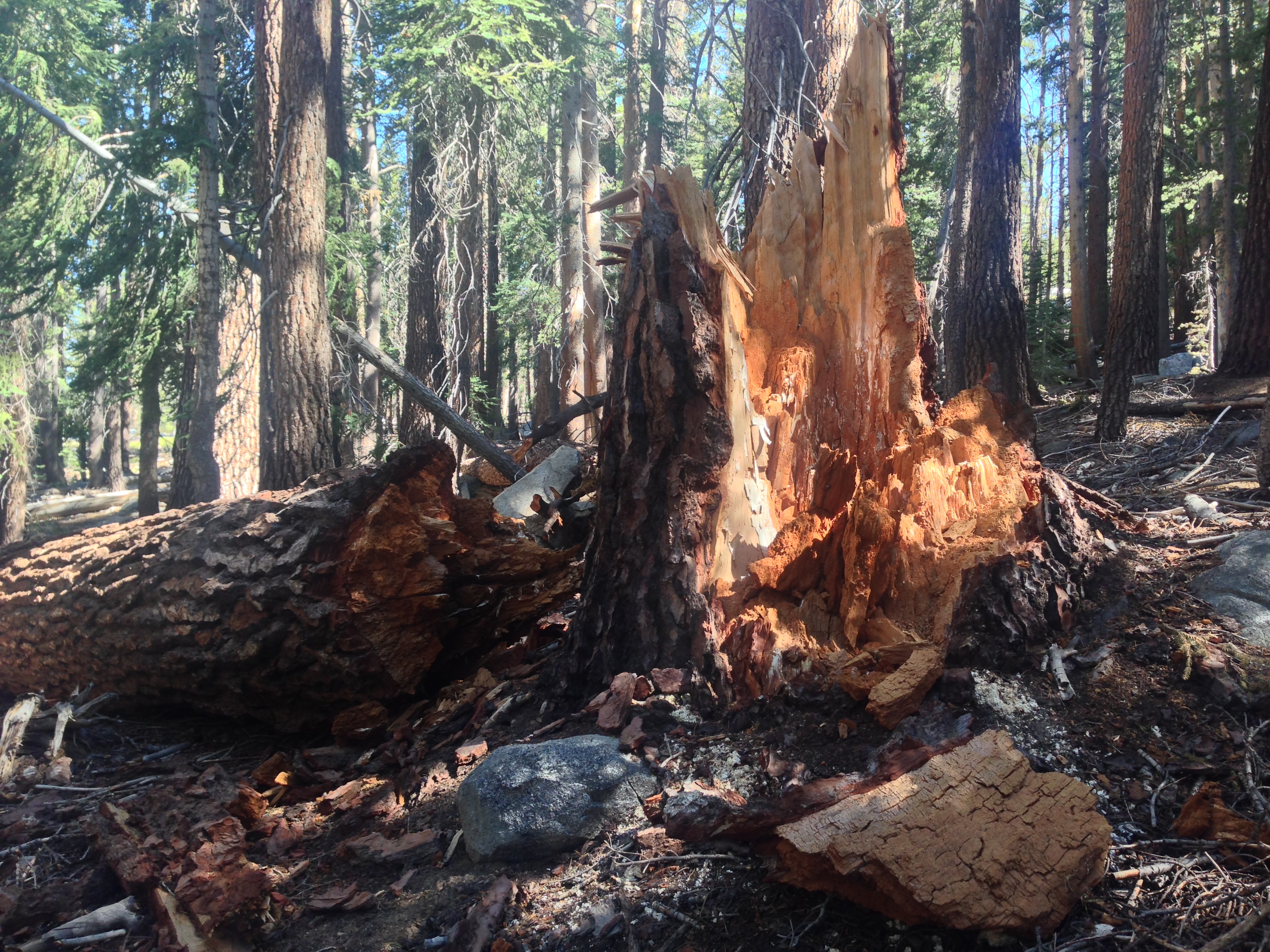
A whole bunch of seemingly healthy trees had collapsed here. I have no idea why. Maybe a strong wind came through this valley? Many of the smaller trees were spared.
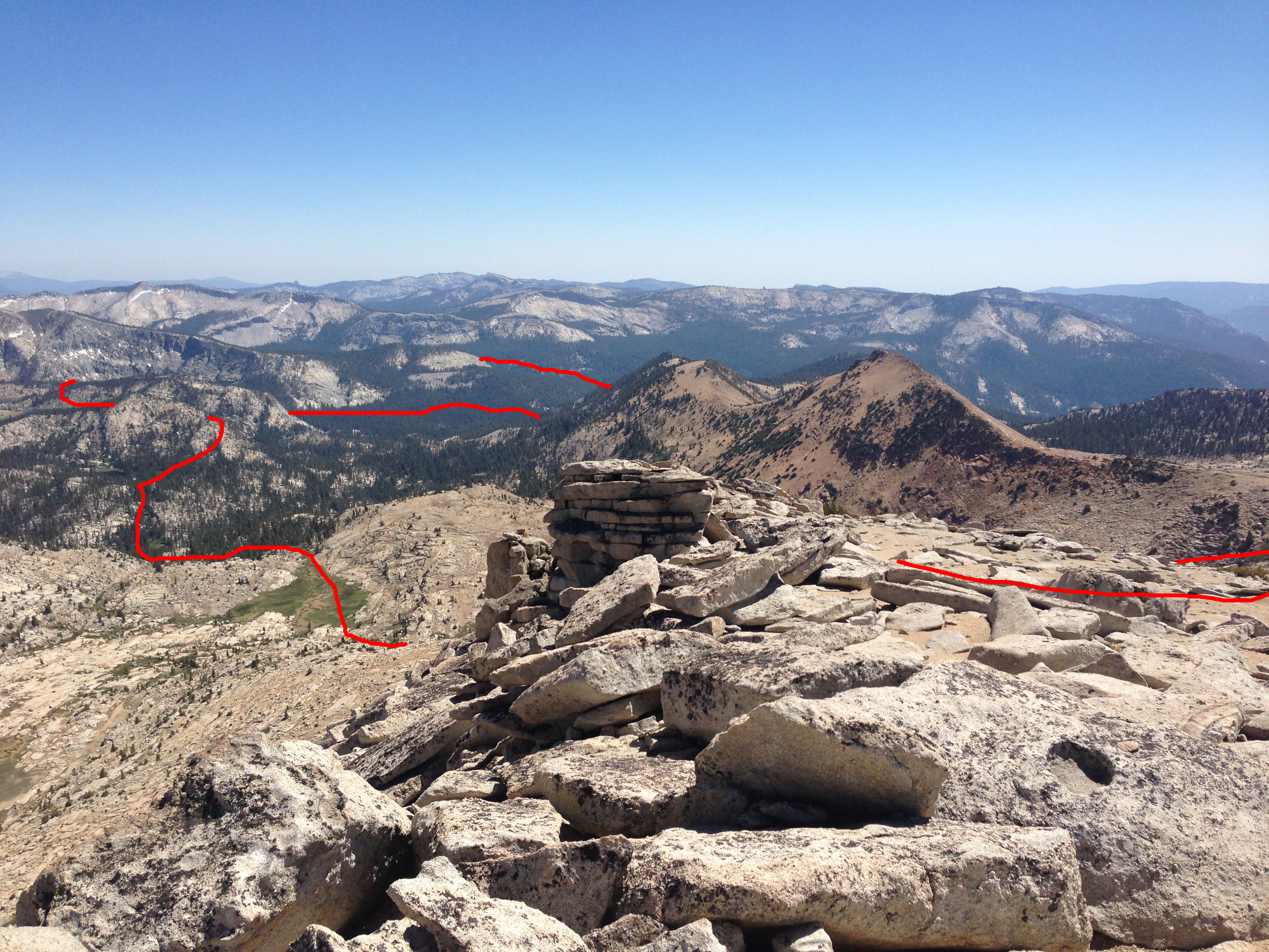
This peak was not named on any of my maps, so I called it “Triangle Peak.” Immediately upon seeing it, I wanted to climb it – but I had a lot of uncertainty. It was not part of my route plan, and I had no idea how to get there.
View of Portal Lake on my way to Triangle Peak.
View from “almost” the summit of Triangle Peak. I made it around the back-side of the peak, and started ascending a difficult pitch that was composed of kitty litter and refrigerator sized boulders. When I was about 50 vertical feet from the summit, I left the pack behind and climbed another (exposed) class 3 section of about 30′. With just 20 vertical feet to go, I found a chimney full of large chock stones. Definitely climbable, but with the vertical exposure below me, I was given pause. In my head I heard my mom’s voice saying, “I told you so…” But then there was room for an argument (also with her voice) saying, “nothing ventured, nothing gained.” It had been a slow methodical climb to this point, so I sat there somewhat afraid of the fact that I was actually feeling brave enough to do it. I finally said to myself, “live another day,” and began the slow, careful descent. Im sure that others have been up to the summit, but all I have for you is a picture from ~20 feet below the summit. If you’re considering this, you may be able to approach the full summit more easily from Kettle Ridge (the spine on the left hand side in my photo).
This is Halfmoon Lake, where I spent night 2. On my map, the print was so small, I thought it was called “half-man lake.” I kept thinking that maybe they discovered half a man here. I was relieved to check my larger map and see that it was called “half moon.”
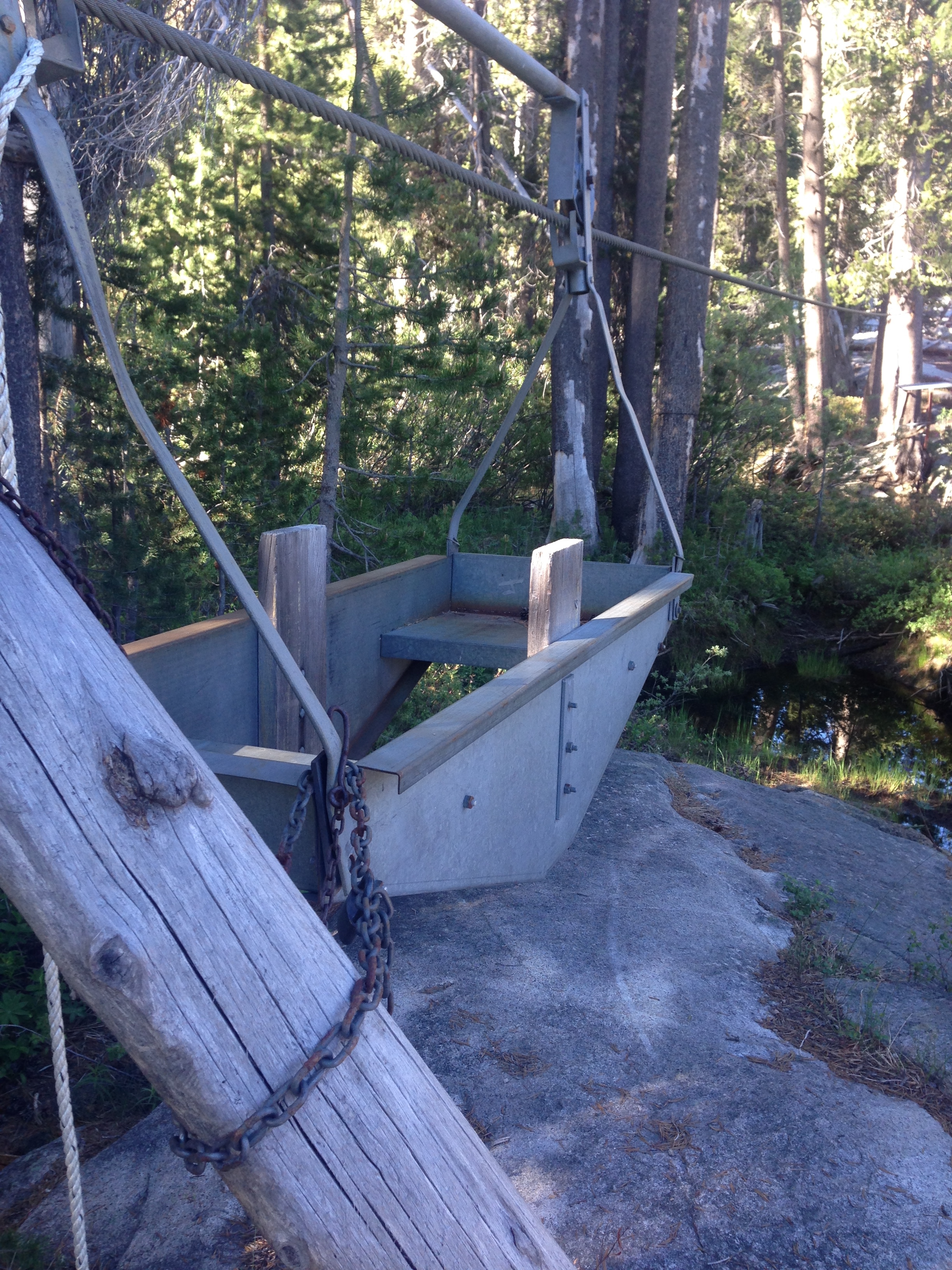
I was surprised to see this method of conveyance at the bottom of the North Fork King’s River. As you can see, there is no way to retrieve the carriage from the other side.
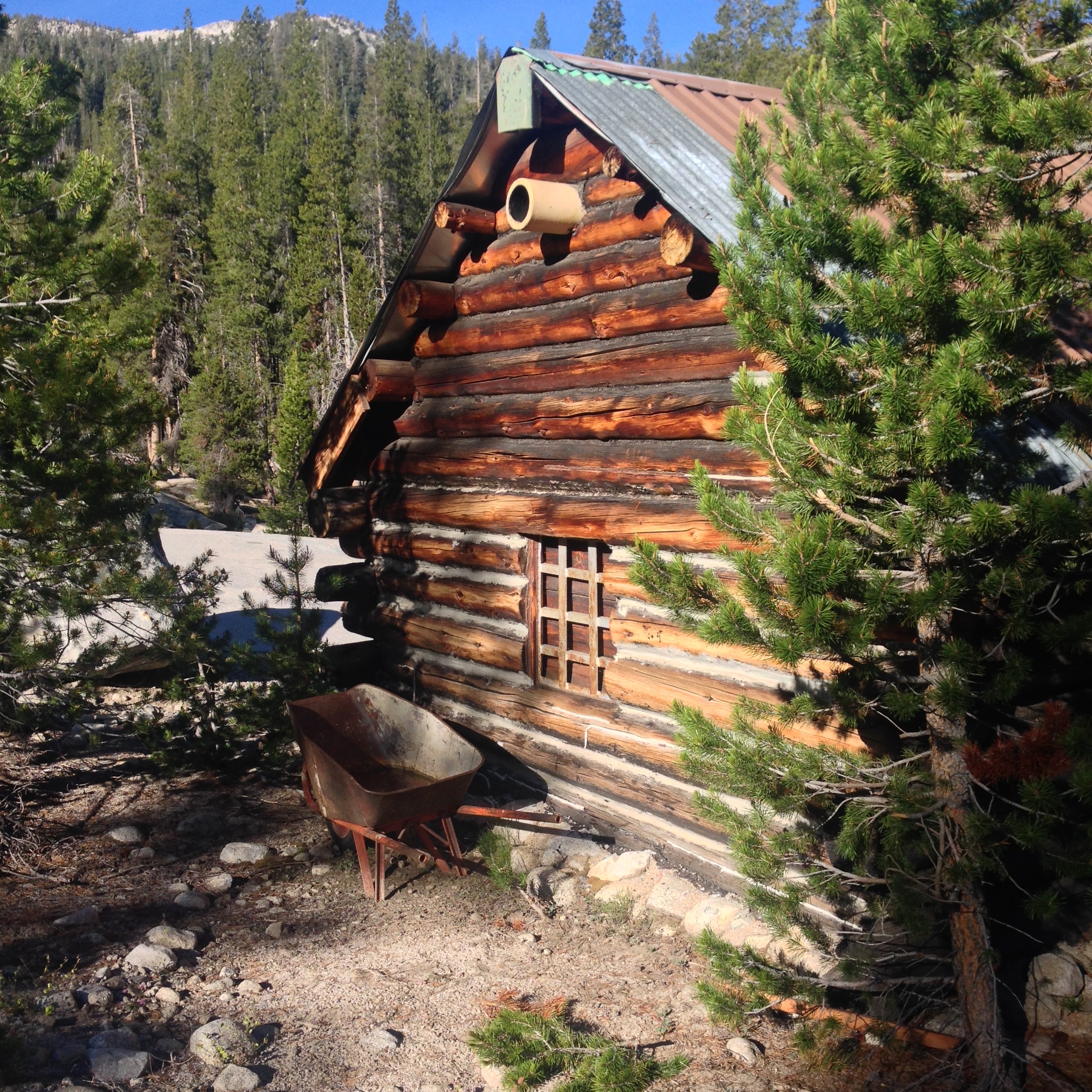
Meadowbrook Cabin
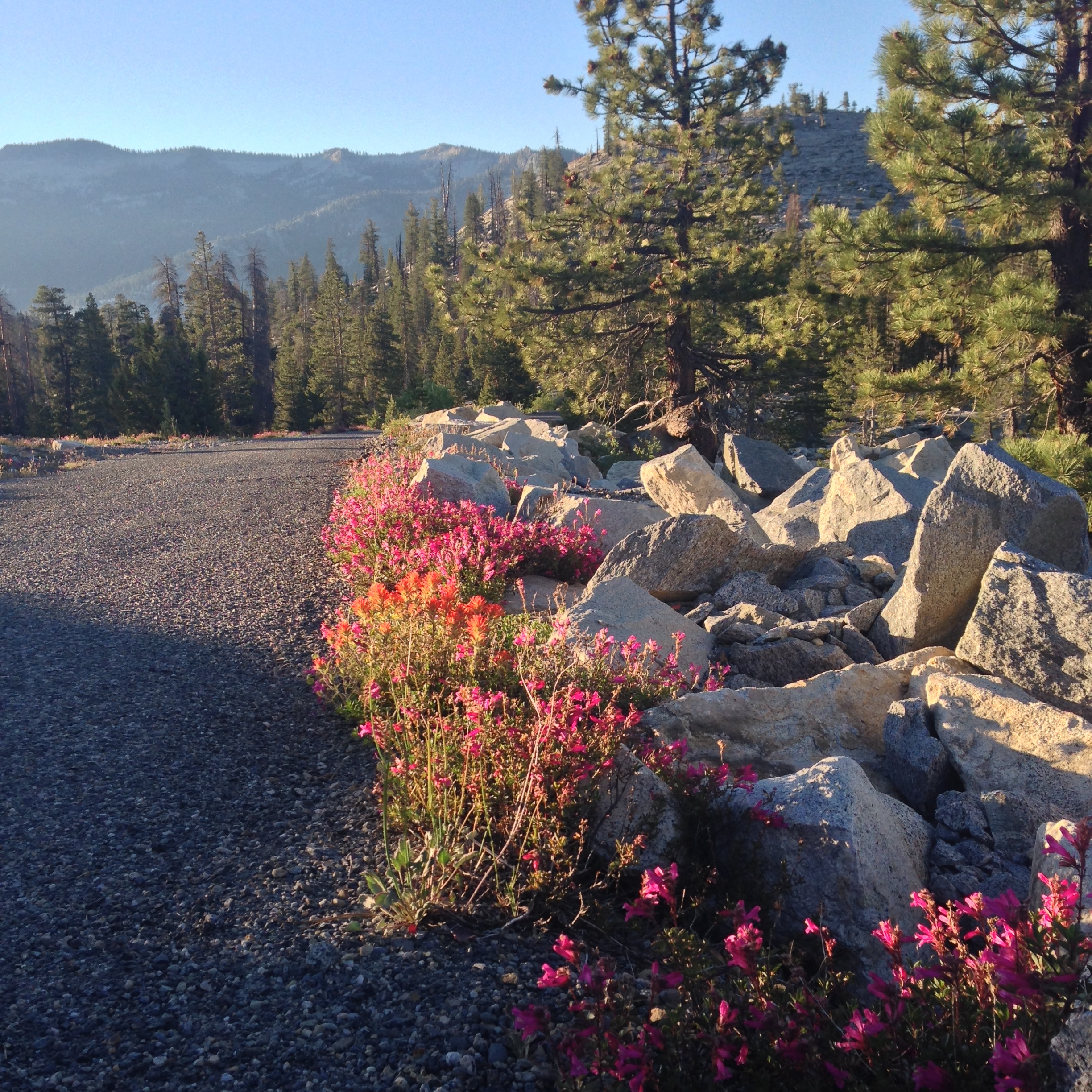
The road on the way to Courtright reservoir
View taken from the car window on the narrow road that crosses the Courtright Dam. This is a really neat spot! There were a ton of large full size pickups with trailers and 5th wheels showing up as I was leaving on a Friday morning… but solitude is not far off if you spend a few minutes heading down the trail!
This is the map for the entire route discussed in this post. To Export GPX files, click on the three horizontal bars in the upper right hand corner of the map and select Export selected map data…
To see full screen, click here (opens in new window)