Tour Divide Mountain Bike Race
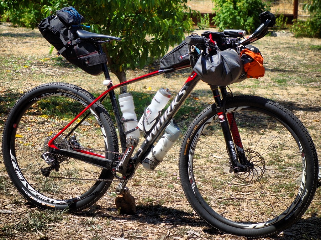
Several people have asked me for a blow-by-blow account of the Great Divide Mountain Bike Route. Since the route information is already well established and available online, this writeup will be the tale of my experience instead of route guidance information. Click here for a gear list.
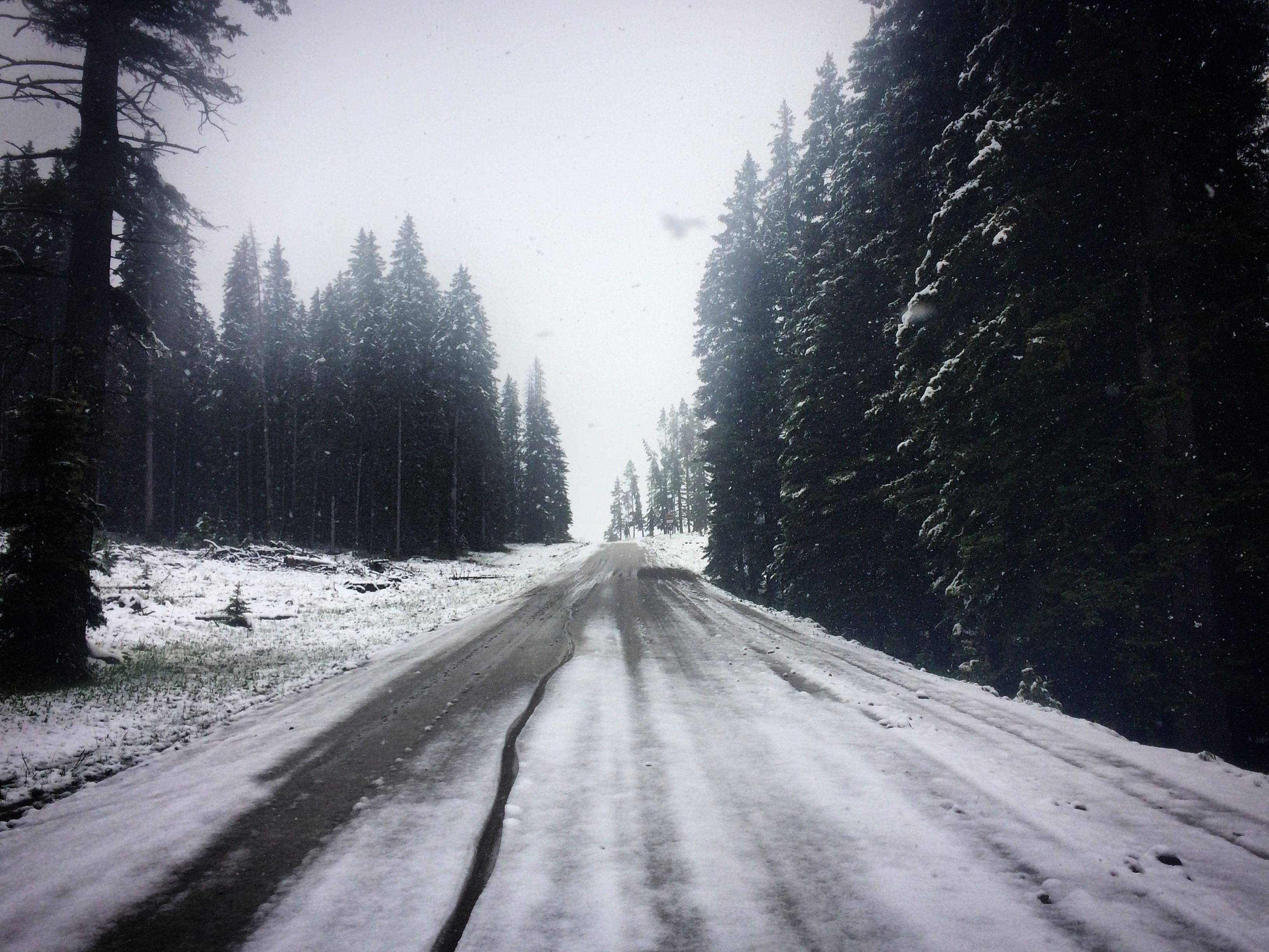
Eleven PM. A narrow tunnel of light from my handlebar illuminates the white snow. Two shallow tire tracks heading uphill into the darkness remind me that Josh and Ben had recently pushed their bikes through this same slush. Bright glints of light near my eyes sparkle – the headlamp reflecting against the sleet. My feet search for stability in the snow, and I constantly question whether it is easier to push through the tire tracks, or blaze my own route – vacillating between the two. Two miles covered in the last hour of darkness; feet cold and wet. Cresting the pass doesn’t promise any relief – the lengthy flat portion at the top, as well as the descent will still be 2 miles per hour pushing downhill in the snow. Who are these crazy people ahead of me?
Before signing up for the Great Divide Mountain Bike Race, I knew what I was getting into. You can see the stats online: Mike Hall’s record of 13:22:51 meant he traveled about 185 miles per day. Having done a couple double centuries on the road before, I knew that there was barely enough time to cover 200 miles on pavement and still get enough sleep. I created a mental “fudge factor” to account for the slower speed of mountain bike tires, carrying the weight of camping gear and food, and most importantly the time lost by riding mostly on fire roads, mud, snow, sand, and trails… instead of pavement. I sat down in front of my computer and started studying Mike Hall’s 2016 GPS track, looking for his sleep time. Hmmm… 1 hour sleep…3 hours sleep… no sleep…. I can see: this will not be easy.
Sticky and damp soil; I’m having a blast. The bike is already covered in mud; at least I don’t need to worry about keeping it clean any more. It can’t get any dirtier & the chain already sounds like dragging rebar through gravel. Only a few hours into the ride and we’ve passed a narrow gorge with an exploding waterfall and ridden a fun slightly rooty single track. It rained all night last night, and was starting to rain again – but the trails were fun and the pace relatively gentle. I’m on cloud-9 because I’m riding with Josh Kato on and off. Eventually I find myself riding alone – and then suddenly I reach the mud. Movement stops completely as each tire attracts 40 pounds of sludge like a round super-magnet passing over chunks of iron ingot. My first move is to carry the bike – which now feels like 100lbs. That lasts only a few seconds. Next attempt: the ‘clean and jerk’. Clean the bike, jerk forward two steps, clean bike, repeat…for miles.
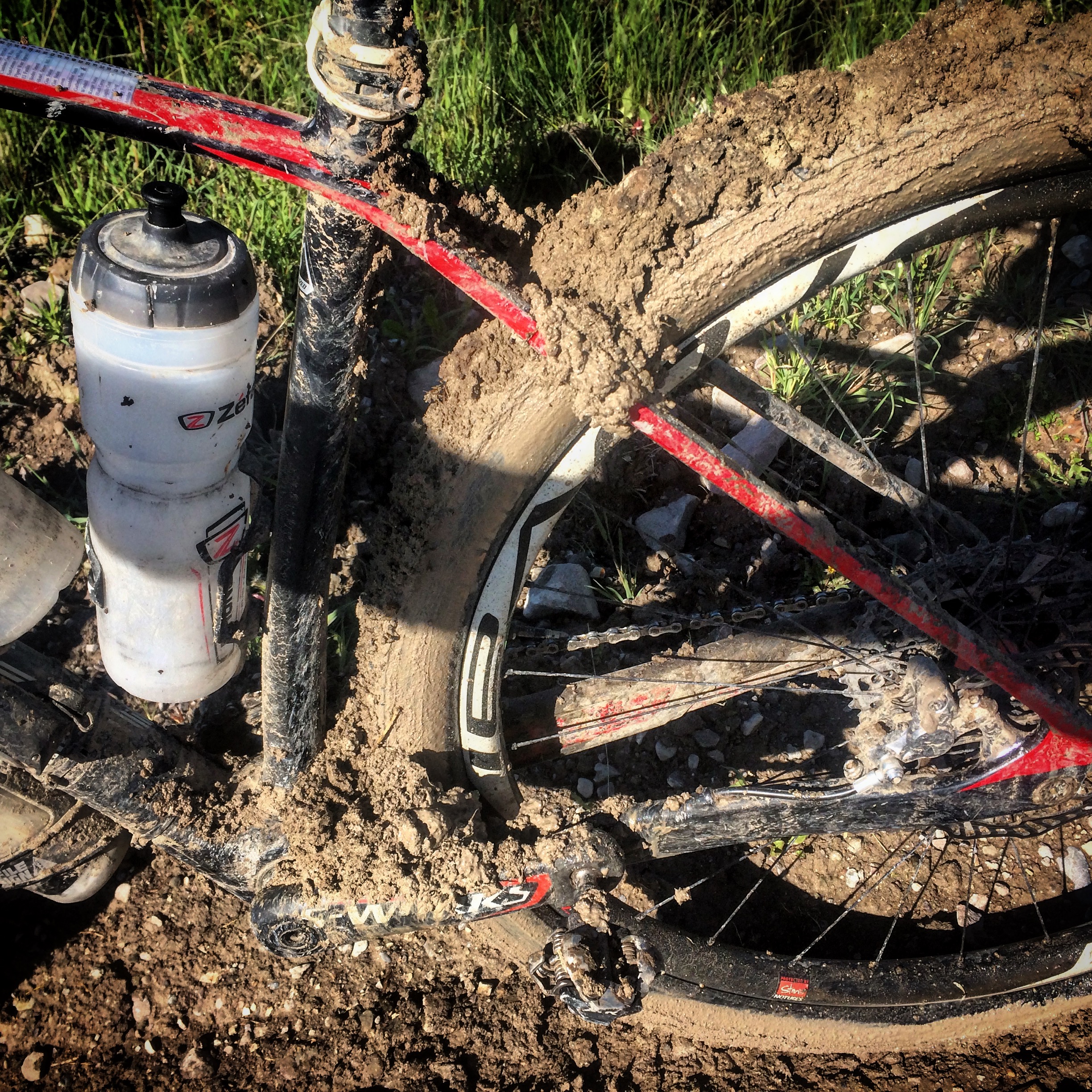
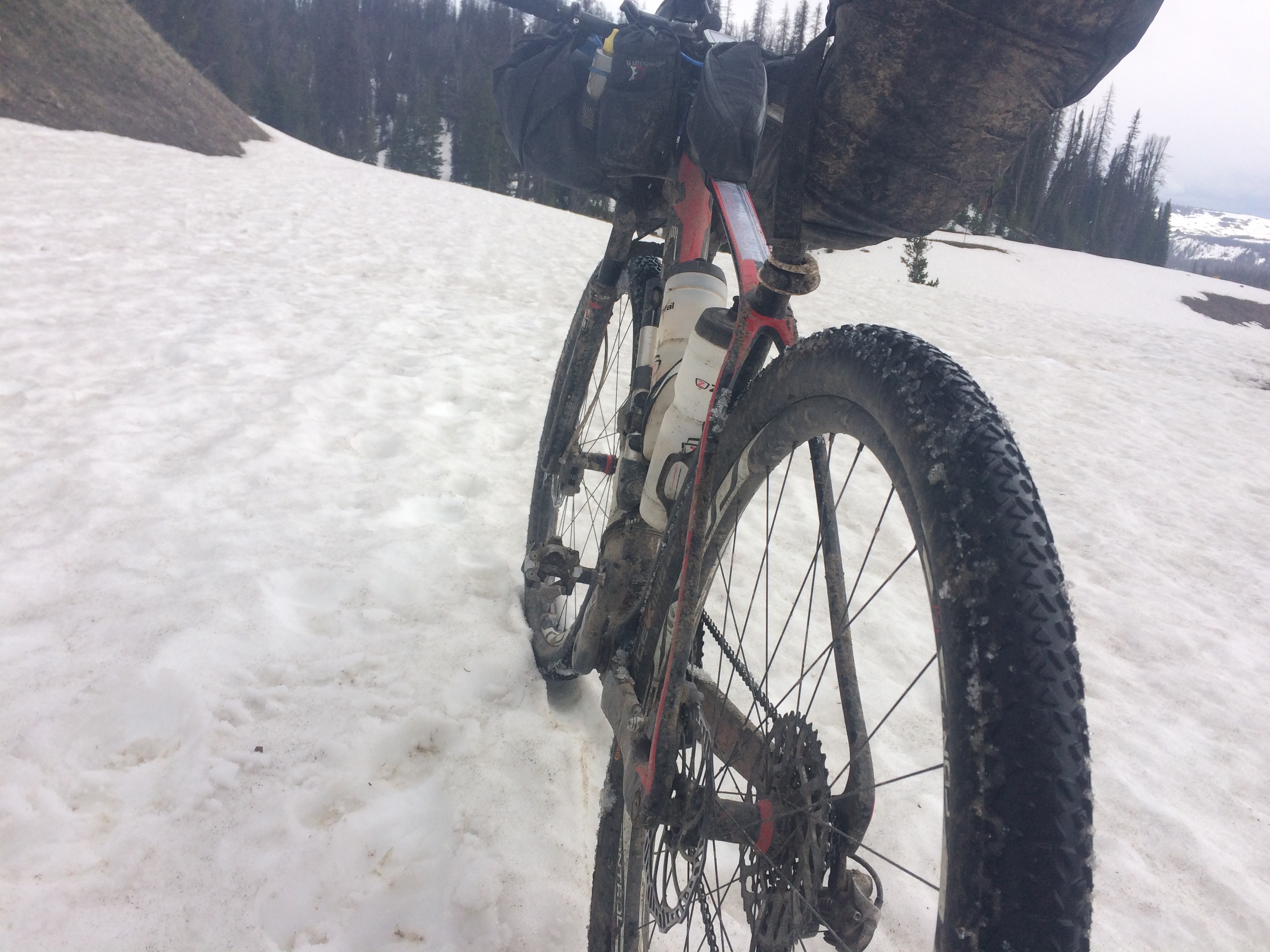
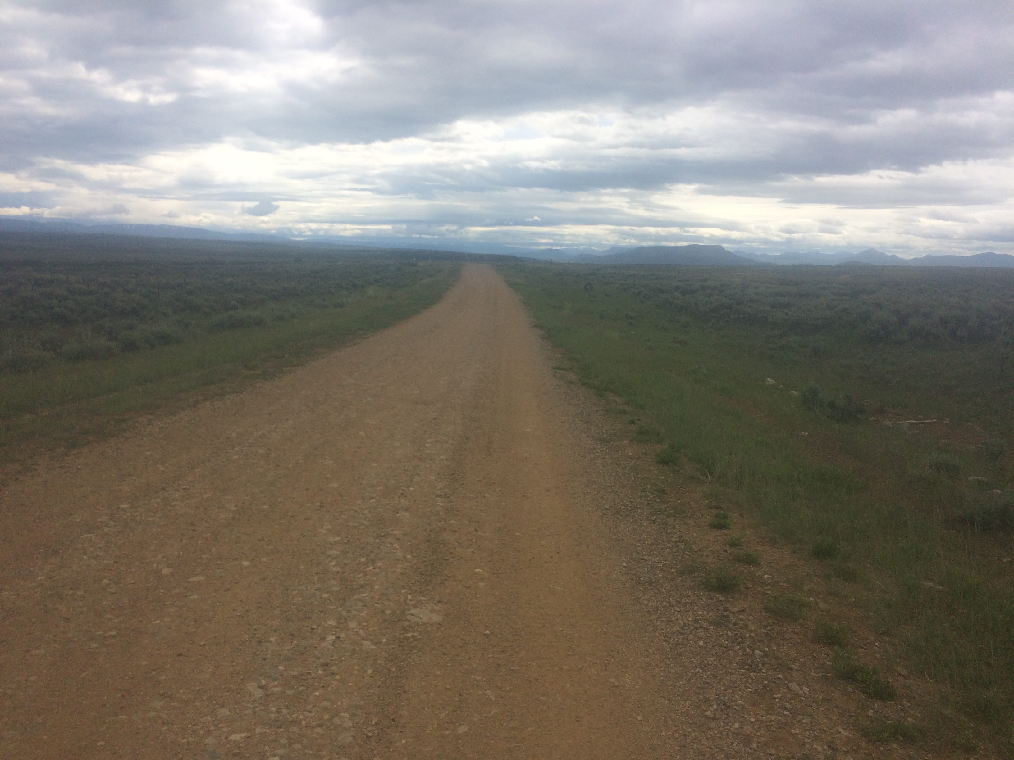
It’s the first day, and I’m already walking miles in the mud (this photo is from one of the several other mud trudges, but it gives you an idea). Much to my surprise, a rider who came through a few hours later reported that the soil, although muddy, was all rideable!?!
Although getting stuck in the mud in the first day seems discouraging, I just reminded myself: Everyone has to go through this. I would later find out that conditions could vary a lot – even within a few hours. Lynne Slivovsky told me after the race that when she came through, it was completely rideable!
By afternoon, I had reached the base of KoKo’s Claim. This section of trail was new to the Tour Divide this year. A bridge had been washed away during the 2016-2017 record breaking winter, meaning the old route would have been too dangerous to attempt (it would have been necessary to ford a big river). In the planning stages, the possibility of riding the paved road into Fernie was considered, but most people preferred to keep the course true to its mountain bike roots. Here is what that trail looked like (video below):
The going was slow: taking a step, hoisting the bike upwards, pausing, repeat. Eventually near the top, I saw another guy ahead of me doing the same thing. From what I had heard earlier in the day, that guy was Ben Steurbaut who had won the French Divide race last year. Seeing him on this difficult section, I decided that this would be the perfect time to muster a big effort to pass. Strategically, it’s a good time to demoralize a competitor when they are frustrated. I stopped resting between heave-steps, and launched a continuous effort to catch Ben. Since the terrain was so steep, all of the upward movement force was on my Achilles tendons. I would soon regret this push. When I caught Ben, he exclaimed, “I came here to ride, not to push!” I chuckled and pushed hard to get out of sight, trying to make it look easy. I rode around lake-sized puddles and snow fields at the top of the ascent. In my mirror, Ben had disappeared, but once I reached the aggressive, rocky downhill dropping into the Bull River Valley, Ben reappeared in the mirror. He was expertly riding the rugged terrain! He passed easily like a pro, turning the tables of demoralization!
The Bull River Valley Forest road was a true joy to ride after slogging through Koko’s Claim trail. The weather had eased up, and the sky was turning colors preparing for one of those extended Northern sunsets. Ben and I rode side by side on the fire road. I asked him how he managed to train for the mountains of the Tour Divide given that he lived in Belgium. He said that he would “ride hard into the wind.” I never would have imagined that this could work, but obviously Ben was highly motivated and well trained. When we rode side-by-side, the pace quickened. I found that if I rode behind him, keeping him just in sight, the pace would become more neutral. Therefore, I’d make excuses to stop and drop behind him – getting water, going to the bathroom, etc. I enjoyed Ben’s proximity, and we rode all the way into Fernie together in the cold night. On the last descent into Fernie, it would have been wise to put on a jacket – but I think we both just wanted go get there. By the time we reached the Seven Eleven (the only place open at this late hour), I was shivering violently.
In the Fernie 7-Eleven, Ben and I met a photographer as well as Paul Attalla (the Northbound TD record holder and Fernie Resident). I had trouble figuring out what food to buy.
Inside the 7-Eleven, I frantically searched for low-carb food and decaffeinated coffee to help warm up. I must have walked passed the coffee station 12 times before I realized the the green one was the decaf… The photographer patiently following me all around the store. Mentally, I wasn’t too clear. Ben looked pretty fresh, and we sat next to each other on some bar-stools, chatting a little and warming up. Matthew Lee called the 7-Eleven phone and asked to speak to me. He wanted to know if the Koko’s claim was “safe.” He was worried because on Trackleaders, he could see that many people were still out there. I tried to assure him that it was possible to camp out there, but I could still detect worry in his voice.
Ben asked where I was going next. I said that I’d probably ride further. My plan had been to ride to Butt’s Cabin on the first day – but that was pretty unrealistic with the extra mileage and very time consuming terrain of the re-route. Ben said, “I came here to race, but I’m not going to… ” … he trailed off. I’m pretty sure that meant that he wanted to race hard, but was experienced enough to avoid blowing himself up on the first day. We rode off looking for a hotel – knocked on the door of a closed one, and finally went to the “expensive” hotel on the other side of the street.
In my room, I took a shower, washed my clothes, and began to assess the damage from 166 miles of racing, pushing through mud, and up rocks. I was hardly able to move my pinky and ring fingers on my right hand, making it nearly impossible to open the soap package without recruiting my teeth and my left hand. I also had a strange injury in my lower leg, and all the toes on both feet were numb. I got into bed, but soon had to wake to use the bathroom. The only problem was that my Achilles tendons had now seized from the hiking. The pain was so excruciating that I crawled on the carpet to the bathroom. This was the first of several trips to the restroom due to switching from my usual low carb diet to fast digesting carbs. I took 3 post-bathroom showers that night.
As the sleepless night progressed, I realized that my race was probably over; there was just too much damage.
4am. Barely able to walk to the bathroom in the hotel room. So much effort invested just to get to the start line; blown up on the first day!? How to get home from Fernie? Seems complicated. OK, ride to USA border, and quit from there. Achilles!
At 4am, I mustered all of my effort to sustain the pain in my Achilles, I rode in the dark from the hotel back to the 24-hour 7-Eleven, got some food, and rode off onto new trail.
Ben had left Fernie a little after me, and passed within a couple hours. I was alone in the woods for the next several hours. The sun was out mostly, trees were dripping from the recent rain, and the air was clear. Trails were soggy, but nothing like the mud from the day before. I passed locations I had seen on the map: Butt’s Cabin, and “the wall,” which I slowly walked up straining my Achilles even further. The pain was a constant. Climbing Phillips Road, it began to rain.
Once in the USA, I clicked on my phone service to see what was going on with the race. Apparently, Greg Gleason had ridden all night and was up in the front, accompanied by Ben and Josh. They all seemed to be stopped at various food stores in Eureka. I grabbed some food and dropped my passport in the mail (I had pre-printed a mailing envelope; I didn’t want to risk losing the passport). The riding got pretty again once we started climbing National Forest Development Road 114. I caught up with Josh and we rode together on and off for a bit. The section along North Fork road was really neat: Lots of cool forest service cabins that were available to rent. I made a mental note that this could be a cool place for a vacation get-away.
Light faded as I began to climb Red Meadow Road. Then I hit the snow. This climb should have only taken a half hour or so, but it was buried under snow. I began to walk, following the tire tracks of Ben and Josh. I had planned on sleeping by Red Meadow Lake – but once I arrived, I realized how silly that would have been. It was raining, and the only surface available was snow. I slowly pushed downhill in the dark to find somewhere drier. On the way down, I ran into Josh.
Josh and I rode together, and I was happy to have a companion in the dark. Also, this was prime bear territory, so I was hoping to have someone to camp next to for safety. Josh knew where there was a campground coming up, so we investigated it together. It didn’t have water, so we pushed on a little further. The next spot was right next to a flowing stream. Site selected! Josh kind of lingered as I started to set up camp. He then said he was going to keep going because he had just taken some caffeine pills. Doh! I was alone by a stream, less than 100 feet from the sign warning about bear attacks!
I started getting ready around 4:30AM at the start of the third day, hardly able to sleep due to the Achilles pain, which eased just enough during the day that I could turn the pedals. After the high clouds burned off, this stated to become a fun and scenic day. The miles clicked by easily, and the scenery near Swan Lake and after Holland Lake was good. Being alone the entire day allowed me to slip into my own rhythm. The only person I saw while riding was the first Northbounder, Kevin who had started earlier this year and faced a lot of Snow in Colorado and New Mexico. I had called ahead to the Blackfoot Commercial Company in Ovando asking if they could prepare a steak for dinner. When I arrived, three women were waving little flags as a greeting party. It was great to be there, and even though the sun hadn’t set yet, this was a great place to stop. I saw Ben standing outside the “jail” and we waved hello at each other. Leigh Ann, the proprietor at the Blackfoot Commercial Company set to processing my laundry and dinner. I got a comfortable hotel room where I’d be staying for a few hours. As I ate, Leigh Ann kept me company and told me Tour Divide stories. After the meal, I bought a diet pepsi and ibuprofen in the hopes that I could mitigate some of the pain in my Achilles. I was very grateful for such a warm welcome in Ovando.
An early stop means an early start, so I got up around 3:15AM and departed Ovando after Ben. As I rode, the temperature strangely dipped from 50F to 39F, leading me to take a coffee break in Lincoln. I went into a cafe, sat at a table, and ordered a cup of coffee. Sitting down for coffee inside a restaurant seemed like a big luxury. Even though it was only 10 minutes, I enjoyed every second. The friendly waitress brought me a couple refills. When I asked for the bill, she said, $1.00. Wow. I left her a well deserved 400% tip.
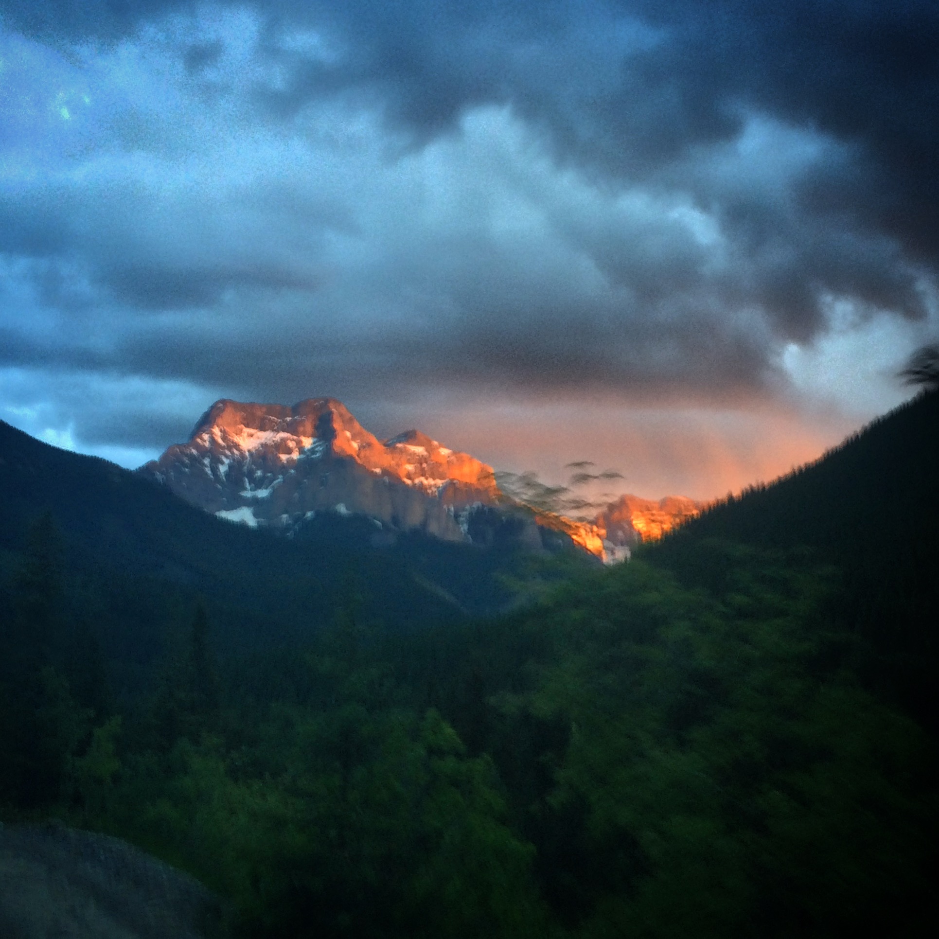
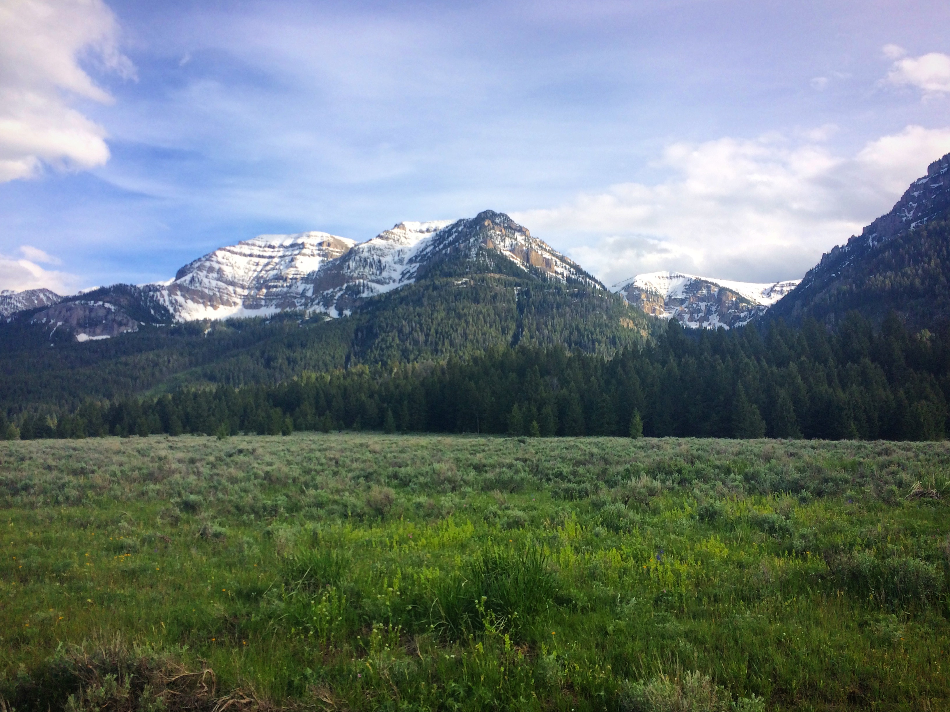
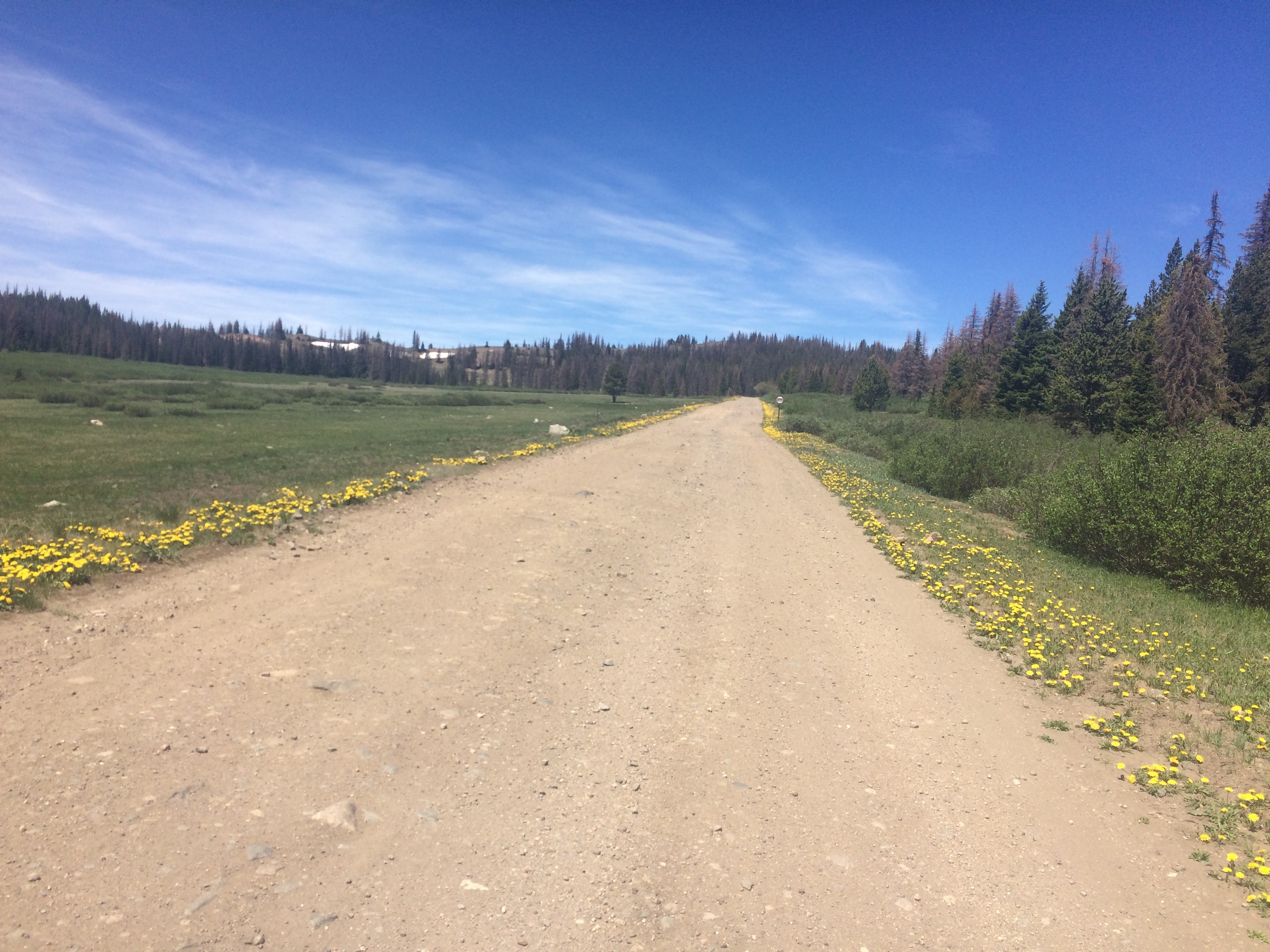
Scenery in the mountains above Helena.
Today, Day 4, would prove to be one of the more exciting days on the divide. The riding was all excellent… Stemple Pass Road, Marsh Creek, Blossburg. One exciting moment of the day was meeting the now famous Ashley Benns. He started heading North early in the season, was thwarted by snow in many places, but by the end of the 2017 season had completed a yo-yo-yo-yo (or whatever you want to call it). Basically, he rode the length of the Tour Divide 4 times! The first thing he said upon our meeting was, “Those are nice shoes.” We were both wearing Sidi Dominators.
When I arrived in Helena, I noticed that the skies were darkening somewhat. Leaving town, the ascent of Grizzly Gulch was warm and humid. By the time I reached Corral Gulch, the skies had turned ominous – lighting was flashing in the distance. In a few minutes, the lighting was overhead, and the rain was hammering down. I hiked up the slippery root covered single track near Lava Mountain counting the seconds between flash and boom. FLASH…1 second…FLASH…BOOM…1 second…FLASH…BOOM..FLASH…1 second… Never before had I seen so much lighting without pause. The temperature dropped quickly, and I started to become hypothermic. I stoped to engage in the difficult task of putting on rain pants over wet skin. I had a down jacket – but it seemed like a bad idea to put it on in this kind of rain. Butte was still a long way away. Coming down Cataract Creek Road, I was eyeing some of the abandoned looking cabins – considering them for shelter… But I kept pushing on. Suddenly, I popped out on a road – and there was the tiny town of Basin! I had forgotten about this sliver of civilization between Helena and Butte!
I walked into the delightfully warm bar and the bearded guys were all laughing at me as I was dripping and shivering violently. I must not have looked as bad as I felt because they kept laughing. Finally, I got one of them to tell me where to go so I could ask somebody about a room. The directions weren’t very clear: he said that I need to “go to the mine.” It turns out that the Mine was on the other side of the freeway up a big hill. As I rode up the hill, a man driving down in a Toyota stopped me and wanted to know where I was going. I told him I wanted to rent a room. He said they don’t rent rooms. He seemed angry. I seemed desperate. He said, “well, you can go up there and ask, but there aren’t any.” I climbed to the end of the road, colder than ever, and entered the building at the entrance to a tourist mine. Inside, a kind woman confirmed that yes, they do have rooms for $70. She went in the back and got me a towel to dry off and warm up. Suddenly the angry man came in and started talking to the woman. His wife? I said to the guy, “Hey, I thought you said they don’t rent rooms… but you work here?” Still gruff, he replied, “I thought they were all rented.”
After I paid, I followed the guy – him in his truck, me on my bike – down to the room. It was only a mile, but an excruciating one. The room was actually a two bedroom mobile home. I washed my clothes by hand, and turned on the furnace to dry them – putting an article of clothing on top of each heater vent. I took a bath, and opened all of the doors windows – the smell of exhaust from the furnace inside the building was noxious. Even though it had been a 141 mile day, I felt like I was playing hooky – stopping well before dark. The rain continued all night outside.
My cozy, but possibly carbon monoxide poisoned mobile home for one night.
At 4am, it was time to go again! I coaxed my Achilles into motion and headed out into the 37F rain. This is perhaps the coldest scenario you can ever encounter on a bicycle. Once the temperatures drop lower, precipitation will turn from rain to snow. With snow, you can wear your down jacket, and the flakes fall off of your outer layer instead of soaking in. In Butte, I decided that it would be necessary to get some different clothing and some chemical toe warmers. I rode over to Bob Ward’s Sports store in the hopes of buying a winter jacket. Who cares how heavy! I arrived at 8:40am. Store opens at 9am. But, there were people inside! In fact, there was a man at the front glass door messing with the floor mat. I stood outside shivering, hoping he would let me in. Unfortunately, he ignored me. Finally, a few minutes later, he emerged and before I could ask, he said, “You can’t come in here!” I said, “I just want to buy a Jacket; I can pay cash if your registers aren’t open.” He said, “We open at 9.” Even though I wasn’t eager to support this apparently grumpy business, they were the only show in town as far as I was concerned. About 10 minutes later, the man opened the door again to leave. He locked the door behind him, got in a truck, and drove away. Instantly, two women opened the door for me, and said, “We’re so sorry, but we have to follow rules.” Apparently, they had heard the interaction. They helped me find the perfect fleece and some toe warmers. As I struggled to put on my clothes outside the door, a woman ran up from her car and said, “here, grab my shoulder!” At the same instant, one of the kind ladies from inside the store came out and offered a chair. One grumpy guy can’t ruin the altruistic spirit of the majority! I thanked them both for their above-and-beyond kindness – and with those warm thoughts in my mind, I was ready to ride on.
Climbing out of Butte, I felt happy and very warm in my new fleece. As the rain turned into snow, my happiness only increased. Before I had felt so vulnerable to the elements – and I felt like I was in this safe cocoon now. The scenery improved into a forested winter wonderland. Near the top, I saw three moose running through the snow perpendicular to my path. The steam from their breath billowing in the freezing air. I must have slowed down to ponder and enjoy this fugacious moment. “That was lucky,” I thought. As I write this blog entry, I’ve been looking at the map, and I realized that I saw the 3 moose right next to a place called “Moose Town” after having ridden up “Moose Creek Road.” So maybe not as lucky as I imagined.
Soon after taking this shot, I would see the three moose!
After the moose, I dropped down Highland and headed towards Divide Creek Road. I had been watching Ben’s tire tracks in the mud – noticing what appeared to be two crashes. Crashes? On the ascent? “What is going on,” I wondered. Then, on Divide Creek, I didn’t see any tire tracks. I called Janet to check in, and she looked at the tracker. She said that Ben had turned the wrong way after crossing HWY 15. Now I was really confused… Was Ben delirious from the cold? Lack of sleep? Did his GPS malfunction? Before my conversation with Janet ended, she reported that he was back on track; right behind me.
The route climbed back up into the snow, and then soon I was on a steep descent – which got progressively steeper. This was Fleecer Ridge. About half way down, I realized that the only two options were to ditch or to try and ride it out. The decision needed to be quick, and since I didn’t decide in time, the increased speed meant that trying to ride out was the only way I might avoid a rocky crash. When going down something so steep, your front braking power is limited by how much force it is going to take to send you over the bars. Your rear braking is limited by the traction of your rear tire. In this situation, you try to maximize both, dancing a fine line between descending too fast and going over the bars. Luckily, it all worked out, and I enjoyed the remaining easy terrain into Wise River, and then on towards the Montana High Country Lodge.
As I was riding the road near the lodge, a man in a truck pulled up and says, “Hey, are you coming to the lodge?” It was Russ Kipp, and he had driven out to find me. Since it would be a little early for stopping, I said, “Sure, I’ll stay if Ben stays.” He said, “Ben isn’t staying – he broke his fork riding down Fleecer Ridge. C’mon and stay with us and get a good meal, shower. Besides, you’re not going to want to ride the Bannack Road today anyway. It’s 100 miles to Lima.” I rolled into the lodge, and was supremely glad I did. I found out that Russ was perhaps one of the greatest fans of the Tour Divide. He seemed to know every stat, every name of every rider… and he kept Tour Divide memorabilia. Moreover, the lodge was beautiful, with a big-window view of the mountains. He only charged $70 for a huge room, and they kindly did my laundry and prepared a healthy meal. It saddened me that I was racing, otherwise, I would have chatted with Russ for another hour, and enjoyed that wonderful setting longer.
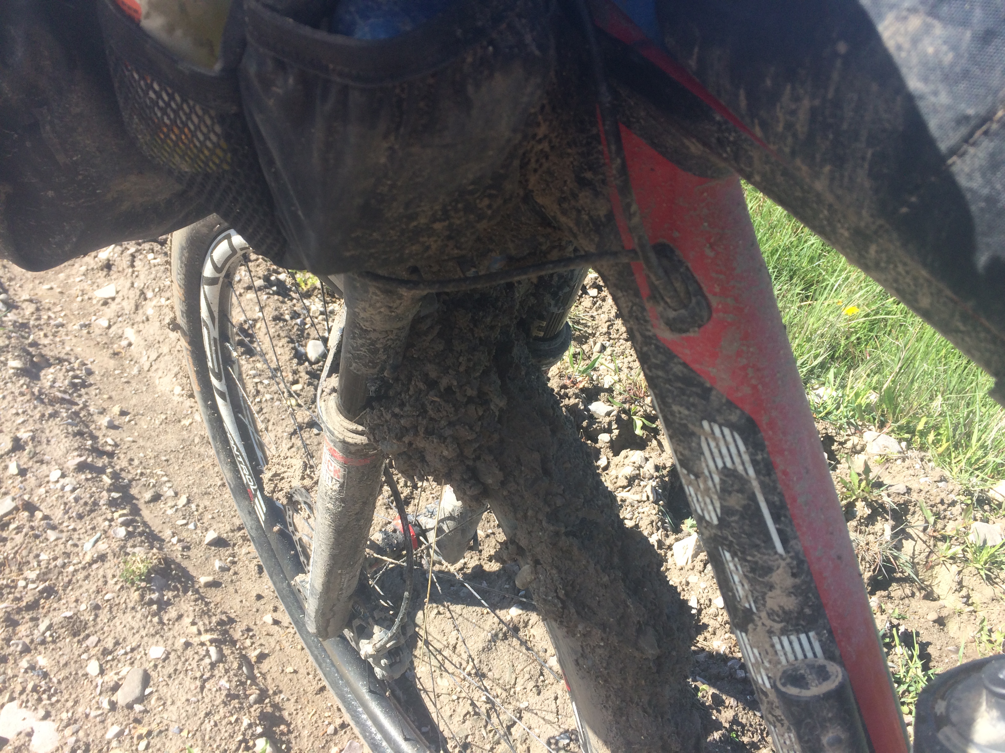
Stopping to clean the bike every few feet.
Russ was right about the Bannack Road… and Medicine Lodge Road. My tires were bogged down in mud for some 12 miles of Step, Clean, Step, Clean… In those sections, it would take me 20 minutes to travel a mile of flat road. Eventually, I pulled into Lima for some refreshments. Everything was covered in mud, so I cleaned my shoes as best I could outside the Exxon before entering. After I bought some food, I ate outside, but then decided to go back in to get some more. It was then that I saw a woman with a dust pan cleaning mud crumbles off the floor. I felt so bad that I insisted she let me clean it up. She was so kind and smiled saying that it was no problem. I wished I could have done something to thank them for being so nice. The rest of the day was benign and somewhat scenic. As night fell, I arrived at Robin’s Roost and stocked up on food for a little adventure.
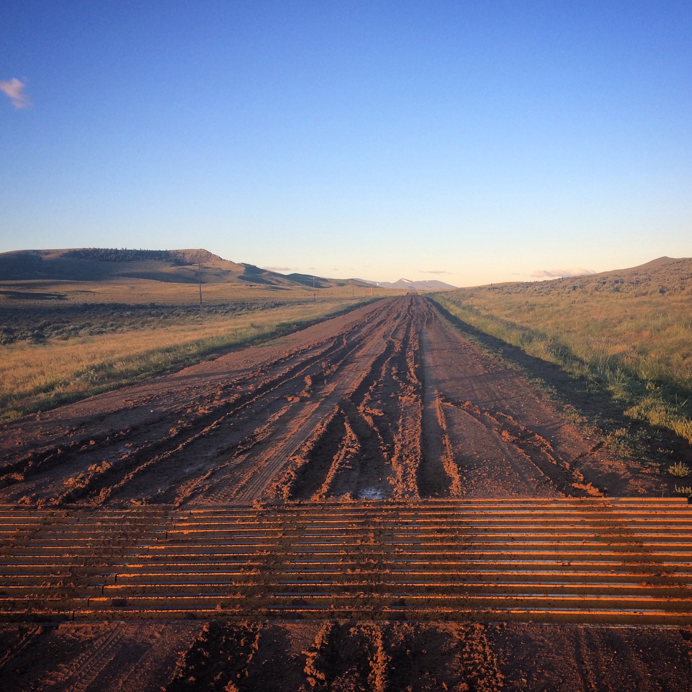
Get ready for the Bannack Road…
The day before, I had been planning to ride all night – but Russ had talked me out of it. Tonight, the weather was good and there wasn’t a logical place to stop anyway. I love night riding, so I just kept going. A big part of that night was the Eccles snowmobile trail. In retrospect, this was the perfect section to be riding at night: it was a straight line of sandy moguls, meaning I probably wan’t missing out on any scenic interest. At 2am, I arrived at the Warm River campground. This could be a good place to sleep, but it was a difficult decision. On one hand, things were still going along smoothly and I was excited about making all of this progress. On the other hand, the little sleep guy inside of me was quietly asking for my attention. I decided to try and take a nap inside of the campground bathroom. Although it wasn’t necessary with clear skies, at the time I felt like sleeping in a bathroom was part of the tour divide experience. To save time, I only got out my sleeping bag. The ground pad stayed on the bike.
The temperature inside the bathroom was 70F, but the chill of the floor through the bag made it immediately uncomfortable for sleeping. Also, using my helmet for a pillow was unwise – so after 30 minutes, I was back on the bike heading towards the Grand Tetons in the dark.
Yowsers. This is going to be fun.
The hike through the snow on the Ashton-Flagg Ranch Road took longer than it should have. In my sleep deprived state, however, I felt like I was moving pretty quickly. By morning, things had started to deteriorate. For the first 6 days, I had been enjoying almost every minute of the ride. Now, as I was descending into the Snake River valley – with snow covered mountain peaks, colorful foliage, and crisp dewy air, my thoughts were just, “meh.” When I got to Flagg Ranch, there were already crowds in the restaurant, so I wandered around aimlessly looking for food. Everything was sugar – so I finally exited with nothing. That seemed foolish. So I went back in and walked around looking at all the food again in a delirious haze. I finally grabbed something and got in line. The line was slow. I put it back on the shelf and left.
Some beautiful scenery coming into Idaho.
Riding towards Colter Bay, I realized that skipping sleep had been a very bad idea. This was the first time on the route that there had been traffic on the road – and here I was exhausted and losing my focus. I finally decided to pull over and take a nap on the side of the road. I tried to hide because with all of the tourists driving the Teton’s, they would be concerned. I nodded off for about 5 minutes, and then someone came to check on me. I rode to the Colter Bay Store, and once again struggled with food choices. As a bright spot, I met Matthew Timme who was racing the Trans-Am. After meeting him, I continued on the route but had to take another 30 minute nap on the side of the road. Between moving slowly and taking naps, I was undoing all of the work I had done last night.

Beautiful scene coming into Brooks Lake Road.
Brooks Lake Road was the final challenge for my day. It took over 2 hours to walk the downhill to Lava Mountain Lodge because the first couple miles were covered in snow, and I had to push my bike down the hill. When I got near the bottom of the descent, a guy was working a snow plow going up to the pass. “Take your time… please,” I said. He responded saying that he hoped to finish by night! Having this clear would easily shave over an hour off the time needed to make the descent. It had been a rough day, so I decided to stop at Lava Mountain Lodge and spend the night in comfort. I rented a room, cleaned my bike with the hose behind the building, and went to the restaurant in my only street clothes: a pair of boxer shorts and a t-shirt. I ordered two dinners and decided to get some real sleep.
The road is plowed! Only down here at the bottom for me, but soon this road will be cleared for everyone else.
An early stop means an early start – so I got up at 2AM to see what the day would bring. I didn’t know it yet, but today (the 8th day) would mark the end of the snowy, muddy terrain. It represented a turning point in many ways. I left my bear spray in the hotel room, as there was just one short section of bear territory left to cover. I quickly checked the tracker before I departed, and it seemed as if Josh Kato had ridden past me during the night. So, I expected to see his tire tracks in the mud heading up to Union Pass. Feeling good, I moved quickly until I reached the snow where it became obvious that no bicycles had passed through so far this season. This section was one of the most difficult because the snow was very deep, and there was a section of grade over 12%. Also, the route wasn’t obvious – the only method of finding your way was to use GPS – the snow drifts were so deep that you’d be wandering between trees and sinking knee deep into snow. This went on for several hours; eventually the sun rose while I was near the top, making for some grand scenery.
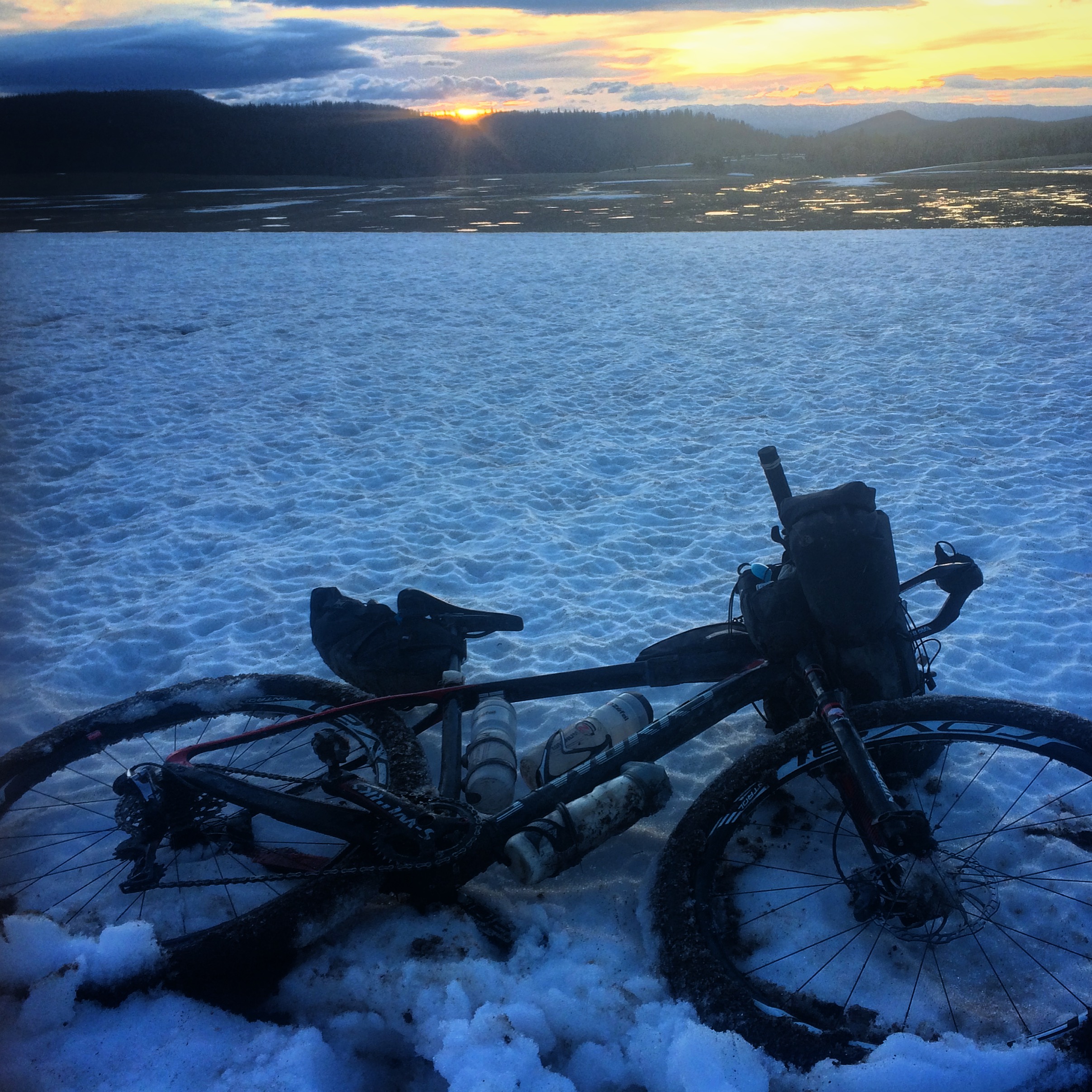
Between Lava Mountain Lodge and Pinedale – a long section of snow push.
As I descended into Pinedale, everything just suddenly got better. I was pumped, and finally going fast! A gentle tail wind was building. As I got closer to Pinedale, I started calling bike shops on my phone. I found one that had the chain lube that I preferred (I had used up an entire 4oz bottle in just 7 days!) I asked how much it would be with tax, and asked them to leave it at the cash register. Upon arrival, I breezed into the store, handed them a $10, and exited with the lube – less than a minute used. I stocked up on food at the grocery and chatted with some North Bound riders. They planned to ride to Banff, so I told them where I had left my unused bear spray so they wouldn’t have to buy any for their journey.
Leaving Pinedale, a favorable tail wind had started to build. The wind was a quartering wind, meaning it was also coming partly from the side – but it was strong! I was able to spin up to 30 miles per hour in some sections – even reaching 40 at times. Mostly, though, I was traveling over 20 miles per hour, which was a rush. The next leg was the Great Basin. The Great Basin would be the longest stretch without civilization so far, and for that reason, it is perhaps a worry for some people. After having slogged through so much mud and snow the previous week, the good dirt quality and tail winds felt like magic. This was fun. It was also beautiful. Prior to the trip, I would have expected sage-land to be pretty boring – but everywhere I looked, I would see animals running about. I was singing out-loud at top voice, and there was no one to bother!
The Great Basin? 105 miles of this. I Loved it.
I had it in my mind that I would stop when I found a shelter. Lighting storms in the distance suggested that it would be raining soon. After 224 miles, and a morning of trudging through snow, a cabin appeared in my headlight. The Hadsell cabin. I decided to pitch my tent in the lee of the building (inside, it was full of trash and cracked floorboards). Unfortunately, the rain did come – and it came on heavily. I decided to uproot my tent and put it inside the cabin. This was a big mistake – The trash or the floorboards punctured my sleeping pad immediately. It wasn’t long before I also realized that the roof was just some open slats. The wind and rain poured in, and I just tried to ignore it. I had been trying to save time by not doing a full pitch with the rainfly, but that had been a mistake.
Things continued to improve on Day 9. Today, the route entered Colorado, and the terrain became even more friendly. Earlier in the ride, any pass over five or six thousand feet was clogged with snow… Today even a 10,000′ pass heading into Steamboat was mostly clear. The joy of fast movement was enhanced by supporters often showing up on the course. Frequently, I’d find myself on a dirt road in what seemed like the middle of nowhere, and there would be a car parked on the side of the road. As I approached, a camera, usually with a big lens, would pop out the window accompanied by a brief cheer. Moreover, today included a visit to the Brush Mountain Lodge where Kirsten Henricksen had a steak lunch and some hugs waiting. I spent an hour there, which is the longest I had stopped anywhere other than sleeping. Brush Mountain Lodge is one of the key stops for divide racers – and I would have loved to stay the night… but my arrival was way too early in the day. I rode off towards Steamboat and was happily greeted by 3 children in front of a house on County Road 62. Later, when I arrived at the Clark Store, I’d get a warm welcome from Erin who was a big Tour Divide aficionado; she was the mother of those 3 cheering boys.
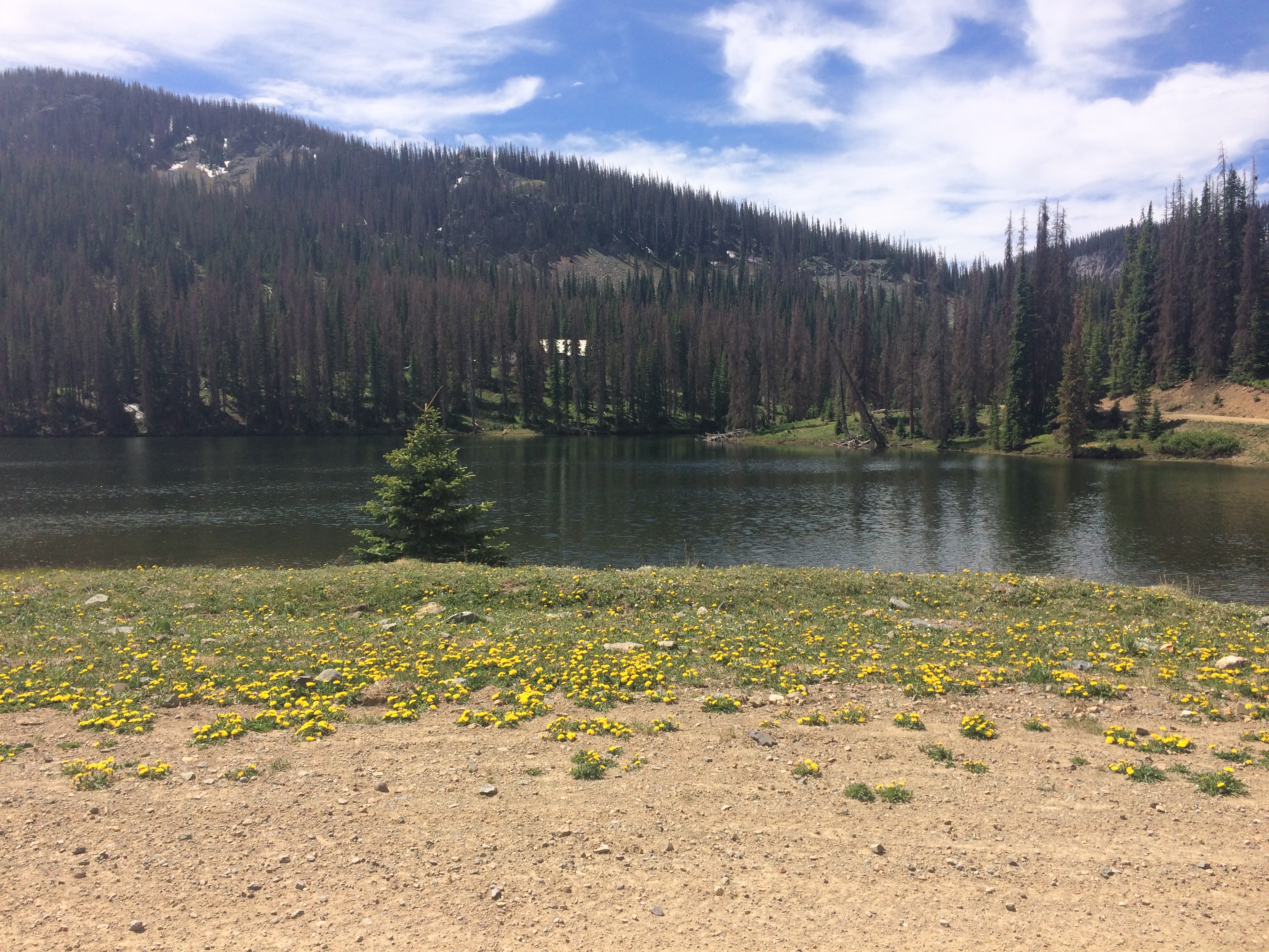
I loved the high elevation stretches of Colorado.
Colorado was turning out to be a highlight. The terrain on day 10 was smooth enough that I could do 240 miles even with an 11,000′ pass thrown in. On this day, people kept popping up out of nowhere along the side of the road. Some would just cheer, others would want to talk. I also met some Northbound Tour Divide riders (not racers). I’d even meet Neil Beltchenko (Concurrent Arizona Trail Race and Colorado Trail Race record holder). I didn’t know who he was, but he looked familiar. He showed up with a couple other guys and conducted a surreptitious “video interview.” I wasn’t aware that a camera was running, or that I was being “interviewed.”
In the “Ride the Divide” movie, racers had mentioned that one of the hardest parts of the race was the loneliness… but in 2017 with SPOT trackers, it sure didn’t feel lonesome. When I stopped at a gas station in Breckenridge, several people came in as I ate. Some just wanted to chat, a girl came running in asking for a hug. After the race my aunt would ask me how I survived without getting a hug every day. Upon reflection, I realize that I averaged one hug every 3 days – enough for my survival needs.
Coming off Boreas Pass, was an enjoyable single track – which I could tell would have been really fun if there weren’t so many downed trees and puddles. I made a phone reservation for a hotel in Salida – an ambitious goal, but they said that I could arrive at any time of the night. I told them I’d get there at 2am. It was a pleasant evening, and made notable by my meeting with Mike Jolly in the dark. He was the first of the North-bound riders who had started with the June 9th Grand Depart. Modest as he was, he seemed quite surprised to be in this position. Mike was also concerned for my welfare: he kept offering me water. I refused, adhering to the “no outside support” rule. This was the official “Golden Spike.” The term “Golden Spike” comes from the transcontinental railroad, which was built from both the East and the West. When the two lines came together, a ceremonial golden spike was driven. Mike and I were the Golden Spike.
As I always do in a hotel, I hand washed my entire kit in Salida. This time, however, there was no functioning heater or air conditioning in the room (both can dry clothing overnight). There was a hair drier, so I aimed that at my hanging clothes, set it on low, and closed the bathroom door. It is imperative that clothing stay clean to prevent rashes. A late, 7am start from Salida still wasn’t late enough. I had to go off course to find an open gas station that would sell food. Today’s ride consisted of perfect weather on good quality fire-roads. Everything was enjoyable.
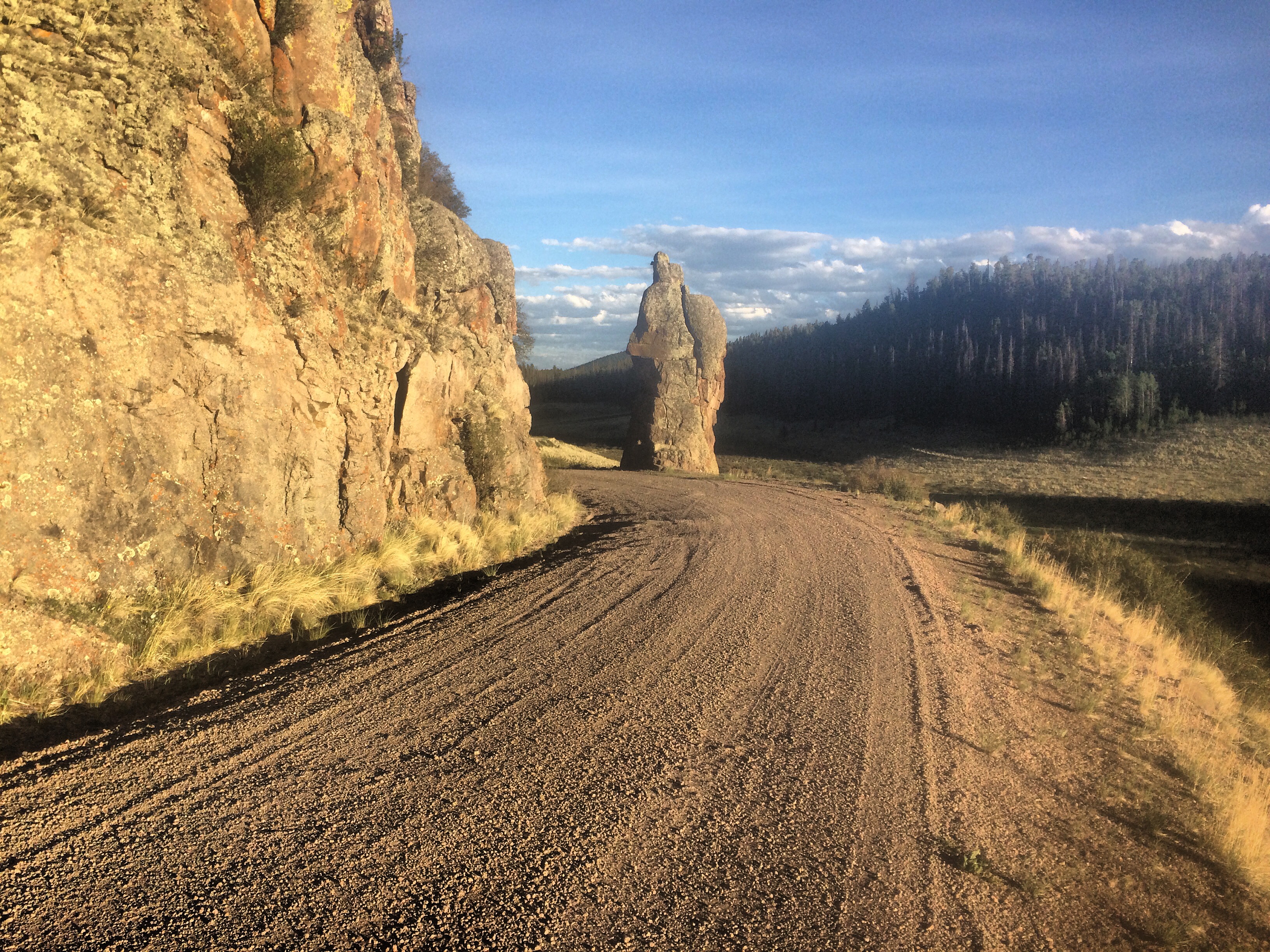
Del Norte looked close on the map, but there were still some challenging mountain bike trails between here and town.
That evening, I arrived in Del Norte. Lucky for me, the convenience store happened to be open (they told me that they had just changed their hours to stay open later, and it was a big boon with all the “kids” coming in to buy cigarettes and alcohol late at night)… In my head, I secretly thanked them, though her tone suggested they were selling to minors. I asked about the “Family Comfort Inn” that I had seen on the map, and she said, “It’s pretty bad. I wouldn’t go there.” I said, “How bad can it be? Worse than a hotel in Peru?” She said, “It’s bad, but if you need to save money, it is cheap.” I went over, and got an idea of what she meant. Still, it was do-able. I got my $70 room, and opened the already unlocked door. It was 90F inside. It turns out that this was actually a multi-room thing – kind of like an apartment. The old heater had the pilot light burning 5″ tall, contributing to the warmth. Despite my best efforts, I could not turn it off. I decided to take a bath to relax for the day. I went back to the guy in the room smelling of Indian food and asked for a fan, which he provided. To get some sleep, I had the fan pointing at me all night long – the door and all windows propped open. I figured that security wise, it probably wasn’t much worse than bandit camping. In the middle of the night, I was startled by a thud. A big black lab was in the room running around! I shooed him out, and the next morning, I found that he had even visited the bathtub – his footprints all over the bottom.
Another beautiful day in Southern Colorado
Another great day began, I was enjoying the clear skies and alpine scenery out of Del Norte at up near 12,000′. In particular, I was happy to arrive at the Skyline Lodge in Platoro. They are big Tour Divide supporters, and were very helpful. Unfortunately, their food for Tour Divide racers hadn’t shown up yet. It was imperative that I resupply because it was a long way to the next town. So, Beverly made me 15 ham and cheese sandwiches, and asked, “if there were food here, what kind of food would you want so we can stock up for the people coming?” She also had printed out several route sheets for a newly announced fire re-route that I’d have to navigate that evening.
After crossing into New Mexico, I was surprised at the diversity of the trees and vegetation that lasted for hundreds of miles. I had expected New Mexico to be more like a desert – but this part was actually quite beautiful. At the appropriate turn off, in the dark, I deviated from the original GPX file, and headed towards Tres Piedras on the fire reroute. Luckily, I had been carrying a small wifi router, which allowed me to transfer the GPX file from my phone to my GPS – so I had a track to follow. In Tres Piedras, there was lightning in the sky in every direction (though just wind but no rain overhead). I decided that I’d need shelter, and was delighted to find that the post office was unlocked. Without a tent, I slept in front of the door – ready to duck inside to the hot room if the clouds opened up.
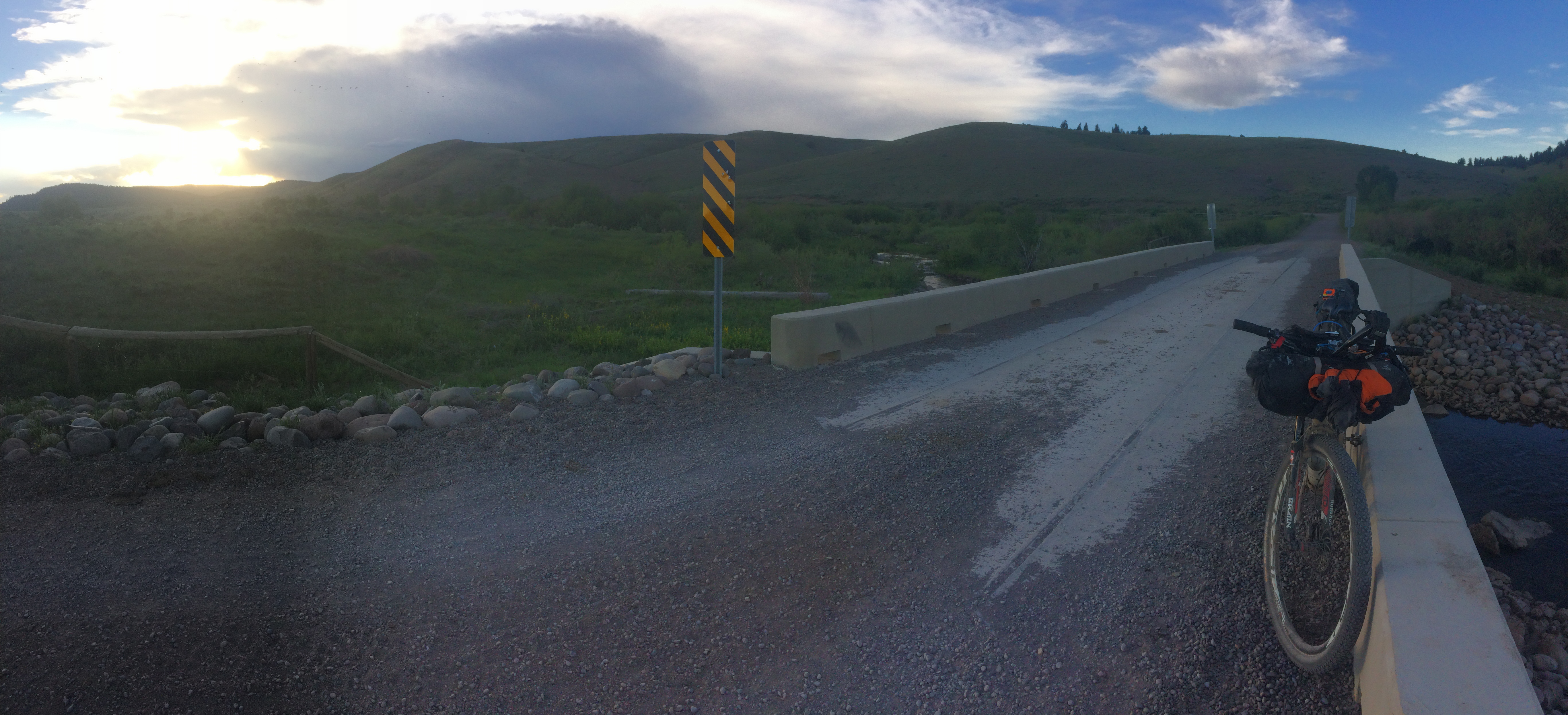
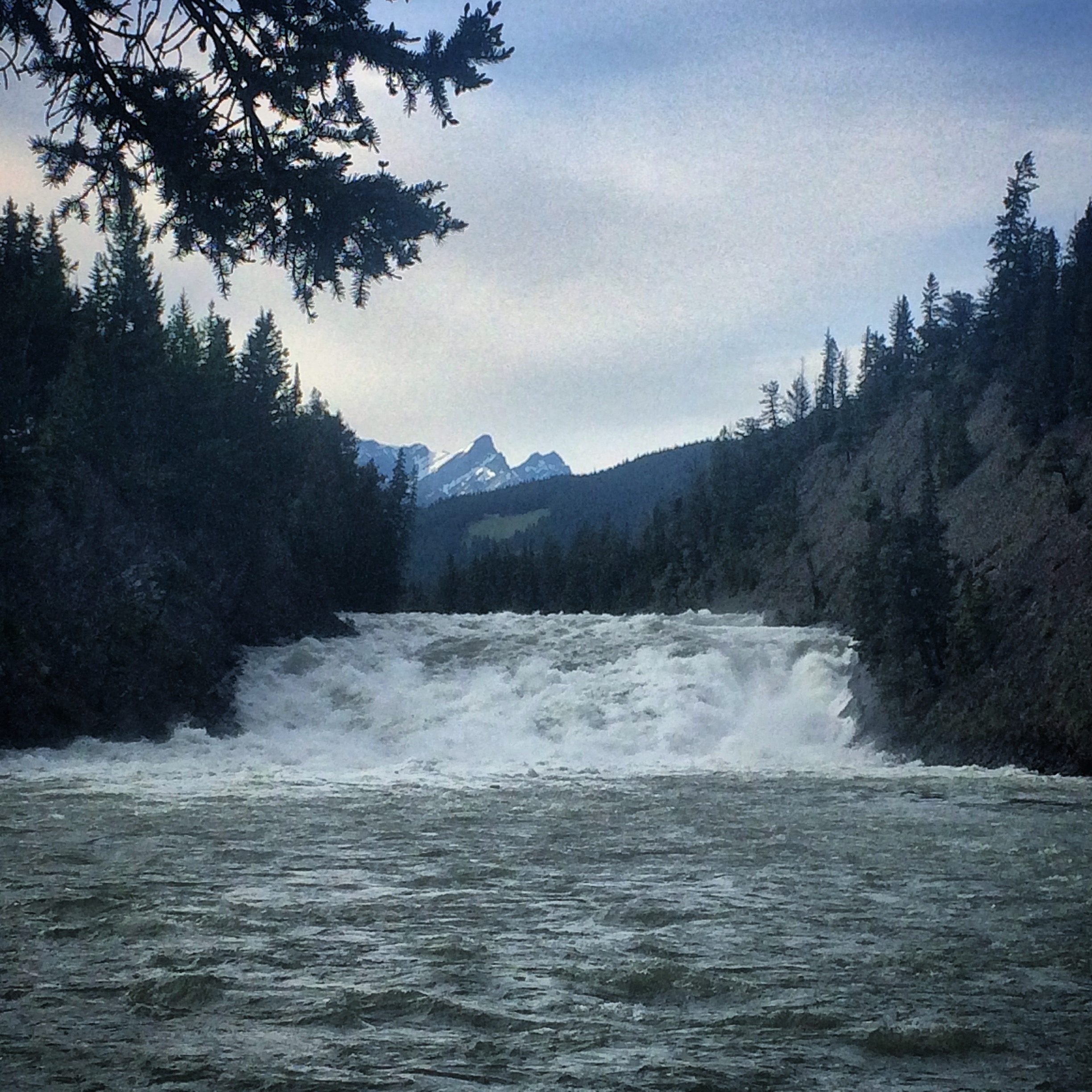
A little flowing water under this bridge – a perfect place to fill the bottles.
The next morning, I wasn’t far from Tres Piedras when hypoglycemia hit me. I have type 1 diabetes, and had been managing extremely well considering the circumstances – but the body is surprisingly unpredictable – even during predictable events. I was shaking, alone, and close to becoming unable to care for myself. I knew it was dangerous, so I stopped – and gobbled carbohydrates – about 160 grams to be exact. For reference, 1 gram of carbohydrate will raise my blood sugar 5mg/dL. So, 160 * 5 would have raised me by 800mg/dL. Normal blood sugar is between 70mg/dL and 130mg/dL. 800 would be a dangerous high – especially after coming off of a dangerous low. This all seems very foolish in retrospect, but when you’re in this situation, feeling like you’re about to die, eating 4 granola bars at once seems like the only solution. Unfortunately, this sugar doesn’t hit your right away – and the adrenaline from your stress hormones leaves you shaky for up to an hour. It all started just a few minutes after I had begun for the day, and I had to keep stopping to regain composure and test-test-test. I kept thinking that Josh was going to show up any minute and that because he was a nurse, at least he could save me. 50 minutes after starting, I had only covered 4.8 miles of paved road – mostly downhill. The panic and shakes began to subside, and I started to feel normal again. This careless eating, though, would set the stage for less controlled blood sugars the remainder of the journey. I have written a post about how I managed to do this race with type 1 diabetes. Only people who have type 1 diabetes themselves can understand what a huge deal it is to have finished the first day, let alone finish the entire race.
A hot spell was descending upon the Western United States – with temperatures predicted to peak at 113F for the next few days. There isn’t much you can do about that, so I loaded up with cold diet sodas and water and began the long, sandy climb out of Abiqui. The elevation profile of this section does not do anything to describe the difficulty, so I was surprised that I had only made it to Cuba by late in the day. I decided to treat myself and not ride into the night. Instead, I got a stuffy hot room, took a shower, and cleaned the clothing. I slept again with the door open because the 10″ by 10″ air conditioning unit simply wasn’t capable.
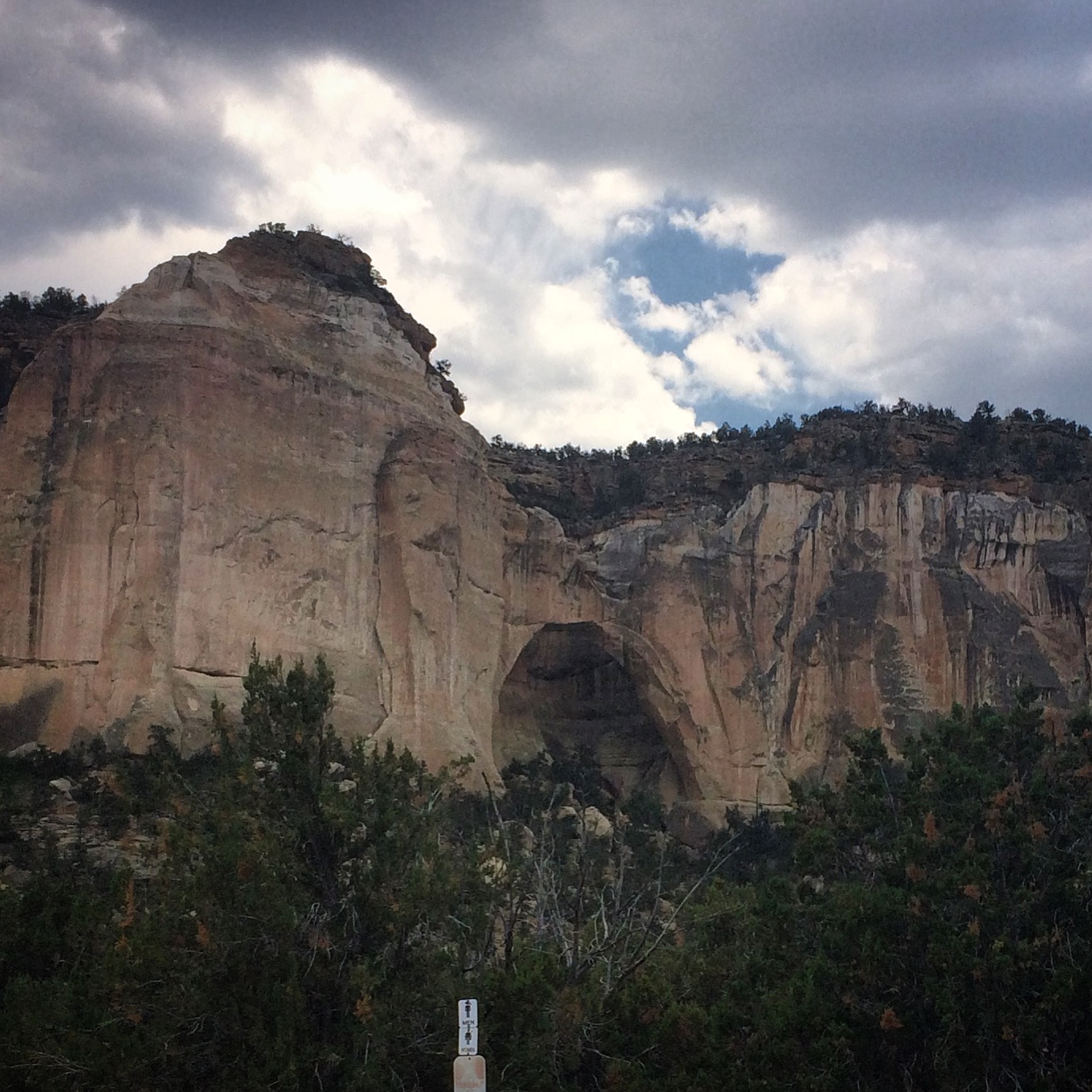
I enjoyed a scenery stop at the La Ventana Natural Arch.
I started at 2:30AM in 80F temperatures. A decent chunk of today’s ride was on pavement, so I was able to manage 230 miles in spite of the 113F high. I thoroughly enjoyed the El Malpais Wilderness area, and even stopped to check out the La Ventana Natural Arch. Late in the afternoon, I came upon Pie Town. I had called in advance to verify hours for “The Gathering Place.” The person who answered the phone assured me that they would be open to 6pm – and that they would stay open later for the Tour Divide riders. I sure was sad when I showed up and they were closed! But then I saw a man and a woman on the porch of the next pie place to the East. I was desperate for food because there was a long stretch ahead with no supplies. The guy on the porch looked somewhat familiar. I said hello, and they told me that “Pie-o-neer” was about to close – but I could probably still get some pie. Inside, Kathy and Stan were friendly and gracious. Yes, it was late, but they had a free piece of pie (being paid for by Salsa Cycles – Thanks, Salsa!) ready for me to choose. I told them about my predicament – needing food for the next leg. They said that they don’t sell food, but they would look in the back to see what they could do. Kathy eventually produced a big bag of leftover quinoa, as well as a huge bag of tortillas filled with peanut butter that she had just made. I wanted to pay them, but they kept refusing. I finally managed to coerce Stan into very reluctantly accepting a $20 – at least for their kindness. It was so generous of them to want to help me out like that. We all went outside and chatted on the porch – where I found out that the familiar looking guy was Kenji Kato (Josh Kato’s brother). He and Alberta had kindly restocked the Toaster House with food for all of the tour divide riders. Since Montana, they had been spectating from a distance – as not to interfere with the racers. I’m glad I met them, though, because they were really fun. The conversation the five of us had on that porch was one of the highlights of the day! Since I already had food from Kathy and Stan, I skipped a visit to the Toaster House, and headed off into the next leg. It soon became dark, and I slept on the porch of an isolated church in the middle of nowhere. Even though the skies were clear, sleeping on the porch saved me from having to set up my tent.
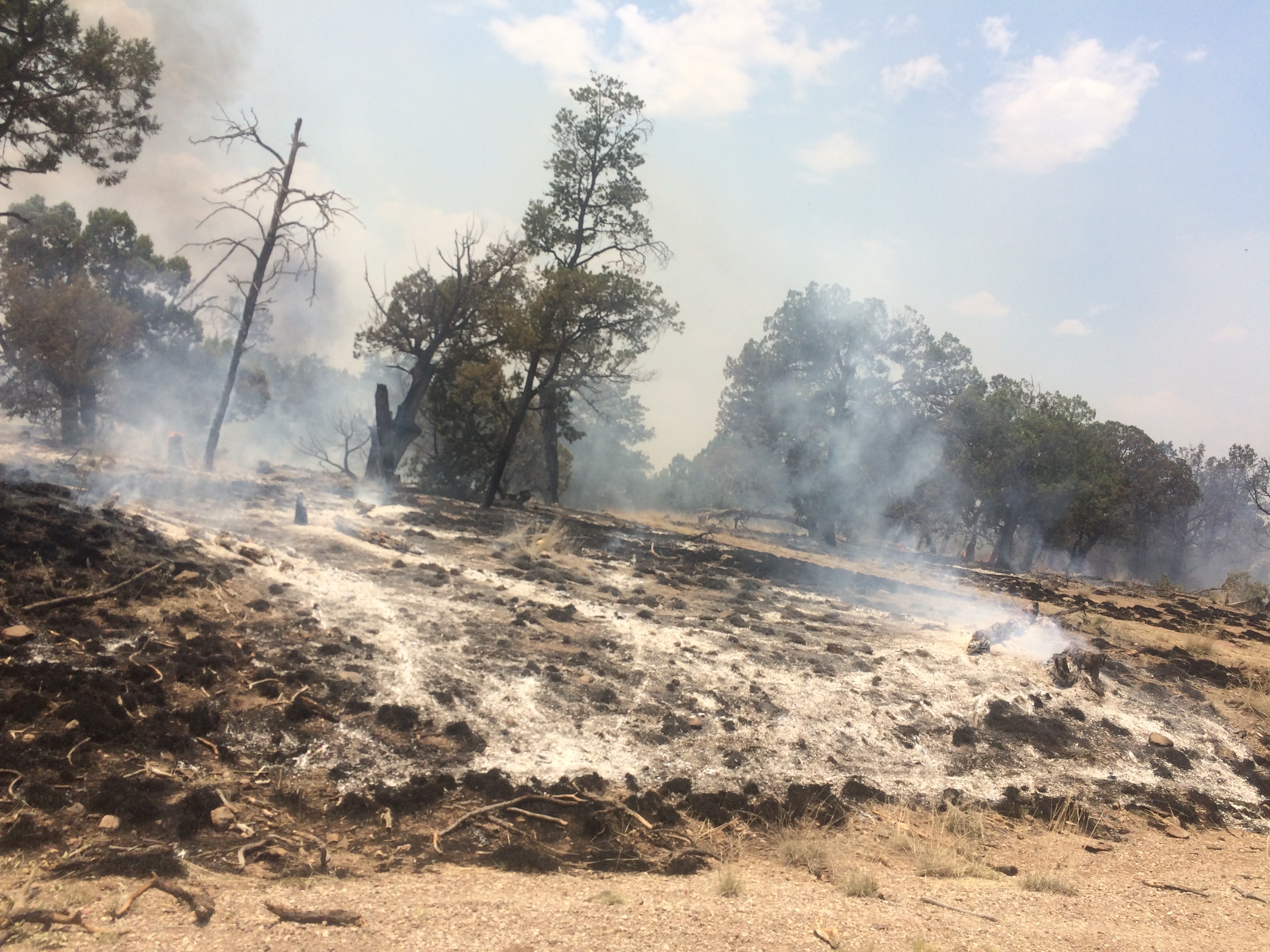
Riding past the fires that had engulfed New Mexico
The last day had arrived – but it was still 260 miles to the border. The terrain was relatively easy until the Beaverhead Ranger Station (a very necessary water stop). From there, a series of lengthy climbs and steep descents consumed a lot of time in the push for Silver City. Making it more difficult was the smoke from the fires that were burning right up to the edge of the dirt road. There were firefighters everywhere. Every 200′, there would be a fire fighter sitting on the left side of the road, with their backs turned toward the fire which was burning on the opposite side of the road. This went on for miles. At least I had “company,” as some of them would say hello. Out here, I would also meet a friendly couple who had hiked quite a ways to see me. Later, two separate guys would join me for a McDonald’s dinner in Silver City (one of them had been chasing me down on the way into town). I chatted with both of them, separately, for a while. Up until now, I had been keeping my caffeine intake at under 75mg/day. So, as the sun set over Silver City, I took advantage of Micky D’s free refills – consuming about 5 large cups of diet coke. Within minutes, I was on high. I felt very happy riding in the dark. Although downhill, the Separ road was the final challenge with it’s sand traps and washboard. The temperature never dropped below 85F that night.
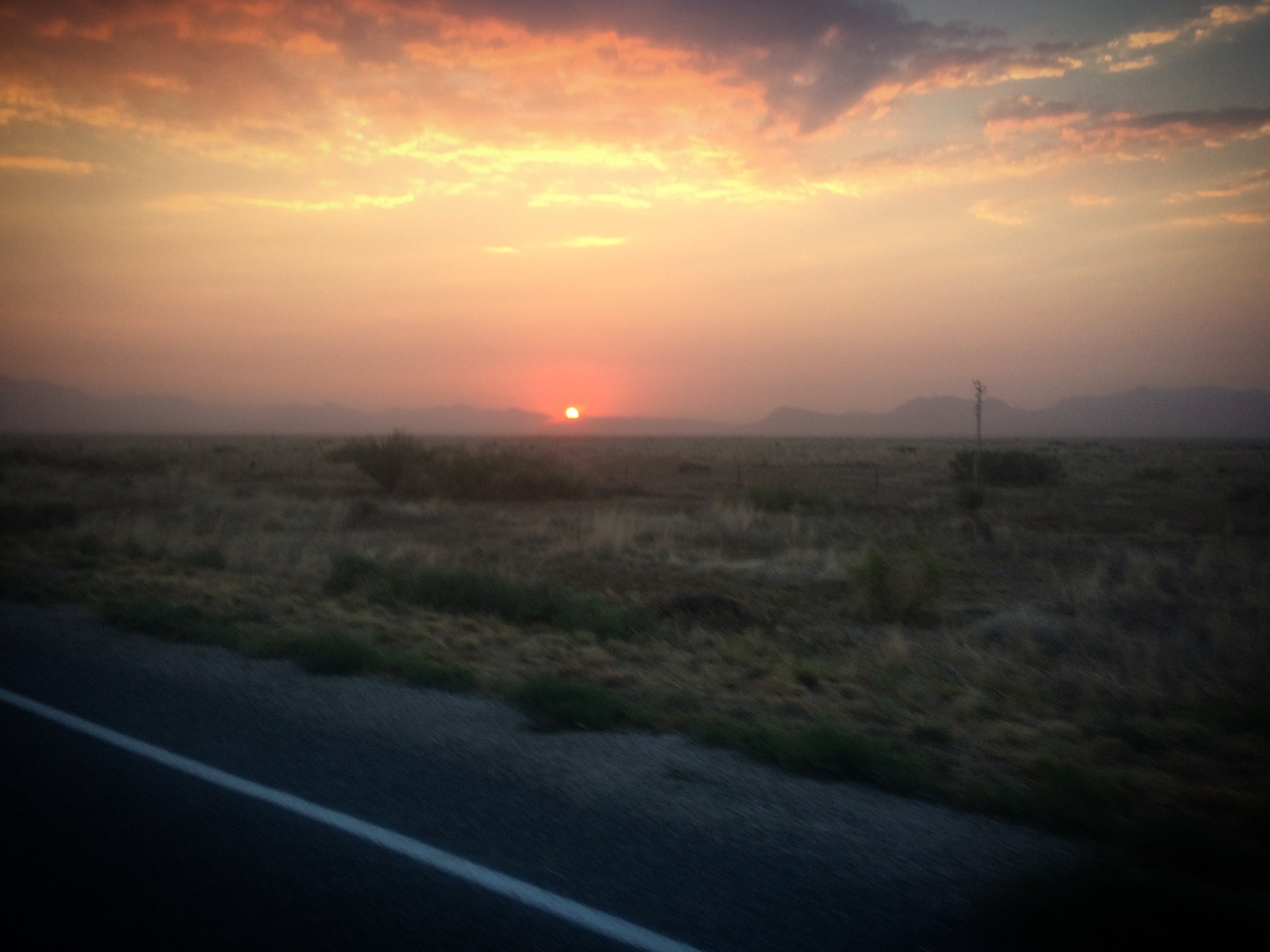
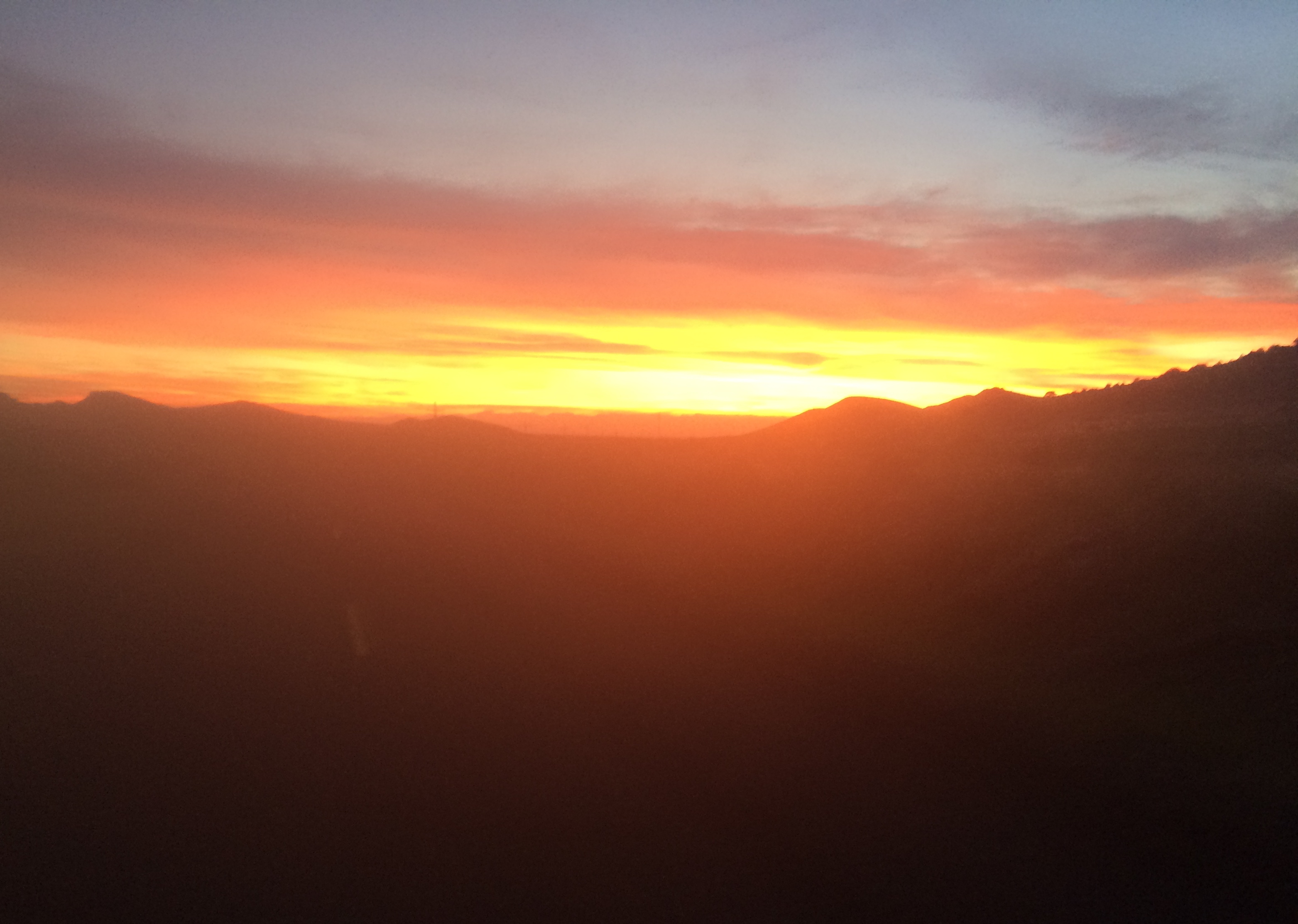
Sunrise just before Antelope Wells
When you turn onto HWY 146, it’s the last stretch of road. You’re almost there. The sign says 65 miles. It is such a strange feeling to see 65 miles and think to yourself how close that feels. Normally, that would be a full day’s ride. At 3:00AM, there was a car parked with it’s headlights on in the Hachita area. A man named Jeff called out and asked me to stop for some water and pictures. It turned out that he is “the guy” that takes people from the border back to civilization. He asked how I was getting back. I told him that I had no idea. He said, “lucky you met me… I’m the guy! I’m going to go back home, take a nap, and I’ll come and get you. It will be really fun. I’ve already got Stephan at my place. We can all hang out at my place and when Ben comes, we can go together to get him. Then I can take you all to Lordsburg.” Not sure what I was getting into, I said, “OK.”
The road to Antelope Wells makes you delirious with its straight flatness – but I still had plenty to contend with. Every few seconds, a rabbit would run across the road. I would have to swerve to avoid these creatures because every so often, one would freeze in front of my headlights. I know I wasn’t hallucinating because when I finally accidentally hit one, both tires went thump-thump. In those last miles, light began to cover the land… and a vehicle drove past me. It was an SUV with a bike rack, and I thought to myself, “Oh, cool – spectators. There are going to be people at the end!” That brightened me up quite a bit. Then, randomly, I started to think about my sister. I remembered a conversation I had with her early in the week – she and her family had been in Los Angeles. I thought to myself, “that’s funny… they don’t travel often…” I suddenly had a revelation: Perhaps my sister would also be at the end! About as quickly, I realized that was an absurd thought – they have two kids, including a 4 month old. For the first time in the race, I started to tear up due to the roller coaster emotions of the event. The whole thing was coming to an end – and I was both happy and sad about that.
I could finally see the finish, and there was just one car in the distance surrounded by the wasteland and a chainlink fence… and a little kid bouncing up and down in a pink suit – my 5 year old niece. Sure enough, my sister had brought her whole crazy family out to this desolate spot at the border of USA and Mexico. I started to cry and pushed as hard as I could to get there fast.
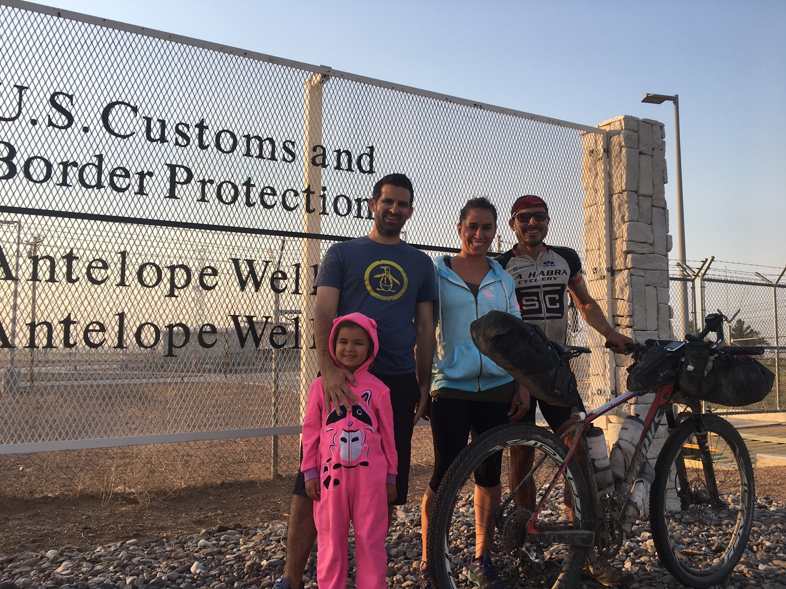
My sister drove her whole crazy family out here just to be at the finish. This was the greatest feeling in the world.
Thanks for reading! Surely that was enough… but if it wasn’t, here are some links to other media:
1) A 1 hour interview with Adventure Sports Podcast. I’m very fond of this one because Kurt is a great interviewer who “gets it.” Also, we dedicated a decent part of the interview towards talking about type-1 diabetes.
2) An interview with Neil Beltchenko from bikepacker.com. We really get down to the point in this one.
3) Interview with KSBY’s Jessica VO.
This is the map for the entire route discussed in this post. To Export GPX files, click on the three horizontal bars in the upper right hand corner of the map and select Export selected map data... To see full screen, click here (opens in new window)