Bikepacking Ecuador – Quito to Banos via Quilotoa
We had been dreading leaving Quito. This is not due to the fact that we loved the city, but because we were worried about the long section of heavy traffic. The route that we provide here was surprisingly pleasant – a huge section of road was busy being constructed. It had been paved, but no cars were allowed on it yet. Furthermore, it was all downhill, meaning that we could fly down freely without a care. You might not be so lucky. We still think this is the best exit from town on any day that is not Sunday (Ciclovia day).
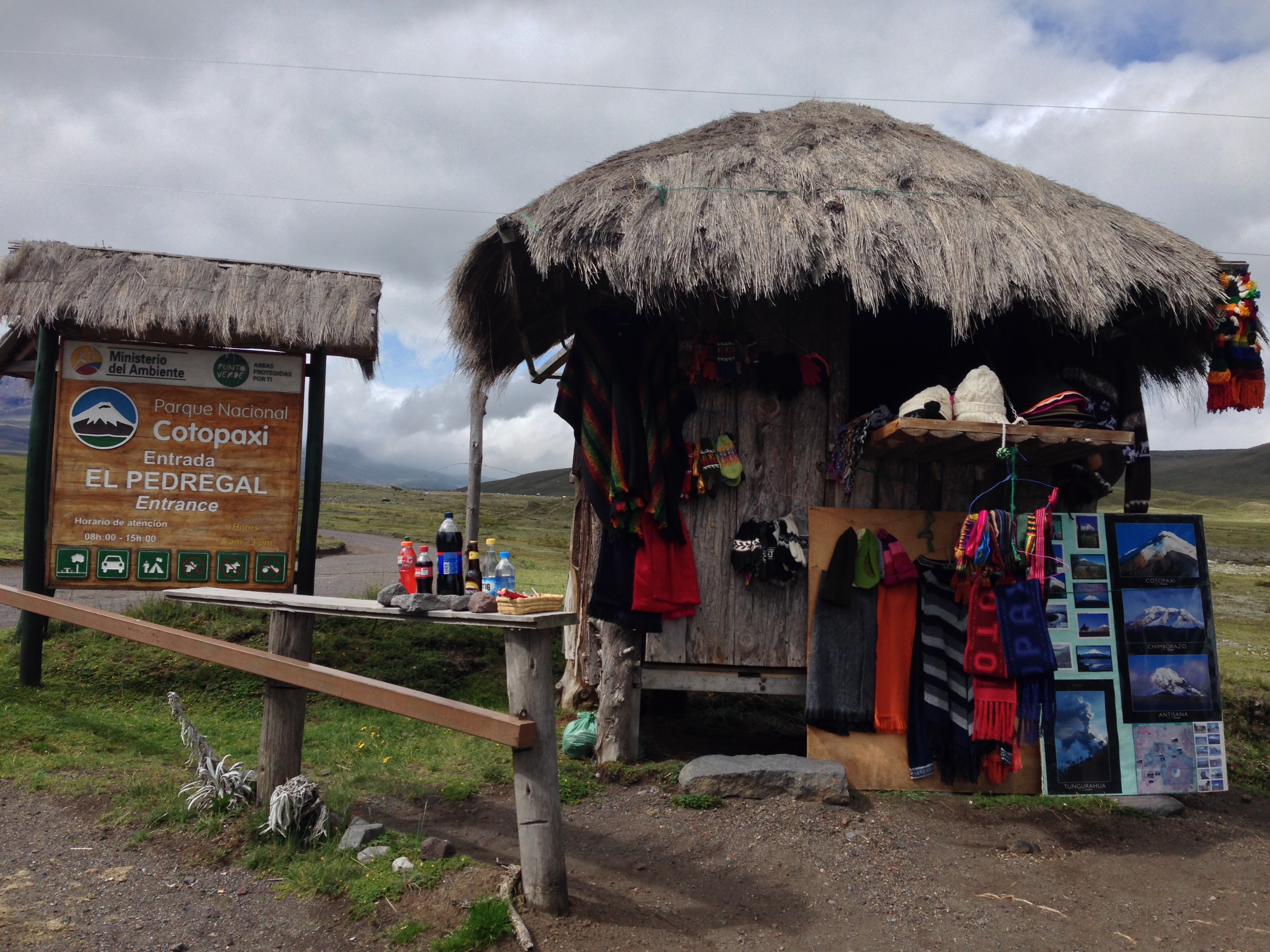
The North Entrance to Cotopaxi park.
Cotapaxi by Bike
The departure from Quito is relatively uninspiring until you get well out of town. After you pass the Regufio de Vida Silvestre Pasochoa, you will start climbing into better scenery. The route is paved from Quito to just South of Barrio San Antonio / Barrio San Fernando. After that, you will be on rough cobbled terrain for much of the climb. A little before you reach the park entrance, the dirt becomes decent quality until a few miles after you pass the Laguna de Limpiopungo (inside Cotopaxi park). After this point (heading South), the pavement is superb, with wide bike lanes and no traffic!
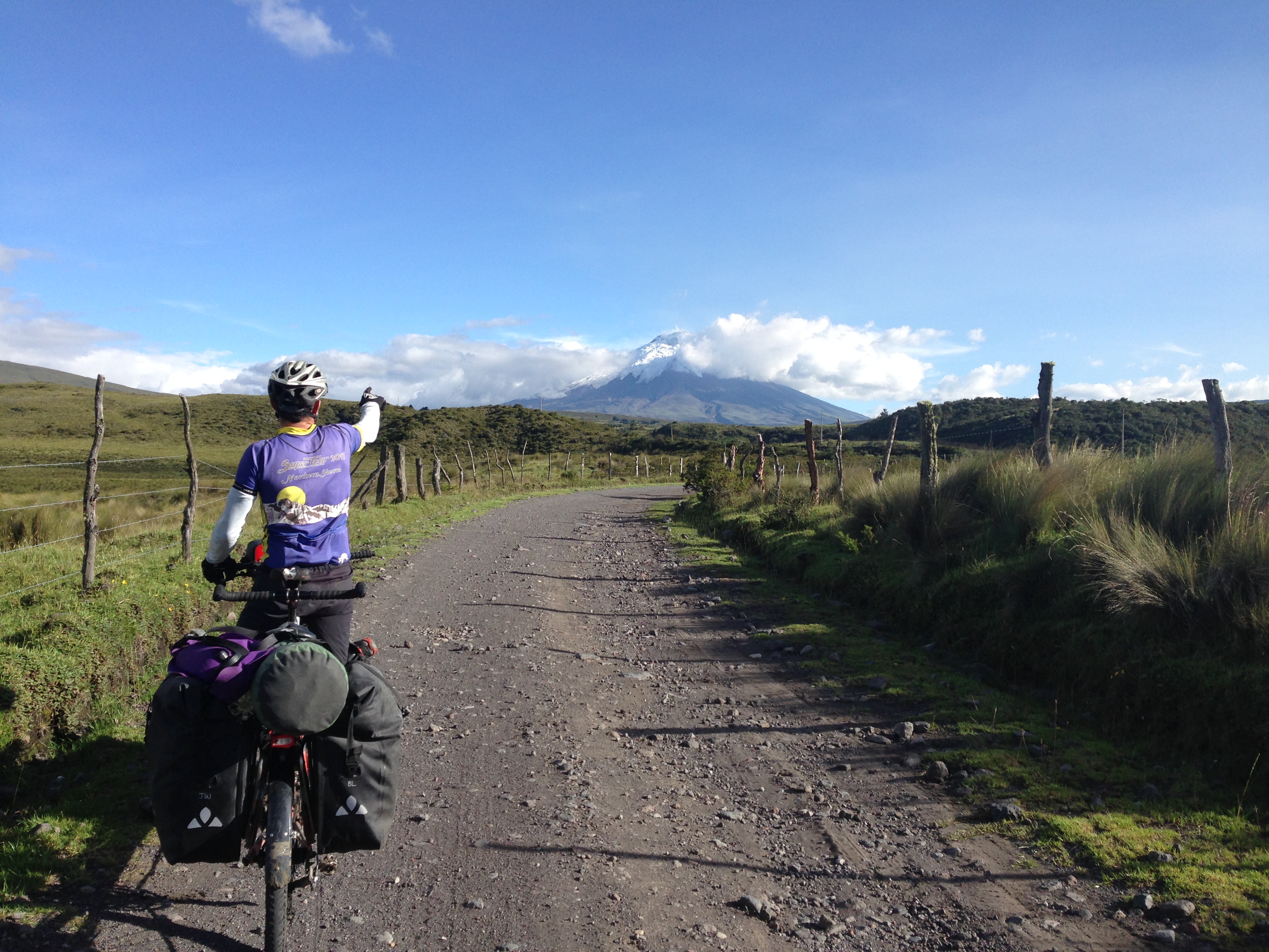
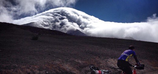
We were really excited at our first sight of Cotopaxi – even though we wouldn’t be climbing it.
As an alternative to climbing Cotopaxi, you may be satisfied with a hike up the peak of Rumiñahui. Access begins just past Laguna de Limpiopungo. See map below:
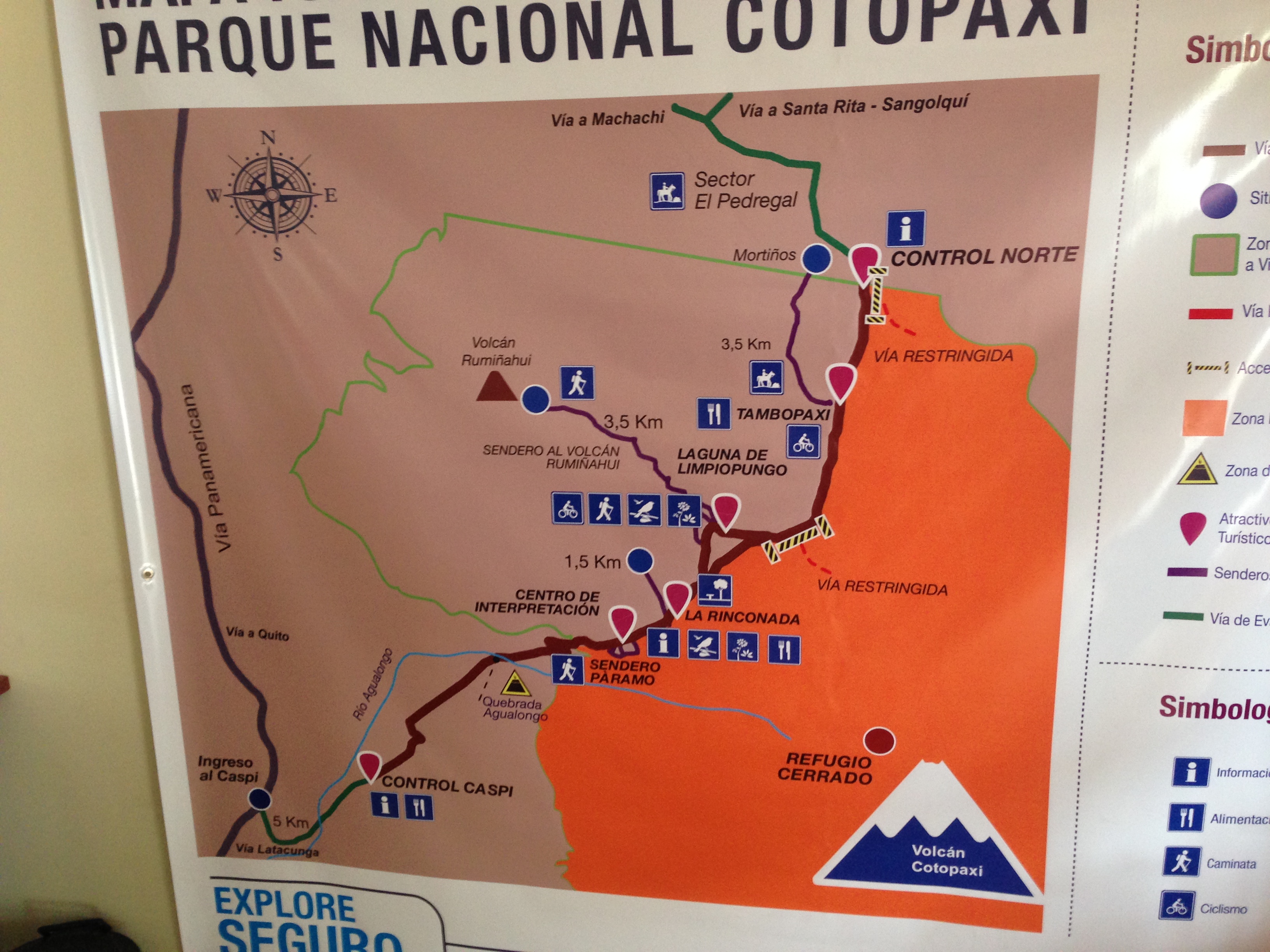
The boundaries of where you can (and cannot) go inside of Cotopaxi park as of March, 2016
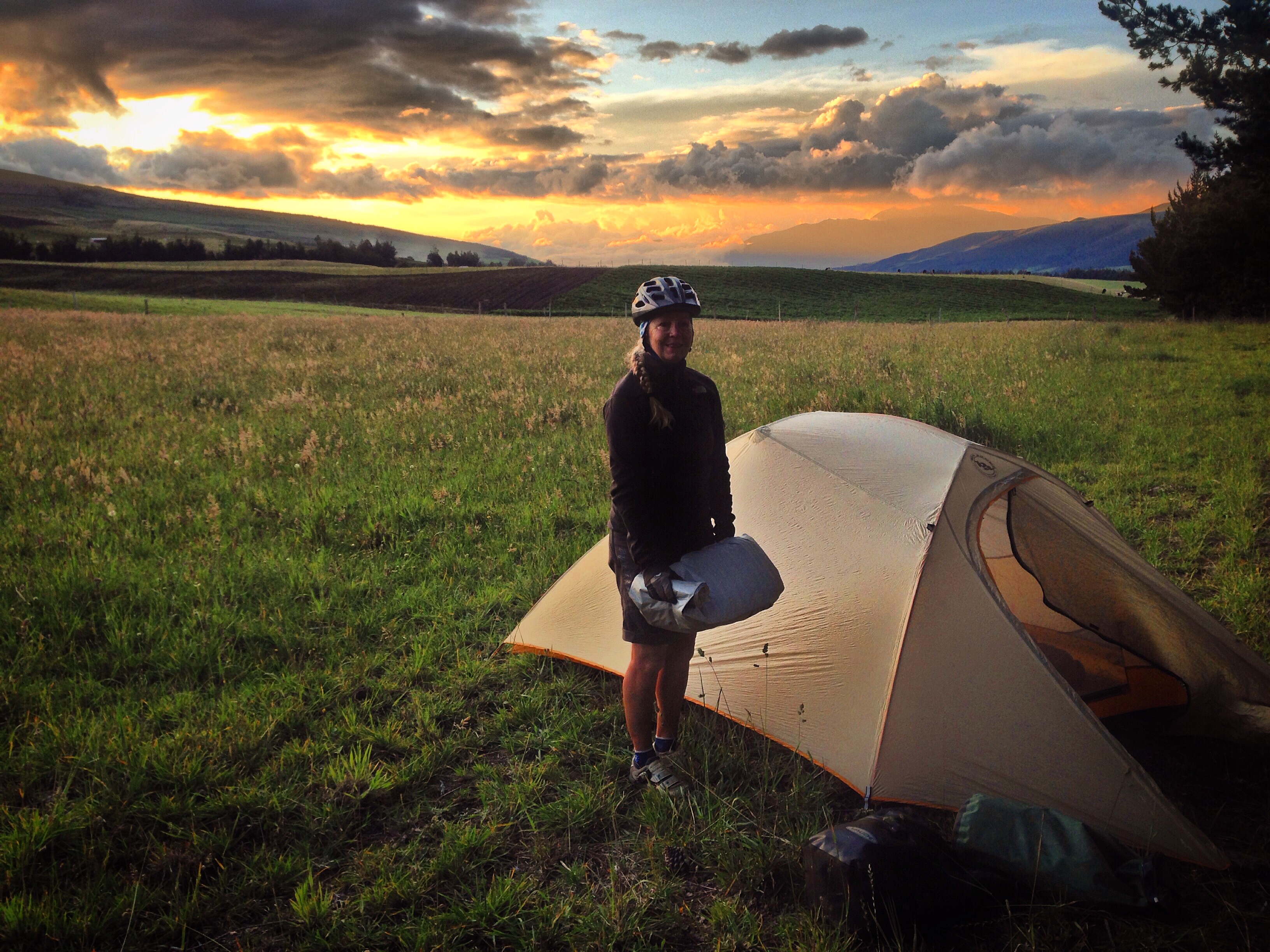
Our camp the night before entering Cotopaxi park.
Cotopaxi erupted in August 2015, and since then, the peak has been closed to climbing. The park is still open in a partial state. We found the dirt route through the park to be beautiful and worth it. You cannot ride any closer to the volcano than we did.
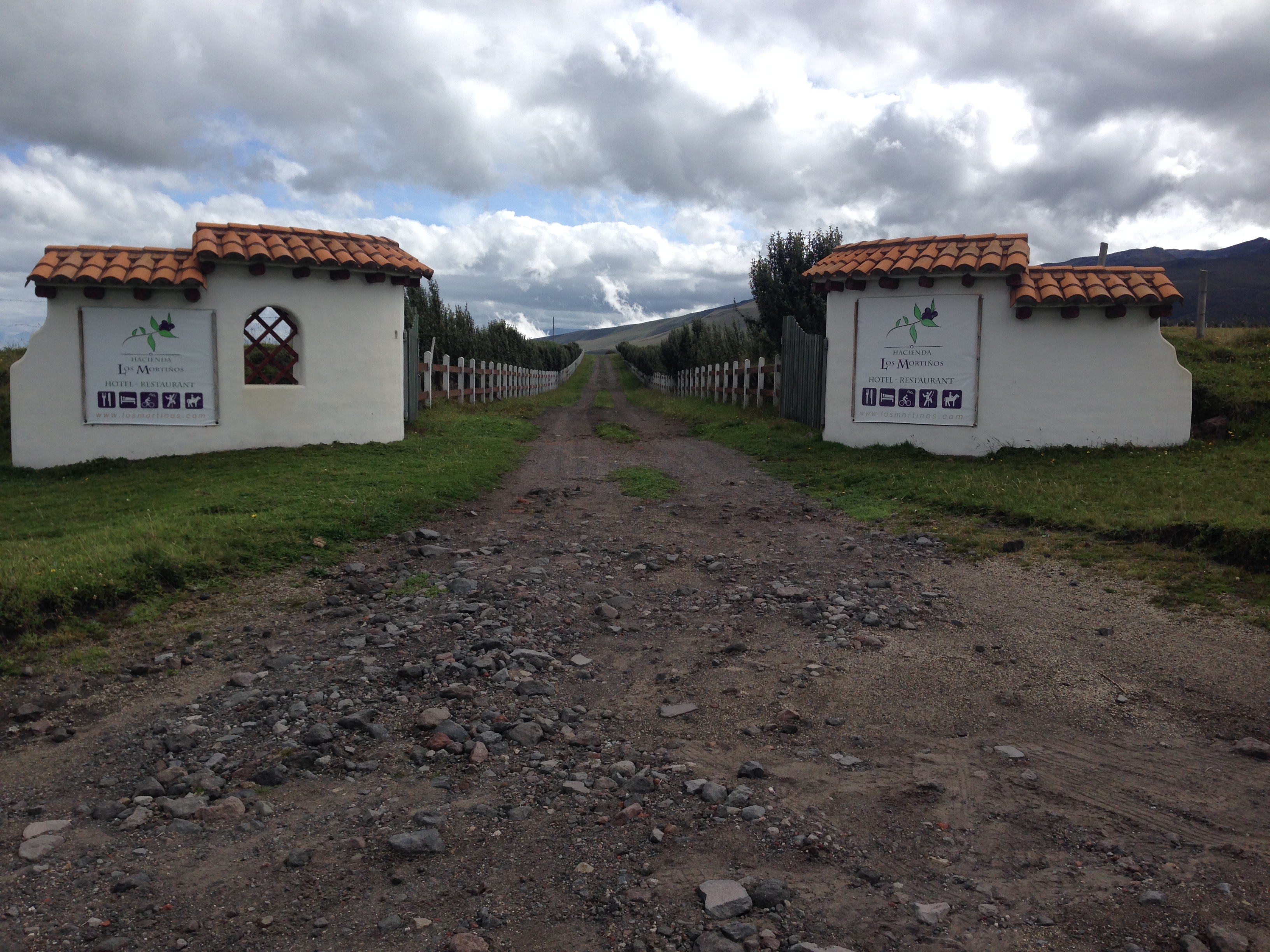
Shortly before you get to the Cotopaxi entrance, there is this lodge – probably too expensive for the typical bike packer. You will see on our GPS track that we went across private property to link the two nearby roads. We recommend that you ride directly to the park entrance instead of following our circuitous route. This lodge is located here: Latitude: 0° 33′ 9.528″ S
Longitude: 78° 27′ 4.632″ W
Although this route is not ideal for bike packing (because you cannot camp inside the park), we found a couple of locations just outside of the park that would be ideal for wild camping. Alternatively, there is a lodge inside the park (two photos down) as well as the lodge mentioned above.
Coming from Quito, a good opportunity to get water before you enter Cotopaxi would be here: Latitude: 0° 29′ 47.04″ S
Longitude: 78° 26′ 9.732″ W This could also be a good place to wild camp. No camping is allowed inside Cotopaxi park at this time.
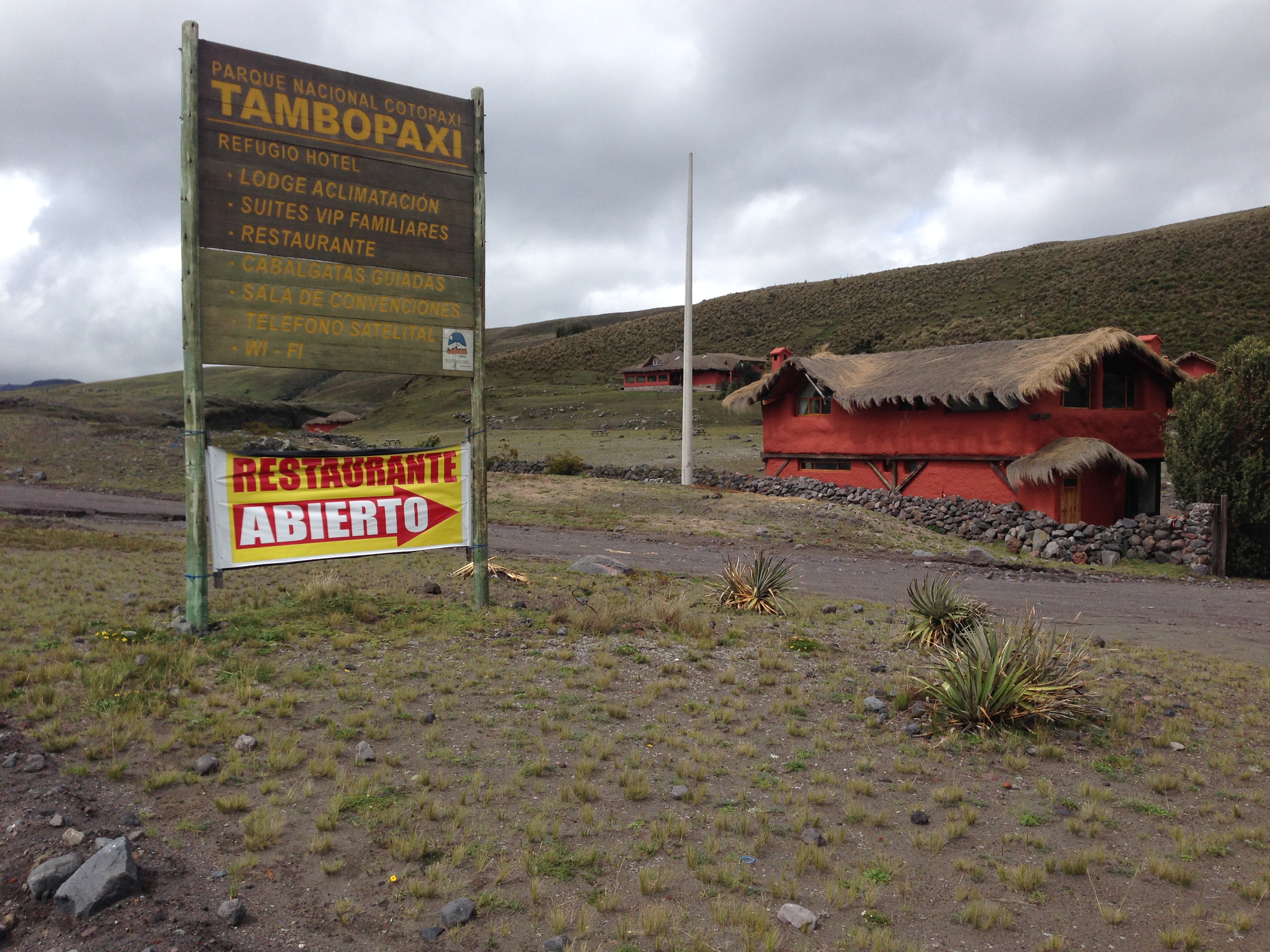
Inside the Park of Cotopaxi, there are some accommodations, but no camping is allowed at this time. This lodge is located here: Latitude: 0° 33′ 48.342″ S
Longitude: 78° 26′ 36.042″ W
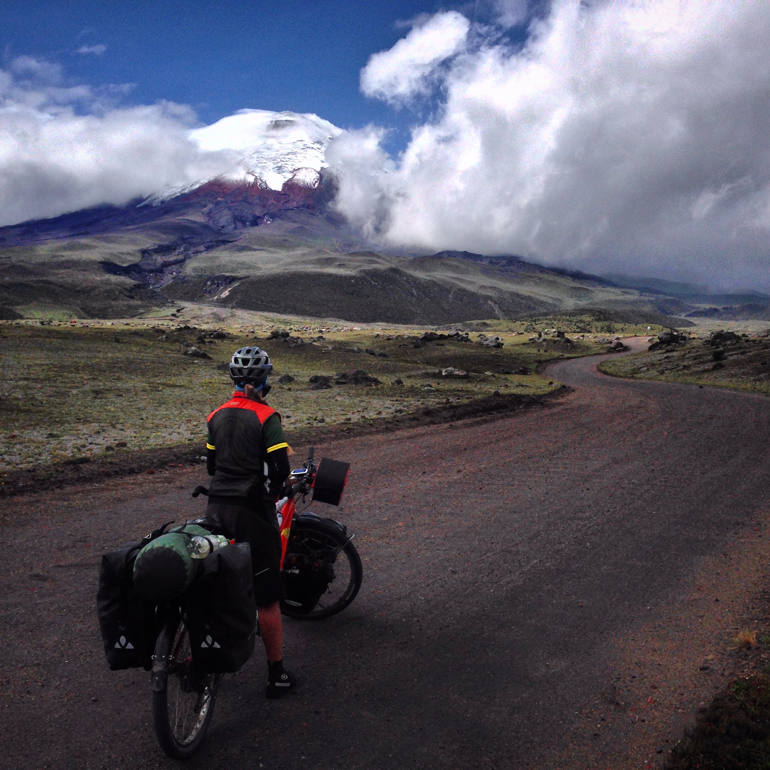
One of our better views of Cotopaxi. At this time, you’re not allowed to climb the volcano. You may ride your bicycle along the inside edge of the park. Entrance is free.
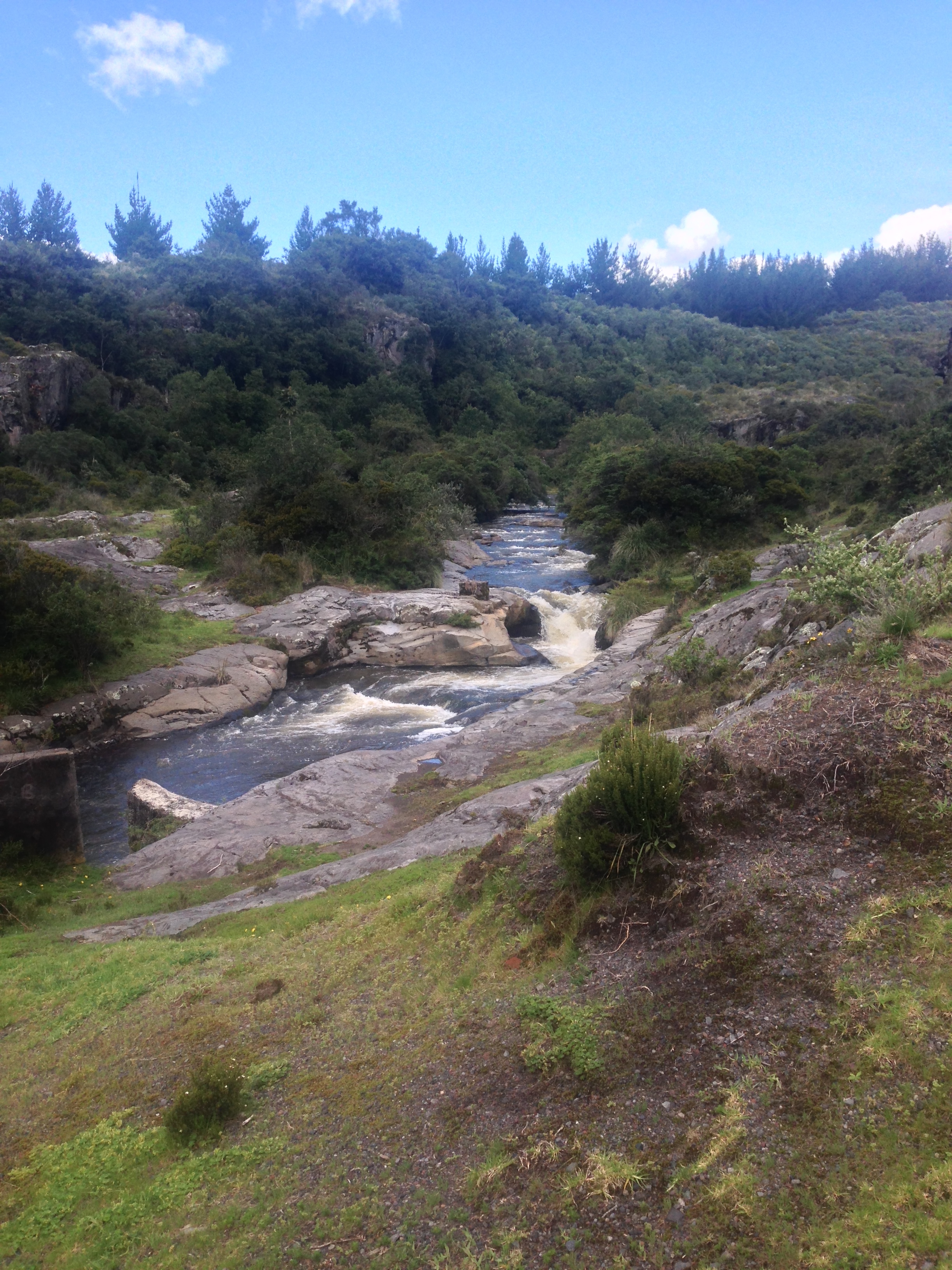
On the South side of the park, there seem to be fewer opportunities for camping. Furthermore, it wouldn’t be as safe due to the large swaths of mud flows (from glaciers melting due to previous eruptions).
Quilotoa circuit by Bike
Where our route crosses the PanAm, you can resupply with food. The route from here towards Quilotoa is mostly paved through farms and fields. There are some surprise climbs-descents. Because of the climbing, it’s a long day from Cotopaxi to Sigchos. You may consider splitting this into two days. There are at least 3 opportunities for accommodation in Sigchos. We were pleased with our hotel for (Jardin de los Andes $16) for two people.
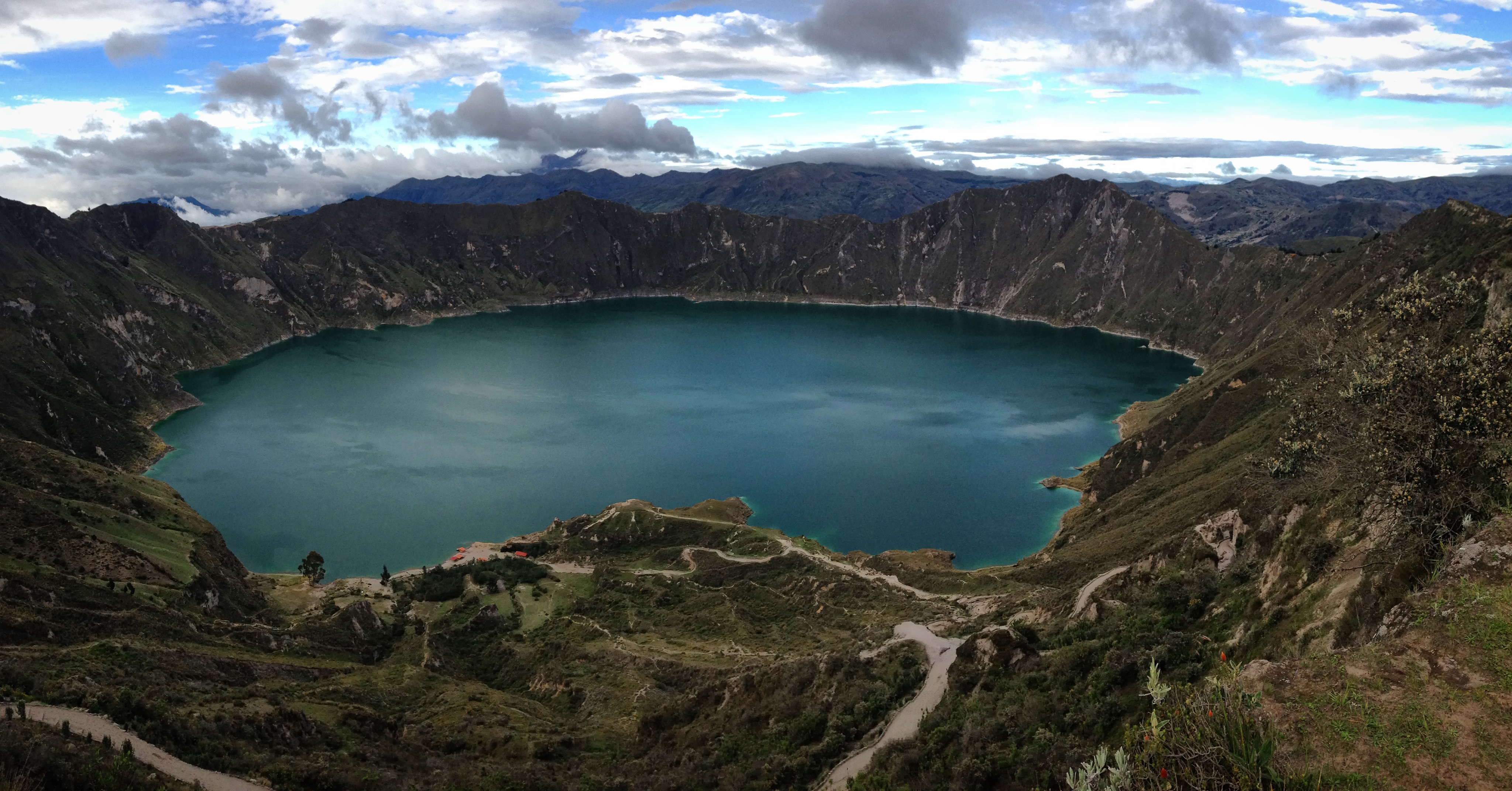
Laguna Quilotoa
From Sigchos to the town of Chugchilán, it is a long, unpaved climb. At the time we passed through (March 2016), there was a great deal of road construction, meaning dirt and rock roads, land slides, very difficult riding, and flat tires. In short time, I’d expect this section to be paved. In Chugchilán, there are 3 opportunities for accommodation Hostal Cloud Forest, Mama Hilda Hostel, and Black Sheep Inn (which gives a discount for cyclists). Camping and food are also available. From Chugchilán to Quilotoa, the road is paved, and well graded (until the end, where it pitches up steeply).
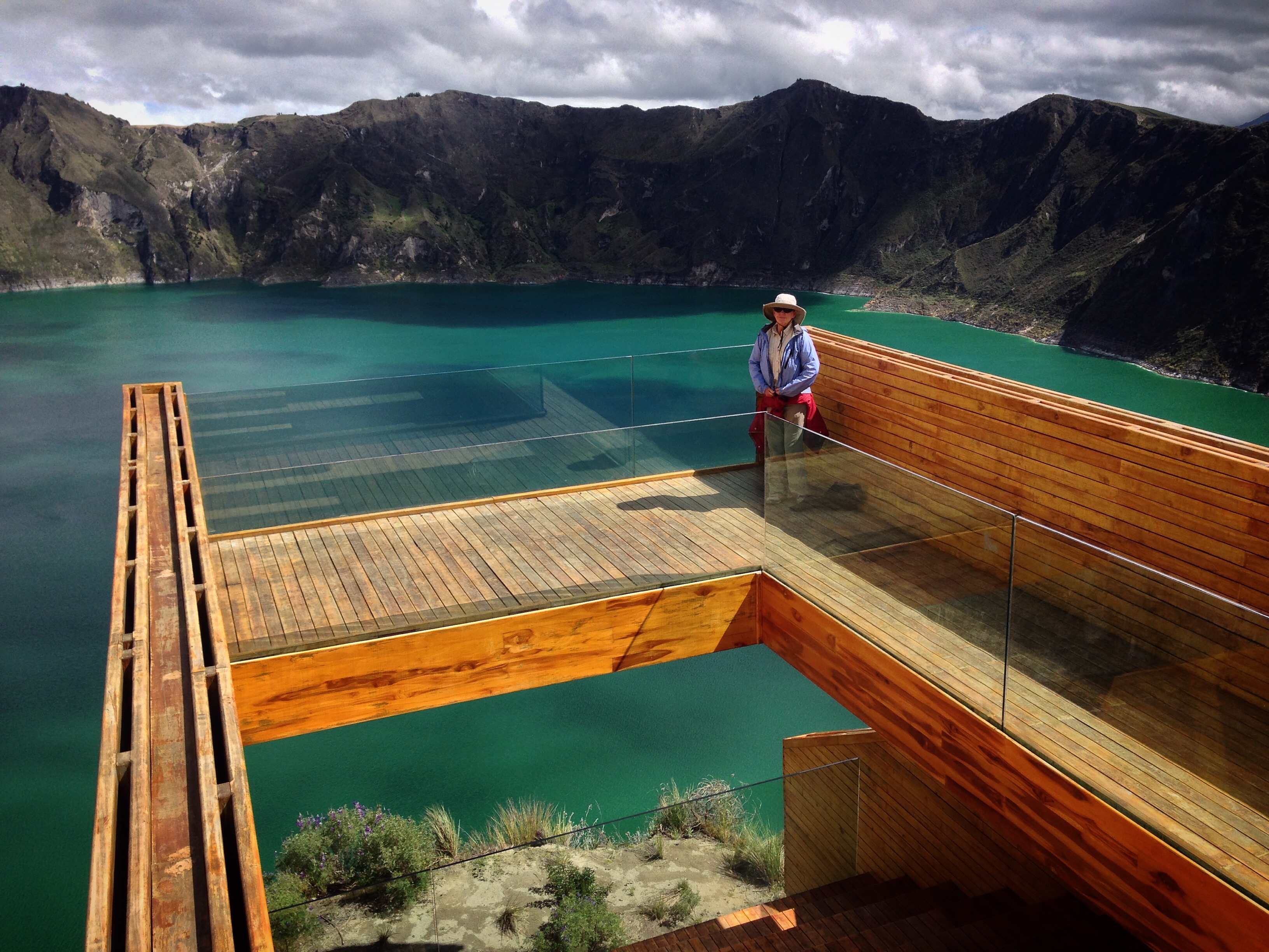
Laguna Quilotoa. Beautiful from all angles. There is a viewing platform on the Southern side of the lake.
One thing we noticed while riding this route was the friendliness of the people. Everyone smiled and waved. Other regions of Ecuador had not been quite this friendly. I expected that the popular Quilotoa circuit would be less friendly (due to an imagined heavy presence of tourists), but really, the only tourist influence is in the town of Quilotoa proper. Everywhere outside of the town itself, we were greeted by very friendly locals. Sometimes, kids walking home from school would run alongside our bike for miles, making conversation with us.
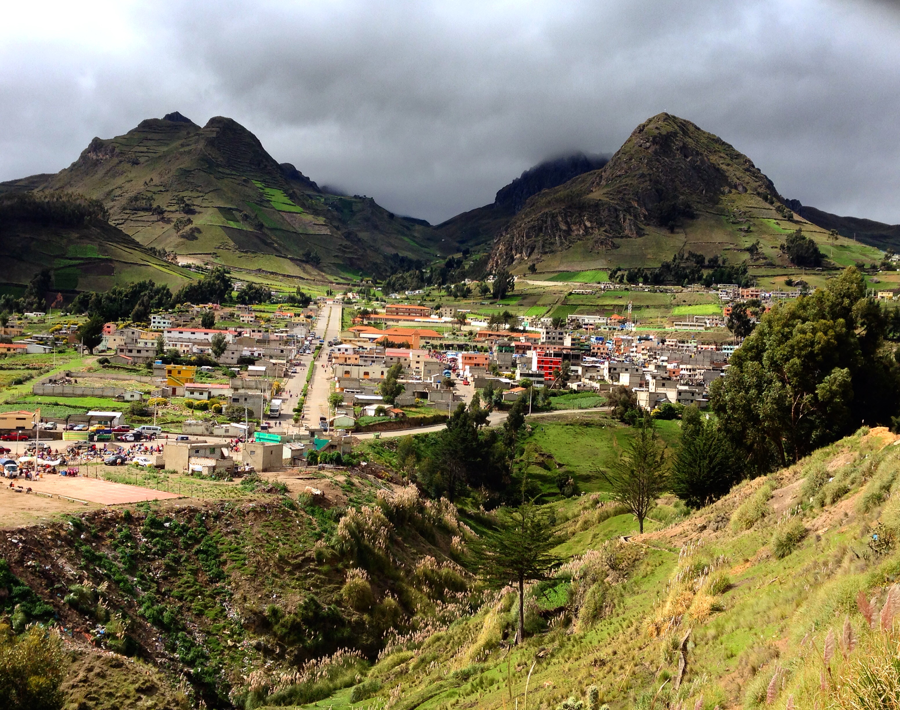
The town of Zumbahua. We liked this town much better than Quilotoa because it did not have that touristic feel.
The village of Quilotoa itself was a let down for us. As soon as we entered the town, there was a gate, and we were told that we needed to pay to enter the town. We were given a receipt (meaning it’s truly official). The purpose for the fee was so we could visit the artisan stalls, use bathrooms, and make use of the hotels and restaurants. Quilotoa was also the first region in Ecuador where children started asking me to take their photos for a dollar. Of course, this is a behavioral adaptation brought on by tourists who willingly dole out dollars in exchange for cute photos (I’m sure it stared by tourists asking to take photos, and then giving – now it has evolved into children asking people to take photos). I have mixed feelings about this situation. On one hand, it’s a fairly harmless way for money to enter the local economy. On the other hand, other communities seem to be doing much better with organic forms of commerce. To see two examples juxtaposed, check out the neighboring community of Zumbahua – it’s just a few miles away, but it seems to have thriving commerce. Meanwhile, Quilotoa (where all the foreign money comes) seems to be impoverished and dirty.
In spite of our concerns about the town itself, the lagoon is extraordinary. It absolutely merits a visit, and if you have the time, a lap around the perimeter. At a rapid pace, about 2 and a half hours; at a slow pace, up to 6 hours. You can also walk down to the lake itself.
Quilotoa to Baños by Bike
Our route to Baños is unique and takes you on some very quiet backroads. We saw only a few cars, and the majority of the section was paved. In return for the tranquility and beauty, though, you’re going to need to pay the high price of several steep climbs. We were able to find and excellent meal in the small aldea of Patate.
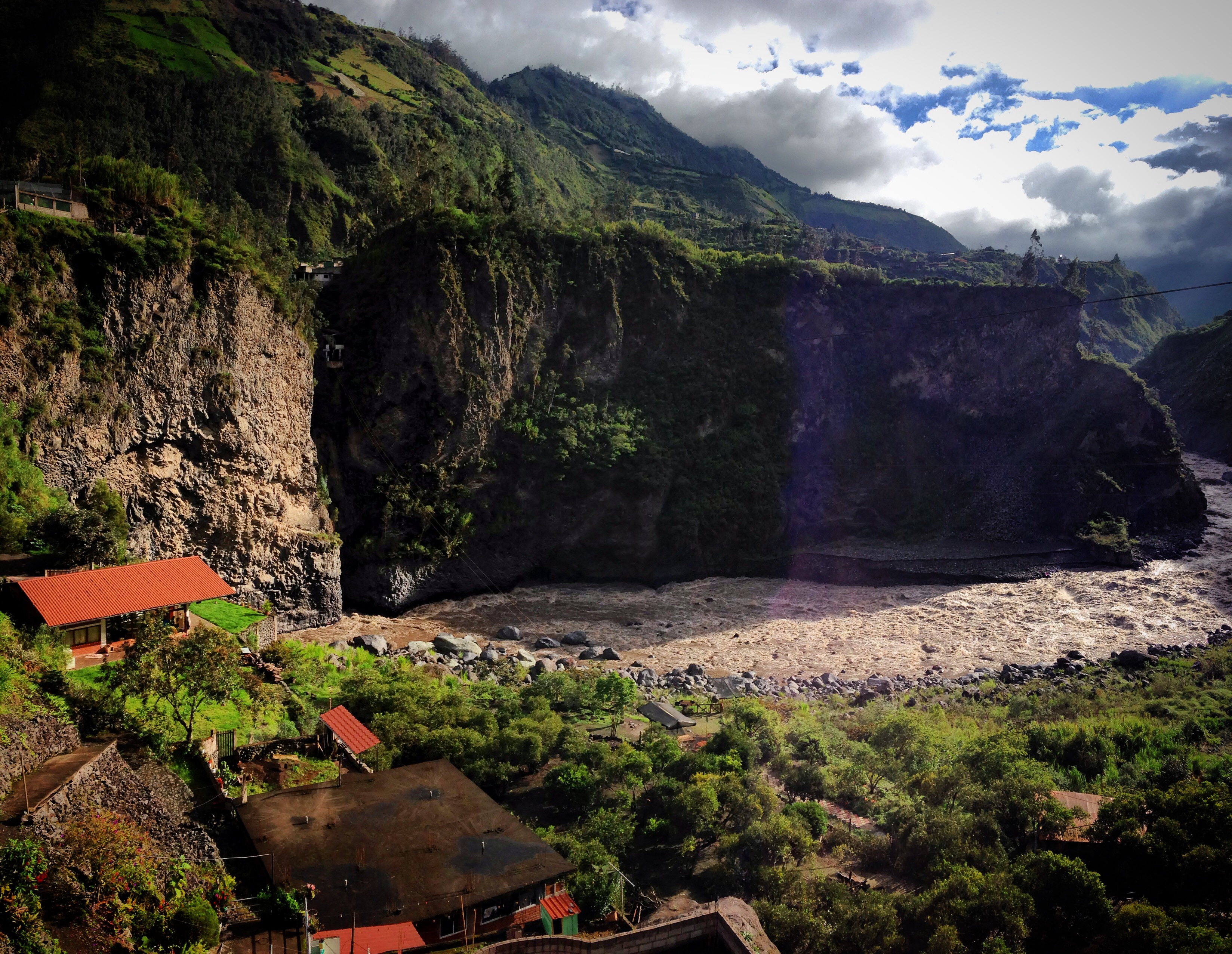
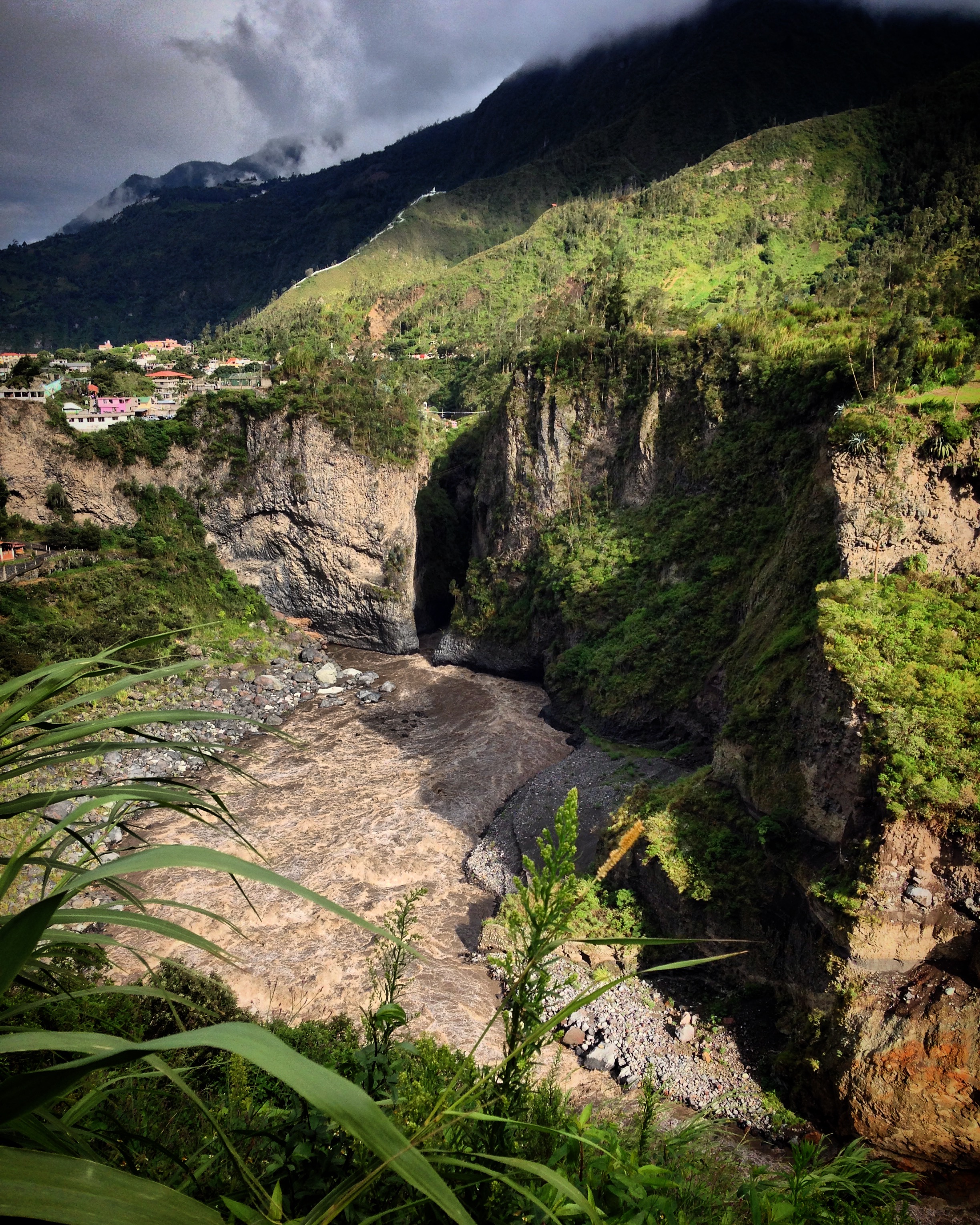
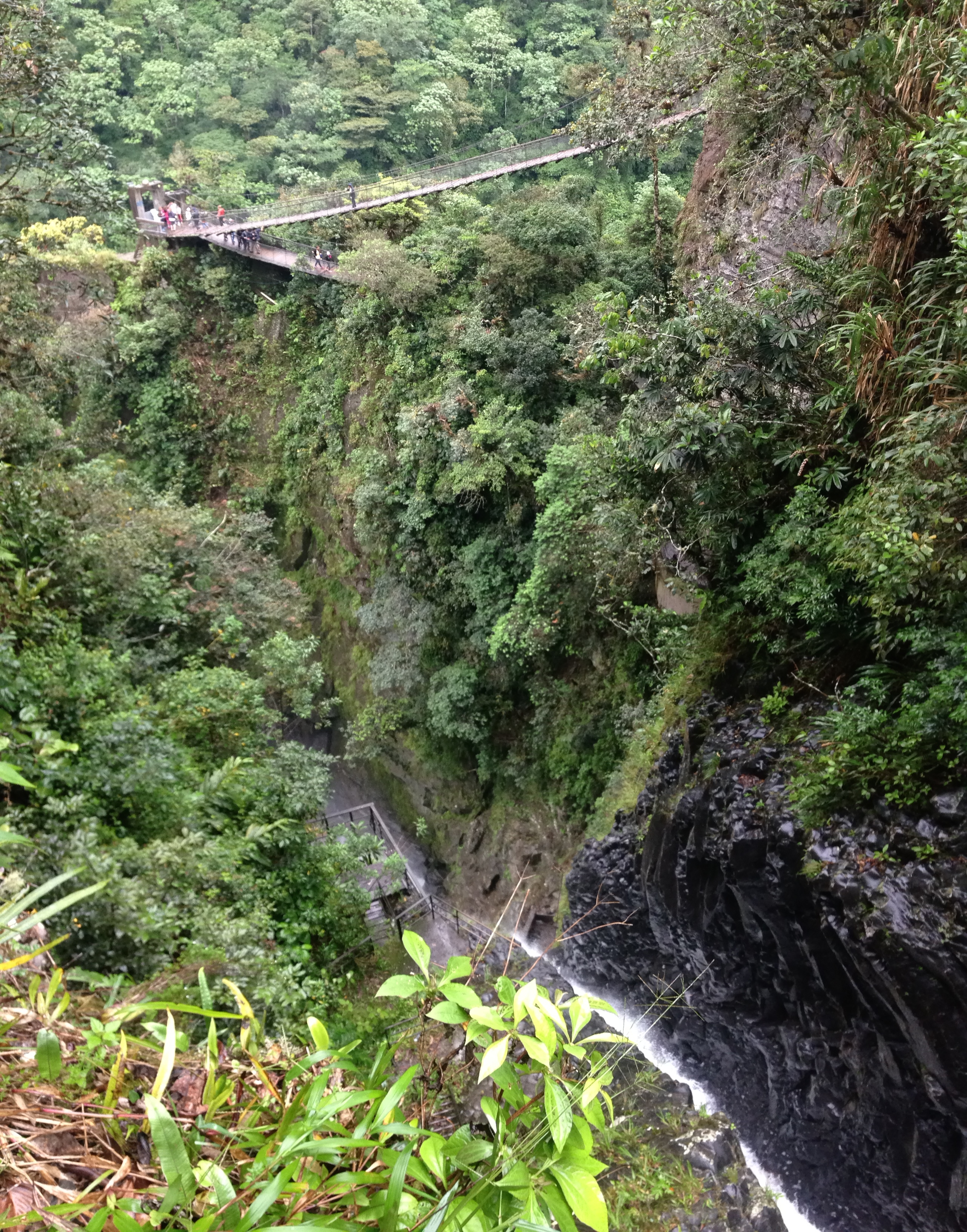
See that cliff on the left? The huge Rio Pastaza suddenly has to slip through a gorge about 8 feet wide!
Baños is probably the most touristic place we went in all of Ecuador. Foreigners come here for vacation… Ecuadorians come here for vacation. Baños has it all: Adventure activities such as bungee jumping and zip lining, plenty of natural beauty, opportunities for cycling and rafting, and good dining options (from an international perspective, more varied options than most of Ecuador). There are hundreds of hotels (meaning a reservation is likely unnecessary). Nearly every building in town is meant to serve you, either by providing tours, dining, or lodging. There isn’t much else!
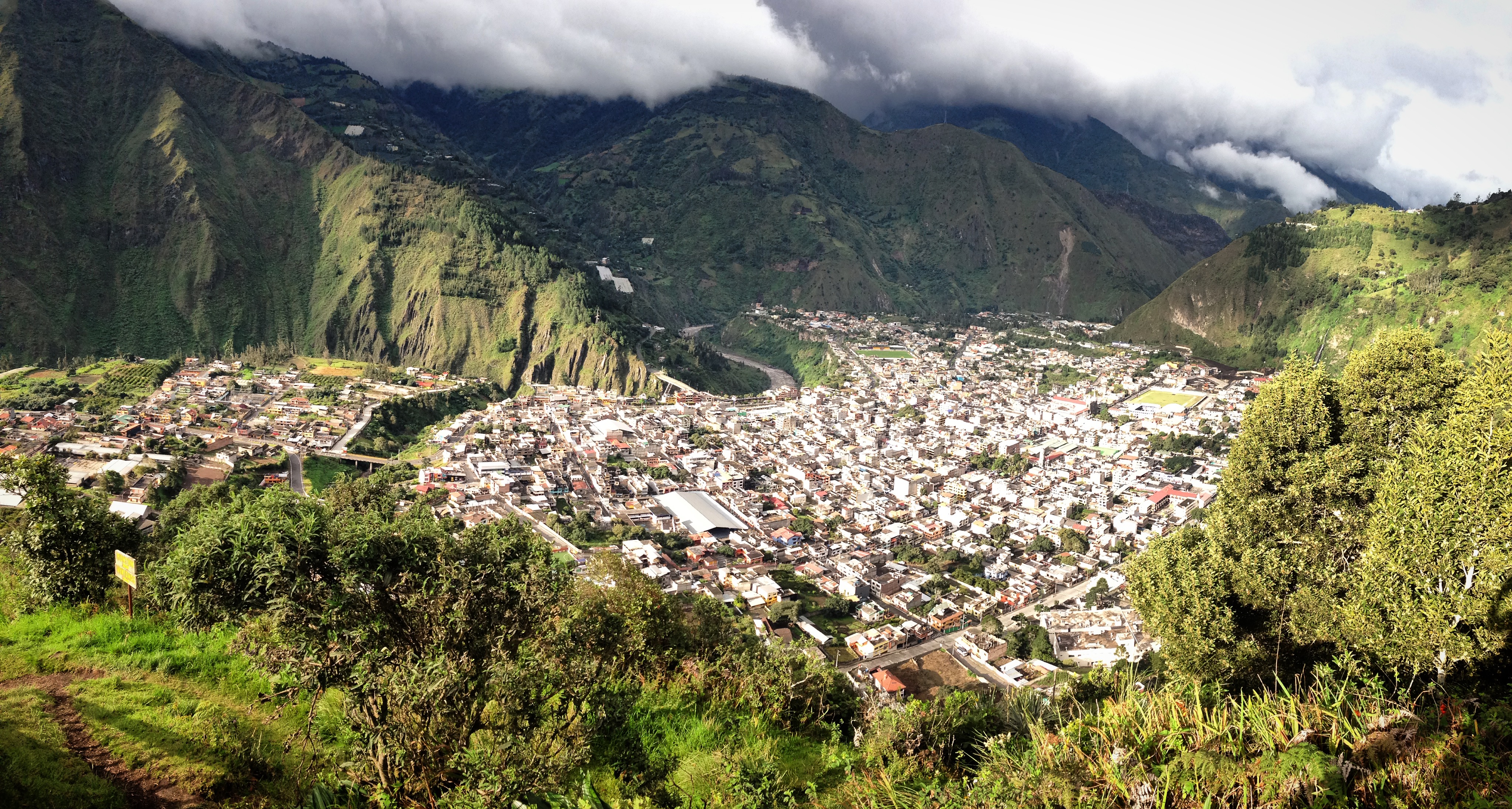
View of Baños from Above.
Our primary objective in coming to Baños was to see the Swing at the Edge of the World. (Linked Photo is from a National Geographic Photo contest, which probably made this site quite a bit more famous). Indeed, Tungurahua had JUST erupted a few days before our arrival – but we were not so lucky to have clear skies for our photos. In fact, there never really was a clear sky moment during our time near Baños. Such is life in the wet season of Ecuador (March is the peak of the wet season). The swing is a significant climb from town (3,800′ vertical) on a paved road that turns into cobblestones. Near the swing (our track from 3/22/2016) there are other swings that vie for your attention. The famous swing is the one at the end of our track. It costs a few dollars to get in. Once in, you wait in line to ride the swing. There is no one monitoring, but everyone was respectful and took a reasonable length turn swinging over the chasm. There are also some easy, self powered zip lines on the premises, and a few stalls to buy basic food.
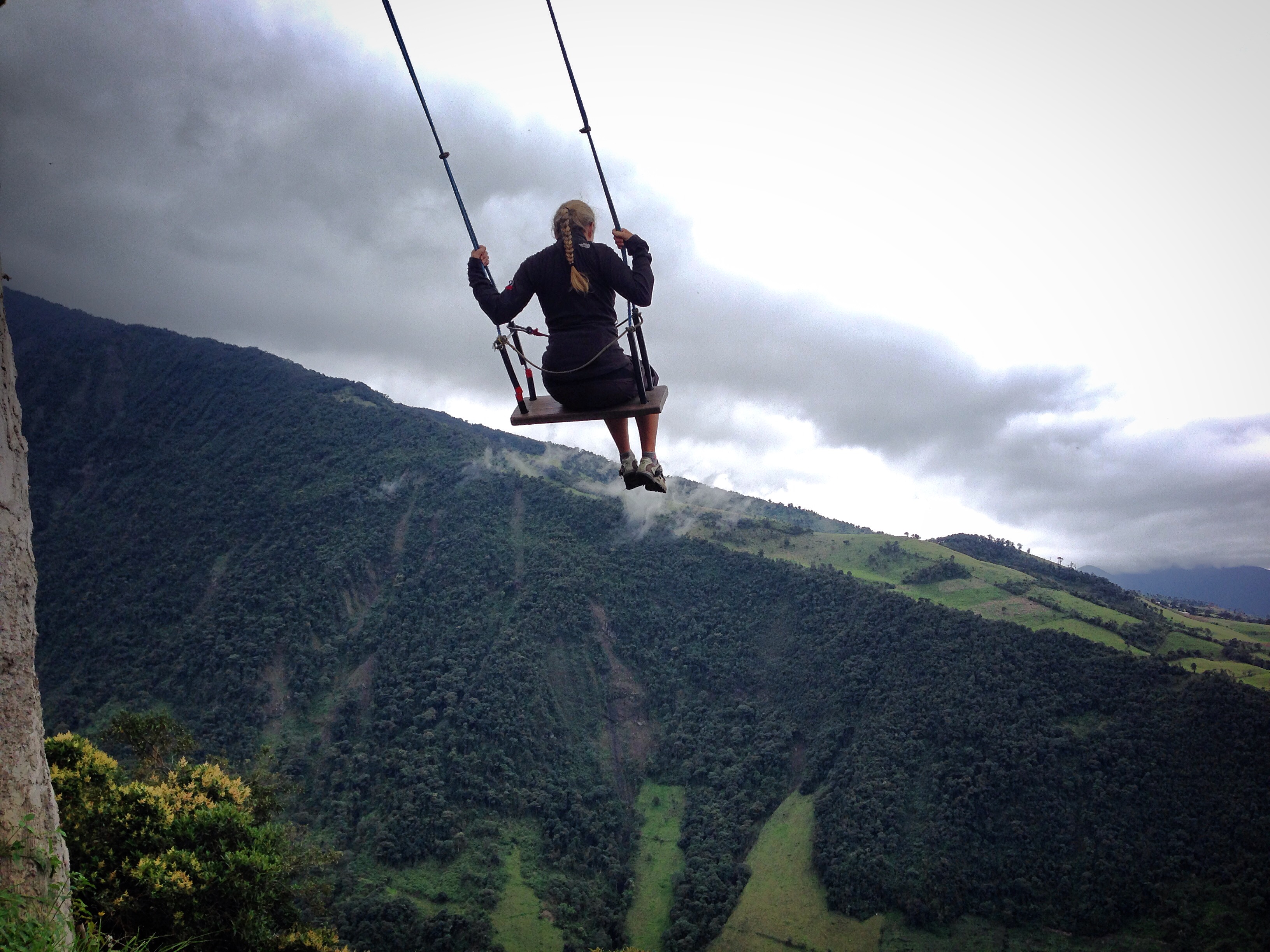
The swing at the edge of the world.
Another popular route is to ride bicycles from Baños to Puyo. This is a very interesting route (even for the seasoned bike packer). It includes cliff views of many waterfalls, and plenty of small foot-excursions along the way. The most popular way for people to do it is to rent bicycles in Baños and ride (mostly) downhill to Puyo. From there, a shuttle brings you back to Baños. Indeed, we met several people doing this (in spite of the rain). We did notice that most people shuttled back from Rio Verde. This is where the “interesting stuff” ends. We kept going, and then returned to Baños in a downpour by bike because we love climbing!
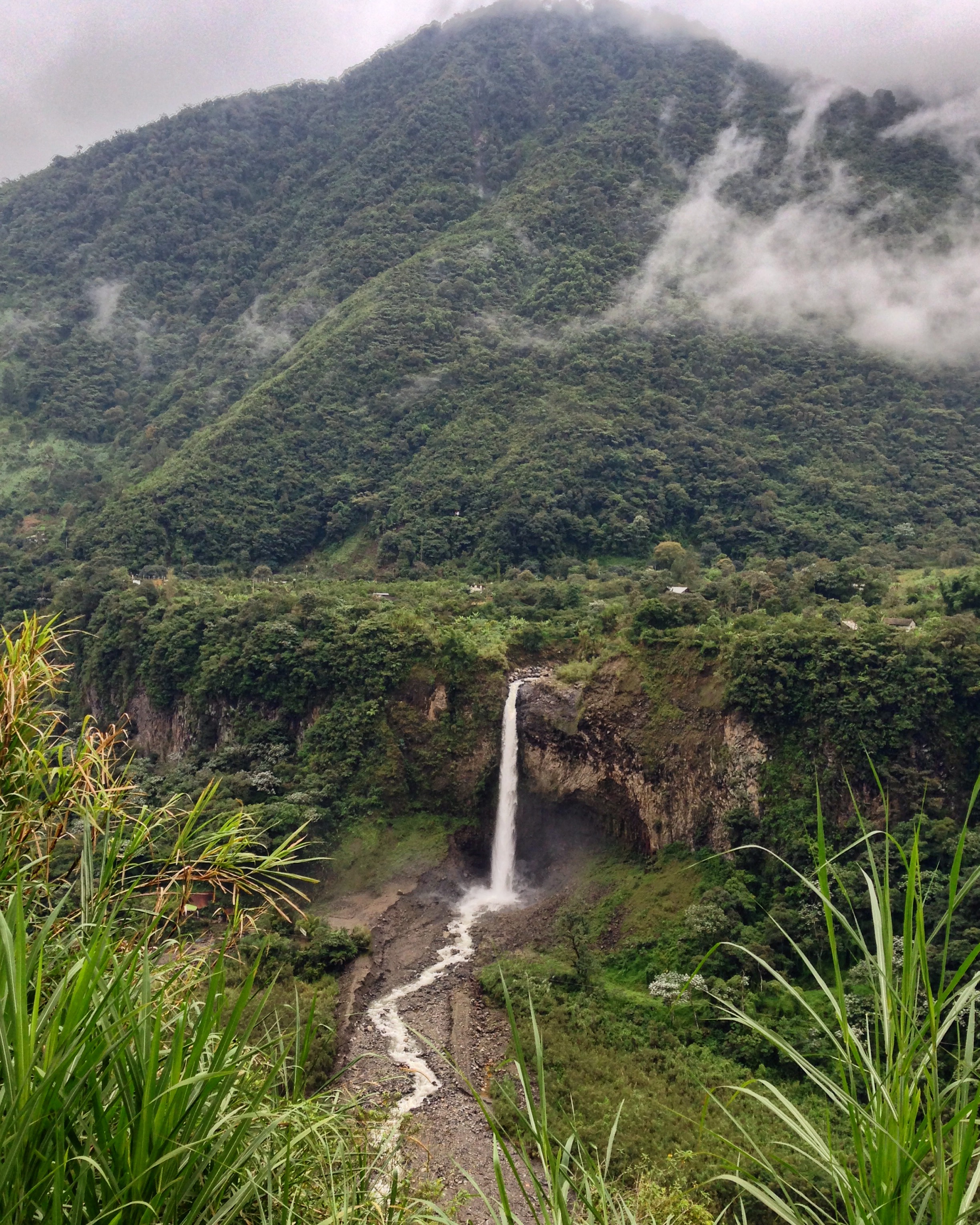
If you like waterfalls, Baños is the place to visit. Plenty of waterfalls can be found along the route from Banos towards Puyo.
Another attraction is to hike to the Pailon del Diablo. This is a steep hike that starts in Rio Verde. It costs a few dollars to enter. If you follow the first half of our track on 03/23/2016, you come to the official Pailon del Diablo entrance. After we rode downhill and climbed back up, you can see that we took an alternative (free) entrance to see the falls. This was quite a spectacular view as well.
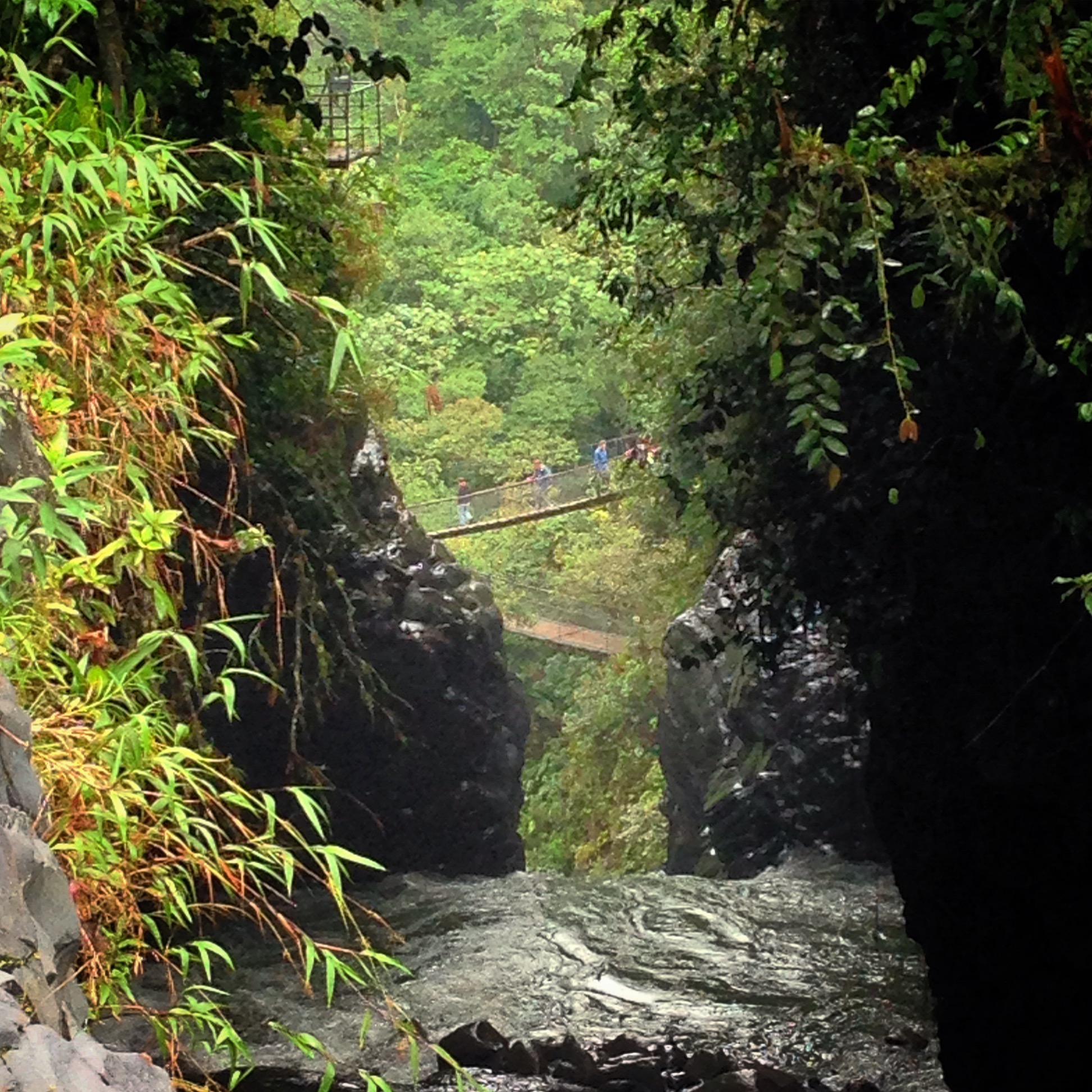
The Bridge as seen from the alternative entrance
This is the map for the entire route discussed in this post. To Export GPX files, click on the three horizontal bars in the upper right hand corner of the map and select Export selected map data…
To see this map in a full screen, click here (opens in new window)


Camping is now allowed in Cotopaxi. There are two camping areas just to the south of where the Lago Limpiopunga road rejoins the main road. The first one appears to be just a big open field. We didn’t see any water or bathrooms or anything, although there may have been some sort of small structure way off in the distance next to the hills. The second one is a little further on and is also labeled as a picnic area. There were several new-looking buildings, so I’m guessing there is running water and bathrooms, but we didn’t investigate.
Also note that if it is/has been raining, I do not recommend taking the shortcut on Brian’s route map that heads south just before the PanAm and connects you through to Lasso, where you cross the highway, especially if you are running out of light, unless you enjoy pushing your bike through a mud bog of a road in a steadily darkening lonely forest.
However, I do recommend the Cabañas Los Volcanes on the old highway in Lasso. Also, there is a dairy on the old highway just before the turn towards Sigchos. They have really great string cheese. Don’t worry if they look closed, just ring the bell!
That swing made me dizzy, just looking at your photo.