Bikepacking Ecuador – Cuenca to Jaen, Peru
This section takes you through Southern Ecuador into Peru. From Cuenca to Jaen, you will only pass through two sizable towns – Loja, and San Ignacio. This makes for quiet roads, but some very steep and muddy sections await.
Riding TEMBR From Cuenca to Jima
We had so much fun on the TEMBR (see our previous post), that we were ready to jump on it again. Our initial plan leaving Cuenca had been to ride the PanAm because Scott and Sue (our intermittent traveling companions) preferred pavement. As such, we rode with them out of Cuenca, skipping the initial miles of the TEMBR. We shortly discovered how spoiled we had become with regard to traffic, and we jumped off the highway onto the dirt at our first chance. We told Scott and Sue that we would meet them a few days later (which we did).
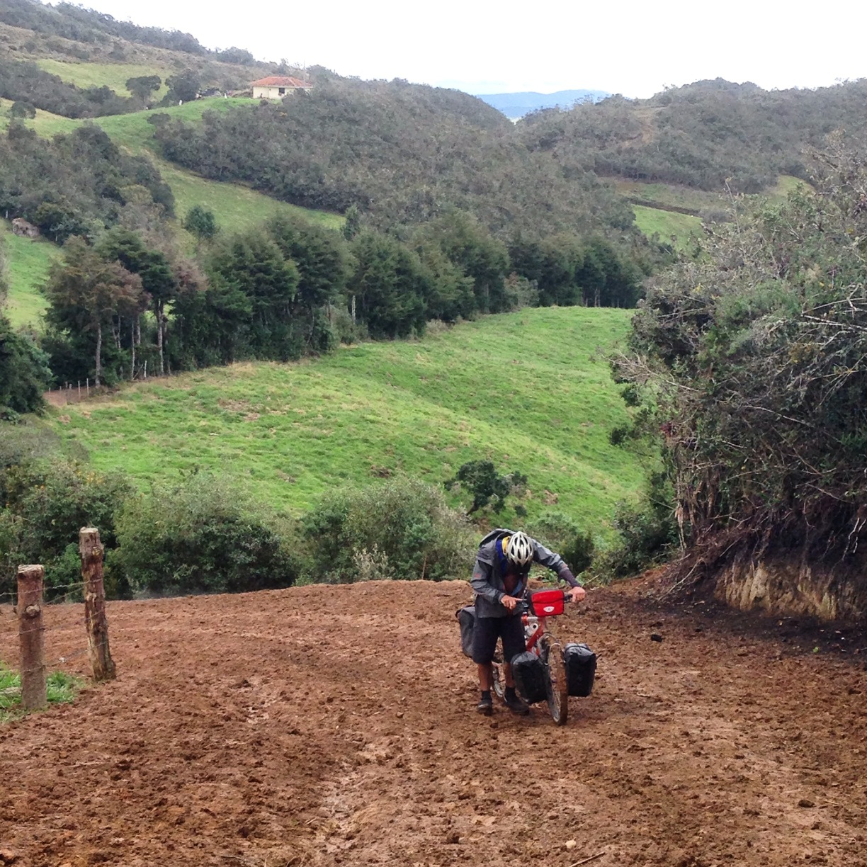
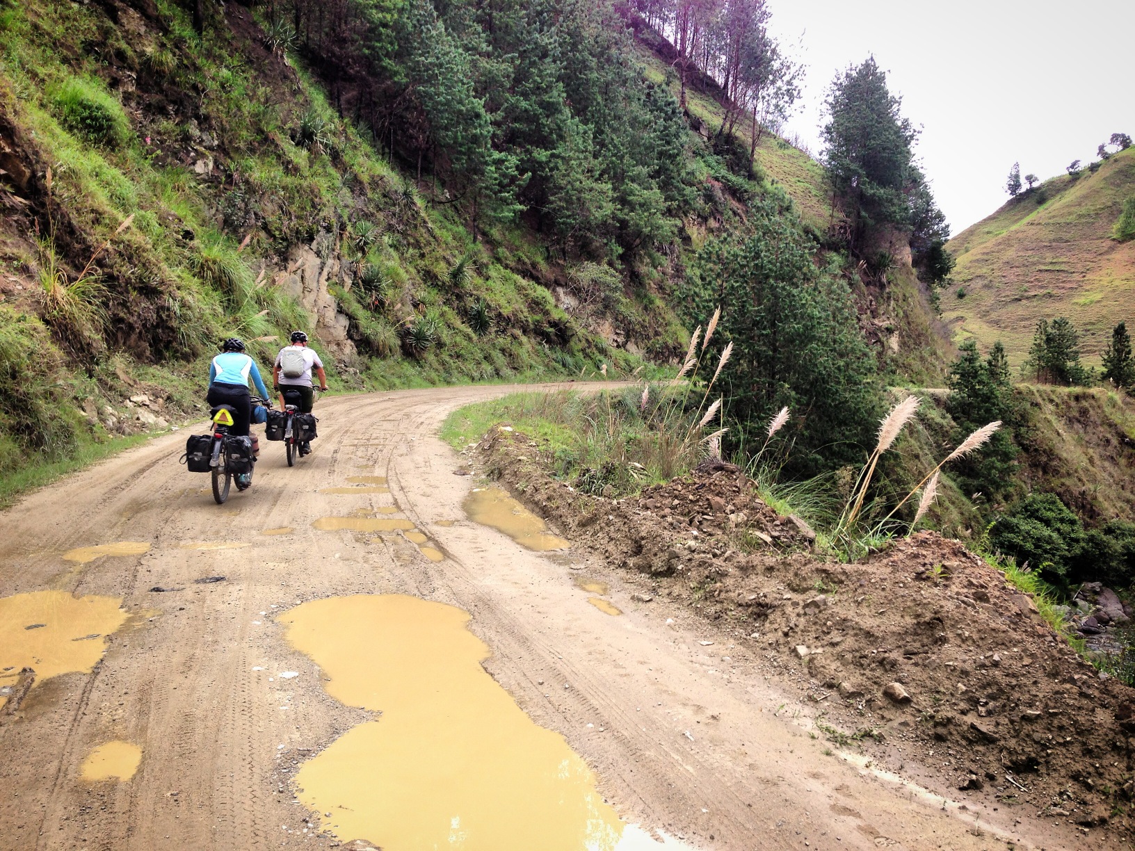
The TEMBR was going great until here: 03.14216° S 79.00311° W At this point, the TEMBR heads back out to the PanAm on this 4 mile long, steep section of pure mud. Up until this point, the TEMBR had been fine – the dirt road was covered with “Lastre,” which is a surface that drains water and doesn’t stick to your tires. This section was not “lastrado,” so the wheels stopped rolling completely, meaning I had to carry the bike – about one foot per push – up the hill. Eventually, we decided to turn back and wash the bike for an hour in a mud puddle. Once it was clean, rather than turn back, we sought an alternative route heading down the dirt road to Jima.
Really, how bad was it? (video below):
The section of the TEMBR was virtually impassible. It would have taken us a full day or two to cover the 4 miles back to pavement at this pace.
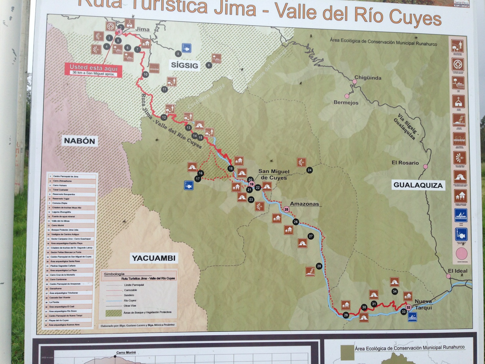
When we got to Jima, we discovered that it was along the way to a tourist route. You can see the map here. This route heads down into the Amazon Basin, which we did not want to do. You may wish to explore it. We decided to spend the night in Jima – they have one hotel located here: 03.18967° S 78.95535° W Not only was the family that runs it very kind, but the room was exceptional compared to many we have stayed at. We spent an enjoyable evening at the dinner table with them.
Instead of going back the way we had come, we continued further down the rabbit hole towards Gima. Our Open Street Map indicated that there might be a connection back to the highway further South…
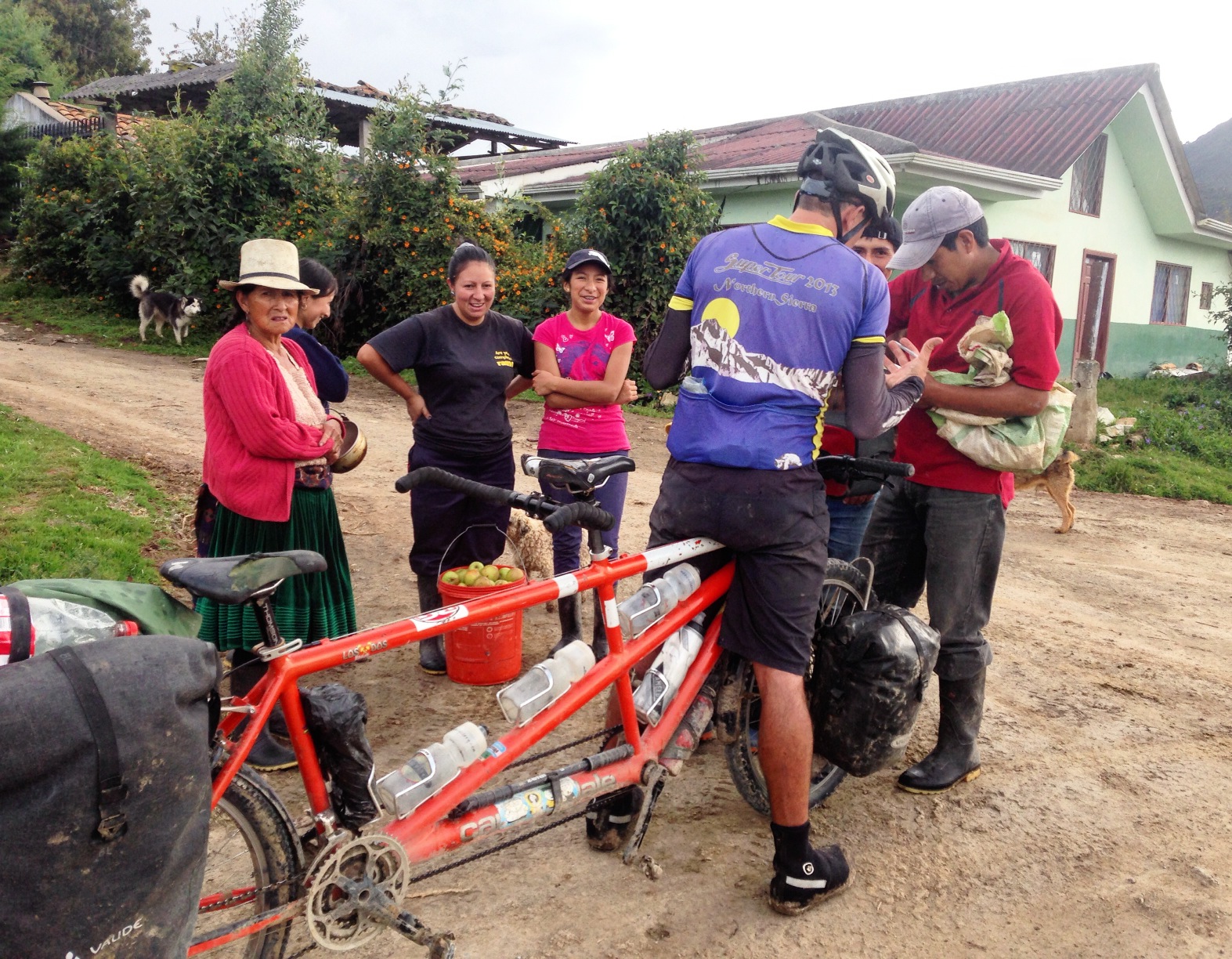
In Jima (also spelled Gima), we asked for directions. We were trying to take a dirt route back up to the PanAm without backtracking. Open Street Map failed us here – the lines indicating the road were incorrect. According to OSM, there was a settlement called “Chivilin” that was on the way to the PanAm – taking us further South. Most residents of Jima had not heard of this town, and almost everyone said it was impossible to get to the PanAm, we would have to retrace several miles, and climb several thousand feet – Basically undoing most of yesterday’s riding!
Instead of backtracking nearly all the way to Cuenca, we found an alternative track back to pavement. We were intrigued by a better (less muddy and less PanAm) improvement to the TEMBR – and I think we found it. Fellow bike packer Nick Gault used information we provided to ride through to Oña. I’ll link to his GPS track after he posts.
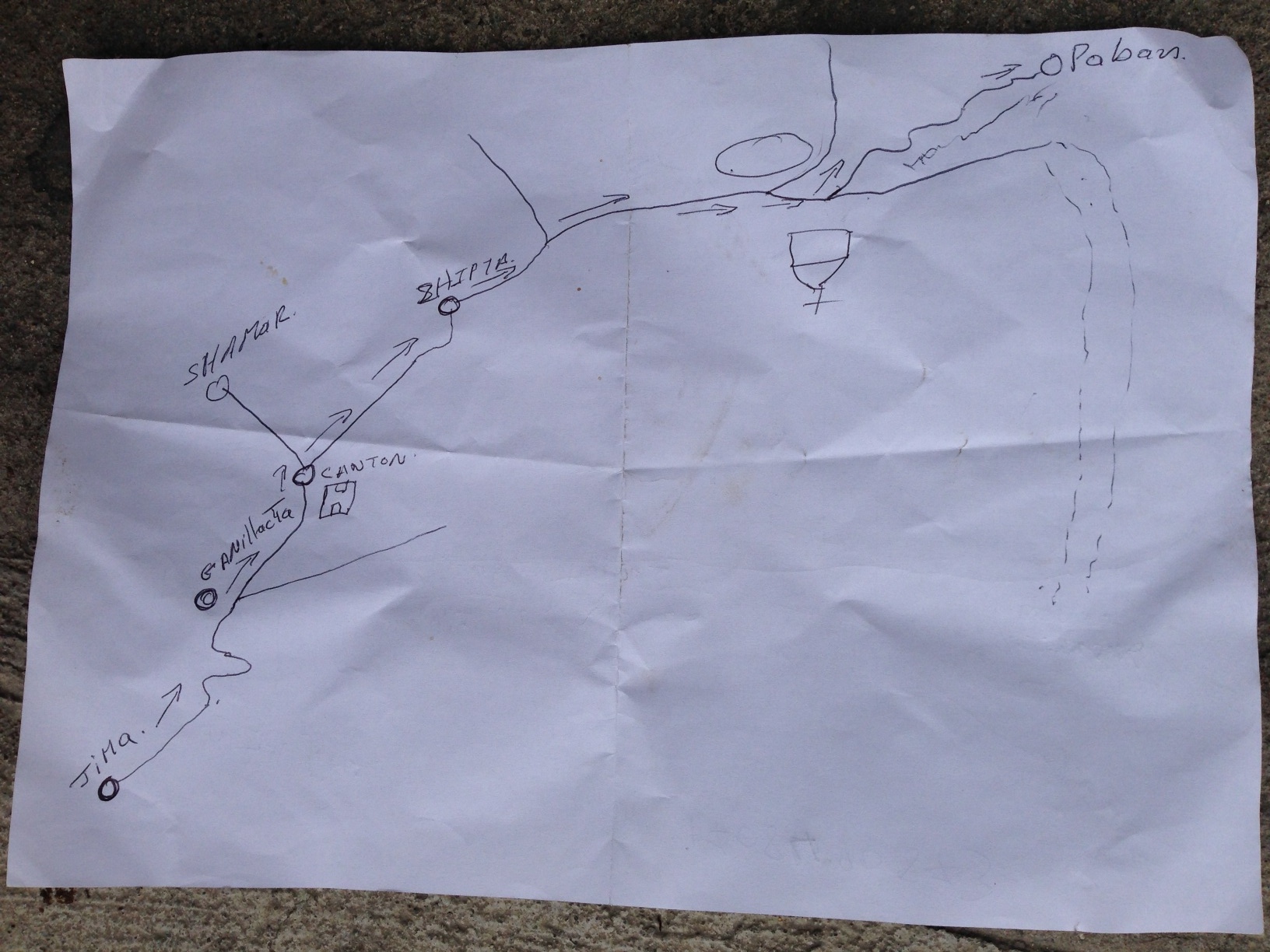
There was one guy in town who knew the route out. He drew us this map, which we shared with fellow bikepacking blogger Nick Gault. He successfully managed to follow it (in conjunction with a GPS track that we drew from satellite images). The route takes you to Paban, and then out to the PanAm near Oña. This would be a satisfactory alternative to the TEMBR. Not only does it keep you off the PanAm longer, but it avoids the 4 mile section of mud discussed at the beginning of this post.
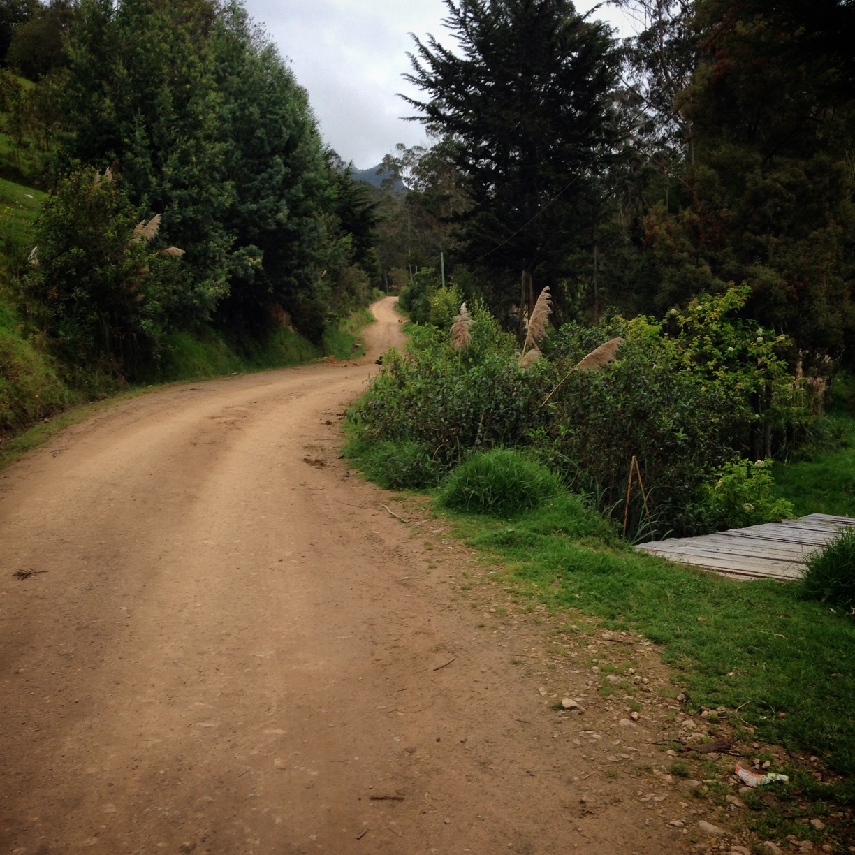
Unfortunately, there was no internet or Cellular Data for us in Jima. Before venturing further into the unknown, we wanted to investigate satellite images to make sure that our planned route actually went through. Only three people in the town of Jima said it was possible, and the majority said it was not possible. This is a shot of the route we took on 04/04/2016, and as you can see, the surface was fine. Nick Gault took the route drawn on the paper map (photo above) and using a GPS track that we had drawn from satellite images, he confirmed that it is indeed possilbe to make a through-route in this section.
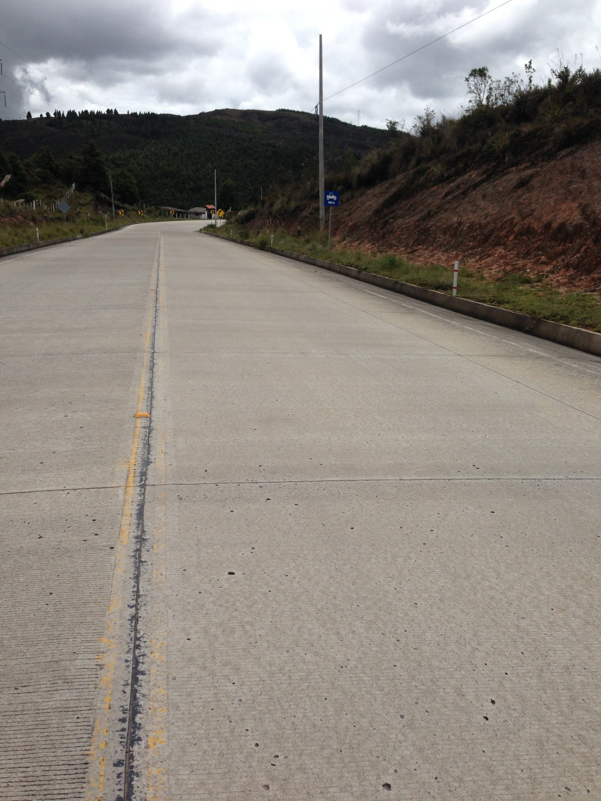
Once back on the PanAm, we were making good time again because it was well paved. For the first several miles South of Cuenca, it is loaded with traffic, but by the time we got back on after our TEMBR adventure, there was hardly any traffic. I selected this photograph in case you’re out in the middle of the PanAm without a place to stay. There is lodging here that welcomes cyclists: Latitude: 3° 14′ 54.138″ S
Longitude: 79° 3′ 50.03″ W
Jima to Loja via the PanAm (and old PanAm)
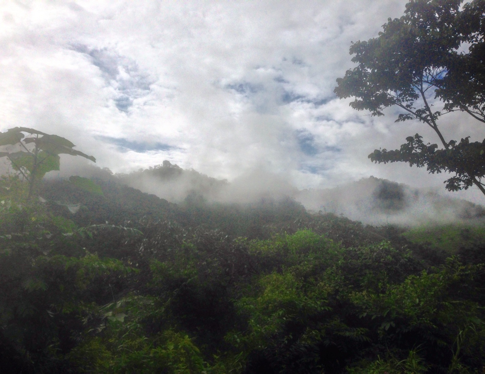
Once back on the PanAm, we put in a big day to try and catch up with Scott and Sue. This meant riding in very heavy rain and dense fog for most of the afternoon.
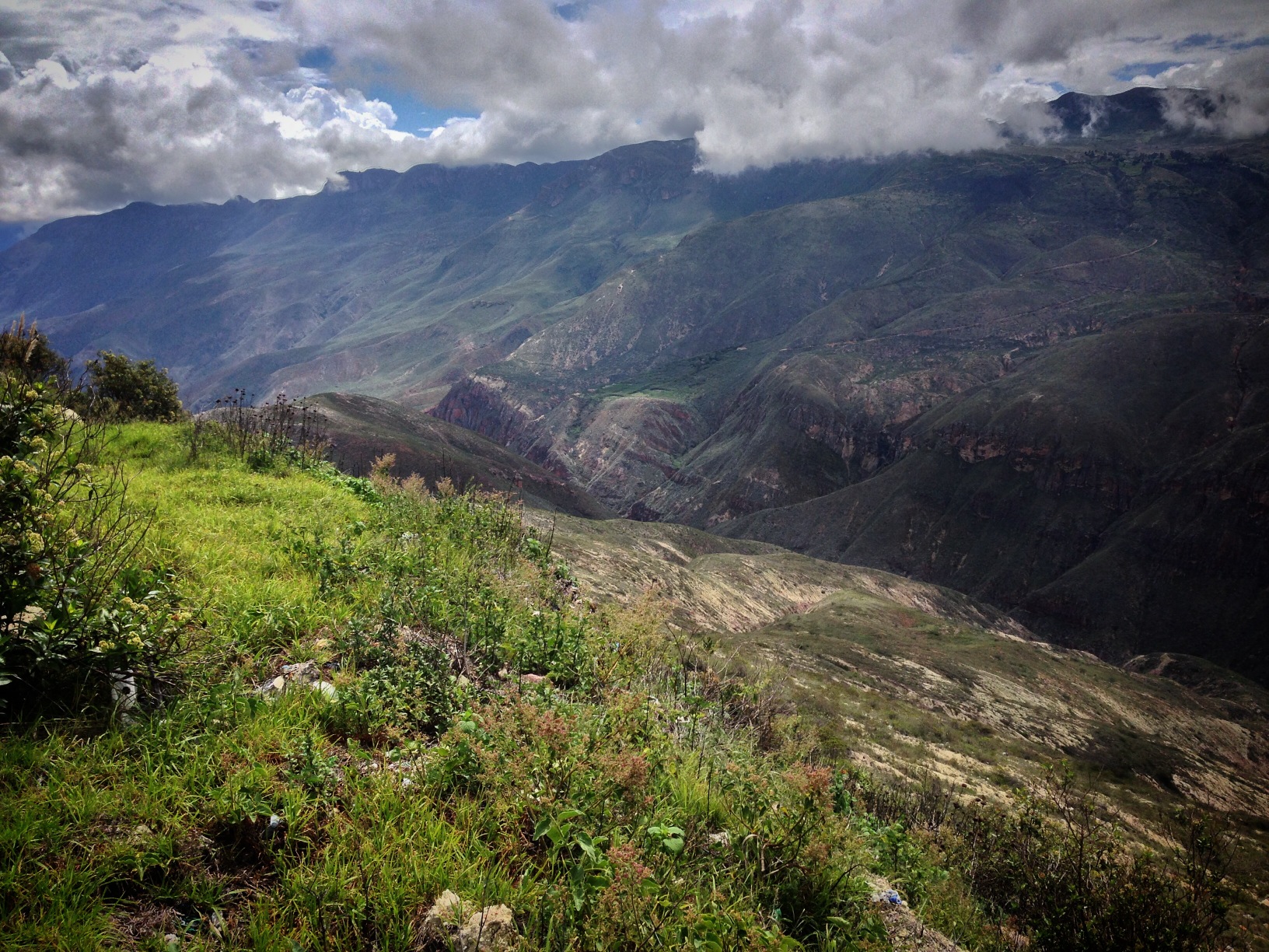
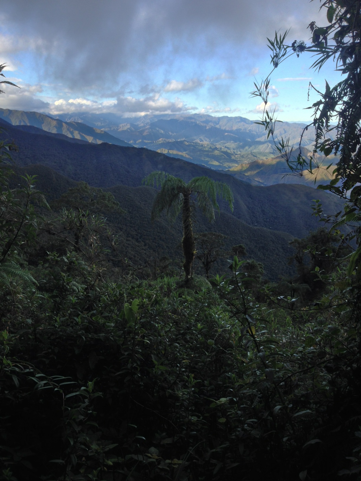
Views into the canyon we had been riding in. Jima is down there towards the left hand side of the picture. It was a long climb out.
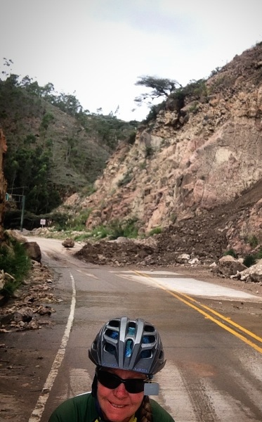
Be careful of landslides! We were swooping into this turn from the other side, and suddenly encountered a truck wedged in this landslide! We used every bit of traction and brake pad we had to stop before hitting it. Landslides like this were very common for us, being that it was the wet season in Ecuador.
We met up with Scott and Sue again in Saraguro. This town has a few hotels, including the one we stayed at located here: 03.62197° S 79.23771° W. Scott and Sue debated whether or not to join us for the next section of TEMBR – the old Pan Am.
Locals refer to it as the old highway or old PanAm. You pick it up here: 03.74333° S 79.26691° W – Just after the town of San Lucas. Scott and Sue were hesitant to join us on a dirt adventure (given our recent history of mud), but we were able to sell them on it by pointing out that the paved PanAm climbs several thousand feet more than this route. It ended up being a spectacular section, though it did have it’s share of mud bogs.
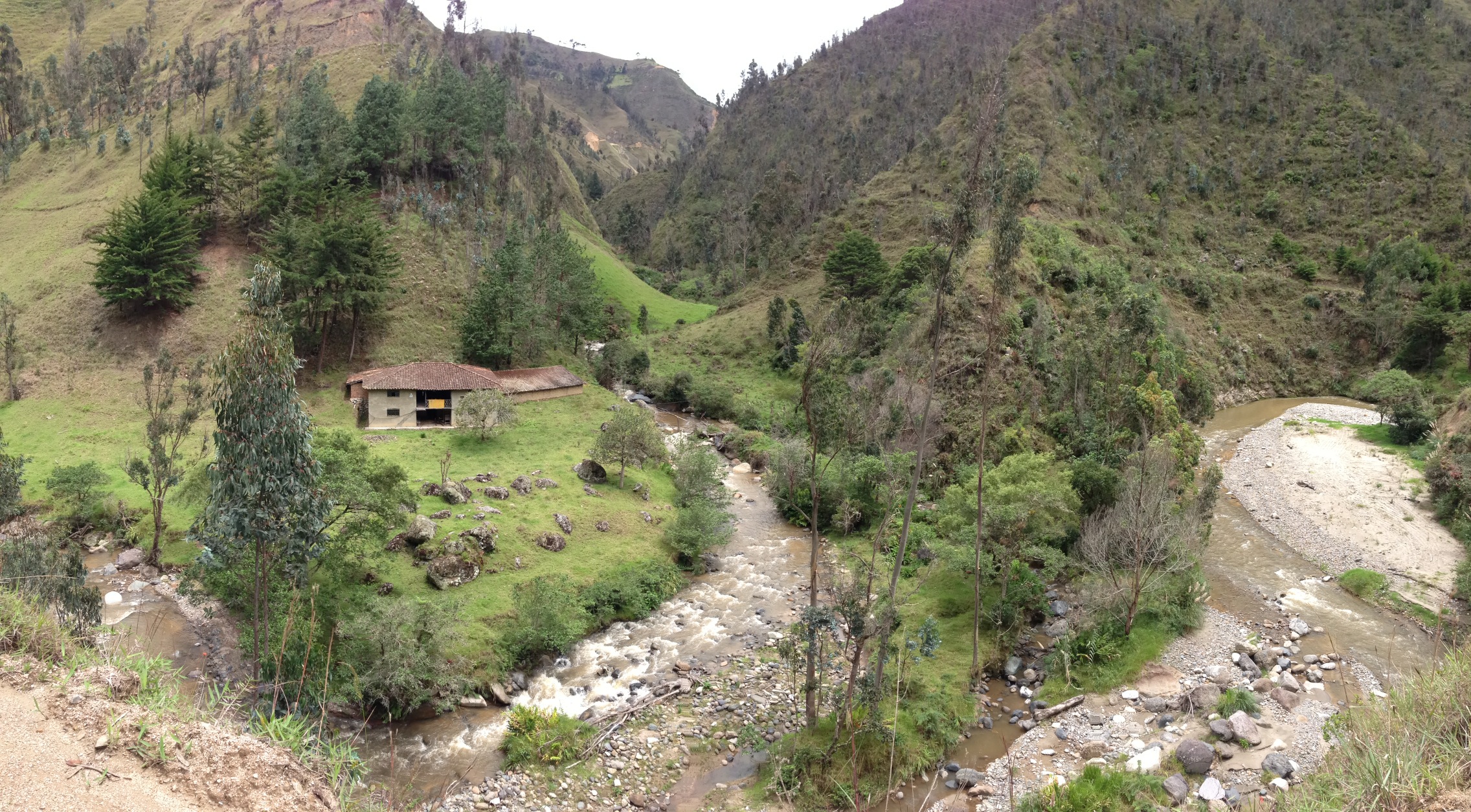
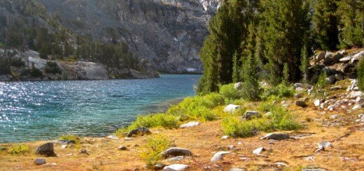
The scenery along the old PanAm was spectacular. Here you see a confluence of two rivers.
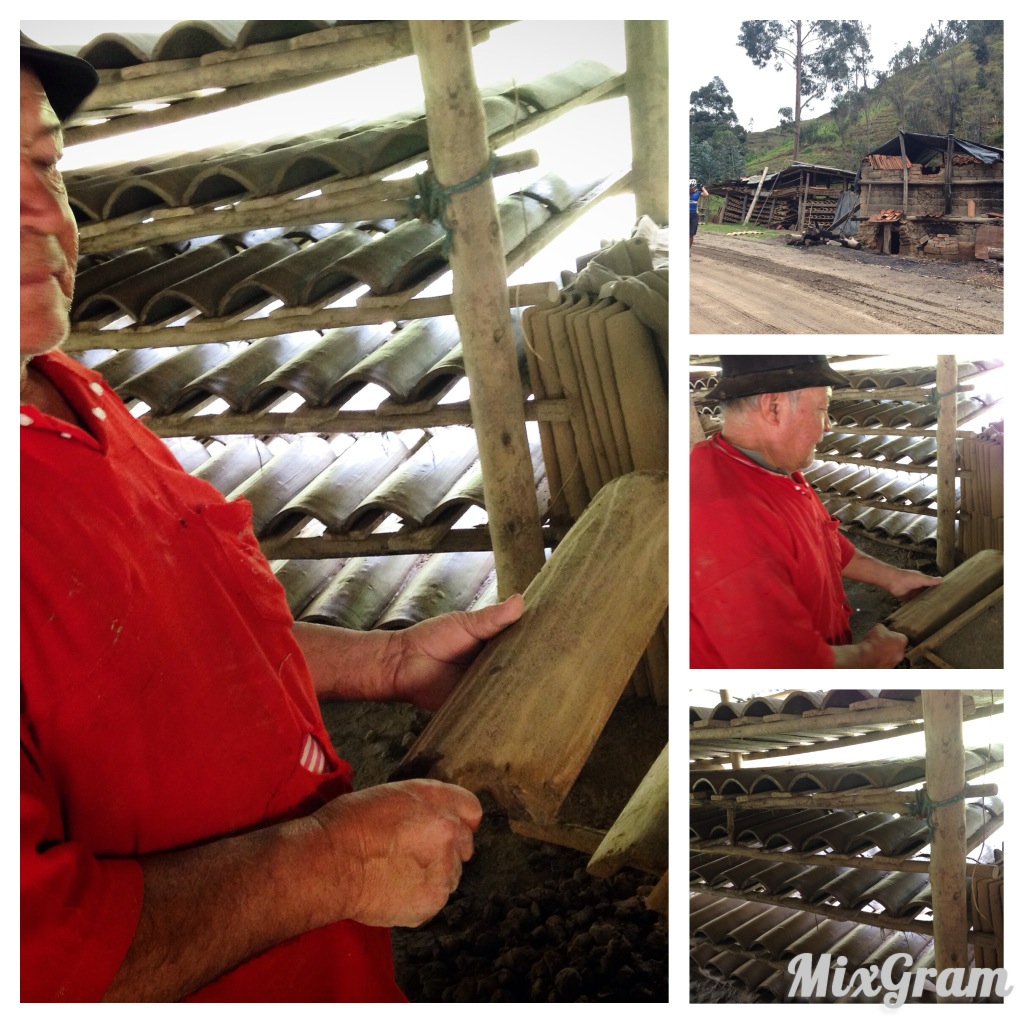
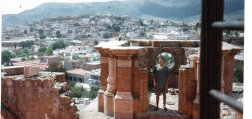
Along the route, on the side of the road we stopped near this building. I have had some curiosity about how these roof tiles are made, so I couldn’t resist asking this man. He warmly invited me into his shop, and gave me a tour, and showed me how he made them. You have to have access to land with clay – a special type of mud, he explained. He makes them by hand and can make 600 in a day! He can sell 1,000 of these for $34. So, he earns about $17 a day doing this.
We concocted a slight modification to TEMBR by taking bike paths into Loja.
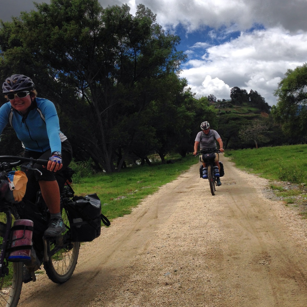
All smiles on the bike path into Loja!
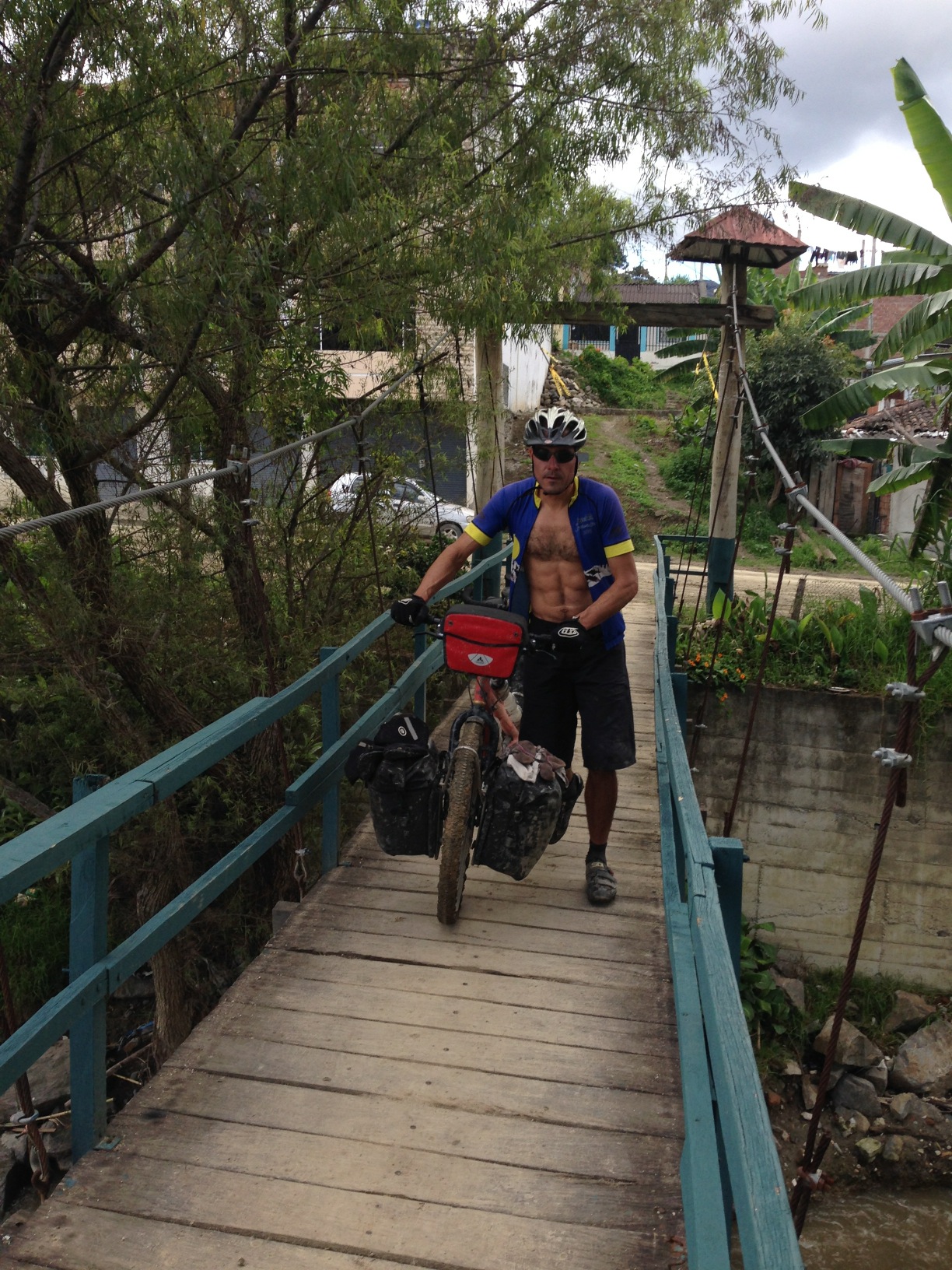
At the time of our entrance into Loja, they were doing work on the muddy road. If the work is complete, we suggest that you follow our route across this bridge (located at 03.93602° S 79.22360° W) From there, you head South all the way into Loja on dirt bike-paths, avoiding any traffic.
Loja is a modern town with lots to see. By chance, a friend from college happened to email me this very day suggesting that we meet some of her ex-pat friends in Loja for dinner. We went with them to the restaurant Zarza owned by Americans – and enjoyed some delicious food, a variety of beer options, and good conversation in English.
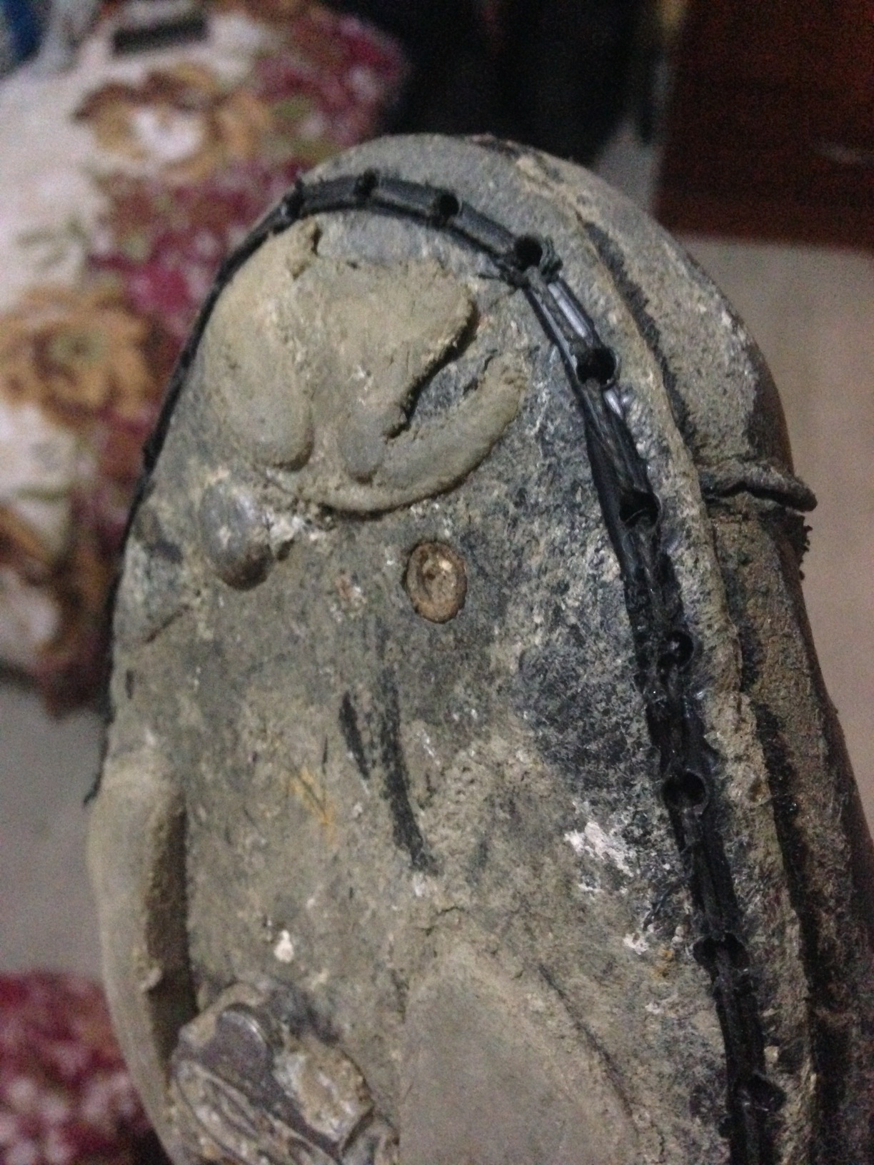
My Sidi Dominator 5 shoes have been getting very worn from pushing the bike so often. If you’ve been following our route, you’ll know that the unpaved grades in Ecuador and Colombia have always been greater than 7 percent – either up or down. In fact, I’d estimate that 10% of the riding we have done is on a grade less steep than 7% (I’m going to calculate this mathematically when I get home). Janet already had her shoe repaired (by a cobbler with glue for $3). My shoes were flapping open like those guys in the cartoons from the Great Depression. When the guy proposed that he stitch them back together, I explained that we’d wear through the stitching. He said he would cut a groove, and glue them. It’s been 40 days (as I write this), and they are still doing great – though the stitching has frayed. That was a $7 repair.
Loja to the Peru Border via Podocarpus
Leaving Loja, the next logical place to visit heading South is Podocarpus park. On the map, it looks exciting, with many peaks and variegated terrain.
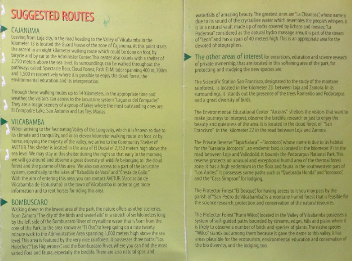
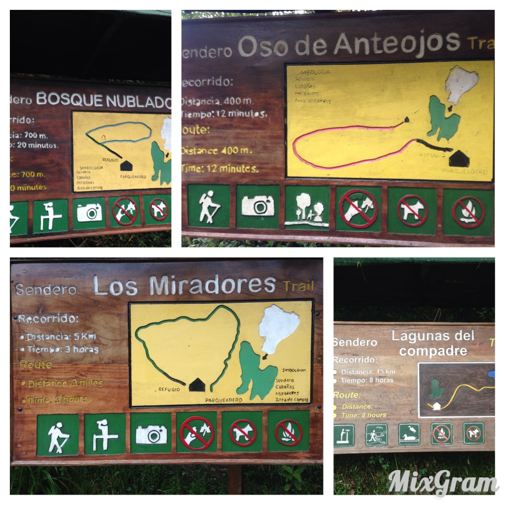
Podocarpus Park was kind of a mystery for us. There was very little information online about this park, but the topography as seen in my Topofusion 3D program attracted my attention. It wasn’t clear how to access the park. We visited the park administration office located here: 03.99375° S 79.20348° W They gave us a free map, but weren’t too enthusiastic about us visiting the park. It was too muddy, they said. They were right – so if you’re nearby in the wet season, you may consider skipping it. Here are the 3 ways to access the park. We took the first one – Cajanuma. We did bird watching with Scott and Sue along the Spectacled Bear, Cloud Forest, and El Mirador Trails. Due to the mud and constant cloud cover, we did not venture on the Lagunas del Compadre trail.
Podocarpus is in the cloud forest. At least on the West side, that means it will be very, very wet during the wet season.
All the trailheads depart from the Park administration center located here: 04.11607° S 79.17207° W
Inside Podocarpus park.
More Podocarpus scenery
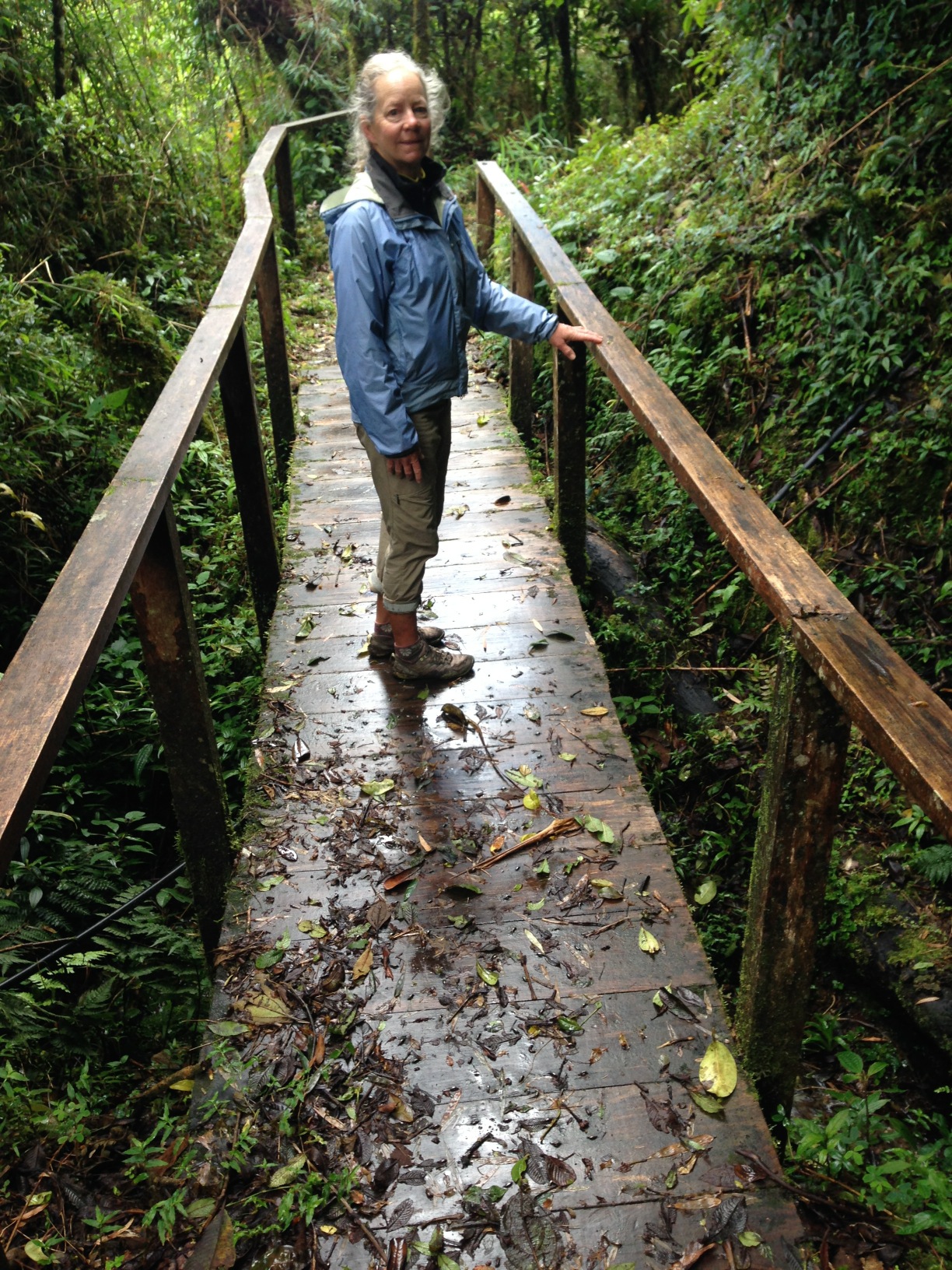
Janet on the short Mirador trail. Most of these trails are pretty short – too short for a normal hike. We extended the time significantly by turning it into a birdwatching trip.
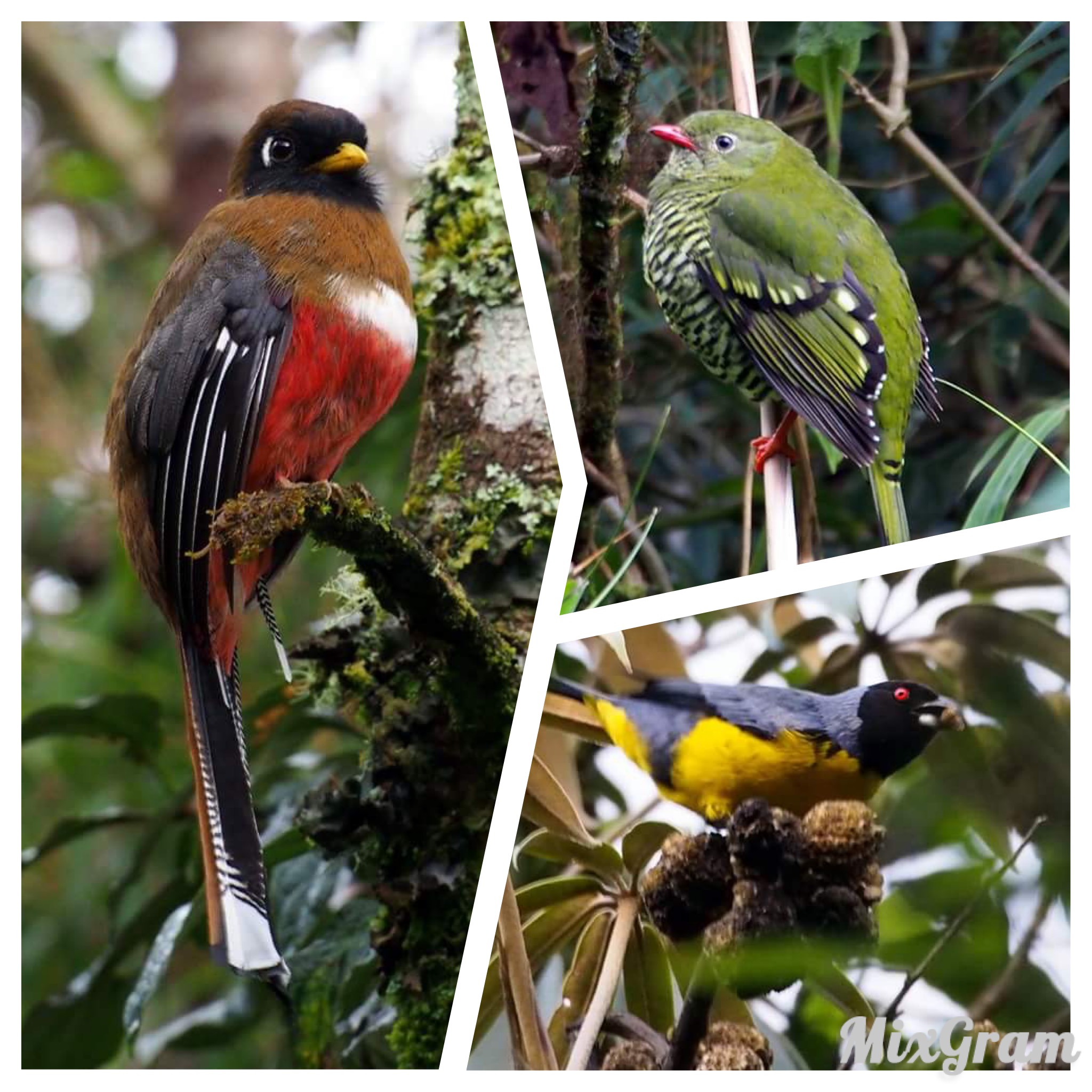
A sampler of Bird photos taken by Scott Mlynarczyk during our birdwatching walks in Podocarpus.
I think that Podocarpus is a cool place to visit if you have some company along. Otherwise, it could be a cold, lonely, and wet place. We were the only visitors in the two days we were there. We had fun, though, being that we were there with Scott and Sue.
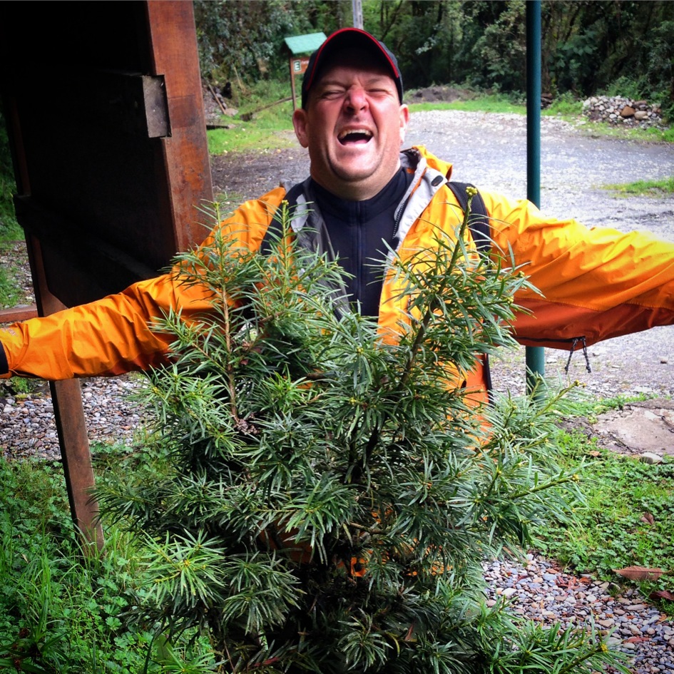
It took a little research, but we finally found out that Podocarpus park is named after a tree – the Podocarpus tree. The only Podocarpus tree we saw during the entire time here was in the parking lot! Here is Scott providing a contrasting background so you can see the detail of the leaves (and how happy he is to not be camping in the rain).
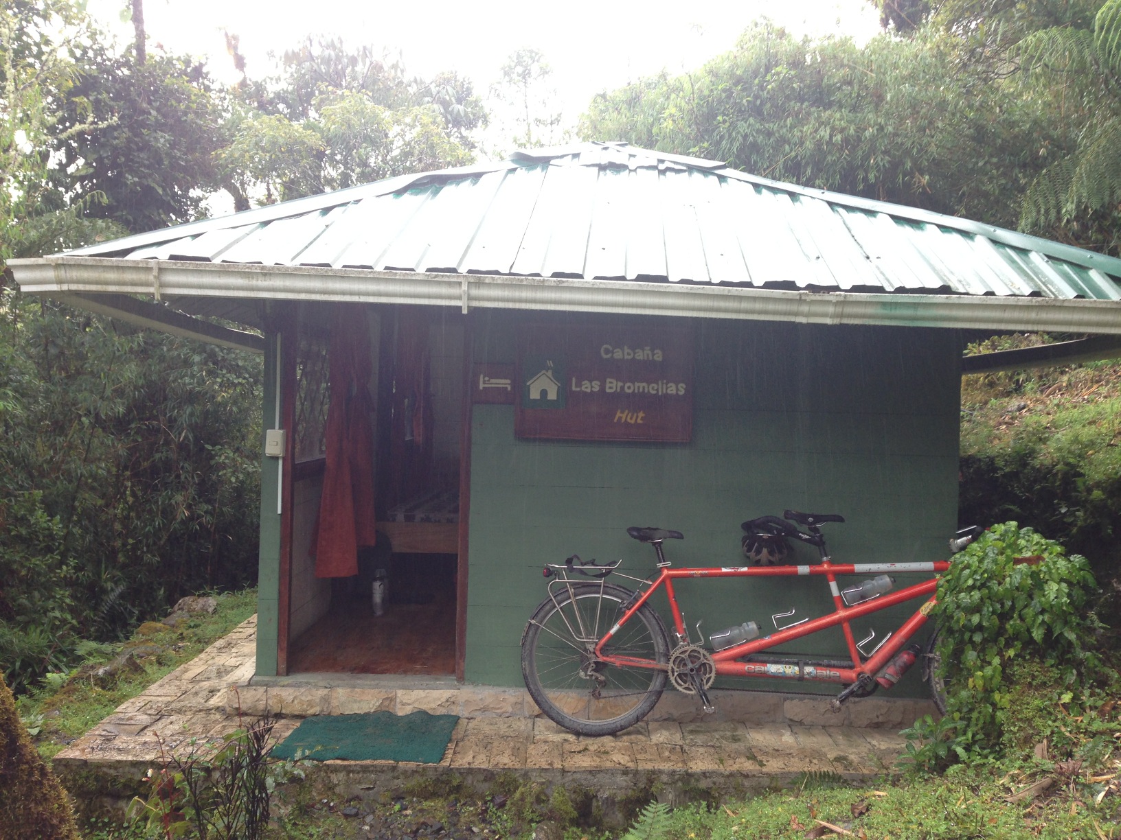
At Podocarpus, there is lodging – it costs $3 per person per night, and you get a rustic cabin with electricity. Bathrooms are down a short trail. These cabins would be great for would-be vacationers, as it is super quiet here. One problem we found was due to the constant rain and humidity of the cloud forest, the mattresses were slightly damp and mildewy – but at least we didn’t have to set up our tent in the rain!
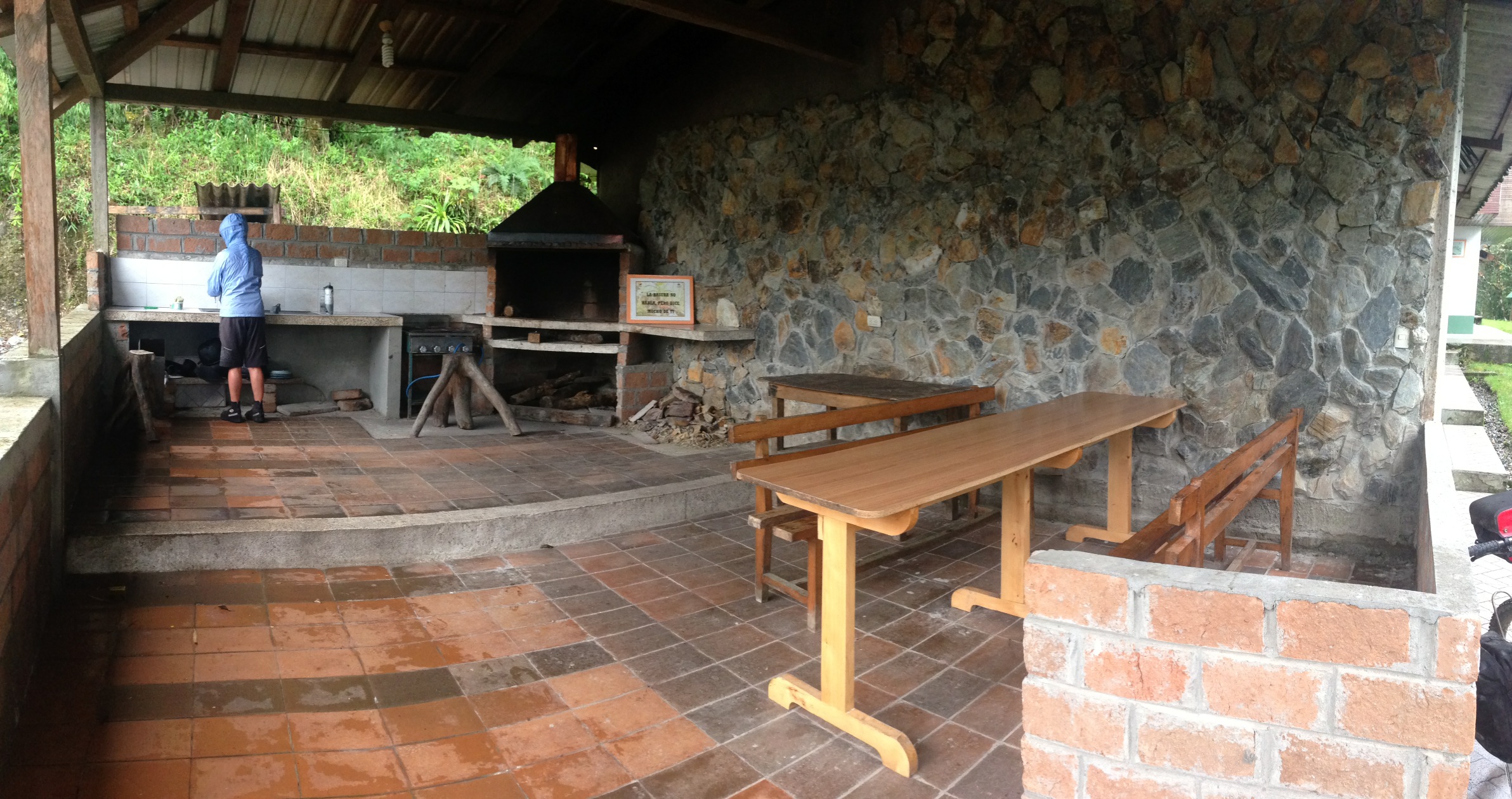
Here is the kitchen at Podocarpus Park. There is a stove, but the gas was not connected. The ranger offered to build us a wood fire back there, but he never showed up.
We left Podocarpus before Scott and Sue. Our goal of making it to Cuzco, Peru in 2.5 months (via the mountain route) meant that we needed to keep moving. They’re on a more relaxed schedule, but to date have been following our route suggestions.
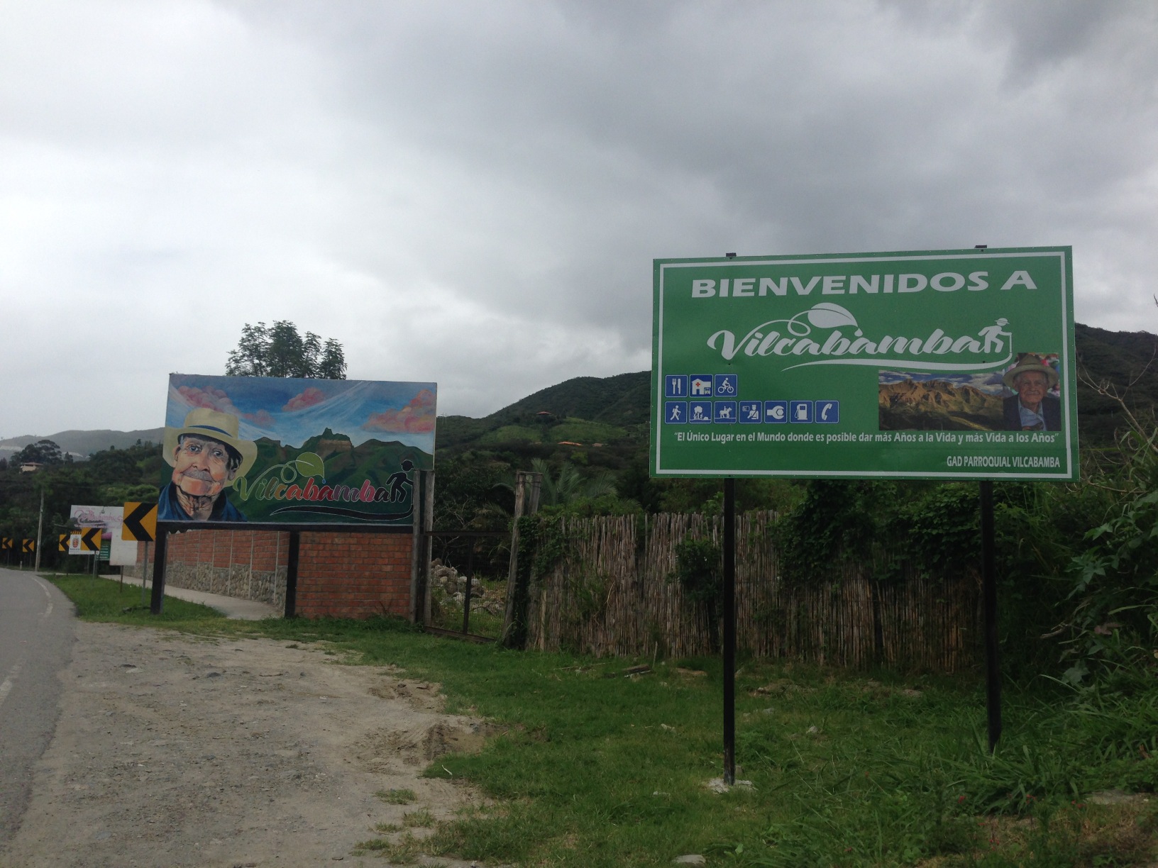
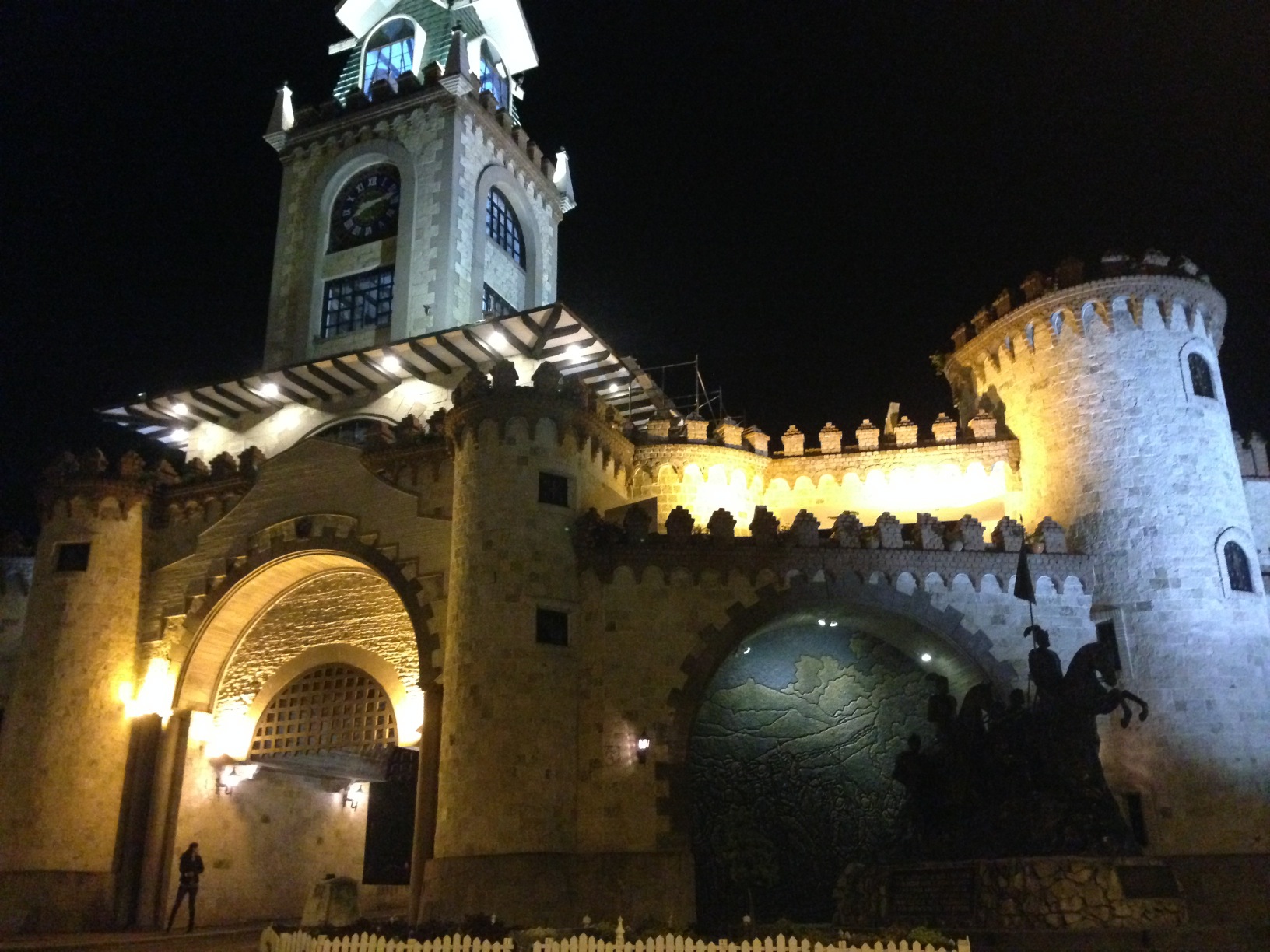
Vilcabamba has a reputation for long-lived people. That old guy in the far sign is a testament to that. The statistics are probably true. What has happened is that this community has converted into a Gringo haven. You will see more foreigners with tattoos and dreadlocks in this village than you will see all of the rest of Ecuador. Times ten. One observation we made was that a lot of these people were also buying vast quantities of inexpensive alcoholic beverages – mid day. I wonder if the statistics for long life include the foreigners.
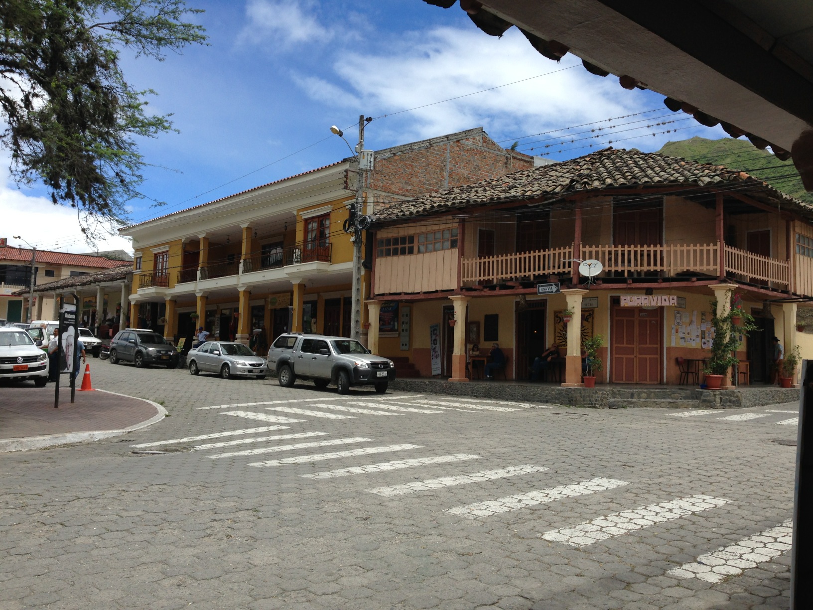
The town square at Vilcabamba. You can find varied food here, as well as accommodation.
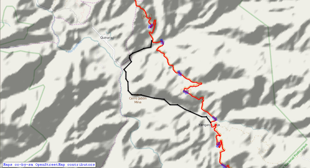
Save yourself a big climb! Follow the black route instead of our GPS track (red). The turnoff coming from the North is located here: 04.32025° S 79.20876° W
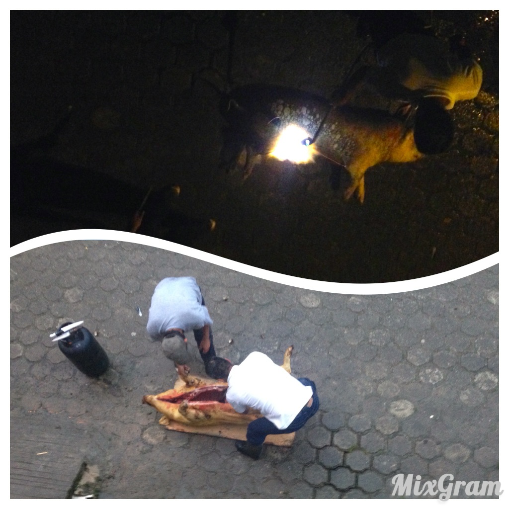
There is lodging in Vallodolid. Two “hotels,” though neither is signed. Both are pretty low-quality options, but we needed one in a pinch. We arrived in town well after dark in a heavy rain storm (rain so heavy that the paved road was actually just a muddy river). We were not looking for wild camps, but given the terrain (sheer slopes), it would be difficult. As dirty and smelly as the hotels were, we were happy – and surprised – to have that option to get out of the rain. One is located here: 04.55120° S 79.13219° W The other is located here: 04.55094° S 79.13185° W. So, what about this picture? At 5AM, with great ruckus, a pig was delivered beneath our window. The noise only increased after the delivery, as a blow torch was used for the next hour – presumably to remove the hair. Burning hair smells and the loud roar of the torch wafted in our window. We left this room as early as we possibly could! As such, we strongly urge you to spend the night in Vilcabamba, and then do a reasonable ride to Palanda – passing through Valladolid. There is a signed Hotel located at 04.64966° S 79.13217° W in Palanda.
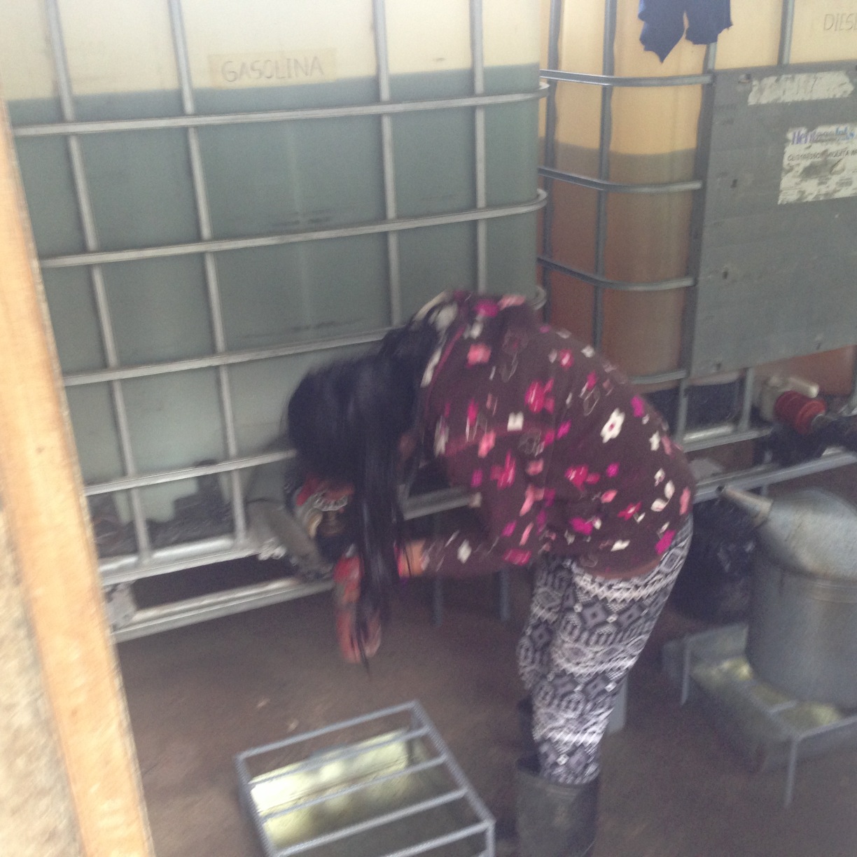
This section of Ecuador is quite remote. This means that between Loja and the La Balsa border crossing, you will see very little traffic. You won’t see a normal pump gasoline station South of Vilcabamba. Instead, this is how you get gasoline. It made me sad to see this young girl in constant contact with the fuel and fumes in this small shack selling gasoline. One benefit for her, though, is that she charged me the equivalent of $20 per gallon for a little squirt of fuel for our camping stove.
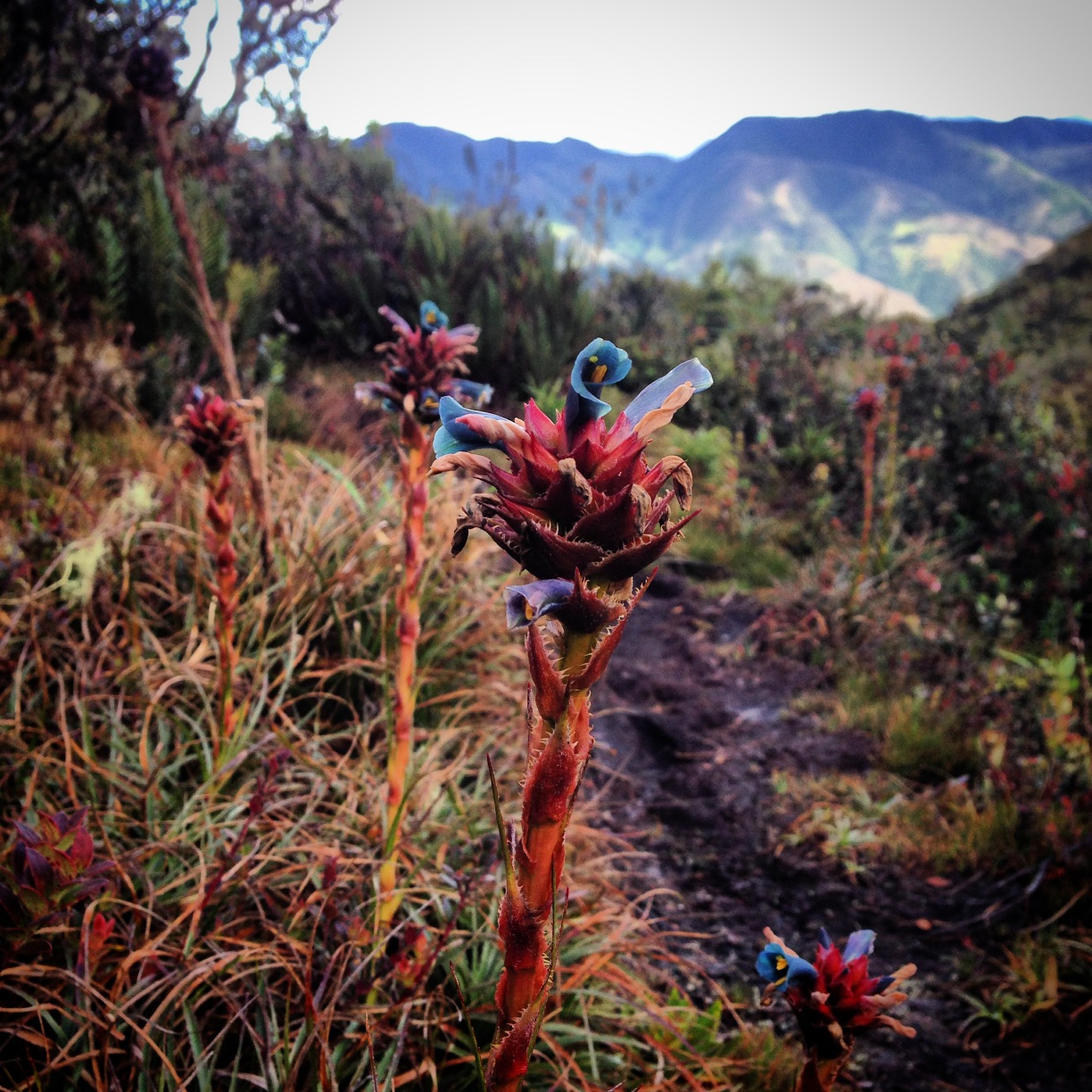
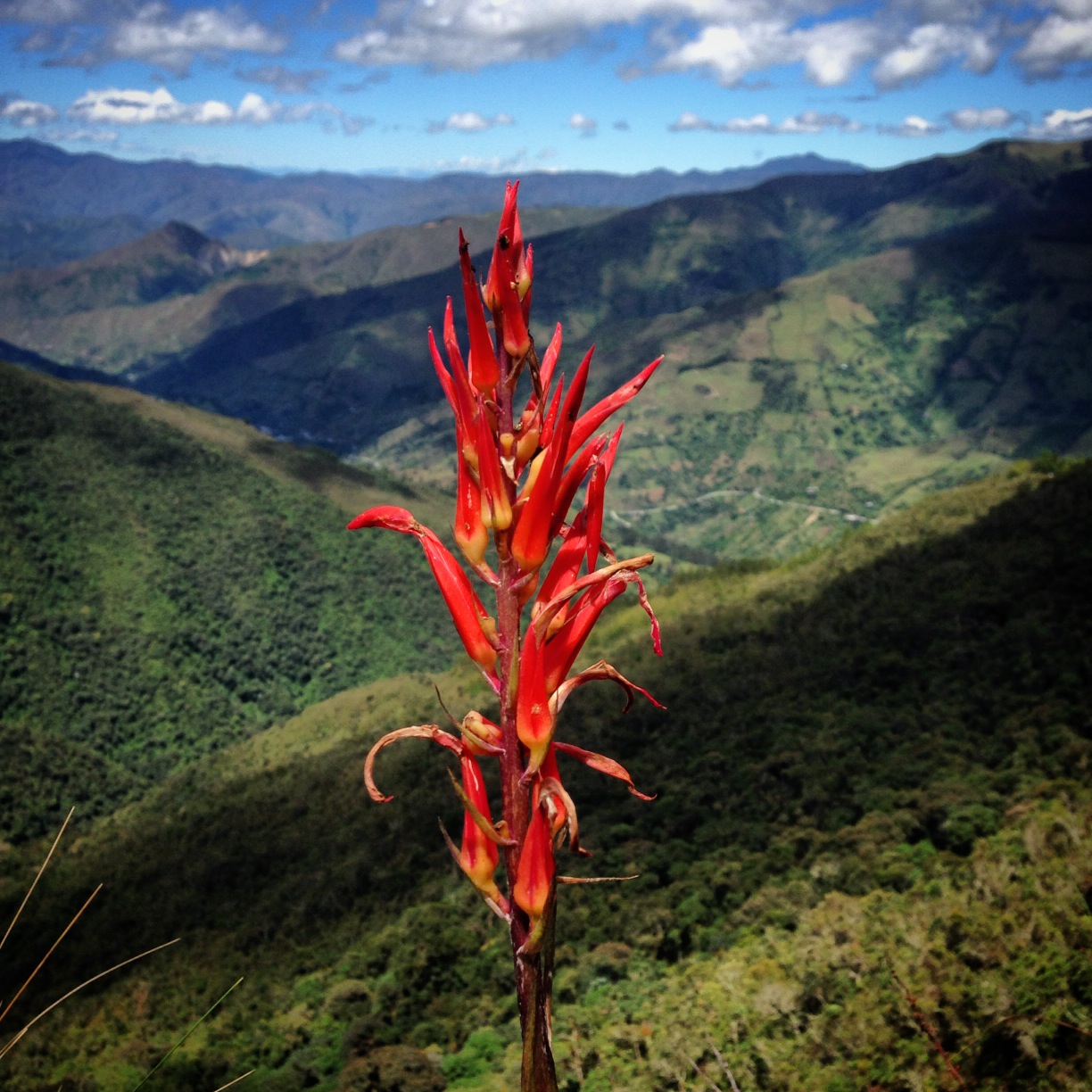
The scenery in Southern Ecuador.
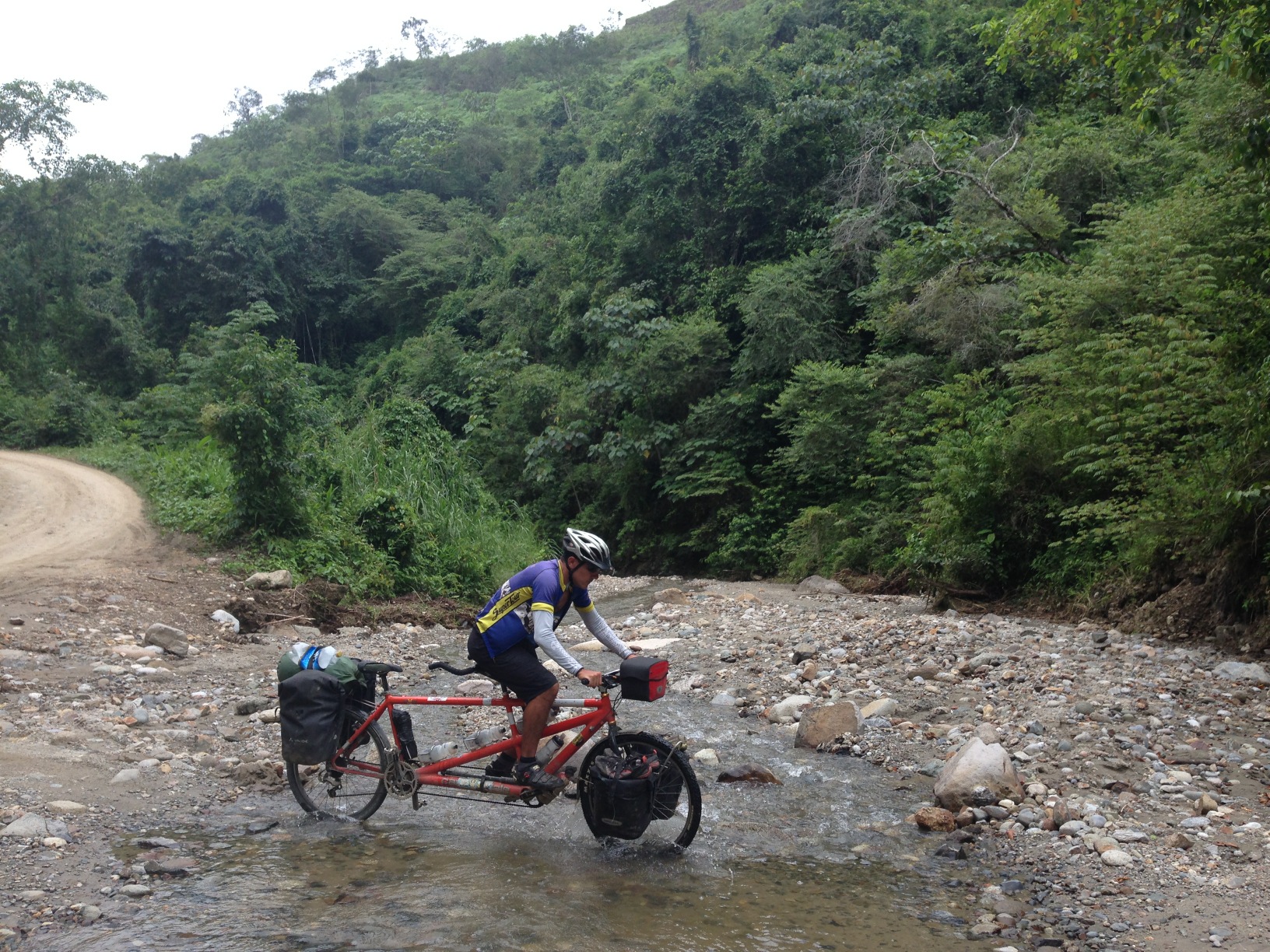
If you follow our route, you will be on pavement most of the time from Loja to Bellavista. Bellavista is a tiny community, about 5 miles South of Palanda. All the way from Bellavista to the Peru border, the route is unpaved. Going South from Zumba, expect steep, extended grades (10 to 15 percent) on dirt – all the way to the Peru border. From Bellavista to the border is a very trying section.
Peru / Ecuador Border to Jaen, Peru
I had been somewhat worried about Peru. From our reading, it seemed like there is a lot more crime in Peru, most roads are unpaved, and hotels are very “rough.” We were also told – from other cycle tourists (even a Colombian) that you really need to watch the the change that you are given (Peruvians will short change you, or scam you). I’ll report more on our opinions at the end of our time in Peru, but I can tell you that we were a little sad to be leaving Ecuador (though no where near as sad as we were when we left Colombia, one of our favorite cycling locations behind Norway and Switzerland).
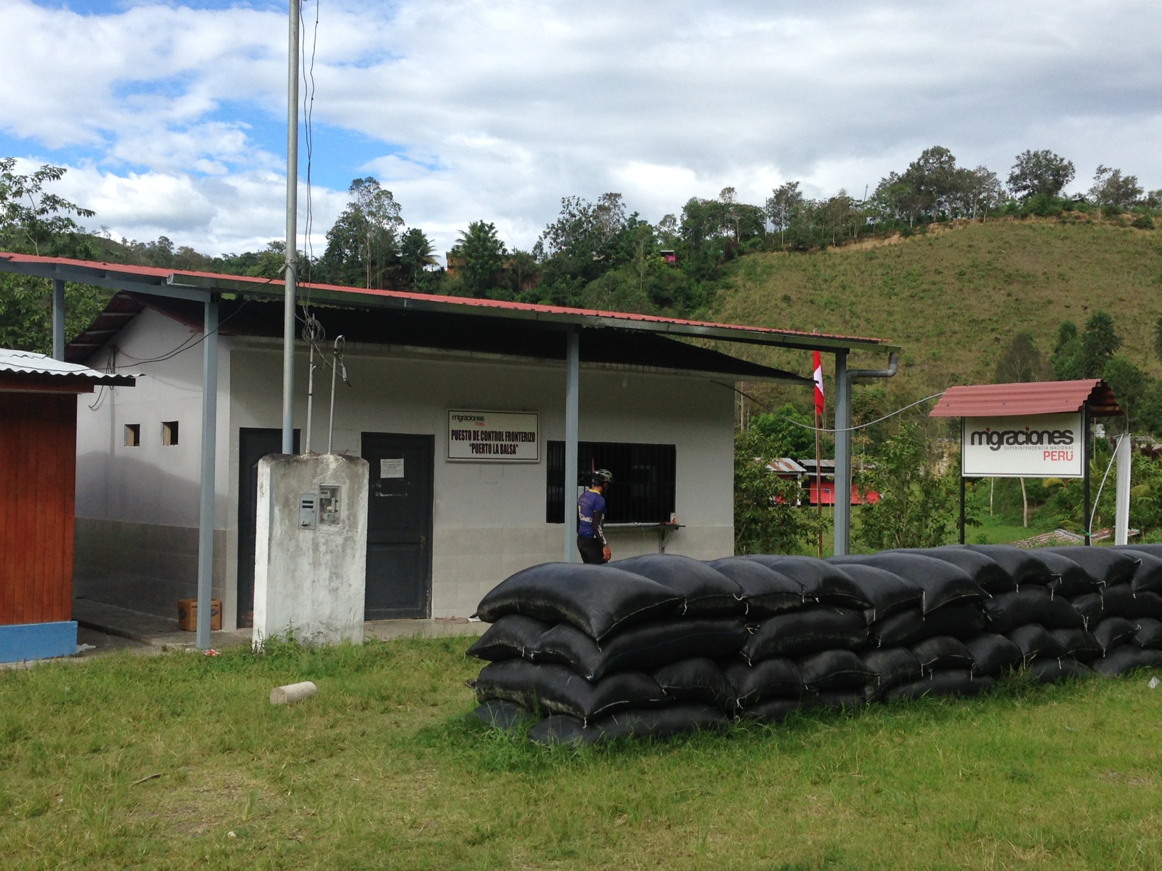
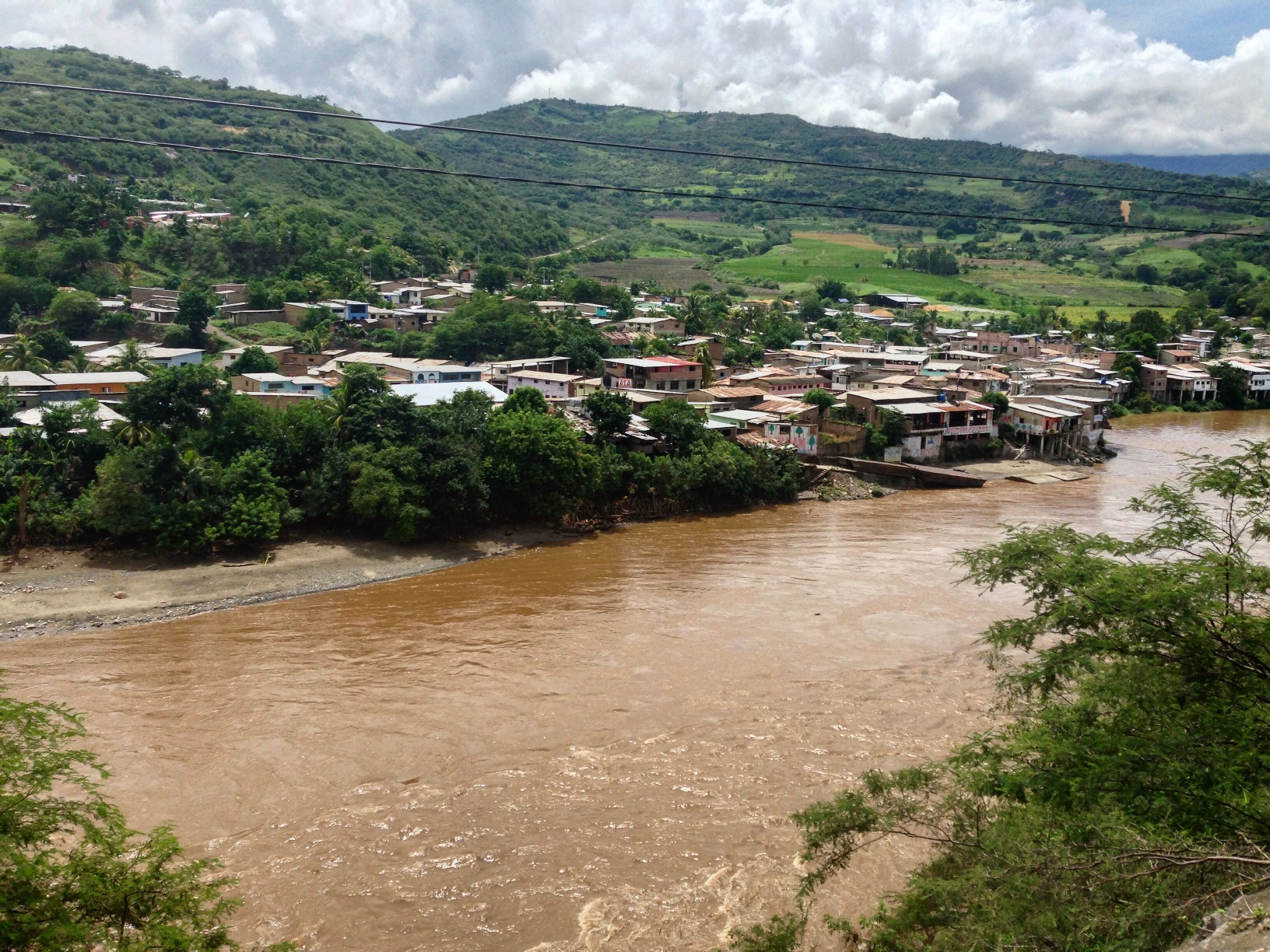
This is the most time I’ve ever spent at a border crossing – and I’ve probably crossed upwards of 40 borders by bike! On the Ecuador side, we waited for the border official to casually finish eating his lunch across the street. He was friendly enough, but he made it clear that we would need to wait for him. We decided to concoct our own lunch from the paucity of food available on the Ecuador side. Once across the bridge, the adventure did not end. There was no one here at the immigration office. We checked nearby at customs, and at various other locations for over half an hour. They all said, “He should be there!” The customs guy pointed us to the shanty village below and said that the building with the red roof was the home of the guy. I went over and knocked. Then I knocked loudly. From upstairs, a sweaty, and nervous face appeared. “WHAT?” He wanted to know. I asked if he was the guy who was supposed to be at immigration, and he said,”I’m coming” I went back and waited at immigration, and other people were showing up. Even though Janet had “saved our place in line,” when the man finally arrived 30 minutes later, a Peruvian woman slipped right to the front of the line – even though she was the last one to get here. There is a hotel located on the Peru side of the La Balsa crossing. We regret not staying here, as we continued South – well into the dark – towards San Ignacio. Scott and Sue said they found accommodation in Namballe, just a little further. We did not see many opportunities for wild camping except for maybe here: 05.10748° S 79.04489° W. The rest of the route is either on steep cliffs or there are small houses / dogs.
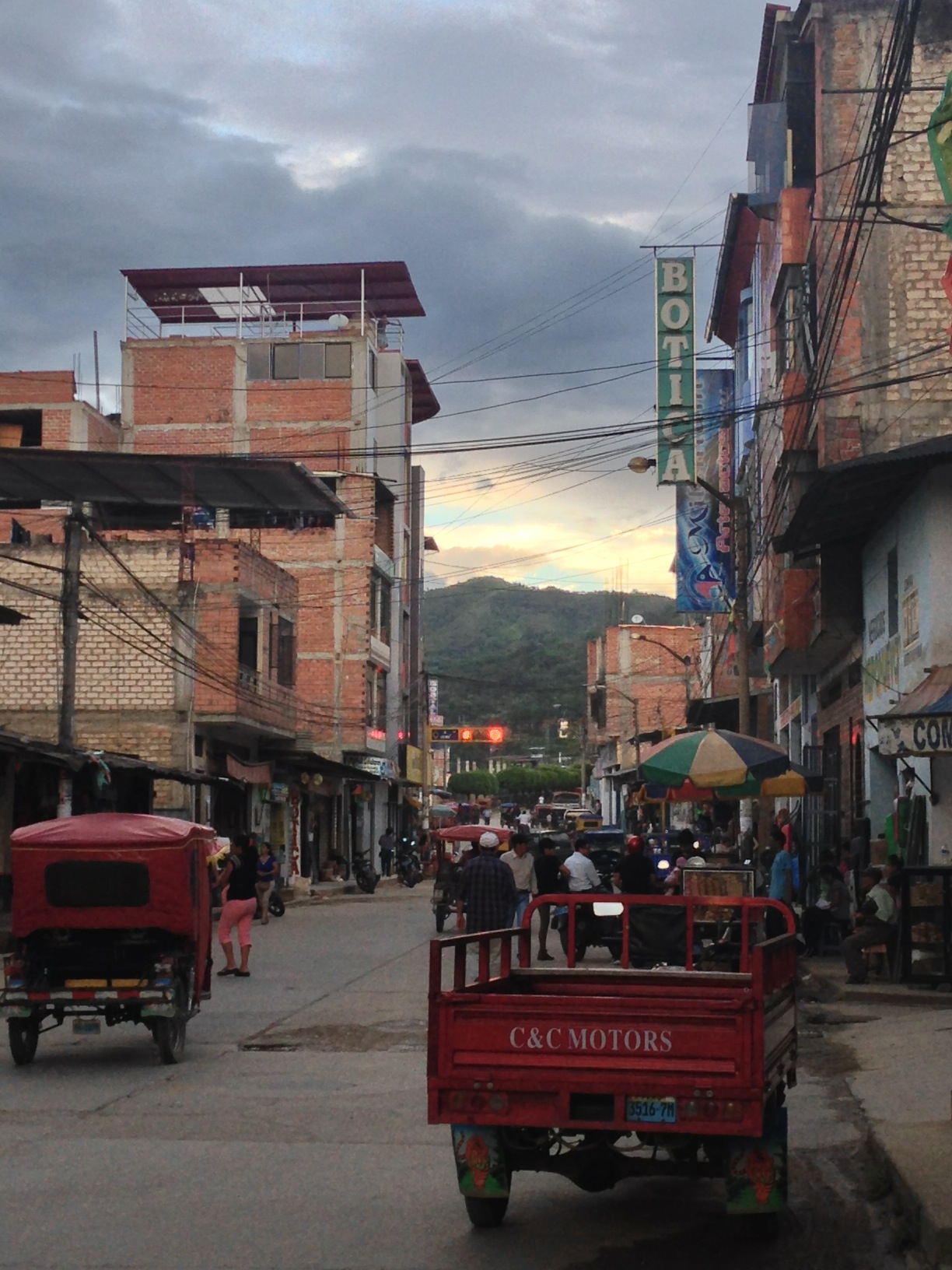
San Ignacio, Peru. Peru was quite a change from Ecuador. In this Northern portion, there were only these tuk-tuks driving – it wouldn’t be until later when we realized that Peruvian drivers were the worst we have encountered in the entire world. Not only do they not slow down, but it seems to be the custom that the person making the most illegal maneuver is the one that also honks the most ferociously. San Ignacio is your first real town after La Balsa.
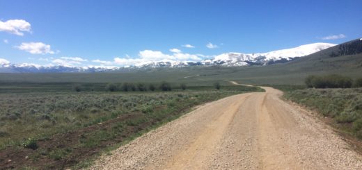
Normally, we try to avoid the low, flat lands – but after the difficulty of terrain in Ecuador with muddy roads, we were quite pleased to be riding well graded pavement in Peru. The lowlands are always hot and humid, but while you’re riding (assuming it is flat), the temperature is not a problem. We had well graded (less than 7 percent) pavement along our route from the border all the way to Huamachuco!
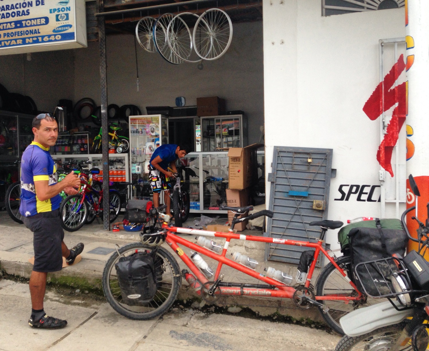
There is a friendly bike shop in Jaén (El Ciclista Jaén), located at 05.70939° S 78.81032° W. In fact, it is 3 bike shops all next door to each other owned by brothers and sisters. We were able to find a replacement for our rear rim whose sidewalls had been nearly ground through in the recent days of Ecuador’s steep, muddy, and rainy terrain.
This is the map for the entire route discussed in this post. To Export GPX files, click on the three horizontal bars in the upper right hand corner of the map and select Export selected map data…
To see this map in a full screen, click here (opens in new window)