Bike Touring Southern Mexico – Oaxaca to Guatemala
The Southern Mexico Portion of our trip from San Diego to Panama was one of the most enjoyable legs! Southern Mexico is abundant with places to visit – including many “natural” destinations. A short list of destinations would include: San Juan Chamula, Palenque (ruins), Golondrinas (waterfalls), Chichen Itza (ruins), Welib Ha (zip lining), Yaxchilan (ruins), Corcho Negro (waterfalls), Las Nubes (waterfalls), Merida (city), La Venta (ruins), Cascadas de Agua Azul (waterfalls), El Chiflon (waterfalls), Lagos de Montebello (lakes), Amatenango del Valle (village), Tonina (ruins), Campeche (city), Misol Ha (waterfalls), Cascadas Magicas (waterfalls), Hierve el Agua (cold springs). This is just a short list of highlights.
02/06/2014 Day 15 Exploring Monte Alban by bike and foot. 15 miles
Went to check out Monte Alban. The ruins were not as impressive as Tikal, Tulum, or Teotihuacan, but they were quiet, and not very crowded. It was an obligatory visit due to our proximity. Oaxaca is an amazingly beautiful (and surprisingly modern) colonial town. We explored the city last night and saw young people everywhere enjoying the evening. We enjoyed seeing large groups of motorcyclists who gathered in different parts of town. Their bikes were parked nearby, and they were socializing near the street in various places. Everything has a really happy, fun vibe to it. The town is very pleasant, and reminds me of some of the more idyllic Southern European cities with outdoor dining, and live music in the streets. We’ve met some people who stay here for a long time; I can see how it would be easy to get “stuck” here
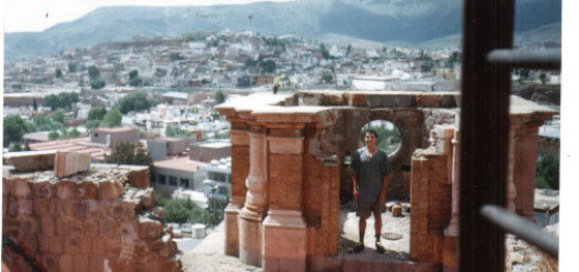
Oaxaca is a delightful town to spend time in – there is an abundance of culture and opportunities to do anything you might do in a larger city. Cycling is a little more dangerous than in the rural areas we had been visiting due to the increased amount of traffic and (relatively) less respectful drivers. Nevertheless, this is not an enormous city like Mexico City, and it is safer for cycling and fairly easy to navigate. You’d probably want to consult a city guide for all the different options for activities available here, but some of our favorites were hanging out in the Zocalo (main square), the Textile museum (picture below), Monte Alban (picture below).
Monte Alban Ruins. Monte Alban is a well-excavated site. Unlike some other Southern Mexico ruins, this is not a jungle site, so it can be warm (in spite of the elevation). Although the ruins were not as fantastic as some of the jungle ruins in Mexico, the plaques are educational. Note that most of the plaques are not in English. There are, however, English speaking guides available for hire.
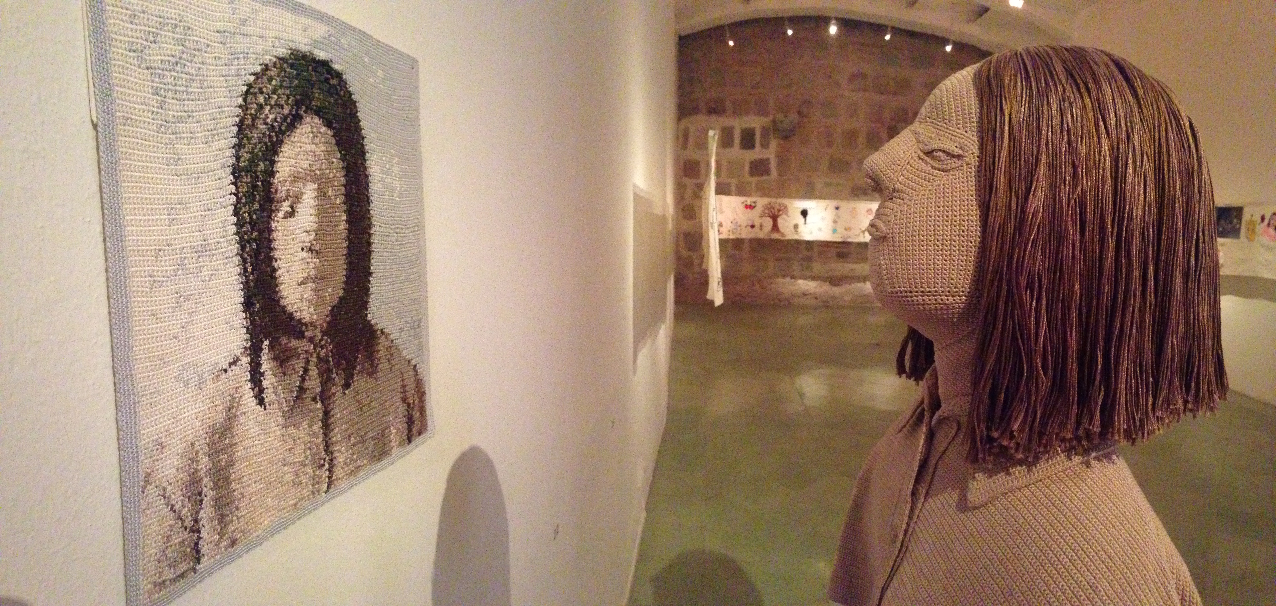
Oaxaca Textile museum is a well maintained, large museum where you can spend several hours.
02/08/2014 Day 17 Oaxaca to Hierve el Agua 46 miles.
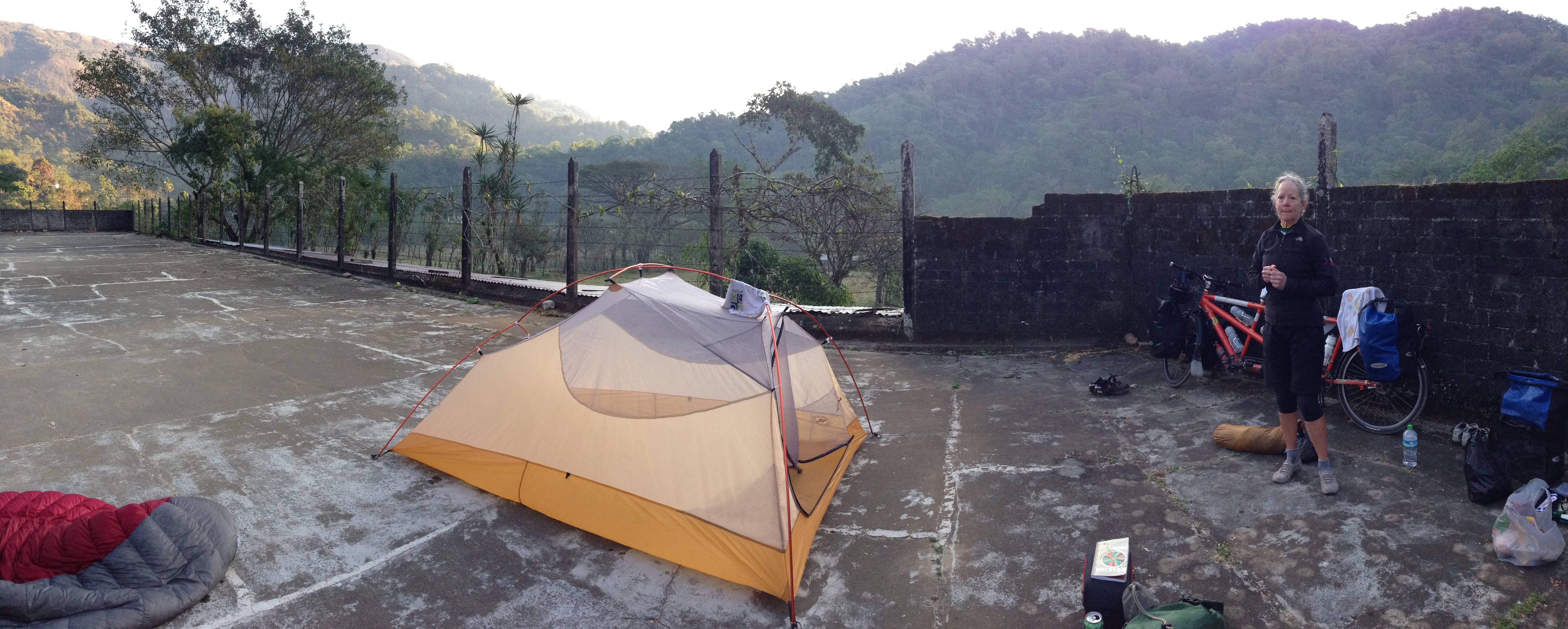
Only 46 miles from Oaxaca is a natural water formation that we felt was worth a visit: Hierve el Agua. The road to this destination is relatively uninspiring for the first 25 miles, but as you approach the mountains, it becomes more interesting scenically. As you descend the Autopista, you want to make sure to slow down so you don’t miss the right hand turn on Cuauhtemoc for San Lorenzo Albarradas. We were able to buy groceries in this little town that is the gateway to Hierve el Agua. Hierve el Agua is definitely a tourist destination, but like many of the tourist destinations in Latin America, they have typical “hours.” The routine is that tourists queue in the nearby towns around 10 am, whereupon they are shuttled by van, truck, or bus to the destination. By 4pm or so, these conveyances all must return to the cities, and you’re left with a nearly vacant park. This was the case when we arrived: things were shutting down, so it was quiet and we had the beautiful setting all to ourselves. Worth noting if you’re cycling to Hierve: the bumpy dirt road going in requires mountain bike tires. Also, the entrance isn’t very “official” – you may need help finding it unless you follow our GPS track.
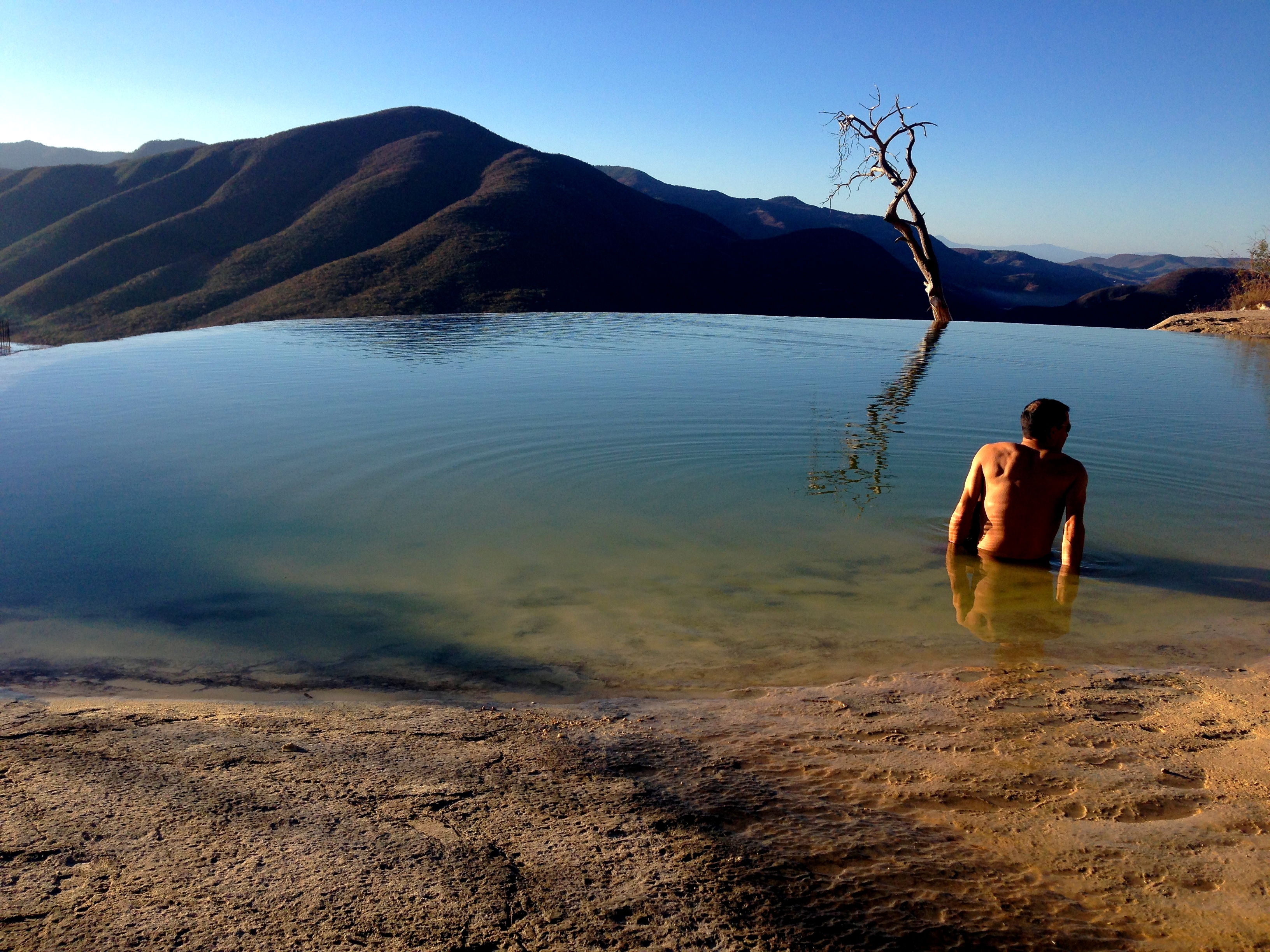
Hierve el Agua – if you camp there the night before (or stay in one of the cabins), you can likely enjoy the sunrise over the pools all by yourself!
We camped here for one night. There isn’t an official campground; we just camped by the palapas near the swimming pool. There are restrooms across the way. You can also rent one of the cabins, which have hot water. The entire camping/cabin area is dingy, but the hiking area and natural pools are quite clean and nice.
02/09/2014 Day 18 Hierve El Agua to Ocotlan de Morelos 54 miles
The story of the day was when we got near the evening, and we saw two girls on the side of the road crying. I asked if they were okay, and she asked if we could give them Both a ride. I said ok, but then she said nevermind. She cried some more, and I said we could take her that I’ve done It before. So she said ok, and had the little girl sit on the top tube in front of Janet, and she jumped on the rack like a cowgirl side saddle. We rode them a few miles on to town. I Asked if they were sisters, but the little girl was her daughter to my surprise because the mom looked to be 14. We took them to town as she asked, four people on one tandem. then she wanted to return the favor, so she directed us to a hotel and asked is to wait outside. She said she could make it cheaper for us. Sure enough, she got it to 150 pesos, she told me it is usually. 250. I thanked her, and she cried a little more. We don’t know what happened , and asked if there was anything else we could do to help her, and she just said bye and went on her way with her daughter. It was sad, and I didn’t feel it was my place to ask what had happened, but we think that her husband may have left her by the side of the road. We hope she is okay.
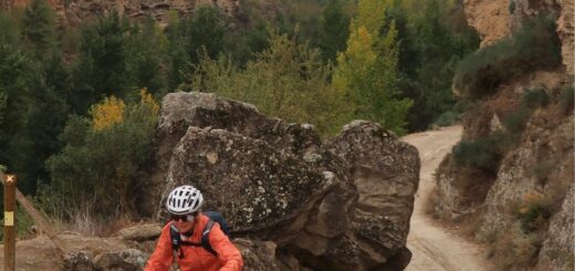
We decided to take the main road back from Hierve El Aqua to Mitla. On our way up, we noticed a major highway, devoid of cars, ascending a more gentle grade than the busy, climby backroad we took yesterday. The road looked great: but it was closed. As is sometimes the case, bikes can sometimes get through when cars cannot. So, we rode the closed, quiet, easier road, and came to a section that said, “no hay paso.” Of course, we just lofted the bike for a few hundred feet and passed a man sleeping in a backhoe. He woke and waved as we walked by. If the road is open when you go, the windy backroad will likely be the preferable option, as this highway probably absorbs most of the traffic. The ride for the day was mostly through rolling Mescal country. It was scenic and fairly easy terrain. We ended up staying in one of the many hotels in Ocotlan de Morelos (as described in “Notes from the Road”).
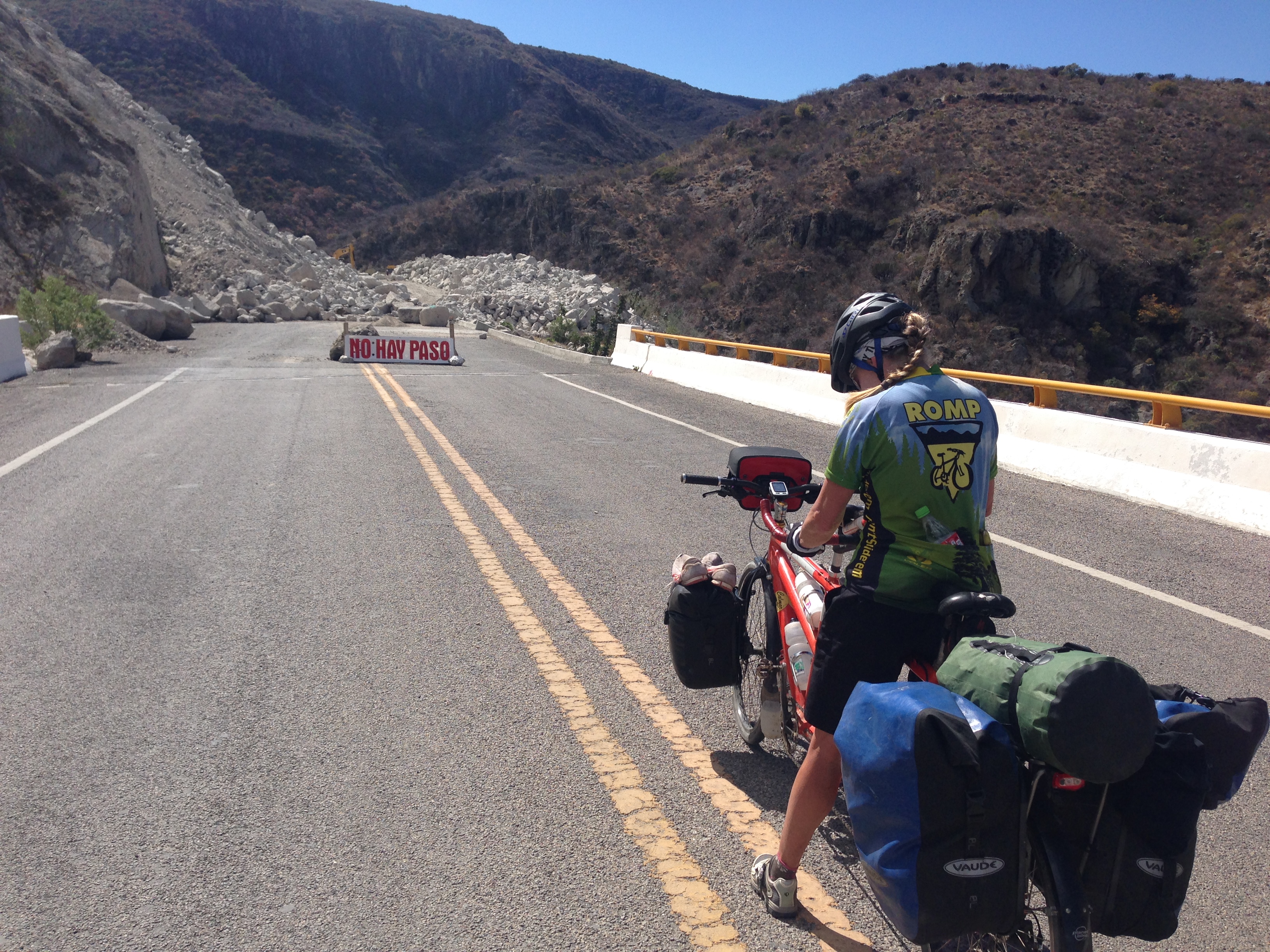
No hay problema. Although the landslide blocked cars, we were able to walk the bike through quite easily.
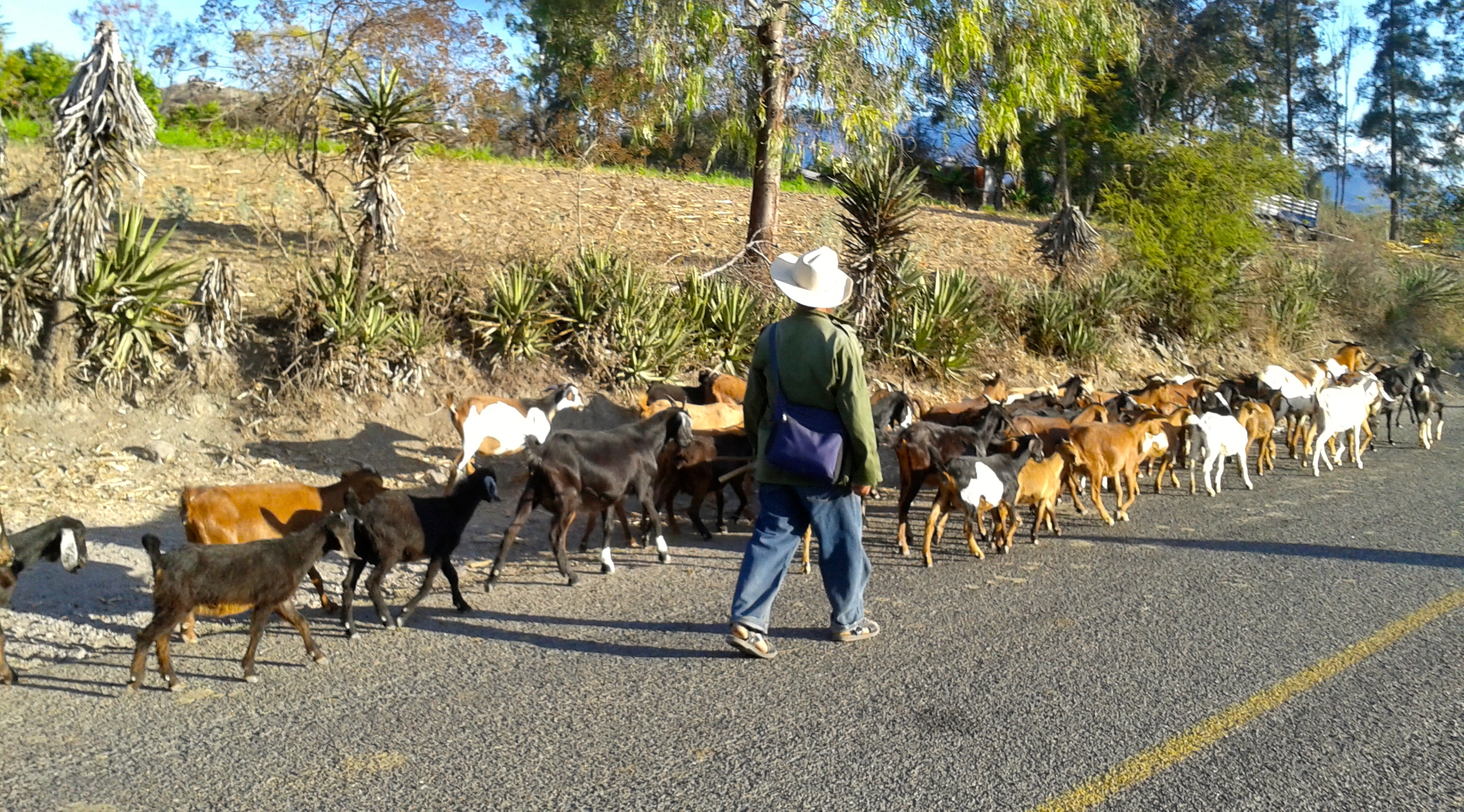
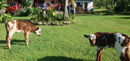
Livestock in the road, frequently seen riding through Mescal country.
02/10/2014 Day 19 Ocotlán De Morelos to Mountain Mans House along Hwy 175 50 miles.
Today we rode a relatively short day. The route is not especially inspiring, but this is what I would consider to be a “commute” from one location to some super terrain and culture in the mountains not far to the West of Oaxaca. If you are cycling this route, be sure to obtain supplies in Miahuatlan (the town before the climbing begins, mile 41). After that, it is harder to find supplies in the mountains (though several cafes catering to travelers are definitely available along MEX 175). We ended up asking permission to stay at a man’s house. He lived by himself, and was a little shy upon our approach. Long discussions over coffee the next morning ensued, and by early afternoon, we felt that he really wanted us to stay longer because he kept bringing up new topics. Out of respect, please do not follow our GPS track to this person’s home; instead I suggest that you find another place to stay or spend the night at Miahuatlan.
02/11/2014 Day 20 – Mountain Mans House to Coffee Finca near Plumas Hidalgo 52 miles
Today is a day to put your climbing boots on. You will rise to an elevation of 9,000′, and you will encounter a lot of up-and-downs along the way that add up. You’re riding along a long ridge that affords fantastic views to the West of deep canyons. It is quite amazing how people have managed to squeeze a living out of these mountains. Everywhere, you can see spots of cultivation and homes. There are even churches perched on the cliffs. It is a beautiful, cool area. You may wish that you didn’t have to descend to the humid heat; the climate here is nearly perfect year-round.
Plumas Hidalgo Coffe Finca. This is where they dry the coffee beans – on a huge concrete platform. Today, they only used a tiny fraction of the pad: maybe 2% for drying. The very generous family, Mateo and Carlos, invited us to stay with them for the night without us even asking.
02/12/2014 Day 21 – Coffee Finca to San Miguel Del Puerto 50 miles
Todays route starts with a climb before the descent. Temperatures are noticeably warmer, and the humidity is significantly higher. The objective is “Las Cascadas Magicas.” I had “discovered” this location online using Google Image search. At the time, there was not a lot written about the destination otherwise, and it does not appear in either the Footprint or Lonely Planet Guidebook. The journey to Cascadas Magicas by bicycle is an adventure all in itself. If you don’t make it to the destination, you can still be satisfied with whatever adventure you have on the journey. If you follow our GPS track out of Santa Maria Huatulco, you will quickly find yourself on a bumpy dirt road. This road shows no respect for hills or rivers – it just goes straight through or over both of them. We had obtained Google Driving directions to the destination, and as you can see, at mile 32, we continued to follow them… down a hiking trail into the jungle. Yes, Google Driving directions that we downloaded into our GPS had hiking trails on them. See my “notes from the road” about my theory on how this could happen. You’d be advised to avoid this out-and-back spur that we took unless you’re looking for a single track, mountain bike adventure. The out-and-back seems to pass through private land. People were friendly enough as we passed, but it appears to be a hiking trail that people use to access their homes. It’s probably impolite to use this as a route to get to the falls.
02/13/2014 Day 22 – San Miguel Del Puerto to Magic Waterfalls 4 miles
Today, we finalized riding to the falls. It was only 4 more miles. The time we lost last night on the jungle single track trail was about the amount of time we would have needed to make it to the falls in one shot. If you’re following this route, hopefully you will not have the same delay issues. There is not an official campground at the destination, but they are flexible – very flexible. They permitted us to camp in the covered restaurant area, which was convenient, as we were the only ones there. The only negative is that their dog “Rambo” enjoyed barking all night long. He was there for security. If you do decide to spend a night here, make sure you have your earplugs handy. The hike to the cascades is guided, and for us, it was included as part of our camping fee (which seemed like an impromptu, arbitrary value). The guided tour was very good; the primary guide was the owners brother. We hung in the back with him, and he introduced us to flora and fauna that we would have completely missed. The falls are beautiful, and varied. It is worth a visit, even though is seems a little “business-y.” This is private land that the owner has fought to maintain as private. He says he has been trying hard to get into guide books.
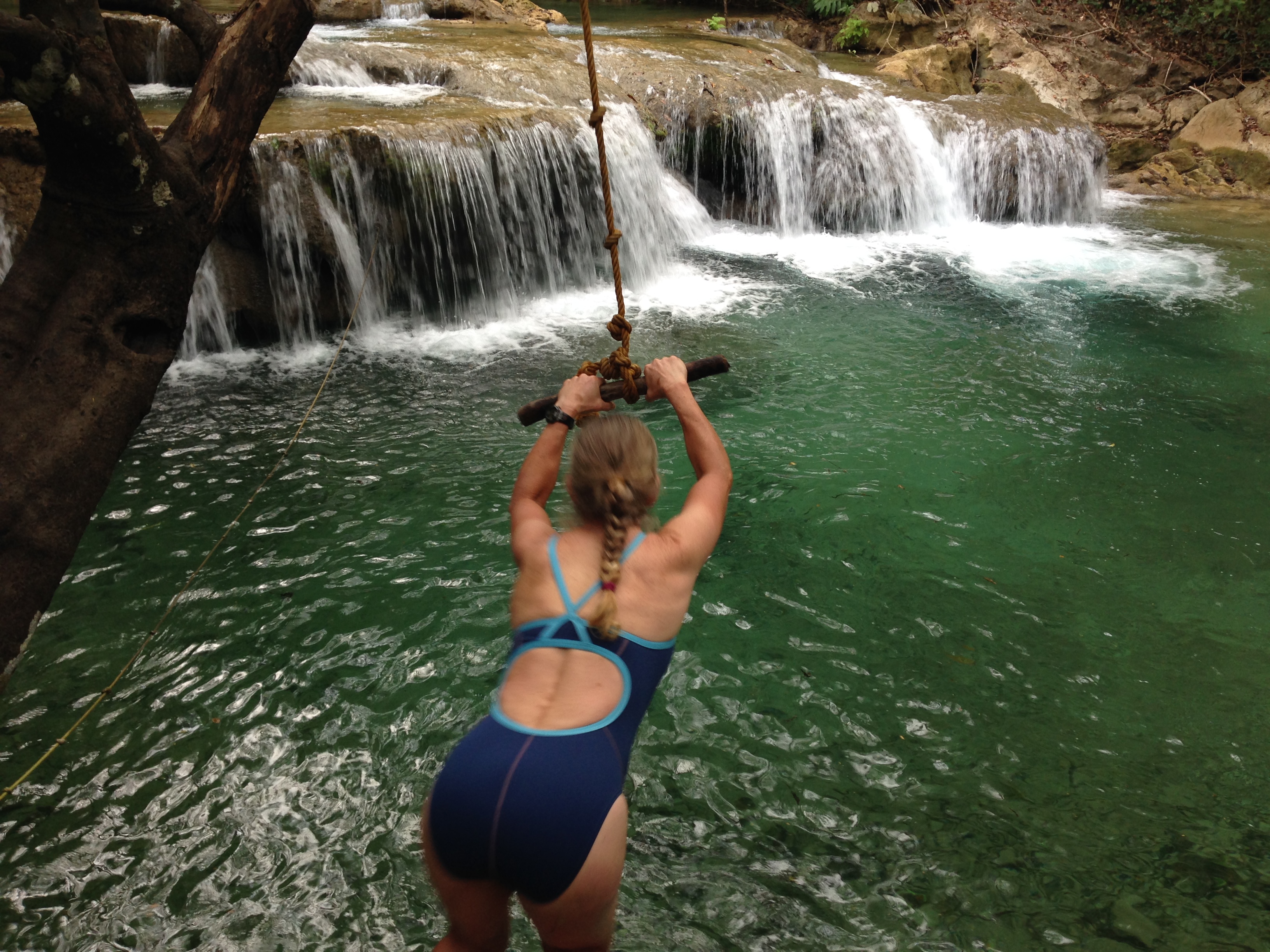
Janet flies on the rope swing into the cascade
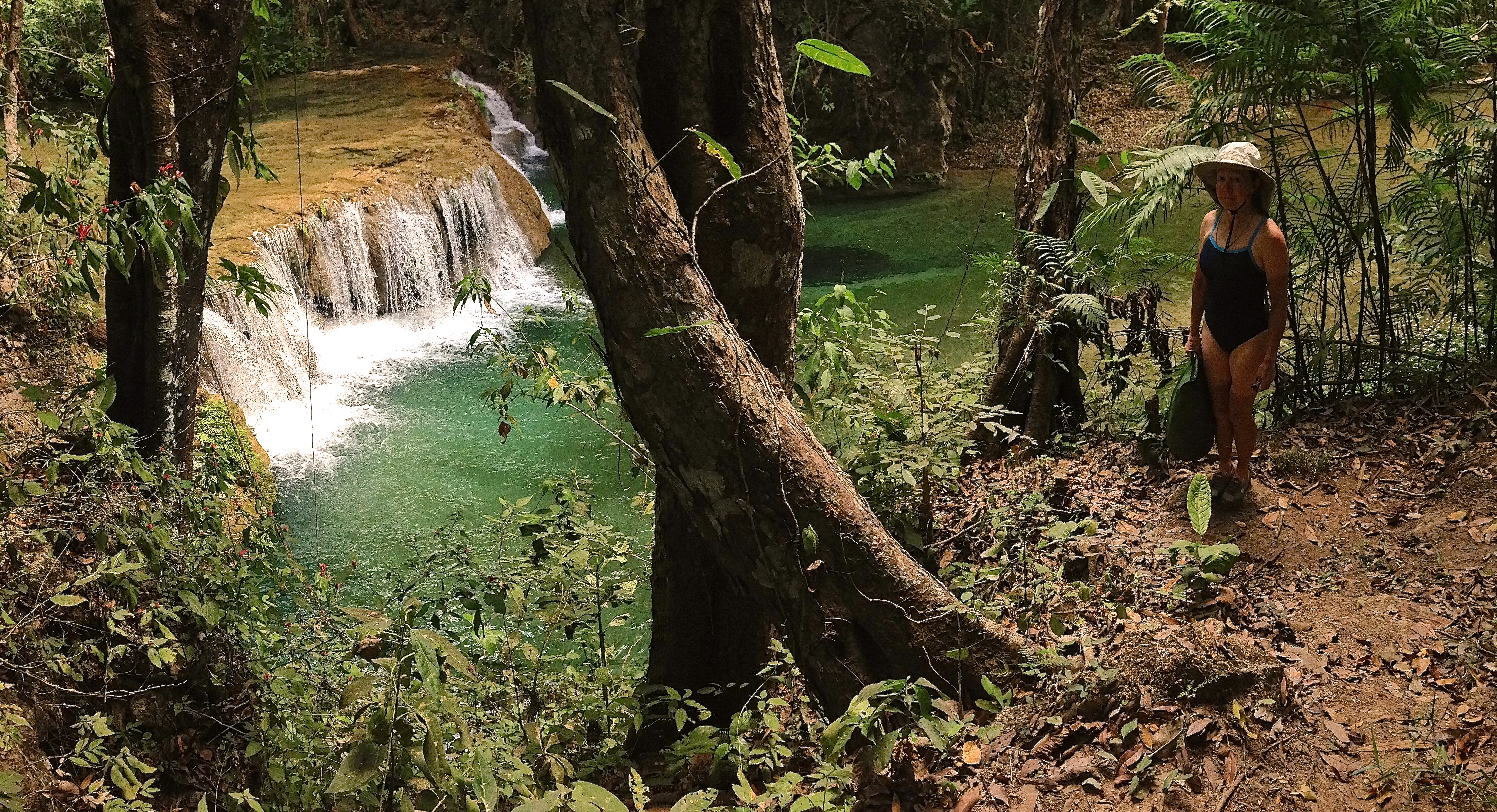
One of the magical cascades
02/14/2014 Day 23 Magic Waterfalls to Salina Cruz
The exit from the park back to the main highway is a little easier from this direction (so if your considering making an easier approach, you may decide to go from Barra de la Cruz). It is still a dirt road, but this one is smoother than the one from Santa Maria Huatulco. From here, we rode East on MEX 200. This road is quiet enough; it didn’t feel dangerous. From Barra de la Cruz, there are a couple of roadside stands for food, but with the exception of a tiny store in Barra de la Cruz, you haven’t really seen a grocery for a couple days. The road is winding, and a little hilly until El Coyul (mile 36). From her to Salina Cruz, it is mostly flat riding. There are a couple of road-side stands and cafes to keep you going. In my opinion, the scenery was mundane through this regions. Our research revealed that the Isthmus of Tehuantepec is one of the windiest regions in the country. The combination of a narrow road, high winds, heat, and boring scenery encouraged us to solicit a bus ride the following morning from Salina Cruz to San Cristobal de las Casas. As we rode on the bus through the region, I looked out the window and was satisfied that we had made the right decision. The road was busy and shoulder less, and if the bus buffeting around on the road wasn’t evidence enough, the plethora of wind turbines surely indicated that a wind was going on. As a result, I don’t recommend riding this section unless you’re aiming to do a “through route.” One negative of our bus ride: we had some tools stolen from our bicycle seat bag. ADO, the bus company we rode with did NOT take any responsibility for the theft, even though the $100+ worth of tools and spare parts were certainly stolen by one of their employees. Sadly, the parts would have little use to anyone unless they had a decent, modern bicycle – it probably went into the trash.
02/17/2014 Day 26 – San Cristóbal De Las Casas 62 miles.
After touring around San Cristobal for a couple days, we resumed riding. We chose to ride horseback, as well as a few other touristic visits in town. The town is brimming with opportunities and self-appointed guides. This is a town where the gringo population may equal or exceed the native population. It is my expectation to see Mexican people in the Mexican streets doing street performances to earn money… but in San Cristobal, the tables are turned, and the Gringos take to the streets doing performances and setting up stations to ask for money. I had been here in 1998, and at that time, I found that Mexican children begging was fairly common. Now, the Mexican beggars are gone, replaced by the Gringo beggars with a different style. The ride out of San Cristobal is through pine forest. The air is clean and cool – this area experiences a near-perfect year round climate, which is probably part of the draw for the Norteños.
Riding the Ocosingo – Comitan Road.
We decided to ride through Chanal. This road is very quiet, but it is often not recommended because it is considered to be dangerous. In many instances, it appears that people, when describing routes, use the word “dangerous” synonymously with “isolated.” I would agree that this road is isolated. Being isolated could possibly make it dangerous; it certainly makes it beautiful and a great ride. We did meet some friendly people in Chanal who were so worried about our safety that they offered to drive us through the road to where it was safer. They assured us, “It is safe here in Chanal, but down ‘there’ it is not safe.” We would find that this was a very common thought: it is safe here – but there it is not safe. When you got to the unsafe place, you would be informed that it is safe ‘here,’ but not where you were. I don’t mean to be dismissive of safety warnings, but I do believe that they need to be filtered somewhat based a little more on facts. We enjoyed this route immensely, and hope you do too!
02/18/2014 Day 27 – Mexico CHIS Mexico 53 miles
One of our objectives was to reach El Chiflon Waterfalls. I love to visit natural water features, and El Chiflon was one of the best water-feature experiences of the trip. This area has received significantly more money than some parks and it shows. The funds have been invested well to contribute to the visitor experience as well as visitor safety. I think more highly of this park than I do of any other park we visited during this trip. The experience was spectacular. Camping is allowed inside the park, and you may also rent a beautiful cabaña instead if you want. Camping was in the playground between the cabañas, which sounds a little odd, but the space is nice. We had it to ourselves (as well as the park to ourselves as night came). There are hikes to some amazing waterfalls, and you can zip line across the top of the falls if you want. We did not do this, but felt a little temptation in our hearts. There is a cafe inside the park, including one immediately across from the camping area. The paths are well made and signed. El Chiflon is definitely a super eco-tourism site.
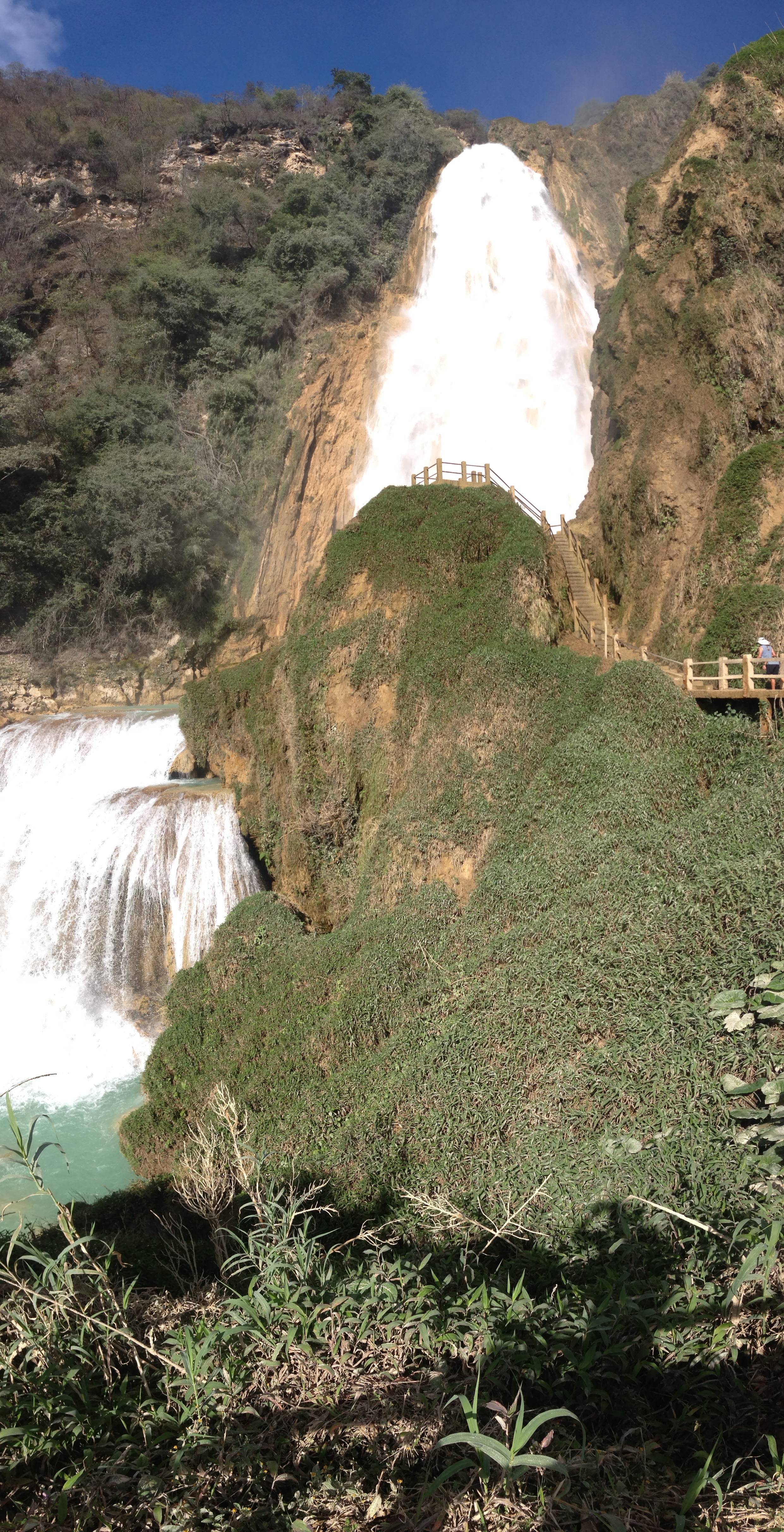
El Chiflon Falls in Chiapas, Mexico
02/19/2014 Day 28 – Chiapas Mexico CHIS Mexico 70 miles.
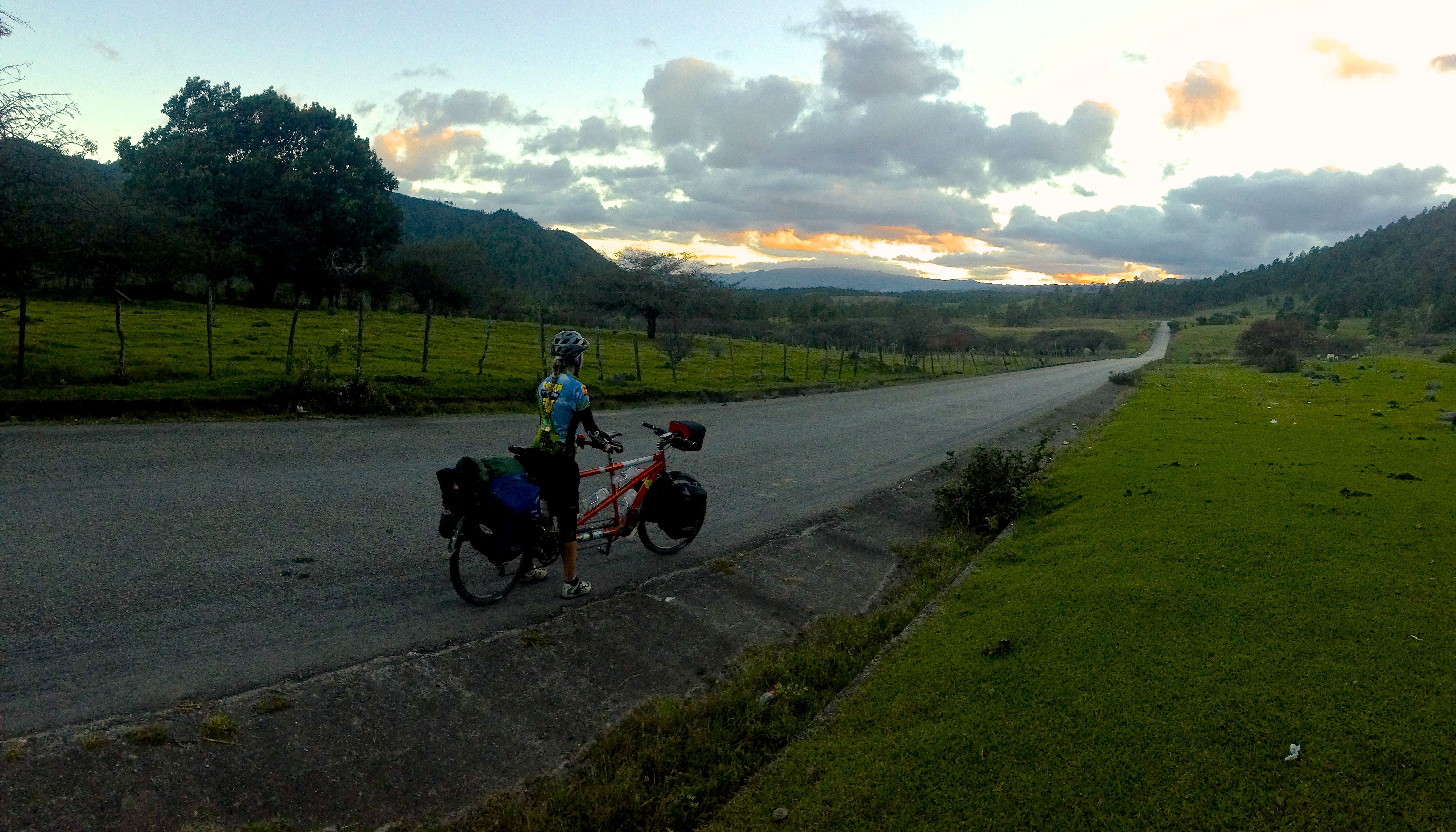
Although we were sad to leave El Chiflon, we were also excited to enter a new country: Guatemala. We left along the most direct route, which is a dirt road. You can follow our GPS track if you want to save yourself the significant climb, mileage, and redundancy of heading back to Comitan. The route isn’t particularly interesting except for how verdant the landscape becomes at the lower elevations. Over the years, I have become lackadaisical about border crossings – but that does not mean that you should be. These days, it is necessary to get an entry and exit stamp. Take careful note that the place to get your exit stamp is at the bottom of a long hill in Mexico. If you ride up the big hill to Guatemala without an exit stamp, they will ask for you to return to the bottom of the hill before they will award you an entry stamp into Guatemala. We managed to “work it out” for a small convenience fee. For us, the fee was quite small; smaller than the fee for the Mexican stamps. If I were to do it again, though, I would have done things correctly the first time. As you ride CA1 into Guatemala, you’ll notice a feeling of relative prosperity that seemed to be absent when I was here in the 90’s. We spent the evening camped by the river behind a wonderful small cafe, and in doing so, I got into a lengthy discussion with one of the owners. He discussed how this is a coffee growing region, and this was a bad year due to a worm that is destroying the coffee plants. I postulated that a lot of the prosperity here was probably due to the continued global increase in the consumption of coffee. Without doing the research, maybe this increase in a region of Guatemala’s apparent prosperity justifies purchasing a bag of Fair Trade Coffee. The scenery through this canyon approaching Huehuetenango is some of the most dramatic encountered thus far.
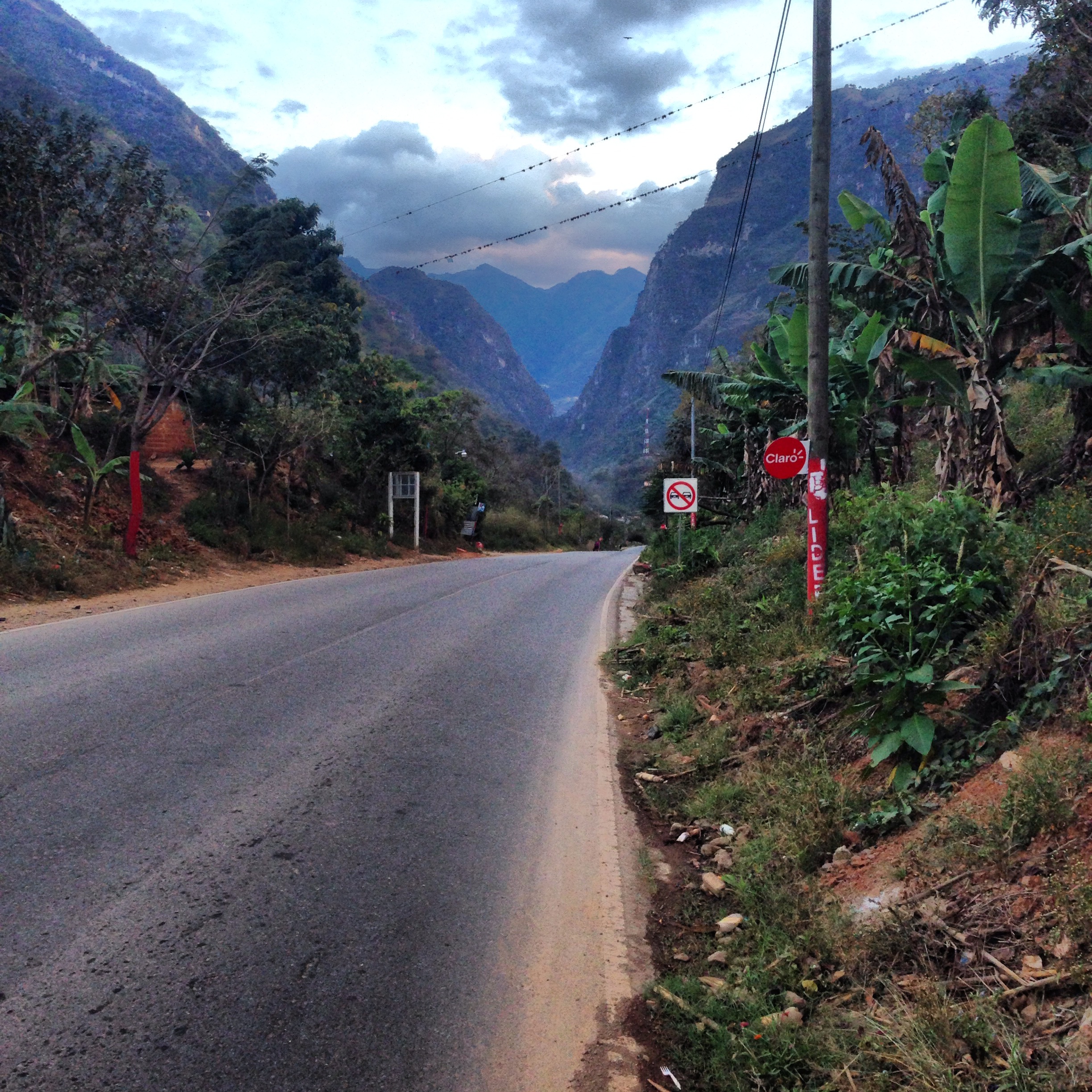
Scenery heading into Guatemala. It’s a long way up from here!
This is the map for the entire route discussed in this post. To Export GPX files, click on the three horizontal bars in the upper right hand corner of the map and select Export selected map data…
To see full screen, click here (opens in new window)
This concludes the Southern Mexico Cycling Guide Portion of our trip. You may now wish to proceed to the following locations:
Bicycling Latin America – San Diego, Baja California, Mexico, and Central America Hub Page