Bike Touring Scandinavia – Norway
Route 1: Cycling Through Oslo
Scandinavia was one of my favorite places in the world for cycle touring! In Particular, Norway presented us with some of the best conditions for riding: Superb, careful drivers, smooth roads, hours and hours of daylight, clean air, healthy food, clean drinking water, and the greatest collection of scenery I’ve seen about anywhere! Before Departure, we had gleaned information about popular cycle routes from this web page. Since we were doing a lengthy tour, I tried my best to stitch together each of these individual routes into one continuous route. Although we could not connect every one of these routes, we also combined the popular cycle routes with some of the popular auto routes. It turns out that Norway also has a collection of roads that they built with no purpose other than to convey tourists to beautiful places. These routes are designated by a cloverleaf symbol.
Our chosen route attempted to connect as many of these scenic routes as possible, without being too circuitous.
We began by following popular bike routes through Oslo. We determined our route through this section by using Strava’s Route Builder. Strava simply aggregates the data from all the GPS tracks that people upload. Presumably, the most popular routes are the most scenic/safest for bicycles. This turned out to be the case, as our ride through and out of Oslo was easy and wonderful.
Route 2: Numedal Bike Route
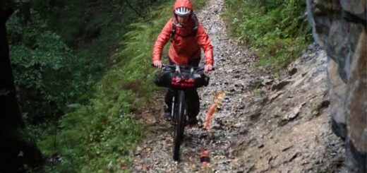
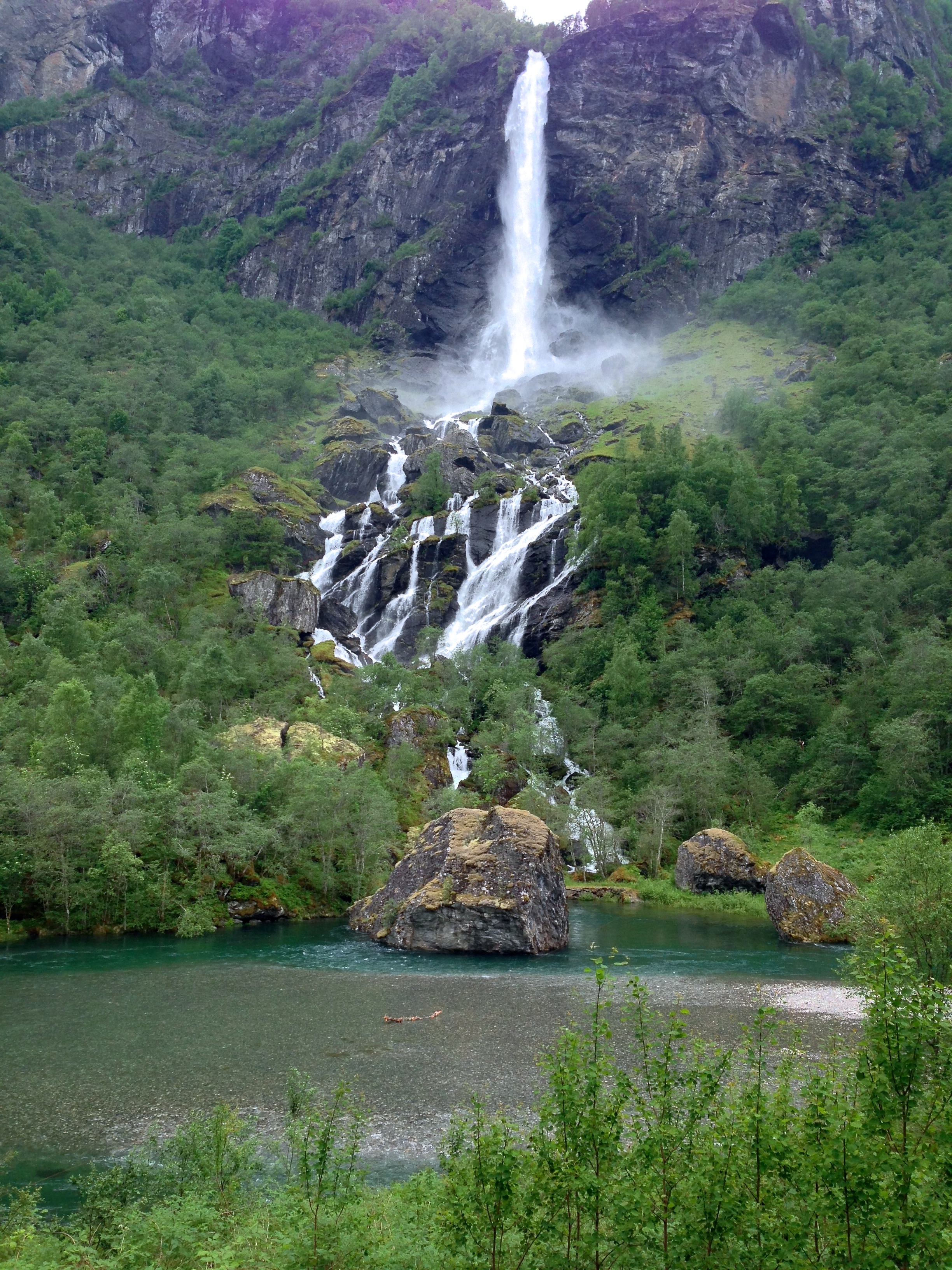
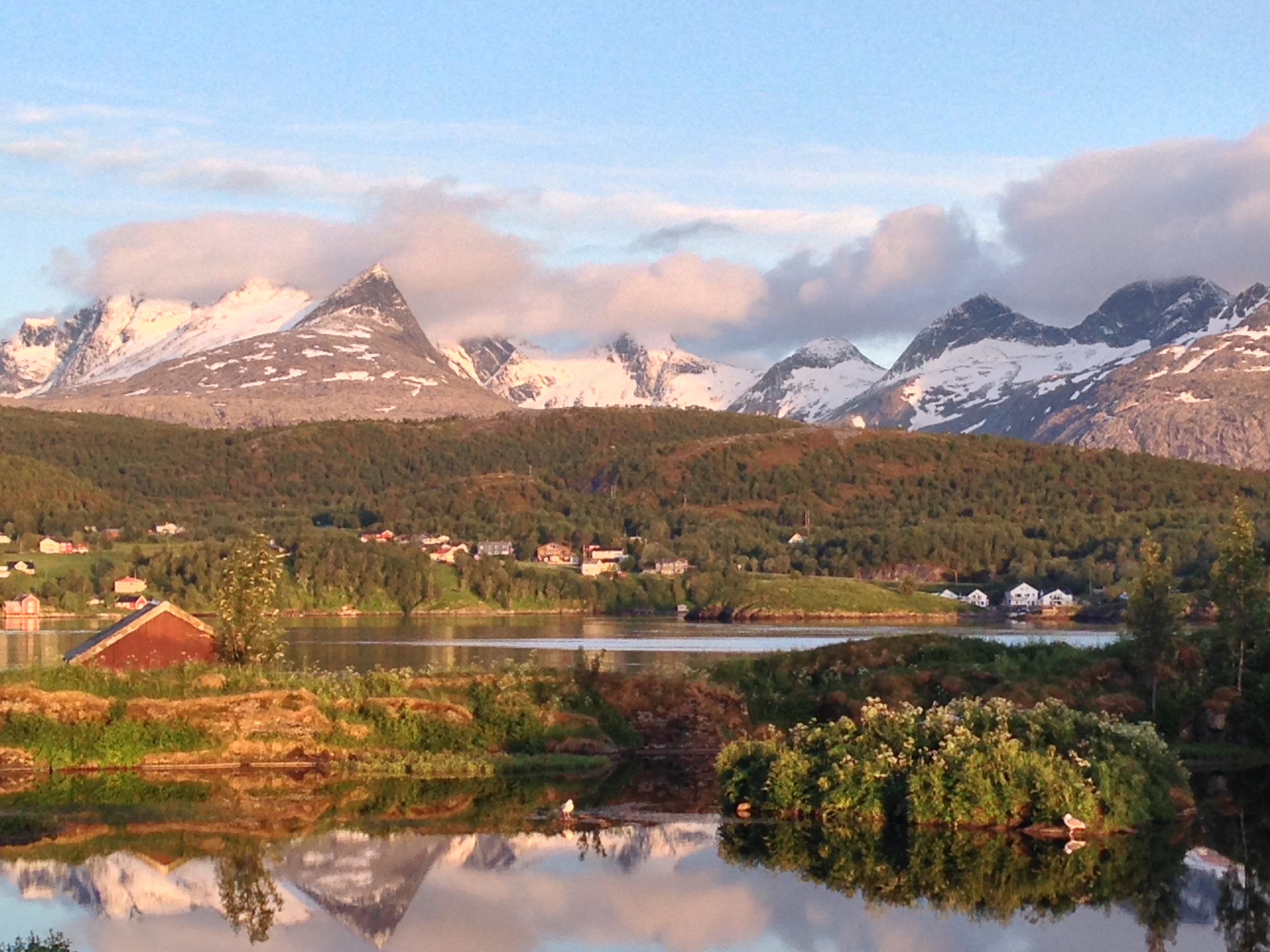
After leaving the city, our first bike route destination was the Numedal Bike Route. We headed for Kongsberg, got on the route, and followed it towards Geilo. This route was probably our second favorite bicycle route within the country. One special treat: the WC in Degali had coin operated showers! Since this was early in the trip, we assumed that we might find these throughout Norway. In the end, this was a one-off treat. The Numedal Bike Route took us by interesting rail-trails and along very quiet roads; it is very enjoyable cycling. It also links up nicely with the next bicycle route: Rallarvegan.
I will build a road for you.
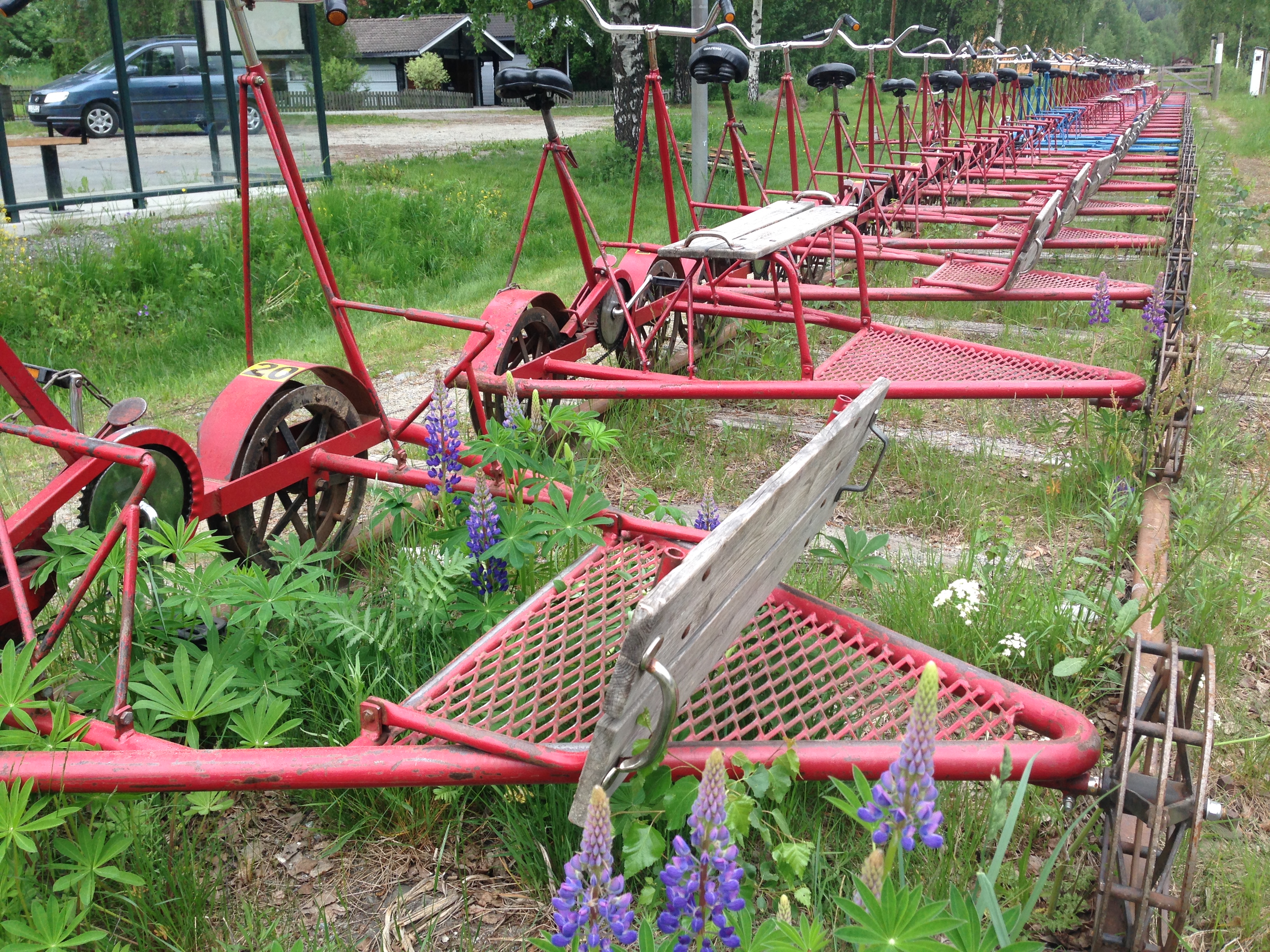
As seen along the Numedal bike route.
Route 3: Rallarvegan Bike Route
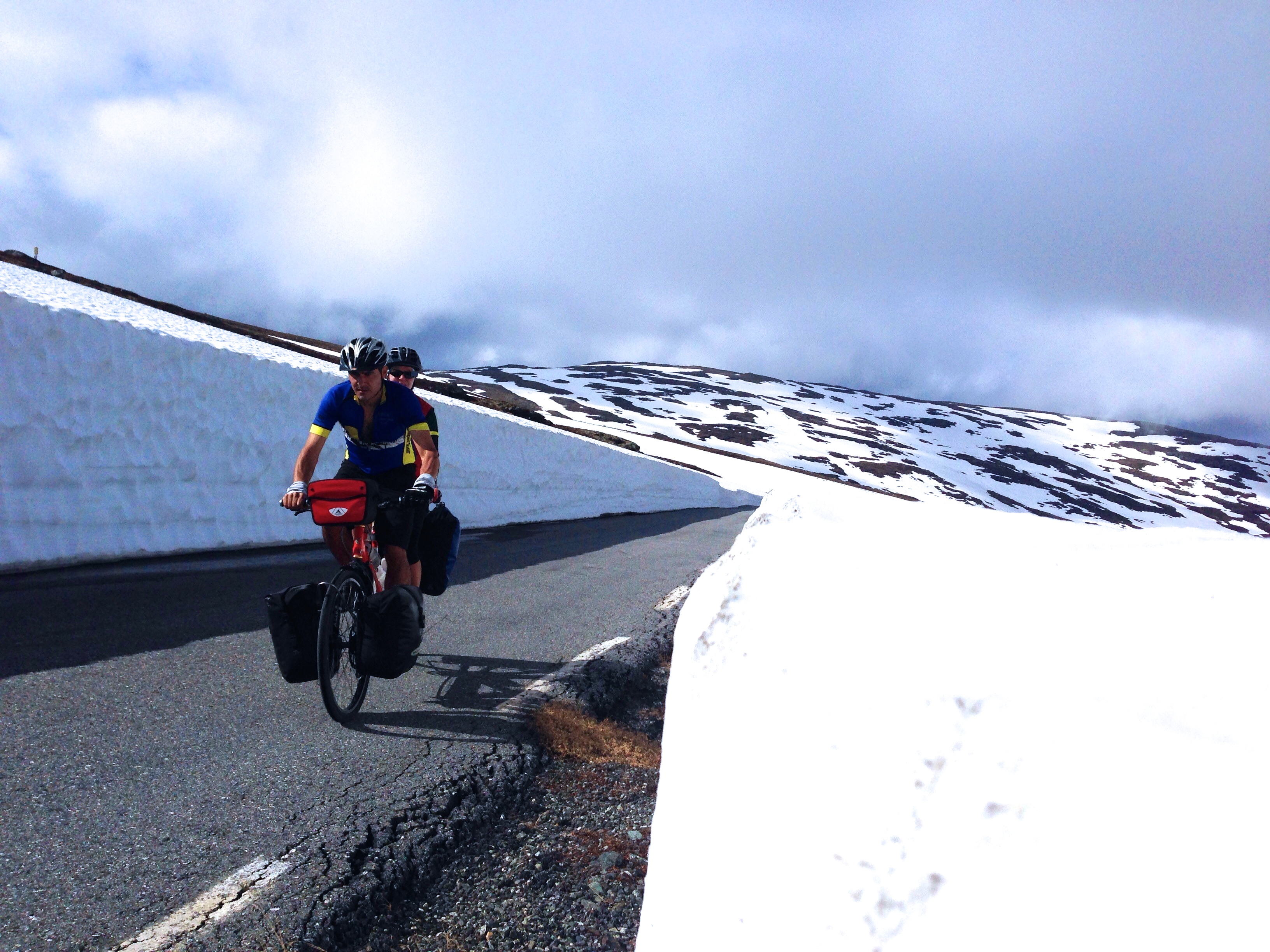
After thoroughly enjoying the Numedal Bike Route, we headed easily towards Rallarvegan. Rallarvegan would have been our number one ride in Norway – however we were unable to complete it due to snow. We tried! When we arrived in Geilo, ready to start on this hard-packed dirt route, we noticed that there was some snow, maybe only 1,000′ higher than our current elevation. We did not know how high the route went, so we headed off. Immediately, I exclaimed at the routes beauty! In time, though, we found ourselves pushing the bike through ever deepening snow. With 40 miles to go, moving at just a couple miles per hour, we decided to turn back. We took a train through approximately the same area – and we could see that the Rallarvegan (from Geilo to Myrdal) would have been wonderful. Thankfully, we exited the train at Myrdal, and rode the last portion of the Rallarvegan down to Flåm.
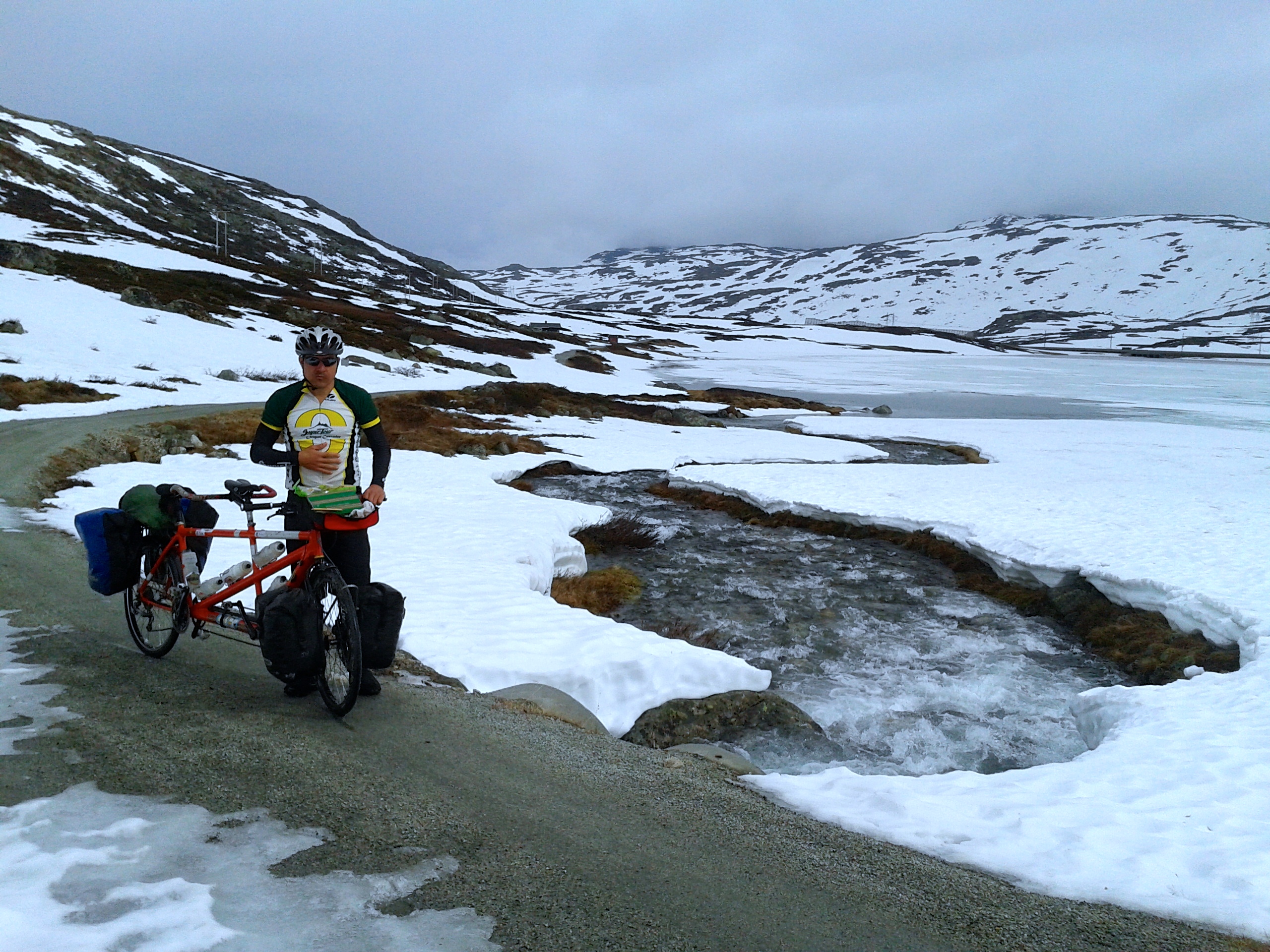
At the start of Rallarvegan, things looked OK…
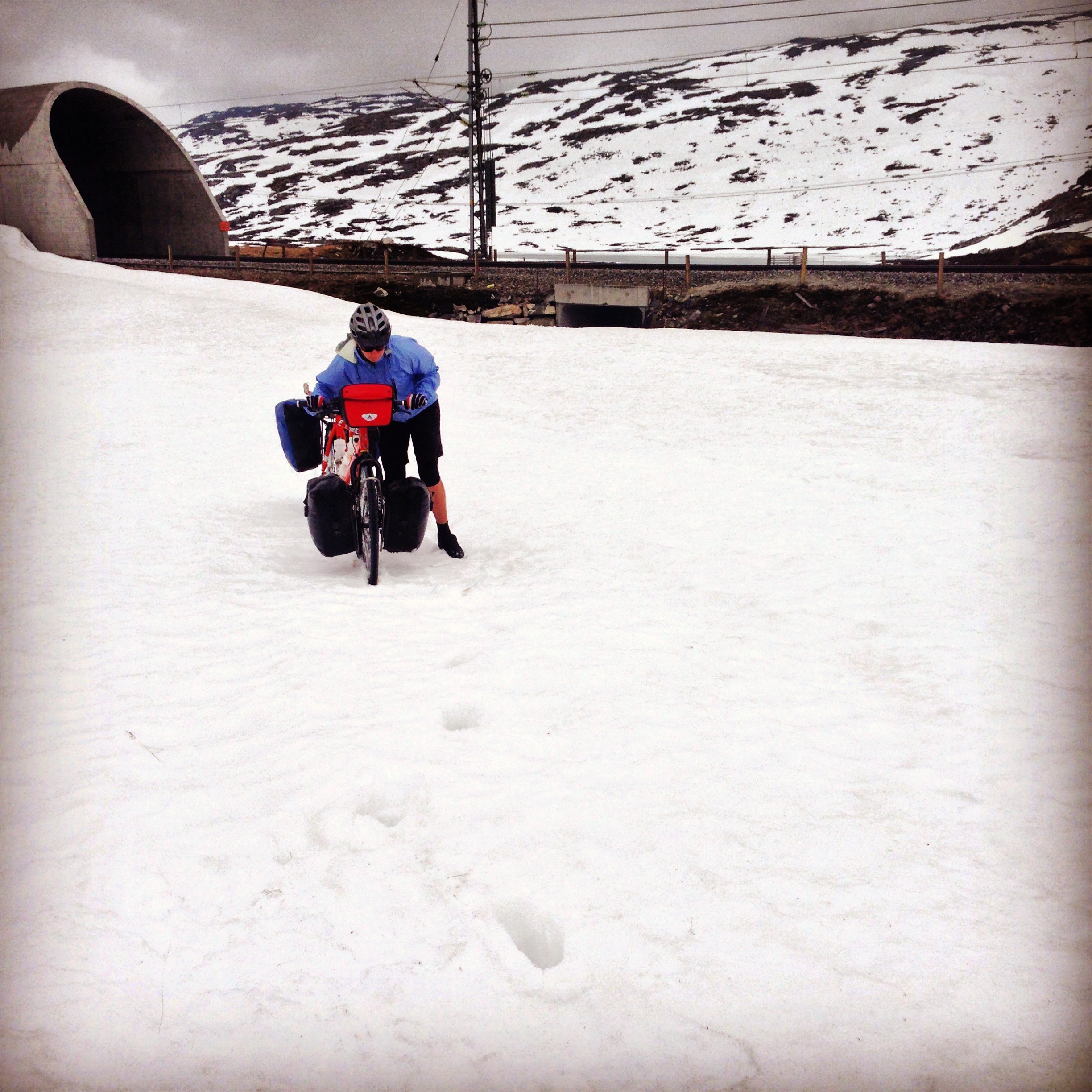
Eventually, the snow became too deep for riding.
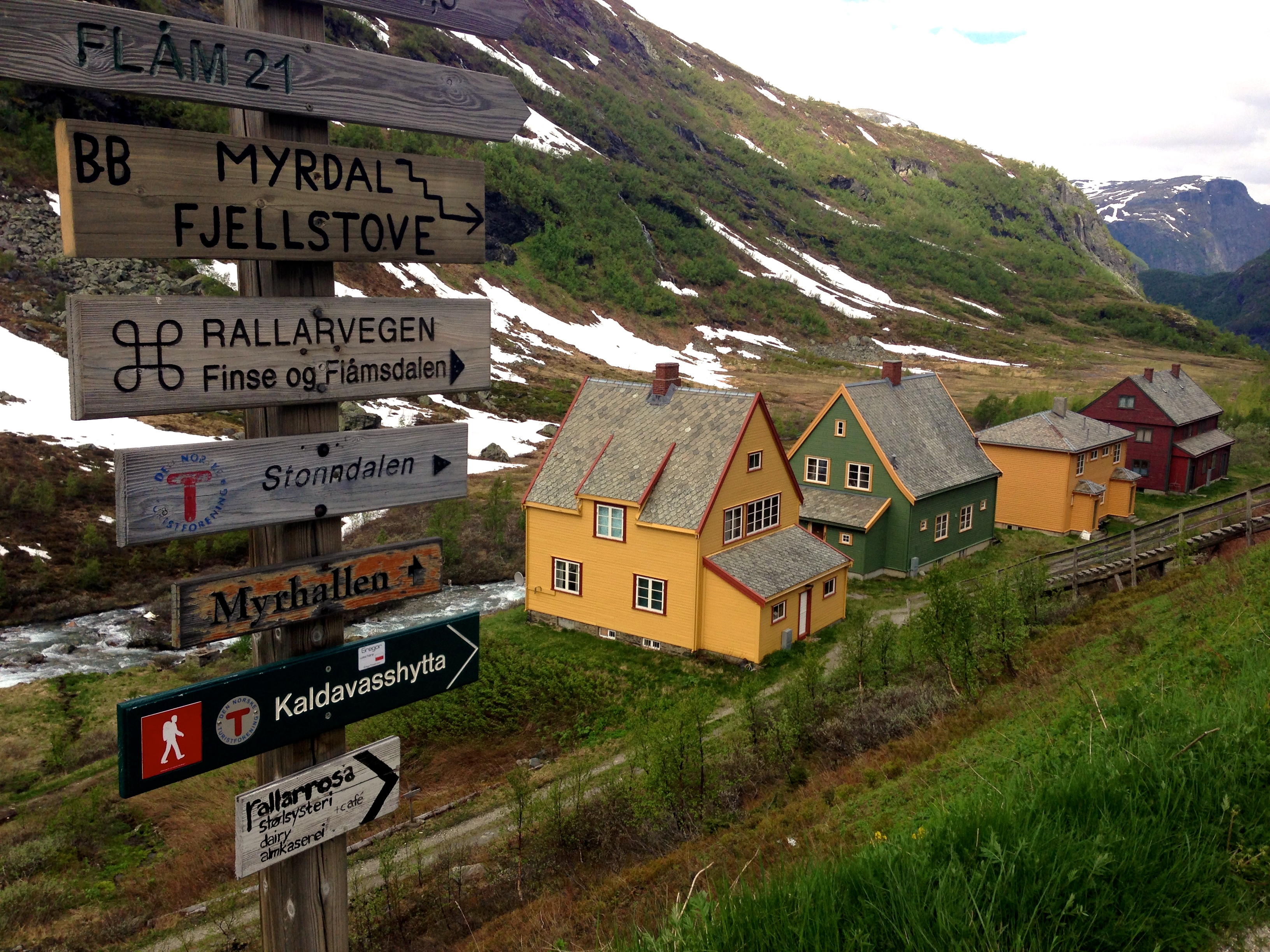
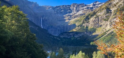
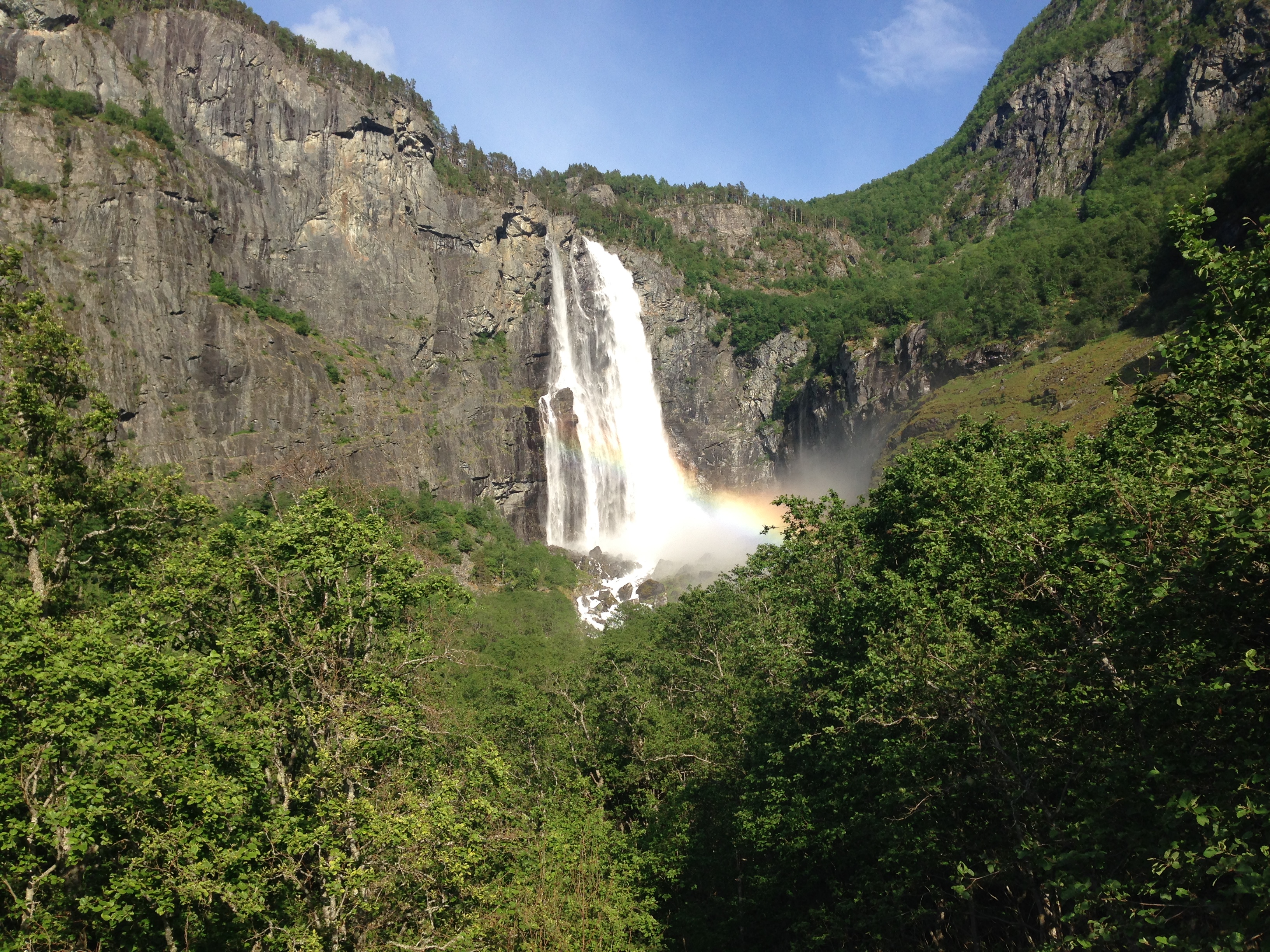
After taking the train to Myrdal, we rode to Flåm – through some of the best scenery on the planet.
In June, at least, the waterfall per mile ratio is outstanding on the ride from Myrdal to Flåm. This partly unpaved, partly paved route was one of the most scenic and enjoyable of the trip.
Route 4: Aurlandsvangen Bike Route
Stegastein lies along the Aurlandsvangen. You can easily connect to this amazing tourist road if you’re in Flåm – it’s just a short distance away. Aurlandsvangen is a tourist road that has no point other than to take road travelers through an amazing part of Norway. This route combines classic fjord views with “high” passes (4,000′ – well above timberline in Norway).
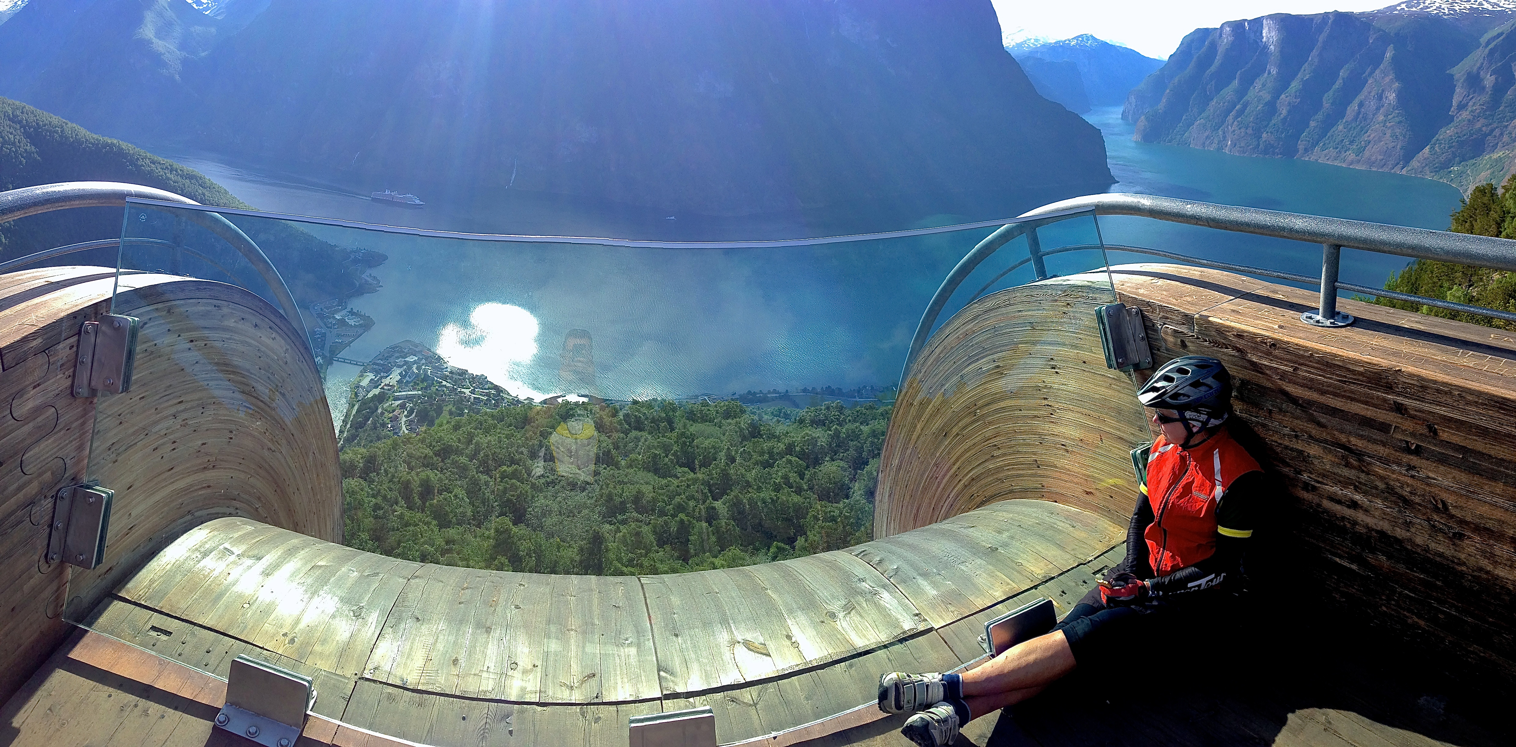
Stegastein has a great lookout platform so you can see the fjords from an unhindered view!
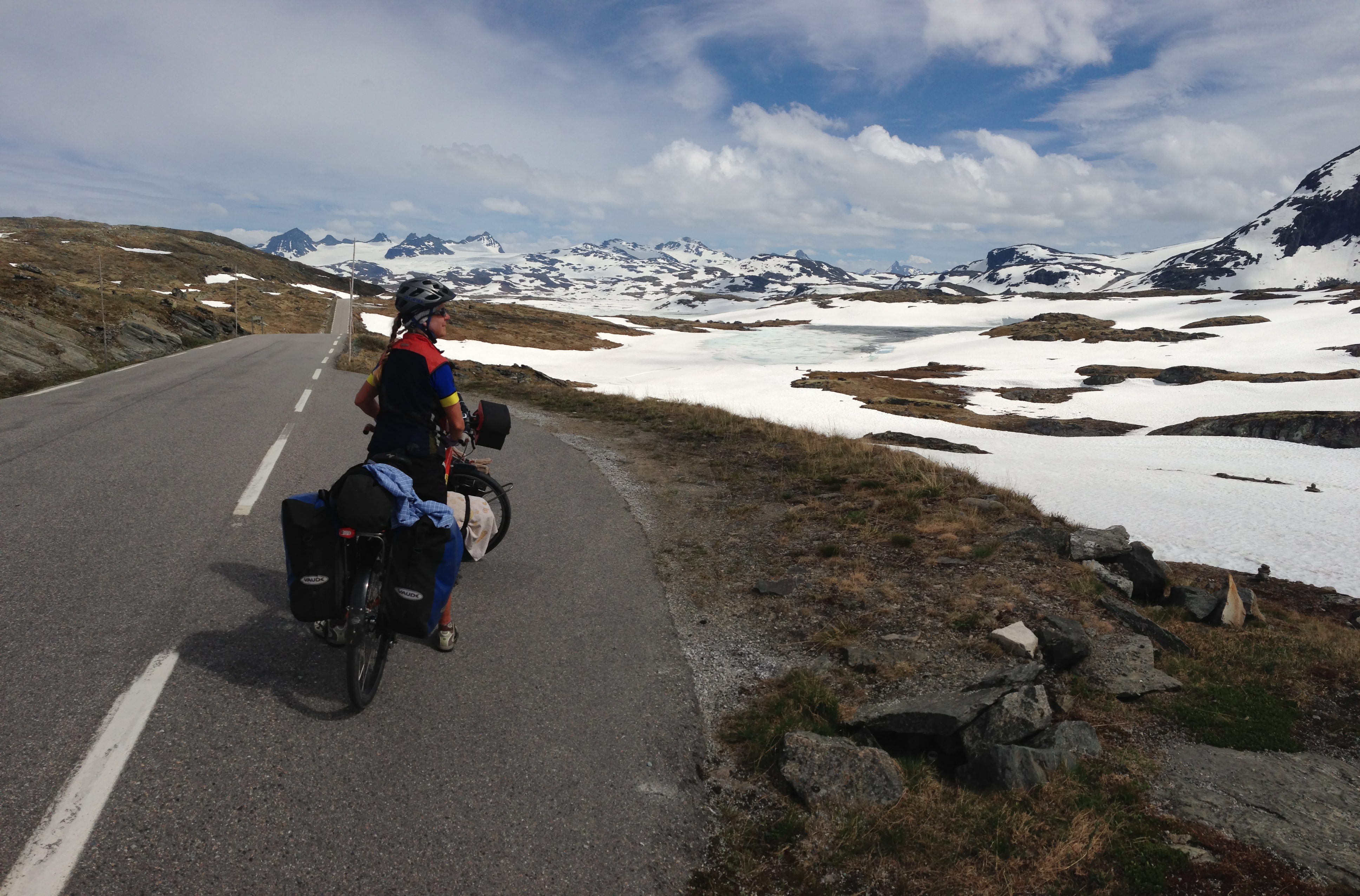
Aurlandsvangen takes you over the “high” passes in Norway. These aren’t very high by California standards.
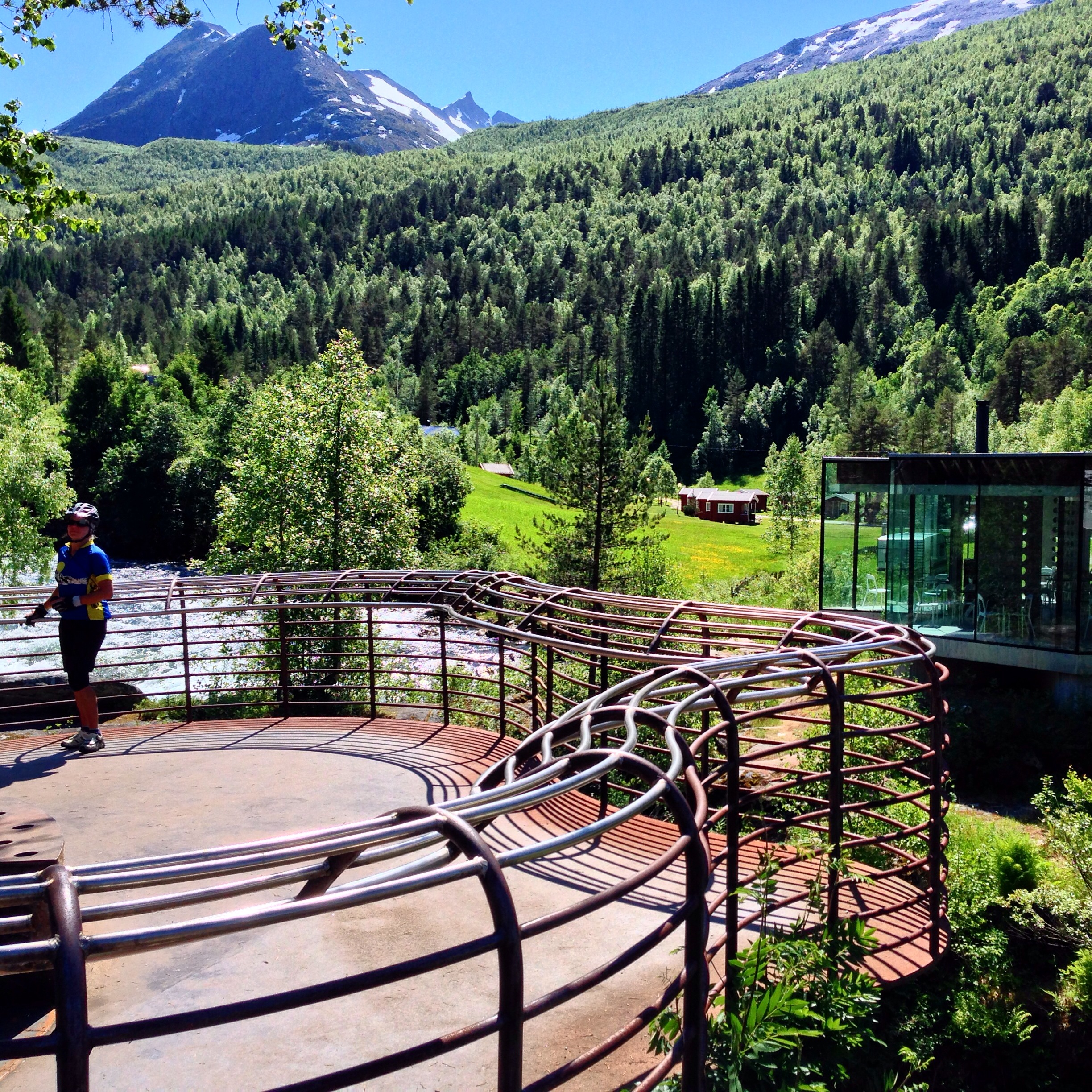
Route 5: Feigefossen Bike Route
The next route takes you on a super-scenic Ferry-hopping journey that includes a highlight: the beautiful waterfall Feigefossen. The route starts in Lærdal. Previously, a ferry would take you to Kaupanger, but that Ferry was not in service. The only way to get there by bicycle is to ride through a long tunnel. The tunnel has a “no bikes” sign at the entrance, but there is a very generous shoulder on either side of the road lanes (unlike many tunnels in Norway). This tunnel feels very safe for cycling if you have a tail light. Because we had no other option, we rode through it – and enjoyed a cool break from the sun. Here is a map of all the tunnels in Norway, and their rules towards bicycles After the tunnel, you take a ferry from Fodness to Manheller – only to encounter another wide, safe, but bike prohibited tunnel. We’re recommending that you take the ferry directly to Kaupanger from Lærdal if you can. From here, ride towards Sogndol, and onward to Solvorn. A ferry from Solvorn takes you to Ornes – where some great cycling begins!
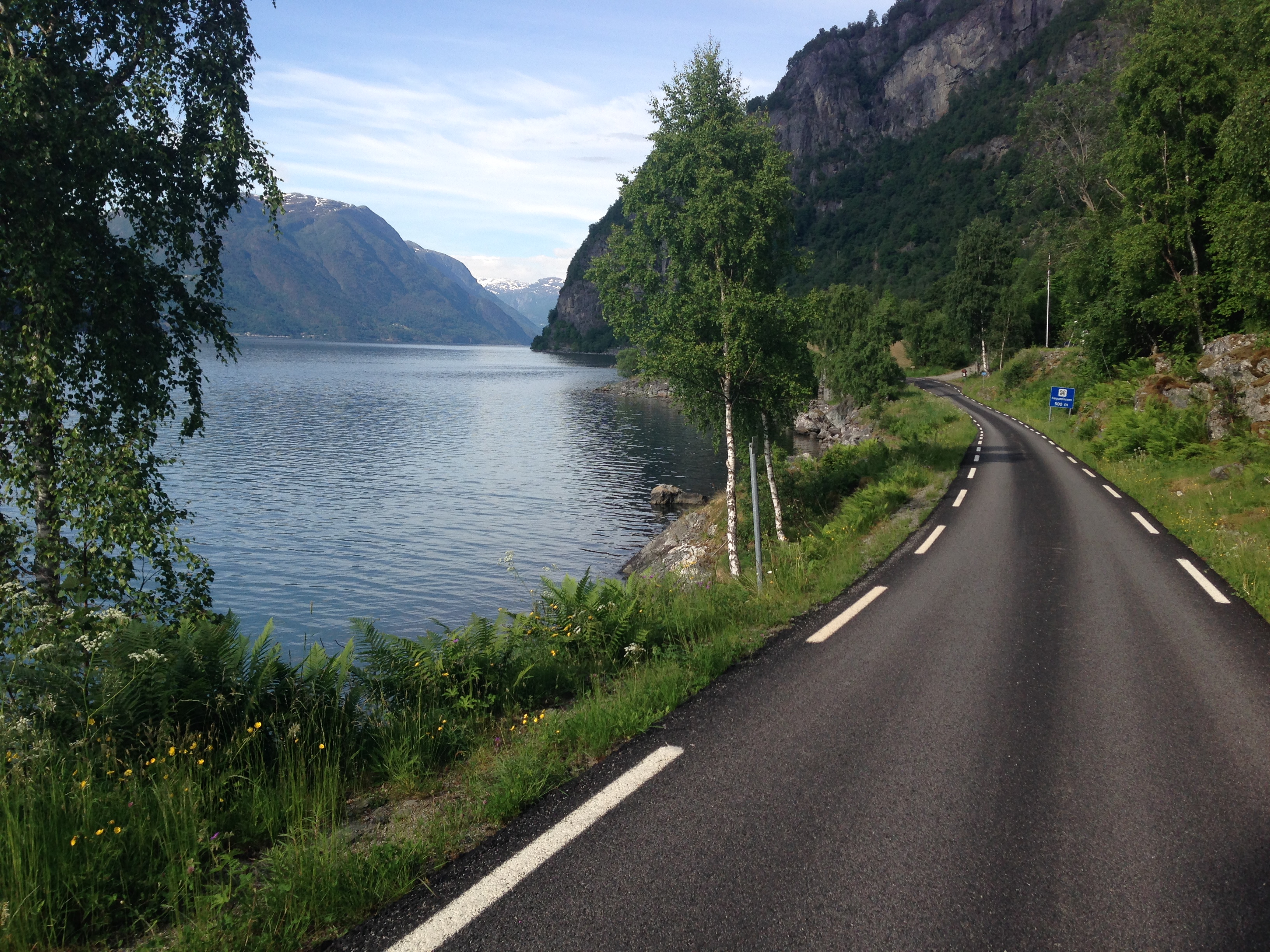
From Ornes to Skjolden, you will have a gorgeous, one lane road all to yourself!
Don’t forget to make the side trip (on foot) to the magnificent Feigefossen!
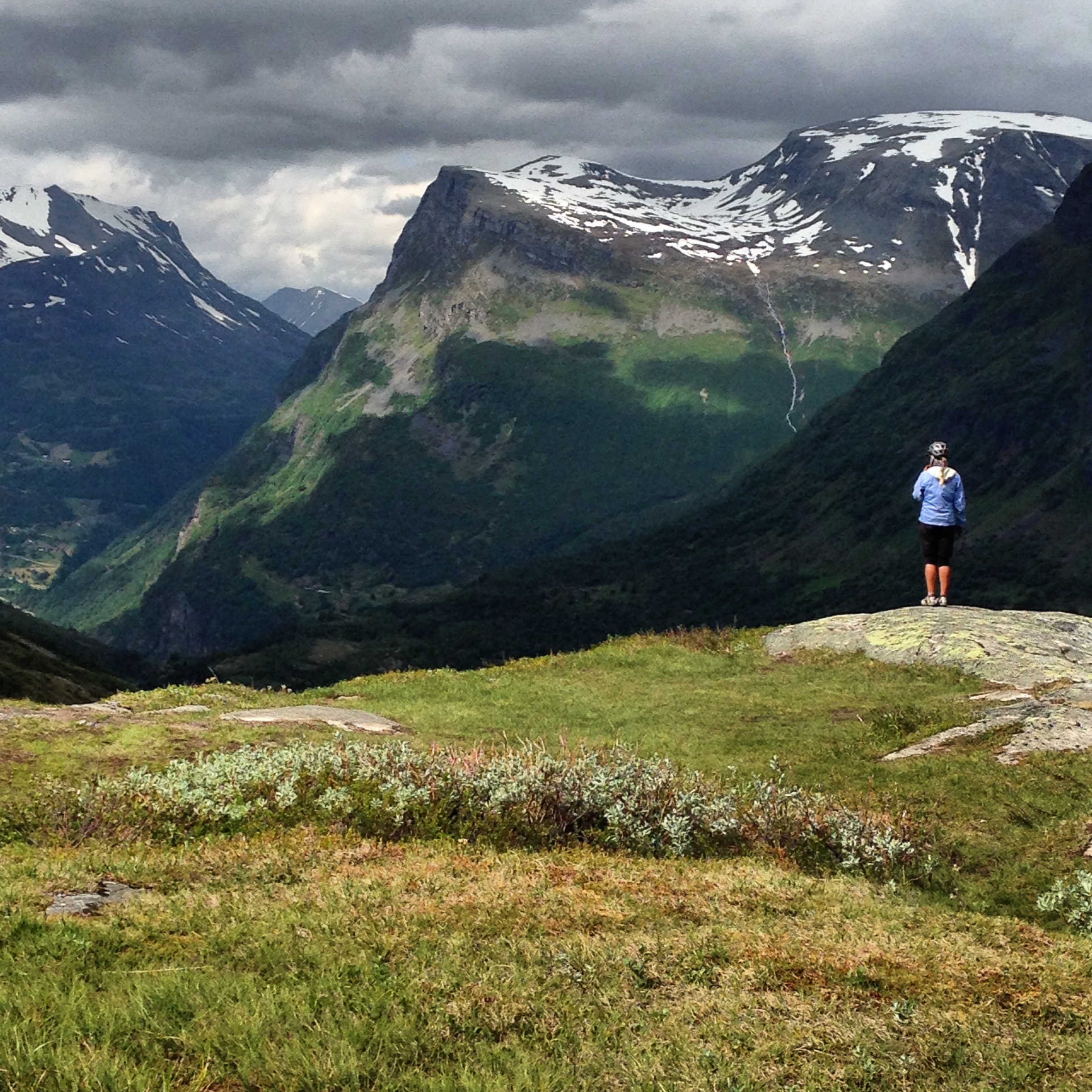
Route 5: Fortun Bike Route
In terms of scenery, the Fortun bike route is similar to the snow route above (Aurlandsvangen), only less dramatic. The route is along the road from Fortun to Turtagro. The climb is considered by some locals to be an “Alpe d’Huez” like climb. Early in the ride, you will ride by beautiful, but less dramatic fjords, and you will quickly ride above timberline, where you will see more snow if you’re there early enough in the season.
At the higher elevations, you’ll pass through tundra
At the lower elevations, you’ll pass beautiful fjords
Route 6: Geiranger and Vicinity
Geiranger is a destination for cruise ships, and there is a reason why: This is a beautiful town nestled in a deep valley – with things to check out. The Norwegian Fjord Center is definitely worth a visit if you’re in the area. It’s on a knoll, a few hundred feet in elevation above the town of Geiranger.
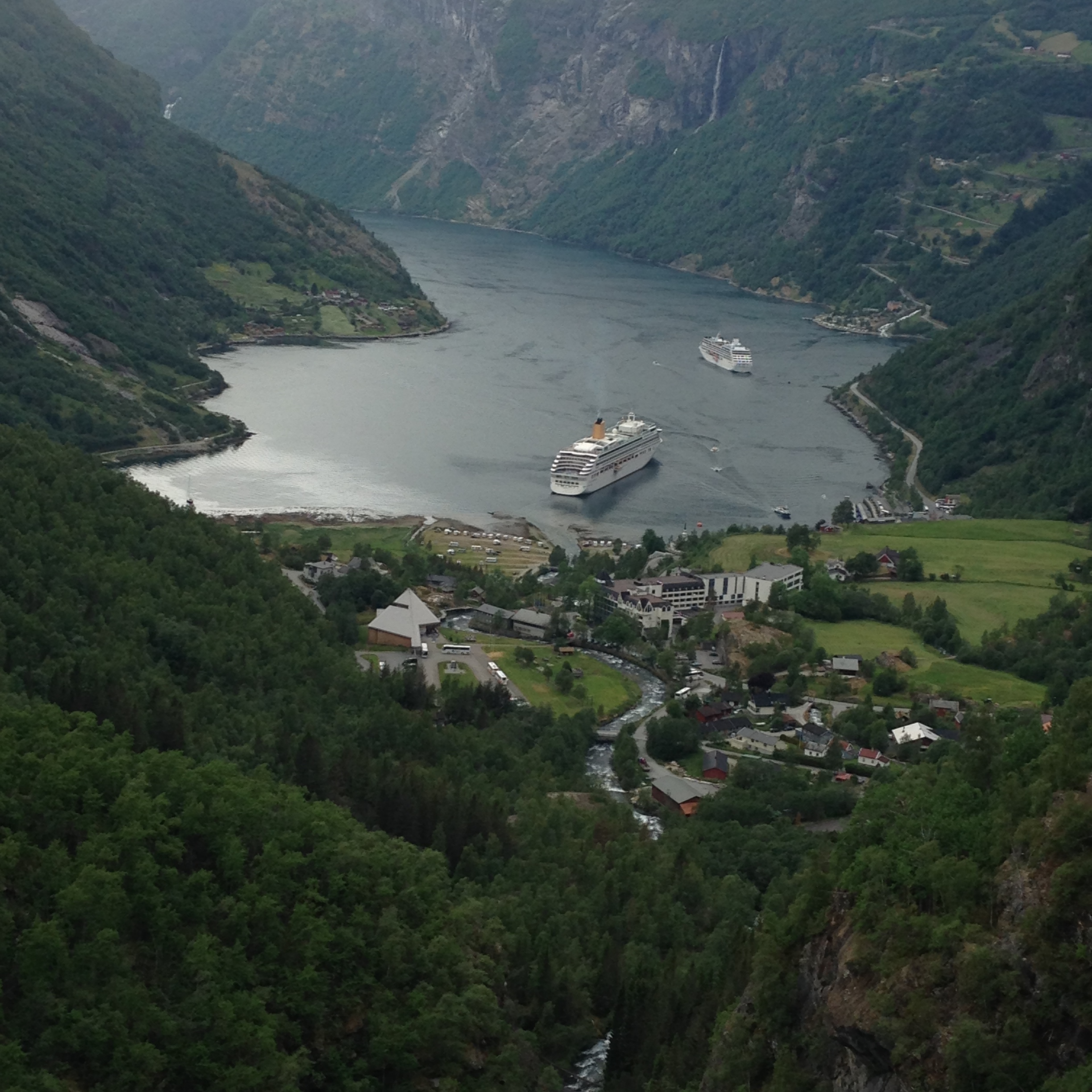
View of Geiranger from above (from the South).
View just a few miles South of Geiranger.
This route is good as part of a contiguous through route, or part of a Cruise ship tour (i.e. Ride South from Geiranger) – but apart from the Fjord Center, you will find just as much interest North at Trollsteigen and Gudbrandsjuvet (Route 7 below).
Route 7: Trollsteigen and Gudbrandsjuvet
Trollsteigen and Gudbrandsjuvet are both tourist attractions that are a must-see if you like man-made structures that perch you with superb views over cascading water and dramatic cliffs. Both are within easy reach of Geiranger for even a day ride.
One of the walkways at Gudbrandsjuvet
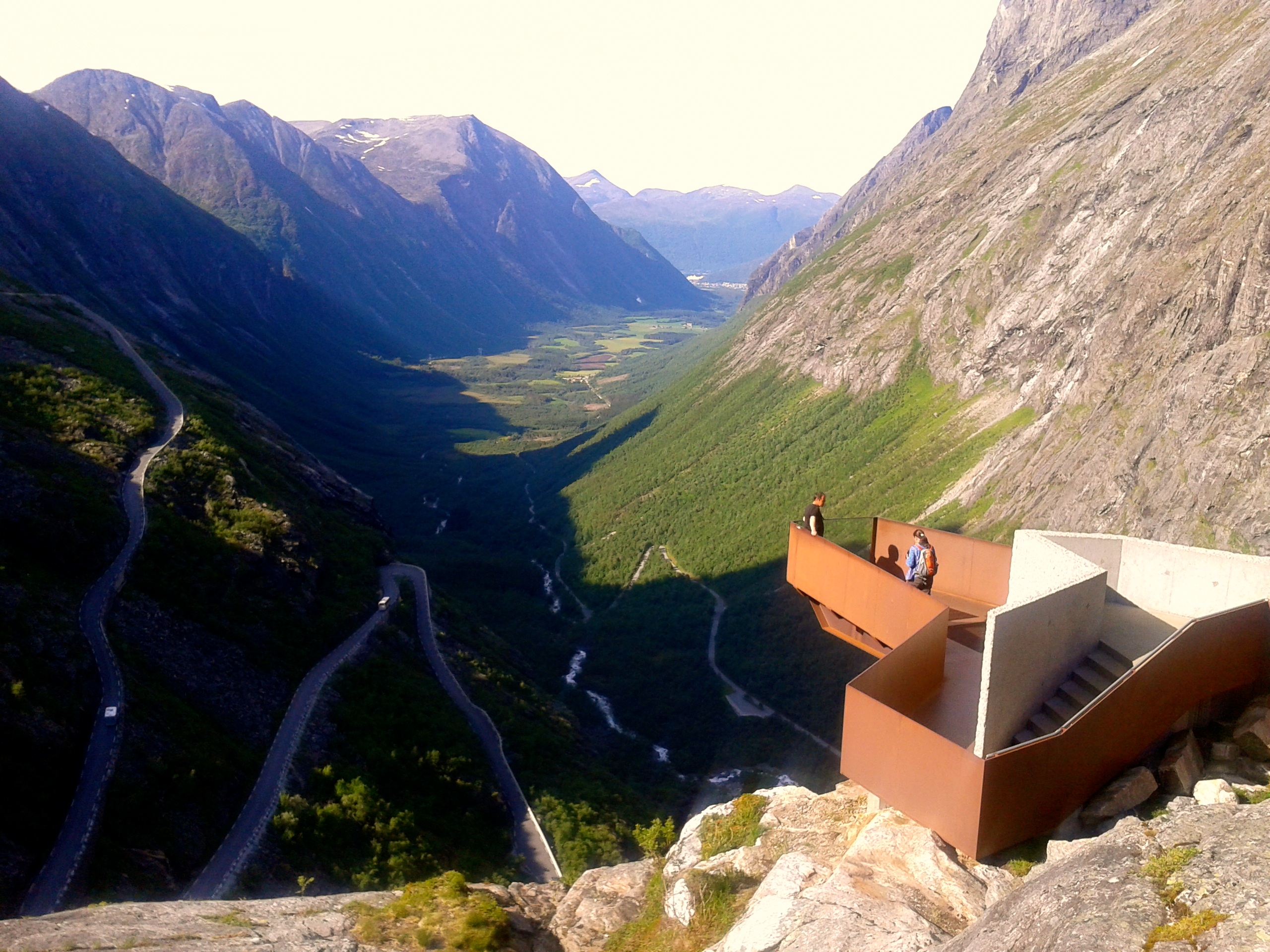
The perch you can stand on at Trollsteigen. There is a tourist center here as well with information about Norway and a cafe.
Route 8: The Atlantic Road
The Polar circle is a notable location because it is the southernmost point where one day a year, the sun never sets. Coincidentally, that day happened to be today – the summer solstice!
In the middle of our second blizzard, I saw an 8’ x 18’ building labeled WC. There were two little tables, chairs, and a thermometer inside indicating that it was 42F in the building. It felt so good and warm; we were elated! The bathroom sink had hot water which came out near boiling, so we peeled open our hot cocoa packets and made 4 cups one after another, slipping into a state of dreamy happiness. Upon writing this entry, I’m reflecting on how happy this 42 degree room and a little sugar could make us. It seems like the greater the challenges, the easier it is to find happiness in little things.
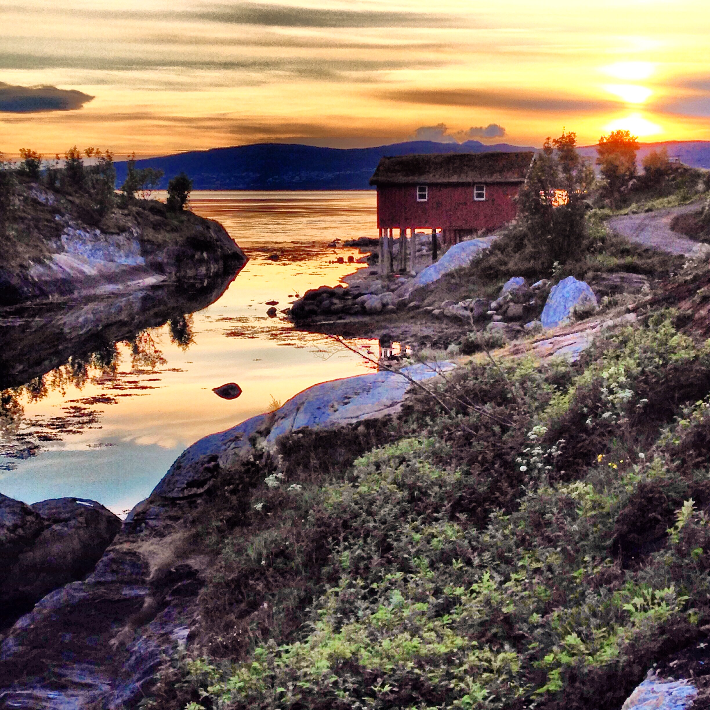
The Atlantic Road is actually only an 8KM stretch of road that stretches between Kristiansund and Molde. As a stand-alone route, it might not be much, but it makes a good portion to incorporate into a long distance tour because the scenery contrasts somewhat with the fjord scenery. This stretch is pretty flat, and can be extremely dramatic (weather wise). You have the long fetch of the Norwegian Sea – unencumbered – meaning that dramatic storms wash the surf over the pavement. This obviously would be a time that you would NOT want to be cycling this route. From the Atlantic Road route, you can easily connect to the next suggested routes: Tidevannstrøm and Lofoten (via Ferry). We did not find any official camping along the Atlantic Road route, but we did find a Pension a few miles South of the famous bridge in the picture. The pension was on the East side of the main road, and the grounds were well kept and beautiful.
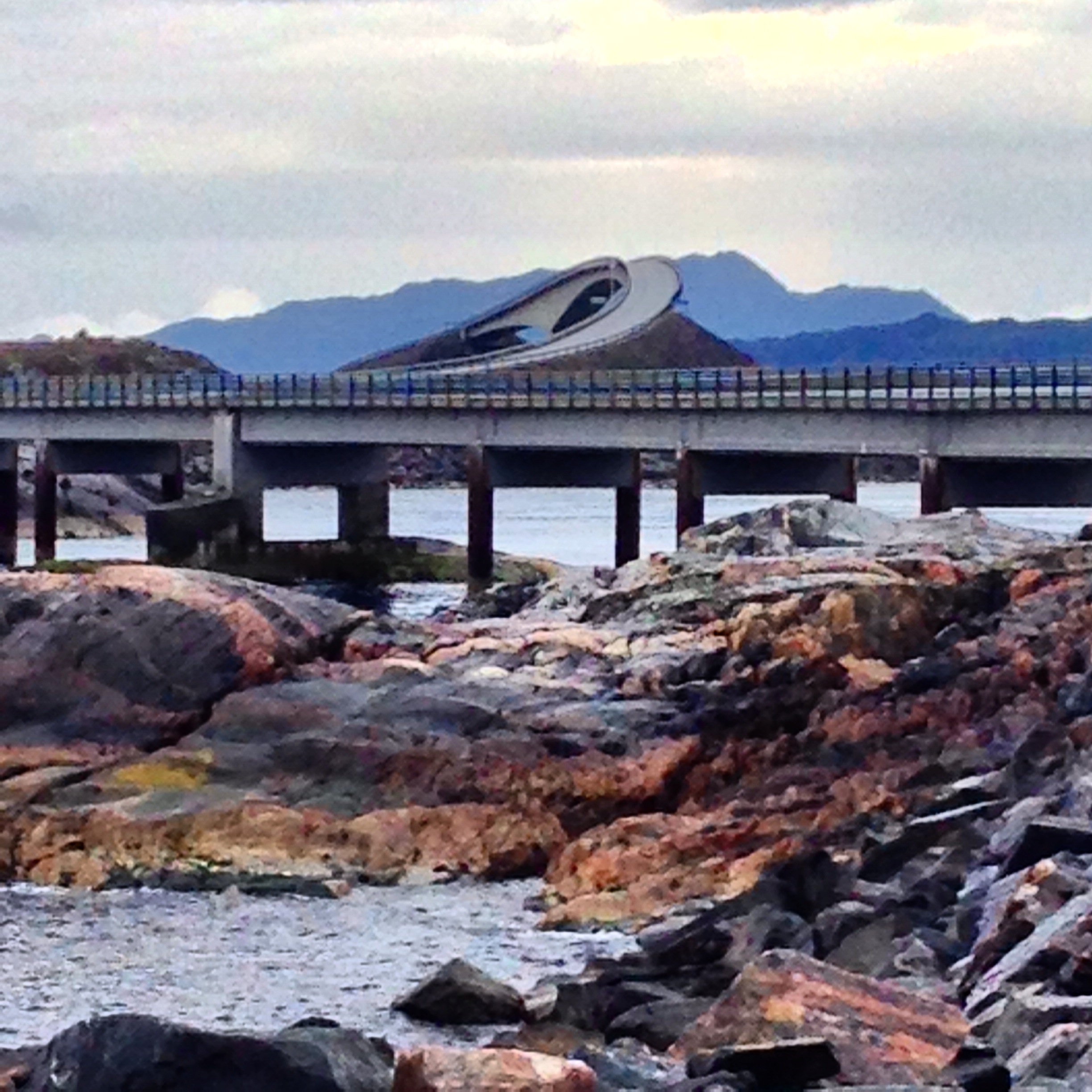
The most famously photographed angle of the Atlantic Road.
Route 9: Polar Circle and Tidevannstrøm
Although the region near the Polar Circle isn’t dramatic scenery-wise, there is a nice visitor center and a short hiking trail at the point where the primary road crosses the Arctic Circle.
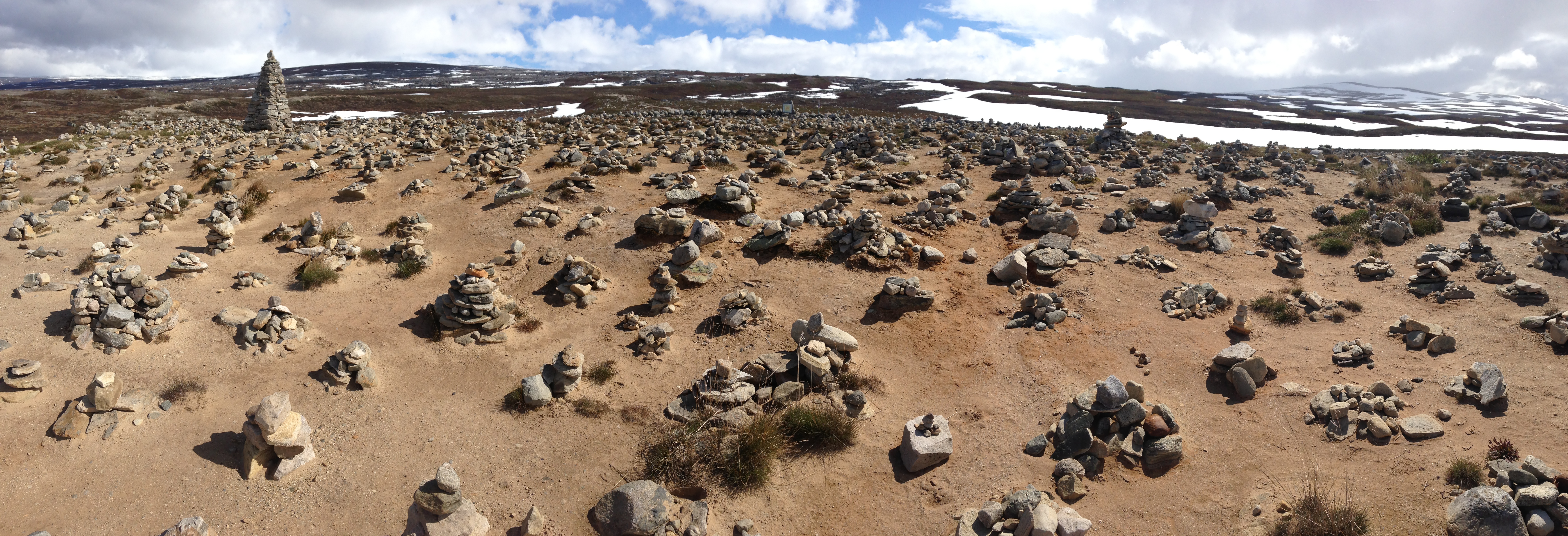
The ordinary scenery at the Polar Circle is enhanced by the rock cairns that have been built. Surprisingly, there is a sign right next to this area indicating that building cairns is prohibited.
The recommended bike route from Misvær to Hoset – the road 552 on the East side of the inlet. This road has been closed since 1989, but is still negotiable by bicycle.
On the way to Tidevannstrøm
Tidevannstrøm is notable because it is the location of the fastest tide in the world – up to 22 mph! It is worth a visit for the surrounding beauty or the natural wonder. There is a good sized campground in the vicinity.
Tidevannstrøm – significant because it is the location of the fastest tides in the world: up to 22mph!
More views from Tidevannstrøm. Fantastic!
More views from Tidevannstrøm. Fantastic!
Route 10: Lofoten Islands
Today I was thinking about a little thing: an area we had recently passed through in Norway called Øvre Jervann, where 100,000 Soviet Prisoners, and 588 Yugoslavian Prisoners had ben held during World War II. If you’re like me, maybe you’re saying, “What? Prisoners of war in Norway?”
I felt compelled to reflect upon this plaque that we had read two days before because of the omnipresent headwind that follows us around in circles, unpaved roads, and homogenous scenery of trees. Grrr! I was thinking about how we would have liked to achieve 90 miles today (and the previous day) – and how it seemed that a power beyond us was developing unique methods of hindering our forward progress. Maybe for a reason?
I thought about the people that had been here. The plaque told us about how these people from the former Yugoslavia were brutally killed far from home in this cold, remote place in the arctic. Apparently, they “were not viewed as prisoners of war and had no protection under the Geneva Convention.”
I started to ponder why we never see plaques saying, “People long ago had a party here. A good time was had by all.” Is it that as a race, humans are focused on brutality and horror? Is it just that we want to honor the spirits of those who have gone before us? Or maybe learning about the hardships of those before us helps us put our own challenges in perspective?
The road we all travel can sometimes be a difficult, isolated one. Every day has unique challenges, but sometimes it is nice to reflect on just how wonderful that we get to go down that road – headwind and all.
The Lofoten Islands seem to be one of the more popular riding regions in Norway. While riding in the Lofoten, we saw many more fellow touring cyclists than we saw in all the rest of Norway combined! The attraction to the Lofoten may be due to the relative flatness as well as the low elevation. Although the Lofoten was dramatic and beautiful, the flatness is not as easy as it may seem – you may find yourself fighting very strong winds. The winds blow through the islands, frequently changing directions. There are a number of roads that you can ride in the Lofoten also – and the traffic in this region is definitely less than in the other parts of Norway.
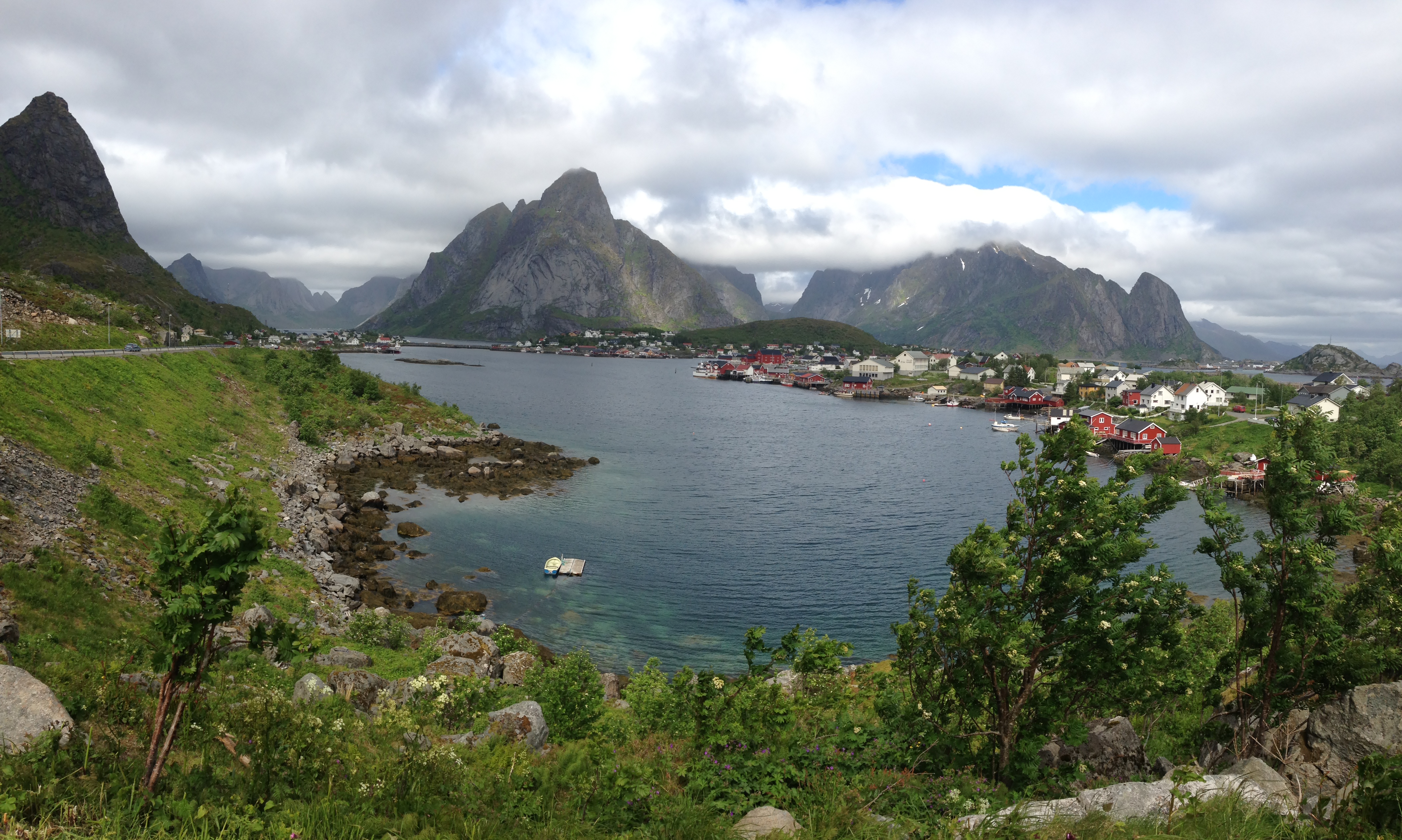
The view shortly after cycling out of Moskenes.
Tide running out.
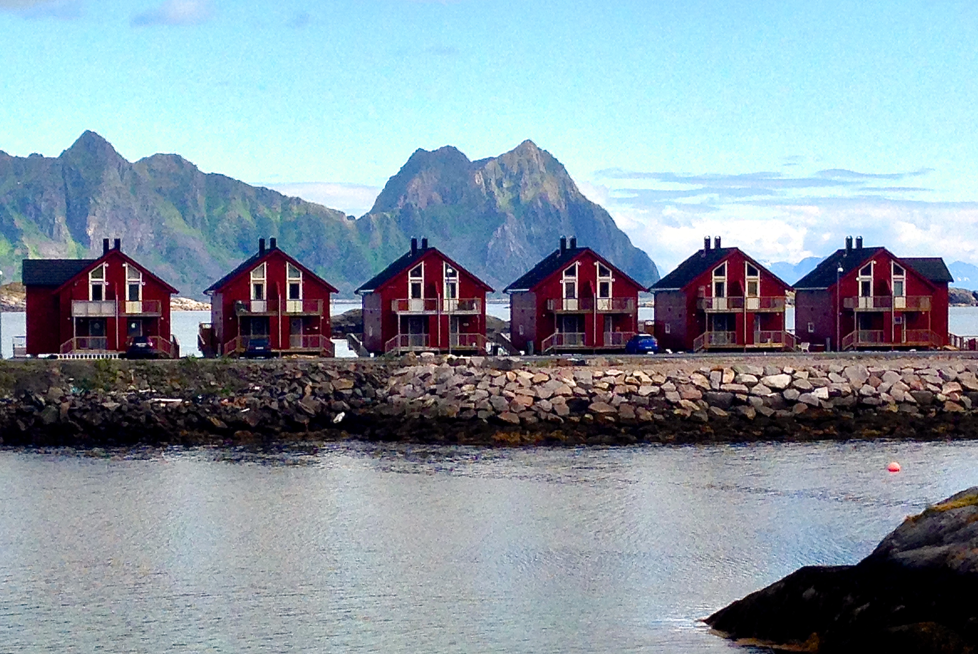
Dramatic Lofoten scenery.
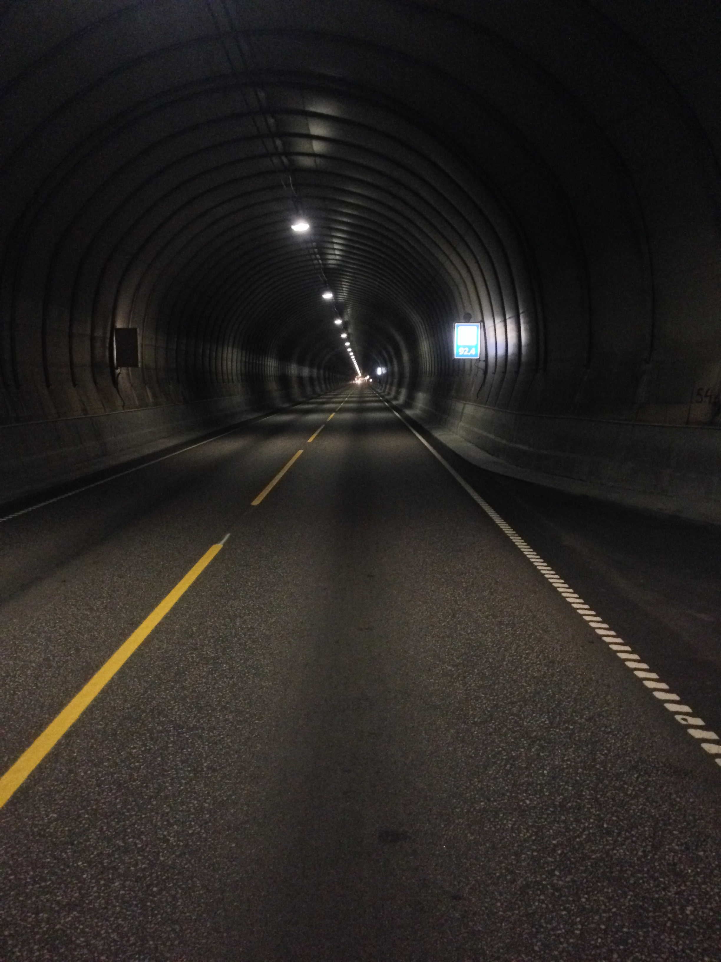
In the Lofoten, you will still need to ride through tunnels – but fortunately, there are no bicycle restrictions in most of these tunnels. You can see that there is a narrow shoulder – which is better than none. You definitely will want to make sure that you are using a tail light.