Bike Touring Guatemala
Cycling Guatemala was distinctive amongst the many small Latin American Countries. On this trip, as well as my many trips to Guatemala in the 90’s, I reinforced my finding that Guatemala contains some of the friendliest – and most generous people a traveler can encounter. What could be better than bicycle touring in a place where you feel like a welcome visitor? I can only think of how important it is to be welcoming to visitors to my own country – because I now realize how deep of an impression it can leave on a visitor and their perceptions of a country as a whole. Guatemala is one of my favorite countries to visit, and that is largely because of its people. Although the culture generally tends towards generosity and friendliness, there are still some outliers and you need to maintain your wits about you. This country still has a top 6 homicide standing in the WORLD. Not a good stat to have.
02/20/2014 Day 29 – near La Mesilla to near San Francisco el Alto 74.5 miles
This section of the route involves a long, steady climb to nearly 10,000′ in elevation. It isn’t easy, but it is beautiful along the way. Once you gain the elevation, the climate becomes pleasant again. One notable fact about Guatemala is that the driving style is dramatically different than in Mexico. While drivers throughout Mexico (except the big cities) patiently waited to pass, drivers throughout Guatemala (especially bus drivers) would impatiently, but expertly careen around us. You will find that it is difficult to find “bandit” camping in most of Central America. This largely has to do with population density and land use – most of the land alongside any type of road is private and in use. The general solution is to ask permission to camp in someone’s yard. This works well in small communities and rural areas, but can result in less than satisfactory results in a city of any size. As such, we found one of the few hotels (motels) in San Francisco el Alto. In areas less frequented by tourists, it can take a little time to find accommodation – so plan to arrive a little earlier than you would in Mexico, which tends to me more rural than Central America.
02/21/2014 Day 30 – San Francisco el Alto to Fuentes Georginas 33 miles
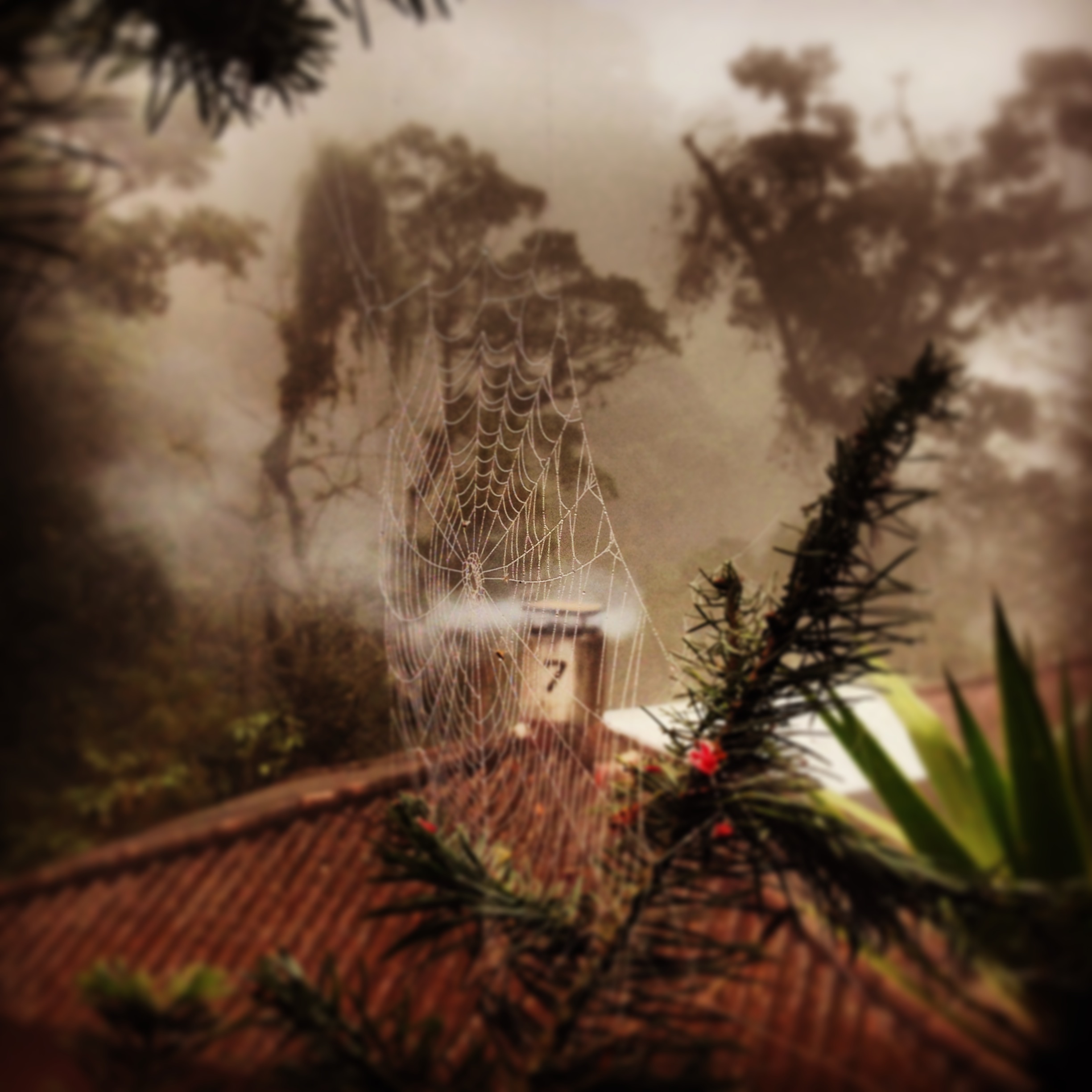
If you enjoy hot springs, then today is your day. The ride from San Francisco el Alto is short – that way you can maximize your enjoyment time of the hot springs. Fuentes Georginas contains a multitude of pools at different temperatures. The upper pool is warm enough for those who like the hottest of hot springs, and the lowest is temperate enough for those who run cooler. The setting is one of the most beautiful in the world – high elevation, humid, tropical – but cool. If you’re lucky enough to arrive on a day when the mountain is encased in clouds, the setting becomes mystical – one of the greatest treats you may ever give yourself.
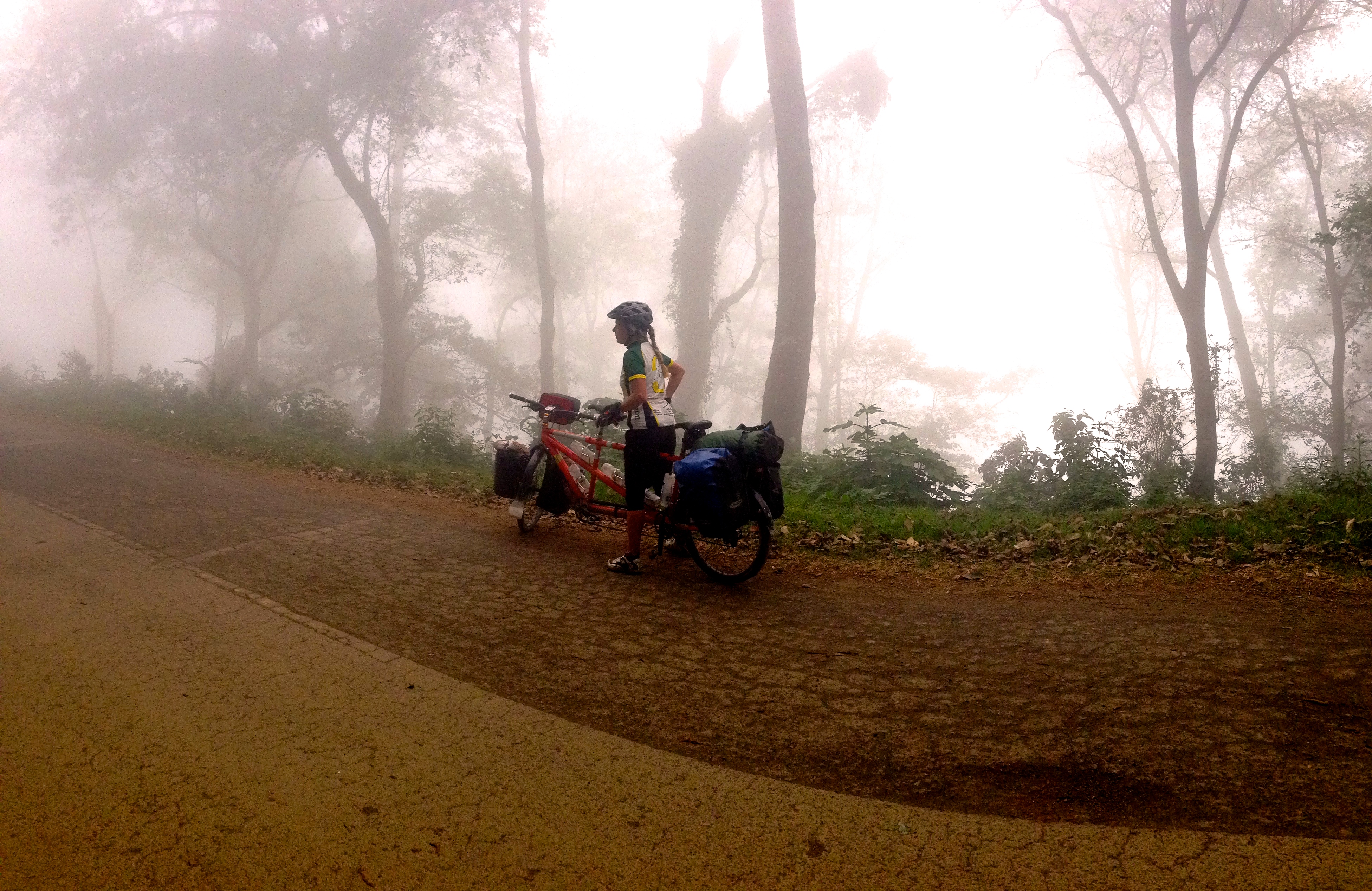
The road heading from Zunil to Fuentes Georginas. We were lucky enough to be enshrouded in fog. This made the climb mysterious and the hot springs even more enticing.
Camping is allowed at the site; basically you pay entry for two days. They also rent Cabañas. There is a restaurant on the premises, which serves fantastic food.
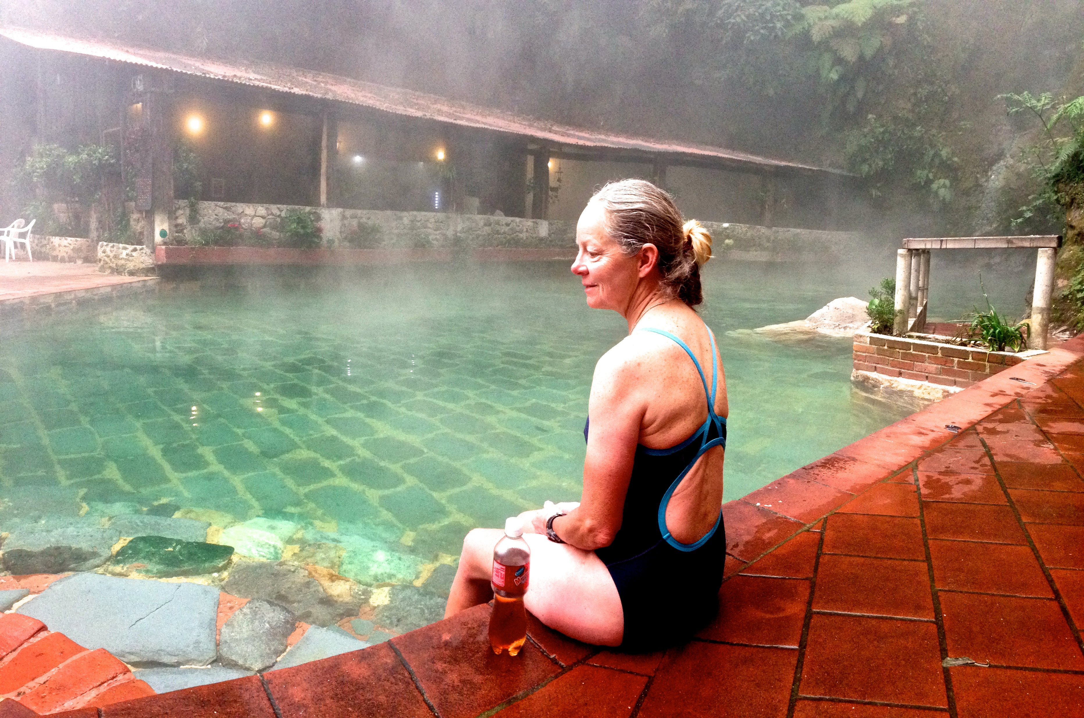
This is the upper pool at Las Fuentes Georginas. You can see the restaurant in the background.
You’ll notice as you ride the windy road up from Zunil that this is a major agricultural region. Here, they produce carrots that are superlative in every sense. In fact, all of their vegetables are enormous; I don’t know how they do this – but you can see people constantly working in the fields with their hands. You can buy some of this produce down in Xela (Quetzaltenango), Almolonga, or Zunil.
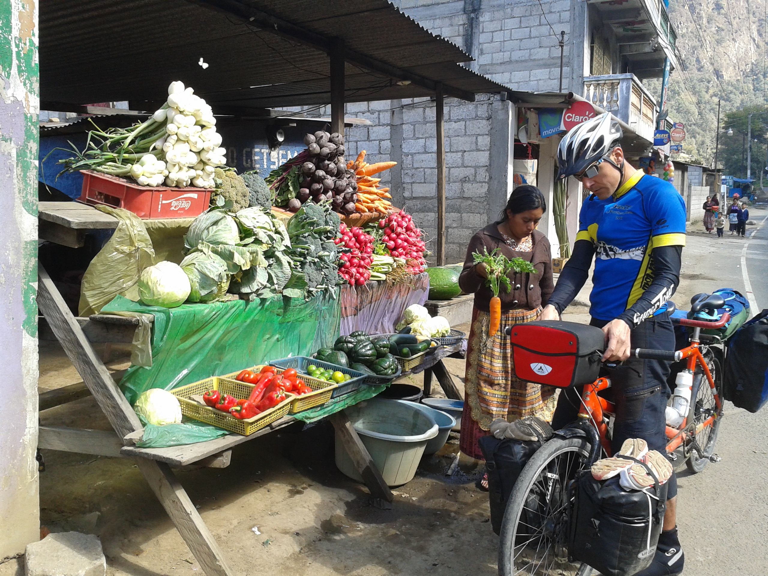
Fantastic produce can be found around the Zunil Region. There are not many regions in Guatemala where you can procure produce of this caliber, so stock up!
It is a little tricky to get there, so you might want to download the GPS track or at least look in the map in the link above (the title to each day is a link to Strava where you can view GPS track overlaid on a map).
One of the cabañas at Fuentes Georginas
02/22/2014 Day 31 – Fuentes Georginas to Santiago Atitlan 47 miles.
The ride from Las Fuentes Georginas to Santiago Atitlan is a long and convoluted route. Some of it is great, and some of it is just a “necessary evil.” The road back to the main highway (CA1) is long and convoluted. It ascends a long ridge near Cuatro Caminos, but adds significantly to the mileage and traffic that must be encountered.
Along the route from Cantel to CA1 shortcut
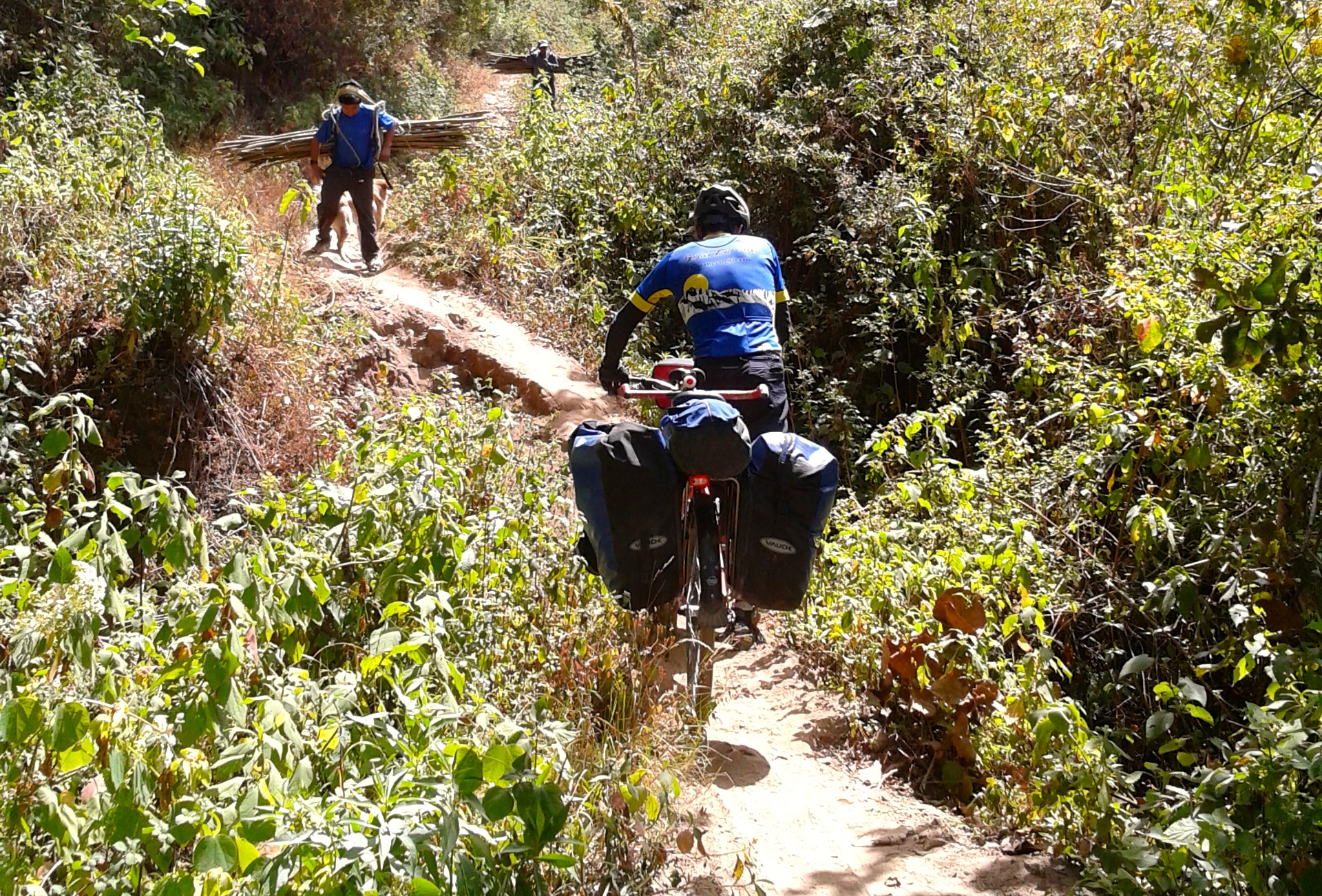
This is partly due to the fact that it is the only way to get around via motor vehicle. If you’re willing to do some hike-a-bike to avoid the extra traffic and save some mileage, there is a route through the forest and a steep canyon that significantly truncates the Cuatro Caminos jog, and entirely avoids traffic along the way. You can follow our GPS track (linked to above). The route is placid until Mile 13 where you abruptly begin climbing a cobbled road. The road continues to get steeper as it peters out into a dirt road. Then, it pitches upward and becomes a veritable hiking trail that is somewhat overgrown. The distance you will need to walk your bike is only 1/2 a mile, but it is a tough 1/2 mile! You exit the trail onto the highway, and are grateful for the long, sweeping downhills with a munificent shoulder! Your joy slowly decreases as you near Nahuala, though, as traffic begins to increase. Fortunately, you get to exit the main road and head on secondary roads shortly afterwards when you exit for HWY 14 towards Lago Atitlan. This road is quiet and gently sloping. Once you reach the top, however, a dramatic descent awaits down to San Pablo / San Pedro. This descent was very taxing on our tandem bike brakes, so be prepared to proceed with caution! From here, we took a boat that was able to carry our bicycle for an additional fee. The boat went from San Pedro to Santiago Atitlan. Alternatively, you could ride around Volcan San Pedro, but it is a significant climb around the backside. No other detriment exists to my knowledge. San Pedro de Atitlan is a bustling, tight town on a hillside. It is popular with tourists – and for good reason. It enjoys a near-perfect climate, and magnificent scenery of mountains, lakes. Of course, you can easily find a language school here at very reasonable prices.
02/23/2014 Day 32 – Santiago Atitlan to Antigua 60 miles.
This route is varied and enjoyable. The route around Lago Atitlan is rolling and peppered (lightly) with some views of the lake. The road has little traffic, and there are little road side stalls if you need to resupply. After Godinez, you’re back on the main highway through Patzun. Patzun does not have many tourist attractions, but it ended up being a nice visit due to our experience with a very friendly man who literally thanked us for visiting the town: not many tourists come to Patzun, he said. This may have something to do with the condition of the road from CA1, which has in a way isolated Patzun from easy access. For the careful cyclist, however, you’re rewarded with very little traffic.
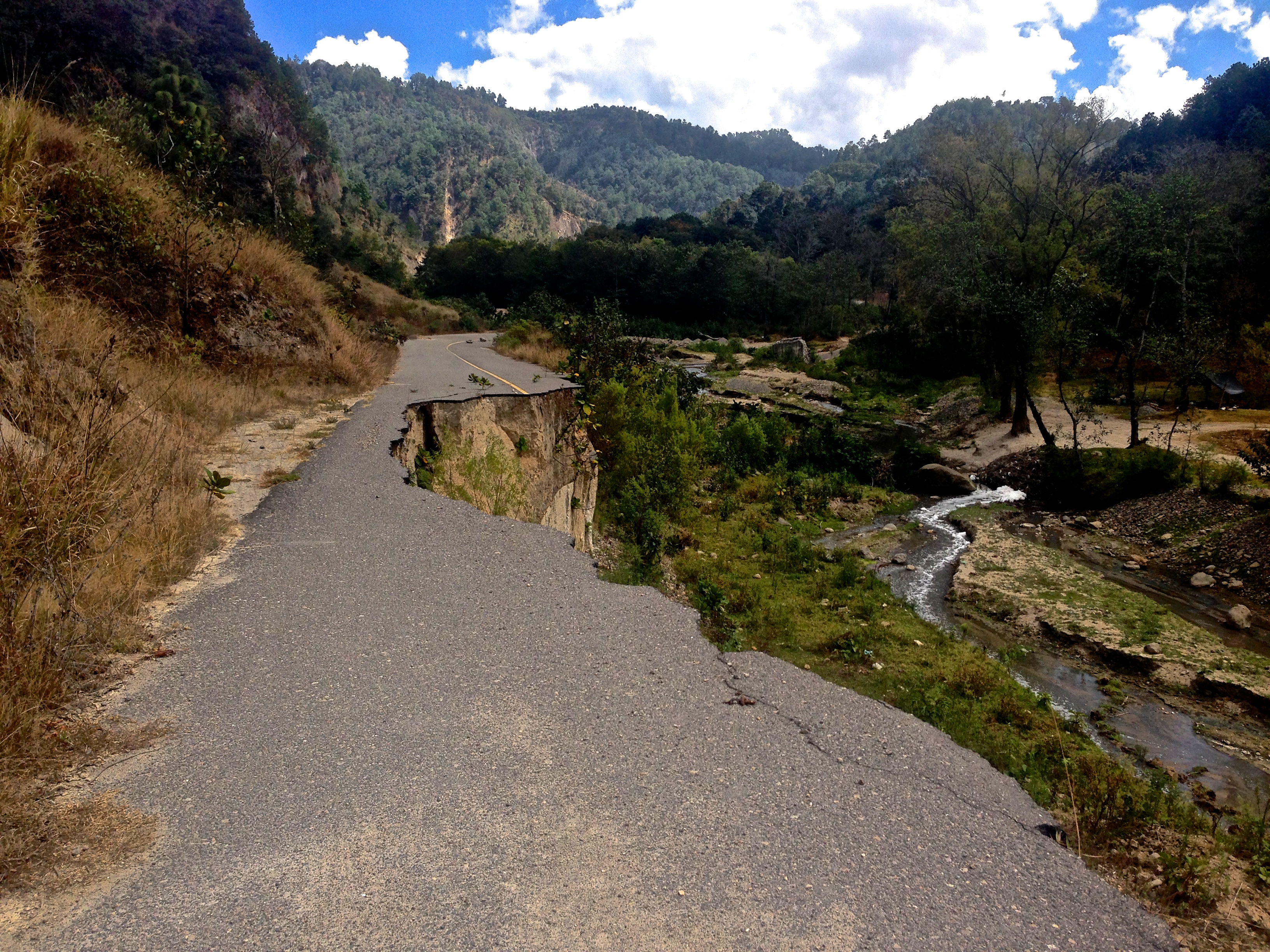
The road between Patzun and Patzicia is washed out. At one point, you have to cross a river at-grade with a dirt surface underneath. It is difficult for cars, and we had to take off our shoes and carry the bike across
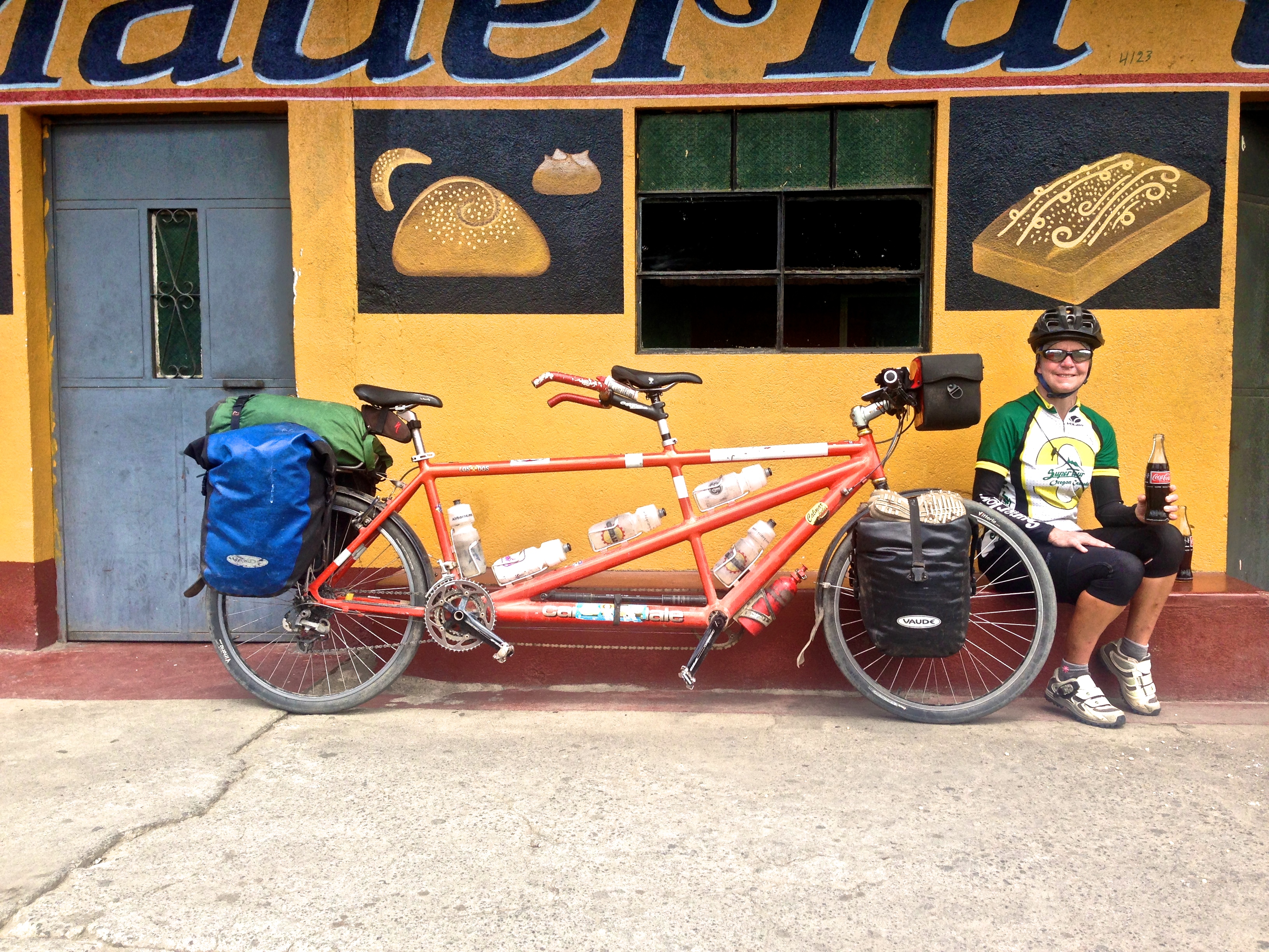
Taking a break in Patzun
After you get to Chimaltenango, the route follows back roads all the way to Antigua. Although these are back roads, the amount of traffic would make it feel like the primary route. You will need to ride carefully, as the roads are narrow, and the cars tend to drive quickly here. Fortunately, it is mostly downhill, so you aren’t getting passed by as many cars as you would if it were uphill. Upon arrival in Antigua, you will find cobblestone streets that try to shake the panniers right off your racks. The entire city is clad in cobblestones – so riding is time consuming and jarring. We found the only place to camp in town – and it is free. The stipulation is that you need to provide identification to the guards – apparently this used to be a campground open to the public, but they had too much partying. Now they will “check you out” to decide whether or not they want to let you in. Gladly, we made the cut, and shared the nice grassy field with two RVers from the United States. Note that if you plan to stay here, the bathrooms are pretty rough.
02/24/2014 Day 33 Antigua to Pacaya FAIL 28 miles
Our guidebook advised us that Pacaya was one of Guatemala’s volcanos that is still erupting. We decided to make this be our next objective, somewhat unaware of what the verb “erupting” can mean. The route from Antigua to Santa Maria de Jesus is very placid, with the beautiful Volcan de Agua in your sights the entire time. If you move one block to the left, you will likely encounter one of Guatemala’s great markets and plazas. Here, we also encountered a voluntary “helper.” He addressed us in English: “Where are you going?” We told him that we wanted to ride to Palin via the dirt road that begins here in Santa Maria de Jesus. He said, “No. You cannot go there. You WILL be robbed.” Incredulous of his certainty, we asked why. He noted that two cyclists from Europe had been robbed of everything (including bicycles) on that road just last week. It is an isolated, dirt road, and it is the logical shortcut from Antigua to Pacaya. If you look at a map, you can see that it is a long way around on busy roads via Villa Nueva and Amatitlan to get to Pacaya from the other direction. We considered his advice, thanked him, and then made the difficult decision to ride the dirt road against his advice. It was not the most pleasant experience. This was partly because we were worried, partly because the dirt and rocks made the going very slow (and thus we were worrying for a longer amount of time), and finally, the road was rather offensive as seen in my picture of dogs and trash.
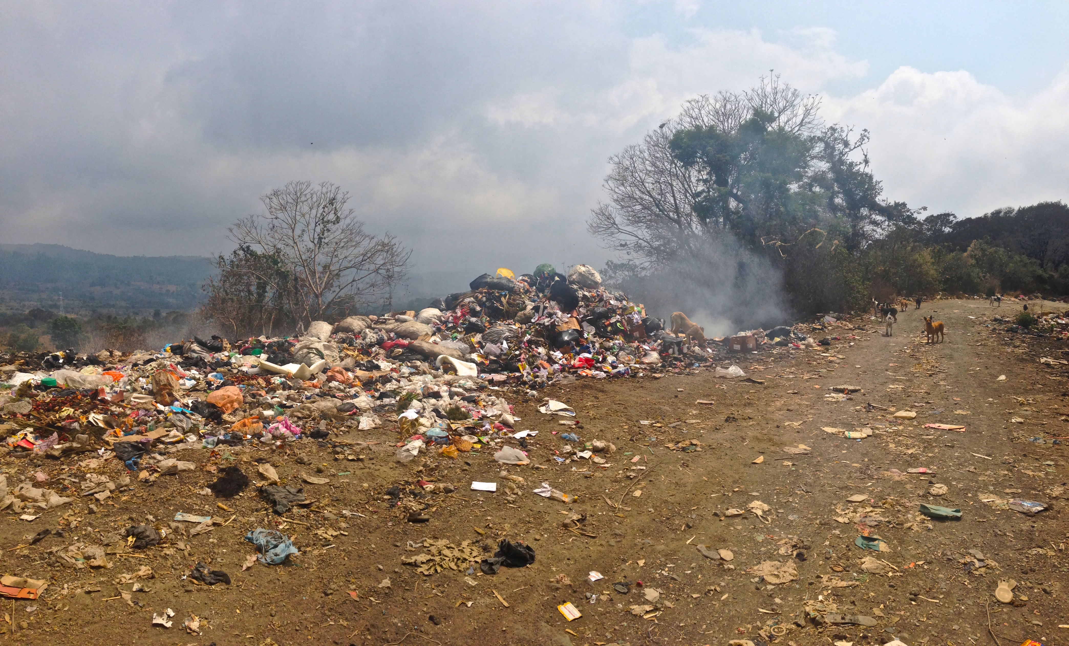
Dogs swarming trash piles as seen on the road from Santa Maria de Jeus to Palin
You may have seen me categorize routes as “necessary evils” in previous posts… but I’d consider this route to be an unnecessary evil. Skip it if you can. We found the town of Palin to be industrial and destitute, and we were relieved to be climbing back into the mountains towards San Vicente Pacaya and Volcan de Pacaya. Unfortunately, as you can read in “Notes from the road,” we did not succeed in ascending the volcano either. Now that I have retrospect, my advice would be to avoid this entire route, and climb a different volcano. There are many volcanos in Guatemala to climb, and many of them have a safer feeling than this one. Everyone’s experience will be different, but that is my advice. If you do end up at San Vicente Pacaya, there is a very nice hotel where our GPS track ends. The owner is particularly kind to cyclists – he even has some classic cycles in the lobby.
02/25/2014 Day 34 – San Vicente Pacaya Guatemala to Chinamas El Salvador
Todays route takes you through varied terrain, and manages to avoid the busiest parts of Guatemala City’s suburbs. After descending from San Vicente de Pacaya, you take the main road towards lake Amatitlan. On the North side of the lake, there is a closed road that eventually turns into a bike path. The bike path is your ticket to the bluffs above the lake without riding on a busy road. Views of the lake are great, even though it is reportedly very polluted. After the bluffs, you’re soon on a busy road until Villa Canales. Here you turn left and begin a grade that averages 10%, but had 30% pitches. It is paved, and has little grocery stores along the way. Once you reach the top of this road, you have regained CA1 – the Pan American Highway. The Pan Am on this section is fast and fun. You will descend rapidly on the road with a very wide shoulder. Most of the time, it feels very safe. Eventually, you will be in the low-lands, and effectively “commuting” towards El Salvador. This border crossing is dramatically more tame than the one crossed at the Mexico-Guatemala border. The staff is tranquil, and there is a quiet bridge / river crossing to separate the two countries.
This is the map for the entire route discussed in this post. To Export GPX files, click on the three horizontal bars in the upper right hand corner of the map and select Export selected map data…
To see full screen, click here (opens in new window)
This concludes the Guatemala Cycling Guide Portion of our trip. You may now wish to proceed to the following locations:
Bicycling Latin America – San Diego, Baja California, Mexico, and Central America Hub Page