Bike Touring Ecuador – From Tulcan to Cayambe via Otavalo
Entering Ecuador, I had low expectations. After having cycled 2 months in Colombia, I knew that the chances of having a comparably good time were low. However after the initial disappointment of setting up an Ecuadorian SIM card, we’ve been finding that Ecuadorians are nearly as polite as the Colombians – but a lot more subdued.
The first thing we were not prepared for was that cars were stopping for us at intersections! Having spent two months in Colombia, we became practiced at “fending for ourselves” at cross-roads. Now that people were stopping for us, we looked like hesitant fools, not daring to edge out into the road.
This is the famous cemetery at Tulcan. From this panorama, you can still only see a tiny fraction of the topiaries in this enormous location!
The amount of care required to keep these topiaries in such good shape is astounding.
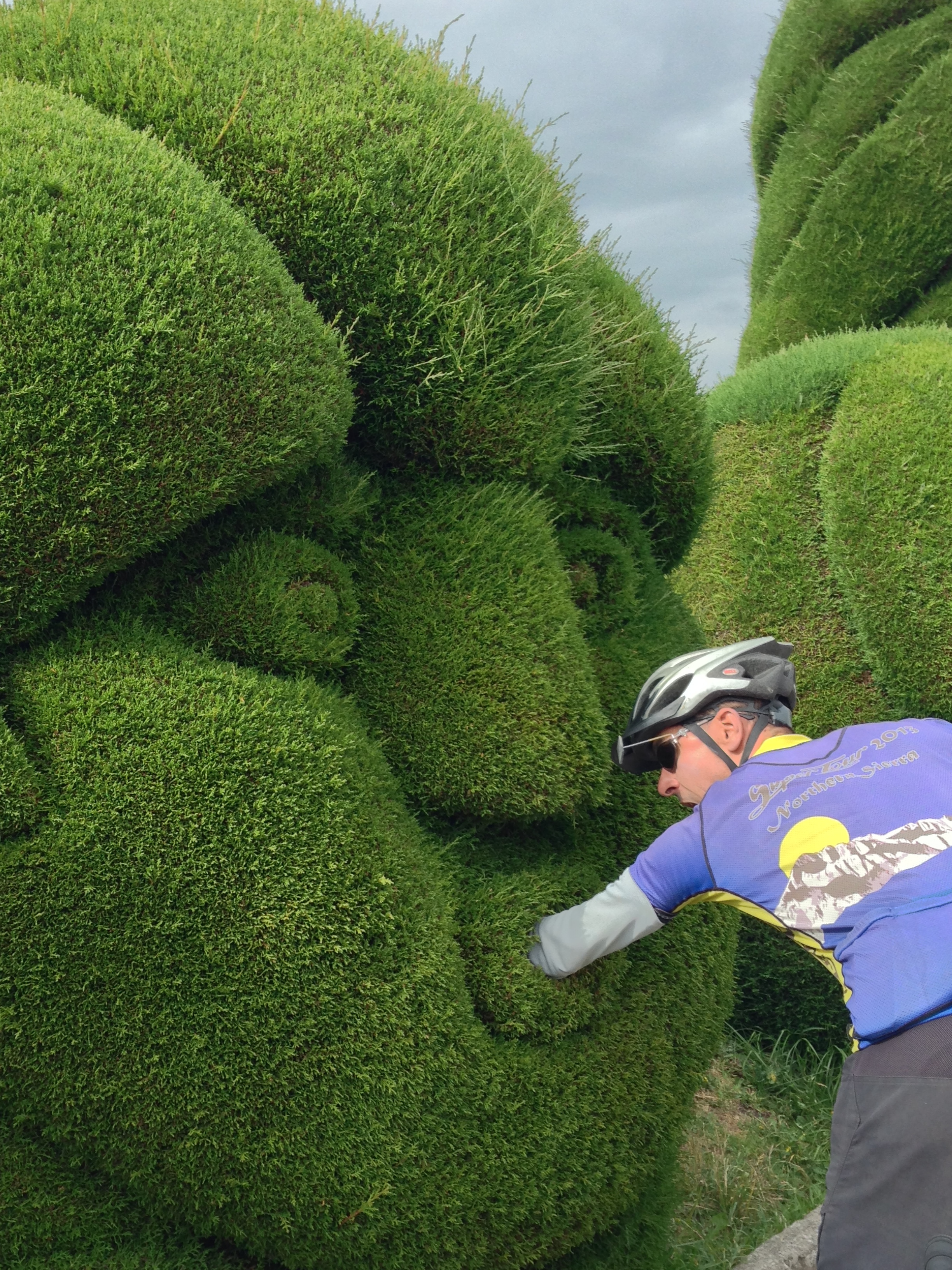
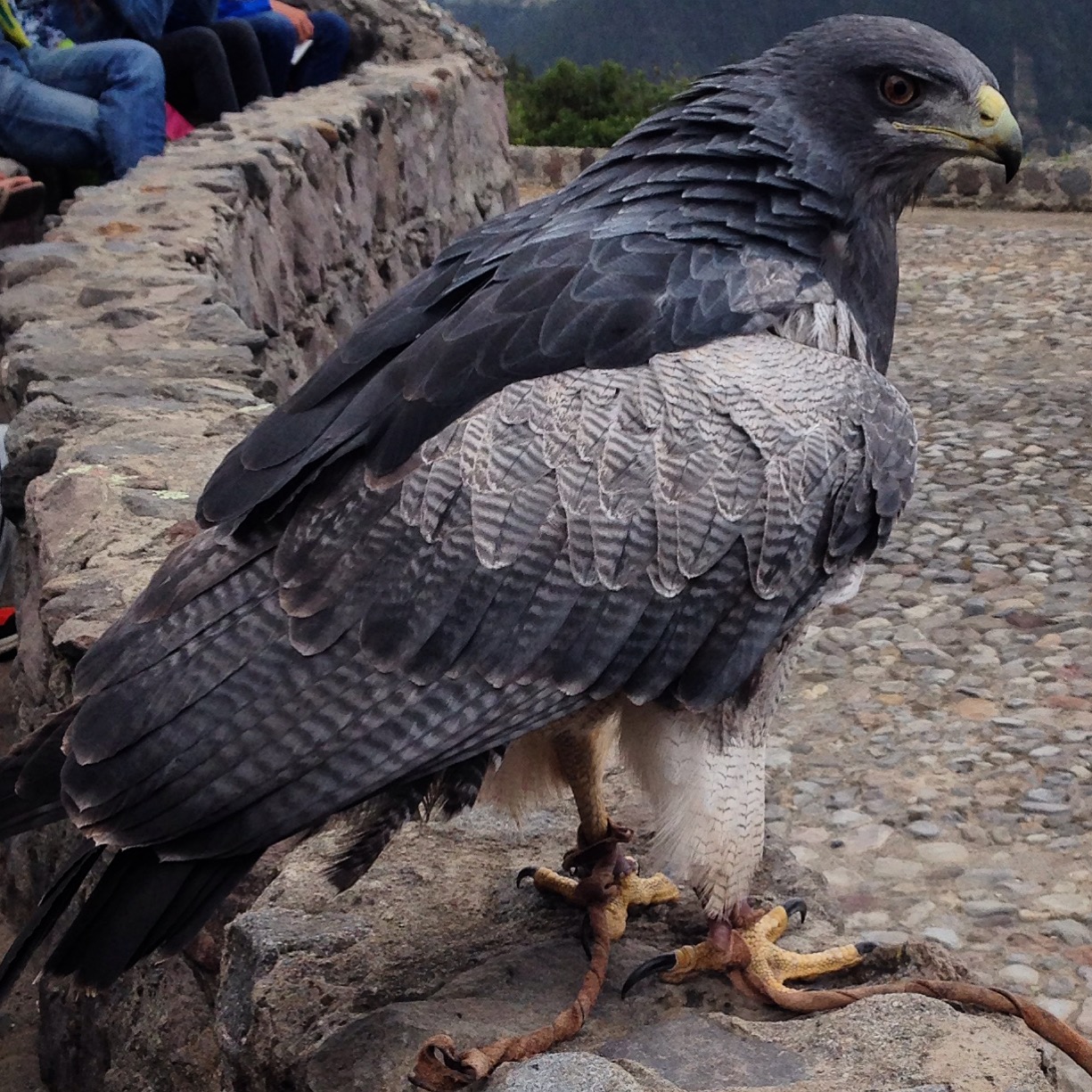
This guy tried to eat my arm, but I got it out just before he took a bite.
Throughout Colombia, we planned our routes using Strava’s route builder in conjunction with information from cyclists we met perchance along the way. This resulted in what I believe to be a very thorough study of both spines of the Colombian Andes. We did not hesitate to cross repeatedly, and almost always traversed lesser used unpaved routes.
Upon arrival to Ecuador, though, we had some extra information. The TEMBR is the “Trans Ecuador Mountain Bike Route” that is being promoted by Cass Gilbert and The Dammer Brothers. This is a very grassroots project; basically, they have ridden the country from North to South mostly avoiding the popular, but usually heavily trafficked PanAmerican Highway.
The road to El Ángel Nature reserve. It is an unpaved climb from the Southern part of Tulcan, but we did not see a single car. We did see three separate riders on motorcycles. The riders kept asking if we had seen a green motorcycle go by – apparently someone had stolen it, and they were looking for the perpetrator(s).
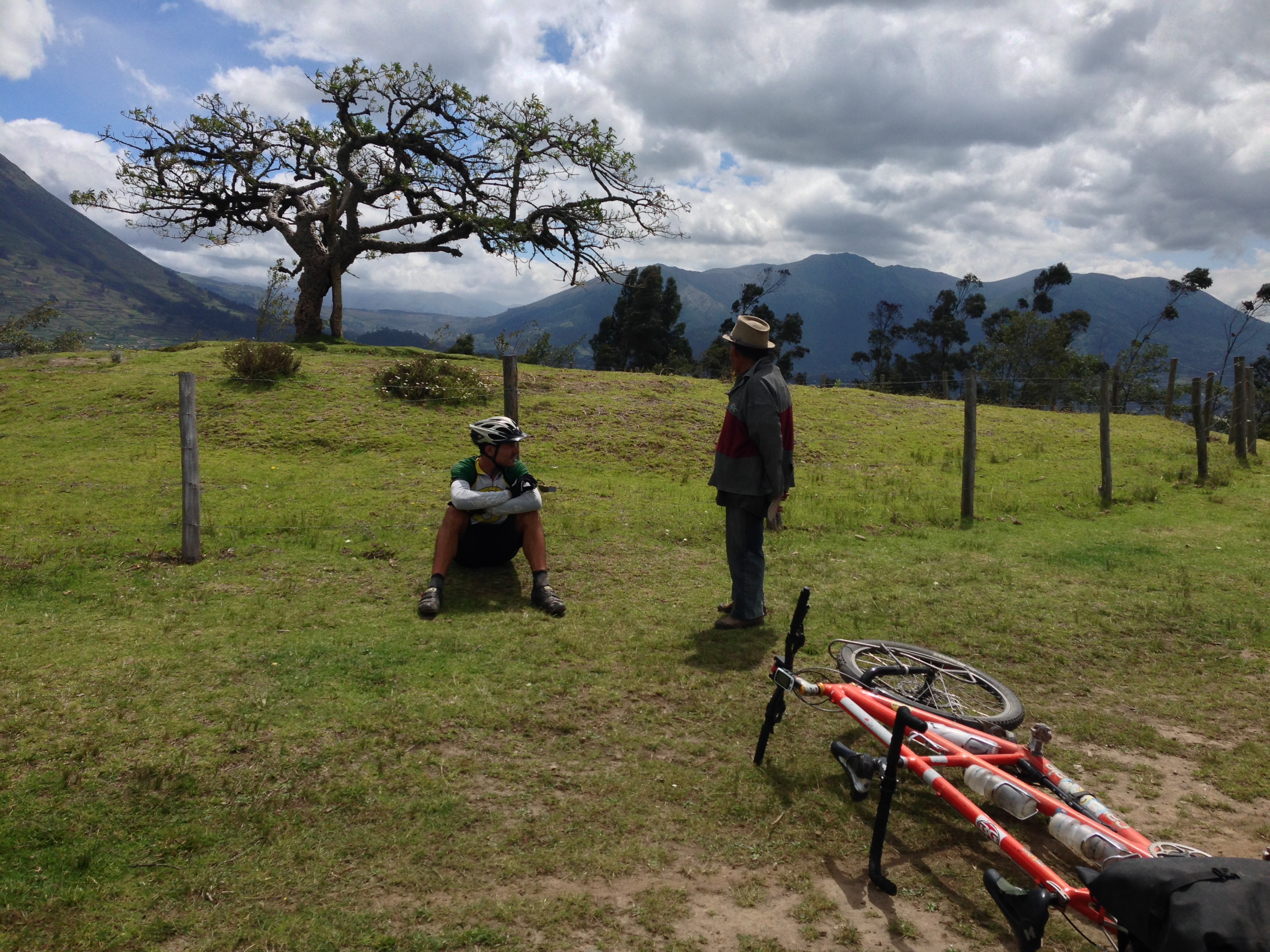
We have taken the GPS tracks that they provided, and knit them into what I might refer to as a compromise route. Remember: these guys were on fat bikes, and sometimes when following their routes, you end up at a shrub-whack or on a muddy cliff. They don’t always follow the most practical lines. For example, we’ve been on decent gravel roads, only to turn off on a time consuming mud track which serves as a shortcut back to the same gravel road you had been on! If the gravel road had been busy with cars, I could understand the diversion – but on many of these routes, we only saw 2-4 cars per DAY!
We don’t believe in riding dirt just for the sake of riding dirt. Our belief is that the dirt should have purpose. For us, the purpose of dirt is to escape the cars, and to land yourself in a beautiful, lesser traveled landscape. The latter often means frequent, rich interactions with locals, and a much better experience overall.
The paramo at El Ángel – from the ranger station, you can do a hike up to a high elevation lagoon.
Also, we wanted to mix some popular touristic destinations into the route. Although some popular destinations can be extremely disappointing (mainly because of the ways a place and people change when being swarmed with floods of foreigners), we still believed there was value in visiting the attractions we selected.
So, to summarize, our “compromise route” takes what we believe to be the best of the TEMBR, and combines it together with other quiet routes out to touristic destinations. This post will take you from the Ecuador border all the way to the visitor refuge of Cayambe. When on busy roads (such as the PanAm), we traversed them primarily in the downhill direction with the idea that we’d be spending much less time on a busy road than if we had been climbing instead.
Route Information:
El Ángel Nature Reserve
From Tulcan, follow our route out of town on good quality pavement. Shortly out of town, you’ll turn right followed by a quick left which will have you on decent quality dirt. This dirt is pretty good all the way up to the El Ángel Ranger Station. From the ranger station, you can hike to some nearby lagoons; the rangers will gladly accompany you. They kindly made us some warm aromatic tea, which they said helps with the elevation. It was made from a plant that you can pick right there in the paramo.
At the apogee of this ride (12,230′), there is a ranger station. Here you can register to hike in the park. Unfortunately, when we arrived, it was pouring rain – hard. We waited an hour and a half for the rain to stop. The very friendly rangers kindly made us some warm tea that is supposed to also help with altitude issues (not that we had any). The rangers eagerly told us as much as they could about the region, including a story about how an earthquake in the paramo feels – like you’re standing on a moving squishy sponge. We know of other cycle tourists who have camped here, but we moved on to the town of El Ángel instead. If you want to spend the night on the floor here, the rangers will permit it (quite gladly – perhaps because it is a lonely location).
Although we felt welcome at the ranger station, we decided to continue on to the town of El Ángel. We knew it was not far, but the descent involves a fairly long stretch of cobblestone surface, which is a challenge for any bike – not to mention a fully loaded tandem!
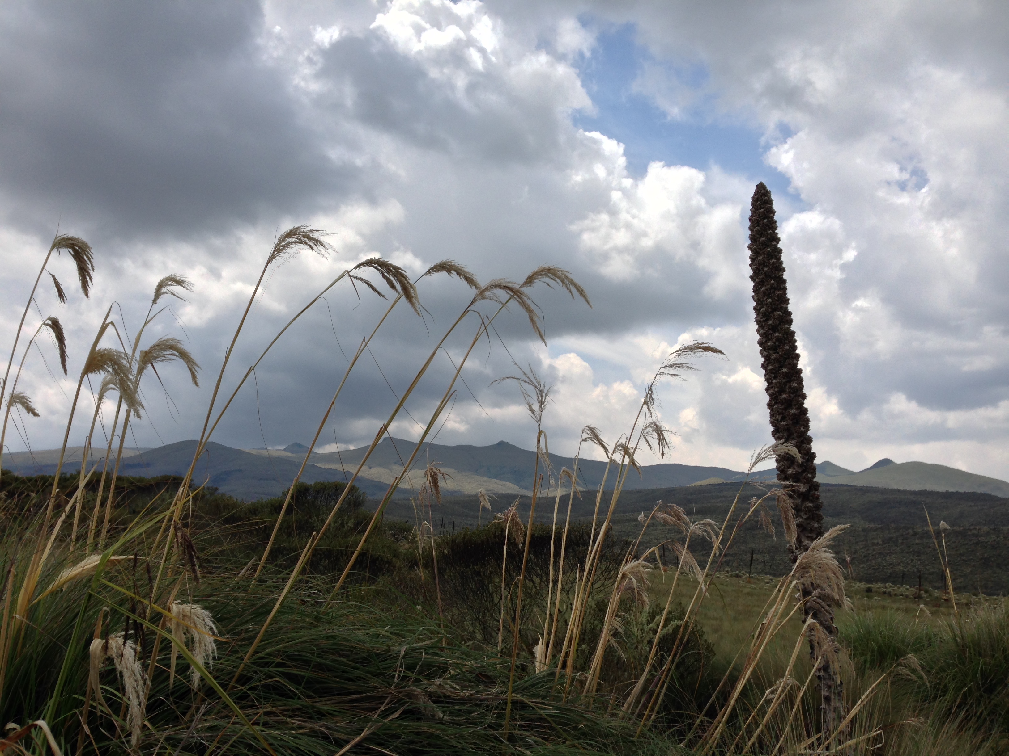
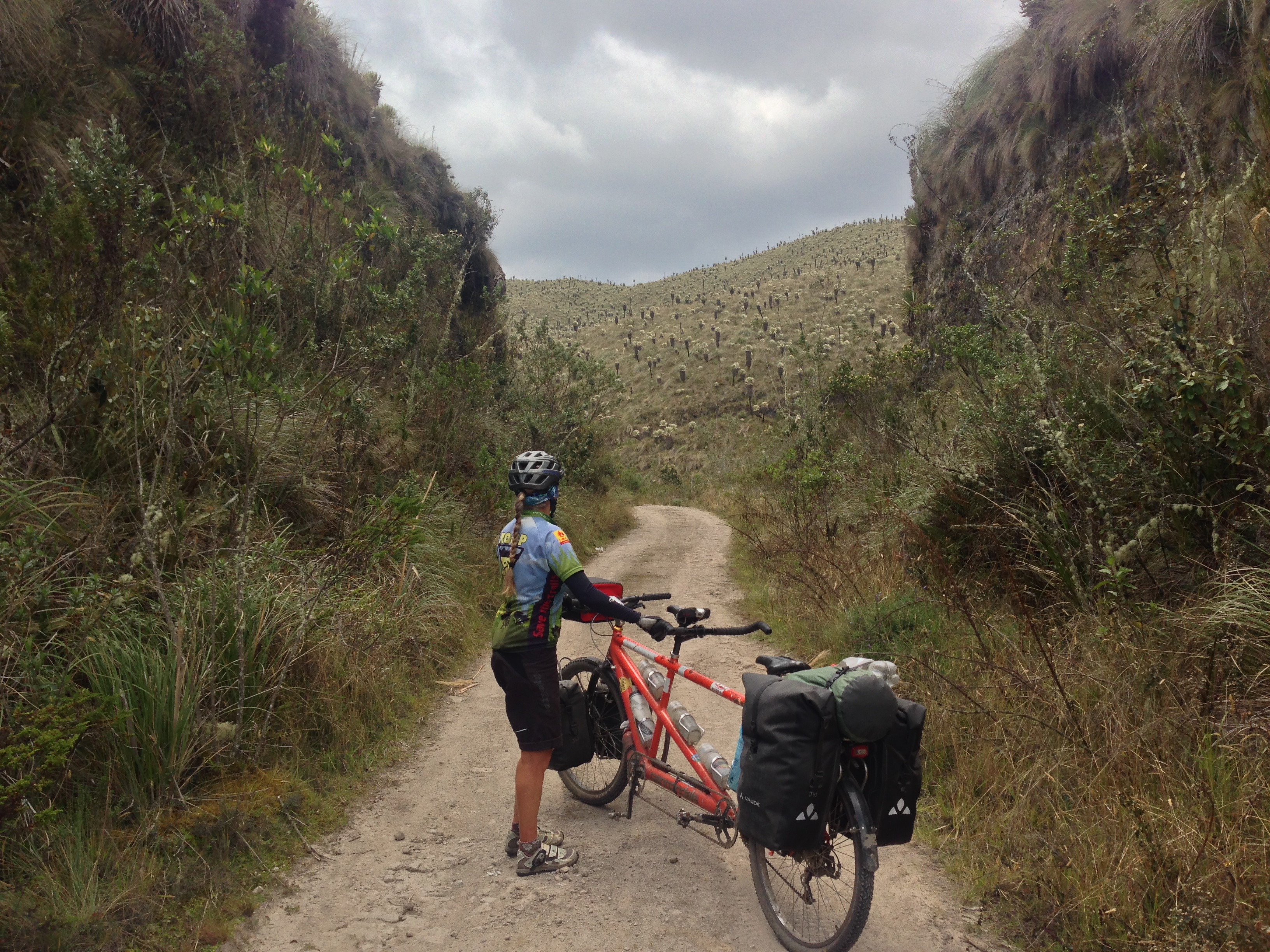
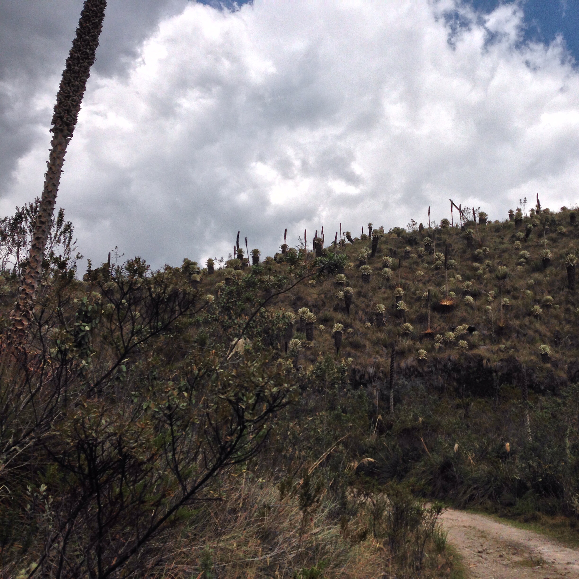
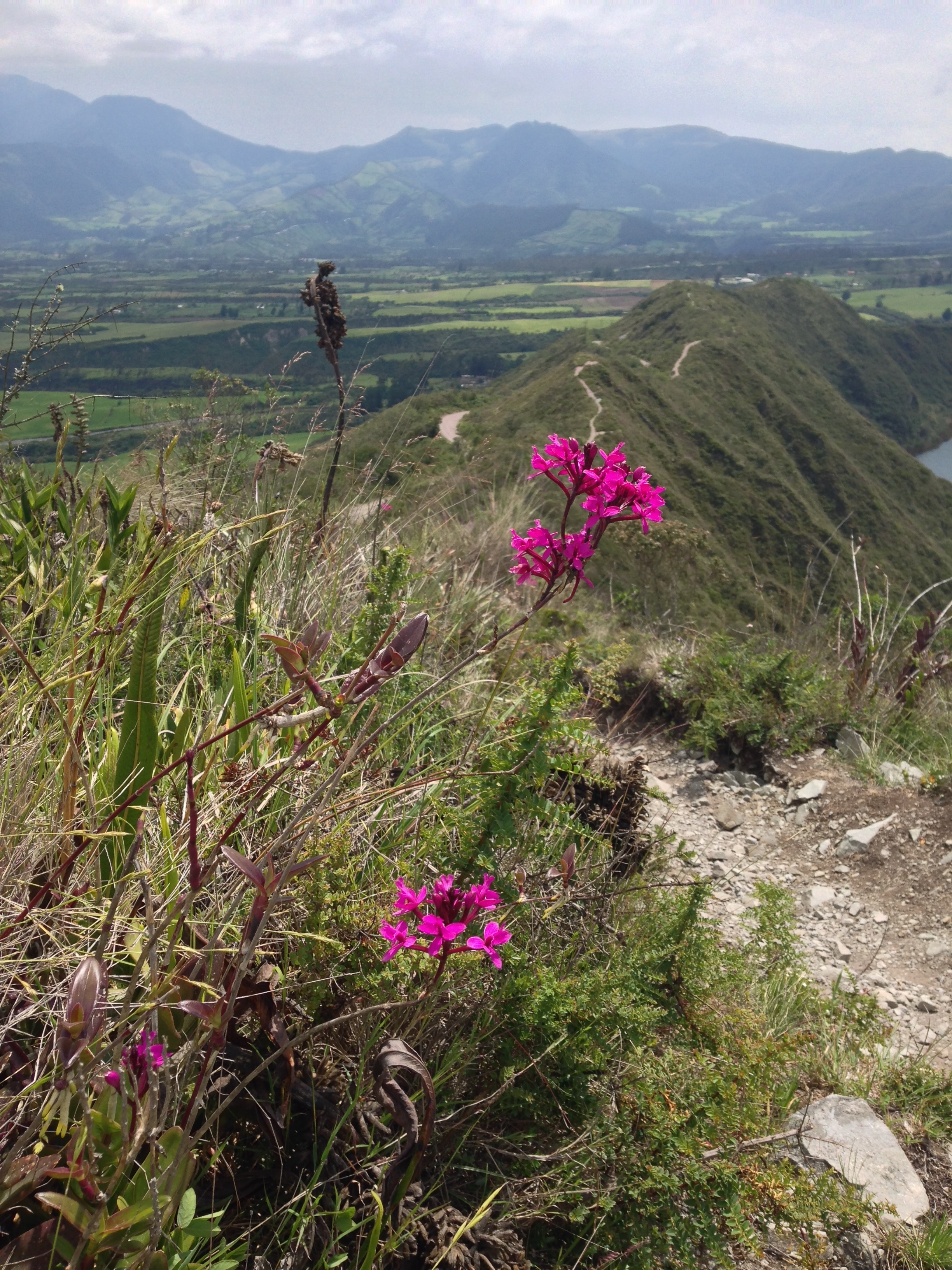
If you haven’t had enough of the Paramo yet, the El Ángel reserve delivers a healthy dose of it. There is a variety of interesting vegetation in the transition zone.
The town of El Ángel offers two accommodations. You can see in our GPS track where we stopped for the night, but just around the corner, you might consider asking at the less-run-down looking hospedaje instead. Our accommodations were very basic; they were asking for $20 for two, but they agreed to $15 after we saw how basic the rooms were. Staff was friendly and polite.
Getting to Otavalo
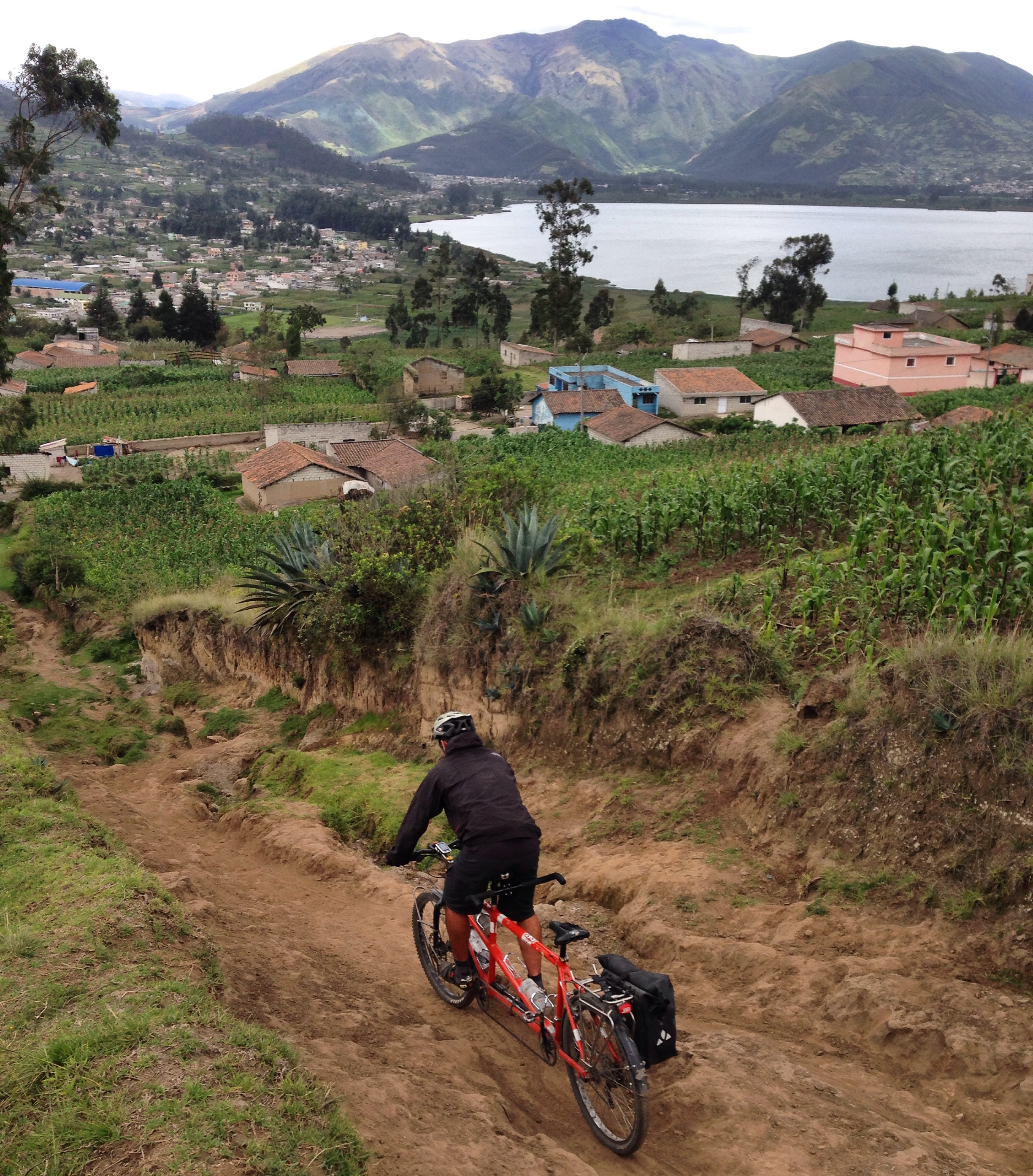
Our next mission was to get to Otavalo via backroads. In our route, you can see that except for one shortcut on dirt, we primarily descend down into the Pan American Highway on a paved route. This route goes by very quickly, as the pavement is smooth, and traffic is light. You’re then on the PanAm until Salinas, where the road stays paved, and the cars all but vanish.
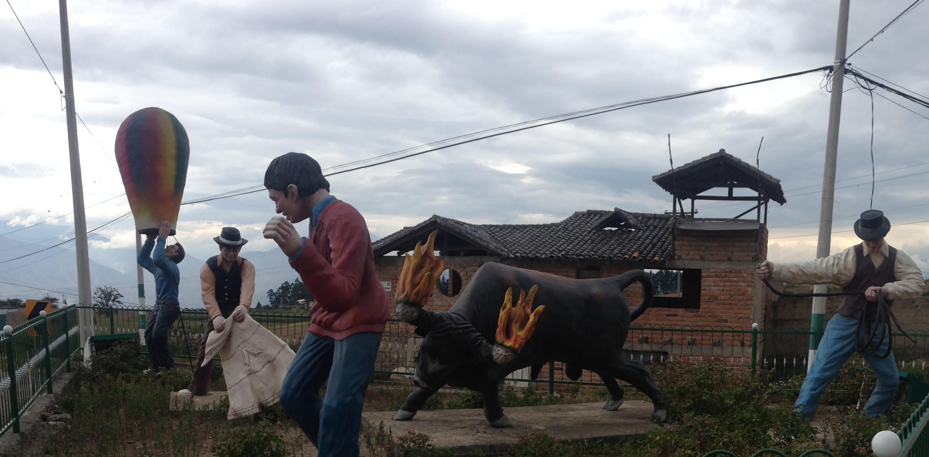
Many of the towns in Ecuador have these statues at the main road entrance to the town. I believe they’re symbolic of what is special about the particular town you’re entering.
It’s a decent climb up to Urcuqui, but great to be off the busy roads.
Main center of town in Tumbabiro. Life is nice and slow here. Great for cycling.
One disadvantage of this route is that along the way, there are plenty of cobblestones to slow you down. We feel that this beats being near cars. Our original plan had been to spend the night and stage out of Otavalo. Upon further consideration, we decided to stay in Cotacachi (famous for its leather products) because of its more central location. The town of Cotacachi allowed for reasonable day trips to Laguna de Cuicocha, Paguche Falls, El Lechero, Otavalo, and the Condor Park.
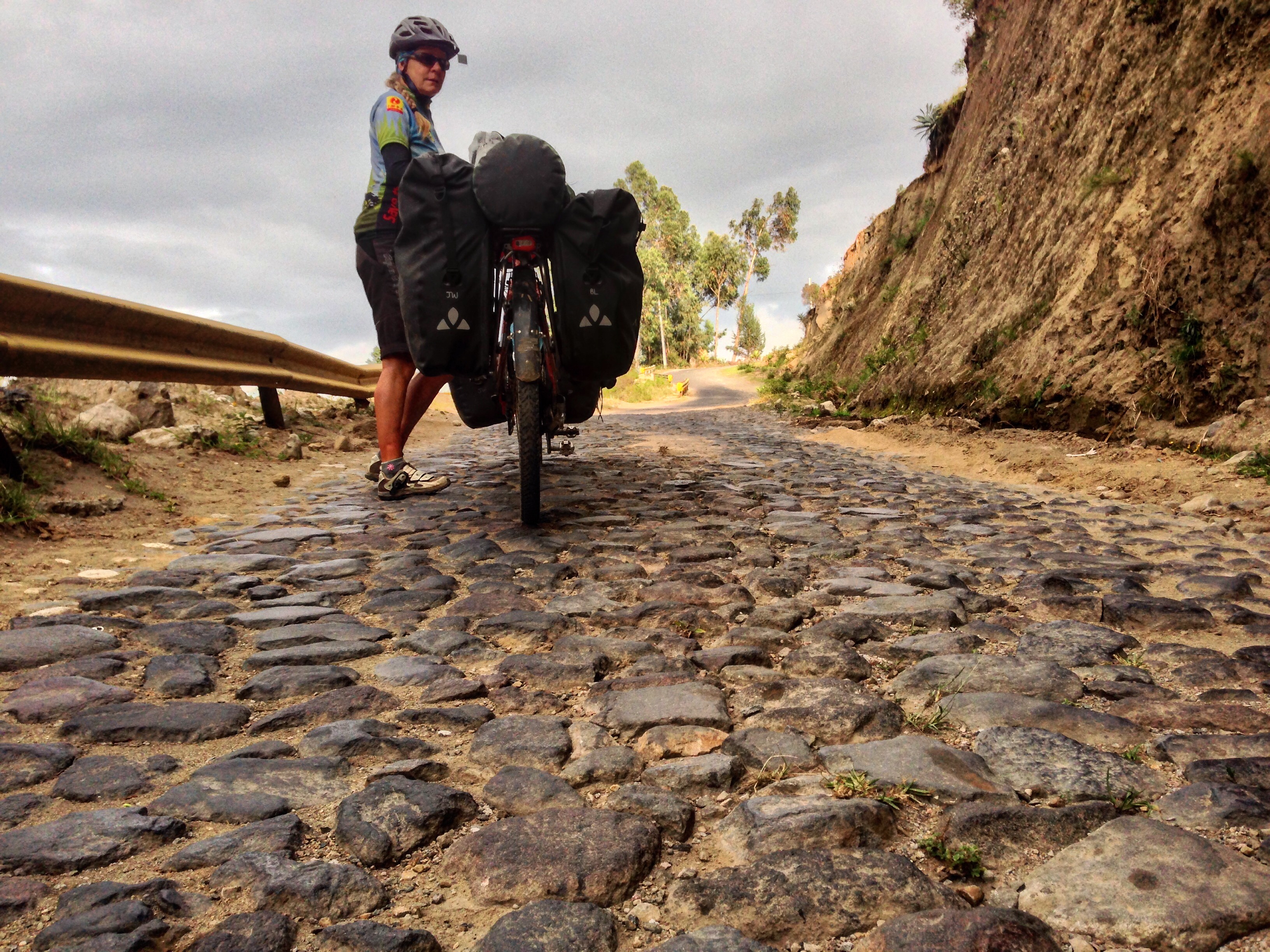
We thought we had seen the worst terrain that could be thrown at you in Colombia – rocky dirt roads. We were wrong: Cobbles are harder.
From the map below, you can see our route from Cotacachi to Laguna de Cuicocha. This route is easily done as a day trip – including a lap around the lake. I did the lake on foot; it would be quite difficult (and perhaps illegal) on a bicycle.

Lago Cuicocha – worth a visit! Even if you don’t go all the way around the crater, you can get spectacular views from the visitor center. It’s 8 miles around the crater on foot, and it took me 2 hours running/hiking/enjoying the views.
The rim of the Lago Cuicocha crater (you can see the trail in the distance).
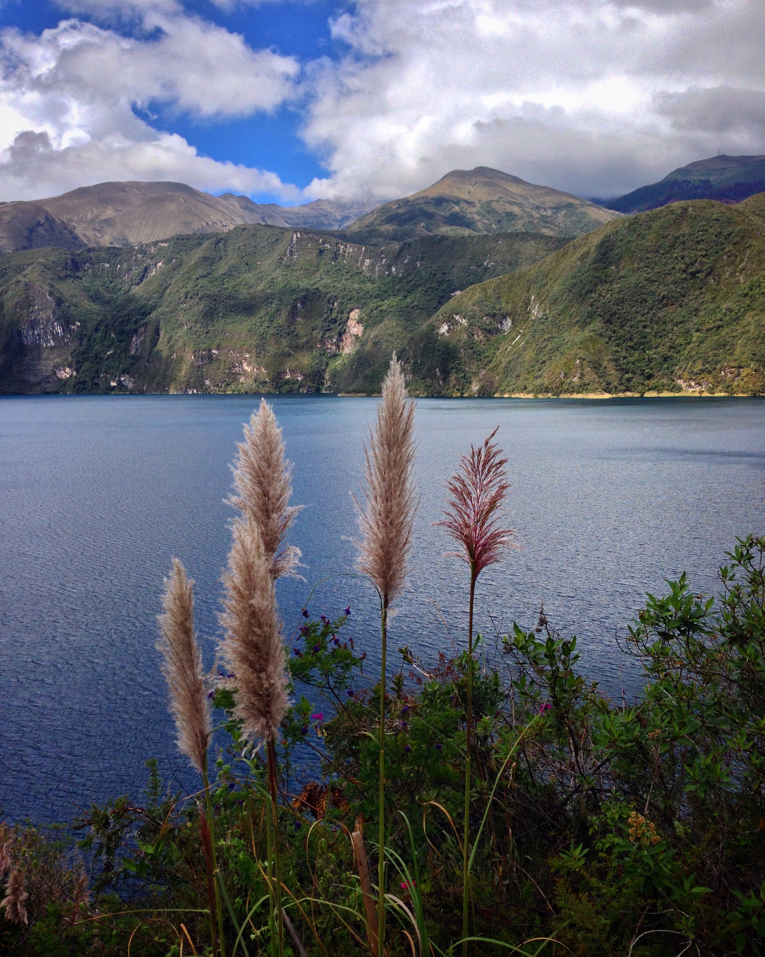
Lago Cuicocha – definitely worth the extra effort to ride up here!
After you have explored the lands to the West of Cotacachi, you may want to visit the attractions on the Eastern side (Otavalo). Of the most popular attractions here, we easily believe that the condor park is the most enjoyable (Assuming you’re there for the flight demonstration). At $4.75 per person entry, it’s a superb value.
See that tree? It’s called “El Lechero,” and it is famous for its healing powers. You can’t go up to it, though. I’m not sure how it heals you, but when we arrived, this guy with a machete was hanging out staring at it.
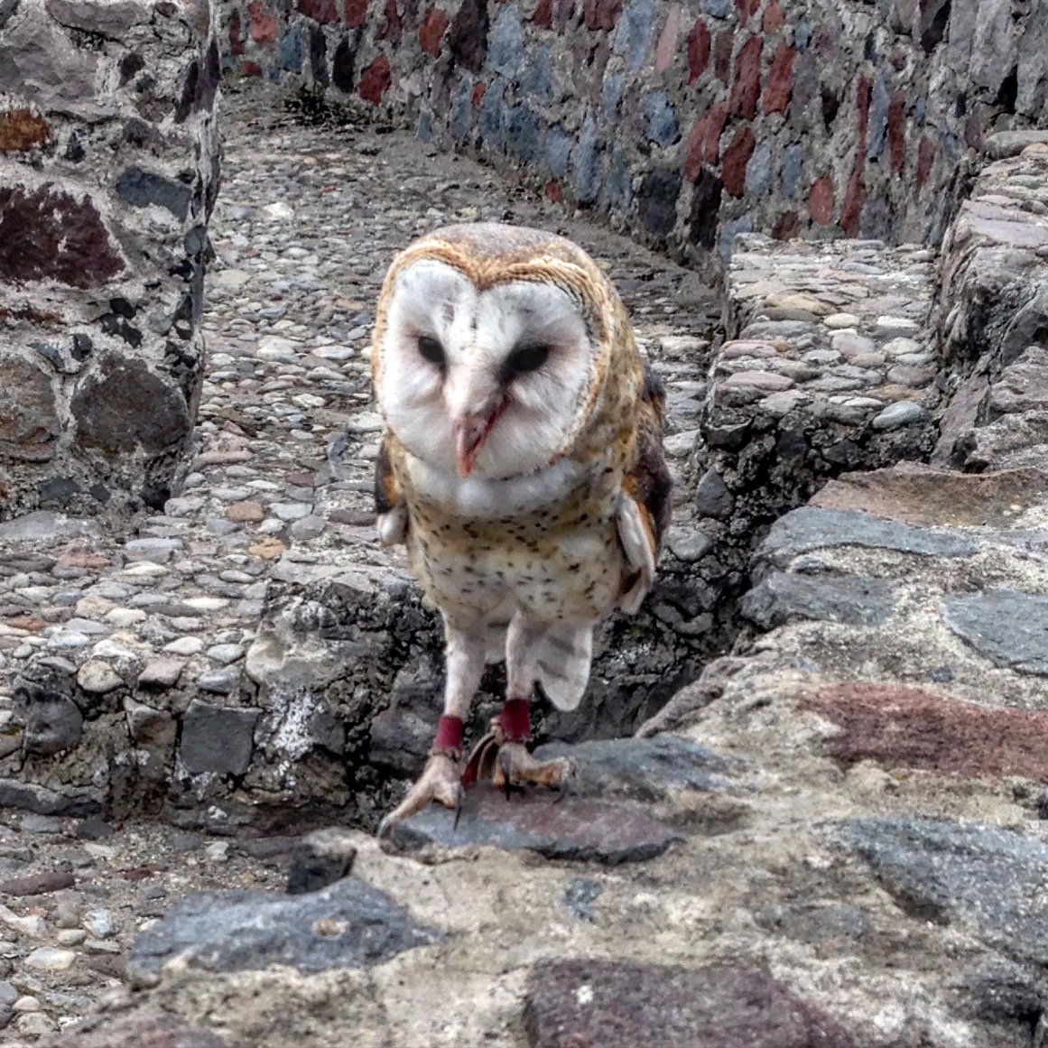
A buho (owl) at the Condor park. This park tops the list of the parks we’ve visited. We especially liked the flight demonstration (by far the best part of this small park). The guide manages these birds with grace. Although the entire presentation is in Spanish, he speaks slowly and clearly.
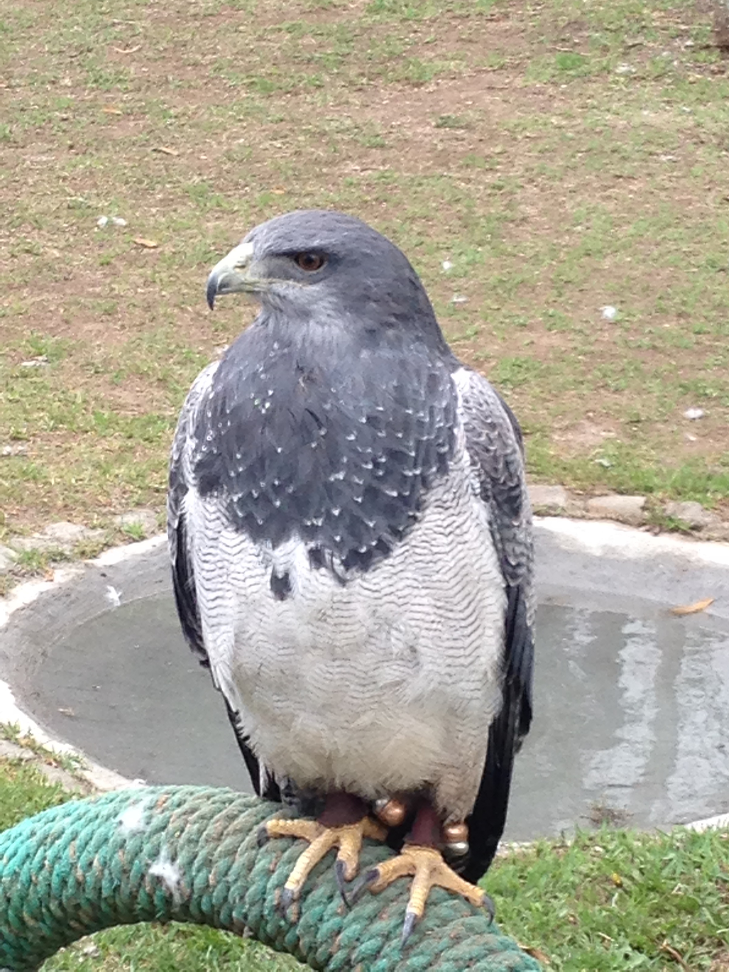
This picture was taken with an iPhone camera. The birds come that close to you! This is a Pechinegra – black chest.
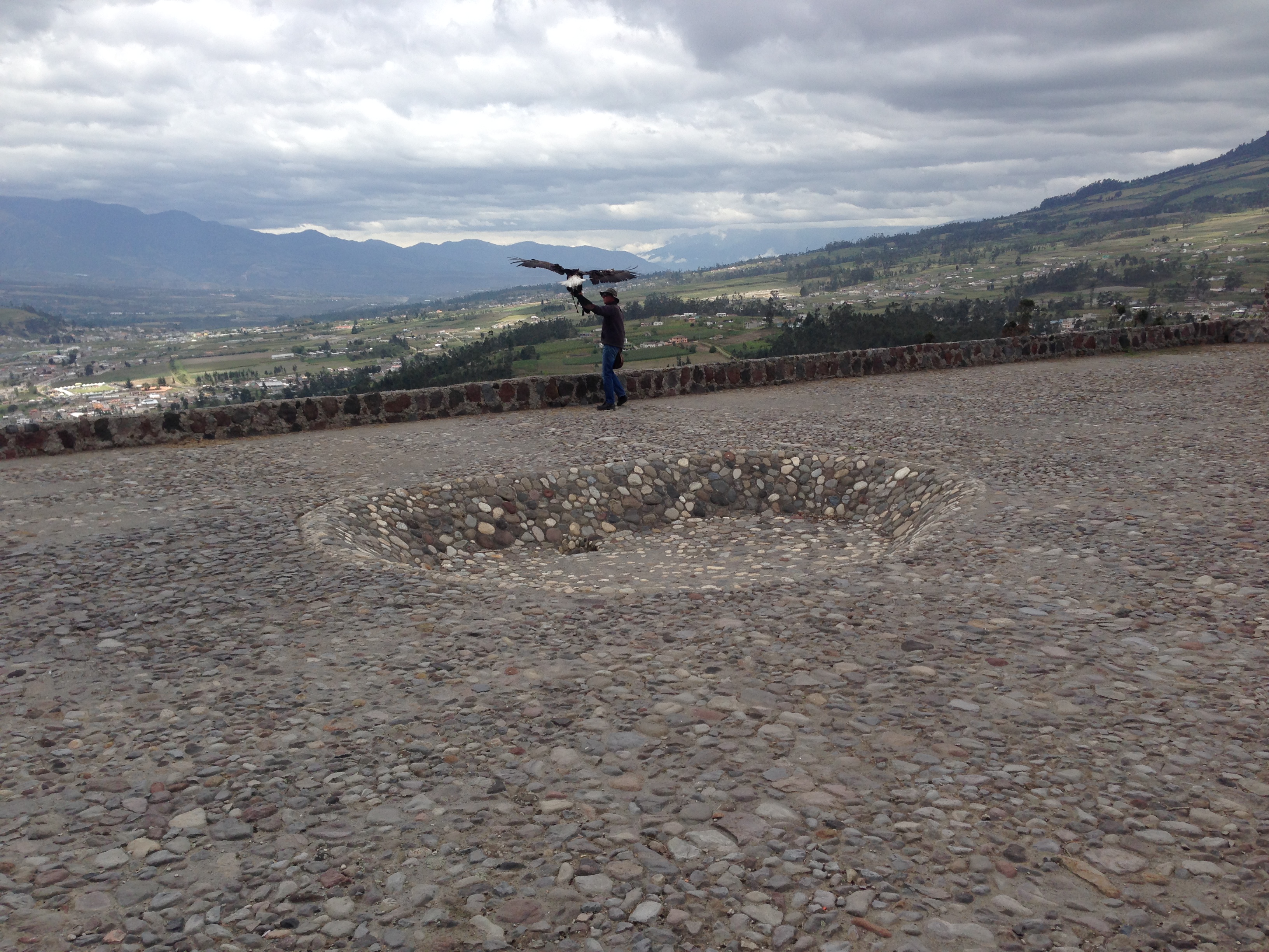
Look at the size of this Bald Eagle compared to the bird handler! They have two bald eagles which obviously have white heads. He told us that because of this fact, they are named “Gringa” and “Gringo” (to which the entire audience laughed).
It costs $4.75 per person to enter the Condor Park. I feel that the flight demonstration is worth more than that! The park is small, and after the show (or before it if you arrive early), there is a small museum (OK), and large aviaries containing other birds. All the birds here are rescued from nature. Tourists will only see birds that will be living the rest of their lives in the park. The park also releases rescue birds to the wild, but they don’t show them to the tourists so they don’t get accustomed to humans.
From the condor park, we found a route on Open Street Map that led fairly directly to Peguche Falls. We do NOT recommend following our GPS track, but instead suggest that you ride the road to the Peguche Entrance, and then reverse our route. (The falls are 510 meters as the crow flies at a 210 degree bearing from the Condor Park on our map). In our situation, the park where the falls are located was extremely crowded with kids celebrating Carnival. Your experience may differ, but this was not a serene location for waterfall viewing.
The route we took from the bird park to the Peguche waterfall is not recommended by us. Although it was the shortest possible route, it later involved us handing the tandem back and forth to each other down a cliff.
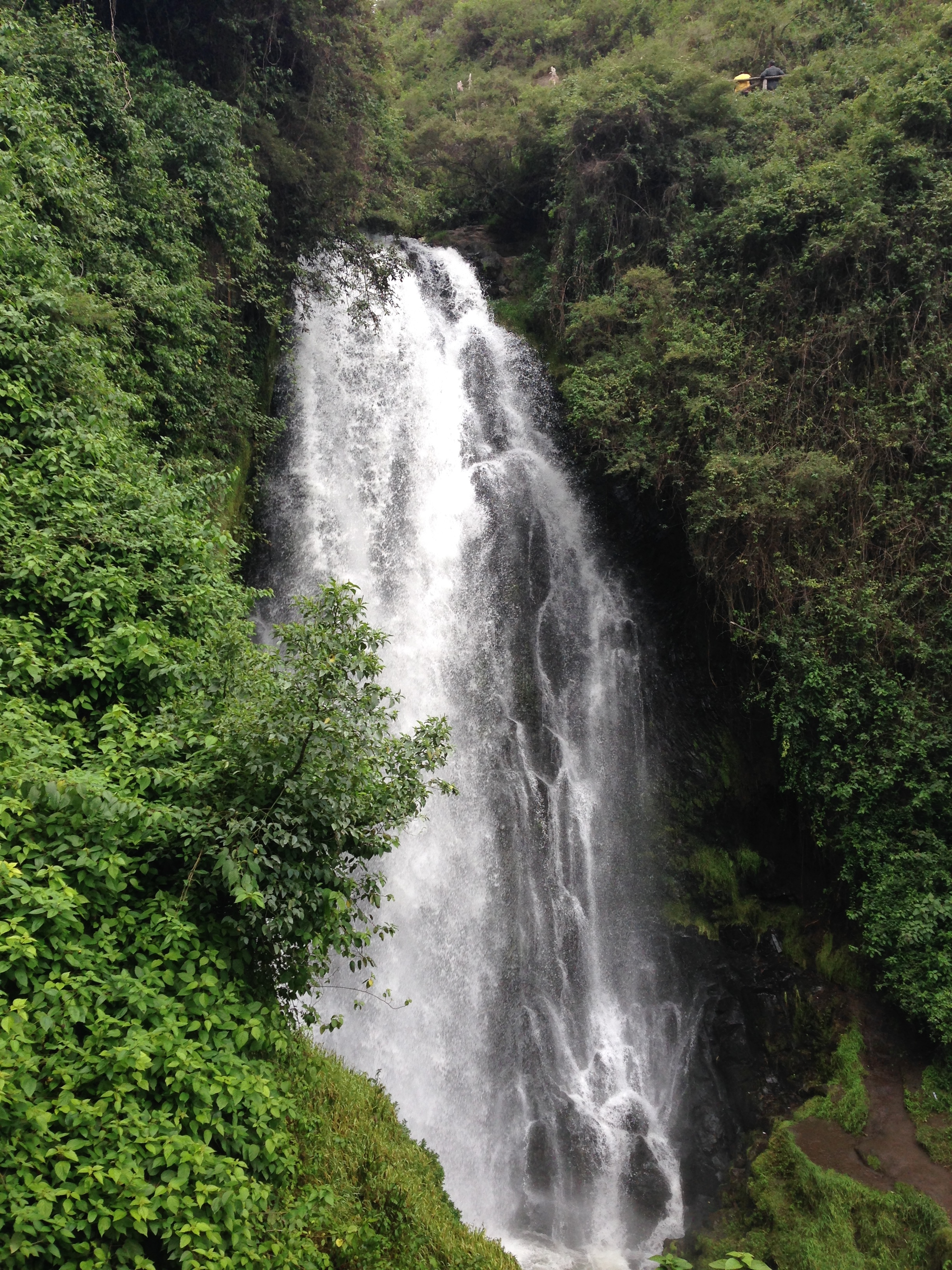
The Peguche waterfall near Otavalo. If you only have time to visit the falls or the Condor park, we definitely recommend the condor park!
In spite of what I said about the falls being crowded, we managed to have some fun by joining in the Carnival celebration with the kids. For the week that preceeds Ash Wednesday (the beginning of Lent), kids will spray foam, dump buckets of water off roof tops, toss water balloons, and smear paint and colored flour on other people. It’s a big party, and no one is immune. Foreigners and adults seem to be a little less susceptible. Nevertheless, I found myself drawing my weapon (a bicycle water bottle) a few times to get some giggly revenge…
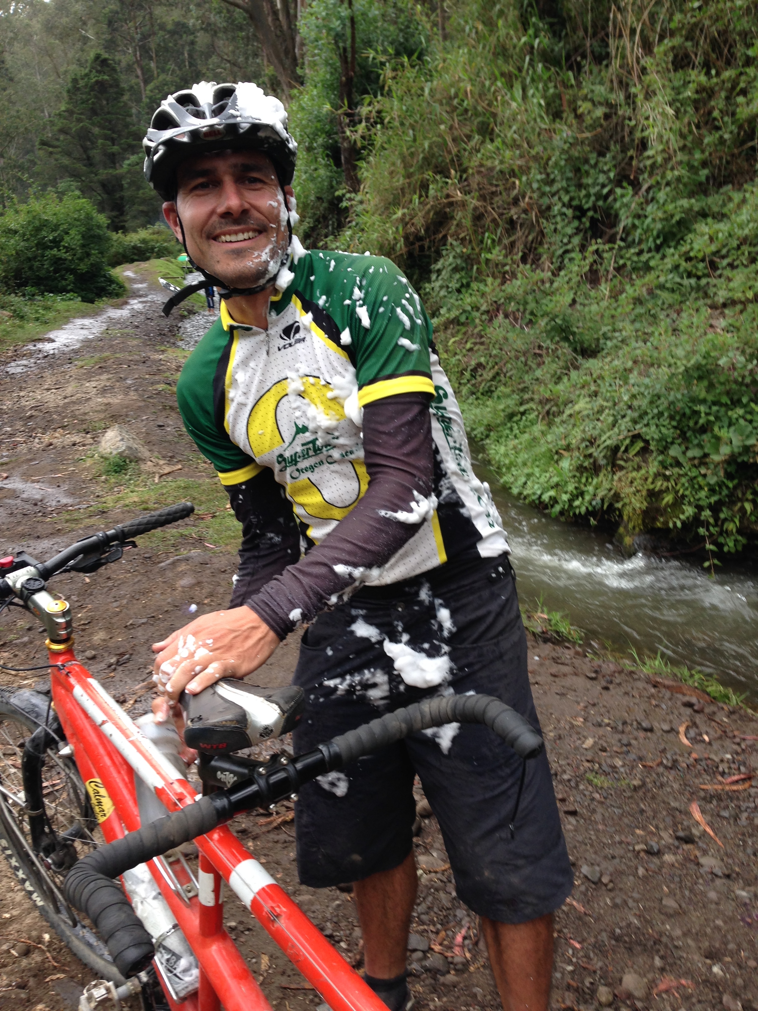
Carnival fun. Be forewarned: if you’re riding your bike in South America during Carnival, you might get doused with paint, spray foam, flour, or….
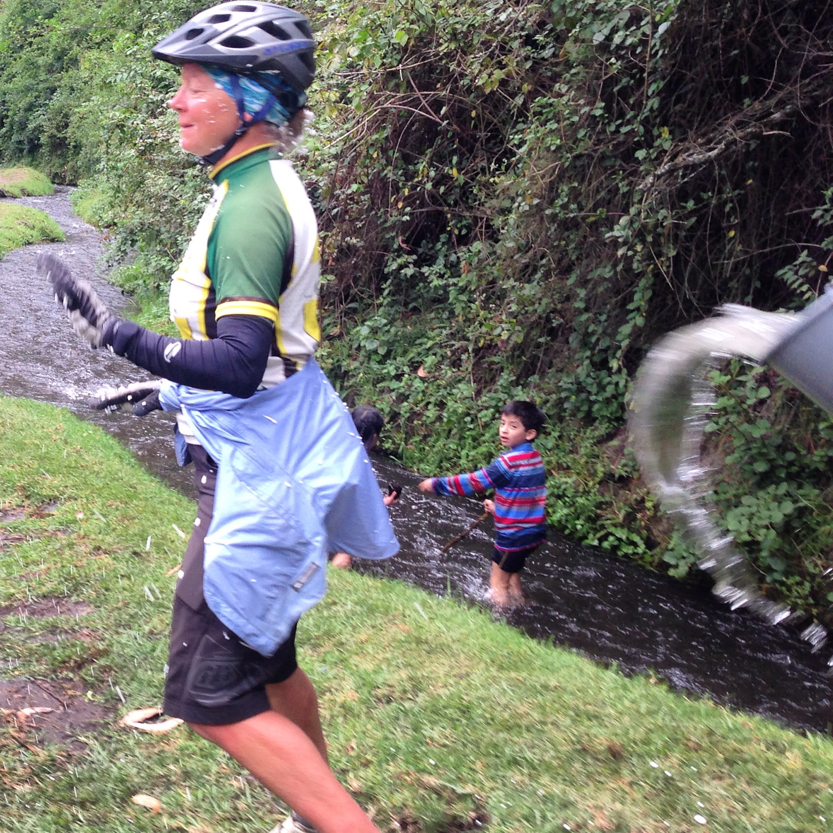
… a bucket of water! Sometimes, buckets are poured from the roofs of buildings, so you have to look in every direction at all times for the entire week preceding Fat Tuesday.
Otavalo to Cayambe and the Refugio
I’ve had an interest in scaling some of the many high volcanoes in South America, but so far, all of my efforts have been thwarted by volcanoes being officially closed to climbing. There is currently a very high level of volcanic activity in all of the mountains making up the Pacific ring of fire. Cayambe is the first volcano that we were near that could legally be scaled!
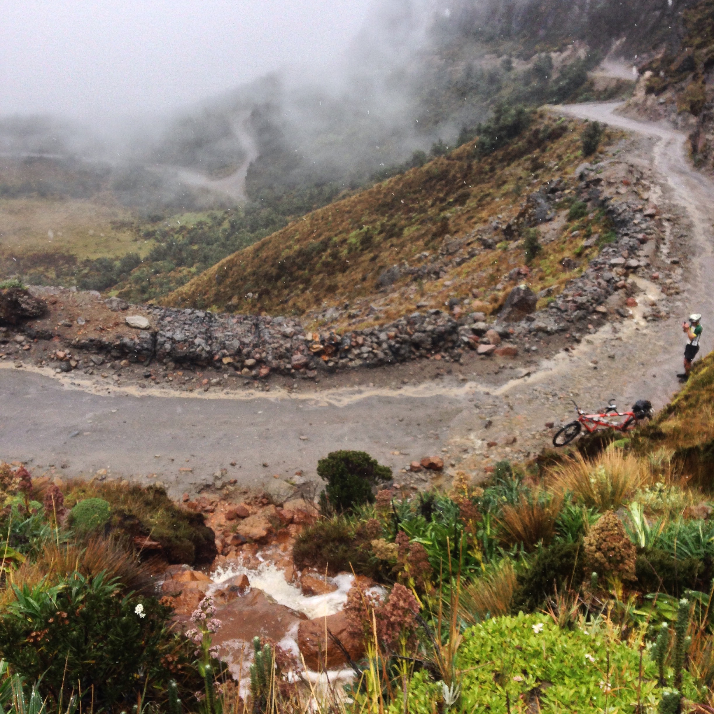
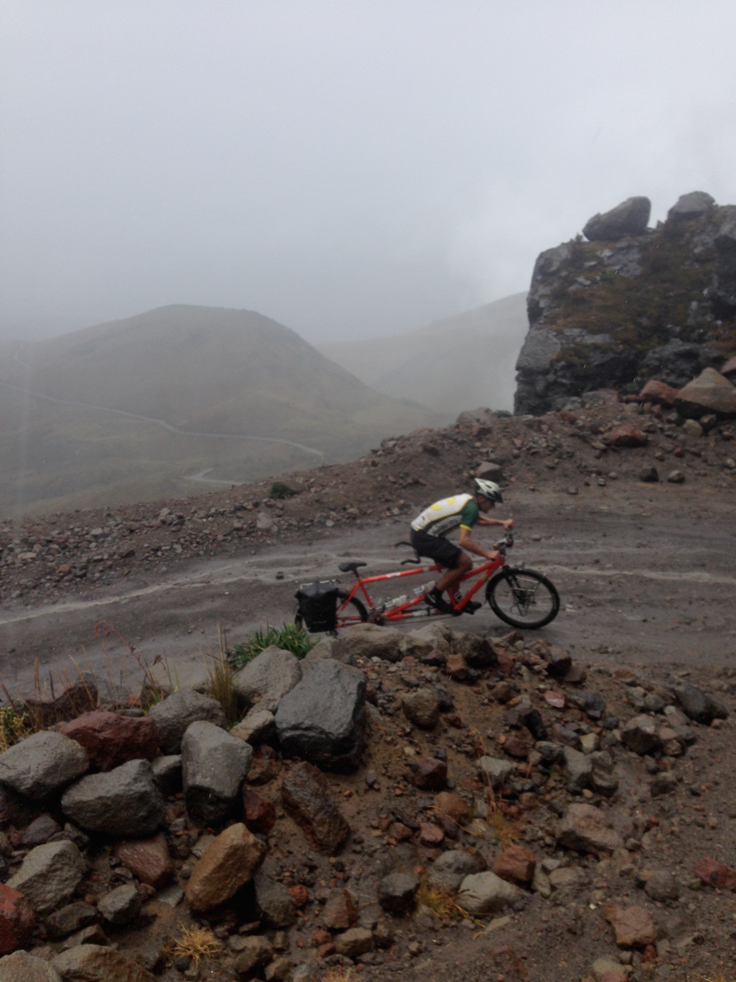
The route up to the Cayambe refuge is all unpaved, steep, and dramatic.
Scaling the volcano requires special gear that we were not carrying. Also, all peaks over 5,000m legally require a guide in Ecuador. As such, I researched guides, and fell in contact with a highly reviewed organization named Explore Share. I was originally quoted $720 for a guide for the 1.5 mile trek from the refugio to the summit. This price included transportation to-and-from Quito. The problem was that we both wanted to ride the bike as high up the mountain as possible – to the refugio. This meant that all we really needed from the guide was gear and guidance for the 3 mile (round trip) trek.
If you plan to climb the Cayambe mountain, it is probably easiest to start in Quito instead of trying to secure a guide in the town of Cayambe.
Brief negotiation with this organization resulted in a lower price of $280 per person – $280 to guide me up, and $280 for Janet to sleep in a dorm room at the refuge. The latter portion of this deal seemed a little silly, so we decided to ride up to the lodge and see what happened. After all, the weather had been questionable all week, and if you pay for a guide, there is no guarantee on the weather.

You can legally climb Cayambe; it’s one of the few volcanos open to climbing at this time. Many volcanos are closed due to activity. If you plan to climb the Cayambe volcano, you are probably best off securing a guide in Quito. (Guides are required on all peaks in Ecuador over 5,000m – though having said that, we met a trio waiting out the storm who told us that they plan to climb without a guide). All the guides we could find were based in Quito. We were initially quoted $800 per person (includes transport from Quito to the base and back, ice axe, and crampons). Upon my hesitation, the price was quickly lowered to $400 for the same package. The guides were reputable according to online reviews. My friend Nick Gault told me his guide charged $100.
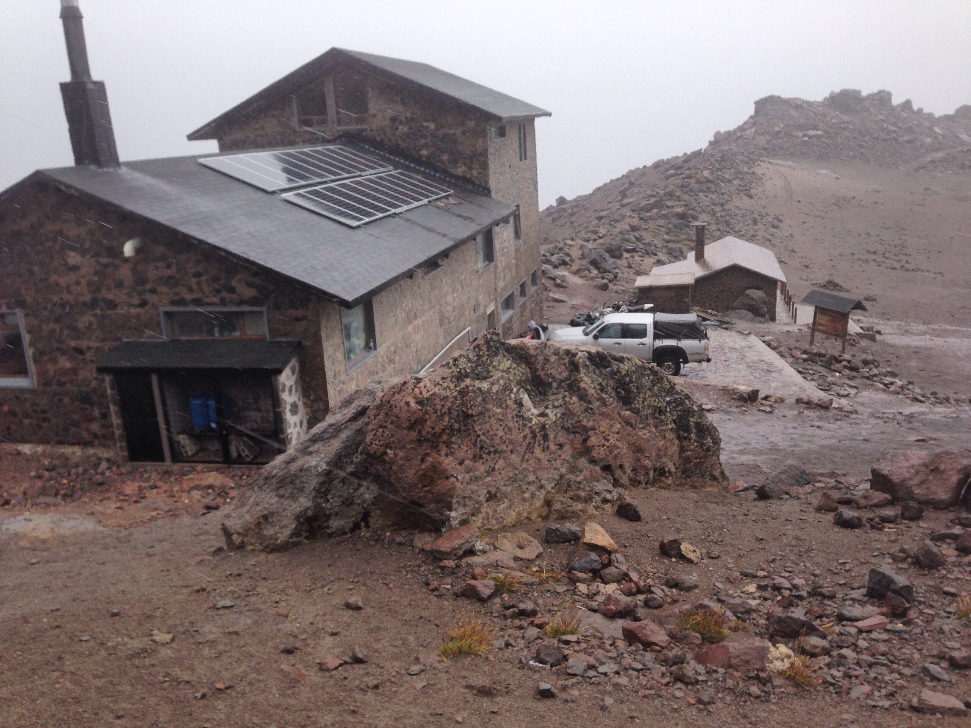
This is the refuge at the base of Cayambe located at 15,200′. From here, it’s only a mile and a half to the top, but people start climbing from here at 11PM the night before!
If you are cycle touring, and you enjoy big climbs on dirt/cobblestones, we can recommend the climb to the Cayambe refuge. For us, it was exceedingly difficult in strong, icy winds, sleet and mud. In retrospect, though, it was a beautiful ride. I wish better conditions for you.
Because the conditions were so awful, with no prognosis for improvement during Ecuador’s wet season (and an El Niño to boot), it was an easy decision to nix a summit attempt, and hope for better conditions on Cotopaxi (which we later found is closed due to volcanic activity) or Chimborazo.
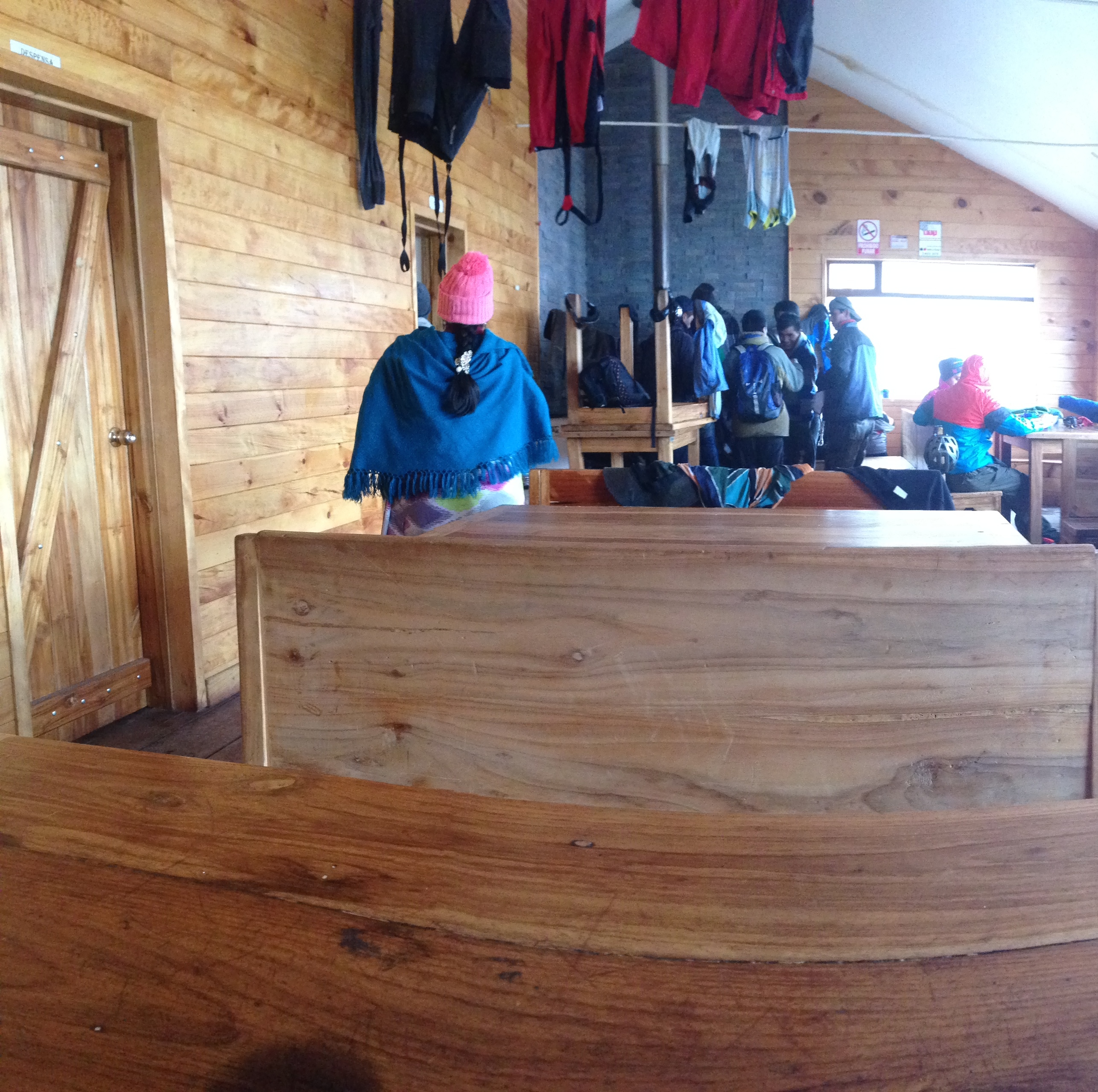
This is what the inside of the refuge looks like at the base of Cayambe. They serve very basic food here (we got hot soup). Also, in the back, there was a wood burning stove which was good for drying clothing (if you could manage to squeeze past the many people cuddled around it).
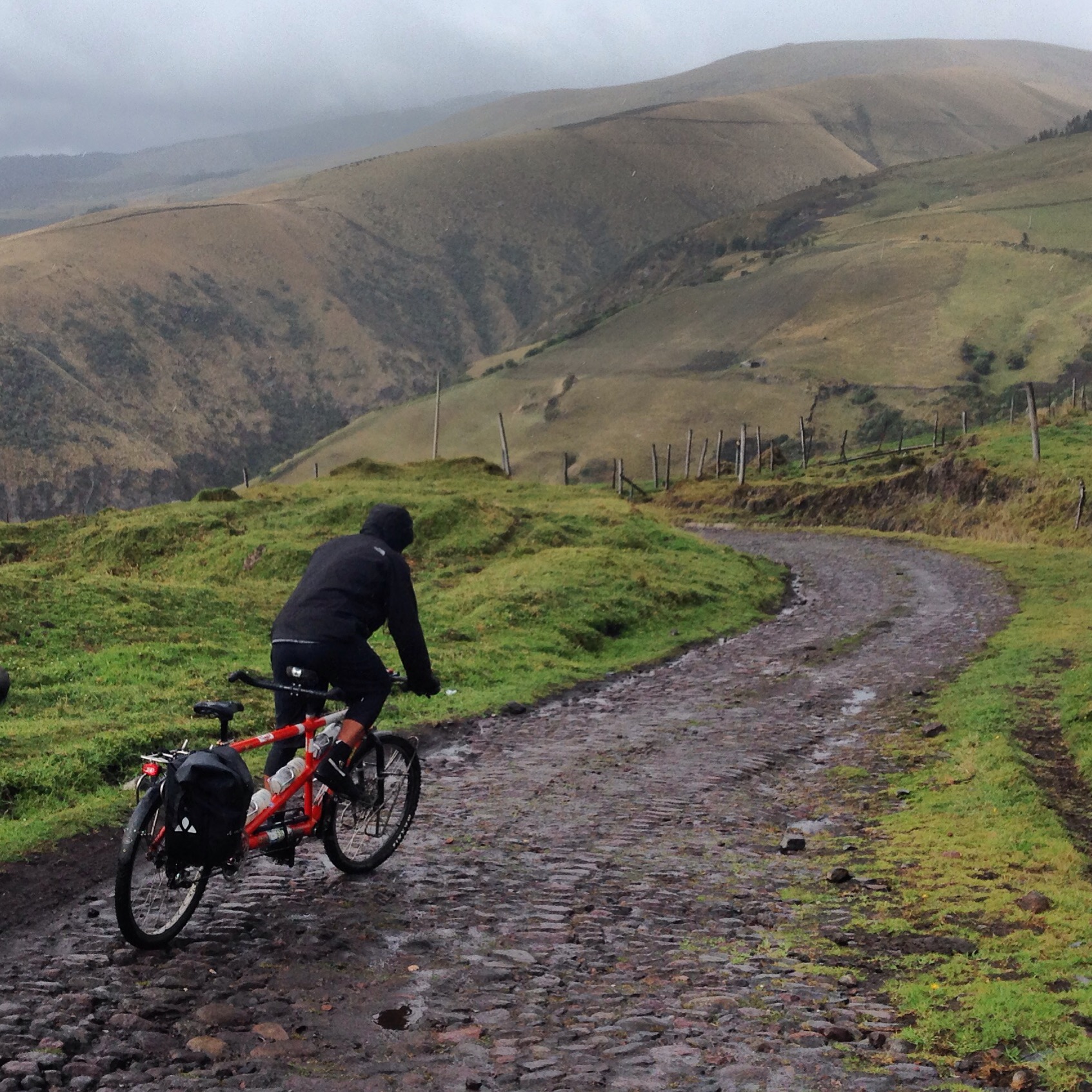
Descending down from the Refuge.
This is the map for the entire route discussed in this post. To Export GPX files, click on the three horizontal bars in the upper right hand corner of the map and select Export selected map data…
To see this map in a full screen, click here (opens in new window)