Bike Touring Ecuador – Cayambe to Quito via Mindo
The route from Cayambe to Quito is a short one if you go directly – in fact, it could be accomplished in a single day of riding. We wanted to check out a few more places on the map, though, so we sought out a convoluted route to Quito that took detours through Mitad del Mundo, Pululahua park, Mindo, and Nono. This was definitely the long way around, but the vast majority of the route was on quiet roads and trails.
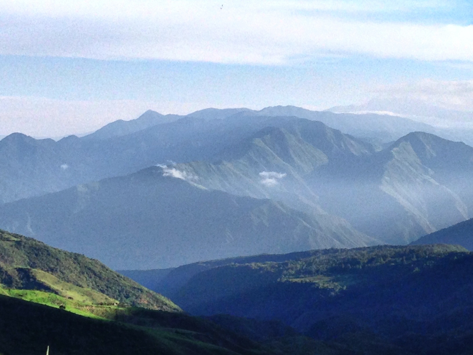
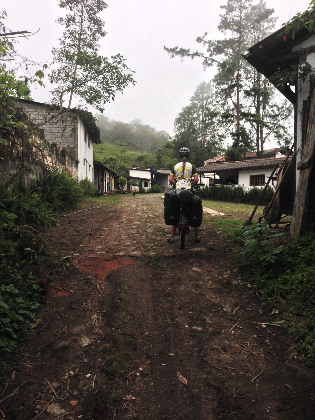
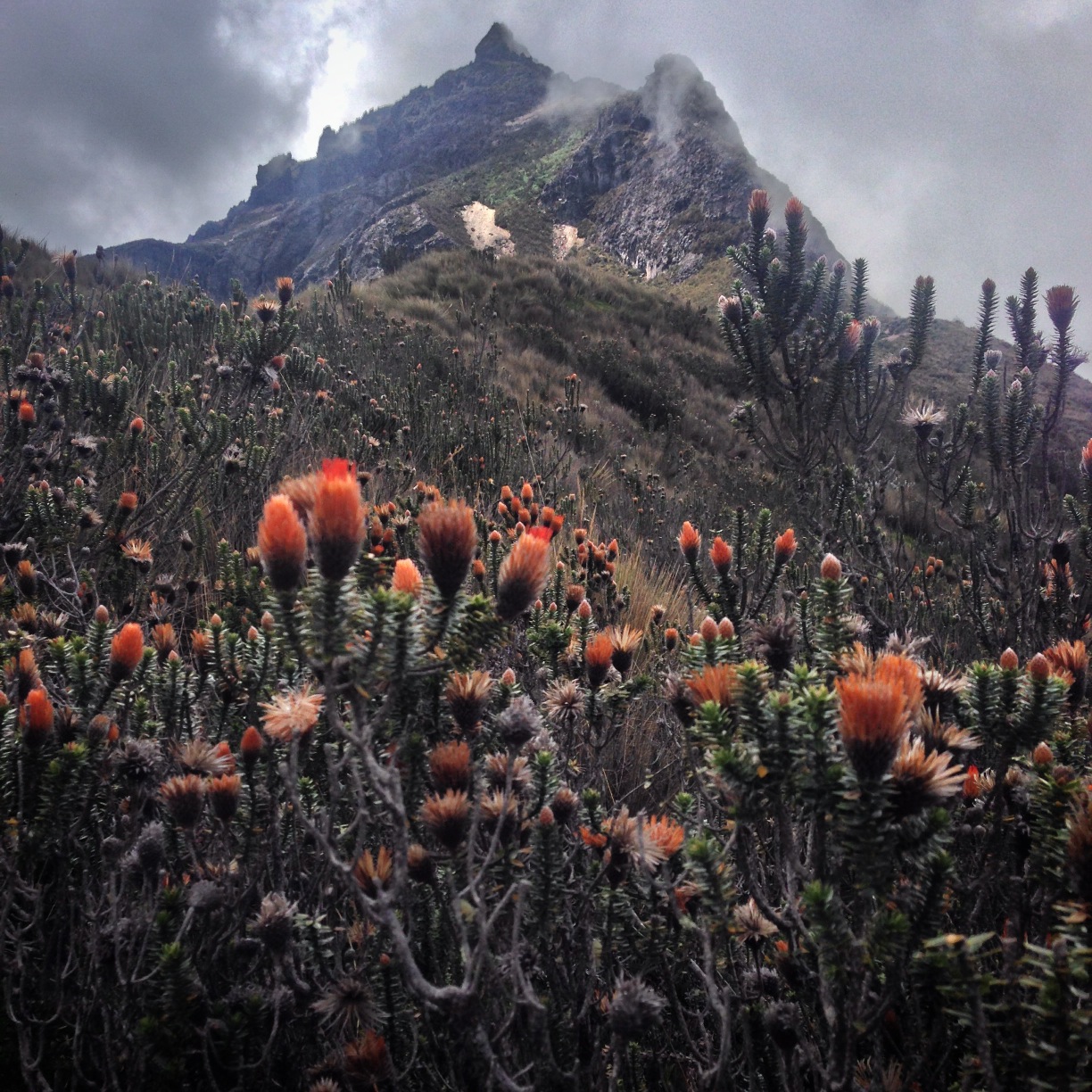
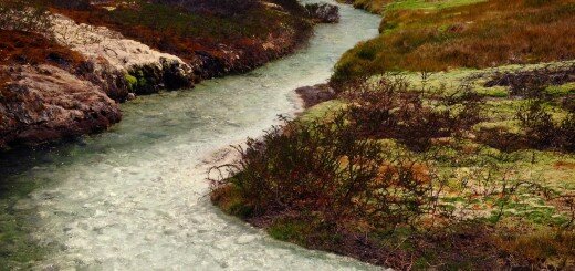
Shortly after leaving Cayambe along our route, you will come to desert scenery – a drastic change from the humid terrain near Cayambe.
The route from Cayambe to Quito is a short one if you go directly – in fact, it could be accomplished in a single day of riding. We wanted to check out a few more places on the map, though, so we sought out a convoluted route to Quito that took detours through Mitad del Mundo, Pululahua park, Mindo, and Nono. This was definitely the long way around, but the vast majority of the route was on quiet roads and trails.
Shortly after leaving Cayambe along our route, you will come to desert scenery – a drastic change from the humid terrain near Cayambe.
Cayambe to Pululahua
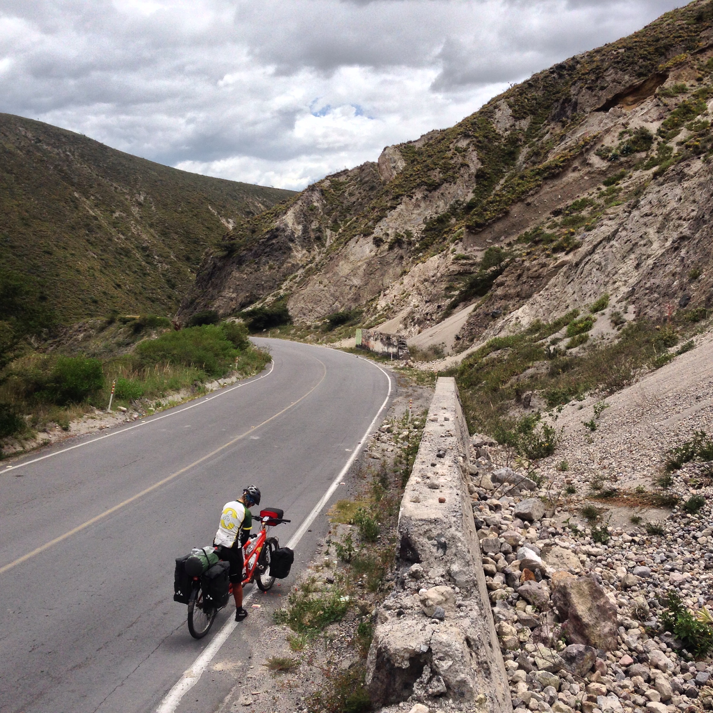
Leaving from Cayambe, our route follows good quality paved roads with little traffic to the first “Mitad del Mundo.” This is Spanish for “middle of the world.” It is called that because it lies along the equator line. This slightly touristic site actually bears the correct GPS coordinates of 00.000 (unlike the other Mitad del Mundo, which is off by a little bit). From Cayambe, you head towards the town of Guayllabamba (without actually entering the town, which has some services). You then briefly head North on the E28B, shortly turning left on a minor road for San Antonio de Pichincha. This road has very little traffic and is well paved. The entire route is difficult in terms of climbing, but excellent for cycling in every other way. Getting to San Antonio de Pichincha is very round-about due to the 3,000′ deep canyon of the Guayllabamba river.
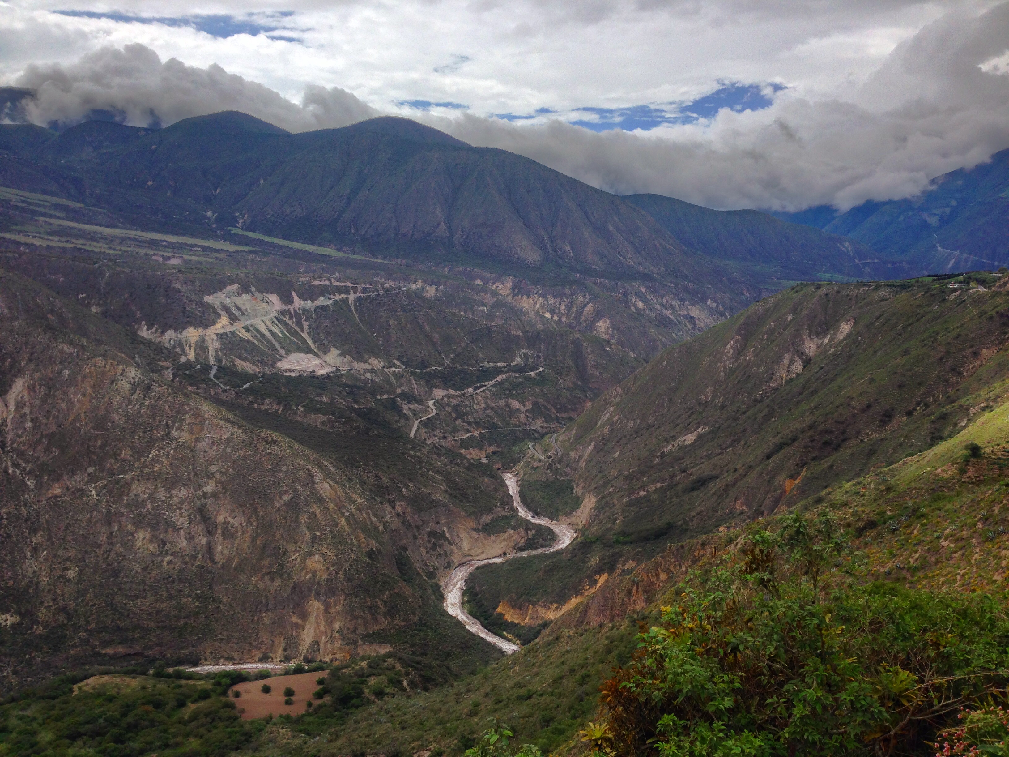
Guayllabamba River between the small towns of Tantagua and Puéllaro. This is a 3,000′ drop, so be prepared to climb up the other side.
This route is fairly lengthy, and involves radical changes in vegetation and climate. In Cayambe, you’ll be in the humid, high mountain zone, and by the time you descend to the bottom of the Guayllabamba river canyon, you’ll be deep into the desert. There does not seem to be any accommodation along the way (we definitely looked in Tanlagua, but there is nothing). There may be the possibility of wild-camping at this location: 00.05653° N 78.44891° W. We didn’t see any other suitable camping area due to the steep mountain side that the road descends and ascends.
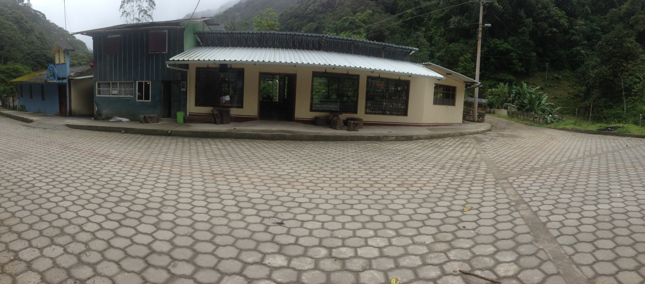
The city of San Antonio de Pichincha is very rough on the edges. As you enter from Tanlagua, you may feel like you’ve entered a city that has been devastated by a nuclear bomb. Once you pedal further into the center, though, you start to see signs of vibrance. There are a number of hotels along the main strip leading up to the other Mitad del Mundo. We actually stayed at two of these hotels due to taking a rest day, and the 2nd one (Inty-Raymi) was much better than the first.
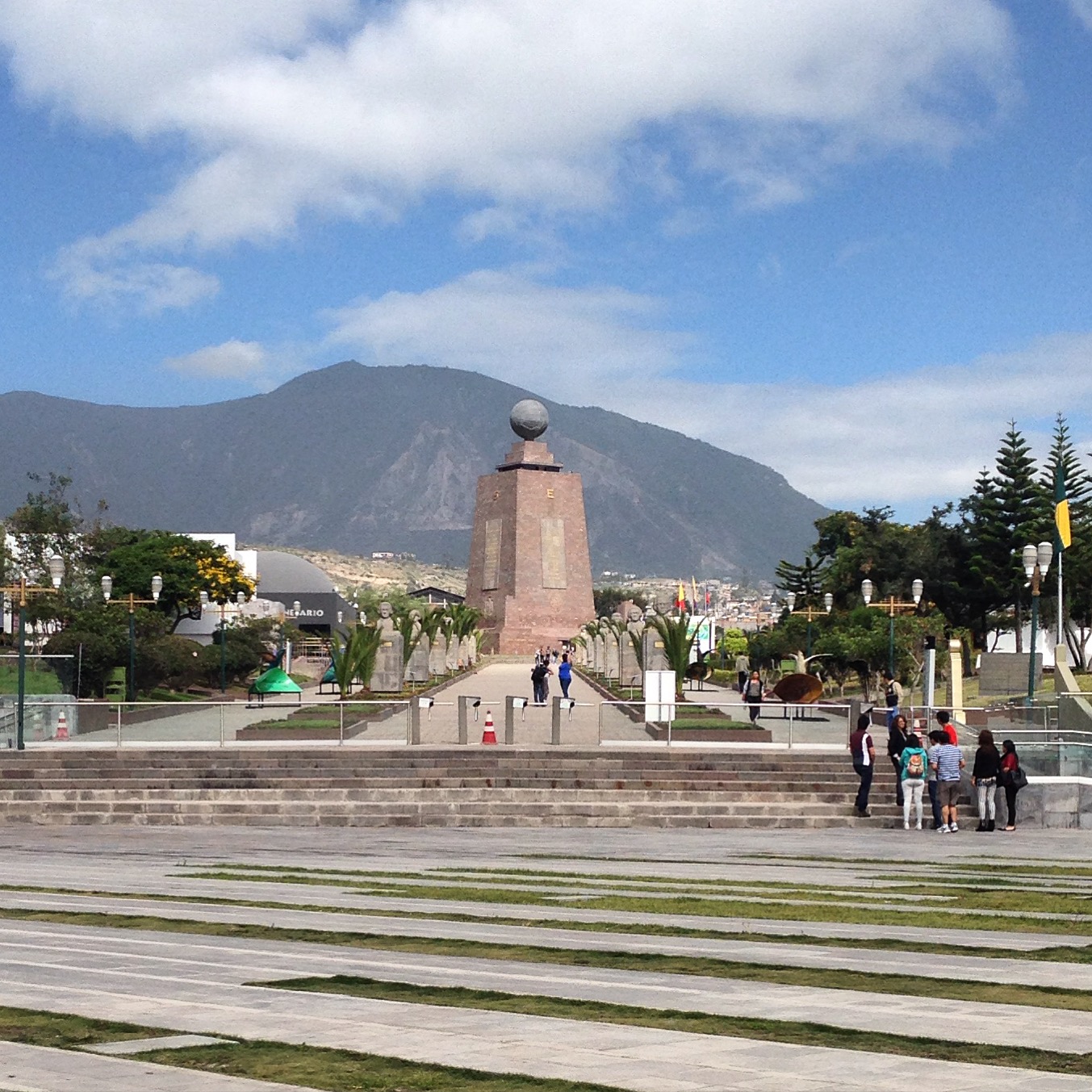
The center of the world – or Mitad del Mundo. The monument is not in the correct place, but off by a few hundred feet. Once inside, I hear that they perform some “magic tricks,” such as a strength test, balancing an egg on a nail, and flushing a drain so you can see the Coriolis effect in action. The funny thing is that the signs on the outside of the park clearly state that the Coriolis effect is a myth – at least to the degree that it would affect water flushing down a drain!
From San Antonio de Pichincha, you may consider a trek to the hill top ruins of Catequilla Located at 00.00103° N 78.42814° W. We headed off towards the town of Calicali. The idea we had was to get lodging there, leave the heavy gear, and then ride the entire Pululahua circuit. Pululahua is a deep and beautiful volcanic crater; people actually live at the bottom. Unfortunately, there is no lodging at Calicali (we asked many people). This meant that we would need to ride fully loaded into the crater. That wouldn’t be a problem, though, as there is camping allowed at a designated location within the crater. Before we did all this, though, we rode up to the scenic mirador overlooking the crater. It is located at 00.02572° N 78.48346° W. If you decide that you don’t want to expend the effort of riding into the crater, at least ride the short steep road up to the mirador for a beautiful vista. Entrance is free. However tempting, you’re not allowed to ride your bicycle down the trail to the bottom of the crater directly from the mirador. We saw several ancient residents walking up this lengthy trail with heavy loads on their backs. There is another route into the crater for bikes (the one detailed on our route map).
Cycling the Pululahua Crater
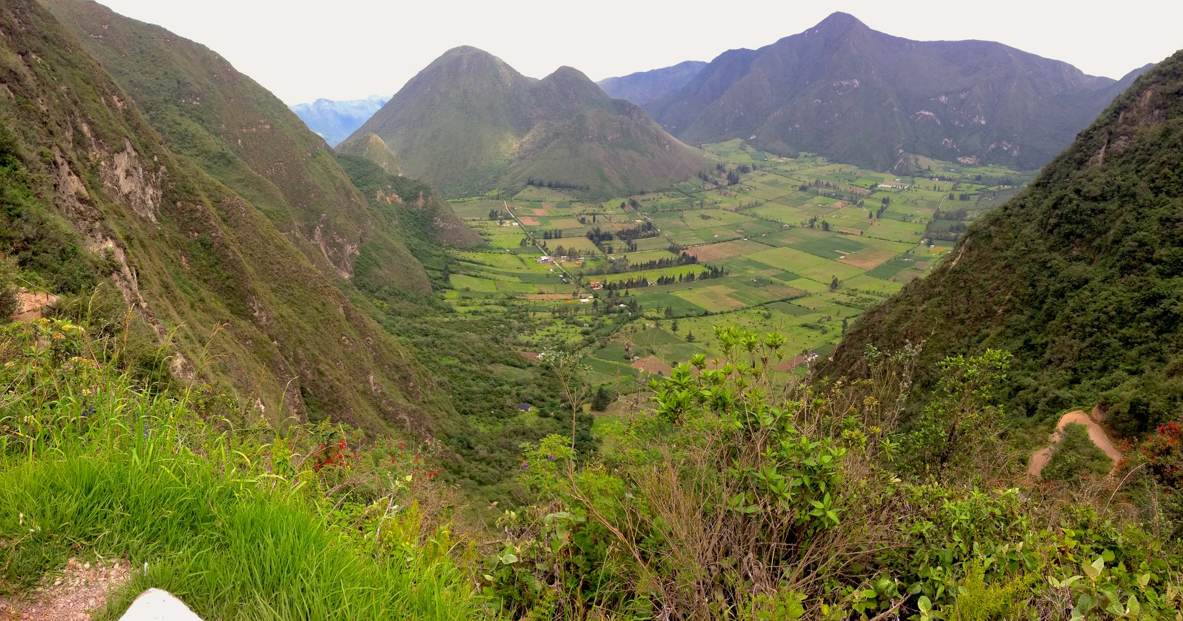
The Pululahua crater as seen from the mirador. Every day, the upper level becomes covered in clouds so you can’t see it from the mirador after noon.
Beautiful scenery on the West side of Pululahua Crater
Riding through the Pululahua crater was an adventure for us – there was very little information about the region. When we entered, I saw something about “hipotermales.” Being used to termales (hot springs), I decided that this was a definite destination. Of course, “hipotermales” means cold springs – but I was optimistic. Unfortunately, we didn’t know exactly where they were. We managed to get fairly close using Open Street Map – but we found ourselves deep in a jungle on a steep track trail. There was no evidence of anyone having been in this region recently – when suddenly we met two men lying in the bush with machetes. They told us to turn around to get to the hipotermales. When I asked if they were nice, the guy said, “well, I don’t like them much myself.” We managed to reach them, and sure enough, it’s a bubbling, cold mud hole! Here is the location if you decide to visit: 00.05801° N 78.50799° W – at least it is an adventure!
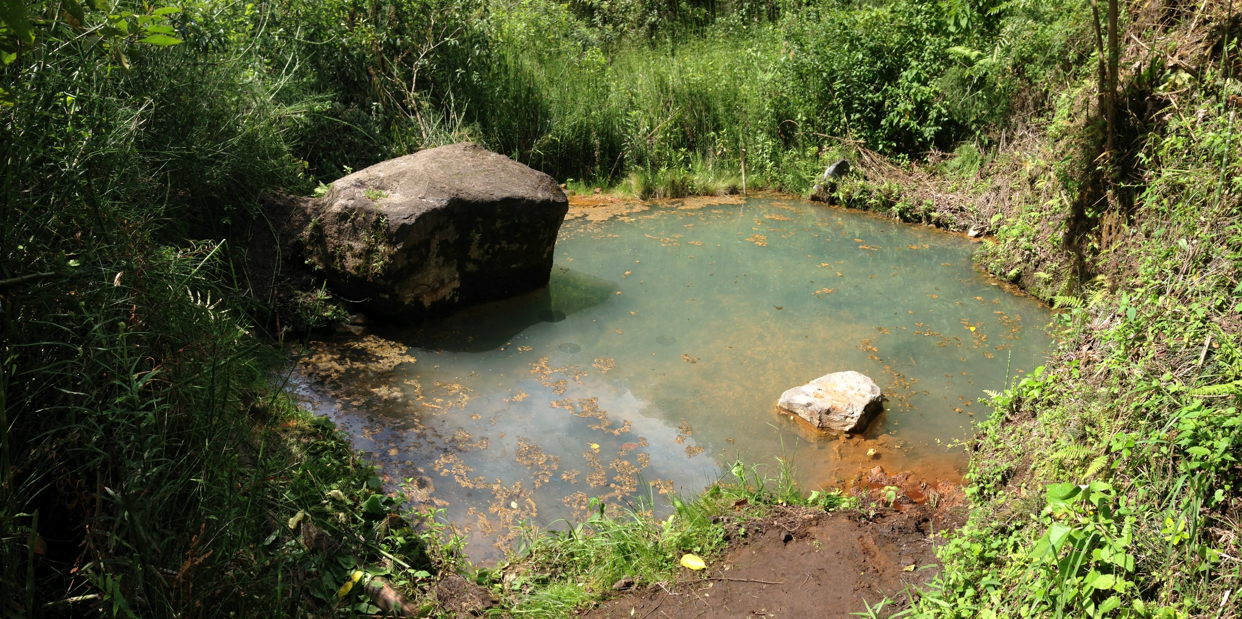
These are the hipotermales that we sought to find for several hours!
Pululahua from the West Side.
While you’re in the canyon, you can legally camp near here: 00.03866° N 78.49587° W I believe that camping is $5, but we did not choose to camp here because it was too early. You could also stay at a resort located here: 00.06141° N 78.50120° W This was owned by the man we had met with the machete. He said that he welcomes camping too, and was going to charge us $5 per person. This area looked pretty nice; the coordinates above take you to a locked gate.
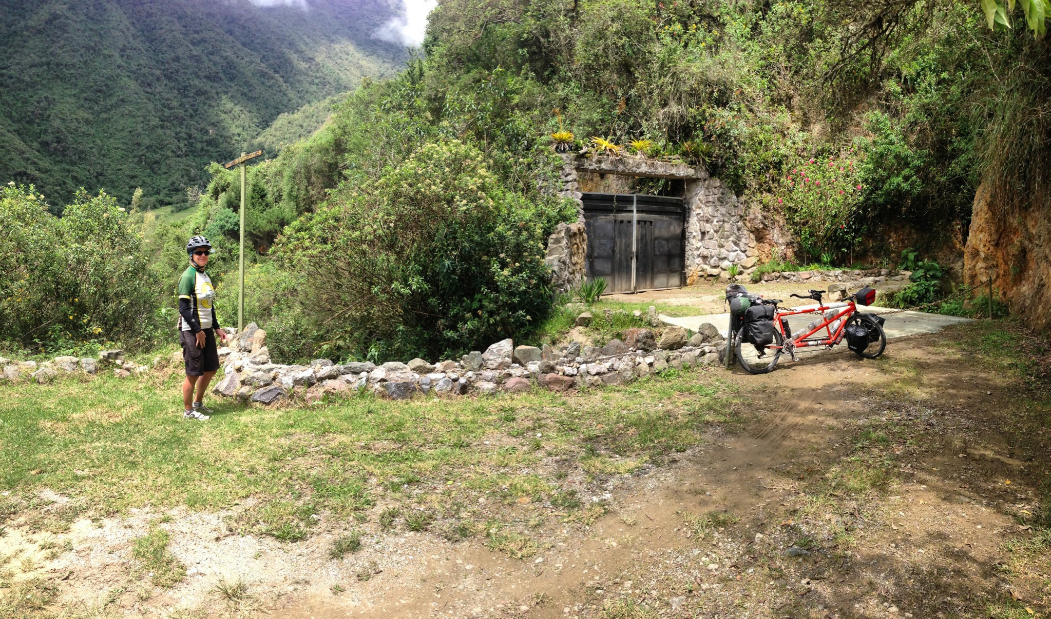
We came to these metal doors at a dead end while exploring. We later found out from the owner that you can lodge here, and also camp for $5 per person.

Janet pointing out some hanging gardens along the Pululahua route
We arrived at this small settlement about half way up and out of the Pululahua crater. For a moment we thought we could camp here, but a barking / chasing dog made us decide to push on.
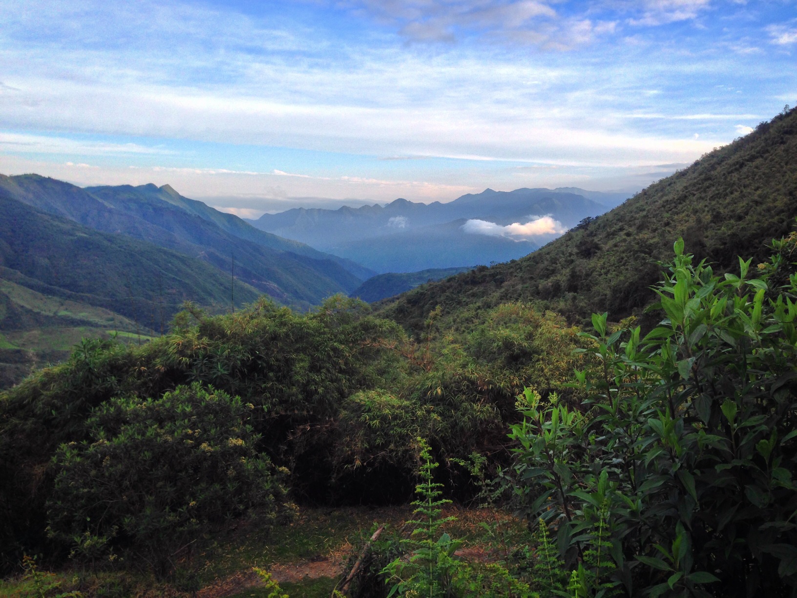
Exiting the park, you will have beautiful mountain views. You will emerge onto the E2B highway just a couple miles West of Calicali. Clearly this is not the most efficient way to Mindo, but we’re really glad we took it. The entire route is dirt up to the intersection with the road from Yunguilla. The road from here to Nanegalito (many services) is well paved, and mostly downhill. Traffic was light, and the riding was enjoyable as we dipped into warmer and moister climes. The route into Mindo has a few climbs, is paved, and doesn’t have much traffic.
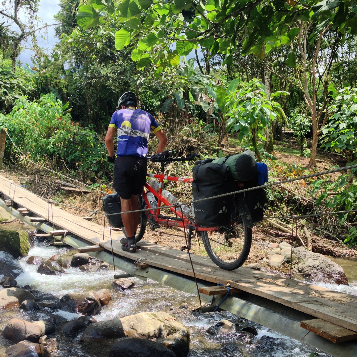
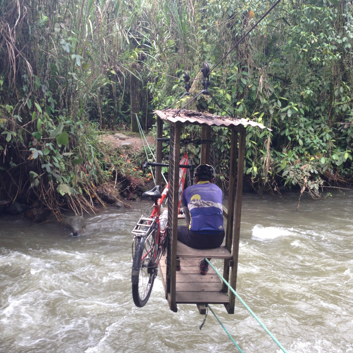
Getting around in Mindo can be tricky – in some areas, the bridges are quite minor
Once in Mindo, you will want to decide what to do. There are a number of activities, the more popular being:
1) Frog concert
2) Butterfly garden (there are two of these)
3) The Tarabita ride
4) The waterfall hikes
5) The lek (a viewing platform for bird watching – good chance to see the “cock of the rock”)
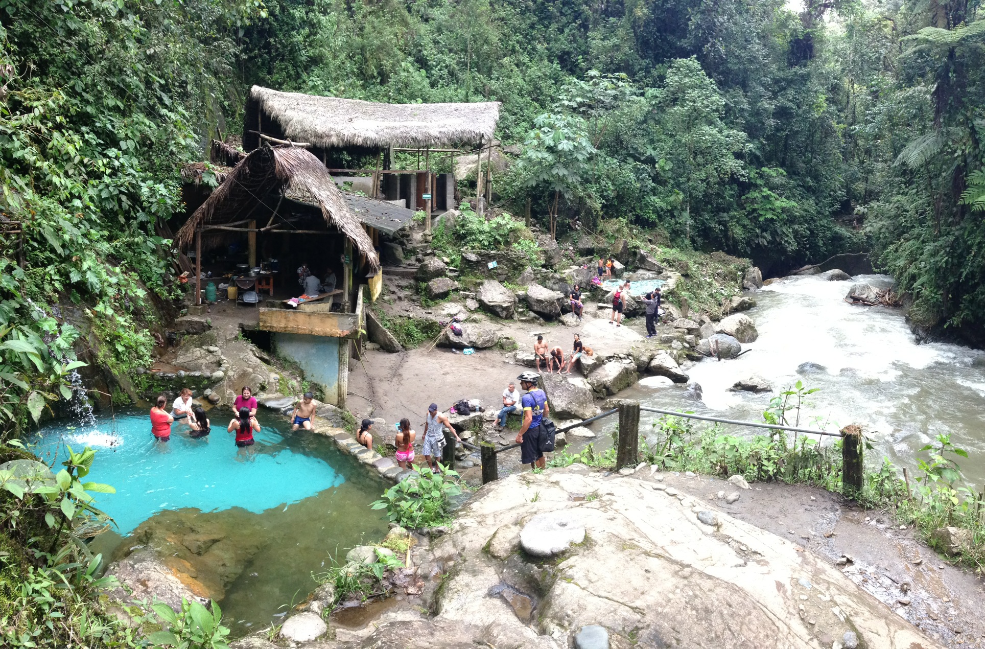
Unfortunately, the Frog concert was not happening the day we would have gone (which is just as well because it was raining heavily that night). We did visit the Butterfly garden (the main one located at 00.06841° S 78.76174° W). This was a beautiful place to relax, but probably not really worth the $6 per person entry (it is pretty small).
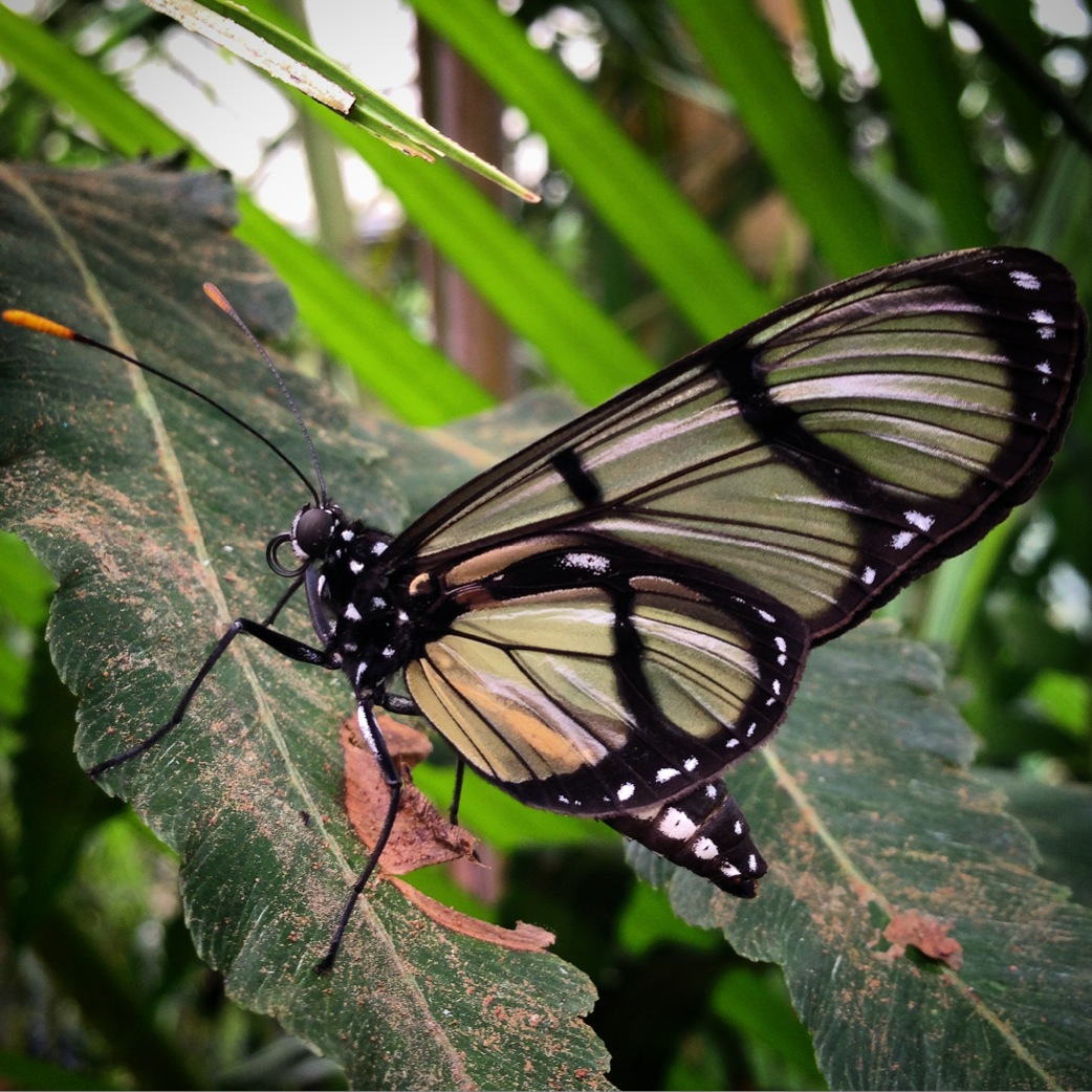
The Mariposa (butterfly) garden has quite a few different colorful butterflies. One of the best parts is the incubation area where you can see cocoons at every possible stage.
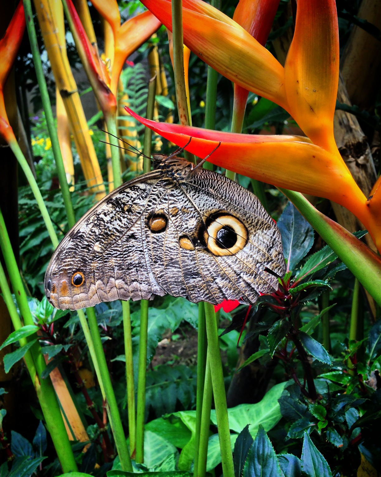
This is the “owl butterfly”

There is a big, powered Tarabita located at 00.07599° S 78.76459° W that will take you to a network of trails. This tarabita costs $5 per person, and gives you access to the trails on that side of the mirador cascada (the main falls that people go to see). It turns out that we discovered a secret entrance that allows you to still ride a (hand powered) tarabita, hike some steep trails, and get to see some waterfalls – for free. Follow our route from 00.07384° S 78.75400° W into the park to see the waterfalls.
This is the human powered tarabita that got us access to the cascades at no cost.
Much to our surprise, after hiking steep and narrow trails to get to the main cascade, we came across this little oasis. There are some cables coming down the canyon, so I can only assume that this is how the materials were delivered to this location.
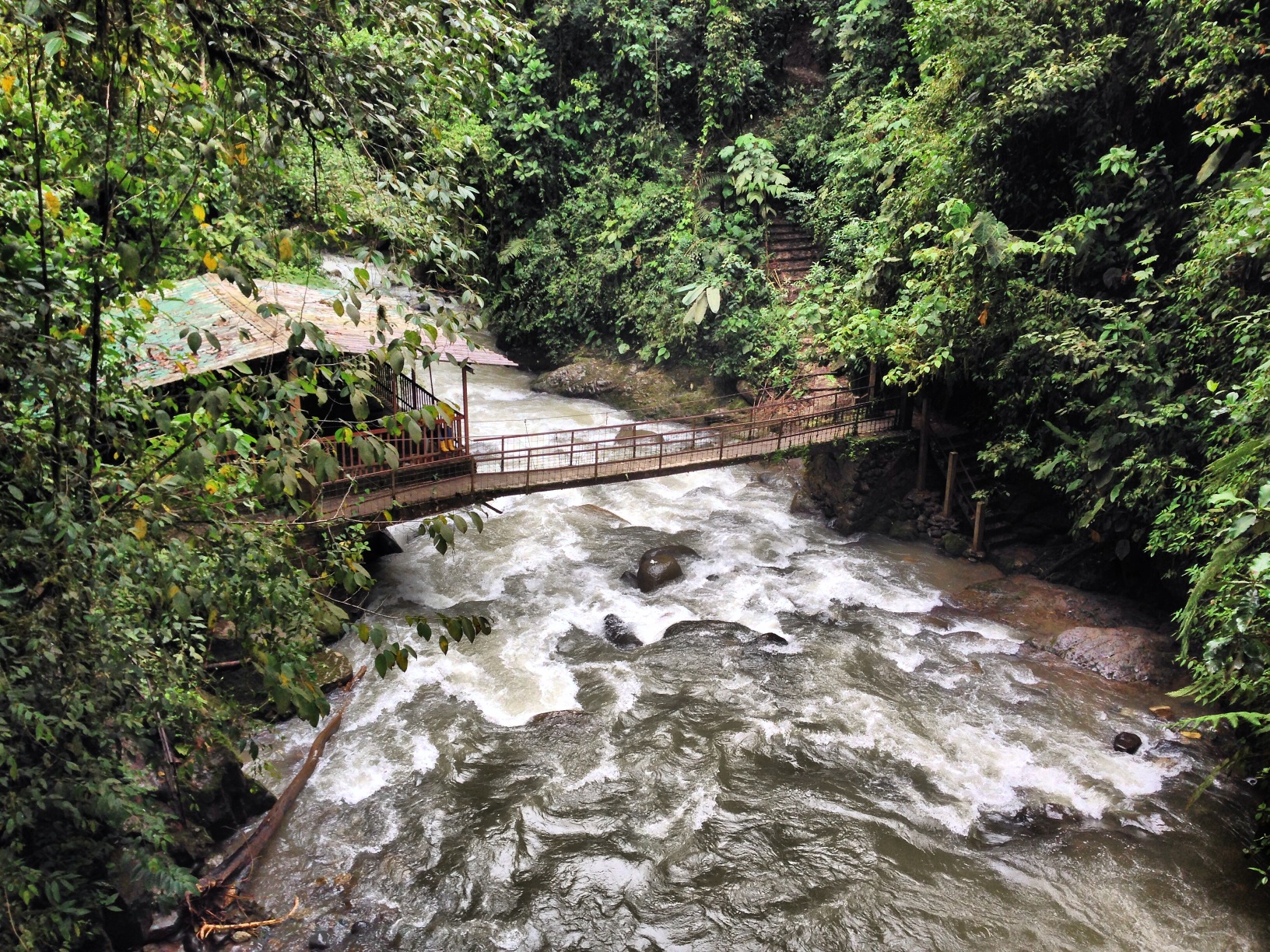
This bridge separates the two properties. If you enter the (free) way that we did, you will not be allowed on the other side. To access the other side, you will need to pay $5 per person for your tarabita ride.
The trail after the tarabita is steep and muddy – you have been warned!
Finally, the lek… We did not visit this, as we are not carrying high powered optics on our bike tour. If you are, you may enjoy visiting this area early in the morning. I believe that entry to Reserva Las Tangaras is $40 including guide, but you can probably negotiate a better price. The Lek is located here: 00.08321° S 78.76661° W
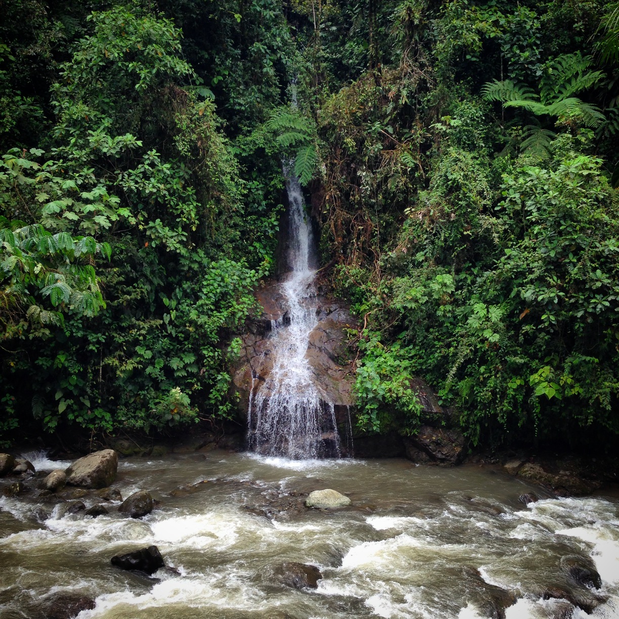
More waterfalls at Mindo.
A cool rope swing that you will encounter if you follow our route into the cascades.
Lodging in Mindo was relatively expensive in mid February – but our friends went there in mid March, and were offered heavily discounted rates. From talking with them, it appears that the difference was related to rainfall. When we were there in February, we usually had a few dry hours in the morning before heavy downpours. By mid March, though, it sounds like it was raining all the time.
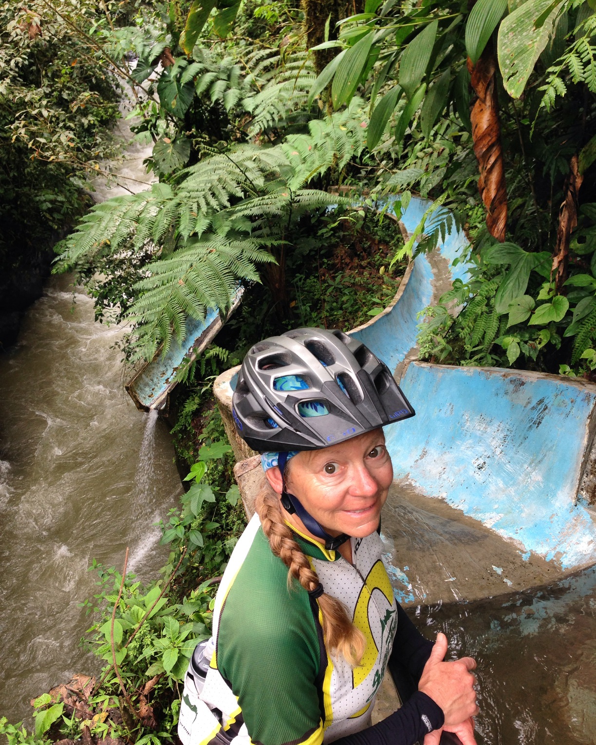
We were quite surprised to find infrastructure deep in the jungle along a narrow trail. We heard that this slide is quite dangerous, so we avoided it. Apparently, there is a special technique that sometimes keeps you from hitting your head. Ask how to ride the slide before you try!
Riding from Mindo to Quito via Nono
Besides the highway, there are three ways to get to Quito from Mindo. One way takes you through Santo Domingo. It’s long in distance, but presumably paved. There have been at least a few reports of cyclists being robbed in that region (at least one was terrifyingly violent), so that route was easily eliminated. For the true adventurer, there is a trail along the Rio Ginto that starts here: 00.11293° S 78.78420° W, and takes you towards Lloa near Quito. Various reports online are all in agreement indicating that it is possible to get an unloaded bicycle through this trail. It involves river crossings, mud bogs, cow manure, and lowering your bike from an enormous boulder. We were certain that this would be too much for a loaded tandem, so we decided to explore a final route: the dirt road that goes to Nono.
This is the type of scenery you will see along the route from Mindo to Nono.
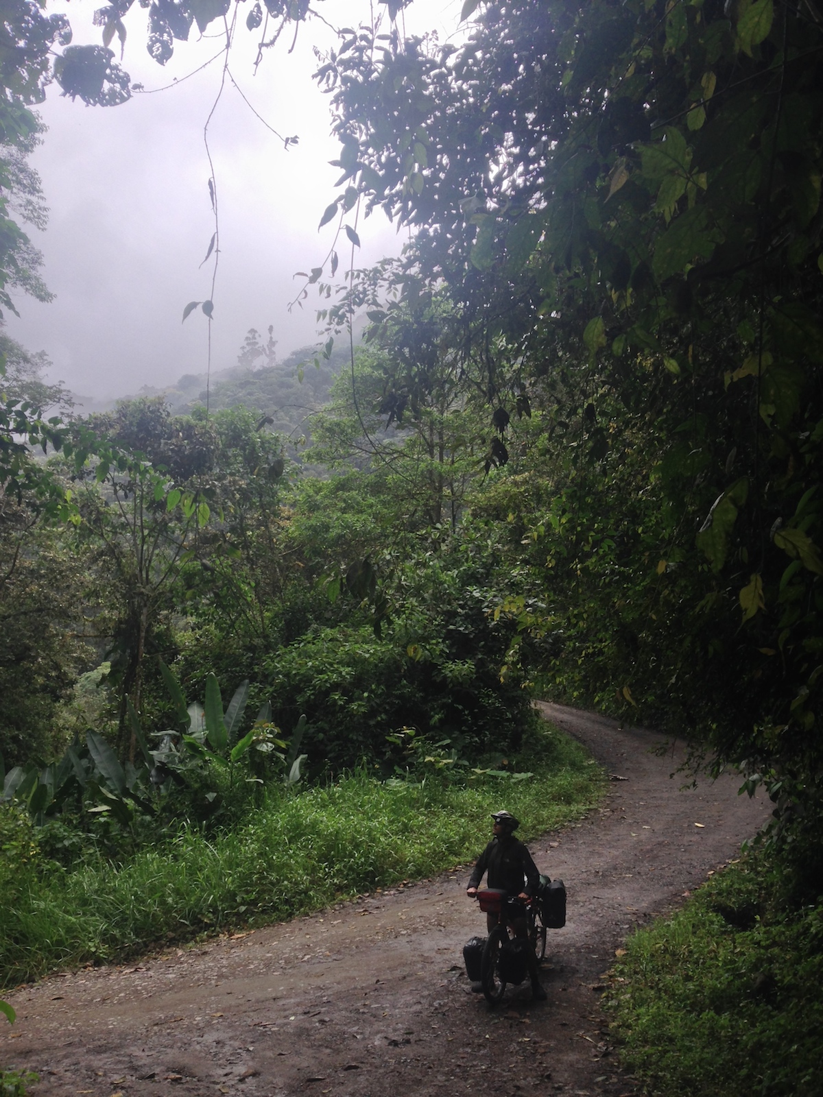
The route from Mindo to Nono is an extraordinary dirt climb that passes through several layers of cloud forest. The entire route is isolated, and there are very few services along the way. The only place to buy food is Tandayapa, and the store there may not be open. We passed Tandayapa twice because we accidentally made a wrong turn heading towards the highway. The first time we passed, the store was open, but the second time, it was closed – and our knocks on the door were not answered.
This is the store in Tandayapa. If you want to keep going to Nono, make sure to turn right here – continuing up into the mountains. Don’t continue straight and downhill like we did!
Because this is such a long stretch to Quito, most cyclists probably can’t achieve it in one day. So, I’ve tried to catalog places for lodging. It seems that there are two options for overnight stays:
1) Expensive birding lodges at over $200 per night.
2) Wild Camping.
I doubt that the birding lodges would appeal to any cycle tourist reading this blog, but I’ve cataloged the locations of EVERY thing you pass along the route (which is easy because there isn’t much). The reward for taking this challenging route is that you will have very little (or no) traffic, and beautiful, lush jungle scenery that gives way to cloud forest, and eventually to pasture lands up near Nono.
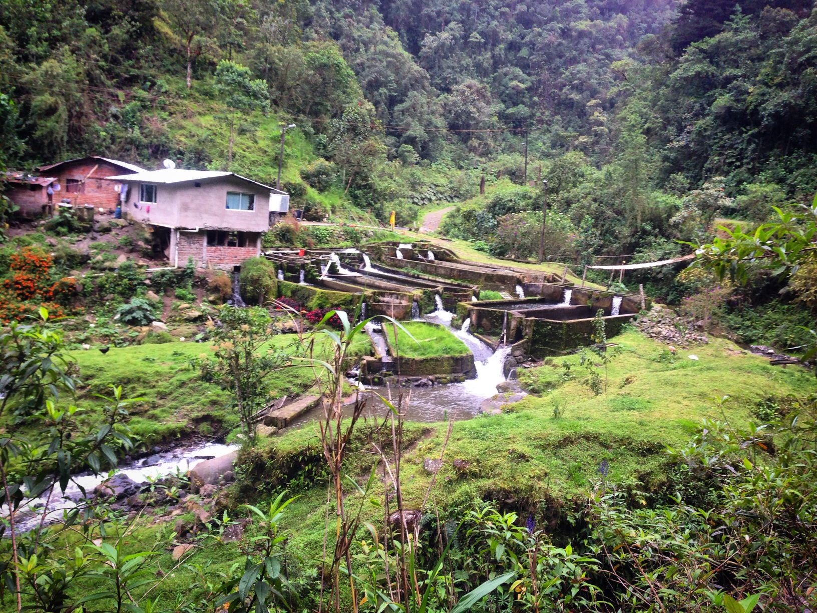
A Trout Farm located at Latitude: 0° 6′ 8.58″ S
Longitude: 78° 32′ 22.02″ W. We briefly considered asking to camp here, as it was well located, and they appeared to have some flat land. We continued on to Latitude: 0° 4′ 15.19″ S
Longitude: 78° 35′ 35.958″ W – where we found a quiet camp site.
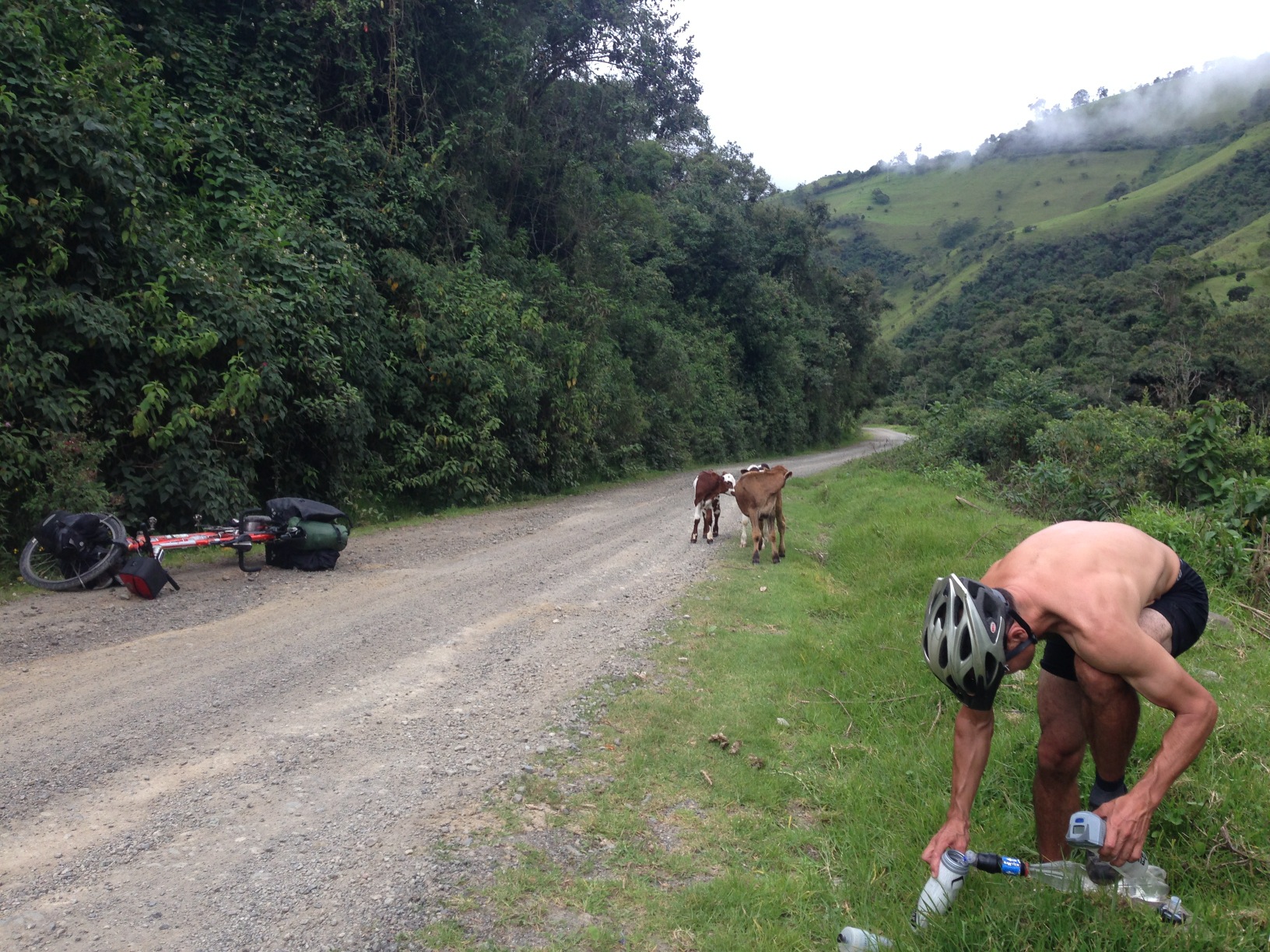
Due to the length of the ride, we ended up having to filter and UV treat water found along the route. After Tandayapa, water is generally available for several miles.

This is one of the bird lodges. Location: Latitude: 0° 0′ 58.46″ S
Longitude: 78° 40′ 52.29″ W
Quito is a somewhat unattractive, and disorganized city – but they cater to cyclists every Sunday. The ciclovia will allow you to ride the city all the way from North to South from 9am to 2pm without having to deal with any of the dangerous traffic. Any other time, riding within the city is not a pleasure, as there aren’t any bike lanes, and the streets are narrow and disorganized.
There are a few good routes within Quito – and we did all of them:
1) Ride up to the Virgin (note: we heard many reports that this neighborhood is very unsafe, but that seems to apply more to people walking the steps as opposed to cyclists on the road.
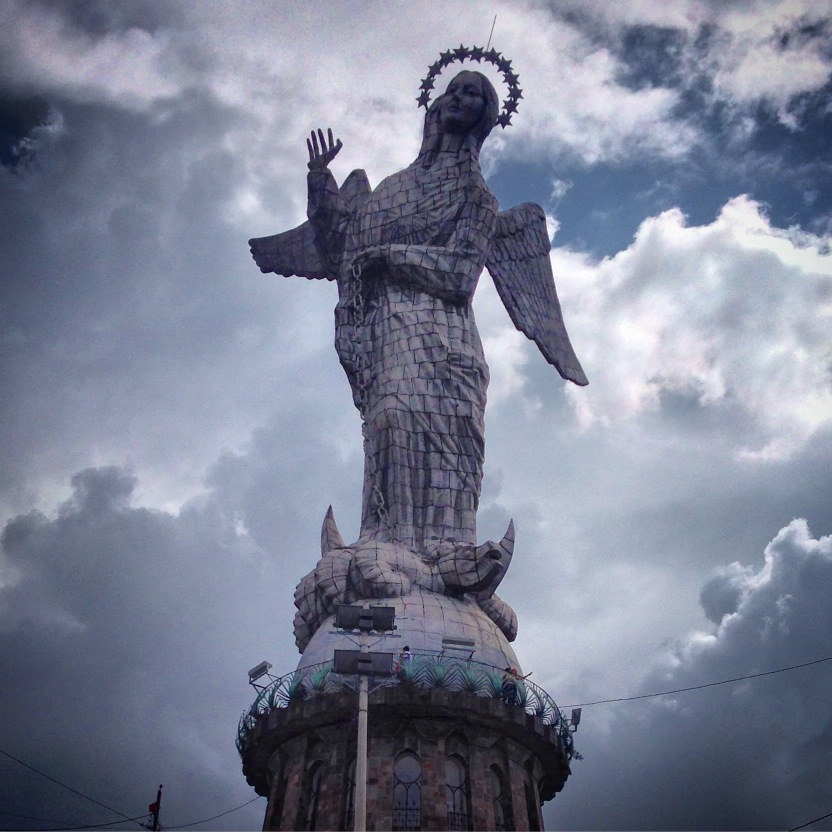
This statue of Mary is the only one you will see with wings. We rode up on the roads, but some people walk up the steps. We were highly advised against walking up due to the risk of robbery.
2) Ride up to antenna mountain.
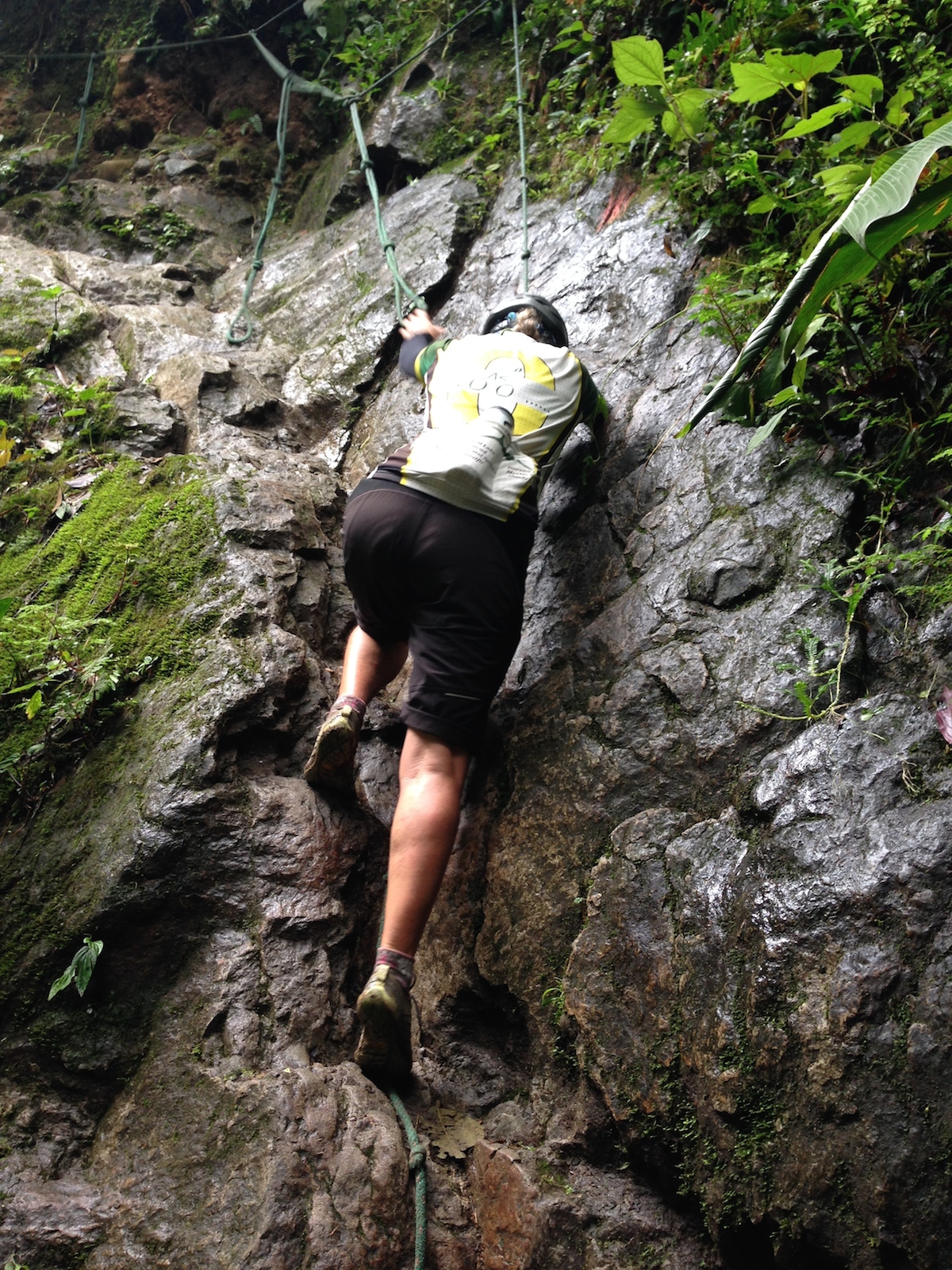
3) Ride the trails below the teleferico. This is for very advanced full suspension mountain bikers. We ended up walking up the trail, and eventually summiting Rucu Pichincha (this is not rideable)

A church found on the way to Ruku Pichincha
Ruku Pichincha, which I climbed.
4) Quito Metropolitan Park Guanguiltagua has a myriad of trails that aren’t too steep, and perfect for beginner mountain bikers.
As a final suggestion for Quito, you may wish to check out the free-walking tour:
We did a “free” walking tour of Quito. Our guide was decent, and took us through the most historic portion of Quito. Remember: free walking tours are supported by tips, so be prepared to give.
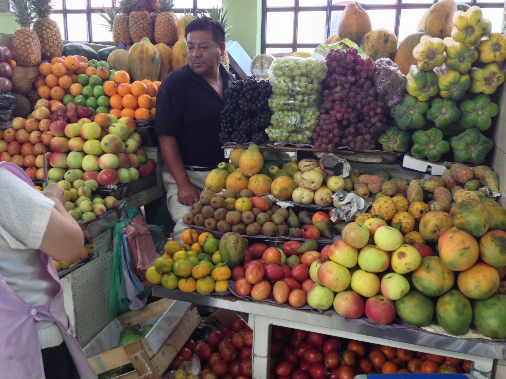
Fruit vending at the markets in Quito. There are a number of exotic fruits which we tried during our 2 week stay in the city. My only advice: be careful with babaco. This fruit has an enzyme called papain, which basically digests proteins. Apparently, papayas have this enzyme as well – but it must be a lot more potent in babaco because it dissolved my lips, causing them to be painful for several days.
This is the map for the entire route discussed in this post. To Export GPX files, click on the three horizontal bars in the upper right hand corner of the map and select Export selected map data…
To see this map in a full screen, click here (opens in new window)


Thanks for the details. And the warning about Babaco. I am glad it was the fruit that got you and not the two guys with machetes in the jungle.