Bike touring Costa Rica
Costa Rica is a destination that is familiar to many North Americans. If they haven’t been there, they likely know someone who has been. Prior to arrival, we thought that Costa Rica would be an oasis of safety, modern touristic resorts, and higher prices. In the end, we discovered that Costa Rica has it’s bad neighborhoods too, the touristic sites are not all high-rise modern hotels, and the prices are indeed higher.
03/11/2014 Day 48 – Costa Rica border to rinconada Vieja national park 62 miles
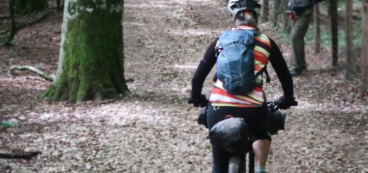
We had made up our minds to really explore Costa Rica thoroughly. After having traversed the country twice on bike (and having seen patches of the Pan American highway), I am certain that avoiding the Pan Am as much as possible is the best thing to do for a cycle tourist. Our first destination was Rionconada Vieja National Park. Rinconada Vieja should be geographically similar to the very popular Monteverde Park. One disadvantage of Monteverde was the long dirt road to access any entrance. Also, we had heard that because of the number of visitors, you’re less likely to see wildlife: the primary purpose for a visit to the region. As such, we opted to visit Rinconada Vieja, which had a long… dirt… road… for access. In fact, the road was difficult enough that we did not make it in one shot as we had planned. We were partly delayed because we had run into fellow touring cyclists during our brief time on the Pan Am. If you are ever getting lonely on a bike tour, there are certain routes that are ridden by the majority. If you spend a little time on these through-ways, you’re likely to see a lot of people. During our brief spells on the Pan Am, we reliably met other cycle tourists. Whenever we deviated, we met no one. The delays occurred because we wanted to help a tourist we met named Michael find a bike shop. We had also met another traveler from Taiwan named Hiram. We all rode together very briefly this one day.
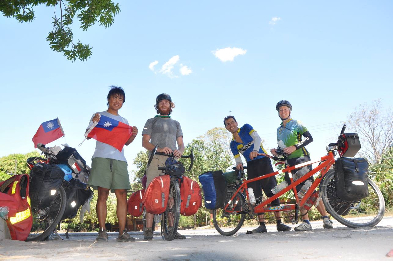
Us with Hyram and Michael. We all ran into each other on the Pan American Highway in Costa Rica.
You will be faced with a decision when you are heading towards Rinconada Vieja: do you go to the lower entrance or the upper entrance? I cannot speak for the lower, more popular entrance: we went to the upper entrance. From what I hear, there is more to see within a shorter distance of the parking at the lower entrance. Furthermore, there is no camping at the lower entrance. We aimed for the upper entrance, but did not make it. We ended up finding accommodations pretty easily, though, at a development on the map named “Tanques” (where our GPS track ends). The friendly young couple who ran the place had cabins available for rent. The cabins were very nice and clean, but they easily allowed us to camp on the lawn for a lower price. The only disadvantage of this location was the tiny bugs that devoured our legs – we would be scratching for the next week.
03/12/2014 Day 49 – (part 1 of 2) enter rinconada Vieja national park 5 miles
When we entered the park at the upper entrance, there was no one there except a ranger. Presently, another car arrived. We all talked to the ranger together. He has a “spiel,” and you could tell he was repeating often said words. He was basically encouraging the people who had arrived in the car to go to the lower entrance. He seemed convinced that they would find more of what they were looking for down there. They followed suit and eventually left – partly because they didn’t have the $20 per person to enter the park (they had a $100 bill, but the man would not accept bills that large, and we did not have enough change). With us remaining, oddly, he changed stories, and encouraged us to camp, which we did. The camping is in the trees, and comfortable enough, but we were exposed to the biting bugs for a second night.
03/12/2014 Day 49 – (part 2 of 2) hike to hot springs. 3 miles
One of the main attractions of this part of the park is the hot springs. We walked to these, and found that it was a hot spring on a river. The cold river water merges with the warm hot spring water, and you have the opportunity to choose your temperature.
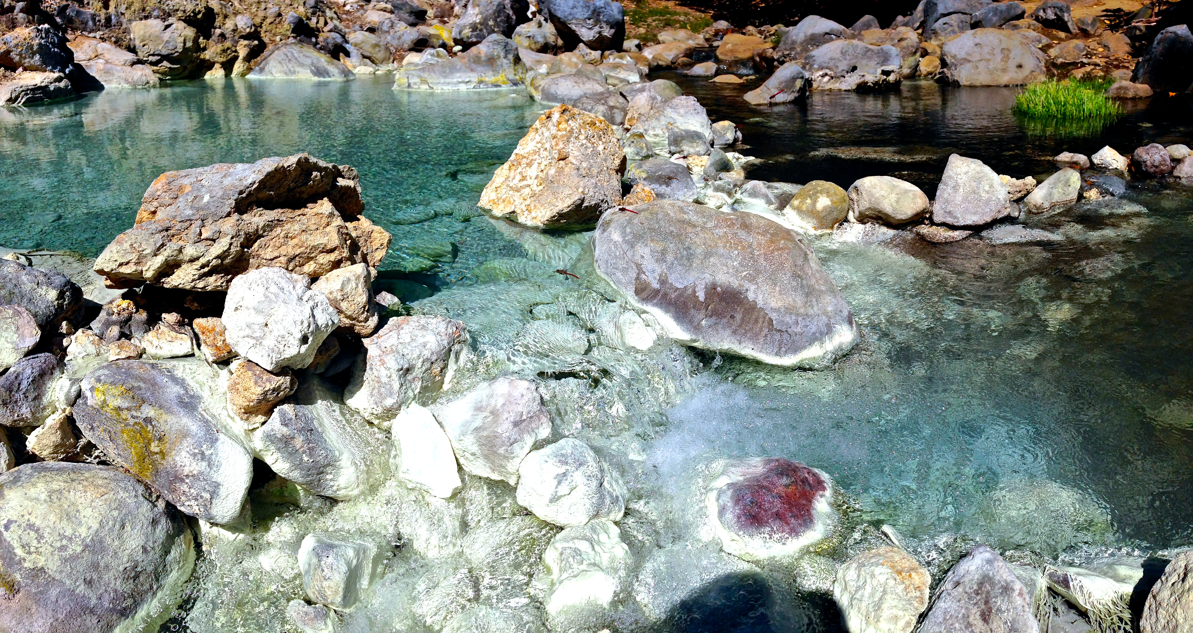
Hot springs in Rinconada de la Vieja Costa Rica. You can see the color change where the hot and cold water come together.
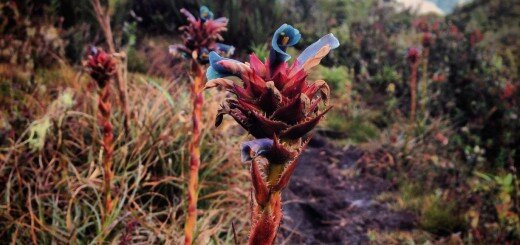
Hiking back from the hot springs, I decided to take a slightly different trail. It was on this trail where I hear some howler monkeys above me. Quite a number of monkeys congregated here, and they put on quite a show. I was happy that we had chosen the upper park, as it was tranquil, with no other visitors, and afforded us opportunities to see Coati, Mantled howlers, White headed capuchin, and Iguanas.
03/13/2014 Day 50 – Parque Rincon de la Vieja to Cabanas near Lago Arenal 60 miles
The route from Parque Rincon de la Vieja to Arenal is still challenging with a rocky, dirt road. As you leave, you must ride a dirt road. You can see from our GPS track that we did try to ride a “jungle trail” for a shortcut – but we turned back as the main dirt road proved easier. Once you get to the intersection with 918 – heading for Pueblo Nuevo – you’ll want to turn left and ride the better quality dirt road. It’s a little longer, but should be easier than the rocky road that we took. After that, it’s pavement, and Pan Am from Bagaces to Cañas. From Cañas, you’ll be relieved to exit the busy road (which was also under construction during our journey), and head back up into the hills. The scenery immediately improves as you enter a pastoral area with rolling green grassy hills being grazed upon by cattle. We rode to Tilaran and looked for suitable accommodation, which could definitely be found here. We were seeking something else and by chance arrived at an amazing set of cabañas named Arecabañas operated by a Swiss couple (Peter and Erika) overlooking Lake Arenal. For the location of this hidden gem, see the termination point of our GPS track, linked to above.
03/14/2014 Day 51 – Swiss owned cabanas to “Pura Vida” 37 miles
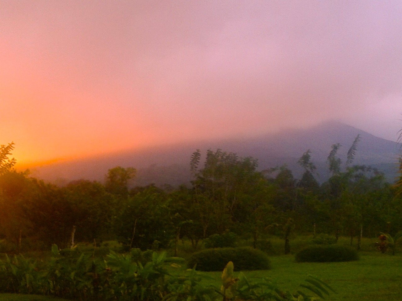
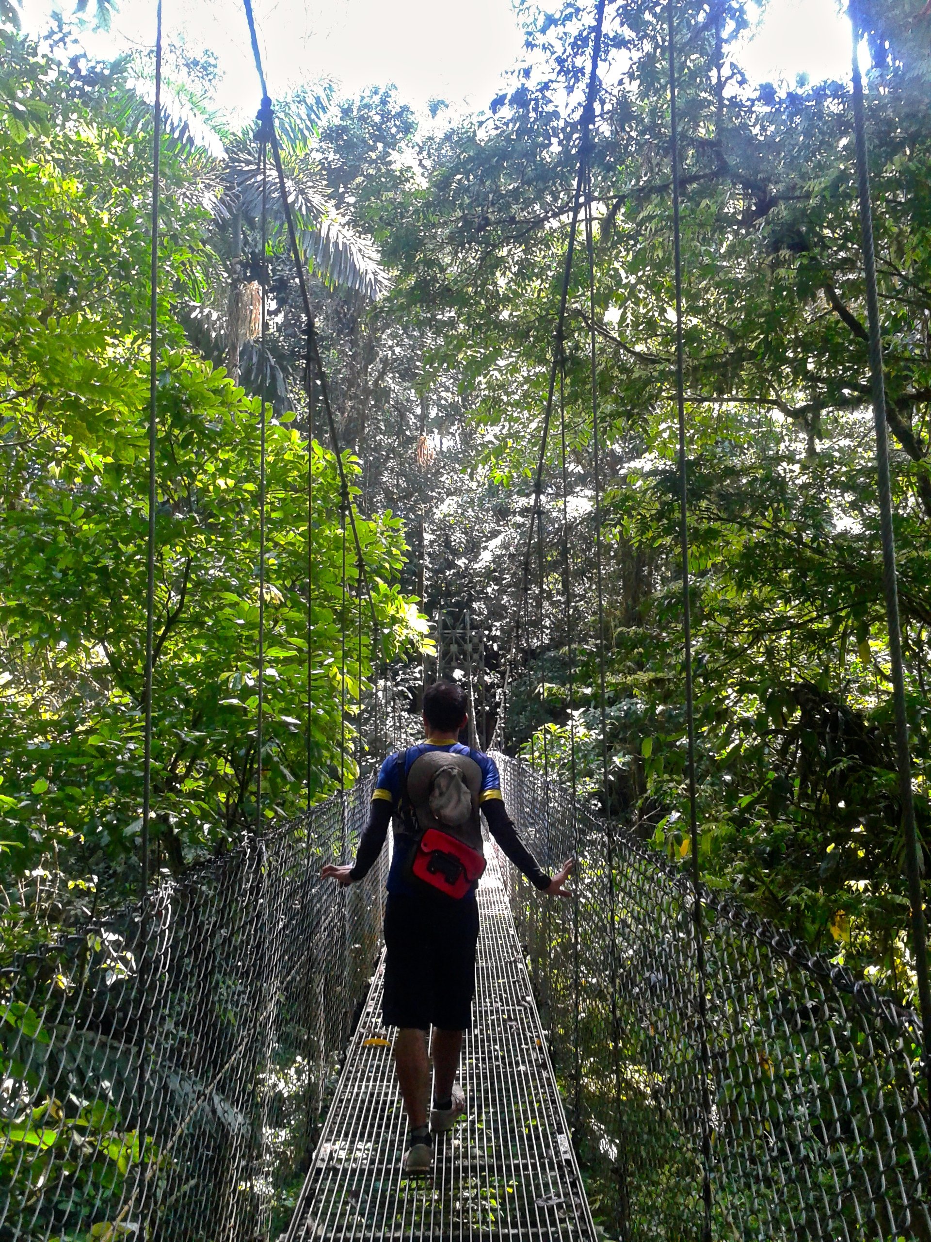
The ride around Lake Arenal is challenging with many small climbs that add up to tire you out. One of the great things to see when you’re in Arenal is a park named “Hanging Bridges of Arenal.” This park gives you the opportunity to explore the canopy of the rainforest without having to zip through it on a zip line. You can walk the bridges at your own pace. We headed for this park, but there was a lot to do along the way. One big tourist trap is “Toad Hall” – which is just a bar/restaurant that is heavily advertised all along the way. Along the lake, the scenery does not give up, as you are frequently rewarded with views of Volcan Arenal. Volcan Arenal used to be erupting, but it has not erupted since 2010. Nevertheless, areas on the mountain are restricted due to thermal venting.
03/15/2014 Day 52 – (part 1 of 3) Walk the Butterfly Garden and Mot Mot Jungle Trail 0.5 miles
I’ve written this blog primarily as a guide. In some cases where we had a good or great experience, I recommend that the reader follow our route. In other instances where our experience was mediocre or bad, I suggest that the reader find their own route. Today’s experience was a superb one that I’m not going to recommend the reader follow – mainly for the sake of our generous hosts’ privacy. I’m sure that a one-time experience was novel for them, but repeated visitors like us would probably wear thin quickly. In writing this, I hope to convey the level of generosity and friendliness exhibited by the owners of the Mot Mot Jungle and the Hanging Bridges of Arenal so you can feel good about patronizing their business.
As we were riding late in the evening looking for a campground, a car pulled up behind us and asked where we were going. We told them that we were looking for camping, and they said, “come camp with us!” We followed them to our house and they invited us into their home for a glass of wine and some fun conversation. We were having a great time, and they asked us to spend the night in their home. We felt grateful, as well as a little shy about this invitation and their generosity. They had also offered us entry to the Mot Mot Jungle as well as the hanging bridges. The only caveat was: “We’re leaving on vacation, so you will have to lock the house yourself.” Wow! These people were going to let two strangers stay in their home unattended!? “Pura Vida,” they said.
Where we camped by the Mot Mot Jungle with special permission.
03/15/2014 Day 52 – (part 2 of 3) – Walk The Hanging Bridges 1.5 miles
We consider the Hanging Bridges of Arenal a “must see.” The walk is 1.5 miles long, and the terrain is fairly easy. They have a restaurant and visitor center at the entrance.
Hiking along the hanging bridges of Arenal
View on the hanging bridges of Arenal
03/15/2014 Day 52 – (part 3 of 3) Hanging Bridges to Rio Fortuna 16 miles
The route to Rio Fortuna involves a fast descent, followed by a steep ascent. Many people can be seen walking up to the Rio Fortuna waterfall site. The road is fairly busy with tourists, and the resorts look large and wealthy. The scene through this region seems a little out of place given the other places we have been. We ended up finding a nice camp spot along the road where we could wait for the Rio Fortuna park to open in the morning.
In the morning, I did visit the waterfalls. The cost to enter is $10 per person. In many places, you can go see waterfalls for free – but in Latin America, it seems that the custom is that waterfalls are worth paying money to visit. If you are a waterfall-phile, here is your guide to Costa Rica Waterfalls.
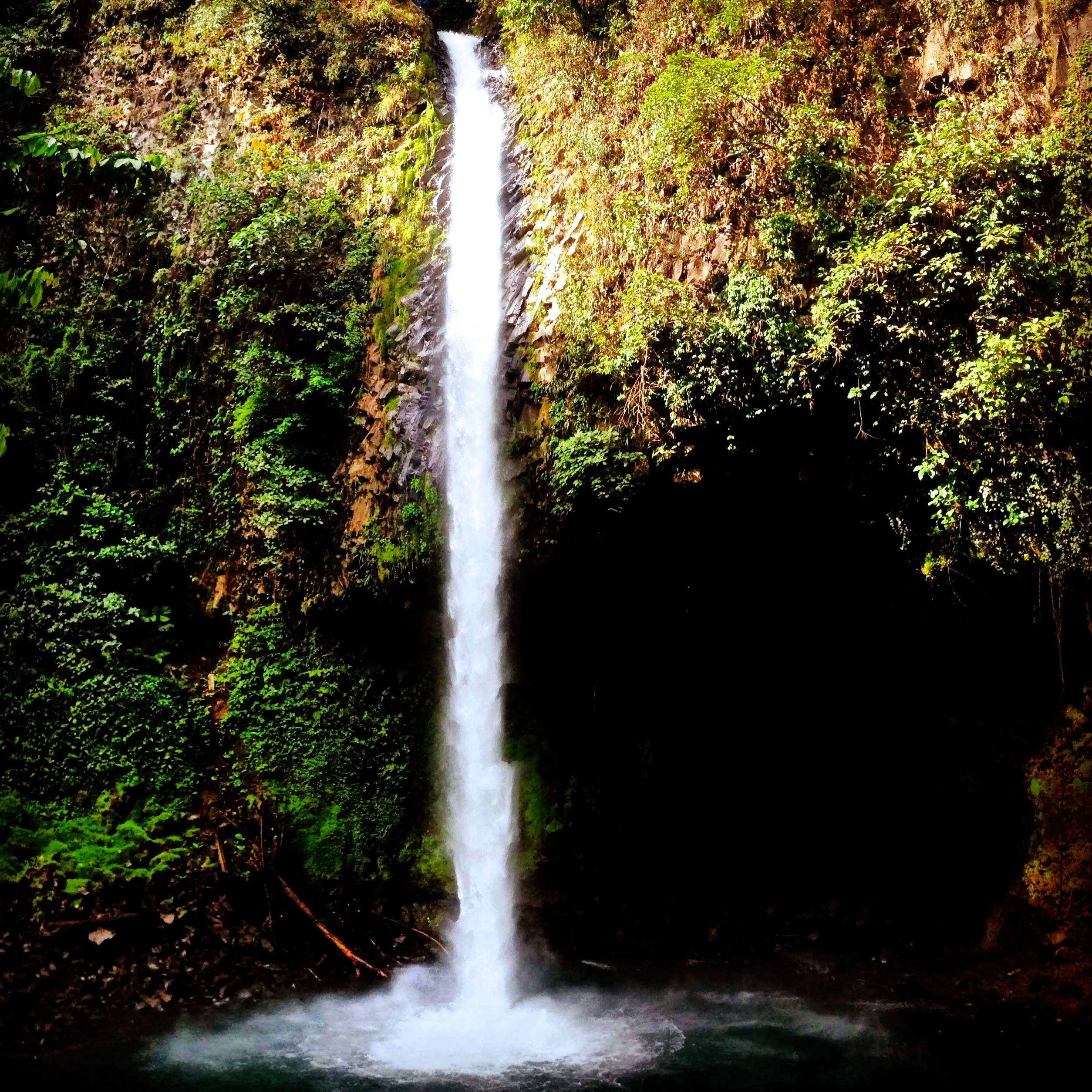
La Fortuna Waterfall.
03/16/2014 Day 53 – Fortuna Waterfall to Zarcero 50 miles
We “discovered” Zarcero from a couple we met near La Fortuna. They told us of where they had been, and what they recommended – so we decided to cross the backbone of Costa Rica again and head to the mountains. Zarcero is set at over a mile high, and they have a wonderfully sublime climate. The route from La Fortuna takes you on some great cycling roads. Suddenly, you won’t be the only cyclist riding – we were passed by many lycra clad serious cyclists along this route. It is understandable that there would be many riders here: this route is good. It is gently rolling, and you eventually start climbing through grass lands dotted with grazing cows. The road is narrow, and the Costa Rican drivers are definitely in a hurry. We benefitted from someone’s misfortune: An 18 wheeler couldn’t make one of the tight turns, and ended up blocking the road. Cars plugged the road for miles on either side of the truck, waiting for the road to clear. Little did people know that in order for the truck to move ahead or backwards, it would need some clearance. In order to get clearance, however, the cars that had packed in so tightly ahead of and behind the truck would need to make an organized move to make the necessary space. So, due to a simple lack of communication, we were able to squeeze by on our bicycle, and enjoy a car-free road for the next couple hours.
Scenic Zarcero
Zarcero has 3 hotels, however one is closed, and one was full, and a third only had a room so small, it could barely fit one person, let alone two and a bike. We sought camping by talking to the police, and suddenly we had a number of invitations to stay at the homes of a few police. In fact, they were practically arguing about who we would stay with. These friendly and helpful officers also recognized that we wanted a place to stay now (as opposed to waiting for their shift(s) to end), so they had us go back to the hotel with the tiny room, and somehow, magically, a large, fantastic room had opened up. We were elated. It is simply called “Zarcero Hotel”
03/17/2014 Day 54 – Zarcero to Jaco 73 miles
The ride from Zarcero to Jaco takes you through many different regions of Costa Rica. Our route manages to avoid the major roads and for the most part keeps you away from traffic. When there is traffic, it is usually on broad shouldered roads. After a big descent, you end up taking some minor roads that have short, steep climbs on them. You pass through some varied and interesting neighborhoods. At times, the route seems a little circuitous (like when you descend to the river right after a zone called “La Argentina” near the intersection of HWY 1 and 716 – but it is all to keep you off main roads. Through this region, you can sample a number of fruits, which if you haven’t spent much time in the tropics, should seem pretty exotic.
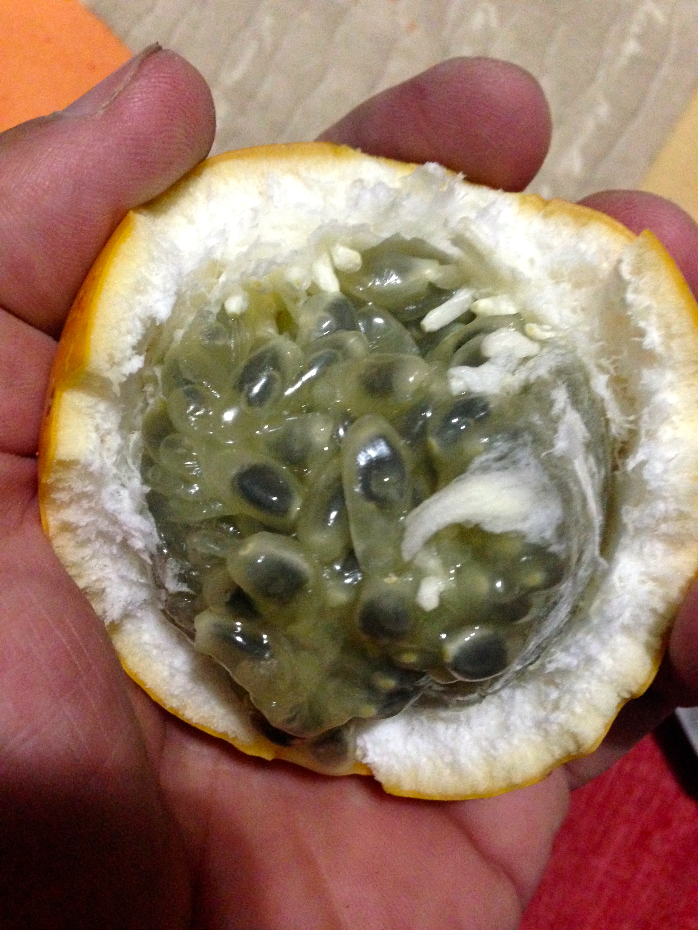
Granadillo, or “sweet passion fruit.” It’s an unexpected treat!
The road flattens out, but maintains beauty as you reach Tarcoles. Before you get to the town, you will ride across Rio Tarcoles, where it is popular to look down and see the Crocodiles safely from the bridge. Tour busses stop here, so be careful with the hordes of people that may emerge onto the bridge at any moment. The coast heading South from here is a mix of dingy and fancy. The riding is pretty good quality, and there is one 1,000′ climb before reaching playa Jaco. There are accommodation all along the way between Tarcoles and Jaco, though they tend to be relatively expensive considering what you get. Jaco is a large, hot, bustling surf town. You should be able to find anything you may need here.
03/18/2014 Day 55 – Jaco to Parque Manuel Antonio 57 miles
The ride to Parque Manuel Antonio is fairly flat and unremarkable until you reach Quepos. Suddenly you are faced with a big climb through an area peppered with restaurants and hotels. This entire distance, you can choose any style and price hotel / restaurant to suit your needs. We wanted convenience for entering into the park, and managed to get a room at the hotel closest to the park entrance. It is hard for me to imagine how this place even had rooms given its prime location; they were not fully booked any day. Perhaps visitors to the area were seeking fancier accommodations? Parque Manuel Antonio feels like a vacation spot. I settled into a relaxed soccer game with some youths on the beach, playing until darkness took the game away.
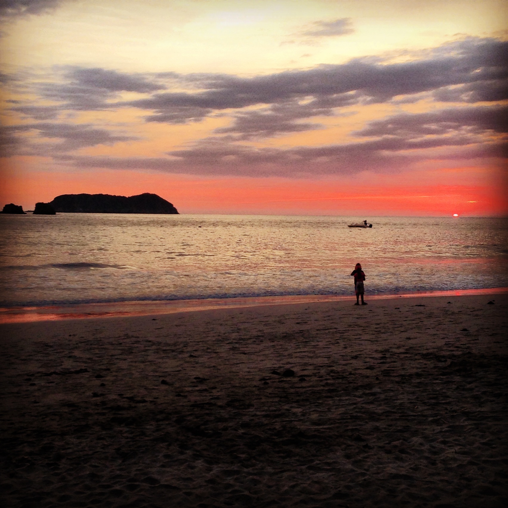
View from the beach at Parque Manuel Antonio
03/19/2014 Day 56 – Hike Miguel Antonio 2 miles
Parque Miguel Antonio is probably best visited with a guide. We did not originally take this view; we figured we could see everything on our own. All around us, guided groups were seeing things. We were taking note of the fact that everyone else was seeing fauna – and we were not. Although we did eventually get the hang of spotting animals to some degree, we did not have the ability to detect the micro fauna… just the macro. This means seeing Hoffmann’s two-toed sloths, mantled howlers, squirrel monkeys, white headed capuchins, Basilisk’s, Iguanas, white nosed Coati, and raccoons. Yup, raccoons. Watch out, because they are very aggressive on the beaches. One of them fought Janet for her food (and lost – but only because Janet can be ferocious).
03/20/2014 Day 57 – Miguel Antonio to Alto de San Juan 48 miles
If you like climbing, you should be prepared for a treat today. After a long, flat, easy, but somewhat boring ride to Dominicana, the route turns skyward and you begin to climb and sluff off the heat and humidity. The grade is easy enough, and there is a restaurant where our GPS track ends. Albert, the owner of La Corranga had basically turned his restaurant into a museum. He was so friendly and welcoming, that this simple restaurant turned into one of my favorite places in the country. The simple environment, the nostalgia, and Alberts wise words comforted us. Even if you just pass by, I highly suggest stopping in for a bite to eat. He plans to add accommodation, but when we were there, all he could offer was a place for us to camp, which we did.
03/21/2014 Day 58 – Alto de San Juan to Villa Mills 33 miles
This is the mother of climbs day. You will find yourself at over 10,000′ by the end of the day. The road is beautiful, with mountain terrain all along the way. There are not a lot of attractions along this route, but just past the terminus of our route, you can find places for viewing birds – including some places that claim to guarantee that you will see a Quetzal. The Quetzal is a beautiful, but elusive bird that is a coveted acquisition for a life list. So far, with several trips to Central America, I have not seen one. Today’s route ends at the Colibri Hotel. This hotel has its own cafeteria style restaurant and importantly, beautifully manicured gardens. You have a sense that some people have enough “extra” to do the things they love. The owner of this hotel loves humming birds (colibris), and has set up feeders and manicured gardens to successfully encourage their presence. At this elevation, the air is cool (actually it feels cold after having been in the low lands for so long). Indeed, it is a welcome and beautiful cool. This location was also one of our favorites in Costa Rica.
The view near the “Colibri” hotel. The man here loves and encourages hummingbirds to visit. The grounds are perfectly manicured.
03/22/2014 Day 59 – Villa Mills to Tapanti National Park 64 miles
Tapanti National Park, and the surrounding area was one of my favorite parts of Costa Rica. This is a lesser visited area of Costa Rica, and it showed. Lower population and more rainfall made the location seem more natural. Tapanti has the highest rainfall of Costa Rica with 250 to 300 inches per year!

Beautiful accommodations just outside of Tapanti National Park
03/23/2014 Day 60 – Tapanti National Park to Pavones 42 miles
After you leave Tapanti and pass Lago de Cachi, you’re in for a brutal climb on CR225. Fortunately, the climb isn’t too long, and you’re treated with some good mountain side scenery all the way to Tucurrique. From here (at least in 2014), the road turns to dirt until Ciudadela Abelardo Rojas. This was slow going for us, but very light traffic thanks to the difficult conditions. CR10 was fairly quiet, and we ended up asking permission to camp in a soccer field. The local residents told us that the community (of Buena Vista) had gotten together to fund the soccer field. After we had settled in, a woman from one of the houses came to bring us pan dulce and explain to us how to turn on the water for the restrooms. Water came via a 200′ PVC pipe that was make-shift supported across a small gorge.
03/24/2014 Day 61 – Pavones to Cahuita 84 miles
The ride through Siquirres, and then on to Limon was challenging. It was especially challenging for us because it was pouring rain. Even in good conditions, though, this section would be difficult. There is no shoulder, and the Costa Rican drivers drive quickly and don’t slow down for bicycles. Moreover, the scenery is relatively uninspiring – especially after the first 20 miles. After you pass Limon, the traffic dies suddenly. We did not go into Limon Proper because so many people all through Costa Rica had warned us that it is the most dangerous city in Costa Rica. That, combined with the very industrial look dissuaded us from doing anything but passing through the minimum portion of the city. After you pass Limon at about mile 60 or so, you get a new type of scenery. You will eventually come to some beach front scenery with long straight flat roads. The riding is quite nice. We did notice a significant change in the apparent standard of living. The Limon provence is one of the poorer in Costa Rica, and many people lived in stilted houses along the road. It was a dramatic change from other habitations we had seen in Costa Rica. That night we spent at a fabulous pension named Casa Mamba.
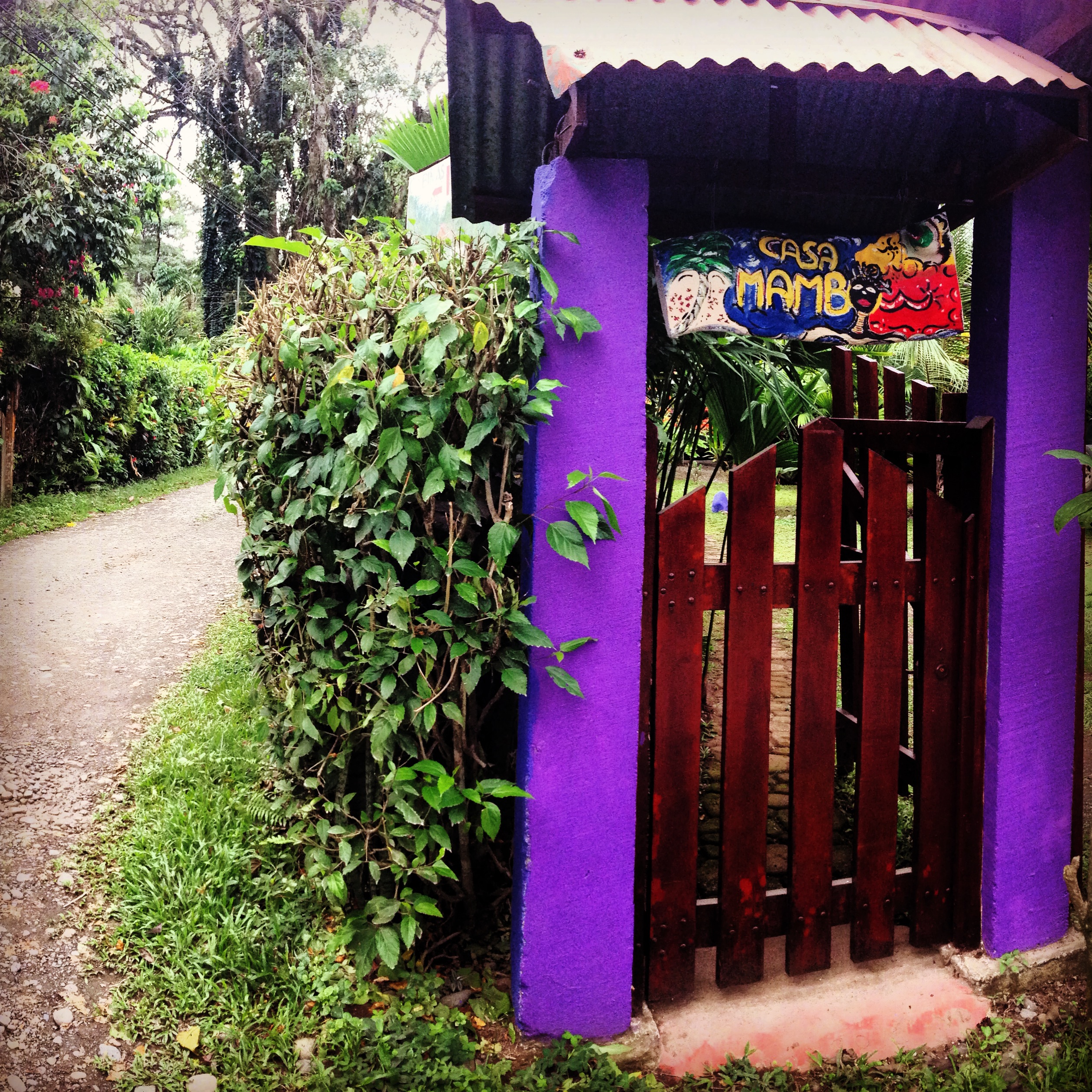
Casa Mamba owned by an Italian couple in Cahuita, Costa Rica
03/25/2014 Day 62 – Cahuita Costa Rica to Almirante Panama 60 miles
From Cahuita, the scenery is similar to that of yesterday’s end. Soon you come to a scenic and manageable hill. After that hill, you’re riding flat land through banana plantations until the Panama border. Expect to pay about $3US to enter Panama. We were immediately surprised (and confused) navigating in Panama. There didn’t appear to be any road signs indicating where to go. We did use our GPS, which worked fairly well – but we were immediately redirected by helpful citizens in Guabito to NOT take the road that goes to Punta Domingo. Instead, they had us head North East to road 1001 (not that this road is named anywhere, but it is named on Open Street Map). On the map, it looks like the road we had originally tried goes through, but I suspect the bridge was out at Punta Domingo. The man said that many people had experienced this same turn around. The terrain South East of Changuinola suddenly becomes very difficult. You encounter a series of short but steep hills on your way to Almirante. The hills are seemingly endless; they only last 10 miles – but in that time span, you will climb a few thousand feet! The area is pretty beautiful, so enjoy it. When you emerge into Almirante, the scene is of a poor industrial town.
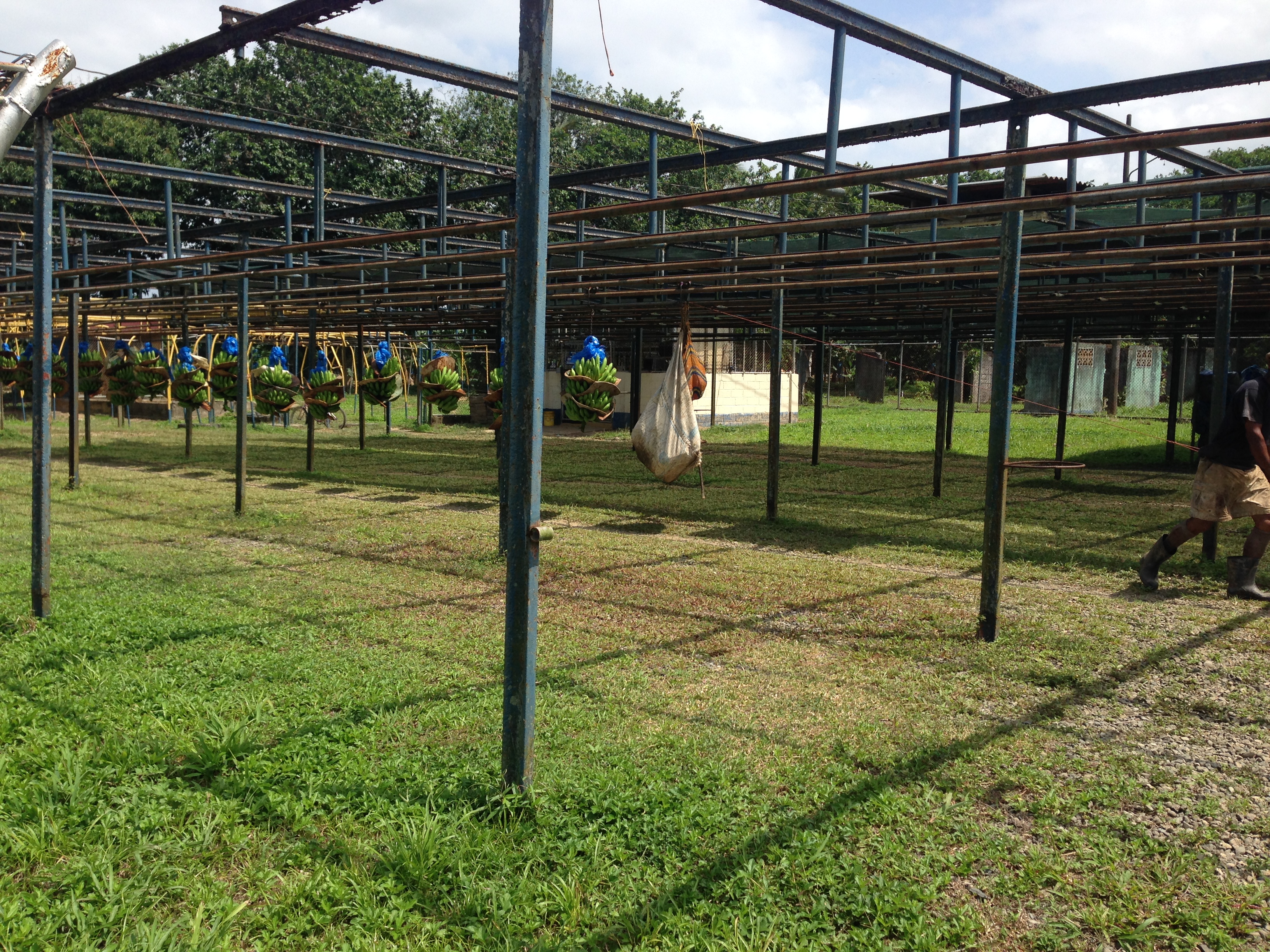
Banana plantations on the way from Costa Rica to Panama
This is the map for the entire route discussed in this post. To Export GPX files, click on the three horizontal bars in the upper right hand corner of the map and select Export selected map data…
To see full screen, click here (opens in new window)
This concludes the Costa Rica Cycling Guide Portion of our trip. You may now wish to proceed to the following locations:
Bicycling Latin America – San Diego, Baja California, Mexico, and Central America Hub Page