Bike Touring Colombia – Neiva to Popayan via Tierradentro
If you like to travel, perhaps you’ve noticed something about the character of popular destinations. When you arrive at a popular destination, you’ll often notice that many services have popped up: restaurants, hotels, gas stations. At one point, clearly, these services didn’t exist. In the popular place that you’re visiting, there was a time when people were just discovering the touristic merits of this location. At the same time that people were finding this place, other enterprising people were paying attention: The visitors need services. In some situations, this occurs on a cold and calculating way. I’ve heard that businesses like Starbucks use satellite imagery and more to examine year-over-year expansion of cities in towns – feeding this data into a computer program that spits out the best location for the next coffee house. In other situations, development occurs more organically – people arrive, and locals take note – over time, converting their homes to guest houses, and small stores – gradually building infrastructure to serve the tourists.
There is an enormous difference between these two patterns of creating infrastructure. In fact, the organic pattern could potentially precede the computer generated model – but it can’t go the other way – organic development can’t really come in after the Starbucks. Here in Colombia, I feel that we’ve been witnessing the early stages of organic growth of infrastructure and services to serve tourists – and “I’m McLovin’ it.”
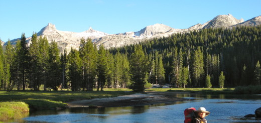
Eco-Restaurant “La Cascada.” +57-310-716-2096. Located at N 2.4679783 W -76.2115199 This place is not currently your “typical” hotel – but the owners were so wonderful that we’d like to add it in here.
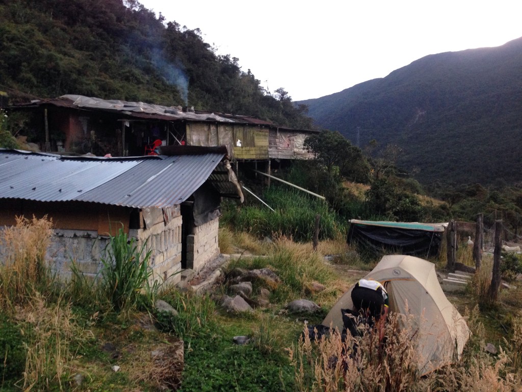
Tonight we’re staying at the home of Lucille, Joanna, Wilson, and Sara. We arrived on the tandem bike at 5PM, and stopped for a break. We noticed that there was a small separate building with 3 doors – the look of the building seemed to suggest “bathrooms” – which for me and Janet might mean “camping.” We loitered for a few minutes, and Sara (the 4 year old daughter) came along with her huge fuzzy pink hat with long chin ties bouncing along like tendrils. She asked if we were going to use the bathroom, and I said no. I asked her if her hat had a name (because it looked like an animal). She said, “Oso…Oso Polar” (polar bear). Then she asked us to follow her on a great adventure. We followed her to where a duck sat perched in a shack filled with sawdust. She told us that the duck was drunk, because it ate too much corn. The next morning, we were informed that “boracha,” which usually means “drunk” colloquially refers to a hen or duck that no longer lays eggs.
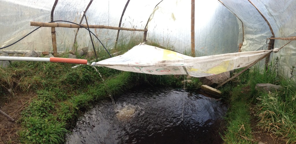
This is the trout pond at Eco-Hotel “La Cascada”
Soon the adults arrived, and informed us that yes, there is a Hospedaje (guest house) here. It was not immediately evident that there was lodging here because the only sign was a hand painted board that said, “Restaurant.” Come on in, they said, and I followed them through a dark and slightly smoky kitchen with low ceilings through several bedrooms. As I walked, I noticed that I could see sunlight coming up through the many cracks in the floorboards that sank heavily with each of my footsteps. Eventually after walking through three interconnected bedrooms, we arrived at the last room, which could be ours for the night for 10,000COP – $3US. Having just met them minutes ago, we felt that this might be too-close quarters, and so we asked about camping. “Whatever you prefer,” they said, as we went out back and investigated camp sites near the hen house, the duck house, and what I later discovered was the trout-house. We merrily set up our tent, and then were joined by Wilson and Sara who wanted us to come play. She told us that she often plays by herself, but now that we were here, we could pick “rice” (pampas grass) and leaves with her.
Joanna told us that they want to convert their home into an “EcoRestaurant-Hospedaje” and in many ways, they have already succeeded. To me, it is an amazing story of innovation, brilliance, and creativity. She told me that they had already build a facility to convert pig feces into cooking gas. Immediately, I was intrigued, as I had been considering building such a system in my own home. She took me on a tour of the yard, and showed me the system built with such simple materials – and a safety valve. It was amazing that it works – and then she told me it makes 3 hours worth of cooking gas PER DAY! Not only that, but now they don’t need to use as much firewood (which creates smoke inside and costs a lot of money). Then she took me on a tour of their trout pond. It’s very difficult to keep these trout here at 11,000’, she said. In fact, they’re one of the few places that have managed to succeed. She also informed me of some other elevation related facts: For example, it is illegal to live over 3,200 meters in Colombia. I asked why, and she first said that it’s too cold – but then followed up with, “It is considered to be the source of the water.”
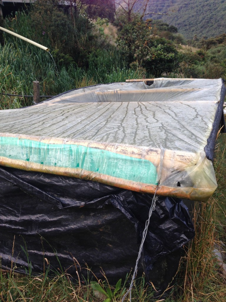
This is the gas generator at Eco-Hotel “La Cascada.” There is a 4″ input pipe and an 4″ output pipe. They keep the gas sealed in with thick plastic. There is a vent to keep it from becoming a “bomb.” This system generates 3 hours worth of cooking gas per day!
They invited us in for a shower to clean up. Janet preferred to skip the shower, but I went in, and they had prepared a ~5 gallon pot of warm water. Their house is powered by a dynamo that generates electricity from water that cascades from the mountain. At this time, however, not enough water is falling, so they don’t have electricity. The shower was in the middle of the house, and it had a large clay floor with a rudimentary curtain held in place by an ingot. The small room was lit by candles placed on the floor, and I showered by using a small bowl dipped into the pot – and pouring it over my head. They provided a towel and soap. The family was extremely accommodating and friendly. I tend to be a do-it-yourselfer, and at first glance, the simple materials they had at their disposal gave me pause – was this going to be comfortable? I quickly realized that they were experts at “making it work.”
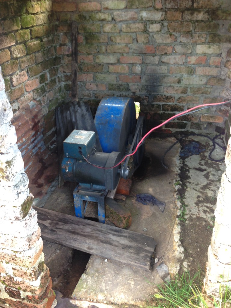
This is the generator at Eco Hotel “La Cascada.” There is a waterfall nearby, and this dynamo generates electricity from water that is diverted from the cascade. When we were there, they had no electricity because of “mucho verano” (a long summer). We ate by candle light, which was actually a great atmosphere.
Janet and I spent a wonderful evening eating in the restaurant’s kitchen – also by candlelight – talking with Joanna. Her brilliance was immediately evident from her manner of speech, actions, and topics of discussion. She works for a government program that assists with women who are single mothers, people who need health care, etc. Her work also includes visiting homes of people who don’t have adequate sanitation – and seeing about adding toilets, places to wash hands, and increasing education about pathogens as well as helping to develop a culture of saving money for future projects. It’s work that spans a broad area of important issues, helping people who are living on the edge.
The ingenuity and creative problem solving of this family are absolutely inspirational; this place is worth a visit if you’re in the area.
Route Information
Tierradentro Complete Foot Route
Tierradentro was a fairly hard place to find! We couldn’t find it on most maps, though we knew it was relatively close to the small town of Inza, Colombia. Once we thought we found Tierradentro on the map, it was still a challenging dirt road to get there. We saw a sign pointing to Tierradentro off the main dirt road – but it just went to a dead end road at someone’s house (after a long, steep descent which we had to re-trace). You’ll notice the correct (and incorrect) route to Tierradentro in our map below:
In the map above, you will want to avoid the out-and-back at mile 43, and ignore the brown sign that points you towards Tierradentro. Keep going straight until you see a large blue/white touristic sign that points you on “via San Andres.”
Once we got to the small village just below San Andres (named Pisimbala), we weren’t exactly sure what to do. It turns out that you can figure everything out with my one map below:
In the map above, I visit all of the sites in this order: Alto de Segovia, Alto del Duende, El Tablon, Alto de San Andres (stop for lunch in the town of San Andres BEFORE you go to the archaeological site), then Alto de Aguacate. There is one other site that is beyond this map, and would be very difficult to visit in this same journey. There are two museums – if you follow the loop as I did, one museum where you enter, and one where you exit. The advantage to following the route in the direction that I did is that you can always bail out from San Andres and skip the difficult Alto de Aguacate. In my opinion, Alto de Segovia and El Tablon held the most interest.
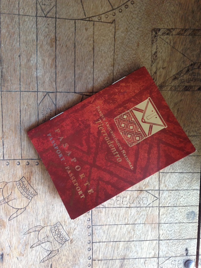
When you get to Tierradentro, you pay your entry fee of $20,000 COP (about $6 US), and then you get a cool passport. You can then take on the challenge of visiting every site. Most of the sites are quite similar, but I decided to visit them all, which took several hours. A Frenchman told me that he spent 10 hours walking between all of the sites!
When you visit each site, you should get an embossed stamp in your passport. Nevertheless, after climbing very steeply to the remote Alto de Aguacate, no one was there to stamp my passport – so don’t get too hung up on completing your booklet!
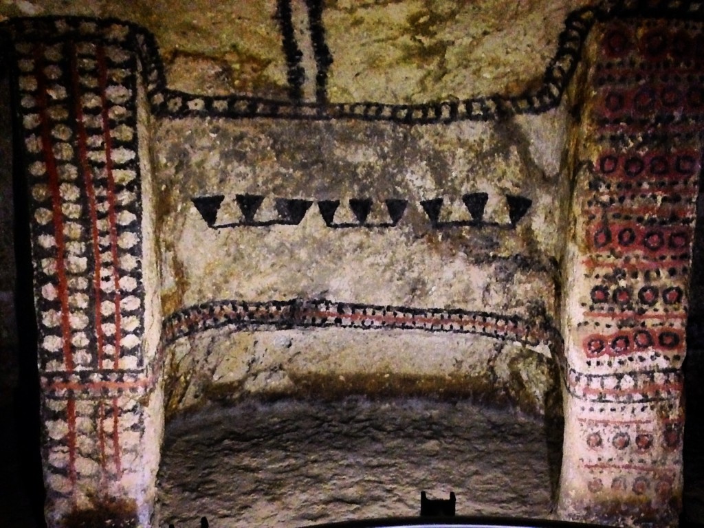
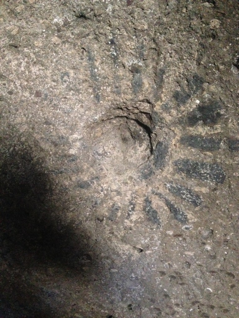
One of the better preserved hypogea with clearly visible paint. In many of the others, the paint has faded away.
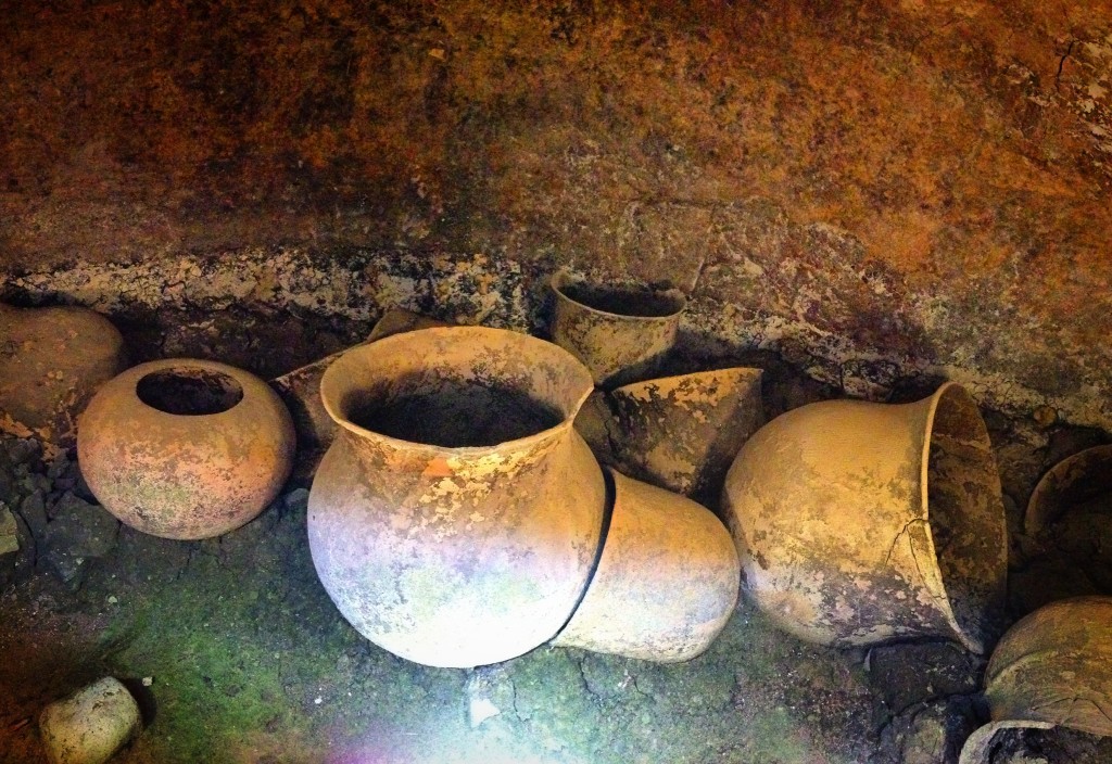
Some pottery found in the hypogea
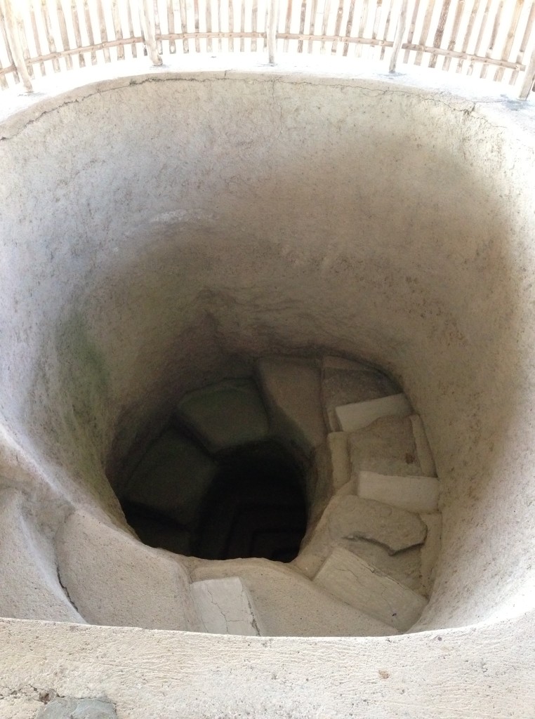
The typical entrance to one of the hypogea. One unique trait is that all of the stairs enter from the West – at all of the sites. Aguacate (the site high on the hill) is the least “developed.” The other sites have been better protected with locked entrances and shelters to keep rain water out. Also, the stairs have been reinforced with concrete to prevent erosion.
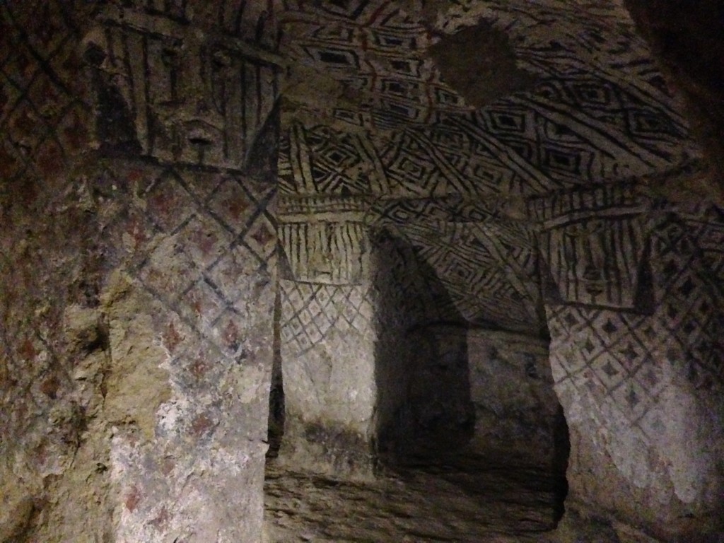
A view inside one of the hypogea, about 20 feet below the surface. Not much is known about the pre-Colombian civilizations that lived here. Radiocarbon dating places these tombs as being constructed between 300 and 900AD. Most of the contents had been looted prior to the arrival of archaeologists. This is now a UNSECO heritage site.
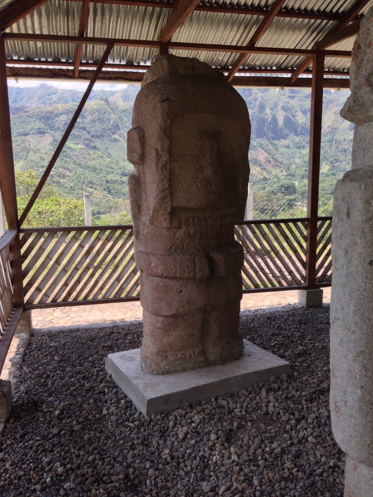
Statue at El Tablon. El Tablon is the one site in Tierradentro that has statues like the ones found at San Agustin.
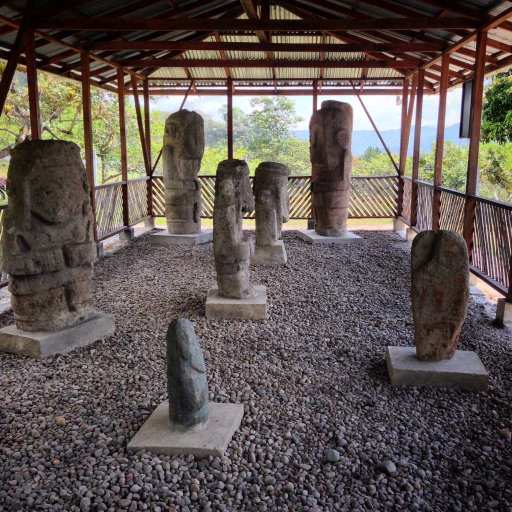
Some statues at the “El Tablon” site in Tierradentro. This site is unique for Tierradentro because it is the only one that has statues. The rest of the sites are hypogea (tombs). These were brought from another site.
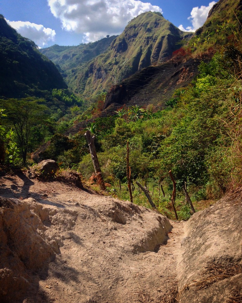
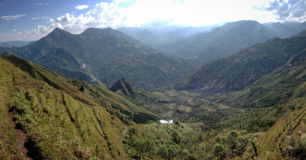
While the tombs may seem somewhat repetitive after you have climbed into a few, the scenery surrounding the Tierradentro site is outstanding.
The view towards Inza from Aguacate.
I’m not a huge archaeology buff – but even if I were, Tierradentro isn’t the most exciting of archaeological sites. Why? Because almost everything is unknown. One thing I like about it, though, is that the archaeologists don’t try to invent history – they just simply state that the facts are unknown.
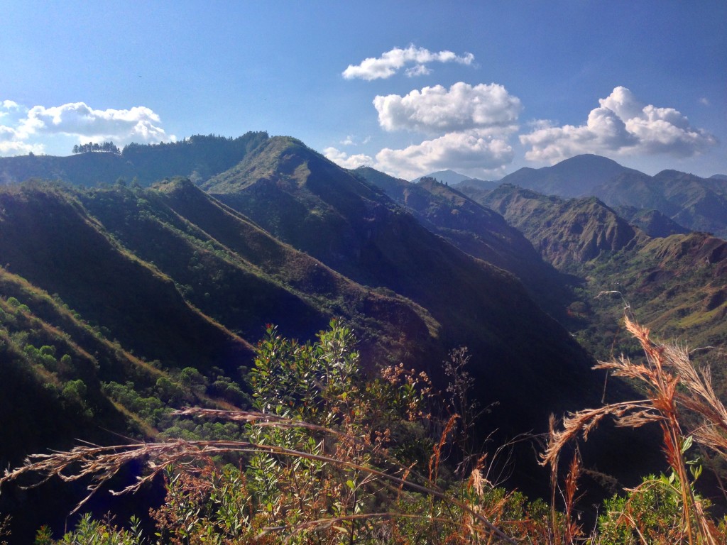
This is the view towards Aguacate, the highest elevation site of all the tombs in Tierradentro.
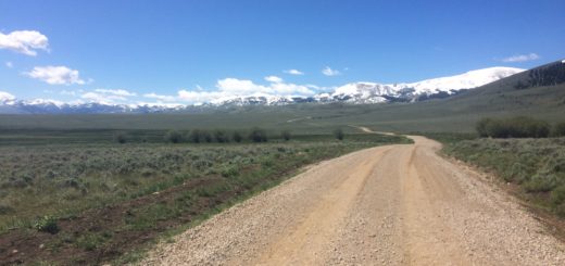
Getting to Tierradentro from Neiva by Bike
Getting to Tierradentro from Neiva is going to get easier in the future. They are actively paving the road. Unfortunately, at this time, this means that there is going to be a lot of dust from 5 miles after La Plata… all the way to the Tierradentro site. Here are some things you will see along the way as you leave Neiva towards Tierradentro:
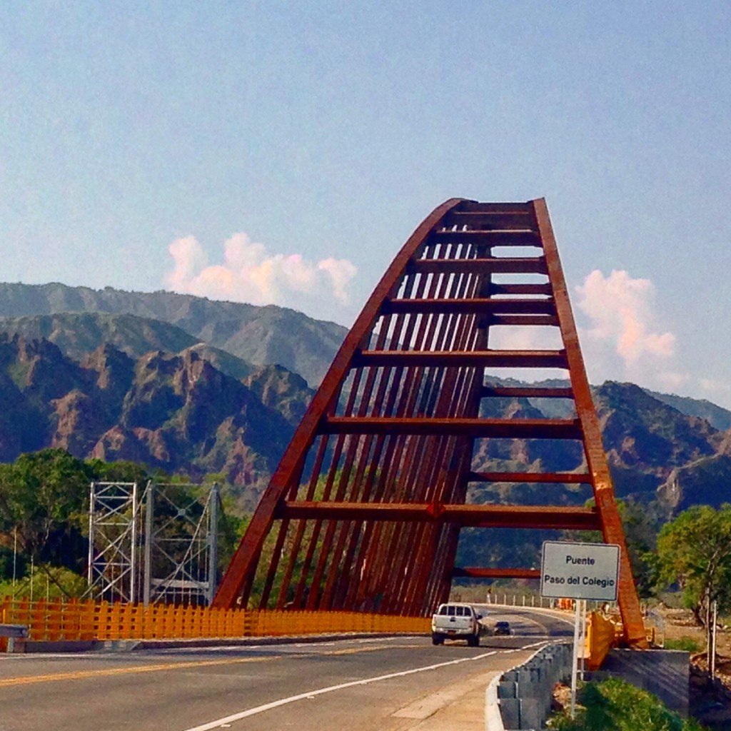
The bridge on HWY 24 crossing the Paez River.
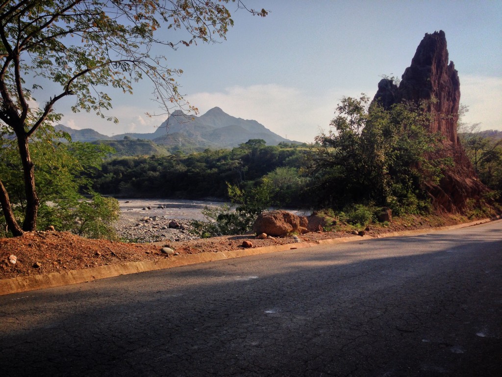
On the way to Tesalia, a few hours after leaving Neiva.
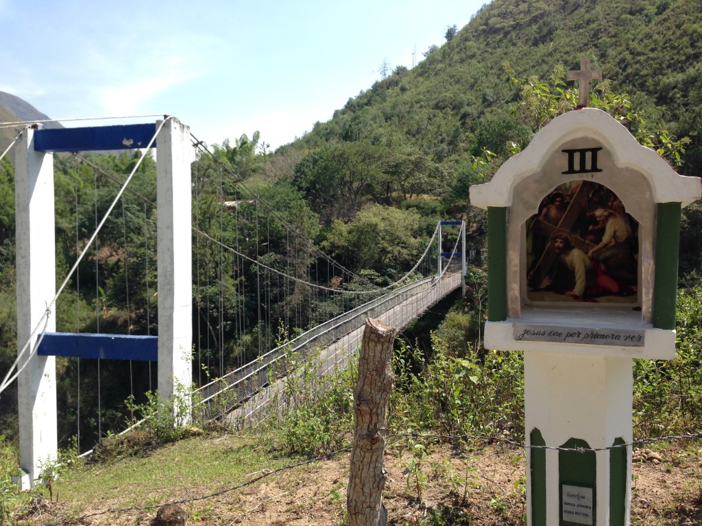
Janet and I took this short out-and-back route to check out the stations of the cross.
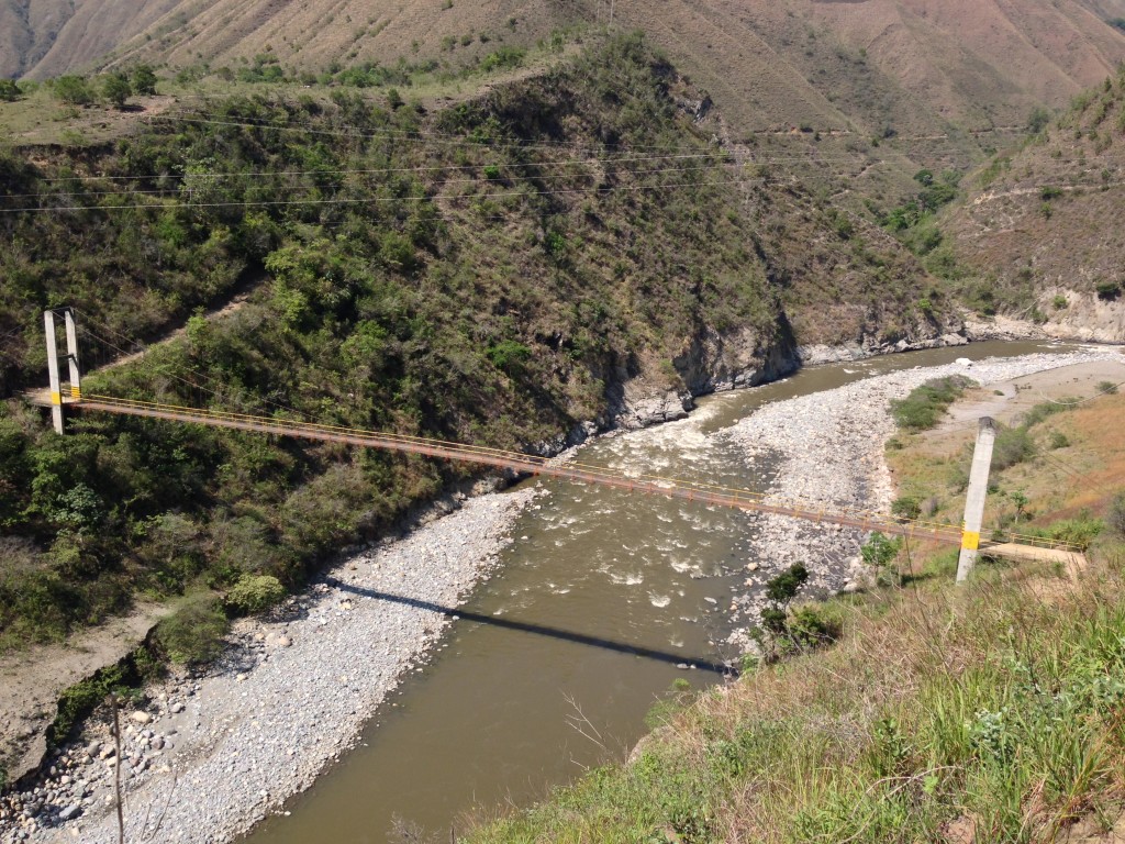
There is some pretty rugged terrain on the way to Tierradentro. Amazing bridges cross the river.
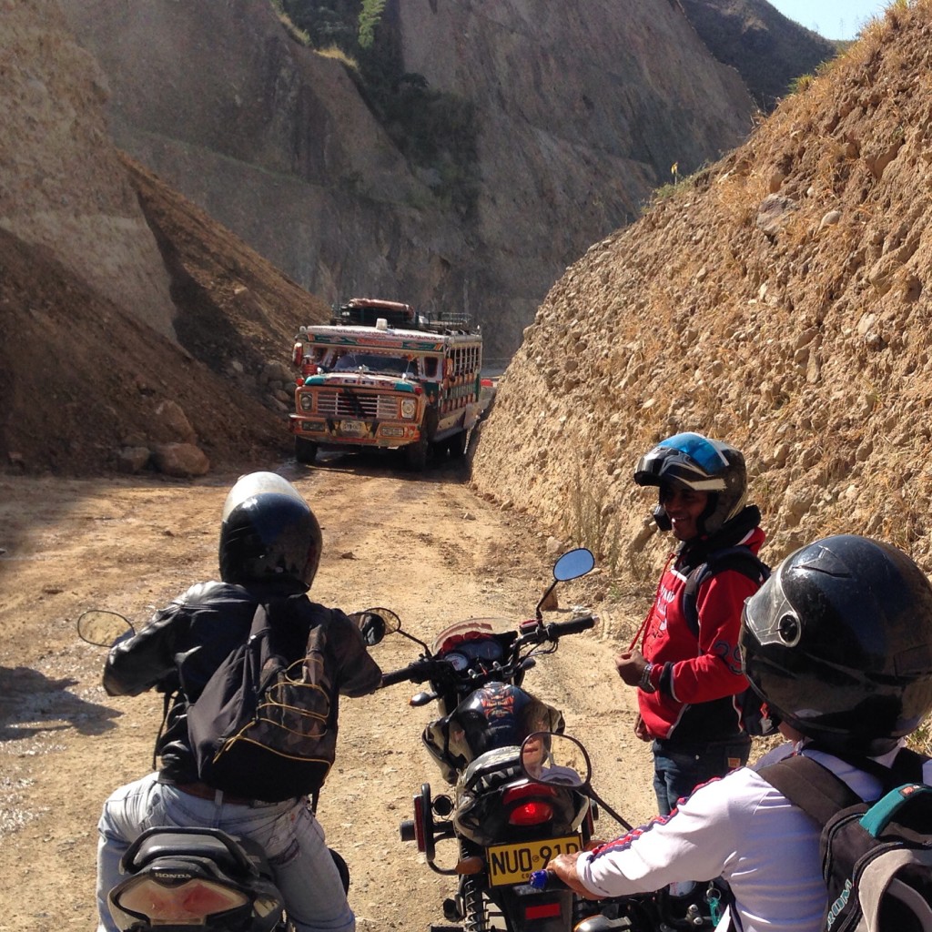
As of this writing, the road from Neiva to La Plata is well paved. From 5 miles past La Plata all the way to Inza, the road is unpaved and very dusty. There are a few pieces of pavement here and there, but mostly from Inza until about the 9,000′ elevation on the way to Totoro, it is dirt. They are actively paving the road here, but as you can see in this picture, landslides slow progress.
Lodging at Tierradentro
We found that there were quite a few places to lodge just below the San Andres townsite in Pisimbala. There is also a small restaurant. These hospedajes are about 30,000 COP ($9US) for two people. We stayed at “Mi Casita,” Which had amazing staff, small rooms, served breakfast, and had reliable hot water. We loved it so much, we stayed an extra night. You can also lodge in the town of San Andres, but it might be less convenient for visiting the park because the entrance is much closer to Pisimbala. The hotel there is also more expensive, and there is a good restaurant nearby.
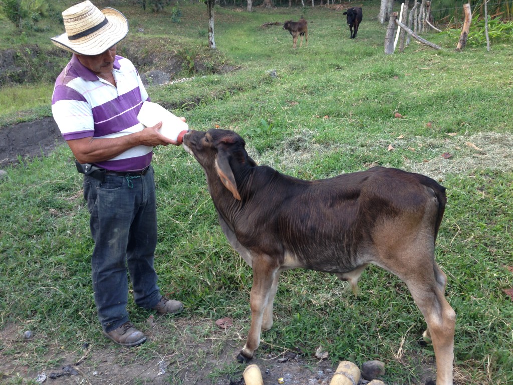
The owners of the hotel “Mi Casita” had a little agriculture in the back area. They had two milk cows and two calves. This calf’s mother had recently died due to “mucho verano” (a lot of summer; not enough grass). So, 3 times a day, he would bring the calf this huge bottle of milk.
Tierradentro to Popayan by Bike
The ride from Tierradentro to Popayan has little in the way of services after you pass Inza. The road is unpaved right now, but at around 9,000′ in elevation it becomes paved. You can lodge as discussed at the beginning of the post. You can also probably camp in the Paramo, which is found above 10,000′.
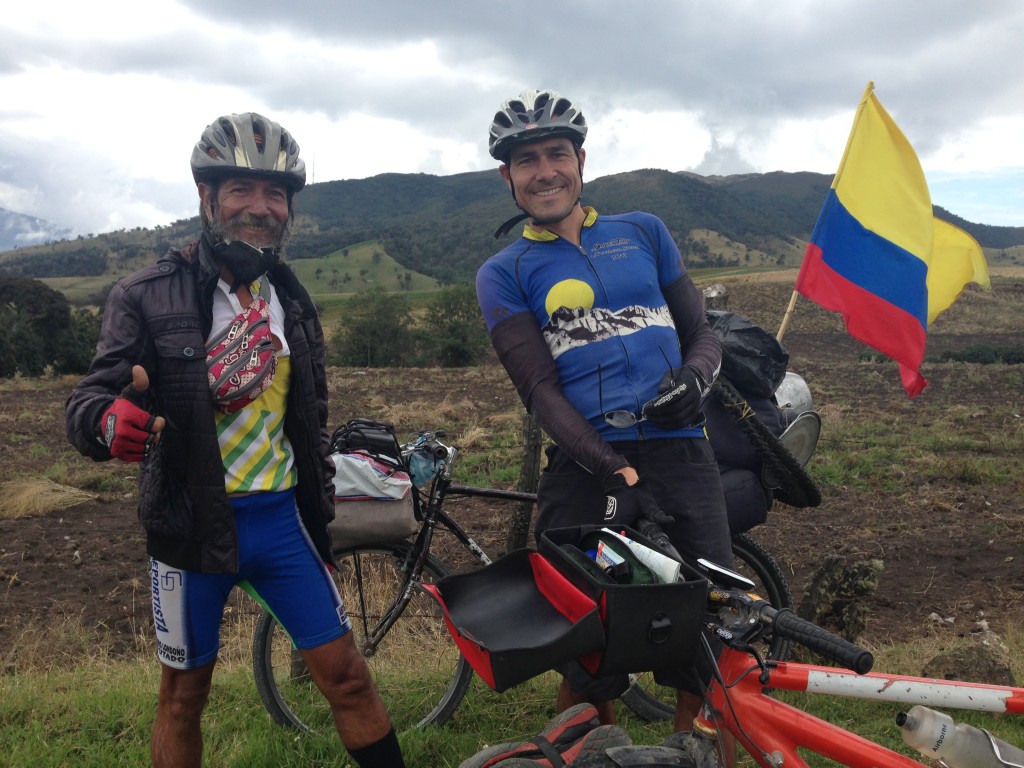
Along the way, we met Miguel. He’s been touring all over Colombia for over a year – but for the last 7 months, all he has had is one US dollar (which he showed us). I said, “how do you eat?” He said, “easy!” And began to describe all the fruits that grow in the low lands, pulling out a tomatillo. He didn’t even ask us for any type of help, but thanked us for talking to him because as he said, “most people think I’m crazy.”
The first settlement you come to after the Eco-restaurant is “Gabriel Lopez.” Unfortunately, this is where the pavement ends again, and is unpaved until a few miles before Totoro. Gabriel Lopez has some small tiendas. In Totoro, you can buy real supplies and use your cellular internet connection again.
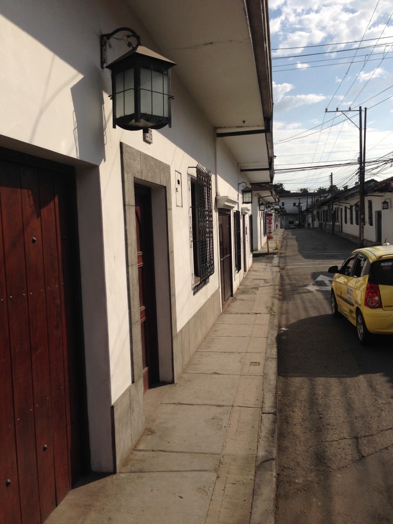
Popayan is known as the “white city.” There is an entire section of white buildings with lanterns like these pictured. Many, many blocks in each direction are decorated like this – which can be an issue for getting lost (all the streets look the same).
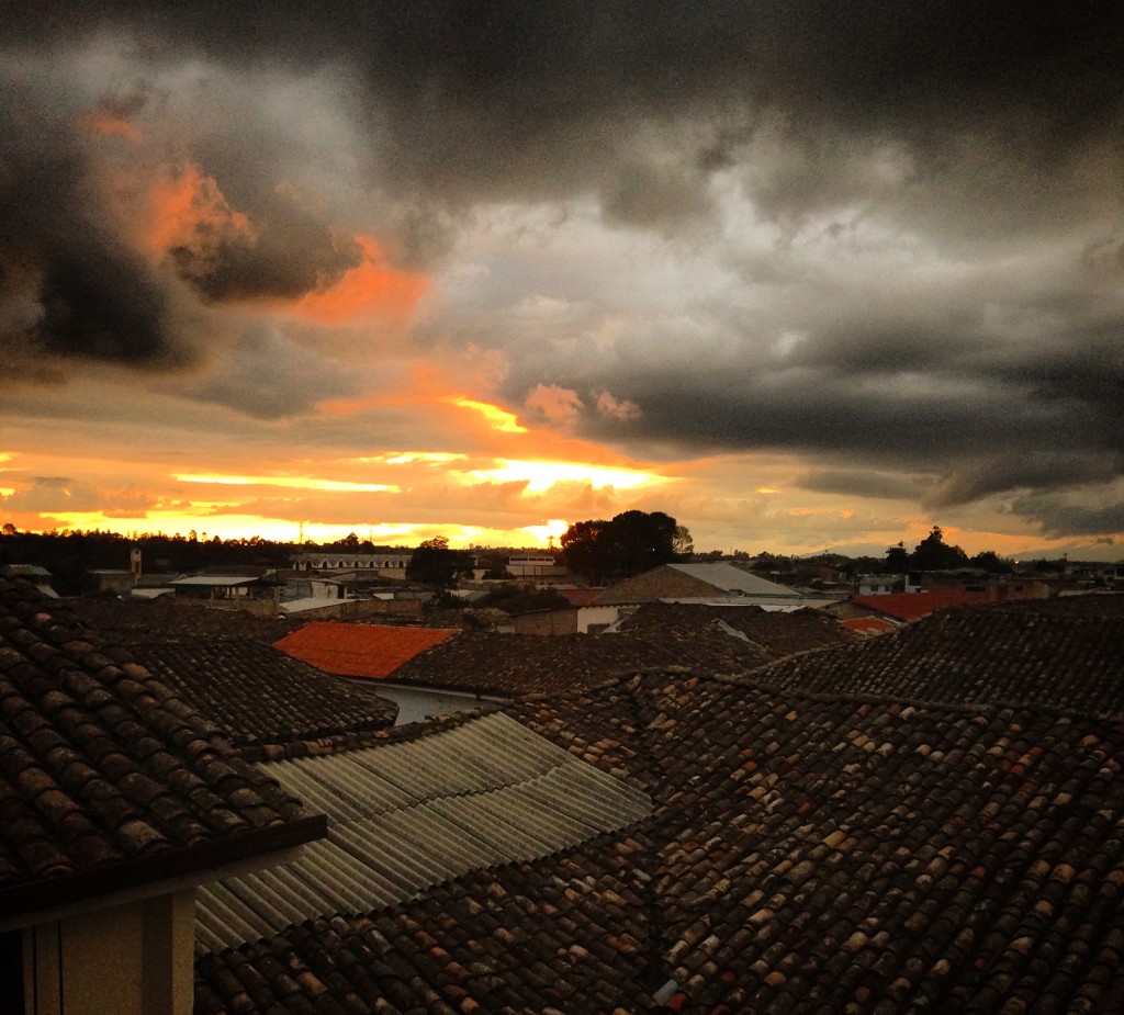
The view from Hotel Krone in Popayan. Very friendly staff, great views – but sketchy hot water.
This is the map for the entire route discussed in this post. To Export GPX files, click on the three horizontal bars in the upper right hand corner of the map and select Export selected map data…
To see this map in a full screen, click here (opens in new window)


Hello,
We cannot see the maps. Is there a possibility to fix that? I look with Internet Explorer, Chrome and Microsoft Edge.
Best regards, Jet
Hi – I have tried this page with Chrome, Safari, and Firefox – and all seem to show the map… Could you perhaps try again? Thanks.
No, I also try it with Safari and firefox, but I cannot see the maps. Are they the same as in Strava?
So much great detail in this post/blog. I appreciate the details on each picture and in the writing. Miguel intrigues me as do all the people you have met. Amazing innovation and resourcefulness at Eco-Restaurant “La Cascada.”