Bike Touring Colombia – Bogota to Cocuy National Park
Thwack!..Thwack!………Thwack! The handful of rocks I had just thrown scatter-gun style had just hit their squishy target. Satisfaction surged through my body – like that feeling you get when you pop that annoying pimple in your face.
Janet and I cheered as the three (formerly) barking dogs ran away with their tails between their legs. Our tender ankles and legs would be spared once again from a canine onslaught.
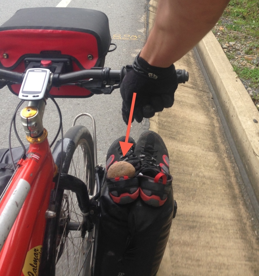
If Teddy Roosevelt had been rough riding with us, he would have said, “Yell loudly, and carry a big rock.”
OK, the dogs in Colombia aren’t that bad… and as Janet has noted, they’re a lot more spritely than their less ebullient and malnourished Mesoamerican counterparts. In a way, we’re glad to see dogs like this, as I will discuss later… but first let’s jump back to the beginning of our trip to Colombia…
Because we almost always fly with a tandem, Janet and I have perfected our calm, steady (but firm) voices for negotiating travel with an 8 foot long cardboard box full of disassembled bicycle parts. We arrived at the check-in counter with unimpassioned preparedness…
Check-in Agent: “Tickets please…”
Me: “Here you go.”
Check-in Agent: “OK… Hmmm… I cannot let you board the plane. You must have a return ticket. I’m sorry, you cannot board without a return ticket.”
Suddenly, a shot of adrenaline surged through my blood. I had heard of this requirement to have proof of onward travel in order to enter a country… but had never experienced it before. What were we going to do?
Me: “Um, But I, uh have traveled many times without an onward ticket.”
Check-in Agent: (after conferring with several bosses): “Hold on, I’m going to call Colombia to see if they can make an exception.”
Check-in Agent: (after long conversation on phone): “OK. Colombia says you can go.”
We’re grateful that Colombia said OK, because it turns out they’ve got a pretty nice place.
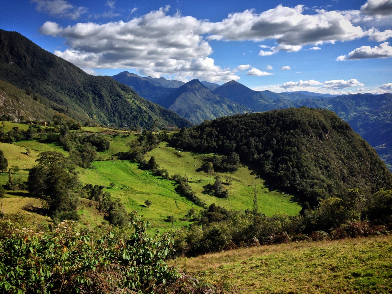
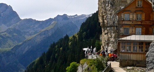
Thankfully, scenery like this presents itself most of the time!
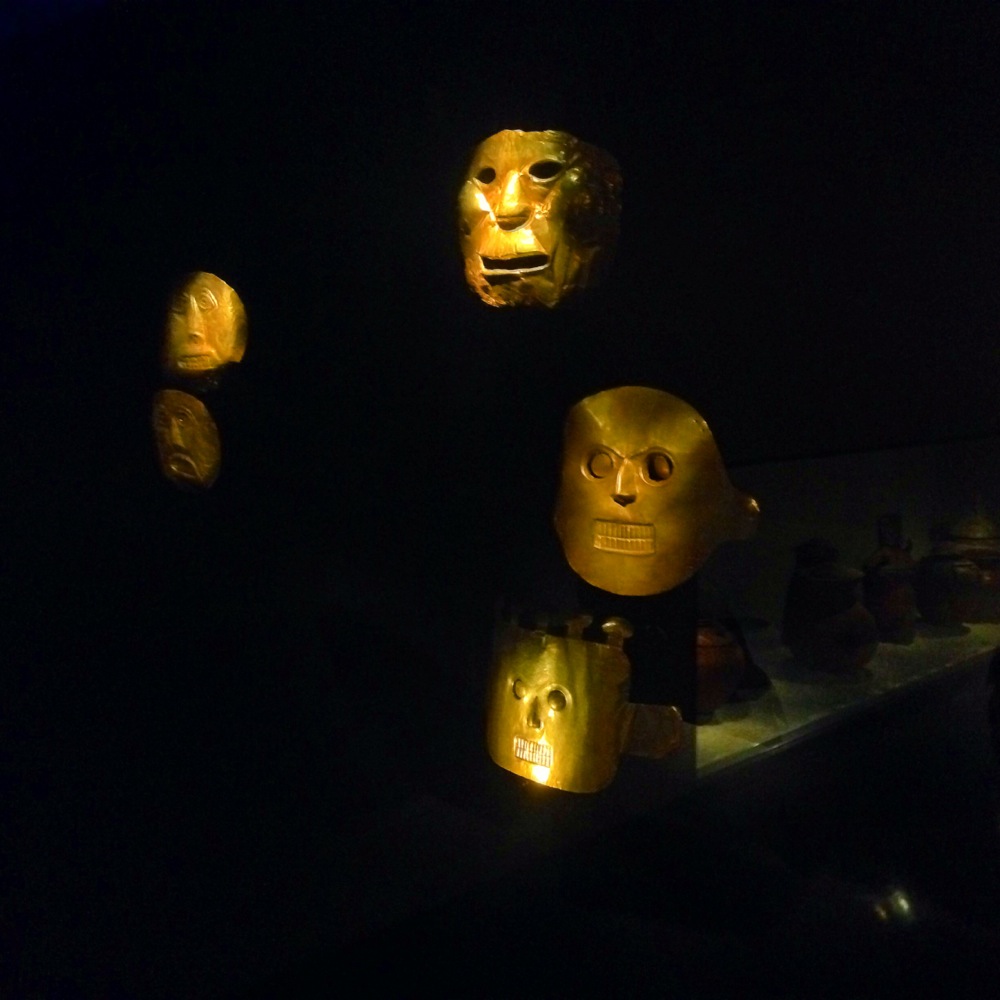
An obligatory visit to the Gold Muesum in Colombia. Most everyone who visits Colombia goes there. The biggest story is that of “El Dorado” – a man who would be covered with sap and then dusted with gold dust. He would then jump into a lake to wash it all off. Spaniards heard of this legend and sought to drain the lake to recover the gold from the bottom. Amongst the gold found was a small golden raft and figurines that represented this ritual. That raft is on display here.
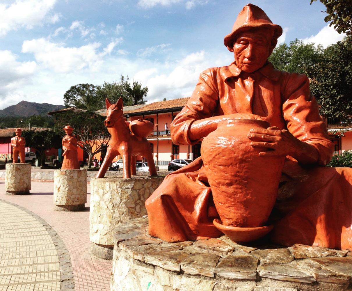
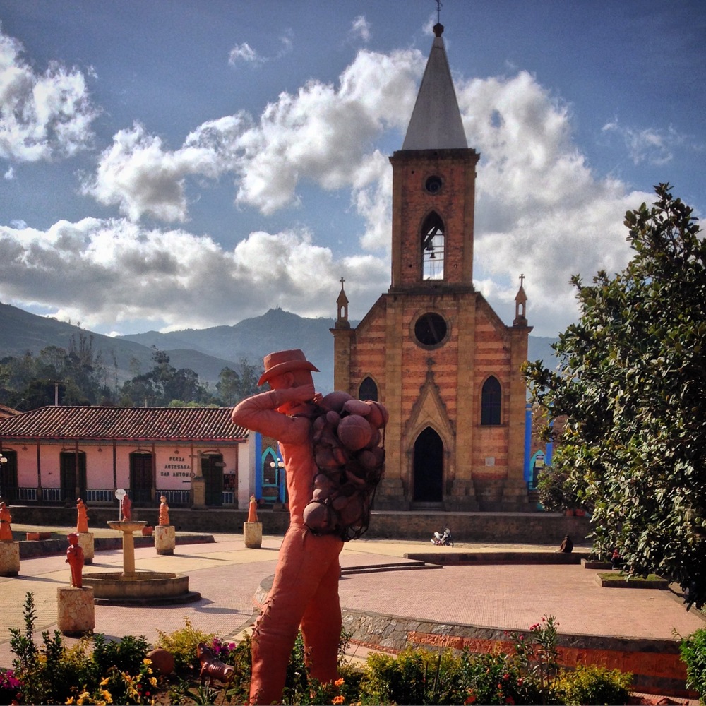
Raquira statues symbolizing the pottery that this town is famous for. Coming into town – and leaving – there is pottery everywhere. This is also a clay house that we didn’t manage to see.
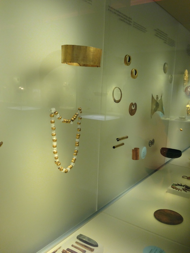
If you like gold, there is plenty to see at Museo del Oro in Bogota.
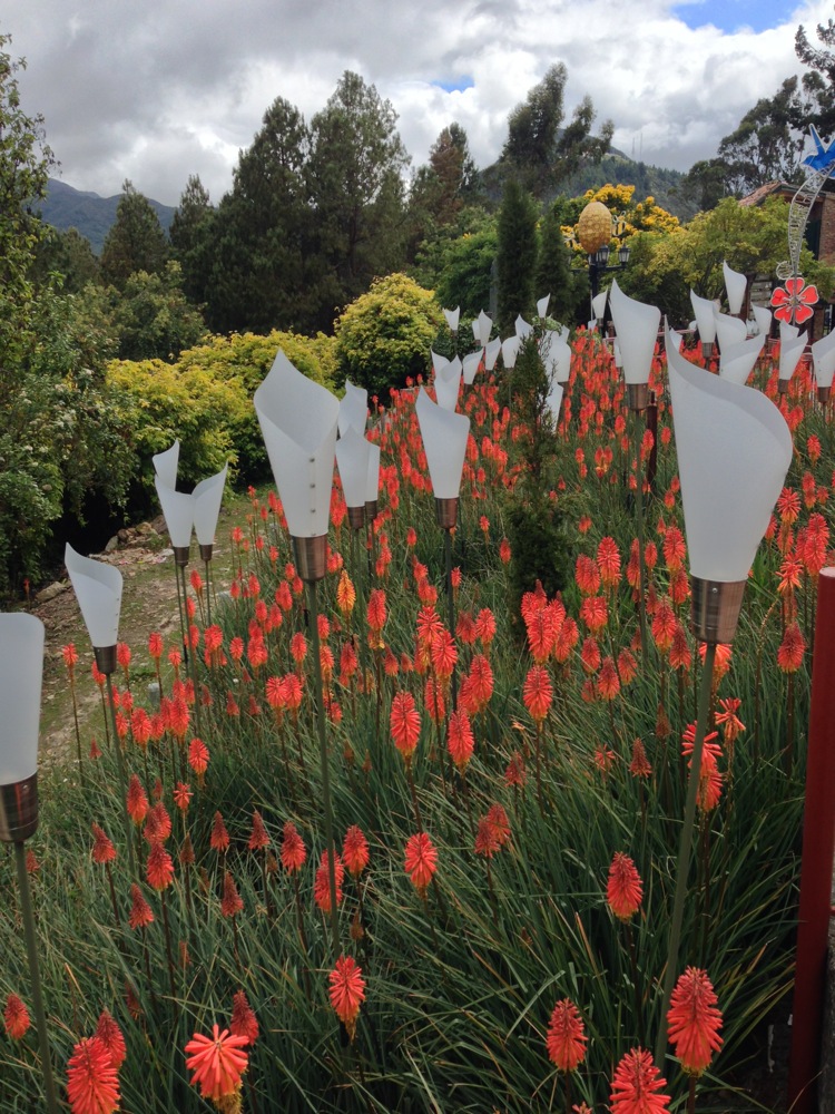
At the top of the mountain behind Bogota (Monserate), you can ascend over 10,000′ to see beautiful gardens with signs. We did it on foot, but you can also take a Funicular or a cable car.
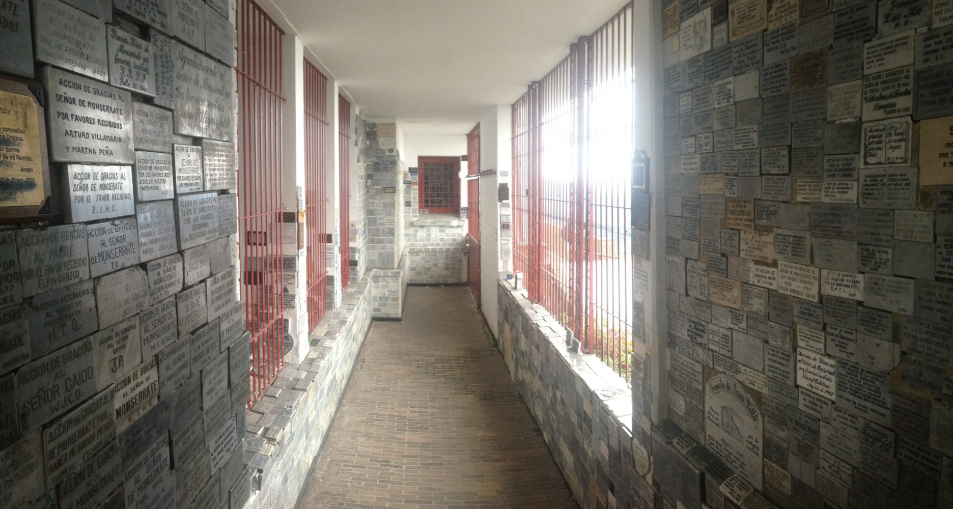
Plaques of those who donated to the church atop Monserate, Bogota.
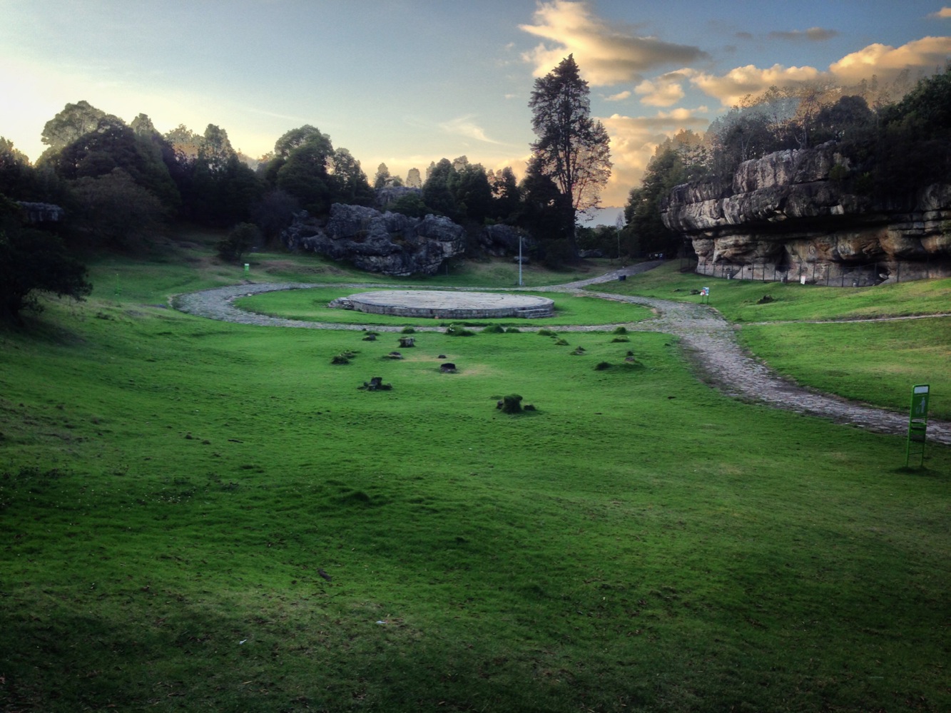
The archaeological park at Facatativa is good for a small day trip, and probably rarely visited by foreigners. The highlight is rock paintings which are somewhat faded – they are estimated to be 10,000 years old!!
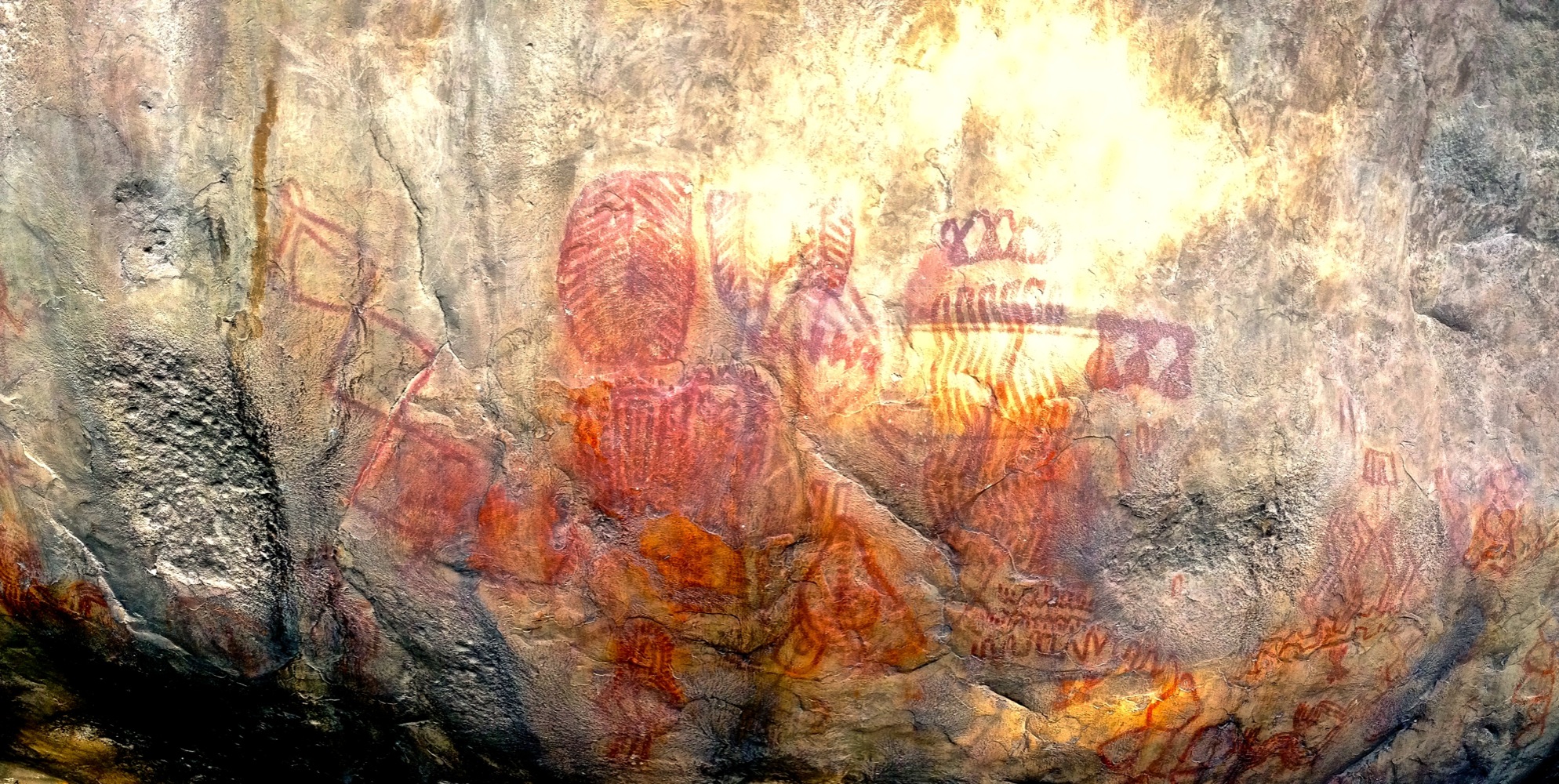
The rock paintings of Tunja seen here are estimated to be 10,000 years old. Archaeologists aren’t sure, but they suspect that the figures represent frogs.
Being the world travelers that we are, prior to our arrival, Janet and I already knew a few things about Colombia. Here is the complete list:
- Drugs
- Juan Valdez Coffee
- Shakira
We also assumed that Colombia would probably be a lot like Mexico and Central America. Although each country in Meso America was subtly different, we’ve already noticed some huge (and very welcome) cultural differences.
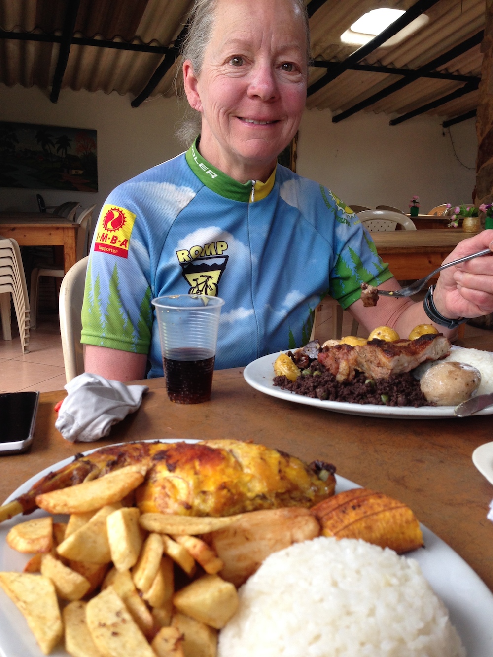
In an atypical move, Janet ordered the special, which was called chanfaina. Due to the surprise appearance of the food, We used our 3G data to figure out its composition AFTER it arrived. Some key elements were: Entrails, sheep liver, and blood cooked into a light and fluffy tofu like composition. By the way, that’s my conejo (rabbit) in the foreground.
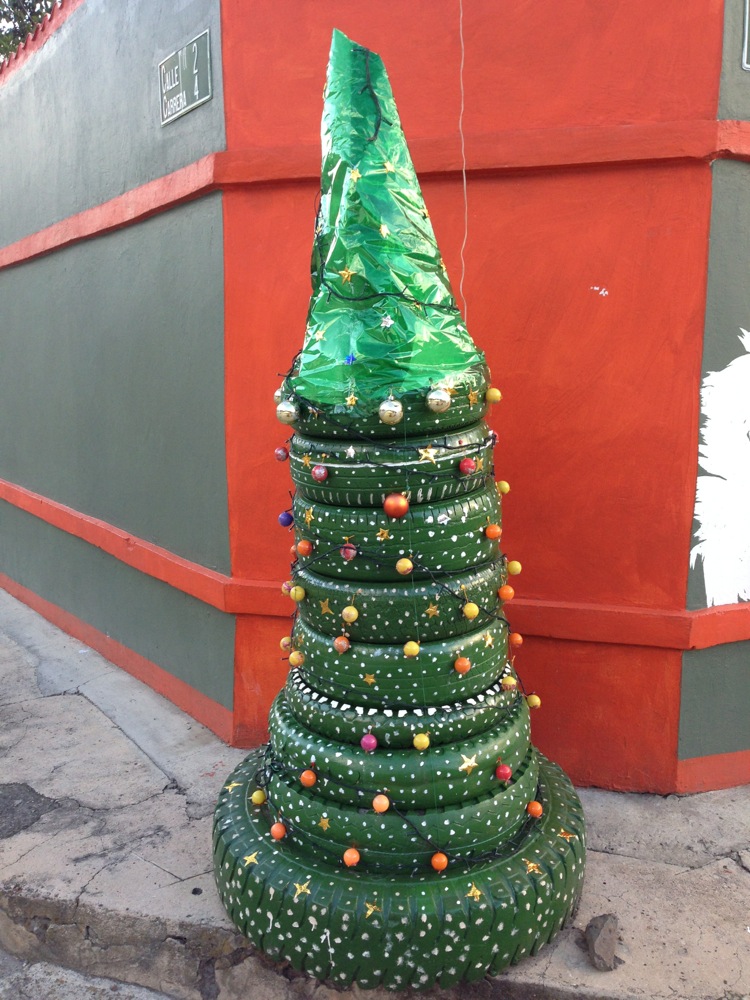
Colombia is very progressive with their recycling. Not only do they have recycling containers in every little town, but we have encountered many of these used-tire trees!
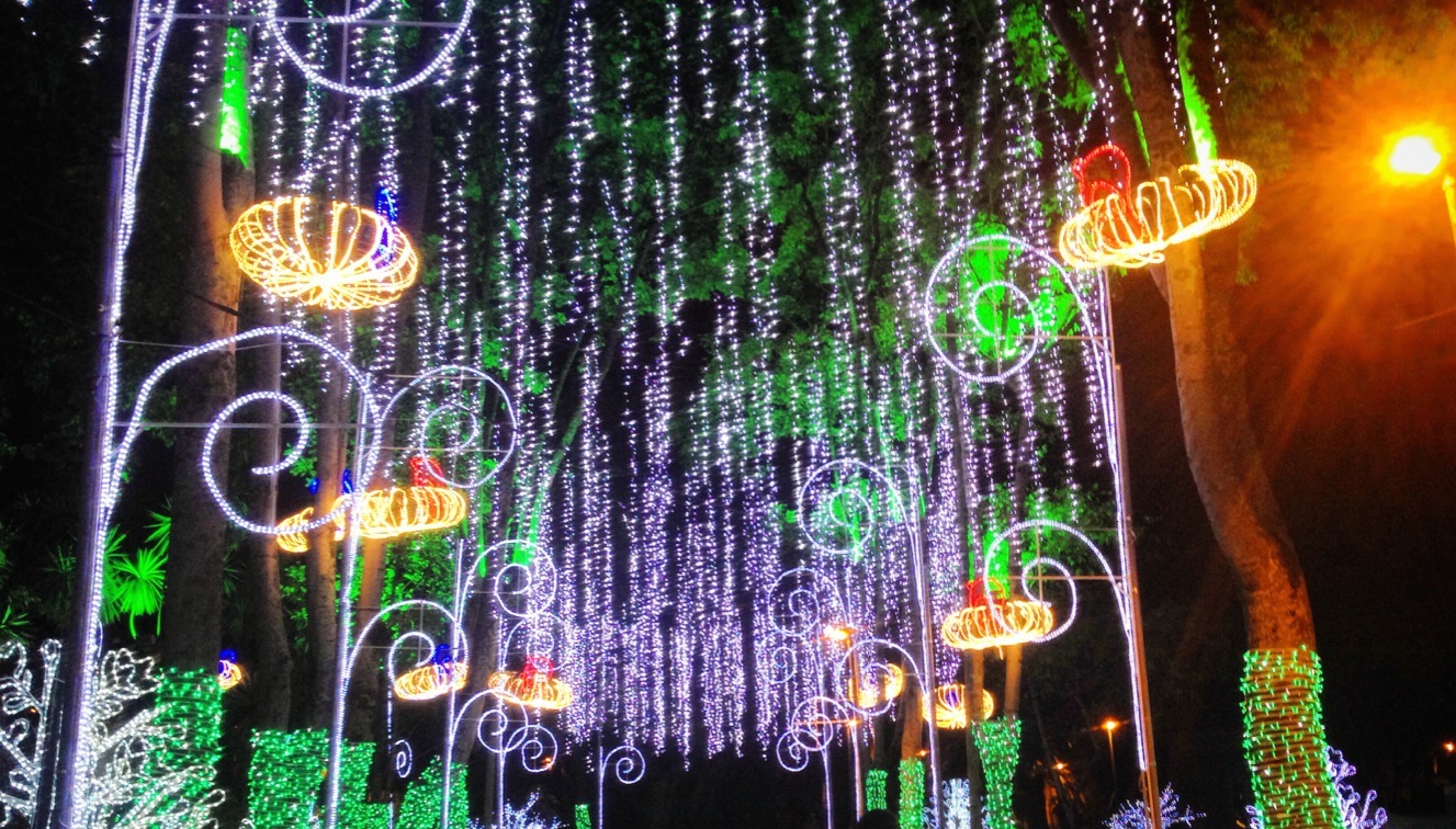
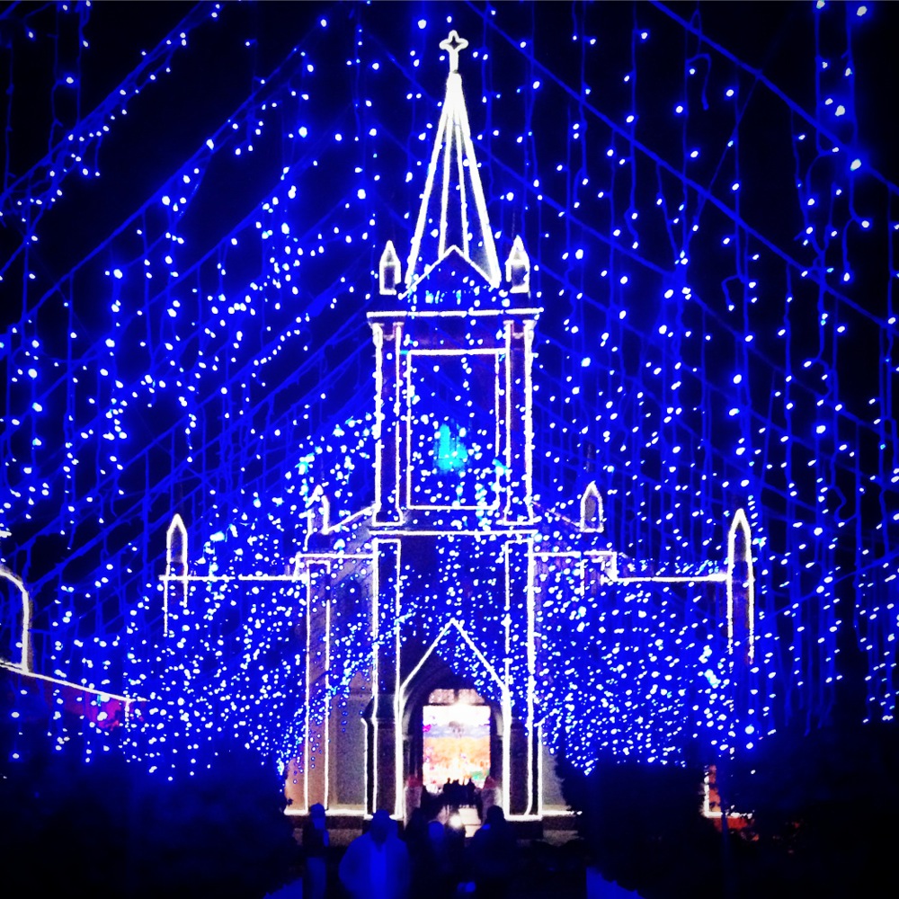
Every single city, town, and village we visit has a spectacular light show for Christmas! This particular lighting is in parque La Independencia – Bogota
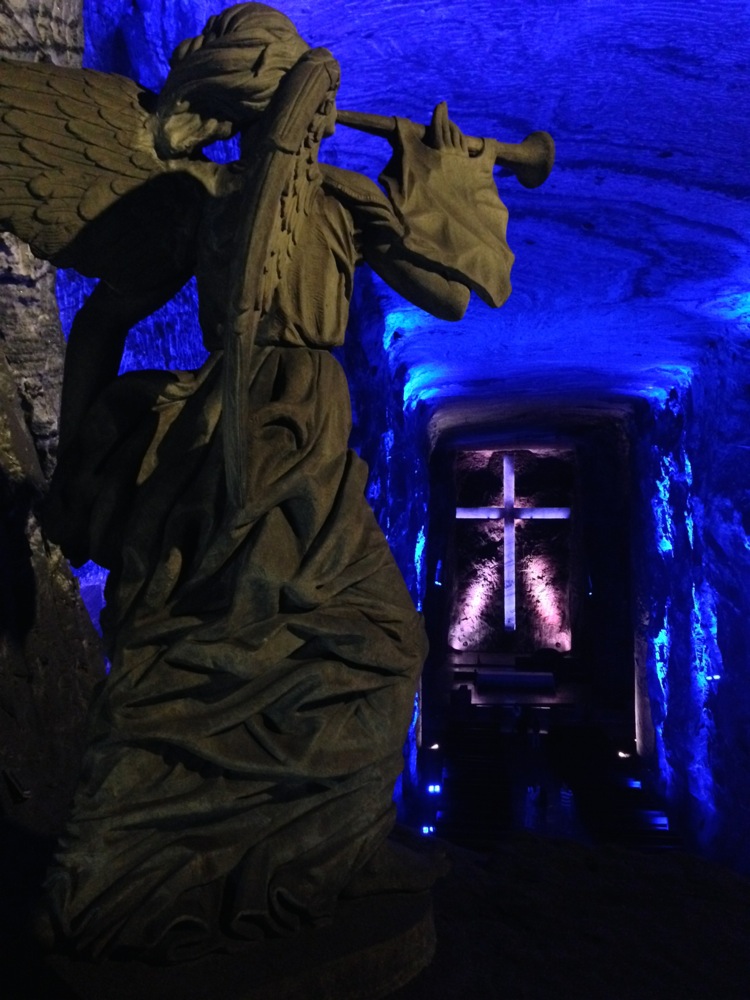
An obligatory visit to the Zipaquira salt mine. This town is more touristic than the others we visited because of the salt mine. To be honest, this mine largely is a “constructed” tourist attraction – meaning that after this portion of the mine because unusable, they decided to come up with another way to make money from the it. Having said that, though (and also having been to the Wieliczka Salt Mine in Poland last year), I’d say that this tour was an excellent value. Although the carvings are much simpler than Wieliczka, this trip is far less expensive, and the guide was very informative and enjoyable
Dogs: Although I started with a negative dog story, we’ve found positives in the Colombian dogs. To begin with, we’ve noticed that there are fewer mutts, and the dogs appear to be health and well cared for. The relationship with animals is very different here too. A week ago, we we came around a corner to find a dog who had been hit by a vehicle. It had clearly just happened, as he was in the middle of the road, but trying to get off to the side. He moved slowly, as his rear legs were crippled. A motorcyclist had pulled over (as did we), and he walked up to the dog, calmed it, and carried it up the dirt road to the owners. After having seen so many animals ignored in other places, it warmed our hearts to think that this dog was going to be able to heal.
The view on our way down to Raquira. This was a very rough dirt road, but the scenery was great. We got into town just before dark.
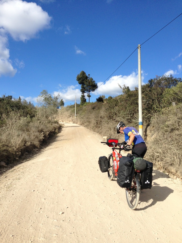
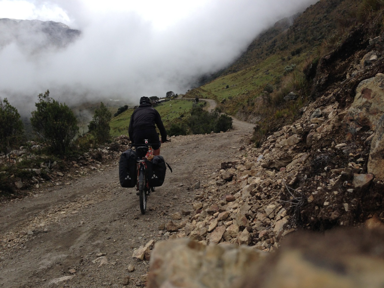
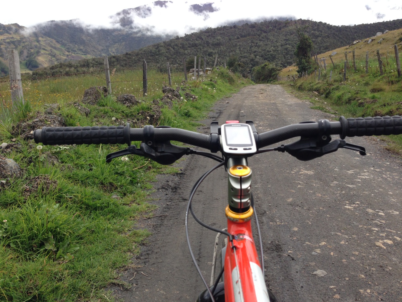
When the grade steepens and the surface is dirt, the only option is to push.
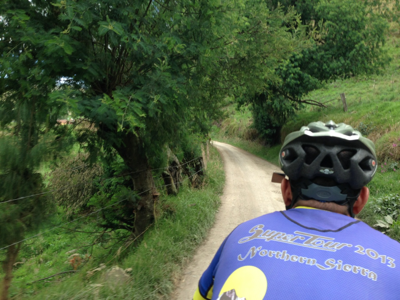
Riding along the lake front of Parque Nuesa. You need to pay a couple dollars per person to get into this park, but it enables you to make a dirt through-route with zero traffic.
Courtesy: Similar to Mexico and parts of Guatemala (but not the rest of Central America), we’ve found that people are extremely polite here. The politeness is on a new level: Everywhere we go, people greet us with a good afternoon, and often a “how are you doing?” Janet and I each receive our own “Buenos Dias” since there are two of us passing on a tandem. In any place of commerce, invariably we are greeted with a smile and a “para servirle,” and “es un gusto sevirle” which basically means “at your service,” and “it is a pleasure to serve you.”
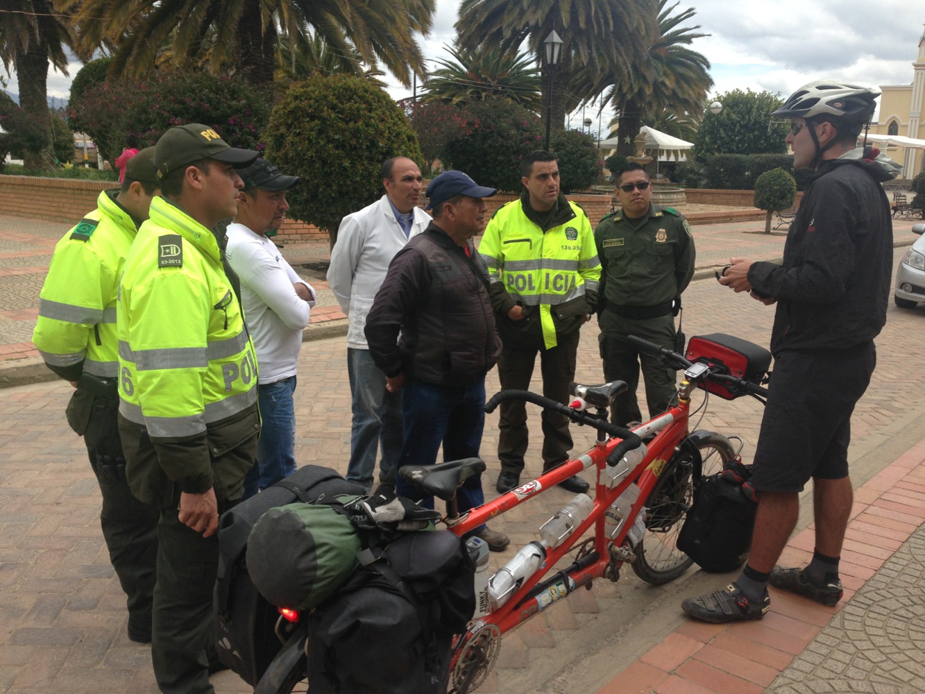
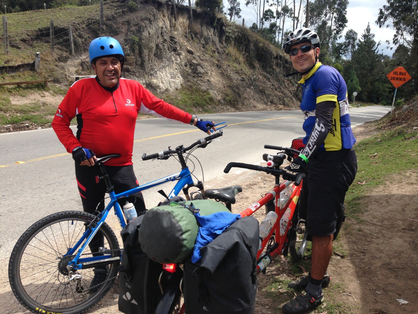
Tandem Bicycles generally attract a lot of attention – but surprisingly less attention in Colombia. On this day, however, several towns people came to ask questions about the bike. I asked one of the guys about the road conditions ahead, and someone in the crowd joked, “he doesn’t know; he’s never been past Tunja.” Everyone laughed, but I think he was serious. Tunja was only a few miles away.
Fear: There is no better way to destroy a country than to have its citizens living in fear. If you are afraid for your future, are you going to want to invest in it? If people are afraid, will they invest in new businesses, have children, seek ways to improve the lives of others, or stick their necks out to make change and improvement? Terrorists who attach places with good social well-being know that fear is a powerful way to weaken a huge populace. Something we very frequently experienced in Mexico and Central America was the “It’s dangerous over there” syndrome. We’d come into a pueblo, and people would tell us, “You can’t continue. It is very dangerous farther down that road. ’They’ will kill you.” We’d go down that road, and get to the next pueblo, where the people would say, “That pueblo you came from is dangerous. You shouldn’t have gone there, ‘They’ will kill you.” In general, there is a sense of fear in those countries. I don’t mean to discount the dangers (after all, all of these countries, including Colombia have much higher murder rates than the US)**… but we have not once had someone tell us that a place is dangerous here in Colombia. Why? The words of our tour guide in Bogota on the first day may lend some insight. He told us that there are many different cultural groups in Colombia. Not too long ago, they didn’t know anything about each other… and they had this type of fear discussed above. The guide told us that the Colombian government has made big moves to encourage public knowledge of the many neighboring cultural groups. The’ve made many (free) museums dedicated to the various groups so people can get to know their neighboring communities instead of fearing them.
** Note that we would filter these comments based on how specific the danger was. If there was an actually story or history of danger, we’d take it much more seriously than if someone told us “they” were going to do something.
Begging: With the exception of two people who asked for a swig of Janet’s diet coke in Bogota, we haven’t experienced any begging. (She honored one of the requests by pouring some into a cup shaped object that a man pulled out of the trash when she initially refused to let him drink out of her bottle). Somewhat related, we’ve noticed that the banks have less security than some in the USA. No armed guards outside with automatic weapons, and no floor to ceiling 5” thick bulletproof glass.
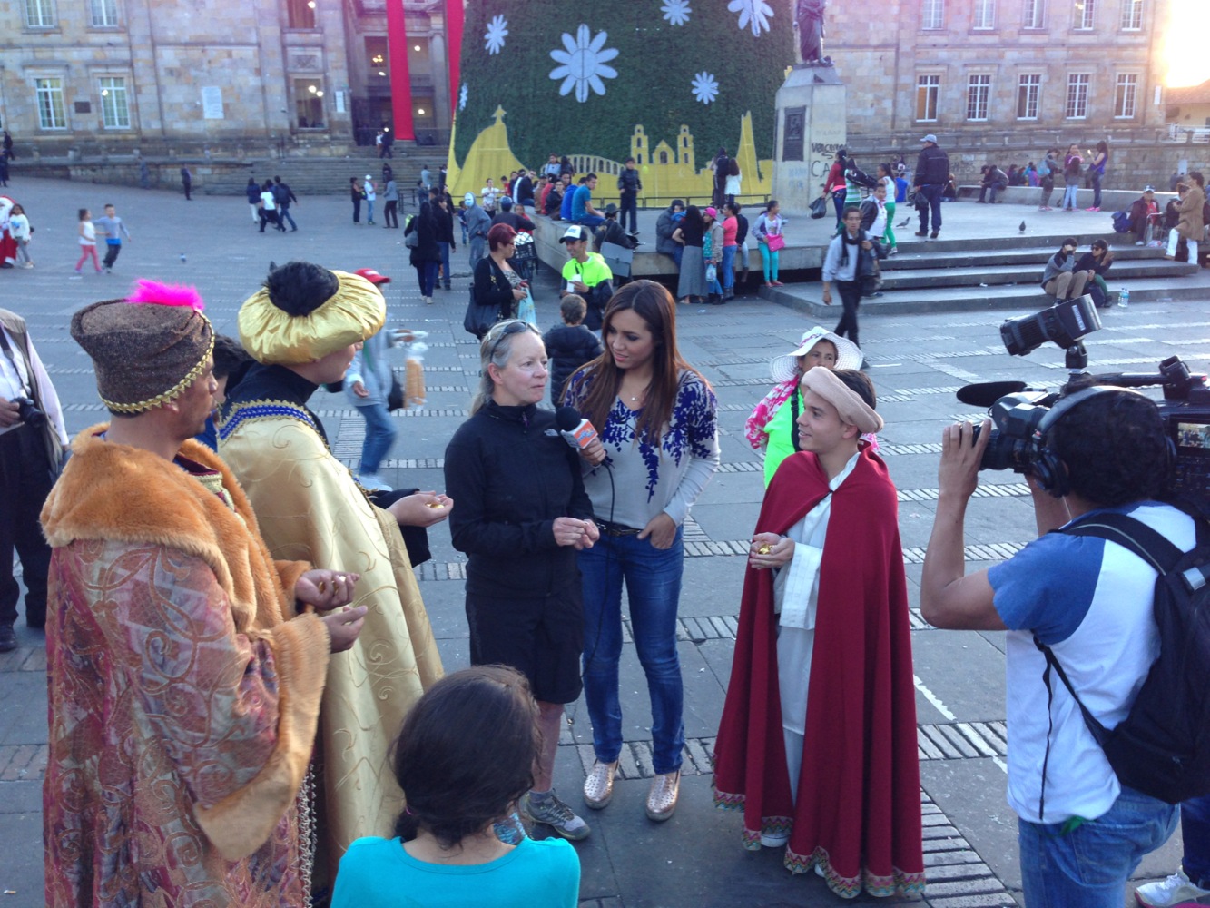
Janet was approached by the Magi (and a news reporter) in the center of Bogota. They gave her some candy and asked her to say some things for Colombian television. Janet said, “Feliz Navidad” amongst other things.
If you look carefully, you can see Janet’s head and sunglasses poking out from the Magi, who are giving Janet a huge hug.
Given our expectations upon arrival, our views have changed somewhat about the social well-being of Colombians. On a few occasions, I’ve had people tell me something like, “Money doesn’t matter; the most important thing is having health,” and “We don’t have much money, but we have this,” pointing to the mountains around us.
The route we have described along lake Nuesa is great – but it is dirt, and it eventually turns into trail. You would not want to do this in the wet season.
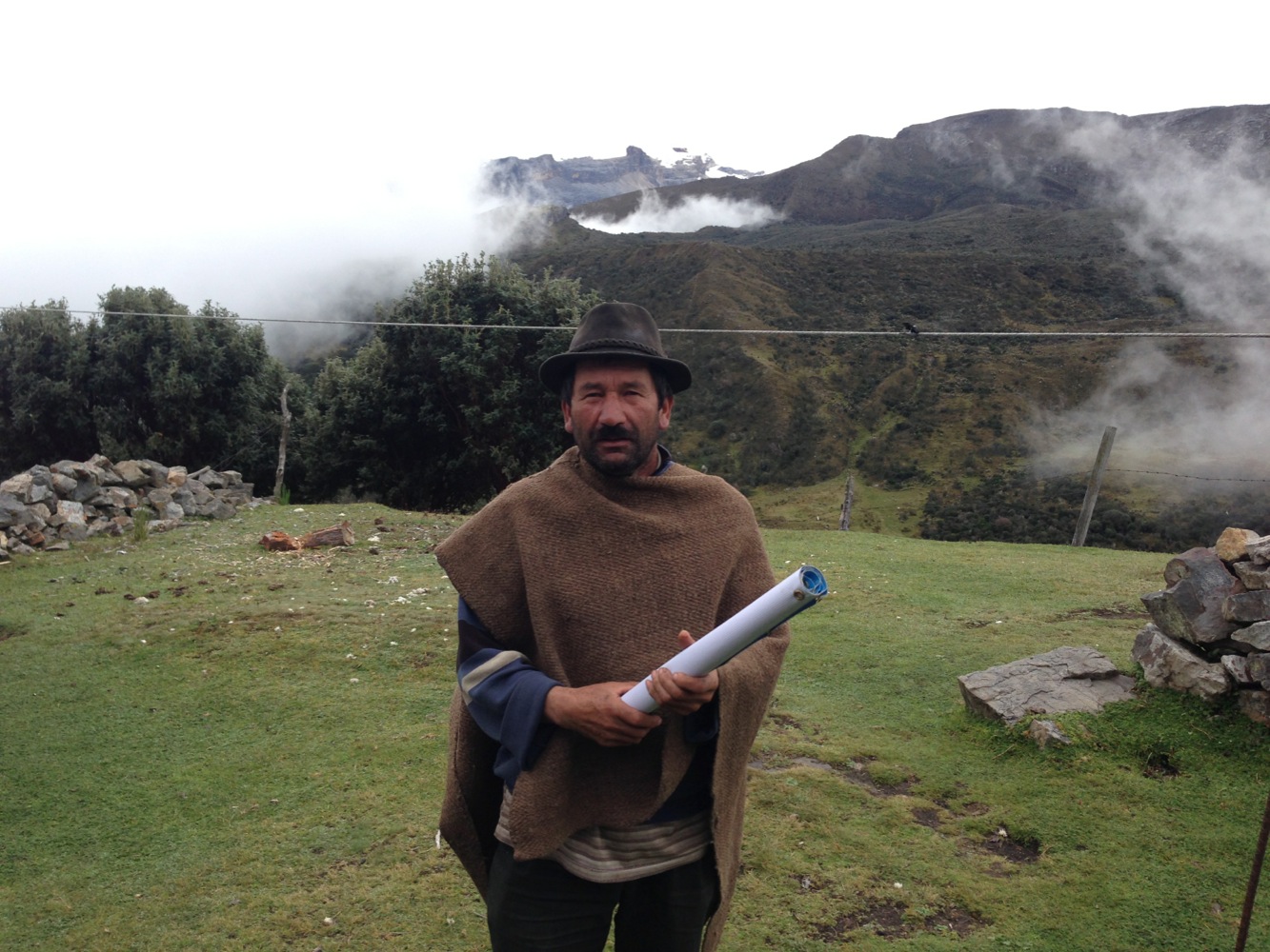
Two days into our ride, we met Jesus (pictured here). Jesus told us about Cucoy (his birth place, in fact). He spoke about it so passionately, and on the spot decided to come touring with us. Unfortunately, he wanted to start on December 26th, and have his daughter (who was currently in school) come and do sag support for us. Sadly, we couldn’t wait for him, but we went ahead and decided to trash all the planning I had done and re-plot a route: straight for Cucoy! Now, having been there, I have absolutely no regrets for this major change of plan!
We felt immediately accepted in Guacamayas. By the second day, we already knew several towns people by name – and were greeting them in the street while going to breakfast or walking to the neighboring village. After seeing new people every day, the sensation of greeting a “familiar,” smiling face makes you feel at home. The woman who helped connect us with the teacher told us she returned here with the intention of leaving within a few months… but now she’s been here for years.
In the evening, we were invited to the Noveña celebration. We learned that in Colombia, “La Noveña” (meaning 9 – as in 9 days of prayer) is celebrated from December 17th to December 24th. Each night, people gather in the central plaza to listen to music, dance, and watch performances.
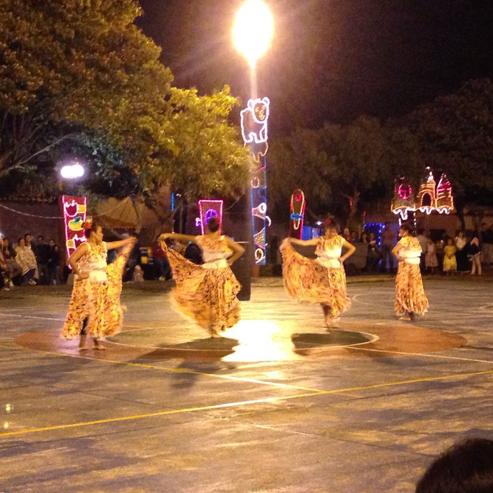
We were immediately welcomed by the people of Guacamayas. This photo is of one of the dances being performed during the Noveña celebration that lasts from December 17 – 24
But a while after the lollipop ran out and I had sucked all the sweetness out of the gumball inside, I soon learned of a bittersweet component of the Noveña: the 4am wakeup call. The idea is that everyone in the village (and surrounding villages) should wake up at 4am to think about God. To ensure this occurs as a community, three things must happen at the same time: 1) Fireworks are launched – the loud ones that shoot into the sky. 2) The Church bells are literally pounded in all sorts of ways. 3) Christmas music is blared from enormous speakers in the plaza. This noise persists from 4am until 4:30am, and it is inescapable no matter how far you are from the city center. The best earplugs have little impact – you can FEEL the firework/bell/music noise vibrating your body as you lie there praying to God: “Please make this be the last song!” For me, at least, in a round about way, they got me talking to God.
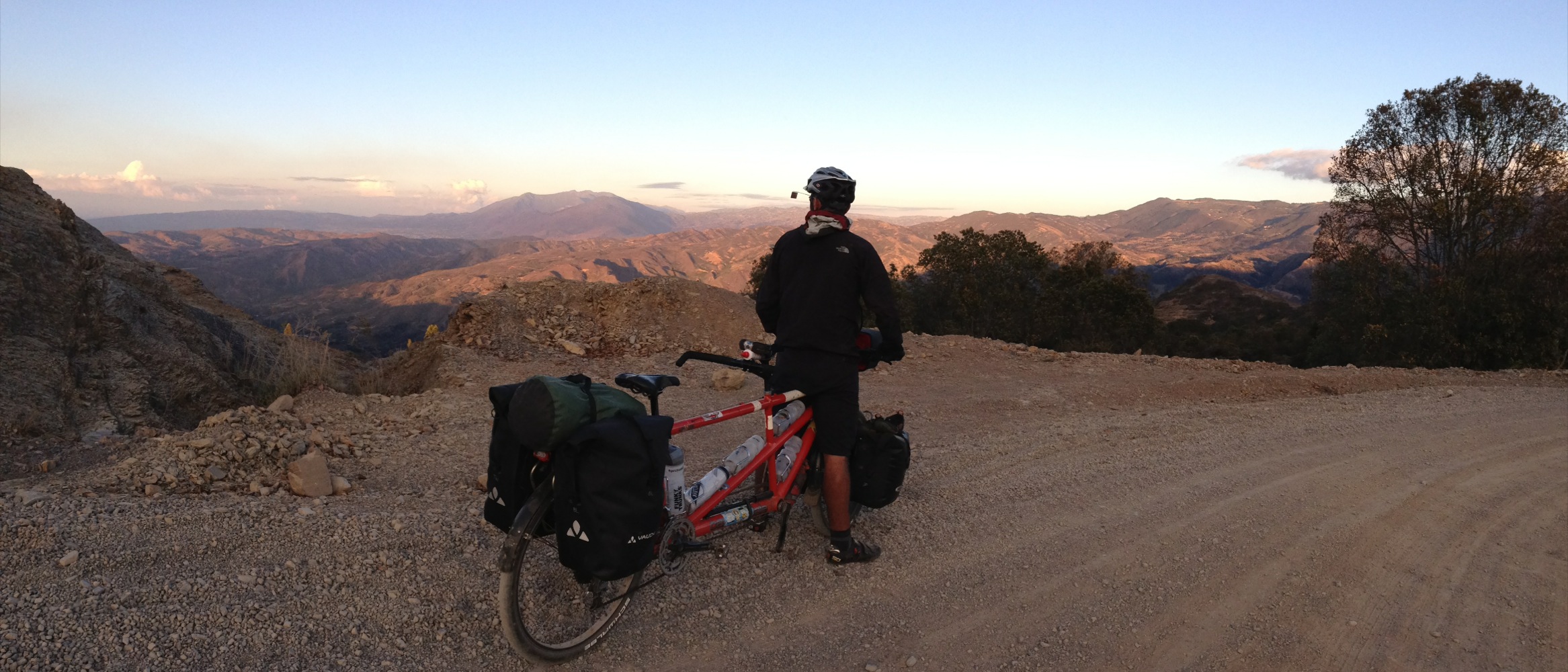
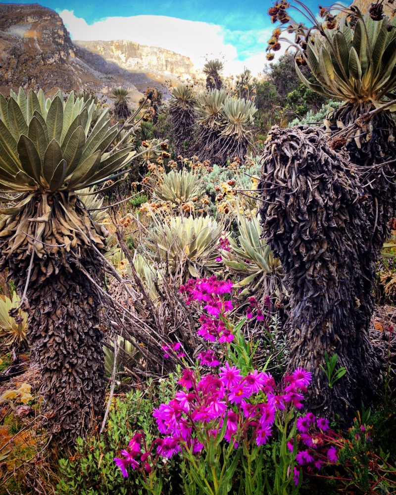
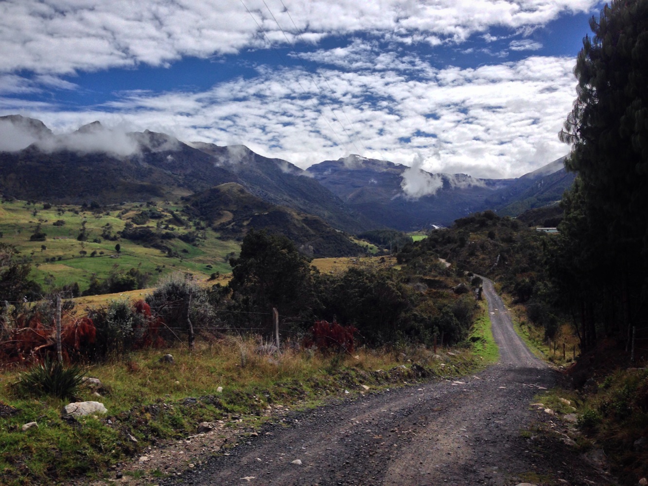
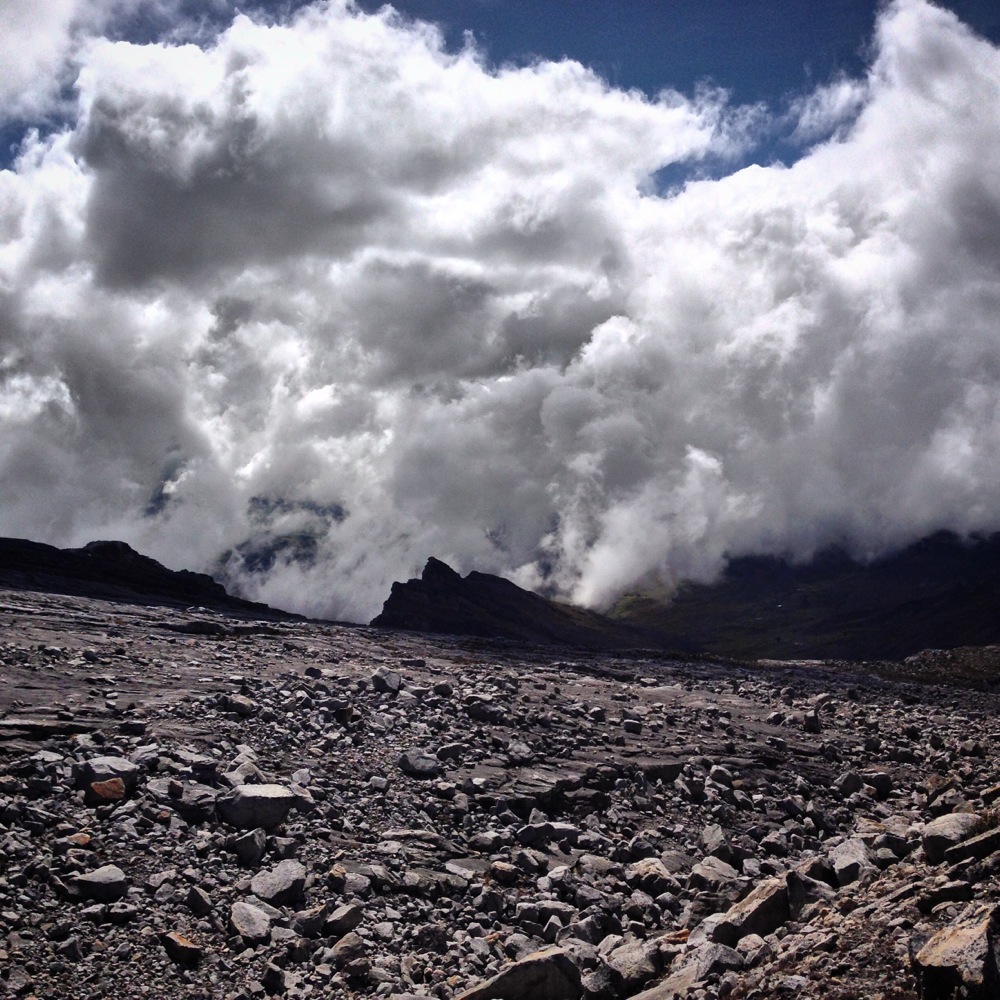
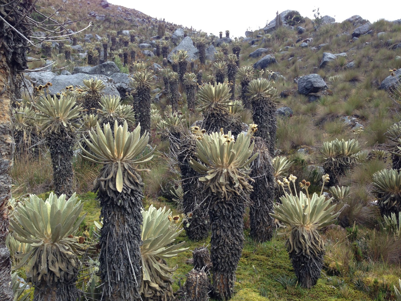
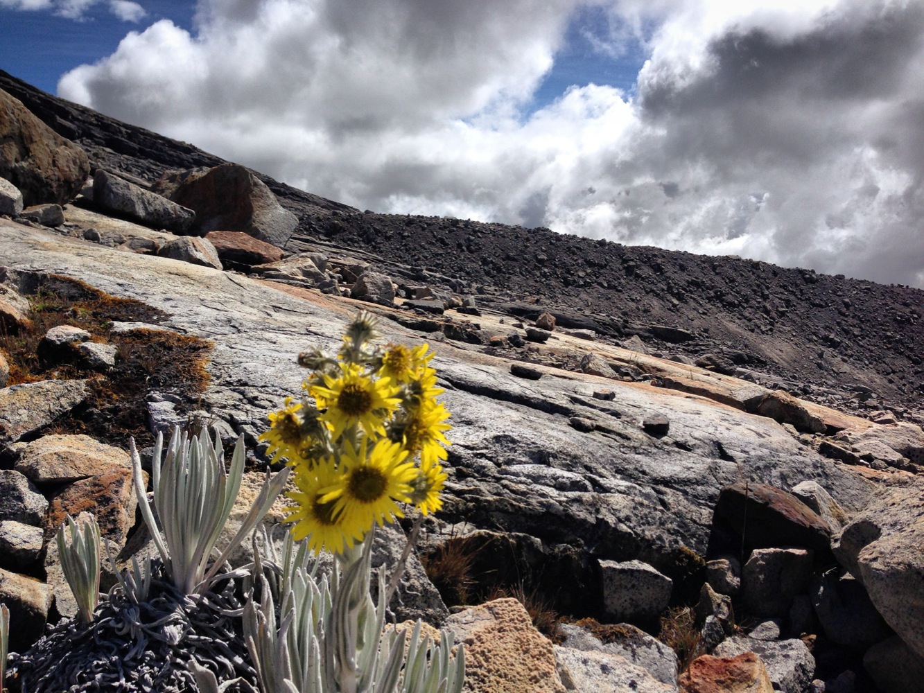
There are other ways to get closer to God, though. If you believe that God resides in the heavens above, then just being in the mountains of Colombia brings you physically closer. Many of the regions we visited on this route were over 8,000 feet, and we frequently crossed passes over 10,000’ to 11,000’! We’ve been finding that Colombia is blessed with beautiful scenery – it’s the type that doesn’t photograph well because there is no singular subject for a focal point; instead, you’re just enveloped in beautiful pastoral grasslands, mountains and valleys. If it weren’t for the vegetation native to this area, you might guess you were in Switzerland. It’s a strange sight to see Cactus, pasture grass, palm trees, Frailjones, and pine trees all growing together in abundance. You can see all of this different vegetation together in one spot in Cocuy National Park.
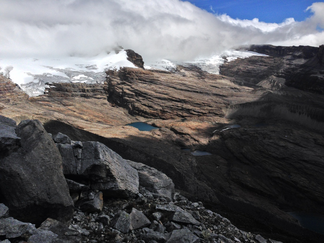
Cucoy National Park has been a conservation area for the last 20 years. This park intends to protect the nature and culture of this region. No matter how hard they try, though, the disappearing glaciers cannot be protected. The glaciers in this park have been melting rapidly, meaning you have to (or get to, depending on how you look at it) walk farther to reach the edge of the glacier. In an effort to protect the vanishing ice, it is prohibited to make snow angels, have snowball fights, and build snowmen. They are taking this very seriously!
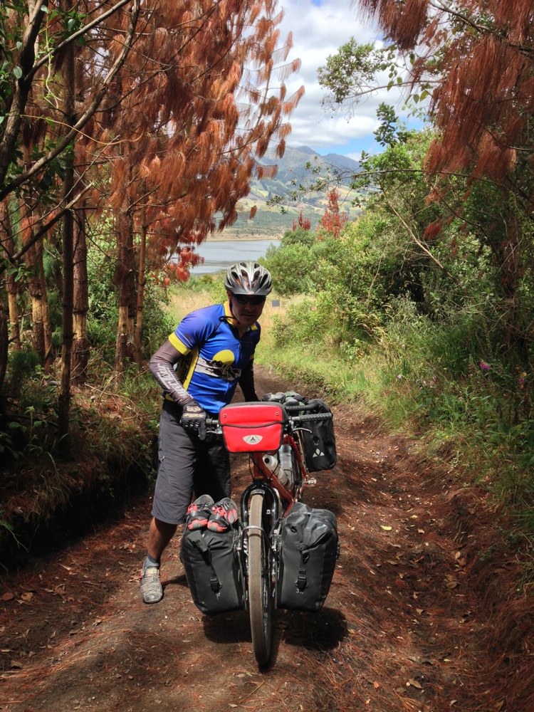
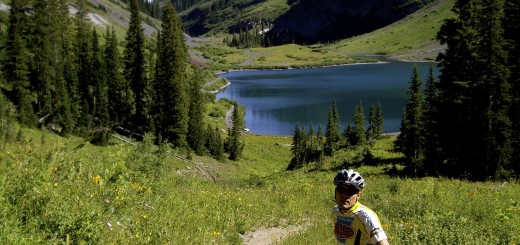
Me riding solo on the way to Cucoy.
My first route into the park proper was via the Lagunillas route. If you are coming by bicycle, you can leave your bike at two of the three cabanas. The cabanas are Migel Herreras, Alejandro Herreras, and SISUMA. Bicycles are not allowed all the way to SISUMA, and you wouldn’t want to ride that trail anyway. Camping is allowed next to the various cabanas for $3US per night.
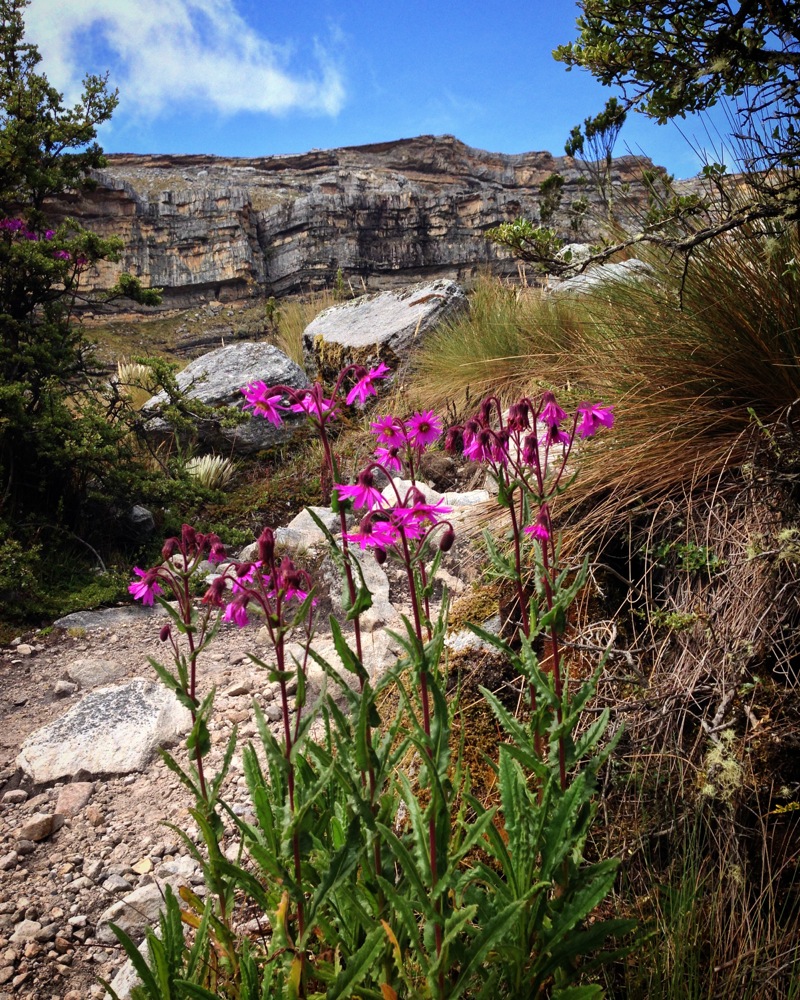
Frajilones seen on the Los Lagunillas route.
After dark, I entered into his small mud, rock, and wood hut and immediately noticed the smell of smoke. There was a wood fire burning between several rocks, and a pot suspended by a metal ring that looked like a spiderweb. Several pots were on the rocks surrounding the fire; each coated with a one centimeter thick layer of carbon. I sat down on a wooden board just above the floor, and Luis and I started talking about what is for dinner. Something dark was frying in an inch of oil; I couldn’t tell what it was because the only light was a candle and the glow of the fire. Luis didn’t speak English, but he told me that this was “shit.” I asked him what “shit” was, and he said “oveja – shit.” Suddenly, I realized, he was saying sheep – in English. For the rest of the evening, he spoke only in Spanish – except for the one English word: Sheep. As we discussed varying topics such as politics, his home grown potatoes (which were just as delicious as the sheep), I looked around the room. I noticed the walls of the room were black and coated thick with carbon. I asked him if he had thought of putting in a chimney, and instead he pointed upwards at a cloth sack hanging from the rafters. This was cheese, and it was being smoked just above our heads. My eyes became more accustomed to the light, and I saw raw meat hanging from the rafters in the small room. I asked about this; it was the sheep we were eating, which he had given a little salt. Here at a cool 13,000′, he said it would last 10 days like that – presumably also being smoked a little by the fire. His water came from a hose connected to one of the many mountain streams, and the hose constantly gurgled into a large bucket with a small plastic bowl inside for scooping. This is how he had lived for 40 years.
My camp at the home of Luis Hererras. See that stone block on the mountain? That is El pulpito del diablo. It looks like perfect square block. You can walk there if desired.
Luis Herreras. He cooked me a fine dinner of sheep and potatoes.
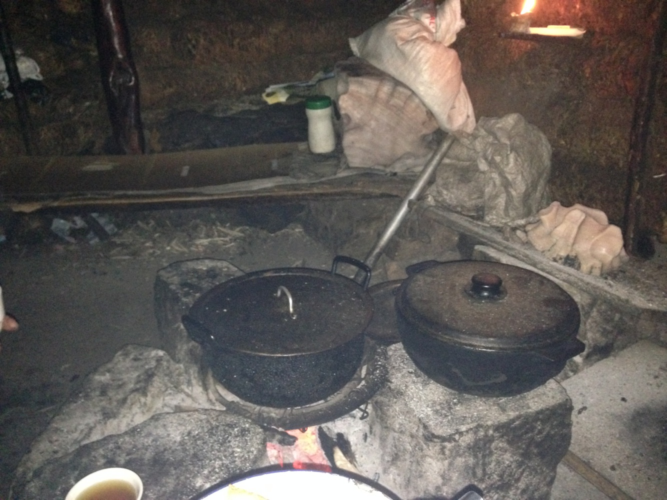
This picture was taken inside the hut of my host Luis Herreras. In the upper right, you can see salt licks, which Luis told me helps make his sheep fat.
This is the home of Luis Hererras, where I spent the night camping before venturing further into the Cucoy.
The next day, I rode over to discover another end of the park, passing by the “La Esperanza – Laguna Grande de la Sierra” trailhead (this looks to be another great route, but there is only so much time). The Ritacubas route starts at the Kanwara cabañas, and takes you to the glaciers.
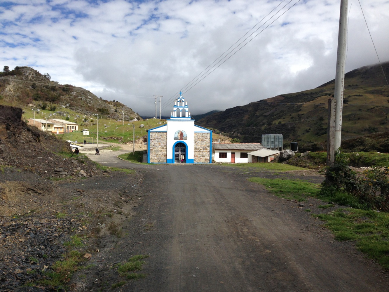
La Capilla – a landmark of sorts. This church is “in the middle of nowhere,” about half way between the two park entrances that I chose to visit.
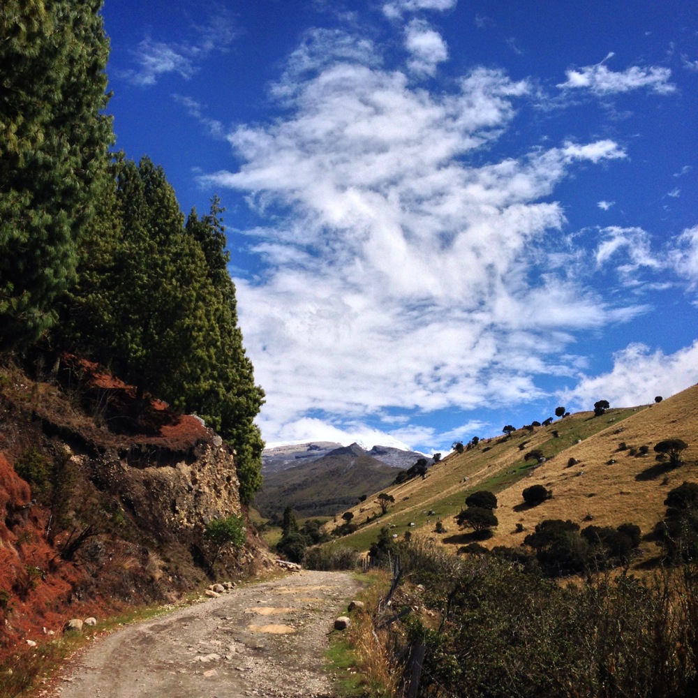
The road between Rio Lagunillas and Rio Corralitos.
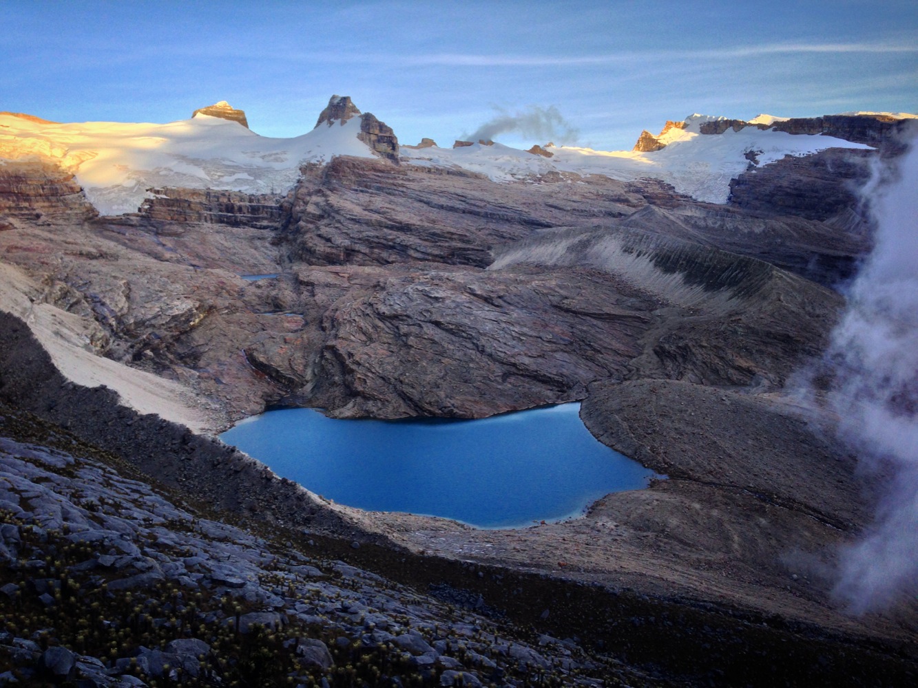
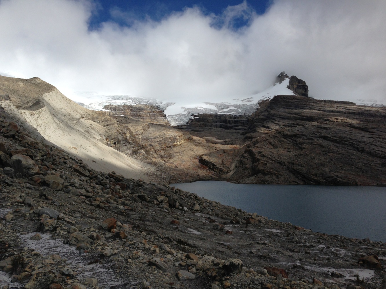
Laguna de los Tempanos
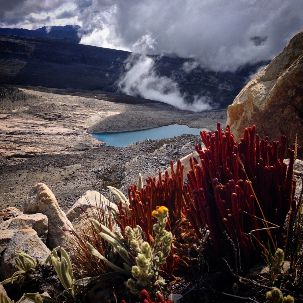
Laguna de los Tempanos
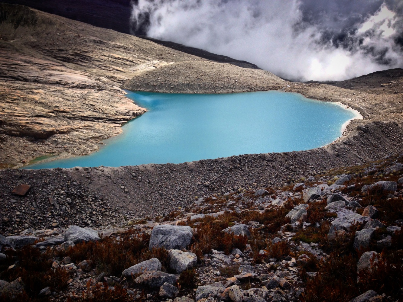
Laguna de los Tempanos

This is shortly before the turn around point where I encountered steep cliffs. I was thinking I’d escape into that river valley and head back up the road to camp. It would have been a looooong day.
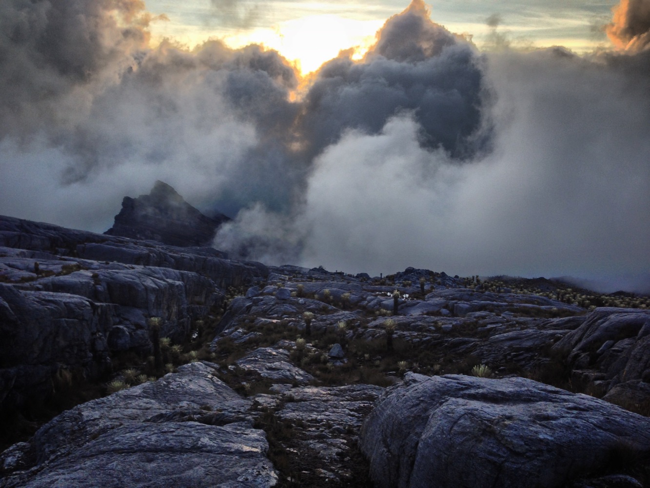
Although the clouds coming in were threatening to obscure my view of the trail, they were also beautiful.
I realized that the line I had seen may actually indicate a route: I saw a weakness in the cliff that might be climbed. From my experience with the Sierra High route, I was able to imagine a zig-zagging line up the cliff using ledges and ramps. The risk of taking this route is that I didn’t know if it connected – and if it didn’t I’d be 30-45 minutes further into the dark if I had to retrace my original route. The benefit was that it could possibly be a shorter return with less climbing. Nervously working to the top, it was never more than class-2… and at the top of the cleft in the cliffs, my heart leapt with joy. I found a rock cairn!
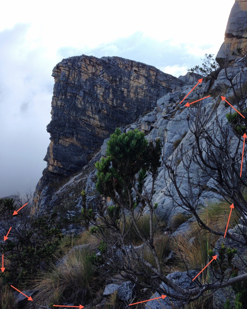
This is the route I took through the weakness in the cliff that eventually got me out of the Laguna de los Tempanos basin.
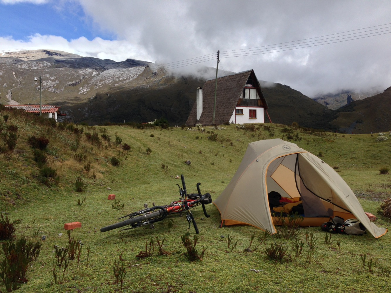
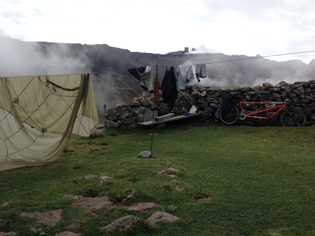
This is what the camping looked like at Kanwara. There are cabiñas for rent also (that’s one of them in the background). This camp is at an elevation almost as high as Mount Whitney!
By the time I returned from Cucoy, Janet had settled in on her one-on-one Spanish classes. Janet had two teachers concurrently, one of whom was actually an English teacher. Janet made acquaintances in town, and would go on conversational hikes with her teachers in the mountains around the village. Janet is already speaking more confidently, and even caught a few grammatical mistakes made by her teachers!
Recommended Bike Route 1 – Zipiquira to Raquira
This route takes you on some rough dirt roads, avoids traffic for the most part (you will still encounter traffic in some sections, but there is an ample shoulder). You will have to pay a couple dollars per person to enter into the Nuesa Park.
Recommended Bike Route 2 – Duitama to Guican
This route is one of our favorites! Starting in Duitama, the traffic on the main road begins to diminish quickly as you head to Santa Rosa de Viterbo. Almost the entire route is good traffic-wise, and a lot of the surfaces are paved. We covered this route over several days, so there isn’t a single Strava map to link to. Here is the route: Duitama -> Santa Rosa de Viterbo -> Portachuelo -> Cennza -> Belen -> Canutos -> Paramo -> Susacon -> Soata -> Boavita -> La Uvita -> San Mateo -> Guacamayas -> Panqueba -> Cocuy -> La Capilla -> Guican.
This route will take you over beautiful and varied terrain, and elevations over 13,000′. It is all dirt from Cocuy to Guican.
Some more pictures that didn’t quite fit:
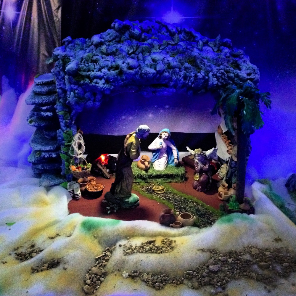
Nativity scenes can be found everywhere at this time of year. This one was in Arcobuco.
Arcobuco had one of the many great light shows. Inside the church here, there is a beautiful nativity scene that was just being finished as we entered.
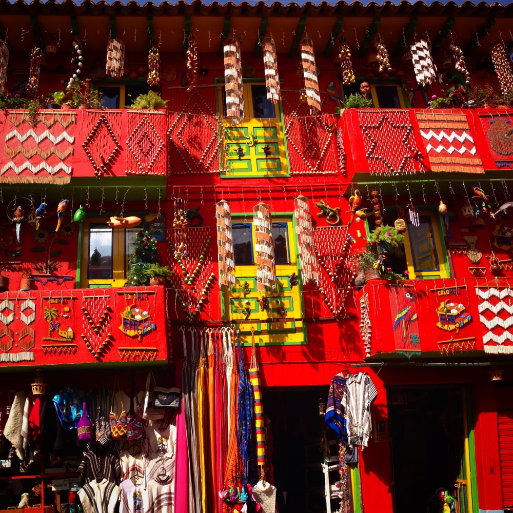
Raquira is known for its pottery and colorful buildings. This building was one of the most colorful. Raquira doesn’t seem to be on the typical “tourist trail,” as we easily got a room with a colorful balcony overlooking the central plaza.
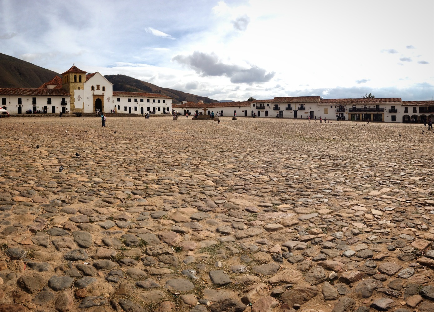
This is a picture of the main plaza in a town called “Villa de Leyva.” The town is known for its huge plaza (the biggest in Colombia). The town has beautiful cobblestone streets, and loaded with tourist amenities. We did not spend much time here (partially for that reason).
Raquira
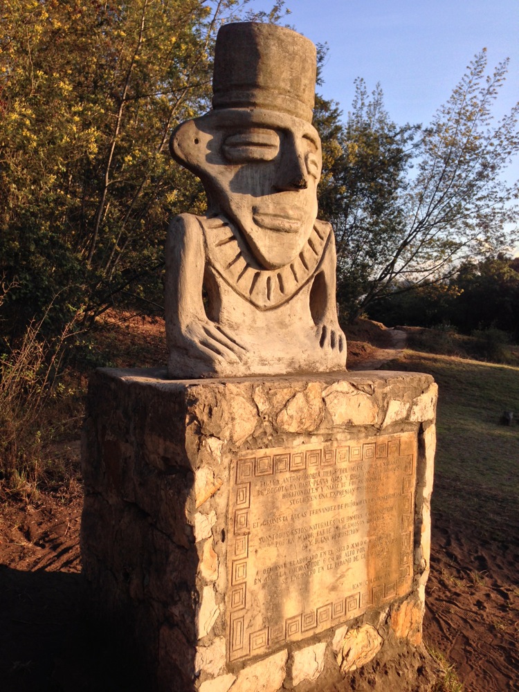
Statue at Facatativa Archaeological park (imported from elsewhere).
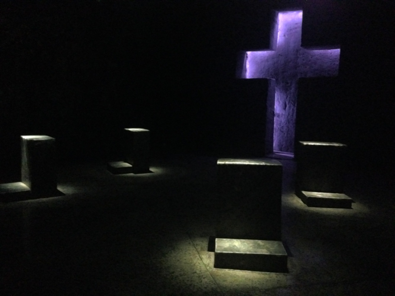
In the Zipaquira salt mine, an artists’ rendition of the stations of the cross can be found – carved from salt. They are all quite alike, but if you have the time, it is still worth a visit for some of the other sights.
Picacho in the background.
This is on the way to Kanwara – the trailhead for the Las Playitas route.
This is the map for the entire route discussed in this post. To Export GPX files, click on the three horizontal bars in the upper right hand corner of the map and select Export selected map data…
To see this map in a full screen, click here (opens in new window)


Excellent story Brian! I’m envious. If you get attacked by a squirrel be sure to get us a pic. Anxiously awaiting your next post.
As always, wonderfully written, Brian. Sounds as though and Janet have had an exceptional beginning to your South American adventure! Looking forward to the next post
What a wonderful adventure the two of you are having. Thank you so much for your beautifully descriptive narrative and illustrative photos.
I can’t wait for the next installment! 🙂
Thanks for the map of your progress and your great visual and written dialogue. Looks like a great time. Keep it up, the best to you and Janet.