Arroyo Seco Dirt Touring Loop
February 16, 2007
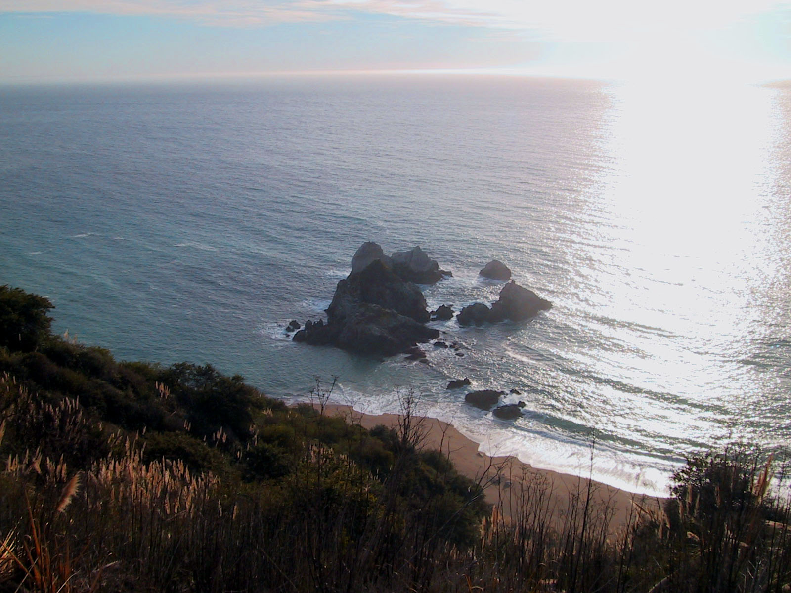
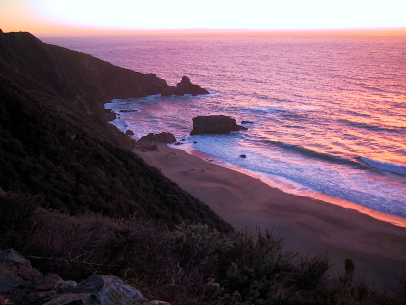
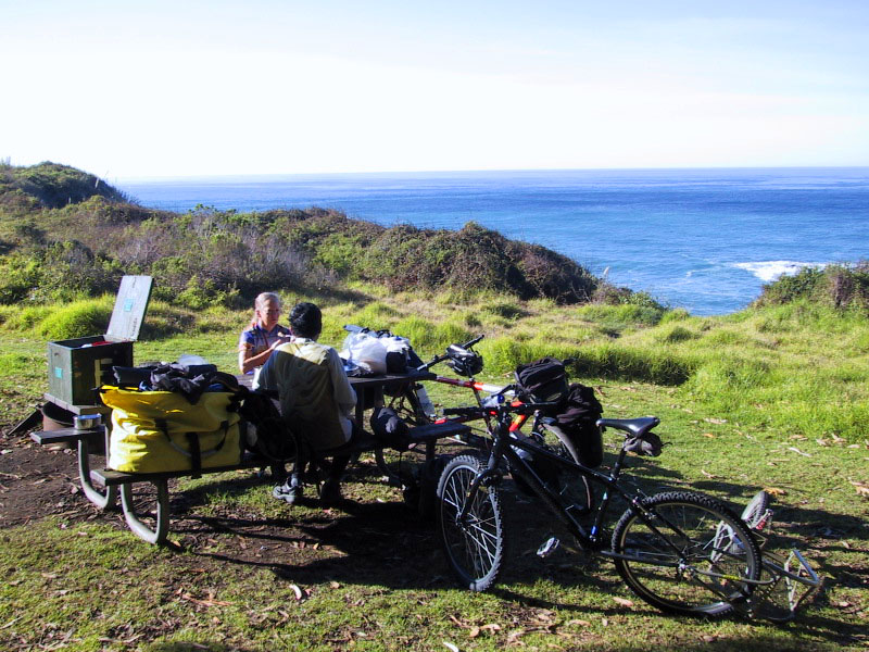
We drove to Carmel, and looked for a place to stash our car for the weekend, and started by parking at the church with their kind permission. We were surprised by the abnormally high temperatures and clear skies (80F in February). Along the route as you head South, there are a number of attractions. First, you will pass Monastery Beach, which is worth a stop, and a common place to see divers walking directly into the ocean. Next you will pass Point Lobos, which merits a visit on foot, or by kayak. Further South, you will pass the Point Sur Lighthouse, and Nepenthe restaurant. When we got to McWay Falls (picture below), we were fascinated to see the wonderful waterfall that I had passed so many other times while zooming by Julia Pfiefer Burns State Park (They shouldn’t have put this park along a downhill)! While we were watching the falls, someone identified a California Condor in the sky (but it was difficult to discern whether it was a Condor or a Turkey Vulture). We moved on since it was getting dark. We checked out the Limekiln Campground (which apparently HAD showers until a big rock slide fell down and blew up their propane tank). The park was closed due to “hazardous conditions.” We made camp at Kirk Creek instead.
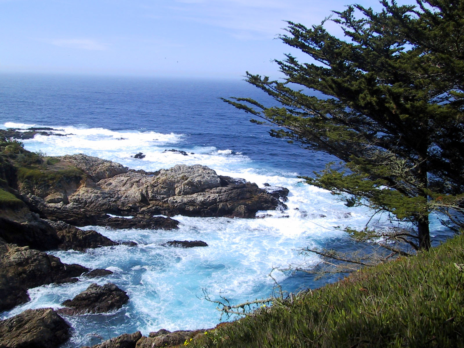
Point Lobos has easily viewable rugged shoreline that is comparable to some of the more rugged regions of the Oregon coast.
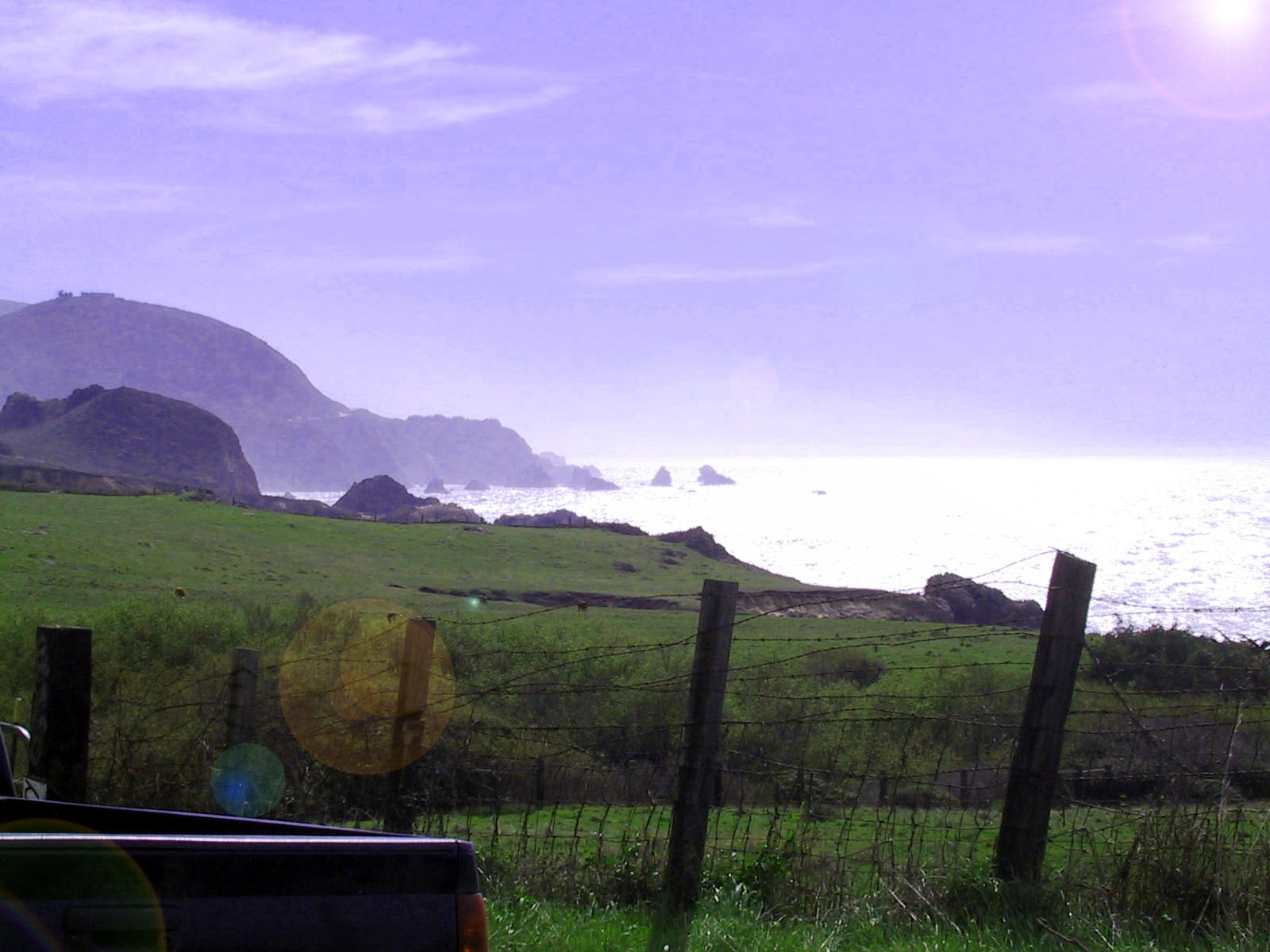
The cliffs Near the Point Sur Light House sparkled in the warm 80F air – in spite of it being February!
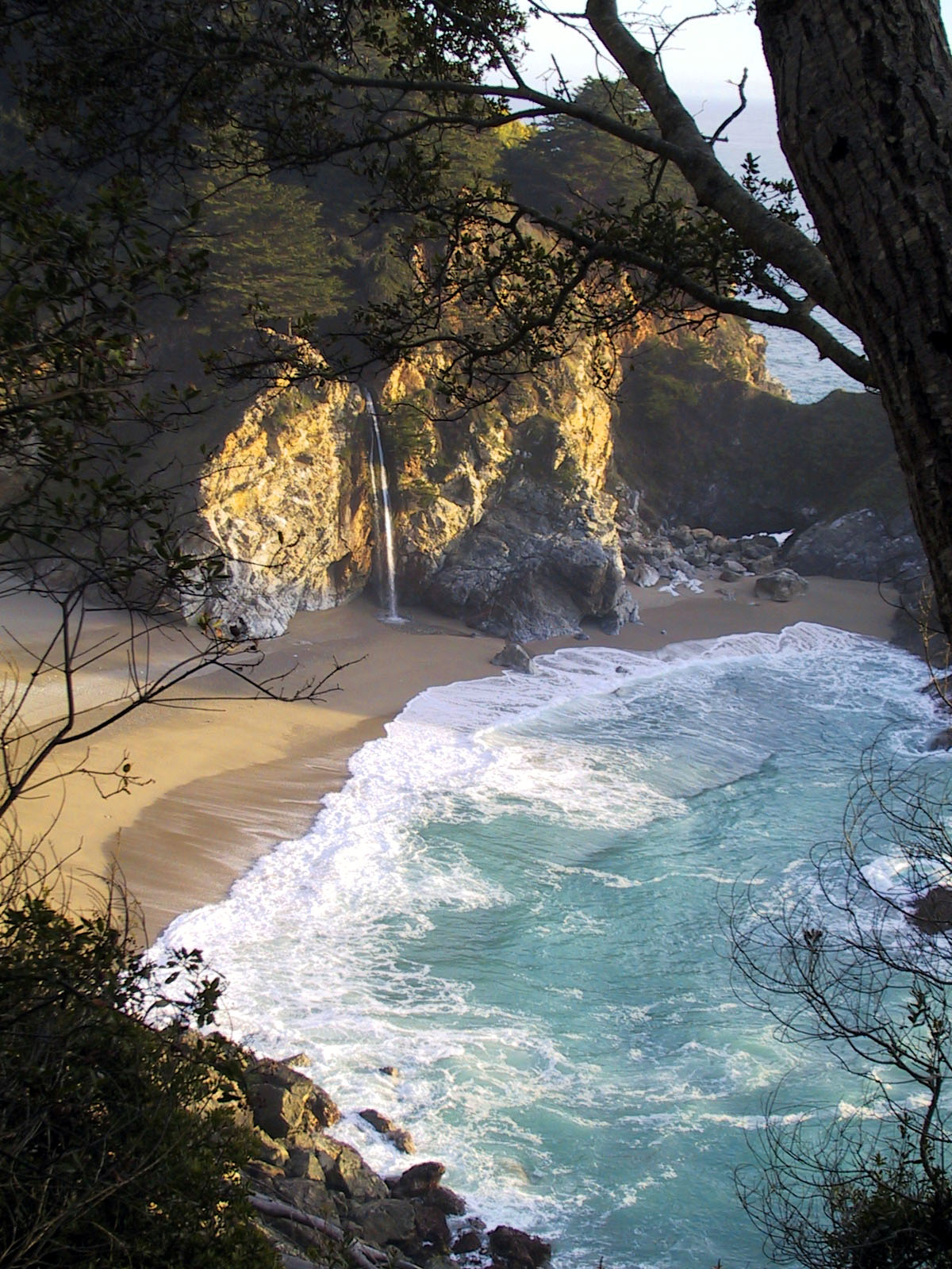
McWay falls is a MUST see as you are heading South from Julia Pfeiffer Burns Park. As you are heading South, look for the entrance, and pull over. It is on a downhill, so if you are on a bicycle, it is best to slow down so you don’t miss it
Kirk Creek is one of the most popular campgrounds on the California Coast. Even in the heart of winter, it can be difficult to get a site. The only solution is to arrive early, as they no longer take reservations. You will often see people sitting at their campsites, sitting in lawn chairs watching the ocean and sun set.
February 17, 2007
One thing you need to be very careful with at the Kirk Creek Campground is raccoons. They are there, and they will steal your food. If you are in a car, it is easy enough to keep your food safe, but if you’re on a bike, constant vigilance is required. Today was hotter than yesterday (in fact, I’ve never seen the coast this warm – even in July). Nacimiento Fergusson road is a difficult climb on a loaded bicycle – but worth it for the views you get of the ocean. At the top, the terrain changes to Pine Forest, and as you descend into Hunter Liggett, it changes to Oak Woodland. Don’t forget to bring identification if you want to enter into the fort! We almost got turned around at the entrance station because I did not have my driver’s license! There is a campground nearby called “Indians.” which is a very logical place to stop for the next night. The campground is an open format, and isn’t super nice during peak season (there can be lots of cars, RVs and noise). It was quiet in February, but I’ve found that you can seek quiet refuge on a bicycle by going towards the hunter’s lodge just a little farther down the road and to the left (see our GPS map linked above). You may need to bring a water filter for this point – we did (and used it). Water was not available.
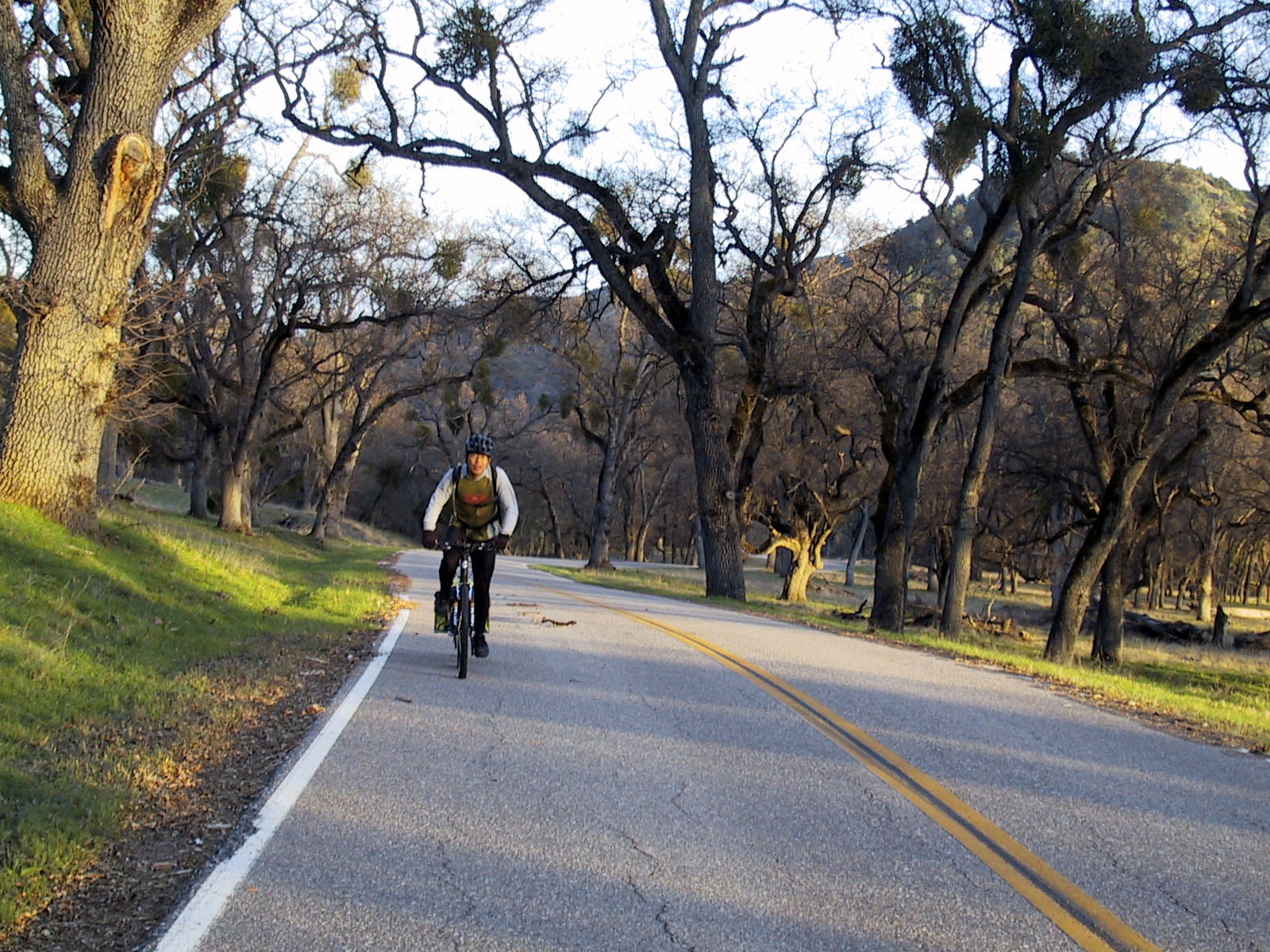
This is the kind of road you can expect at Fort Hunter Liggett. Very few cars – if any. At the time we rode this section, you were REQUIRED to show photo ID to enter the base. That requirement changes from time to time. If you’re on a bike, be sure to bring your drivers license just in case.
This is the view that you will get from the Kirk Creek Hiker Biker site. Don’t forget to protect your food from the raccoons!
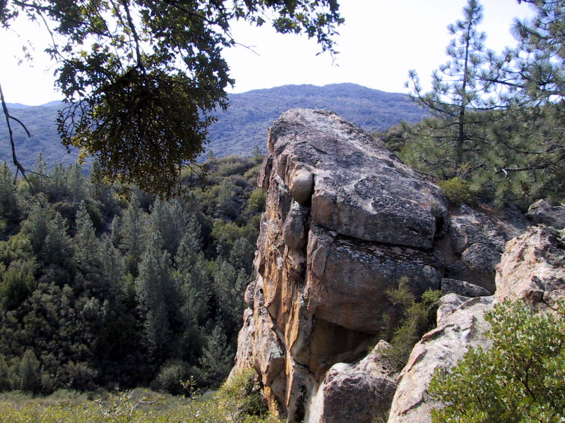
As you ride along the road towards Indian’s Campground, you will notice some superb rugged rock formations. There are some great hiking trails in either direction from the road.
February 18, 2007
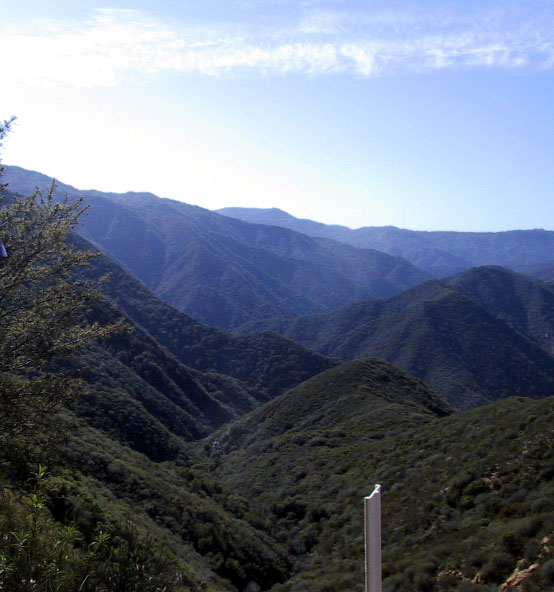
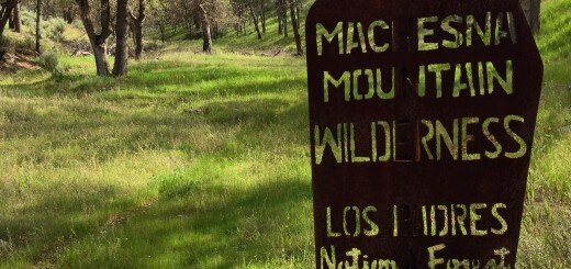
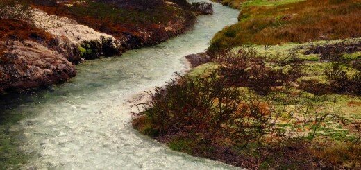
This is where the route gets exciting. You will be passing over Arroyo Seco road – which is an old dirt road that has been closed to motor vehicles since 1994. That is great news for bicycles because you will not encounter any traffic. The road is a little loose and sandy as you climb, but as you get higher, the soil becomes more compacted and easier to ride. Near the top, the views of Big Sur are fantastic! Bicycles are not allowed in the wilderness, and if you look at a map, you will see that the Arroyo Seco road is a narrow ribbon of “non wilderness” that traverses the Ventana – a true wilderness. As you climb, you see Junipero Serra peak to your right. Down to the left, you see the Arroyo Seco gorge which you can access by creek walking (there are a number of falls, narrows and other goodies if you’re willing to swim). Off the trail to the left (near the top) is Hanging Valley Spring if you brought your water filter and have run out of water. The road has been closed due to land slides, but you can see that the only big one is easily negotiated by bicycle in the picture below. The next logical place to stop for the night is the Arroyo Seco Campground, which is at the very end of the Arroyo Seco dirt road.
February 19, 2007
The route from Arroyo Seco Campground is fairly straight forward. You ride out from the campground on Arroyo Seco road, and then turn left on Carmel Valley Road. This is a quiet road, with a decent climb in the middle. As you near Carmel valley, traffic begins to increase. There is an optional “bonus route” that you can take to make the ride a little longer and more hilly called Cachagua road.
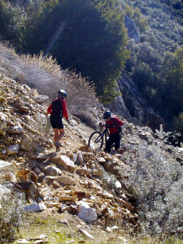
It is possible to cross the landslide on Indian’s-Arroyo Seco Road with a bicycle. It takes a few minutes, even with a loaded touring tandem.
February 19, 2007
The route from Arroyo Seco Campground is fairly straight forward. You ride out from the campground on Arroyo Seco road, and then turn left on Carmel Valley Road. This is a quiet road, with a decent climb in the middle. As you near Carmel valley, traffic begins to increase. There is an optional “bonus route” that you can take to make the ride a little longer and more hilly called Cachagua road.


This seems like it would be an awesome way to get to Carmel for the coast ride back down. I am guessing Indian Road and Arroyo Seco Rd are the same.